CO9 1SY - Land for sale in Hall Drive, Gosfield, CO9
View on Property Piper
Land for sale in Hall Drive, Gosfield, CO9
Property Details
- Price: £5000000
- Bedrooms: 1
- Bathrooms: 1
- Property Type: undefined
- Property SubType: undefined
Brochure Descriptions
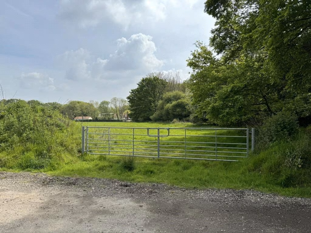
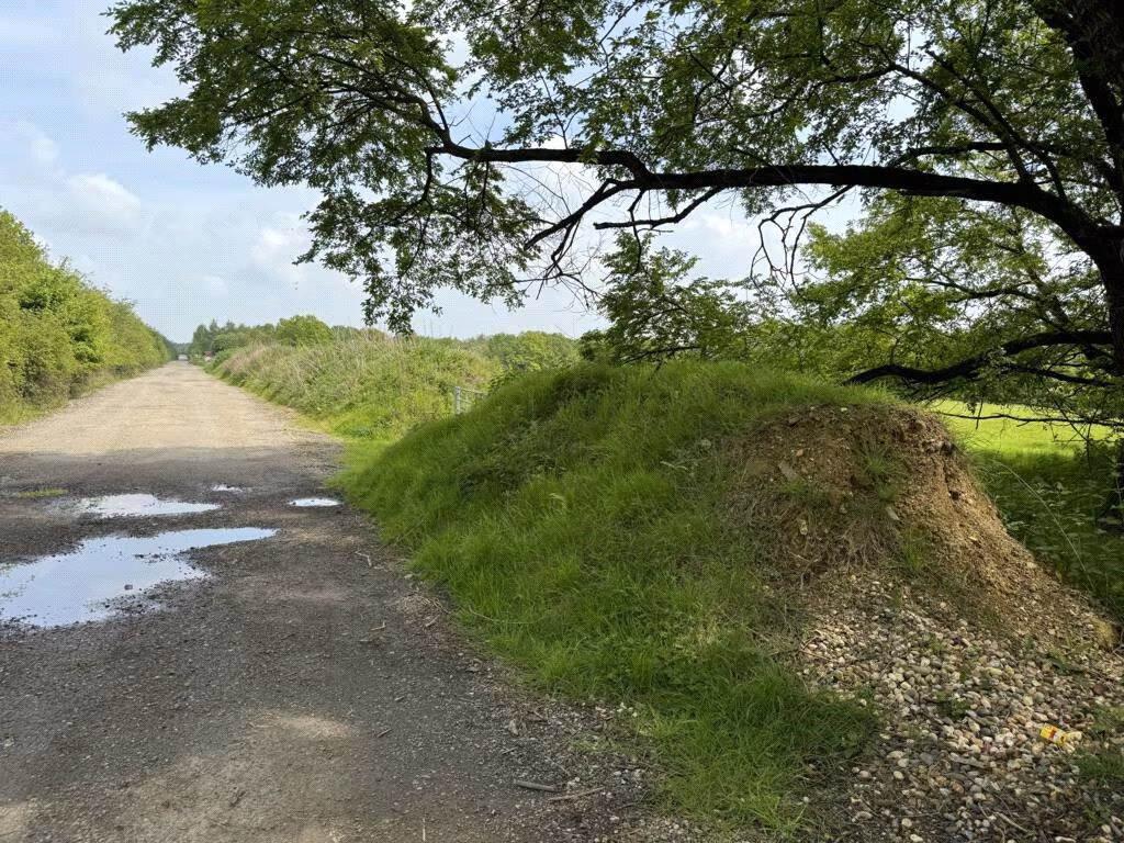
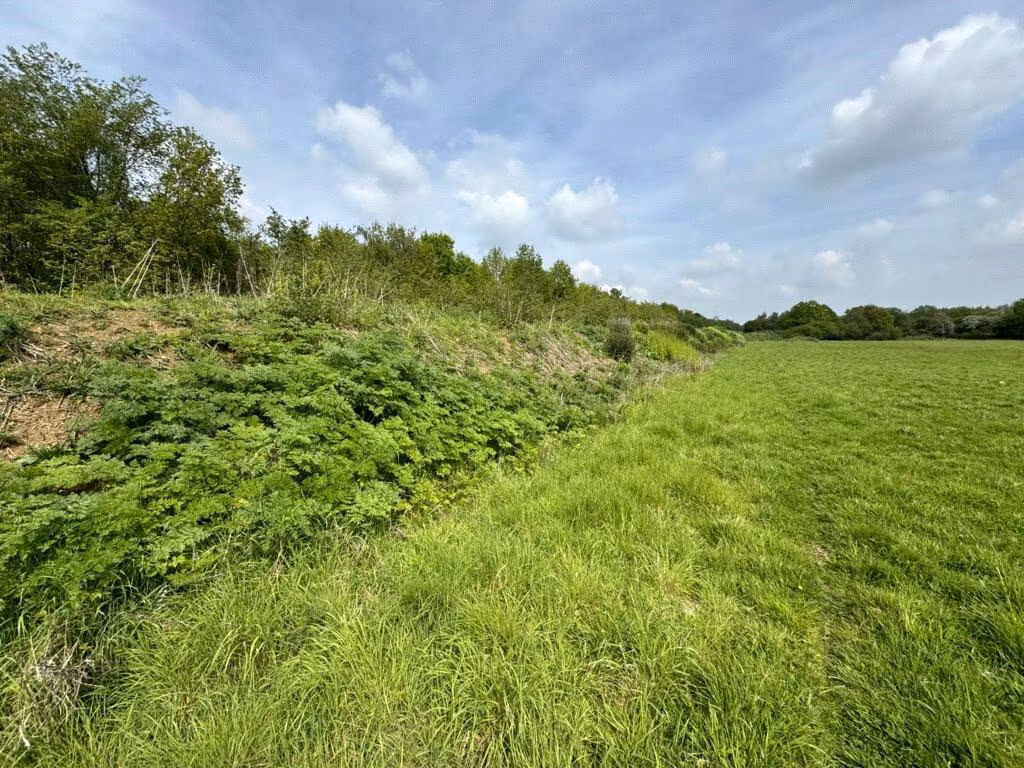
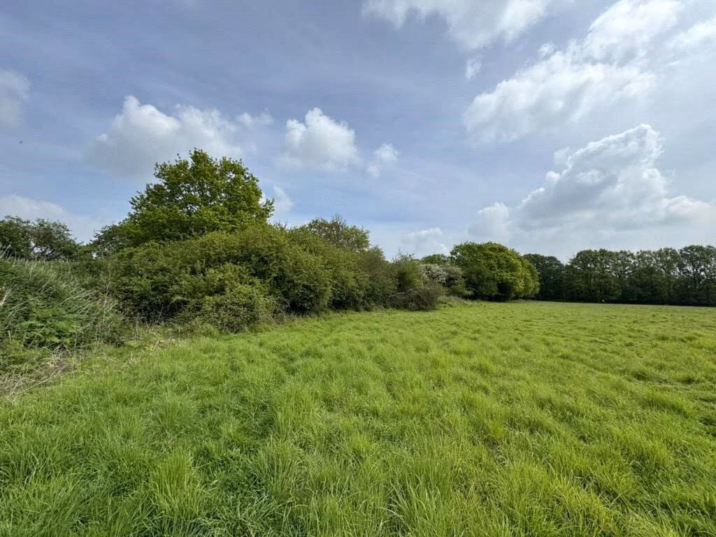
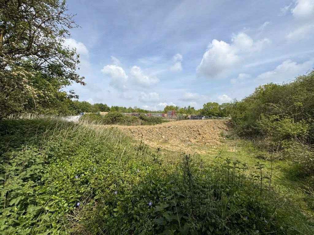
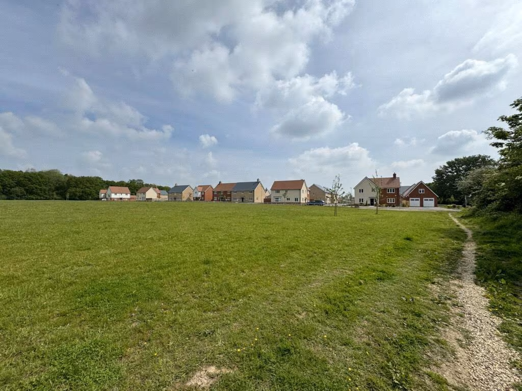
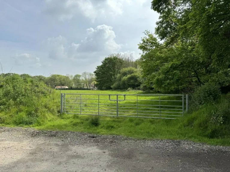
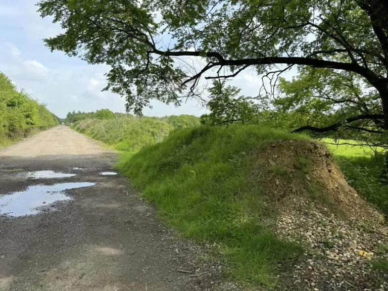
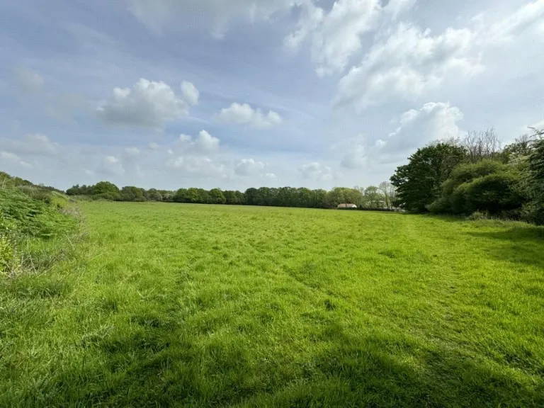
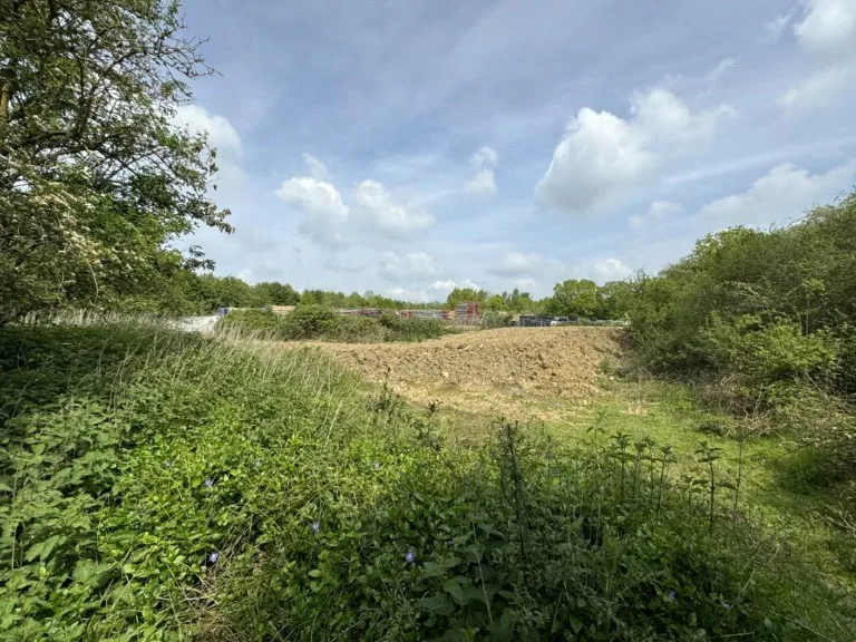
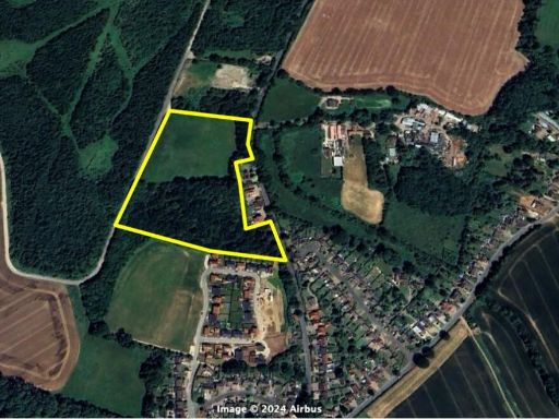
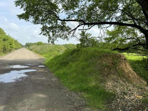
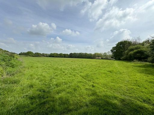
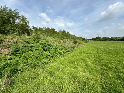
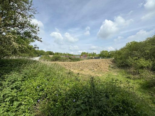
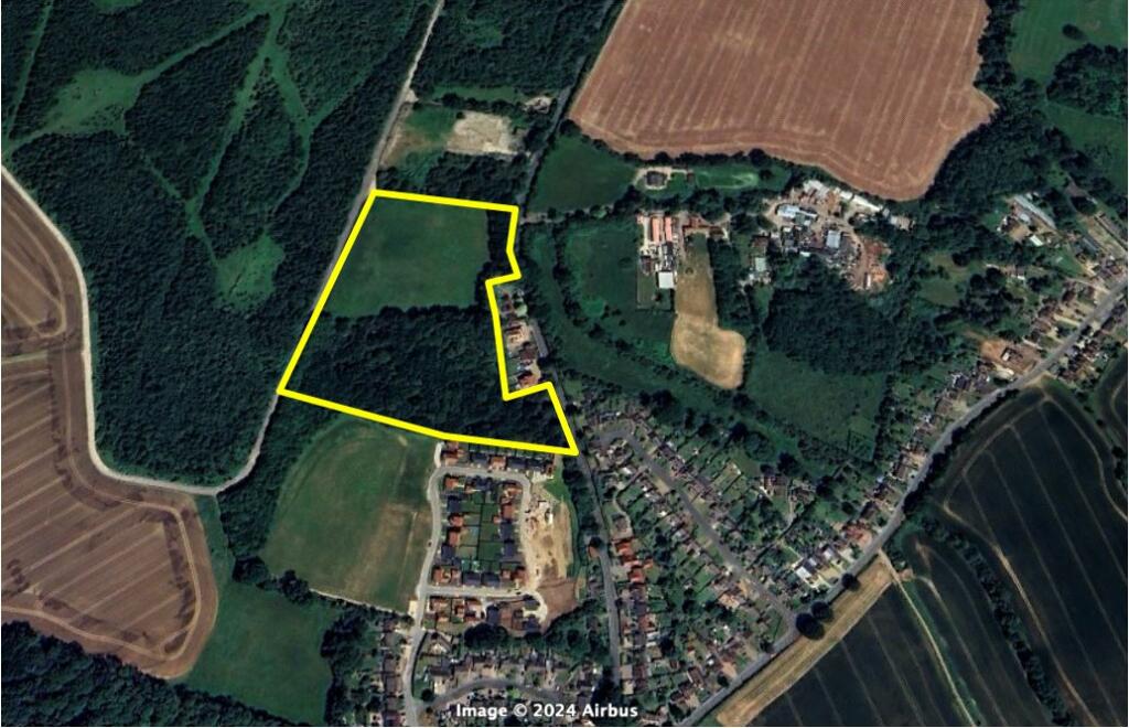
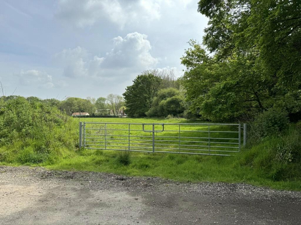
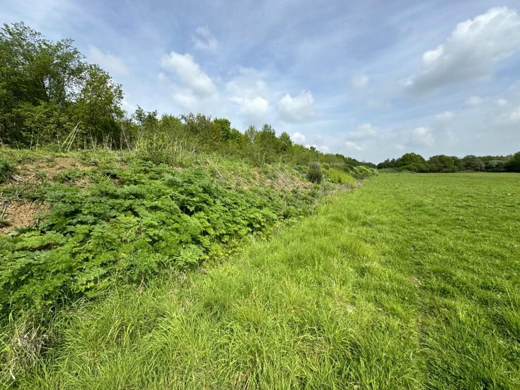
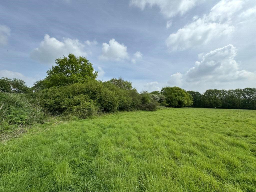
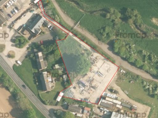
- This substantial development opportunity spans over 4.79 hectares (STS) and is approved for the construction of 35 dwellings. The land is located adjacent to existing residential properties, offering potential homeowners a peaceful countryside setting with views of green fields and forested areas. This sizeable plot provides ample space for a medium to large residential estate, promising a transformative addition to the local area.
- This property comprises a parcel of land positioned to the north of Hall Drive in the charming area of Gosfield, Braintree. The land offers a promising opportunity for development or investment with its ample open space and potential for customization. While specific dimensions are not clear, the expansiveness of the land suggests a generous plot size suitable for various developmental projects. The location provides a serene environment, potentially surrounded by lush greenery typical of the Braintree area.
Textual Property Features
Detected Visual Features
- land plot
- development opportunity
- rural
- green space
- investment
- residential area
- land
- pasture
- field
- agriculture
- nature
- scenic
Nearby Schools
- Beckers Green Primary School
- Gosfield Community Primary School
- St Margaret's Preparatory School
- Richard de Clare Community Academy
- Colne Engaine Church of England Primary School
- de Vere Primary School
- St Margaret's Church of England Voluntary Controlled Primary School Toppesfield
- St Michael's Church of England Voluntary Aided Primary School
- Rayne Primary and Nursery School
- Great Bradfords Junior School
- Great Bradfords Infant and Nursery School
- Tabor Academy
- Stisted Church of England Primary Academy
- The Ramsey Academy, Halstead
- St Peter's Church of England Voluntary Controlled Primary School, Sible Hedingham
- Lyons Hall School
- Bocking Primary School
- St Giles' Church of England Primary School
- Hedingham School and Sixth Form
- Wethersfield CofE VC Primary School
- Alec Hunter Academy
- St Francis Catholic Primary School, Braintree
- John Bunyan Primary School and Nursery
- Shalford Primary School
- Holy Trinity Church of England Voluntary Controlled Primary School, Halstead
- Gosfield School
- St Andrew's Church of England Primary School, Halstead
Nearest Bars And Restaurants
- Id: 322746793
- Tags:
- Amenity: pub
- Created_by: Potlatch 0.10f
- Name: Three Pigeons
- Source: survey
- Wikidata: Q26462604
- TagsNormalized:
- Lat: 51.939861
- Lon: 0.628215
- FullGeoHash: u10rqr37w7z5
- PartitionGeoHash: u10r
- Images:
- FoodStandards: null
- Distance: 2715.5
,- Id: 235378822
- Tags:
- Addr:
- Housename: Gosfield Lake Resort
- Postcode: CO9 1UD
- Street: Church Road
- Amenity: restaurant
- Building: commercial
- Cuisine: indian
- Name: Lakeview
- Phone: +44 1787477715
- TagsNormalized:
- Lat: 51.9335951
- Lon: 0.5824434
- FullGeoHash: u10rmq0p5gv3
- PartitionGeoHash: u10r
- Images:
- FoodStandards: null
- Distance: 651.3
,- Id: 2440781606
- Tags:
- Amenity: cafe
- Name: Lakeside
- TagsNormalized:
- Lat: 51.9338966
- Lon: 0.5820097
- FullGeoHash: u10rmnrbcu1b
- PartitionGeoHash: u10r
- Images:
- FoodStandards: null
- Distance: 647.3
,- Id: 312236530
- Tags:
- Amenity: pub
- Name: The Green Man
- Wikidata: Q26622435
- TagsNormalized:
- Lat: 51.935108
- Lon: 0.5931091
- FullGeoHash: u10rmqrzumy4
- PartitionGeoHash: u10r
- Images:
- FoodStandards: null
- Distance: 439.8
,- Id: 320925854
- Tags:
- Amenity: pub
- Name: The Kings Head
- Wikidata: Q26593254
- TagsNormalized:
- Lat: 51.9362482
- Lon: 0.5918706
- FullGeoHash: u10rmqwyxd6s
- PartitionGeoHash: u10r
- Images:
- FoodStandards: null
- Distance: 290.3
}
Nearest General Shops
- Id: 8017026530
- Tags:
- Addr:
- City: Halstead
- Country: GB
- Housenumber: 1
- Postcode: CO9 2AR
- Street: Market Hill
- Alt_name: Hardys Hand Cut Tailoring
- Clothes: men
- Email: info@hardysmenswear.co.uk
- Name: Hardys Menswear
- Opening_hours: Mo-Sa 09:00-17:30
- Phone: +44 1787 477222
- Shop: clothes
- Website: http://www.hardysmenswear.com/
- TagsNormalized:
- Lat: 51.9452829
- Lon: 0.6390631
- FullGeoHash: u10rw8375nxf
- PartitionGeoHash: u10r
- Images:
- FoodStandards: null
- Distance: 3544.9
,- Id: 4078121790
- Tags:
- Name: Lobbs Cycles
- Phone: +44 1787478888
- Service:
- Bicycle:
- Repair: yes
- Retail: yes
- Second_hand: yes
- Shop: bicycle
- TagsNormalized:
- Lat: 51.9442978
- Lon: 0.6366749
- FullGeoHash: u10rw2pt7wgj
- PartitionGeoHash: u10r
- Images:
- FoodStandards: null
- Distance: 3361.2
,- Id: 5543980000
- Tags:
- Fixme: check on ground
- Name: WHSmith
- Shop: newsagent
- TagsNormalized:
- Lat: 51.943797
- Lon: 0.6353751
- FullGeoHash: u10rw2ndt3d4
- PartitionGeoHash: u10r
- Images:
- FoodStandards: null
- Distance: 3262.7
}
Nearest Grocery shops
- Id: 457095502
- Tags:
- Addr:
- City: Bocking Churchstreet
- Housenumber: 62
- Postcode: CM7 5JY
- Street: Church Street
- Building: yes
- Name: The Co-operative Food
- Opening_hours: Mo-Su 07:00-22:00
- Shop: supermarket
- TagsNormalized:
- the co-operative food
- food
- shop
- Lat: 51.901955
- Lon: 0.5544454
- FullGeoHash: u10rk87wz98m
- PartitionGeoHash: u10r
- Images:
- FoodStandards: null
- Distance: 4645.7
,- Id: 316308915
- Tags:
- Name: Co-operative Food Store
- Shop: convenience
- TagsNormalized:
- Lat: 51.9447221
- Lon: 0.6417716
- FullGeoHash: u10rw85rfq58
- PartitionGeoHash: u10r
- Images:
- FoodStandards: null
- Distance: 3712.8
,- Id: 1108824460
- Tags:
- Name: Co-operative
- Shop: convenience
- TagsNormalized:
- Lat: 51.9366381
- Lon: 0.6317617
- FullGeoHash: u10rqqu0c55d
- PartitionGeoHash: u10r
- Images:
- FoodStandards: null
- Distance: 2954.6
}
Nearest Supermarkets
- Id: 428889293
- Tags:
- Brand: Sainsbury's
- Brand:wikidata: Q152096
- Brand:wikipedia: en:Sainsbury's
- Name: Sainsbury's
- Shop: supermarket
- TagsNormalized:
- sainsburys
- supermarket
- shop
- Lat: 51.9444223
- Lon: 0.6364035
- FullGeoHash: u10rw2pqjq0u
- PartitionGeoHash: u10r
- Images:
- FoodStandards: null
- Distance: 3346
,- Id: 56975679
- Tags:
- Building: yes
- Name: East of England Co-op Supermarket
- Shop: supermarket
- Source: Bing
- TagsNormalized:
- Lat: 51.9431001
- Lon: 0.6362406
- FullGeoHash: u10rqrzq3rxm
- PartitionGeoHash: u10r
- Images:
- FoodStandards: null
- Distance: 3306.7
,- Id: 59924608
- Tags:
- Addr:
- City: Halstead
- Country: GB
- Postcode: CO9 1HJ
- Street: Kings Road
- Brand: Lidl
- Brand:wikidata: Q151954
- Brand:wikipedia: en:Lidl
- Building: yes
- Fhrs:
- Name: Lidl
- Not:
- Shop: supermarket
- Source:
- Addr:
- Postcode: code-point_open
- Survey:
- TagsNormalized:
- Lat: 51.9428042
- Lon: 0.6342288
- FullGeoHash: u10rqrvuf8e2
- PartitionGeoHash: u10r
- Images:
- FoodStandards:
- Id: 1005736
- FHRSID: 1005736
- LocalAuthorityBusinessID: 17/00099/MIXED
- BusinessName: Lidl UK
- BusinessType: Retailers - other
- BusinessTypeID: 4613
- AddressLine1: Kings Road
- AddressLine2: Halstead
- AddressLine3: Essex
- AddressLine4: null
- PostCode: CO9 1HL
- RatingValue: 5
- RatingKey: fhrs_5_en-GB
- RatingDate: 2017-10-03
- LocalAuthorityCode: 110
- LocalAuthorityName: Braintree
- LocalAuthorityWebSite: http://www.braintree.gov.uk
- LocalAuthorityEmailAddress: food&safety@braintree.gov.uk
- Scores:
- Hygiene: 0
- Structural: 0
- ConfidenceInManagement: 0
- NewRatingPending: false
- Geocode:
- Longitude: 0.90029000000000
- Latitude: 51.89570000000000
- Distance: 3165.2
}
Nearest Religious buildings
- Id: 309757660
- Tags:
- Amenity: place_of_worship
- Created_by: JOSM
- Denomination: united_reformed
- Name: Halstead United Reformed Church
- Religion: christian
- TagsNormalized:
- place of worship
- united reformed
- church
- christian
- Lat: 51.943351
- Lon: 0.6340131
- FullGeoHash: u10rqrvxvw6q
- PartitionGeoHash: u10r
- Images:
- FoodStandards: null
- Distance: 3161.5
,- Id: 418889725
- Tags:
- Amenity: place_of_worship
- Denomination: baptist
- Name: Parkfields Baptist Church
- Religion: christian
- TagsNormalized:
- place of worship
- baptist
- church
- christian
- Lat: 51.9358152
- Lon: 0.6292188
- FullGeoHash: u10rqqdhjcet
- PartitionGeoHash: u10r
- Images:
- FoodStandards: null
- Distance: 2787
,- Id: 143113152
- Tags:
- Amenity: place_of_worship
- Denomination: anglican
- Name: Saint Catherines
- Religion: christian
- Wikidata: Q17536280
- TagsNormalized:
- place of worship
- anglican
- christian
- church
- Lat: 51.9347147
- Lon: 0.5846027
- FullGeoHash: u10rmq3twhx2
- PartitionGeoHash: u10r
- Images:
- FoodStandards: null
- Distance: 461
}
Nearest Medical buildings
- Id: 900727609
- Tags:
- Addr:
- City: Halstead
- Housenumber: 78
- Postcode: CO9 2DL
- Street: Hedingham Road
- Amenity: hospital
- Name: Halstead Hospital
- TagsNormalized:
- Lat: 51.9481012
- Lon: 0.6382035
- FullGeoHash: u10rw8bex5zn
- PartitionGeoHash: u10r
- Images:
- FoodStandards: null
- Distance: 3573.3
,- Id: 5035326138
- Tags:
- Addr:
- City: Essex
- Country: GB
- Housename: Bank Building
- Housenumber: 2
- Place: Halstead
- Postcode: CO9 2AR
- Street: Market Hill
- Amenity: clinic
- Email: reception@halsteadphysiotherapyclinic.co.uk
- Name: Halstead Sports Injury and Physiotherapy Clinic
- Operator: Braintree, Halstead and Haverhill Sports Injury and Physiotherapy Clinic
- Phone: +44 1787478789
- Website: http://physioclinichaverhill.com
- TagsNormalized:
- clinic
- physiotherapy
- sports
- therapy
- Lat: 51.9454062
- Lon: 0.6388694
- FullGeoHash: u10rw835ytx9
- PartitionGeoHash: u10r
- Images:
- FoodStandards: null
- Distance: 3535.1
,- Id: 56954536
- Tags:
- Amenity: parking
- Capacity: 60
- Capacity:disabled: yes
- Fee: no
- Name: Elizabeth Courtauld Surgery
- Parking: surface
- TagsNormalized:
- Lat: 51.9418829
- Lon: 0.635886
- FullGeoHash: u10rqrxp3hyb
- PartitionGeoHash: u10r
- Images:
- FoodStandards: null
- Distance: 3262.1
,- Id: 710906453
- Tags:
- Amenity: doctors
- Name: Elizabeth Courtauld Surgery
- TagsNormalized:
- Lat: 51.9421804
- Lon: 0.6356472
- FullGeoHash: u10rqryc5shz
- PartitionGeoHash: u10r
- Images:
- FoodStandards: null
- Distance: 3250.4
}
Nearest Airports
- Id: 495488524
- Tags:
- Aerodrome: international
- Aerodrome:type: public
- Aeroway: aerodrome
- Alt_name: Stansted
- Iata: STN
- Icao: EGSS
- Is_in: Essex,England,UK
- Name: London Stansted Airport
- Ref: STN
- Source: Gagravarr_Airports
- Website: https://www.stanstedairport.com/
- Wikidata: Q8709
- Wikipedia: en:London Stansted Airport
- TagsNormalized:
- airport
- international airport
- Lat: 51.8869677
- Lon: 0.2429264
- FullGeoHash: u10pjt8zkxg4
- PartitionGeoHash: u10p
- Images:
- FoodStandards: null
- Distance: 24387.8
}
Nearest Leisure Facilities
- Id: 1101578659
- Tags:
- TagsNormalized:
- Lat: 51.919793
- Lon: 0.6182197
- FullGeoHash: u10rq5dntwfj
- PartitionGeoHash: u10r
- Images:
- FoodStandards: null
- Distance: 2861.3
,- Id: 682302866
- Tags:
- TagsNormalized:
- Lat: 51.9416575
- Lon: 0.5712017
- FullGeoHash: u10rkzxyjfwz
- PartitionGeoHash: u10r
- Images:
- FoodStandards: null
- Distance: 1268.1
,- Id: 234862987
- Tags:
- Leisure: pitch
- Sport: tennis
- TagsNormalized:
- Lat: 51.9283297
- Lon: 0.5942411
- FullGeoHash: u10rmt28qy62
- PartitionGeoHash: u10r
- Images:
- FoodStandards: null
- Distance: 1139.2
,- Id: 236004424
- Tags:
- Fee: yes
- Leisure: park
- Name: Gosfield Lake Resort
- TagsNormalized:
- Lat: 51.9346441
- Lon: 0.5810321
- FullGeoHash: u10rmnrj5p2g
- PartitionGeoHash: u10r
- Images:
- FoodStandards: null
- Distance: 645.3
,- Id: 235383474
- Tags:
- TagsNormalized:
- Lat: 51.9362266
- Lon: 0.5885203
- FullGeoHash: u10rmqsw3w2e
- PartitionGeoHash: u10r
- Images:
- FoodStandards: null
- Distance: 196.8
}
Nearest Tourist attractions
- Id: 302044226
- Tags:
- Addr:
- City: Sible Hedingham
- Postcode: CO9 3HZ
- Street: Alderford Street
- Man_made: watermill
- Name: Alderford Water Mill
- Tourism: museum
- Website: http://www.alderfordmill.org.uk/
- TagsNormalized:
- Lat: 51.9750142
- Lon: 0.5971602
- FullGeoHash: u10rttfb6ufu
- PartitionGeoHash: u10r
- Images:
- FoodStandards: null
- Distance: 4157.1
,- Id: 236003866
- Tags:
- Caravans: yes
- Description: tents 15th April to the 2nd October only
- Fee: yes
- Motorhomes: yes
- Name: Gosfield Lake Resort
- Opening_hours: Jan 1-Dec 31
- Shower: yes
- Tents: yes
- Toilets: yes
- Tourism: camp_site
- Website: https://gosfieldlake.co.uk/
- TagsNormalized:
- Lat: 51.9352701
- Lon: 0.5790426
- FullGeoHash: u10rmnt8usj3
- PartitionGeoHash: u10r
- Images:
- FoodStandards: null
- Distance: 729.2
,- Id: 236003868
- Tags:
- Name: Gosfield Lake Resort
- Tourism: caravan_site
- TagsNormalized:
- Lat: 51.9344308
- Lon: 0.5834628
- FullGeoHash: u10rmq2ggxt6
- PartitionGeoHash: u10r
- Images:
- FoodStandards: null
- Distance: 535.5
}
Nearest Train stations
- Id: 55420748
- Tags:
- Name: Cressing
- Naptan:
- Network: National Rail
- Public_transport: station
- Railway: station
- Ref:
- Train: yes
- Wikidata: Q1886114
- Wikipedia: en:Cressing railway station
- TagsNormalized:
- Lat: 51.852306
- Lon: 0.5779203
- FullGeoHash: u10qvpkvdd2t
- PartitionGeoHash: u10q
- Images:
- FoodStandards: null
- Distance: 9556.7
,- Id: 187038971
- Tags:
- Amenity: shelter
- Building: train_station
- TagsNormalized:
- shelter
- station
- train
- train station
- Lat: 51.8692466
- Lon: 0.5682988
- FullGeoHash: u10rhftb626k
- PartitionGeoHash: u10r
- Images:
- FoodStandards: null
- Distance: 7771.5
,- Id: 55420882
- Tags:
- Addr:
- Postcode: CM77 8YH
- Street: Chapel Hill Retail Park
- Name: Braintree Freeport
- Naptan:
- Network: National Rail
- Note: FIXME location approximate, judged from landsat
- Public_transport: station
- Railway: station
- Ref:
- Train: yes
- Wikidata: Q2540597
- Wikipedia: en:Braintree Freeport railway station
- TagsNormalized:
- Lat: 51.8692939
- Lon: 0.5681965
- FullGeoHash: u10rhft8xcnn
- PartitionGeoHash: u10r
- Images:
- FoodStandards: null
- Distance: 7767.6
,- Id: 1997260503
- Tags:
- Name: Braintree
- Name:lt: Breintris
- Naptan:
- Network: National Rail
- Old_name: Braintree and Bocking
- Public_transport: station
- Railway: station
- Ref:
- Train: yes
- Wikidata: Q2716690
- Wikipedia: en:Braintree railway station (England)
- TagsNormalized:
- Lat: 51.8753105
- Lon: 0.5567303
- FullGeoHash: u10rhet7sfb0
- PartitionGeoHash: u10r
- Images:
- FoodStandards: null
- Distance: 7307.2
,- Id: 187033767
- Tags:
- Amenity: cafe
- Building: train_station
- Name: Cafe Alexander
- TagsNormalized:
- cafe
- station
- train
- train station
- Lat: 51.8753588
- Lon: 0.5565999
- FullGeoHash: u10rhet7ceyb
- PartitionGeoHash: u10r
- Images:
- FoodStandards: null
- Distance: 7304.8
}
Nearest Hotels
- Id: 2340512853
- Tags:
- TagsNormalized:
- Lat: 51.9091698
- Lon: 0.6857442
- FullGeoHash: u10rr9g2ffxg
- PartitionGeoHash: u10r
- Images:
- FoodStandards: null
- Distance: 7385.2
,- Id: 10661255737
- Tags:
- Brand: Travelodge
- Brand:wikidata: Q9361374
- Internet_access: wlan
- Internet_access:fee: customers
- Internet_access:ssid: Travelodge WiFi
- Name: Travelodge
- Tourism: hotel
- TagsNormalized:
- Lat: 51.8774746
- Lon: 0.5545117
- FullGeoHash: u10rhs5b1n1y
- PartitionGeoHash: u10r
- Images:
- FoodStandards: null
- Distance: 7126.7
,- Id: 314063238
- Tags:
- Amenity: pub
- Name: The Bull Hotel
- Wikidata: Q26415608
- TagsNormalized:
- Lat: 51.9433031
- Lon: 0.6348141
- FullGeoHash: u10rqryr8jx8
- PartitionGeoHash: u10r
- Images:
- FoodStandards: null
- Distance: 3214.5
}
Tags
- land plot
- development opportunity
- rural
- green space
- investment
- residential area
- rural
- land
- pasture
- field
- agriculture
- nature
- scenic
Local Market Stats
- Average Price/sqft: £329
- Avg Income: £44500
- Rental Yield: 3.6%
- Social Housing: 10%
- Planning Success Rate: 73%
AirBnB Data
- 1km average: £138/night
- Listings in 1km: 1
Similar Properties
 Land for sale in Site Adjacent To Waterhouse, Hedingham Road, CO9 — £250,000 • 1 bed • 1 bath
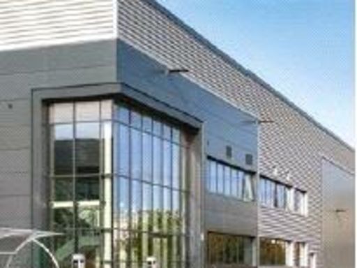 Land for sale in Plot H Factory Lane, CO11 — £996,000 • 1 bed • 1 bath
 Land for sale in Land at Greenstead Green, Halstead, CO9 — £395,000 • 1 bed • 1 bath
 Land for sale in Plot I Factory Lane, CO11 — £720,000 • 1 bed • 1 bath
 Land for sale in Plot F Factory Lane, CO11 — £378,000 • 1 bed • 1 bath • 27443 ft²
 Land for sale in Plot C Factory Lane, CO11 — £5,712,000 • 1 bed • 1 bath
Meta
- {
"@context": "https://schema.org",
"@type": "Residence",
"name": "Land for sale in Hall Drive, Gosfield, CO9",
"description": "",
"url": "https://propertypiper.co.uk/property/884b661d-6d11-4746-b71a-b2894dfb057e",
"image": "https://image-a.propertypiper.co.uk/ff4a3e44-dd0b-470f-8a8f-94374d9b38cc-1024.jpeg",
"address": {
"@type": "PostalAddress",
"streetAddress": "Hall Drive, Gosfield, CO9",
"postalCode": "CO9 1SY",
"addressLocality": "Braintree",
"addressRegion": "Braintree",
"addressCountry": "England"
},
"geo": {
"@type": "GeoCoordinates",
"latitude": 51.9379926,
"longitude": 0.5887192
},
"numberOfRooms": 1,
"numberOfBathroomsTotal": 1,
"offers": {
"@type": "Offer",
"price": 5000000,
"priceCurrency": "GBP",
"availability": "https://schema.org/InStock"
},
"additionalProperty": [
{
"@type": "PropertyValue",
"name": "Feature",
"value": "land plot"
},
{
"@type": "PropertyValue",
"name": "Feature",
"value": "development opportunity"
},
{
"@type": "PropertyValue",
"name": "Feature",
"value": "rural"
},
{
"@type": "PropertyValue",
"name": "Feature",
"value": "green space"
},
{
"@type": "PropertyValue",
"name": "Feature",
"value": "investment"
},
{
"@type": "PropertyValue",
"name": "Feature",
"value": "residential area"
},
{
"@type": "PropertyValue",
"name": "Feature",
"value": "rural"
},
{
"@type": "PropertyValue",
"name": "Feature",
"value": "land"
},
{
"@type": "PropertyValue",
"name": "Feature",
"value": "pasture"
},
{
"@type": "PropertyValue",
"name": "Feature",
"value": "field"
},
{
"@type": "PropertyValue",
"name": "Feature",
"value": "agriculture"
},
{
"@type": "PropertyValue",
"name": "Feature",
"value": "nature"
},
{
"@type": "PropertyValue",
"name": "Feature",
"value": "scenic"
}
]
}