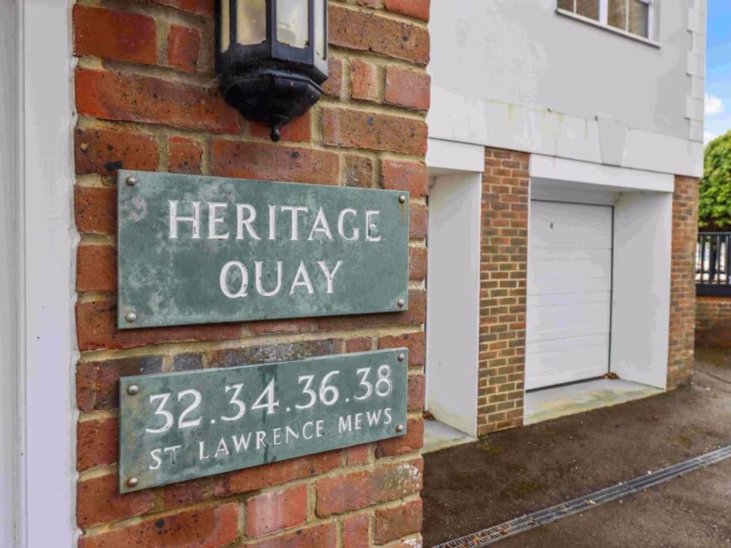
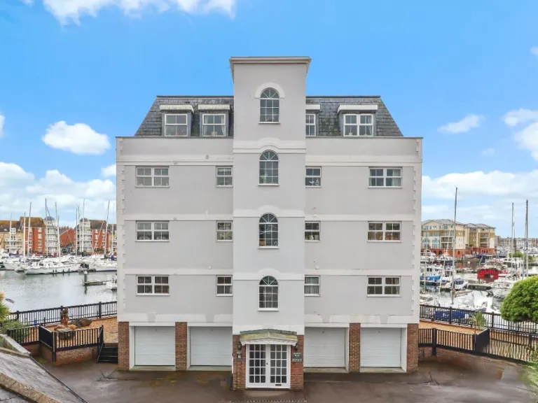
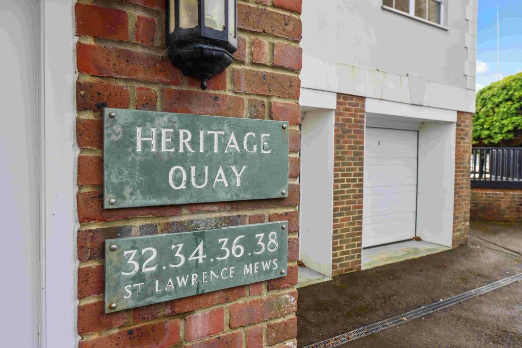
BN23 5QD - 3 bedroom flat for sale in St. Lawrence Mews, Eastbourne, E…
View on Property Piper
3 bedroom flat for sale in St. Lawrence Mews, Eastbourne, East Sussex, BN23
Property Details
- Price: £500000
- Bedrooms: 3
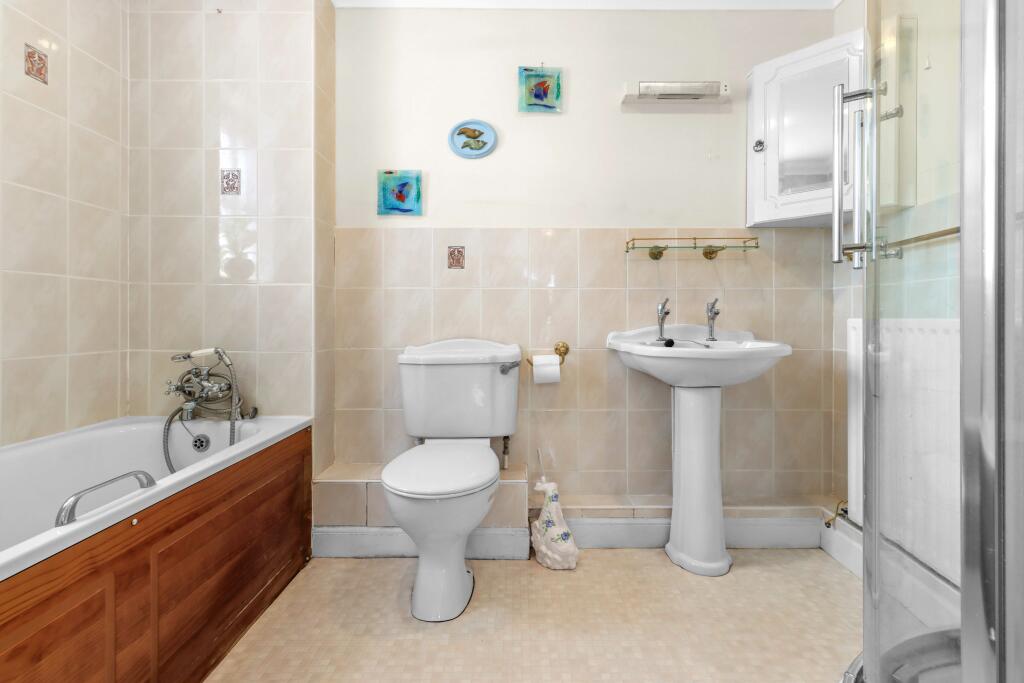
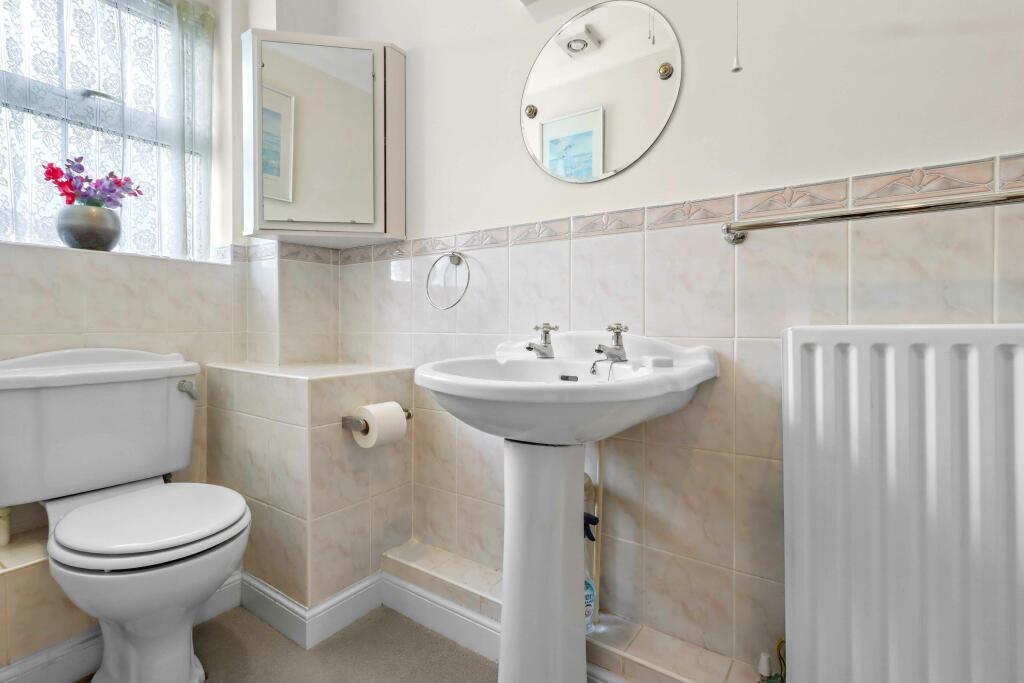
- Bathrooms: 3
- Property Type: undefined
- Property SubType: undefined
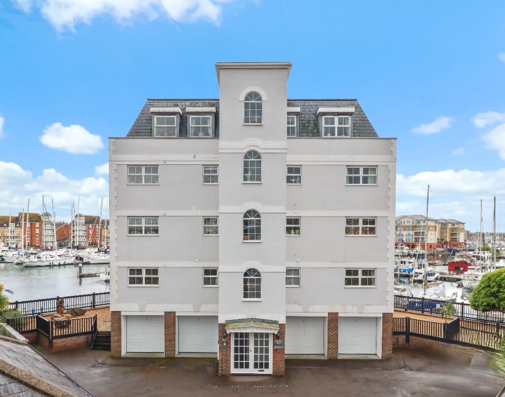
Image Descriptions
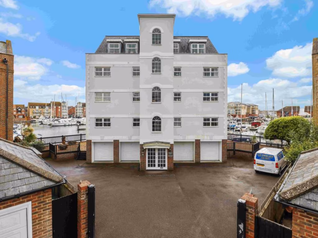
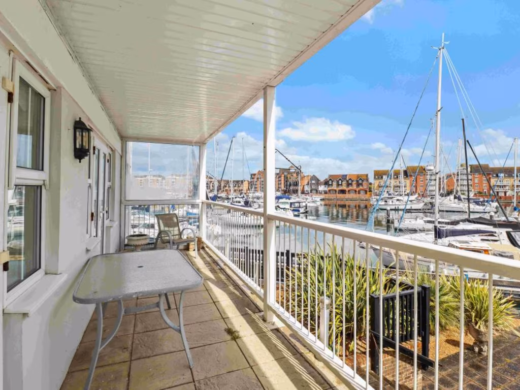
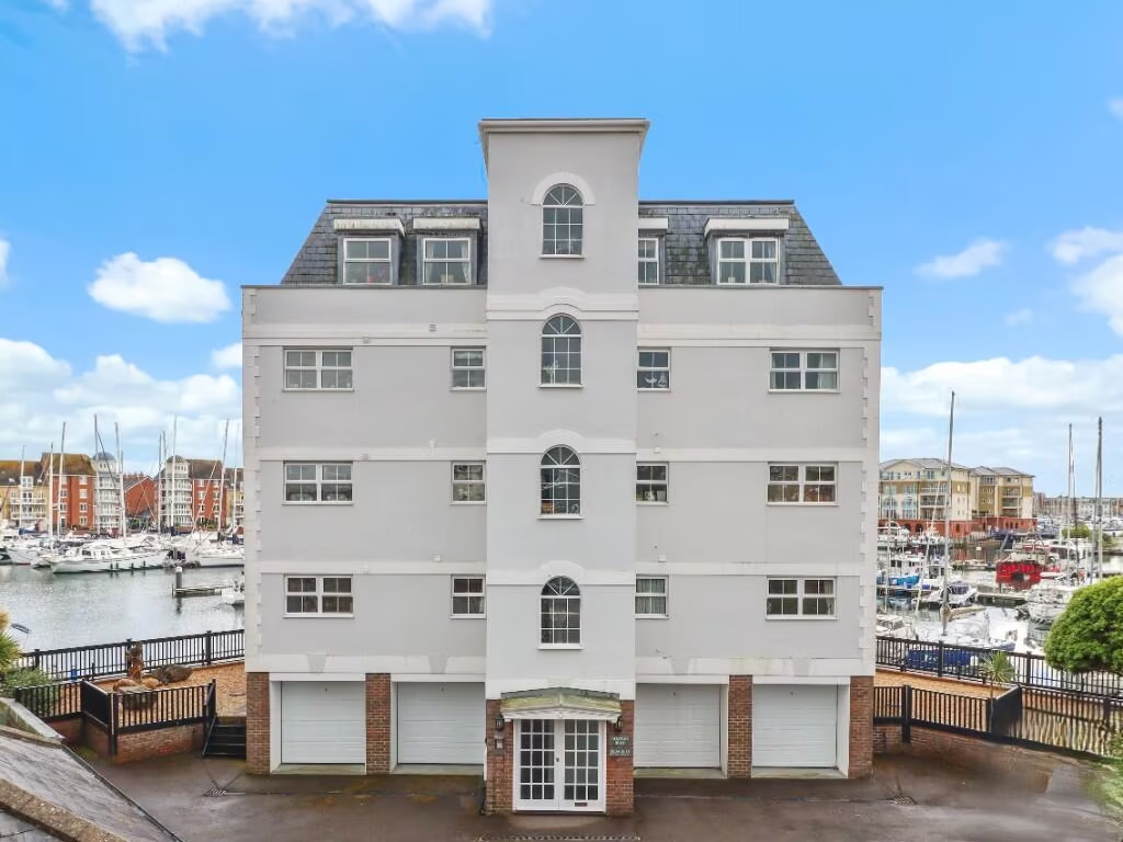
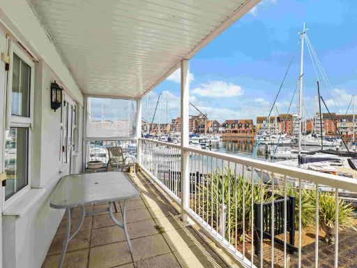
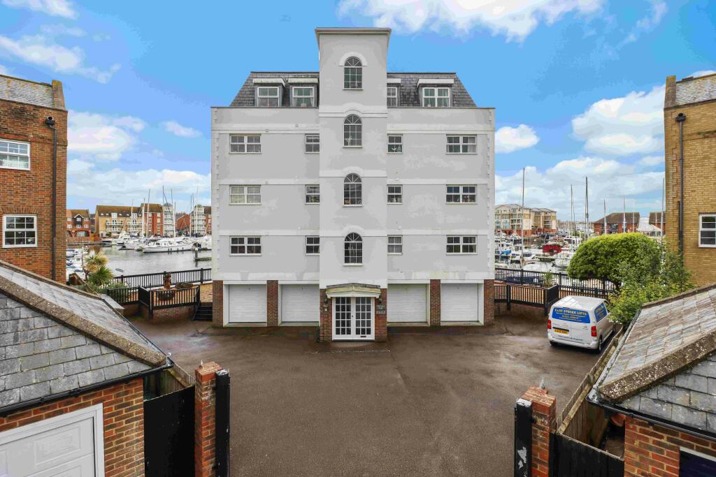
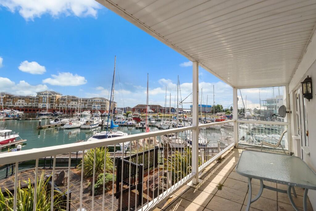
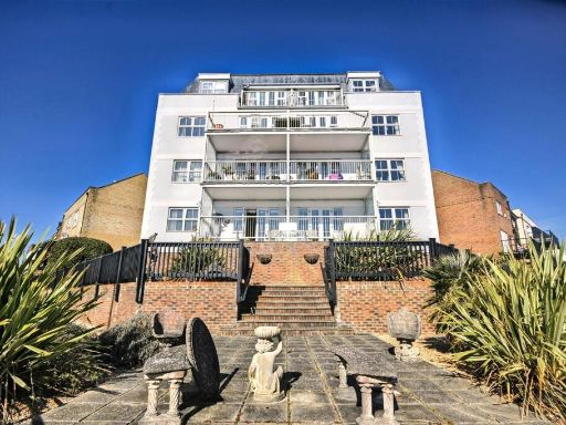
- apartment building modern
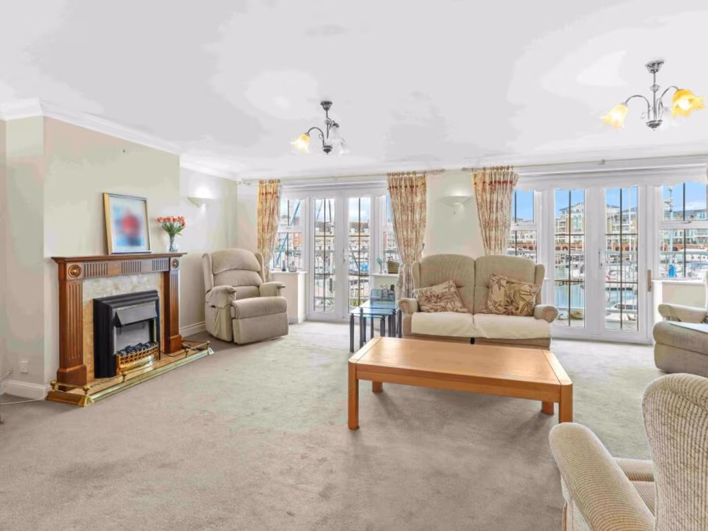
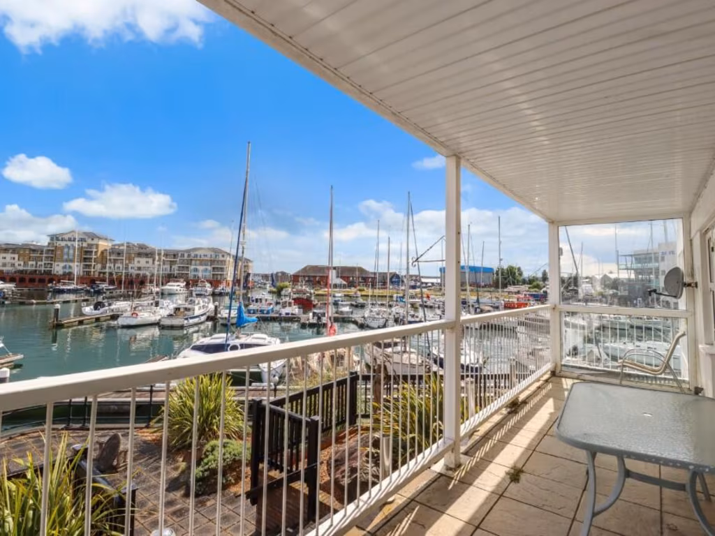
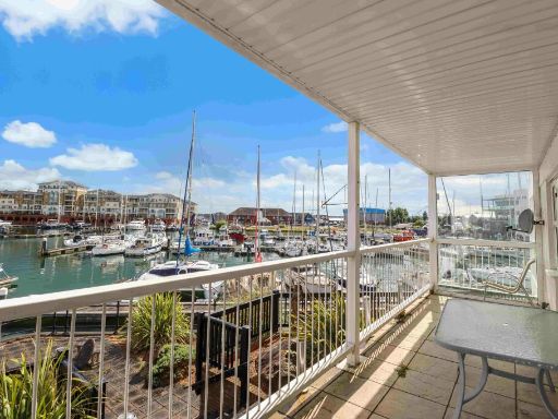
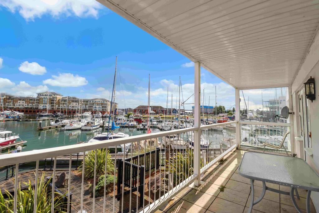
- balcony modern
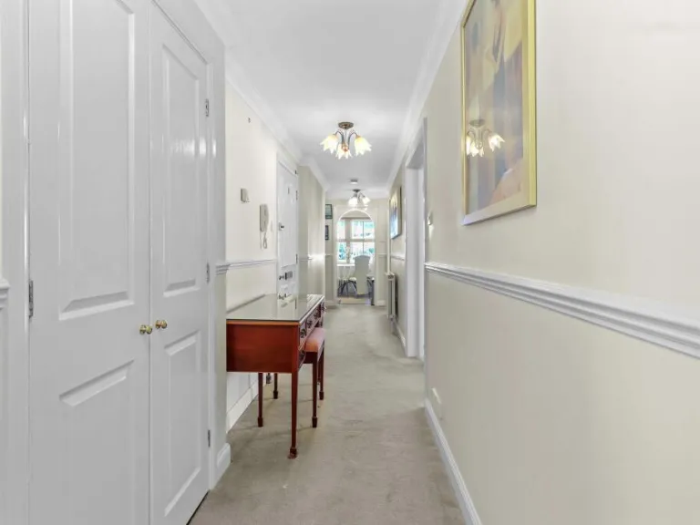
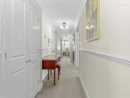
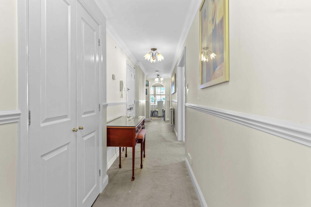
- hallway modern
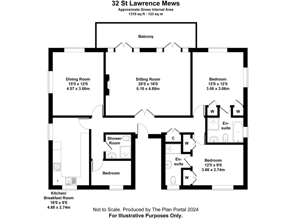
Floorplan Description
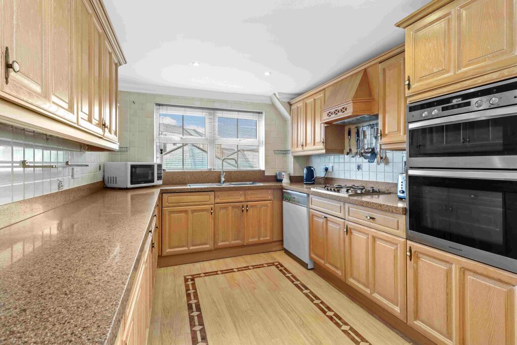
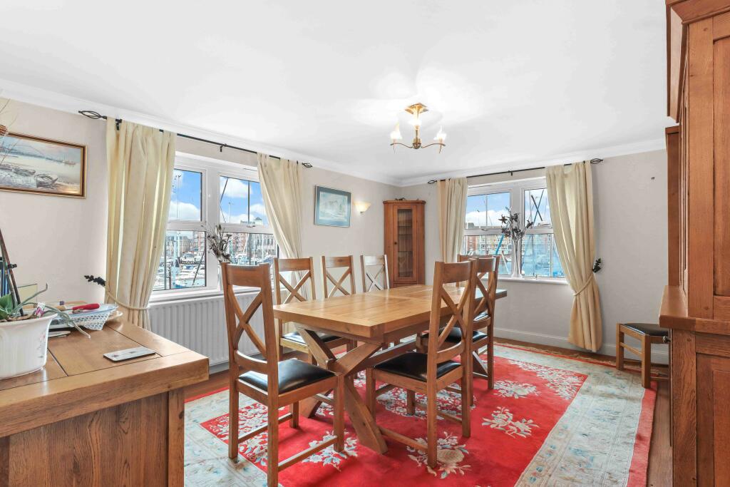
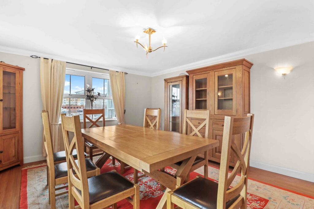
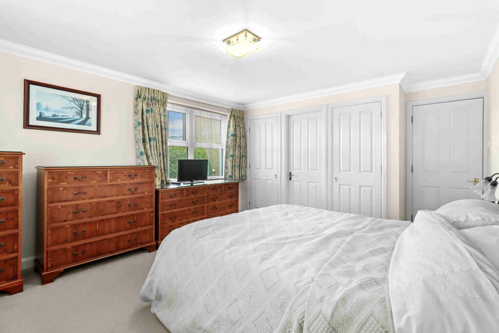
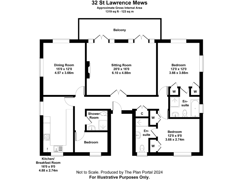
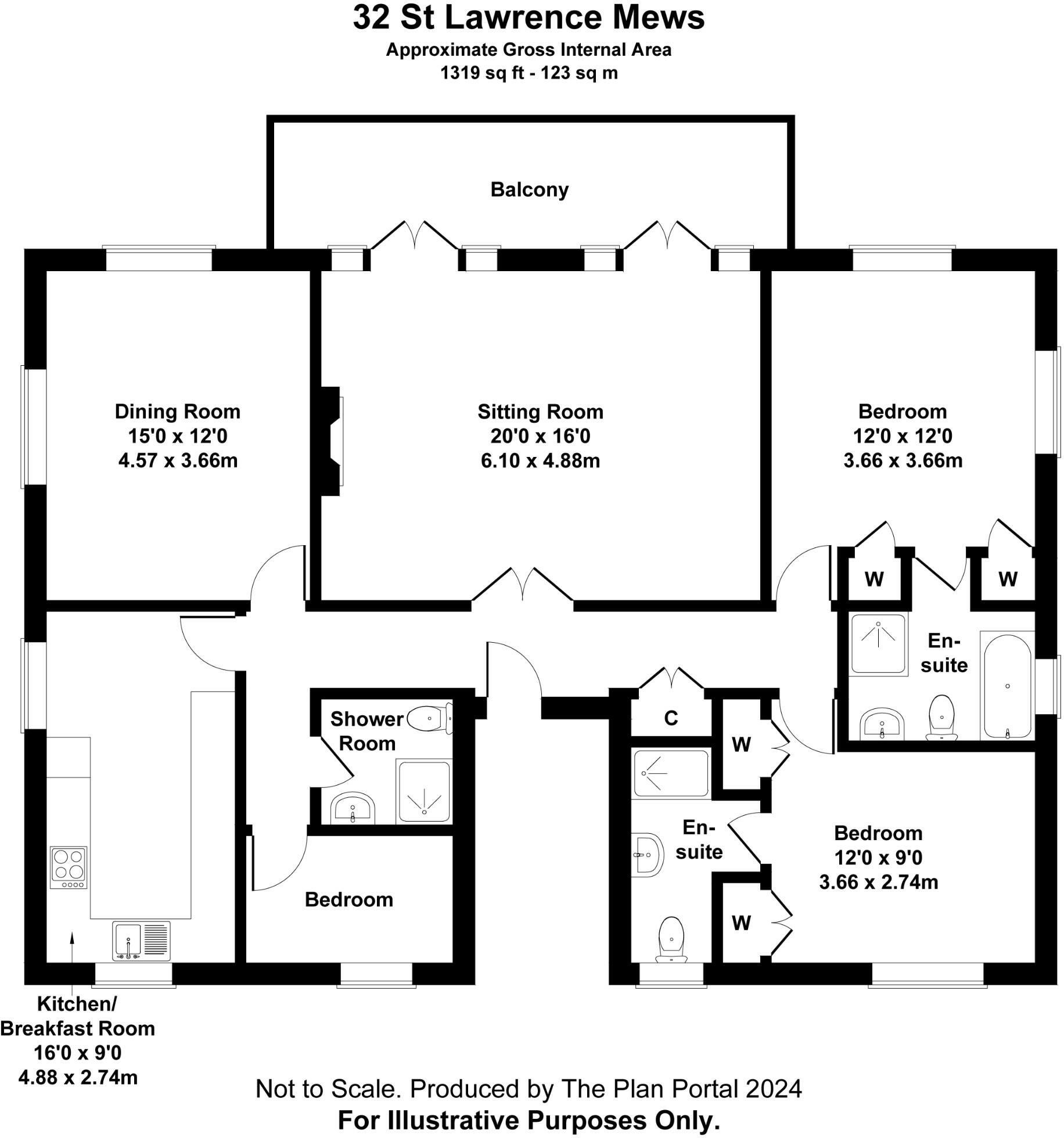
- A property at 32 St Lawrence Mews with dining and sitting rooms, kitchen/breakfast room, two bedrooms with en-suites, and a shower room.
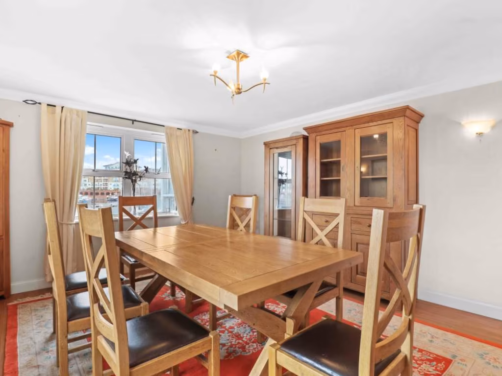
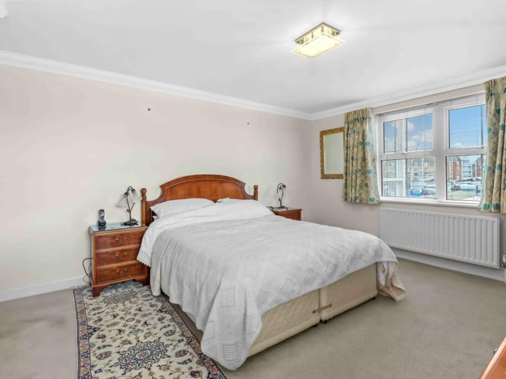
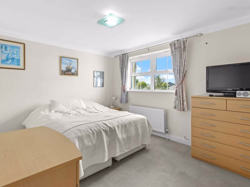
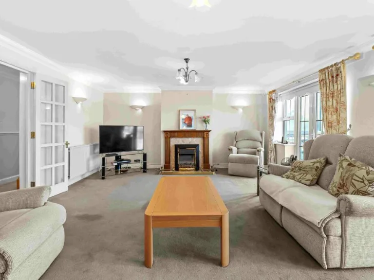
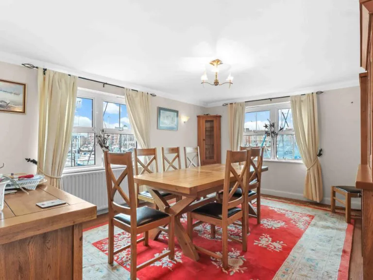
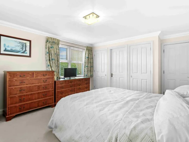
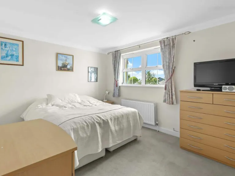
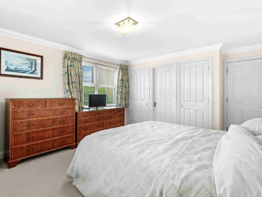
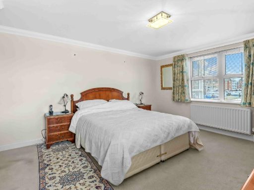
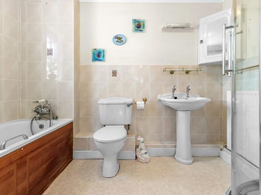
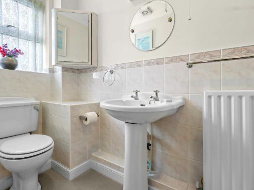
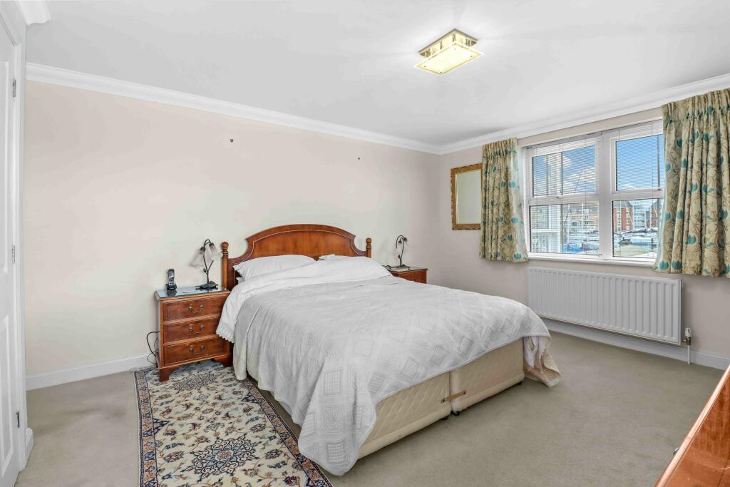
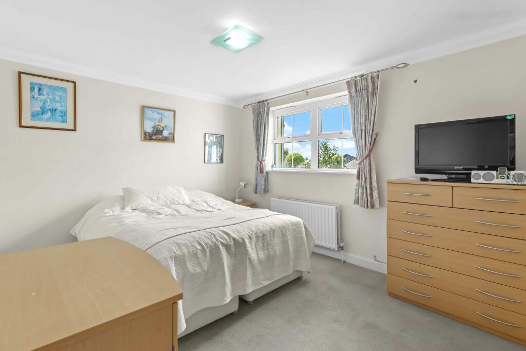
Rooms
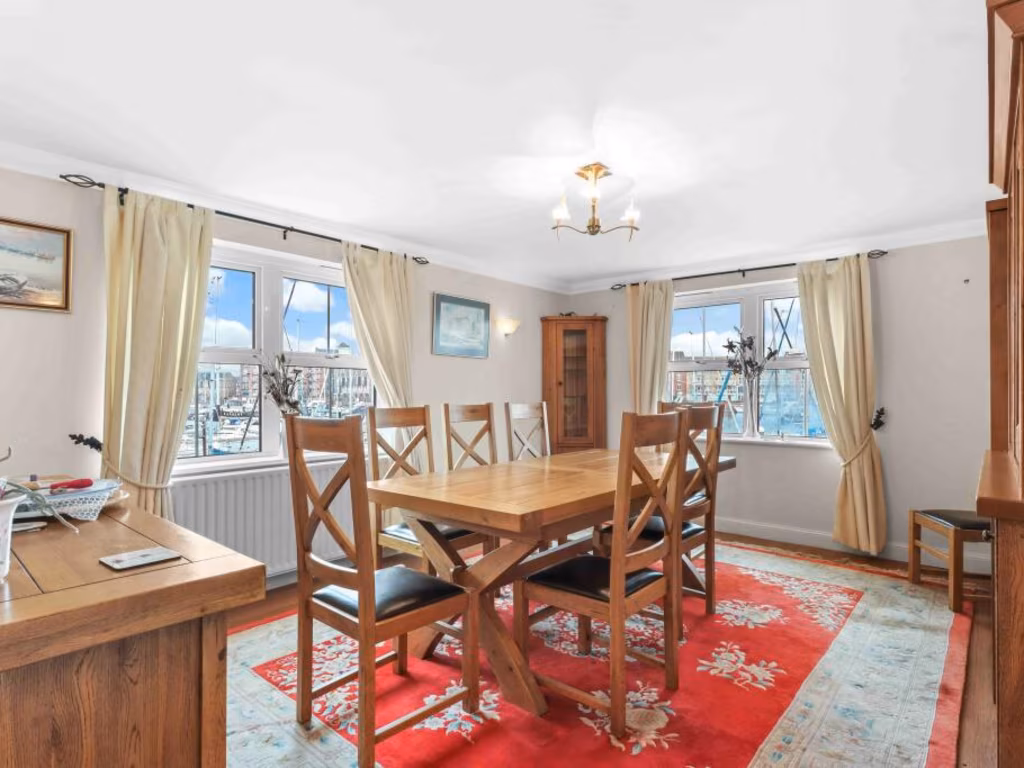
- Dining Room: average
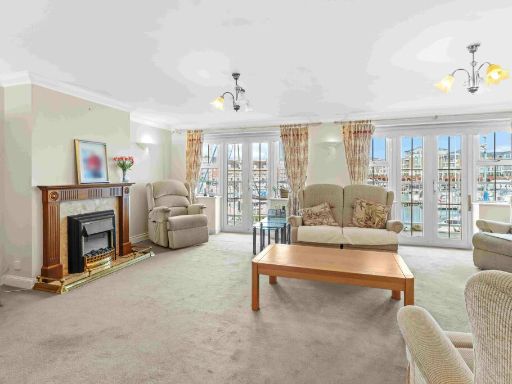
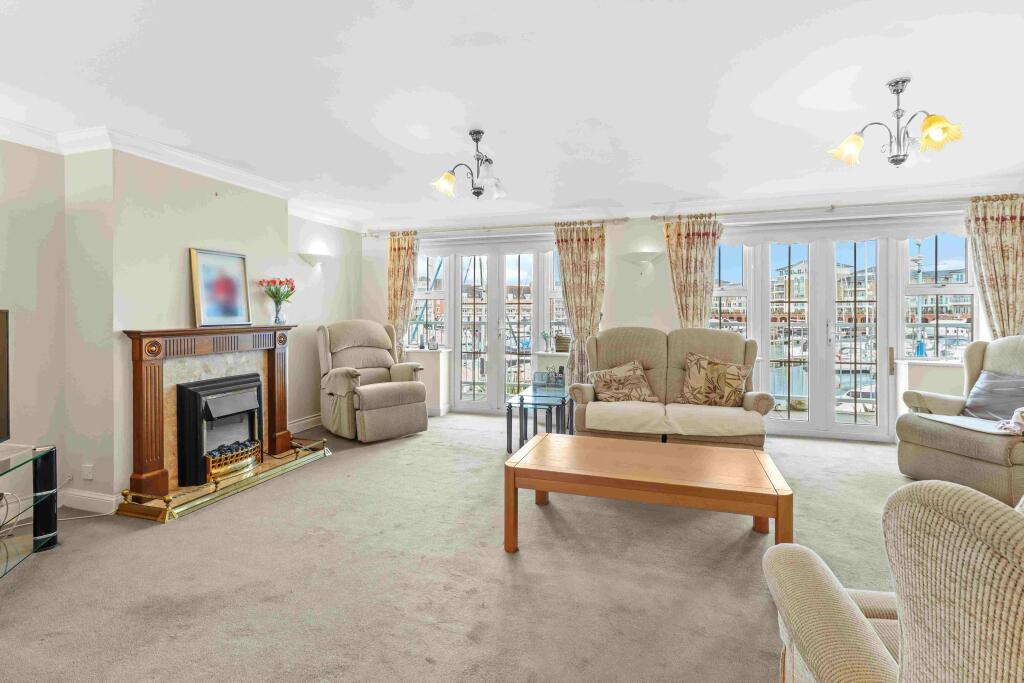
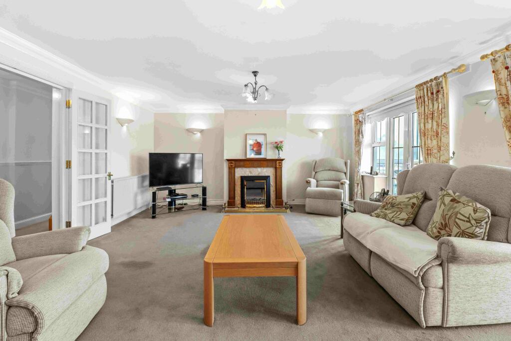
- Sitting Room: large
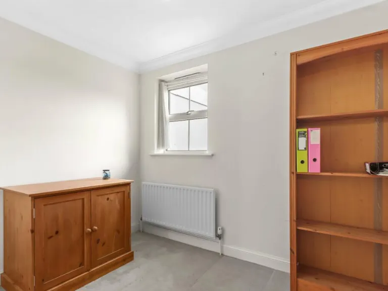
- Bedroom: average
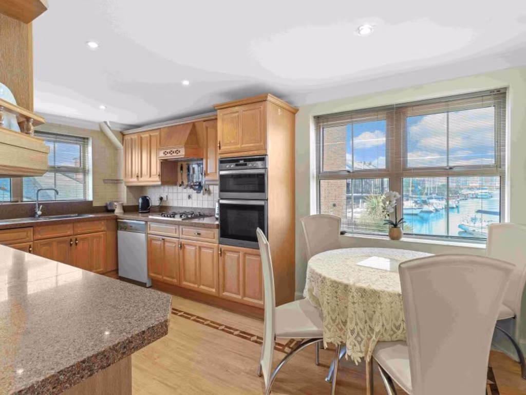
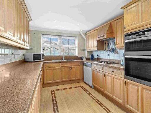
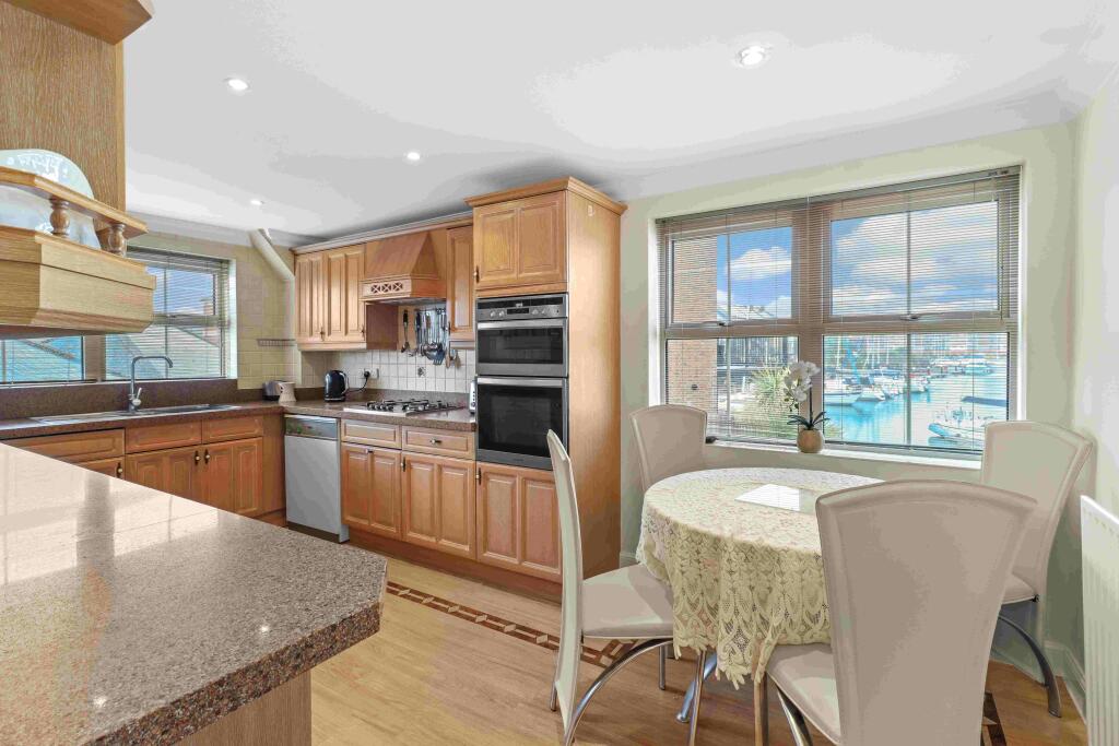
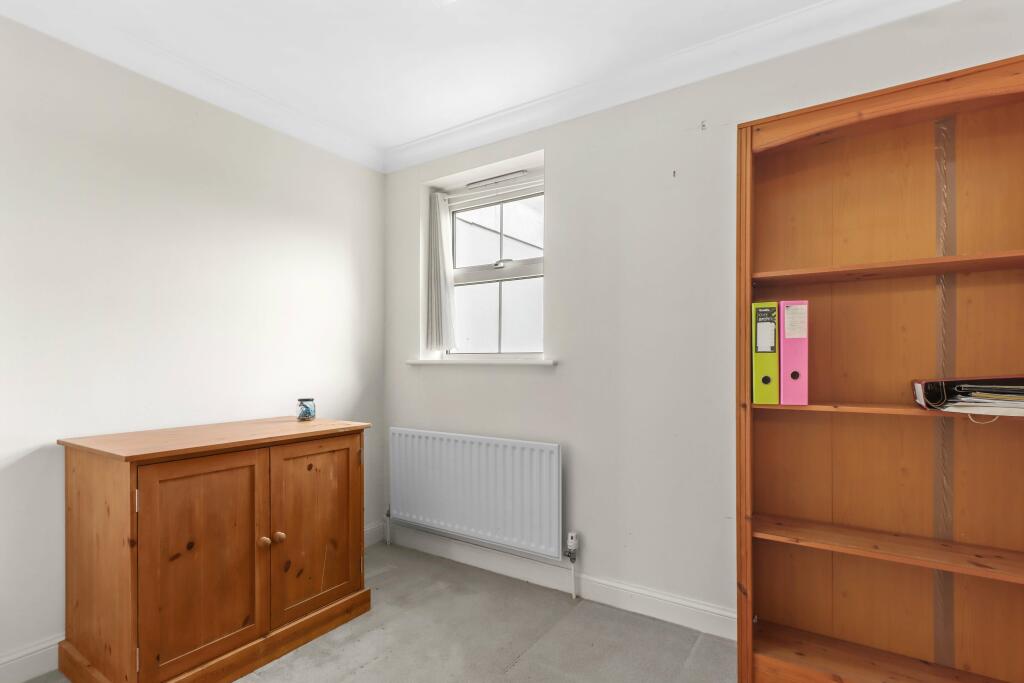
- Kitchen/Breakfast Room: average
- Bedroom: small
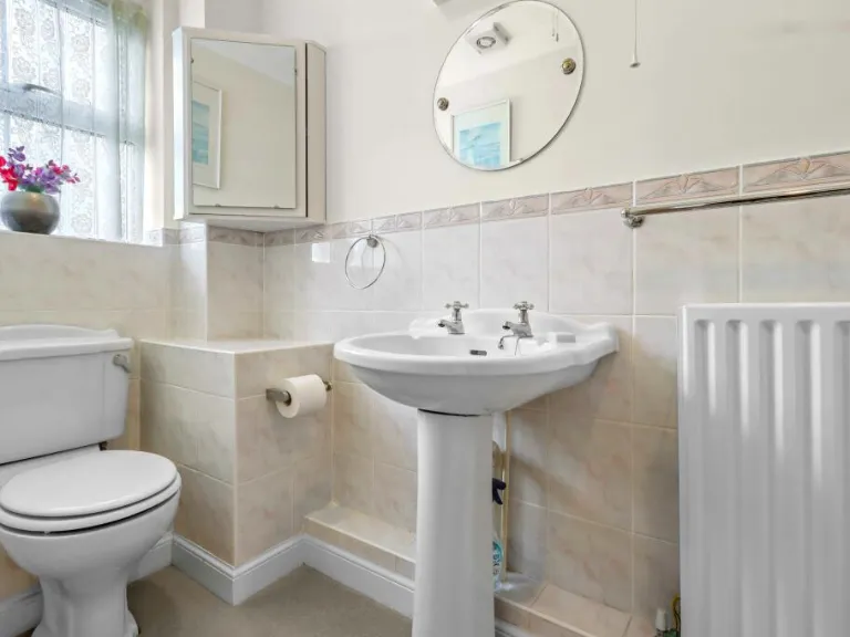
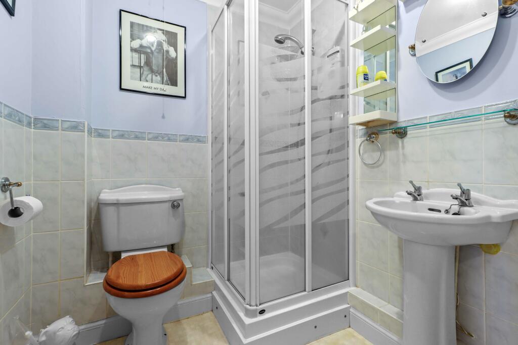
- Shower Room:
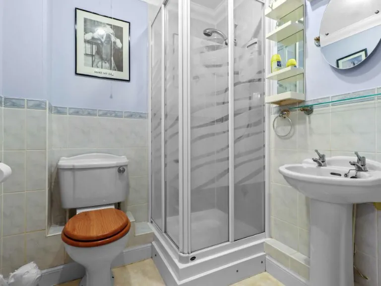
- En-suite:
- En-suite:
Textual Property Features
Detected Visual Features
- apartment building
- modern
- multi-story
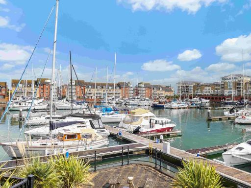
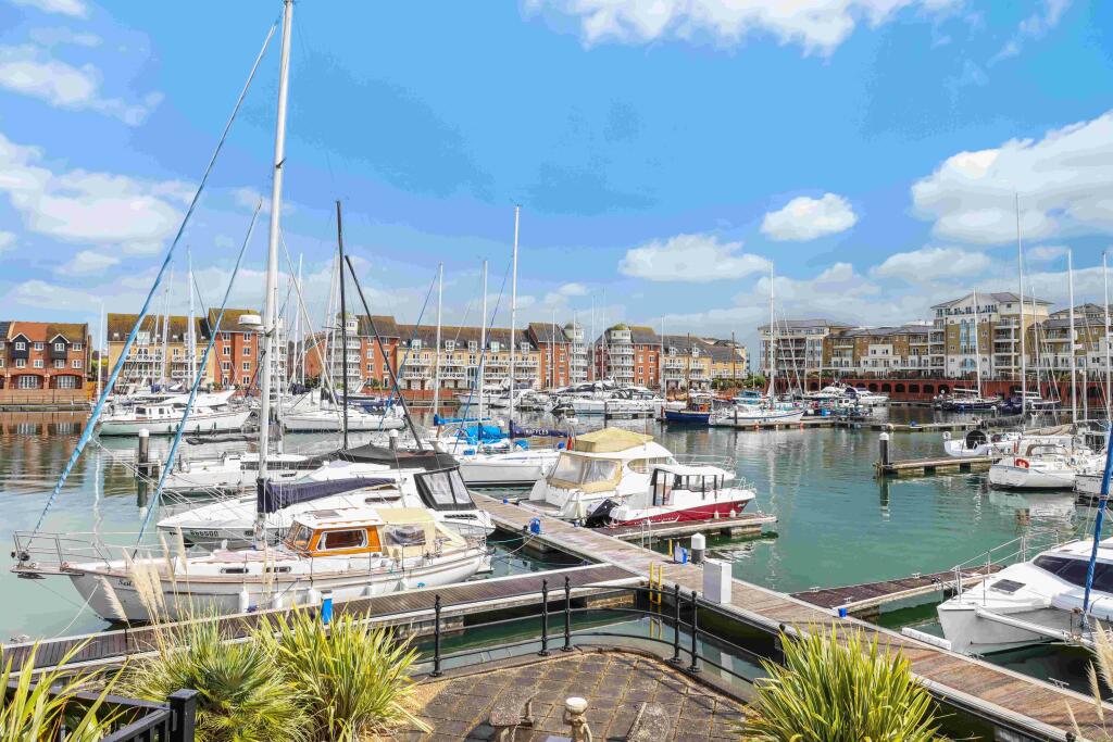
- waterfront
- garage
- balcony
- windows
- sailing marina
- brick and render
- driveway
- urban living
- marina view
- outdoor space
- railing
- tile flooring
- hallway
- standard ceiling
- medium size
- doors
- neutral decor
EPC Details
- Fully double glazed
- Cavity wall, as built, insulated (assumed)
- Boiler and radiators, mains gas
- Low energy lighting in 43% of fixed outlets
- To unheated space, limited insulation (assumed)
Nearby Schools
- Gildredge House
- Stafford Junior School
- St Andrew's Church of England Infants School
- West Rise Community Infant School
- Oakwood Primary Academy
- Langney Primary Academy
- West Rise Junior School
- The Eastbourne Academy
- The Turing School
- Pevensey and Westham CofE Primary School
- Eastbourne College
- Bourne Primary School
- St Thomas A Becket Catholic Primary School
- The Cavendish School
- Ratton School
- Parkland Infant School
- Parkland Junior School
- Roselands Infants' School
- Tollgate Community Junior School
- The Haven Church of England Methodist Primary School
- St Catherine's College
- Heron Park Primary Academy
- Shinewater Primary School
- Stone Cross School
- Hankham Primary School
Nearest General Shops
- Id: 526828713
- Tags:
- Addr:
- City: Eastbourne
- Housename: Sovereign Harbour Village Retail Park
- Postcode: BN23 6JH
- Street: Pevensey Bay Road
- Brand: TK Maxx
- Brand:wikidata: Q23823668
- Brand:wikipedia: en:TK Maxx
- Building: yes
- Name: TK Maxx
- Phone: +44 1323472803
- Shop: department_store
- Website: https://www.tkmaxx.com/uk/en/?utm_source=google&utm_medium=places&utm_campaign=411
- TagsNormalized:
- tk maxx
- department store
- shop
- Lat: 50.7946401
- Lon: 0.3232071
- FullGeoHash: u100zqgk5r0w
- PartitionGeoHash: u100
- Images:
- FoodStandards: null
- Distance: 359
,- Id: 526828707
- Tags:
- Addr:
- City: Eastbourne
- Housename: Sovereign Harbour Village Retail Park
- Housenumber: Unit 5
- Postcode: BN23 6JH
- Street: Pevensey Bay Road
- Brand: Bensons for Beds
- Brand:wikidata: Q4890299
- Brand:wikipedia: en:Bensons for Beds
- Building: yes
- Contact:
- Website: https://stores.bensonsforbeds.co.uk/eastbourne/unit-5-pevensey-bay-road
- Internet_access: wlan
- Name: Bensons for Beds
- Phone: +44 1323479592
- Shop: bed
- Website: https://stores.bensonsforbeds.co.uk/eastbourne/unit-5-sovereign-harbour-retail-park?utm_source=google&utm_medium=organic&utm_campaign=Yext
- TagsNormalized:
- Lat: 50.794685
- Lon: 0.3241048
- FullGeoHash: u100zquh2pw4
- PartitionGeoHash: u100
- Images:
- FoodStandards: null
- Distance: 298.3
,- Id: 526828709
- Tags:
- Addr:
- City: Eastbourne
- Housename: Sovereign Harbour Village Retail Park
- Housenumber: Unit 6
- Postcode: BN23 6JH
- Street: Pevensey Bay Road
- Brand: Wilko
- Brand:wikidata: Q8002536
- Brand:wikipedia: en:Wilko (retailer)
- Building: yes
- Contact:
- Website: https://stores.wilko.com/gb/eastbourne/unit-6
- Name: Wilko
- Phone: +44 3330052964
- Shop: variety_store
- Website: https://stores.wilko.com/gb/eastbourne/unit-6?utm_source=yext&utm_medium=storelistings&utm_campaign=yext-storelistings&utm_term=449
- TagsNormalized:
- Lat: 50.7948829
- Lon: 0.3243538
- FullGeoHash: u100zqujturw
- PartitionGeoHash: u100
- Images:
- FoodStandards: null
- Distance: 274
}
Nearest Grocery shops
- Id: 6109989494
- Tags:
- Addr:
- City: Eastbourne
- Country: GB
- Housenumber: 14
- Postcode: BN23 7LU
- Street: Pembury Road
- Brand: Premier
- Brand:wikidata: Q7240340
- Brand:wikipedia: en:Premier Stores
- Name: Premier
- Payment:
- Cash: yes
- Credit_cards: yes
- Shop: convenience
- TagsNormalized:
- Lat: 50.7985247
- Lon: 0.307245
- FullGeoHash: u100yzxdz767
- PartitionGeoHash: u100
- Images:
- FoodStandards: null
- Distance: 1493.6
,- Id: 853951436
- Tags:
- Addr:
- City: Eastbourne
- Housenumber: 46
- Postcode: BN23 6DG
- Street: Beatty Road
- Brand: Co-op Food
- Brand:wikidata: Q3277439
- Brand:wikipedia: en:Co-op Food
- Building: yes
- Name: Co-op Food
- Shop: convenience
- TagsNormalized:
- co-op
- co-op food
- food
- convenience
- shop
- Lat: 50.7854888
- Lon: 0.3184014
- FullGeoHash: u100zjpygm32
- PartitionGeoHash: u100
- Images:
- FoodStandards: null
- Distance: 1322.9
,- Id: 6110024916
- Tags:
- Addr:
- City: Eastbourne
- Postcode: BN23 7BP
- Street: Etchingham Road
- Brand: Best-one
- Brand:wikidata: Q4896532
- Brand:wikipedia: en:Best-one
- Name: Best-one
- Shop: convenience
- TagsNormalized:
- Lat: 50.7974589
- Lon: 0.3130742
- FullGeoHash: u100zp7uxhtj
- PartitionGeoHash: u100
- Images:
- FoodStandards: null
- Distance: 1068.6
}
Nearest Religious buildings
- Id: 794459789
- Tags:
- Amenity: place_of_worship
- Building: church
- Religion: christian
- TagsNormalized:
- place of worship
- church
- christian
- Lat: 50.8102593
- Lon: 0.3445991
- FullGeoHash: u101pcdzjwzd
- PartitionGeoHash: u101
- Images:
- FoodStandards: null
- Distance: 1993.2
,- Id: 878676825
- Tags:
- Amenity: place_of_worship
- Building: church
- Denomination: anglican
- Name: St. Richard
- Religion: christian
- Wikidata: Q105082138
- TagsNormalized:
- place of worship
- church
- anglican
- christian
- Lat: 50.7957304
- Lon: 0.3144166
- FullGeoHash: u100zphfw6qn
- PartitionGeoHash: u100
- Images:
- FoodStandards: null
- Distance: 956.5
,- Id: 2975383423
- Tags:
- Amenity: place_of_worship
- Denomination: anglican
- Name: The Haven Church
- Religion: christian
- Wikidata: Q105082216
- TagsNormalized:
- place of worship
- anglican
- church
- christian
- Lat: 50.7904072
- Lon: 0.3195416
- FullGeoHash: u100zq0etf5k
- PartitionGeoHash: u100
- Images:
- FoodStandards: null
- Distance: 838.8
}
Nearest Leisure Facilities
- Id: 303946380
- Tags:
- TagsNormalized:
- Lat: 50.7895531
- Lon: 0.3286295
- FullGeoHash: u100zmzq9dgv
- PartitionGeoHash: u100
- Images:
- FoodStandards: null
- Distance: 686.2
,- Id: 1041182690
- Tags:
- TagsNormalized:
- Lat: 50.7938951
- Lon: 0.319527
- FullGeoHash: u100zq8xvs2d
- PartitionGeoHash: u100
- Images:
- FoodStandards: null
- Distance: 630.6
,- Id: 1149955547
- Tags:
- TagsNormalized:
- Lat: 50.7930006
- Lon: 0.3312396
- FullGeoHash: u100zw94wmw4
- PartitionGeoHash: u100
- Images:
- FoodStandards: null
- Distance: 376.8
,- Id: 526828712
- Tags:
- Addr:
- City: Eastbourne
- Housename: Sovereign Harbour Village Retail Park
- Housenumber: Unit 4c
- Postcode: BN23 6JH
- Street: Pevensey Bay Road
- Brand: The Gym
- Brand:wikidata: Q48815022
- Brand:wikipedia: en:The Gym Group
- Building: yes
- Contact:
- Website: https://www.thegymgroup.com/find-a-gym/eastbourne-gyms/eastbourne/
- Internet_access: wlan
- Leisure: fitness_centre
- Name: The Gym
- Opening_hours: 24/7
- Phone: +44 3003034800
- Website: https://www.thegymgroup.com/find-a-gym/eastbourne-gyms/eastbourne/?utm_source=google&utm_medium=organic&utm_campaign=gmb-listing&utm_content=Eastbourne
- TagsNormalized:
- the gym
- gym
- fitness
- fitness centre
- leisure
- Lat: 50.7944045
- Lon: 0.323351
- FullGeoHash: u100zqg6ye7c
- PartitionGeoHash: u100
- Images:
- FoodStandards: null
- Distance: 359.3
,- Id: 19578151
- Tags:
- Leisure: marina
- Name: Sovereign Harbour
- Natural: water
- Seamark:
- Water: harbour
- Wikidata: Q2569013
- TagsNormalized:
- marina
- leisure
- harbour
- water
- Lat: 50.7943739
- Lon: 0.3280884
- FullGeoHash: u100zqyftj86
- PartitionGeoHash: u100
- Images:
- FoodStandards: null
- Distance: 148.9
}
Nearest Tourist attractions
- Id: 821625237
- Tags:
- Addr:
- City: Pevensey Bay
- Housename: Grey Tower
- Postcode: BN24 6DP
- Street: Eastbourne Road
- Name: Grey Tower Caravan Park
- Tourism: caravan_site
- TagsNormalized:
- Lat: 50.8037507
- Lon: 0.3412758
- FullGeoHash: u101pb892399
- PartitionGeoHash: u101
- Images:
- FoodStandards: null
- Distance: 1290.8
,- Id: 821889838
- Tags:
- Addr:
- City: Pevensey Bay
- Postcode: BN24 6DT
- Street: Eastbourne Road
- Name: Castle View Caravan Site
- Tourism: caravan_site
- TagsNormalized:
- Lat: 50.8047429
- Lon: 0.3352361
- FullGeoHash: u101p8sp5dd0
- PartitionGeoHash: u101
- Images:
- FoodStandards: null
- Distance: 1124.8
,- Id: 821625236
- Tags:
- Name: Bay View Park
- Tourism: camp_site
- TagsNormalized:
- Lat: 50.8001316
- Lon: 0.3381714
- FullGeoHash: u100zxyhpyyu
- PartitionGeoHash: u100
- Images:
- FoodStandards: null
- Distance: 866
}
Nearest Train stations
- Id: 6745675395
- Tags:
- Name: Eastbourne
- Naptan:
- Network: National Rail
- Public_transport: station
- Railway: station
- Ref:
- Wikidata: Q800700
- Wikimedia_commons: Category:Eastbourne railway station
- Wikipedia: en:Eastbourne railway station
- TagsNormalized:
- Lat: 50.7696435
- Lon: 0.2815355
- FullGeoHash: u100y6m48780
- PartitionGeoHash: u100
- Images:
- FoodStandards: null
- Distance: 4368.7
,- Id: 6745675396
- Tags:
- Name: Hampden Park
- Naptan:
- Network: National Rail
- Platforms: 2
- Public_transport: station
- Railway: station
- Ref:
- Source: NPE
- Wheelchair: no
- Wikidata: Q2163730
- Wikipedia: en:Hampden Park railway station
- TagsNormalized:
- Lat: 50.7959254
- Lon: 0.2796796
- FullGeoHash: u100yr5etnb1
- PartitionGeoHash: u100
- Images:
- FoodStandards: null
- Distance: 3398
,- Id: 1252781690
- Tags:
- Name: Eastbourne Miniature Steam Railway
- Public_transport: station
- Railway: station
- Usage: tourism
- TagsNormalized:
- Lat: 50.7882891
- Lon: 0.2874059
- FullGeoHash: u100yt9r1p33
- PartitionGeoHash: u100
- Images:
- FoodStandards: null
- Distance: 2972.1
,- Id: 6745645283
- Tags:
- Name: Pevensey Bay
- Naptan:
- Network: National Rail
- Public_transport: station
- Railway: station
- Ref:
- Wikidata: Q2721185
- Wikipedia: en:Pevensey Bay railway station
- TagsNormalized:
- Lat: 50.8176698
- Lon: 0.3431985
- FullGeoHash: u101pg1fmh72
- PartitionGeoHash: u101
- Images:
- FoodStandards: null
- Distance: 2664.2
,- Id: 6745645284
- Tags:
- Name: Pevensey and Westham
- Naptan:
- Network: National Rail
- Public_transport: station
- Railway: station
- Ref:
- Wikidata: Q2280818
- Wikipedia: en:Pevensey & Westham railway station
- TagsNormalized:
- Lat: 50.8157704
- Lon: 0.3253781
- FullGeoHash: u101p6szmf5m
- PartitionGeoHash: u101
- Images:
- FoodStandards: null
- Distance: 2238.1
}
Nearest Bus stations and stops
- Id: 988255913
- Tags:
- Bus: yes
- Highway: bus_stop
- Name: Tanbridge Road
- Public_transport: platform
- TagsNormalized:
- Lat: 50.7983552
- Lon: 0.3238971
- FullGeoHash: u100zrecg7g0
- PartitionGeoHash: u100
- Images:
- FoodStandards: null
- Distance: 412.9
,- Id: 987926946
- Tags:
- Bus: yes
- Highway: bus_stop
- Name: Tanbridge Road
- Public_transport: platform
- Shelter: no
- TagsNormalized:
- Lat: 50.7982791
- Lon: 0.3240189
- FullGeoHash: u100zrecqjw4
- PartitionGeoHash: u100
- Images:
- FoodStandards: null
- Distance: 400.9
,- Id: 6608999805
- Tags:
- Bus: yes
- Highway: bus_stop
- Name: Medical Centre
- Public_transport: platform
- TagsNormalized:
- Lat: 50.7991052
- Lon: 0.3294582
- FullGeoHash: u100zrxyhztc
- PartitionGeoHash: u100
- Images:
- FoodStandards: null
- Distance: 390.5
,- Id: 6608929282
- Tags:
- Bus: yes
- Highway: bus_stop
- Name: Medical Centre
- Public_transport: platform
- TagsNormalized:
- Lat: 50.7990153
- Lon: 0.3290721
- FullGeoHash: u100zrxteyvc
- PartitionGeoHash: u100
- Images:
- FoodStandards: null
- Distance: 374.5
,- Id: 992933087
- Tags:
- Bench: yes
- Bin: yes
- Bus: yes
- Highway: bus_stop
- Is_in: Sovereign Harbour, Eastbourne, East Sussex, UK
- Lit: no
- Name: Sovereign Harbour North (Macquarie Quay)
- Public_transport: platform
- Shelter: yes
- Tactile_paving: no
- TagsNormalized:
- Lat: 50.7935345
- Lon: 0.3301672
- FullGeoHash: u100zw8mv3ne
- PartitionGeoHash: u100
- Images:
- FoodStandards: null
- Distance: 285.2
}
Nearest Hotels
- Id: 457107670
- Tags:
- Addr:
- City: Eastbourne
- Postcode: BN23 8AL
- Street: Willingdon Drove
- Brand: Travelodge
- Brand:wikidata: Q9361374
- Brand:wikipedia: en:Travelodge UK
- Building: yes
- Internet_access: wlan
- Internet_access:fee: customers
- Internet_access:ssid: Travelodge WiFi
- Name: Travelodge Eastbourne
- Tourism: hotel
- Website: https://www.travelodge.co.uk
- TagsNormalized:
- Lat: 50.7981264
- Lon: 0.2897064
- FullGeoHash: u100yxdbw9he
- PartitionGeoHash: u100
- Images:
- FoodStandards: null
- Distance: 2706.5
,- Id: 823922279
- Tags:
- Addr:
- City: Pevensey Bay
- Housenumber: 2
- Postcode: BN24 6EJ
- Street: Eastbourne Road
- Building: yes
- Internet_access: yes
- Internet_access:fee: no
- Name: Bay Hotel
- Tourism: hotel
- TagsNormalized:
- Lat: 50.8126683
- Lon: 0.3517902
- FullGeoHash: u103040jjrcv
- PartitionGeoHash: u103
- Images:
- FoodStandards: null
- Distance: 2518.7
,- Id: 70850541
- Tags:
- Addr:
- City: Eastbourne
- Postcode: BN23 8AL
- Street: Willingdon Drove
- Brand: Premier Inn
- Brand:wikidata: Q2108626
- Brand:wikipedia: en:Premier Inn
- Building: yes
- Internet_access: wlan
- Internet_access:fee: customers
- Internet_access:operator: Virgin Media
- Internet_access:ssid: Premier Inn Free Wi-Fi
- Name: Premier Inn
- Tourism: hotel
- Website: https://www.premierinn.com
- TagsNormalized:
- Lat: 50.8015201
- Lon: 0.2955281
- FullGeoHash: u101n8phq39x
- PartitionGeoHash: u101
- Images:
- FoodStandards: null
- Distance: 2373.4
}
Tags
- apartment building
- modern
- multi-story
- waterfront
- garage
- balcony
- windows
- sailing marina
- brick and render
- driveway
- urban living
- balcony
- marina view
- modern
- waterfront
- outdoor space
- railing
- tile flooring
- modern
- hallway
- standard ceiling
- medium size
- doors
- neutral decor
Local Market Stats
- Average Price/sqft: £337
- Avg Income: £43300
- Rental Yield: 5%
- Social Housing: 15%
- Planning Success Rate: 93%
AirBnB Data
- 1km average: £91/night
- Listings in 1km: 3
Similar Properties
 4 bedroom flat for sale in St. Lawrence Mews, Eastbourne, BN23 — £500,000 • 4 bed • 3 bath • 1401 ft²
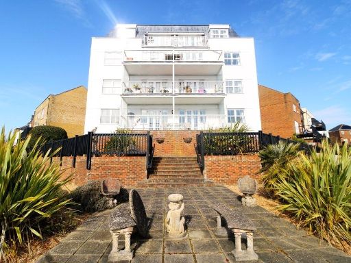 3 bedroom flat for sale in St. Lawrence Mews, Eastbourne, BN23 5QD, BN23 — £545,000 • 3 bed • 2 bath • 933 ft²
 2 bedroom flat for sale in Phoenix Drive, Eastbourne, BN23 — £365,000 • 2 bed • 2 bath • 911 ft²
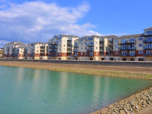 2 bedroom flat for sale in Macquarie Quay, Eastbourne, BN23 — £259,950 • 2 bed • 2 bath • 850 ft²
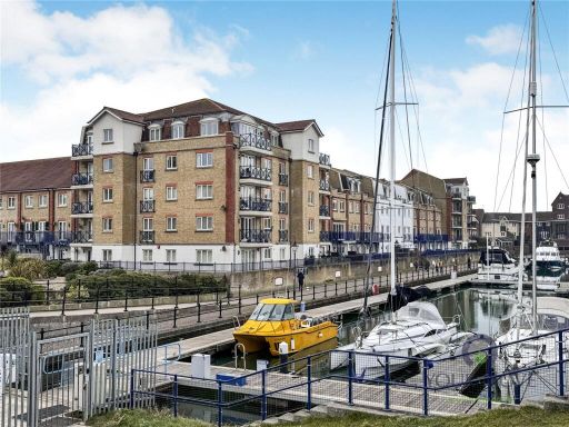 2 bedroom flat for sale in The Piazza, Eastbourne, East Sussex, BN23 — £250,000 • 2 bed • 2 bath • 776 ft²
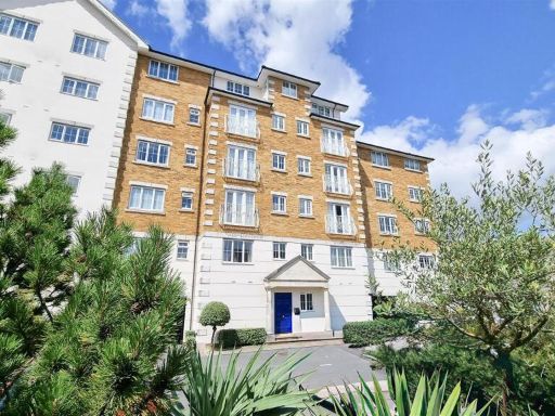 2 bedroom flat for sale in Golden Gate Way, Eastbourne, BN23 5PT, BN23 — £240,000 • 2 bed • 2 bath • 851 ft²
Meta
- {
"@context": "https://schema.org",
"@type": "Residence",
"name": "3 bedroom flat for sale in St. Lawrence Mews, Eastbourne, E…",
"description": "",
"url": "https://propertypiper.co.uk/property/870c6c8b-35e2-457f-9fd7-1de48af41354",
"image": "https://image-a.propertypiper.co.uk/f0ed09b4-9477-48e6-9c0b-8b7547ea4597-1024.jpeg",
"address": {
"@type": "PostalAddress",
"streetAddress": "32 ST LAWRENCE MEWS EASTBOURNE ",
"postalCode": "BN23 5QD",
"addressLocality": "Eastbourne",
"addressRegion": "Eastbourne",
"addressCountry": "England"
},
"geo": {
"@type": "GeoCoordinates",
"latitude": 50.79571259948039,
"longitude": 0.3280251349562416
},
"numberOfRooms": 3,
"numberOfBathroomsTotal": 3,
"floorSize": {
"@type": "QuantitativeValue",
"value": 1319,
"unitCode": "FTK"
},
"offers": {
"@type": "Offer",
"price": 500000,
"priceCurrency": "GBP",
"availability": "https://schema.org/InStock"
},
"additionalProperty": [
{
"@type": "PropertyValue",
"name": "Feature",
"value": "apartment building"
},
{
"@type": "PropertyValue",
"name": "Feature",
"value": "modern"
},
{
"@type": "PropertyValue",
"name": "Feature",
"value": "multi-story"
},
{
"@type": "PropertyValue",
"name": "Feature",
"value": "waterfront"
},
{
"@type": "PropertyValue",
"name": "Feature",
"value": "garage"
},
{
"@type": "PropertyValue",
"name": "Feature",
"value": "balcony"
},
{
"@type": "PropertyValue",
"name": "Feature",
"value": "windows"
},
{
"@type": "PropertyValue",
"name": "Feature",
"value": "sailing marina"
},
{
"@type": "PropertyValue",
"name": "Feature",
"value": "brick and render"
},
{
"@type": "PropertyValue",
"name": "Feature",
"value": "driveway"
},
{
"@type": "PropertyValue",
"name": "Feature",
"value": "urban living"
},
{
"@type": "PropertyValue",
"name": "Feature",
"value": "balcony"
},
{
"@type": "PropertyValue",
"name": "Feature",
"value": "marina view"
},
{
"@type": "PropertyValue",
"name": "Feature",
"value": "modern"
},
{
"@type": "PropertyValue",
"name": "Feature",
"value": "waterfront"
},
{
"@type": "PropertyValue",
"name": "Feature",
"value": "outdoor space"
},
{
"@type": "PropertyValue",
"name": "Feature",
"value": "railing"
},
{
"@type": "PropertyValue",
"name": "Feature",
"value": "tile flooring"
},
{
"@type": "PropertyValue",
"name": "Feature",
"value": "modern"
},
{
"@type": "PropertyValue",
"name": "Feature",
"value": "hallway"
},
{
"@type": "PropertyValue",
"name": "Feature",
"value": "standard ceiling"
},
{
"@type": "PropertyValue",
"name": "Feature",
"value": "medium size"
},
{
"@type": "PropertyValue",
"name": "Feature",
"value": "doors"
},
{
"@type": "PropertyValue",
"name": "Feature",
"value": "neutral decor"
}
]
}
High Res Floorplan Images
Compatible Floorplan Images
FloorplanImages Thumbnail