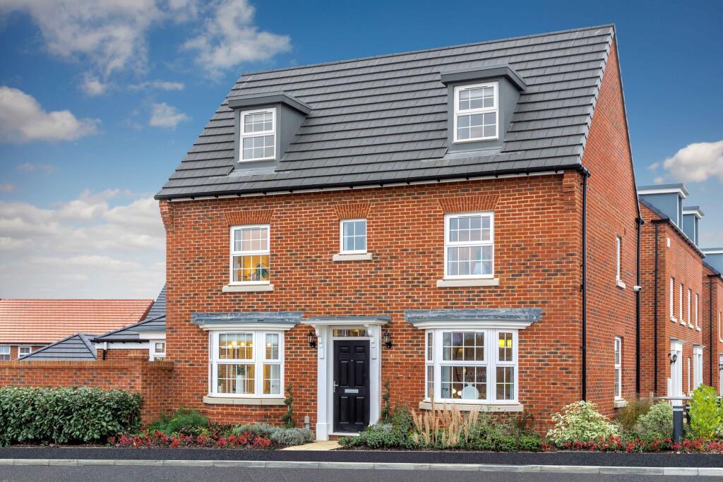
YO22 4FR - 4 bedroom detached house for sale in Abbey View Road, Whitb…
View on Property Piper
4 bedroom detached house for sale in Abbey View Road,
Whitby,
YO22 4FR, YO22
Property Details
- Price: £379995
- Bedrooms: 4
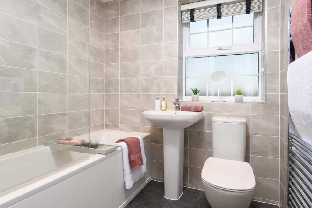
- Bathrooms: 1
- Property Type: undefined
- Property SubType: undefined
Brochure Descriptions
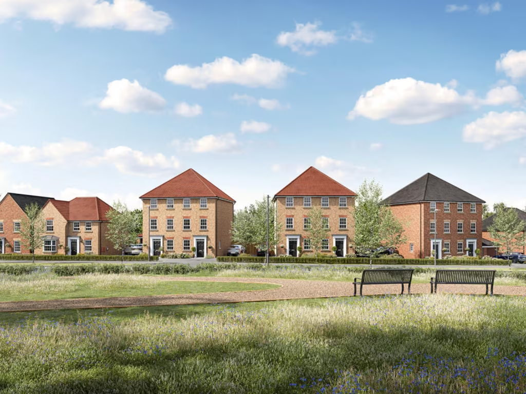
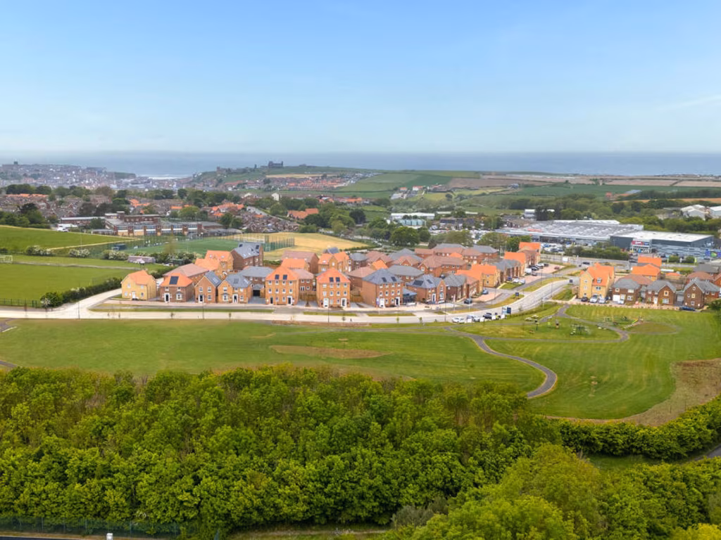
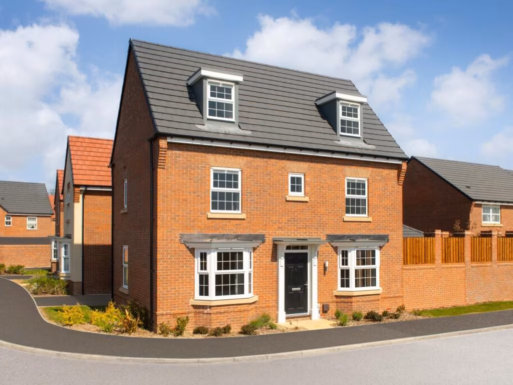
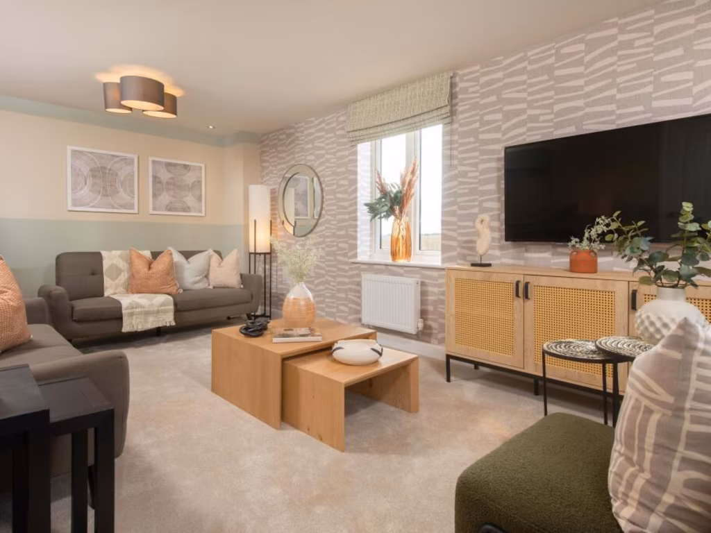
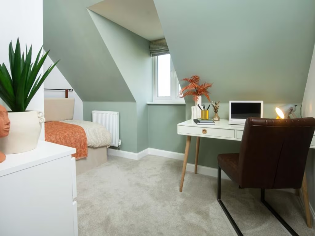
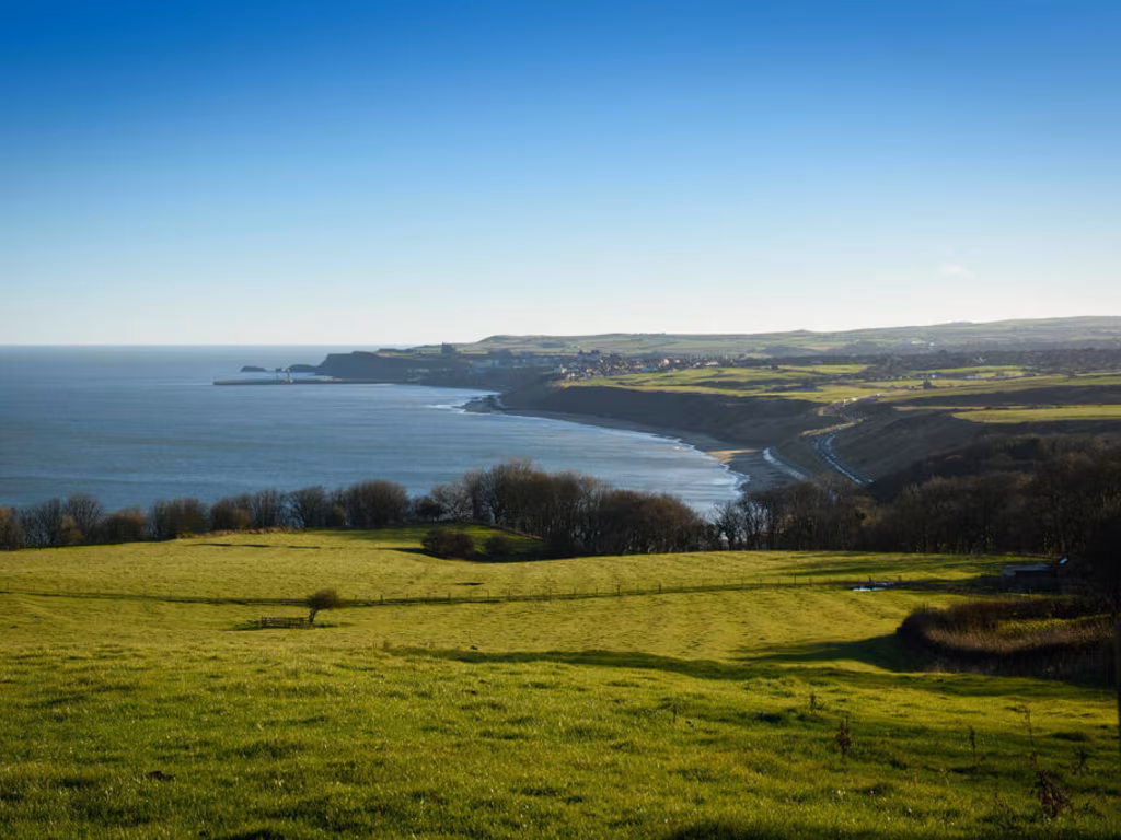
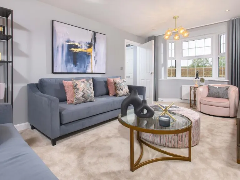
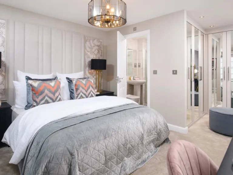
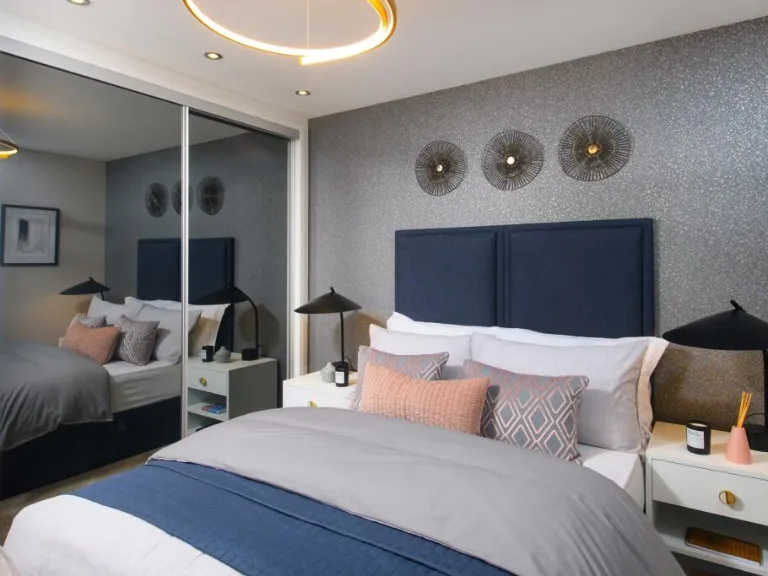
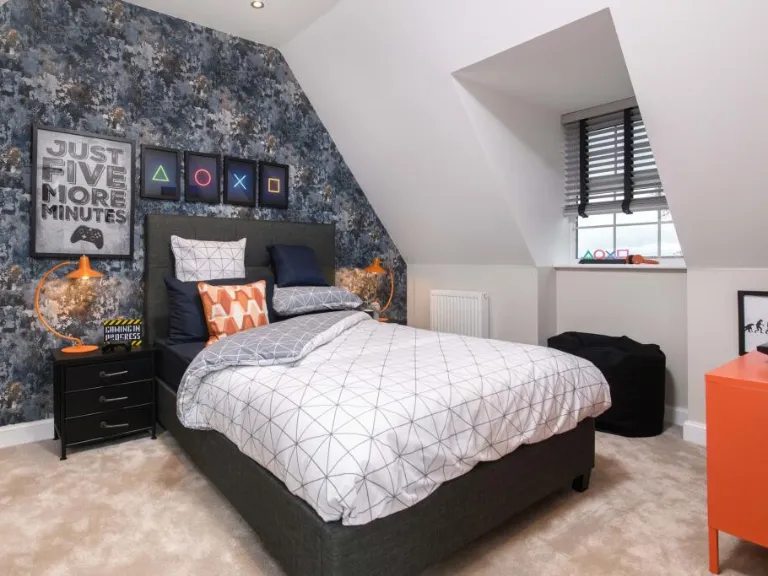
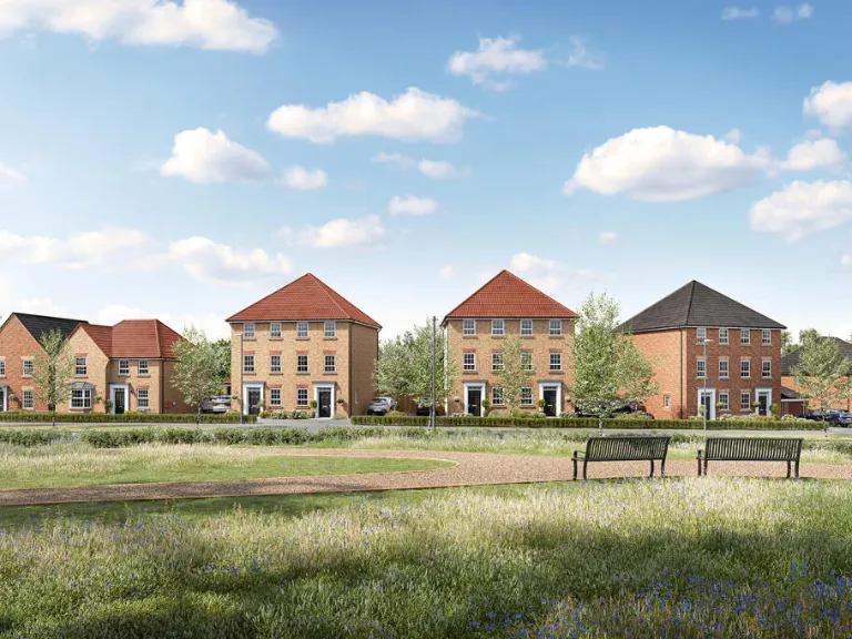
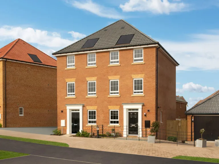
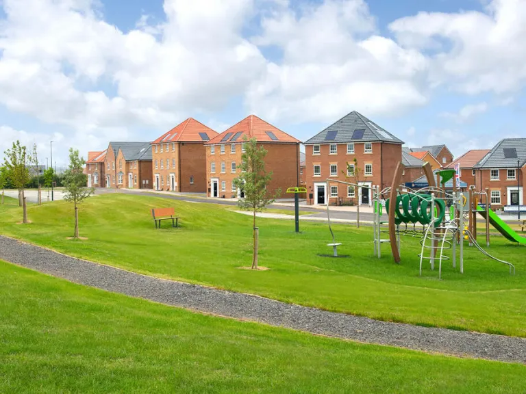
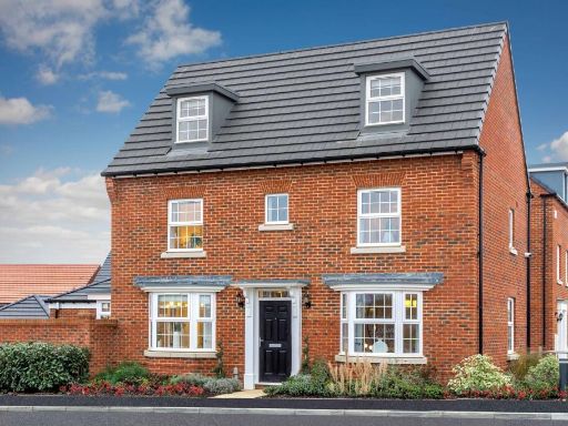
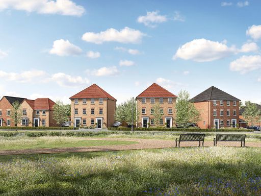
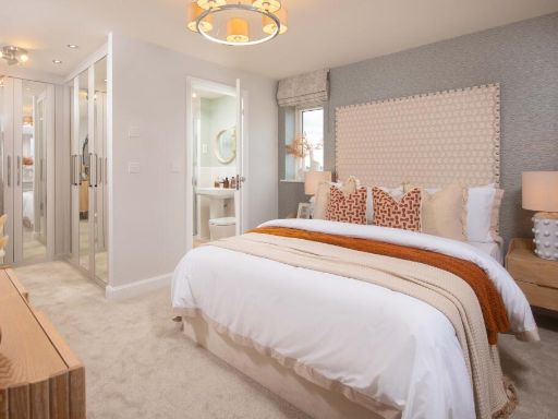
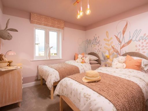
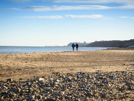
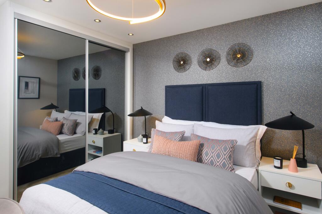
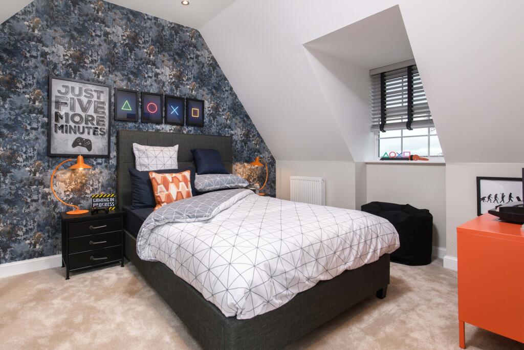
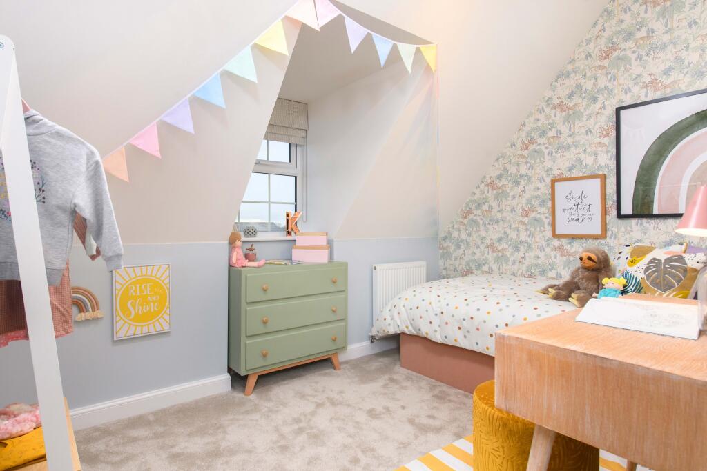
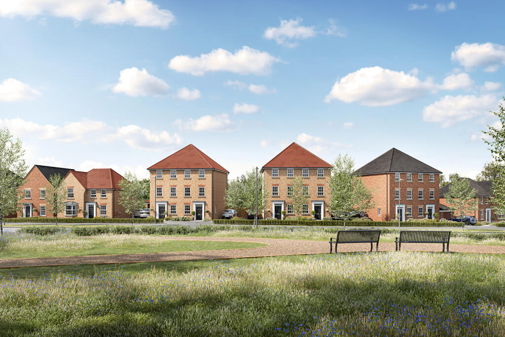
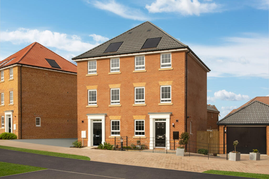
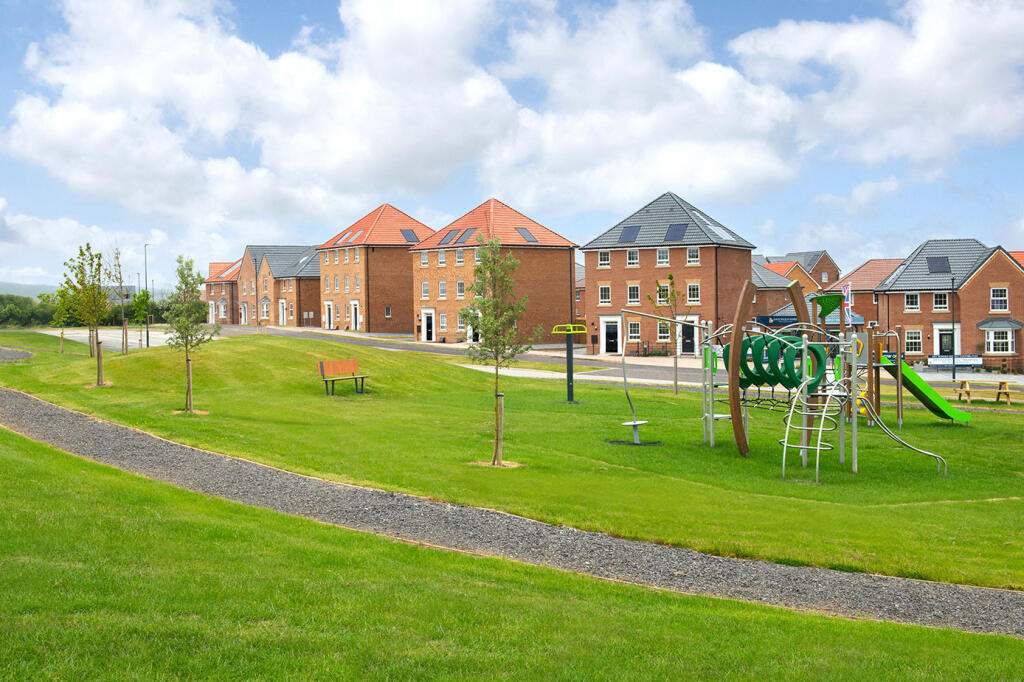
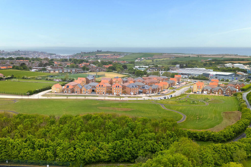
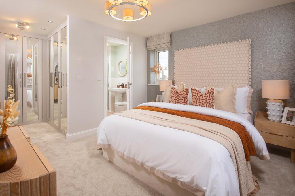
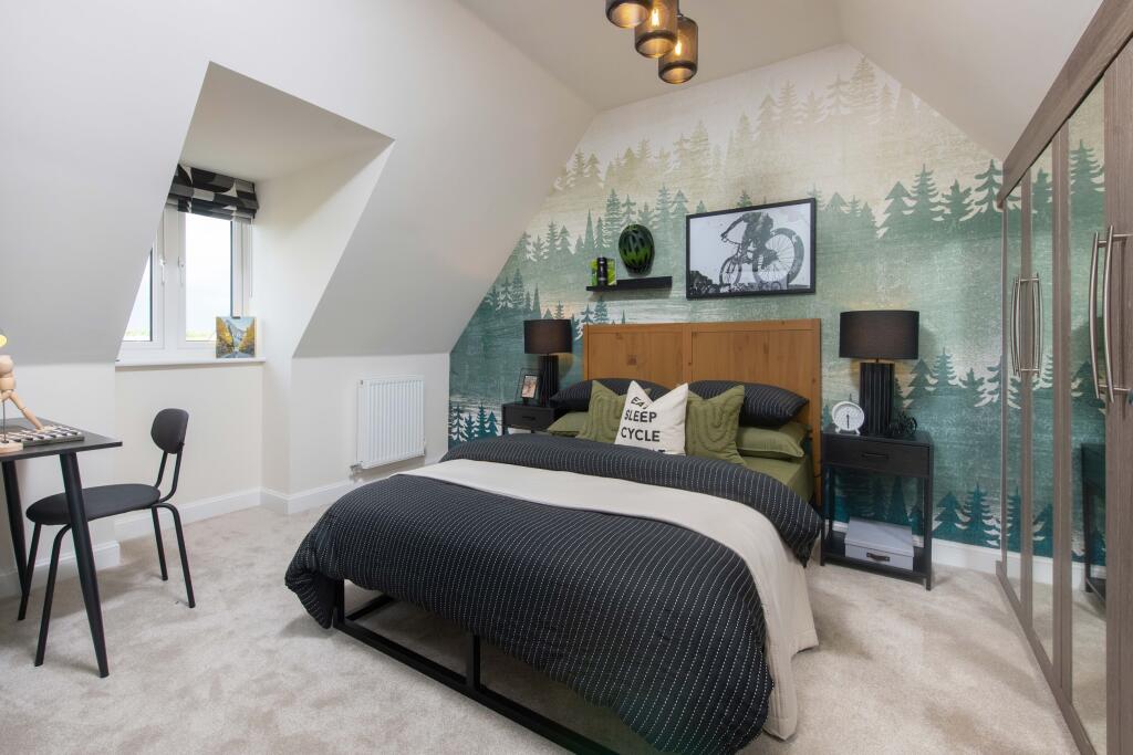
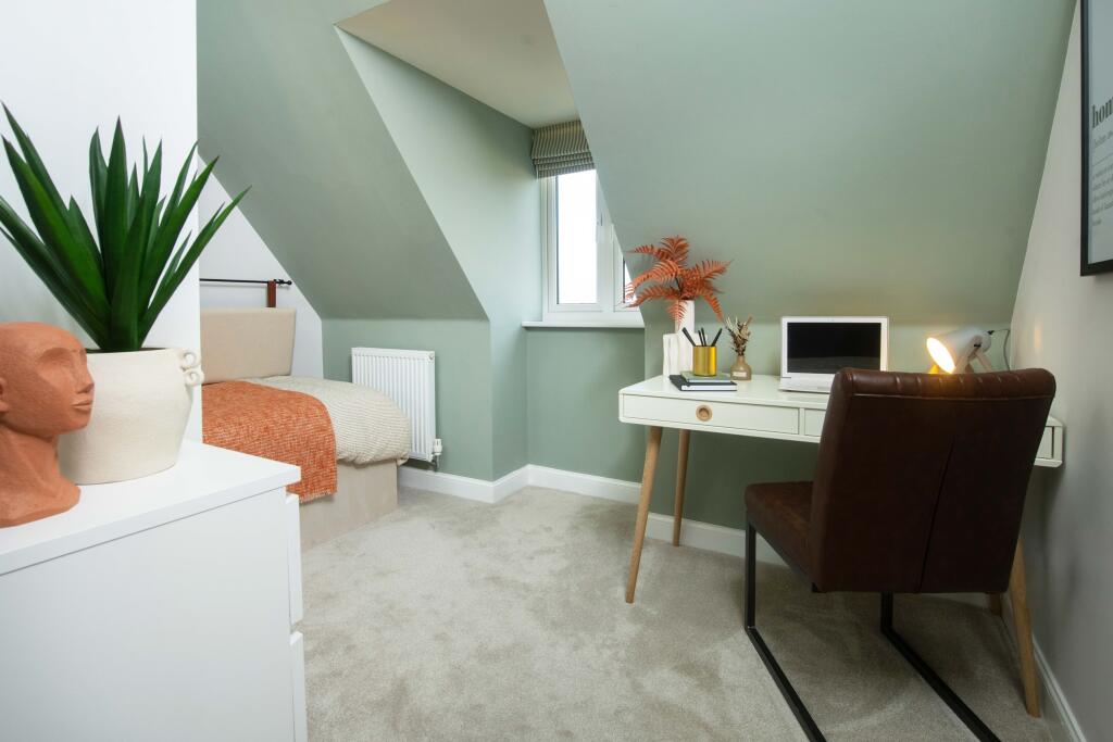
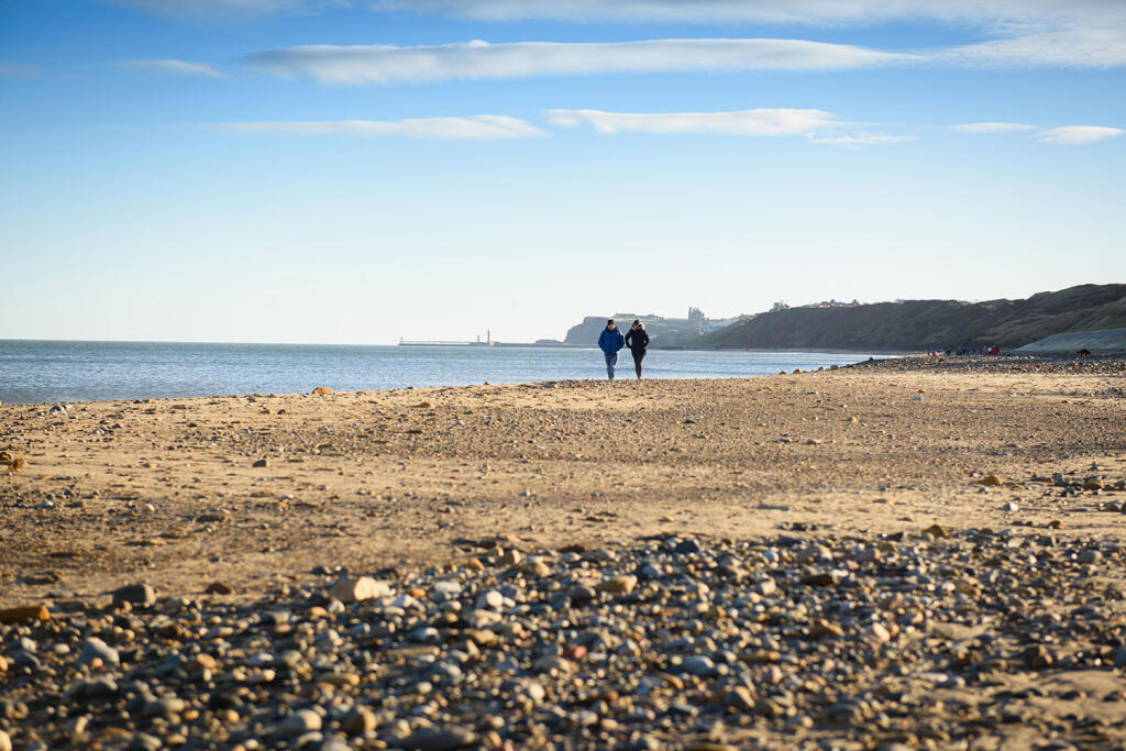
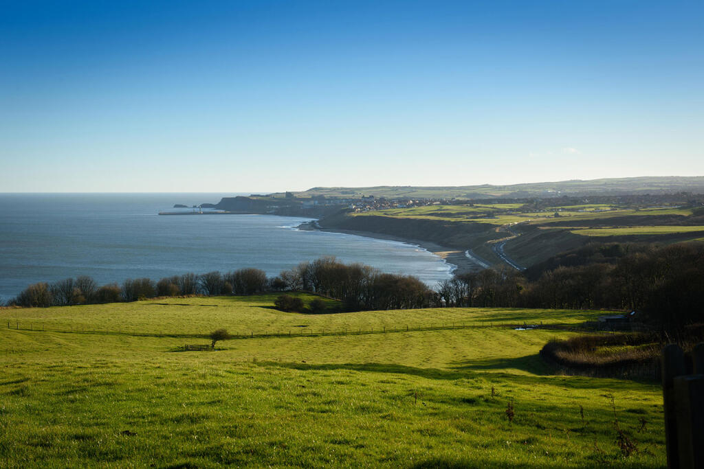
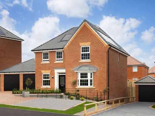
- Chaloners Green in Whitby offers a quaint residential setting surrounded by picturesque natural landscapes. The property boasts a sizeable garden area with lush greenery, indicative of a serene environment likely to offer forest views or rural tranquility. Rooms are expected to be of average to large sizes given typical properties in such locales, lending themselves well to comfortable living spaces. The overall property size is anticipated to be generous, reflecting an idyllic retreat in Whitby's calming countryside.
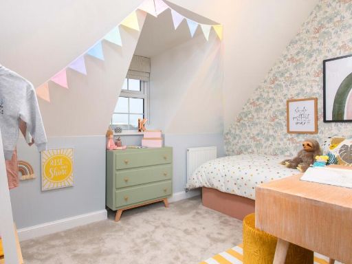
Image Descriptions
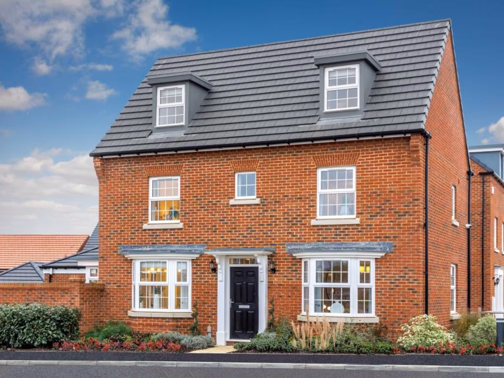
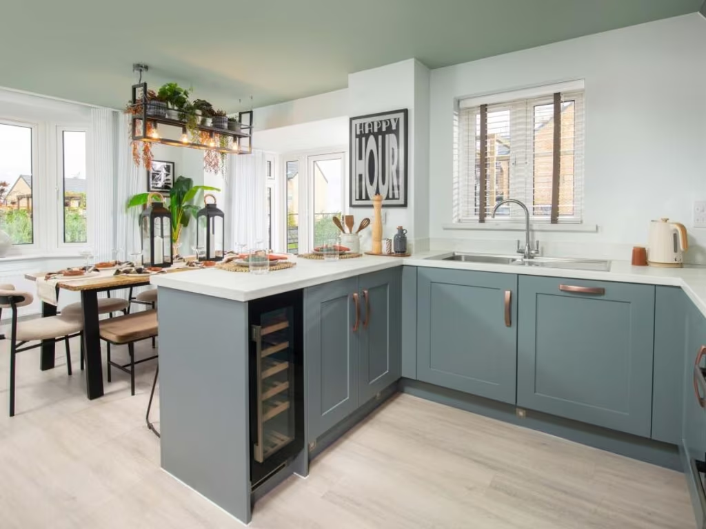
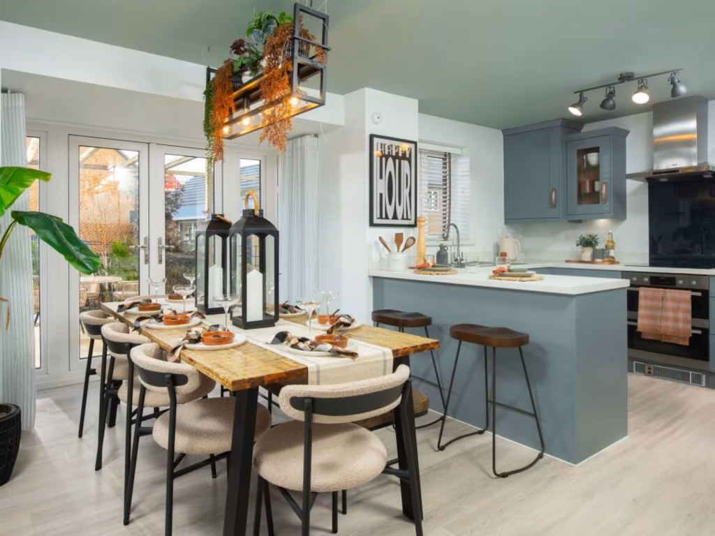
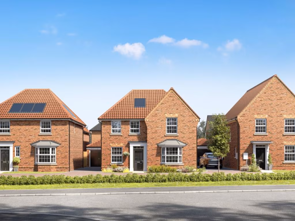
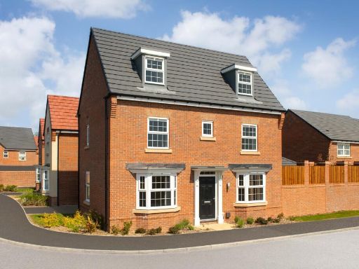
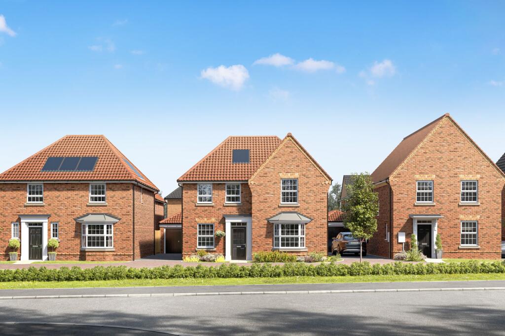
- detached house modern
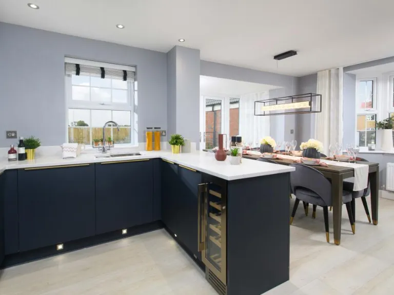
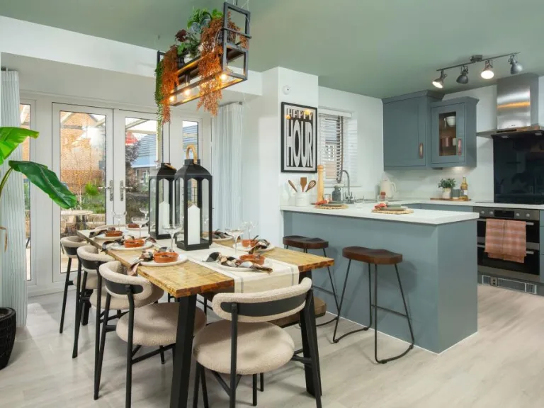
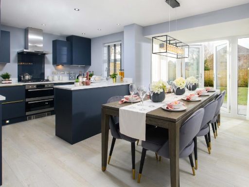
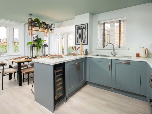
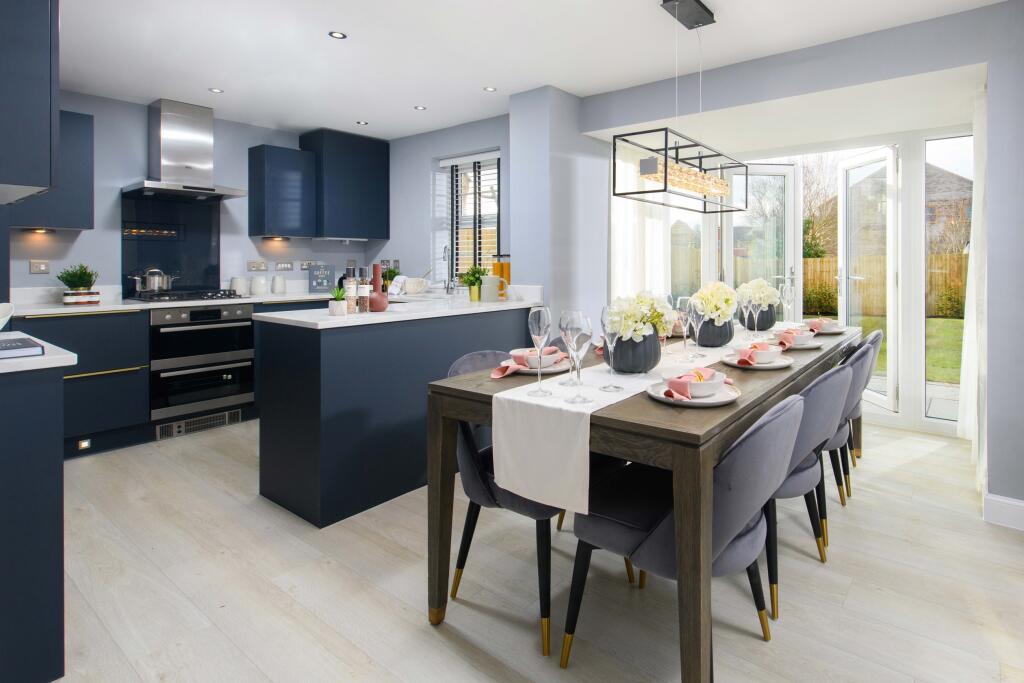
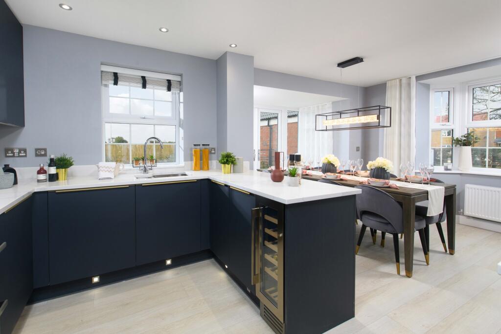
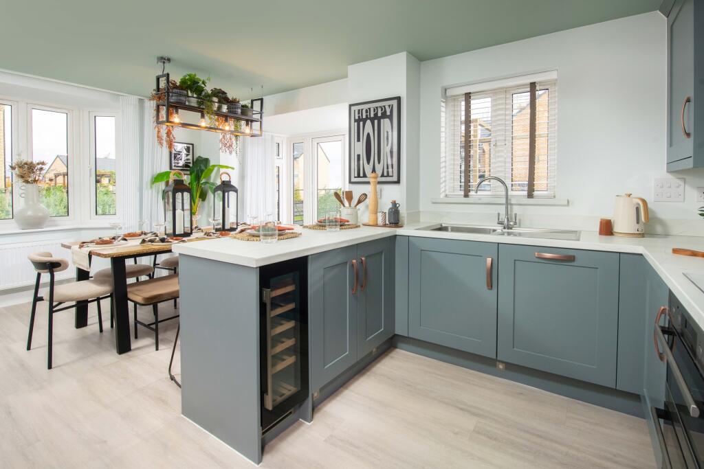
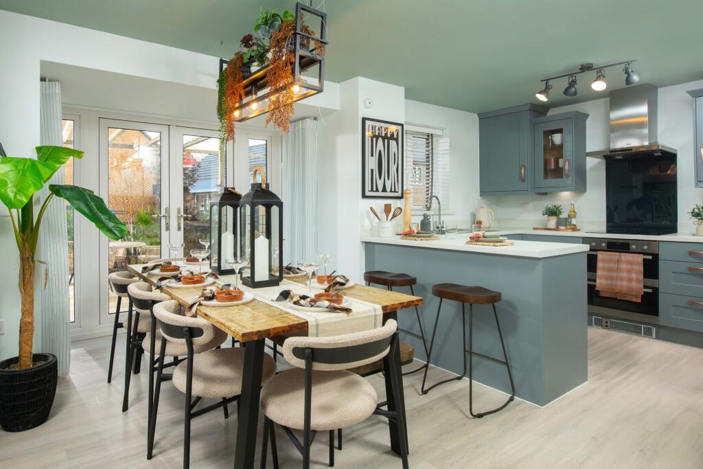
- kitchen and dining area modern
Floorplan Description
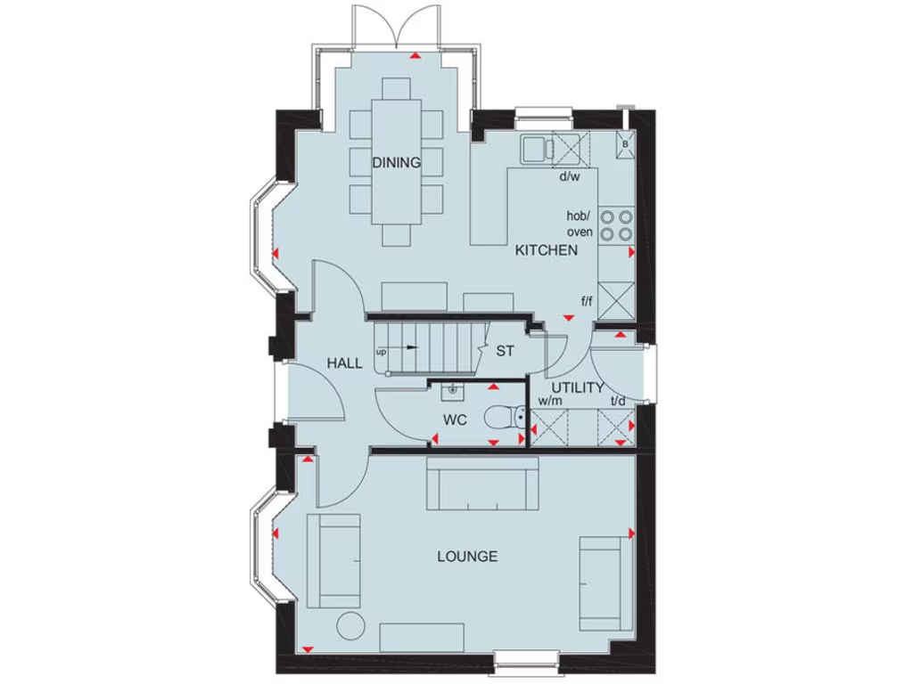
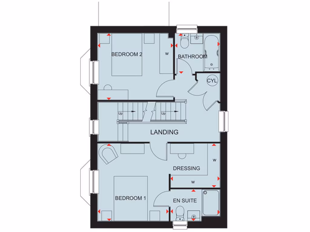
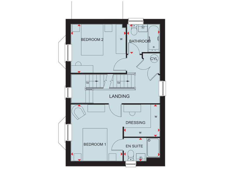
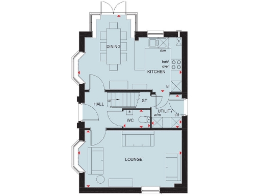
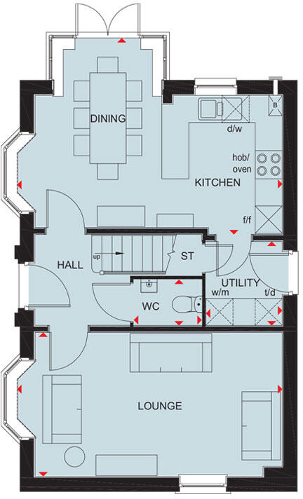
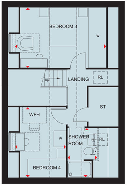
- A traditional style floorplan with a Lounge, Dining, Kitchen, Utility, WC, and Hall areas.
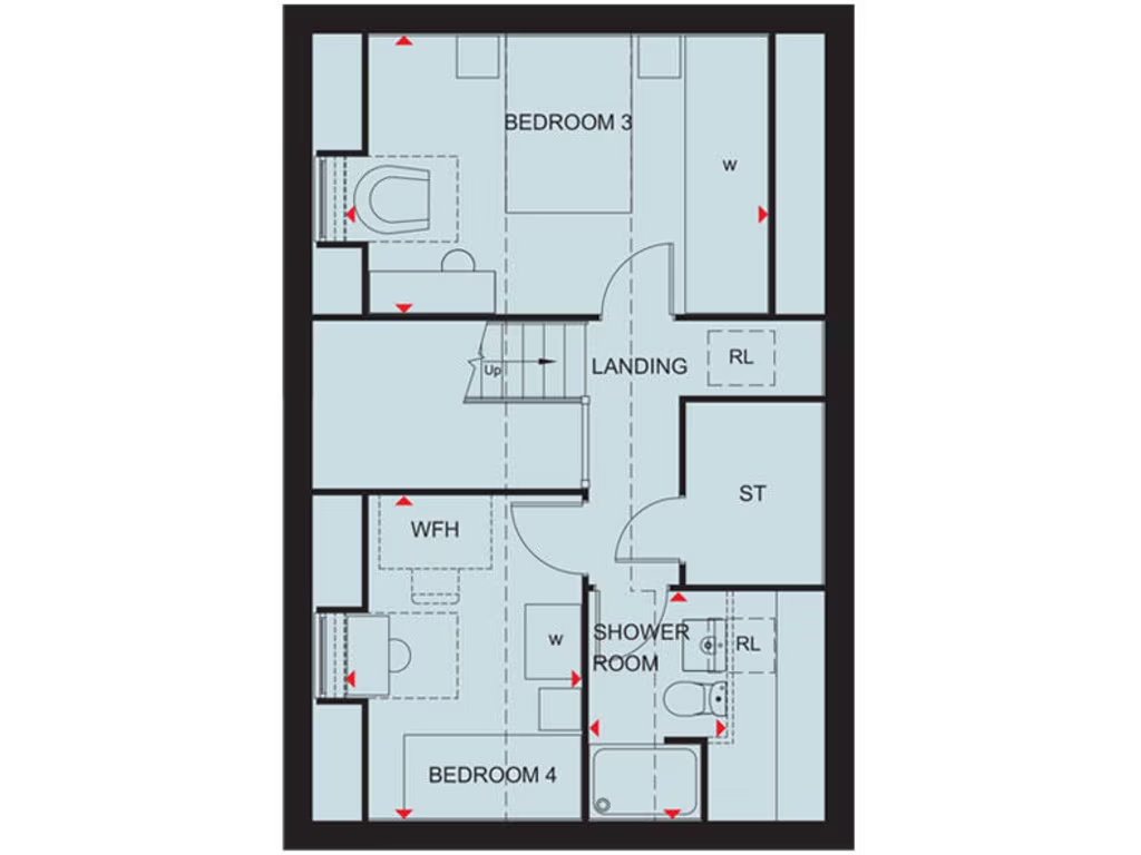
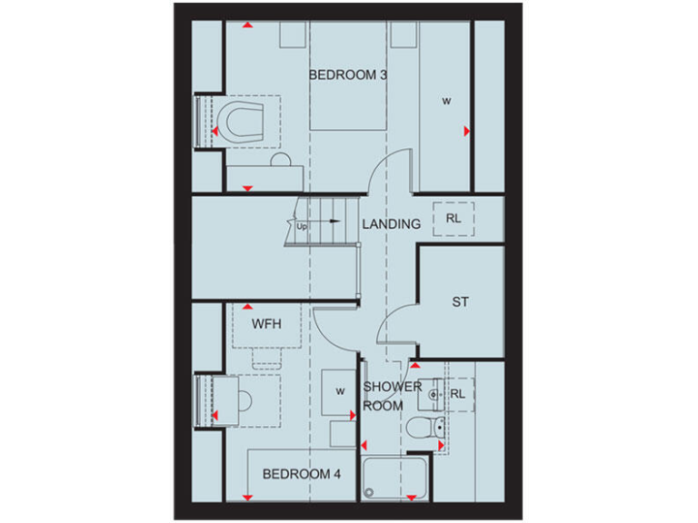
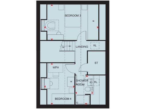
- The floor plan features two bedrooms, a shower room, and a home office space, with additional storage areas.
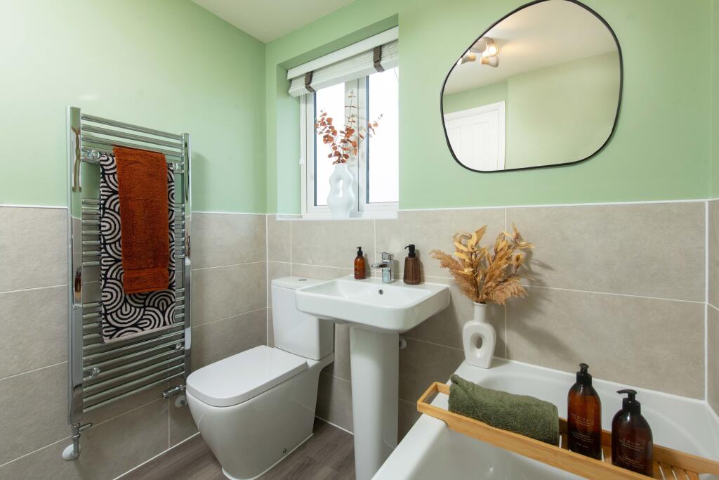
Rooms
- Dining: Average
- Kitchen: Small
- Hall: Small
- WC: Small
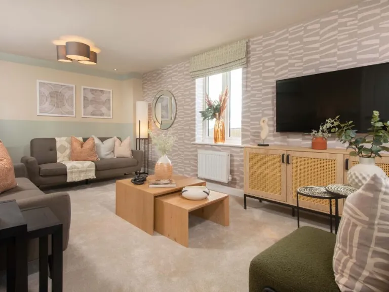
- Lounge: Average
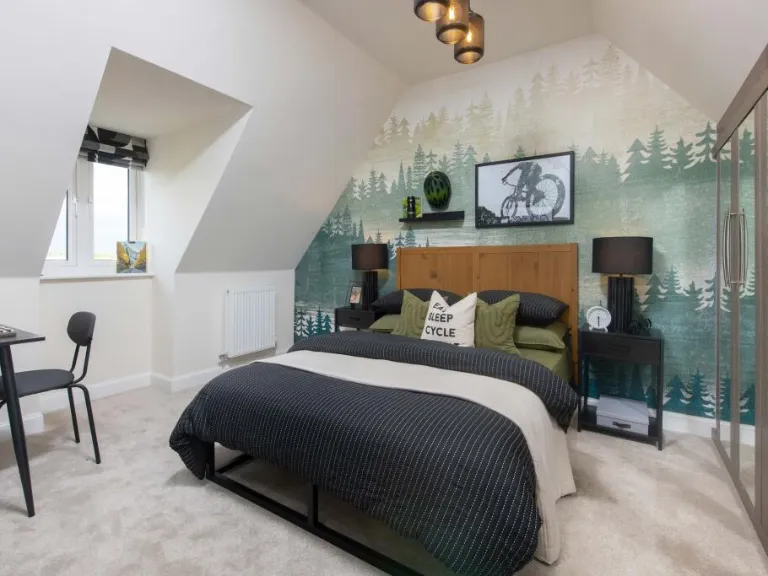
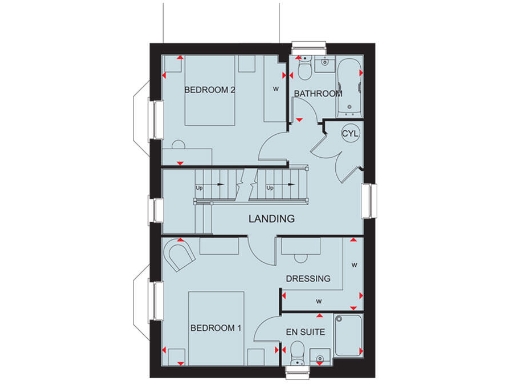
- Bedroom 2:
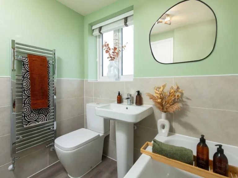
- Bathroom:
- Landing:
- Cyl:
- Bedroom 1:
- En Suite:
- Bedroom 3:
- Bedroom 4:
- Work from Home Space (WFH):
- Shower Room:
- Landing:
Textual Property Features
- Is New Build
- Has Garden
- Success
Detected Visual Features
- modern house
- detached
- family home
- red brick
- double glazed windows
- gabled roof
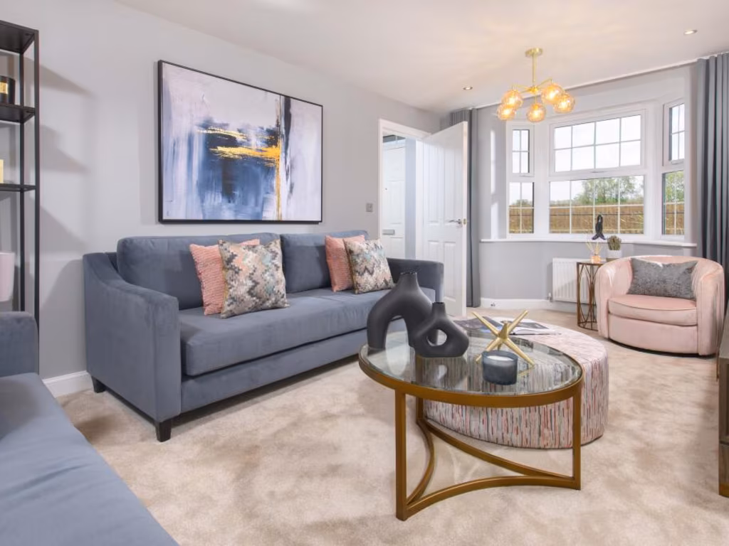
- modern kitchen
- dining area
- open plan
- natural light
- neutral colors
- kitchen island
- contemporary design
- stylish lighting
Nearby Schools
- Fylingdales Church of England Voluntary Controlled Primary School
- East Whitby Primary Academy
- Goathland Primary School
- Caedmon College Whitby
- Airy Hill Primary School
- Stakesby Primary Academy
- Fyling Hall School
- Sleights Church of England Voluntary Controlled Primary School
- Hawsker Cum Stainsacre Church of England Voluntary Controlled Primary School
- Ruswarp Church of England Voluntary Controlled Primary School
- West Cliff Primary School
- Lythe Church of England Voluntary Controlled Primary School
Nearest Bars And Restaurants
- Id: 960164650
- Tags:
- Amenity: fast_food
- Cuisine: fish_and_chips
- Name: Riverside Fisheries
- TagsNormalized:
- fast food
- food
- fish
- fisheries
- Lat: 54.4822387
- Lon: -0.6096418
- FullGeoHash: gcxtfnhn436j
- PartitionGeoHash: gcxt
- Images:
- FoodStandards: null
- Distance: 1593.7
,- Id: 158280294
- Tags:
- Amenity: cafe
- Building: yes
- Source: survey
- TagsNormalized:
- Lat: 54.4783103
- Lon: -0.6187265
- FullGeoHash: gcxtcvmrnth5
- PartitionGeoHash: gcxt
- Images:
- FoodStandards: null
- Distance: 1534.5
,- Id: 1827389945
- Tags:
- Addr:
- City: Stainsacre
- Postcode: YO22 4NT
- Amenity: pub
- Name: The Windmill Inn
- TagsNormalized:
- Lat: 54.4643542
- Lon: -0.5928901
- FullGeoHash: gcxtfdbmbemp
- PartitionGeoHash: gcxt
- Images:
- FoodStandards: null
- Distance: 746.4
,- Id: 440957293
- Tags:
- Amenity: restaurant
- Building: yes
- Name: The Penny Hedge
- TagsNormalized:
- Lat: 54.4727581
- Lon: -0.6033062
- FullGeoHash: gcxtfk2wvfn7
- PartitionGeoHash: gcxt
- Images:
- FoodStandards: null
- Distance: 466.7
,- Id: 688225949
- Tags:
- Amenity: cafe
- Name: Botham's Cafe (Fairfield Way bakery)
- TagsNormalized:
- Lat: 54.4686068
- Lon: -0.5948872
- FullGeoHash: gcxtf7wydh5z
- PartitionGeoHash: gcxt
- Images:
- FoodStandards: null
- Distance: 443.5
}
Nearest General Shops
- Id: 2030938590
- Tags:
- Designation: Tyres, Exhaust's, M.O.T Centre
- Name: Whitby Tyre & Exhaust Centre
- Shop: car_repair
- TagsNormalized:
- Lat: 54.4689263
- Lon: -0.5954771
- FullGeoHash: gcxtf7y2kru1
- PartitionGeoHash: gcxt
- Images:
- FoodStandards: null
- Distance: 406.4
,- Id: 4387326603
- Tags:
- Addr:
- Name: AGI DIY
- Shop: doityourself
- TagsNormalized:
- Lat: 54.4718314
- Lon: -0.6000944
- FullGeoHash: gcxtfk712v35
- PartitionGeoHash: gcxt
- Images:
- FoodStandards: null
- Distance: 368.5
,- Id: 158279801
- Tags:
- Addr:
- City: Whitby
- Country: GB
- County: North Yorkshire
- Housename: Stainsacre Lane Industrial Estate
- Postcode: YO22 4NL
- Street: Fairfield Way
- Brand: B&M Bargains
- Brand:wikidata: Q4836931
- Brand:wikipedia: en:B&M
- Building: retail
- Contact:
- Website: https://www.bmstores.co.uk/stores/whitby-649
- Fhrs:
- Name: B&M Bargains
- Shop: variety_store
- TagsNormalized:
- b&m
- retail
- variety store
- shop
- Lat: 54.4708036
- Lon: -0.5994224
- FullGeoHash: gcxtfk5e2my2
- PartitionGeoHash: gcxt
- Images:
- FoodStandards:
- Id: 1222897
- FHRSID: 1222897
- LocalAuthorityBusinessID: 19/00129/COMM
- BusinessName: B & M
- BusinessType: Retailers - supermarkets/hypermarkets
- BusinessTypeID: 7840
- AddressLine1: Stainsacre Lane Industrial Estate
- AddressLine2: Fairfield Way
- AddressLine3: Whitby
- AddressLine4: North Yorkshire
- PostCode: YO22 4NL
- RatingValue: 5
- RatingKey: fhrs_5_en-GB
- RatingDate: 2020-01-16
- LocalAuthorityCode: 255
- LocalAuthorityName: Scarborough
- LocalAuthorityWebSite: https://www.scarborough.gov.uk/home/business-licensing-and-grants/food-hygiene
- LocalAuthorityEmailAddress: crt@scarborough.gov.uk
- Scores:
- Hygiene: 0
- Structural: 5
- ConfidenceInManagement: 0
- NewRatingPending: false
- Geocode:
- Longitude: -0.60035401582718
- Latitude: 54.47105789184570
- Distance: 281.8
}
Nearest Grocery shops
- Id: 687987265
- Tags:
- Addr:
- Housenumber: 30
- Postcode: YO21 1NH
- Street: High Street
- Designation: Village Grocery Store, Green Grocers & Off-Licence
- Name: Colin Duck Grocers & Off Licence
- Shop: convenience
- Website: http://www.ducks-ruswarp.co.uk
- TagsNormalized:
- Lat: 54.4706644
- Lon: -0.629212
- FullGeoHash: gcxtcsjfd7c9
- PartitionGeoHash: gcxt
- Images:
- FoodStandards: null
- Distance: 1788.5
,- Id: 2030916381
- Tags:
- Brand: McColl's
- Brand:wikidata: Q16997477
- Brand:wikipedia: en:McColl's
- Contact:
- Website: https://www.mccolls.co.uk/storelocator/whitby-helredale-road/
- Designation: Convenience Store
- Name: McColl's
- Shop: convenience
- TagsNormalized:
- Lat: 54.4779694
- Lon: -0.6067372
- FullGeoHash: gcxtfjqjjvxc
- PartitionGeoHash: gcxt
- Images:
- FoodStandards: null
- Distance: 1084.2
,- Id: 972872235
- Tags:
- Addr:
- City: Whitby
- Country: GB
- County: North Yorkshire
- Housename: Stainsacre Lane Industrial Estate
- Postcode: YO22 4PU
- Street: Fairfield Way
- Brand: The Food Warehouse
- Brand:wikidata: Q87263899
- Building: yes
- Fhrs:
- Name: The Food Warehouse
- Shop: supermarket
- TagsNormalized:
- food
- the food warehouse
- warehouse
- shop
- Lat: 54.4705591
- Lon: -0.5979082
- FullGeoHash: gcxtfkhd58pm
- PartitionGeoHash: gcxt
- Images:
- FoodStandards:
- Id: 1434098
- FHRSID: 1434098
- LocalAuthorityBusinessID: 21/00119/COMM
- BusinessName: Food Warehouse
- BusinessType: Retailers - supermarkets/hypermarkets
- BusinessTypeID: 7840
- AddressLine1: Stainsacre Lane Industrial Estate
- AddressLine2: Fairfield Way
- AddressLine3: Whitby
- AddressLine4: North Yorkshire
- PostCode: YO22 4PU
- RatingValue: 5
- RatingKey: fhrs_5_en-GB
- RatingDate: 2021-12-03
- LocalAuthorityCode: 255
- LocalAuthorityName: Scarborough
- LocalAuthorityWebSite: https://www.scarborough.gov.uk/home/business-licensing-and-grants/food-hygiene
- LocalAuthorityEmailAddress: crt@scarborough.gov.uk
- Scores:
- Hygiene: 0
- Structural: 5
- ConfidenceInManagement: 0
- NewRatingPending: false
- Geocode:
- Longitude: -0.59785400000000
- Latitude: 54.47104680000000
- Distance: 325.9
}
Nearest Religious buildings
- Id: 148225589
- Tags:
- Addr:
- Amenity: school
- Capacity: 84
- Denomination: anglican
- Diocese: Diocese of York
- Isced:
- Max_age: 11
- Min_age: 5
- Name: Hawsker Cum Stainsacre Church of England Voluntary Controlled Primary School
- Phone: +44 1947 602772
- Ref:
- Ref:edubase:group: 17154
- Religion: christian
- School:
- Boarding: no
- Federation:
- Name: The Heritage Coast Primary Church of England Federation
- Gender: mixed
- Selective: no
- Trust: no
- Type: voluntary_controlled
- Source:
- Website: https://www.hawskerprimaryschool.co.uk/w3/
- Wikidata: Q66138380
- TagsNormalized:
- school
- anglican
- church
- christian
- Lat: 54.4618988
- Lon: -0.5779003
- FullGeoHash: gcxtff7ptcy2
- PartitionGeoHash: gcxt
- Images:
- FoodStandards: null
- Distance: 1714.9
,- Id: 760730626
- Tags:
- Amenity: place_of_worship
- Building: church
- Denomination: anglican
- Name: All Saints'
- Religion: christian
- Source: website
- Source:geometry: Bing
- Website: http://www.hawsker-church.org.uk/
- Wikidata: Q26441681
- TagsNormalized:
- place of worship
- church
- anglican
- christian
- Lat: 54.4623835
- Lon: -0.5787428
- FullGeoHash: gcxtffdd6k4h
- PartitionGeoHash: gcxt
- Images:
- FoodStandards: null
- Distance: 1642.5
,- Id: 252904036
- Tags:
- Amenity: place_of_worship
- Building: church
- Name: Whitby Cemetery
- Religion: christian
- Source: NPE
- Wikidata: Q26552251
- TagsNormalized:
- place of worship
- church
- cemetery
- christian
- Lat: 54.4753654
- Lon: -0.6097484
- FullGeoHash: gcxtfhgypb4s
- PartitionGeoHash: gcxt
- Images:
- FoodStandards: null
- Distance: 907.2
}
Nearest Medical buildings
- Id: 361178539
- Tags:
- Addr:
- City: Whitby
- Postcode: YO21 1DP
- Street: Spring Hill
- Amenity: hospital
- Healthcare: hospital
- Name: Whitby Hospital
- Wikidata: Q30293180
- TagsNormalized:
- Lat: 54.4837725
- Lon: -0.6170833
- FullGeoHash: gcxtcyqwuzm6
- PartitionGeoHash: gcxt
- Images:
- FoodStandards: null
- Distance: 1950.7
,- Id: 117237478
- Tags:
- Amenity: parking
- Name: Whitby Hospital Car Park (rear)
- Parking: surface
- Source: Bing
- TagsNormalized:
- Lat: 54.4834266
- Lon: -0.6177194
- FullGeoHash: gcxtcyqhyng5
- PartitionGeoHash: gcxt
- Images:
- FoodStandards: null
- Distance: 1939.2
,- Id: 117237203
- Tags:
- Amenity: parking
- Name: Whitby Hospital Car Park (front)
- Parking: surface
- Source: Bing
- TagsNormalized:
- Lat: 54.4836858
- Lon: -0.6161161
- FullGeoHash: gcxtcyrq7rnt
- PartitionGeoHash: gcxt
- Images:
- FoodStandards: null
- Distance: 1911.3
,- Id: 412723107
- Tags:
- Addr:
- City: Whitby
- Housenumber: 1
- Postcode: YO22 4HJ
- Street: Mount Farm Close
- Amenity: pharmacy
- Name: Day Lewis Pharmacy
- Note: was a Premier convenience store before being pharmacy
- Old_name: Premier Xtra
- TagsNormalized:
- pharmacy
- day lewis pharmacy
- Lat: 54.4726804
- Lon: -0.6049357
- FullGeoHash: gcxtfhrqrgx5
- PartitionGeoHash: gcxt
- Images:
- FoodStandards: null
- Distance: 492.2
}
Nearest Leisure Facilities
- Id: 9624370415
- Tags:
- TagsNormalized:
- picnic
- picnic table
- leisure
- Lat: 54.4643121
- Lon: -0.5924155
- FullGeoHash: gcxtfdbteewu
- PartitionGeoHash: gcxt
- Images:
- FoodStandards: null
- Distance: 773.1
,- Id: 9624370414
- Tags:
- TagsNormalized:
- picnic
- picnic table
- leisure
- Lat: 54.4643939
- Lon: -0.5925067
- FullGeoHash: gcxtfdbw1dfu
- PartitionGeoHash: gcxt
- Images:
- FoodStandards: null
- Distance: 762.8
,- Id: 937400575
- Tags:
- TagsNormalized:
- Lat: 54.4721976
- Lon: -0.6118237
- FullGeoHash: gcxtfh67x3x5
- PartitionGeoHash: gcxt
- Images:
- FoodStandards: null
- Distance: 760.6
,- Id: 937400576
- Tags:
- TagsNormalized:
- Lat: 54.4734499
- Lon: -0.6073228
- FullGeoHash: gcxtfhtfb753
- PartitionGeoHash: gcxt
- Images:
- FoodStandards: null
- Distance: 642.9
,- Id: 176051217
- Tags:
- TagsNormalized:
- Lat: 54.4716295
- Lon: -0.6043216
- FullGeoHash: gcxtfhrbnr9n
- PartitionGeoHash: gcxt
- Images:
- FoodStandards: null
- Distance: 369.6
}
Nearest Tourist attractions
- Id: 805113658
- Tags:
- Addr:
- City: Ruswarp
- Postcode: YO22 4NE
- Street: Glen Esk Road
- Name: Glen Esk
- Tourism: caravan_site
- TagsNormalized:
- Lat: 54.4708884
- Lon: -0.6218139
- FullGeoHash: gcxtcu55yttc
- PartitionGeoHash: gcxt
- Images:
- FoodStandards: null
- Distance: 1320
,- Id: 7857143958
- Tags:
- Addr:
- City: Whitby
- Postcode: YO22 4JE
- Name: Captain Cook's Haven
- Tourism: chalet
- TagsNormalized:
- Lat: 54.4733328
- Lon: -0.6191147
- FullGeoHash: gcxtcut4jt4x
- PartitionGeoHash: gcxt
- Images:
- FoodStandards: null
- Distance: 1236.5
,- Id: 440957283
- Tags:
- Building: yes
- Name: Marstons Inns
- Tourism: motel
- TagsNormalized:
- Lat: 54.4723635
- Lon: -0.6031329
- FullGeoHash: gcxtfk2u9bx9
- PartitionGeoHash: gcxt
- Images:
- FoodStandards: null
- Distance: 421.4
}
Nearest Train stations
- Id: 12710092
- Tags:
- Name: Grosmont
- Naptan:
- Public_transport: station
- Railway: station
- Usage: tourism
- Wheelchair: yes
- TagsNormalized:
- Lat: 54.4361695
- Lon: -0.7248417
- FullGeoHash: gcxmxtb1tvqz
- PartitionGeoHash: gcxm
- Images:
- FoodStandards: null
- Distance: 8739.2
,- Id: 1239278035
- Tags:
- Name: Sleights
- Naptan:
- Network: National Rail
- Operator: Northern Rail
- Public_transport: station
- Railway: station
- Ref:
- Uic_ref: 7001999
- Wikidata: Q2658220
- Wikipedia: en:Sleights railway station
- TagsNormalized:
- Lat: 54.4611128
- Lon: -0.6627591
- FullGeoHash: gcxtbfm6ux6b
- PartitionGeoHash: gcxt
- Images:
- FoodStandards: null
- Distance: 4031.1
,- Id: 3720115321
- Tags:
- Name: Whitby
- Naptan:
- Network: National Rail
- Operator: Northern Rail
- Public_transport: station
- Railway: station
- Ref:
- Uic_ref: 7002397
- Wikidata: Q2225295
- Wikipedia: en:Whitby railway station
- TagsNormalized:
- Lat: 54.4848396
- Lon: -0.6151711
- FullGeoHash: gcxtfn8j1qr0
- PartitionGeoHash: gcxt
- Images:
- FoodStandards: null
- Distance: 1997.1
,- Id: 513949908
- Tags:
- Landuse: railway
- Name: Whitby
- Operator: Northern Rail
- Public_transport: station
- TagsNormalized:
- Lat: 54.4839093
- Lon: -0.614717
- FullGeoHash: gcxtfn2ru0cf
- PartitionGeoHash: gcxt
- Images:
- FoodStandards: null
- Distance: 1891.3
,- Id: 3720121641
- Tags:
- Name: Ruswarp
- Naptan:
- Network: National Rail
- Public_transport: station
- Railway: station
- Ref:
- Uic_ref: 7001914
- Wikidata: Q7382694
- Wikipedia: en:Ruswarp railway station
- TagsNormalized:
- Lat: 54.4699399
- Lon: -0.6277753
- FullGeoHash: gcxtceyy7u8z
- PartitionGeoHash: gcxt
- Images:
- FoodStandards: null
- Distance: 1687.8
}
Nearest Bus stations and stops
- Id: 687988069
- Tags:
- Bench: yes
- Bus: yes
- Departures_board: timetable
- Highway: bus_stop
- Name: Whitby Bus Station
- Public_transport: platform
- Shelter: yes
- TagsNormalized:
- Lat: 54.4848382
- Lon: -0.615804
- FullGeoHash: gcxtcyxt4tzr
- PartitionGeoHash: gcxt
- Images:
- FoodStandards: null
- Distance: 2015.1
,- Id: 7447563904
- Tags:
- Bus: yes
- Highway: bus_stop
- Public_transport: platform
- TagsNormalized:
- Lat: 54.4841248
- Lon: -0.6133836
- FullGeoHash: gcxtfn9351h0
- PartitionGeoHash: gcxt
- Images:
- FoodStandards: null
- Distance: 1876.7
,- Id: 7447563907
- Tags:
- Bus: yes
- Highway: bus_stop
- Public_transport: platform
- TagsNormalized:
- Lat: 54.4839176
- Lon: -0.6131878
- FullGeoHash: gcxtfn3rzdqh
- PartitionGeoHash: gcxt
- Images:
- FoodStandards: null
- Distance: 1850.5
,- Id: 7447563887
- Tags:
- Bus: yes
- Highway: bus_stop
- Public_transport: platform
- TagsNormalized:
- Lat: 54.4837259
- Lon: -0.6130323
- FullGeoHash: gcxtfn3weq9u
- PartitionGeoHash: gcxt
- Images:
- FoodStandards: null
- Distance: 1827
,- Id: 688166559
- Tags:
- Bench: yes
- Bus: yes
- Highway: bus_stop
- Name: Whitby (Cemetary, N-Bound)
- Public_transport: platform
- Shelter: yes
- TagsNormalized:
- Lat: 54.4762221
- Lon: -0.6062061
- FullGeoHash: gcxtfjndfrgf
- PartitionGeoHash: gcxt
- Images:
- FoodStandards: null
- Distance: 888.8
}
Nearest Hotels
- Id: 688010732
- Tags:
- Addr:
- City: Whitby
- Housenumber: 38
- Postcode: YO21 1BN
- Street: Baxtergate
- Name: George Hotel
- Tourism: hotel
- TagsNormalized:
- Lat: 54.4852052
- Lon: -0.6165538
- FullGeoHash: gcxtcyxp362h
- PartitionGeoHash: gcxt
- Images:
- FoodStandards: null
- Distance: 2073.5
,- Id: 688113536
- Tags:
- Addr:
- City: Ruswarp
- Postcode: YO21 1NH
- Street: High Street
- Name: Ruswarp Hall
- Tourism: hotel
- TagsNormalized:
- Lat: 54.471597
- Lon: -0.6293633
- FullGeoHash: gcxtcsm8nc8s
- PartitionGeoHash: gcxt
- Images:
- FoodStandards: null
- Distance: 1814
,- Id: 1027029791
- Tags:
- Addr:
- City: Whitby
- Country: GB
- Housename: Larpool Hall
- Postcode: YO22 4ND
- Street: Larpool Drive
- Contact:
- Website: https://www.hfholidays.co.uk/
- Email: reservations@hfholidays.co.uk
- Internet_access: yes
- Internet_access:fee: no
- Name: Larpool Hall
- Operator: HF Holidays
- Phone: +44 1947 602737
- Smoking: no
- Tourism: hotel
- Website: https://www.hfholidays.co.uk/holidays/larpool-hall
- Wheelchair: yes
- TagsNormalized:
- Lat: 54.4715017
- Lon: -0.6141781
- FullGeoHash: gcxtfh0z2xgs
- PartitionGeoHash: gcxt
- Images:
- FoodStandards: null
- Distance: 863
}
Tags
- modern house
- detached
- family home
- red brick
- double glazed windows
- gabled roof
- modern kitchen
- dining area
- open plan
- natural light
- neutral colors
- kitchen island
- contemporary design
- stylish lighting
Local Market Stats
- Average Price/sqft: £268
- Avg Income: £38600
- Social Housing: 6%
- Planning Success Rate: 85%
AirBnB Data
- 1km average: £94/night
- Listings in 1km: 2
Similar Properties
 4 bedroom detached house for sale in Abbey View Road,
Whitby,
YO22 4FR, YO22 — £449,995 • 4 bed • 1 bath • 1283 ft²
4 bedroom detached house for sale in Abbey View Road,
Whitby,
YO22 4FR, YO22 — £449,995 • 4 bed • 1 bath • 1283 ft²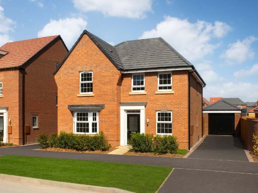 4 bedroom detached house for sale in Abbey View Road,
Whitby,
YO22 4FR, YO22 — £439,995 • 4 bed • 1 bath • 1283 ft²
4 bedroom detached house for sale in Abbey View Road,
Whitby,
YO22 4FR, YO22 — £439,995 • 4 bed • 1 bath • 1283 ft²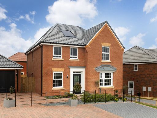 4 bedroom detached house for sale in Abbey View Road,
Whitby,
YO22 4FR, YO22 — £434,995 • 4 bed • 1 bath • 1283 ft²
4 bedroom detached house for sale in Abbey View Road,
Whitby,
YO22 4FR, YO22 — £434,995 • 4 bed • 1 bath • 1283 ft²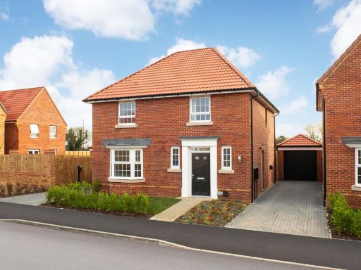 4 bedroom detached house for sale in Abbey View Road,
Whitby,
YO22 4FR, YO22 — £389,995 • 4 bed • 1 bath • 1167 ft²
4 bedroom detached house for sale in Abbey View Road,
Whitby,
YO22 4FR, YO22 — £389,995 • 4 bed • 1 bath • 1167 ft²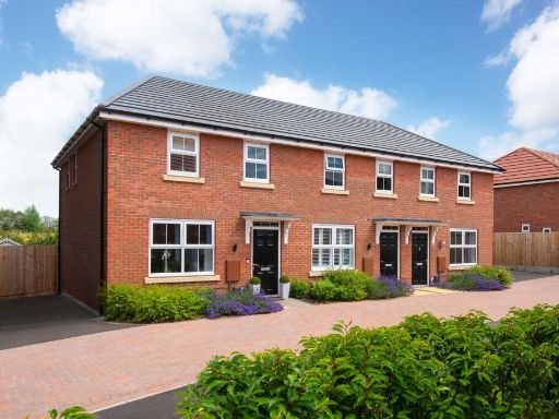 3 bedroom end of terrace house for sale in Abbey View Road,
Whitby,
YO22 4FR, YO22 — £234,995 • 3 bed • 1 bath • 695 ft²
3 bedroom end of terrace house for sale in Abbey View Road,
Whitby,
YO22 4FR, YO22 — £234,995 • 3 bed • 1 bath • 695 ft²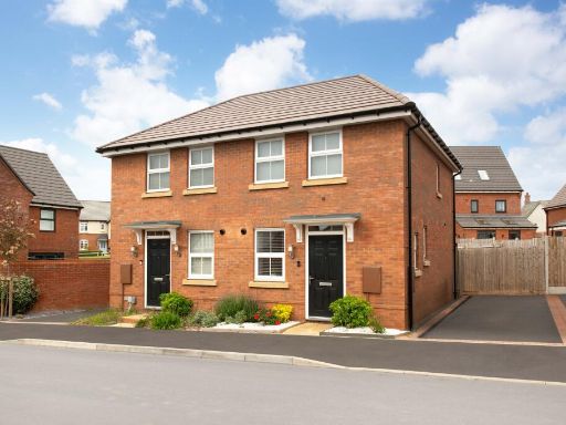 2 bedroom end of terrace house for sale in Abbey View Road,
Whitby,
YO22 4FR, YO22 — £199,995 • 2 bed • 1 bath • 474 ft²
2 bedroom end of terrace house for sale in Abbey View Road,
Whitby,
YO22 4FR, YO22 — £199,995 • 2 bed • 1 bath • 474 ft²
Meta
- {
"@context": "https://schema.org",
"@type": "Residence",
"name": "4 bedroom detached house for sale in Abbey View Road, Whitb…",
"description": "",
"url": "https://propertypiper.co.uk/property/85a3cdc6-660b-45ce-b866-8007f360dfaf",
"image": "https://image-a.propertypiper.co.uk/937ca774-5542-4aa3-8791-e2553348018e-1024.jpeg",
"address": {
"@type": "PostalAddress",
"streetAddress": "Abbey View Road, \r\nWhitby,\r\nYO22 4FR",
"postalCode": "YO22 4FR",
"addressLocality": "Scarborough",
"addressRegion": "Scarborough and Whitby",
"addressCountry": "England"
},
"geo": {
"@type": "GeoCoordinates",
"latitude": 54.46866,
"longitude": -0.60175
},
"numberOfRooms": 4,
"numberOfBathroomsTotal": 1,
"floorSize": {
"@type": "QuantitativeValue",
"value": 1077,
"unitCode": "FTK"
},
"offers": {
"@type": "Offer",
"price": 379995,
"priceCurrency": "GBP",
"availability": "https://schema.org/InStock"
},
"additionalProperty": [
{
"@type": "PropertyValue",
"name": "Feature",
"value": "modern house"
},
{
"@type": "PropertyValue",
"name": "Feature",
"value": "detached"
},
{
"@type": "PropertyValue",
"name": "Feature",
"value": "family home"
},
{
"@type": "PropertyValue",
"name": "Feature",
"value": "red brick"
},
{
"@type": "PropertyValue",
"name": "Feature",
"value": "double glazed windows"
},
{
"@type": "PropertyValue",
"name": "Feature",
"value": "gabled roof"
},
{
"@type": "PropertyValue",
"name": "Feature",
"value": "modern kitchen"
},
{
"@type": "PropertyValue",
"name": "Feature",
"value": "dining area"
},
{
"@type": "PropertyValue",
"name": "Feature",
"value": "open plan"
},
{
"@type": "PropertyValue",
"name": "Feature",
"value": "natural light"
},
{
"@type": "PropertyValue",
"name": "Feature",
"value": "neutral colors"
},
{
"@type": "PropertyValue",
"name": "Feature",
"value": "kitchen island"
},
{
"@type": "PropertyValue",
"name": "Feature",
"value": "contemporary design"
},
{
"@type": "PropertyValue",
"name": "Feature",
"value": "stylish lighting"
}
]
}
High Res Floorplan Images
Compatible Floorplan Images
FloorplanImages Thumbnail