DA11 8AD - 2 bedroom apartment for sale in Springhead Parkway, Northfl…
View on Property Piper
2 bedroom apartment for sale in Springhead Parkway, Northfleet, Gravesend, Kent, DA11
Property Details
- Price: £265000
- Bedrooms: 2
- Bathrooms: 2
- Property Type: undefined
- Property SubType: undefined
Image Descriptions
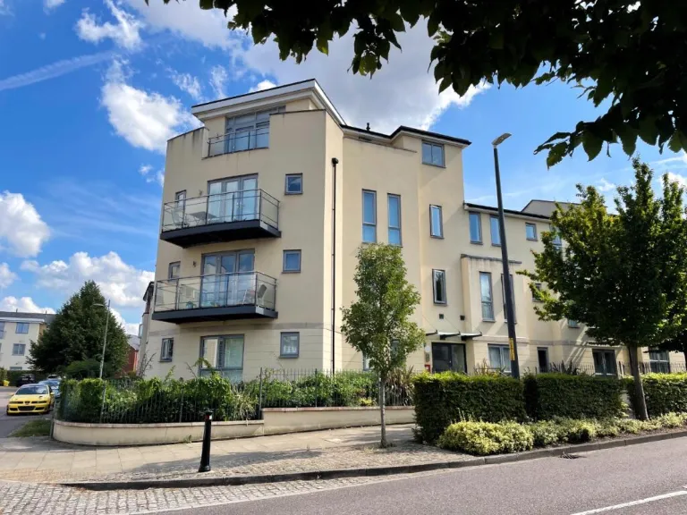
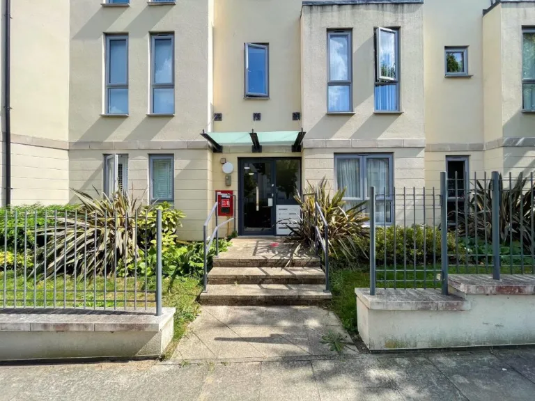
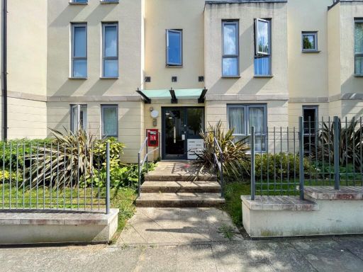
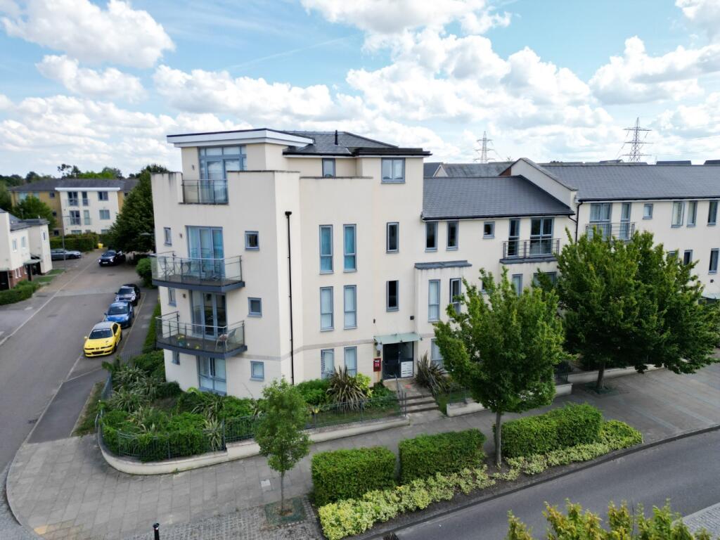
- modern apartment building Contemporary
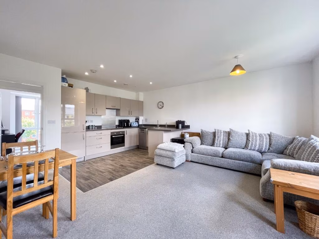
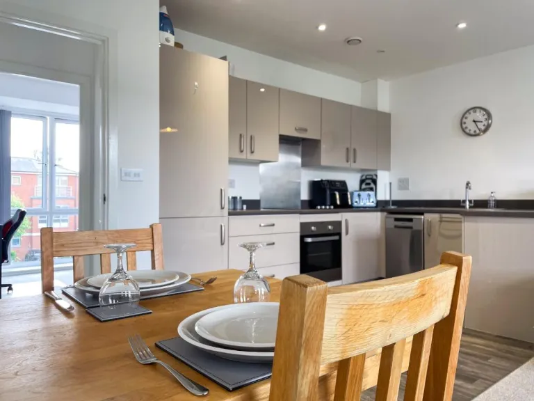
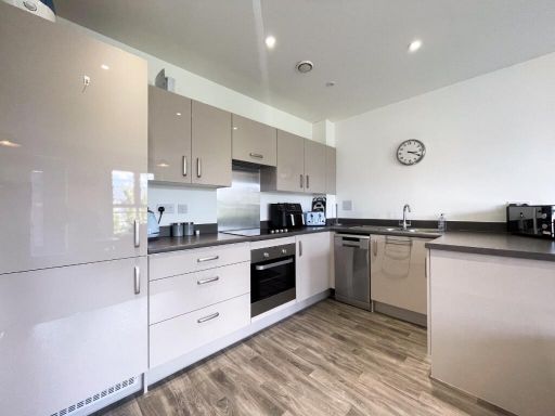
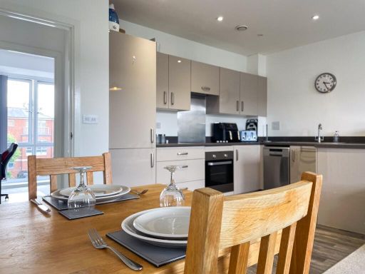
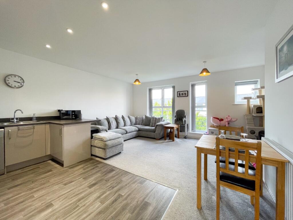
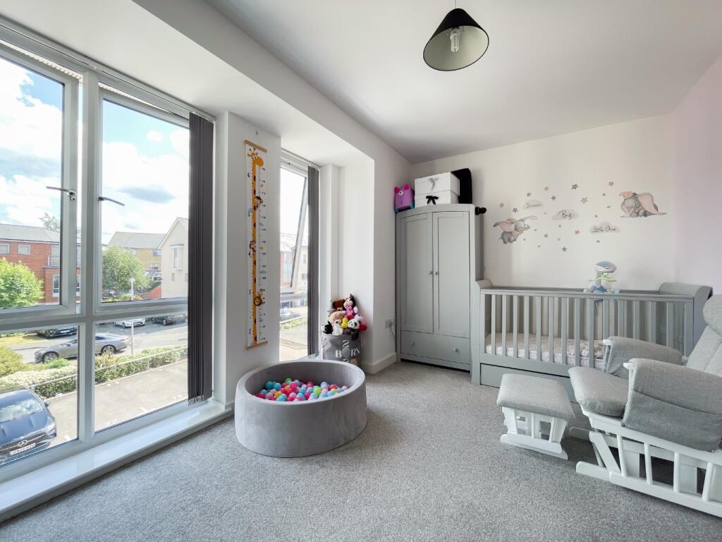
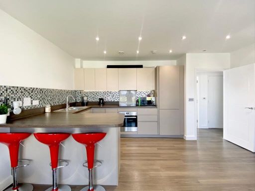
- open-plan living room and kitchen modern
Floorplan Description
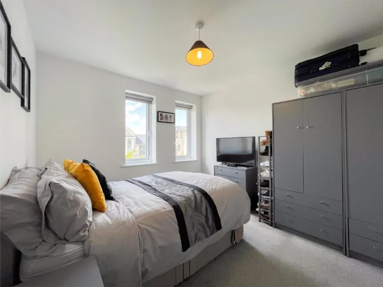
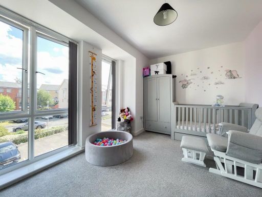
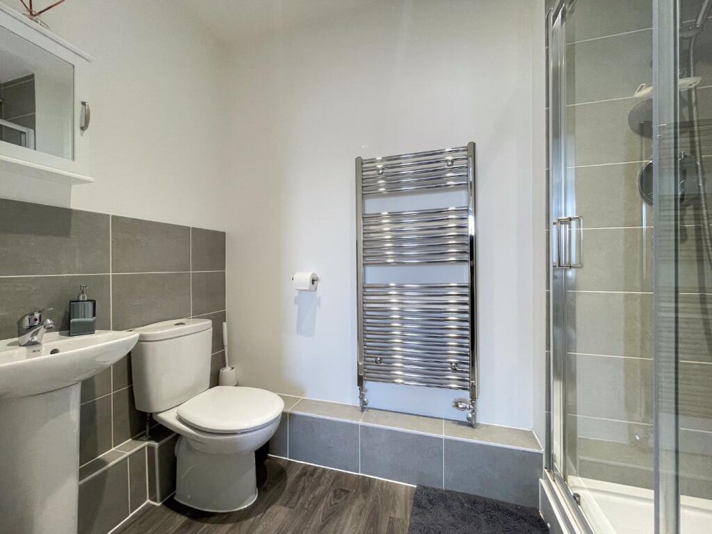
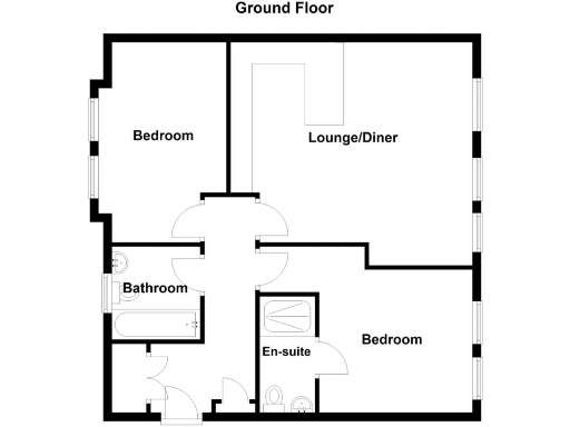
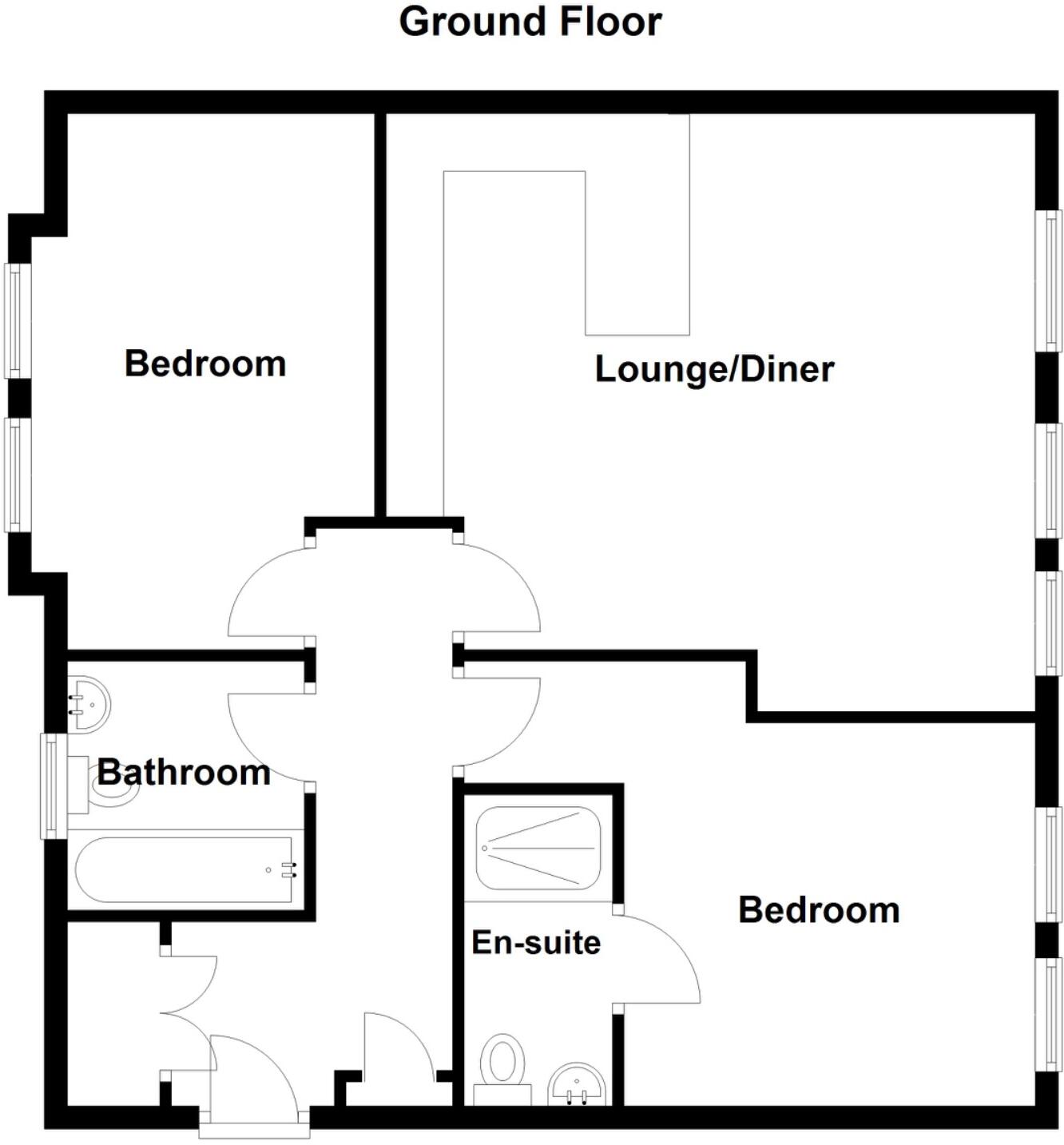
- A property with two bedrooms, a lounge/diner, a bathroom, and an en-suite.
Rooms
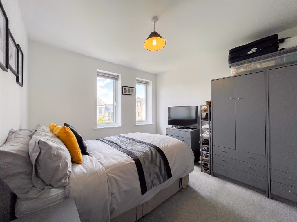
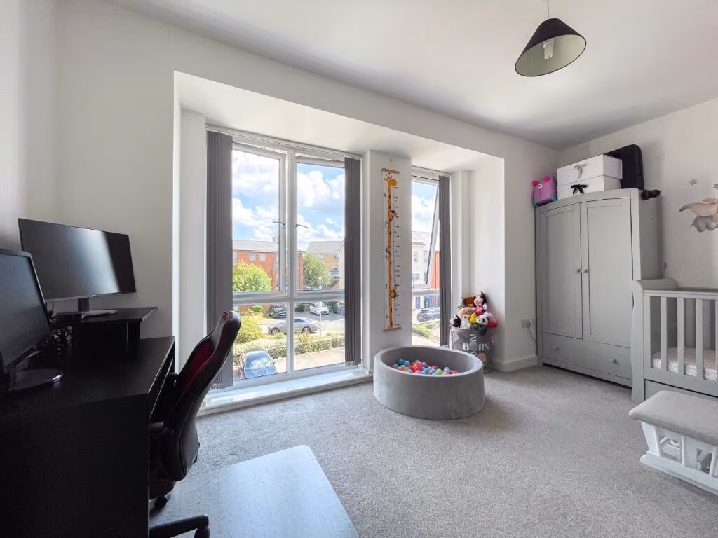
- Bedroom:
- Lounge/Diner:
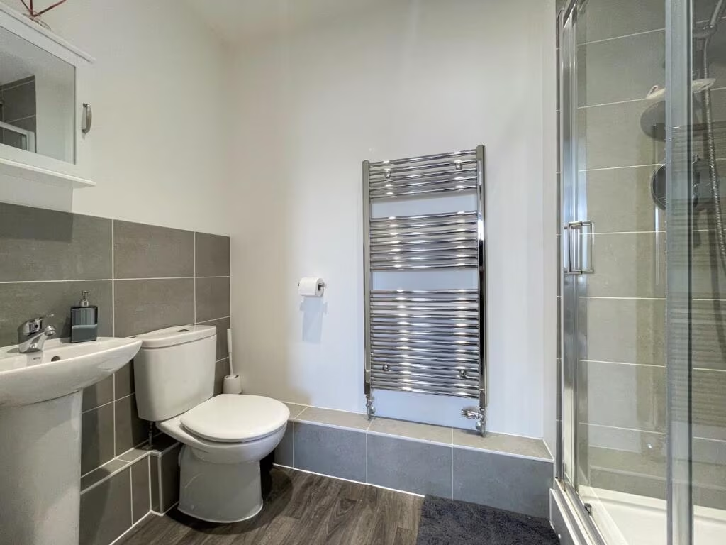
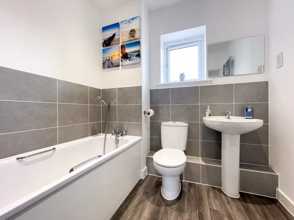
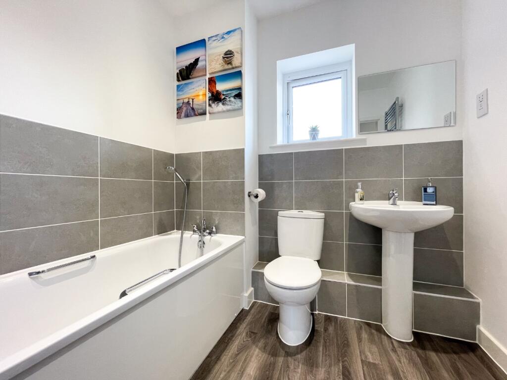
- Bathroom:
- Bedroom:
- En-suite:
Textual Property Features
Detected Visual Features
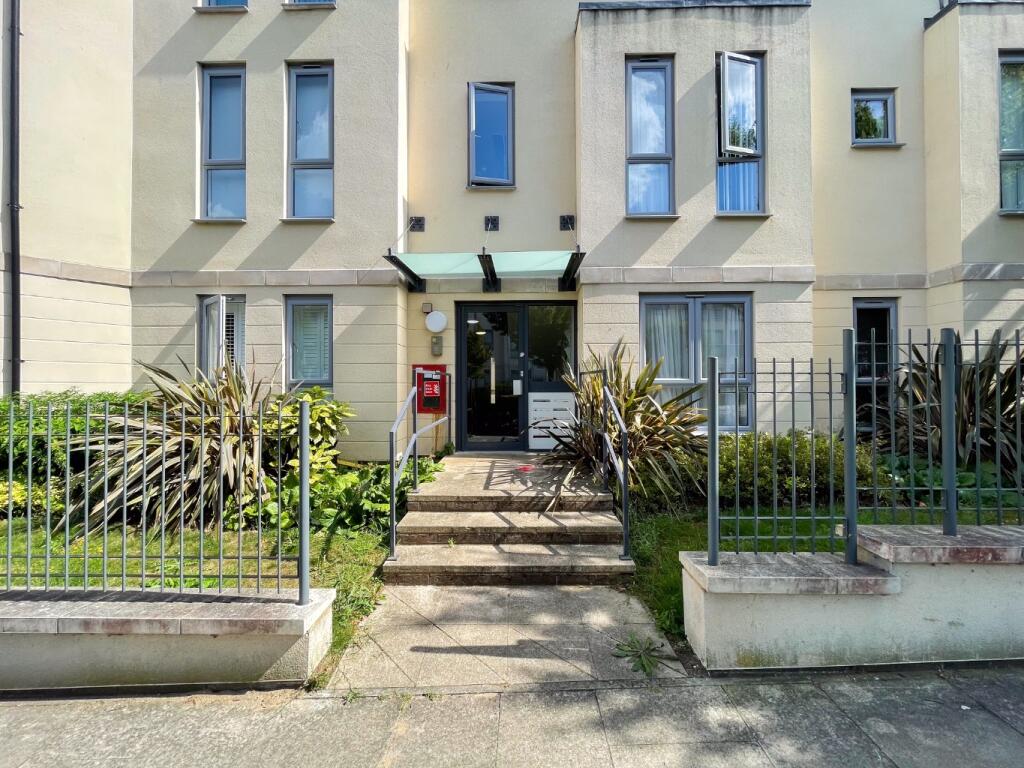
- modern apartment
- contemporary design
- balcony
- urban building
- lots of windows
- multi-story
- low-maintenance
- clean exterior
- open-plan
- modern kitchen
- living room
- neutral decor
- contemporary
- good condition
- well-maintained
- natural light
EPC Details
- High performance glazing
- Average thermal transmittance 0.26 W/m-¦K
- Boiler and radiators, mains gas
- Low energy lighting in all fixed outlets
- (other premises below)
Nearby Schools
- Saint George's Church of England School
- Northfleet School for Girls
- Northfleet Technology College
- Manor Community Primary School
- Istead Rise Primary School
- Sedley's Church of England Primary School
- Springhead Park Primary School
- Cherry Orchard Primary Academy
- St Joseph's Catholic Primary School, Northfleet
- Bronte School
- Ebbsfleet Academy
- Lawn Primary School
- The Craylands School
- Painters Ash Primary School
- Shears Green Infant School
- Shears Green Junior School
- Cecil Road Primary and Nursery School
- Mayfield Grammar School, Gravesend
- Wrotham Road Primary School
- Rosherville Church of England Academy
- St Mary's Catholic Primary School
- Lansdowne Primary Academy
- Langafel Church of England Voluntary Controlled Primary School
- Bean Primary School
- Ebbsfleet Green Primary School
- Copperfield Academy
- St Botolph's Church of England Primary School
- Thameside Primary School
Nearest General Shops
- Id: 1113145675
- Tags:
- Name: Emma Hair Fashions
- Shop: hairdresser
- TagsNormalized:
- Lat: 51.4261362
- Lon: 0.3407224
- FullGeoHash: u10hxcb4gqt5
- PartitionGeoHash: u10h
- Images:
- FoodStandards: null
- Distance: 1012.8
,- Id: 4450149291
- Tags:
- Addr:
- City: Gravesend
- Housenumber: 25
- Postcode: DA11 8LF
- Street: Dene Holm Road
- Subdistrict: Northfleet
- Fhrs:
- Name: Coopers of Kent
- Shop: seafood
- Source: ratings.food.gov.uk
- TagsNormalized:
- Lat: 51.4262914
- Lon: 0.3400251
- FullGeoHash: u10hx9zeg5t1
- PartitionGeoHash: u10h
- Images:
- FoodStandards: null
- Distance: 966.6
,- Id: 90886204
- Tags:
- Addr:
- City: Gravesend
- Country: GB
- Postcode: DA13 9PA
- Street: Station Road
- Building: yes
- Name: Millbrook Garden Centre
- Shop: garden_centre
- Source: local_knowledge
- Source:shape: Bing
- Url: www.millbrookgardencentre.co.uk
- Wheelchair: yes
- TagsNormalized:
- Lat: 51.4264569
- Lon: 0.3270734
- FullGeoHash: u10hx3yhv67s
- PartitionGeoHash: u10h
- Images:
- FoodStandards: null
- Distance: 717.1
}
Nearest Religious buildings
- Id: 529003461
- Tags:
- Amenity: place_of_worship
- Denomination: methodist
- Name: Dene Holm Methodist Church
- Note: The sign-board outside say Dene Holm
- Religion: christian
- TagsNormalized:
- place of worship
- methodist
- church
- christian
- Lat: 51.4258734
- Lon: 0.3420981
- FullGeoHash: u10hxcc17mwg
- PartitionGeoHash: u10h
- Images:
- FoodStandards: null
- Distance: 1101.9
,- Id: 878915112
- Tags:
- Amenity: place_of_worship
- Building: church
- Denomination: methodist
- Name: Dene Holm Methodist Church
- Note: The sign-board outside say Dene Holm
- Religion: christian
- TagsNormalized:
- place of worship
- church
- methodist
- christian
- Lat: 51.4259922
- Lon: 0.3422622
- FullGeoHash: u10hxcc4p7c0
- PartitionGeoHash: u10h
- Images:
- FoodStandards: null
- Distance: 1101.5
,- Id: 878915111
- Tags:
- Amenity: place_of_worship
- Building: yes
- Denomination: protestant
- Name: The Light of the World Holy Ghost Church of God
- Religion: christian
- Source: OS OpenData OpenMap Local
- TagsNormalized:
- place of worship
- protestant
- church
- christian
- Lat: 51.4409189
- Lon: 0.3385209
- FullGeoHash: u10hxsw90473
- PartitionGeoHash: u10h
- Images:
- FoodStandards: null
- Distance: 1086.7
}
Nearest Medical buildings
- Id: 1113145655
- Tags:
- Amenity: pharmacy
- Dispensing: yes
- Name: J. D. Pender
- TagsNormalized:
- Lat: 51.4261057
- Lon: 0.340837
- FullGeoHash: u10hxcb4y0fm
- PartitionGeoHash: u10h
- Images:
- FoodStandards: null
- Distance: 1020.8
,- Id: 986667572
- Tags:
- Addr:
- City: Gravesend
- Postcode: DA11 8BZ
- Street: Vale Road
- Amenity: clinic
- Healthcare: clinic
- Name: Fleet Health Campus
- Operator: NHS
- Operator:type: public
- Operator:wikidata: Q918396
- TagsNormalized:
- Lat: 51.4359185
- Lon: 0.3411218
- FullGeoHash: u10hxg87uwnv
- PartitionGeoHash: u10h
- Images:
- FoodStandards: null
- Distance: 832.7
,- Id: 9120191618
- Tags:
- Amenity: pharmacy
- Brand: Lloyds Pharmacy
- Brand:wikidata: Q6662870
- Brand:wikipedia: en:LloydsPharmacy
- Dispensing: yes
- Healthcare: pharmacy
- Name: Lloyds Pharmacy
- TagsNormalized:
- pharmacy
- lloyds pharmacy
- health
- healthcare
- Lat: 51.4357431
- Lon: 0.3410687
- FullGeoHash: u10hxg86gmrq
- PartitionGeoHash: u10h
- Images:
- FoodStandards: null
- Distance: 820.9
,- Id: 9120191635
- Tags:
- Addr:
- City: Gravesend
- Housename: Building B, Fleet Health Campus
- Postcode: DA11 8BZ
- Street: Vale Road
- Amenity: clinic
- Healthcare: clinic
- Name: Springhead Health Ltd
- Phone: +44 1474 543100
- Website: https://www.springheadhealth.co.uk/
- TagsNormalized:
- Lat: 51.4357638
- Lon: 0.3406946
- FullGeoHash: u10hxg854c26
- PartitionGeoHash: u10h
- Images:
- FoodStandards: null
- Distance: 798.6
}
Nearest Airports
- Id: 121158889
- Tags:
- Aerodrome: continental
- Aeroway: aerodrome
- Fhrs:
- Authority: City of London Corporation
- Iata: LCY
- Icao: EGLC
- Name: London City Airport
- Operator: London City Airport Limited
- Ref: LCY
- Website: https://www.londoncityairport.com/
- Wikidata: Q8982
- Wikipedia: en:London City Airport
- TagsNormalized:
- airport
- continental airport
- Lat: 51.5042658
- Lon: 0.0539987
- FullGeoHash: u10j10p64702
- PartitionGeoHash: u10j
- Images:
- FoodStandards: null
- Distance: 20738.1
,- Id: 103894219
- Tags:
- Aerodrome: international
- Aeroway: aerodrome
- Iata: SEN
- Icao: EGMC
- Name: London Southend Airport
- Old_name: Southend Municipal Airport
- Ref: SEN
- Wikidata: Q1415441
- TagsNormalized:
- airport
- international airport
- Lat: 51.5701749
- Lon: 0.6924624
- FullGeoHash: u10mru04p937
- PartitionGeoHash: u10m
- Images:
- FoodStandards: null
- Distance: 29364.5
,- Id: 260720166
- Tags:
- Aerodrome: international
- Aeroway: aerodrome
- Alt_name: Gatwick Airport
- Ele: 62
- Iata: LGW
- Icao: EGKK
- Internet_access: wlan
- Internet_access:fee: no
- Internet_access:ssid: Gatwick FREE Wi-Fi
- Name: London Gatwick Airport
- Operator: Gatwick Airport Limited
- Ref: LGW
- Website: https://www.gatwickairport.com/
- Wikidata: Q8703
- Wikipedia: en:Gatwick Airport
- TagsNormalized:
- airport
- international airport
- Lat: 51.1540917
- Lon: -0.1883773
- FullGeoHash: gcpg58qf4mzd
- PartitionGeoHash: gcpg
- Images:
- FoodStandards: null
- Distance: 47538.9
}
Nearest Leisure Facilities
- Id: 987727136
- Tags:
- Leisure: playground
- Surface: woodchips
- TagsNormalized:
- Lat: 51.431214
- Lon: 0.3365959
- FullGeoHash: u10hxdv0e30j
- PartitionGeoHash: u10h
- Images:
- FoodStandards: null
- Distance: 456.5
,- Id: 142905328
- Tags:
- Leisure: pitch
- Source: Bing
- Sport: soccer
- TagsNormalized:
- Lat: 51.434186
- Lon: 0.3358984
- FullGeoHash: u10hxek9g50n
- PartitionGeoHash: u10h
- Images:
- FoodStandards: null
- Distance: 422.9
,- Id: 550725039
- Tags:
- Leisure: park
- Source: local knowledge;aerial imagery
- TagsNormalized:
- Lat: 51.4322638
- Lon: 0.3291838
- FullGeoHash: u10hx6zwwsch
- PartitionGeoHash: u10h
- Images:
- FoodStandards: null
- Distance: 89.4
,- Id: 638545471
- Tags:
- TagsNormalized:
- Lat: 51.4324814
- Lon: 0.3294032
- FullGeoHash: u10hx6zzgtky
- PartitionGeoHash: u10h
- Images:
- FoodStandards: null
- Distance: 68.3
,- Id: 638545472
- Tags:
- TagsNormalized:
- Lat: 51.4322736
- Lon: 0.3296821
- FullGeoHash: u10hxdbndnsy
- PartitionGeoHash: u10h
- Images:
- FoodStandards: null
- Distance: 58.3
}
Nearest Tourist attractions
- Id: 1832087538
- Tags:
- Building: bunker
- Bunker_type: civil_defence
- Location: underground
- Military: bunker
- Name: Cold War Bunker
- Tourism: museum
- Website: https://www.gravesham.gov.uk/home/community-and-leisure/arts-and-heritage/cold-war-bunker
- TagsNormalized:
- Lat: 51.4311498
- Lon: 0.3643172
- FullGeoHash: u10k86c21jnw
- PartitionGeoHash: u10k
- Images:
- FoodStandards: null
- Distance: 2358
,- Id: 8231440720
- Tags:
- TagsNormalized:
- Lat: 51.4363764
- Lon: 0.3552915
- FullGeoHash: u10k85dwwgs8
- PartitionGeoHash: u10k
- Images:
- FoodStandards: null
- Distance: 1778.2
,- Id: 1073688562
- Tags:
- Addr:
- City: Gravesend
- Housenumber: 4
- Postcode: DA11 9JE
- Street: London Road
- Subdistrict: Northfleet
- Building: yes
- Building:colour: white
- Building:levels: 3
- Fhrs:
- Image: https://archive.org/details/northfleet-2021-05-30/PXL_20210530_181431252.jpg
- Name: Jessamine House
- Roof:
- Source: ratings.food.gov.uk;Bing;photo
- Tourism: guest_house
- TagsNormalized:
- Lat: 51.4418394
- Lon: 0.3389528
- FullGeoHash: u10hxswy6jvs
- PartitionGeoHash: u10h
- Images:
- FoodStandards: null
- Distance: 1190
}
Nearest Train stations
- Id: 6691194325
- Tags:
- Name: Gravesend
- Naptan:
- Network: National Rail
- Public_transport: station
- Railway: station
- Ref:
- Wikidata: Q2615632
- Wikipedia: en:Gravesend railway station
- TagsNormalized:
- Lat: 51.4413627
- Lon: 0.3668306
- FullGeoHash: u10k8ke5ev09
- PartitionGeoHash: u10k
- Images:
- FoodStandards: null
- Distance: 2709.4
,- Id: 6779166272
- Tags:
- Name: Swanscombe
- Naptan:
- Network: National Rail
- Public_transport: station
- Railway: station
- Ref:
- Source: NPE
- Wikidata: Q2298428
- Wikipedia: en:Swanscombe railway station
- TagsNormalized:
- Lat: 51.4489829
- Lon: 0.311584
- FullGeoHash: u10hxn4bh3tc
- PartitionGeoHash: u10h
- Images:
- FoodStandards: null
- Distance: 2242.5
,- Id: 6779166271
- Tags:
- Image: https://archive.org/details/northfleet-2021-05-30/PXL_20210530_190146672.jpg
- Name: Northfleet
- Naptan:
- Network: National Rail
- Public_transport: station
- Railway: station
- Ref:
- Wikidata: Q2545395
- Wikipedia: en:Northfleet railway station
- TagsNormalized:
- Lat: 51.4459453
- Lon: 0.3239669
- FullGeoHash: u10hxm7ykgr1
- PartitionGeoHash: u10h
- Images:
- FoodStandards: null
- Distance: 1552.5
,- Id: 6691194319
- Tags:
- Fixme: Does this station have a unique CRS ref
- Name: Ebbsfleet International (domestic)
- Naptan:
- Network: National Rail
- Public_transport: station
- Railway: station
- Ref:
- Wikipedia: en:Ebbsfleet International railway station
- TagsNormalized:
- Lat: 51.4432708
- Lon: 0.3226384
- FullGeoHash: u10hxkfyy08x
- PartitionGeoHash: u10h
- Images:
- FoodStandards: null
- Distance: 1305.5
,- Id: 6677056493
- Tags:
- Layer: 2
- Name: Ebbsfleet International
- Naptan:
- Network: National Rail
- Public_transport: station
- Railway: station
- Ref:
- Source: Bing
- Train: yes
- Wikidata: Q800703
- Wikipedia: en:Ebbsfleet International railway station
- TagsNormalized:
- Lat: 51.4423531
- Lon: 0.321223
- FullGeoHash: u10hxkccmj9j
- PartitionGeoHash: u10h
- Images:
- FoodStandards: null
- Distance: 1259.6
}
Nearest Hotels
- Id: 27778299
- Tags:
- Addr:
- Postcode: DA11 7LF
- Street: Wrotham Road
- Brand: Premier Inn
- Brand:wikidata: Q2108626
- Building: yes
- Contact:
- Phone: +44 871 527 8474
- Website: https://www.premierinn.com/gb/en/hotels/england/kent/gravesend/gravesend-central.html
- Name: Premier Inn Gravesend Central
- Tourism: hotel
- TagsNormalized:
- Lat: 51.4318995
- Lon: 0.3631527
- FullGeoHash: u10k86bkw0fr
- PartitionGeoHash: u10k
- Images:
- FoodStandards: null
- Distance: 2273.2
,- Id: 1074354479
- Tags:
- Addr:
- City: Northfleet
- Housenumber: 1
- Postcode: DA11 9ES
- Street: The Hill
- Building: hotel
- Building:colour: brown
- Building:levels: 3
- Building:material: brick
- Fhrs:
- Image: https://archive.org/details/northfleet-2021-05-30/PXL_20210530_181602038.jpg
- Name: The Granby Hotel
- Roof:
- Source: ratings.food.gov.uk
- Tourism: hotel
- TagsNormalized:
- Lat: 51.4421482
- Lon: 0.3366663
- FullGeoHash: u10hxsv0hzkw
- PartitionGeoHash: u10h
- Images:
- FoodStandards: null
- Distance: 1151
,- Id: 764677695
- Tags:
- Building: yes
- Name: The Spring River
- Tourism: hotel
- TagsNormalized:
- Lat: 51.4313472
- Lon: 0.3172675
- FullGeoHash: u10hx4z12f5b
- PartitionGeoHash: u10h
- Images:
- FoodStandards: null
- Distance: 919
}
Tags
- modern apartment
- contemporary design
- balcony
- urban building
- lots of windows
- multi-story
- low-maintenance
- clean exterior
- open-plan
- modern kitchen
- living room
- neutral decor
- contemporary
- good condition
- well-maintained
- natural light
Local Market Stats
- Average Price/sqft: £358
- Avg Income: £50900
- Rental Yield: 4.9%
- Social Housing: 15%
- Planning Success Rate: 69%
AirBnB Data
- 1km average: £90/night
- Listings in 1km: 1
Similar Properties
 2 bedroom flat for sale in Springhead Parkway, Northfleet, Gravesend, DA11 — £270,000 • 2 bed • 2 bath
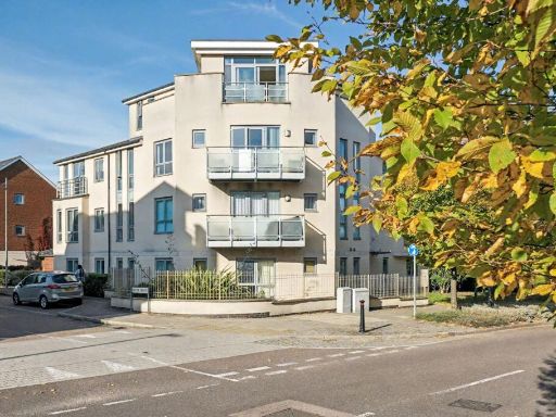 2 bedroom apartment for sale in Springhead Parkway, Northfleet, DA11 — £280,000 • 2 bed • 2 bath • 775 ft²
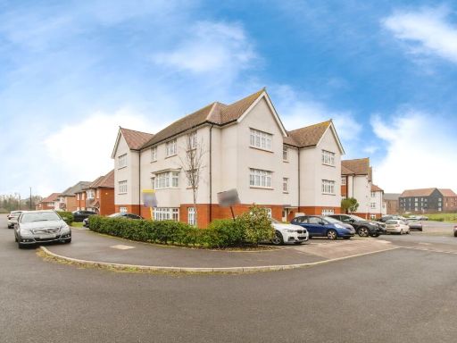 2 bedroom flat for sale in Hildefirth Close, Weldon, Ebbsfleet Valley, Swanscombe, DA10 — £250,000 • 2 bed • 1 bath • 762 ft²
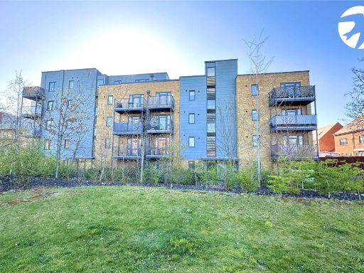 2 bedroom flat for sale in Motte Lane, Castle Hill, Ebbsfleet Valley, Swanscombe, DA10 — £240,000 • 2 bed • 1 bath • 657 ft²
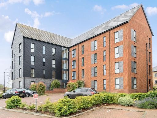 2 bedroom apartment for sale in Mortimer Square, Ebbsfleet Valley, Swanscombe, Kent. DA10 — £280,000 • 2 bed • 2 bath • 811 ft²
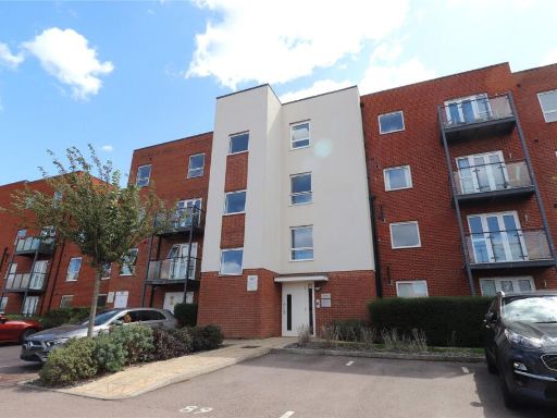 2 bedroom apartment for sale in Lett Lane, Castle Hill, Ebbsfleet Valley, DA10 — £250,000 • 2 bed • 2 bath • 753 ft²
Meta
- {
"@context": "https://schema.org",
"@type": "Residence",
"name": "2 bedroom apartment for sale in Springhead Parkway, Northfl…",
"description": "",
"url": "https://propertypiper.co.uk/property/850815f0-99f4-4d13-9609-97150fd23e96",
"image": "https://image-a.propertypiper.co.uk/559f5078-3c6f-45a1-87b4-bf00c6566081-1024.jpeg",
"address": {
"@type": "PostalAddress",
"streetAddress": "127, Springhead Parkway, Northfleet",
"postalCode": "DA11 8AD",
"addressLocality": "Gravesham",
"addressRegion": "Gravesham",
"addressCountry": "England"
},
"geo": {
"@type": "GeoCoordinates",
"latitude": 51.432567525766466,
"longitude": 0.33037838450456525
},
"numberOfRooms": 2,
"numberOfBathroomsTotal": 2,
"floorSize": {
"@type": "QuantitativeValue",
"value": 765,
"unitCode": "FTK"
},
"offers": {
"@type": "Offer",
"price": 265000,
"priceCurrency": "GBP",
"availability": "https://schema.org/InStock"
},
"additionalProperty": [
{
"@type": "PropertyValue",
"name": "Feature",
"value": "modern apartment"
},
{
"@type": "PropertyValue",
"name": "Feature",
"value": "contemporary design"
},
{
"@type": "PropertyValue",
"name": "Feature",
"value": "balcony"
},
{
"@type": "PropertyValue",
"name": "Feature",
"value": "urban building"
},
{
"@type": "PropertyValue",
"name": "Feature",
"value": "lots of windows"
},
{
"@type": "PropertyValue",
"name": "Feature",
"value": "multi-story"
},
{
"@type": "PropertyValue",
"name": "Feature",
"value": "low-maintenance"
},
{
"@type": "PropertyValue",
"name": "Feature",
"value": "clean exterior"
},
{
"@type": "PropertyValue",
"name": "Feature",
"value": "open-plan"
},
{
"@type": "PropertyValue",
"name": "Feature",
"value": "modern kitchen"
},
{
"@type": "PropertyValue",
"name": "Feature",
"value": "living room"
},
{
"@type": "PropertyValue",
"name": "Feature",
"value": "neutral decor"
},
{
"@type": "PropertyValue",
"name": "Feature",
"value": "contemporary"
},
{
"@type": "PropertyValue",
"name": "Feature",
"value": "good condition"
},
{
"@type": "PropertyValue",
"name": "Feature",
"value": "well-maintained"
},
{
"@type": "PropertyValue",
"name": "Feature",
"value": "natural light"
}
]
}
High Res Floorplan Images
Compatible Floorplan Images
FloorplanImages Thumbnail