PE21 0NH - 2 bedroom semidetached bungalow for sale in Churchill Drive…
View on Property Piper
2 bedroom semi-detached bungalow for sale in Churchill Drive, Boston, PE21
Property Details
- Price: £184950
- Bedrooms: 2
- Bathrooms: 1
- Property Type: undefined
- Property SubType: undefined
Brochure Descriptions
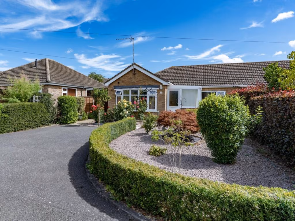
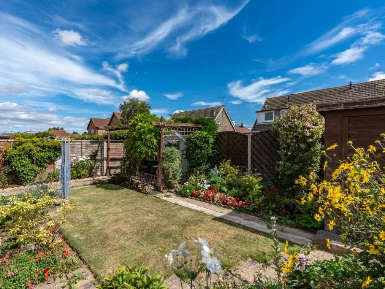
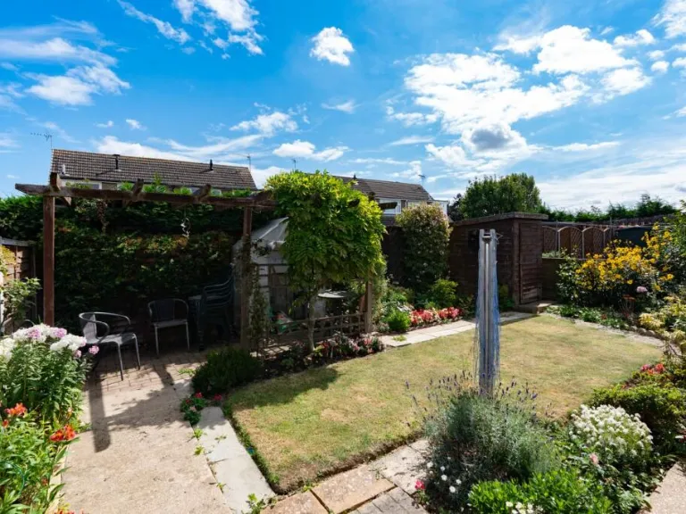
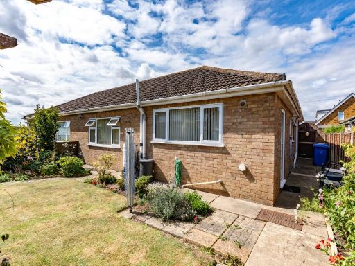
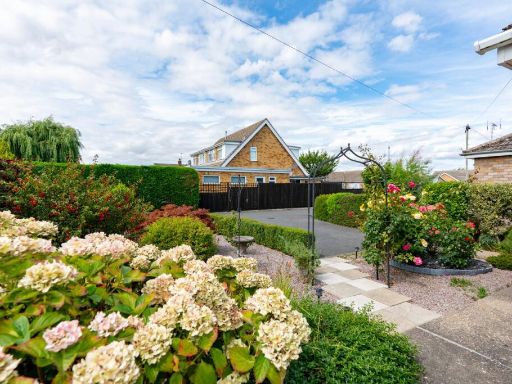
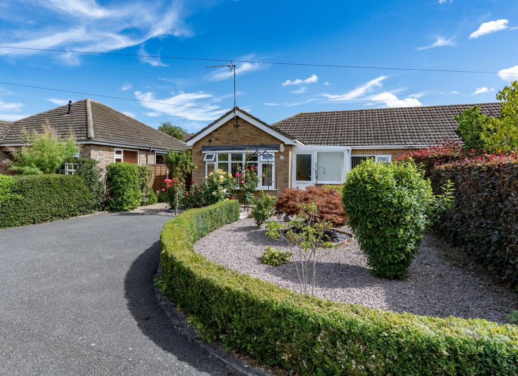
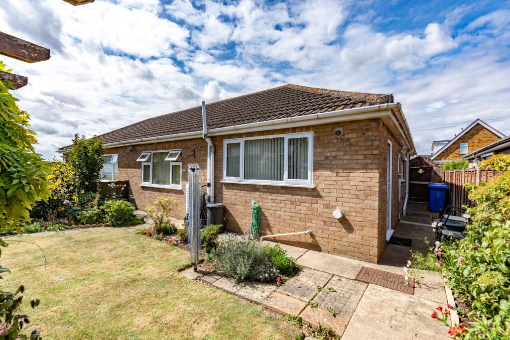
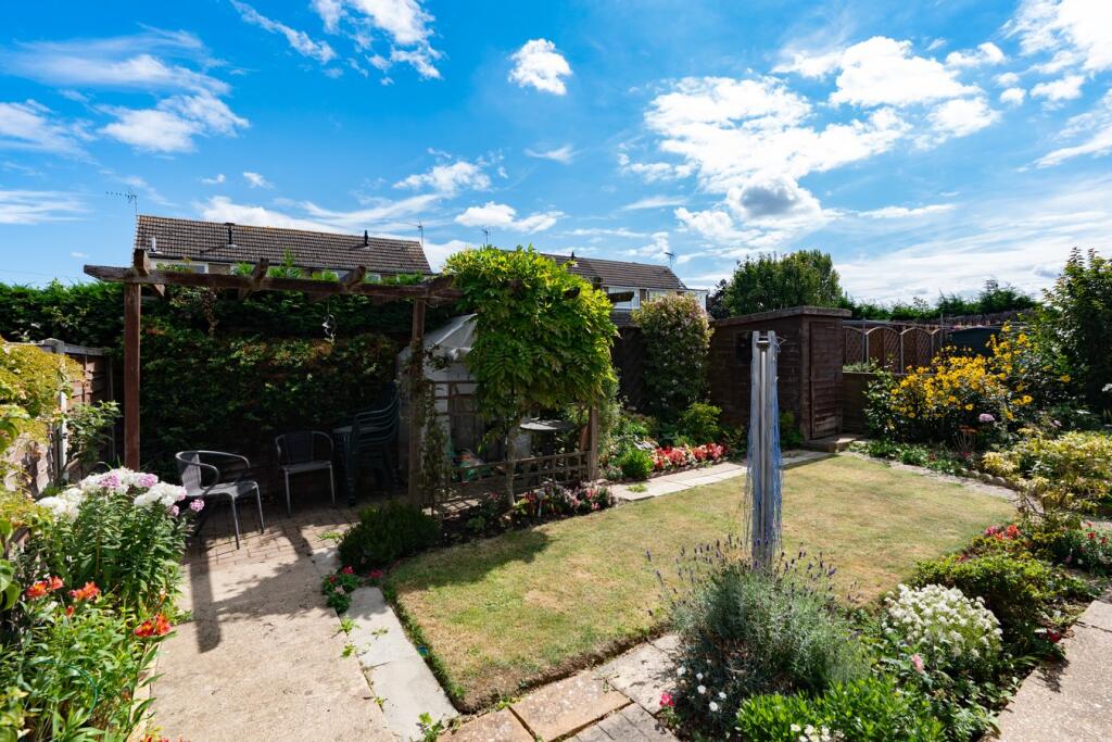
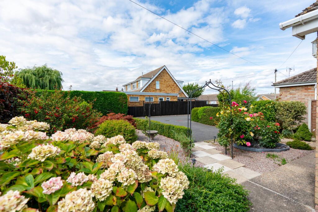
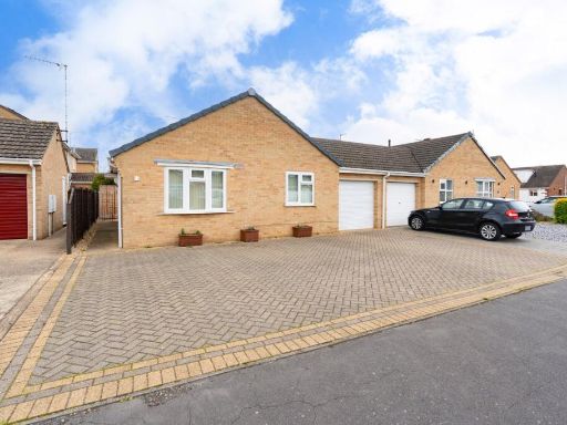
- The property is a detached single-storey bungalow with a pitched tile roof and brick construction. It features a neat and well-maintained front garden with structured hedges, shrubbery, and gravel areas, as well as a private driveway that appears to accommodate multiple vehicles. The garden size is average for residential properties of this type, and the overall bungalow size also appears average, likely suitable for small to medium-sized families. The house is set in a quiet suburban location with other similar bungalows nearby and does not overlook any main roads. The external appearance is modern and well-kept, with clear access and privacy from neighboring properties.
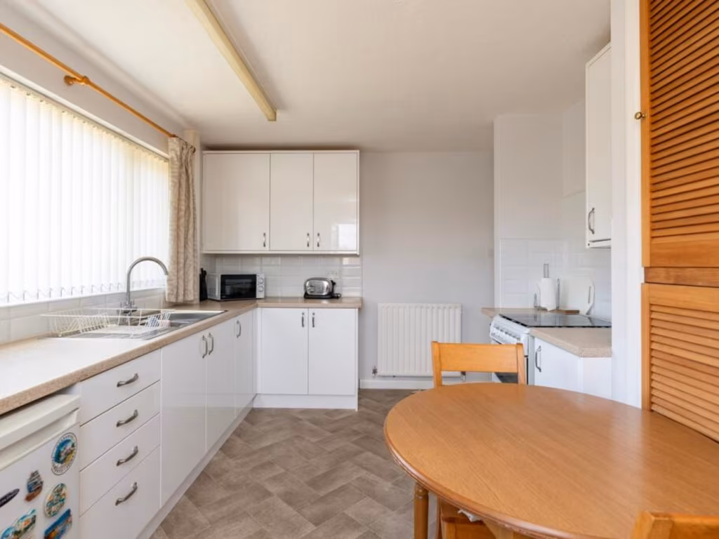
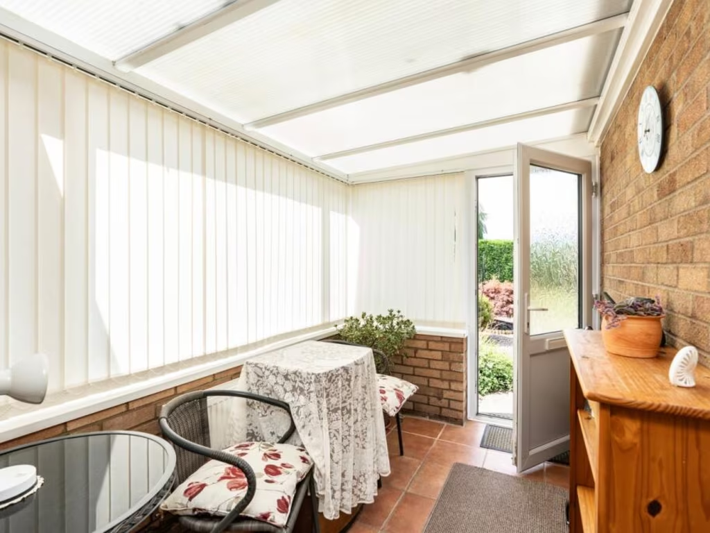
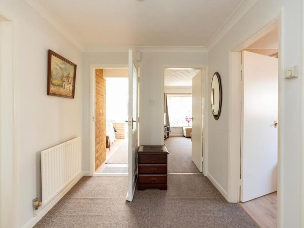
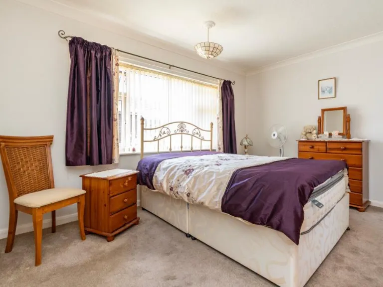
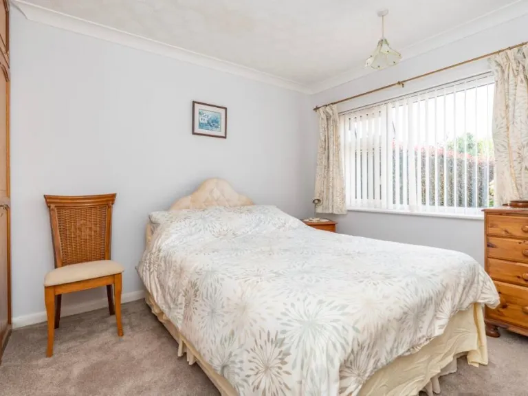
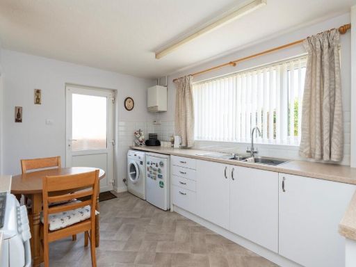
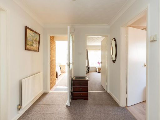
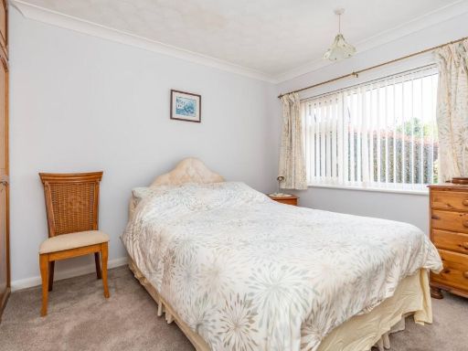
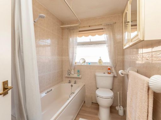
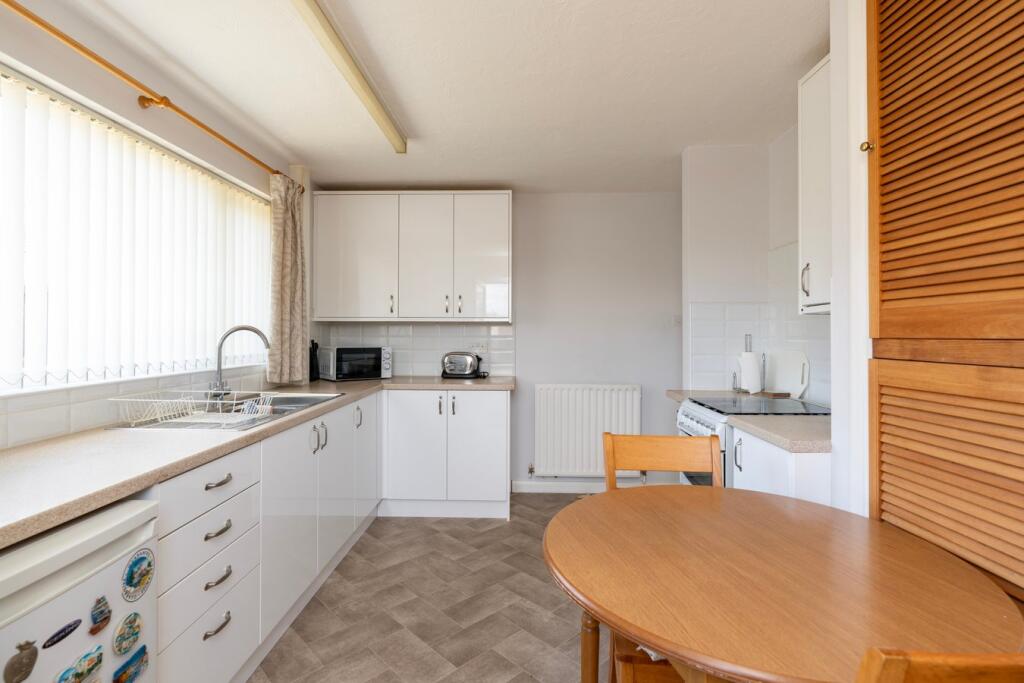
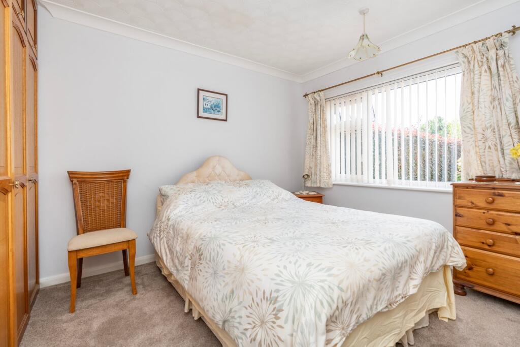
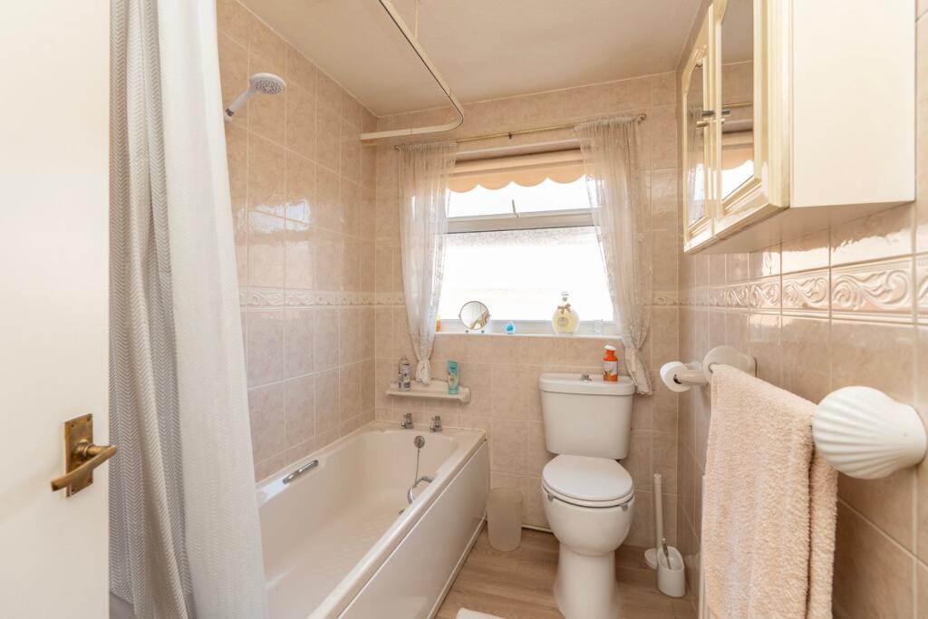
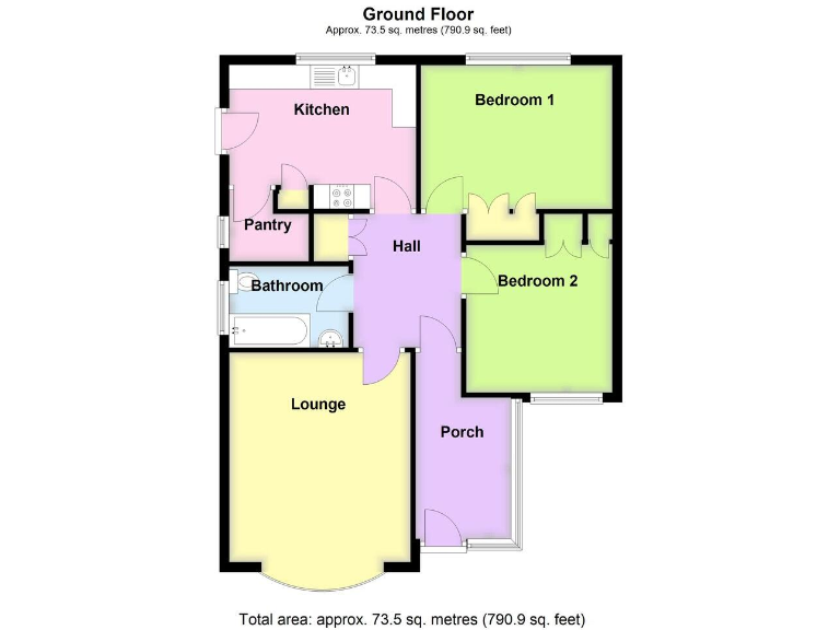
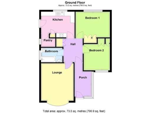
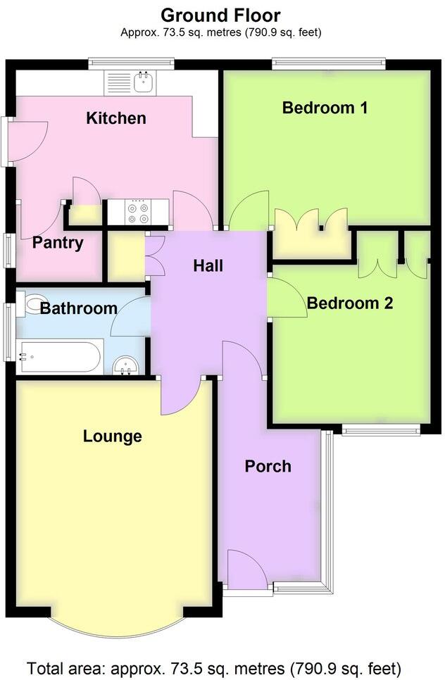
- This is a single-storey residential property (likely a detached or semi-detached bungalow) with two bedrooms, a lounge, kitchen, pantry, bathroom, hall, and porch. The overall property size is about 790.9 sq. feet (approx. 73.5 sq. metres), which is considered average for a two-bedroom dwelling. Both bedrooms appear to be of moderate size, with the lounge likely being the largest single room. There is a separate kitchen and pantry, offering functional storage space. No external views or garden size can be determined from the floorplan alone.
Image Descriptions
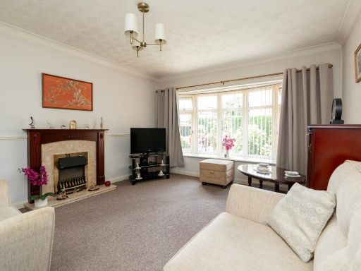
- bungalow mid-20th century
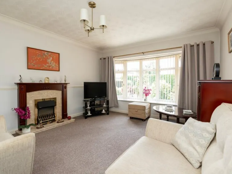
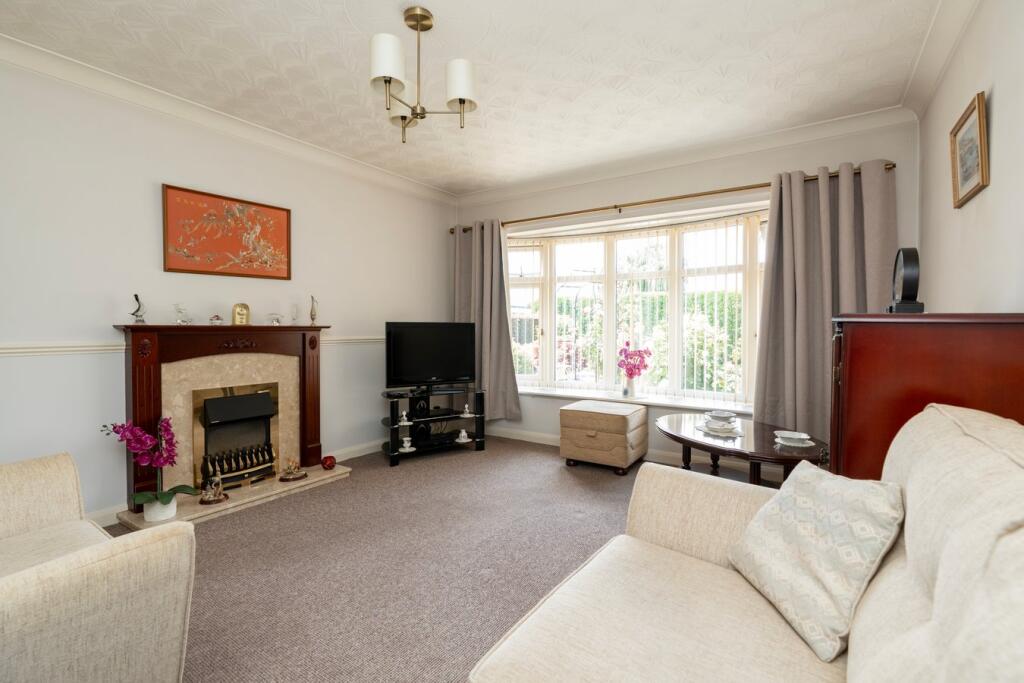
- living room mid-20th century
Floorplan Description
- A single-story property with two bedrooms, a bathroom, kitchen, lounge, pantry, and porch
Rooms
- Kitchen: average
- Bedroom 1: average
- Bathroom: small
- Bedroom 2: average
- Lounge: average
- Porch: small
Textual Property Features
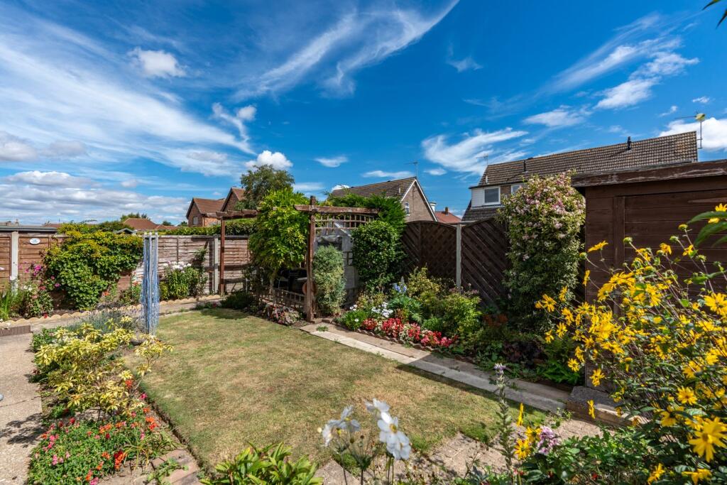
- Has Garden
- Chain Free
- Success
Detected Visual Features
- bungalow
- semi-detached
- single-story
- mid-century
- front garden
- driveway
- garage
- mid-20th century
- living room
- fireplace
- curtains
- large window
- standard ceiling height
- chandelier
- neutral tone
- suburban
EPC Details
- Fully double glazed
- Cavity wall, as built, no insulation (assumed)
- Boiler and radiators, mains gas
- Low energy lighting in 40% of fixed outlets
- Solid, no insulation (assumed)
Nearby Schools
- Boston Pioneers Free School Academy
- Boston West Academy
- The Giles Academy
- The Sibsey Free Primary School
- Gipsey Bridge Academy
- Frithville Primary School
- Fishtoft Academy
- Kirton Primary School
- St George's Preparatory School & Little Dragons Preschool
- Carlton Road Academy
- Tower Road Academy
- Saint Mary's RC Primary Academy
- Boston High School
- The Butterwick Pinchbeck's Endowed CofE Primary School
- Wyberton Primary Academy
- St Nicholas CE Primary Academy
- Park Academy
- Old Leake Primary Academy
- Hawthorn Tree School
- Thomas Middlecott Academy
- St Thomas CofE Primary Academy
- Staniland Academy
- The Boston Grammar School
- Haven High Academy
Nearest General Shops
- Id: 7329960445
- Tags:
- Addr:
- City: Boston
- Country: GB
- Housename: Johnson's Garden Centre
- Postcode: PE21 9RZ
- Street: Wainfleet Road
- Fhrs:
- Authority: Boston
- Id: 231857
- Local_authority_id: 6935
- Name: Fine Foods Supermarket & Cafe Bar
- Shop: supermarket
- TagsNormalized:
- Lat: 52.9863415
- Lon: 0.0145322
- FullGeoHash: u12j2mfef9gy
- PartitionGeoHash: u12j
- Images:
- FoodStandards: null
- Distance: 1262.9
,- Id: 7297647197
- Tags:
- Addr:
- City: Boston
- Country: GB
- Housenumber: 2
- Postcode: PE21 0PH
- Street: Eastwood Road
- Fhrs:
- Authority: Boston
- Id: 1156522
- Local_authority_id: 39791
- Name: The Blue Shop Off Licence
- Shop: alcohol
- TagsNormalized:
- Lat: 52.9766344
- Lon: -0.0033635
- FullGeoHash: gcrvruje387v
- PartitionGeoHash: gcrv
- Images:
- FoodStandards:
- Id: 1156522
- FHRSID: 1156522
- LocalAuthorityBusinessID: 39791
- BusinessName: The Blue Shop Off Licence
- BusinessType: Retailers - other
- BusinessTypeID: 4613
- AddressLine1: null
- AddressLine2: 2 Eastwood Road
- AddressLine3: null
- AddressLine4: Fishtoft
- PostCode: PE21 0PH
- RatingValue: 5
- RatingKey: fhrs_5_en-GB
- RatingDate: 2019-11-06
- LocalAuthorityCode: 219
- LocalAuthorityName: Boston
- LocalAuthorityWebSite: https://www.mybostonuk.com/
- LocalAuthorityEmailAddress: environmental.health@boston.gov.uk
- Scores:
- Hygiene: 0
- Structural: 0
- ConfidenceInManagement: 0
- NewRatingPending: false
- Geocode:
- Longitude: -0.00337320000000
- Latitude: 52.97668970000000
- Distance: 830.2
,- Id: 7297647196
- Tags:
- Name: Wags N Whiskers
- Shop: pet
- TagsNormalized:
- Lat: 52.976523
- Lon: -0.0020278
- FullGeoHash: gcrvrund8exv
- PartitionGeoHash: gcrv
- Images:
- FoodStandards: null
- Distance: 739.9
}
Nearest Religious buildings
- Id: 105580000
- Tags:
- Amenity: place_of_worship
- Building: church
- Denomination: anglican
- Name: St Nicholas Church
- Religion: christian
- Wikidata: Q17542942
- TagsNormalized:
- place of worship
- church
- anglican
- christian
- Lat: 52.9686013
- Lon: -0.00928
- FullGeoHash: gcrvrf9hrybq
- PartitionGeoHash: gcrv
- Images:
- FoodStandards: null
- Distance: 1438.7
,- Id: 317867625
- Tags:
- Amenity: community_centre
- Building: yes
- Name: Skirbeck St. Nicholas Church Community Hall
- Source: Bing
- TagsNormalized:
- community centre
- church
- community hall
- Lat: 52.969524
- Lon: -0.0097462
- FullGeoHash: gcrvrfbcufuw
- PartitionGeoHash: gcrv
- Images:
- FoodStandards: null
- Distance: 1414.1
,- Id: 649383582
- Tags:
- Amenity: place_of_worship
- Building: yes
- Denomination: mormon
- Name: The Church of Jesus Christ of Latter-day Saints
- Religion: christian
- Source: OS_OpenData_StreetView
- TagsNormalized:
- place of worship
- mormon
- church
- christian
- Lat: 52.971116
- Lon: 0.0005812
- FullGeoHash: u12j2507je9r
- PartitionGeoHash: u12j
- Images:
- FoodStandards: null
- Distance: 740.1
}
Nearest Medical buildings
- Id: 976945453
- Tags:
- Amenity: doctors
- Healthcare: doctor
- Name: Greyfriars Surgery
- TagsNormalized:
- doctor
- doctors
- health
- healthcare
- surgery
- Lat: 52.9754491
- Lon: -0.0229302
- FullGeoHash: gcrvr7zk3eqp
- PartitionGeoHash: gcrv
- Images:
- FoodStandards: null
- Distance: 2130.8
,- Id: 7304560661
- Tags:
- Amenity: clinic
- Name: Pen Street Foot Clinic
- TagsNormalized:
- Lat: 52.9791127
- Lon: -0.0194138
- FullGeoHash: gcrvrs9cewkj
- PartitionGeoHash: gcrv
- Images:
- FoodStandards: null
- Distance: 1937.3
,- Id: 7304560664
- Tags:
- Amenity: clinic
- Name: Boston Chiropractic Clinic
- TagsNormalized:
- Lat: 52.9781817
- Lon: -0.0194098
- FullGeoHash: gcrvrs3u78z5
- PartitionGeoHash: gcrv
- Images:
- FoodStandards: null
- Distance: 1918.3
,- Id: 7297647200
- Tags:
- Amenity: pharmacy
- Brand: Lloyds Pharmacy
- Brand:wikidata: Q6662870
- Brand:wikipedia: en:LloydsPharmacy
- Healthcare: pharmacy
- Name: Lloyds Pharmacy
- TagsNormalized:
- pharmacy
- lloyds pharmacy
- health
- healthcare
- Lat: 52.975084
- Lon: -0.0057426
- FullGeoHash: gcrvrggf4pqj
- PartitionGeoHash: gcrv
- Images:
- FoodStandards: null
- Distance: 981.1
}
Nearest Tourist attractions
- Id: 1030945913
- Tags:
- Historic: tower
- Name: Hussey Tower
- Ruins: yes
- Tourism: attraction
- Website: https://www.heritagelincolnshire.org/sites/hussey-tower
- Wikidata: Q17543000
- TagsNormalized:
- Lat: 52.9735588
- Lon: -0.0195329
- FullGeoHash: gcrvre9c2g54
- PartitionGeoHash: gcrv
- Images:
- FoodStandards: null
- Distance: 1915.6
,- Id: 8829838491
- Tags:
- Name: Palethorpe House Bed & Breakfast
- Tourism: guest_house
- TagsNormalized:
- Lat: 52.9869567
- Lon: -0.010238
- FullGeoHash: gcrvrvbx3ktu
- PartitionGeoHash: gcrv
- Images:
- FoodStandards: null
- Distance: 1806.2
,- Id: 294164546
- Tags:
- Name: Pilgrims Way
- Tents: yes
- Tourism: camp_site
- TagsNormalized:
- Lat: 52.9704405
- Lon: 0.0211774
- FullGeoHash: u12j26zrjmz1
- PartitionGeoHash: u12j
- Images:
- FoodStandards: null
- Distance: 996.8
}
Nearest Train stations
- Id: 5846009453
- Tags:
- Name: Walls Lane
- Operator: Lincolnshire Coast Light Railway
- Public_transport: station
- Railway: station
- Usage: tourism
- TagsNormalized:
- Lat: 53.1783215
- Lon: 0.335201
- FullGeoHash: u12nx8u44txu
- PartitionGeoHash: u12n
- Images:
- FoodStandards: null
- Distance: 31364.4
,- Id: 20471338
- Tags:
- Name: Skegness
- Naptan:
- Network: National Rail
- Operator: East Midlands Railway
- Public_transport: station
- Railway: station
- Ref:
- Source: NPE tracing
- Train: yes
- Wheelchair: yes
- Wikipedia: en:Skegness railway station
- TagsNormalized:
- Lat: 53.1431867
- Lon: 0.3345214
- FullGeoHash: u12nrd7tdbj0
- PartitionGeoHash: u12n
- Images:
- FoodStandards: null
- Distance: 28656.3
,- Id: 7156695895
- Tags:
- Addr:
- Postcode: PE11 1EA
- Street: Winsover Road
- Name: Spalding
- Naptan:
- Network: National Rail
- Old_name: Spalding Town
- Public_transport: station
- Railway: station
- Ref:
- Wikidata: Q2097124
- Wikipedia: en:Spalding railway station
- TagsNormalized:
- Lat: 52.7887647
- Lon: -0.1571731
- FullGeoHash: gcruk3vscdgp
- PartitionGeoHash: gcru
- Images:
- FoodStandards: null
- Distance: 23565.5
,- Id: 20471713
- Tags:
- Name: Havenhouse
- Naptan:
- Network: National Rail
- Public_transport: station
- Railway: station
- Ref:
- Source: NPE tracing
- Wikidata: Q2676343
- Wikipedia: en:Havenhouse railway station
- TagsNormalized:
- Lat: 53.1146157
- Lon: 0.2729912
- FullGeoHash: u12nnjnz14hb
- PartitionGeoHash: u12n
- Images:
- FoodStandards: null
- Distance: 23472.6
,- Id: 20471718
- Tags:
- Name: Wainfleet
- Naptan:
- Network: National Rail
- Public_transport: station
- Railway: station
- Ref:
- Source: NPE tracing
- Wikipedia: en:Wainfleet railway station
- TagsNormalized:
- Lat: 53.105126
- Lon: 0.2345366
- FullGeoHash: u12nj76zc0gp
- PartitionGeoHash: u12n
- Images:
- FoodStandards: null
- Distance: 20864.4
}
Nearest Hotels
- Id: 1447926294
- Tags:
- Amenity: pub
- Name: Red Cow Hotel
- TagsNormalized:
- Lat: 52.9811877
- Lon: -0.0200591
- FullGeoHash: gcrvrscmu94z
- PartitionGeoHash: gcrv
- Images:
- FoodStandards: null
- Distance: 2038.9
,- Id: 188604979
- Tags:
- Addr:
- City: Boston
- Country: GB
- Housenumber: 49
- Postcode: PE21 6SH
- Street: Wide Bargate
- Building: yes
- Name: The New England Hotel
- Source: Bing
- Tourism: hotel
- Website: https://smartmovehotels.co.uk/properties/the-new-england-hotel/
- TagsNormalized:
- Lat: 52.9800373
- Lon: -0.0192066
- FullGeoHash: gcrvrsdp06y8
- PartitionGeoHash: gcrv
- Images:
- FoodStandards: null
- Distance: 1947.7
,- Id: 188397214
- Tags:
- Addr:
- City: Boston
- Country: GB
- Postcode: PE21 9RW
- Street: Wainfleet Road
- Air_conditioning: no
- Bar: no
- Brand: Premier Inn
- Brand:wikidata: Q2108626
- Building: yes
- Building:levels: 2
- Fhrs:
- Authority: Boston
- Id: 231983
- Local_authority_id: 1134
- Name: Premier Inn Boston
- Operator: Premier Inn
- Source: Bing
- Tourism: hotel
- TagsNormalized:
- Lat: 52.9878586
- Lon: -0.0040625
- FullGeoHash: gcrvryjh9kfb
- PartitionGeoHash: gcrv
- Images:
- FoodStandards: null
- Distance: 1624.7
}
Tags
- bungalow
- semi-detached
- single-story
- mid-century
- front garden
- driveway
- garage
- mid-20th century
- living room
- fireplace
- curtains
- large window
- standard ceiling height
- chandelier
- neutral tone
- suburban
Local Market Stats
- Average Price/sqft: £180
- Avg Income: £40700
- Rental Yield: 4.6%
- Social Housing: 13%
- Planning Success Rate: 91%
Similar Properties
 2 bedroom bungalow for sale in Highgrove Crescent, Boston, PE21 — £159,950 • 2 bed • 1 bath • 828 ft²
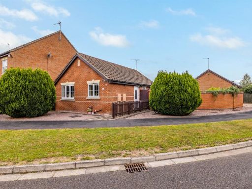 2 bedroom bungalow for sale in Cooks Lock, PE21 — £192,499 • 2 bed • 1 bath • 812 ft²
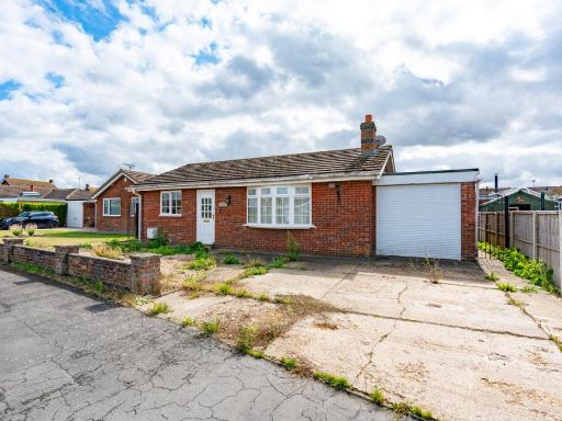 2 bedroom detached bungalow for sale in Acorn Close, Freiston, Boston, PE22 — £150,000 • 2 bed • 1 bath • 756 ft²
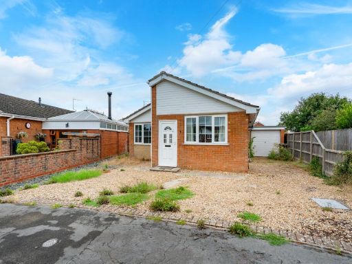 2 bedroom detached bungalow for sale in Yew Tree Grove, Boston, PE21 — £169,500 • 2 bed • 1 bath • 891 ft²
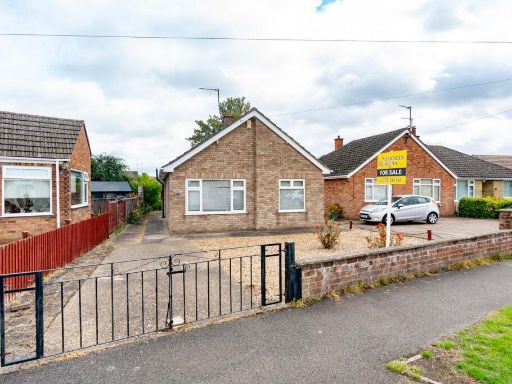 2 bedroom detached bungalow for sale in Winston Gardens, Boston, PE21 — £199,950 • 2 bed • 1 bath • 708 ft²
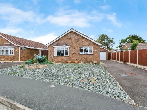 2 bedroom detached bungalow for sale in Prince William Drive, Butterwick, Boston, PE22 — £180,000 • 2 bed • 1 bath • 722 ft²
Meta
- {
"@context": "https://schema.org",
"@type": "Residence",
"name": "2 bedroom semidetached bungalow for sale in Churchill Drive…",
"description": "",
"url": "https://propertypiper.co.uk/property/84487ed9-2019-4c8c-83ef-5dd205ebbd42",
"image": "https://image-a.propertypiper.co.uk/9519d967-3e36-4586-922a-eab1cad1e577-1024.jpeg",
"address": {
"@type": "PostalAddress",
"streetAddress": "24A CHURCHILL DRIVE BOSTON",
"postalCode": "PE21 0NH",
"addressLocality": "Boston",
"addressRegion": "Boston and Skegness",
"addressCountry": "England"
},
"geo": {
"@type": "GeoCoordinates",
"latitude": 52.9755032,
"longitude": 0.0088929
},
"numberOfRooms": 2,
"numberOfBathroomsTotal": 1,
"floorSize": {
"@type": "QuantitativeValue",
"value": 790,
"unitCode": "FTK"
},
"offers": {
"@type": "Offer",
"price": 184950,
"priceCurrency": "GBP",
"availability": "https://schema.org/InStock"
},
"additionalProperty": [
{
"@type": "PropertyValue",
"name": "Feature",
"value": "bungalow"
},
{
"@type": "PropertyValue",
"name": "Feature",
"value": "semi-detached"
},
{
"@type": "PropertyValue",
"name": "Feature",
"value": "single-story"
},
{
"@type": "PropertyValue",
"name": "Feature",
"value": "mid-century"
},
{
"@type": "PropertyValue",
"name": "Feature",
"value": "front garden"
},
{
"@type": "PropertyValue",
"name": "Feature",
"value": "driveway"
},
{
"@type": "PropertyValue",
"name": "Feature",
"value": "garage"
},
{
"@type": "PropertyValue",
"name": "Feature",
"value": "mid-20th century"
},
{
"@type": "PropertyValue",
"name": "Feature",
"value": "living room"
},
{
"@type": "PropertyValue",
"name": "Feature",
"value": "fireplace"
},
{
"@type": "PropertyValue",
"name": "Feature",
"value": "curtains"
},
{
"@type": "PropertyValue",
"name": "Feature",
"value": "large window"
},
{
"@type": "PropertyValue",
"name": "Feature",
"value": "standard ceiling height"
},
{
"@type": "PropertyValue",
"name": "Feature",
"value": "chandelier"
},
{
"@type": "PropertyValue",
"name": "Feature",
"value": "neutral tone"
},
{
"@type": "PropertyValue",
"name": "Feature",
"value": "suburban"
}
]
}
High Res Floorplan Images
Compatible Floorplan Images
FloorplanImages Thumbnail