CV11 4TJ - 4 bedroom detached house for sale in Chetwynd Drive, Nuneat…
View on Property Piper
4 bedroom detached house for sale in Chetwynd Drive, Nuneaton, CV11
Property Details
- Price: £399950
- Bedrooms: 4
- Bathrooms: 2
- Property Type: undefined
- Property SubType: undefined
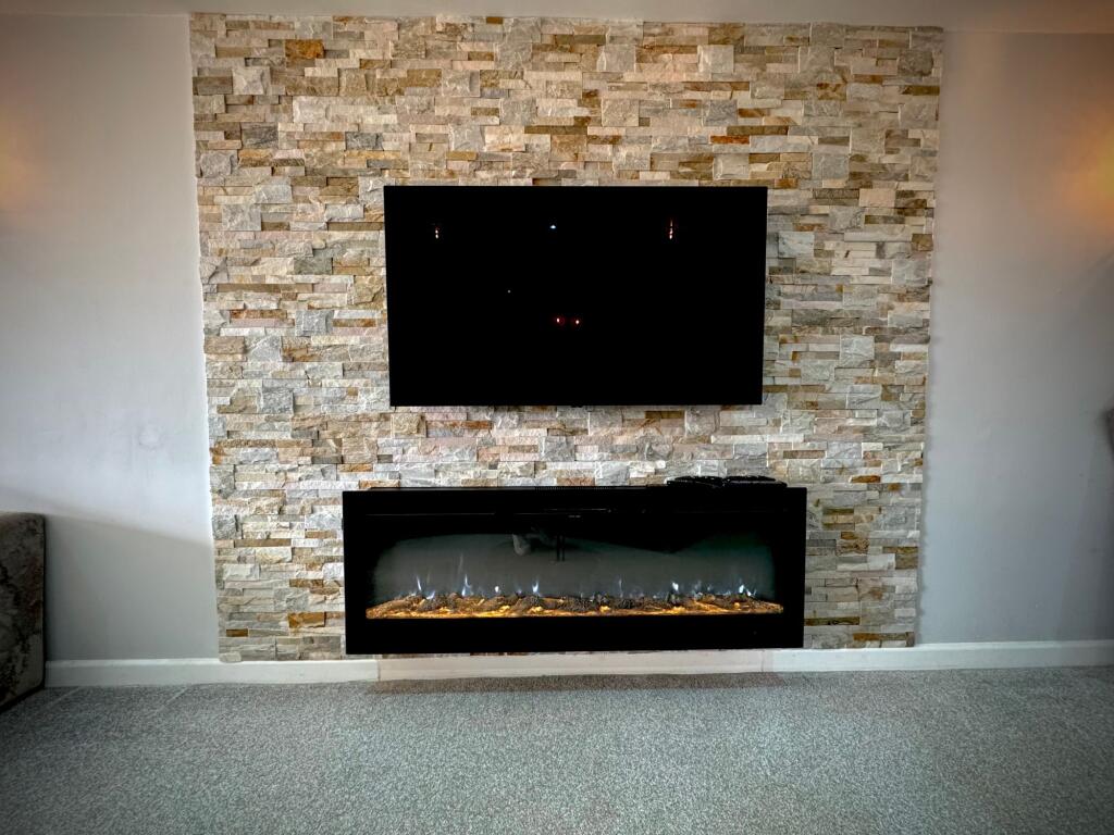
Image Descriptions
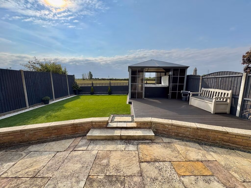
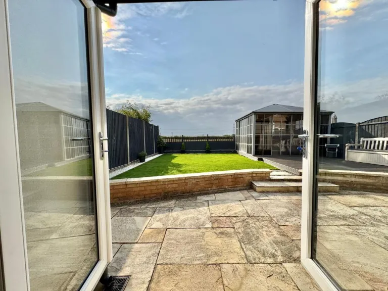
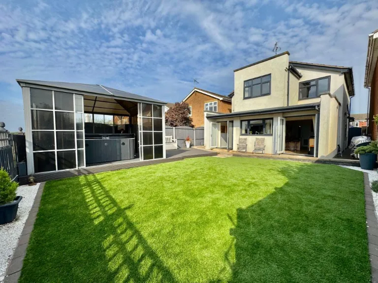
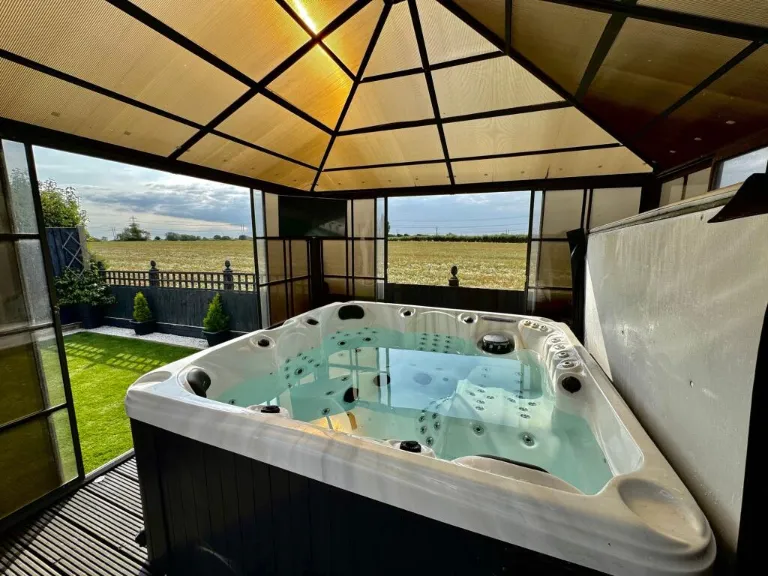
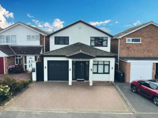
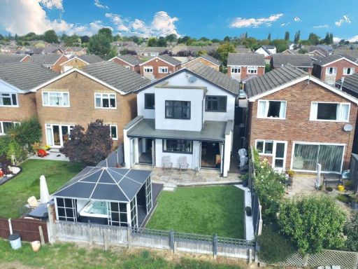
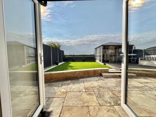
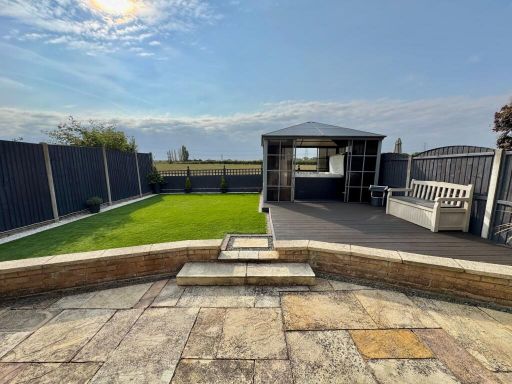
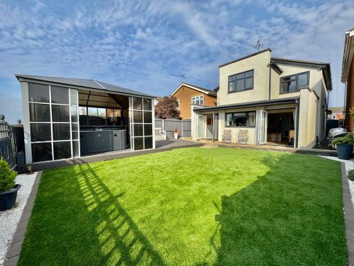
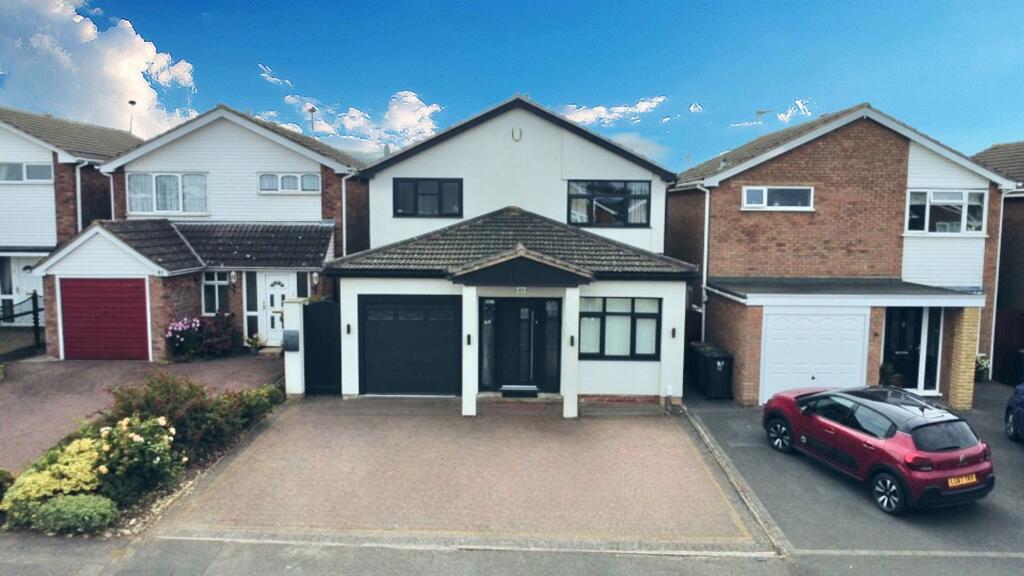
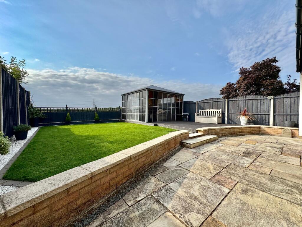
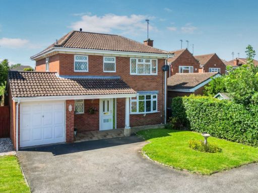
- detached house modern suburban
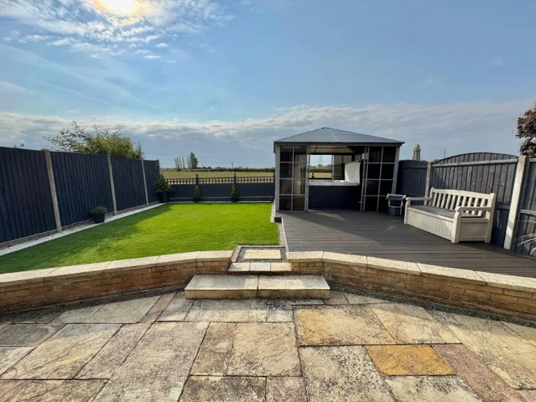
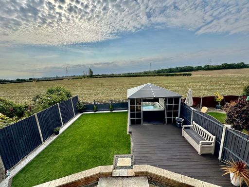
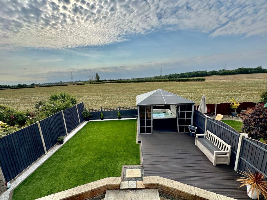
- back garden and deck area modern
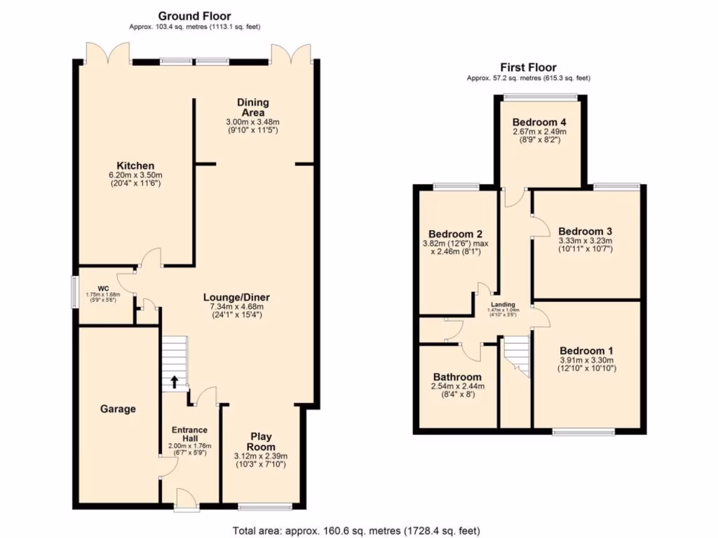
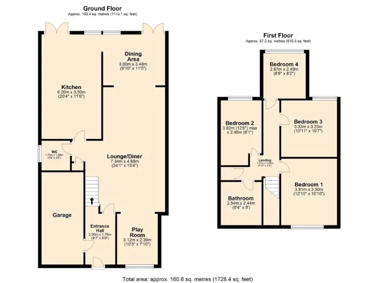
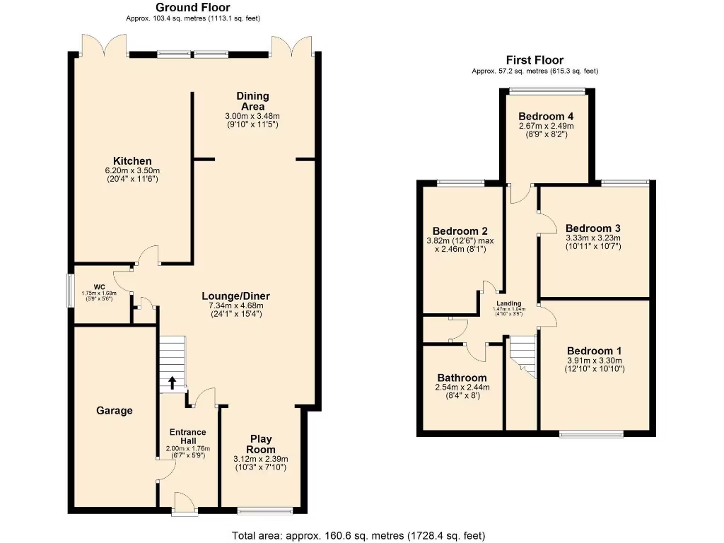
Floorplan Description
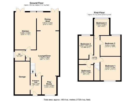
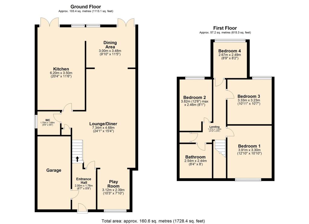
- A multi-story property with multiple bedrooms and a spacious lounge/diner area.
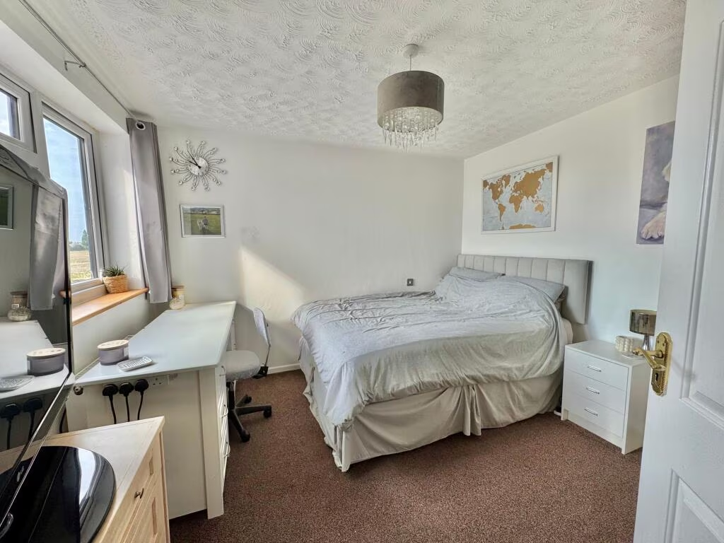
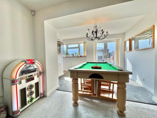
Rooms
- Dining Area: small
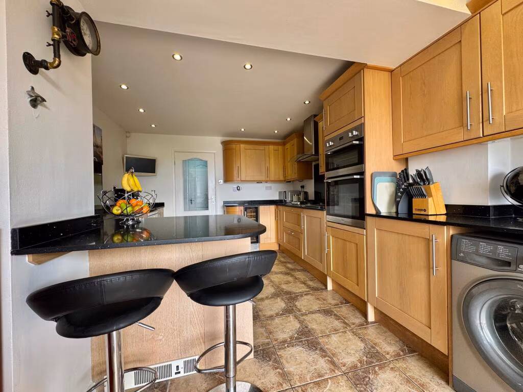
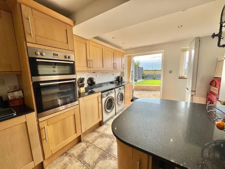
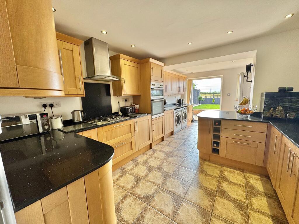
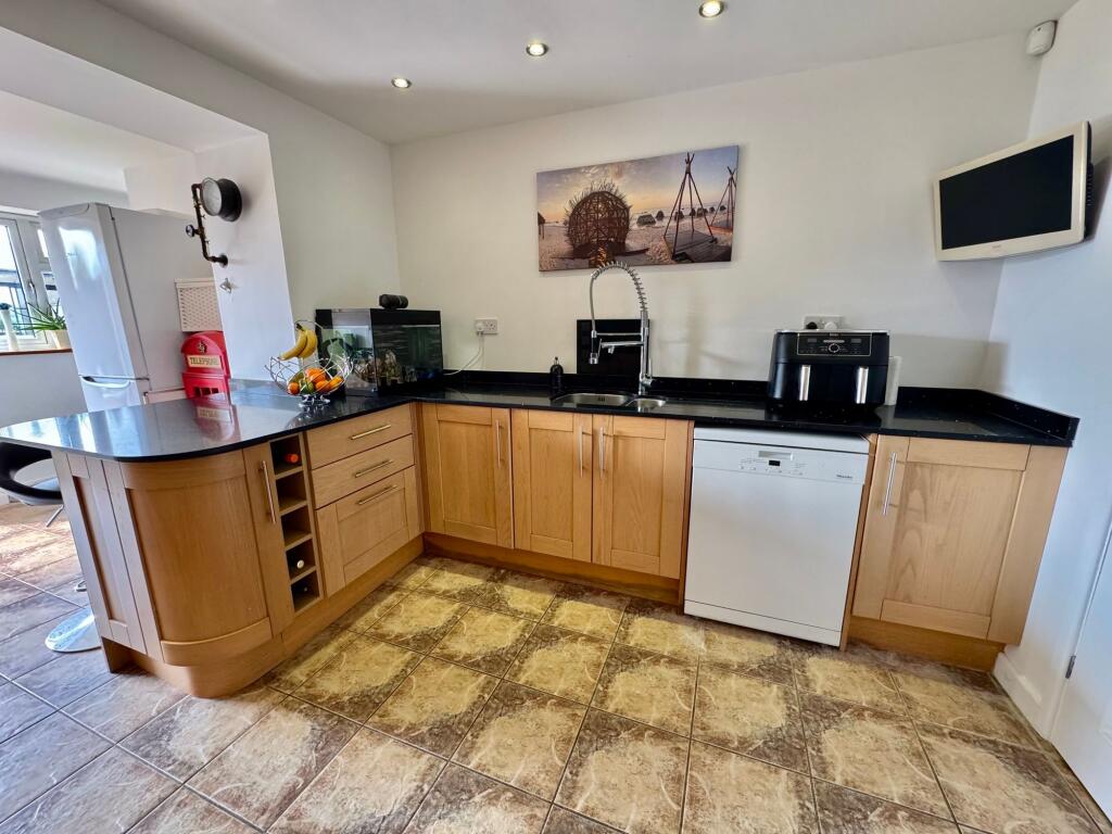
- Kitchen: large
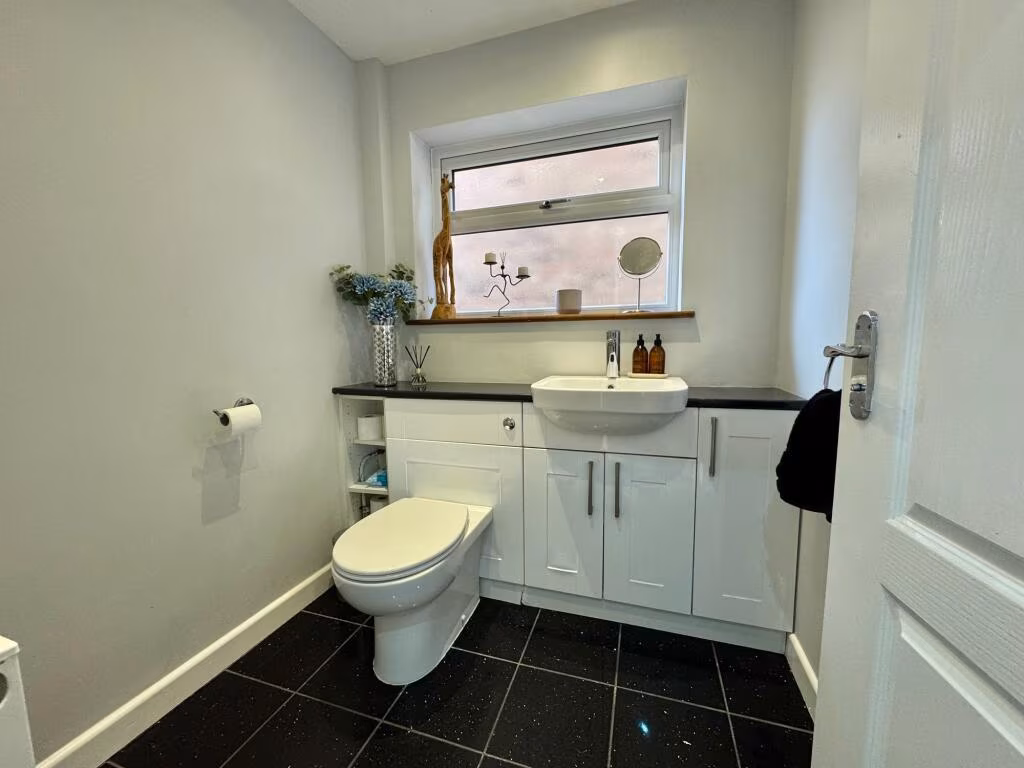
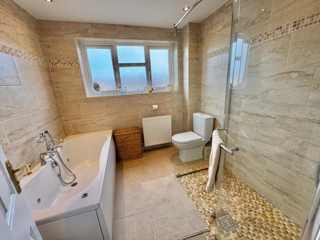
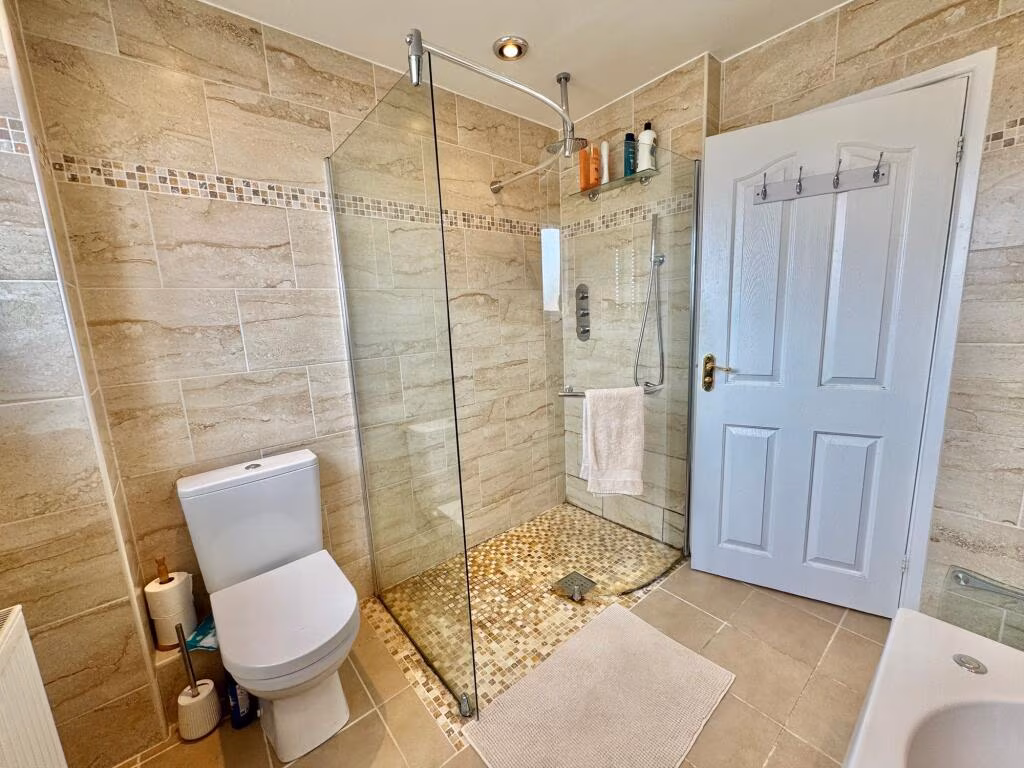
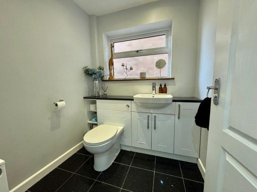
- WC: small
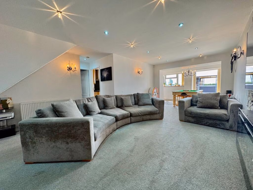
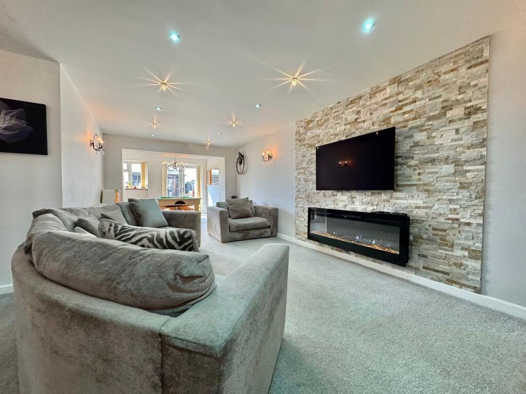
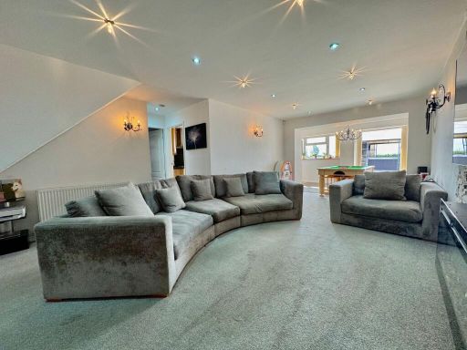
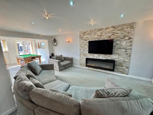
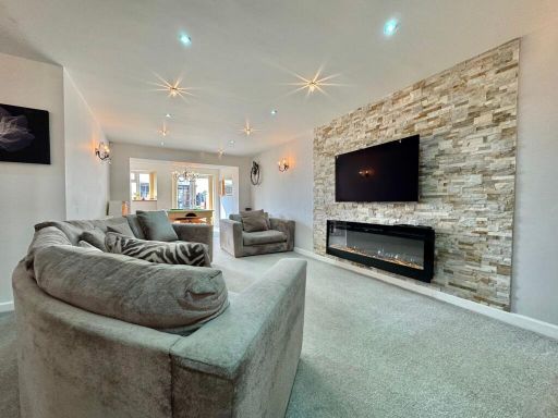
- Lounge/Diner: large
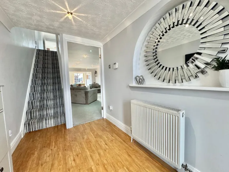
- Entrance Hall: average
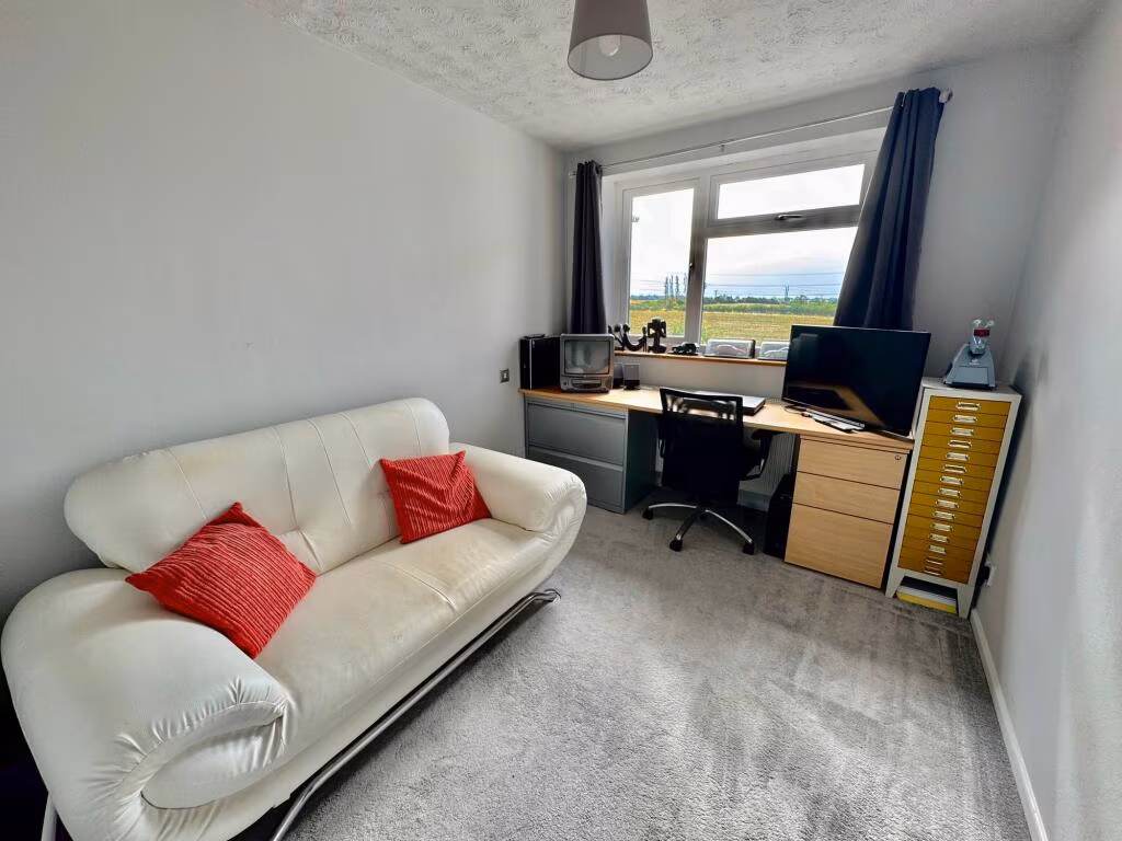
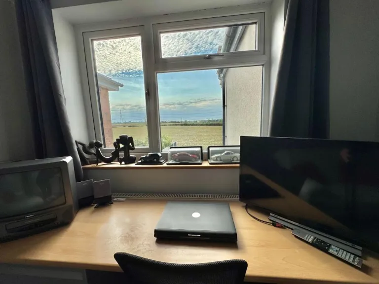
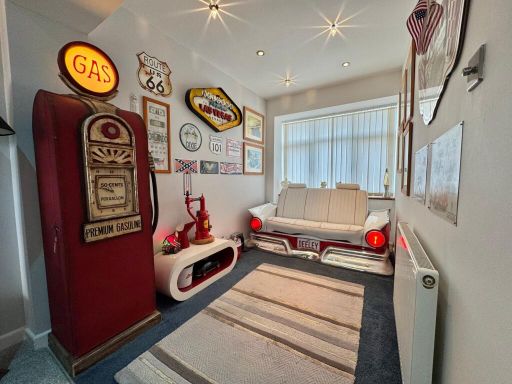
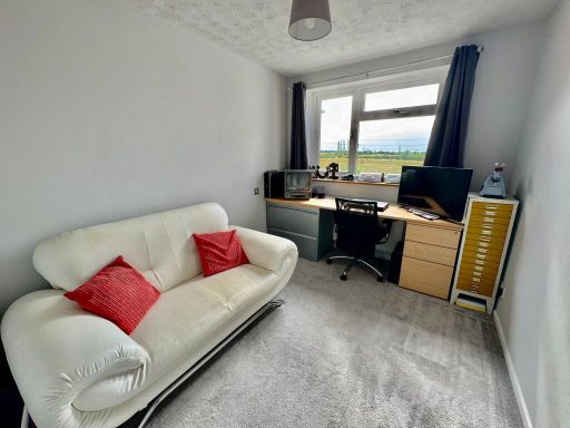
- Play Room: small
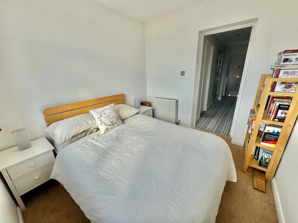
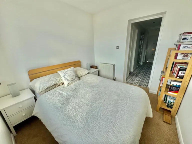
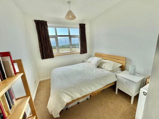
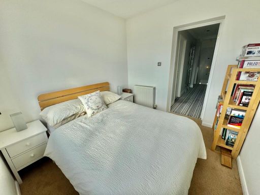
- Bedroom 4: small
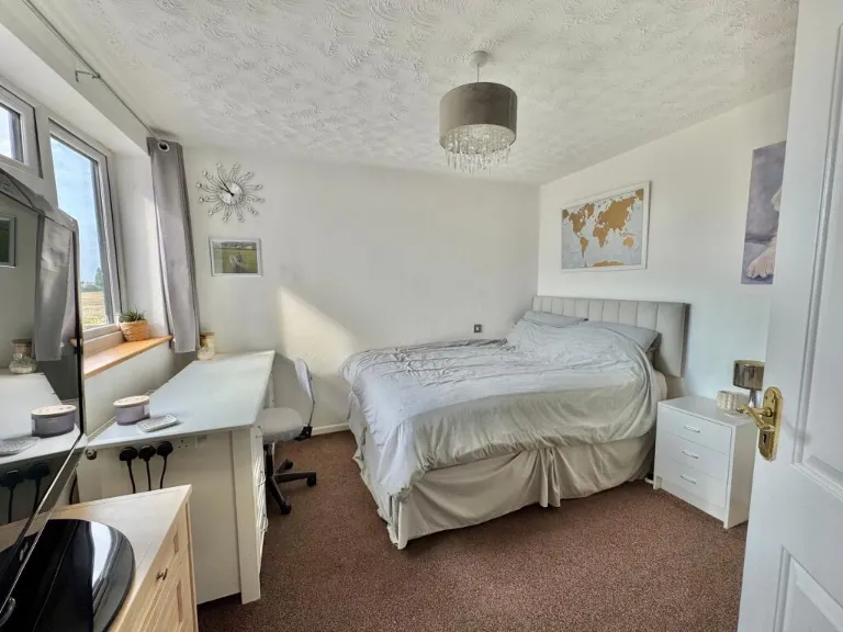
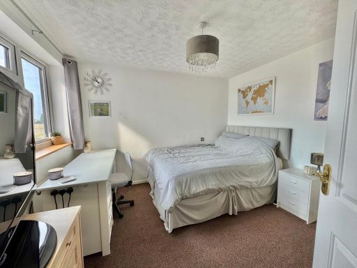
- Bedroom 2: average
- Bedroom 3: average
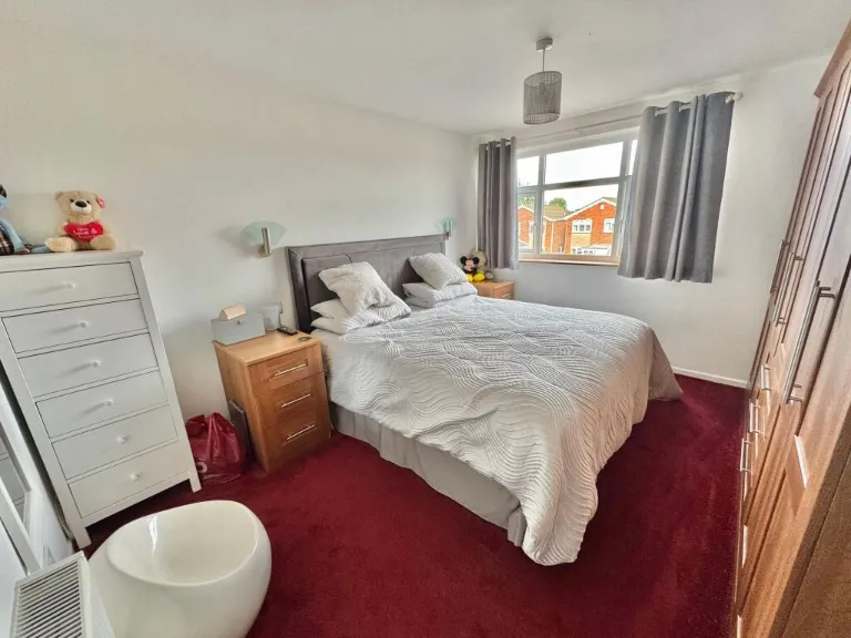
- Bedroom 1: average
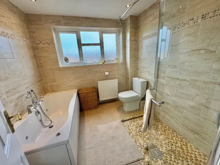
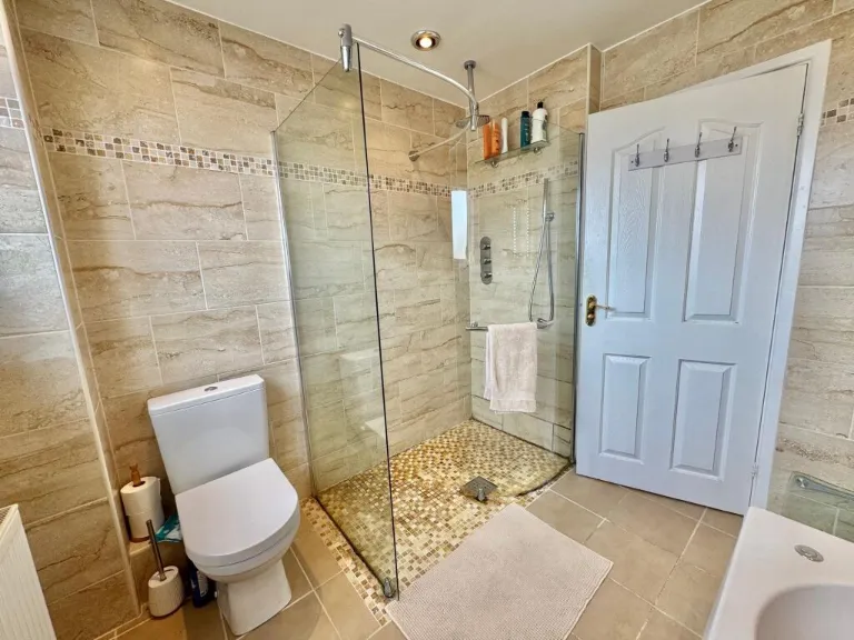
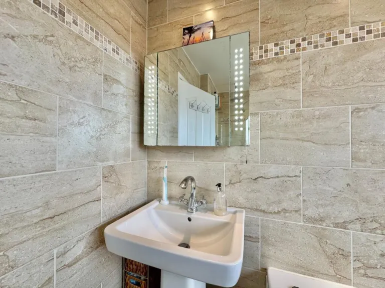
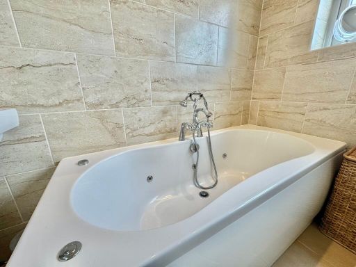
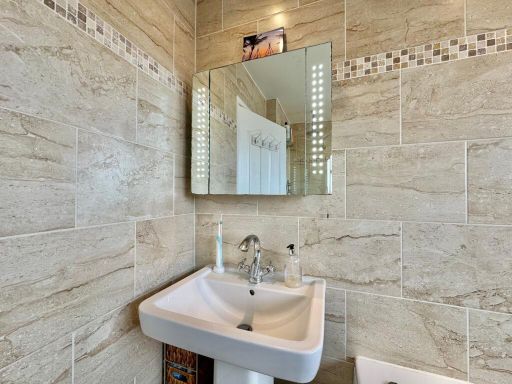
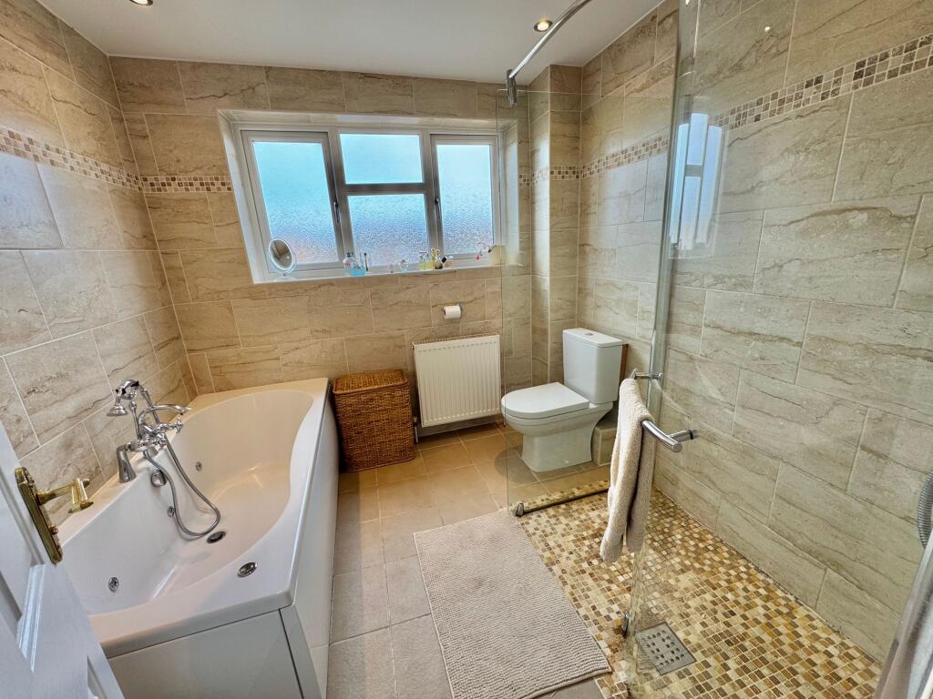
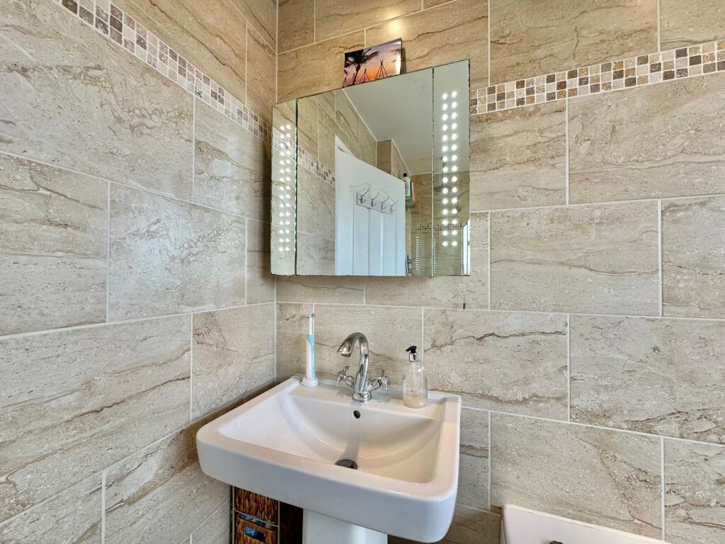
- Bathroom: small
- Garage:
- Landing:
Textual Property Features
Detected Visual Features
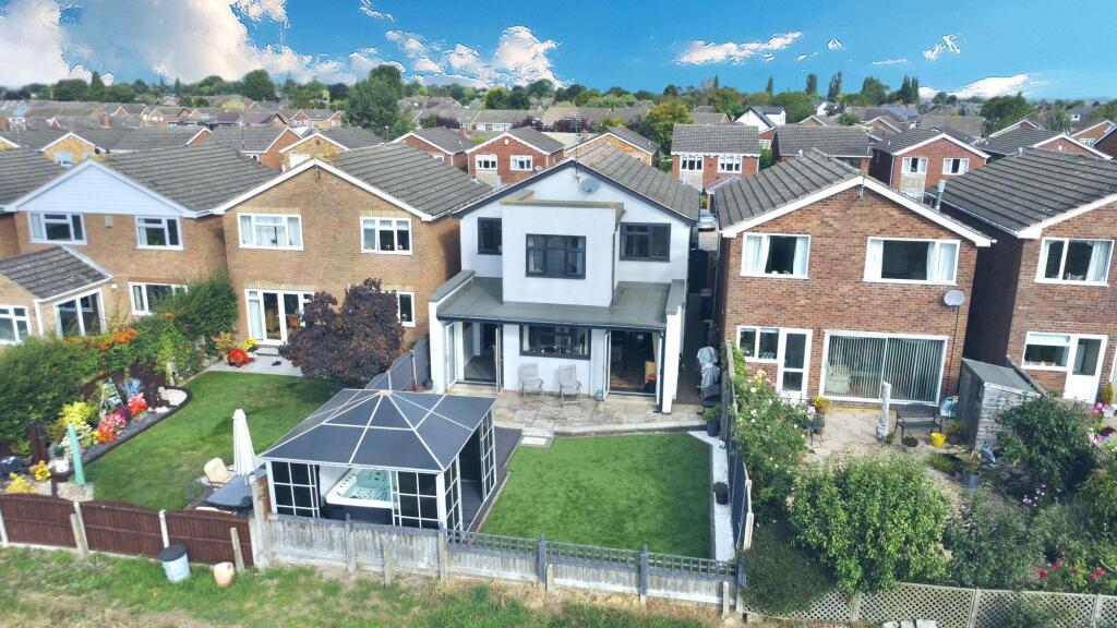
- modern suburban house
- detached
- garage
- driveway
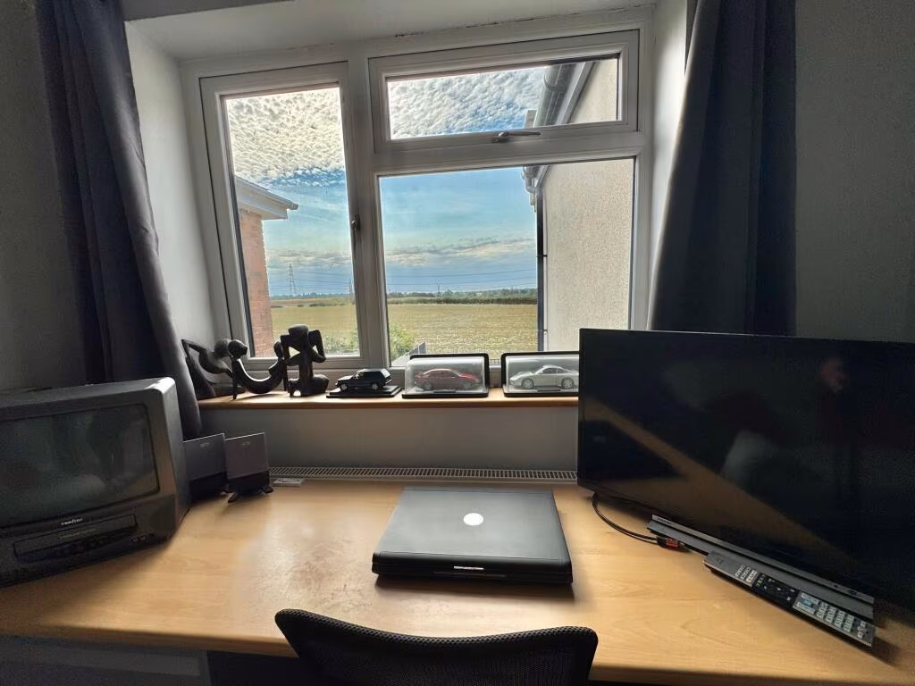
- double glazed windows
- well-maintained
- contemporary
- modern garden
- deck area
- artificial grass
- countryside view
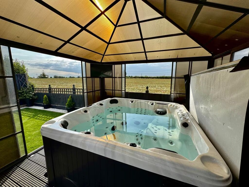
- covered hot tub
- fenced garden
Nearby Schools
- Chetwynd Junior School
- Middlemarch School
- St Nicolas CofE Academy
- Higham Lane School
- Milby Primary School
- Nicholas Chamberlaine School
- Race Leys Infant School
- Race Leys Junior School
- Whitestone Infant School
- Chilvers Coton Community Infant School
- Abbey CofE Infant School
- Higham-on-the-Hill Church of England Primary School
- St Michael's Church of England Academy
- George Eliot Academy
- All Saints CofE Primary School and Nursery, Nuneaton
- Wembrook Primary School
- Our Lady & St. Joseph Catholic Academy
- The Canons C of E Primary School
- St Thomas More Catholic School and Sixth Form College
- Etone College
- Westfield Infant School
- Weddington Primary School
- All Saints Bedworth CofE Academy
- St James' CofE Academy
- Arden Forest Infant School
- St Francis Catholic Academy
Nearest Bars And Restaurants
- Id: 5389527409
- Tags:
- Amenity: pub
- Name: The Bull and Spice (PH)
- TagsNormalized:
- Lat: 52.5133889
- Lon: -1.4574559
- FullGeoHash: gcqfwzf8wv4n
- PartitionGeoHash: gcqf
- Images:
- FoodStandards: null
- Distance: 2411.6
,- Id: 260273993
- Tags:
- Amenity: pub
- Name: The Bull Inn
- TagsNormalized:
- Lat: 52.5134376
- Lon: -1.4573469
- FullGeoHash: gcqfwzfbcq73
- PartitionGeoHash: gcqf
- Images:
- FoodStandards: null
- Distance: 2408.8
,- Id: 7333785512
- Tags:
- Amenity: pub
- Name: The Crows Nest
- TagsNormalized:
- Lat: 52.5142121
- Lon: -1.4457695
- FullGeoHash: gcqfxpgjrnsj
- PartitionGeoHash: gcqf
- Images:
- FoodStandards: null
- Distance: 1902.6
,- Id: 1193258009
- Tags:
- TagsNormalized:
- Lat: 52.5142784
- Lon: -1.4452412
- FullGeoHash: gcqfxpgtg7n0
- PartitionGeoHash: gcqf
- Images:
- FoodStandards: null
- Distance: 1886.9
,- Id: 260184534
- Tags:
- Amenity: pub
- Building: yes
- Name: The Corner House
- TagsNormalized:
- Lat: 52.4957291
- Lon: -1.4332159
- FullGeoHash: gcqfxks3g9hv
- PartitionGeoHash: gcqf
- Images:
- FoodStandards: null
- Distance: 631.2
}
Nearest General Shops
- Id: 422164830
- Tags:
- Addr:
- City: Bulkington
- Postcode: CV12 9JB
- Street: School Road
- Building: yes
- Name: Graylands
- Shop: car
- Source: Warwicks CC Aerial Imagery 2013
- Website: https://www.graylandsltd.co.uk/
- TagsNormalized:
- Lat: 52.4765676
- Lon: -1.4233551
- FullGeoHash: gcqfx95d1mjw
- PartitionGeoHash: gcqf
- Images:
- FoodStandards: null
- Distance: 2702.7
,- Id: 5389527403
- Tags:
- Name: W. Smith and Sons
- Shop: funeral_directors
- TagsNormalized:
- funeral
- funeral directors
- shop
- Lat: 52.51334
- Lon: -1.4597561
- FullGeoHash: gcqfwzc03hnf
- PartitionGeoHash: gcqf
- Images:
- FoodStandards: null
- Distance: 2536.3
,- Id: 695644911
- Tags:
- Addr:
- City: Nuneaton
- Housename: Gorse Farm
- Postcode: CV11 6QL
- Street: Lutterworth Road
- Building: yes
- Name: The Cowshed Butchery at Gorse Farm Shop
- Opening_hours: Mo off; Tu 06:00-16:00; We 06:00-17:00; Th-Sa 09:00-17:00; Su 09:30-14:30
- Phone: 07516 937824
- Shop: farm
- Website: https://gorsefarmshop.wixsite.com/thecowshedbutchery
- TagsNormalized:
- Lat: 52.5003138
- Lon: -1.4168833
- FullGeoHash: gcqfxv2k2pz4
- PartitionGeoHash: gcqf
- Images:
- FoodStandards: null
- Distance: 794.3
}
Nearest Grocery shops
- Id: 2700623584
- Tags:
- TagsNormalized:
- Lat: 52.5061033
- Lon: -1.4357224
- FullGeoHash: gcqfxq6w1ppf
- PartitionGeoHash: gcqf
- Images:
- FoodStandards: null
- Distance: 773.4
,- Id: 1193261526
- Tags:
- TagsNormalized:
- Lat: 52.5060343
- Lon: -1.4354038
- FullGeoHash: gcqfxq6vbdjq
- PartitionGeoHash: gcqf
- Images:
- FoodStandards: null
- Distance: 754.1
,- Id: 1193263424
- Tags:
- TagsNormalized:
- Lat: 52.5050769
- Lon: -1.4345982
- FullGeoHash: gcqfxq725rwp
- PartitionGeoHash: gcqf
- Images:
- FoodStandards: null
- Distance: 636.9
}
Nearest Religious buildings
- Id: 232205665
- Tags:
- Amenity: place_of_worship
- Building: church
- Denomination: anglican
- Heritage: 2
- Heritage:operator: Historic England
- Listed_status: Grade II*
- Name: St Botolph
- Religion: christian
- Source: bing
- Wikidata: Q17550783
- TagsNormalized:
- place of worship
- church
- anglican
- christian
- Lat: 52.5055354
- Lon: -1.3976137
- FullGeoHash: gcr48nq6cjpw
- PartitionGeoHash: gcr4
- Images:
- FoodStandards: null
- Distance: 2166.4
,- Id: 662077240
- Tags:
- Amenity: place_of_worship
- Building: church
- Denomination: roman catholic
- Name: Our Lady Of The Sacred Heart
- Religion: christian
- Source: Warwicks CC Aerial Imagery 2013
- TagsNormalized:
- place of worship
- church
- catholic
- roman catholic
- christian
- Lat: 52.4816909
- Lon: -1.4336126
- FullGeoHash: gcqfx6h042kb
- PartitionGeoHash: gcqf
- Images:
- FoodStandards: null
- Distance: 2136.7
,- Id: 557939860
- Tags:
- Amenity: place_of_worship
- Building: chapel
- Religion: christian
- Source: Bing aerial imagery
- TagsNormalized:
- place of worship
- chapel
- christian
- church
- Lat: 52.5115536
- Lon: -1.4495798
- FullGeoHash: gcqfxp2myr4f
- PartitionGeoHash: gcqf
- Images:
- FoodStandards: null
- Distance: 1866.1
}
Nearest Medical buildings
- Id: 557958710
- Tags:
- Addr:
- City: Nuneaton
- Housenumber: 41
- Postcode: CV11 4LE
- Street: Lutterworth Road
- Amenity: dentist
- Building: yes
- Healthcare: dentist
- Name: Whitestone Family Dental Surgery
- TagsNormalized:
- dentist
- health
- healthcare
- dental
- surgery
- Lat: 52.5116412
- Lon: -1.4513806
- FullGeoHash: gcqfwzrnkrkj
- PartitionGeoHash: gcqf
- Images:
- FoodStandards: null
- Distance: 1966.4
,- Id: 1193259149
- Tags:
- Amenity: pharmacy
- Brand: Lloyds Pharmacy
- Brand:wikidata: Q6662870
- Brand:wikipedia: en:LloydsPharmacy
- Healthcare: pharmacy
- Name: Lloyds Pharmacy
- TagsNormalized:
- pharmacy
- lloyds pharmacy
- health
- healthcare
- Lat: 52.5140955
- Lon: -1.4446833
- FullGeoHash: gcqfxpuhb2yj
- PartitionGeoHash: gcqf
- Images:
- FoodStandards: null
- Distance: 1848.1
,- Id: 1014919360
- Tags:
- Amenity: clinic
- Building: yes
- Name: The Lodge, Bramcote
- Operator: NHS
- TagsNormalized:
- Lat: 52.4982362
- Lon: -1.4072254
- FullGeoHash: gcqfxvp23k89
- PartitionGeoHash: gcqf
- Images:
- FoodStandards: null
- Distance: 1472
,- Id: 1193261321
- Tags:
- Amenity: pharmacy
- Brand: Lloyds Pharmacy
- Brand:wikidata: Q6662870
- Brand:wikipedia: en:LloydsPharmacy
- Healthcare: pharmacy
- Name: Lloyds Pharmacy
- TagsNormalized:
- pharmacy
- lloyds pharmacy
- health
- healthcare
- Lat: 52.5060645
- Lon: -1.4355666
- FullGeoHash: gcqfxq6tuzgf
- PartitionGeoHash: gcqf
- Images:
- FoodStandards: null
- Distance: 763.5
}
Nearest Airports
- Id: 2437117
- Tags:
- Aerodrome: international
- Aerodrome:type: public
- Aeroway: aerodrome
- Ele: 104
- Iata: BHX
- Icao: EGBB
- Internet_access: wlan
- Is_in: Birmingham,England,UK
- Name: Birmingham Airport
- Ref: BHX
- Type: multipolygon
- Website: https://www.birminghamairport.co.uk/
- Wikidata: Q8719
- Wikipedia: en:Birmingham Airport
- TagsNormalized:
- airport
- international airport
- Lat: 52.4543817
- Lon: -1.7468974
- FullGeoHash: gcqf2jpbym6y
- PartitionGeoHash: gcqf
- Images:
- FoodStandards: null
- Distance: 22162.5
}
Nearest Leisure Facilities
- Id: 656559329
- Tags:
- Leisure: pitch
- Source: Warwicks CC Aerial Imagery 2013
- Sport: soccer
- TagsNormalized:
- Lat: 52.5047253
- Lon: -1.4403717
- FullGeoHash: gcqfxnpnhyjn
- PartitionGeoHash: gcqf
- Images:
- FoodStandards: null
- Distance: 915.8
,- Id: 656559185
- Tags:
- Leisure: garden
- Source: Warwicks CC Aerial Imagery 2013
- TagsNormalized:
- Lat: 52.5070868
- Lon: -1.432415
- FullGeoHash: gcqfxqsgyq3v
- PartitionGeoHash: gcqf
- Images:
- FoodStandards: null
- Distance: 759.5
,- Id: 232313924
- Tags:
- Landuse: meadow
- Source: bing
- Sport: equestrian
- TagsNormalized:
- Lat: 52.4960868
- Lon: -1.4359936
- FullGeoHash: gcqfxkd7fgve
- PartitionGeoHash: gcqf
- Images:
- FoodStandards: null
- Distance: 713.6
,- Id: 701397023
- Tags:
- Leisure: park
- Source: Warwicks CC Aerial Imagery 2013
- TagsNormalized:
- Lat: 52.504451
- Lon: -1.4279605
- FullGeoHash: gcqfxw0hw553
- PartitionGeoHash: gcqf
- Images:
- FoodStandards: null
- Distance: 423.5
,- Id: 231195035
- Tags:
- Landuse: meadow
- Source: bing
- Sport: equestrian
- TagsNormalized:
- Lat: 52.5012169
- Lon: -1.4241368
- FullGeoHash: gcqfxtdcz0nt
- PartitionGeoHash: gcqf
- Images:
- FoodStandards: null
- Distance: 308.5
}
Nearest Tourist attractions
- Id: 4791466023
- Tags:
- Name: Manor Court Care Home
- Name:en: Manor Court Care Home
- Tourism: hostel
- TagsNormalized:
- Lat: 52.525423
- Lon: -1.4786984
- FullGeoHash: gcqfy3gnzbd8
- PartitionGeoHash: gcqf
- Images:
- FoodStandards: null
- Distance: 4367.2
,- Id: 148117471
- Tags:
- Building: yes
- Name: Nuneaton Museum and Art Gallery
- Source: survey; Bing
- Tourism: museum
- Wikidata: Q7069802
- TagsNormalized:
- Lat: 52.5202243
- Lon: -1.4660584
- FullGeoHash: gcqfy9h2qr7t
- PartitionGeoHash: gcqf
- Images:
- FoodStandards: null
- Distance: 3340.1
,- Id: 218616482
- Tags:
- Name: Griff Caravan Site
- Tourism: caravan_site
- TagsNormalized:
- Lat: 52.5005371
- Lon: -1.4696575
- FullGeoHash: gcqfwt3vf3ry
- PartitionGeoHash: gcqf
- Images:
- FoodStandards: null
- Distance: 2779
}
Nearest Hotels
- Id: 186437565
- Tags:
- Brand: Holiday Inn Express
- Brand:wikidata: Q5880423
- Brand:wikipedia: en:Holiday Inn Express
- Building: yes
- Name: Holiday Inn Express
- Toilets:
- Tourism: hotel
- Wheelchair: yes
- Wheelchair:description: Fully accessible, there's four restaurants within easy wheeling distance, however, you have to follow the pathway
- TagsNormalized:
- Lat: 52.496958
- Lon: -1.4767645
- FullGeoHash: gcqfwku8uyk8
- PartitionGeoHash: gcqf
- Images:
- FoodStandards: null
- Distance: 3286.1
,- Id: 463491876
- Tags:
- Brand: Travelodge
- Brand:wikidata: Q9361374
- Brand:wikipedia: en:Travelodge UK
- Building: yes
- Internet_access: wlan
- Internet_access:fee: customers
- Internet_access:ssid: Travelodge WiFi
- Name: Travelodge
- Tourism: hotel
- TagsNormalized:
- Lat: 52.5086334
- Lon: -1.4741625
- FullGeoHash: gcqfwqyscw8y
- PartitionGeoHash: gcqf
- Images:
- FoodStandards: null
- Distance: 3208.5
,- Id: 222275101
- Tags:
- Name: Weston Hall Hotel
- Tourism: hotel
- TagsNormalized:
- Lat: 52.4825206
- Lon: -1.4338067
- FullGeoHash: gcqfx65uvfuj
- PartitionGeoHash: gcqf
- Images:
- FoodStandards: null
- Distance: 2047.8
}
Tags
- modern suburban house
- detached
- garage
- driveway
- double glazed windows
- well-maintained
- contemporary
- modern garden
- deck area
- artificial grass
- countryside view
- covered hot tub
- fenced garden
Local Market Stats
- Average Price/sqft: £262
- Avg Income: £44100
- Rental Yield: 3.7%
- Social Housing: 8%
- Planning Success Rate: 92%
Similar Properties
 4 bedroom detached house for sale in Axminster Close, Nuneaton, CV11 — £425,000 • 4 bed • 2 bath • 1671 ft²
 4 bedroom detached house for sale in Chaytor Drive, The Shires, Nuneaton, CV10 — £325,000 • 4 bed • 2 bath • 1511 ft²
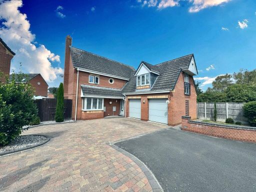 4 bedroom detached house for sale in Orchid Close, Bedworth, CV12 — £499,950 • 4 bed • 2 bath • 1661 ft²
 4 bedroom detached house for sale in Bucks Hill, Nuneaton, Warwickshire, CV10 — £230,000 • 4 bed • 1 bath • 1264 ft²
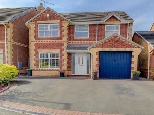 4 bedroom detached house for sale in Cliveden Walk, Maple Park, Nuneaton, CV11 — £385,000 • 4 bed • 2 bath • 891 ft²
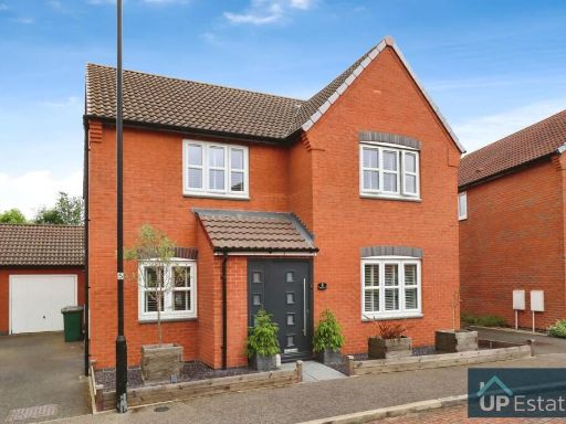 4 bedroom detached house for sale in Old Farm Lane, Coventry, CV6 — £475,000 • 4 bed • 3 bath • 1723 ft²
Meta
- {
"@context": "https://schema.org",
"@type": "Residence",
"name": "4 bedroom detached house for sale in Chetwynd Drive, Nuneat…",
"description": "",
"url": "https://propertypiper.co.uk/property/82e3ddb9-b2bb-4642-80af-358052a42ae4",
"image": "https://image-a.propertypiper.co.uk/bbcdb0f2-f221-4db3-ba86-9d5a5cea75b3-1024.jpeg",
"address": {
"@type": "PostalAddress",
"streetAddress": "21 21 Chetwynd Drive, Nuneaton, CV11",
"postalCode": "CV11 4TJ",
"addressLocality": "Nuneaton and Bedworth",
"addressRegion": "Nuneaton",
"addressCountry": "England"
},
"geo": {
"@type": "GeoCoordinates",
"latitude": 52.5006627,
"longitude": -1.4286029
},
"numberOfRooms": 4,
"numberOfBathroomsTotal": 2,
"floorSize": {
"@type": "QuantitativeValue",
"value": 1359,
"unitCode": "FTK"
},
"offers": {
"@type": "Offer",
"price": 399950,
"priceCurrency": "GBP",
"availability": "https://schema.org/InStock"
},
"additionalProperty": [
{
"@type": "PropertyValue",
"name": "Feature",
"value": "modern suburban house"
},
{
"@type": "PropertyValue",
"name": "Feature",
"value": "detached"
},
{
"@type": "PropertyValue",
"name": "Feature",
"value": "garage"
},
{
"@type": "PropertyValue",
"name": "Feature",
"value": "driveway"
},
{
"@type": "PropertyValue",
"name": "Feature",
"value": "double glazed windows"
},
{
"@type": "PropertyValue",
"name": "Feature",
"value": "well-maintained"
},
{
"@type": "PropertyValue",
"name": "Feature",
"value": "contemporary"
},
{
"@type": "PropertyValue",
"name": "Feature",
"value": "modern garden"
},
{
"@type": "PropertyValue",
"name": "Feature",
"value": "deck area"
},
{
"@type": "PropertyValue",
"name": "Feature",
"value": "artificial grass"
},
{
"@type": "PropertyValue",
"name": "Feature",
"value": "countryside view"
},
{
"@type": "PropertyValue",
"name": "Feature",
"value": "covered hot tub"
},
{
"@type": "PropertyValue",
"name": "Feature",
"value": "fenced garden"
}
]
}
High Res Floorplan Images
Compatible Floorplan Images
FloorplanImages Thumbnail