B28 0PB - 2 bedroom semidetached house for sale in Chilcote Close, Bi…
View on Property Piper
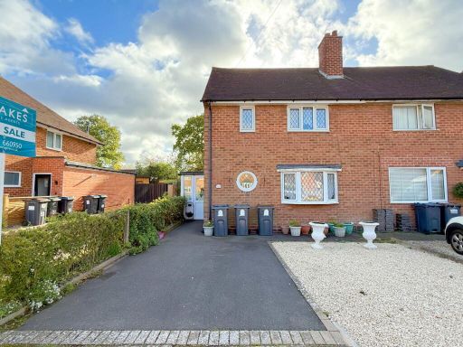
2 bedroom semi-detached house for sale in Chilcote Close, Birmingham, B28
Property Details
- Price: £250000
- Bedrooms: 2
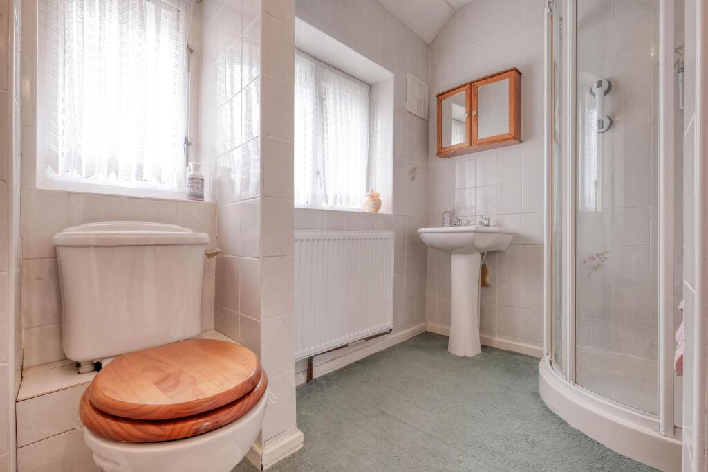
- Bathrooms: 1
- Property Type: undefined
- Property SubType: undefined
Image Descriptions
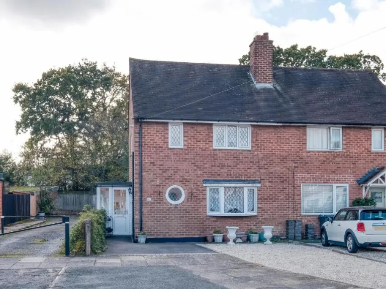
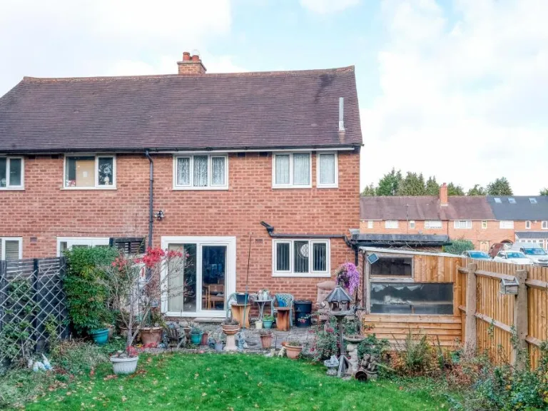
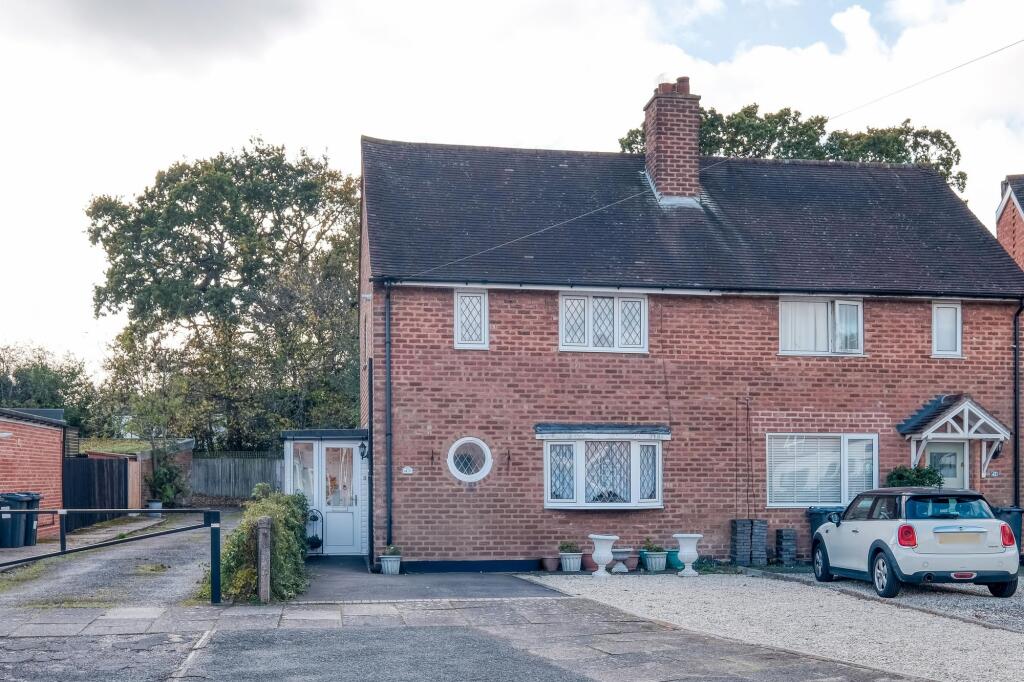
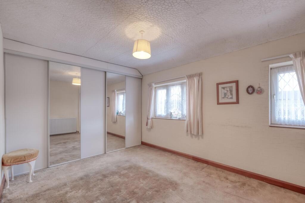
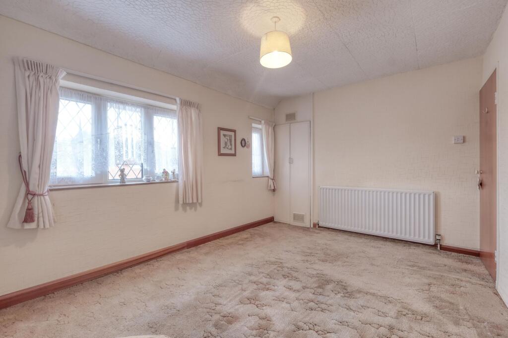
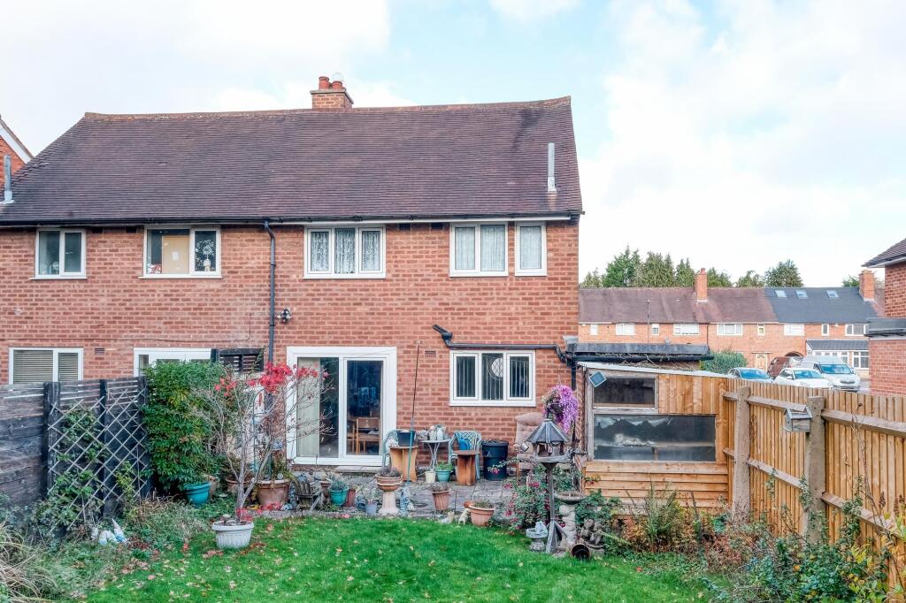
- Semi-detached brick house 20th Century suburban
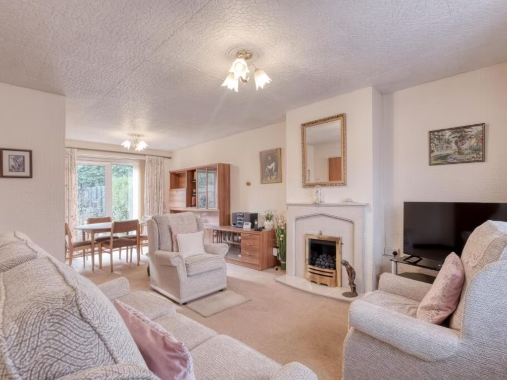
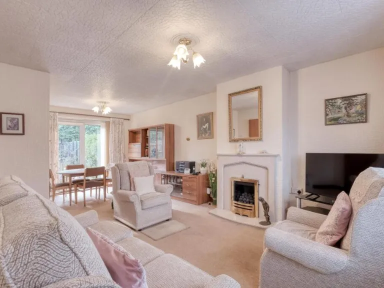
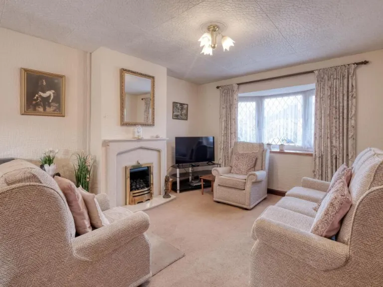
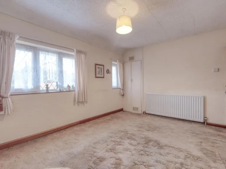
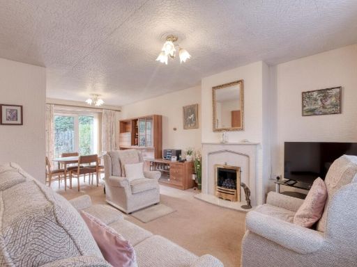
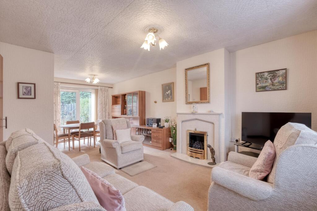
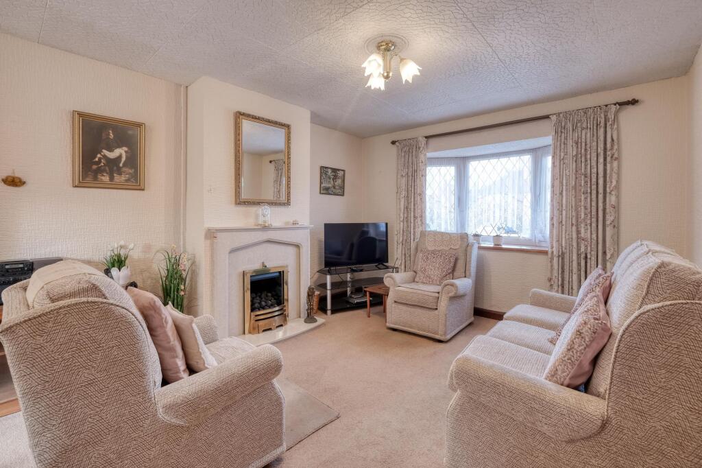
- living room Mid-20th Century
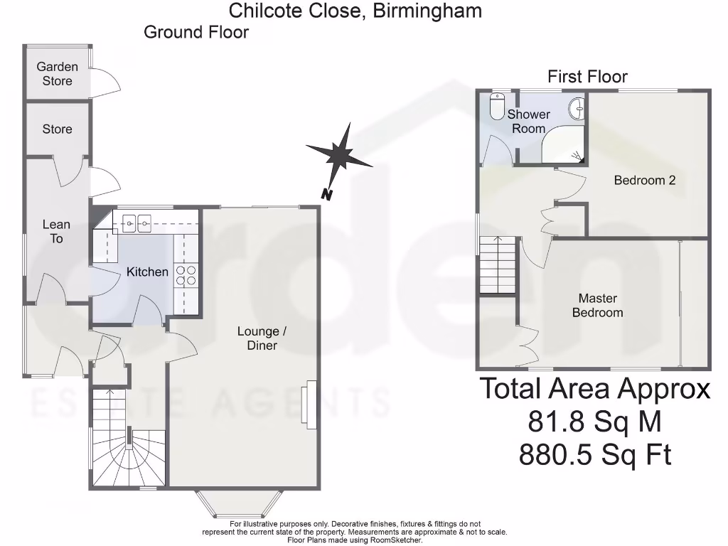
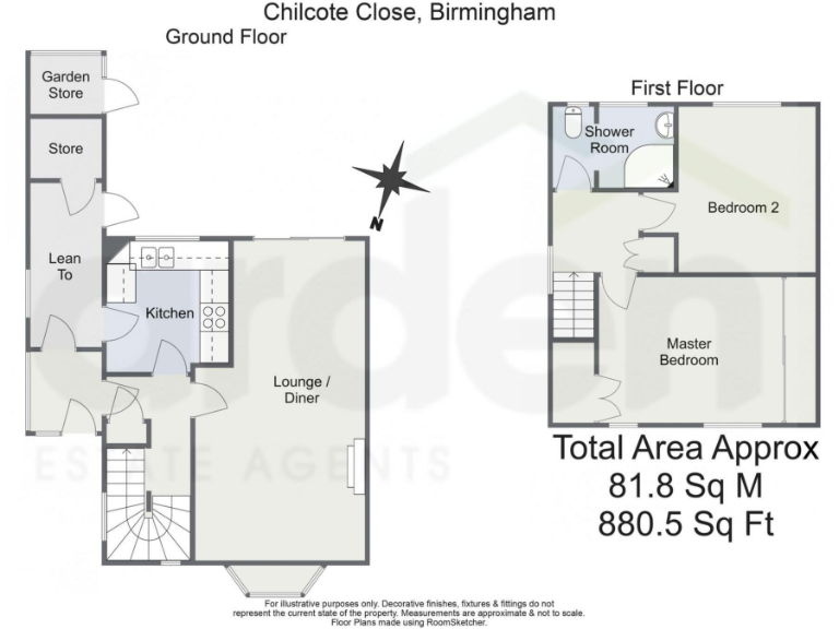
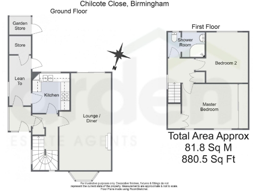
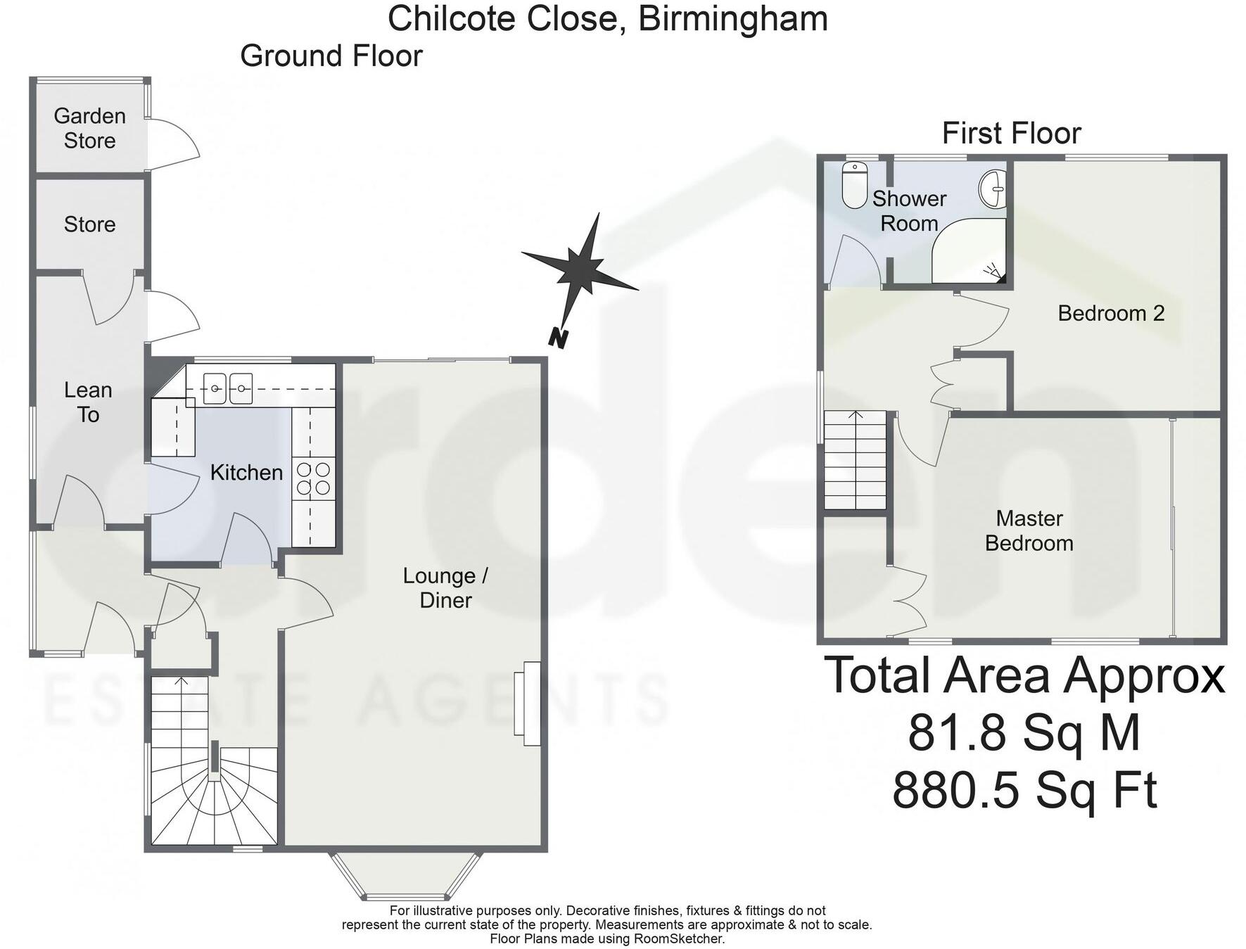
Floorplan Description
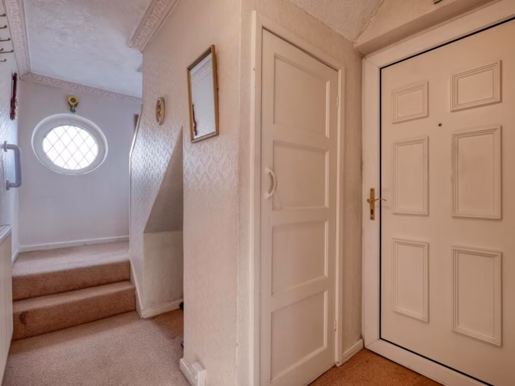
- Two-storey residential property with kitchen, lounge/diner, two bedrooms and shower room.
Rooms
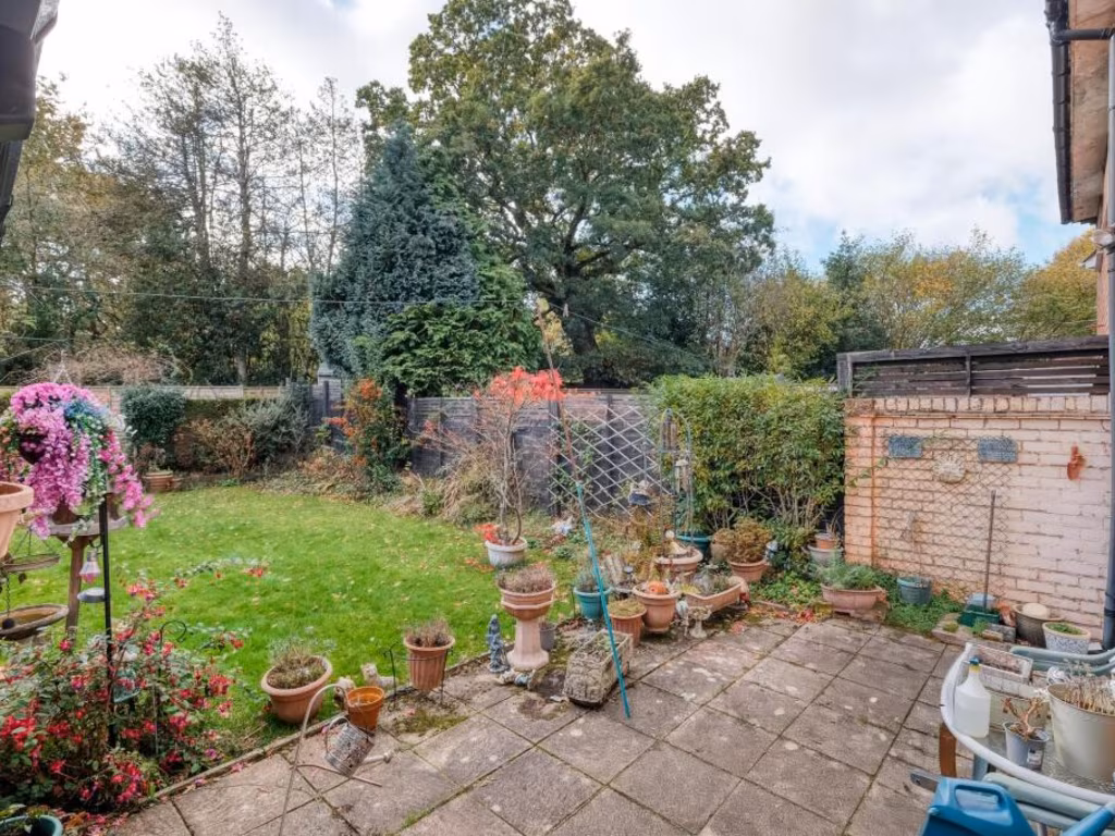
- Garden Store:
- Store:
- Lean To:
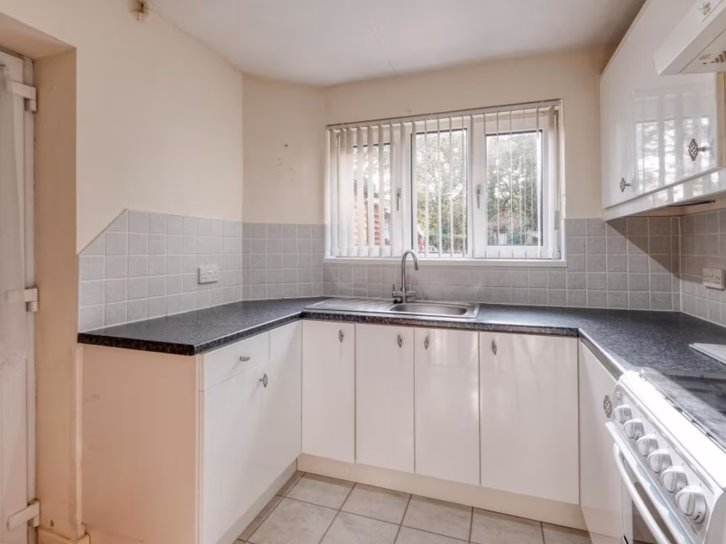
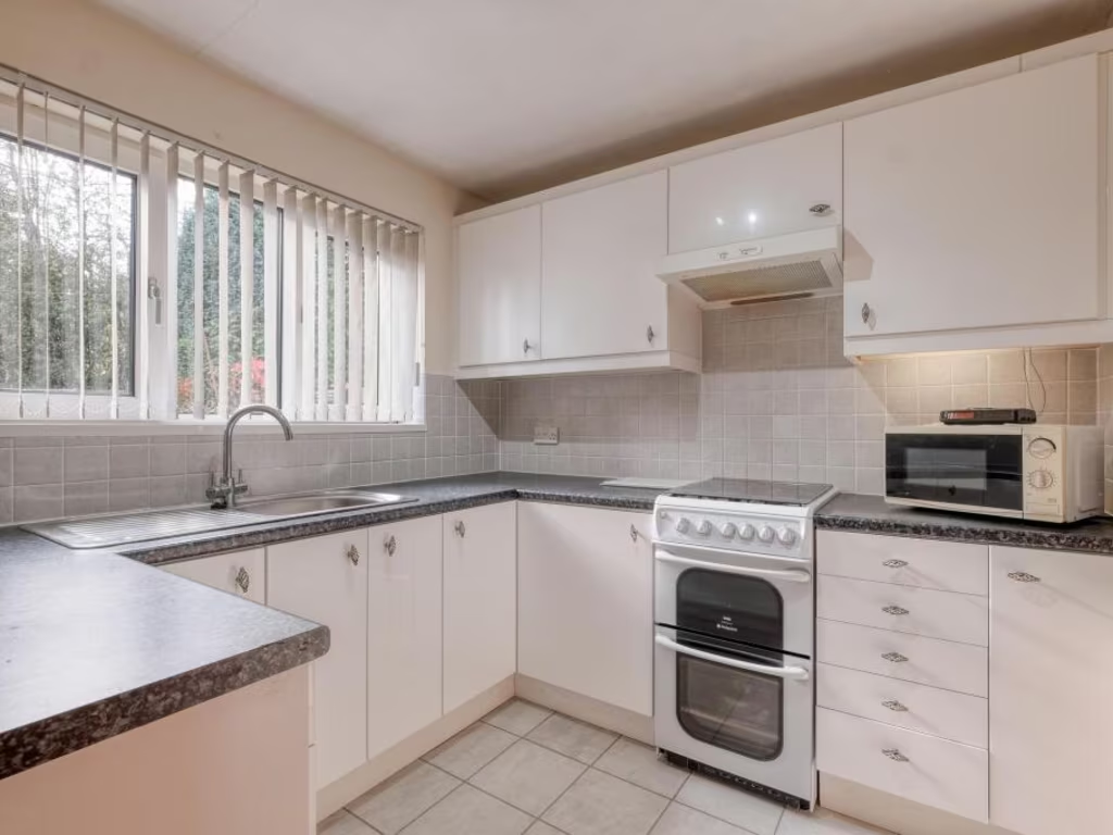
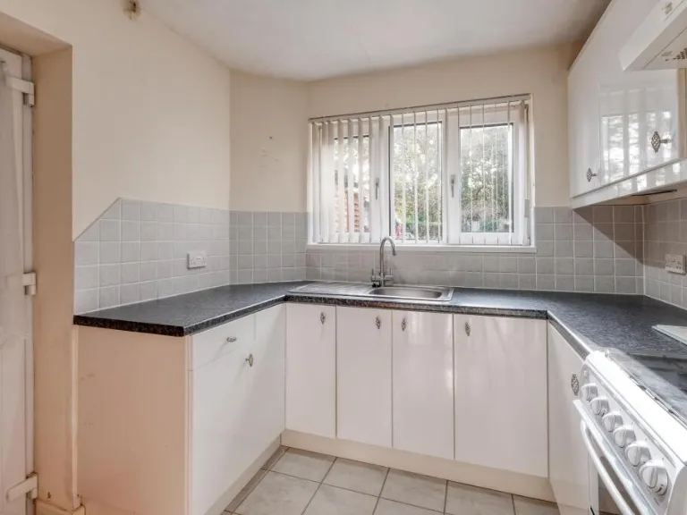
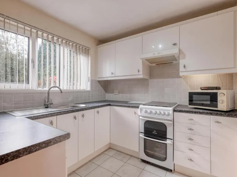
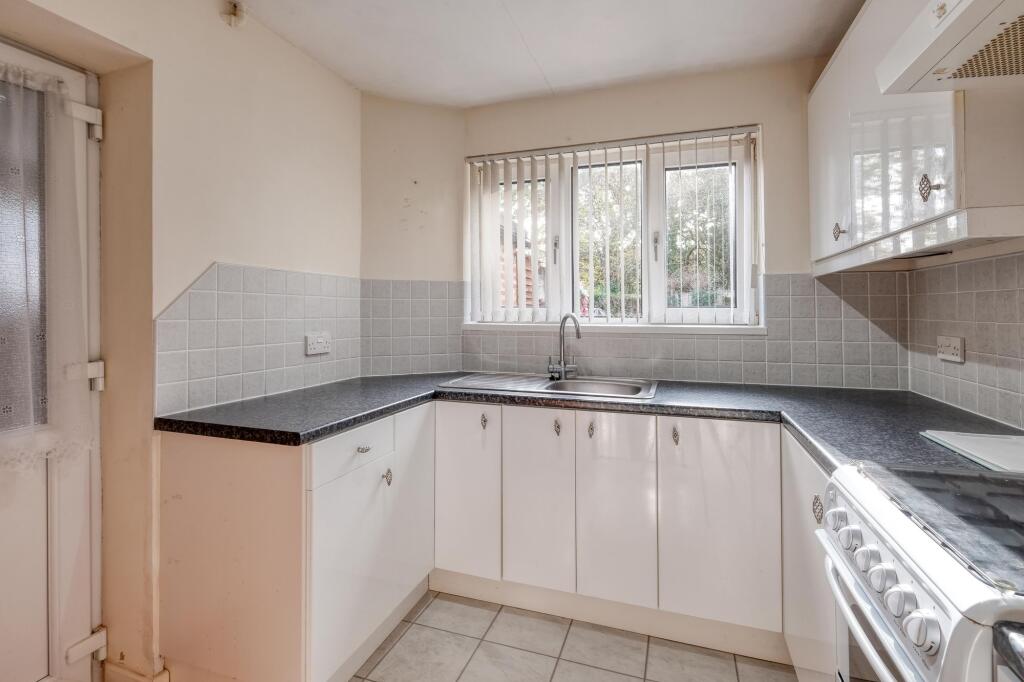
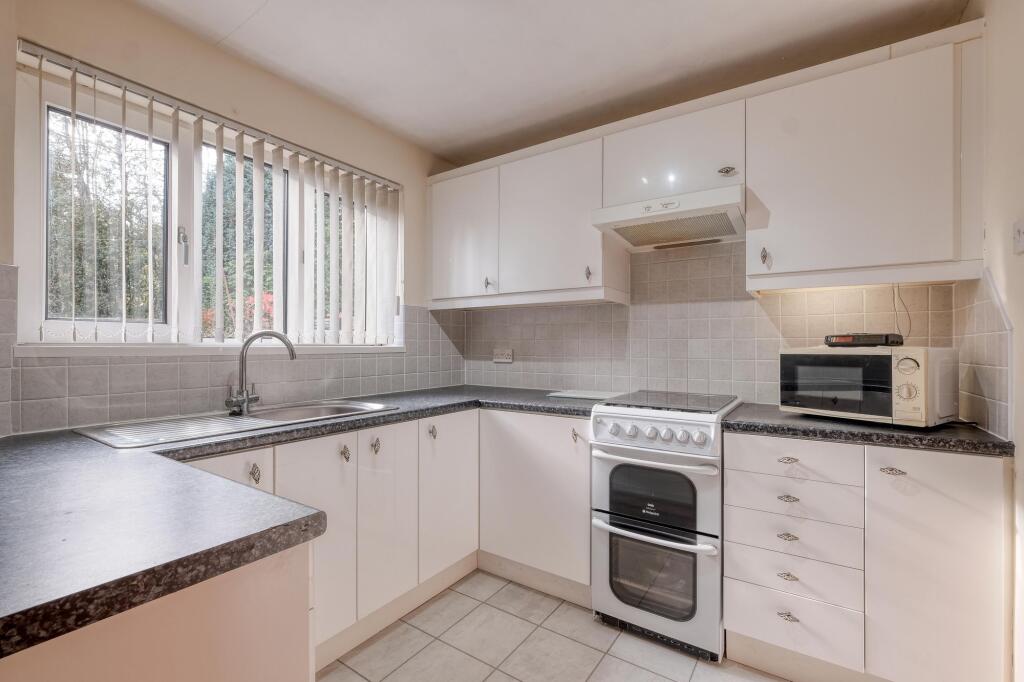
- Kitchen:
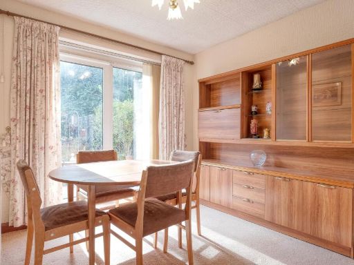
- Lounge / Diner:
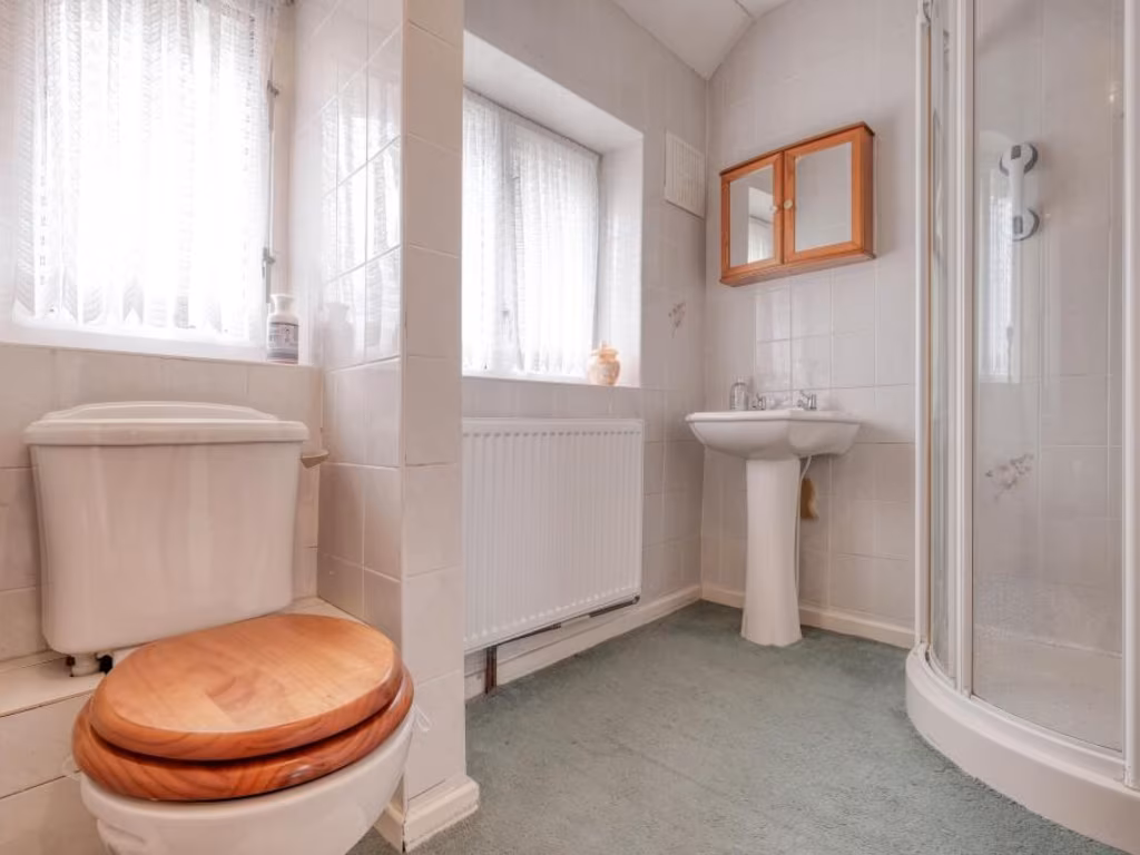
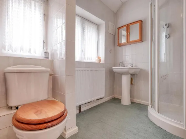
- Shower Room:
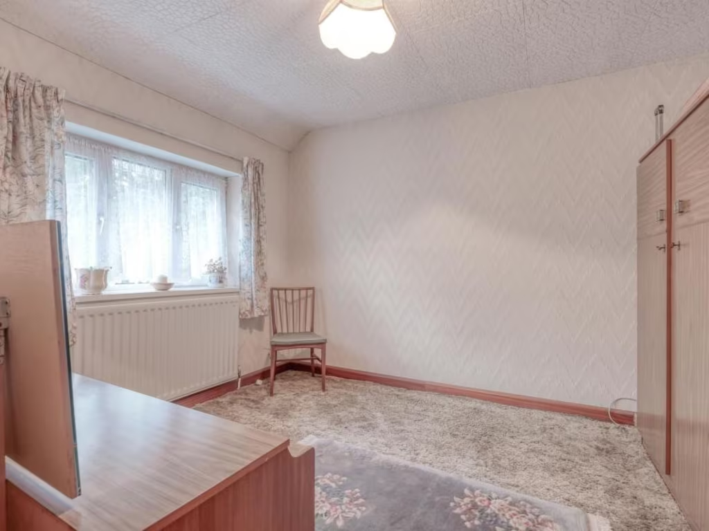
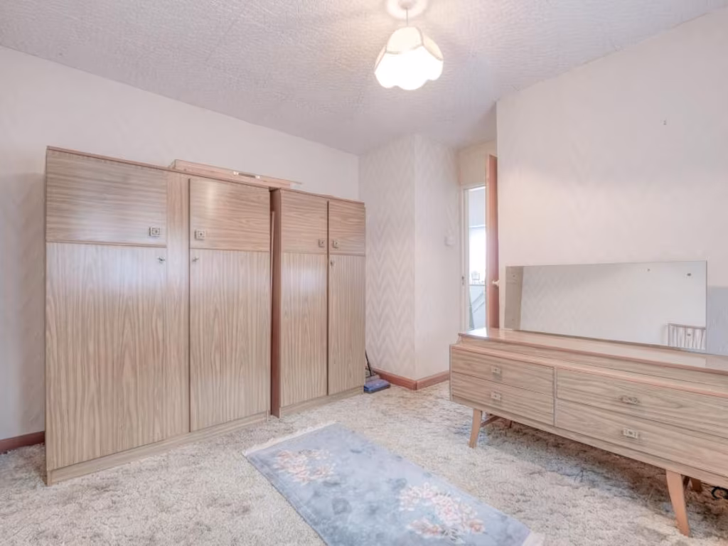
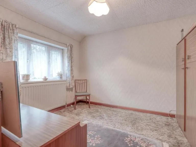
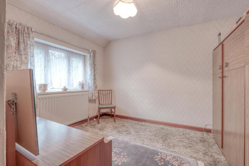
- Bedroom 2:
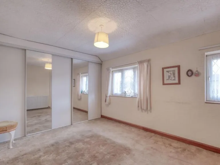
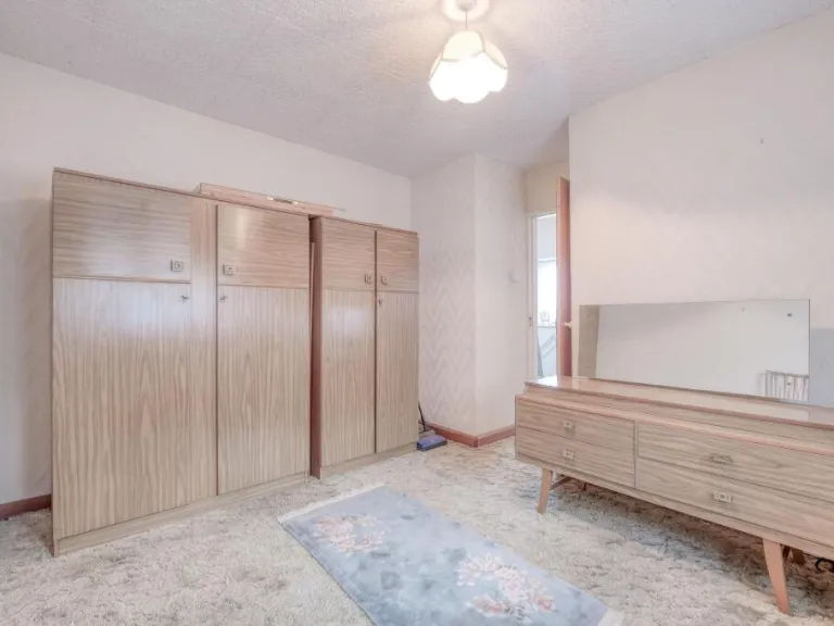
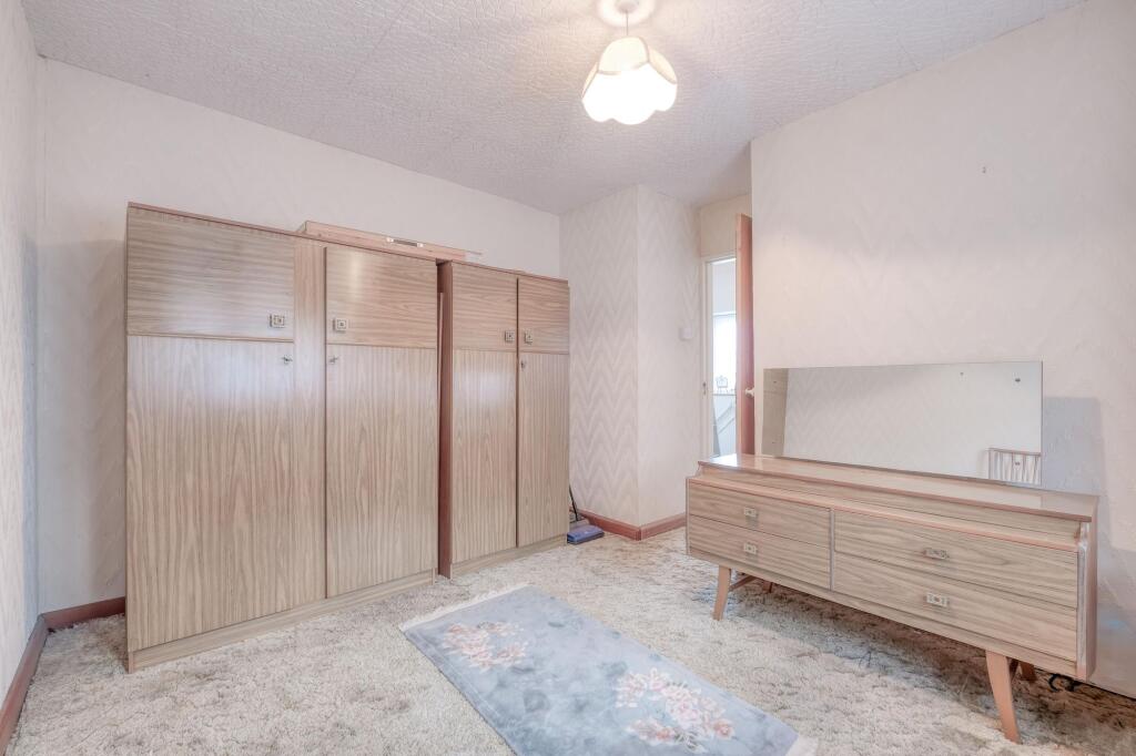
- Master Bedroom:
Textual Property Features
Detected Visual Features
- semi-detached
- brick
- two-story
- suburban
- chimney
- gable roof
- garage
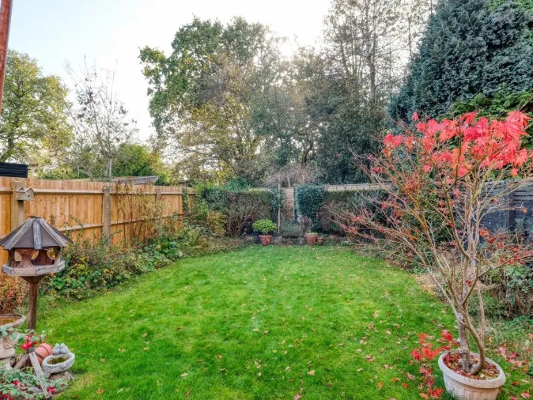
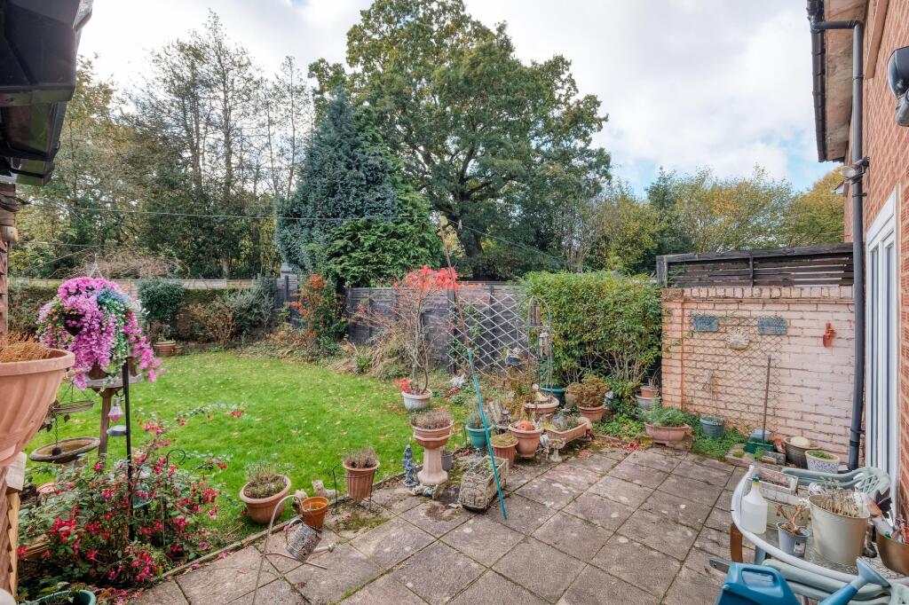
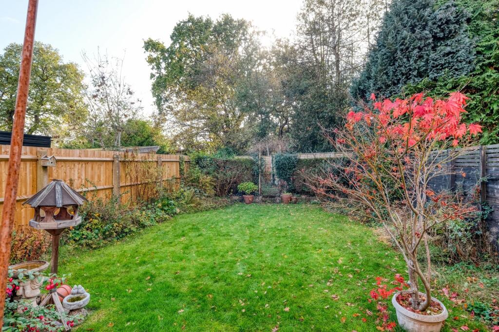
- garden
- 20th century
- gravel driveway
- living room
- Mid-20th Century
- fireplace
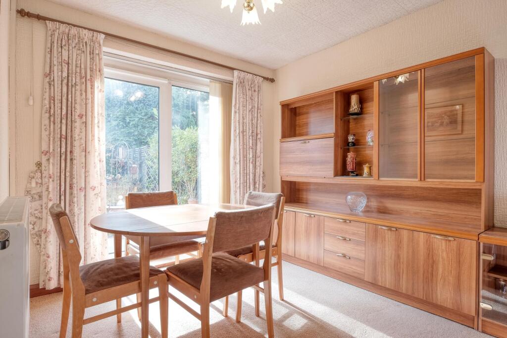
- dining area
- textured ceiling
- neutral colors
- outdated
- natural light
Nearby Schools
- Christ Church, Church of England Secondary Academy
- Yardley Wood Community Primary School
- St Ambrose Barlow Catholic Primary School
- Hall Green Infant School
- Lakey Lane Primary School
- Ninestiles, an Academy
- Peterbrook Primary School
- Burman Infant School
- Highters Heath Community School
- Haslucks Green School
- Chilcote Primary School
- Our Lady of Lourdes Catholic Primary School
- Severne Junior Infant and Nursery School
- Dickens Heath Community Primary School
- Woodlands Infant School
- Light Hall School
- Kingswood School
- Tudor Grange Primary Academy, St James
- Blossomfield Infant and Nursery School
- Streetsbrook Infant and Early Years Academy
- Robin Hood Academy
- Hall Green Junior School
- Hall Green School
- Mill Lodge Primary School
- Billesley Primary School
- Aspire Ap School
- St Bernard's Catholic Primary School
- Yorkmead Junior and Infant School
Nearest General Shops
- Id: 9494827719
- Tags:
- Name: Collar & Tie
- Shop: pet_grooming
- TagsNormalized:
- Lat: 52.4141613
- Lon: -1.8448716
- FullGeoHash: gcqdnj8we7u4
- PartitionGeoHash: gcqd
- Images:
- FoodStandards: null
- Distance: 223.8
,- Id: 9494827722
- Tags:
- Shop: vacant
- Source: survey
- TagsNormalized:
- Lat: 52.4141686
- Lon: -1.8446785
- FullGeoHash: gcqdnj8wxvhn
- PartitionGeoHash: gcqd
- Images:
- FoodStandards: null
- Distance: 223.8
,- Id: 101959833
- Tags:
- Addr:
- City: Birmingham
- Country: GB
- Housenumber: 247-251
- Postcode: B28 0XA
- Street: Baldwins Lane
- Building: retail
- Fhrs:
- Name: Baldwins Supermarket
- Shop: supermarket
- Source: bing
- TagsNormalized:
- Lat: 52.4146238
- Lon: -1.8448959
- FullGeoHash: gcqdnjb96f1c
- PartitionGeoHash: gcqd
- Images:
- FoodStandards:
- Id: 997259
- FHRSID: 997259
- LocalAuthorityBusinessID: PI/000534685
- BusinessName: Baldwins Supermarket
- BusinessType: Retailers - other
- BusinessTypeID: 4613
- AddressLine1: 247-251 Baldwins Lane
- AddressLine2: Birmingham
- AddressLine3: null
- AddressLine4: null
- PostCode: B28 0XA
- RatingValue: 3
- RatingKey: fhrs_3_en-GB
- RatingDate: 2018-11-23
- LocalAuthorityCode: 402
- LocalAuthorityName: Birmingham
- LocalAuthorityWebSite: http://www.birmingham.gov.uk/environmental-health
- LocalAuthorityEmailAddress: Admin.EH@birmingham.gov.uk
- Scores:
- Hygiene: 5
- Structural: 10
- ConfidenceInManagement: 10
- NewRatingPending: false
- Geocode:
- Longitude: -1.84430205821991
- Latitude: 52.41451263427730
- Distance: 172.3
}
Nearest Grocery shops
- Id: 509322577
- Tags:
- Brand: Tesco Express
- Brand:wikidata: Q98456772
- Contact:
- Website: https://www.tesco.com/store-locator/birmingham/200-robin-hood-ln
- Name: Tesco Express
- Shop: convenience
- Source: survey
- TagsNormalized:
- tesco
- tesco express
- convenience
- shop
- Lat: 52.4240412
- Lon: -1.8483456
- FullGeoHash: gcqdjzw04mtd
- PartitionGeoHash: gcqd
- Images:
- FoodStandards: null
- Distance: 904
,- Id: 848715905
- Tags:
- Addr:
- City: Solihull
- Housenumber: 122
- Postcode: B90 2EH
- Street: Haslucks Green Road
- Fhrs:
- Name: The Co-operative Food
- Shop: supermarket
- Source: survey
- TagsNormalized:
- the co-operative food
- food
- shop
- Lat: 52.4113271
- Lon: -1.8352624
- FullGeoHash: gcqdnjpw5790
- PartitionGeoHash: gcqd
- Images:
- FoodStandards: null
- Distance: 852.1
,- Id: 101959869
- Tags:
- Addr:
- City: Birmingham
- Housenumber: 316-320
- Postcode: B28 0RB
- Street: Baldwins Lane
- Brand: Londis
- Brand:wikidata: Q21008564
- Building: retail
- Name: Londis
- Shop: convenience
- Source: bing
- TagsNormalized:
- londis
- retail
- convenience
- shop
- Lat: 52.4141309
- Lon: -1.8461824
- FullGeoHash: gcqdjvxwky4t
- PartitionGeoHash: gcqd
- Images:
- FoodStandards: null
- Distance: 240.8
}
Nearest Supermarkets
- Id: 311927586
- Tags:
- Brand: ALDI
- Brand:wikidata: Q41171672
- Brand:wikipedia: en:Aldi
- Building: retail
- Contact:
- Website: https://stores.aldi.co.uk/hall-green/stratford-road
- Name: ALDI
- Shop: supermarket
- Source: visual survey;estimate
- TagsNormalized:
- aldi
- retail
- supermarket
- shop
- Lat: 52.4270709
- Lon: -1.8406313
- FullGeoHash: gcqdq059y4mg
- PartitionGeoHash: gcqd
- Images:
- FoodStandards: null
- Distance: 1247.5
,- Id: 257931195
- Tags:
- Addr:
- City: Solihull
- Country: GB
- Housename: Parkgate
- Postcode: B90 3GG
- Street: Stratford Road
- Alt_name: ASDA Shirley Superstore
- Brand: Asda
- Brand:wikidata: Q297410
- Brand:wikipedia: en:Asda
- Building: retail
- Contact:
- Facebook: https://www.facebook.com/asda/
- Twitter: @asda
- Website: https://storelocator.asda.com/west-midlands/solihull/parkgate-stratford-road-shirley
- Fhrs:
- Name: Asda
- Operator: Asda Stores Ltd
- Shop: supermarket
- Source: visual survey;estimate
- Wheelchair: yes
- TagsNormalized:
- asda
- retail
- supermarket
- shop
- Lat: 52.4132099
- Lon: -1.8297516
- FullGeoHash: gcqdnme95dqr
- PartitionGeoHash: gcqd
- Images:
- FoodStandards: null
- Distance: 1085.1
,- Id: 64440274
- Tags:
- Addr:
- City: Solihull
- Postcode: B90 3LU
- Street: Stratford Road
- Brand: Tesco
- Brand:wikidata: Q487494
- Brand:wikipedia: en:Tesco
- Building: retail
- Contact:
- Website: https://www.tesco.com/store-locator/solihull/21-35-stratford-rd
- Name: Tesco
- Opening_hours: 24/7
- Shop: supermarket
- Source: visual survey;OS_OpenData_StreetView
- TagsNormalized:
- tesco
- retail
- supermarket
- shop
- Lat: 52.4194399
- Lon: -1.8311407
- FullGeoHash: gcqdnqdt77fd
- PartitionGeoHash: gcqd
- Images:
- FoodStandards: null
- Distance: 1007.4
}
Nearest Religious buildings
- Id: 100893530
- Tags:
- Amenity: place_of_worship
- Building: yes
- Name: Yardley Wood Full Gospel Church
- Religion: christian
- Source: bing
- TagsNormalized:
- place of worship
- church
- wood
- christian
- Lat: 52.411163
- Lon: -1.8533471
- FullGeoHash: gcqdjv4mjuuj
- PartitionGeoHash: gcqd
- Images:
- FoodStandards: null
- Distance: 794.4
,- Id: 103044268
- Tags:
- Amenity: place_of_worship
- Building: yes
- Name: Trinity United Reform Church
- Religion: christian
- Source: bing
- TagsNormalized:
- place of worship
- church
- christian
- Lat: 52.4228526
- Lon: -1.8481512
- FullGeoHash: gcqdjzq1qbn8
- PartitionGeoHash: gcqd
- Images:
- FoodStandards: null
- Distance: 773
,- Id: 100896701
- Tags:
- Addr:
- City: Birmingham
- Postcode: B28 0TB
- Street: Priory Road
- Amenity: place_of_worship
- Building: yes
- Heritage: 2
- Heritage:operator: Historic England
- Listed_status: Grade II
- Name: Haven Church
- Previous_name: Dog and Partridge (pub)
- Religion: christian
- Source: visual survey;bing;Birmingham City Council
- TagsNormalized:
- place of worship
- church
- christian
- Lat: 52.4145642
- Lon: -1.855977
- FullGeoHash: gcqdjvb8bwgn
- PartitionGeoHash: gcqd
- Images:
- FoodStandards: null
- Distance: 765.9
}
Nearest Medical buildings
- Id: 64156759
- Tags:
- Addr:
- City: Birmingham
- Housenumber: 1491
- Postcode: B28 9HT
- Street: Stratford Road
- Amenity: dentist
- Building: yes
- Healthcare: dentist
- Source: bing
- TagsNormalized:
- Lat: 52.4223905
- Lon: -1.8379323
- FullGeoHash: gcqdnpjwt1f7
- PartitionGeoHash: gcqd
- Images:
- FoodStandards: null
- Distance: 841.2
,- Id: 793166477
- Tags:
- Amenity: pharmacy
- Healthcare: pharmacy
- Name: Jhoots
- Source: survey
- TagsNormalized:
- Lat: 52.421523
- Lon: -1.8366652
- FullGeoHash: gcqdnpn9d85j
- PartitionGeoHash: gcqd
- Images:
- FoodStandards: null
- Distance: 820.5
,- Id: 277202516
- Tags:
- Amenity: pharmacy
- Healthcare: pharmacy
- Name: Newborough Pharmacy
- Source: survey
- TagsNormalized:
- Lat: 52.4141571
- Lon: -1.8444156
- FullGeoHash: gcqdnj8yw501
- PartitionGeoHash: gcqd
- Images:
- FoodStandards: null
- Distance: 227.5
,- Id: 101959880
- Tags:
- Amenity: doctors
- Building: yes
- Name: Surgery
- Source: bing
- TagsNormalized:
- Lat: 52.414521
- Lon: -1.8459987
- FullGeoHash: gcqdjvzb9ngs
- PartitionGeoHash: gcqd
- Images:
- FoodStandards: null
- Distance: 195.8
}
Nearest Airports
- Id: 2437117
- Tags:
- Aerodrome: international
- Aerodrome:type: public
- Aeroway: aerodrome
- Ele: 104
- Iata: BHX
- Icao: EGBB
- Internet_access: wlan
- Is_in: Birmingham,England,UK
- Name: Birmingham Airport
- Ref: BHX
- Type: multipolygon
- Website: https://www.birminghamairport.co.uk/
- Wikidata: Q8719
- Wikipedia: en:Birmingham Airport
- TagsNormalized:
- airport
- international airport
- Lat: 52.4543817
- Lon: -1.7468974
- FullGeoHash: gcqf2jpbym6y
- PartitionGeoHash: gcqf
- Images:
- FoodStandards: null
- Distance: 7891.5
}
Nearest Leisure Facilities
- Id: 663877840
- Tags:
- Leisure: park
- Source: bing
- TagsNormalized:
- Lat: 52.4137313
- Lon: -1.8357665
- FullGeoHash: gcqdnjxhpe9m
- PartitionGeoHash: gcqd
- Images:
- FoodStandards: null
- Distance: 682.3
,- Id: 1036281678
- Tags:
- Leisure: pitch
- Source: bing
- Sport: equestrian
- TagsNormalized:
- pitch
- leisure
- equestrian
- sports
- Lat: 52.4184572
- Lon: -1.8537354
- FullGeoHash: gcqdjy6psuds
- PartitionGeoHash: gcqd
- Images:
- FoodStandards: null
- Distance: 644.8
,- Id: 709824051
- Tags:
- Leisure: pitch
- Name: Baldwin Crown Green Bowling Club
- Sport: bowls
- TagsNormalized:
- pitch
- leisure
- bowling
- club
- bowls
- sports
- Lat: 52.41437
- Lon: -1.8419595
- FullGeoHash: gcqdnjdxz4xr
- PartitionGeoHash: gcqd
- Images:
- FoodStandards: null
- Distance: 287.4
,- Id: 911045318
- Tags:
- Access: private
- Leisure: pitch
- Operator: Chilcote Primary School
- TagsNormalized:
- Lat: 52.4162639
- Lon: -1.8434587
- FullGeoHash: gcqdnn1du7c9
- PartitionGeoHash: gcqd
- Images:
- FoodStandards: null
- Distance: 104.8
,- Id: 911045319
- Tags:
- Access: private
- Leisure: pitch
- Operator: Chilcote Primary School
- Sport: multi
- TagsNormalized:
- Lat: 52.4159061
- Lon: -1.8437843
- FullGeoHash: gcqdnn12u9ng
- PartitionGeoHash: gcqd
- Images:
- FoodStandards: null
- Distance: 87.4
}
Nearest Tourist attractions
- Id: 842386541
- Tags:
- Building: yes
- Tourism: guest_house
- TagsNormalized:
- Lat: 52.3926628
- Lon: -1.867161
- FullGeoHash: gcqdj9b37upz
- PartitionGeoHash: gcqd
- Images:
- FoodStandards: null
- Distance: 3015.7
,- Id: 80261946
- Tags:
- Addr:
- City: Birmingham
- Postcode: B13 0BD
- Street: Cole Bank Road
- Building: heritage
- Heritage: 2
- Heritage:operator: Historic England
- Listed_status: Grade II
- Name: Sarehole Mill
- Source: visual survey;OS_OpenData_StreetView
- Start_date: 1764..1768
- Tourism: museum
- Wikidata: Q82108
- Wikipedia: en:Sarehole Mill
- TagsNormalized:
- Lat: 52.4343307
- Lon: -1.8560248
- FullGeoHash: gcqdmc2kp7xw
- PartitionGeoHash: gcqd
- Images:
- FoodStandards: null
- Distance: 2153.2
,- Id: 101976924
- Tags:
- Addr:
- City: Birmingham
- Housenumber: 142
- Postcode: B28 0JX
- Street: Robin Hood Lane
- Building: yes
- Name: Kings Court Guesthouse
- Source: usr
- Tourism: guest_house
- TagsNormalized:
- Lat: 52.4227956
- Lon: -1.8454716
- FullGeoHash: gcqdnp20vmks
- PartitionGeoHash: gcqd
- Images:
- FoodStandards: null
- Distance: 737.2
}
Nearest Train stations
- Id: 8205906583
- Tags:
- Name: Spring Road
- Naptan:
- Network: National Rail
- Public_transport: station
- Railway: station
- Ref:
- Source: NPE; survey 2013
- West_midlands_fare_zone: 3
- Wikidata: Q2358217
- Wikipedia: en:Spring Road railway station
- TagsNormalized:
- Lat: 52.444262
- Lon: -1.8362585
- FullGeoHash: gcqdq5nvup42
- PartitionGeoHash: gcqd
- Images:
- FoodStandards: null
- Distance: 3179.1
,- Id: 31554745
- Tags:
- Name: Whitlocks End
- Naptan:
- Network: National Rail
- Public_transport: station
- Railway: station
- Ref:
- Source: NPE
- West_midlands_fare_zone: 4
- Wikidata: Q2133242
- Wikipedia: en:Whitlocks End railway station
- TagsNormalized:
- Lat: 52.3918816
- Lon: -1.8514322
- FullGeoHash: gcqdjceufd85
- PartitionGeoHash: gcqd
- Images:
- FoodStandards: null
- Distance: 2736.1
,- Id: 8367463939
- Tags:
- Name: Hall Green
- Naptan:
- Network: National Rail
- Public_transport: station
- Railway: station
- Ref:
- Source: NPE; survey 2013
- West_midlands_fare_zone: 3
- Wikidata: Q3543527
- Wikipedia: en:Hall Green railway station
- TagsNormalized:
- Lat: 52.4369843
- Lon: -1.8455704
- FullGeoHash: gcqdq1b5e46g
- PartitionGeoHash: gcqd
- Images:
- FoodStandards: null
- Distance: 2314.5
,- Id: 8485791831
- Tags:
- Name: Shirley
- Naptan:
- Network: National Rail
- Public_transport: station
- Railway: station
- Ref:
- Source: survey
- West_midlands_fare_zone: 4
- Wikidata: Q1815915
- Wikipedia: en:Shirley railway station (England)
- TagsNormalized:
- Lat: 52.4035742
- Lon: -1.8451962
- FullGeoHash: gcqdn5b2gy3b
- PartitionGeoHash: gcqd
- Images:
- FoodStandards: null
- Distance: 1400.9
,- Id: 9529770468
- Tags:
- Name: Yardley Wood
- Naptan:
- Network: National Rail
- Public_transport: station
- Railway: station
- Ref:
- Source: NPE
- West_midlands_fare_zone: 3
- Wikidata: Q2248035
- Wikipedia: en:Yardley Wood railway station
- TagsNormalized:
- Lat: 52.421023
- Lon: -1.8545598
- FullGeoHash: gcqdjycw9dgy
- PartitionGeoHash: gcqd
- Images:
- FoodStandards: null
- Distance: 843.5
}
Nearest Hotels
- Id: 261710812
- Tags:
- Brand: Premier Inn
- Brand:wikidata: Q2108626
- Brand:wikipedia: en:Premier Inn
- Building: yes
- Internet_access: wlan
- Internet_access:fee: customers
- Internet_access:operator: Virgin Media
- Internet_access:ssid: Premier Inn Free Wi-Fi
- Name: Premier Inn
- Source: OS_OpenData_StreetView
- Tourism: hotel
- TagsNormalized:
- Lat: 52.4118644
- Lon: -1.8276351
- FullGeoHash: gcqdnmm1jp8m
- PartitionGeoHash: gcqd
- Images:
- FoodStandards: null
- Distance: 1271.2
,- Id: 64156772
- Tags:
- Addr:
- City: Birmingham
- Country: GB
- Postcode: B28 9ES
- Street: Stratford Road
- Brand: Premier Inn
- Brand:wikidata: Q2108626
- Brand:wikipedia: en:Premier Inn
- Building: yes
- Fhrs:
- Internet_access: wlan
- Internet_access:fee: customers
- Internet_access:operator: Virgin Media
- Internet_access:ssid: Premier Inn Free Wi-Fi
- Name: Premier Inn Birmingham South (Hall Green)
- Tourism: hotel
- TagsNormalized:
- Lat: 52.4237498
- Lon: -1.8374152
- FullGeoHash: gcqdnpqn3p7b
- PartitionGeoHash: gcqd
- Images:
- FoodStandards: null
- Distance: 987
,- Id: 64156784
- Tags:
- Addr:
- City: Birmingham
- Country: GB
- Housenumber: 2
- Postcode: B28 9EY
- Street: Pembroke Croft
- Building: detached
- Fhrs:
- Name: The Corner House Hotel
- Source: bing
- Tourism: hotel
- TagsNormalized:
- Lat: 52.4211404
- Lon: -1.8344293
- FullGeoHash: gcqdnqbpq8y6
- PartitionGeoHash: gcqd
- Images:
- FoodStandards: null
- Distance: 904.8
}
Tags
- semi-detached
- brick
- two-story
- suburban
- chimney
- gable roof
- garage
- garden
- 20th century
- gravel driveway
- living room
- Mid-20th Century
- fireplace
- dining area
- textured ceiling
- neutral colors
- outdated
- natural light
Local Market Stats
- Average Price/sqft: £277
- Avg Income: £43700
- Rental Yield: 4.1%
- Social Housing: 8%
- Planning Success Rate: 85%
Similar Properties
 2 bedroom semi-detached house for sale in Chilcote Close, Hall Green, Birmingham, B28 0PB, B28 — £250,000 • 2 bed • 1 bath • 627 ft²
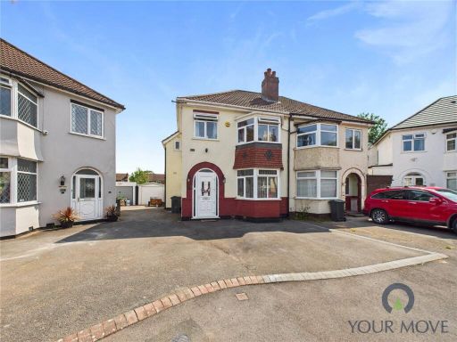 3 bedroom semi-detached house for sale in Fallowfield Avenue, Birmingham, West Midlands, B28 — £300,000 • 3 bed • 1 bath • 817 ft²
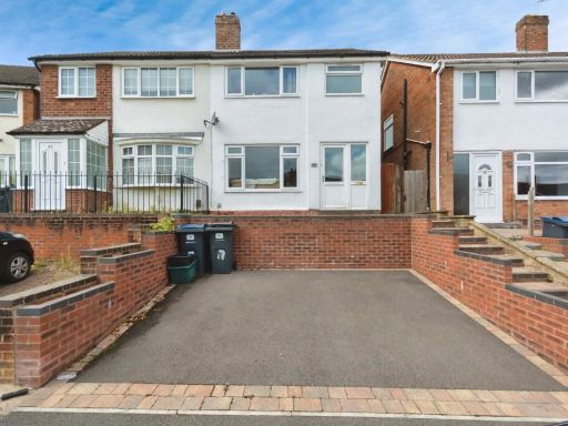 3 bedroom semi-detached house for sale in Wilson Croft, BIRMINGHAM, West Midlands, B28 — £240,000 • 3 bed • 1 bath • 813 ft²
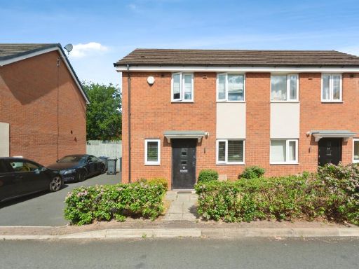 2 bedroom semi-detached house for sale in Welby Road, Birmingham, B28 — £255,000 • 2 bed • 1 bath • 625 ft²
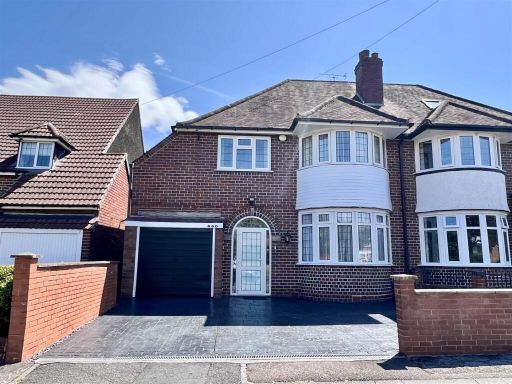 3 bedroom semi-detached house for sale in Fox Hollies Road, Hall Green, Birmingham, B28 — £420,000 • 3 bed • 1 bath • 1303 ft²
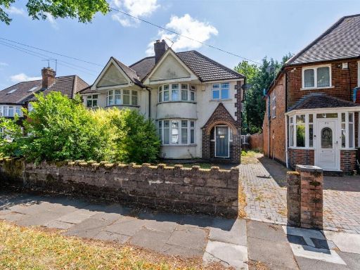 3 bedroom semi-detached house for sale in Woodford Green Road, Hall Green, Birmingham, B28 — £290,000 • 3 bed • 1 bath • 875 ft²
Meta
- {
"@context": "https://schema.org",
"@type": "Residence",
"name": "2 bedroom semidetached house for sale in Chilcote Close, Bi…",
"description": "",
"url": "https://propertypiper.co.uk/property/82b4e4a3-f81c-4474-95a9-d964b6d57a23",
"image": "https://image-a.propertypiper.co.uk/0d0d03b8-efab-4e1f-9544-09692a46c21d-1024.jpeg",
"address": {
"@type": "PostalAddress",
"streetAddress": "Chilcote Close, Birmingham",
"postalCode": "B28 0PB",
"addressLocality": "Birmingham",
"addressRegion": "Birmingham, Hall Green",
"addressCountry": "England"
},
"geo": {
"@type": "GeoCoordinates",
"latitude": 52.4161723,
"longitude": -1.8449961
},
"numberOfRooms": 2,
"numberOfBathroomsTotal": 1,
"floorSize": {
"@type": "QuantitativeValue",
"value": 880,
"unitCode": "FTK"
},
"offers": {
"@type": "Offer",
"price": 250000,
"priceCurrency": "GBP",
"availability": "https://schema.org/InStock"
},
"additionalProperty": [
{
"@type": "PropertyValue",
"name": "Feature",
"value": "semi-detached"
},
{
"@type": "PropertyValue",
"name": "Feature",
"value": "brick"
},
{
"@type": "PropertyValue",
"name": "Feature",
"value": "two-story"
},
{
"@type": "PropertyValue",
"name": "Feature",
"value": "suburban"
},
{
"@type": "PropertyValue",
"name": "Feature",
"value": "chimney"
},
{
"@type": "PropertyValue",
"name": "Feature",
"value": "gable roof"
},
{
"@type": "PropertyValue",
"name": "Feature",
"value": "garage"
},
{
"@type": "PropertyValue",
"name": "Feature",
"value": "garden"
},
{
"@type": "PropertyValue",
"name": "Feature",
"value": "20th century"
},
{
"@type": "PropertyValue",
"name": "Feature",
"value": "gravel driveway"
},
{
"@type": "PropertyValue",
"name": "Feature",
"value": "living room"
},
{
"@type": "PropertyValue",
"name": "Feature",
"value": "Mid-20th Century"
},
{
"@type": "PropertyValue",
"name": "Feature",
"value": "fireplace"
},
{
"@type": "PropertyValue",
"name": "Feature",
"value": "dining area"
},
{
"@type": "PropertyValue",
"name": "Feature",
"value": "textured ceiling"
},
{
"@type": "PropertyValue",
"name": "Feature",
"value": "neutral colors"
},
{
"@type": "PropertyValue",
"name": "Feature",
"value": "outdated"
},
{
"@type": "PropertyValue",
"name": "Feature",
"value": "natural light"
}
]
}
High Res Floorplan Images
Compatible Floorplan Images
FloorplanImages Thumbnail