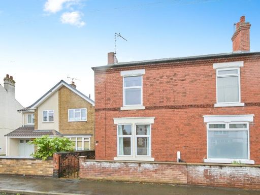
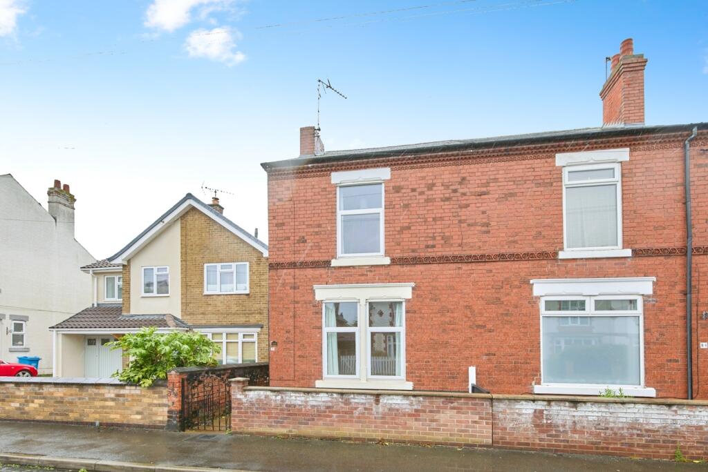
NG10 4FS - 3 bedroom semidetached house for sale in Curzon Street, Lon…
View on Property Piper
3 bedroom semi-detached house for sale in Curzon Street, Long Eaton, Nottingham, Derbyshire, NG10
Property Details
- Price: £200000
- Bedrooms: 3
- Bathrooms: 1
- Property Type: undefined
- Property SubType: undefined
Image Descriptions
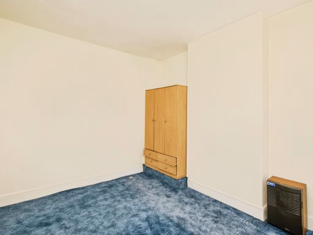
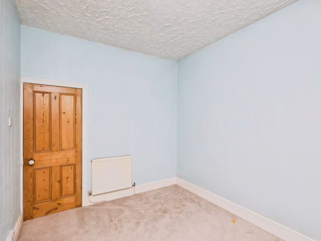
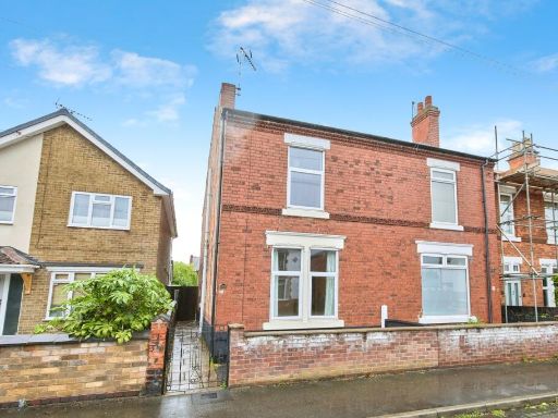
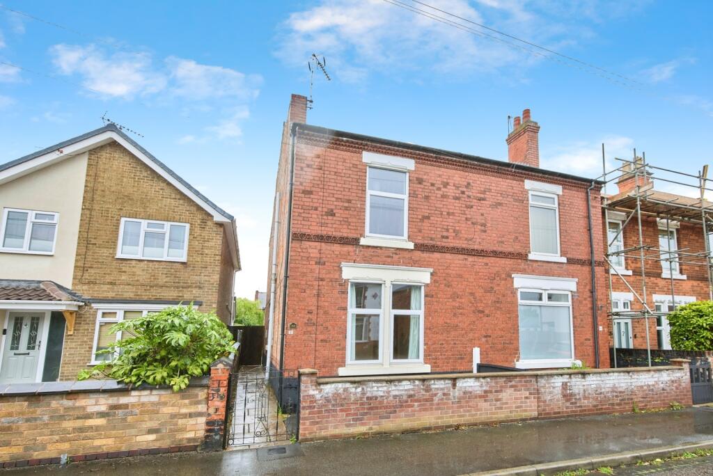
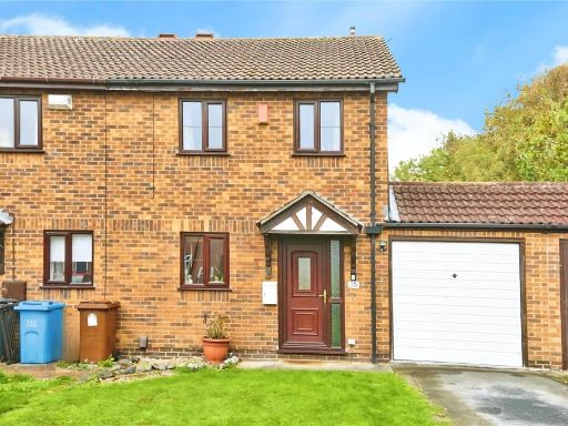
- Victorian semi-detached house Victorian
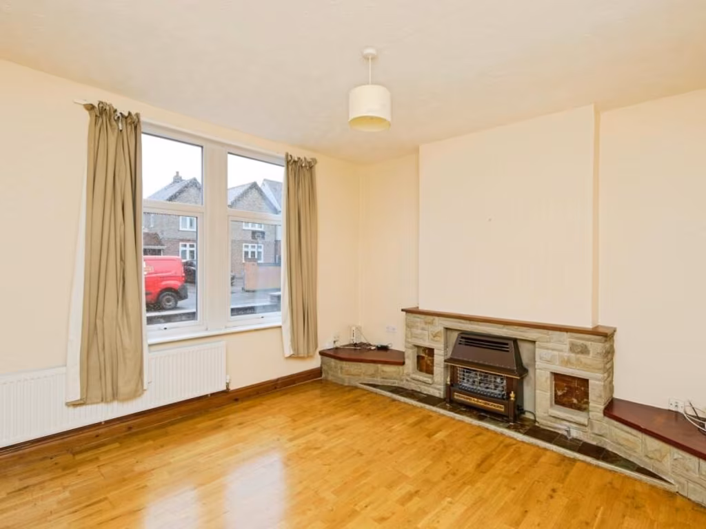
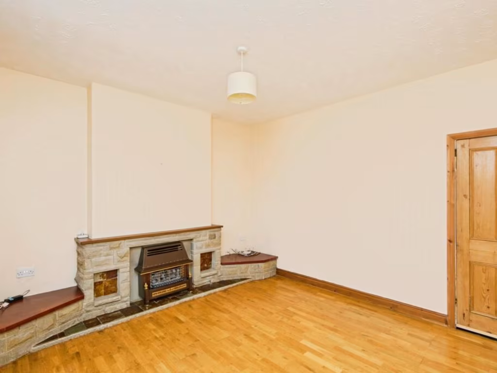
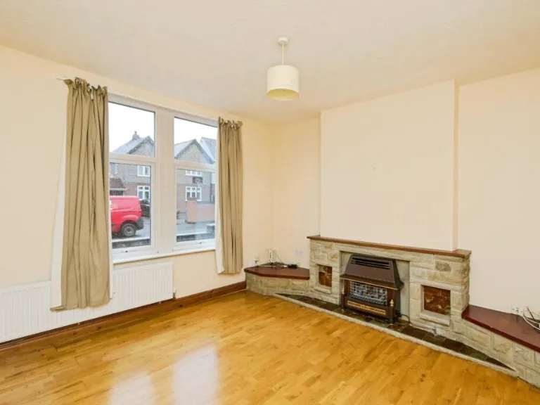
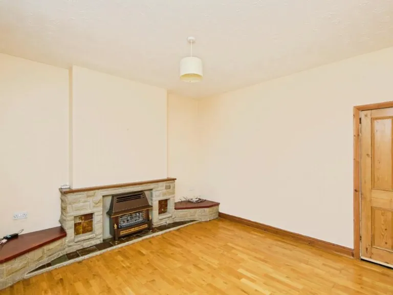
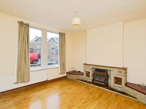
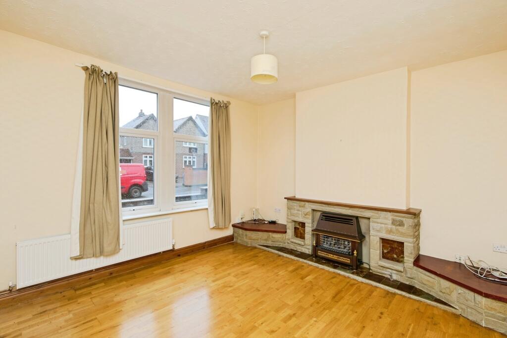
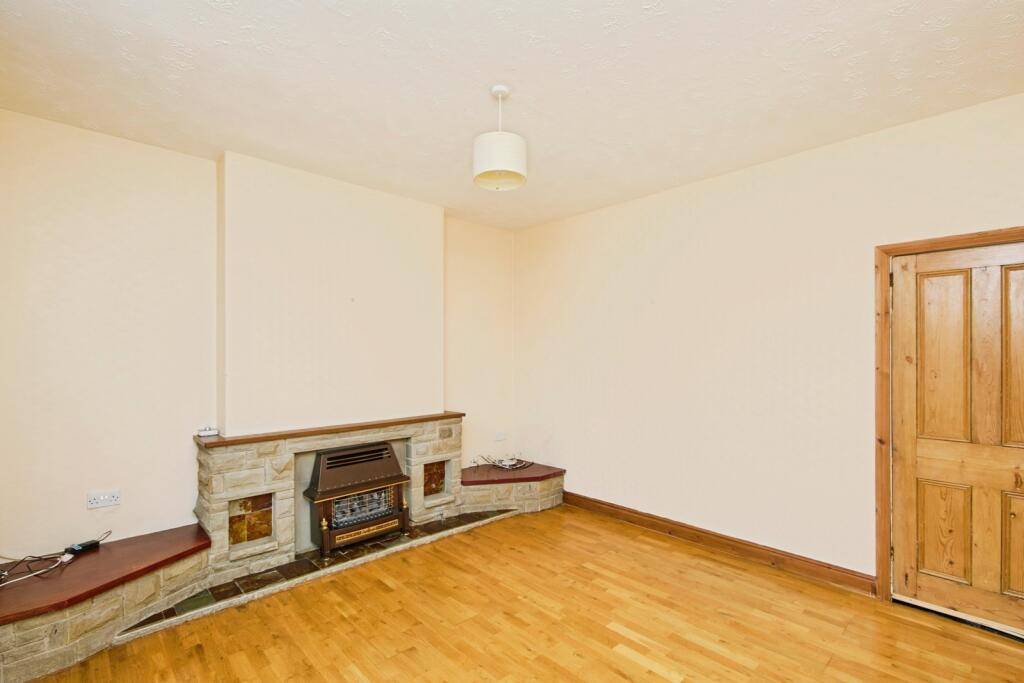
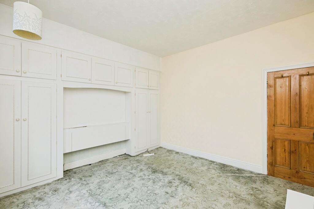
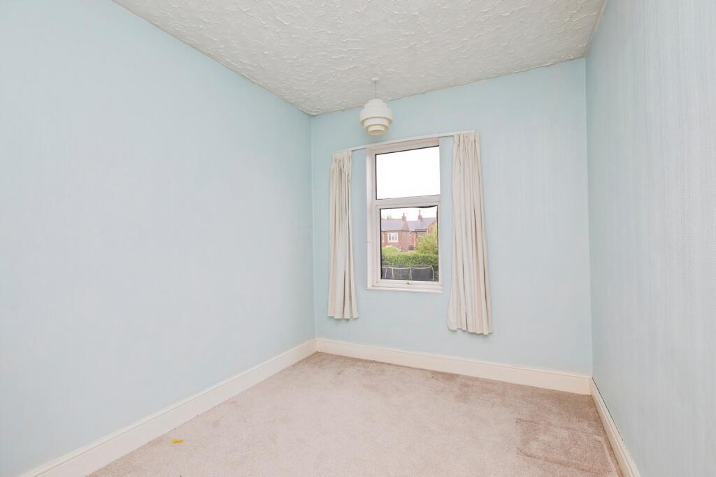
- living room Post-war
Floorplan Description
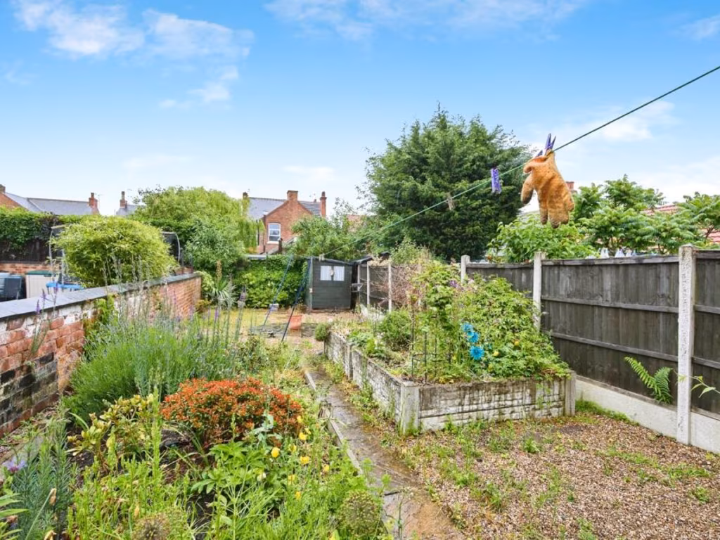
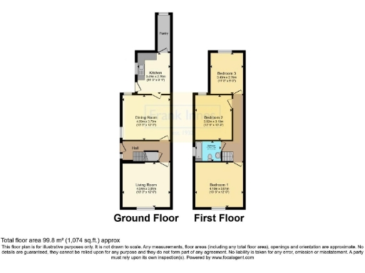
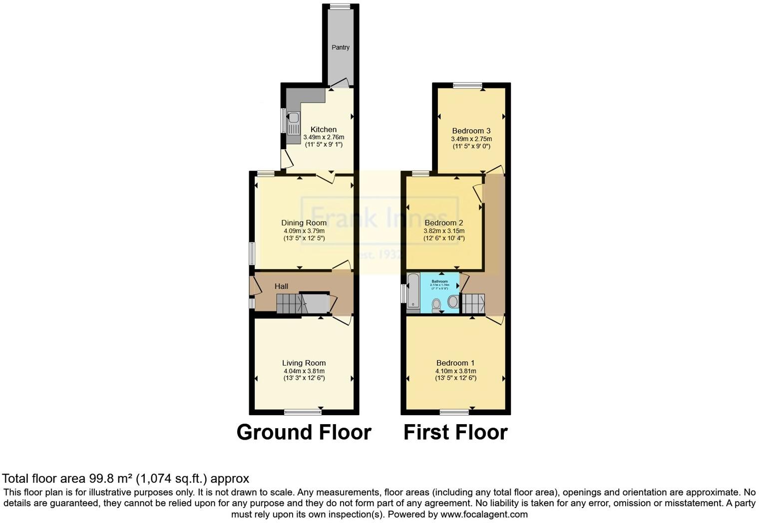
- A two-story house with a ground floor kitchen, dining room, living room, and upstairs bedrooms.
Rooms
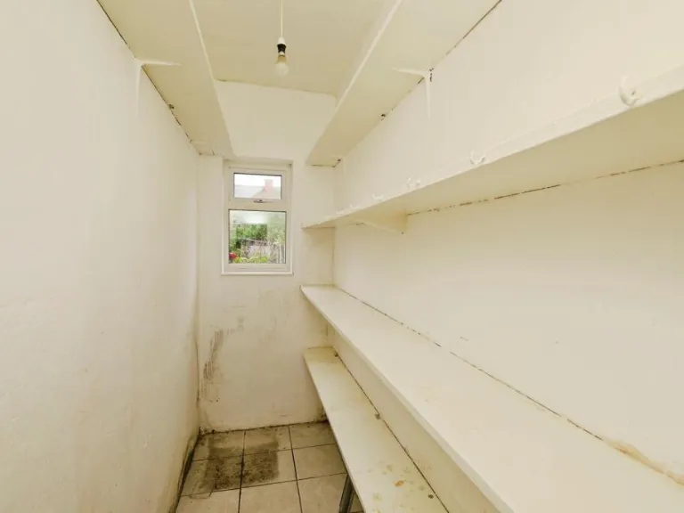
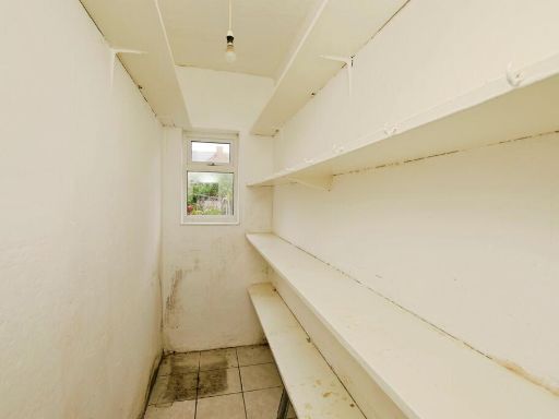
- Pantry:
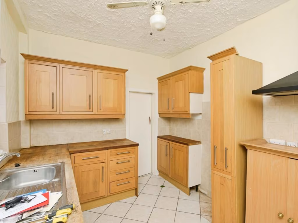
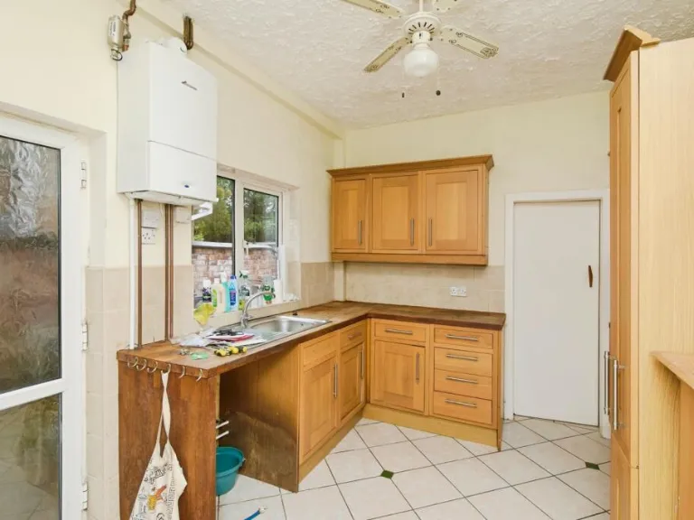
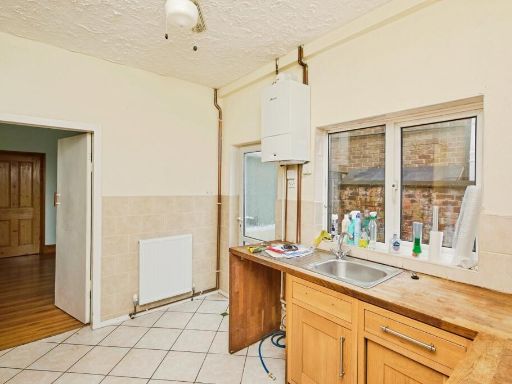
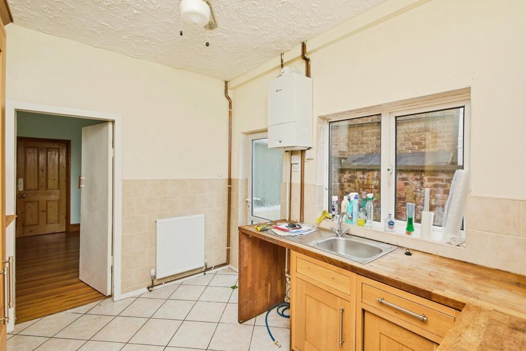
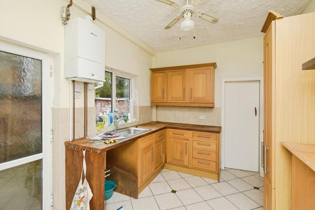
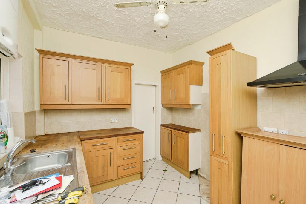
- Kitchen:
- Dining Room:
- Hall:
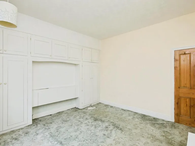
- Living Room:
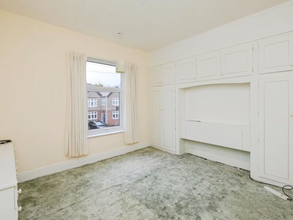
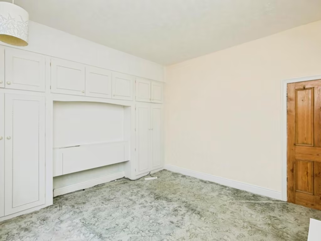
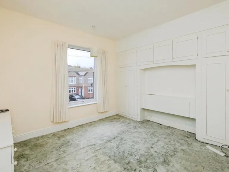
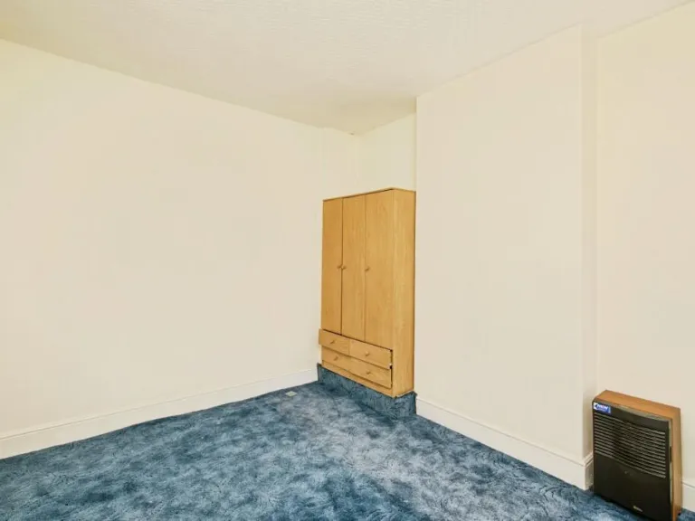
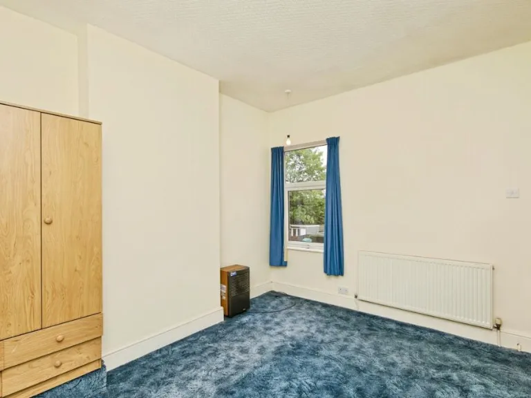
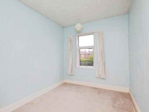
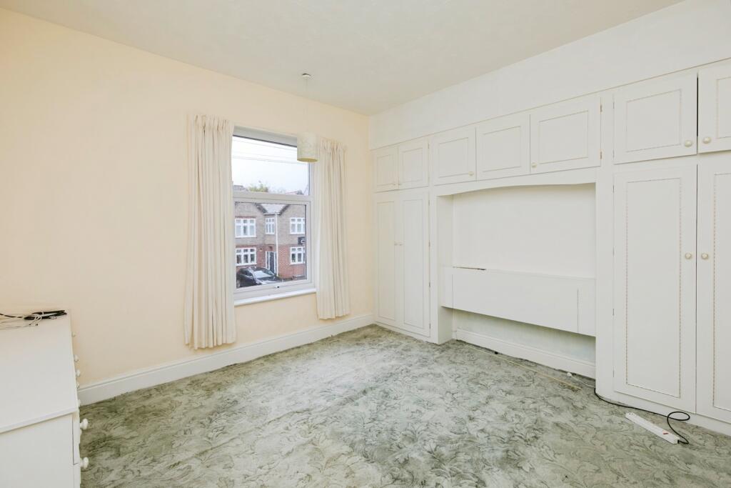
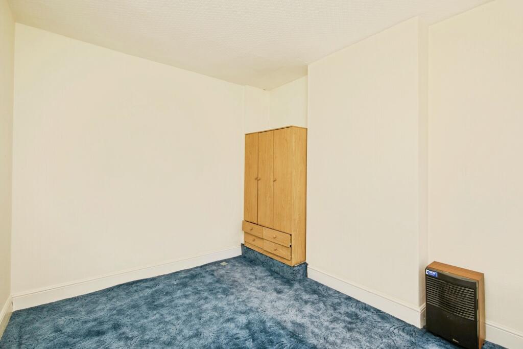
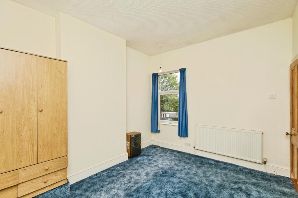
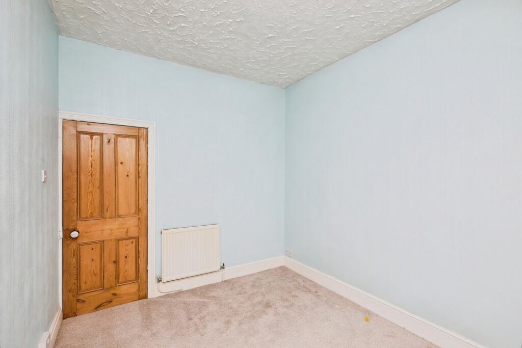
- Bedroom 3:
- Bedroom 2:
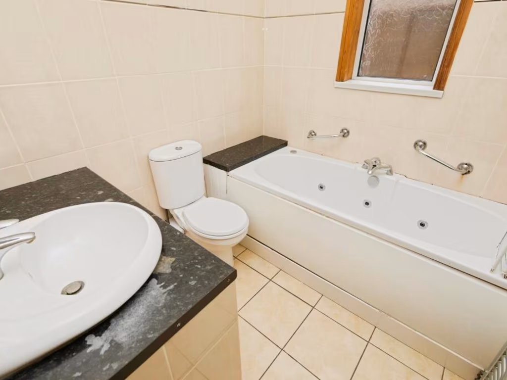
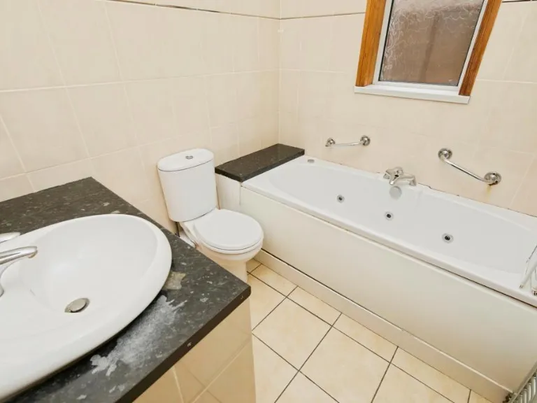
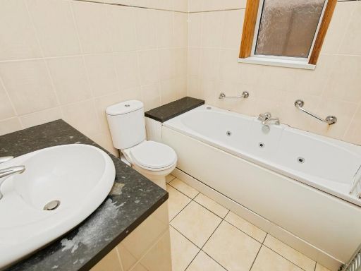
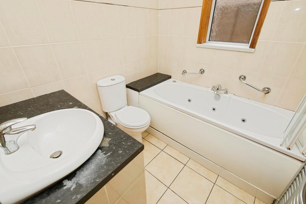
- Bathroom:
- Bedroom 1:
Textual Property Features
Detected Visual Features
- Victorian
- semi-detached
- brick exterior
- sash windows
- chimney stack
- high ceiling
- Post-war
- standard ceiling
- medium living room
- large window
- wooden flooring
- stone fireplace
- corner hearth
EPC Details
- Fully double glazed
- Cavity wall, as built, insulated (assumed)
- Boiler and radiators, mains gas
- Low energy lighting in 18% of fixed outlets
- Solid, no insulation (assumed)
Nearby Schools
- St Laurence CofE Primary School
- The Long Eaton School
- Trent College
- Parklands Infant and Nursery School
- Wilsthorpe School
- OneSchool Global Uk Nottingham Campus
- Toton Banks Road Infant and Nursery School
- Chetwynd Spencer Academy
- Toton Bispham Drive Junior School
- Risley Lower Grammar CE (VC) Primary School
- William Lilley Infant and Nursery School
- Fairfield Spencer Academy
- Sawley Infant and Nursery School
- Grange Primary School
- Harrington Junior School
- George Spencer Academy
- Brooklands Primary School
- Firfield Primary School
- Friesland School
- Ladycross Infant School
- Albany Junior School
- Sawley Junior School
- Dovedale Primary School
- English Martyrs' Catholic Voluntary Academy
- Longmoor Primary School
- Cloudside Academy
- St John's CofE Primary School
Nearest General Shops
- Id: 320455929
- Tags:
- Addr:
- City: Nottingham
- Housenumber: 91
- Postcode: NG10 4GE
- Street: College Street
- Suburb: Long Eaton
- Building: retail
- Old_name: Edwards East Midlands
- Shop: vacant
- Source: survey
- Source:area: Bing
- Source:postcode: interpolation
- TagsNormalized:
- Lat: 52.9049871
- Lon: -1.283555
- FullGeoHash: gcrhfz13gh2h
- PartitionGeoHash: gcrh
- Images:
- FoodStandards: null
- Distance: 233.9
,- Id: 320455935
- Tags:
- Addr:
- City: Nottingham
- Housenumber: 89
- Postcode: NG10 4GE
- Street: College Street
- Suburb: Long Eaton
- Building: retail
- Name: Technique Hair Centre
- Shop: hairdresser
- Source: survey
- Source:area: Bing
- Source:postcode: interpolation
- TagsNormalized:
- Lat: 52.9049465
- Lon: -1.283583
- FullGeoHash: gcrhfz13dkg4
- PartitionGeoHash: gcrh
- Images:
- FoodStandards: null
- Distance: 233.4
,- Id: 320080240
- Tags:
- Addr:
- City: Nottingham
- Postcode: NG10 4GA
- Street: Canal Street
- Suburb: Long Eaton
- Building: yes
- Name: Springfield Garage
- Shop: car_repair
- Source: survey; Bing
- Source:postcode: interpolation
- TagsNormalized:
- garage
- car repair
- repair
- shop
- Lat: 52.9044147
- Lon: -1.284427
- FullGeoHash: gcrhfybww9ty
- PartitionGeoHash: gcrh
- Images:
- FoodStandards: null
- Distance: 209.3
}
Nearest Religious buildings
- Id: 296921201
- Tags:
- HE_ref: 1087969
- Addr:
- Amenity: church_hall
- Building: yes
- Listed_status: Grade II
- Source:
- Listed_status: Historic England
- Start_date: date stone
- Start_date: 1886
- TagsNormalized:
- Lat: 52.9022401
- Lon: -1.2821555
- FullGeoHash: gcrhfyd3gs7d
- PartitionGeoHash: gcrh
- Images:
- FoodStandards: null
- Distance: 487.3
,- Id: 320080242
- Tags:
- Addr:
- Postcode: NG10 4NL
- Street: Canal Street
- Amenity: church_hall
- Building: yes
- Denomination: anglican
- Name: St John's Hall
- Religion: christian
- Source: survey
- TagsNormalized:
- church
- church hall
- anglican
- christian
- Lat: 52.9052455
- Lon: -1.2827127
- FullGeoHash: gcrhfz1gqss4
- PartitionGeoHash: gcrh
- Images:
- FoodStandards: null
- Distance: 283.9
,- Id: 320080243
- Tags:
- Addr:
- Postcode: NG10 4NL
- Street: Canal Street
- Amenity: place_of_worship
- Building: church
- Denomination: anglican
- Fhrs:
- Name: St John's Parish Church
- Religion: christian
- Service_times: 10:30
- Wikidata: Q105094723
- TagsNormalized:
- place of worship
- church
- anglican
- parish
- christian
- Lat: 52.905162
- Lon: -1.2831262
- FullGeoHash: gcrhfz1duvpb
- PartitionGeoHash: gcrh
- Images:
- FoodStandards:
- Id: 1049492
- FHRSID: 1049492
- LocalAuthorityBusinessID: 116783
- BusinessName: Welcome on Wednesday
- BusinessType: Other catering premises
- BusinessTypeID: 7841
- AddressLine1: St Johns Parish Church
- AddressLine2: Canal Street
- AddressLine3: null
- AddressLine4: Long Eaton
- PostCode: NG10 4NL
- RatingValue: 5
- RatingKey: fhrs_5_en-GB
- RatingDate: 2022-02-16
- LocalAuthorityCode: 066
- LocalAuthorityName: Erewash
- LocalAuthorityWebSite: http://www.erewash.gov.uk/
- LocalAuthorityEmailAddress: environmentalhealth@erewash.gov.uk
- Scores:
- Hygiene: 5
- Structural: 0
- ConfidenceInManagement: 0
- NewRatingPending: false
- Geocode:
- Longitude: -1.28195798397064
- Latitude: 52.90503692626950
- Distance: 257.8
}
Nearest Airports
- Id: 11359528
- Tags:
- Aerodrome: international
- Aerodrome:type: public
- Aeroway: aerodrome
- Iata: EMA
- Icao: EGNX
- Is_in: Castle Donington,England,UK
- Name: East Midlands Airport
- Old_name: RAF Castle Donington
- Operator: Manchester Airports Holdings Limited
- Operator:type: private
- Ref: EMA
- Type: multipolygon
- Website: https://www.eastmidlandsairport.com/
- Wikidata: Q8977
- Wikipedia: en:East Midlands Airport
- TagsNormalized:
- airport
- international airport
- Lat: 52.8281122
- Lon: -1.3322143
- FullGeoHash: gcrh99jfj1vh
- PartitionGeoHash: gcrh
- Images:
- FoodStandards: null
- Distance: 9131.8
}
Nearest Leisure Facilities
- Id: 49014618
- Tags:
- Leisure: park
- Name: Petersham Green
- TagsNormalized:
- Lat: 52.9070883
- Lon: -1.2933843
- FullGeoHash: gcrhfx6njunf
- PartitionGeoHash: gcrh
- Images:
- FoodStandards: null
- Distance: 466.3
,- Id: 49642882
- Tags:
- Fixme: Approximate
- Leisure: pitch
- Sport: multi
- TagsNormalized:
- Lat: 52.9063726
- Lon: -1.2926251
- FullGeoHash: gcrhfx69zwsv
- PartitionGeoHash: gcrh
- Images:
- FoodStandards: null
- Distance: 393.7
,- Id: 320455936
- Tags:
- Addr:
- City: Nottingham
- Postcode: NG10 4NP
- Street: College Street
- Suburb: Long Eaton
- Building: yes
- Fhrs:
- Leisure: social_club
- Name: Zingari Club & Institute
- Source:
- Postcode: Food Hygiene Open Data
- TagsNormalized:
- Lat: 52.9036855
- Lon: -1.2822734
- FullGeoHash: gcrhfyf62cg8
- PartitionGeoHash: gcrh
- Images:
- FoodStandards:
- Id: 252559
- FHRSID: 252559
- LocalAuthorityBusinessID: 103033
- BusinessName: Zingari Club
- BusinessType: Pub/bar/nightclub
- BusinessTypeID: 7843
- AddressLine1: null
- AddressLine2: College Street
- AddressLine3: null
- AddressLine4: Long Eaton
- PostCode: NG10 4NP
- RatingValue: 5
- RatingKey: fhrs_5_en-GB
- RatingDate: 2020-03-16
- LocalAuthorityCode: 066
- LocalAuthorityName: Erewash
- LocalAuthorityWebSite: http://www.erewash.gov.uk/
- LocalAuthorityEmailAddress: environmentalhealth@erewash.gov.uk
- Scores:
- Hygiene: 0
- Structural: 5
- ConfidenceInManagement: 5
- NewRatingPending: false
- Geocode:
- Longitude: -1.28259500000000
- Latitude: 52.90427500000000
- Distance: 374.1
,- Id: 51459062
- Tags:
- TagsNormalized:
- Lat: 52.9045658
- Lon: -1.282712
- FullGeoHash: gcrhfyczqtue
- PartitionGeoHash: gcrh
- Images:
- FoodStandards: null
- Distance: 302.4
,- Id: 51459066
- Tags:
- Leisure: park
- Name: St James Park
- Operator: Erewash Borough Council
- TagsNormalized:
- Lat: 52.9040909
- Lon: -1.283673
- FullGeoHash: gcrhfyck8m24
- PartitionGeoHash: gcrh
- Images:
- FoodStandards: null
- Distance: 271.4
}
Nearest Tourist attractions
- Id: 8308671518
- Tags:
- TagsNormalized:
- Lat: 52.8963154
- Lon: -1.2823782
- FullGeoHash: gcrhfv6pq7vs
- PartitionGeoHash: gcrh
- Images:
- FoodStandards: null
- Distance: 1071
,- Id: 8308717417
- Tags:
- TagsNormalized:
- Lat: 52.8978433
- Lon: -1.2808152
- FullGeoHash: gcrhfvg26bdy
- PartitionGeoHash: gcrh
- Images:
- FoodStandards: null
- Distance: 949.7
,- Id: 5694779421
- Tags:
- TagsNormalized:
- Lat: 52.8971525
- Lon: -1.2858109
- FullGeoHash: gcrhftxsnrvv
- PartitionGeoHash: gcrh
- Images:
- FoodStandards: null
- Distance: 936.7
}
Nearest Train stations
- Id: 7170589239
- Tags:
- Name: Ilkeston
- Naptan:
- Network: National Rail
- Public_transport: station
- Railway: station
- Ref:
- Wikidata: Q15228309
- Wikipedia: en:Ilkeston railway station
- TagsNormalized:
- Lat: 52.9790983
- Lon: -1.2950397
- FullGeoHash: gcrj6s8cx7sr
- PartitionGeoHash: gcrj
- Images:
- FoodStandards: null
- Distance: 8196.2
,- Id: 4292892169
- Tags:
- Is_in:
- Layer: 2
- Name: Beeston
- Naptan:
- Network: National Rail
- Public_transport: station
- Railway: station
- Ref:
- Wheelchair: yes
- Wikidata: Q3299120
- Wikipedia: en:Beeston railway station
- TagsNormalized:
- Lat: 52.9207938
- Lon: -1.2075065
- FullGeoHash: gcrjh9btzncz
- PartitionGeoHash: gcrj
- Images:
- FoodStandards: null
- Distance: 5587.9
,- Id: 2136826434
- Tags:
- Addr:
- Name: East Midlands Parkway
- Naptan:
- Network: National Rail
- Operator: East Midlands Railway
- Public_transport: station
- Railway: station
- Ref:
- Train: yes
- Wikidata: Q5328988
- Wikipedia: en:East Midlands Parkway railway station
- TagsNormalized:
- Lat: 52.862275
- Lon: -1.262883
- FullGeoHash: gcrher23hdq1
- PartitionGeoHash: gcrh
- Images:
- FoodStandards: null
- Distance: 5075
,- Id: 6415345182
- Tags:
- Name: Attenborough
- Naptan:
- Network: National Rail
- Public_transport: station
- Railway: station
- Ref:
- Wikidata: Q2098552
- Wikipedia: en:Attenborough railway station
- TagsNormalized:
- Lat: 52.9064132
- Lon: -1.2311523
- FullGeoHash: gcrhgzrd0n4r
- PartitionGeoHash: gcrh
- Images:
- FoodStandards: null
- Distance: 3741
,- Id: 1587569090
- Tags:
- Name: Long Eaton
- Naptan:
- Network: National Rail
- Public_transport: station
- Railway: station
- Ref:
- Train: yes
- Wheelchair: limited
- Wheelchair:description: Both platforms have a lift available. Sloped access is steep.
- Wikidata: Q2357399
- Wikipedia: en:Long Eaton railway station
- TagsNormalized:
- Lat: 52.8849595
- Lon: -1.2872899
- FullGeoHash: gcrhfeqt5yzp
- PartitionGeoHash: gcrh
- Images:
- FoodStandards: null
- Distance: 2289.7
}
Nearest Bus stations and stops
- Id: 1600358926
- Tags:
- Bus: yes
- Highway: bus_stop
- Name: Grasmere Road Stores
- Note: No services?
- Public_transport: platform
- Shelter: no
- Source: survey
- Wheelchair: yes
- TagsNormalized:
- Lat: 52.9063922
- Lon: -1.2917979
- FullGeoHash: gcrhfx764fmd
- PartitionGeoHash: gcrh
- Images:
- FoodStandards: null
- Distance: 340.5
,- Id: 1610851651
- Tags:
- Bus: yes
- Highway: bus_stop
- Name: Spinney Road
- Public_transport: platform
- Shelter: no
- Source: survey
- TagsNormalized:
- Lat: 52.9078571
- Lon: -1.2853373
- FullGeoHash: gcrhfz8497rj
- PartitionGeoHash: gcrh
- Images:
- FoodStandards: null
- Distance: 277.5
,- Id: 1610851658
- Tags:
- Bus: yes
- Highway: bus_stop
- Name: St John's Church
- Public_transport: platform
- Shelter: no
- Source: survey
- TagsNormalized:
- Lat: 52.9051341
- Lon: -1.2833608
- FullGeoHash: gcrhfz16xxbc
- PartitionGeoHash: gcrh
- Images:
- FoodStandards: null
- Distance: 242.9
,- Id: 1610851568
- Tags:
- Bus: yes
- Highway: bus_stop
- Name: Canal Street
- Public_transport: platform
- Shelter: yes
- Source: survey
- TagsNormalized:
- Lat: 52.9050235
- Lon: -1.2834201
- FullGeoHash: gcrhfz16n5ht
- PartitionGeoHash: gcrh
- Images:
- FoodStandards: null
- Distance: 241.6
,- Id: 1610851632
- Tags:
- Bus: yes
- Highway: bus_stop
- Name: Spinney Road
- Public_transport: platform
- Shelter: no
- Source: survey
- TagsNormalized:
- Lat: 52.9070365
- Lon: -1.2846498
- FullGeoHash: gcrhfz2tc6rt
- PartitionGeoHash: gcrh
- Images:
- FoodStandards: null
- Distance: 224.5
}
Nearest Hotels
- Id: 316454505
- Tags:
- Addr:
- City: Nottingham
- Housenumber: 20-22
- Postcode: NG10 1LW
- Street: Derby Road
- Suburb: Long Eaton
- Bar: yes
- Building: commercial
- Fhrs:
- Name: Bennetts
- Old_name: Europa Hotel
- Restaurant: yes
- Source:
- Tourism: hotel
- Website: http://www.bennettslongeaton.co.uk/
- TagsNormalized:
- Lat: 52.9004252
- Lon: -1.2741741
- FullGeoHash: gcrhgn0pmd4b
- PartitionGeoHash: gcrh
- Images:
- FoodStandards: null
- Distance: 1027.2
,- Id: 73305226
- Tags:
- Addr:
- City: Nottingham
- Postcode: NG10 4EP
- Street: Bostocks Lane
- Suburb: Long Eaton
- Brand: Best Western
- Brand:wikidata: Q830334
- Brand:wikipedia: en:Best Western
- Building: hotel
- Name: Best Western Nottingham Derby
- Old_name: Ramada Nottingham
- Source:
- Tourism: hotel
- TagsNormalized:
- Lat: 52.9092847
- Lon: -1.2993182
- FullGeoHash: gcrhfrvfgtw1
- PartitionGeoHash: gcrh
- Images:
- FoodStandards: null
- Distance: 929.6
,- Id: 73305225
- Tags:
- Addr:
- City: Nottingham
- Postcode: NG10 4EP
- Street: Bostocks Lane
- Suburb: Long Eaton
- Brand: Novotel
- Brand:wikidata: Q420545
- Brand:wikipedia: en:Novotel
- Building: hotel
- Fhrs:
- Name: Novotel
- Source:
- Tourism: hotel
- TagsNormalized:
- Lat: 52.910471
- Lon: -1.298113
- FullGeoHash: gcrj42n9zf8v
- PartitionGeoHash: gcrj
- Images:
- FoodStandards: null
- Distance: 929.1
}
Tags
- Victorian
- semi-detached
- brick exterior
- sash windows
- chimney stack
- high ceiling
- Post-war
- standard ceiling
- medium living room
- large window
- wooden flooring
- stone fireplace
- corner hearth
Local Market Stats
- Average Price/sqft: £233
- Avg Income: £39600
- Rental Yield: 4.4%
- Social Housing: 9%
- Planning Success Rate: 95%
Similar Properties
 2 bedroom end of terrace house for sale in Armitage Drive, Long Eaton, Nottingham, Derbyshire, NG10 — £235,000 • 2 bed • 1 bath • 783 ft²
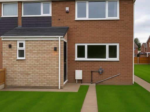 3 bedroom semi-detached house for sale in Lodge Road, Long Eaton, Nottingham, Derbyshire, NG10 — £270,000 • 3 bed • 1 bath • 987 ft²
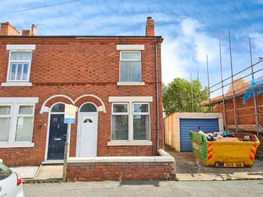 3 bedroom semi-detached house for sale in Grange Road, Long Eaton, Nottingham, Derbyshire, NG10 — £200,000 • 3 bed • 1 bath • 911 ft²
 3 bedroom detached house for sale in Curzon Street, NOTTINGHAM, Nottinghamshire, NG10 — £350,000 • 3 bed • 2 bath • 1129 ft²
 3 bedroom semi-detached house for sale in Longmoor Road, Long Eaton, Nottingham, Derbyshire, NG10 — £220,000 • 3 bed • 1 bath • 755 ft²
 3 bedroom semi-detached house for sale in Worrall Avenue, Long Eaton, Long Eaton, NG10 — £210,000 • 3 bed • 1 bath • 796 ft²
Meta
- {
"@context": "https://schema.org",
"@type": "Residence",
"name": "3 bedroom semidetached house for sale in Curzon Street, Lon…",
"description": "",
"url": "https://propertypiper.co.uk/property/82587d62-1919-46b5-b6ef-9acbd4a14d0e",
"image": "https://image-a.propertypiper.co.uk/5628ae70-fcba-4187-a442-8123a7148e8c-1024.jpeg",
"address": {
"@type": "PostalAddress",
"streetAddress": "29 29 Curzon Street, Long Eaton, Nottingham, Derbyshire, NG10",
"postalCode": "NG10 4FS",
"addressLocality": "Erewash",
"addressRegion": "Erewash",
"addressCountry": "England"
},
"geo": {
"@type": "GeoCoordinates",
"latitude": 52.905550461119105,
"longitude": -1.2869156964835409
},
"numberOfRooms": 3,
"numberOfBathroomsTotal": 1,
"floorSize": {
"@type": "QuantitativeValue",
"value": 1074,
"unitCode": "FTK"
},
"offers": {
"@type": "Offer",
"price": 200000,
"priceCurrency": "GBP",
"availability": "https://schema.org/InStock"
},
"additionalProperty": [
{
"@type": "PropertyValue",
"name": "Feature",
"value": "Victorian"
},
{
"@type": "PropertyValue",
"name": "Feature",
"value": "semi-detached"
},
{
"@type": "PropertyValue",
"name": "Feature",
"value": "brick exterior"
},
{
"@type": "PropertyValue",
"name": "Feature",
"value": "sash windows"
},
{
"@type": "PropertyValue",
"name": "Feature",
"value": "chimney stack"
},
{
"@type": "PropertyValue",
"name": "Feature",
"value": "high ceiling"
},
{
"@type": "PropertyValue",
"name": "Feature",
"value": "Post-war"
},
{
"@type": "PropertyValue",
"name": "Feature",
"value": "standard ceiling"
},
{
"@type": "PropertyValue",
"name": "Feature",
"value": "medium living room"
},
{
"@type": "PropertyValue",
"name": "Feature",
"value": "large window"
},
{
"@type": "PropertyValue",
"name": "Feature",
"value": "wooden flooring"
},
{
"@type": "PropertyValue",
"name": "Feature",
"value": "stone fireplace"
},
{
"@type": "PropertyValue",
"name": "Feature",
"value": "corner hearth"
}
]
}
High Res Floorplan Images
Compatible Floorplan Images
FloorplanImages Thumbnail