WA3 7EN - 3 bedroom semidetached house for sale in Deacons Close, Cro…
View on Property Piper
3 bedroom semi-detached house for sale in Deacons Close,
Croft,
Warrington,
WA3
Property Details
- Price: £364995
- Bedrooms: 3
- Bathrooms: 1
- Property Type: undefined
- Property SubType: undefined
Brochure Descriptions
- Planned residential development site plan showing a mix of 2–4 bedroom detached, semi‑detached and terraced homes arranged around a primary loop road with secondary cul‑de‑sacs. The scheme includes showhome/sales centre and affordable housing parcels (marked), generous private rear gardens (small to average in size for most plots) and communal landscaped verges/planting along the perimeter. The site adjoins Croft Primary School and benefits from tree‑lined edges and pedestrian paths. Overall the development footprint is medium‑sized with a suburban density layout providing a mix of house types to suit families and first‑time buyers. No internal room layouts or exact square footage are shown on the plan.
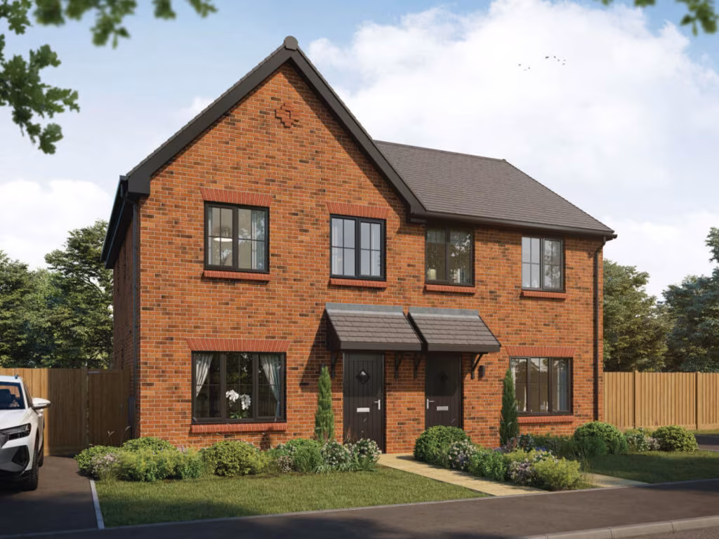
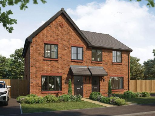
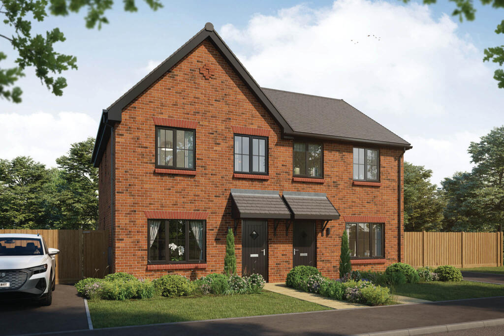
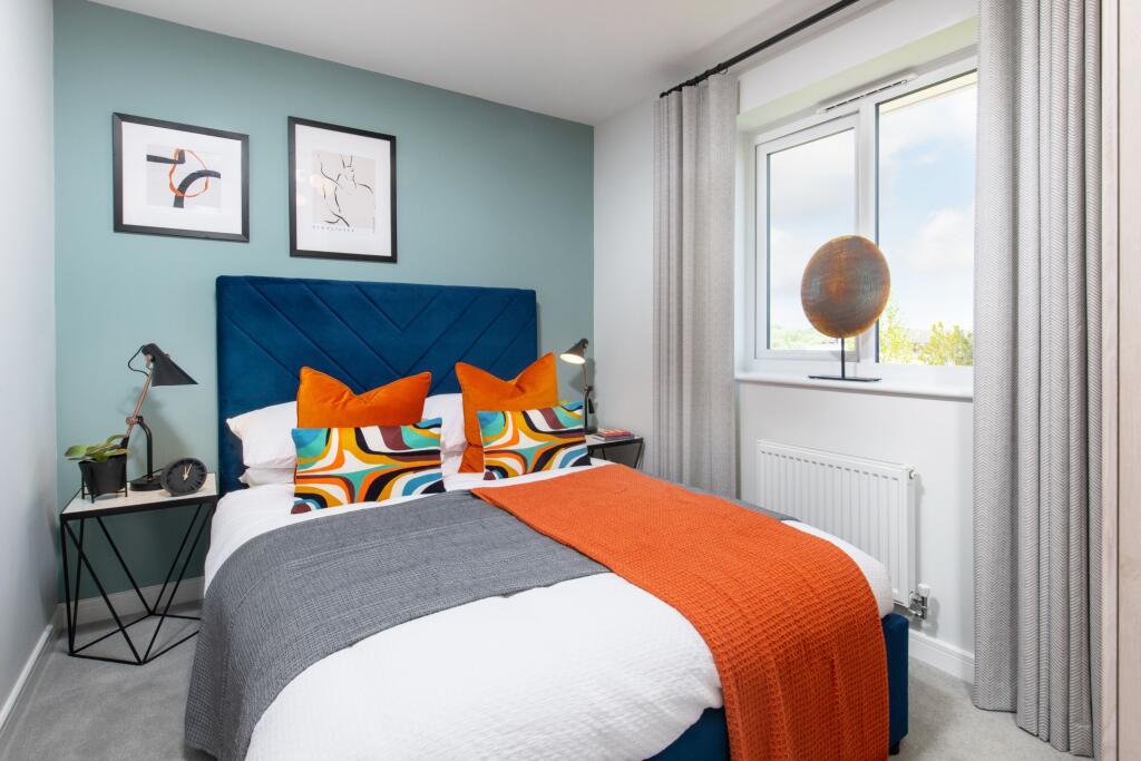
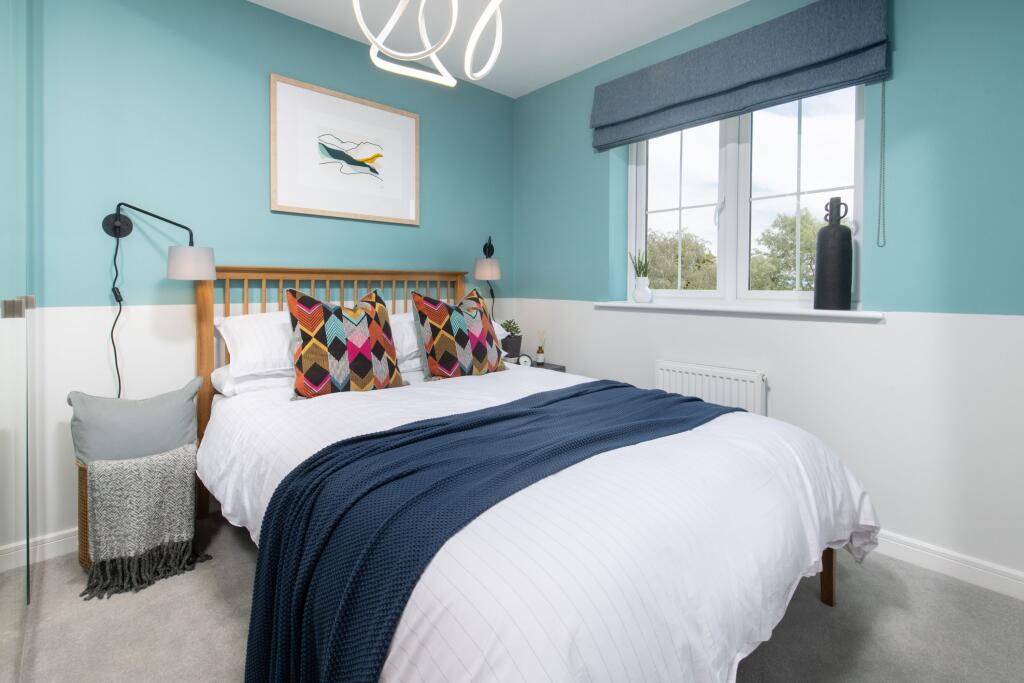
- Three-bedroom semi-detached family home (marketing name: The Tyne). Traditional red-brick exterior with pitched tiled roof, two-storey layout and symmetrical fenestration. Entrance porches to each side suggest two mirror-image dwellings; likely internal layout comprising ground-floor living room, kitchen/dining area and three bedrooms with bathrooms upstairs. Small, landscaped front garden with planted beds and a paved path to the front door; off-street parking appears available at the side. Garden size cannot be fully determined from the image but front garden is small/average; overall property footprint and plot size are typical of modern starter/young-family homes — average property size for a three-bedroom semi. No exceptional views visible (close boarded fencing and trees to rear), finishes appear contemporary and aimed at mass-market housebuilding.
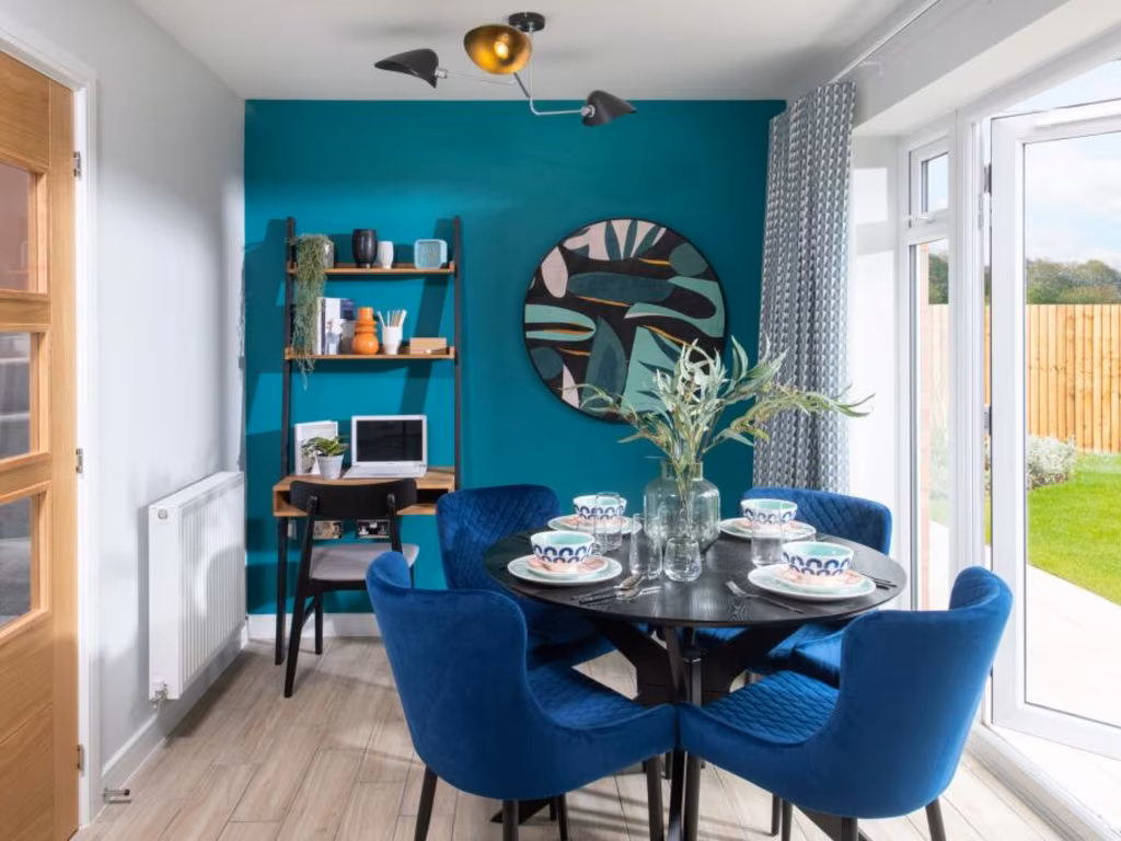
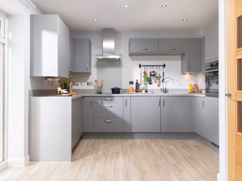
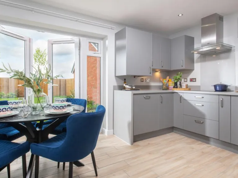
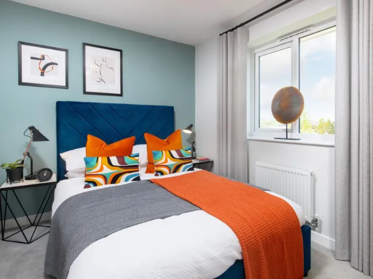
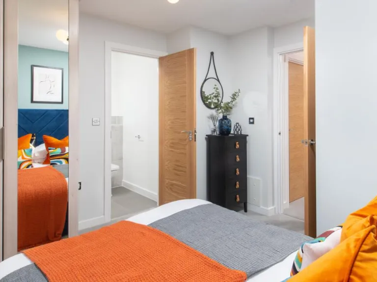
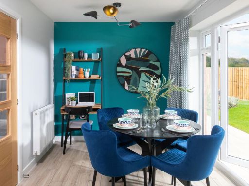
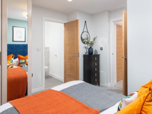
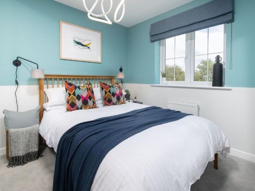
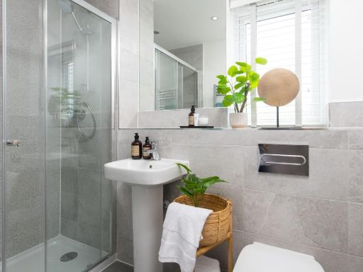
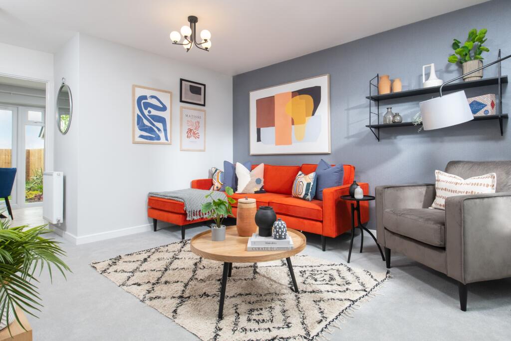
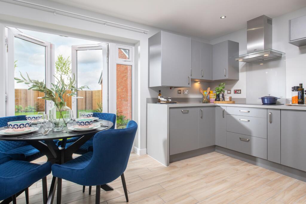
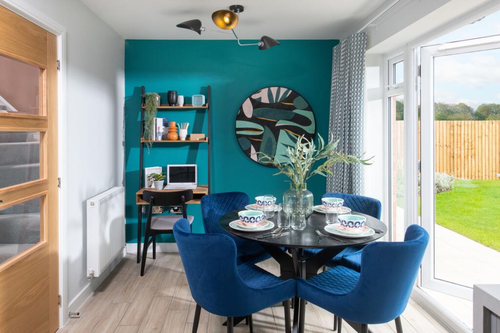
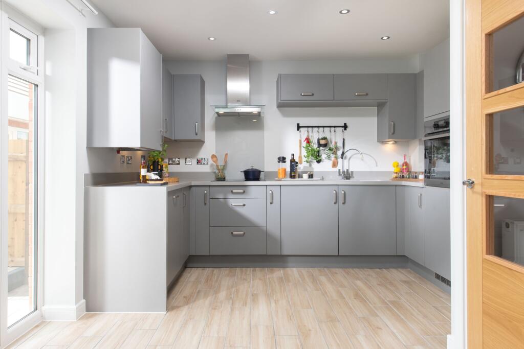
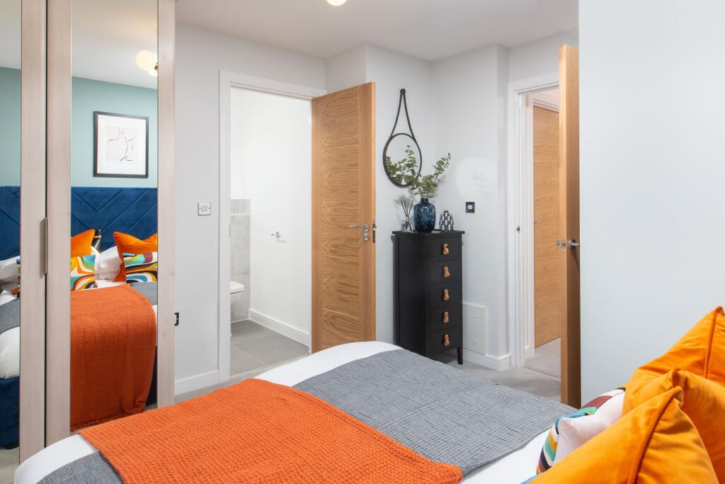
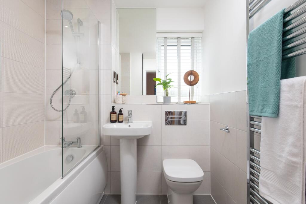
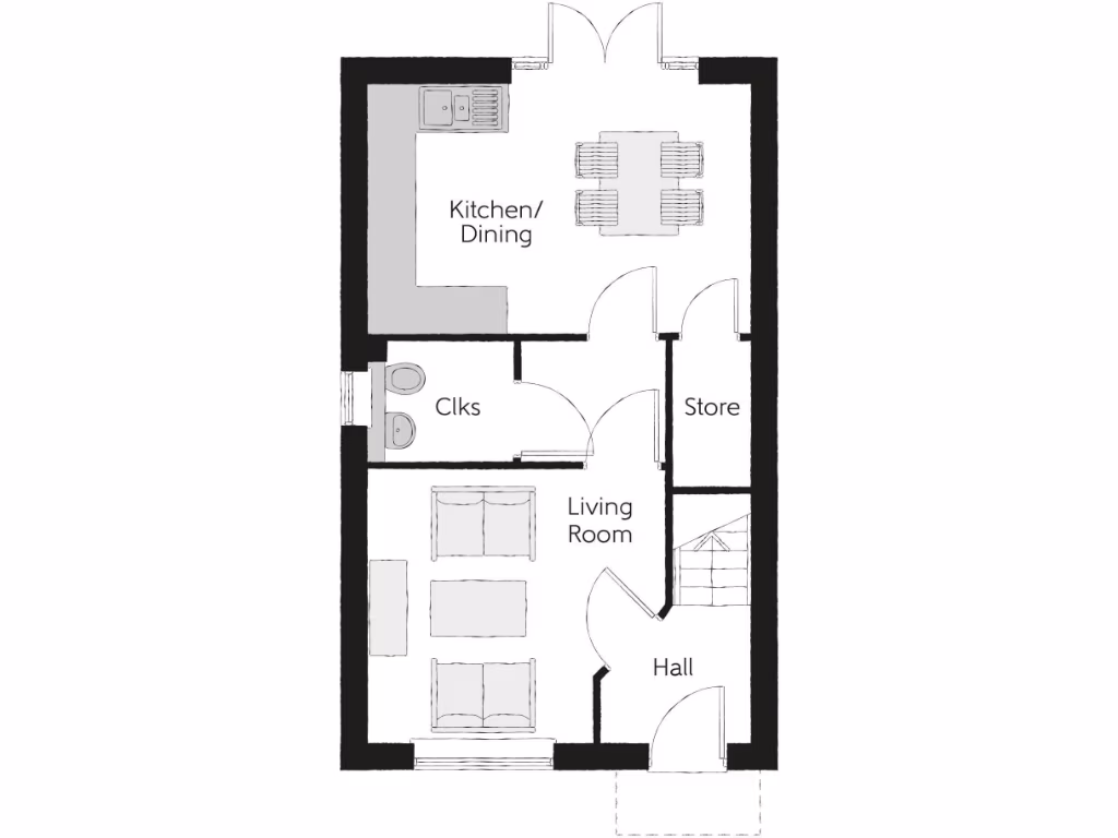
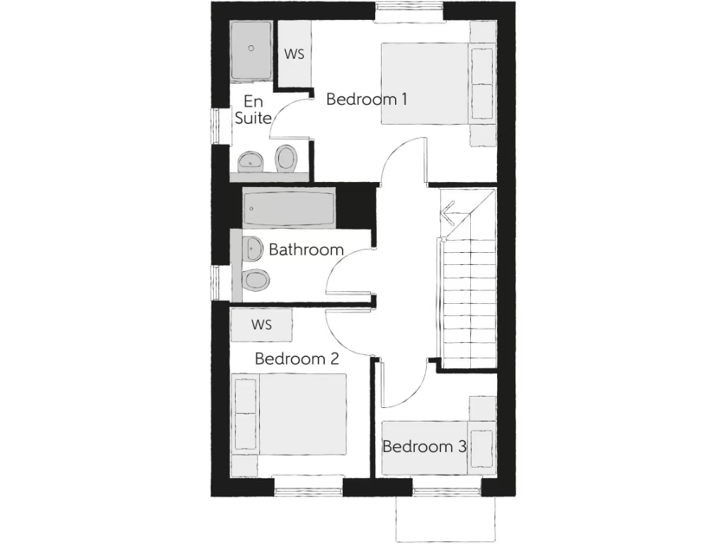
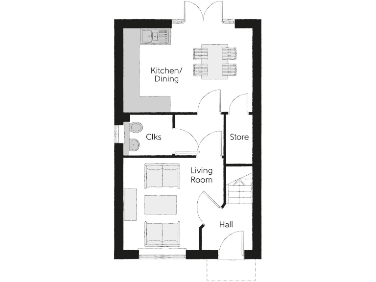
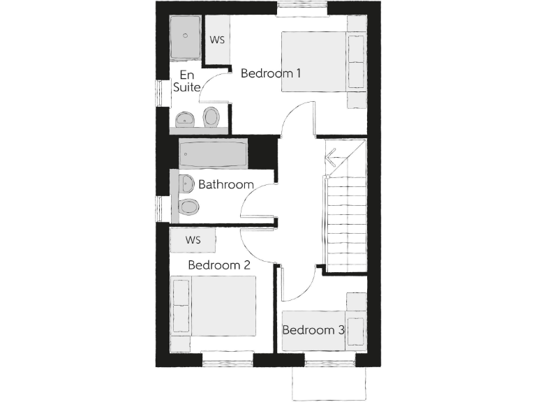
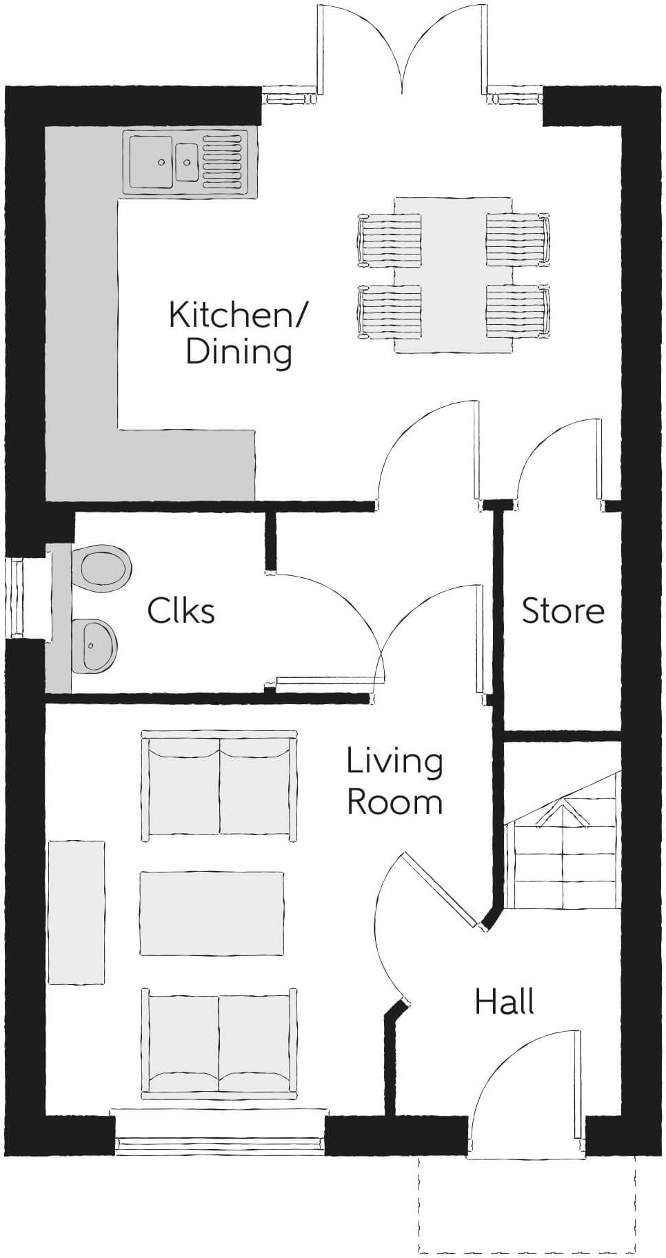
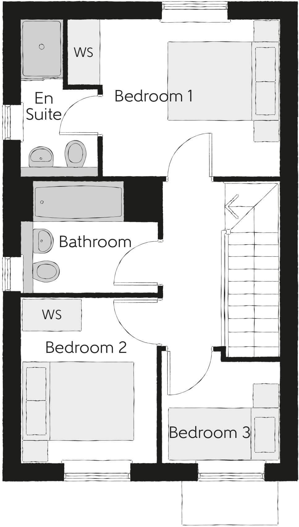
- Modern two-storey three-bedroom home (shown as “The Tyne”) with a compact, efficient townhouse footprint. Ground floor comprises an entrance hall leading to a front living room, an inner hall with storage, a rear open-plan kitchen/dining area with double doors to the outside and a cloakroom — the kitchen/dining is relatively generous for the plan (large for a narrow plan). First floor provides a master bedroom with en suite, two further bedrooms and a family bathroom. Room sizes from the floorplan indicate: living room — average; kitchen/dining — large/above-average for this type; master bedroom — average; bedrooms 2 and 3 — small to average. Overall property footprint is modest (typical narrow town/terrace house), suitable for a small family or as a starter home. No external views (sea/river/woodland/cityscape) are shown on the plan. Furniture not included; all dimensions should be treated as indicative from the provided floorplan.
- Modern development of two-storey, red-brick dwellings finished with pitched roofs and timber/UPVC fenestration. The image shows a terraced/semi-detached run with small, formal front gardens bounded by low hedging and a paved road frontage. Property appears to be a mid-sized family home typical of new-build schemes — likely 2–4 bedrooms — with modest front gardens and limited private outdoor space visible (small). The street scene suggests a planned residential estate with planted street trees and frontage landscaping; no notable views (sea, river or extensive countryside) are visible from the image. Overall impression: medium-density new-build development, well presented and suited to family or starter-home market.
- No photographs of the building or internal accommodation are provided on this sheet — the image is a branded promotional page. The only locational information visible is the development name and postcode: Deacons Close, Croft, Cheshire, WA3 7EN. The branding indicates this is a Bellway new‑homes development (new build housing). As a valuator I can note: this appears to be a new residential development likely comprising newly constructed homes rather than a single older dwelling. No information on number of bedrooms, layout, external garden size or total plot area is visible, so room/garden size and total square footage cannot be determined from the image alone. For an accurate valuation or specification you would need photographs or plans showing the dwelling type (house/flat), floorplans, plot dimensions and internal finish specification.
- Large new residential development site plan comprising approximately 90 numbered plots (mixture of 2–4 bedroom house types). The scheme shows a mix of terraces, semi‑detached and detached houses in distinct colour‑coded house types, private rear gardens (small to average in size) and front gardens/driveways. Internal loop roads and cul‑de‑sacs serve the plots with on‑plot parking and some garages. The layout includes retained/proposed green corridors, tree planting, informal amenity/open space areas and pedestrian footpaths linking through the site. A primary school (labelled Croft Primary School) is shown adjacent to the site and a named existing road (Deacons Close) runs along one boundary. Overall plot sizes vary from small (compact town/terrace plots) to average/large for the detached house plots at the edges; the development footprint is medium-to-large for a suburban housing estate.
Image Descriptions
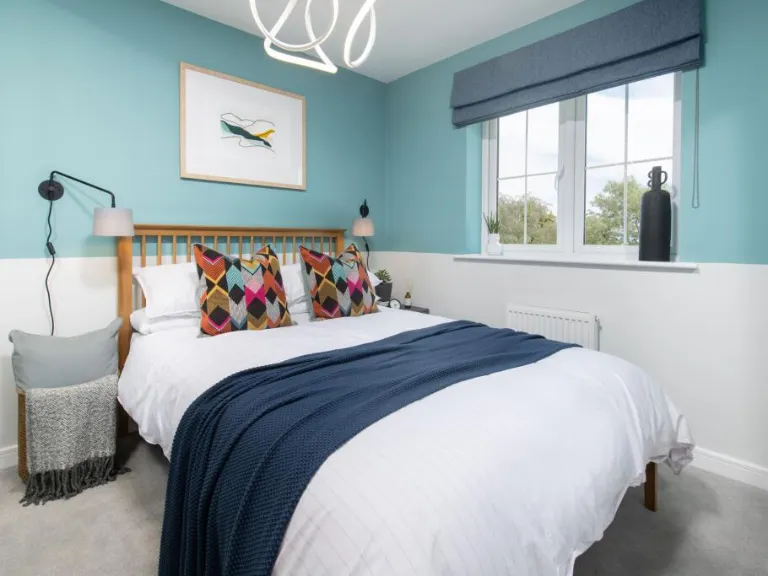
- semi-detached house modern
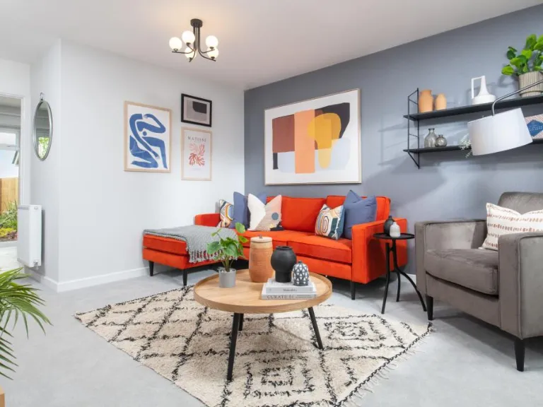
- living room modern
Floorplan Description
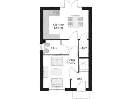
- Ground floor plan showing Hall, Living Room, Kitchen/Dining, Clks (cloakroom) and Store.
Rooms
- Kitchen/ Dining:
- Clks:
- Living Room:
- Store:
- Hall:
- Bedroom 1:
- En Suite:
- WS:
- Bathroom:
- Bedroom 2:
- WS:
- Bedroom 3:
Textual Property Features
- Is New Build
- Chain Free
- Success
Detected Visual Features
- semi-detached
- modern
- brick façade
- two-story
- driveway
- well-kept garden
- new construction
- residential area
- contemporary
- living room
- neutral colors
- artwork
- pendant lighting
- shelves
- bright
Nearby Schools
- St Peter's Catholic Primary School
- Cinnamon Brow CofE Primary School
- Croft Primary School
- St Lewis Catholic Primary School
- Lowton Junior and Infant School
- Lowton St Mary's CofE (Voluntary Aided) Primary School
- Gilded Hollins Community School
- Bruche Primary School Academy
- Padgate Academy
- St Bridget's Catholic Primary School
- Newchurch Community Primary School
- Twiss Green Community Primary School
- St Luke's CofE Primary School
- St Catherine's Catholic Primary School, Lowton
- Lowton Church of England High School
- Woolston Community Primary School
- St Oswald's Catholic Primary School
- Woolston CofE Aided Primary School
- King's Leadership Academy Warrington
- Christ Church CofE Primary School Padgate
- St Andrew's CofE Primary School
- Birchwood Community High School
- Green Meadow Independent Primary School
Nearest General Shops
- Id: 3487680364
- Tags:
- Name: Kenyon Hall Farm Shop
- Opening_hours: 09:30-05:30
- Shop: farm
- TagsNormalized:
- Lat: 53.4503684
- Lon: -2.5729728
- FullGeoHash: gcw0j6q6vqu6
- PartitionGeoHash: gcw0
- Images:
- FoodStandards: null
- Distance: 1843.3
,- Id: 3487678959
- Tags:
- Name: Kenyon Hall Plant Centre
- Opening_hours: 09:30-05:30
- Shop: garden_centre
- TagsNormalized:
- Lat: 53.4503584
- Lon: -2.5722834
- FullGeoHash: gcw0j6qfvkyr
- PartitionGeoHash: gcw0
- Images:
- FoodStandards: null
- Distance: 1808.6
,- Id: 970425772
- Tags:
- Building: yes
- Shop: fishing
- TagsNormalized:
- Lat: 53.4463642
- Lon: -2.5314464
- FullGeoHash: gcw0n3seth2v
- PartitionGeoHash: gcw0
- Images:
- FoodStandards: null
- Distance: 1574.7
}
Nearest Religious buildings
- Id: 98181004
- Tags:
- Addr:
- Postcode: WA3 7PH
- Street: Glover Road
- Amenity: place_of_worship
- Building: yes
- Fhrs:
- Name: Thomas Risley
- Religion: christian
- Source:
- TagsNormalized:
- place of worship
- christian
- church
- Lat: 53.4221376
- Lon: -2.5349891
- FullGeoHash: gcqpym4nd2pp
- PartitionGeoHash: gcqp
- Images:
- FoodStandards:
- Id: 420498
- FHRSID: 420498
- LocalAuthorityBusinessID: 49243
- BusinessName: Thomas Risley Church
- BusinessType: Other catering premises
- BusinessTypeID: 7841
- AddressLine1: null
- AddressLine2: Glover Road
- AddressLine3: null
- AddressLine4: Warrington
- PostCode: WA3 7PH
- RatingValue: 5
- RatingKey: fhrs_5_en-GB
- RatingDate: 2018-05-24
- LocalAuthorityCode: 890
- LocalAuthorityName: Warrington
- LocalAuthorityWebSite: http://www.warrington.gov.uk
- LocalAuthorityEmailAddress: environmental.health@warrington.gov.uk
- Scores:
- Hygiene: 5
- Structural: 5
- ConfidenceInManagement: 5
- NewRatingPending: false
- Geocode:
- Longitude: -2.53509900000000
- Latitude: 53.42209300000000
- Distance: 2228.5
,- Id: 368556584
- Tags:
- Amenity: place_of_worship
- Religion: christian
- TagsNormalized:
- place of worship
- christian
- church
- Lat: 53.4443903
- Lon: -2.5439826
- FullGeoHash: gcw0n1780umn
- PartitionGeoHash: gcw0
- Images:
- FoodStandards: null
- Distance: 775.6
,- Id: 61113204
- Tags:
- Amenity: place_of_worship
- Building: church
- Denomination: anglican
- Name: Christ Church
- Religion: christian
- Wikidata: Q5108679
- Wikipedia: en:Christ Church, Croft
- TagsNormalized:
- place of worship
- church
- anglican
- christian
- Lat: 53.4374937
- Lon: -2.5433221
- FullGeoHash: gcqpypupbqcd
- PartitionGeoHash: gcqp
- Images:
- FoodStandards: null
- Distance: 620.1
}
Nearest Airports
- Id: 116737532
- Tags:
- Addr:
- City: Liverpool
- Country: GB
- Postcode: L24 1YD
- Street: Speke Hall Avenue
- Aerodrome: international
- Aerodrome:type: public
- Aeroway: aerodrome
- Iata: LPL
- Icao: EGGP
- Is_in: Liverpool,England,UK
- Name: Liverpool John Lennon Airport
- Old_name: Speke Airport
- Operator: Liverpool Airport plc
- Source: wikipedia
- Website: https://www.liverpoolairport.com/
- Wikidata: Q8727
- Wikipedia: en:Liverpool John Lennon Airport
- TagsNormalized:
- airport
- international airport
- Lat: 53.3357677
- Lon: -2.8518179
- FullGeoHash: gcmzrj7r7gdr
- PartitionGeoHash: gcmz
- Images:
- FoodStandards: null
- Distance: 22972.2
,- Id: 1224469
- Tags:
- Addr:
- City: Manchester
- Country: GB
- Postcode: M90 1QX
- Aerodrome: international
- Aeroway: aerodrome
- Arp: yes
- Atis: 128.175
- Iata: MAN
- Icao: EGCC
- Name: Manchester Airport
- Note: rough sketched outline referring to Yahoo imagery - true boundary is where?
- Old_name: Ringway
- Operator: Manchester Airport PLC
- Size: 18720000
- Source:
- Tower_frequency: 118.625,119.400
- Type: multipolygon
- Website: https://www.manchesterairport.co.uk/
- Wikidata: Q8694
- Wikipedia: en:Manchester Airport
- TagsNormalized:
- airport
- international airport
- Lat: 53.3503197
- Lon: -2.2798822
- FullGeoHash: gcqrs05u4ukt
- PartitionGeoHash: gcqr
- Images:
- FoodStandards: null
- Distance: 20589.6
}
Nearest Leisure Facilities
- Id: 236635679
- Tags:
- Leisure: park
- Name: Croft Playing Fields
- TagsNormalized:
- Lat: 53.4366326
- Lon: -2.5564149
- FullGeoHash: gcqpvzf6znqc
- PartitionGeoHash: gcqp
- Images:
- FoodStandards: null
- Distance: 417.1
,- Id: 236635680
- Tags:
- Leisure: playground
- Name: Croft Playground
- TagsNormalized:
- Lat: 53.4371401
- Lon: -2.5561051
- FullGeoHash: gcqpvzftykvv
- PartitionGeoHash: gcqp
- Images:
- FoodStandards: null
- Distance: 362.5
,- Id: 570096410
- Tags:
- Leisure: pitch
- Sport: tennis
- TagsNormalized:
- Lat: 53.4421638
- Lon: -2.5507074
- FullGeoHash: gcw0jbyehjqs
- PartitionGeoHash: gcw0
- Images:
- FoodStandards: null
- Distance: 323.4
,- Id: 103700535
- Tags:
- Leisure: horse_riding
- Name: Heathcroft Stud
- TagsNormalized:
- Lat: 53.4391679
- Lon: -2.5501198
- FullGeoHash: gcw0jbr19yuv
- PartitionGeoHash: gcw0
- Images:
- FoodStandards: null
- Distance: 135.4
,- Id: 9177013468
- Tags:
- TagsNormalized:
- outdoor
- outdoor seating
- leisure
- Lat: 53.4396042
- Lon: -2.5528439
- FullGeoHash: gcw0jbmh62m8
- PartitionGeoHash: gcw0
- Images:
- FoodStandards: null
- Distance: 53.3
}
Nearest Tourist attractions
- Id: 10679132531
- Tags:
- Name: Safari Swings
- Tourism: attraction
- TagsNormalized:
- Lat: 53.4064868
- Lon: -2.6146579
- FullGeoHash: gcqpud25649z
- PartitionGeoHash: gcqp
- Images:
- FoodStandards: null
- Distance: 5526.7
,- Id: 1089753964
- Tags:
- Addr:
- City: Wigan
- Street: Kenyon Lane
- Building: yes
- Guest_house: bed_and_breakfast
- Name: Five Acres
- Tourism: guest_house
- Website: https://www.facebook.com/Five-Acres-Guest-House-281864578622171/
- TagsNormalized:
- Lat: 53.4627824
- Lon: -2.5628212
- FullGeoHash: gcw0jstg3byp
- PartitionGeoHash: gcw0
- Images:
- FoodStandards: null
- Distance: 2696.6
,- Id: 9469577972
- Tags:
- Amenity: clock
- Artwork_type: installation
- Name: The Millennium Garden
- Tourism: artwork
- TagsNormalized:
- Lat: 53.4522067
- Lon: -2.5193827
- FullGeoHash: gcw0ndtmwjs0
- PartitionGeoHash: gcw0
- Images:
- FoodStandards: null
- Distance: 2595.7
}
Nearest Bus stations and stops
- Id: 8754427281
- Tags:
- Bus: yes
- Departures_board: timetable
- Highway: bus_stop
- Name: The Horseshoe
- Public_transport: platform
- Shelter: yes
- TagsNormalized:
- Lat: 53.4374613
- Lon: -2.5566176
- FullGeoHash: gcqpvzfrf2z9
- PartitionGeoHash: gcqp
- Images:
- FoodStandards: null
- Distance: 365.9
,- Id: 9032798109
- Tags:
- Bus: yes
- Departures_board: no
- Highway: bus_stop
- Name: The Horseshoe
- Public_transport: platform
- Shelter: no
- TagsNormalized:
- Lat: 53.4371975
- Lon: -2.5555303
- FullGeoHash: gcqpvzgn5zd7
- PartitionGeoHash: gcqp
- Images:
- FoodStandards: null
- Distance: 331.2
,- Id: 8754427284
- Tags:
- Bus: yes
- Departures_board: timetable
- Highway: bus_stop
- Name: The Horseshoe
- Public_transport: platform
- Shelter: yes
- TagsNormalized:
- Lat: 53.4378963
- Lon: -2.5554499
- FullGeoHash: gcw0jb54m9yk
- PartitionGeoHash: gcw0
- Images:
- FoodStandards: null
- Distance: 274.9
,- Id: 8754427287
- Tags:
- Bus: yes
- Departures_board: no
- Highway: bus_stop
- Name: General Elliot
- Public_transport: platform
- Shelter: no
- TagsNormalized:
- Lat: 53.4401179
- Lon: -2.5521192
- FullGeoHash: gcw0jbmx721b
- PartitionGeoHash: gcw0
- Images:
- FoodStandards: null
- Distance: 81.9
,- Id: 8754427288
- Tags:
- Bus: yes
- Departures_board: no
- Highway: bus_stop
- Name: General Elliot
- Public_transport: platform
- Shelter: no
- TagsNormalized:
- Lat: 53.4400683
- Lon: -2.5520427
- FullGeoHash: gcw0jbmwvng0
- PartitionGeoHash: gcw0
- Images:
- FoodStandards: null
- Distance: 76.6
}
Nearest Hotels
- Id: 267439228
- Tags:
- Addr:
- City: Lane Head
- Housenumber: 322
- Postcode: WA3 1HD
- Street: Newton Road
- Brand: Travelodge
- Brand:wikidata: Q9361374
- Brand:wikipedia: en:Travelodge UK
- Building: yes
- Internet_access: wlan
- Internet_access:fee: customers
- Internet_access:ssid: Travelodge WiFi
- Name: Travelodge
- Phone: 0871 559 1851
- Tourism: hotel
- Wheelchair: limited
- TagsNormalized:
- Lat: 53.4668019
- Lon: -2.5694911
- FullGeoHash: gcw0jt2fww28
- PartitionGeoHash: gcw0
- Images:
- FoodStandards: null
- Distance: 3258.5
,- Id: 291568218
- Tags:
- Brand: Premier Inn
- Brand:wikidata: Q2108626
- Brand:wikipedia: en:Premier Inn
- Building: yes
- Building:levels: 2
- Building:material: brick
- Internet_access: wlan
- Internet_access:fee: customers
- Internet_access:operator: Virgin Media
- Internet_access:ssid: Premier Inn Free Wi-Fi
- Name: Premier Inn, Warrington North East
- Roof:
- Tourism: hotel
- TagsNormalized:
- Lat: 53.4299367
- Lon: -2.5964222
- FullGeoHash: gcqpuyt7fyp7
- PartitionGeoHash: gcqp
- Images:
- FoodStandards: null
- Distance: 3116.3
,- Id: 60305166
- Tags:
- Addr:
- City: Warrington
- Housename: Birchwood Business Park
- Postcode: WA3 6ZN
- Street: Aston Avenue
- Air_conditioning: yes
- Bar: yes
- Brand: Penta Hotels
- Building: yes
- Email: info.warrington@pentahotels.com
- Fhrs:
- Internet_access: wlan
- Name: Pentahotel Warrington
- Phone: +44 1925 847 050
- Tourism: hotel
- Website: https://www.pentahotels.com/hotels-destinations/united-kingdom/warrington
- TagsNormalized:
- Lat: 53.4228373
- Lon: -2.5204944
- FullGeoHash: gcqpytkds4xj
- PartitionGeoHash: gcqp
- Images:
- FoodStandards: null
- Distance: 2788.8
}
Tags
- semi-detached
- modern
- brick façade
- two-story
- driveway
- well-kept garden
- new construction
- residential area
- modern
- contemporary
- living room
- neutral colors
- artwork
- pendant lighting
- shelves
- bright
Local Market Stats
- Average Price/sqft: £244
- Avg Income: £43400
- Rental Yield: 4%
- Social Housing: 6%
- Planning Success Rate: 81%
AirBnB Data
- 1km average: £72/night
- Listings in 1km: 1
Similar Properties
 3 bedroom semi-detached house for sale in Deacons Close,
Croft,
Warrington,
WA3 — £359,995 • 3 bed • 1 bath • 852 ft²
3 bedroom semi-detached house for sale in Deacons Close,
Croft,
Warrington,
WA3 — £359,995 • 3 bed • 1 bath • 852 ft² 3 bedroom semi-detached house for sale in Deacons Close,
Croft,
Warrington,
WA3 — £369,995 • 3 bed • 1 bath • 852 ft²
3 bedroom semi-detached house for sale in Deacons Close,
Croft,
Warrington,
WA3 — £369,995 • 3 bed • 1 bath • 852 ft²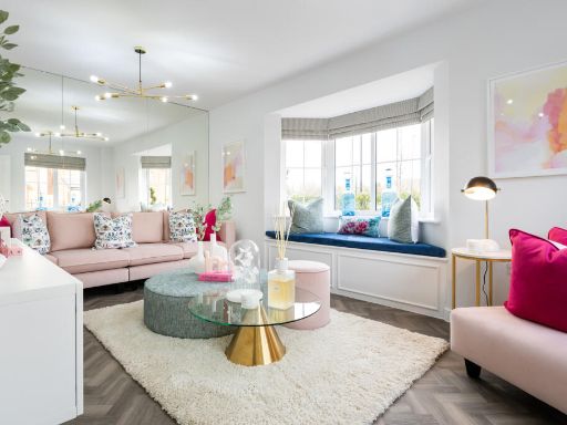 3 bedroom semi-detached house for sale in Deacons Close,
Croft,
Warrington,
WA3 — £379,995 • 3 bed • 1 bath • 905 ft²
3 bedroom semi-detached house for sale in Deacons Close,
Croft,
Warrington,
WA3 — £379,995 • 3 bed • 1 bath • 905 ft² 3 bedroom semi-detached house for sale in Deacons Close,
Croft,
Warrington,
WA3 — £354,995 • 3 bed • 1 bath • 852 ft²
3 bedroom semi-detached house for sale in Deacons Close,
Croft,
Warrington,
WA3 — £354,995 • 3 bed • 1 bath • 852 ft²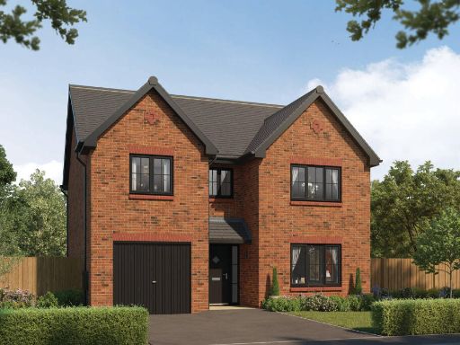 4 bedroom detached house for sale in Deacons Close,
Croft,
Warrington,
WA3 — £599,995 • 4 bed • 1 bath • 1528 ft²
4 bedroom detached house for sale in Deacons Close,
Croft,
Warrington,
WA3 — £599,995 • 4 bed • 1 bath • 1528 ft²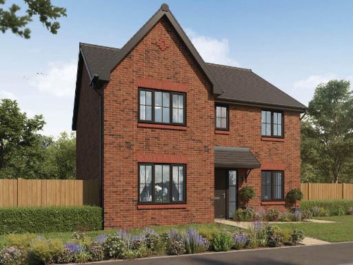 4 bedroom detached house for sale in Deacons Close,
Croft,
Warrington,
WA3 — £599,995 • 4 bed • 1 bath • 1489 ft²
4 bedroom detached house for sale in Deacons Close,
Croft,
Warrington,
WA3 — £599,995 • 4 bed • 1 bath • 1489 ft²
Meta
- {
"@context": "https://schema.org",
"@type": "Residence",
"name": "3 bedroom semidetached house for sale in Deacons Close, Cro…",
"description": "",
"url": "https://propertypiper.co.uk/property/81a15d6f-f148-4440-94e1-dc4e378a795a",
"image": "https://image-a.propertypiper.co.uk/81b6f885-502c-4c98-a80a-0157e94b37f6-1024.jpeg",
"address": {
"@type": "PostalAddress",
"streetAddress": "Deacons Close,\r\nCroft,\r\nWarrington,\r\nWA3",
"postalCode": "WA3 7EN",
"addressLocality": "Warrington",
"addressRegion": "Warrington North",
"addressCountry": "England"
},
"geo": {
"@type": "GeoCoordinates",
"latitude": 53.43938161346384,
"longitude": -2.5521316280713635
},
"numberOfRooms": 3,
"numberOfBathroomsTotal": 1,
"floorSize": {
"@type": "QuantitativeValue",
"value": 852,
"unitCode": "FTK"
},
"offers": {
"@type": "Offer",
"price": 364995,
"priceCurrency": "GBP",
"availability": "https://schema.org/InStock"
},
"additionalProperty": [
{
"@type": "PropertyValue",
"name": "Feature",
"value": "semi-detached"
},
{
"@type": "PropertyValue",
"name": "Feature",
"value": "modern"
},
{
"@type": "PropertyValue",
"name": "Feature",
"value": "brick façade"
},
{
"@type": "PropertyValue",
"name": "Feature",
"value": "two-story"
},
{
"@type": "PropertyValue",
"name": "Feature",
"value": "driveway"
},
{
"@type": "PropertyValue",
"name": "Feature",
"value": "well-kept garden"
},
{
"@type": "PropertyValue",
"name": "Feature",
"value": "new construction"
},
{
"@type": "PropertyValue",
"name": "Feature",
"value": "residential area"
},
{
"@type": "PropertyValue",
"name": "Feature",
"value": "modern"
},
{
"@type": "PropertyValue",
"name": "Feature",
"value": "contemporary"
},
{
"@type": "PropertyValue",
"name": "Feature",
"value": "living room"
},
{
"@type": "PropertyValue",
"name": "Feature",
"value": "neutral colors"
},
{
"@type": "PropertyValue",
"name": "Feature",
"value": "artwork"
},
{
"@type": "PropertyValue",
"name": "Feature",
"value": "pendant lighting"
},
{
"@type": "PropertyValue",
"name": "Feature",
"value": "shelves"
},
{
"@type": "PropertyValue",
"name": "Feature",
"value": "bright"
}
]
}
High Res Floorplan Images
Compatible Floorplan Images
FloorplanImages Thumbnail