SO19 9QQ - 2 bedroom maisonette for sale in Wadhurst Gardens, Southamp…
View on Property Piper
2 bedroom maisonette for sale in Wadhurst Gardens, Southampton, SO19
Property Details
- Price: £190000
- Bedrooms: 2
- Bathrooms: 1
- Property Type: undefined
- Property SubType: undefined
Brochure Descriptions
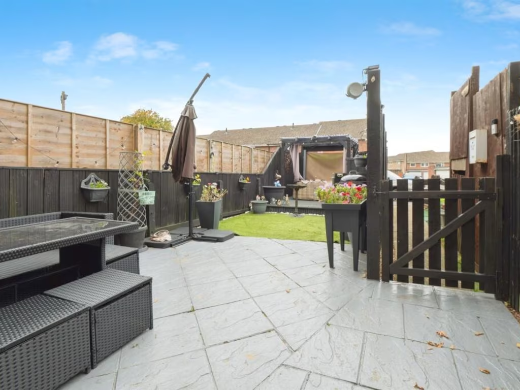
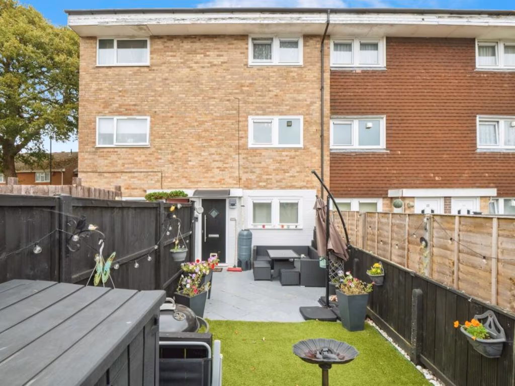
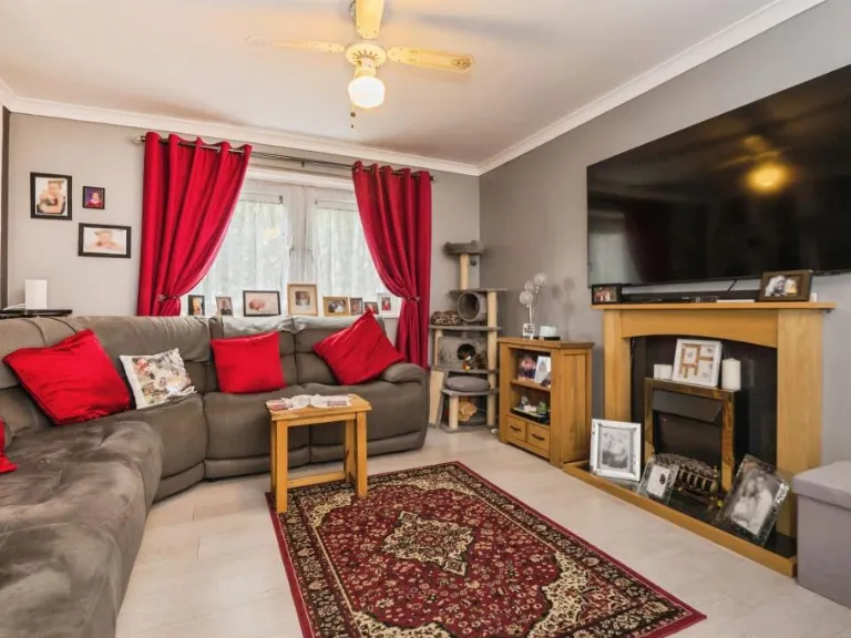
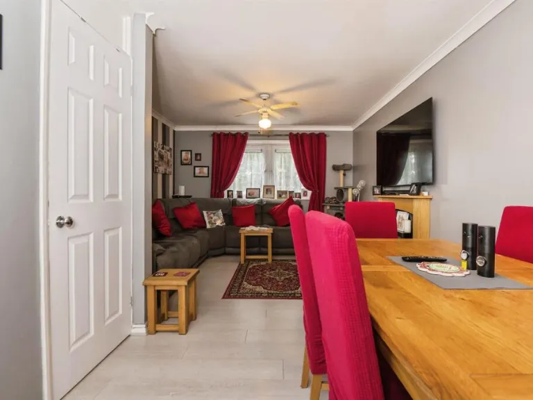
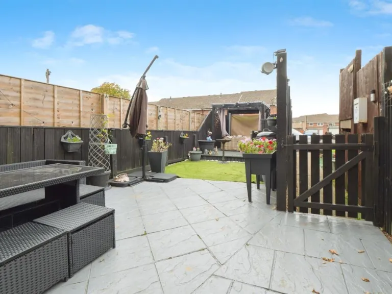
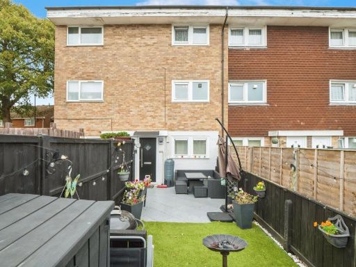
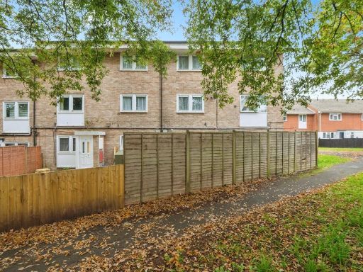
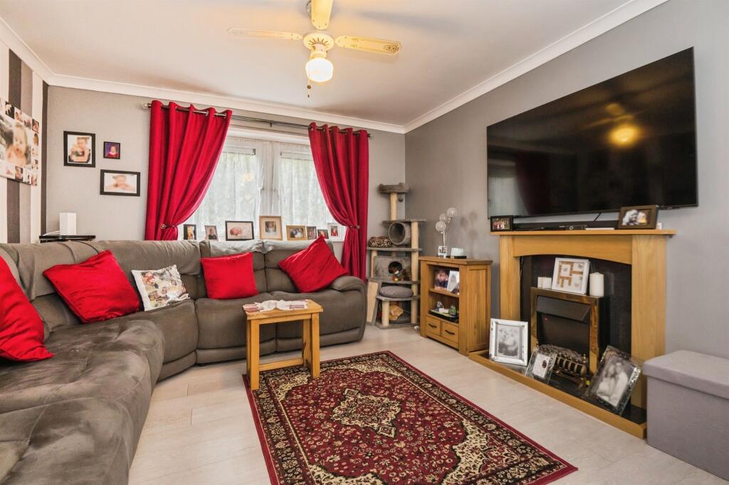
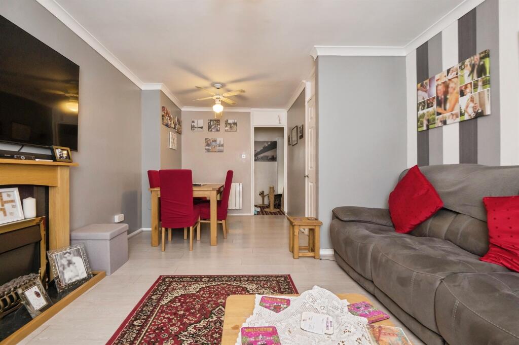
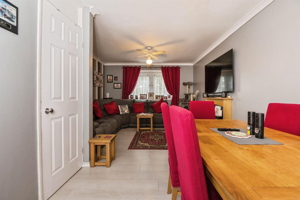
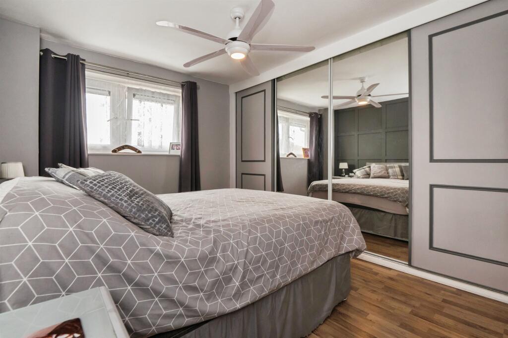
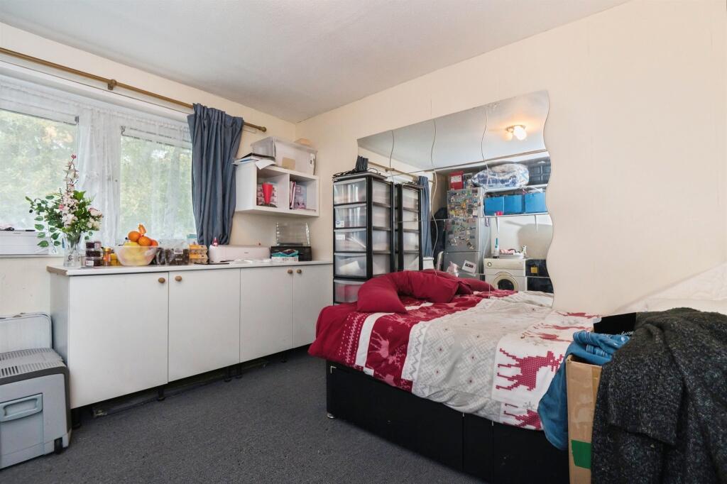
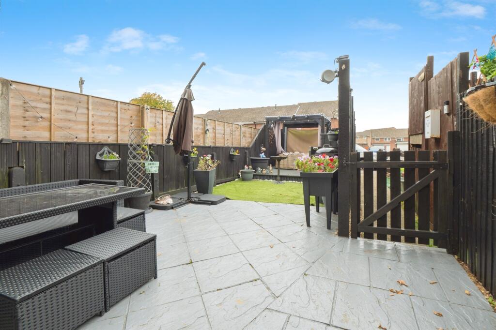
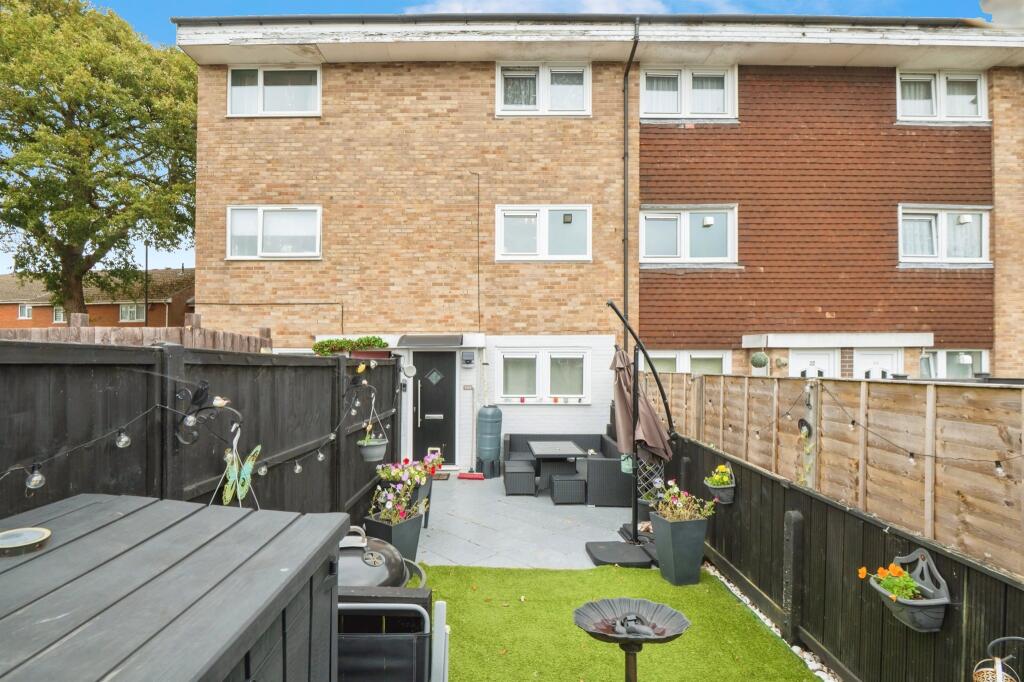
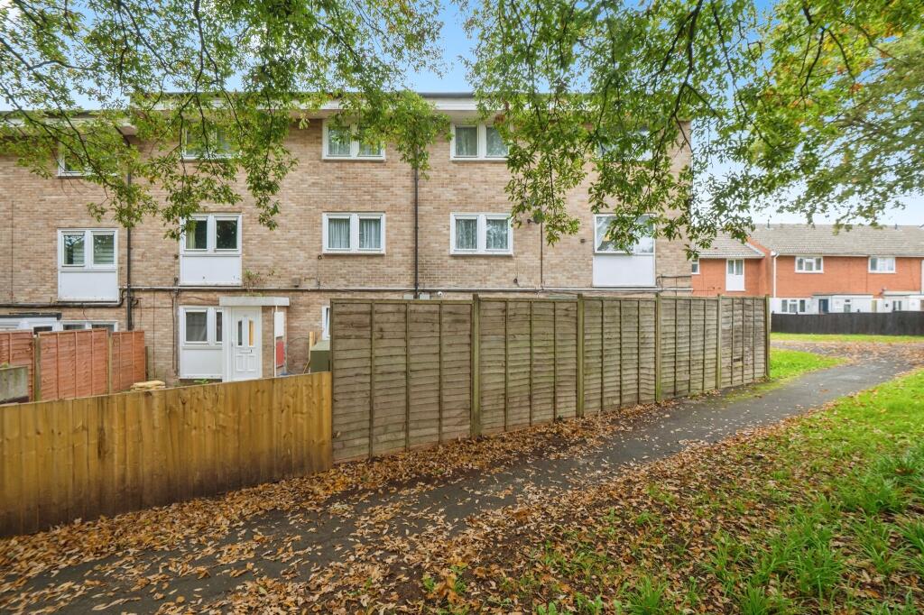
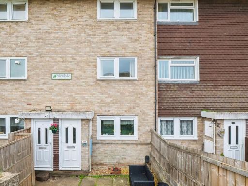
- Purpose-built block containing flats; this listing appears to be a ground-floor/maisonette style flat located on Wadhurst Gardens, Southampton. Exterior shows a small enclosed private yard/entrance area and on-street parking immediately outside. Interior photos show an open-plan lounge/dining room of average proportion, presented in good decorative order with laminate flooring, a focal fireplace and space for a dining table. Overall room sizes read as small-to-average, consistent with a one- or two-bedroom flat. The property likely offers low-maintenance outdoor space (small enclosed yard) and would suit first-time buyers or investors. No exceptional views are visible (residential/urban setting with trees nearby).
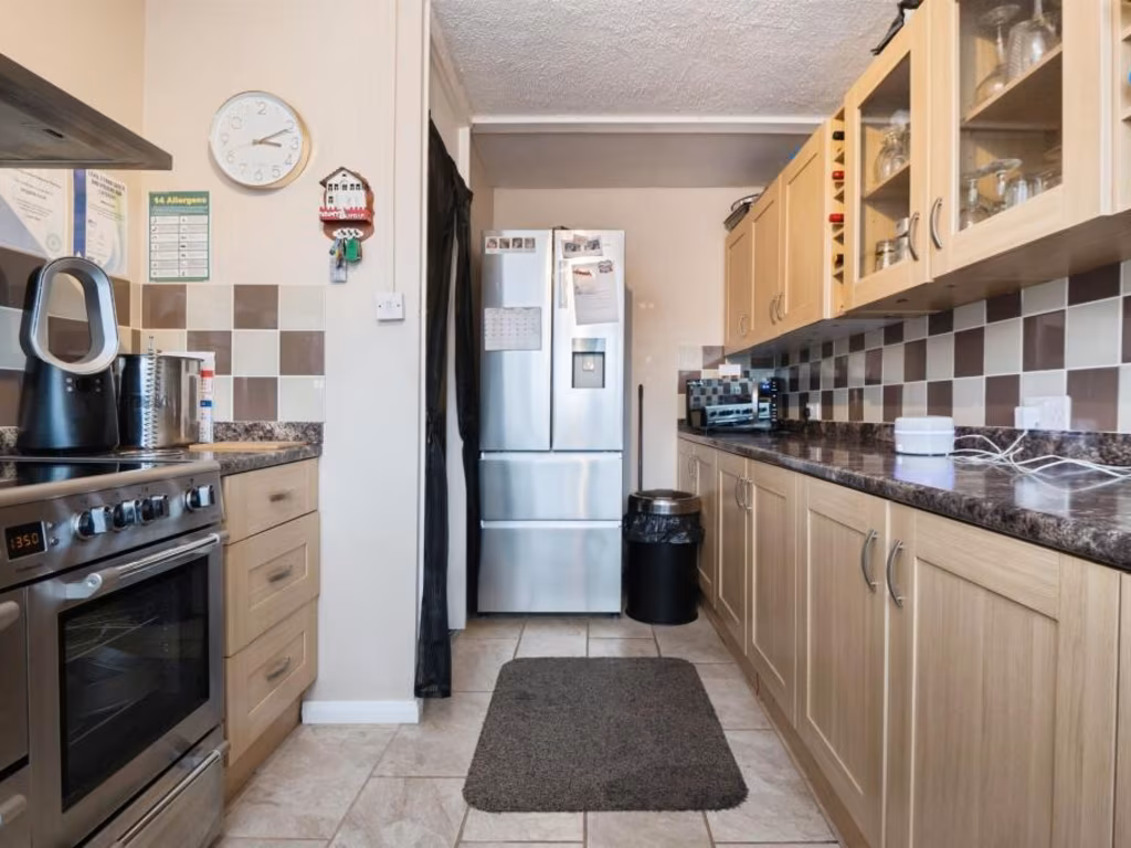
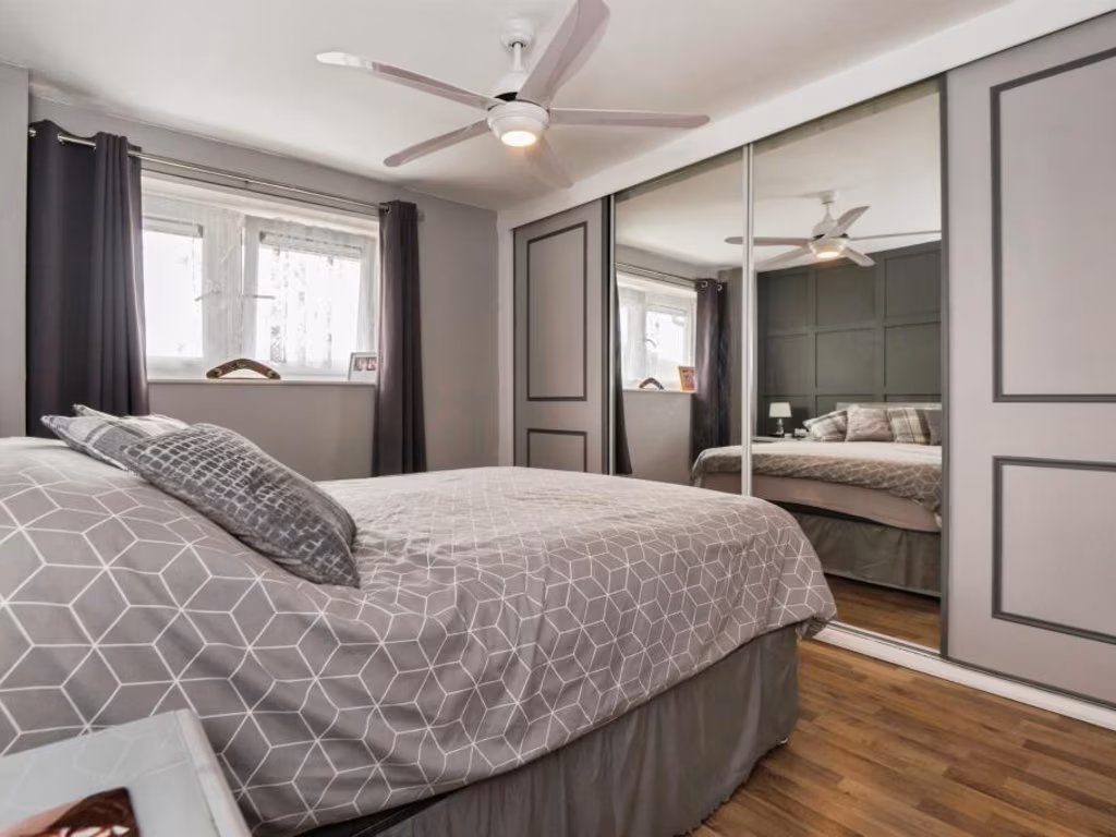
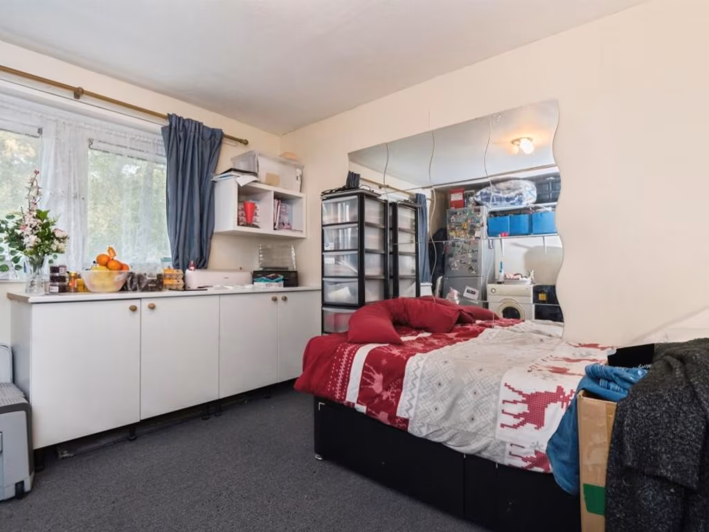
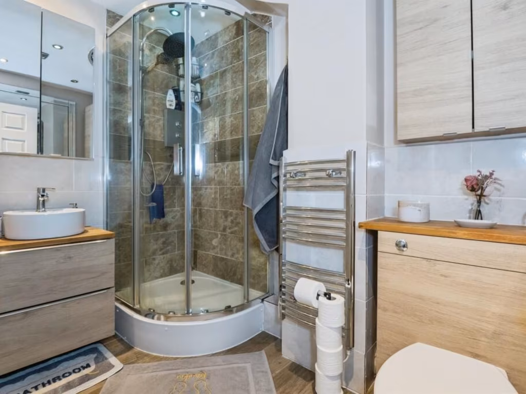
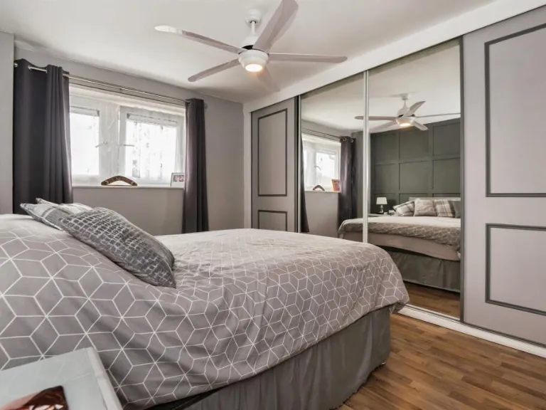
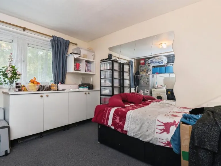
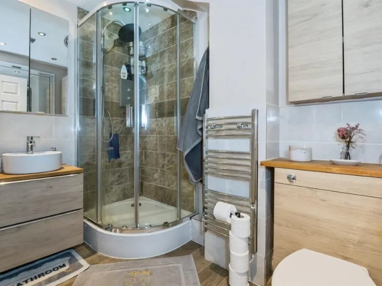
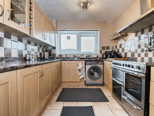
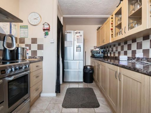
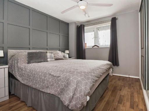
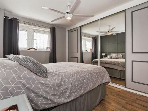
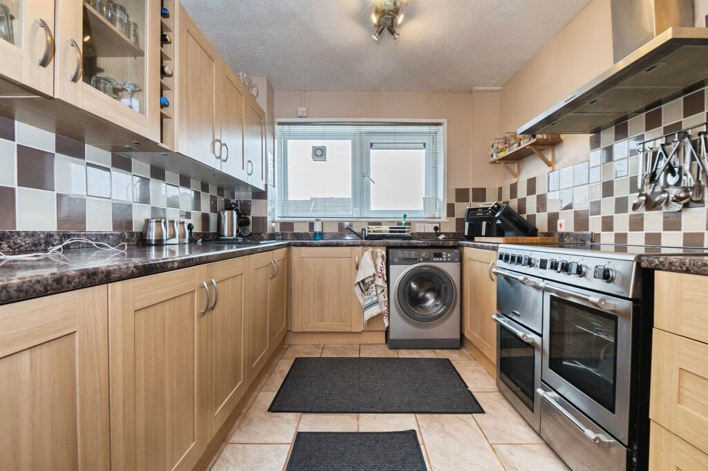
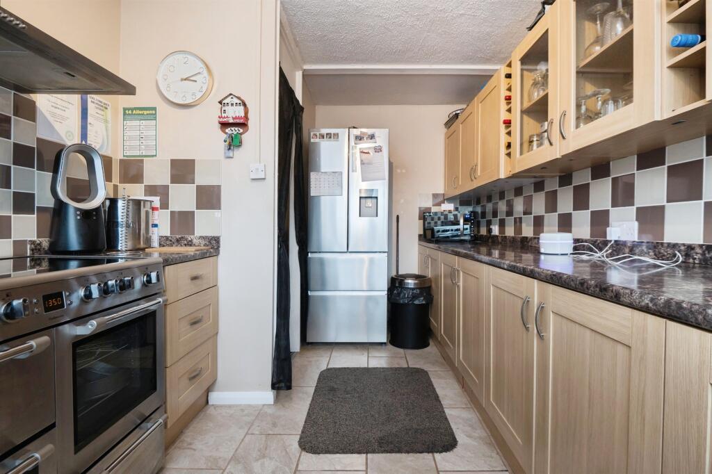
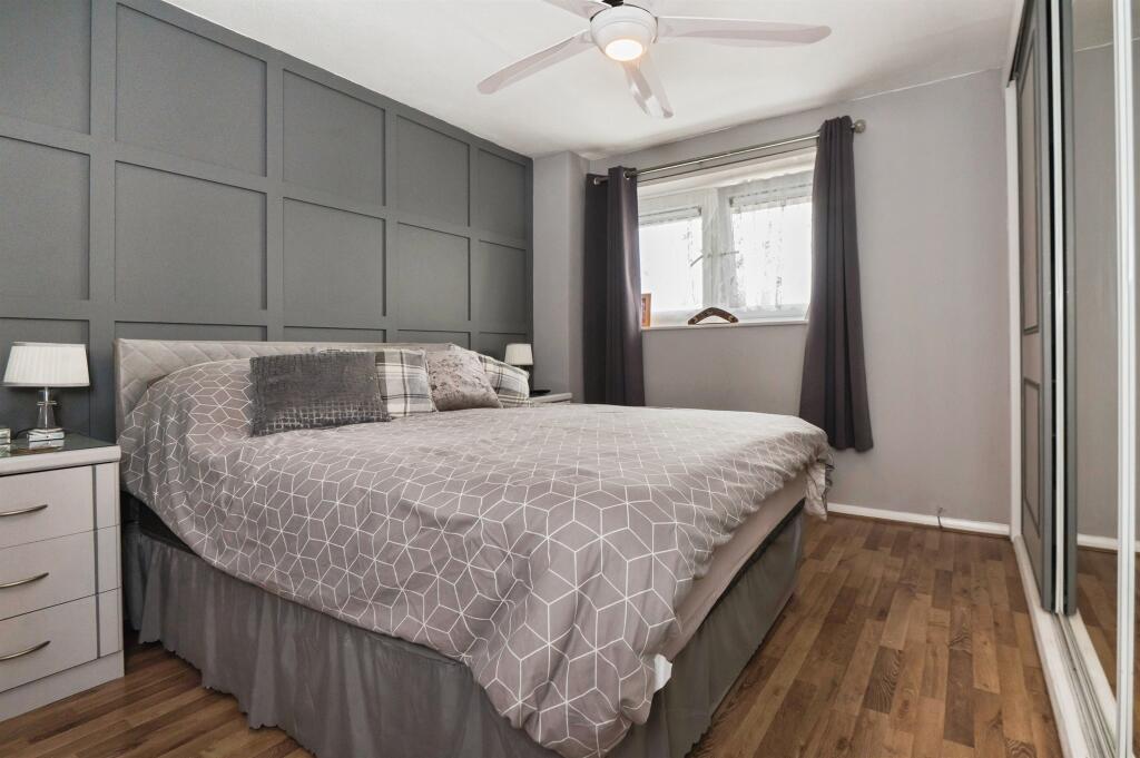
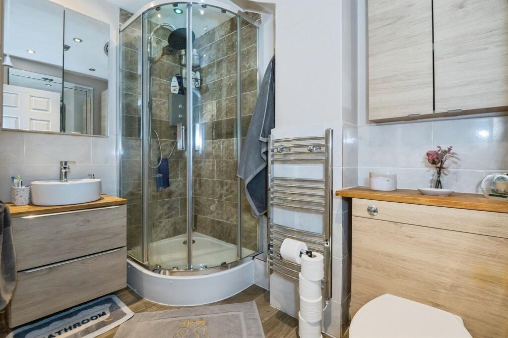
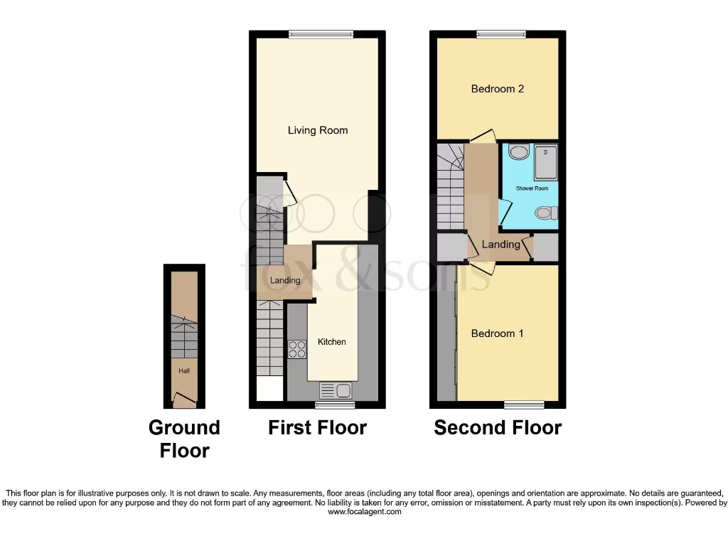
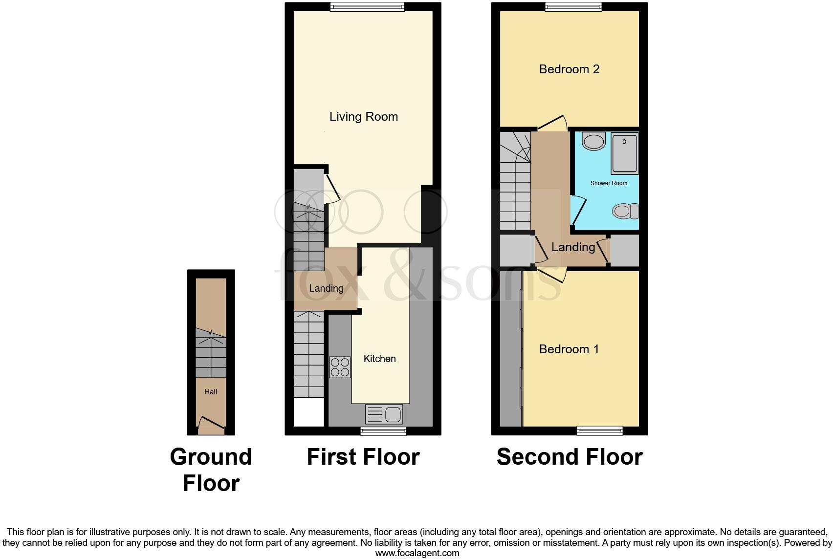
- First-floor maisonette presented over three levels (ground entrance, first-floor living/kitchen and second-floor sleeping accommodation). The property comprises two bedrooms, a spacious lounge/diner, fitted kitchen and a shower room. Accommodation footprint is relatively compact but efficiently arranged vertically; overall property size is small-to-average for a maisonette. No garden or external grounds are shown on the floorplan. Suitable for first-time buyers or investors seeking a modest two-bedroom flat in Southampton. EPC rating shown as C; leasehold with service charge and ground rent noted.
Image Descriptions
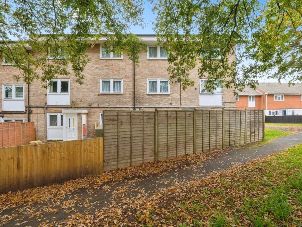
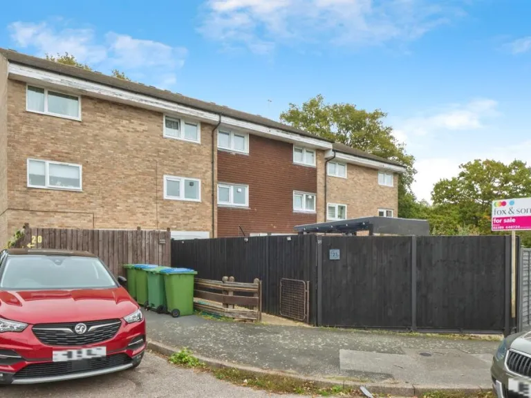
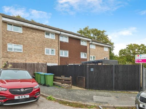
- exterior of a terraced house Post-war
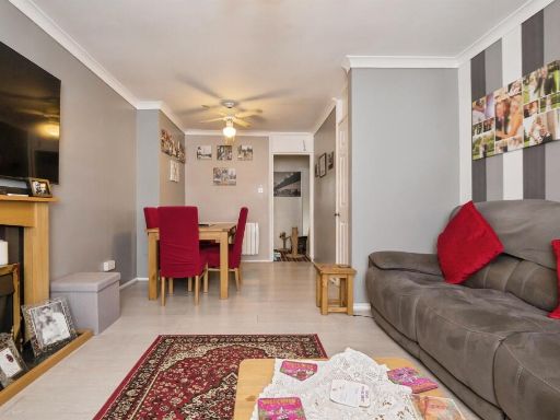
- living room modern
Floorplan Description
- Three-storey property with kitchen, living room, two bedrooms and shower room
Rooms
- Hall:
- Landing:
- Kitchen:
- Living Room:
- Landing:
- Shower Room:
- Bedroom 1:
- Bedroom 2:
Textual Property Features
Detected Visual Features
- Post-war
- terrace
- residential area
- brick facade
- flat roof
- exterior condition unknown
- limited parking
- potential maintenance
- modern
- living room
- fireplace
- ceiling fan
EPC Details
- Fully double glazed
- Cavity wall, filled cavity
- Electric storage heaters
- Low energy lighting in all fixed outlets
- (another dwelling below)
Nearby Schools
- Weston Shore Infant School
- Oasis Academy Mayfield
- Woolston Infant School
- St Monica Primary School
- Glenfield Infant School
- Bitterne Manor Primary School
- Netley Abbey Infant School
- Weston Secondary School
- Valentine Primary School
- Ludlow Infant Academy
- Hightown Primary School
- Sholing Infant School
- Sholing Junior School
- CHARLTON HOUSE SCHOOL LIMITED
- Moorlands Primary School
- The Hamble School
- Bitterne CE Primary School
- Woodlands Community College
- Hamble Primary School
- Netley Abbey Junior School
- Weston Park Primary School
- St Patrick's Catholic Primary School
- Ludlow Junior School
- Oasis Academy Sholing
- Thornhill Primary School
- Beechwood Junior School
- Harefield Primary School
Nearest General Shops
- Id: 382938005
- Tags:
- Addr:
- City: Southampton
- Postcode: SO19 9NA
- Street: Ashley Crescent
- Building: yes
- Name: Picador Accident Repair Centre
- Shop: car_repair
- TagsNormalized:
- Lat: 50.8921816
- Lon: -1.3455975
- FullGeoHash: gcp192shmq3b
- PartitionGeoHash: gcp1
- Images:
- FoodStandards: null
- Distance: 952.3
,- Id: 4600235907
- Tags:
- Addr:
- City: Southampton
- Street: Portsmouth Road
- Name: Cutting Edge
- Shop: hairdresser
- TagsNormalized:
- Lat: 50.8943576
- Lon: -1.3515807
- FullGeoHash: gcp191pc1guk
- PartitionGeoHash: gcp1
- Images:
- FoodStandards: null
- Distance: 884
,- Id: 30064465
- Tags:
- Addr:
- City: Southampton
- Country: GB
- Postcode: SO19 9HL
- Barrier: wall
- Name: Mayfield Nursery
- Shop: garden_centre
- Source: Bing_Aerial
- TagsNormalized:
- Lat: 50.8934336
- Lon: -1.3606615
- FullGeoHash: gcp190c5wr9h
- PartitionGeoHash: gcp1
- Images:
- FoodStandards: null
- Distance: 772.4
}
Nearest Grocery shops
- Id: 6991211146
- Tags:
- Addr:
- City: Southampton
- Country: GB
- Housenumber: 80
- Postcode: SO19 9HG
- Street: Weston Lane
- Brand: Co-op Food
- Brand:wikidata: Q3277439
- Brand:wikipedia: en:Co-op Food
- Fhrs:
- Name: Co-op Food
- Operator: The Co-operative Group
- Operator:wikidata: Q117202
- Shop: convenience
- TagsNormalized:
- co-op
- co-op food
- food
- convenience
- shop
- Lat: 50.8893382
- Lon: -1.3675524
- FullGeoHash: gcp18bh5vspn
- PartitionGeoHash: gcp1
- Images:
- FoodStandards:
- Id: 219166
- FHRSID: 219166
- LocalAuthorityBusinessID: 20720/0080/0/000
- BusinessName: The Co-Operative Food
- BusinessType: Retailers - supermarkets/hypermarkets
- BusinessTypeID: 7840
- AddressLine1: 80 Weston Lane
- AddressLine2: Southampton
- AddressLine3: null
- AddressLine4: null
- PostCode: SO19 9HG
- RatingValue: 5
- RatingKey: fhrs_5_en-GB
- RatingDate: 2016-10-19
- LocalAuthorityCode: 877
- LocalAuthorityName: Southampton
- LocalAuthorityWebSite: http://www.southampton.gov.uk
- LocalAuthorityEmailAddress: hygiene.rating@southampton.gov.uk
- Scores:
- Hygiene: 0
- Structural: 0
- ConfidenceInManagement: 0
- NewRatingPending: false
- Geocode:
- Longitude: -1.36465900000000
- Latitude: 50.89019500000000
- Distance: 821.5
,- Id: 813651958
- Tags:
- Addr:
- Housenumber: 2
- Postcode: SO19 9HQ
- Street: Newtown Road
- Building: yes
- Name: Dhaliwal Late Shopper
- Shop: convenience
- TagsNormalized:
- Lat: 50.8940416
- Lon: -1.3582004
- FullGeoHash: gcp190fzr8ur
- PartitionGeoHash: gcp1
- Images:
- FoodStandards: null
- Distance: 790.5
,- Id: 284262281
- Tags:
- Brand: The Co-operative Food
- Brand:wikidata: Q107617274
- Building: yes
- Name: The Co-operative Food
- Shop: convenience
- Source: Bing
- TagsNormalized:
- the co-operative food
- food
- convenience
- shop
- Lat: 50.886374
- Lon: -1.3582656
- FullGeoHash: gcp13pdfw5eu
- PartitionGeoHash: gcp1
- Images:
- FoodStandards: null
- Distance: 147.3
}
Nearest Religious buildings
- Id: 27232277
- Tags:
- Amenity: place_of_worship
- Denomination: methodist
- Name: Saint Andrew's
- Religion: christian
- TagsNormalized:
- place of worship
- methodist
- christian
- church
- Lat: 50.8983323
- Lon: -1.3497941
- FullGeoHash: gcp193c078bd
- PartitionGeoHash: gcp1
- Images:
- FoodStandards: null
- Distance: 1341.2
,- Id: 839343006
- Tags:
- Amenity: place_of_worship
- Building: yes
- Denomination: anglican
- Heritage: yes
- Name: Saint Edward The Confessor Church, Hound
- Religion: christian
- Wikidata: Q26405764
- TagsNormalized:
- place of worship
- anglican
- church
- christian
- Lat: 50.8777401
- Lon: -1.3561758
- FullGeoHash: gcp13nh2qf4j
- PartitionGeoHash: gcp1
- Images:
- FoodStandards: null
- Distance: 1032.1
,- Id: 153201508
- Tags:
- Addr:
- City: Southampton
- Street: Weston Lane
- Amenity: place_of_worship
- Denomination: anglican
- Name: Holy Trinity Weston
- Religion: christian
- Service_times: Su 09:00-10:00; Su 10:30-12:00; Su[1] 18:30
- Wikidata: Q105084862
- TagsNormalized:
- place of worship
- anglican
- christian
- church
- Lat: 50.8897083
- Lon: -1.3656357
- FullGeoHash: gcp18bjw43hn
- PartitionGeoHash: gcp1
- Images:
- FoodStandards: null
- Distance: 711.4
}
Nearest Medical buildings
- Id: 148730262
- Tags:
- Addr:
- City: Southampton
- Country: GB
- Housenumber: 66
- Postcode: SO19 9AL
- Street: Portsmouth Road
- Amenity: doctors
- Building: yes
- Healthcare: doctor
- Name: Woolston Lodge Surgery
- Website: http://www.woolstonlodge.co.uk/
- TagsNormalized:
- doctor
- doctors
- health
- healthcare
- surgery
- Lat: 50.8970585
- Lon: -1.3722581
- FullGeoHash: gcp18c8bb56h
- PartitionGeoHash: gcp1
- Images:
- FoodStandards: null
- Distance: 1574.2
,- Id: 640321048
- Tags:
- Amenity: pharmacy
- Healthcare: pharmacy
- Name: Lloyds Pharmacy Woolston
- Opening_hours: Mo-Fr 08:30-19:00
- TagsNormalized:
- pharmacy
- health
- healthcare
- lloyds pharmacy
- Lat: 50.8971316
- Lon: -1.372078
- FullGeoHash: gcp18c8ck302
- PartitionGeoHash: gcp1
- Images:
- FoodStandards: null
- Distance: 1571.1
,- Id: 148730890
- Tags:
- Addr:
- City: Southampton
- Country: GB
- Housenumber: 68a
- Postcode: SO19 9AN
- Street: Portsmouth Road
- Amenity: doctors
- Building: yes
- Healthcare: doctor
- Name: The Old Fire Station Surgery
- Website: https://www.oldfirestationsurgery.co.uk/
- TagsNormalized:
- doctor
- doctors
- health
- healthcare
- Lat: 50.8969368
- Lon: -1.3717886
- FullGeoHash: gcp18c905h8q
- PartitionGeoHash: gcp1
- Images:
- FoodStandards: null
- Distance: 1541.4
,- Id: 255055547
- Tags:
- Addr:
- City: Southampton
- Country: GB
- Postcode: SO19 9GH
- Amenity: doctors; pharmacy
- Building: yes
- Dispensing: yes
- Name: Weston Lane Centre for Healthy Living
- Source: Bing
- TagsNormalized:
- doctor
- doctors
- pharmacy
- health
- Lat: 50.8888374
- Lon: -1.369566
- FullGeoHash: gcp18b48yyce
- PartitionGeoHash: gcp1
- Images:
- FoodStandards: null
- Distance: 943.2
}
Nearest Airports
- Id: 100647893
- Tags:
- Aerodrome: international
- Aerodrome:type: public
- Aeroway: aerodrome
- Contact:
- Vhf:
- Approach: 120.225 MHz
- Tower: 118.2 MHz
- Ele: 44ft
- Iata: SOU
- Icao: EGHI
- Is_in: Hampshire, England,UK
- Name: Southampton Airport
- Operator: Southampton International Airport Limited
- Source: Bing;Gagravarr_Airports
- Wikidata: Q8988
- Wikipedia: en:Southampton Airport
- TagsNormalized:
- airport
- international airport
- Lat: 50.9513872
- Lon: -1.3516684
- FullGeoHash: gcp1c5rtrffz
- PartitionGeoHash: gcp1
- Images:
- FoodStandards: null
- Distance: 7165
}
Nearest Leisure Facilities
- Id: 30041868
- Tags:
- Building: yes
- Leisure: sports_centre
- Name: Chamberlayne Leisure Centre
- TagsNormalized:
- sports
- sports centre
- leisure
- Lat: 50.8906611
- Lon: -1.3613636
- FullGeoHash: gcp1902etfvd
- PartitionGeoHash: gcp1
- Images:
- FoodStandards: null
- Distance: 532.5
,- Id: 105885397
- Tags:
- Leisure: playground
- Source: Bing
- TagsNormalized:
- Lat: 50.8855694
- Lon: -1.3606136
- FullGeoHash: gcp13p3jzmsv
- PartitionGeoHash: gcp1
- Images:
- FoodStandards: null
- Distance: 334.8
,- Id: 154540158
- Tags:
- Barrier: fence
- Leisure: pitch
- TagsNormalized:
- Lat: 50.8879428
- Lon: -1.3582501
- FullGeoHash: gcp13pfgy2p6
- PartitionGeoHash: gcp1
- Images:
- FoodStandards: null
- Distance: 163.6
,- Id: 42746672
- Tags:
- Leisure: playground
- Name: Tickleford Gulley Play Area
- TagsNormalized:
- Lat: 50.8878481
- Lon: -1.3545334
- FullGeoHash: gcp13pvejn6t
- PartitionGeoHash: gcp1
- Images:
- FoodStandards: null
- Distance: 161.9
,- Id: 154540160
- Tags:
- Barrier: fence
- Leisure: pitch
- TagsNormalized:
- Lat: 50.8876949
- Lon: -1.3578012
- FullGeoHash: gcp13pg62cyh
- PartitionGeoHash: gcp1
- Images:
- FoodStandards: null
- Distance: 121.8
}
Nearest Tourist attractions
- Id: 26920905
- Tags:
- Historic: ruins
- Name: Netley Abbey
- Ruins: abbey
- Tourism: attraction
- Website: https://www.english-heritage.org.uk/visit/places/netley-abbey/
- TagsNormalized:
- Lat: 50.8784786
- Lon: -1.3571372
- FullGeoHash: gcp13n5u87v4
- PartitionGeoHash: gcp1
- Images:
- FoodStandards: null
- Distance: 951.1
,- Id: 2449939418
- Tags:
- TagsNormalized:
- Lat: 50.8818665
- Lon: -1.3619038
- FullGeoHash: gcp13nb2376u
- PartitionGeoHash: gcp1
- Images:
- FoodStandards: null
- Distance: 689.8
,- Id: 2449939419
- Tags:
- TagsNormalized:
- Lat: 50.8835448
- Lon: -1.3523465
- FullGeoHash: gcp13pp60h1r
- PartitionGeoHash: gcp1
- Images:
- FoodStandards: null
- Distance: 481.2
}
Nearest Train stations
- Id: 534773954
- Tags:
- Name: Piccadilly
- Public_transport: station
- Railway: station
- Usage: tourism
- TagsNormalized:
- Lat: 50.8672955
- Lon: -1.3407083
- FullGeoHash: gcp13kperppk
- PartitionGeoHash: gcp1
- Images:
- FoodStandards: null
- Distance: 2455.1
,- Id: 534773861
- Tags:
- Name: Chapel Road Station
- Public_transport: station
- Railway: station
- Usage: tourism
- TagsNormalized:
- Lat: 50.8672425
- Lon: -1.3409694
- FullGeoHash: gcp13kpe1jk8
- PartitionGeoHash: gcp1
- Images:
- FoodStandards: null
- Distance: 2452.3
,- Id: 7172235187
- Tags:
- Addr:
- City: Southampton
- Postcode: SO19 2DJ
- Street: Garton Road
- Name: Woolston
- Naptan:
- Network: National Rail
- Public_transport: station
- Railway: station
- Ref:
- Wikidata: Q2632304
- Wikipedia: en:Woolston railway station
- TagsNormalized:
- Lat: 50.8990424
- Lon: -1.3766466
- FullGeoHash: gcp189vs3v1y
- PartitionGeoHash: gcp1
- Images:
- FoodStandards: null
- Distance: 1948.6
,- Id: 15837641
- Tags:
- Name: Netley
- Naptan:
- Network: National Rail
- Public_transport: station
- Railway: station
- Ref:
- Wikidata: Q2555327
- Wikipedia: en:Netley railway station
- TagsNormalized:
- Lat: 50.8749
- Lon: -1.3416249
- FullGeoHash: gcp13mrpcbez
- PartitionGeoHash: gcp1
- Images:
- FoodStandards: null
- Distance: 1701.6
,- Id: 7172230784
- Tags:
- Internet_access: no
- Name: Sholing
- Naptan:
- Network: National Rail
- Public_transport: station
- Railway: station
- Ref:
- Wikidata: Q7500232
- Wikipedia: en:Sholing railway station
- TagsNormalized:
- Lat: 50.8964487
- Lon: -1.364194
- FullGeoHash: gcp18cqt7cxn
- PartitionGeoHash: gcp1
- Images:
- FoodStandards: null
- Distance: 1181.3
}
Nearest Bus stations and stops
- Id: 2015147416
- Tags:
- Bus: yes
- Highway: bus_stop
- Name: The Gardeners Arms
- Naptan:
- Public_transport: platform
- TagsNormalized:
- Lat: 50.8908291
- Lon: -1.3536363
- FullGeoHash: gcp190qk9fps
- PartitionGeoHash: gcp1
- Images:
- FoodStandards: null
- Distance: 466.7
,- Id: 2015147412
- Tags:
- Bus: yes
- Highway: bus_stop
- Name: The Gardeners Arms
- Naptan:
- Public_transport: platform
- TagsNormalized:
- Lat: 50.8906261
- Lon: -1.3533735
- FullGeoHash: gcp190qe2h79
- PartitionGeoHash: gcp1
- Images:
- FoodStandards: null
- Distance: 454.7
,- Id: 638906202
- Tags:
- Bus: yes
- Highway: bus_stop
- Name: Poulner Close
- Naptan:
- Public_transport: platform
- TagsNormalized:
- Lat: 50.8879621
- Lon: -1.3617442
- FullGeoHash: gcp13pb7v59y
- PartitionGeoHash: gcp1
- Images:
- FoodStandards: null
- Distance: 387.1
,- Id: 973825095
- Tags:
- Bus: yes
- Highway: bus_stop
- Name: Drayton Close
- Naptan:
- Public_transport: platform
- TagsNormalized:
- Lat: 50.8859827
- Lon: -1.3613848
- FullGeoHash: gcp13p88m6ty
- PartitionGeoHash: gcp1
- Images:
- FoodStandards: null
- Distance: 366.1
,- Id: 638906132
- Tags:
- Bus: yes
- Highway: bus_stop
- Name: Winchfield Close
- Naptan:
- Public_transport: platform
- TagsNormalized:
- Lat: 50.8873278
- Lon: -1.3601301
- FullGeoHash: gcp13pc84tmq
- PartitionGeoHash: gcp1
- Images:
- FoodStandards: null
- Distance: 261.6
}
Nearest Hotels
- Id: 183445905
- Tags:
- Addr:
- City: Southampton
- Country: GB
- Housenumber: 2
- Postcode: SO14 3DT
- Street: Terminus Terrace
- Amenity: pub
- Building: yes
- Fhrs:
- Name: The London Hotel
- TagsNormalized:
- Lat: 50.8980445
- Lon: -1.3970486
- FullGeoHash: gcp181www7jj
- PartitionGeoHash: gcp1
- Images:
- FoodStandards: null
- Distance: 3101.3
,- Id: 4656550089
- Tags:
- TagsNormalized:
- Lat: 50.8972821
- Lon: -1.3927163
- FullGeoHash: gcp1839f5m53
- PartitionGeoHash: gcp1
- Images:
- FoodStandards: null
- Distance: 2789.1
,- Id: 508688901
- Tags:
- Building: yes
- Building:levels: 10
- Name: Southampton Harbour Hotel and Spa
- Note: Exact boundary and other details will be added when known.
- Source: local_knowledge
- Tourism: hotel
- TagsNormalized:
- Lat: 50.8951147
- Lon: -1.392164
- FullGeoHash: gcp1834m81p2
- PartitionGeoHash: gcp1
- Images:
- FoodStandards: null
- Distance: 2663
}
Tags
- Post-war
- terrace
- residential area
- brick facade
- flat roof
- exterior condition unknown
- limited parking
- potential maintenance
- modern
- living room
- fireplace
- ceiling fan
Local Market Stats
- Average Price/sqft: £297
- Avg Income: £43600
- Rental Yield: 4.9%
- Social Housing: 23%
- Planning Success Rate: 86%
Similar Properties
 2 bedroom maisonette for sale in Wadhurst Gardens, Southampton, SO19 — £175,000 • 2 bed • 2 bath • 625 ft²
 2 bedroom maisonette for sale in Tickleford Drive, Weston, SO19 — £180,000 • 2 bed • 1 bath • 613 ft²
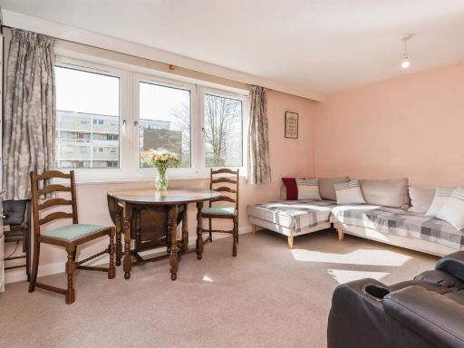 2 bedroom maisonette for sale in Wavell Road, Southampton, SO18 — £130,000 • 2 bed • 1 bath • 732 ft²
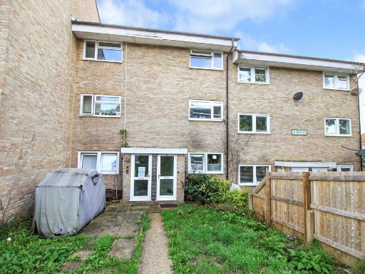 2 bedroom maisonette for sale in Staplehurst Close, Weston, SO19 — £180,000 • 2 bed • 1 bath • 648 ft²
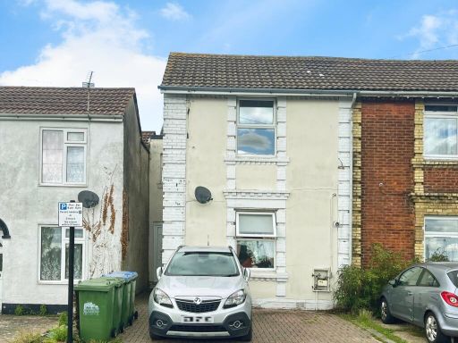 2 bedroom maisonette for sale in Elgin Road, Southampton, SO15 — £190,000 • 2 bed • 1 bath • 675 ft²
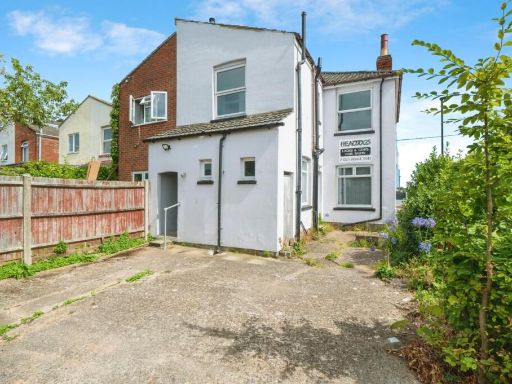 2 bedroom maisonette for sale in Ludlow Road, Southampton, SO19 — £168,000 • 2 bed • 1 bath • 592 ft²
Meta
- {
"@context": "https://schema.org",
"@type": "Residence",
"name": "2 bedroom maisonette for sale in Wadhurst Gardens, Southamp…",
"description": "",
"url": "https://propertypiper.co.uk/property/813e0696-777b-4065-b7af-748c1d218f3e",
"image": "https://image-a.propertypiper.co.uk/debbf74a-4157-40bc-8b81-7d2668409822-1024.jpeg",
"address": {
"@type": "PostalAddress",
"streetAddress": "Wadhurst Gardens, Southampton",
"postalCode": "SO19 9QQ",
"addressLocality": "Southampton",
"addressRegion": "Southampton, Itchen",
"addressCountry": "England"
},
"geo": {
"@type": "GeoCoordinates",
"latitude": 50.88702051320002,
"longitude": -1.3564320700571186
},
"numberOfRooms": 2,
"numberOfBathroomsTotal": 1,
"floorSize": {
"@type": "QuantitativeValue",
"value": 607,
"unitCode": "FTK"
},
"offers": {
"@type": "Offer",
"price": 190000,
"priceCurrency": "GBP",
"availability": "https://schema.org/InStock"
},
"additionalProperty": [
{
"@type": "PropertyValue",
"name": "Feature",
"value": "Post-war"
},
{
"@type": "PropertyValue",
"name": "Feature",
"value": "terrace"
},
{
"@type": "PropertyValue",
"name": "Feature",
"value": "residential area"
},
{
"@type": "PropertyValue",
"name": "Feature",
"value": "brick facade"
},
{
"@type": "PropertyValue",
"name": "Feature",
"value": "flat roof"
},
{
"@type": "PropertyValue",
"name": "Feature",
"value": "exterior condition unknown"
},
{
"@type": "PropertyValue",
"name": "Feature",
"value": "limited parking"
},
{
"@type": "PropertyValue",
"name": "Feature",
"value": "potential maintenance"
},
{
"@type": "PropertyValue",
"name": "Feature",
"value": "modern"
},
{
"@type": "PropertyValue",
"name": "Feature",
"value": "living room"
},
{
"@type": "PropertyValue",
"name": "Feature",
"value": "fireplace"
},
{
"@type": "PropertyValue",
"name": "Feature",
"value": "ceiling fan"
}
]
}
High Res Floorplan Images
Compatible Floorplan Images
FloorplanImages Thumbnail