CM6 2DN - 4 bedroom detached house for sale in Plot 2, The Maypoles,…
View on Property Piper
4 bedroom detached house for sale in Plot 2, The Maypoles, Great Dunmow, CM6
Property Details
- Price: £875000
- Bedrooms: 4
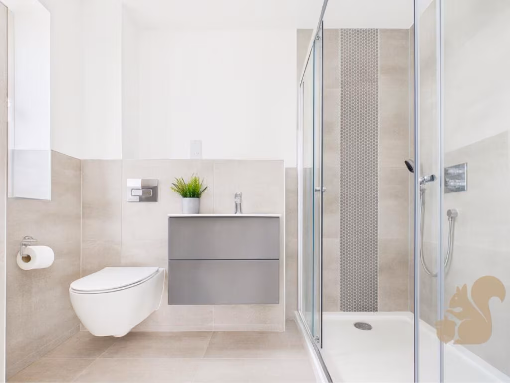
- Bathrooms: 2
- Property Type: undefined
- Property SubType: undefined
Brochure Descriptions
- Image contains only branded cover artwork for a development called "The Maypoles." No photos or text showing a residential address, exterior, interior rooms, garden or views are present. Because only the development name/brand is visible, no accurate description of the dwelling type, room count, garden size, view or overall property footprint can be inferred. From a valuator’s perspective: insufficient visual information to assess condition, size or market positioning — further marketing material or an exact address is required to provide a valuation appraisal.
- Image is a branded brochure/cover page for Oakheart Land & New Homes (marketing front) and does not show the residential property or any internal/external photos. No address, room details, floorplan or measurements are visible. As a valuator: there is insufficient information to assess condition, size or value. Recommend obtaining the full brochure, site plan and photographs (external elevations, gardens, reception rooms, kitchen, bathrooms and bedrooms) plus plot size and floor area (GIA/NIA) before any valuation.
Image Descriptions
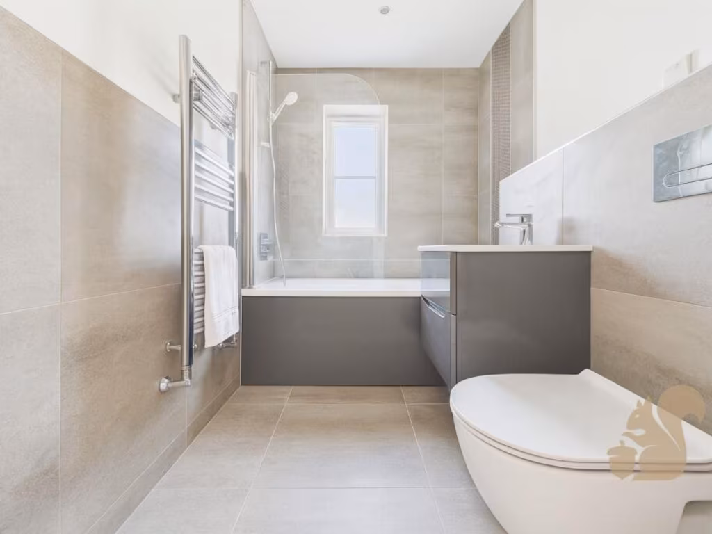
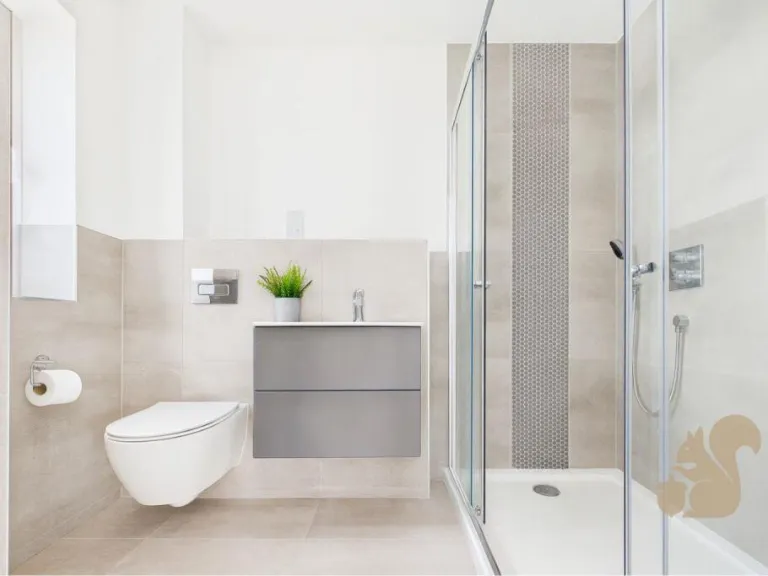
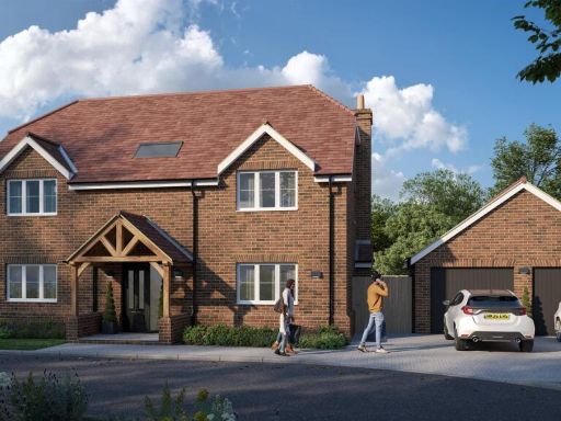
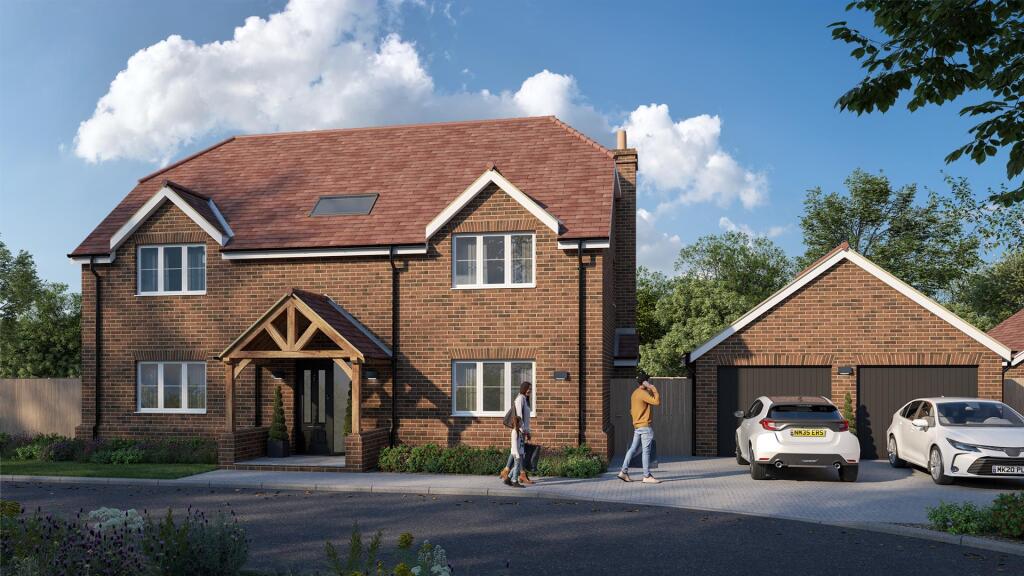
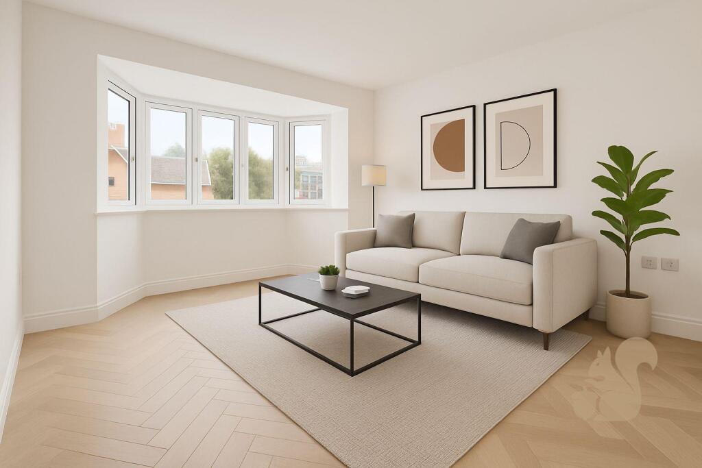
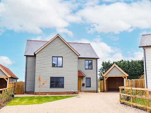
- detached house modern
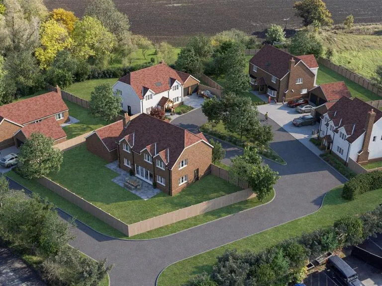
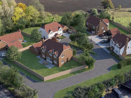
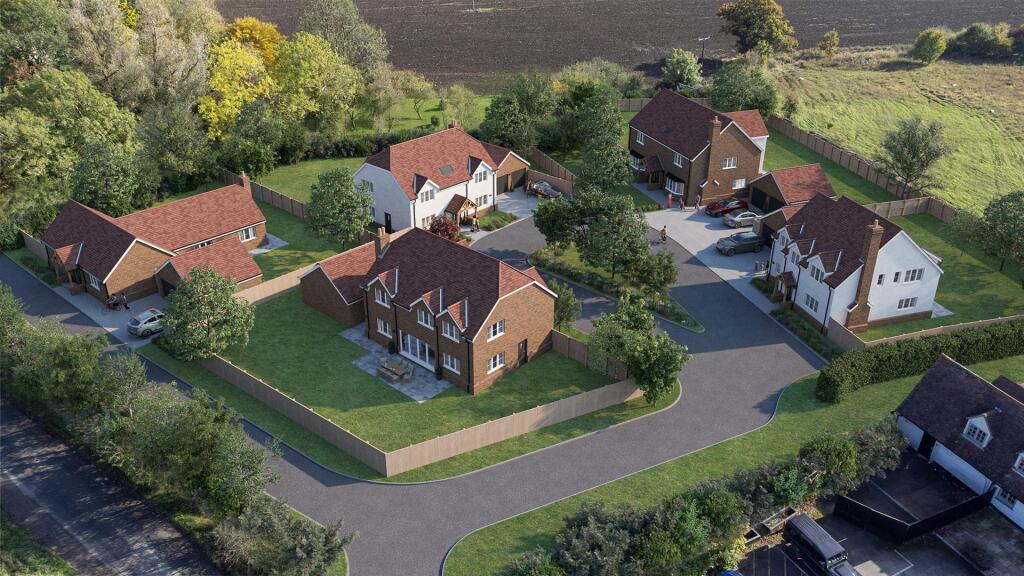
- aerial view of a new housing development modern detached homes
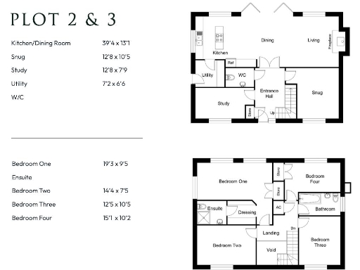
Rooms
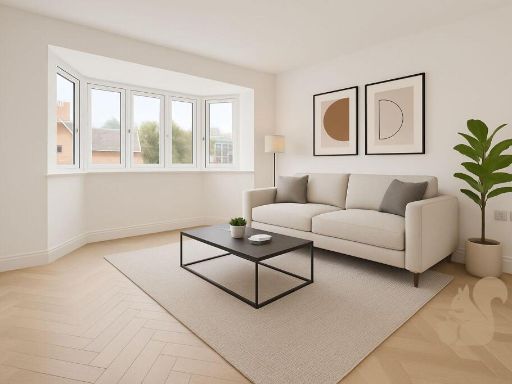
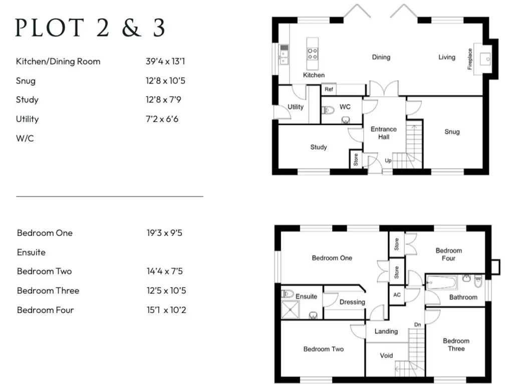
- Kitchen/Dining Room:
- Snug:
- Study:
- Utility:
- W/C:
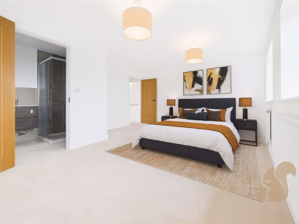
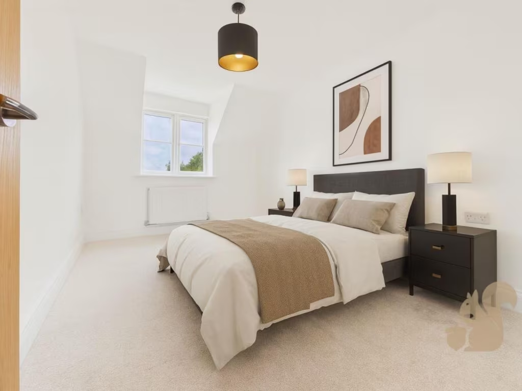
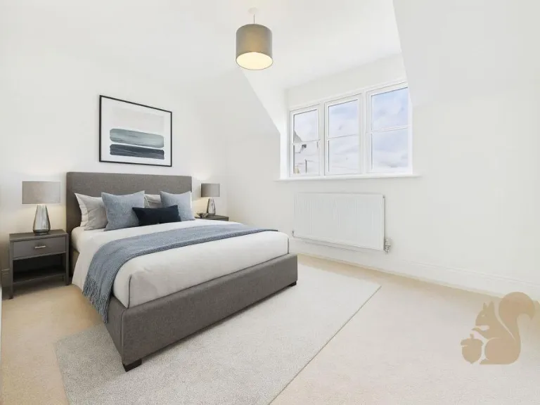
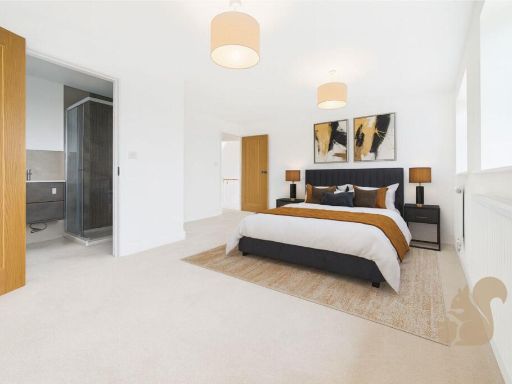
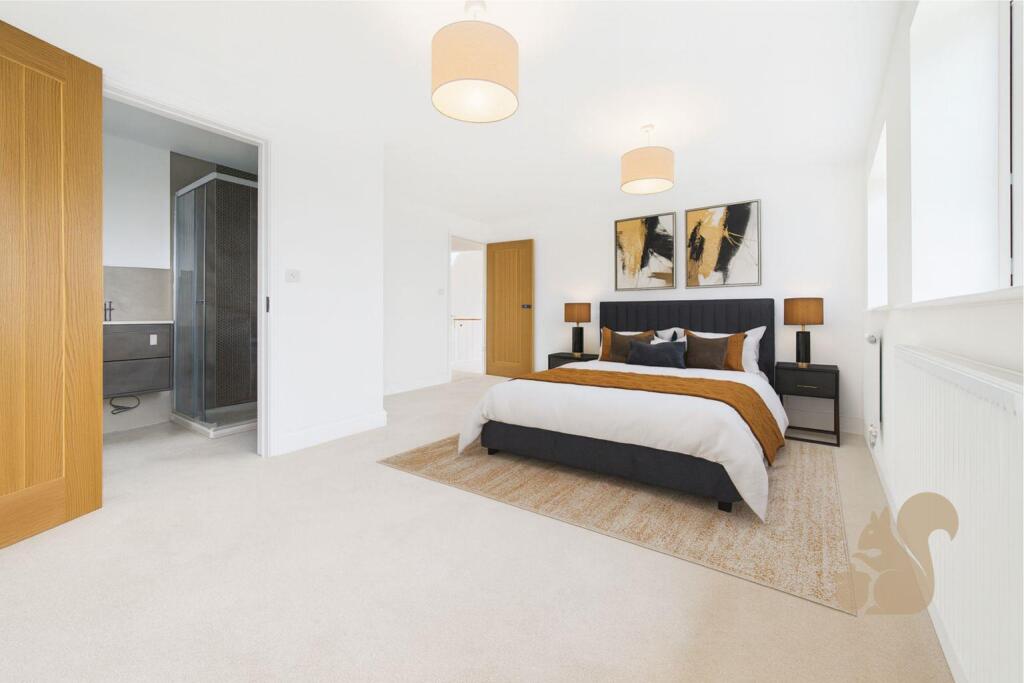
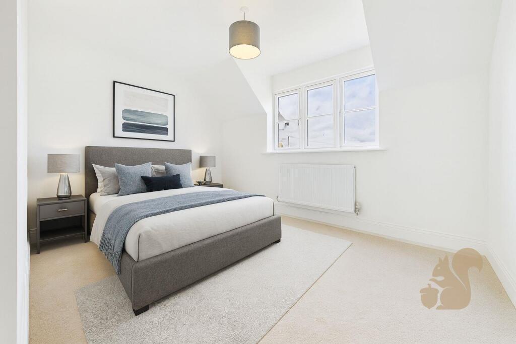
- Bedroom One:
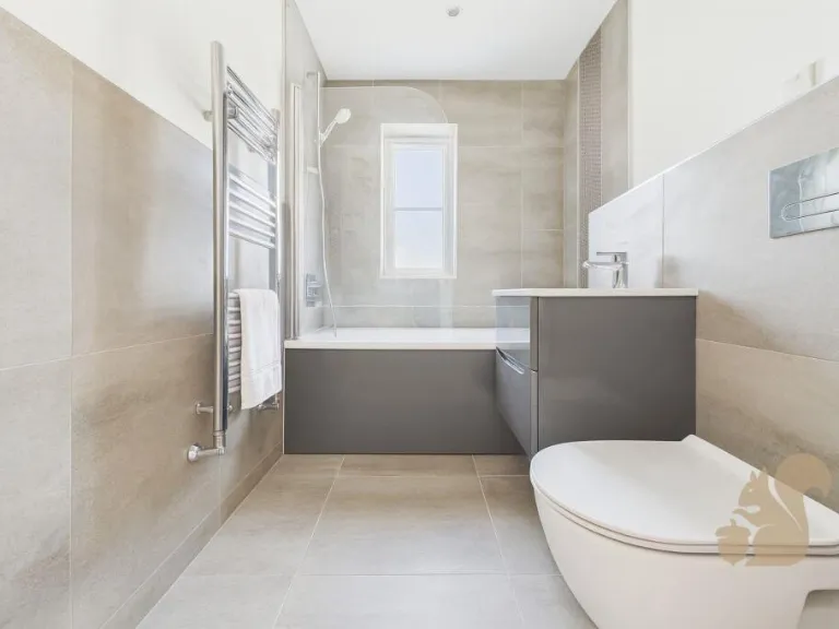
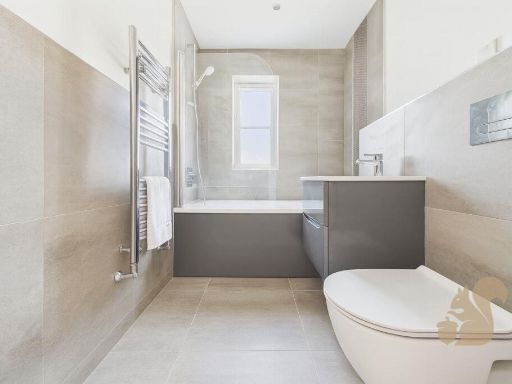
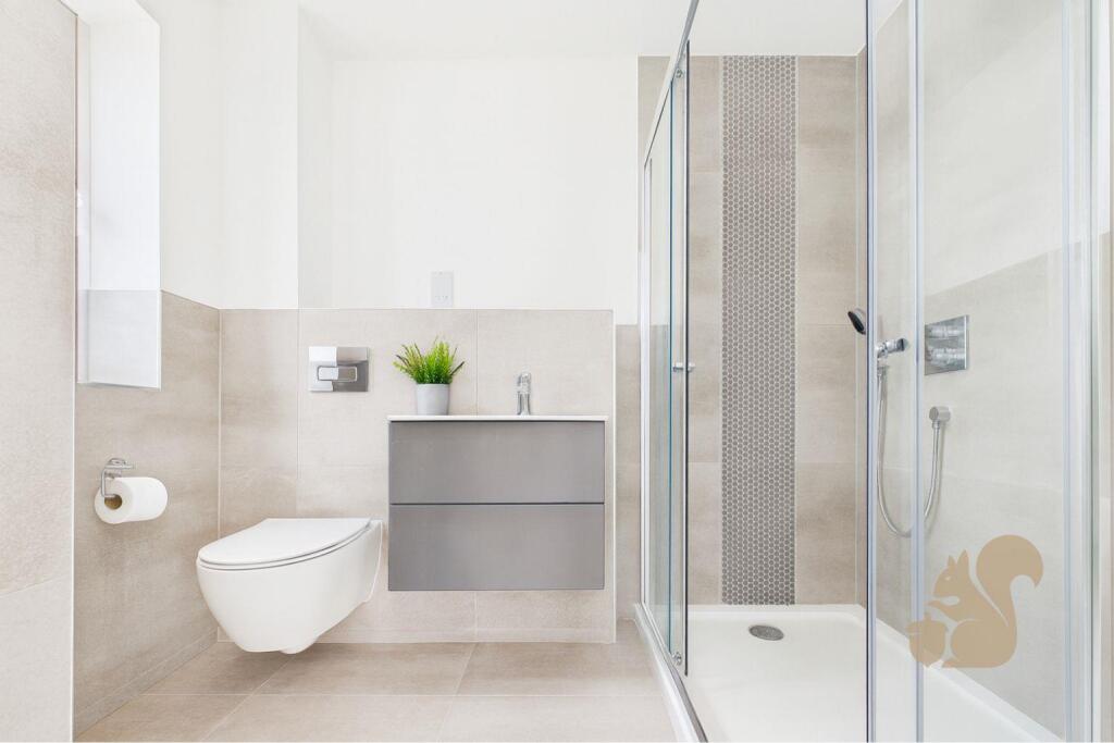
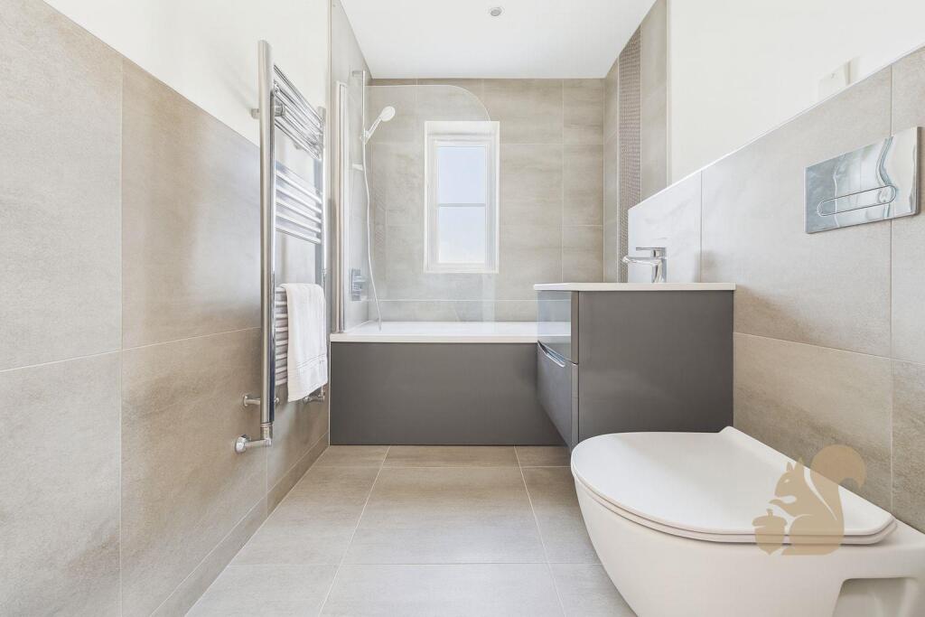
- Ensuite:
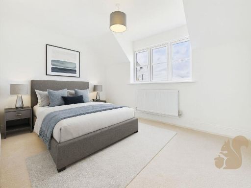
- Bedroom Two:
- Bedroom Three:
- Bedroom Four:
Textual Property Features
Detected Visual Features
- detached house
- modern
- new build
- brick
- gabled roof
- driveway
- garage
- garden
- suburban
- detached
- housing development
- rural
- spacious
EPC Details
- Fully double glazed
- Timber frame, as built, no insulation (assumed)
- Boiler and radiators, oil
- Low energy lighting in 50% of fixed outlets
- Solid, no insulation (assumed)
Nearby Schools
- Great Dunmow Primary School
- Felsted Primary School
- Takeley Primary School
- Roseacres Primary School
- Debden Church of England Voluntary Controlled Primary Academy
- Dunmow St Mary's Primary School
- Great Easton Church of England Voluntary Aided Primary School
- Great Bardfield Primary School
- The Flitch Green Academy
- Felsted School
- Helena Romanes School
- Stebbing Primary School
- Henham and Ugley Primary and Nursery School
- Thaxted Primary School
Nearest Bars And Restaurants
- Id: 1440345759
- Tags:
- Amenity: pub
- Name: The Farmhouse Inn
- TagsNormalized:
- Lat: 51.934961
- Lon: 0.3455948
- FullGeoHash: u10pry7xhfqj
- PartitionGeoHash: u10p
- Images:
- FoodStandards: null
- Distance: 2855.7
,- Id: 285821662
- Tags:
- Amenity: pub
- Building: yes
- Name: The Stag
- TagsNormalized:
- Lat: 51.8925099
- Lon: 0.3359319
- FullGeoHash: u10ppwsxgbbz
- PartitionGeoHash: u10p
- Images:
- FoodStandards: null
- Distance: 2097.1
,- Id: 1141004907
- Tags:
- Amenity: pub
- Name: The Three Horseshoes
- TagsNormalized:
- Lat: 51.9169823
- Lon: 0.3319931
- FullGeoHash: u10pre1wrfzy
- PartitionGeoHash: u10p
- Images:
- FoodStandards: null
- Distance: 1470.3
,- Id: 547703313
- Tags:
- Amenity: pub
- Amenity_1: restaurant
- Building: commercial
- Name: The Swan
- Outdoor_seating: yes
- Wikidata: Q26458594
- TagsNormalized:
- Lat: 51.9045055
- Lon: 0.3331157
- FullGeoHash: u10pr8ftdjj5
- PartitionGeoHash: u10p
- Images:
- FoodStandards: null
- Distance: 1251.6
,- Id: 370359914
- Tags:
- Amenity: pub
- Name: The Green Man
- TagsNormalized:
- Lat: 51.9089845
- Lon: 0.3515892
- FullGeoHash: u10r218pb85c
- PartitionGeoHash: u10r
- Images:
- FoodStandards: null
- Distance: 147.2
}
Nearest General Shops
- Id: 8579224379
- Tags:
- Addr:
- City: Broxted
- Country: GB
- Housename: The Arches
- Postcode: CM6 2EL
- Name: Hark Forward
- Shop: art
- Website: https://harkforward.co.uk/
- TagsNormalized:
- Lat: 51.9109036
- Lon: 0.3003496
- FullGeoHash: u10pqf4dytuc
- PartitionGeoHash: u10p
- Images:
- FoodStandards: null
- Distance: 3379
,- Id: 6725293585
- Tags:
- Addr:
- Housenumber: Unit 17/18
- Postcode: CM6 2HG
- Street: Little Brooks Yard
- Name: Dunmow Motorcycles
- Shop: motorcycle
- Website: http://dunmowmotorcycles.co.uk
- TagsNormalized:
- Lat: 51.9041794
- Lon: 0.3323923
- FullGeoHash: u10pr8f5c23d
- PartitionGeoHash: u10p
- Images:
- FoodStandards: null
- Distance: 1312.1
,- Id: 12632395
- Tags:
- Brand: Bentley
- Brand:wikidata: Q27224
- Brand:wikipedia: en:Bentley
- Building: yes
- Name: P & A Wood
- Note: Also Rolls Royce.
- Shop: car
- Type: multipolygon
- TagsNormalized:
- Lat: 51.9043602
- Lon: 0.339331
- FullGeoHash: u10pr8zhffp8
- PartitionGeoHash: u10p
- Images:
- FoodStandards: null
- Distance: 897.1
}
Nearest Grocery shops
- Id: 422925491
- Tags:
- Name: Stebbing Shop
- Shop: convenience
- Source: gps survey
- TagsNormalized:
- Lat: 51.8928052
- Lon: 0.412234
- FullGeoHash: u10r1qu1t8pb
- PartitionGeoHash: u10r
- Images:
- FoodStandards: null
- Distance: 4679.7
,- Id: 611360859
- Tags:
- Brand: One Stop
- Brand:wikidata: Q65954217
- Name: One Stop
- Shop: convenience
- TagsNormalized:
- Lat: 51.8701924
- Lon: 0.3653893
- FullGeoHash: u10r06djf0wj
- PartitionGeoHash: u10r
- Images:
- FoodStandards: null
- Distance: 4492.6
,- Id: 1050875118
- Tags:
- Brand: Tesco
- Brand:wikidata: Q487494
- Brand:wikipedia: en:Tesco
- Building: yes
- Name: Tesco
- Note: Petrol station shop attached to larger store.
- Operator: Tesco
- Shop: convenience
- Website: https://www.tesco.com/store-locator/dunmow/stortford-rd
- TagsNormalized:
- Lat: 51.8729637
- Lon: 0.3449476
- FullGeoHash: u10ppg5jvv79
- PartitionGeoHash: u10p
- Images:
- FoodStandards: null
- Distance: 4063.3
}
Nearest Supermarkets
- Id: 2725318202
- Tags:
- Brand: Tesco Express
- Brand:wikidata: Q98456772
- Contact:
- Website: https://www.tesco.com/store-locator/dunmow/1-priors-green-local-centre
- Name: Priors Green Supermarket (Tesco Express)
- Opening_hours: 07:00-23:00
- Operator: Tesco
- Shop: supermarket
- TagsNormalized:
- tesco
- tesco express
- supermarket
- shop
- Lat: 51.8701024
- Lon: 0.281741
- FullGeoHash: u10pn6tjjpcm
- PartitionGeoHash: u10p
- Images:
- FoodStandards: null
- Distance: 6383.1
,- Id: 285675101
- Tags:
- Addr:
- City: Great Dunmow
- Postcode: CM6 1BD
- Street: White Street
- Alt_name: The Co-operative Food
- Brand: Co-op Food
- Brand:wikidata: Q3277439
- Brand:wikipedia: en:Co-op Food
- Building: yes
- Name: Co-op Food
- Operator: The Co-operative Group
- Operator:wikidata: Q117202
- Shop: supermarket
- TagsNormalized:
- co-op
- co-op food
- food
- supermarket
- shop
- Lat: 51.872224
- Lon: 0.3639644
- FullGeoHash: u10r07118grs
- PartitionGeoHash: u10r
- Images:
- FoodStandards: null
- Distance: 4250
,- Id: 274094156
- Tags:
- Addr:
- City: Great Dunmow
- Postcode: CM6 1SF
- Street: Stortford Road
- Alt_name: Tesco Dunmow Superstore
- Brand: Tesco
- Brand:wikidata: Q487494
- Brand:wikipedia: en:Tesco
- Building: retail
- Layer: -1
- Name: Tesco
- Opening_hours: Mo-Sa 06:00-24:00; Su 10:00-16:00
- Operator: Tesco Stores Ltd
- Shop: supermarket
- Website: https://www.tesco.com/store-locator/dunmow/stortford-rd
- Wheelchair: yes
- TagsNormalized:
- tesco
- retail
- supermarket
- shop
- Lat: 51.8730877
- Lon: 0.3471835
- FullGeoHash: u10ppghy9uqv
- PartitionGeoHash: u10p
- Images:
- FoodStandards: null
- Distance: 4040.5
}
Nearest Religious buildings
- Id: 144941492
- Tags:
- Addr:
- Amenity: place_of_worship
- Building: church
- Denomination: anglican
- Name: St Mary the Virgin, Tilty
- Religion: christian
- Source:
- Postcode: code-point_open
- Wikidata: Q17539396
- TagsNormalized:
- place of worship
- church
- anglican
- christian
- Lat: 51.9141635
- Lon: 0.3247708
- FullGeoHash: u10pr6smztqx
- PartitionGeoHash: u10p
- Images:
- FoodStandards: null
- Distance: 1780.4
,- Id: 145036752
- Tags:
- Amenity: place_of_worship
- Building: church
- Denomination: anglican
- Name: St John and St Giles, Great Easton
- Religion: christian
- Wikidata: Q17533333
- TagsNormalized:
- place of worship
- church
- anglican
- christian
- Lat: 51.9046388
- Lon: 0.3354711
- FullGeoHash: u10pr8uq3jcq
- PartitionGeoHash: u10p
- Images:
- FoodStandards: null
- Distance: 1101.1
,- Id: 452487364
- Tags:
- Addr:
- City: Dunmow
- Country: GB
- Postcode: CM6 2DR
- Street: Great Easton
- Amenity: school
- Name: Great Easton Church of England Voluntary Aided Primary School
- Phone: +44 1371870219
- Ref:
- Source:
- Addr: edubase
- Geometry: OS_Open_Map_Local_FunctionalSite
- Name: edubase
- Website: https://www.greateastonprimary.co.uk/
- TagsNormalized:
- Lat: 51.9076208
- Lon: 0.33913
- FullGeoHash: u10pr9qzy3ce
- PartitionGeoHash: u10p
- Images:
- FoodStandards: null
- Distance: 741.4
}
Nearest Medical buildings
- Id: 611453079
- Tags:
- Amenity: doctors
- Healthcare: doctor
- Name: Angel Lane Surgery
- TagsNormalized:
- doctor
- doctors
- health
- healthcare
- surgery
- Lat: 51.8714998
- Lon: 0.3621304
- FullGeoHash: u10r04ztqhru
- PartitionGeoHash: u10r
- Images:
- FoodStandards: null
- Distance: 4301.3
,- Id: 611452789
- Tags:
- Amenity: pharmacy
- Healthcare: pharmacy
- Name: Ropers
- TagsNormalized:
- Lat: 51.8727187
- Lon: 0.3625918
- FullGeoHash: u10r070h3p85
- PartitionGeoHash: u10r
- Images:
- FoodStandards: null
- Distance: 4175.3
,- Id: 1134695571
- Tags:
- Amenity: pharmacy
- Healthcare: pharmacy
- Name: Yogi Pharmacy
- TagsNormalized:
- Lat: 51.8731717
- Lon: 0.3619816
- FullGeoHash: u10r05px4u14
- PartitionGeoHash: u10r
- Images:
- FoodStandards: null
- Distance: 4117.2
,- Id: 48076432
- Tags:
- Name: Doctor's Pond
- Natural: water
- Water: pond
- TagsNormalized:
- Lat: 51.8745262
- Lon: 0.3620341
- FullGeoHash: u10r05rxh084
- PartitionGeoHash: u10r
- Images:
- FoodStandards: null
- Distance: 3970.8
}
Nearest Airports
- Id: 495488524
- Tags:
- Aerodrome: international
- Aerodrome:type: public
- Aeroway: aerodrome
- Alt_name: Stansted
- Iata: STN
- Icao: EGSS
- Is_in: Essex,England,UK
- Name: London Stansted Airport
- Ref: STN
- Source: Gagravarr_Airports
- Website: https://www.stanstedairport.com/
- Wikidata: Q8709
- Wikipedia: en:London Stansted Airport
- TagsNormalized:
- airport
- international airport
- Lat: 51.8869677
- Lon: 0.2429264
- FullGeoHash: u10pjt8zkxg4
- PartitionGeoHash: u10p
- Images:
- FoodStandards: null
- Distance: 7729.1
}
Nearest Leisure Facilities
- Id: 935630852
- Tags:
- TagsNormalized:
- swimming
- swimming pool
- pool
- leisure
- Lat: 51.9165705
- Lon: 0.3424352
- FullGeoHash: u10prg17gq4n
- PartitionGeoHash: u10p
- Images:
- FoodStandards: null
- Distance: 935.2
,- Id: 935495955
- Tags:
- Barrier: fence
- Leisure: pitch
- Sport: equestrian
- TagsNormalized:
- pitch
- leisure
- equestrian
- sports
- Lat: 51.9089581
- Lon: 0.3584502
- FullGeoHash: u10r21tp87pu
- PartitionGeoHash: u10r
- Images:
- FoodStandards: null
- Distance: 612.6
,- Id: 935630857
- Tags:
- TagsNormalized:
- swimming
- swimming pool
- pool
- leisure
- Lat: 51.905315
- Lon: 0.3544759
- FullGeoHash: u10r21447uh2
- PartitionGeoHash: u10r
- Images:
- FoodStandards: null
- Distance: 565.8
,- Id: 935630856
- Tags:
- TagsNormalized:
- swimming
- swimming pool
- pool
- leisure
- Lat: 51.9081431
- Lon: 0.3553818
- FullGeoHash: u10r21dfbgpy
- PartitionGeoHash: u10r
- Images:
- FoodStandards: null
- Distance: 423.7
,- Id: 935630858
- Tags:
- Leisure: pitch
- Sport: tennis
- TagsNormalized:
- Lat: 51.9091886
- Lon: 0.346132
- FullGeoHash: u10prcu0cqne
- PartitionGeoHash: u10p
- Images:
- FoodStandards: null
- Distance: 235.5
}
Nearest Tourist attractions
- Id: 1628775292
- Tags:
- TagsNormalized:
- Lat: 51.8740169
- Lon: 0.3681766
- FullGeoHash: u10r07kh51sk
- PartitionGeoHash: u10r
- Images:
- FoodStandards: null
- Distance: 4136.4
,- Id: 1193131902
- Tags:
- TagsNormalized:
- Lat: 51.8773284
- Lon: 0.3674019
- FullGeoHash: u10r07gx34ft
- PartitionGeoHash: u10r
- Images:
- FoodStandards: null
- Distance: 3770.3
,- Id: 10689278131
- Tags:
- Name: Dairymeade Farm Glamping
- Tourism: camp_site
- Website: https://www.dairymeadefarmglamping.com/
- TagsNormalized:
- Lat: 51.9192981
- Lon: 0.3104939
- FullGeoHash: u10pr5d5g49h
- PartitionGeoHash: u10p
- Images:
- FoodStandards: null
- Distance: 2896.2
}
Nearest Train stations
- Id: 5906356206
- Tags:
- Light_rail: yes
- Name: Terminal C
- Network: Stansted Airport Terminal Link
- Public_transport: station
- Railway: station
- Station: light_rail
- TagsNormalized:
- Lat: 51.8892206
- Lon: 0.2541483
- FullGeoHash: u10pjy1hd5f9
- PartitionGeoHash: u10p
- Images:
- FoodStandards: null
- Distance: 6919.4
,- Id: 5906356207
- Tags:
- Light_rail: yes
- Name: Terminal B
- Network: Stansted Airport Terminal Link
- Public_transport: station
- Railway: station
- Station: light_rail
- TagsNormalized:
- Lat: 51.8911228
- Lon: 0.2569959
- FullGeoHash: u10pjy7psqqh
- PartitionGeoHash: u10p
- Images:
- FoodStandards: null
- Distance: 6667.2
,- Id: 5906352887
- Tags:
- Level: 1
- Light_rail: yes
- Name: Main Terminal Building (Departures)
- Network: Stansted Airport Terminal Link
- Public_transport: station
- Railway: station
- Station: light_rail
- Wheelchair: yes
- TagsNormalized:
- Lat: 51.8902434
- Lon: 0.2601274
- FullGeoHash: u10pjym6t6mn
- PartitionGeoHash: u10p
- Images:
- FoodStandards: null
- Distance: 6494.4
,- Id: 6137852415
- Tags:
- Name: Stansted Airport
- Naptan:
- Network: National Rail
- Public_transport: station
- Railway: station
- Ref:
- Wikidata: Q2652717
- Wikipedia: en:Stansted Airport railway station
- TagsNormalized:
- Lat: 51.8892596
- Lon: 0.2621537
- FullGeoHash: u10pjynuue5f
- PartitionGeoHash: u10p
- Images:
- FoodStandards: null
- Distance: 6400.7
,- Id: 6432356094
- Tags:
- Building:
- Level: 1
- Light_rail: yes
- Name: Main Terminal Building (Arrivals)
- Network: Stansted Airport Terminal Link
- Public_transport: station
- Railway: station
- Station: light_rail
- Wheelchair: yes
- TagsNormalized:
- Lat: 51.8911955
- Lon: 0.2615497
- FullGeoHash: u10pjyw2necw
- PartitionGeoHash: u10p
- Images:
- FoodStandards: null
- Distance: 6367.8
}
Nearest Hotels
- Id: 533672901
- Tags:
- Addr:
- City: Dunmow
- Postcode: CM6 1LW
- Street: Chelmsford Road
- Alt_name: Travelodge Great Dunmow
- Branch: Great Dunmow
- Brand: Travelodge
- Brand:wikidata: Q9361374
- Brand:wikipedia: en:Travelodge UK
- Building: yes
- Fhrs:
- Authority: Uttlesford
- Id: 118671
- Local_authority_id: 48013999100
- Internet_access: wlan
- Internet_access:fee: customers
- Internet_access:ssid: Travelodge WiFi
- Name: Travelodge
- Operator: Travelodge Hotels Ltd
- Tourism: hotel
- TagsNormalized:
- Lat: 51.8608876
- Lon: 0.3743392
- FullGeoHash: u10r08bxddps
- PartitionGeoHash: u10r
- Images:
- FoodStandards: null
- Distance: 5655.8
,- Id: 611380186
- Tags:
- Amenity: pub;restaurant
- Name: Saracen's Head
- Tourism: hotel
- TagsNormalized:
- bar
- pub
- restaurant
- hotel
- tourism
- Lat: 51.8726285
- Lon: 0.3622618
- FullGeoHash: u10r05pgcqcc
- PartitionGeoHash: u10r
- Images:
- FoodStandards: null
- Distance: 4180.3
,- Id: 1240412962
- Tags:
- Name: The Saracen's Head
- Tourism: hotel
- TagsNormalized:
- Lat: 51.8726917
- Lon: 0.3621252
- FullGeoHash: u10r05psq4s4
- PartitionGeoHash: u10r
- Images:
- FoodStandards: null
- Distance: 4171.5
}
Tags
- detached house
- modern
- new build
- brick
- gabled roof
- driveway
- garage
- garden
- suburban
- modern
- detached
- housing development
- new build
- rural
- spacious
- garden
- driveway
- garage
AirBnB Data
- 1km average: £85/night
- Listings in 1km: 1
Similar Properties
 4 bedroom detached house for sale in Lindsell, Dunmow, CM6 — £900,000 • 4 bed • 3 bath • 2400 ft²
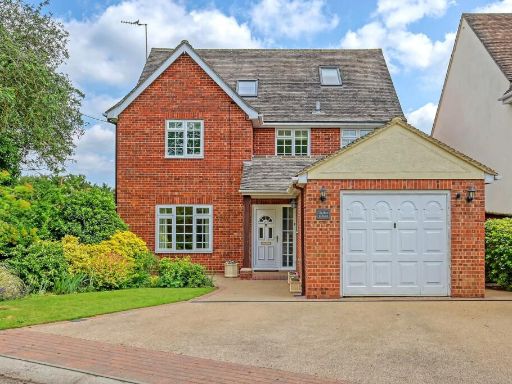 6 bedroom detached house for sale in Lindsell, Dunmow, CM6 — £800,000 • 6 bed • 3 bath • 2899 ft²
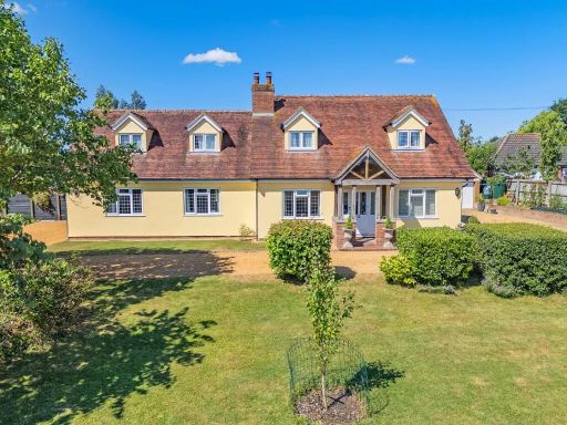 5 bedroom detached house for sale in Lindsell, Dunmow, Essex, CM6 — £975,000 • 5 bed • 4 bath • 3088 ft²
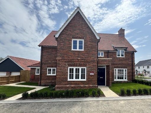 5 bedroom detached house for sale in Off Duck Street,
Little Easton,
Dunmow,
CM6 2JE, CM6 — £865,000 • 5 bed • 3 bath • 2101 ft²
5 bedroom detached house for sale in Off Duck Street,
Little Easton,
Dunmow,
CM6 2JE, CM6 — £865,000 • 5 bed • 3 bath • 2101 ft²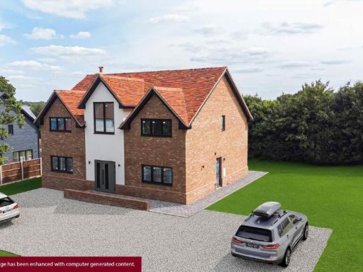 4 bedroom detached house for sale in Chelmsford Road, Barnston, Dunmow, CM6 — £1,100,000 • 4 bed • 3 bath • 2029 ft²
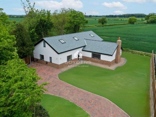 5 bedroom detached house for sale in Cobbs Lane Bambers Green, CM22 — £1,000,000 • 5 bed • 5 bath • 2633 ft²
Meta
- {
"@context": "https://schema.org",
"@type": "Residence",
"name": "4 bedroom detached house for sale in Plot 2, The Maypoles,…",
"description": "",
"url": "https://propertypiper.co.uk/property/8095d950-be80-485e-9cea-eb2a8a14fd89",
"image": "https://image-a.propertypiper.co.uk/14549b16-0f60-49d7-89e4-ff9a6949e3bd-1024.jpeg",
"address": {
"@type": "PostalAddress",
"streetAddress": "Plot 2, The Maypoles, Great Dunmow",
"postalCode": "CM6 2DN",
"addressLocality": "Uttlesford",
"addressRegion": "Saffron Walden",
"addressCountry": "England"
},
"geo": {
"@type": "GeoCoordinates",
"latitude": 51.909395093770584,
"longitude": 0.3495486226732204
},
"numberOfRooms": 4,
"numberOfBathroomsTotal": 2,
"floorSize": {
"@type": "QuantitativeValue",
"value": 2001,
"unitCode": "FTK"
},
"offers": {
"@type": "Offer",
"price": 875000,
"priceCurrency": "GBP",
"availability": "https://schema.org/InStock"
},
"additionalProperty": [
{
"@type": "PropertyValue",
"name": "Feature",
"value": "detached house"
},
{
"@type": "PropertyValue",
"name": "Feature",
"value": "modern"
},
{
"@type": "PropertyValue",
"name": "Feature",
"value": "new build"
},
{
"@type": "PropertyValue",
"name": "Feature",
"value": "brick"
},
{
"@type": "PropertyValue",
"name": "Feature",
"value": "gabled roof"
},
{
"@type": "PropertyValue",
"name": "Feature",
"value": "driveway"
},
{
"@type": "PropertyValue",
"name": "Feature",
"value": "garage"
},
{
"@type": "PropertyValue",
"name": "Feature",
"value": "garden"
},
{
"@type": "PropertyValue",
"name": "Feature",
"value": "suburban"
},
{
"@type": "PropertyValue",
"name": "Feature",
"value": "modern"
},
{
"@type": "PropertyValue",
"name": "Feature",
"value": "detached"
},
{
"@type": "PropertyValue",
"name": "Feature",
"value": "housing development"
},
{
"@type": "PropertyValue",
"name": "Feature",
"value": "new build"
},
{
"@type": "PropertyValue",
"name": "Feature",
"value": "rural"
},
{
"@type": "PropertyValue",
"name": "Feature",
"value": "spacious"
},
{
"@type": "PropertyValue",
"name": "Feature",
"value": "garden"
},
{
"@type": "PropertyValue",
"name": "Feature",
"value": "driveway"
},
{
"@type": "PropertyValue",
"name": "Feature",
"value": "garage"
}
]
}
High Res Floorplan Images
Compatible Floorplan Images
FloorplanImages Thumbnail