SK9 3DD - 5 bedroom detached house for sale in Jamie Webb Drive, Wilm…
View on Property Piper
5 bedroom detached house for sale in Jamie Webb Drive,
Wilmslow,
Cheshire,
SK9 3DD, SK9
Property Details
- Price: £879950
- Bedrooms: 5
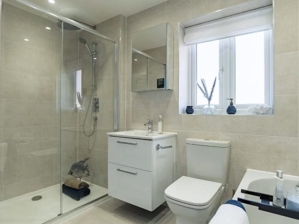
- Bathrooms: 4
- Property Type: undefined
- Property SubType: undefined
Brochure Descriptions
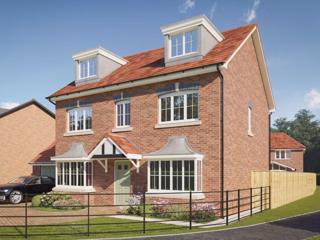
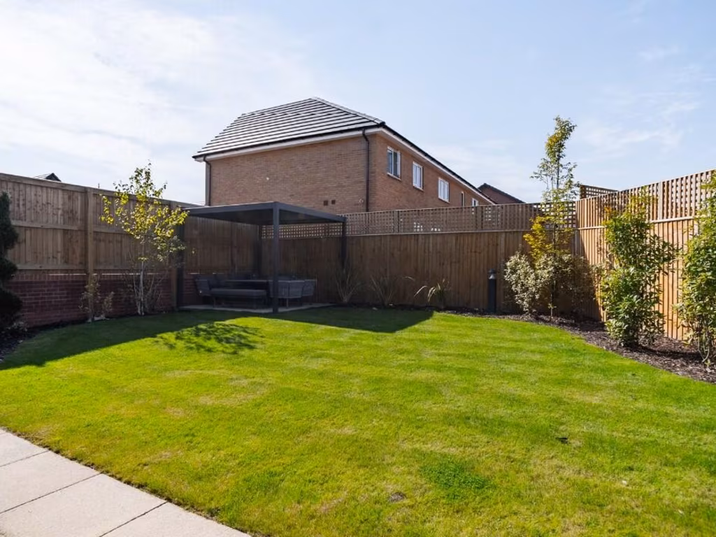
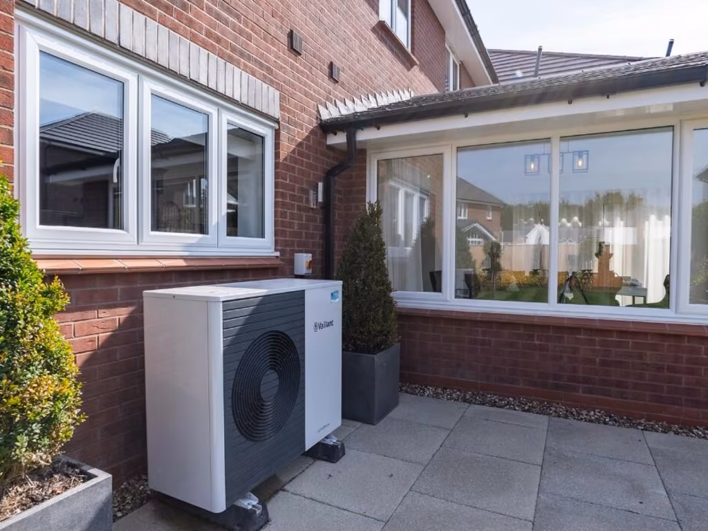
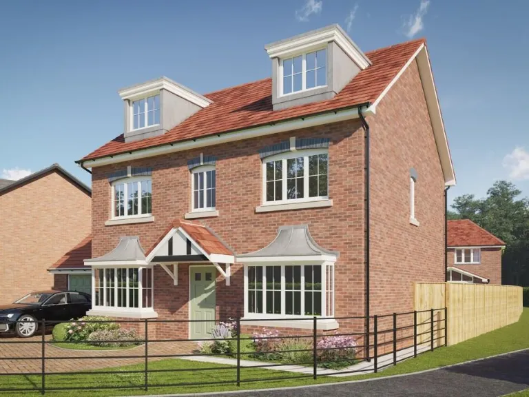
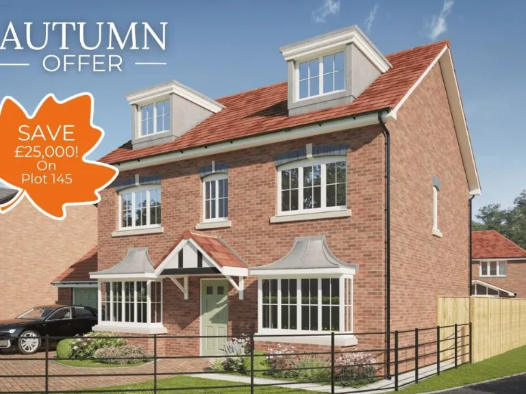
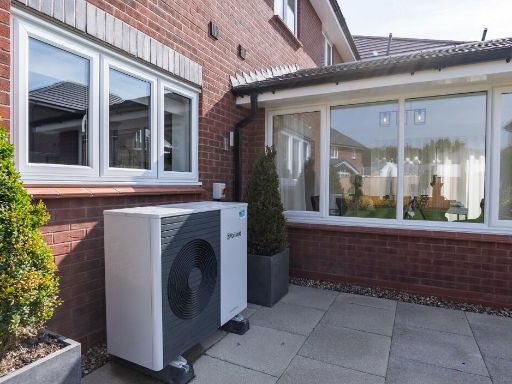
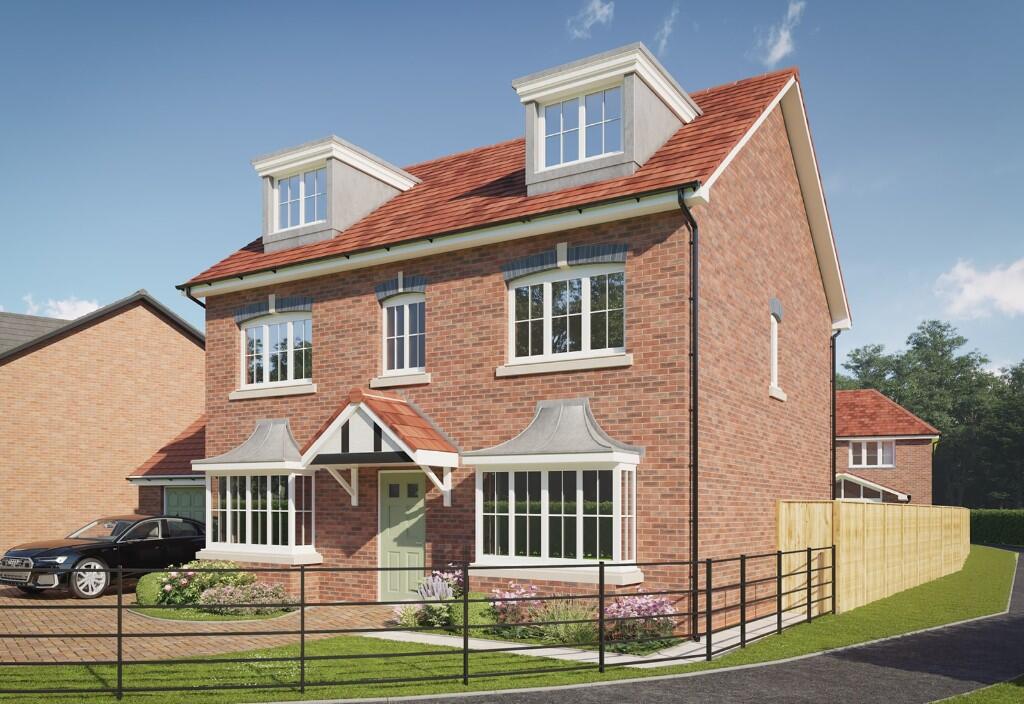
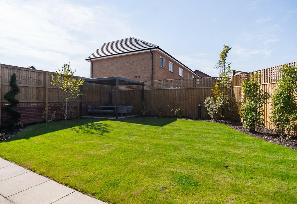
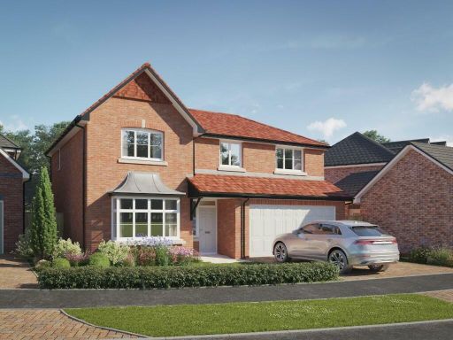
- The properties depicted are newly developed modern detached houses located in a serene suburban setting. Each house features a two-car garage, with a well-manicured garden at the front. The homes are constructed of brick, likely offering durability and a timeless aesthetic appeal. The neighborhood design suggests an ideal environment for families, with spacious driveways and a clean, quiet street. The overall property sizes are assumed to be above average, given the generous layout of the houses and gardens. The location is enhanced by the presence of lush, mature trees in the background, adding a sense of tranquility and privacy.
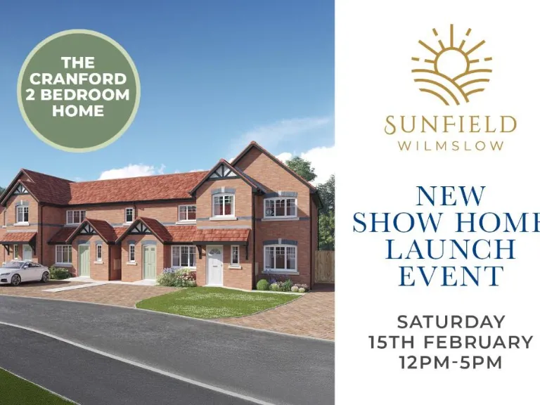
- The property is likely located within a modern development known as Sunfield in Wilmslow. The community is surrounded by a mix of amenities including a retail park and likely benefits from easy access to major routes like the A34. The area appears to be a planned, suburban-style neighborhood with small to average plot sizes typical for modern new builds, convenient for commuting professionals and families. The proximity to major roads suggests good connectivity to nearby urban centers.
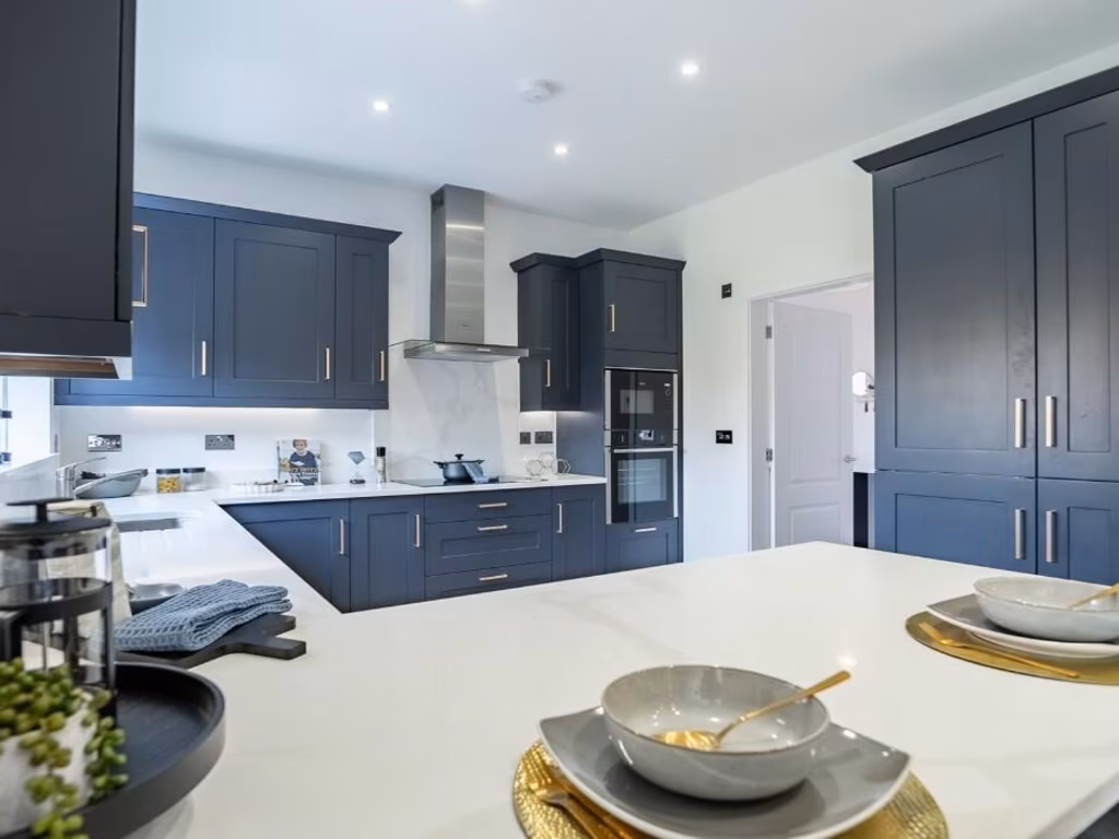
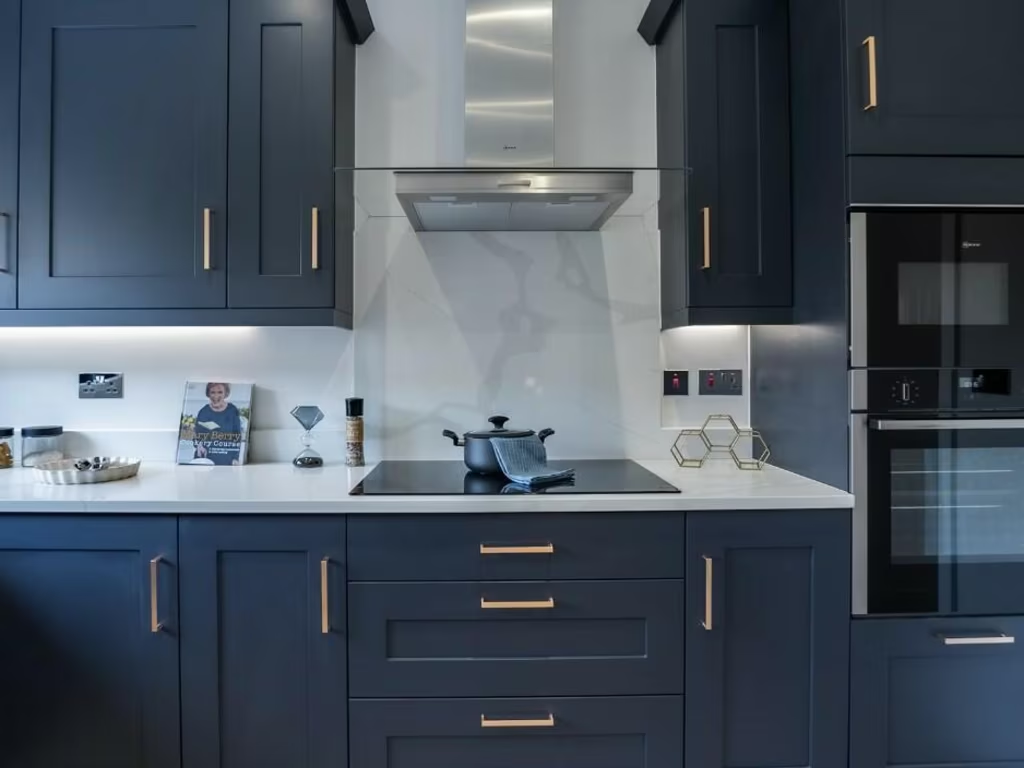
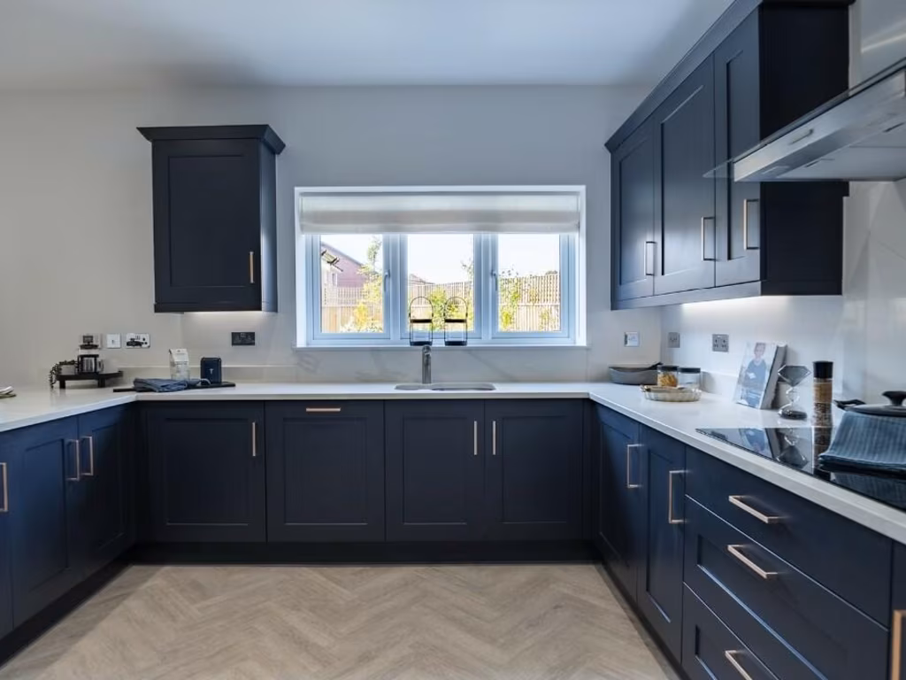
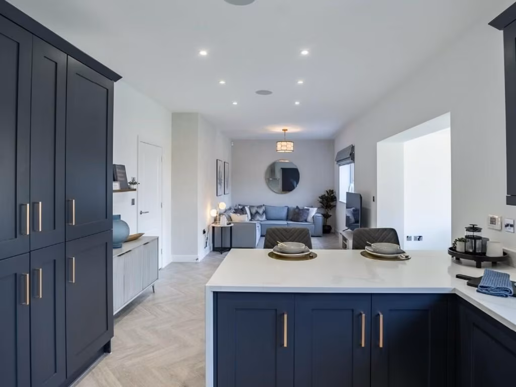
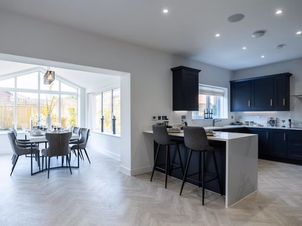
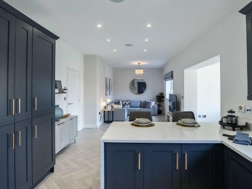
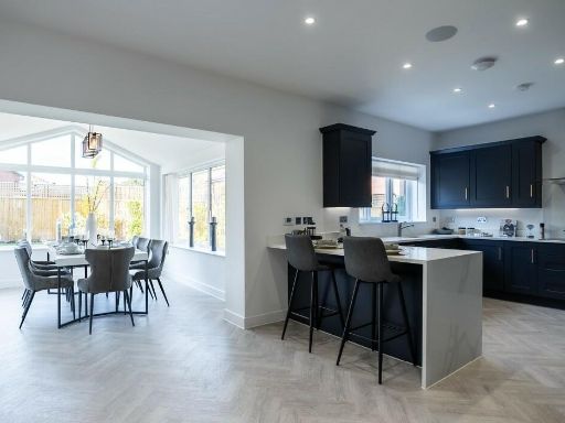
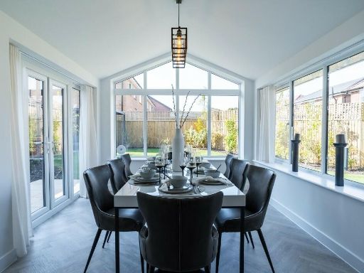
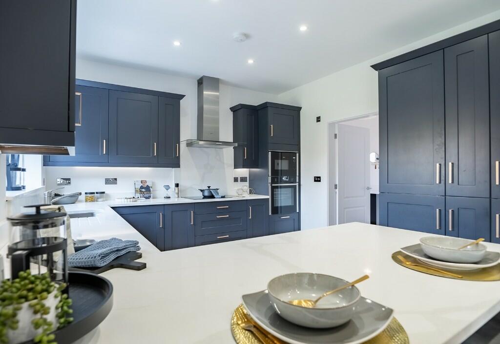
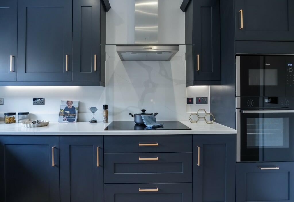
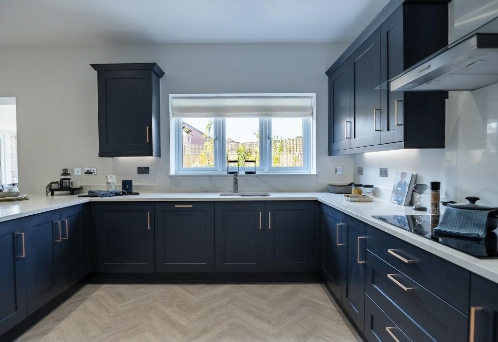
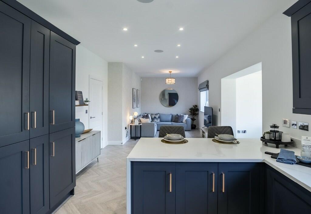
- The property is a modern detached home located in the prestigious Sunfield Wilmslow development. It features a traditional two-story design with a prominent gabled roof and brick facade, offering great curb appeal. The house includes a sizable integrated double garage and driveway parking. The front garden is landscaped, offering a welcoming aesthetic that complements the residential setting. The neighbourhood is tree-lined, providing a sense of privacy and tranquility. Properties in this developments likely vary from modern four- to five-bedroom layouts, ideal for families seeking ample living space. Each home likely includes a large backyard, an essential for garden enthusiasts or families who enjoy outdoor activities. The overall property size is generous, emphasizing spacious living areas with likely a combination of open-plan and private room designs.
- The property is part of the Sunfield development in Wilmslow, located near Handforth Dean Retail Park. The surroundings are suburban, with access roads like Coppice Way and Long Marl Drive connecting to A34. The development likely contains modern homes set in a well-planned neighborhood with easy access to local amenities and retail centers. The area may offer a blend of countryside charm with urban convenience, suitable for families or professionals.
Image Descriptions
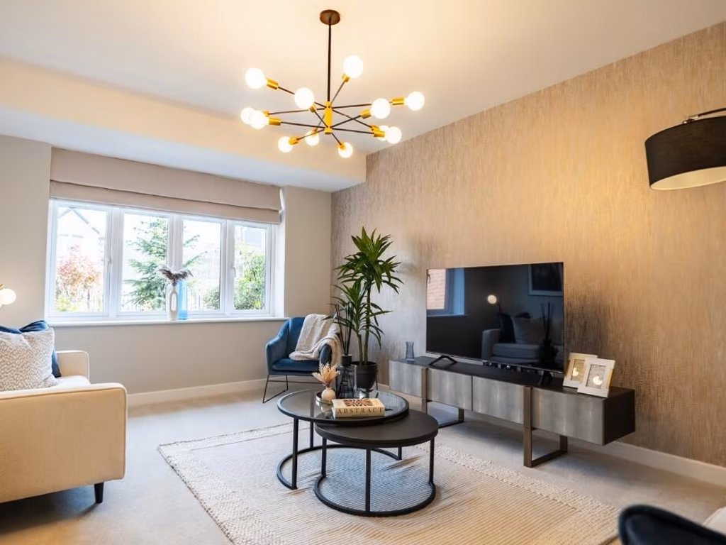
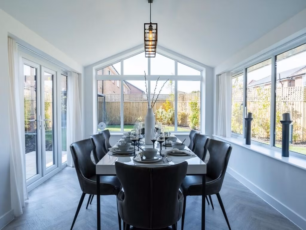
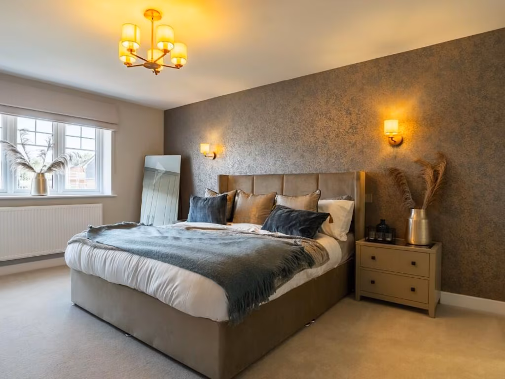
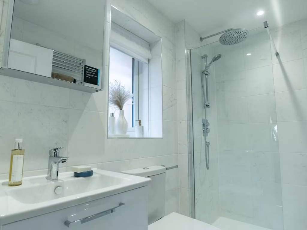
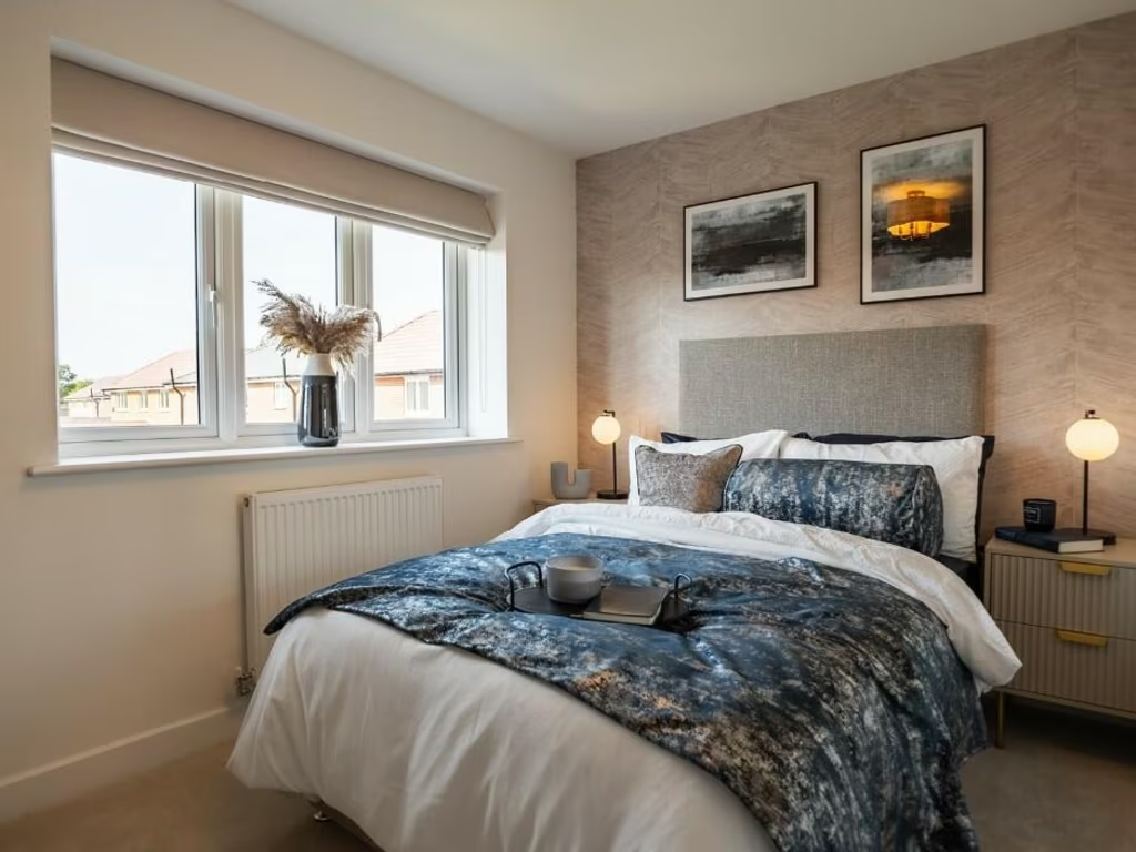
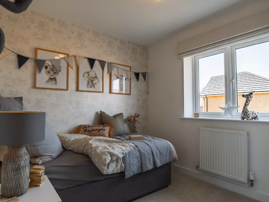
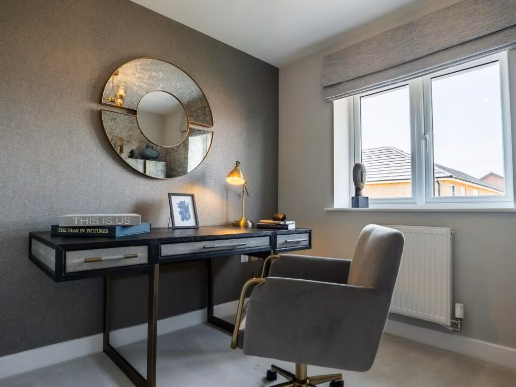
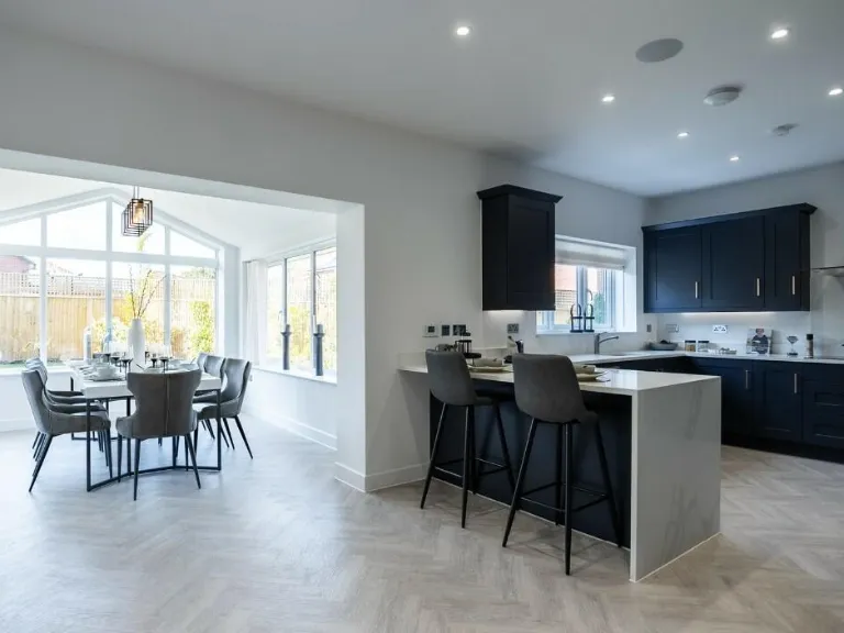
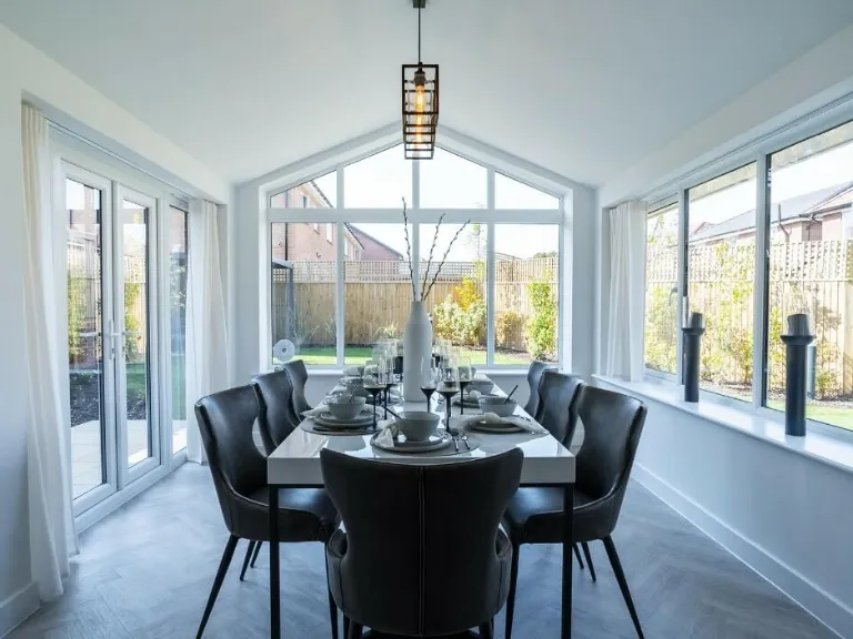
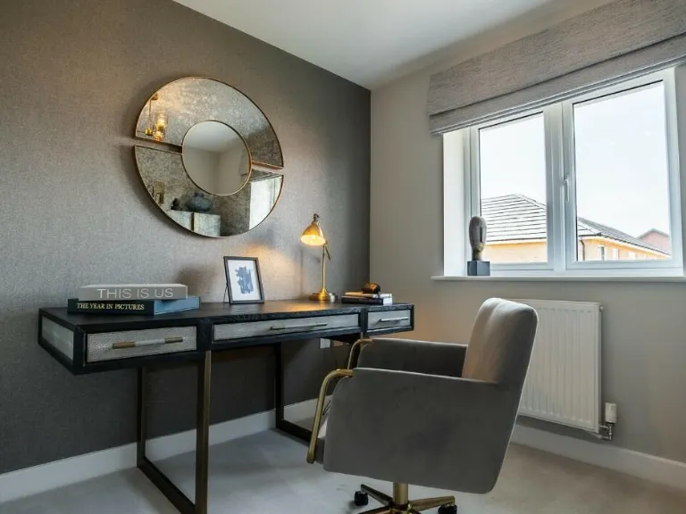
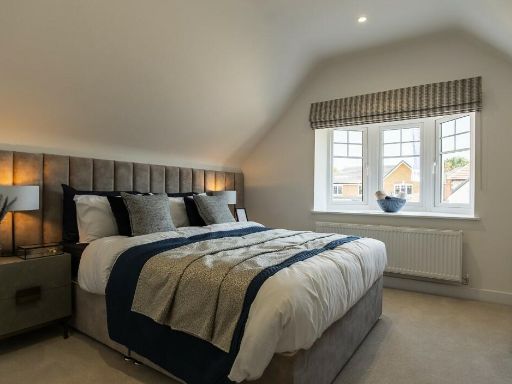
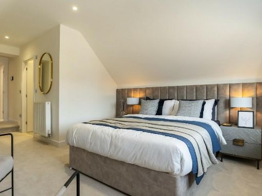
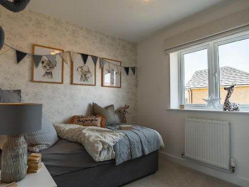
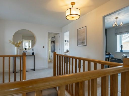
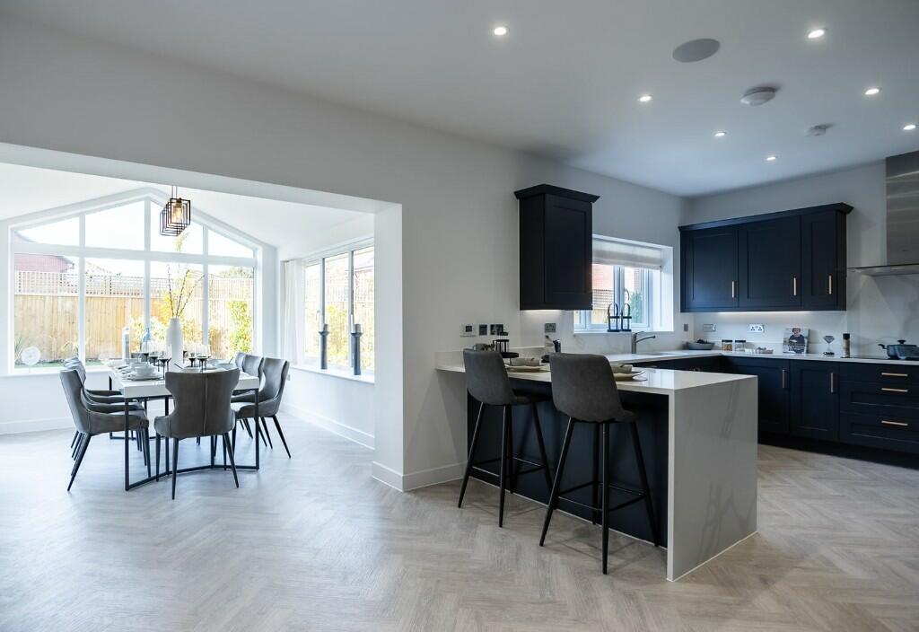
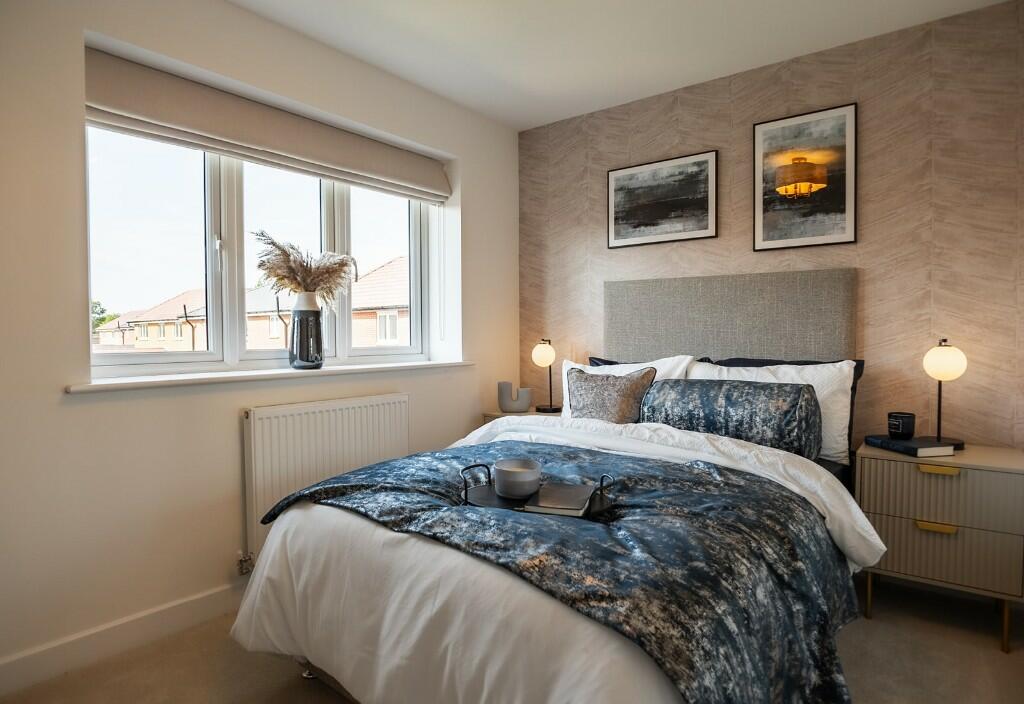
- modern semi-detached
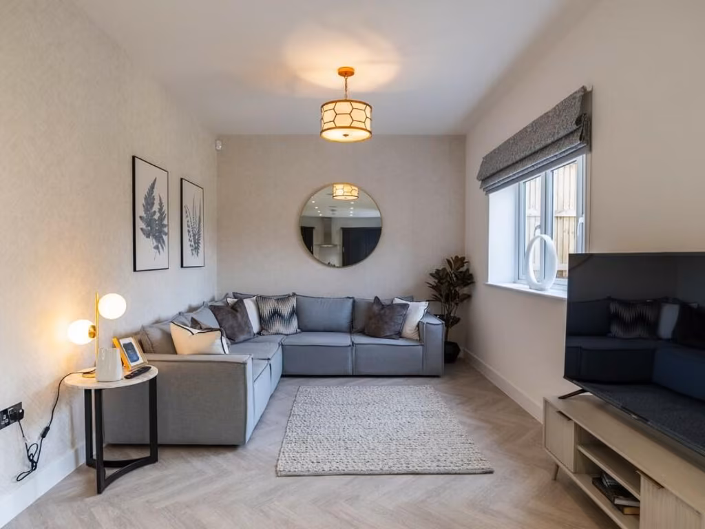
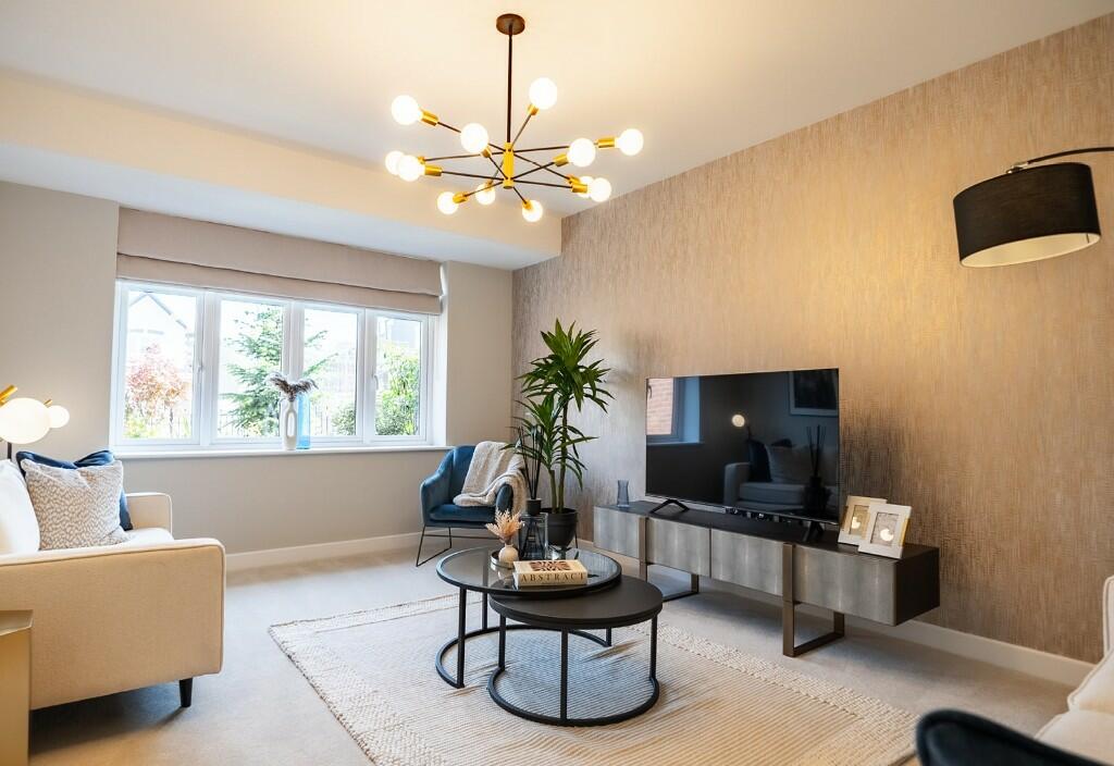
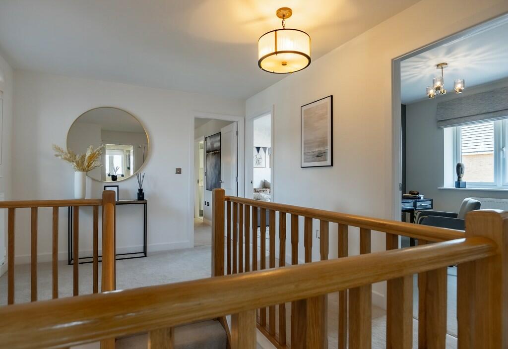
- living room contemporary
Floorplan Description
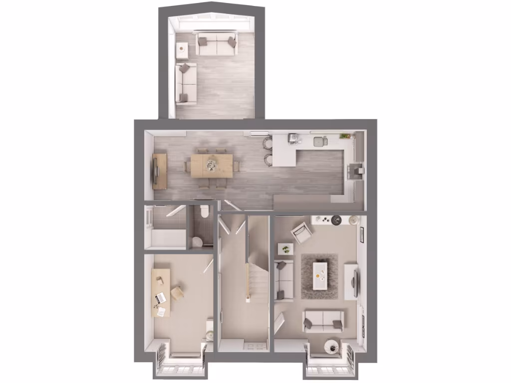
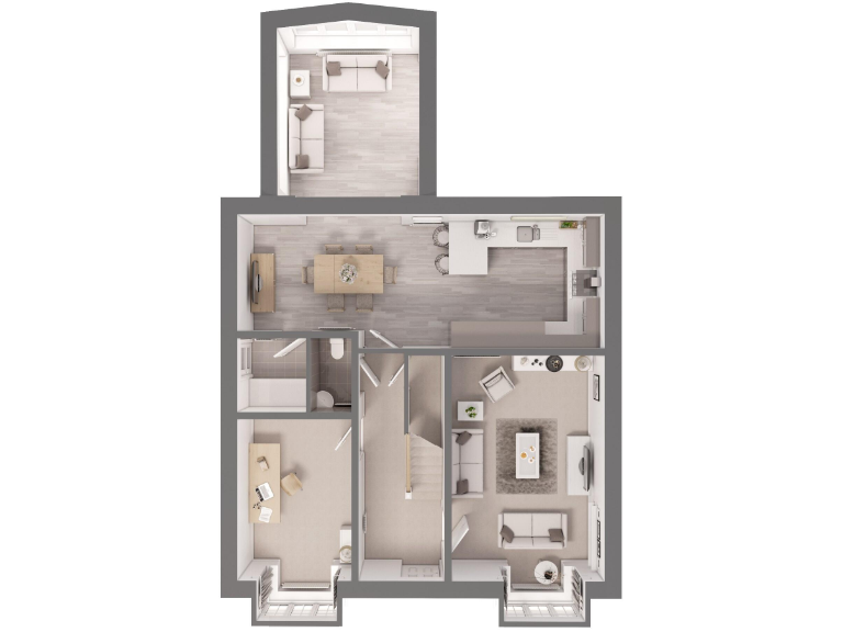
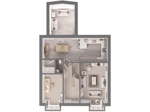
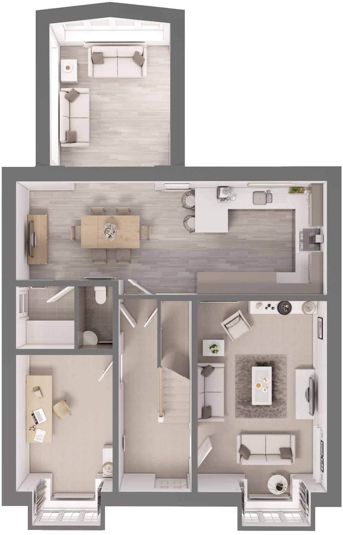
- A floor plan featuring a mix of living, dining, kitchen, and office spaces.
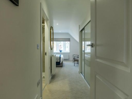
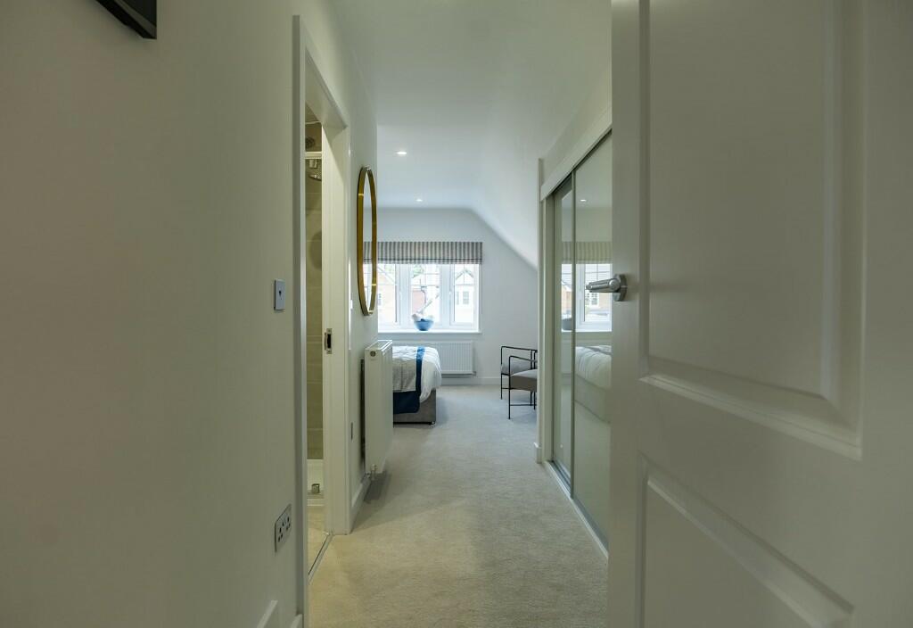
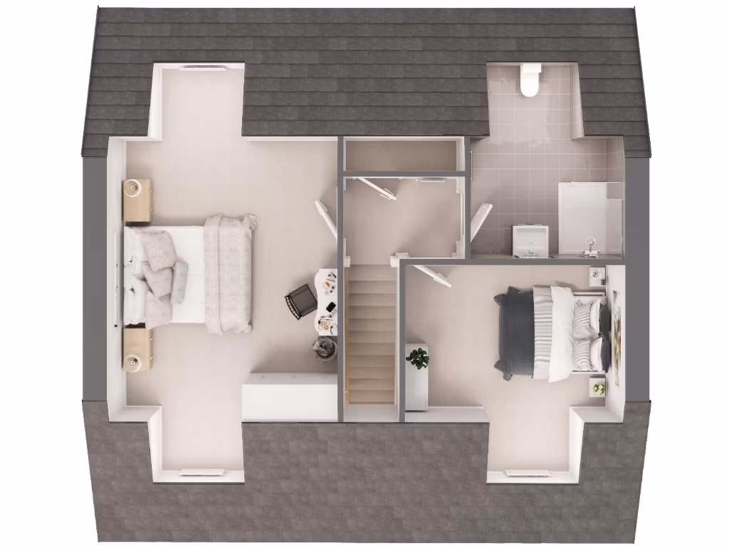
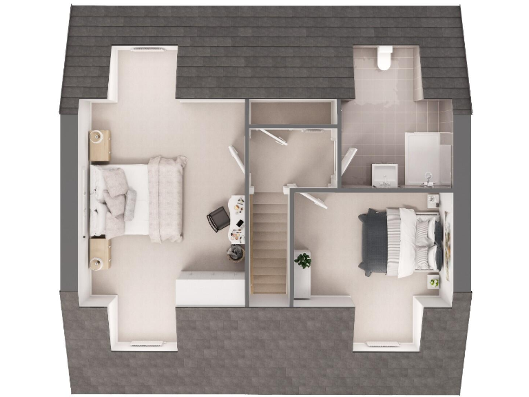
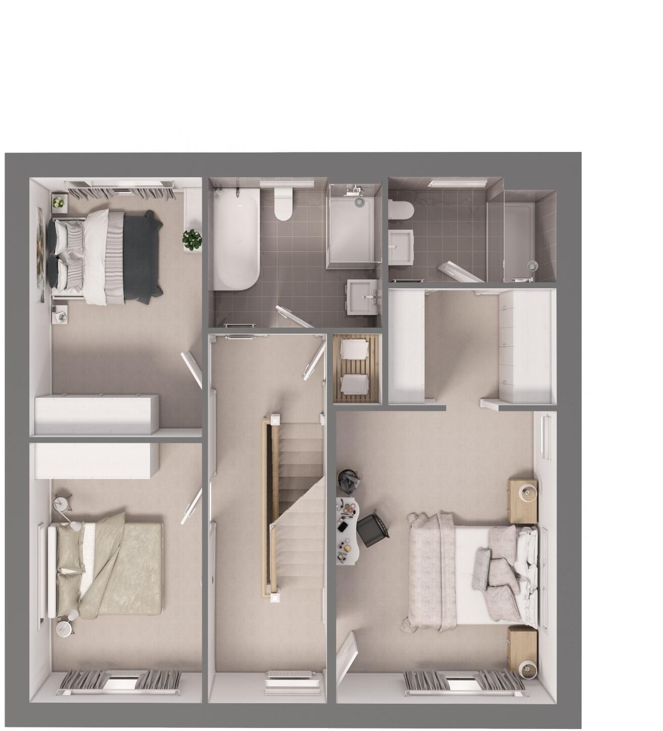
- Multi-room upper floor layout with three bedrooms and two bathrooms.
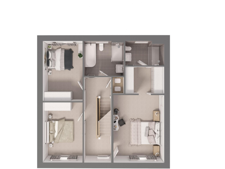
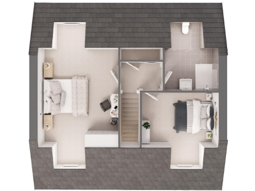
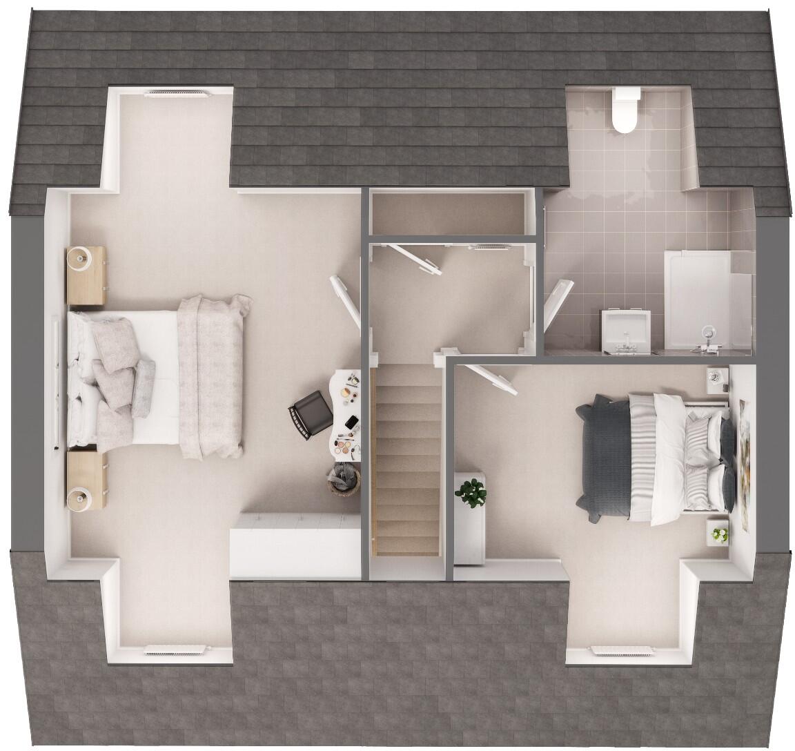
- The floorplan features two bedrooms and a bathroom, likely designed as an attic or upper floor due to the sloped walls.
Rooms
- Entryway/Stairs: Small
- Living Room: Large
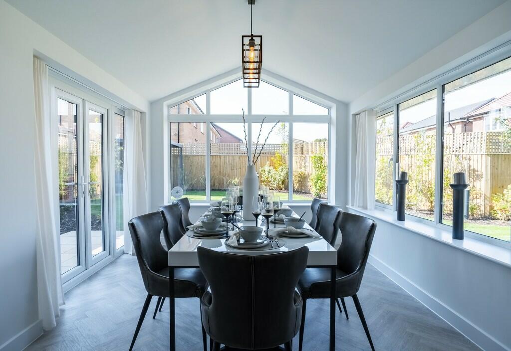
- Dining Area: Average
- Kitchen: Average
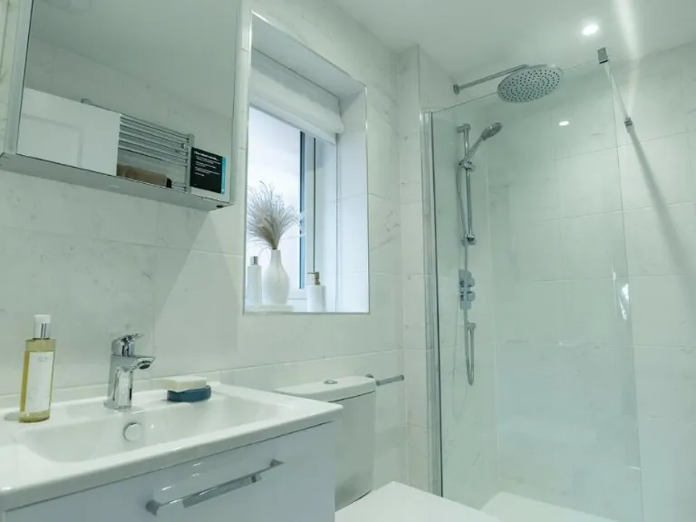
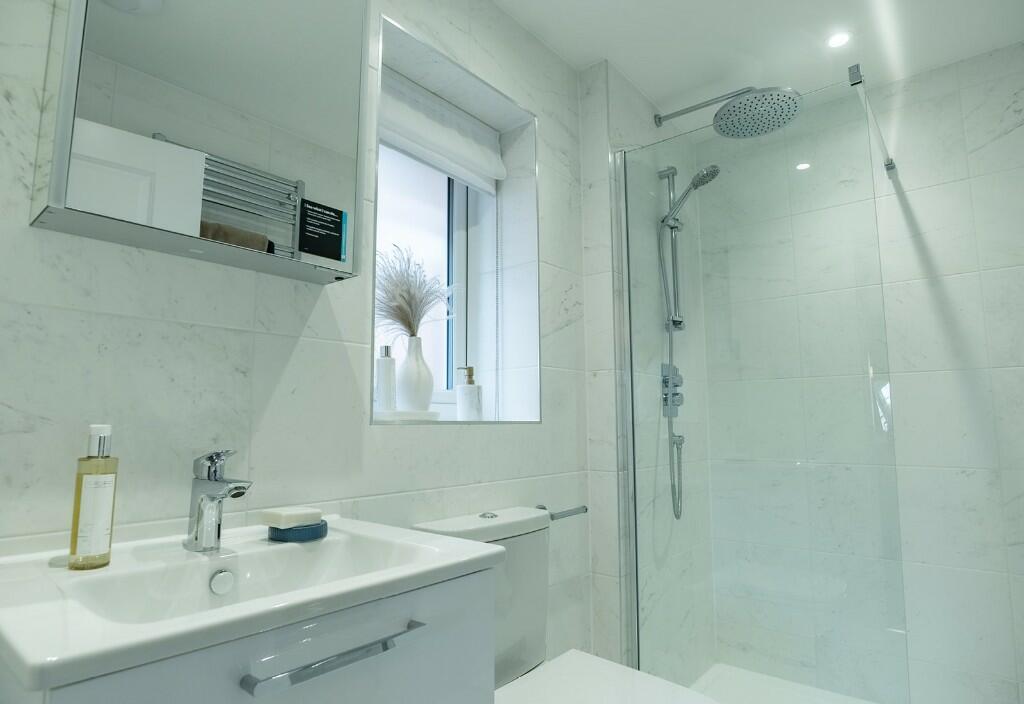
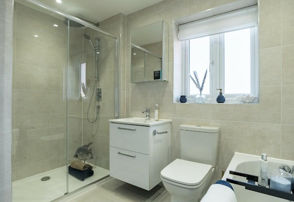
- Bathroom: Small
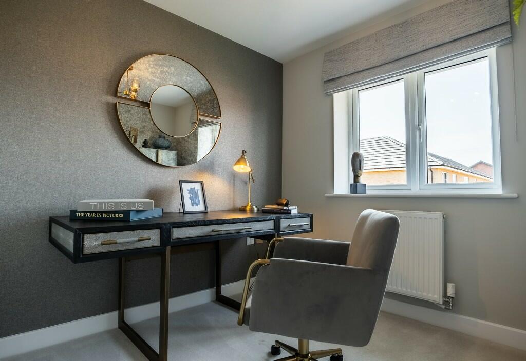
- Office/Study: Average
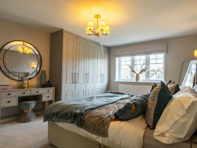
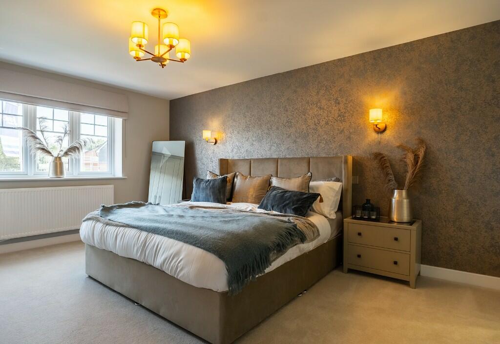
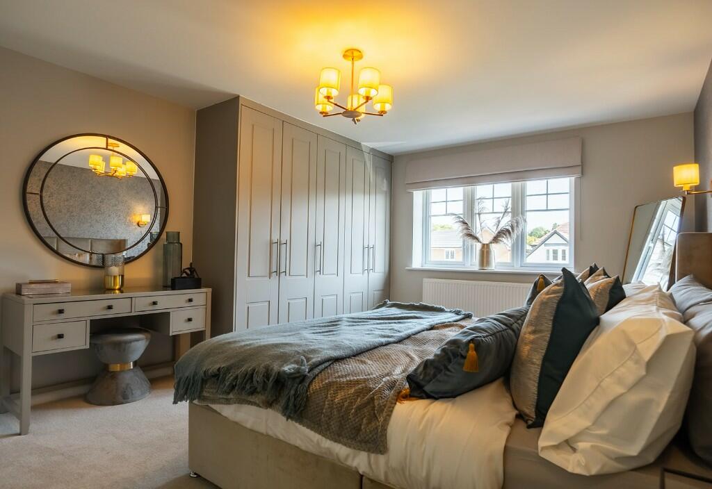
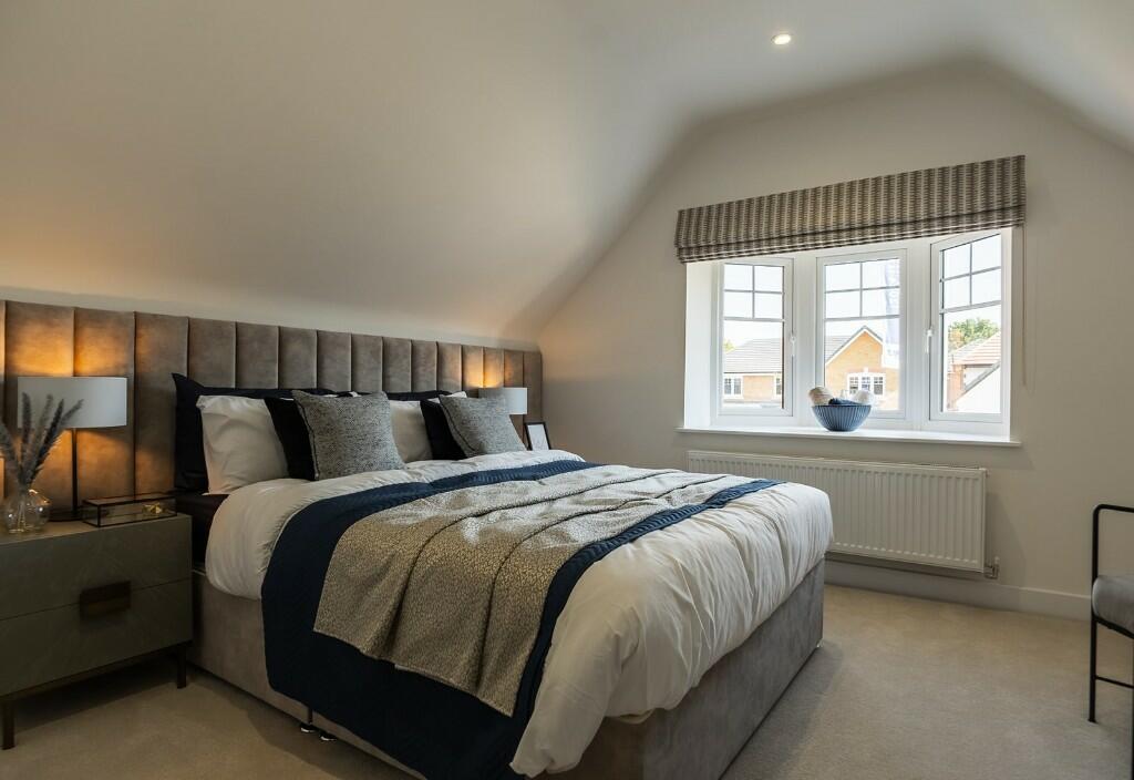
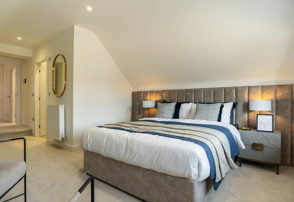
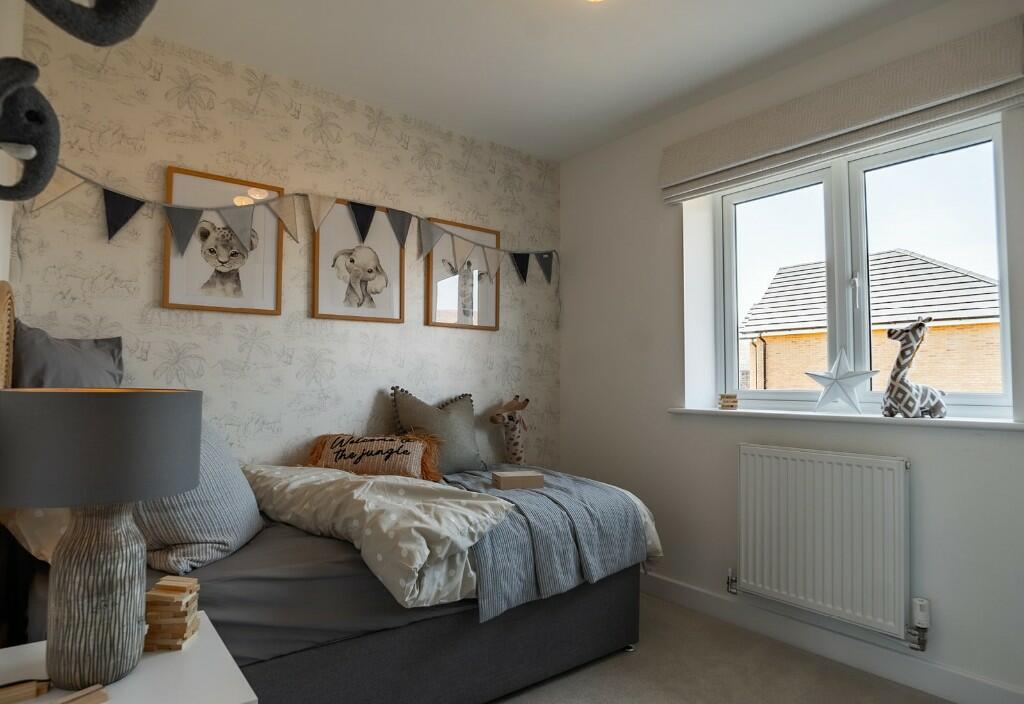
- Bedroom: Average
- Bathroom: Small
- Bedroom: Average
- Bedroom: Large
- Bathroom: Small
- Bedroom: Average
- Bedroom: Average
- Bathroom: Small
Textual Property Features
Detected Visual Features
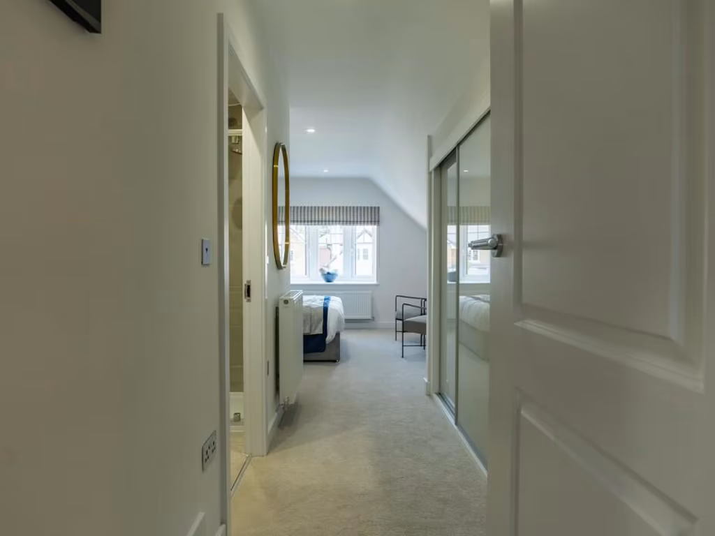
- modern
- semi-detached
- new-build
- three-storey
- dormer windows
- red brick
- pitched roof
- driveway
- garage
- garden
- contemporary
- living room
- modern lighting
- standard ceiling height
- bright
- large window
- carpeted
- well-maintained
Nearby Schools
- Handforth Grange Primary School
- Thorn Grove Primary School
- Bolshaw Primary School
- Lane End Primary School
- Cheadle Hulme Primary School
- Oak Tree Primary School
- Wilmslow Preparatory School
- Bradshaw Hall Primary School
- North West Hospital School
- Cheadle Catholic Junior School
- Laurus Cheadle Hulme
- Wilmslow High School
- Lacey Green Primary Academy
- St James' Catholic High School
- Hursthead Junior School
- Outwood Primary School
- Cheadle Hulme High School
- Cheadle Hulme School
- Greenbank Preparatory School
- Cheadle Catholic Infant School
- The Wilmslow Academy
- St Benedict's Catholic Primary School
- Moss Hey Primary School
- Hursthead Infant School
- Etchells Primary School
Nearest General Shops
- Id: 10044775953
- Tags:
- Brand: Timpson
- Brand:wikidata: Q7807658
- Check_date: 2022-09-22
- Name: Timpson
- Opening_hours: Mo-Sa 09:00-18:00; Su 10:00-16:00
- Shop: locksmith
- Wheelchair: yes
- TagsNormalized:
- Lat: 53.349884
- Lon: -2.2052509
- FullGeoHash: gcqrtb41tgjw
- PartitionGeoHash: gcqr
- Images:
- FoodStandards: null
- Distance: 367.9
,- Id: 294607514
- Tags:
- Addr:
- Postcode: SK9 3PB
- Street: Coppice Way
- Brand: Marks & Spencer
- Brand:wikidata: Q714491
- Contact:
- Website: https://www.marksandspencer.com/stores/handforth-71
- Fhrs:
- Name: Marks & Spencer
- Shop: department_store
- TagsNormalized:
- marks & spencer
- department store
- shop
- Lat: 53.3488715
- Lon: -2.2061478
- FullGeoHash: gcqrmzce9n2y
- PartitionGeoHash: gcqr
- Images:
- FoodStandards:
- Id: 892742
- FHRSID: 892742
- LocalAuthorityBusinessID: 78407
- BusinessName: Marks & Spencer
- BusinessType: Retailers - supermarkets/hypermarkets
- BusinessTypeID: 7840
- AddressLine1: null
- AddressLine2: Coppice Way
- AddressLine3: null
- AddressLine4: Handforth, Wilmslow
- PostCode: SK9 3PB
- RatingValue: 5
- RatingKey: fhrs_5_en-GB
- RatingDate: 2021-06-01
- LocalAuthorityCode: 703
- LocalAuthorityName: Cheshire East
- LocalAuthorityWebSite: http://www.cheshireeast.gov.uk/
- LocalAuthorityEmailAddress: commercialservices@cheshireeast.gov.uk
- Scores:
- Hygiene: 5
- Structural: 5
- ConfidenceInManagement: 5
- NewRatingPending: false
- Geocode:
- Longitude: -2.20545800000000
- Latitude: 53.34886900000000
- Distance: 320.6
,- Id: 1095740174
- Tags:
- Building: yes
- Layer: 1
- Name: Blackcircles Pitstop
- Shop: tyres
- TagsNormalized:
- Lat: 53.3496653
- Lon: -2.2028353
- FullGeoHash: gcqrtb5bq4qv
- PartitionGeoHash: gcqr
- Images:
- FoodStandards: null
- Distance: 293.1
}
Nearest Religious buildings
- Id: 256709762
- Tags:
- Amenity: place_of_worship
- Denomination: methodist
- Name: St Marys Methodist Church
- Religion: christian
- TagsNormalized:
- place of worship
- methodist
- church
- christian
- Lat: 53.3531636
- Lon: -2.2155407
- FullGeoHash: gcqrt8dswnt1
- PartitionGeoHash: gcqr
- Images:
- FoodStandards: null
- Distance: 1105.6
,- Id: 879342611
- Tags:
- Amenity: place_of_worship
- Building: church
- Denomination: anglican
- Name: Saint Chad's Church
- Religion: christian
- Wikidata: Q105094077
- TagsNormalized:
- place of worship
- church
- anglican
- christian
- Lat: 53.3486746
- Lon: -2.2146605
- FullGeoHash: gcqrmxg6d9tr
- PartitionGeoHash: gcqr
- Images:
- FoodStandards: null
- Distance: 832.9
,- Id: 457766414
- Tags:
- Amenity: place_of_worship
- Name: St. Benedict's Roman Catholic Church
- Religion: christian
- Url: http://myweb.tiscali.co.uk/stbenedicts
- TagsNormalized:
- place of worship
- catholic
- church
- roman catholic
- christian
- Lat: 53.3462463
- Lon: -2.2110794
- FullGeoHash: gcqrmxmuqj5d
- PartitionGeoHash: gcqr
- Images:
- FoodStandards: null
- Distance: 581.9
}
Nearest Medical buildings
- Id: 7630223948
- Tags:
- Leisure: fitness_centre
- Name: Fusion Health
- TagsNormalized:
- fitness
- fitness centre
- leisure
- health
- Lat: 53.3556434
- Lon: -2.2022922
- FullGeoHash: gcqrtch74ugf
- PartitionGeoHash: gcqr
- Images:
- FoodStandards: null
- Distance: 956.5
,- Id: 457796364
- Tags:
- Amenity: pharmacy
- Brand: Well Pharmacy
- Brand:wikidata: Q7726524
- Dispensing: yes
- Healthcare: pharmacy
- Name: Well Pharmacy
- TagsNormalized:
- pharmacy
- well pharmacy
- health
- healthcare
- Lat: 53.3492954
- Lon: -2.214854
- FullGeoHash: gcqrmxgnnjmp
- PartitionGeoHash: gcqr
- Images:
- FoodStandards: null
- Distance: 862.9
,- Id: 1002878498
- Tags:
- Amenity: doctors
- Healthcare: doctor
- Name: Handforth Clinic
- TagsNormalized:
- doctor
- doctors
- health
- healthcare
- clinic
- Lat: 53.3478094
- Lon: -2.2146215
- FullGeoHash: gcqrmxeme86w
- PartitionGeoHash: gcqr
- Images:
- FoodStandards: null
- Distance: 814.7
,- Id: 457796362
- Tags:
- Addr:
- City: Handforth
- Postcode: SK9 3HL
- Street: Wilmslow Road
- Amenity: pharmacy
- Brand: Well Pharmacy
- Brand:wikidata: Q7726524
- Dispensing: yes
- Healthcare: pharmacy
- Name: Well Pharmacy
- TagsNormalized:
- pharmacy
- well pharmacy
- health
- healthcare
- Lat: 53.3479324
- Lon: -2.2144664
- FullGeoHash: gcqrmxeqppqh
- PartitionGeoHash: gcqr
- Images:
- FoodStandards: null
- Distance: 806.1
}
Nearest Airports
- Id: 1224469
- Tags:
- Addr:
- City: Manchester
- Country: GB
- Postcode: M90 1QX
- Aerodrome: international
- Aeroway: aerodrome
- Arp: yes
- Atis: 128.175
- Iata: MAN
- Icao: EGCC
- Name: Manchester Airport
- Note: rough sketched outline referring to Yahoo imagery - true boundary is where?
- Old_name: Ringway
- Operator: Manchester Airport PLC
- Size: 18720000
- Source:
- Tower_frequency: 118.625,119.400
- Type: multipolygon
- Website: https://www.manchesterairport.co.uk/
- Wikidata: Q8694
- Wikipedia: en:Manchester Airport
- TagsNormalized:
- airport
- international airport
- Lat: 53.3503197
- Lon: -2.2798822
- FullGeoHash: gcqrs05u4ukt
- PartitionGeoHash: gcqr
- Images:
- FoodStandards: null
- Distance: 5154.9
}
Nearest Leisure Facilities
- Id: 1068243484
- Tags:
- TagsNormalized:
- Lat: 53.354254
- Lon: -2.2093147
- FullGeoHash: gcqrt8z5p1zd
- PartitionGeoHash: gcqr
- Images:
- FoodStandards: null
- Distance: 923.5
,- Id: 41130138
- Tags:
- Leisure: pitch
- Sport: basketball
- TagsNormalized:
- pitch
- leisure
- basketball
- sports
- Lat: 53.340061
- Lon: -2.2090474
- FullGeoHash: gcqrmwr2mknc
- PartitionGeoHash: gcqr
- Images:
- FoodStandards: null
- Distance: 892.4
,- Id: 41130136
- Tags:
- Leisure: track
- Note: possibly also for skateboarding?
- Sport: bmx
- TagsNormalized:
- Lat: 53.3402427
- Lon: -2.2085317
- FullGeoHash: gcqrmwrc3mzm
- PartitionGeoHash: gcqr
- Images:
- FoodStandards: null
- Distance: 858.1
,- Id: 21300639
- Tags:
- Brand: Total Fitness
- Brand:wikidata: Q7828019
- Building: yes
- Leisure: fitness_centre
- Name: Total Fitness
- TagsNormalized:
- fitness
- total
- fitness centre
- leisure
- Lat: 53.3499903
- Lon: -2.196637
- FullGeoHash: gcqrw006nxh8
- PartitionGeoHash: gcqr
- Images:
- FoodStandards: null
- Distance: 504.6
,- Id: 40777011
- Tags:
- Leisure: pitch
- Note: now used for 5-a-side football
- Sport: soccer
- TagsNormalized:
- Lat: 53.3492386
- Lon: -2.196073
- FullGeoHash: gcqrqpbvgfck
- PartitionGeoHash: gcqr
- Images:
- FoodStandards: null
- Distance: 486.7
}
Nearest Tourist attractions
- Id: 9935906278
- Tags:
- Addr:
- City: Cheadle Hulme
- Housenumber: 4
- Postcode: SK8 6NB
- Street: Gillbent Road
- Name: Wolfgang Webster Gallery
- Phone: +44 161 488 4889
- Tourism: gallery
- TagsNormalized:
- Lat: 53.3659548
- Lon: -2.1898224
- FullGeoHash: gcqrw4vrjrn0
- PartitionGeoHash: gcqr
- Images:
- FoodStandards: null
- Distance: 2263
,- Id: 563990485
- Tags:
- Addr:
- Housenumber: 106
- Postcode: SK9 4BN
- Street: Lacey Green
- Fhrs:
- Name: Heatherlea Guest House
- Source:
- Tourism: guest_house
- TagsNormalized:
- Lat: 53.3378672
- Lon: -2.2259341
- FullGeoHash: gcqrmmg5egp5
- PartitionGeoHash: gcqr
- Images:
- FoodStandards: null
- Distance: 1865.1
,- Id: 553410708
- Tags:
- Addr:
- Housenumber: 134
- Street: Manchester Road
- Name: Finney Green Cottage
- Tourism: guest_house
- TagsNormalized:
- Lat: 53.3397453
- Lon: -2.2217118
- FullGeoHash: gcqrmqnnw35w
- PartitionGeoHash: gcqr
- Images:
- FoodStandards: null
- Distance: 1516.3
}
Nearest Train stations
- Id: 446424282
- Tags:
- Name: Cheadle Hulme
- Naptan:
- Network: National Rail
- Public_transport: station
- Railway: station
- Ref:
- Wikipedia: en:Cheadle Hulme railway station
- TagsNormalized:
- Lat: 53.3760261
- Lon: -2.1883499
- FullGeoHash: gcqrwhy3zu2j
- PartitionGeoHash: gcqr
- Images:
- FoodStandards: null
- Distance: 3355.4
,- Id: 29689132
- Tags:
- Name: Bramhall
- Naptan:
- Network: National Rail
- Public_transport: station
- Railway: station
- Ref:
- Wikipedia: en:Bramhall railway station
- TagsNormalized:
- Lat: 53.3601721
- Lon: -2.1623117
- FullGeoHash: gcqrwccmw3p9
- PartitionGeoHash: gcqr
- Images:
- FoodStandards: null
- Distance: 3035.8
,- Id: 446375378
- Tags:
- Name: Wilmslow
- Naptan:
- Network: National Rail
- Public_transport: station
- Railway: station
- Ref:
- Wikipedia: en:Wilmslow railway station
- TagsNormalized:
- Lat: 53.3270993
- Lon: -2.2260089
- FullGeoHash: gcqrm7ghf5z6
- PartitionGeoHash: gcqr
- Images:
- FoodStandards: null
- Distance: 2715
,- Id: 20012021
- Tags:
- Name: Styal
- Naptan:
- Network: National Rail
- Public_transport: station
- Railway: station
- Ref:
- Wikipedia: en:Styal railway station
- TagsNormalized:
- Lat: 53.3485037
- Lon: -2.2404522
- FullGeoHash: gcqrmpb999vu
- PartitionGeoHash: gcqr
- Images:
- FoodStandards: null
- Distance: 2530.1
,- Id: 6416944405
- Tags:
- Name: Handforth
- Naptan:
- Network: National Rail
- Public_transport: station
- Railway: station
- Ref:
- Wikipedia: en:Handforth railway station
- TagsNormalized:
- Lat: 53.346446
- Lon: -2.2136737
- FullGeoHash: gcqrmxkj9dm3
- PartitionGeoHash: gcqr
- Images:
- FoodStandards: null
- Distance: 750.3
}
Nearest Hotels
- Id: 1119686796
- Tags:
- Addr:
- City: Wilmslow
- Postcode: SK9 3LD
- Street: Stanley Road
- Suburb: Handforth
- Brand: Best Western
- Brand:wikidata: Q830334
- Fhrs:
- Landuse: commercial
- Name: Manchester Airport Stanley Hotel
- Tourism: hotel
- Website: https://www.bestwestern.co.uk/hotels/manchester-airport-stanley-hotel-bw-signature-collection-84319
- TagsNormalized:
- Lat: 53.3580575
- Lon: -2.2173861
- FullGeoHash: gcqrt9935nv5
- PartitionGeoHash: gcqr
- Images:
- FoodStandards: null
- Distance: 1577.3
,- Id: 1144681328
- Tags:
- Addr:
- Housenumber: 180
- Postcode: SK9 3LF
- Street: Wilmslow Road
- Name: Pinewood Hotel
- Tourism: hotel
- Website: https://www.pinewood-hotel.co.uk/
- TagsNormalized:
- Lat: 53.3537387
- Lon: -2.2161234
- FullGeoHash: gcqrt8f209f8
- PartitionGeoHash: gcqr
- Images:
- FoodStandards: null
- Distance: 1175.8
,- Id: 306530323
- Tags:
- Brand: Premier Inn
- Brand:wikidata: Q2108626
- Brand:wikipedia: en:Premier Inn
- Internet_access: wlan
- Internet_access:fee: customers
- Internet_access:operator: Virgin Media
- Internet_access:ssid: Premier Inn Free Wi-Fi
- Name: Premier Inn Manchester (Handforth)
- Tourism: hotel
- TagsNormalized:
- Lat: 53.3453137
- Lon: -2.2158202
- FullGeoHash: gcqrmx4qzxhx
- PartitionGeoHash: gcqr
- Images:
- FoodStandards: null
- Distance: 910.3
}
Tags
- modern
- semi-detached
- new-build
- three-storey
- dormer windows
- red brick
- pitched roof
- driveway
- garage
- garden
- contemporary
- living room
- modern lighting
- standard ceiling height
- bright
- large window
- carpeted
- well-maintained
Local Market Stats
- Average Price/sqft: £383
- Avg Income: £53400
- Rental Yield: 3.5%
- Social Housing: 5%
- Planning Success Rate: 90%
Similar Properties
 5 bedroom detached house for sale in Jamie Webb Drive,
Wilmslow,
Cheshire,
SK9 3DD, SK9 — £884,950 • 5 bed • 4 bath • 1948 ft²
5 bedroom detached house for sale in Jamie Webb Drive,
Wilmslow,
Cheshire,
SK9 3DD, SK9 — £884,950 • 5 bed • 4 bath • 1948 ft²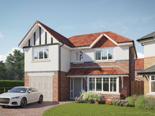 4 bedroom detached house for sale in Jamie Webb Drive,
Wilmslow,
Cheshire,
SK9 3DD, SK9 — £694,950 • 4 bed • 2 bath • 1263 ft²
4 bedroom detached house for sale in Jamie Webb Drive,
Wilmslow,
Cheshire,
SK9 3DD, SK9 — £694,950 • 4 bed • 2 bath • 1263 ft²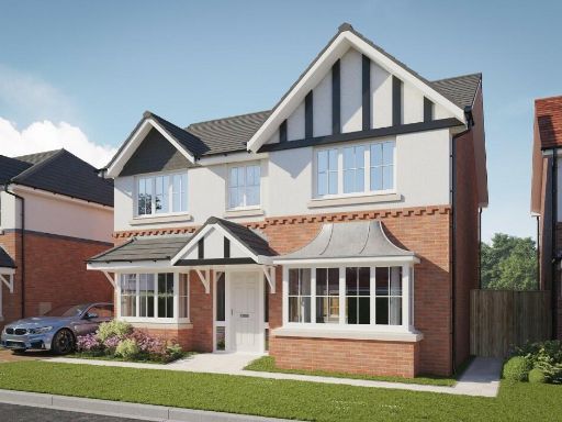 4 bedroom detached house for sale in Jamie Webb Drive,
Wilmslow,
Cheshire,
SK9 3DD, SK9 — £749,950 • 4 bed • 3 bath • 1584 ft²
4 bedroom detached house for sale in Jamie Webb Drive,
Wilmslow,
Cheshire,
SK9 3DD, SK9 — £749,950 • 4 bed • 3 bath • 1584 ft²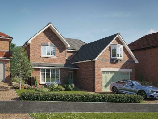 5 bedroom detached house for sale in Jamie Webb Drive,
Wilmslow,
Cheshire,
SK9 3DD, SK9 — £869,950 • 5 bed • 4 bath • 1920 ft²
5 bedroom detached house for sale in Jamie Webb Drive,
Wilmslow,
Cheshire,
SK9 3DD, SK9 — £869,950 • 5 bed • 4 bath • 1920 ft²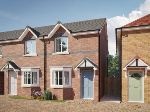 2 bedroom mews property for sale in Jamie Webb Drive,
Wilmslow,
Cheshire,
SK9 3DD, SK9 — £369,950 • 2 bed • 2 bath • 757 ft²
2 bedroom mews property for sale in Jamie Webb Drive,
Wilmslow,
Cheshire,
SK9 3DD, SK9 — £369,950 • 2 bed • 2 bath • 757 ft²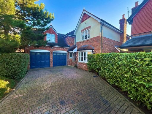 5 bedroom detached house for sale in Harrow Close, Wilmslow, SK9 — £820,000 • 5 bed • 4 bath • 2555 ft²
Meta
- {
"@context": "https://schema.org",
"@type": "Residence",
"name": "5 bedroom detached house for sale in Jamie Webb Drive, Wilm…",
"description": "",
"url": "https://propertypiper.co.uk/property/7f65a7ec-4ad0-41a8-b585-d237ec4a7c98",
"image": "https://image-a.propertypiper.co.uk/a4e7bec4-825f-431d-a527-7e9c0e6fccc8-1024.jpeg",
"address": {
"@type": "PostalAddress",
"streetAddress": "Jamie Webb Drive,\r\nWilmslow,\r\nCheshire,\r\nSK9 3DD",
"postalCode": "SK9 3DD",
"addressLocality": "Stockport",
"addressRegion": "Cheadle",
"addressCountry": "England"
},
"geo": {
"@type": "GeoCoordinates",
"latitude": 53.34704150487353,
"longitude": -2.202415256081901
},
"numberOfRooms": 5,
"numberOfBathroomsTotal": 4,
"floorSize": {
"@type": "QuantitativeValue",
"value": 2020,
"unitCode": "FTK"
},
"offers": {
"@type": "Offer",
"price": 879950,
"priceCurrency": "GBP",
"availability": "https://schema.org/InStock"
},
"additionalProperty": [
{
"@type": "PropertyValue",
"name": "Feature",
"value": "modern"
},
{
"@type": "PropertyValue",
"name": "Feature",
"value": "semi-detached"
},
{
"@type": "PropertyValue",
"name": "Feature",
"value": "new-build"
},
{
"@type": "PropertyValue",
"name": "Feature",
"value": "three-storey"
},
{
"@type": "PropertyValue",
"name": "Feature",
"value": "dormer windows"
},
{
"@type": "PropertyValue",
"name": "Feature",
"value": "red brick"
},
{
"@type": "PropertyValue",
"name": "Feature",
"value": "pitched roof"
},
{
"@type": "PropertyValue",
"name": "Feature",
"value": "driveway"
},
{
"@type": "PropertyValue",
"name": "Feature",
"value": "garage"
},
{
"@type": "PropertyValue",
"name": "Feature",
"value": "garden"
},
{
"@type": "PropertyValue",
"name": "Feature",
"value": "contemporary"
},
{
"@type": "PropertyValue",
"name": "Feature",
"value": "living room"
},
{
"@type": "PropertyValue",
"name": "Feature",
"value": "modern lighting"
},
{
"@type": "PropertyValue",
"name": "Feature",
"value": "standard ceiling height"
},
{
"@type": "PropertyValue",
"name": "Feature",
"value": "bright"
},
{
"@type": "PropertyValue",
"name": "Feature",
"value": "large window"
},
{
"@type": "PropertyValue",
"name": "Feature",
"value": "carpeted"
},
{
"@type": "PropertyValue",
"name": "Feature",
"value": "well-maintained"
}
]
}
High Res Floorplan Images
Compatible Floorplan Images
FloorplanImages Thumbnail