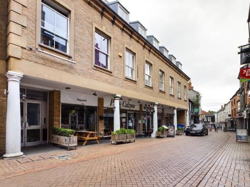
OX16 5NA - 2 bedroom apartment for sale in 3538 Parsons Street, Banbur…
View on Property Piper
2 bedroom apartment for sale in 35-38 Parsons Street, Banbury, Oxfordshire, OX16
Property Details
- Price: £179950
- Bedrooms: 2
- Bathrooms: 2
- Property Type: undefined
- Property SubType: undefined
Image Descriptions
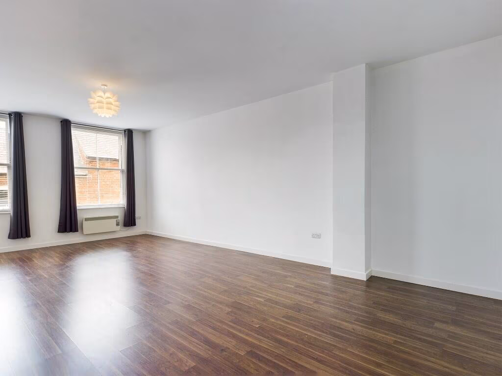
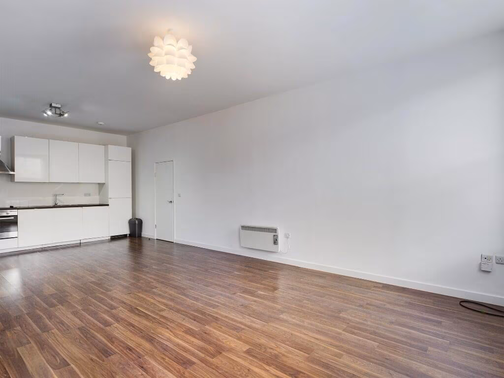
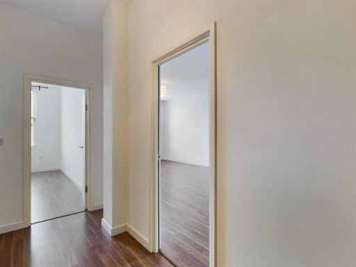
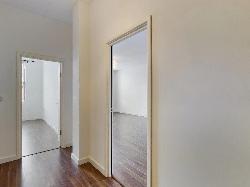
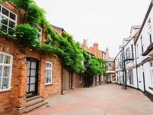
- Commercial Building Contemporary
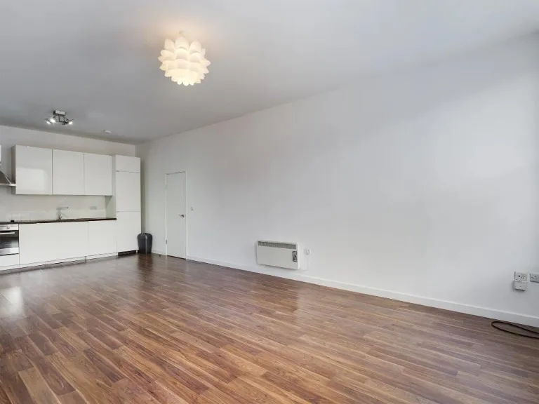
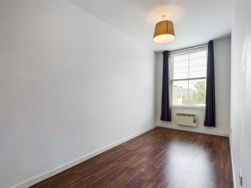
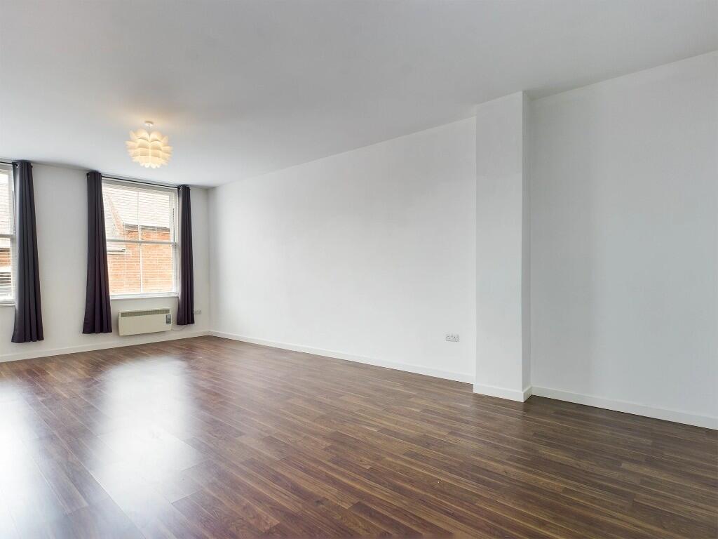
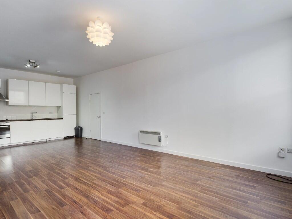
- living room contemporary
Floorplan Description
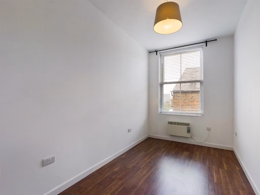
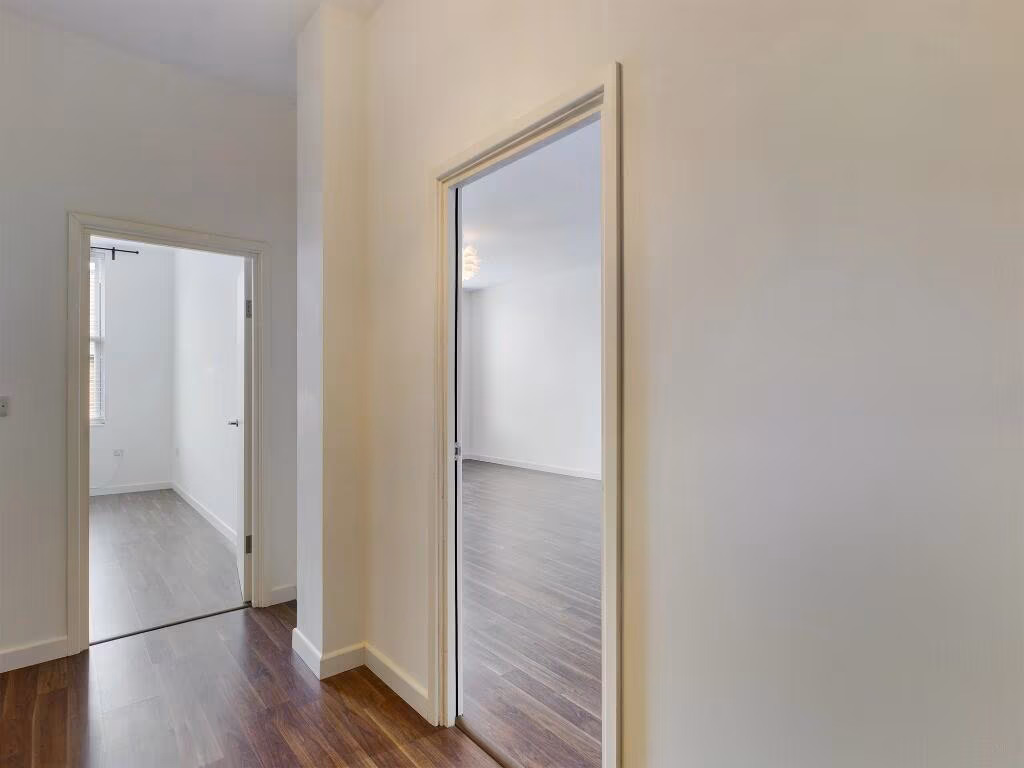
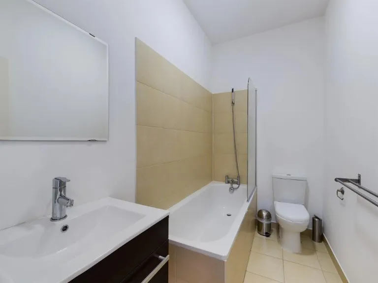
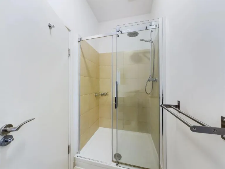
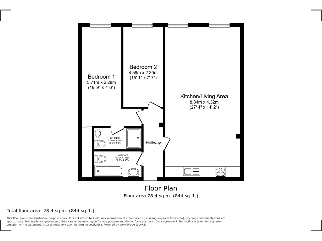
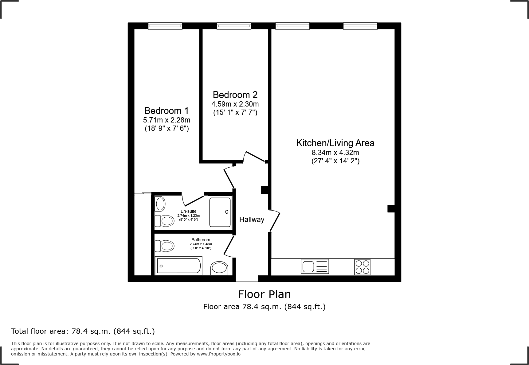
- A modern property featuring two bedrooms, an en-suite, bathroom, and a large kitchen/living area.
Rooms
- Bedroom 1: average
- Bedroom 2: average
- Kitchen/Living Area: large
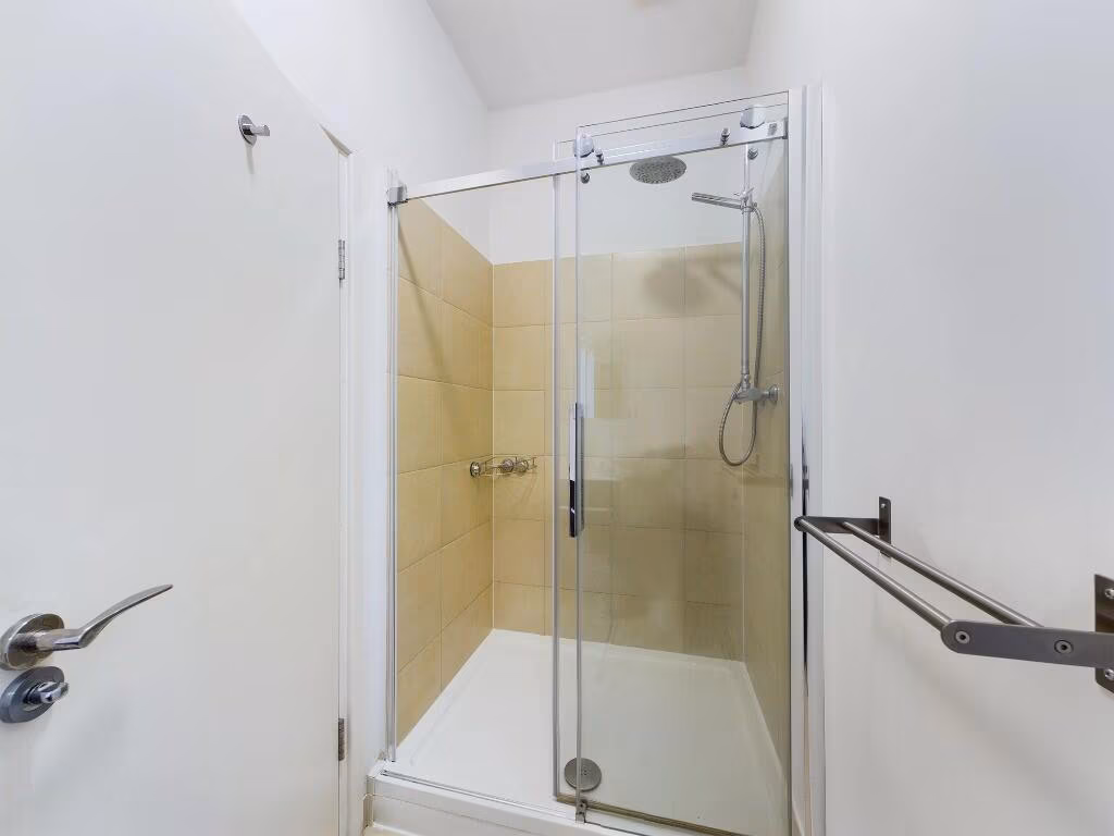
- En-suite: small
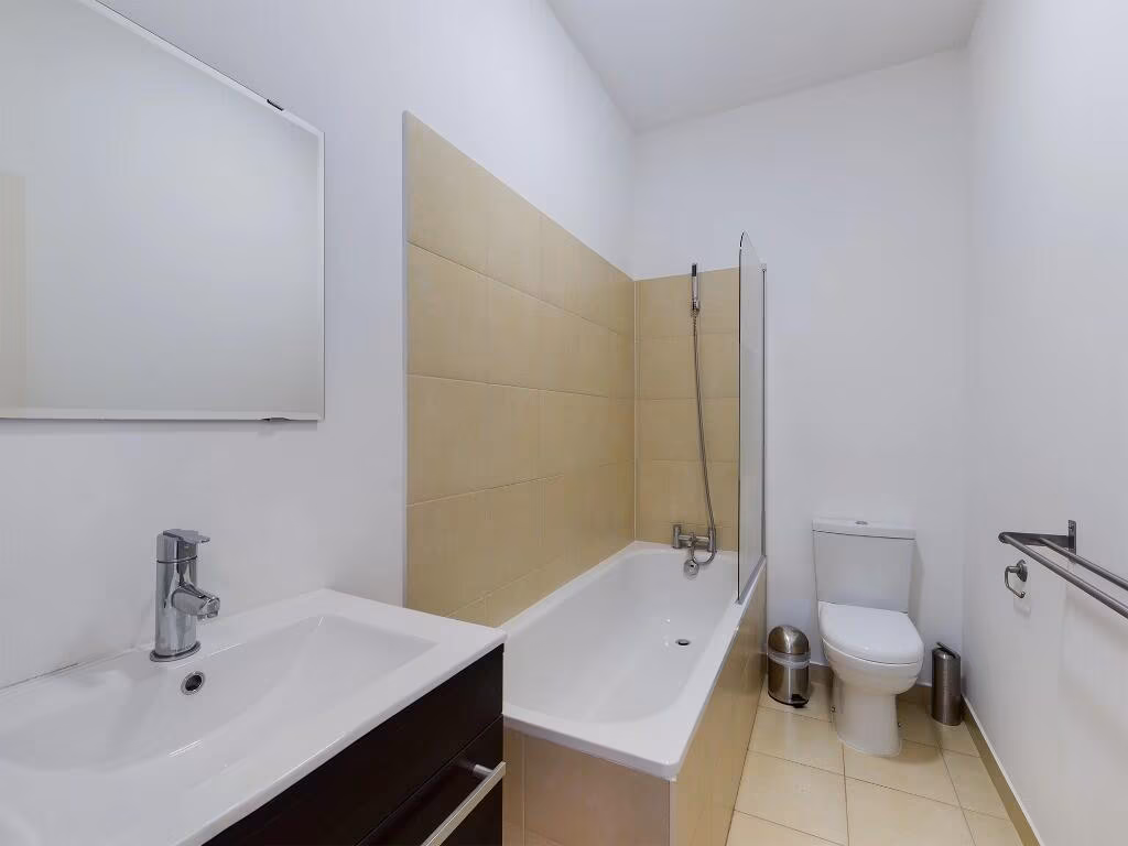
- Bathroom: small
- Bedroom 1:
- Bedroom 2:
- Kitchen/Living Area:
- En-suite:
- Bathroom:
Textual Property Features
Detected Visual Features
- commercial property
- mixed-use
- retail units
- brick facade
- central location
- urban
- near amenities
- contemporary
- laminate flooring
- neutral decor
- radiator
- double glazed window
- medium size room
- standard ceiling height
EPC Details
- Fully double glazed
- Cavity wall, filled cavity
- Room heaters, electric
- Low energy lighting in all fixed outlets
- (another dwelling below)
Nearby Schools
- The Warriner School
- Tudor Hall School
- Longford Park Primary School
- Orchard Fields Community School
- Dashwood Banbury Academy
- William Morris Primary School
- North Oxfordshire Academy
- Cherry Fields Primary School
- Cropredy Church of England Primary School
- Bloxham School
- Bishop Loveday Church of England Primary School
- Wykham Park
- Queensway School
- St Joseph's Catholic Primary School, Banbury
- St Mary's Church of England Primary School, Banbury
- Hill View Primary School
- Christopher Rawlins Church of England Voluntary Aided Primary School
- Bishop Carpenter Church of England Primary School
- Carrdus School
- Hardwick Primary School
- Hanwell Fields Community School
- Blessed George Napier Catholic School and Sixth Form
- The Grange Community Primary School
- Futures Institute Banbury
- St John's Catholic Primary School
- Harriers Banbury Academy
- St John's Priory School
- St Leonard's Church of England Primary School
Nearest Bars And Restaurants
- Id: 401364369
- Tags:
- Addr:
- City: Banbury
- Housenumber: 27
- Postcode: OX16 5LY
- Street: Parsons Street
- Amenity: restaurant
- Building: yes
- Cuisine: indian
- Name: Jool
- Website: https://joolonline.co.uk/
- TagsNormalized:
- Lat: 52.0620386
- Lon: -1.3389052
- FullGeoHash: gcr01t9535rv
- PartitionGeoHash: gcr0
- Images:
- FoodStandards: null
- Distance: 20.8
,- Id: 385133349
- Tags:
- Amenity: pub
- Building: yes
- Name: The White Horse
- TagsNormalized:
- Lat: 52.0623054
- Lon: -1.3390928
- FullGeoHash: gcr01t8uuvhh
- PartitionGeoHash: gcr0
- Images:
- FoodStandards: null
- Distance: 20.7
,- Id: 4049050971
- Tags:
- Amenity: pub
- Name: Whitehorse
- TagsNormalized:
- Lat: 52.0622883
- Lon: -1.3390785
- FullGeoHash: gcr01t8uv1yw
- PartitionGeoHash: gcr0
- Images:
- FoodStandards: null
- Distance: 18.9
,- Id: 984963563
- Tags:
- Addr:
- City: Banbury
- Housenumber: 39
- Postcode: OX16 5NA
- Street: Parsons Street
- Amenity: restaurant
- Building: yes
- Cuisine: indian
- Name: K2 Balti Restaurant & Take Away
- Website: https://k2takeaway.co.uk/
- TagsNormalized:
- Lat: 52.0621553
- Lon: -1.338601
- FullGeoHash: gcr01t9k034v
- PartitionGeoHash: gcr0
- Images:
- FoodStandards: null
- Distance: 16.9
,- Id: 385133347
- Tags:
- Addr:
- City: Banbury
- Housenumber: 36-37
- Postcode: OX16 5NA
- Street: Parsons Street
- Amenity: restaurant
- Building: yes
- Cuisine: italian
- Name: Pizza Calzone
- Website: https://www.pizzacalzonebanbury.co.uk/
- TagsNormalized:
- Lat: 52.0622211
- Lon: -1.3387717
- FullGeoHash: gcr01t9hkm7m
- PartitionGeoHash: gcr0
- Images:
- FoodStandards: null
- Distance: 3.7
}
Nearest General Shops
- Id: 984963566
- Tags:
- Addr:
- City: Banbury
- Housenumber: 29
- Postcode: OX16 5LY
- Street: Parsons Street
- Building: yes
- Name: Paul Joseph Hiardresser
- Shop: hairdresser
- Website: http://www.pauljosephhair.co.uk/
- TagsNormalized:
- Lat: 52.0620545
- Lon: -1.3391303
- FullGeoHash: gcr01t8gkn2h
- PartitionGeoHash: gcr0
- Images:
- FoodStandards: null
- Distance: 27.7
,- Id: 401364367
- Tags:
- Building: yes
- Name: Bao Giang Oriental Supermarket
- Shop: supermarket
- TagsNormalized:
- Lat: 52.0620435
- Lon: -1.3388056
- FullGeoHash: gcr01t957s64
- PartitionGeoHash: gcr0
- Images:
- FoodStandards: null
- Distance: 19.6
,- Id: 938875177
- Tags:
- Brand: Ladbrokes
- Brand:wikidata: Q1799875
- Brand:wikipedia: en:Ladbrokes Coral
- Building: yes
- Name: Ladbrokes
- Shop: bookmaker
- TagsNormalized:
- Lat: 52.0621815
- Lon: -1.3390635
- FullGeoHash: gcr01t8ujw1c
- PartitionGeoHash: gcr0
- Images:
- FoodStandards: null
- Distance: 16.8
}
Nearest Grocery shops
- Id: 930208721
- Tags:
- Addr:
- City: Banbury
- Housenumber: 23
- Postcode: OX16 5EG
- Street: High Street
- Brand: Tesco Express
- Brand:wikidata: Q98456772
- Brand:wikipedia: en:Tesco
- Building: retail
- Contact:
- Website: https://www.tesco.com/store-locator/banbury/23-high-st
- Fhrs:
- Name: Tesco Express
- Opening_hours: Mo-Su 06:00-23:00
- Opening_hours:covid19: open
- Operator: Tesco PLC
- Payment:
- Cash: yes
- Credit_cards: yes
- Debit_cards: yes
- Shop: convenience
- Source:
- TagsNormalized:
- tesco
- tesco express
- retail
- convenience
- shop
- Lat: 52.0606573
- Lon: -1.3371177
- FullGeoHash: gcr01t676cuv
- PartitionGeoHash: gcr0
- Images:
- FoodStandards:
- Id: 222604
- FHRSID: 222604
- LocalAuthorityBusinessID: 11/00120/C
- BusinessName: Tesco Express
- BusinessType: Retailers - supermarkets/hypermarkets
- BusinessTypeID: 7840
- AddressLine1: 23 High Street
- AddressLine2: null
- AddressLine3: Banbury
- AddressLine4: Oxfordshire
- PostCode: OX16 5EG
- RatingValue: 5
- RatingKey: fhrs_5_en-GB
- RatingDate: 2017-07-13
- LocalAuthorityCode: 268
- LocalAuthorityName: Cherwell
- LocalAuthorityWebSite: http://www.cherwell.gov.uk
- LocalAuthorityEmailAddress: HPandCompliance@cherwell-dc.gov.uk
- Scores:
- Hygiene: 5
- Structural: 5
- ConfidenceInManagement: 0
- NewRatingPending: false
- Geocode:
- Longitude: -1.33716890000000
- Latitude: 52.06075500000000
- Distance: 209.2
,- Id: 937110917
- Tags:
- Addr:
- City: Banbury
- Housenumber: 3
- Postcode: OX16 5BH
- Street: George Street
- Building: yes
- Name: Natural Health Store
- Shop: health_food
- TagsNormalized:
- health
- health food
- food
- shop
- Lat: 52.0610112
- Lon: -1.336696
- FullGeoHash: gcr01t6tkezh
- PartitionGeoHash: gcr0
- Images:
- FoodStandards: null
- Distance: 198.1
,- Id: 984963560
- Tags:
- Building: yes
- Name: Banbury Convenience Stores
- Shop: convenience
- TagsNormalized:
- Lat: 52.0620651
- Lon: -1.3393877
- FullGeoHash: gcr01t8ew025
- PartitionGeoHash: gcr0
- Images:
- FoodStandards: null
- Distance: 42.1
}
Nearest Religious buildings
- Id: 205770891
- Tags:
- Addr:
- Postcode: OX16 0AH
- Street: Horsefair
- Amenity: place_of_worship
- Building: church
- Denomination: quaker
- Name: Friends Meeting House
- Religion: christian
- Source: wikipedia
- Source:geometry: Bing
- Wikidata: Q26495674
- TagsNormalized:
- place of worship
- church
- quaker
- quakers
- christian
- Lat: 52.0618119
- Lon: -1.3403692
- FullGeoHash: gcr01mxfp1hk
- PartitionGeoHash: gcr0
- Images:
- FoodStandards: null
- Distance: 114.9
,- Id: 401339714
- Tags:
- Addr:
- City: Banbury
- Housenumber: 2-3
- Postcode: OX16 0TB
- Street: North Bar Street
- Amenity: pub
- Building: yes
- Name: The Church House
- Website: http://thechurchhousebanbury.co.uk/
- TagsNormalized:
- Lat: 52.0617335
- Lon: -1.340042
- FullGeoHash: gcr01t81wf83
- PartitionGeoHash: gcr0
- Images:
- FoodStandards: null
- Distance: 99.2
,- Id: 187538245
- Tags:
- Amenity: place_of_worship
- Building: church
- Denomination: anglican
- Name: Saint Mary's
- Religion: christian
- Wikidata: Q17528230
- TagsNormalized:
- place of worship
- church
- anglican
- christian
- Lat: 52.0614768
- Lon: -1.3391179
- FullGeoHash: gcr01t8bh69m
- PartitionGeoHash: gcr0
- Images:
- FoodStandards: null
- Distance: 84.9
}
Nearest Medical buildings
- Id: 1077628844
- Tags:
- Amenity: pharmacy
- Brand: Boots
- Brand:wikidata: Q6123139
- Building: yes
- Dispensing: yes
- Healthcare: pharmacy
- Name: Boots
- TagsNormalized:
- pharmacy
- boots
- health
- healthcare
- Lat: 52.0629413
- Lon: -1.3346195
- FullGeoHash: gcr01tu0t5et
- PartitionGeoHash: gcr0
- Images:
- FoodStandards: null
- Distance: 298.5
,- Id: 938775857
- Tags:
- Addr:
- City: Banbury
- Housenumber: 26
- Postcode: OX16 5EG
- Street: High Street
- Amenity: dentist
- Building: yes
- Healthcare: dentist
- Healthcare:speciality: dentistry
- Name: Amsel & Wilkins
- Operator: Private
- Website: https://www.amsel-wilkins.co.uk/cosmetic-dentistry-oxfordshire.html
- TagsNormalized:
- dentist
- health
- healthcare
- dentistry
- Lat: 52.0604868
- Lon: -1.3375802
- FullGeoHash: gcr01t64245u
- PartitionGeoHash: gcr0
- Images:
- FoodStandards: null
- Distance: 210.6
,- Id: 938791467
- Tags:
- Addr:
- City: Banbury
- Housenumber: 35
- Postcode: OX16 5ER
- Street: High Street
- Amenity: dentist
- Building: yes
- Healthcare: dentist
- Healthcare:speciality: dentistry
- Name: Banbury Dental Practice
- TagsNormalized:
- dentist
- health
- healthcare
- dentistry
- dental
- Lat: 52.0603359
- Lon: -1.3388423
- FullGeoHash: gcr01t316wnb
- PartitionGeoHash: gcr0
- Images:
- FoodStandards: null
- Distance: 209.4
,- Id: 984842890
- Tags:
- Addr:
- City: Banbury
- Housenumber: 22
- Postcode: OX16 5NG
- Street: Market Place
- Amenity: dentist
- Brand: My Dentist
- Brand:wikidata: Q65118035
- Brand:wikipedia: en:Mydentist
- Building: yes
- Healthcare: dentist
- Name: My Dentist
- Website: https://www.mydentist.co.uk/dentists/practices/england/south-east-england/banbury/22-cornhill
- TagsNormalized:
- dentist
- my dentist
- health
- healthcare
- Lat: 52.0625592
- Lon: -1.3363173
- FullGeoHash: gcr01tdyms3w
- PartitionGeoHash: gcr0
- Images:
- FoodStandards: null
- Distance: 175.6
}
Nearest Leisure Facilities
- Id: 984930029
- Tags:
- Leisure: outdoor_seating
- Operator: The Church House
- TagsNormalized:
- outdoor
- outdoor seating
- leisure
- Lat: 52.0618857
- Lon: -1.3401538
- FullGeoHash: gcr01t84knuv
- PartitionGeoHash: gcr0
- Images:
- FoodStandards: null
- Distance: 98.1
,- Id: 984907349
- Tags:
- Leisure: outdoor_seating
- Name: Ye Olde Reindeer Inn
- TagsNormalized:
- outdoor
- outdoor seating
- leisure
- inn
- Lat: 52.0623469
- Lon: -1.33768
- FullGeoHash: gcr01t9vjuck
- PartitionGeoHash: gcr0
- Images:
- FoodStandards: null
- Distance: 79.6
,- Id: 984907347
- Tags:
- Leisure: outdoor_seating
- Name: The Old Auctioneer
- TagsNormalized:
- outdoor
- outdoor seating
- leisure
- Lat: 52.0623272
- Lon: -1.3381041
- FullGeoHash: gcr01t9t5cjq
- PartitionGeoHash: gcr0
- Images:
- FoodStandards: null
- Distance: 50.7
,- Id: 938875179
- Tags:
- Leisure: outdoor_seating
- Operator: The White Horse
- TagsNormalized:
- outdoor
- outdoor seating
- leisure
- Lat: 52.0622964
- Lon: -1.338928
- FullGeoHash: gcr01t9hbeqy
- PartitionGeoHash: gcr0
- Images:
- FoodStandards: null
- Distance: 11.1
,- Id: 984963564
- Tags:
- Leisure: outdoor_seating
- Name: Pizza Calzone
- TagsNormalized:
- outdoor
- outdoor seating
- leisure
- pizza
- Lat: 52.062133
- Lon: -1.338783
- FullGeoHash: gcr01t95uj50
- PartitionGeoHash: gcr0
- Images:
- FoodStandards: null
- Distance: 10
}
Nearest Tourist attractions
- Id: 187928191
- Tags:
- Building: yes
- Layer: 1
- Name: Banbury Museum
- Tourism: museum
- Wikidata: Q4854014
- TagsNormalized:
- Lat: 52.0637586
- Lon: -1.333313
- FullGeoHash: gcr01tvj7s1c
- PartitionGeoHash: gcr0
- Images:
- FoodStandards: null
- Distance: 413.9
,- Id: 187928202
- Tags:
- Building: yes
- Name: Tooley's Historic Boatyard
- Phone: +44 1295 5272917
- Tourism: museum
- Waterway: boatyard
- Website: http://www.tooleysboatyard.co.uk/
- Wikidata: Q7824078
- Wikipedia: en:Tooley's Boatyard
- TagsNormalized:
- Lat: 52.0633965
- Lon: -1.3333949
- FullGeoHash: gcr01tv538s9
- PartitionGeoHash: gcr0
- Images:
- FoodStandards: null
- Distance: 393.6
,- Id: 960759832
- Tags:
- Building: yes
- Guest_house: hostel
- Name: Mawle Court- Banbury Foyer
- Tourism: hostel
- TagsNormalized:
- Lat: 52.0607984
- Lon: -1.3358687
- FullGeoHash: gcr01t7k0h0p
- PartitionGeoHash: gcr0
- Images:
- FoodStandards: null
- Distance: 256.5
}
Nearest Train stations
- Id: 17577157
- Tags:
- Name: Bicester North
- Naptan:
- Network: National Rail
- Postal_code: OX26 6EF
- Public_transport: station
- Railway: station
- Ref:
- Wheelchair: yes
- Wikidata: Q2184930
- Wikipedia: en:Bicester North railway station
- TagsNormalized:
- Lat: 51.9034655
- Lon: -1.1499566
- FullGeoHash: gcppmbdxs54p
- PartitionGeoHash: gcpp
- Images:
- FoodStandards: null
- Distance: 21884.2
,- Id: 4490148480
- Tags:
- Name: Tackley
- Naptan:
- Network: National Rail
- Public_transport: station
- Railway: station
- Ref:
- Wikidata: Q2457327
- Wikipedia: en:Tackley railway station
- TagsNormalized:
- Lat: 51.8814551
- Lon: -1.297508
- FullGeoHash: gcpp4kxpmu5y
- PartitionGeoHash: gcpp
- Images:
- FoodStandards: null
- Distance: 20298.3
,- Id: 1494376631
- Tags:
- Name: Heyford
- Naptan:
- Network: National Rail
- Public_transport: station
- Railway: station
- Ref:
- Wikidata: Q2075758
- Wikipedia: en:Heyford railway station
- TagsNormalized:
- Lat: 51.9185846
- Lon: -1.2994468
- FullGeoHash: gcpp67mz8twh
- PartitionGeoHash: gcpp
- Images:
- FoodStandards: null
- Distance: 16197.4
,- Id: 1766559047
- Tags:
- Name: King's Sutton
- Naptan:
- Network: National Rail
- Operator: Chiltern Railways
- Public_transport: station
- Railway: station
- Ref:
- Wheelchair: limited
- Wikidata: Q1956571
- Wikipedia: en:Kings Sutton railway station
- TagsNormalized:
- Lat: 52.0210915
- Lon: -1.2809729
- FullGeoHash: gcppfy5hz4m6
- PartitionGeoHash: gcpp
- Images:
- FoodStandards: null
- Distance: 6047.3
,- Id: 6634463841
- Tags:
- Name: Banbury
- Naptan:
- Network: National Rail
- Public_transport: station
- Railway: station
- Ref:
- Source: NPE
- Wheelchair: yes
- Wikidata: Q2092204
- Wikipedia: en:Banbury railway station
- TagsNormalized:
- Lat: 52.0605712
- Lon: -1.3277563
- FullGeoHash: gcr01v34v1c5
- PartitionGeoHash: gcr0
- Images:
- FoodStandards: null
- Distance: 778.6
}
Nearest Hotels
- Id: 3985537709
- Tags:
- Brand: Best Western
- Brand:wikidata: Q830334
- Brand:wikipedia: en:Best Western
- Name: Best Western
- Operator: Best Western
- Tourism: hotel
- TagsNormalized:
- Lat: 52.0568055
- Lon: -1.3396429
- FullGeoHash: gcr01s8sb5cu
- PartitionGeoHash: gcr0
- Images:
- FoodStandards: null
- Distance: 604.5
,- Id: 930226752
- Tags:
- Brand: Premier Inn
- Brand:wikidata: Q2108626
- Brand:wikipedia: en:Premier Inn
- Building: yes
- Internet_access: wlan
- Internet_access:fee: customers
- Internet_access:operator: Virgin Media
- Internet_access:ssid: Premier Inn Free Wi-Fi
- Name: Premier Inn
- Tourism: hotel
- TagsNormalized:
- Lat: 52.0643918
- Lon: -1.3351049
- FullGeoHash: gcr01w5c1f1d
- PartitionGeoHash: gcr0
- Images:
- FoodStandards: null
- Distance: 350.8
,- Id: 379772691
- Tags:
- Brand: Mercure
- Brand:wikidata: Q1709809
- Brand:wikipedia: en:Mercure (hotel)
- Building: yes
- Name: Mercure Whately Hall Hotel
- Tourism: hotel
- Wikidata: Q26299063
- TagsNormalized:
- Lat: 52.0611315
- Lon: -1.3405713
- FullGeoHash: gcr01mry46md
- PartitionGeoHash: gcr0
- Images:
- FoodStandards: null
- Distance: 169.9
}
Tags
- commercial property
- mixed-use
- retail units
- brick facade
- central location
- urban
- near amenities
- contemporary
- laminate flooring
- neutral decor
- radiator
- double glazed window
- medium size room
- standard ceiling height
Local Market Stats
- Average Price/sqft: £309
- Avg Income: £52800
- Rental Yield: 4.5%
- Social Housing: 17%
- Planning Success Rate: 83%
AirBnB Data
- 1km average: £116/night
- Listings in 1km: 7
Similar Properties
 2 bedroom apartment for sale in High Street, Banbury, OX16 — £195,950 • 2 bed • 1 bath • 644 ft²
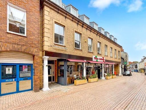 2 bedroom flat for sale in Parsons Street, Banbury, OX16 — £185,000 • 2 bed • 2 bath • 813 ft²
 2 bedroom apartment for sale in Banbury, OX16 0AE, OX16 — £195,000 • 2 bed • 1 bath • 558 ft²
 2 bedroom flat for sale in Banbury, Oxfordshire, OX16 — £170,000 • 2 bed • 2 bath • 785 ft²
 2 bedroom apartment for sale in 17b Dashwood Road, OX16 — £225,000 • 2 bed • 1 bath • 678 ft²
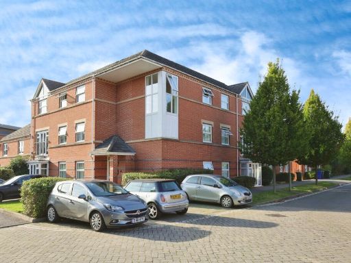 2 bedroom apartment for sale in Alma Road, Banbury, OX16 — £170,000 • 2 bed • 2 bath • 499 ft²
Meta
- {
"@context": "https://schema.org",
"@type": "Residence",
"name": "2 bedroom apartment for sale in 3538 Parsons Street, Banbur…",
"description": "",
"url": "https://propertypiper.co.uk/property/7b7a4d29-453e-444c-b61c-2509b3fc28e5",
"image": "https://image-a.propertypiper.co.uk/5e0af3ee-1302-4bc7-9d20-e7eb3984aa38-1024.jpeg",
"address": {
"@type": "PostalAddress",
"streetAddress": "FLAT 5, 35-38 PARSONS STREET, BANBURY",
"postalCode": "OX16 5NA",
"addressLocality": "Cherwell",
"addressRegion": "Banbury",
"addressCountry": "England"
},
"geo": {
"@type": "GeoCoordinates",
"latitude": 52.062219043028016,
"longitude": -1.3388252300191745
},
"numberOfRooms": 2,
"numberOfBathroomsTotal": 2,
"floorSize": {
"@type": "QuantitativeValue",
"value": 818,
"unitCode": "FTK"
},
"offers": {
"@type": "Offer",
"price": 179950,
"priceCurrency": "GBP",
"availability": "https://schema.org/InStock"
},
"additionalProperty": [
{
"@type": "PropertyValue",
"name": "Feature",
"value": "commercial property"
},
{
"@type": "PropertyValue",
"name": "Feature",
"value": "mixed-use"
},
{
"@type": "PropertyValue",
"name": "Feature",
"value": "retail units"
},
{
"@type": "PropertyValue",
"name": "Feature",
"value": "brick facade"
},
{
"@type": "PropertyValue",
"name": "Feature",
"value": "central location"
},
{
"@type": "PropertyValue",
"name": "Feature",
"value": "urban"
},
{
"@type": "PropertyValue",
"name": "Feature",
"value": "near amenities"
},
{
"@type": "PropertyValue",
"name": "Feature",
"value": "contemporary"
},
{
"@type": "PropertyValue",
"name": "Feature",
"value": "laminate flooring"
},
{
"@type": "PropertyValue",
"name": "Feature",
"value": "neutral decor"
},
{
"@type": "PropertyValue",
"name": "Feature",
"value": "radiator"
},
{
"@type": "PropertyValue",
"name": "Feature",
"value": "double glazed window"
},
{
"@type": "PropertyValue",
"name": "Feature",
"value": "medium size room"
},
{
"@type": "PropertyValue",
"name": "Feature",
"value": "standard ceiling height"
}
]
}
High Res Floorplan Images
Compatible Floorplan Images
FloorplanImages Thumbnail