PO33 2HY - 2 bedroom terraced house for sale in Warwick Street, RYDE,…
View on Property Piper
2 bedroom terraced house for sale in Warwick Street, RYDE, Isle of Wight, PO33
Property Details
- Price: £175000
- Bedrooms: 2
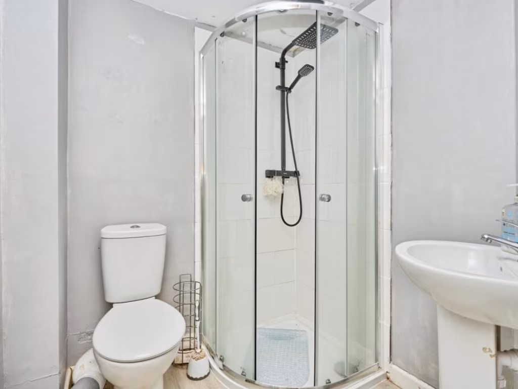
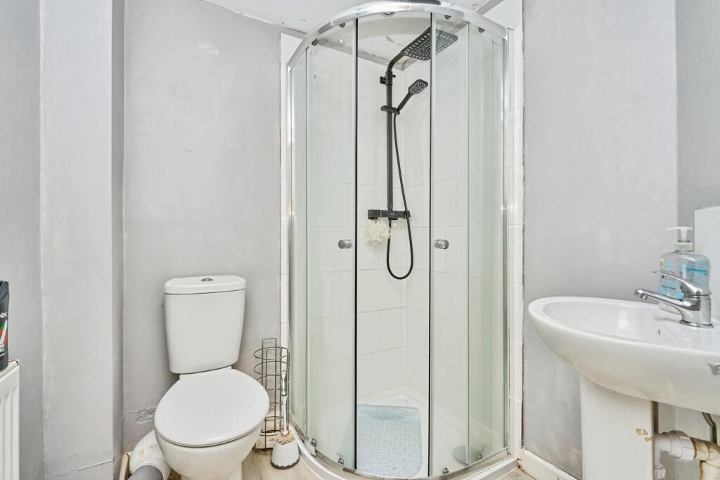
- Bathrooms: 1
- Property Type: undefined
- Property SubType: undefined
Image Descriptions
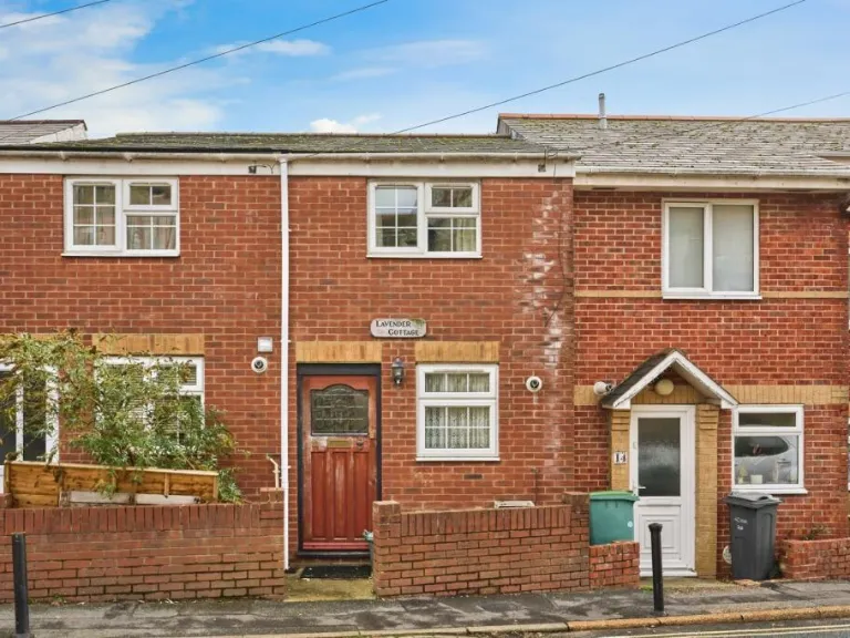
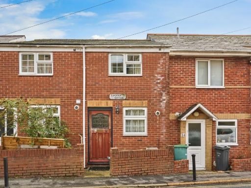
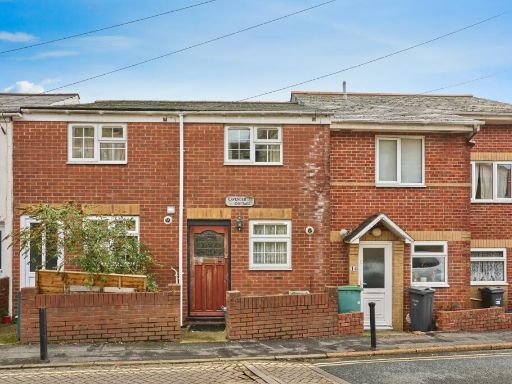
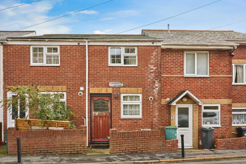
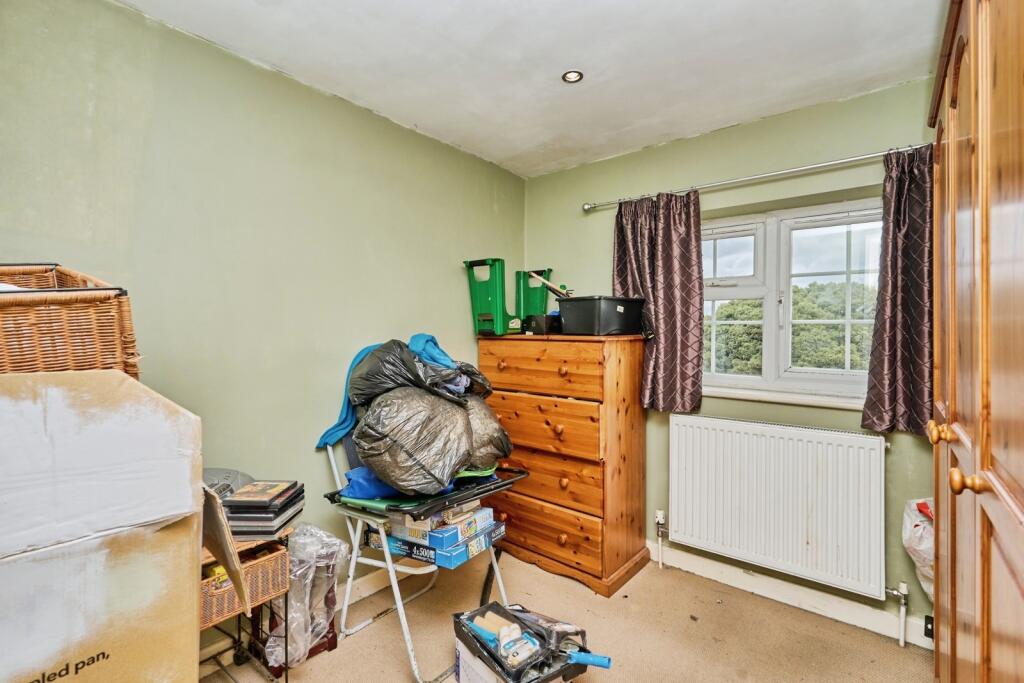
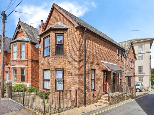
- exterior of a semi-detached cottage cottage
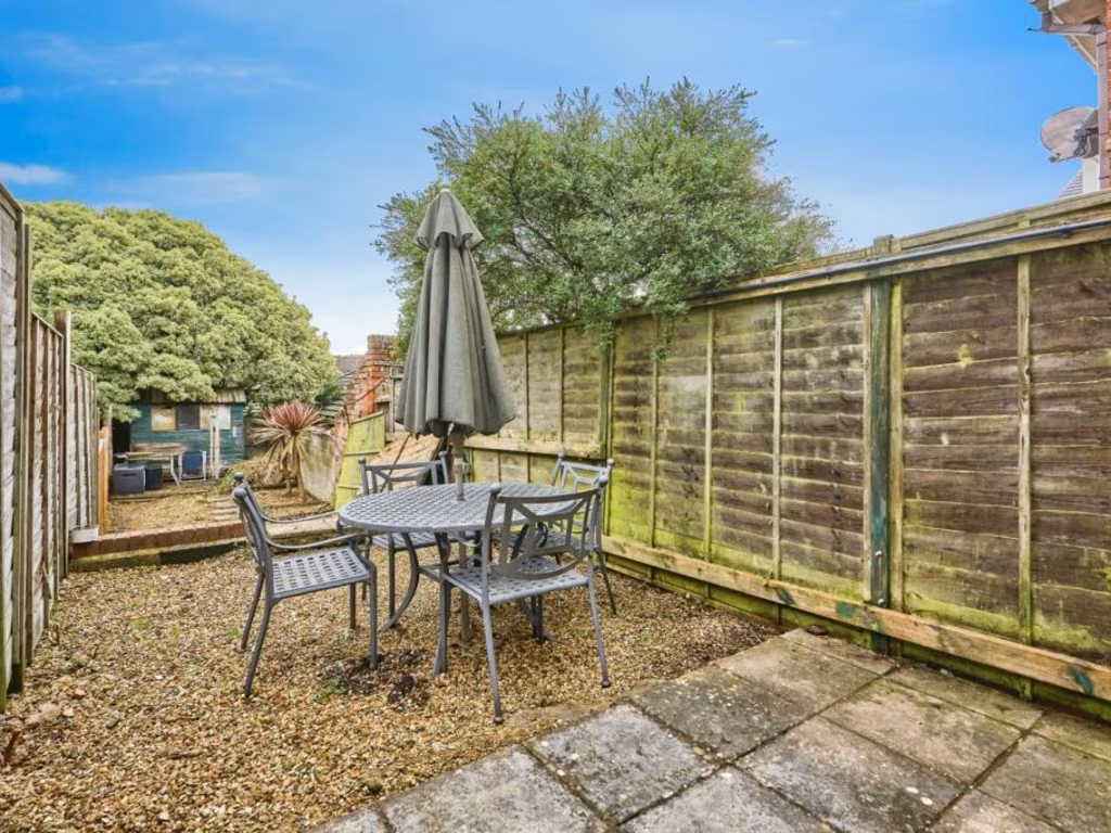
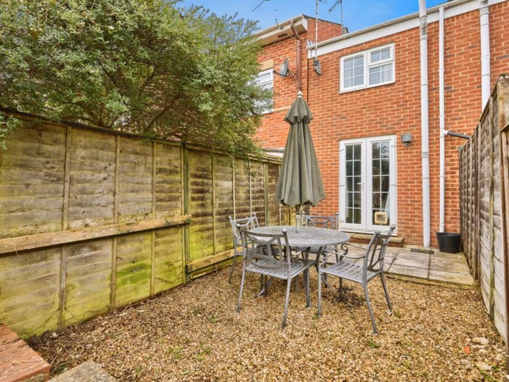
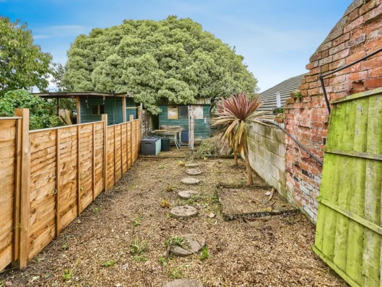
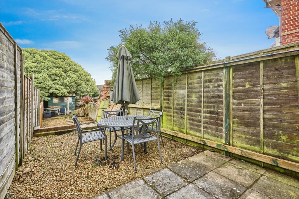
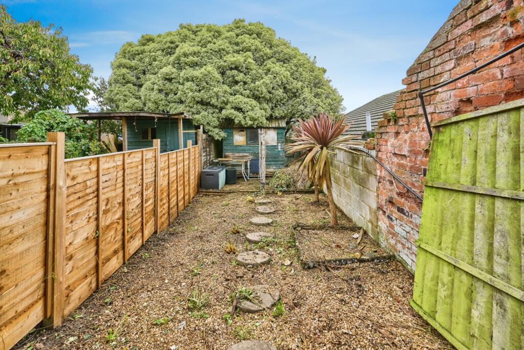
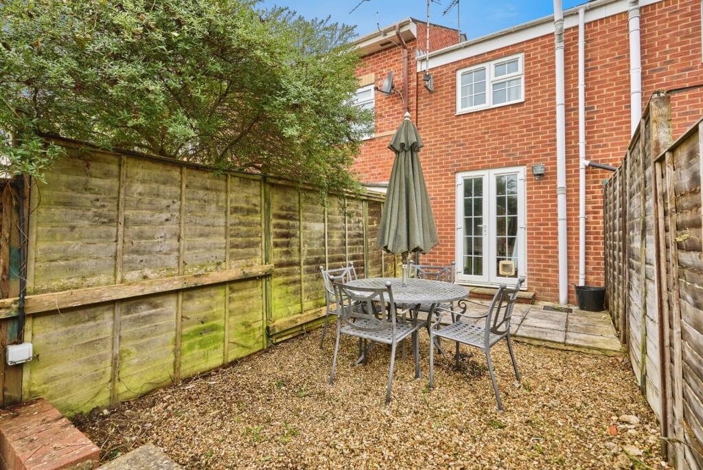
- backyard
Floorplan Description
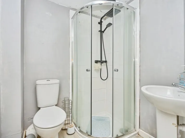
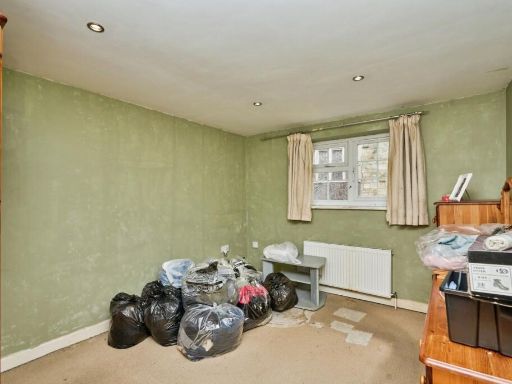
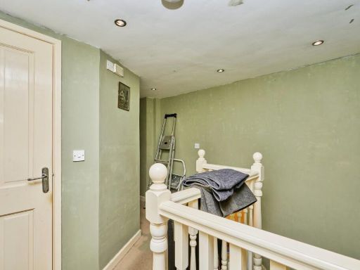
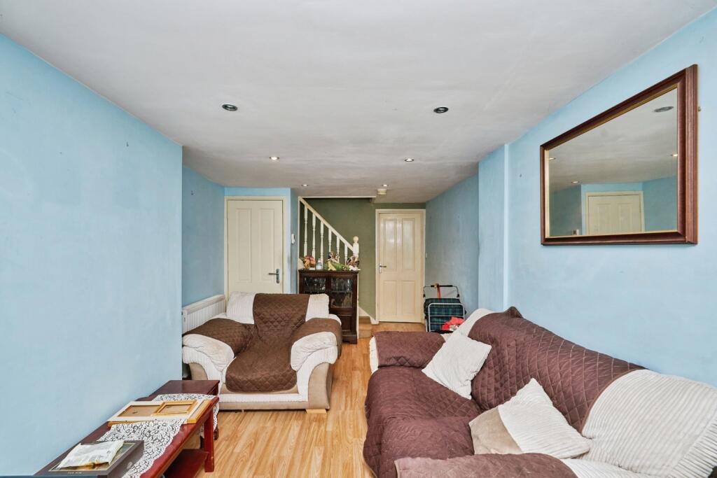
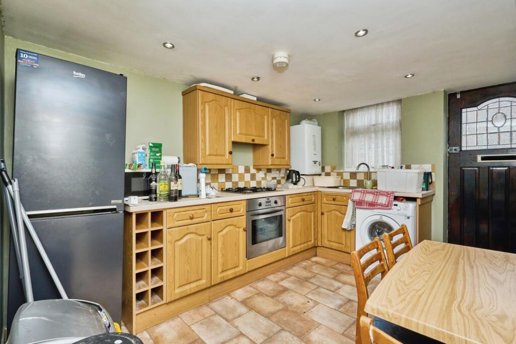
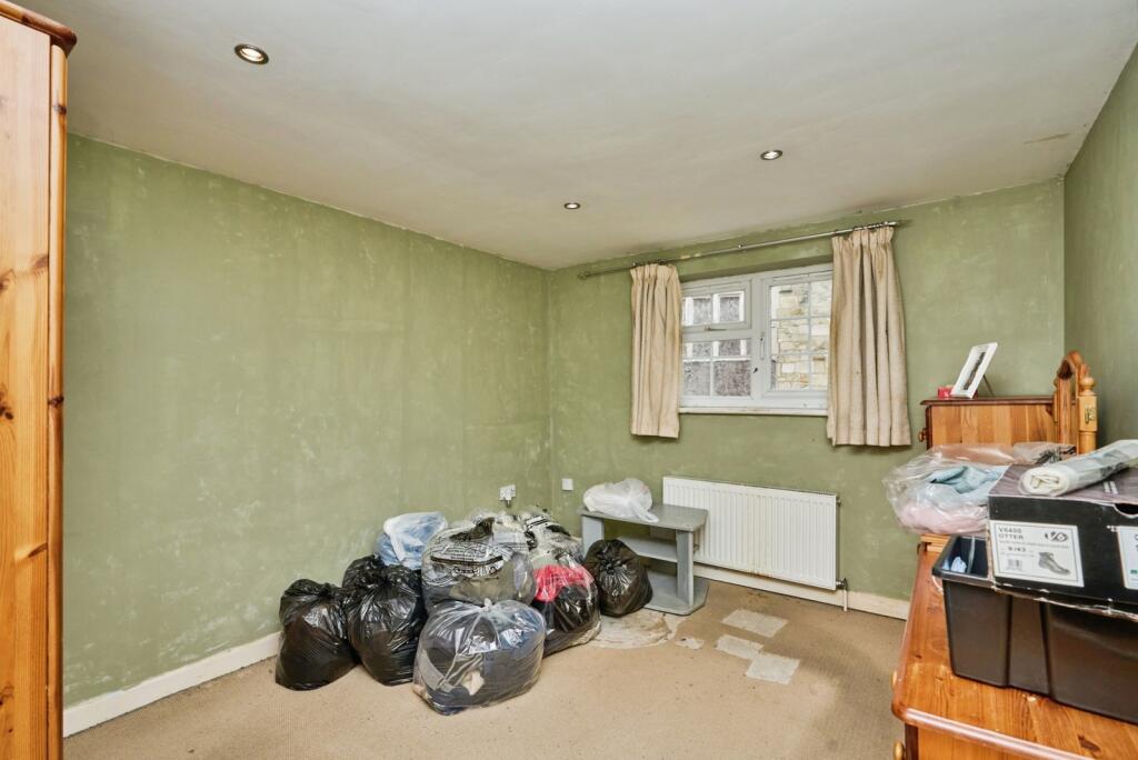
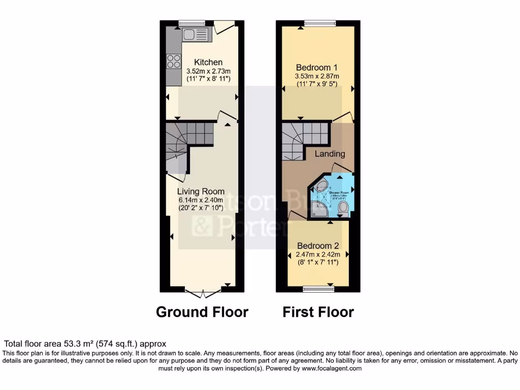
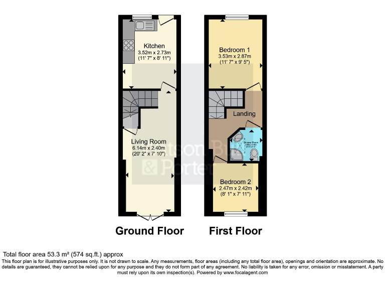
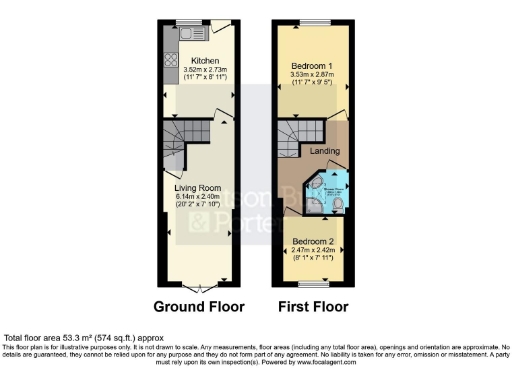
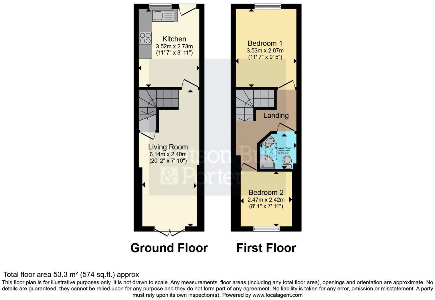
- Two-storey property with living room and kitchen on ground floor; two bedrooms and shower room on first floor.
Rooms
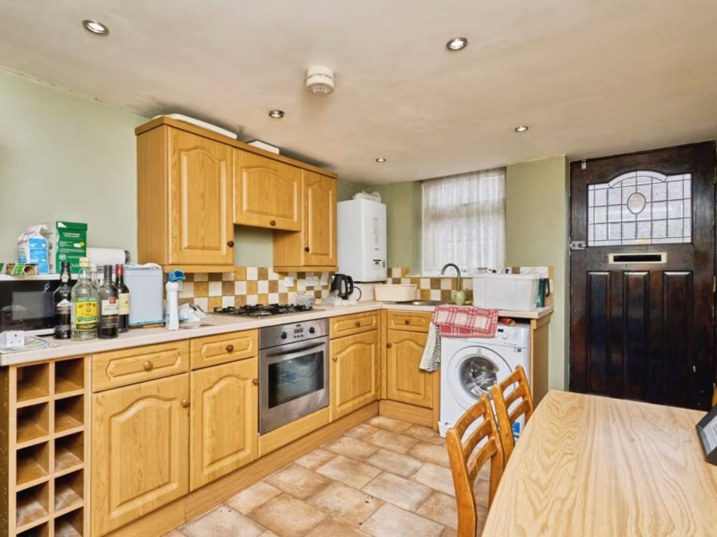
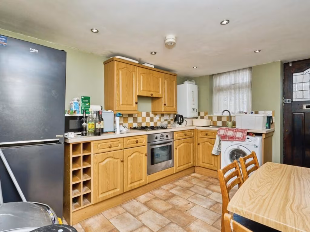
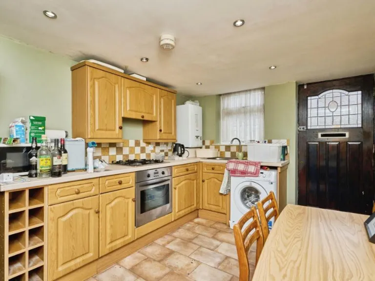
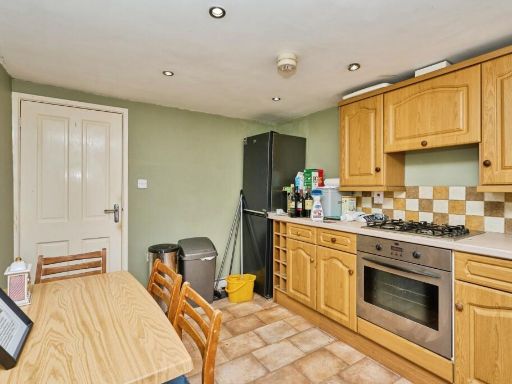
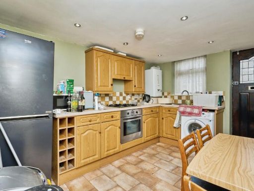
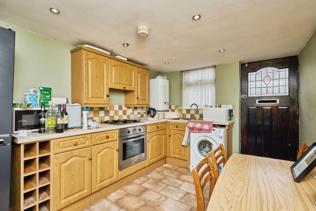
- Kitchen:
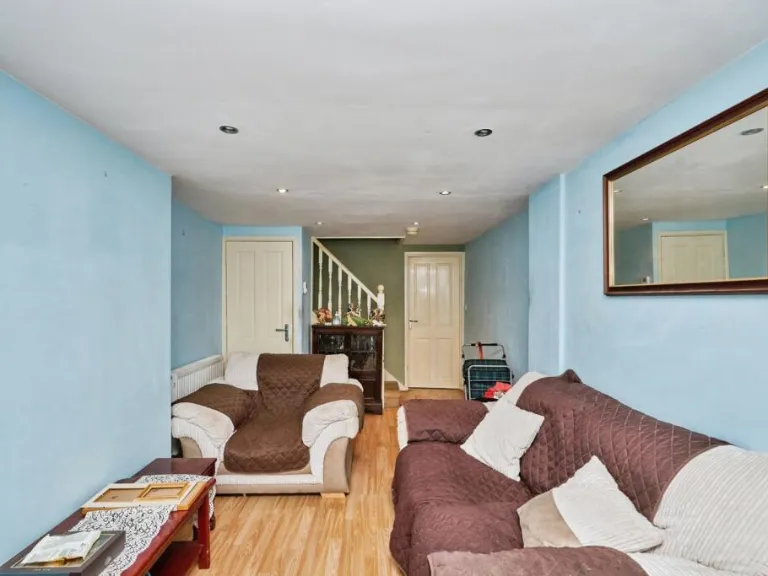
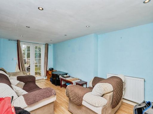
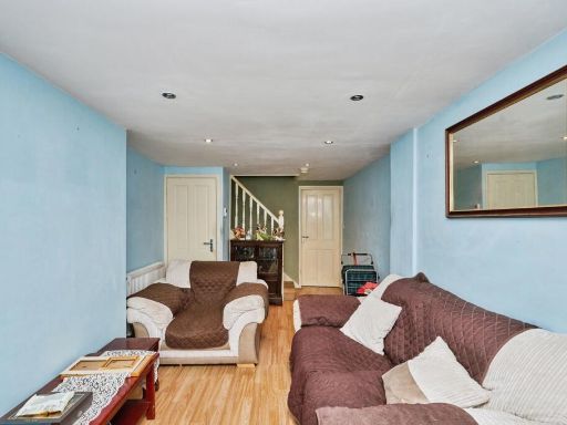
- Living Room:
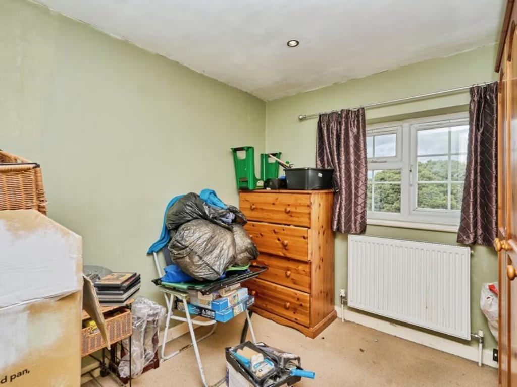
- Bedroom 1:
- Bedroom 2:
Textual Property Features
- Has Garden
- Chain Free
- Success
Detected Visual Features
- cottage
- brick exterior
- semi-detached
- old style
- village
- two-storey
- terraced housing
- residential area
- traditional windows
- period property
- rustic
- character
- backyard
- garden
- patio
- fence
- outdoor furniture
- gravel
- concrete slabs
- privacy
- low-maintenance
EPC Details
- Single glazed
- Cavity wall, as built, no insulation (assumed)
- Boiler and radiators, mains gas
- Low energy lighting in 75% of fixed outlets
- Solid, no insulation (assumed)
Nearby Schools
- Bembridge Church of England Primary School
- St Helens Primary School
- St Mary's Catholic Primary School
- St Jude's CofE Primary School
- Gomer Junior School
- Gomer Infant School
- The Portsmouth Grammar School
- Lee-On-the-Solent Infant and Nursery School
- Nettlestone Primary School
- Ryde School with Upper Chine
- Alverstoke Community Infant School
- Portsmouth High School
- Brading Church of England Controlled Primary School
- Haylands Primary School
- Ryde Academy
- Binstead Primary School
- Dover Park Primary School
- Bay House School
- Alverstoke Church of England Aided Junior School
- Leesland Church of England Controlled Junior School
- Newtown Church of England Voluntary Controlled Primary School
- The Bay Church of England School
- Newchurch Primary School
- Oakfield Church of England Aided Primary School, Ryde
- Wootton Community Primary School
- Greenmount Primary School
- Haselworth Primary School
- Leesland Church of England Controlled Infant School
- Lee-on-the-Solent Junior School
Nearest General Shops
- Id: 5113222443
- Tags:
- Level: 0
- Name: Islanwide Carpets
- Opening_hours: Mo-Sa 09:00-17:00
- Shop: interior_decoration
- TagsNormalized:
- carpet
- interior decoration
- shop
- Lat: 50.7276729
- Lon: -1.1622146
- FullGeoHash: gcp0td9wn7tg
- PartitionGeoHash: gcp0
- Images:
- FoodStandards: null
- Distance: 75.1
,- Id: 9201189238
- Tags:
- Addr:
- City: Ryde
- Country: GB
- Housenumber: 6
- Street: Star Street
- Name: Six Hair Studio
- Shop: beauty
- TagsNormalized:
- Lat: 50.7276729
- Lon: -1.1621623
- FullGeoHash: gcp0td9wpesg
- PartitionGeoHash: gcp0
- Images:
- FoodStandards: null
- Distance: 73.2
,- Id: 5113028039
- Tags:
- Addr:
- City: Ryde
- Country: GB
- Street: High Street
- Level: 0
- Name: Bella Lucca
- Shop: clothes
- TagsNormalized:
- Lat: 50.7269768
- Lon: -1.1625894
- FullGeoHash: gcp0td96j9ye
- PartitionGeoHash: gcp0
- Images:
- FoodStandards: null
- Distance: 68.5
}
Nearest Religious buildings
- Id: 133022296
- Tags:
- Addr:
- City: Ryde
- Country: GB
- Postcode: PO33 2JF
- Street: George Street
- Amenity: place_of_worship
- Building: church
- Contact:
- Website: https://rydebaptist.xyz/
- Denomination: baptist
- Fhrs:
- Name: Ryde Baptist Church
- Religion: christian
- Source:
- TagsNormalized:
- place of worship
- church
- baptist
- christian
- Lat: 50.729096
- Lon: -1.1618081
- FullGeoHash: gcp0tdcyruvh
- PartitionGeoHash: gcp0
- Images:
- FoodStandards:
- Id: 1201240
- FHRSID: 1201240
- LocalAuthorityBusinessID: 19/00219/CP
- BusinessName: Ryde Baptist Church
- BusinessType: Restaurant/Cafe/Canteen
- BusinessTypeID: 1
- AddressLine1: George Street
- AddressLine2: Ryde
- AddressLine3: Isle Of Wight
- AddressLine4: null
- PostCode: PO33 2JF
- RatingValue: 5
- RatingKey: fhrs_5_en-GB
- RatingDate: 2019-10-18
- LocalAuthorityCode: 867
- LocalAuthorityName: Isle of Wight
- LocalAuthorityWebSite: http://www.iwight.com/eh
- LocalAuthorityEmailAddress: eh@iow.gov.uk
- Scores:
- Hygiene: 0
- Structural: 0
- ConfidenceInManagement: 0
- NewRatingPending: false
- Geocode:
- Longitude: -1.16140902042389
- Latitude: 50.72944259643550
- Distance: 221.7
,- Id: 1464502750
- Tags:
- Amenity: place_of_worship
- Name: Ryde Spiritualist Church
- Religion: spiritualist
- TagsNormalized:
- place of worship
- church
- spiritualist
- Lat: 50.7271281
- Lon: -1.1590022
- FullGeoHash: gcp0tds4cq13
- PartitionGeoHash: gcp0
- Images:
- FoodStandards: null
- Distance: 185.5
,- Id: 5113028080
- Tags:
- Addr:
- City: Ryde
- Country: GB
- Street: High Street
- Amenity: place_of_worship
- Denomination: catholic
- Name: Saint Mary's
- Religion: christian
- TagsNormalized:
- place of worship
- catholic
- christian
- church
- Lat: 50.7267115
- Lon: -1.1624707
- FullGeoHash: gcp0td9882rh
- PartitionGeoHash: gcp0
- Images:
- FoodStandards: null
- Distance: 73.2
}
Nearest Airports
- Id: 100647893
- Tags:
- Aerodrome: international
- Aerodrome:type: public
- Aeroway: aerodrome
- Contact:
- Vhf:
- Approach: 120.225 MHz
- Tower: 118.2 MHz
- Ele: 44ft
- Iata: SOU
- Icao: EGHI
- Is_in: Hampshire, England,UK
- Name: Southampton Airport
- Operator: Southampton International Airport Limited
- Source: Bing;Gagravarr_Airports
- Wikidata: Q8988
- Wikipedia: en:Southampton Airport
- TagsNormalized:
- airport
- international airport
- Lat: 50.9513872
- Lon: -1.3516684
- FullGeoHash: gcp1c5rtrffz
- PartitionGeoHash: gcp1
- Images:
- FoodStandards: null
- Distance: 28284.5
}
Nearest Leisure Facilities
- Id: 449390722
- Tags:
- TagsNormalized:
- Lat: 50.7278818
- Lon: -1.1577801
- FullGeoHash: gcp0tdszmf89
- PartitionGeoHash: gcp0
- Images:
- FoodStandards: null
- Distance: 284.9
,- Id: 474015447
- Tags:
- TagsNormalized:
- Lat: 50.7272991
- Lon: -1.1654104
- FullGeoHash: gcp0t6x7gvzj
- PartitionGeoHash: gcp0
- Images:
- FoodStandards: null
- Distance: 266.4
,- Id: 472579704
- Tags:
- TagsNormalized:
- Lat: 50.7254055
- Lon: -1.1632716
- FullGeoHash: gcp0td2bvucy
- PartitionGeoHash: gcp0
- Images:
- FoodStandards: null
- Distance: 221.2
,- Id: 312930071
- Tags:
- TagsNormalized:
- Lat: 50.7265536
- Lon: -1.1623414
- FullGeoHash: gcp0td3xe6zq
- PartitionGeoHash: gcp0
- Images:
- FoodStandards: null
- Distance: 78.8
,- Id: 6120970355
- Tags:
- Addr:
- City: Ryde
- Country: GB
- Street: High Street
- Leisure: fitness_station
- Level: 1
- Name: Evolution Gym
- Sport: fitness
- TagsNormalized:
- fitness
- fitness station
- station
- leisure
- sports
- Lat: 50.7271347
- Lon: -1.1626397
- FullGeoHash: gcp0td96ux31
- PartitionGeoHash: gcp0
- Images:
- FoodStandards: null
- Distance: 70.6
}
Nearest Tourist attractions
- Id: 8865699178
- Tags:
- Addr:
- City: Ryde
- Country: GB
- Housename: Sea View
- Housenumber: 8
- Postcode: PO33 2AQ
- Street: Dover Street
- Fhrs:
- Guest_house: bed_and_breakfast
- Name: Sea View B&B
- Tourism: guest_house
- TagsNormalized:
- Lat: 50.7306903
- Lon: -1.1570552
- FullGeoHash: gcp0tejrwwj5
- PartitionGeoHash: gcp0
- Images:
- FoodStandards:
- Id: 541388
- FHRSID: 541388
- LocalAuthorityBusinessID: 50942
- BusinessName: Sea View B&B
- BusinessType: Hotel/bed & breakfast/guest house
- BusinessTypeID: 7842
- AddressLine1: 8 Dover Street
- AddressLine2: Ryde
- AddressLine3: Isle Of Wight
- AddressLine4: null
- PostCode: PO33 2AQ
- RatingValue: 4
- RatingKey: fhrs_4_en-GB
- RatingDate: 2016-07-06
- LocalAuthorityCode: 867
- LocalAuthorityName: Isle of Wight
- LocalAuthorityWebSite: http://www.iwight.com/eh
- LocalAuthorityEmailAddress: eh@iow.gov.uk
- Scores:
- Hygiene: 5
- Structural: 0
- ConfidenceInManagement: 10
- NewRatingPending: false
- Geocode:
- Longitude: -1.15724194049835
- Latitude: 50.73076248168950
- Distance: 512.8
,- Id: 3300277780
- Tags:
- Addr:
- City: Ryde
- Country: GB
- Housename: Royal Victoria Arcade
- Postcode: PO33 2LQ
- Street: Union Street
- Name: Ryde District Heritage Centre
- Operator: Historic Ryde Society
- Phone: +44 1983 717435
- Source: Society volunteer
- Survey:
- Tourism: museum
- Website: https://historicrydesociety.com/history-of-the-museum-of-ryde/
- Wheelchair: limited
- Wheelchair:description: Museum is in Arcade's basement. Stairlift at Museum Entrance. A folding wheelchair is available at bottom of stairlift. Steps involved at Arcade's Union St ,(main) and Church Lane, (rear) entrances.
- Wikidata: Q113454717
- TagsNormalized:
- Lat: 50.7314116
- Lon: -1.1624147
- FullGeoHash: gcp0te3ecu8c
- PartitionGeoHash: gcp0
- Images:
- FoodStandards: null
- Distance: 482
,- Id: 5112931542
- Tags:
- Name: Salvation Army Lifehouse
- Tourism: hostel
- TagsNormalized:
- salvation army
- hostel
- tourism
- Lat: 50.7263257
- Lon: -1.1638722
- FullGeoHash: gcp0td2qrb3z
- PartitionGeoHash: gcp0
- Images:
- FoodStandards: null
- Distance: 179.6
}
Nearest Train stations
- Id: 7227760
- Tags:
- Addr:
- City: Havenstreet, near Ryde
- Street: Main Road
- Name: Havenstreet
- Naptan:
- Public_transport: station
- Railway: station
- Usage: tourism
- Wikidata: Q5683726
- TagsNormalized:
- Lat: 50.7054566
- Lon: -1.2146336
- FullGeoHash: gcp0kqes8ypw
- PartitionGeoHash: gcp0
- Images:
- FoodStandards: null
- Distance: 4440.3
,- Id: 252733074
- Tags:
- Name: Ashey
- Naptan:
- Public_transport: station
- Railway: station
- Request_stop: yes
- Usage: tourism
- Wikidata: Q4804934
- TagsNormalized:
- Lat: 50.6964692
- Lon: -1.183063
- FullGeoHash: gcp0mj482du6
- PartitionGeoHash: gcp0
- Images:
- FoodStandards: null
- Distance: 3725.6
,- Id: 7144107
- Tags:
- Name: Smallbrook Junction
- Naptan:
- Network: National Rail
- Note: No road/path access - open for interchange only
- Operator: Island Line Trains
- Public_transport: station
- Railway: station
- Ref:
- Wikidata: Q1868757
- Wikipedia: en:Smallbrook Junction railway station
- TagsNormalized:
- Lat: 50.7114593
- Lon: -1.1550109
- FullGeoHash: gcp0mxwzwm1m
- PartitionGeoHash: gcp0
- Images:
- FoodStandards: null
- Distance: 1801.2
,- Id: 2513777384
- Tags:
- Name: Ryde Esplanade
- Naptan:
- Network: National Rail
- Operator: Island Line
- Public_transport: station
- Railway: station
- Ref:
- Wheelchair: yes
- Wikidata: Q2174613
- Wikipedia: en:Ryde Esplanade railway station
- TagsNormalized:
- Lat: 50.7330485
- Lon: -1.1596319
- FullGeoHash: gcp0teet6tey
- PartitionGeoHash: gcp0
- Images:
- FoodStandards: null
- Distance: 675.8
,- Id: 7138878
- Tags:
- Image: File:Ryde St. John's Road Railway station 1971.jpg
- Name: Ryde St John's Road
- Naptan:
- Network: National Rail
- Operator: Island Line Trains
- Public_transport: station
- Railway: station
- Ref:
- Wikidata: Q4567463
- Wikipedia: en:Ryde St John's Road railway station
- TagsNormalized:
- Lat: 50.7241835
- Lon: -1.1566159
- FullGeoHash: gcp0tdjcbchs
- PartitionGeoHash: gcp0
- Images:
- FoodStandards: null
- Distance: 480.1
}
Nearest Hotels
- Id: 312918465
- Tags:
- Addr:
- City: Ryde
- Country: GB
- Postcode: PO33 2BW
- Street: Dover Street
- Building: yes
- Contact:
- Phone: +44 1983 564327
- Website: https://thedorsethotel.co.uk/
- Fhrs:
- Internet_access: wlan
- Internet_access:fee: no
- Name: Dorset House Hotel
- Source:
- Stars: 3
- Tourism: hotel
- Wikidata: Q26565570
- TagsNormalized:
- Lat: 50.7293074
- Lon: -1.1573378
- FullGeoHash: gcp0tdvr8h63
- PartitionGeoHash: gcp0
- Images:
- FoodStandards: null
- Distance: 389.3
,- Id: 374018159
- Tags:
- Addr:
- City: Ryde
- Postcode: PO33 2LD
- Street: Lind Hill
- Brand: Travelodge
- Brand:wikidata: Q9361374
- Brand:wikipedia: en:Travelodge UK
- Building: yes
- Contact:
- Website: https://www.travelodge.co.uk/hotels/596/Ryde-Isle-of-Wight-hotel
- Internet_access: wlan
- Internet_access:fee: customers
- Internet_access:ssid: Travelodge WiFi
- Name: Travelodge
- Operator: Travelodge
- Tourism: hotel
- TagsNormalized:
- Lat: 50.7296316
- Lon: -1.1638991
- FullGeoHash: gcp0te03x0tz
- PartitionGeoHash: gcp0
- Images:
- FoodStandards: null
- Distance: 322.9
,- Id: 251856398
- Tags:
- Contact:
- Website: https://www.abingdonlodge.com/
- Name: Abingdon Lodge
- Tourism: hotel
- TagsNormalized:
- Lat: 50.7265806
- Lon: -1.166137
- FullGeoHash: gcp0t6qzepcp
- PartitionGeoHash: gcp0
- Images:
- FoodStandards: null
- Distance: 322
}
Tags
- cottage
- brick exterior
- semi-detached
- old style
- village
- two-storey
- terraced housing
- residential area
- traditional windows
- period property
- rustic
- character
- backyard
- garden
- patio
- fence
- outdoor furniture
- gravel
- concrete slabs
- privacy
- low-maintenance
Local Market Stats
- Average Price/sqft: £274
- Avg Income: £36500
- Rental Yield: 3.4%
- Social Housing: 3%
- Planning Success Rate: 84%
AirBnB Data
- 1km average: £101/night
- Listings in 1km: 18
Similar Properties
 1 bedroom end of terrace house for sale in Church Lane, Ryde, Isle of Wight, PO33 — £150,000 • 1 bed • 1 bath • 444 ft²
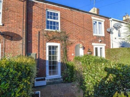 2 bedroom terraced house for sale in Bedworth Place, RYDE, Isle of Wight, PO33 — £180,000 • 2 bed • 1 bath • 610 ft²
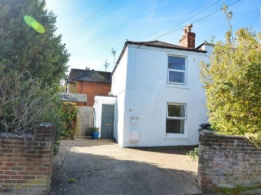 2 bedroom semi-detached house for sale in Central Ryde, PO33 — £189,950 • 2 bed • 1 bath • 774 ft²
 2 bedroom terraced house for sale in Stainers Close, Ryde, Isle of Wight, PO33 — £190,000 • 2 bed • 1 bath • 474 ft²
 1 bedroom ground floor flat for sale in John Street, Ryde, Isle of Wight, PO33 — £115,000 • 1 bed • 1 bath • 571 ft²
 1 bedroom house for sale in George Street, Ryde, Isle of Wight, PO33 — £85,000 • 1 bed • 1 bath • 550 ft²
Meta
- {
"@context": "https://schema.org",
"@type": "Residence",
"name": "2 bedroom terraced house for sale in Warwick Street, RYDE,…",
"description": "",
"url": "https://propertypiper.co.uk/property/7a8704bb-2076-4526-b7f5-b3bf04e8f557",
"image": "https://image-a.propertypiper.co.uk/21795a94-25f0-4ace-9eb9-74fe175c32c3-1024.jpeg",
"address": {
"@type": "PostalAddress",
"streetAddress": "Warwick Street, RYDE, Isle of Wight, PO33",
"postalCode": "PO33 2HY",
"addressLocality": "Isle of Wight",
"addressRegion": "Isle of Wight",
"addressCountry": "England"
},
"geo": {
"@type": "GeoCoordinates",
"latitude": 50.7271049,
"longitude": -1.1616376
},
"numberOfRooms": 2,
"numberOfBathroomsTotal": 1,
"floorSize": {
"@type": "QuantitativeValue",
"value": 574,
"unitCode": "FTK"
},
"offers": {
"@type": "Offer",
"price": 175000,
"priceCurrency": "GBP",
"availability": "https://schema.org/InStock"
},
"additionalProperty": [
{
"@type": "PropertyValue",
"name": "Feature",
"value": "cottage"
},
{
"@type": "PropertyValue",
"name": "Feature",
"value": "brick exterior"
},
{
"@type": "PropertyValue",
"name": "Feature",
"value": "semi-detached"
},
{
"@type": "PropertyValue",
"name": "Feature",
"value": "old style"
},
{
"@type": "PropertyValue",
"name": "Feature",
"value": "village"
},
{
"@type": "PropertyValue",
"name": "Feature",
"value": "two-storey"
},
{
"@type": "PropertyValue",
"name": "Feature",
"value": "terraced housing"
},
{
"@type": "PropertyValue",
"name": "Feature",
"value": "residential area"
},
{
"@type": "PropertyValue",
"name": "Feature",
"value": "traditional windows"
},
{
"@type": "PropertyValue",
"name": "Feature",
"value": "period property"
},
{
"@type": "PropertyValue",
"name": "Feature",
"value": "rustic"
},
{
"@type": "PropertyValue",
"name": "Feature",
"value": "character"
},
{
"@type": "PropertyValue",
"name": "Feature",
"value": "backyard"
},
{
"@type": "PropertyValue",
"name": "Feature",
"value": "garden"
},
{
"@type": "PropertyValue",
"name": "Feature",
"value": "patio"
},
{
"@type": "PropertyValue",
"name": "Feature",
"value": "fence"
},
{
"@type": "PropertyValue",
"name": "Feature",
"value": "outdoor furniture"
},
{
"@type": "PropertyValue",
"name": "Feature",
"value": "gravel"
},
{
"@type": "PropertyValue",
"name": "Feature",
"value": "concrete slabs"
},
{
"@type": "PropertyValue",
"name": "Feature",
"value": "privacy"
},
{
"@type": "PropertyValue",
"name": "Feature",
"value": "low-maintenance"
}
]
}
High Res Floorplan Images
Compatible Floorplan Images
FloorplanImages Thumbnail