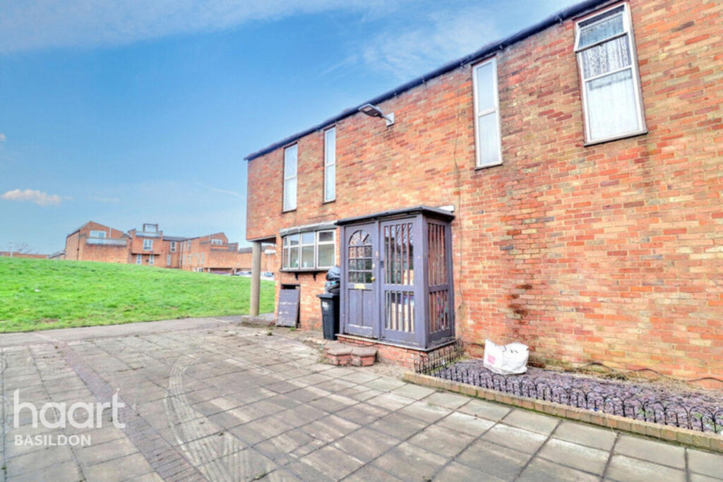
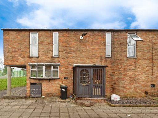
SS15 5FW - 3 bedroom end of terrace house for sale in Beeston Courts,…
View on Property Piper
3 bedroom end of terrace house for sale in Beeston Courts, Basildon, SS15
Property Details
- Price: £270000
- Bedrooms: 3
- Bathrooms: 1
- Property Type: undefined
- Property SubType: undefined
Image Descriptions
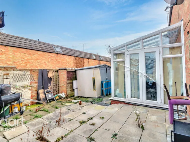
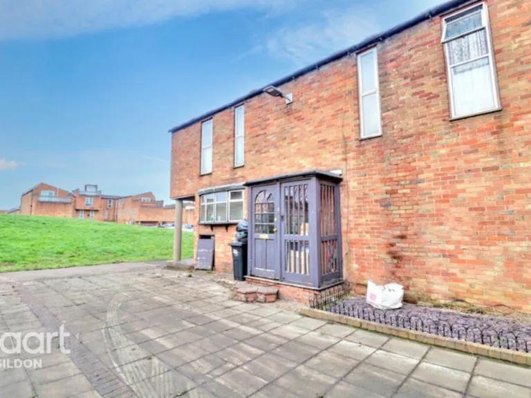
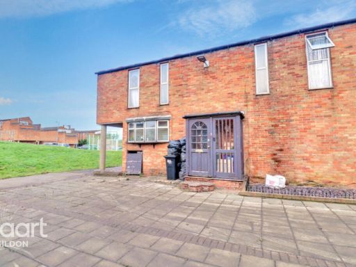
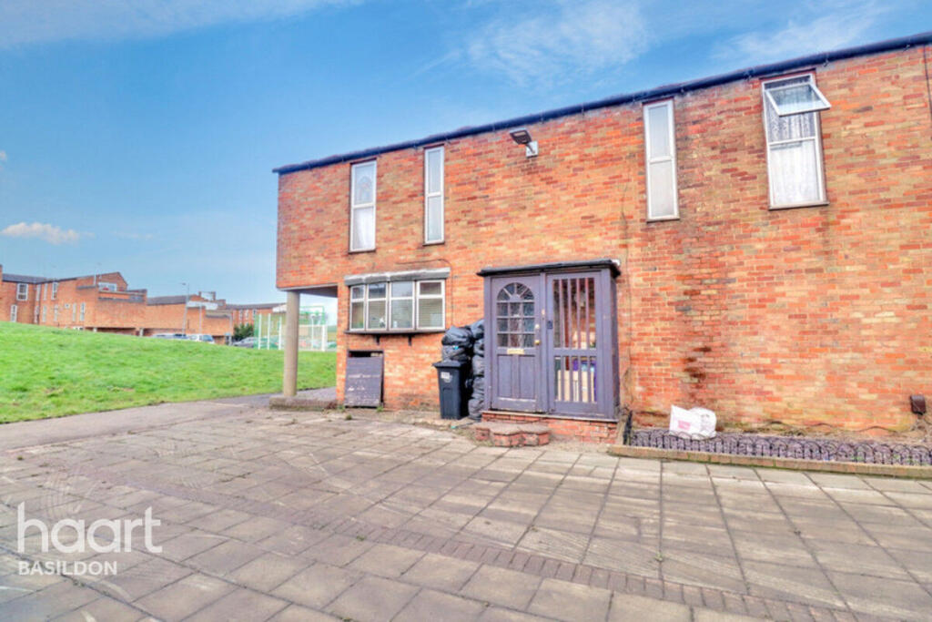
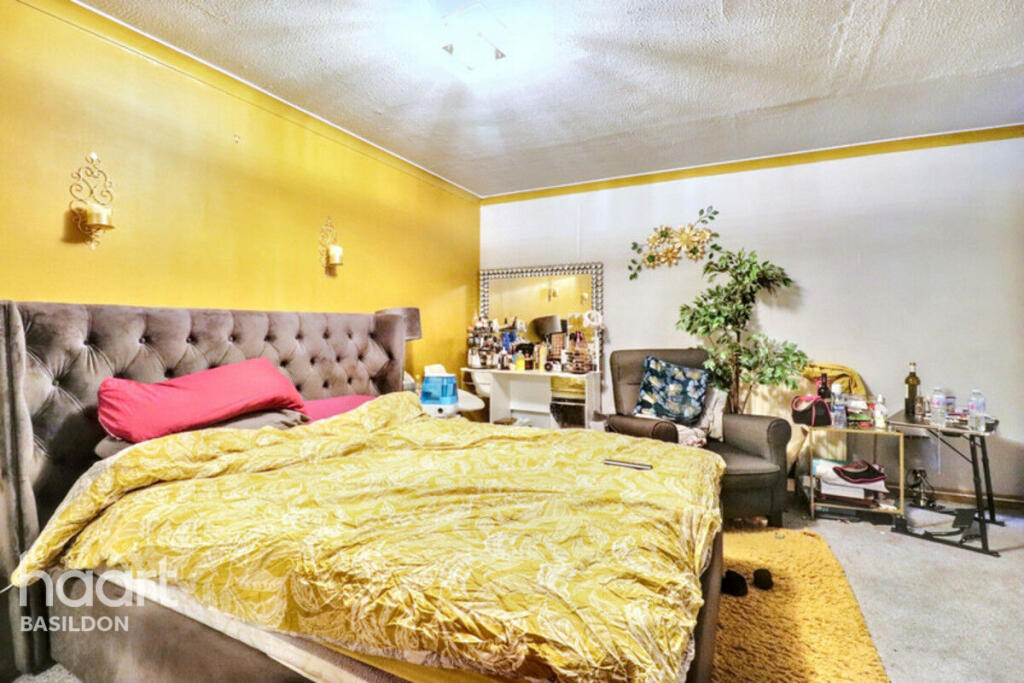
- exterior 1960s-1970s
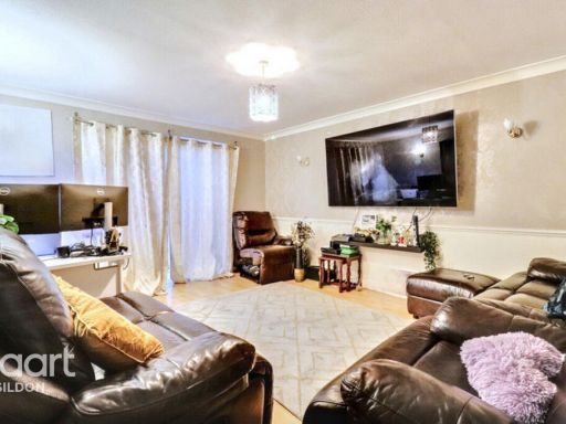
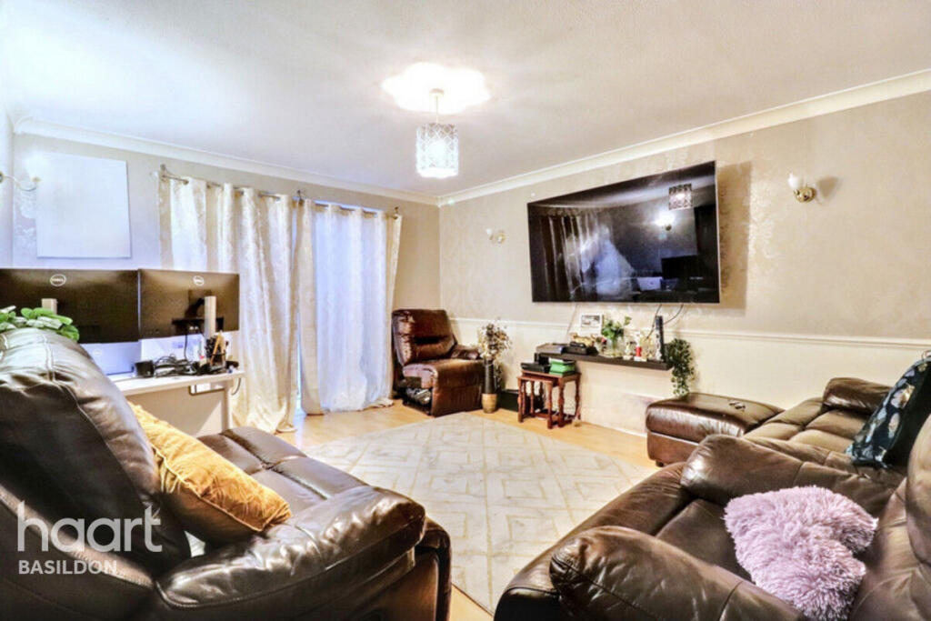
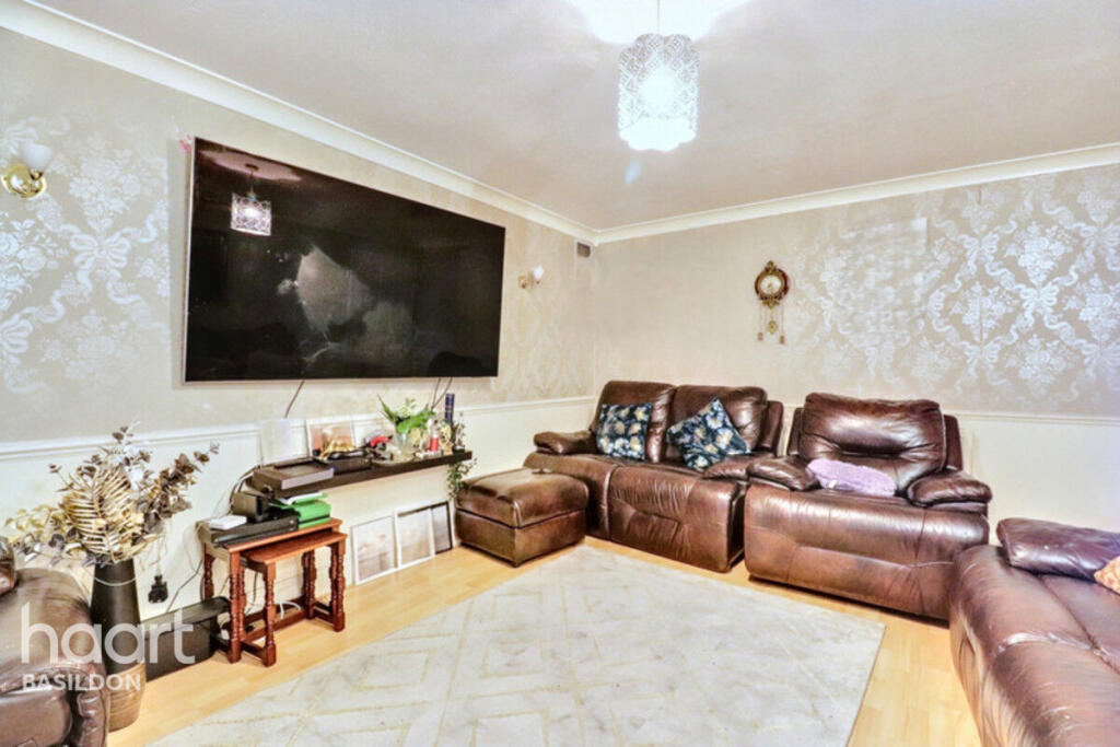
- living room modern
Floorplan Description
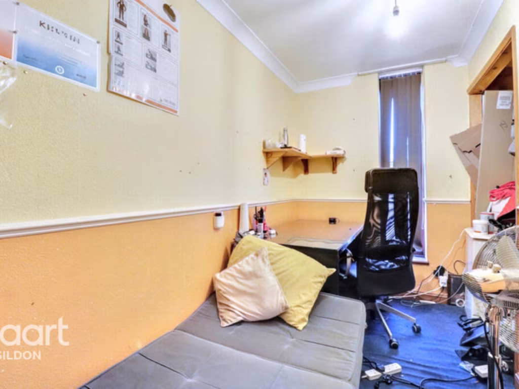
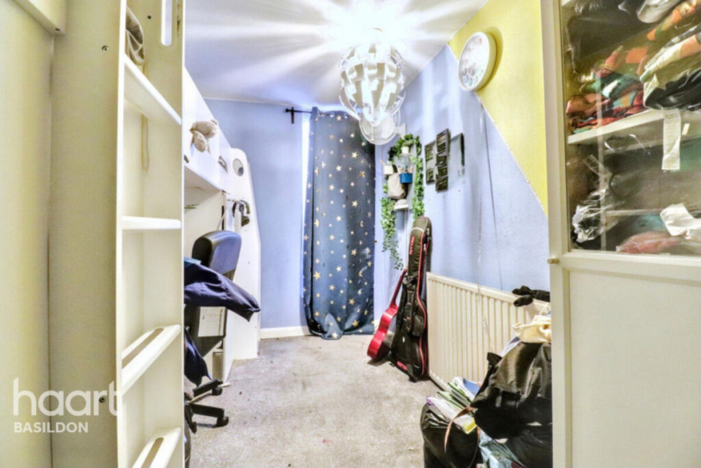
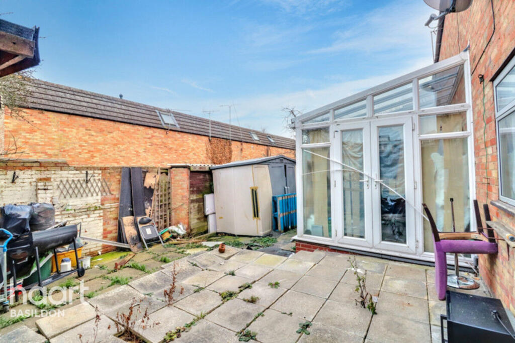
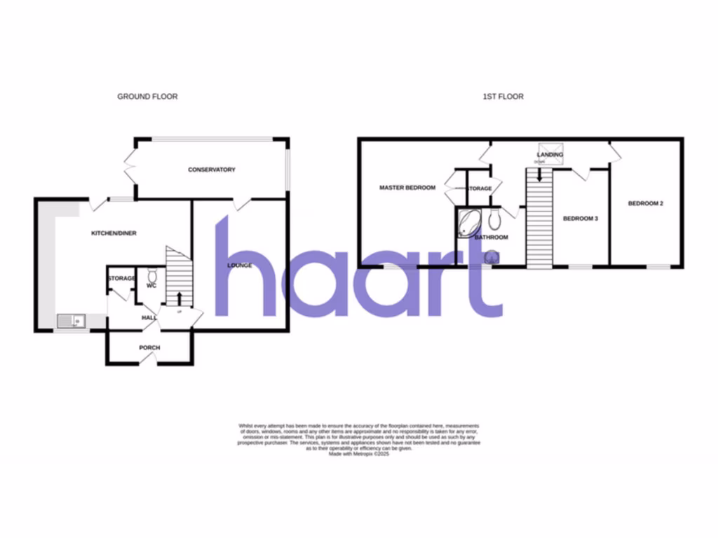
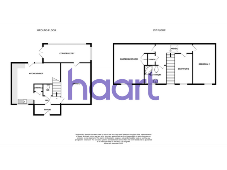
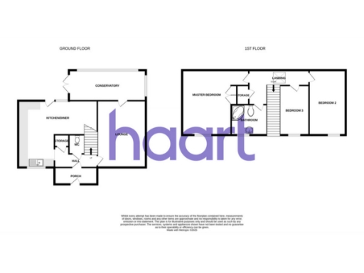
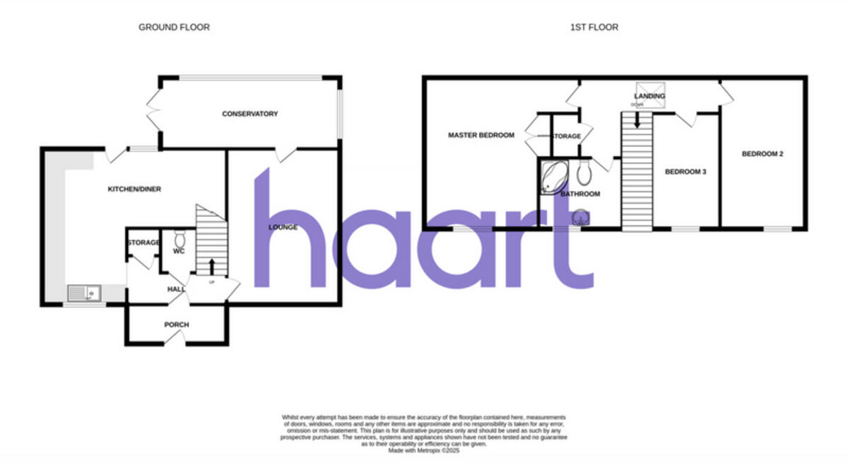
- Two-storey house with conservatory, kitchen/diner, lounge and three bedrooms
Rooms
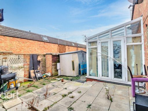
- CONSERVATORY:
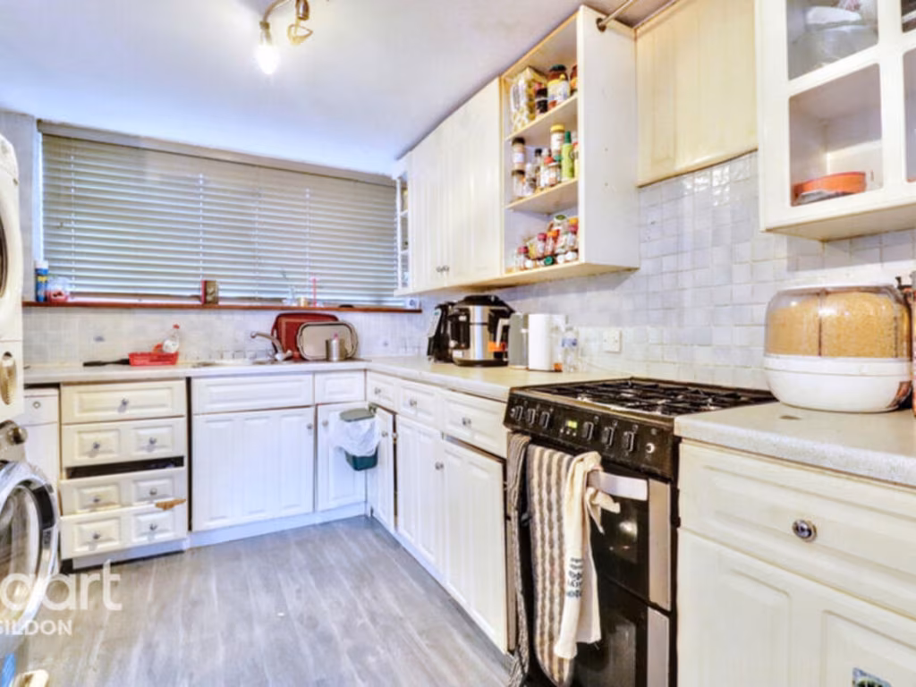
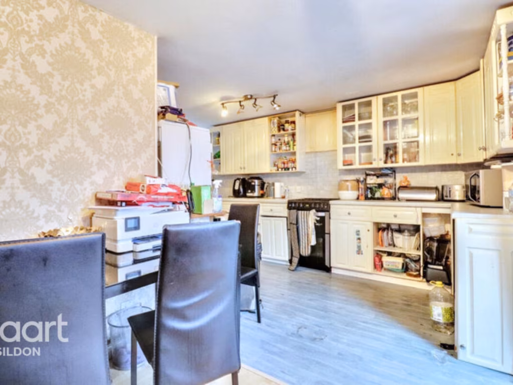
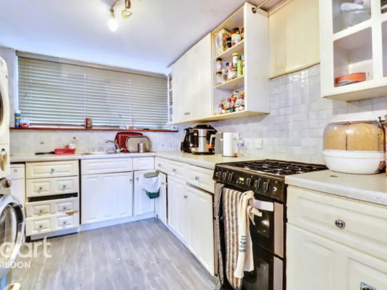
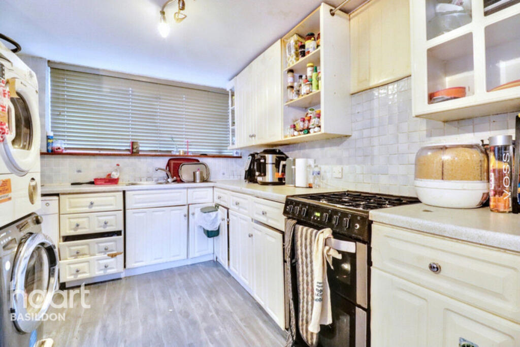
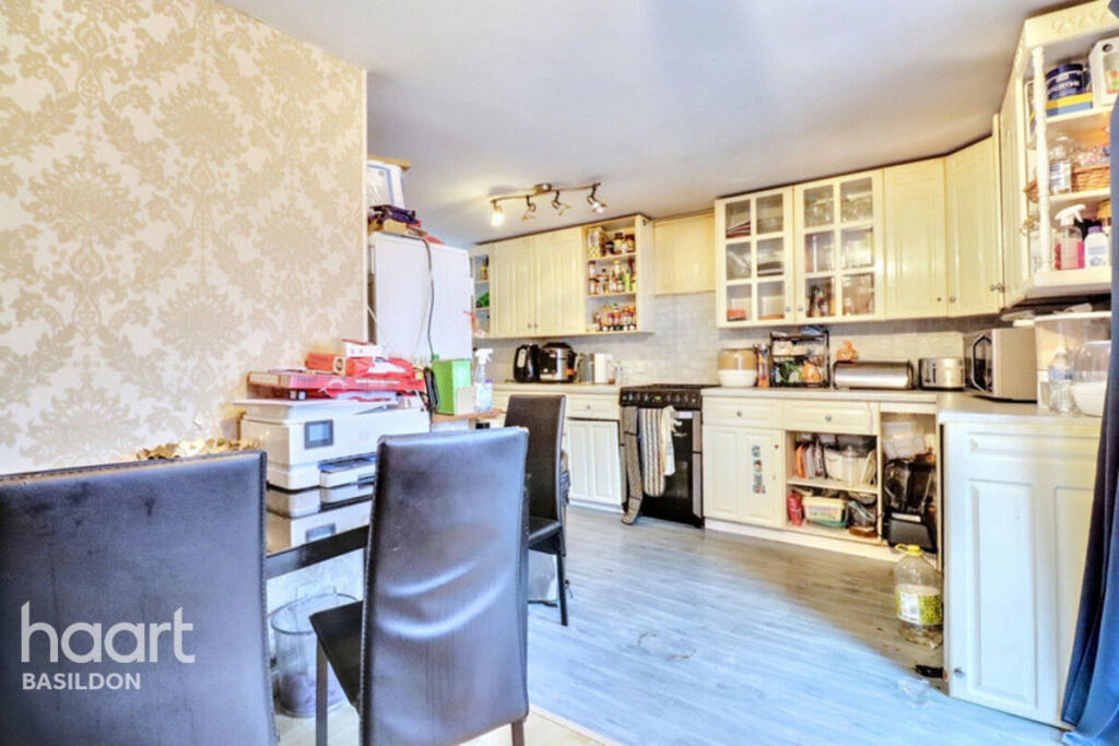
- KITCHEN/DINER:
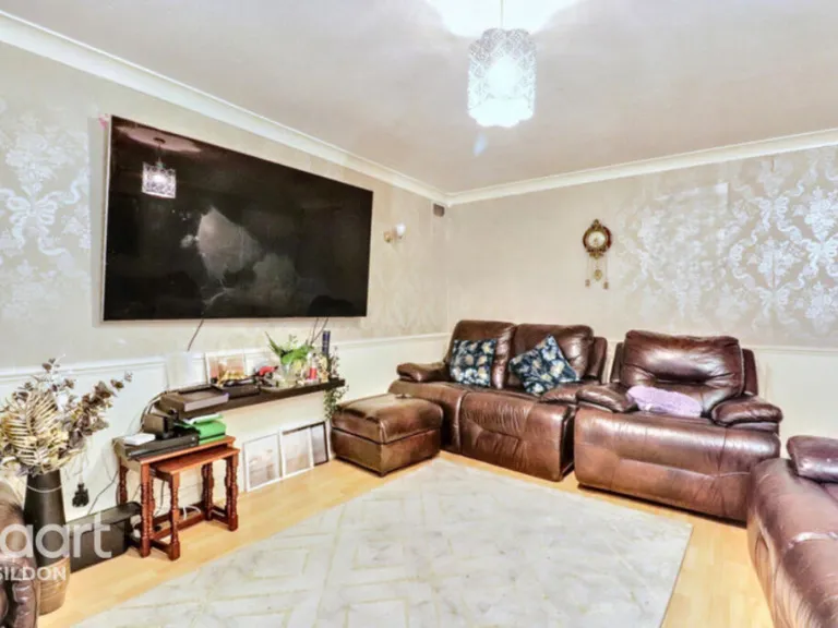
- LOUNGE:
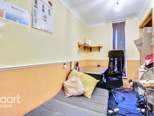
- STORAGE:
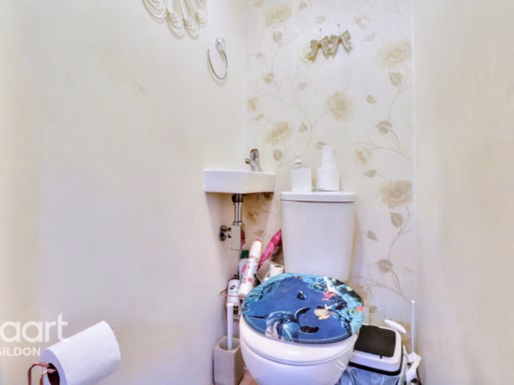
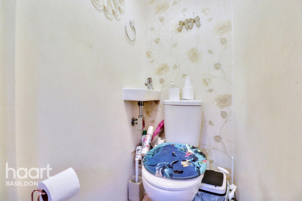
- WC:
- HALL:
- PORCH:
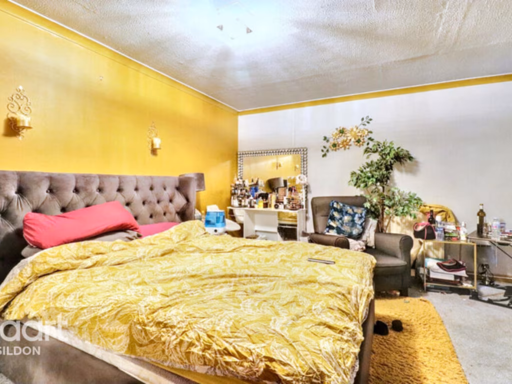
- MASTER BEDROOM:
- STORAGE:
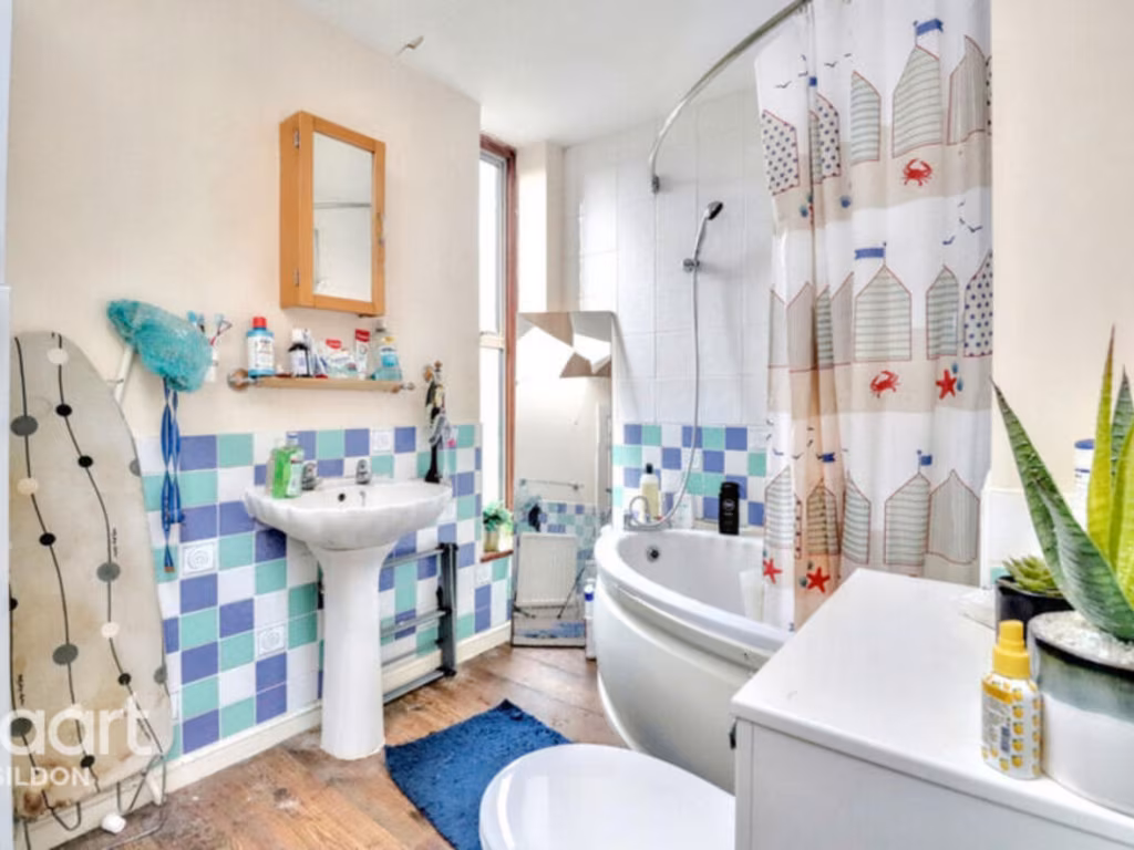
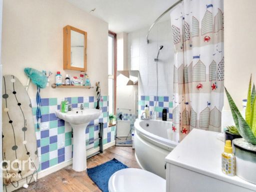
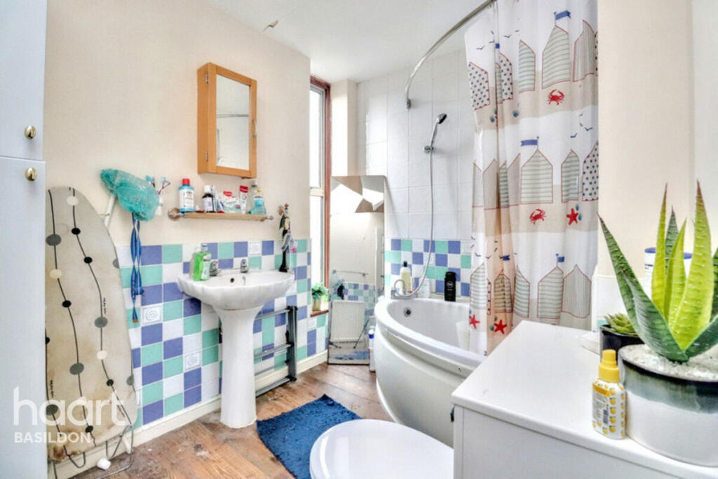
- BATHROOM:
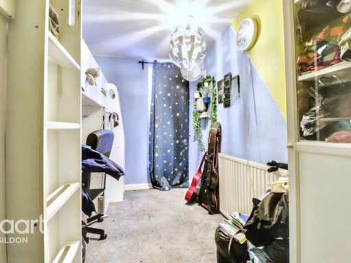
- LANDING:
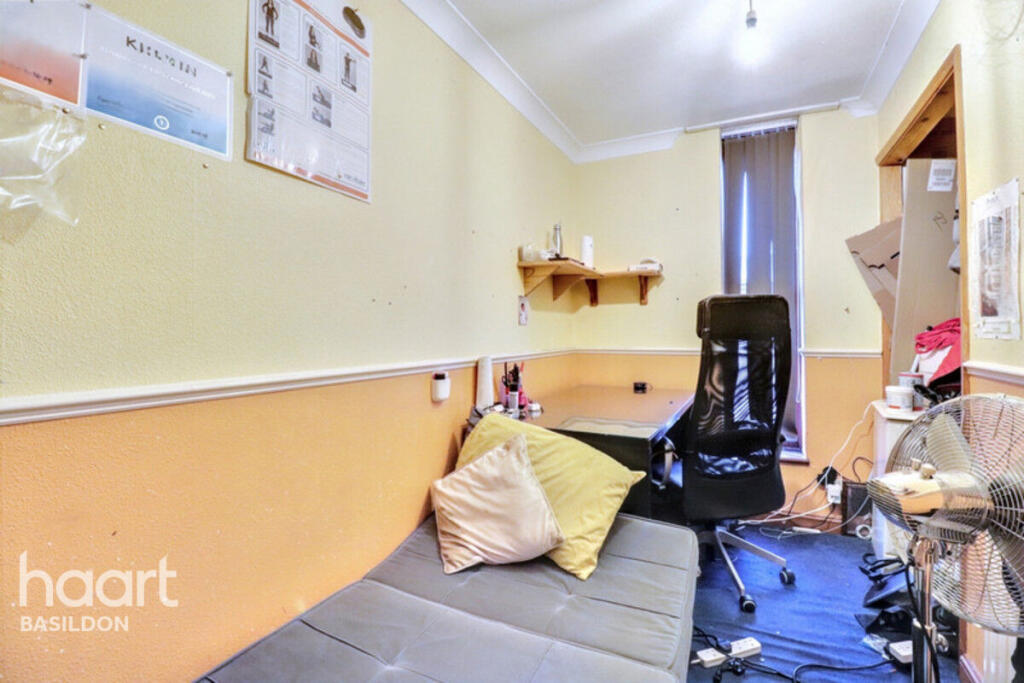
- BEDROOM 3:
- BEDROOM 2:
Textual Property Features
Detected Visual Features
- corner house
- semi-detached
- side entrance
- brick facade
- two stories
- 1960s
- 1970s
- modernization needed
- unkempt exterior
- paved front yard
- modern
- living room
- laminate flooring
- neutral walls
- large window
- ceiling light fixture
- medium size
- standard ceiling height
- apartment
- house
EPC Details
- Fully double glazed
- Cavity wall, as built, no insulation (assumed)
- Boiler and radiators, mains gas
- Low energy lighting in all fixed outlets
- Solid, no insulation (assumed)
Nearby Schools
- Horndon-On-the-Hill CofE Primary School
- Lee Chapel Primary School
- Merrylands Primary School
- St Peter's Catholic Primary School
- South Green Junior School
- Arthur Bugler Primary School
- Graham James Primary Academy
- Giffards Primary School
- Ortu Gable Hall School
- Great Berry Primary School
- Fairhouse Community Primary School
- The James Hornsby School
- South Green Infant School
- Woodlands School
- Kingswood Primary School and Nursery
- Cherry Tree Primary School
- Ghyllgrove Primary School
- Millhouse Primary School
- Laindon Park Primary School & Nursery
- Noak Bridge Primary School
- Vange Primary School and Nursery
- St Anne Line Catholic Junior School
- Janet Duke Primary School
- The Phoenix Primary School
- The Willows Primary School
- De La Salle School
Nearest Bars And Restaurants
- Id: 246291822
- Tags:
- Amenity: fast_food
- Brand: McDonald's
- Brand:wikidata: Q38076
- Brand:wikipedia: en:McDonald's
- Building: yes
- Contact:
- Website: https://www.mcdonalds.com/gb/en-gb/location/laindon/laindon/fortune-of-war-roundabout/8261143.html
- Cuisine: burger
- Drive_through: yes
- Name: McDonald's
- Takeaway: yes
- TagsNormalized:
- fast food
- food
- mcdonalds
- burgers
- drive through
- takeaway
- Lat: 51.5842189
- Lon: 0.4240913
- FullGeoHash: u10m3wsgf537
- PartitionGeoHash: u10m
- Images:
- FoodStandards: null
- Distance: 1769.7
,- Id: 617885085
- Tags:
- Amenity: restaurant
- Brand: Miller & Carter
- Brand:wikidata: Q87067401
- Building: yes
- Cuisine: steak
- Name: Miller & Carter
- TagsNormalized:
- restaurant
- miller & carter
- Lat: 51.5541235
- Lon: 0.4227935
- FullGeoHash: u10m395uec1t
- PartitionGeoHash: u10m
- Images:
- FoodStandards: null
- Distance: 1645.8
,- Id: 618748343
- Tags:
- Amenity: pub
- Brand: Hungry Horse
- Brand:wikidata: Q5943510
- Brand:wikipedia: en:Hungry Horse
- Building: yes
- Contact:
- Website: https://www.hungryhorse.co.uk/pubs/essex/four-seasons/
- Name: Hungry Horse
- TagsNormalized:
- Lat: 51.5755058
- Lon: 0.4108764
- FullGeoHash: u10m3m51n55e
- PartitionGeoHash: u10m
- Images:
- FoodStandards: null
- Distance: 1433.6
,- Id: 60302041
- Tags:
- Amenity: pub
- Name: Castlemayne
- TagsNormalized:
- Lat: 51.564055
- Lon: 0.4454439
- FullGeoHash: u10m64uq7se1
- PartitionGeoHash: u10m
- Images:
- FoodStandards: null
- Distance: 1284.1
,- Id: 498961348
- Tags:
- Amenity: pub
- Building: yes
- Name: Plough & Tractor
- TagsNormalized:
- Lat: 51.5726349
- Lon: 0.4420356
- FullGeoHash: u10m6h9bk5vw
- PartitionGeoHash: u10m
- Images:
- FoodStandards: null
- Distance: 1053
}
Nearest General Shops
- Id: 139290048
- Tags:
- Addr:
- City: Basildon
- Postcode: SS14 3AF
- Street: Miles Gray Road
- Brand: B&Q
- Brand:wikidata: Q707602
- Brand:wikipedia: en:B&Q
- Building: retail
- Contact:
- Website: https://www.diy.com/store/1199
- Name: B&Q
- Opening_hours: Mo-Fr 07:00-20:00; Sa 08:00-20:00; Su 10:00-16:00
- Phone: +44 1268 534884
- Shop: doityourself
- TagsNormalized:
- b&q
- retail
- doityourself
- shop
- Lat: 51.5799894
- Lon: 0.4445386
- FullGeoHash: u10m6jgenwbj
- PartitionGeoHash: u10m
- Images:
- FoodStandards: null
- Distance: 1698.1
,- Id: 1042950147
- Tags:
- Addr:
- City: Basildon
- Postcode: SS14 3AF
- Street: Miles Gray Road
- Brand: Carpetright
- Brand:wikidata: Q5045782
- Brand:wikipedia: en:Carpetright
- Building:
- Name: Carpetright
- Opening_hours: Mo,We,Fr 09:30-18:00; Tu,Th 09:30-18:00; Sa 09:00-18:00; Su 10:00-16:00
- Phone: +44 1268 988847
- Shop: carpet
- Website: https://www.carpetright.co.uk/store/basildon
- TagsNormalized:
- Lat: 51.5804344
- Lon: 0.4436532
- FullGeoHash: u10m6jgjccgu
- PartitionGeoHash: u10m
- Images:
- FoodStandards: null
- Distance: 1696.7
,- Id: 1042950146
- Tags:
- Addr:
- City: Basildon
- Postcode: SS14 3AF
- Street: Miles Gray Road
- Unit: F2
- Brand: Poundstretcher
- Brand:wikidata: Q7235675
- Brand:wikipedia: en:Poundstretcher
- Building:
- Name: Poundstretcher
- Opening_hours: Mo-Sa 08:30-20:00; Su 10:00-16:00
- Phone: +44 1268 931207
- Shop: variety_store
- Website: https://www.poundstretcher.co.uk/
- TagsNormalized:
- poundstretcher
- variety store
- shop
- Lat: 51.5802267
- Lon: 0.4437141
- FullGeoHash: u10m6jghe71j
- PartitionGeoHash: u10m
- Images:
- FoodStandards: null
- Distance: 1681.4
}
Nearest Grocery shops
- Id: 9568587004
- Tags:
- TagsNormalized:
- Lat: 51.5797818
- Lon: 0.4186205
- FullGeoHash: u10m3tbf484p
- PartitionGeoHash: u10m
- Images:
- FoodStandards: null
- Distance: 1420
,- Id: 6594427575
- Tags:
- Addr:
- Housenumber: 16A
- Street: Woolmer Green
- Air_conditioning: yes
- Name: Trinity Food and Wine
- Opening_hours: Mo-Sa 06:00-18:00
- Payment:
- Cards: yes
- Cash: yes
- Coins: yes
- Credit_cards: yes
- Debit_cards: yes
- Mastercard: yes
- Notes: yes
- Visa: yes
- Visa_debit: yes
- Shop: supermarket
- TagsNormalized:
- Lat: 51.5754393
- Lon: 0.4380948
- FullGeoHash: u10m3vp08qep
- PartitionGeoHash: u10m
- Images:
- FoodStandards: null
- Distance: 1024.1
,- Id: 271215677
- Tags:
- Amenity: post_office
- Brand: McColl's
- Brand:wikidata: Q16997477
- Shop: convenience
- TagsNormalized:
- office
- post office
- mccolls
- convenience
- shop
- Lat: 51.5614971
- Lon: 0.4211918
- FullGeoHash: u10m3d6xqrxq
- PartitionGeoHash: u10m
- Images:
- FoodStandards: null
- Distance: 923.2
}
Nearest Religious buildings
- Id: 500212440
- Tags:
- Amenity: place_of_worship
- Building: yes
- Denomination: catholic
- Name: St Therese's Roman Catholic Church
- Religion: christian
- Source: OS OpenMap Local
- TagsNormalized:
- place of worship
- catholic
- church
- roman catholic
- christian
- Lat: 51.5669333
- Lon: 0.421949
- FullGeoHash: u10m3e7r0j5f
- PartitionGeoHash: u10m
- Images:
- FoodStandards: null
- Distance: 473.9
,- Id: 500209565
- Tags:
- Amenity: place_of_worship
- Building: yes
- Denomination: mormon
- Name: The Church of Jesus Christ of Latter-day Saints
- Religion: christian
- Source: OS OpenMap Local
- TagsNormalized:
- place of worship
- mormon
- church
- christian
- Lat: 51.5719325
- Lon: 0.4282464
- FullGeoHash: u10m3sru6c58
- PartitionGeoHash: u10m
- Images:
- FoodStandards: null
- Distance: 379.3
,- Id: 500209568
- Tags:
- Amenity: place_of_worship
- Building: yes
- Denomination: jehovahs_witness
- Name: Kingdom Hall of Jehova's Witnesses
- Religion: christian
- Source: OS OpenMap Local
- TagsNormalized:
- place of worship
- jehovah
- jehovahs witness
- christian
- church
- Lat: 51.5706304
- Lon: 0.4316104
- FullGeoHash: u10m3u4k9q21
- PartitionGeoHash: u10m
- Images:
- FoodStandards: null
- Distance: 327.1
}
Nearest Medical buildings
- Id: 512069607
- Tags:
- Amenity: doctors
- Healthcare: doctor
- Name: Ballards Walk Surgery
- TagsNormalized:
- doctor
- doctors
- health
- healthcare
- surgery
- Lat: 51.573984
- Lon: 0.4421427
- FullGeoHash: u10m6hcbnxmq
- PartitionGeoHash: u10m
- Images:
- FoodStandards: null
- Distance: 1132.5
,- Id: 498961344
- Tags:
- Addr:
- City: Basildon
- Housenumber: 188-190
- Postcode: SS15 5NG
- Street: Great Knightleys
- Amenity: dentist
- Building: yes
- Healthcare: dentist
- Name: Great Knightleys Dental Care
- Opening_hours: Mo, Th 09:00-13:00, 14:00-19:00; Tu-We, Fr 09:00-13:00, 14:00-17:00; Sa 09:00-15:00; Su off
- Operator: Southern Dental
- Phone: +44 1268 541966
- Wheelchair: yes
- TagsNormalized:
- dentist
- health
- healthcare
- dental
- Lat: 51.5724748
- Lon: 0.4411914
- FullGeoHash: u10m6h3r2w05
- PartitionGeoHash: u10m
- Images:
- FoodStandards: null
- Distance: 992.8
,- Id: 621735410
- Tags:
- Amenity: doctors
- Building: yes
- Healthcare: doctor
- Name: Knights Surgery
- Operator: NHS
- TagsNormalized:
- doctor
- doctors
- health
- healthcare
- surgery
- Lat: 51.5757138
- Lon: 0.4367081
- FullGeoHash: u10m3vn421ch
- PartitionGeoHash: u10m
- Images:
- FoodStandards: null
- Distance: 988.1
,- Id: 612321698
- Tags:
- Amenity: hospital
- Healthcare: hospital
- Name: Laindon Health Centre
- TagsNormalized:
- hospital
- health
- healthcare
- health centre
- Lat: 51.5732518
- Lon: 0.4233551
- FullGeoHash: u10m3ss7byuq
- PartitionGeoHash: u10m
- Images:
- FoodStandards: null
- Distance: 627.7
}
Nearest Airports
- Id: 103894219
- Tags:
- Aerodrome: international
- Aeroway: aerodrome
- Iata: SEN
- Icao: EGMC
- Name: London Southend Airport
- Old_name: Southend Municipal Airport
- Ref: SEN
- Wikidata: Q1415441
- TagsNormalized:
- airport
- international airport
- Lat: 51.5701749
- Lon: 0.6924624
- FullGeoHash: u10mru04p937
- PartitionGeoHash: u10m
- Images:
- FoodStandards: null
- Distance: 18257.7
,- Id: 121158889
- Tags:
- Aerodrome: continental
- Aeroway: aerodrome
- Fhrs:
- Authority: City of London Corporation
- Iata: LCY
- Icao: EGLC
- Name: London City Airport
- Operator: London City Airport Limited
- Ref: LCY
- Website: https://www.londoncityairport.com/
- Wikidata: Q8982
- Wikipedia: en:London City Airport
- TagsNormalized:
- airport
- continental airport
- Lat: 51.5042658
- Lon: 0.0539987
- FullGeoHash: u10j10p64702
- PartitionGeoHash: u10j
- Images:
- FoodStandards: null
- Distance: 26857.2
}
Nearest Leisure Facilities
- Id: 492103954
- Tags:
- Leisure: park
- Name: Markhams Chase Park
- TagsNormalized:
- Lat: 51.5718639
- Lon: 0.4335139
- FullGeoHash: u10m3u7evs5r
- PartitionGeoHash: u10m
- Images:
- FoodStandards: null
- Distance: 517.1
,- Id: 492103955
- Tags:
- TagsNormalized:
- Lat: 51.5724221
- Lon: 0.4317923
- FullGeoHash: u10m3u6rjkr8
- PartitionGeoHash: u10m
- Images:
- FoodStandards: null
- Distance: 496
,- Id: 1047614701
- Tags:
- TagsNormalized:
- Lat: 51.5705072
- Lon: 0.4249311
- FullGeoHash: u10m3sj7vx7d
- PartitionGeoHash: u10m
- Images:
- FoodStandards: null
- Distance: 321.5
,- Id: 617195038
- Tags:
- TagsNormalized:
- Lat: 51.568916
- Lon: 0.4314274
- FullGeoHash: u10m3gf4syxw
- PartitionGeoHash: u10m
- Images:
- FoodStandards: null
- Distance: 219.7
,- Id: 617268233
- Tags:
- Leisure: pitch
- Sport: basketball
- TagsNormalized:
- pitch
- leisure
- basketball
- sports
- Lat: 51.5687456
- Lon: 0.4287028
- FullGeoHash: u10m3gb1tqzv
- PartitionGeoHash: u10m
- Images:
- FoodStandards: null
- Distance: 36.8
}
Nearest Tourist attractions
- Id: 10068537346
- Tags:
- Addr:
- Housename: Studio 49 The Village Barleylands Road Billericay CM11 2UD
- Name: The Alchemy Gallery
- Operator: Craft Arena
- Tourism: gallery
- TagsNormalized:
- Lat: 51.6009474
- Lon: 0.4459175
- FullGeoHash: u10md1stq9u1
- PartitionGeoHash: u10m
- Images:
- FoodStandards: null
- Distance: 3805.3
,- Id: 122458146
- Tags:
- Addr:
- Country: GB
- Postcode: SS17 9NR
- Street: High Road
- Building: yes
- Fhrs:
- Name: The Haywain
- Tourism: motel
- TagsNormalized:
- Lat: 51.550828
- Lon: 0.4667812
- FullGeoHash: u10m68eckfc7
- PartitionGeoHash: u10m
- Images:
- FoodStandards:
- Id: 104867
- FHRSID: 104867
- LocalAuthorityBusinessID: 3588
- BusinessName: The Haywain
- BusinessType: Hotel/bed & breakfast/guest house
- BusinessTypeID: 7842
- AddressLine1: null
- AddressLine2: High Road
- AddressLine3: Fobbing, Stanford-Le-Hope
- AddressLine4: Essex
- PostCode: SS17 9NR
- RatingValue: 5
- RatingKey: fhrs_5_en-GB
- RatingDate: 2021-07-29
- LocalAuthorityCode: 109
- LocalAuthorityName: Basildon
- LocalAuthorityWebSite: http://www.basildon.gov.uk
- LocalAuthorityEmailAddress: ehs@basildon.gov.uk
- Scores:
- Hygiene: 0
- Structural: 5
- ConfidenceInManagement: 0
- NewRatingPending: false
- Geocode:
- Longitude: 0.46649900000000
- Latitude: 51.55071600000000
- Distance: 3308
,- Id: 343354569
- Tags:
- Amenity: cafe
- Information: office
- Name: Plotlands Visitor Centre
- Operator: Essex Wildlife Trust
- Tourism: information
- TagsNormalized:
- Lat: 51.5608417
- Lon: 0.3929624
- FullGeoHash: u10m2fq5stw1
- PartitionGeoHash: u10m
- Images:
- FoodStandards: null
- Distance: 2588.4
}
Nearest Train stations
- Id: 2008923738
- Tags:
- Name: West Horndon
- Naptan:
- Network: National Rail
- Public_transport: station
- Railway: station
- Ref:
- Wikidata: Q1808174
- Wikipedia: en:West Horndon railway station
- TagsNormalized:
- Lat: 51.5678537
- Lon: 0.3406801
- FullGeoHash: u10jrg8hd2tm
- PartitionGeoHash: u10j
- Images:
- FoodStandards: null
- Distance: 6057.3
,- Id: 6735092344
- Tags:
- Name: Stanford-le-Hope
- Naptan:
- Network: National Rail
- Operator: c2c
- Public_transport: station
- Railway: station
- Ref:
- Wikidata: Q2062756
- Wikipedia: en:Stanford-le-Hope railway station
- TagsNormalized:
- Lat: 51.5141935
- Lon: 0.4229093
- FullGeoHash: u10m19ggyt8j
- PartitionGeoHash: u10m
- Images:
- FoodStandards: null
- Distance: 6052.5
,- Id: 6733461096
- Tags:
- Name: Pitsea
- Naptan:
- Network: National Rail
- Operator: c2c
- Platforms: 4
- Public_transport: station
- Railway: station
- Ref:
- Source: NPE
- Wikidata: Q2982936
- Wikipedia: en:Pitsea railway station
- TagsNormalized:
- Lat: 51.5602396
- Lon: 0.5079761
- FullGeoHash: u10m7d3bhtq3
- PartitionGeoHash: u10m
- Images:
- FoodStandards: null
- Distance: 5583
,- Id: 2008917061
- Tags:
- Name: Basildon
- Name:lt: Bazildonas
- Naptan:
- Network: National Rail
- Public_transport: station
- Railway: station
- Ref:
- Wheelchair: yes
- Wikidata: Q2752701
- Wikipedia: en:Basildon railway station
- TagsNormalized:
- Lat: 51.5681417
- Lon: 0.4567961
- FullGeoHash: u10m67swhn7g
- PartitionGeoHash: u10m
- Images:
- FoodStandards: null
- Distance: 1969.2
,- Id: 6733268329
- Tags:
- Name: Laindon
- Naptan:
- Network: National Rail
- Public_transport: station
- Railway: station
- Ref:
- Source: NPE
- Wheelchair: yes
- Wikidata: Q2801845
- Wikipedia: en:Laindon railway station
- TagsNormalized:
- Lat: 51.5675954
- Lon: 0.4237157
- FullGeoHash: u10m3ese1292
- PartitionGeoHash: u10m
- Images:
- FoodStandards: null
- Distance: 334
}
Nearest Hotels
- Id: 122524117
- Tags:
- Addr:
- City: Basildon
- Country: GB
- Postcode: SS14 3TJ
- Street: Festival Way
- Brand: Travelodge
- Brand:wikidata: Q9361374
- Brand:wikipedia: en:Travelodge UK
- Building: yes
- Fhrs:
- Internet_access: wlan
- Internet_access:fee: customers
- Internet_access:ssid: Travelodge WiFi
- Name: Travelodge
- Phone: +44 871 984 6008
- Tourism: hotel
- Website: https://www.travelodge.co.uk/
- TagsNormalized:
- Lat: 51.5851876
- Lon: 0.4646022
- FullGeoHash: u10m6wf36pbw
- PartitionGeoHash: u10m
- Images:
- FoodStandards: null
- Distance: 3118.2
,- Id: 122529130
- Tags:
- Addr:
- City: Basildon
- Postcode: SS14 3DG
- Street: Cranes Farm Road
- Brand: Holiday Inn
- Brand:wikidata: Q2717882
- Brand:wikipedia: en:Holiday Inn
- Building: yes
- Internet_access: yes
- Internet_access:fee: customers
- Name: Holiday Inn
- Phone: +44 371 942 9003
- Tourism: hotel
- Website: https://www.ihg.com/holidayinn/hotels/gb/en/reservation
- Wheelchair: yes
- TagsNormalized:
- Lat: 51.5836089
- Lon: 0.4607461
- FullGeoHash: u10m6qx821th
- PartitionGeoHash: u10m
- Images:
- FoodStandards: null
- Distance: 2799.7
,- Id: 607501652
- Tags:
- Addr:
- Country: GB
- Postcode: SS14 3AE
- Street: Burches
- Fhrs:
- Name: Hotel Campanile
- Tourism: hotel
- TagsNormalized:
- Lat: 51.5843737
- Lon: 0.4426479
- FullGeoHash: u10m6ndkf2np
- PartitionGeoHash: u10m
- Images:
- FoodStandards: null
- Distance: 2022
}
Tags
- corner house
- semi-detached
- side entrance
- brick facade
- two stories
- 1960s
- 1970s
- modernization needed
- unkempt exterior
- paved front yard
- modern
- living room
- laminate flooring
- neutral walls
- large window
- ceiling light fixture
- medium size
- standard ceiling height
- apartment
- house
Local Market Stats
- Average Price/sqft: £368
- Avg Income: £44200
- Rental Yield: 5.4%
- Social Housing: 16%
- Planning Success Rate: 81%
Similar Properties
 3 bedroom end of terrace house for sale in Beeston Courts, Basildon, Essex, SS15 — £270,000 • 3 bed • 2 bath • 1166 ft²
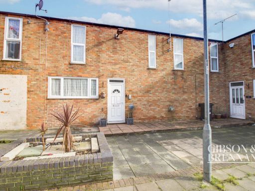 3 bedroom terraced house for sale in Beeston Courts, Basildon, SS15 — £300,000 • 3 bed • 1 bath • 836 ft²
 3 bedroom terraced house for sale in Wells Gardens, Basildon, Essex, SS14 — £365,000 • 3 bed • 2 bath • 963 ft²
 3 bedroom end of terrace house for sale in Ascot Grove, Basildon, Essex, SS14 — £310,000 • 3 bed • 1 bath • 938 ft²
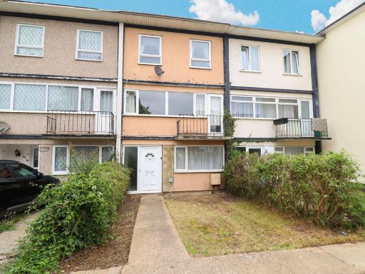 3 bedroom terraced house for sale in Long Riding, Basildon, Essex, SS14 — £280,000 • 3 bed • 1 bath • 1017 ft²
 3 bedroom end of terrace house for sale in Buckerills, Basildon, Essex, SS13 — £290,000 • 3 bed • 1 bath • 898 ft²
Meta
- {
"@context": "https://schema.org",
"@type": "Residence",
"name": "3 bedroom end of terrace house for sale in Beeston Courts,…",
"description": "",
"url": "https://propertypiper.co.uk/property/797dbb7f-8667-48ad-b891-82aa528e5fc4",
"image": "https://image-a.propertypiper.co.uk/78e20d42-dd9f-4839-9bb7-3165386c7d5f-1024.jpeg",
"address": {
"@type": "PostalAddress",
"streetAddress": "119 BEESTON COURTS LAINDON BASILDON",
"postalCode": "SS15 5FW",
"addressLocality": "Basildon",
"addressRegion": "Basildon and Billericay",
"addressCountry": "England"
},
"geo": {
"@type": "GeoCoordinates",
"latitude": 51.5685212,
"longitude": 0.4283122
},
"numberOfRooms": 3,
"numberOfBathroomsTotal": 1,
"offers": {
"@type": "Offer",
"price": 270000,
"priceCurrency": "GBP",
"availability": "https://schema.org/InStock"
},
"additionalProperty": [
{
"@type": "PropertyValue",
"name": "Feature",
"value": "corner house"
},
{
"@type": "PropertyValue",
"name": "Feature",
"value": "semi-detached"
},
{
"@type": "PropertyValue",
"name": "Feature",
"value": "side entrance"
},
{
"@type": "PropertyValue",
"name": "Feature",
"value": "brick facade"
},
{
"@type": "PropertyValue",
"name": "Feature",
"value": "two stories"
},
{
"@type": "PropertyValue",
"name": "Feature",
"value": "1960s"
},
{
"@type": "PropertyValue",
"name": "Feature",
"value": "1970s"
},
{
"@type": "PropertyValue",
"name": "Feature",
"value": "modernization needed"
},
{
"@type": "PropertyValue",
"name": "Feature",
"value": "unkempt exterior"
},
{
"@type": "PropertyValue",
"name": "Feature",
"value": "paved front yard"
},
{
"@type": "PropertyValue",
"name": "Feature",
"value": "modern"
},
{
"@type": "PropertyValue",
"name": "Feature",
"value": "living room"
},
{
"@type": "PropertyValue",
"name": "Feature",
"value": "laminate flooring"
},
{
"@type": "PropertyValue",
"name": "Feature",
"value": "neutral walls"
},
{
"@type": "PropertyValue",
"name": "Feature",
"value": "large window"
},
{
"@type": "PropertyValue",
"name": "Feature",
"value": "ceiling light fixture"
},
{
"@type": "PropertyValue",
"name": "Feature",
"value": "medium size"
},
{
"@type": "PropertyValue",
"name": "Feature",
"value": "standard ceiling height"
},
{
"@type": "PropertyValue",
"name": "Feature",
"value": "apartment"
},
{
"@type": "PropertyValue",
"name": "Feature",
"value": "house"
}
]
}
High Res Floorplan Images
Compatible Floorplan Images
FloorplanImages Thumbnail