GL17 9LN - 3 bedroom house for sale in Camomile Green, Lydbrook, GL17
View on Property Piper
3 bedroom house for sale in Camomile Green, Lydbrook, GL17
Property Details
- Price: £525000
- Bedrooms: 3
- Bathrooms: 2
- Property Type: undefined
- Property SubType: undefined
Brochure Descriptions
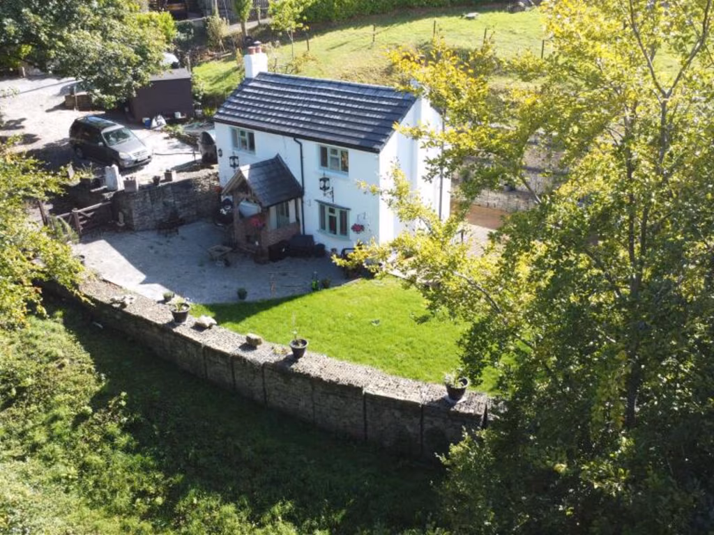
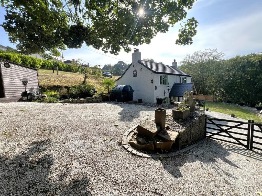
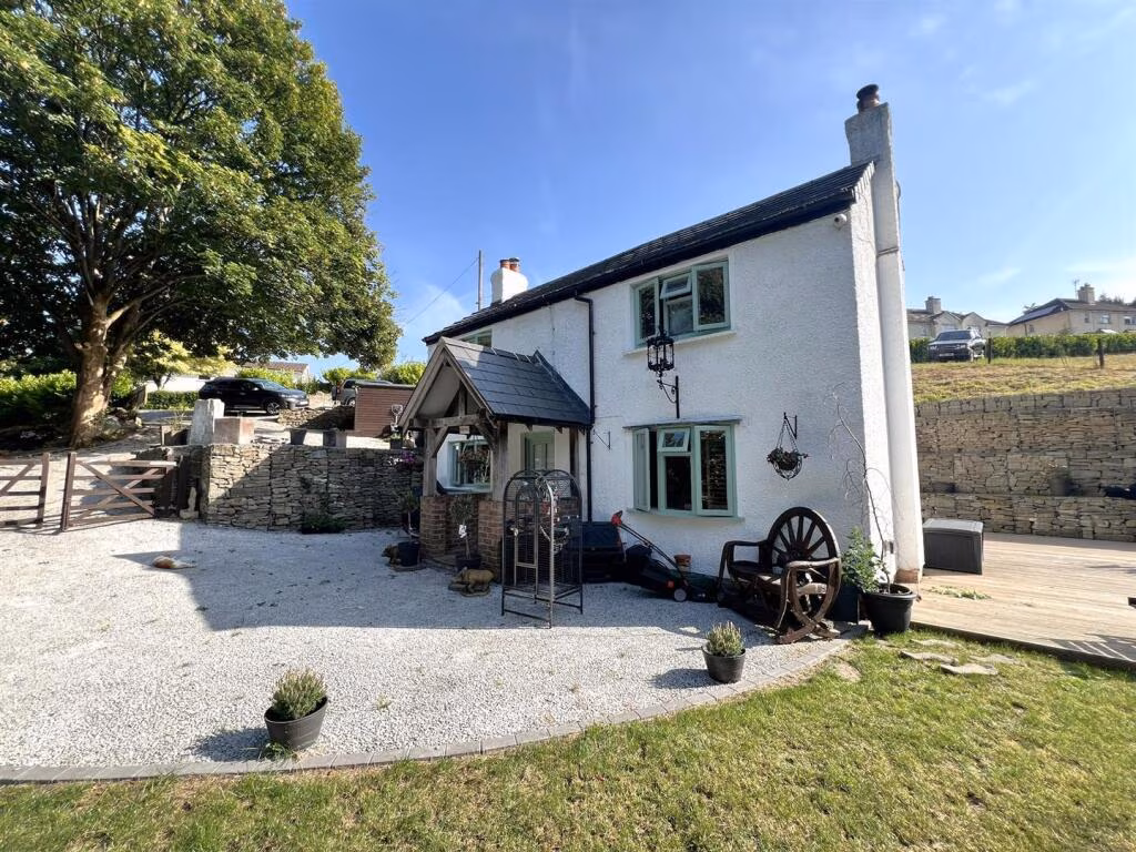
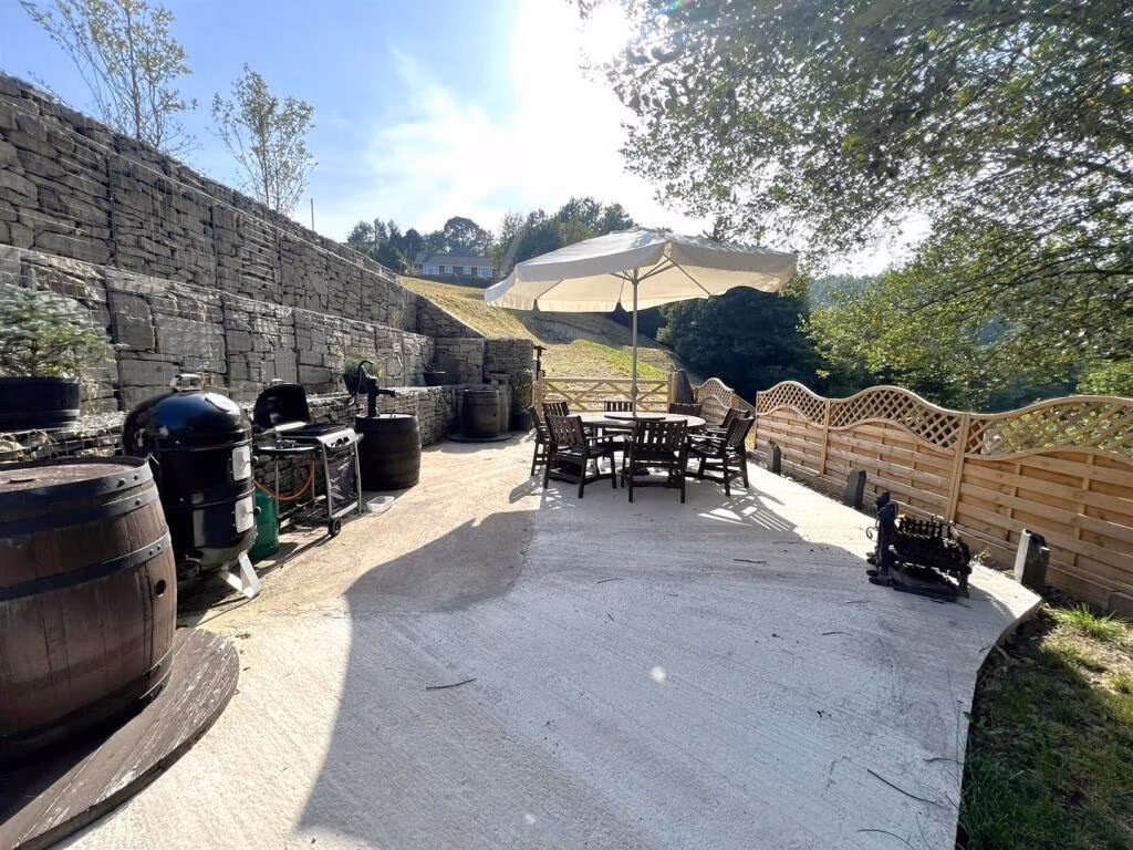
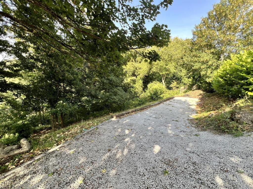
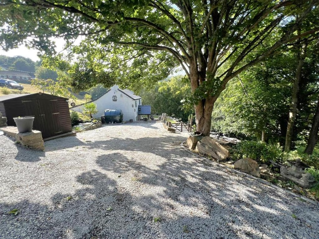
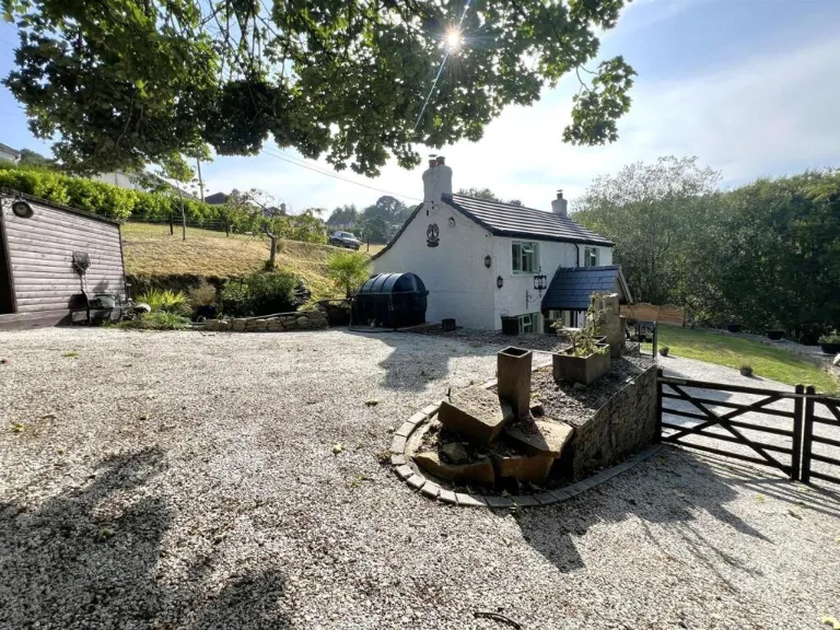
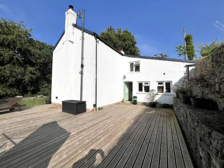
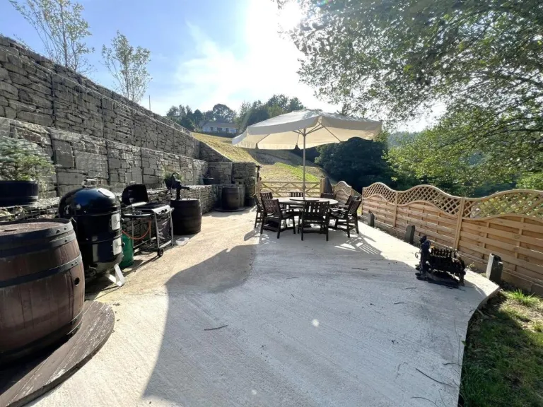
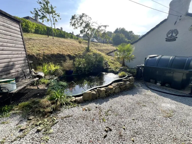
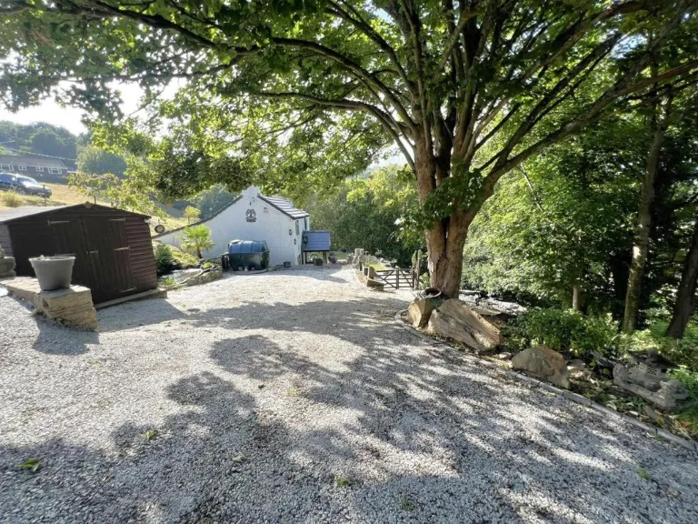
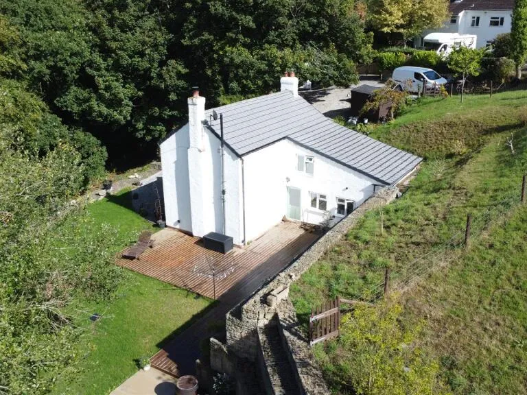
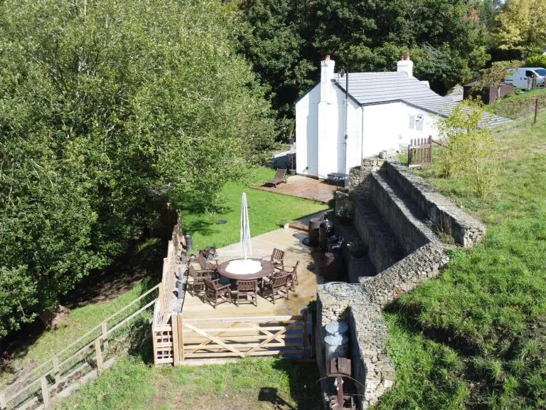
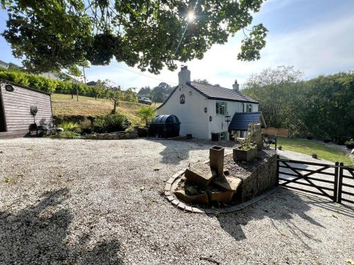
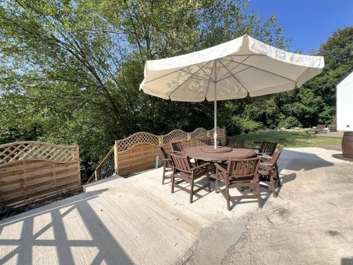
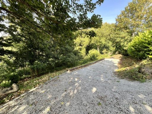
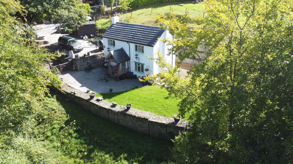
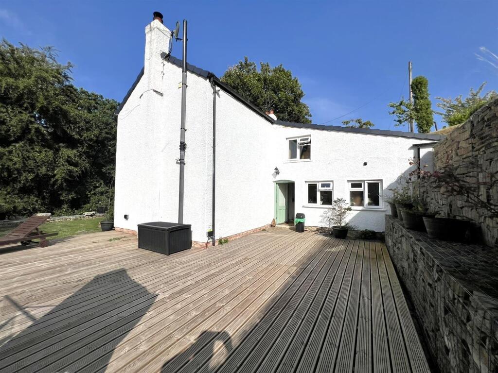
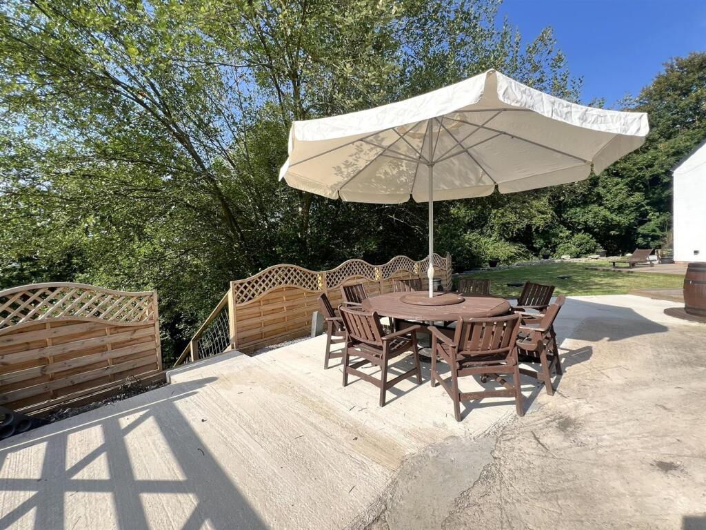
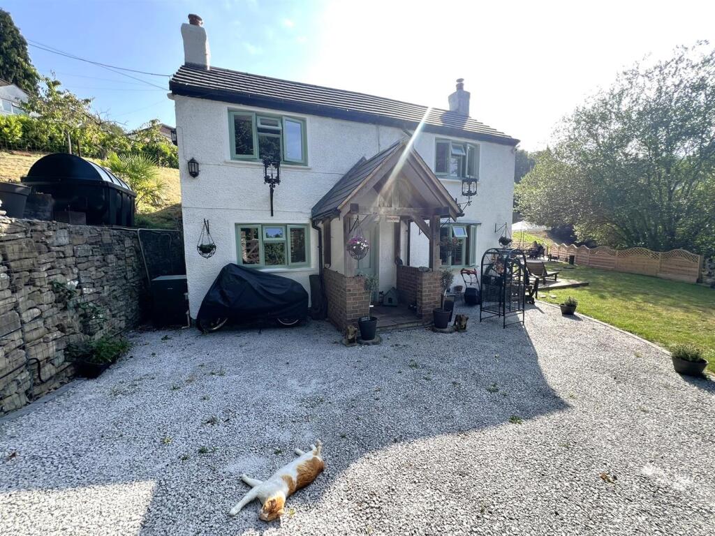
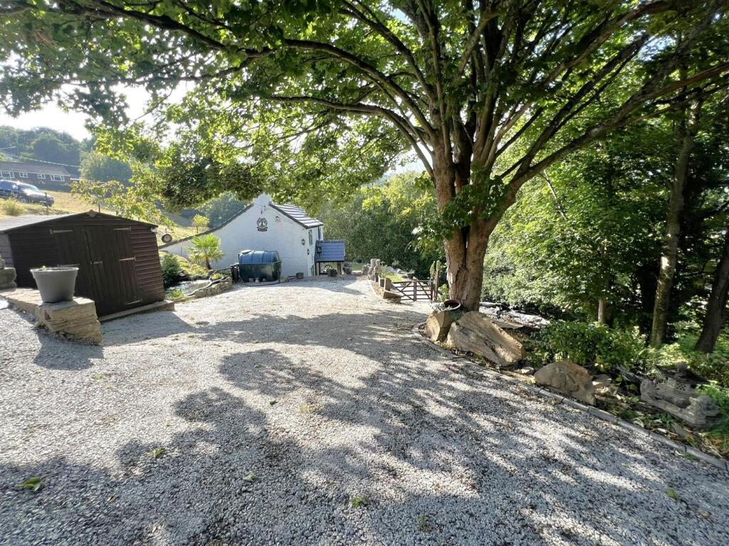
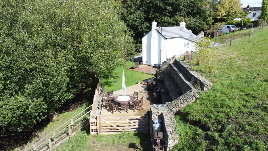
- Detached two-storey cottage set in a rural/woodland valley location. White-rendered exterior with a pitched roof, small porch and chimneys; property sits behind a low stone boundary wall with a gravel driveway and parking for several vehicles. Gardens are modest in size (small to average) — a neatly kept lawn to the front with stone terracing and mature trees and hedgerow screening the site. Setting offers countryside and woodland views on all sides and appears to be a standalone property with private access. Overall plot is modest/medium for a cottage in a rural setting; the building footprint suggests a small-to-medium sized home (likely 2–3 bedrooms).
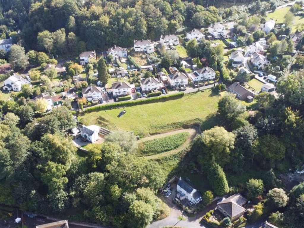
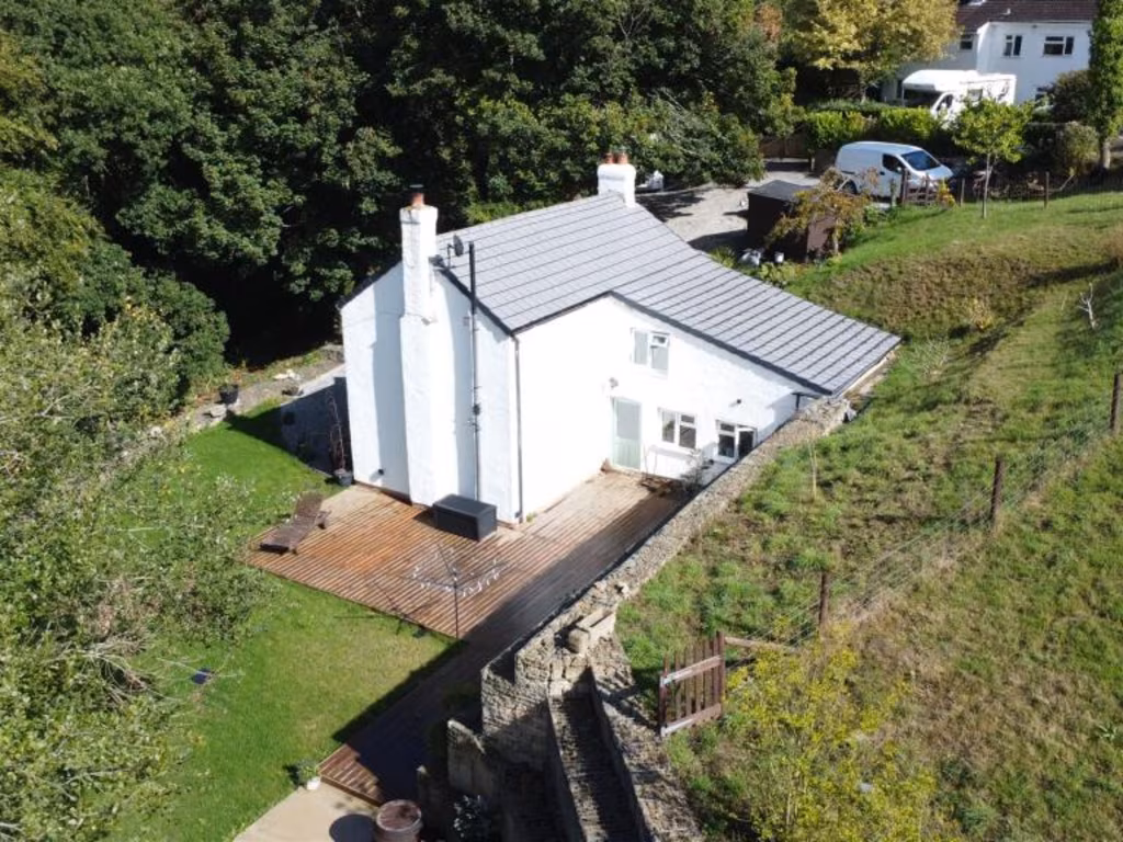
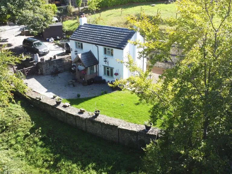
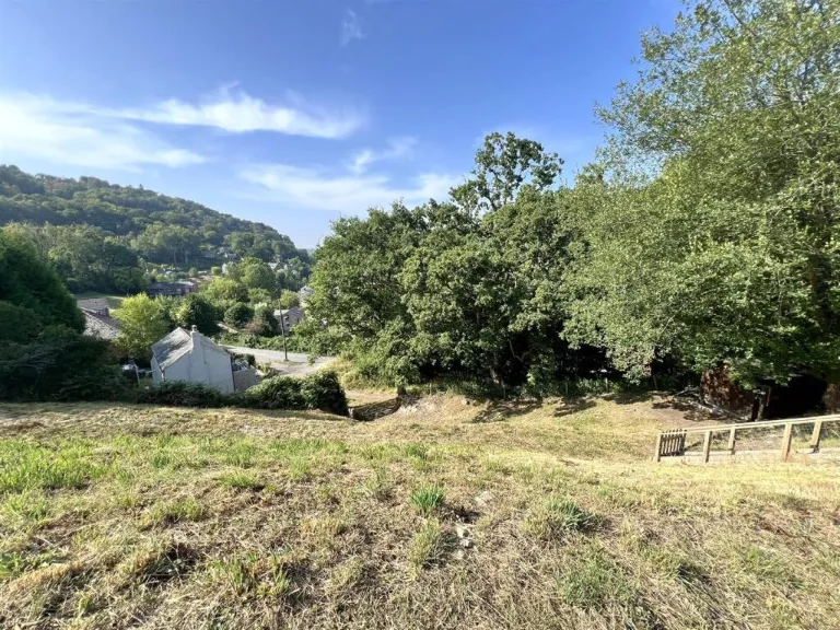
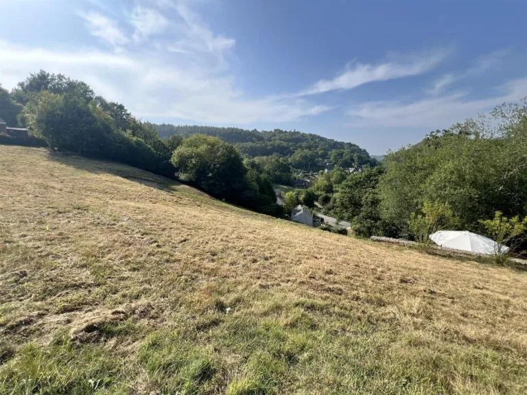
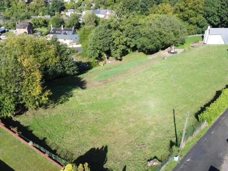
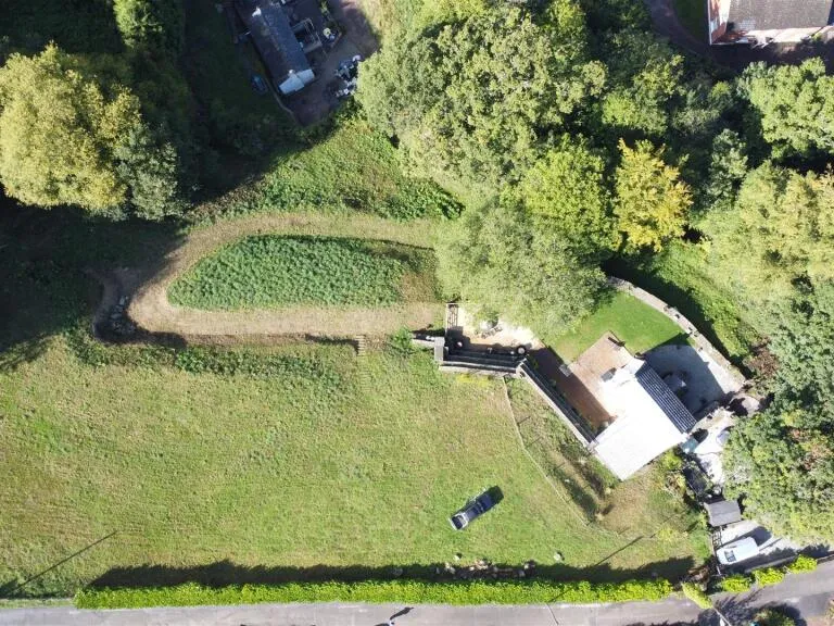
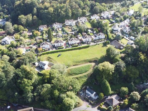
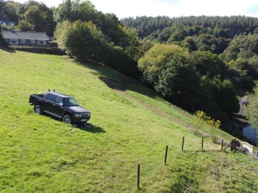
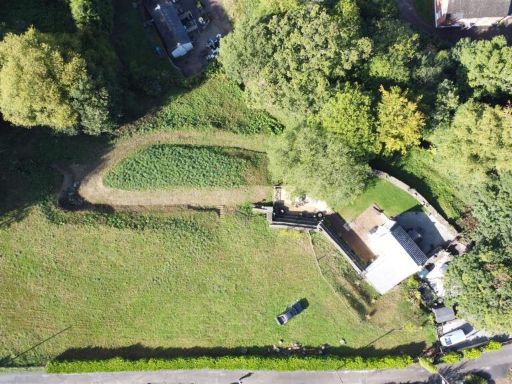
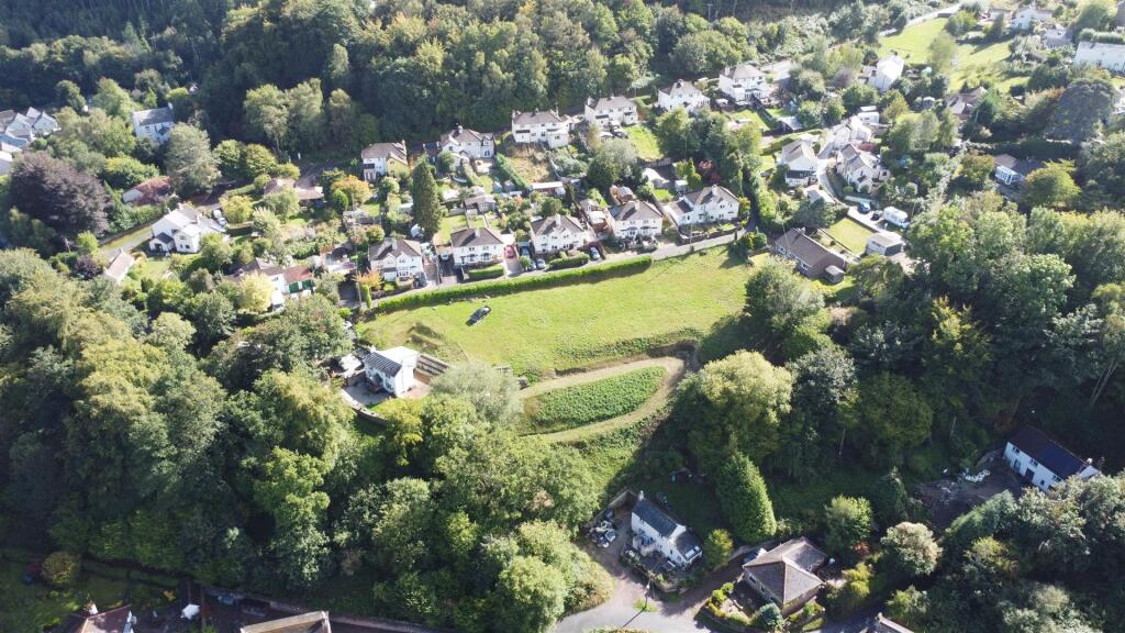
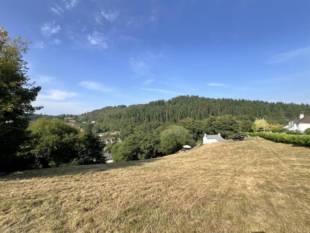
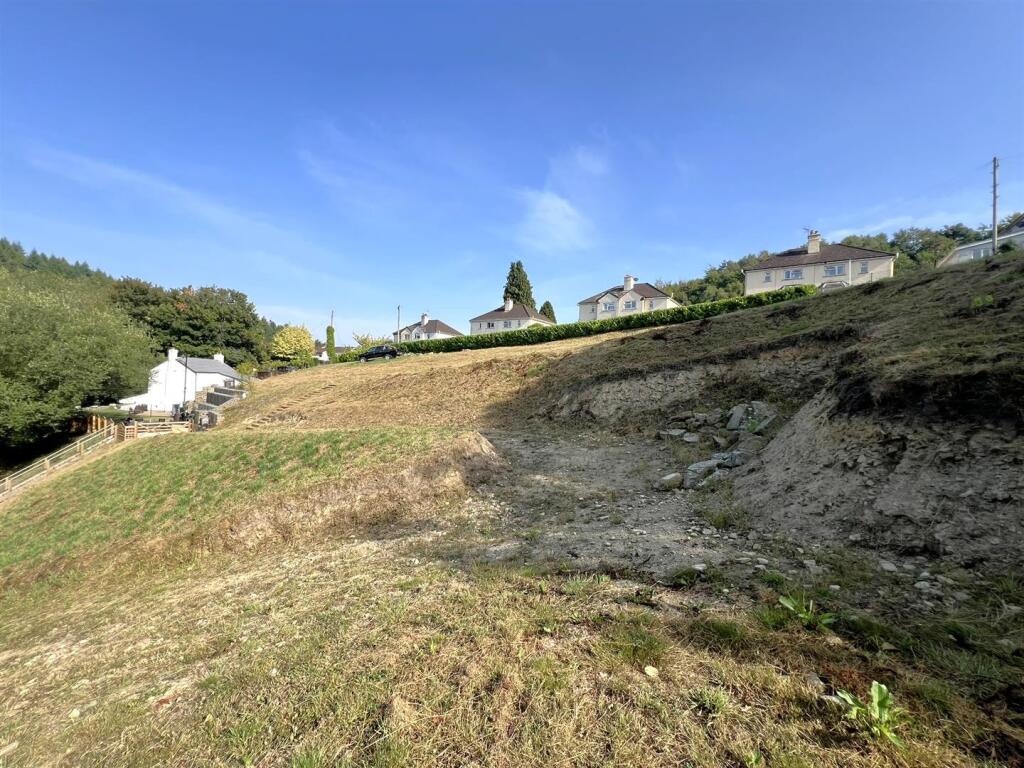
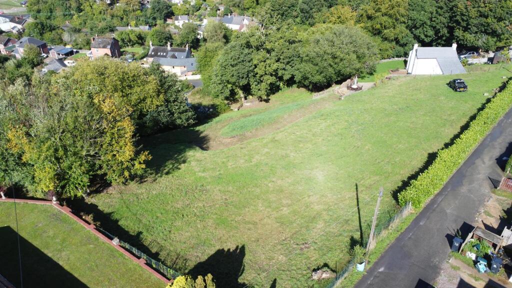
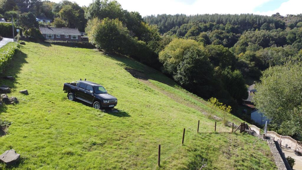
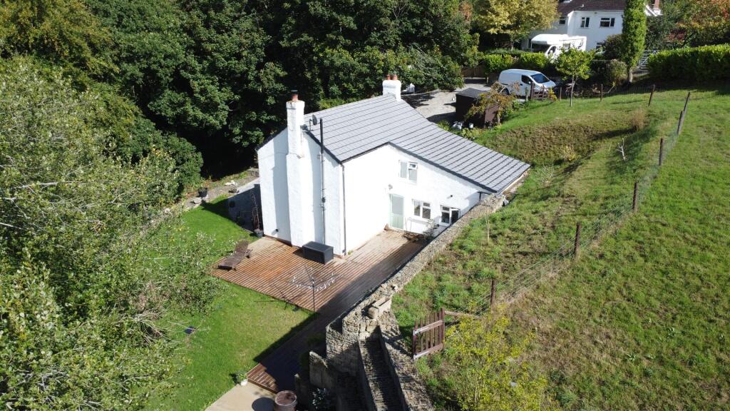
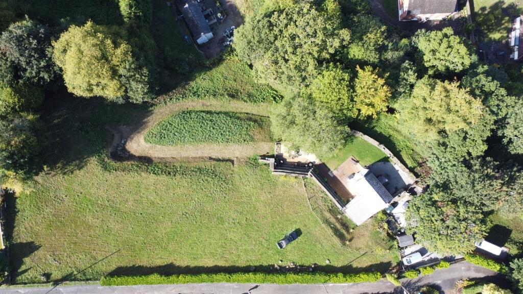
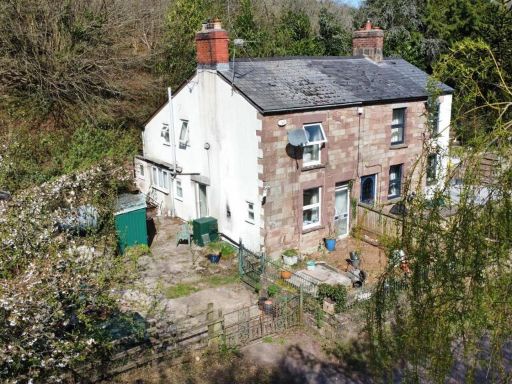
- Aerial view of a semi-rural detached property set within a large, irregularly shaped plot surrounded by mature woodland. The main residence sits toward the lower-central area of the site with an access drive and substantial open lawn/field to the north and east. The immediate setting is rural/edge-of-village with neighbouring detached houses to the north and significant tree cover on three sides, offering seclusion and woodland views. The plot appears large (generous grounds) and the property would be described as a detached house on a large plot with excellent privacy; garden/grounds size = large. Overall property context = spacious semi-rural residential plot with woodland and valley views.
Image Descriptions
- cottage traditional cottage
- house neighborhood suburban neighborhood
Floorplan Description
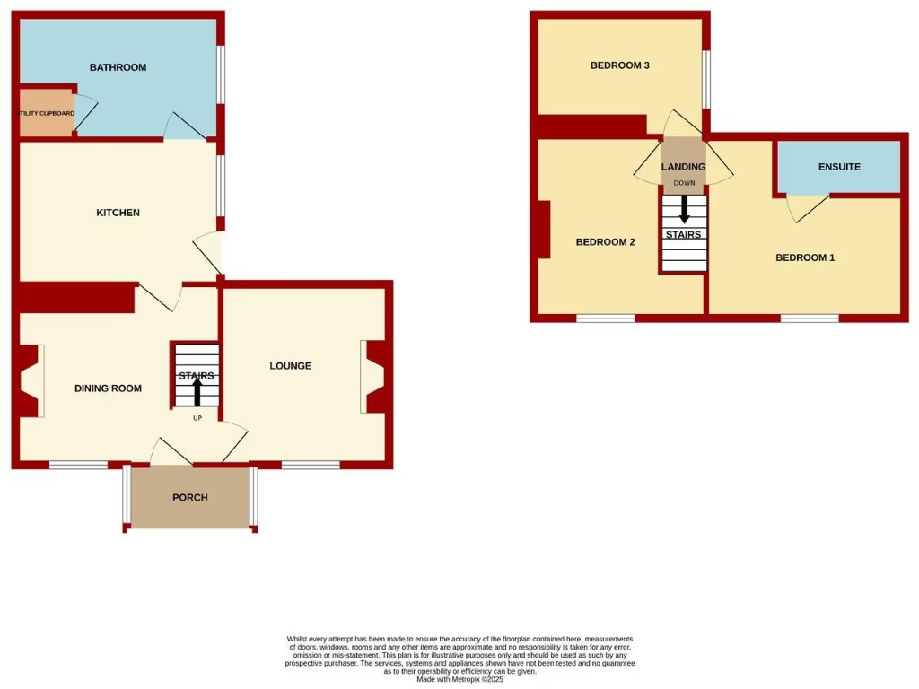
- Two-storey house floorplan showing ground and first floor rooms.
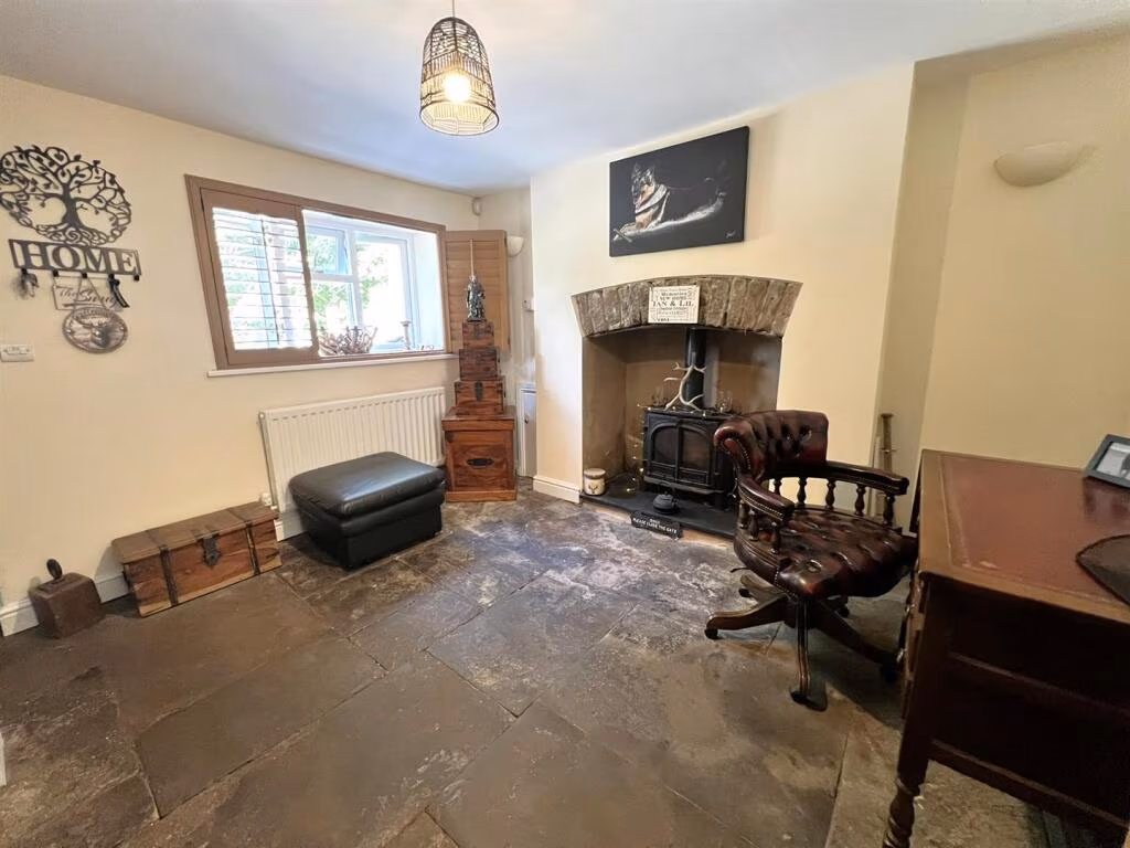
Rooms
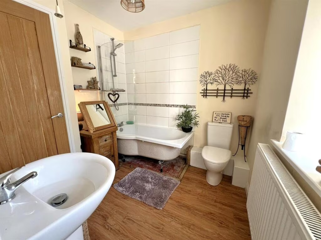
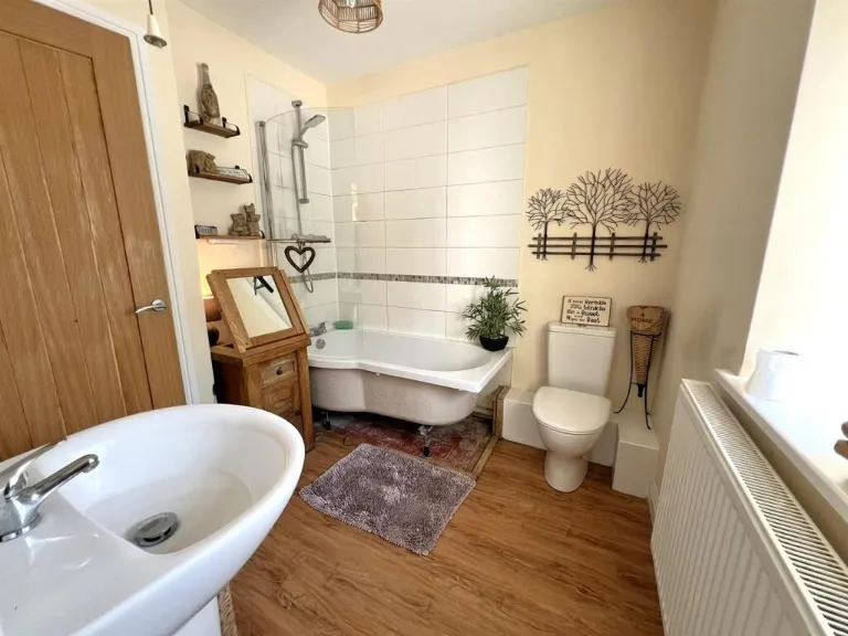
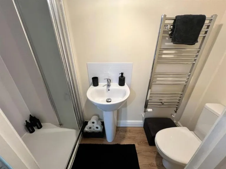
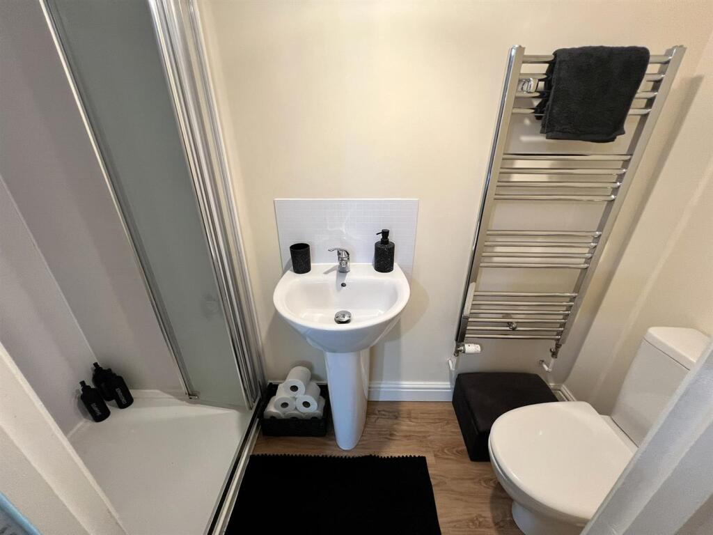
- BATHROOM:
- UTILITY CUPBOARD:
- KITCHEN:
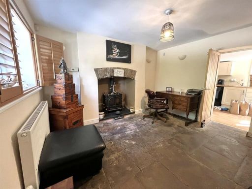
- DINING ROOM:
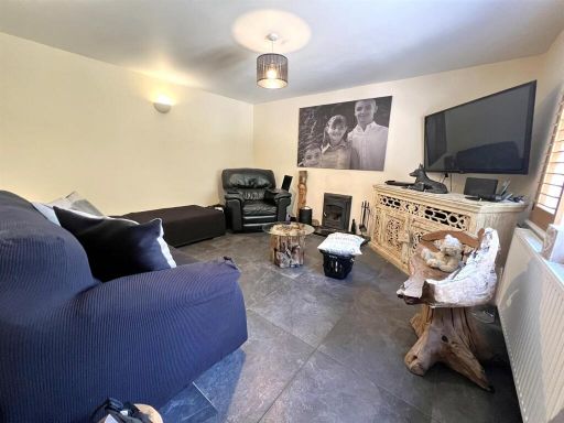
- LOUNGE:
- PORCH:
- STAIRS:
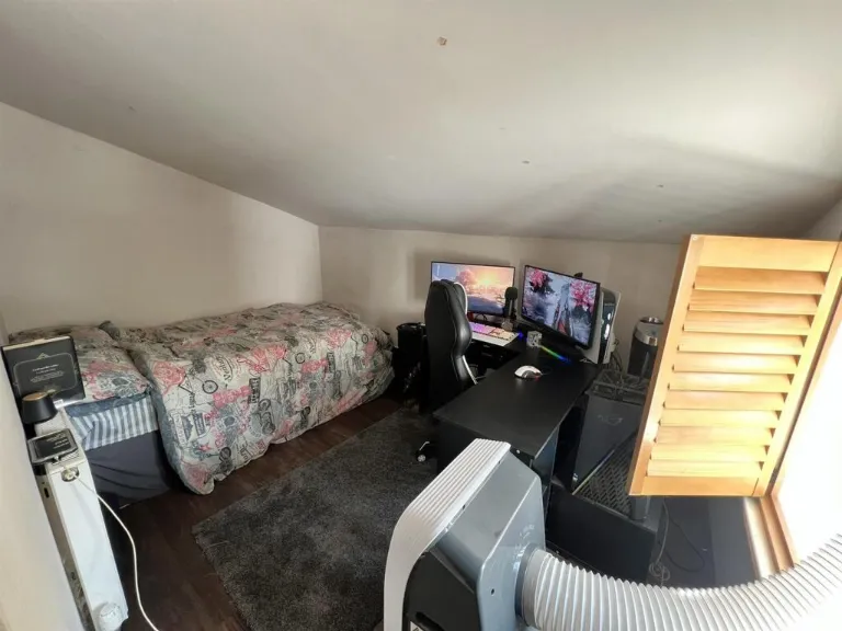
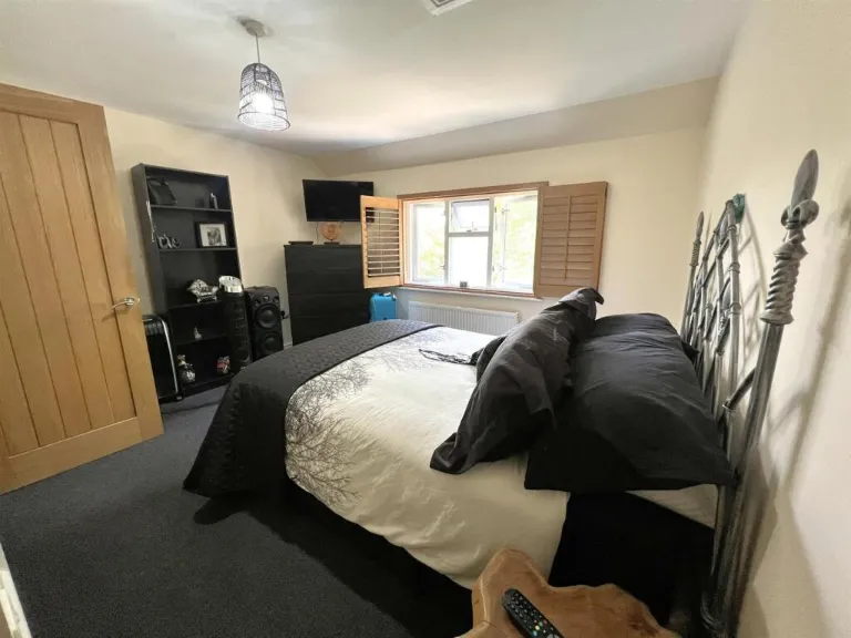
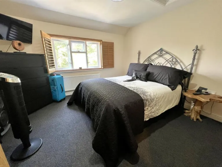
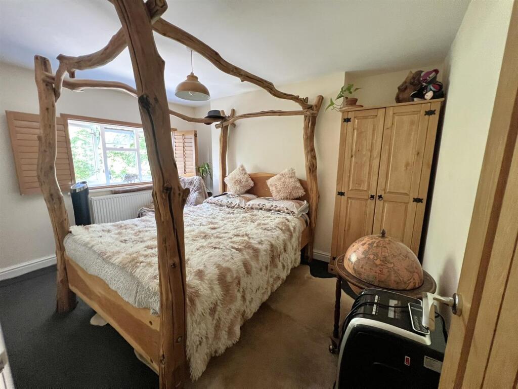
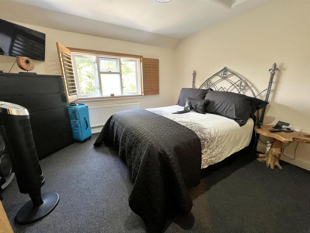
- BEDROOM 3:
- LANDING:
- BEDROOM 2:
- STAIRS:
- BEDROOM 1:
- ENSUITE:
Textual Property Features
Detected Visual Features
- cottage
- traditional
- stone wall
- garden
- driveway
- country property
- suburban
- residential
- family homes
- green space
- wooded area
- detached houses
- community
- peaceful
- developed area
- modern housing
EPC Details
- Fully double glazed
- Sandstone or limestone, as built, no insulation (assumed)
- Boiler and radiators, mains gas
- Low energy lighting in all fixed outlets
- Solid, no insulation (assumed)
Nearby Schools
- Parkend Primary School
- Ellwood Primary School
- Redbrook Church of England Primary School
- Soudley School
- Five Acres High School
- Steam Mills Primary School
- Woodside Primary School
- Lea CofE Primary School
- Weston-under-Penyard CofE Primary School
- Littledean Church of England Primary School
- Forest View Primary School
- English Bicknor Church of England Primary School
- Ruardean Church of England Primary School
- Clearwell Church of England Primary School
- St John's C of E Academy
- Berry Hill Primary School
- St White's Primary School
- Coalway Junior School
- Coalway Community Infant School
- SGS Forest High School
- Lydbrook Primary School
- Drybrook Primary School
- Whitchurch CofE Primary School
- Dene Magna School
- Mitcheldean Endowed Primary School
- Walford Nursery & Primary School
Nearest General Shops
- Id: 3633875659
- Tags:
- TagsNormalized:
- Lat: 51.8045926
- Lon: -2.5995036
- FullGeoHash: gcnnsyepe5vx
- PartitionGeoHash: gcnn
- Images:
- FoodStandards: null
- Distance: 3750.2
,- Id: 2888335314
- Tags:
- Name: Pygmy Pinetum
- Shop: garden_centre
- TagsNormalized:
- Lat: 51.8015258
- Lon: -2.5696778
- FullGeoHash: gcnntw0vf0m3
- PartitionGeoHash: gcnn
- Images:
- FoodStandards: null
- Distance: 3703.5
,- Id: 187685245
- Tags:
- Building: yes
- Name: Pedalabikeaway
- Shop: bicycle
- Website: https://www.pedalabikeaway.co.uk/pbabikeshop/
- TagsNormalized:
- Lat: 51.809537
- Lon: -2.5693689
- FullGeoHash: gcnntx9h3mew
- PartitionGeoHash: gcnn
- Images:
- FoodStandards: null
- Distance: 2820.8
}
Nearest Grocery shops
- Id: 4361601869
- Tags:
- Brand: Premier
- Brand:wikidata: Q7240340
- Name: Premier
- Shop: convenience
- TagsNormalized:
- Lat: 51.8107305
- Lon: -2.6160715
- FullGeoHash: gcnnsrz53h5t
- PartitionGeoHash: gcnn
- Images:
- FoodStandards: null
- Distance: 3888.3
,- Id: 6528512254
- Tags:
- Name: Wyeside stores and Post Office
- Shop: convenience
- TagsNormalized:
- office
- post office
- convenience
- shop
- Lat: 51.8628337
- Lon: -2.59016
- FullGeoHash: gcnpj13fuuut
- PartitionGeoHash: gcnp
- Images:
- FoodStandards: null
- Distance: 3302.7
,- Id: 328338637
- Tags:
- Addr:
- Postcode: GL17 9SA
- Street: Main Street
- Atm: yes
- Building: yes
- Fhrs:
- Name: Central Stores
- Operator: Premier
- Shop: convenience
- TagsNormalized:
- Lat: 51.8407341
- Lon: -2.5809721
- FullGeoHash: gcnnvm2d4vr8
- PartitionGeoHash: gcnn
- Images:
- FoodStandards:
- Id: 656939
- FHRSID: 656939
- LocalAuthorityBusinessID: 05/00002/COM
- BusinessName: Central Stores (Lydbrook) Ltd
- BusinessType: Retailers - other
- BusinessTypeID: 4613
- AddressLine1: Lydbrook
- AddressLine2: Glos
- AddressLine3: null
- AddressLine4: null
- PostCode: GL17 9SA
- RatingValue: 5
- RatingKey: fhrs_5_en-GB
- RatingDate: 2021-09-20
- LocalAuthorityCode: 126
- LocalAuthorityName: Forest of Dean
- LocalAuthorityWebSite: http://www.fdean.gov.uk
- LocalAuthorityEmailAddress: ERS@publicagroup.uk
- Scores:
- Hygiene: 0
- Structural: 0
- ConfidenceInManagement: 0
- NewRatingPending: false
- Geocode:
- Longitude: -2.58294000000000
- Latitude: 51.84120100000000
- Distance: 794.1
}
Nearest Religious buildings
- Id: 391948054
- Tags:
- Addr:
- Amenity: school
- Capacity: 77
- Denomination: anglican
- Diocese: Diocese of Gloucester
- Isced:
- Max_age: 11
- Min_age: 4
- Name: English Bicknor Church of England Primary School
- Phone: +44 1594 860367
- Ref:
- Religion: christian
- School:
- Boarding: no
- Gender: mixed
- Selective: no
- Trust: no
- Type: voluntary_controlled
- Website: http://www.englishbicknorcofeprimaryschool.co.uk/
- Wikidata: Q66162484
- TagsNormalized:
- school
- anglican
- church
- christian
- Lat: 51.838897
- Lon: -2.6103072
- FullGeoHash: gcnnusgprqvc
- PartitionGeoHash: gcnn
- Images:
- FoodStandards: null
- Distance: 2481.2
,- Id: 391948055
- Tags:
- Amenity: place_of_worship
- Building: church
- Denomination: anglican
- Name: Saint Mary
- Religion: christian
- Source: Wikipedia
- Wikidata: Q17525885
- TagsNormalized:
- place of worship
- church
- anglican
- christian
- Lat: 51.8393441
- Lon: -2.6090658
- FullGeoHash: gcnnuth4h65s
- PartitionGeoHash: gcnn
- Images:
- FoodStandards: null
- Distance: 2407.7
,- Id: 179485299
- Tags:
- Amenity: place_of_worship
- Building: yes
- Denomination: anglican
- Name: Holy Jesus
- Religion: christian
- Wikidata: Q5885680
- TagsNormalized:
- place of worship
- anglican
- christian
- church
- Lat: 51.8384555
- Lon: -2.5760578
- FullGeoHash: gcnnvkuhvs80
- PartitionGeoHash: gcnn
- Images:
- FoodStandards: null
- Distance: 428.2
}
Nearest Medical buildings
- Id: 9666996596
- Tags:
- Addr:
- City: Cinderford
- Housename: Cinderford Medical Centre
- Postcode: GL14 2NX
- Street: Valley Road
- Amenity: doctors
- Contact:
- Phone: +44 1594 820820
- Website: https://www.foresthealthcentre.nhs.uk
- Healthcare: doctor
- Name: Forest Health Care
- Opening_hours: Mo-Fr 08:30-18:00
- TagsNormalized:
- doctor
- doctors
- health
- healthcare
- forest
- Lat: 51.8268485
- Lon: -2.5078889
- FullGeoHash: gcnnyfvc3by3
- PartitionGeoHash: gcnn
- Images:
- FoodStandards: null
- Distance: 4682.8
,- Id: 660621502
- Tags:
- Addr:
- Postcode: GL14 3HX
- Street: Speech House Road
- Amenity: hospital
- Emergency: no
- Name: Dilke Memorial Hospital
- Note: Minor injuries department closed
- TagsNormalized:
- Lat: 51.8111022
- Lon: -2.5197939
- FullGeoHash: gcnnwxvjs93r
- PartitionGeoHash: gcnn
- Images:
- FoodStandards: null
- Distance: 4603.2
,- Id: 2241966759
- Tags:
- Amenity: pharmacy
- Dispensing: yes
- Healthcare: pharmacy
- Name: Drybrook Pharmacy
- TagsNormalized:
- Lat: 51.854434
- Lon: -2.5169527
- FullGeoHash: gcnnyxz1yz05
- PartitionGeoHash: gcnn
- Images:
- FoodStandards: null
- Distance: 4543.5
,- Id: 567184045
- Tags:
- Addr:
- Housename: The surgery,
- Postcode: GL17 9JE
- Street: Drybrook Road
- Amenity: doctors
- Building: yes
- Healthcare: doctor
- Name: Drybrook Surgery
- TagsNormalized:
- doctor
- doctors
- health
- healthcare
- surgery
- Lat: 51.8517861
- Lon: -2.5168123
- FullGeoHash: gcnnyxr6d188
- PartitionGeoHash: gcnn
- Images:
- FoodStandards: null
- Distance: 4417.4
}
Nearest Leisure Facilities
- Id: 897170066
- Tags:
- TagsNormalized:
- Lat: 51.8339584
- Lon: -2.5509405
- FullGeoHash: gcnnvun6wy0v
- PartitionGeoHash: gcnn
- Images:
- FoodStandards: null
- Distance: 1644.6
,- Id: 855878527
- Tags:
- Leisure: pitch
- Sport: tennis
- TagsNormalized:
- Lat: 51.834113
- Lon: -2.5986589
- FullGeoHash: gcnnuu5ewfgr
- PartitionGeoHash: gcnn
- Images:
- FoodStandards: null
- Distance: 1637.4
,- Id: 4906041433
- Tags:
- TagsNormalized:
- Lat: 51.8443662
- Lon: -2.5772814
- FullGeoHash: gcnnvmgr2frd
- PartitionGeoHash: gcnn
- Images:
- FoodStandards: null
- Distance: 1090.2
,- Id: 989297986
- Tags:
- Leisure: park
- Name: Lydbrook Recreation Ground
- TagsNormalized:
- Lat: 51.8377376
- Lon: -2.5769738
- FullGeoHash: gcnnvkg88ntj
- PartitionGeoHash: gcnn
- Images:
- FoodStandards: null
- Distance: 370.3
,- Id: 417874050
- Tags:
- Leisure: pitch
- Sport: soccer
- TagsNormalized:
- Lat: 51.8376975
- Lon: -2.5770091
- FullGeoHash: gcnnvkg2rr4w
- PartitionGeoHash: gcnn
- Images:
- FoodStandards: null
- Distance: 367.1
}
Nearest Tourist attractions
- Id: 7138957185
- Tags:
- Name: Ragmans Lane Farm
- Name:en: Ragmans Lane Farm
- Tourism: attraction
- TagsNormalized:
- Lat: 51.8571816
- Lon: -2.5773661
- FullGeoHash: gcnpj271zp29
- PartitionGeoHash: gcnp
- Images:
- FoodStandards: null
- Distance: 2508.2
,- Id: 992702211
- Tags:
- Building: yes
- Name: Belvedere House B&B
- Phone: +44 1594368398
- Source: Bing
- Tourism: guest_house
- TagsNormalized:
- Lat: 51.8488678
- Lon: -2.5870187
- FullGeoHash: gcnnvnu1w17p
- PartitionGeoHash: gcnn
- Images:
- FoodStandards: null
- Distance: 1785.7
,- Id: 992702203
- Tags:
- Building: yes
- Name: River Wye Lodge
- Source: Bing
- Tourism: guest_house
- TagsNormalized:
- Lat: 51.8490534
- Lon: -2.5864052
- FullGeoHash: gcnnvnudskhd
- PartitionGeoHash: gcnn
- Images:
- FoodStandards: null
- Distance: 1784.8
}
Nearest Train stations
- Id: 262378723
- Tags:
- Name: Lydney Town
- Naptan:
- Operator: Dean Forest Railway
- Public_transport: station
- Railway: station
- Usage: tourism
- Wheelchair: no
- Wikidata: Q6707734
- TagsNormalized:
- Lat: 51.725442
- Lon: -2.5319837
- FullGeoHash: gcnnq2k68920
- PartitionGeoHash: gcnn
- Images:
- FoodStandards: null
- Distance: 12499.3
,- Id: 262378693
- Tags:
- Name: Norchard
- Public_transport: station
- Railway: station
- Usage: tourism
- Wikidata: Q7050477
- TagsNormalized:
- Lat: 51.7357697
- Lon: -2.5395674
- FullGeoHash: gcnnq4nwxy3r
- PartitionGeoHash: gcnn
- Images:
- FoodStandards: null
- Distance: 11262.7
,- Id: 7689205150
- Tags:
- Name: Perrygrove
- Public_transport: station
- Railway: station
- Train: yes
- Usage: tourism
- Wikidata: Q7169991
- Wikipedia: en:Perrygrove railway station
- TagsNormalized:
- Lat: 51.7825235
- Lon: -2.6111685
- FullGeoHash: gcnnsddx5658
- PartitionGeoHash: gcnn
- Images:
- FoodStandards: null
- Distance: 6314.1
,- Id: 7689205151
- Tags:
- Name: Oakiron
- Public_transport: station
- Railway: station
- Train: yes
- Usage: tourism
- Wikidata: Q7073925
- Wikipedia: en:Oakiron railway station
- TagsNormalized:
- Lat: 51.7824969
- Lon: -2.6102566
- FullGeoHash: gcnnsdeqbt59
- PartitionGeoHash: gcnn
- Images:
- FoodStandards: null
- Distance: 6292.3
,- Id: 8693763578
- Tags:
- Name: Rookwood
- Public_transport: station
- Railway: station
- Usage: tourism
- Wikidata: Q7366236
- Wikipedia: en:Rookwood railway station
- TagsNormalized:
- Lat: 51.7850193
- Lon: -2.6127976
- FullGeoHash: gcnnse1mt7kb
- PartitionGeoHash: gcnn
- Images:
- FoodStandards: null
- Distance: 6107.2
}
Nearest Hotels
- Id: 7167337451
- Tags:
- Name: Kings Head Hotel
- Tourism: hotel
- TagsNormalized:
- Lat: 51.7940103
- Lon: -2.6161274
- FullGeoHash: gcnnskyczz64
- PartitionGeoHash: gcnn
- Images:
- FoodStandards: null
- Distance: 5338.7
,- Id: 438264444
- Tags:
- Amenity: restaurant
- Building: yes
- Name: The Royal Lodge
- Tourism: hotel
- Website: https://royalhotel-symondsyat.com/
- TagsNormalized:
- Lat: 51.8388729
- Lon: -2.6379884
- FullGeoHash: gcnnguzp66m3
- PartitionGeoHash: gcnn
- Images:
- FoodStandards: null
- Distance: 4363.3
,- Id: 31221729
- Tags:
- Historic: manor
- Layer: 2
- Name: Speech House Hotel
- Source: NPE
- Tourism: hotel
- Url: https://www.thespeechhouse.co.uk/
- Wikidata: Q7575371
- Wikipedia: en:Speech House
- TagsNormalized:
- Lat: 51.806293
- Lon: -2.5520376
- FullGeoHash: gcnntzj9t0yz
- PartitionGeoHash: gcnn
- Images:
- FoodStandards: null
- Distance: 3524.2
}
Tags
- cottage
- traditional
- stone wall
- garden
- driveway
- country property
- suburban
- residential
- family homes
- green space
- wooded area
- detached houses
- community
- peaceful
- developed area
- modern housing
Local Market Stats
- Average Price/sqft: £257
- Avg Income: £44100
- Social Housing: 5%
- Planning Success Rate: 85%
AirBnB Data
- 1km average: £85/night
- Listings in 1km: 1
Similar Properties
 2 bedroom semi-detached house for sale in Tibbs Cross, Littledean, Cinderford, GL14 — £315,000 • 2 bed • 1 bath • 699 ft²
 3 bedroom detached house for sale in Farm Road, Ruardean Woodside, Ruardean, GL17 — £350,000 • 3 bed • 1 bath • 1130 ft²
 3 bedroom terraced house for sale in Church Road, Lydbrook GL17 FOR SALE, GL17 — £275,000 • 3 bed • 3 bath • 1274 ft²
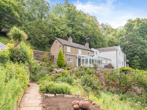 3 bedroom cottage for sale in Forge Hill, Joys Green, Lydbrook, GL17 — £400,000 • 3 bed • 2 bath • 1174 ft²
 3 bedroom detached house for sale in Vention Lane, Lydbrook, GL17 — £399,000 • 3 bed • 1 bath • 1927 ft²
 3 bedroom detached house for sale in Symonds Yat Rock, Coleford, GL16 — £495,000 • 3 bed • 1 bath • 1071 ft²
Meta
- {
"@context": "https://schema.org",
"@type": "Residence",
"name": "3 bedroom house for sale in Camomile Green, Lydbrook, GL17",
"description": "",
"url": "https://propertypiper.co.uk/property/7859c063-973a-43eb-8094-aa41b599428d",
"image": "https://image-a.propertypiper.co.uk/c3243fa4-f5a1-4563-99d6-ed07c7dd17e7-1024.jpeg",
"address": {
"@type": "PostalAddress",
"streetAddress": "Beeches Cottage, Camomile Green, LYDBROOK",
"postalCode": "GL17 9LN",
"addressLocality": "Forest of Dean",
"addressRegion": "Forest of Dean",
"addressCountry": "England"
},
"geo": {
"@type": "GeoCoordinates",
"latitude": 51.8346781751463,
"longitude": -2.574846840378016
},
"numberOfRooms": 3,
"numberOfBathroomsTotal": 2,
"floorSize": {
"@type": "QuantitativeValue",
"value": 1248,
"unitCode": "FTK"
},
"offers": {
"@type": "Offer",
"price": 525000,
"priceCurrency": "GBP",
"availability": "https://schema.org/InStock"
},
"additionalProperty": [
{
"@type": "PropertyValue",
"name": "Feature",
"value": "cottage"
},
{
"@type": "PropertyValue",
"name": "Feature",
"value": "traditional"
},
{
"@type": "PropertyValue",
"name": "Feature",
"value": "stone wall"
},
{
"@type": "PropertyValue",
"name": "Feature",
"value": "garden"
},
{
"@type": "PropertyValue",
"name": "Feature",
"value": "driveway"
},
{
"@type": "PropertyValue",
"name": "Feature",
"value": "country property"
},
{
"@type": "PropertyValue",
"name": "Feature",
"value": "suburban"
},
{
"@type": "PropertyValue",
"name": "Feature",
"value": "residential"
},
{
"@type": "PropertyValue",
"name": "Feature",
"value": "family homes"
},
{
"@type": "PropertyValue",
"name": "Feature",
"value": "green space"
},
{
"@type": "PropertyValue",
"name": "Feature",
"value": "wooded area"
},
{
"@type": "PropertyValue",
"name": "Feature",
"value": "detached houses"
},
{
"@type": "PropertyValue",
"name": "Feature",
"value": "community"
},
{
"@type": "PropertyValue",
"name": "Feature",
"value": "peaceful"
},
{
"@type": "PropertyValue",
"name": "Feature",
"value": "developed area"
},
{
"@type": "PropertyValue",
"name": "Feature",
"value": "modern housing"
}
]
}
High Res Floorplan Images
Compatible Floorplan Images
FloorplanImages Thumbnail