LU6 2AW - 4 bedroom detached house for sale in Lancot Avenue, Dunstab…
View on Property Piper
4 bedroom detached house for sale in Lancot Avenue, Dunstable, LU6
Property Details
- Price: £700000
- Bedrooms: 4
- Bathrooms: 2
- Property Type: undefined
- Property SubType: undefined
Brochure Descriptions
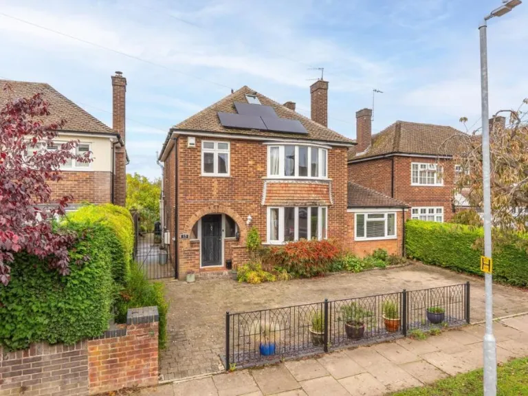
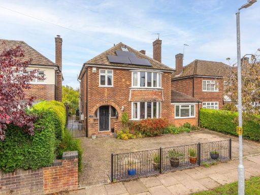
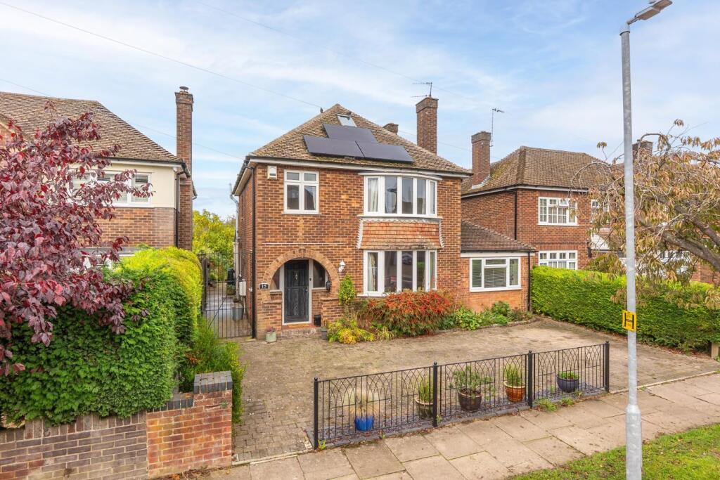
- Detached two-storey brick family home on a suburban street. The property presents a traditional bay-fronted façade with a single-storey side extension, pitched roof with solar panels and an arched covered entrance. Large paved front forecourt/driveway providing multiple off-street parking spaces and gated side access to the rear. Mature hedging and modest planting to the front border. Likely internal layout: entrance hall, bay-front living room, ground-floor extension space (possible dining/family room or utility), and first-floor bedrooms served from a central landing. Overall plot appears medium in size for the street with an average rear garden (not visible from this image). No notable wide or long-distance views — typical suburban outlook onto the street. Valuator notes: good kerb appeal, off-street parking and solar panels add value; condition externally appears well maintained though internal condition and exact room sizes are unknown from this image.
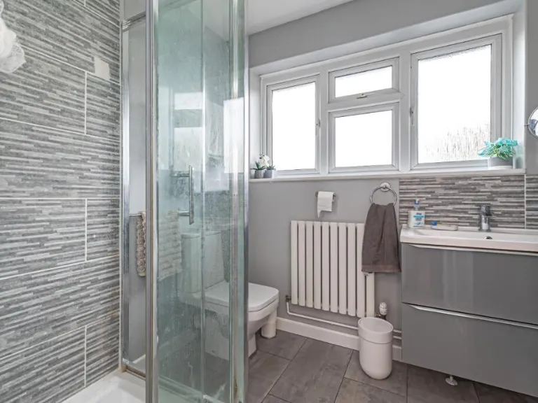
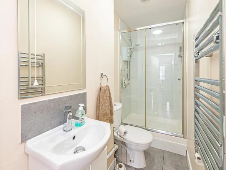
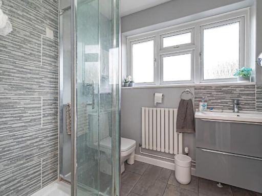
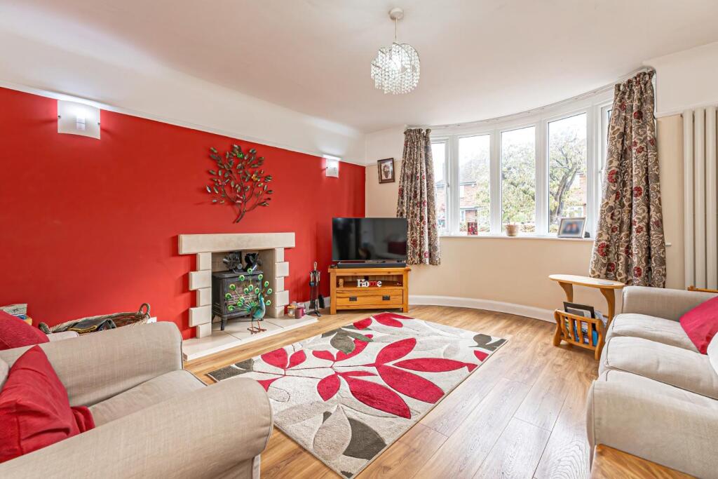
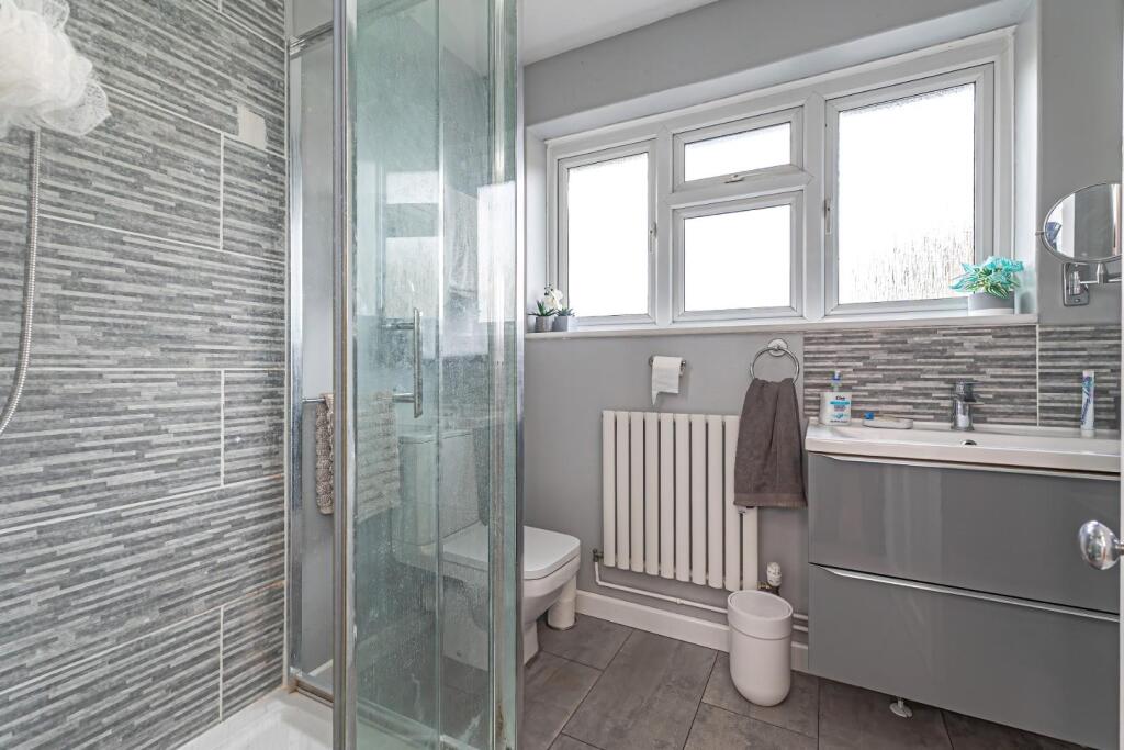
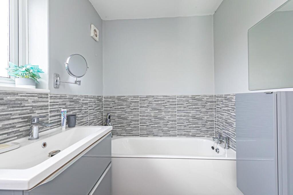
- Interior view of a compact, modern bathroom likely from a small flat or terraced house. Features a corner shower enclosure with sliding glass doors and tiled walls, close-coupled WC, small wall-hung basin with mixer tap and splashback, chrome heated towel rail, and contemporary fittings in a neutral palette. Flooring appears to be vinyl or tile with light-coloured walls. The room is small in size (suitable as an en-suite or main bathroom in a modest property); overall property size cannot be determined from this image. Presentation is tidy and functional, suggesting recent minor refurbishment and good basic specification for a lower- to mid-market residential unit.
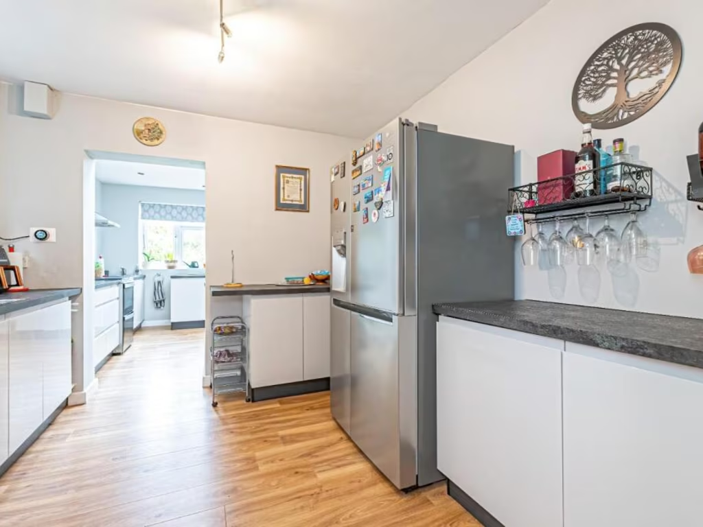
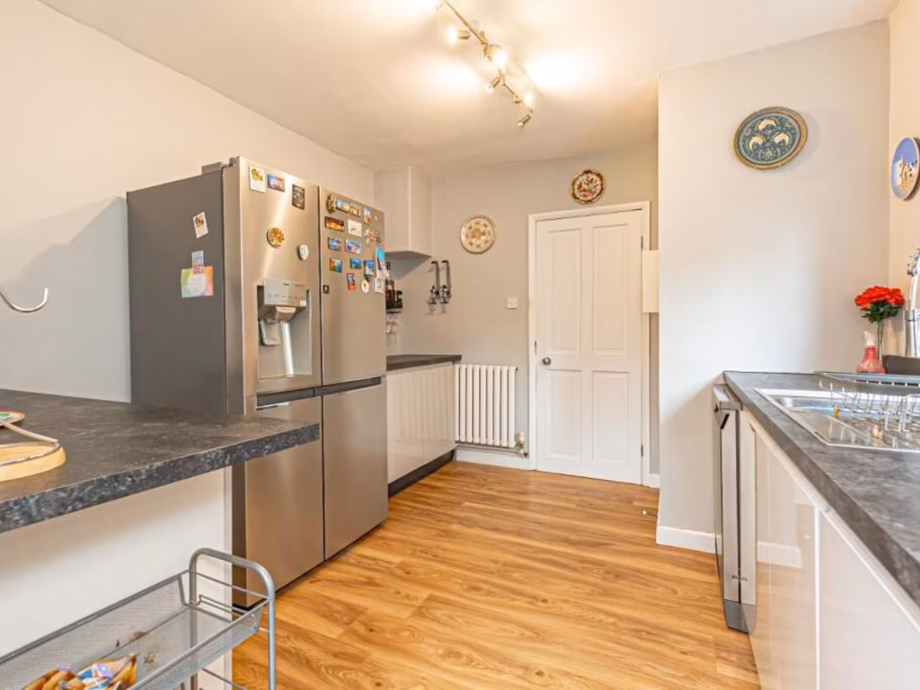
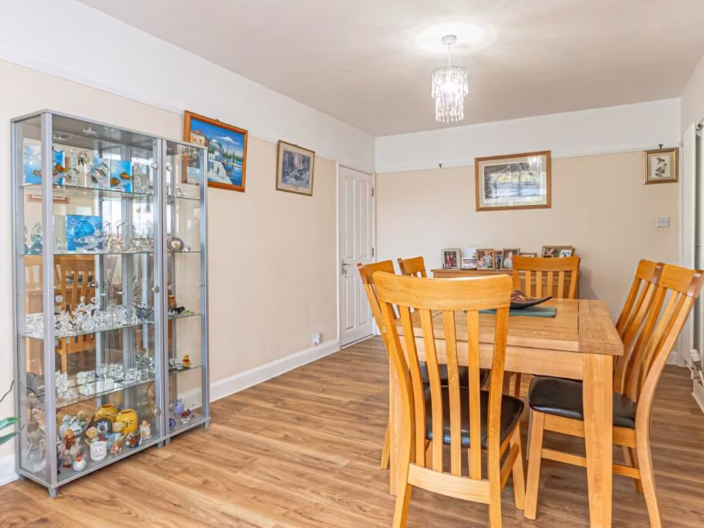
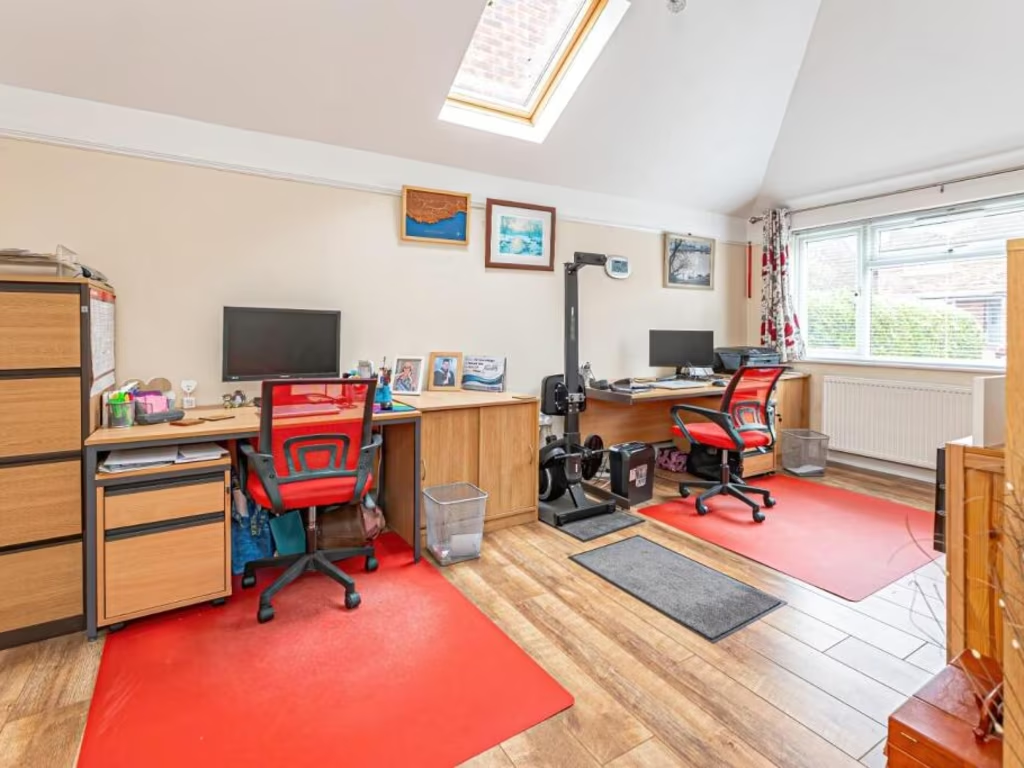
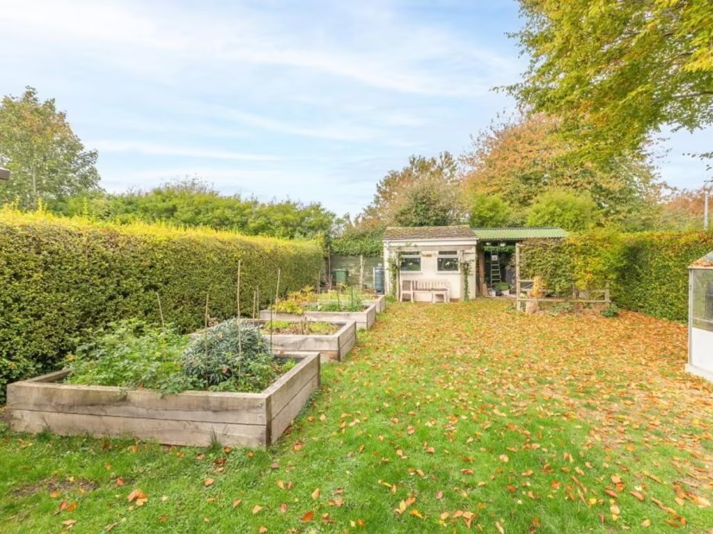
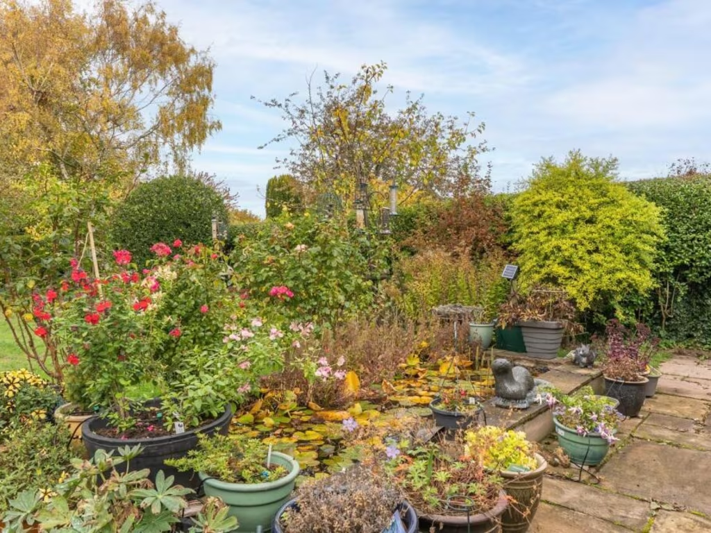
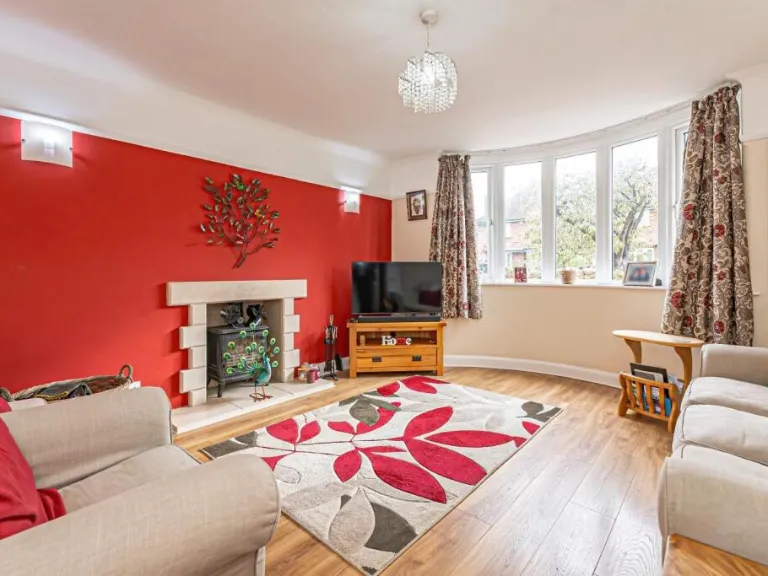
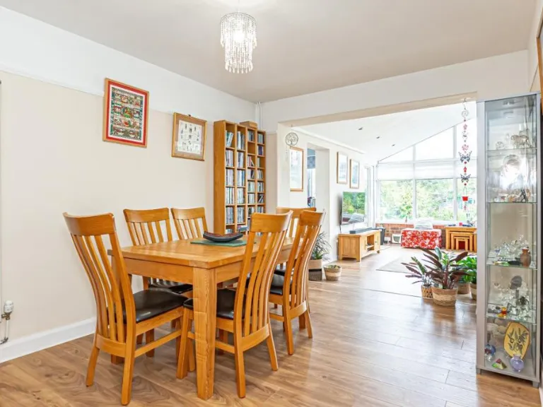
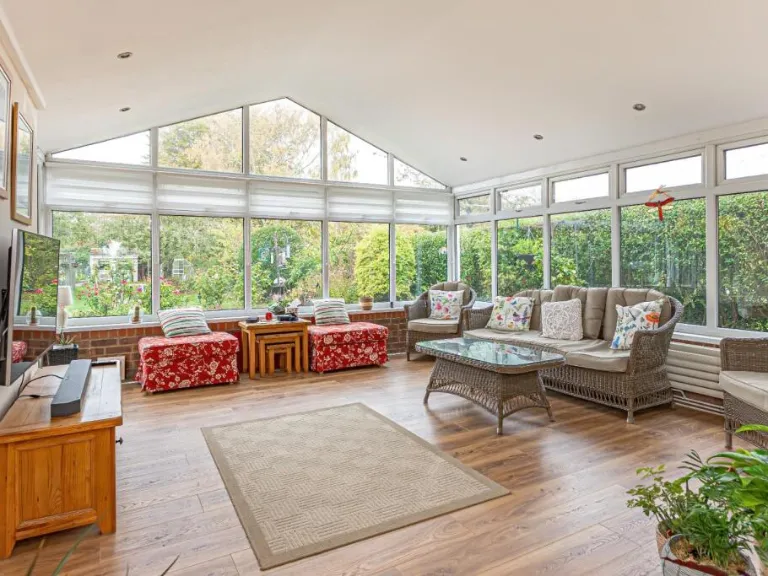
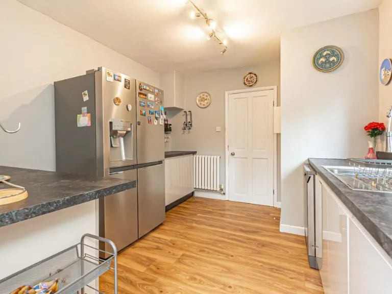
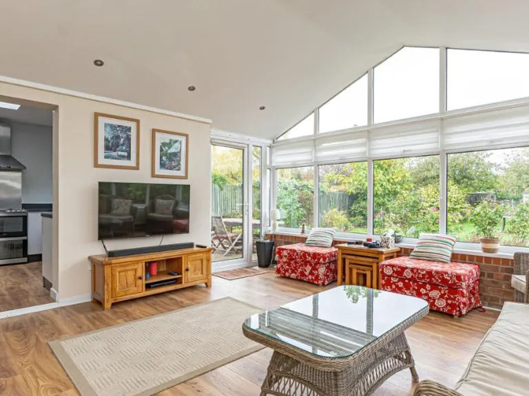
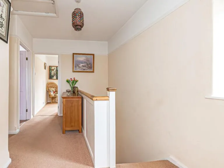
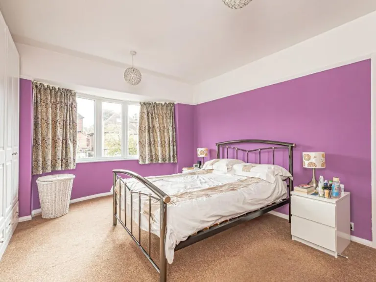
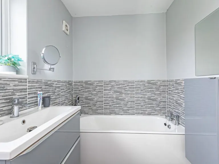
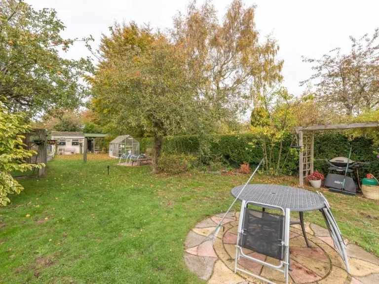
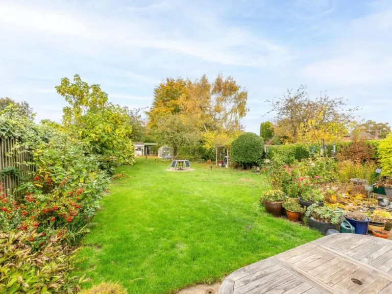
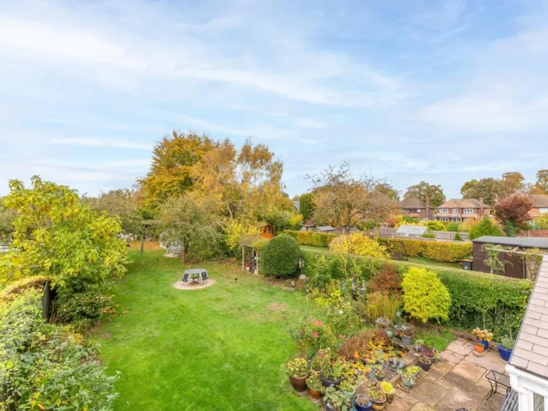
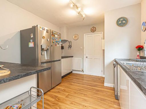
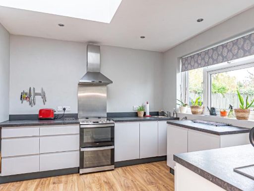
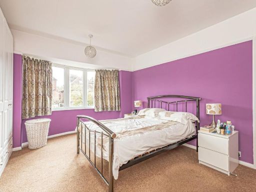
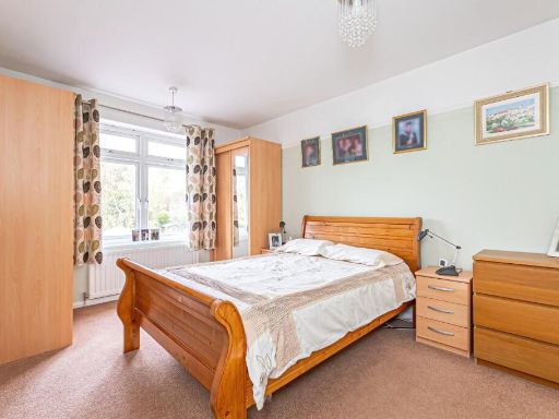
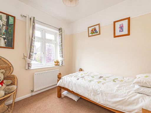
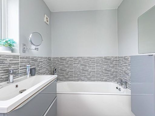
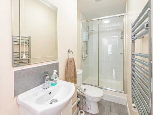
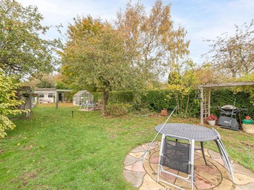
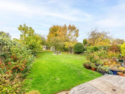
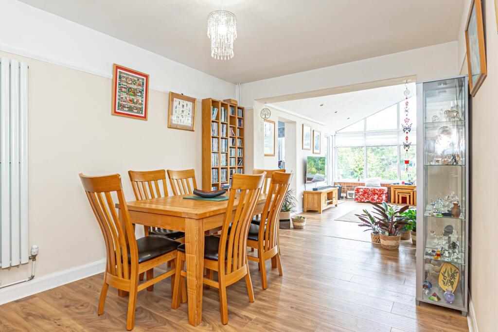
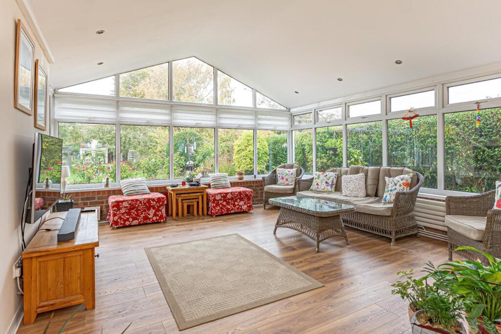
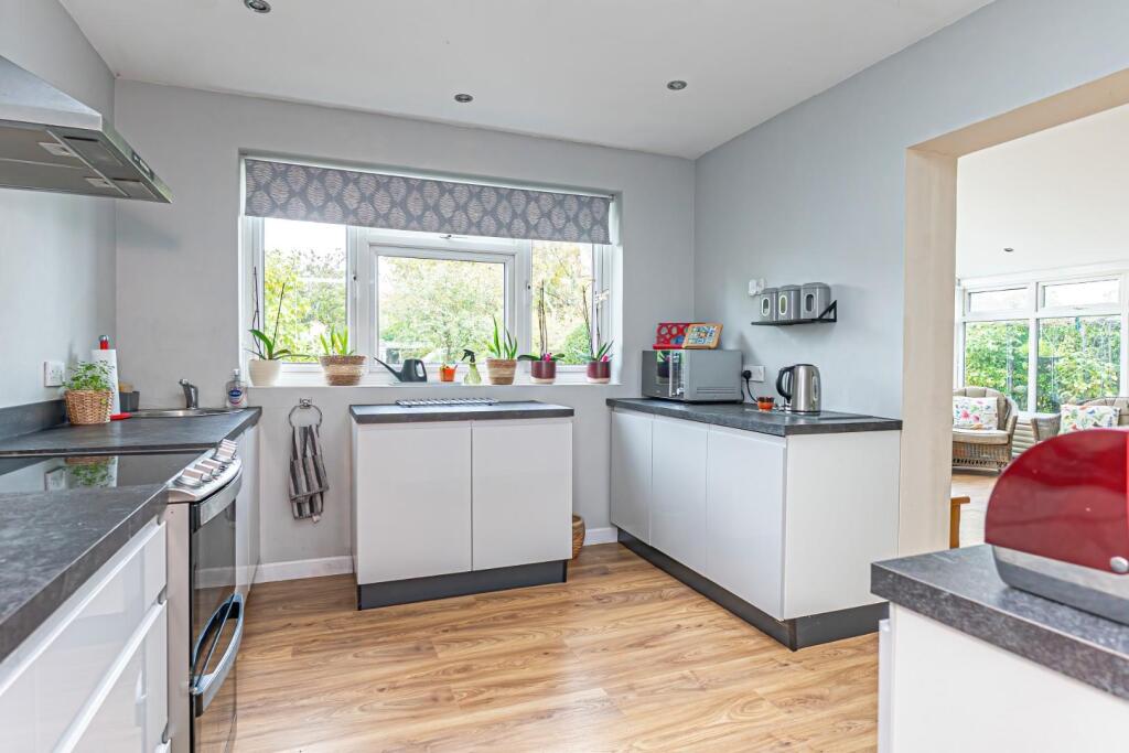
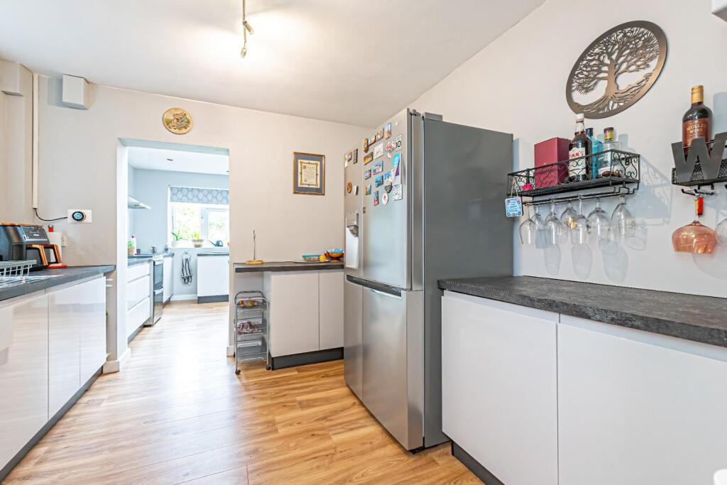
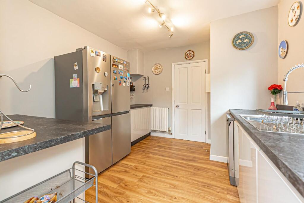
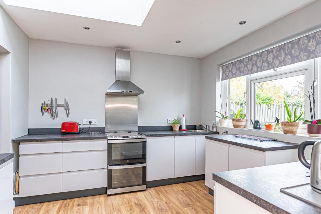
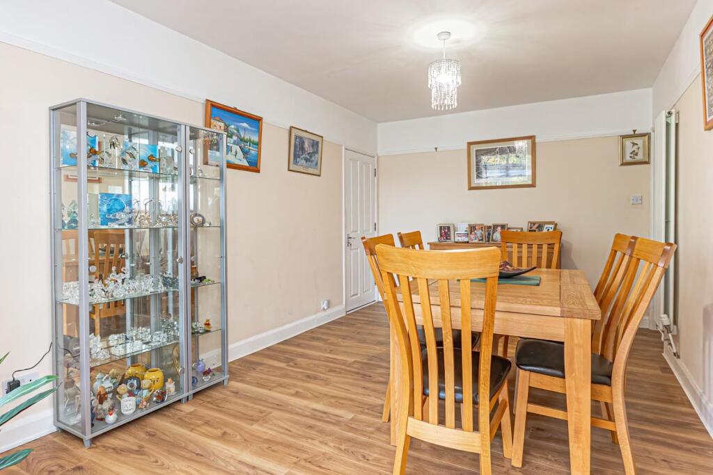
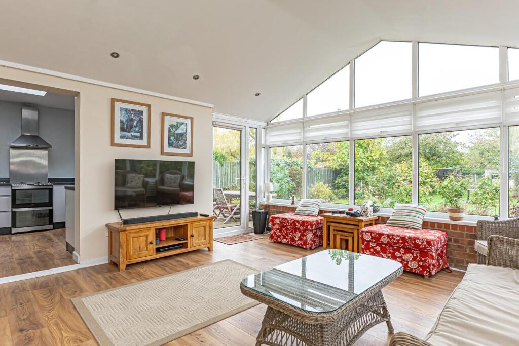
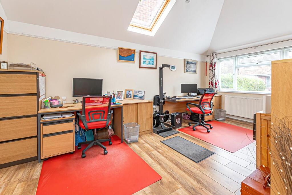
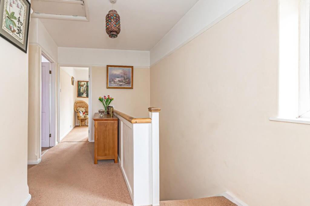
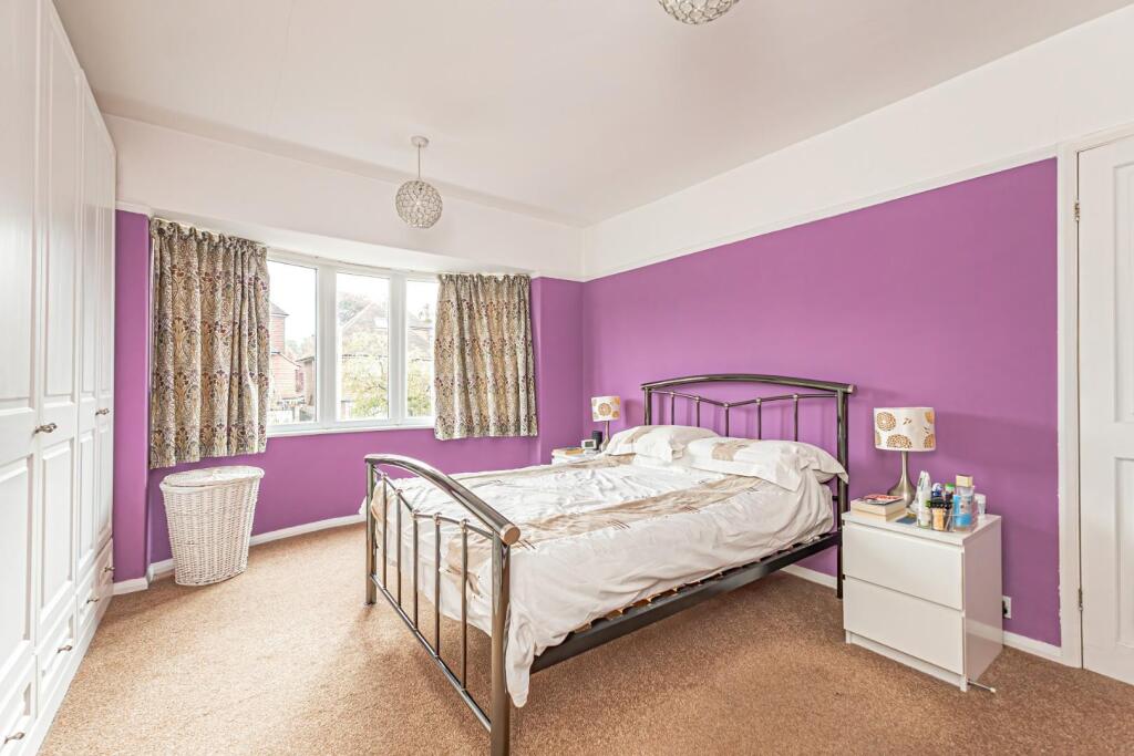
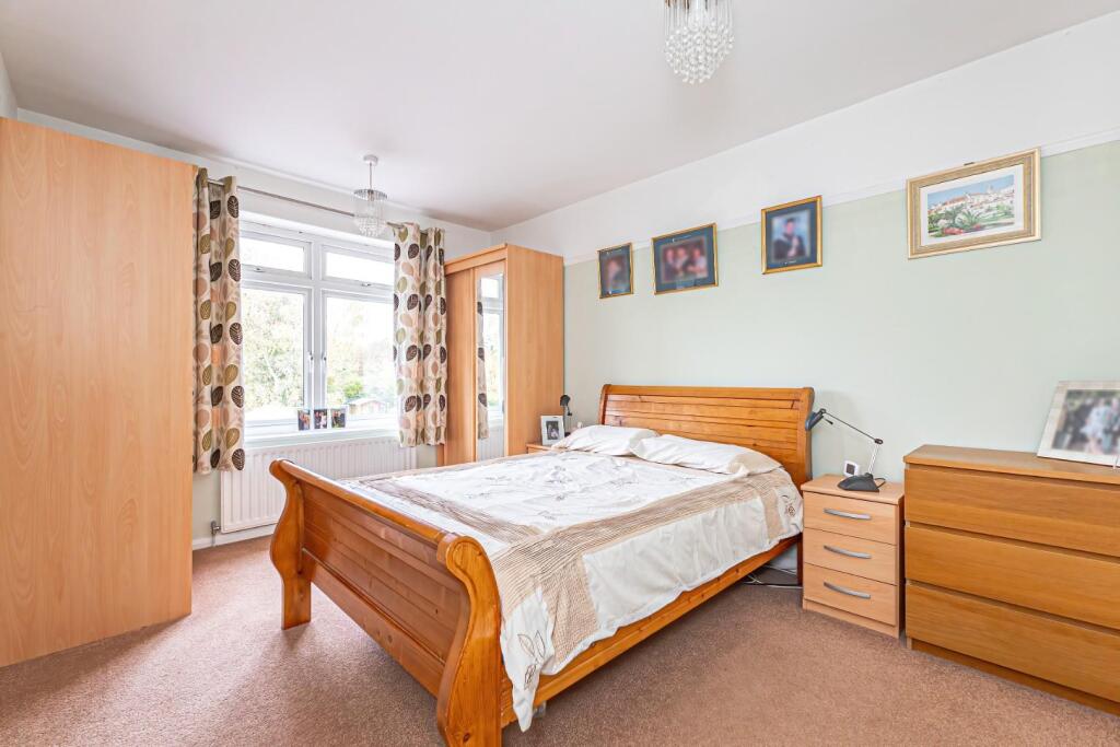
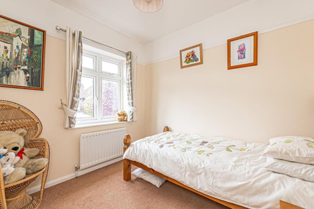
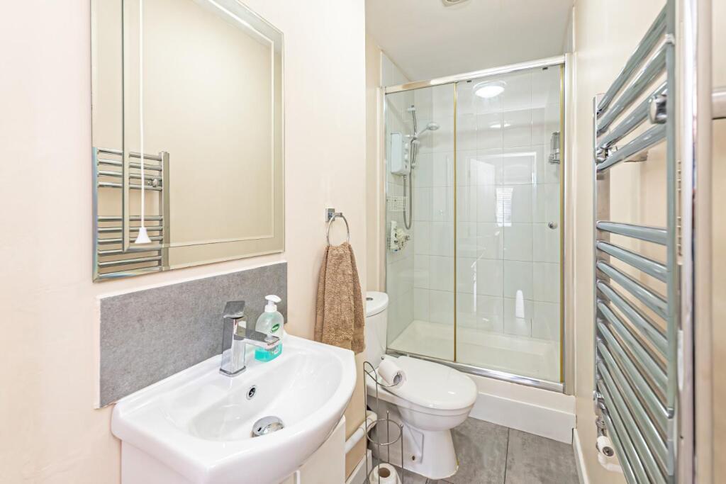
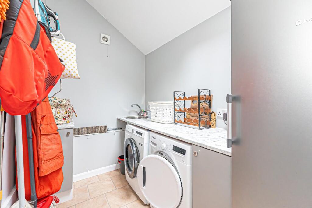
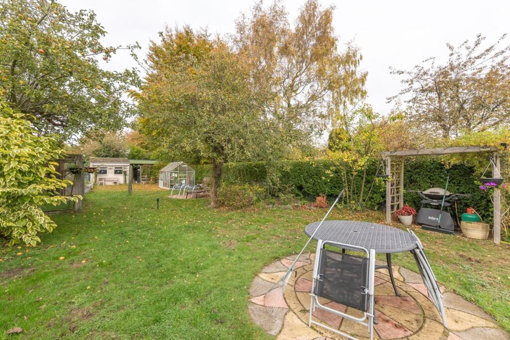
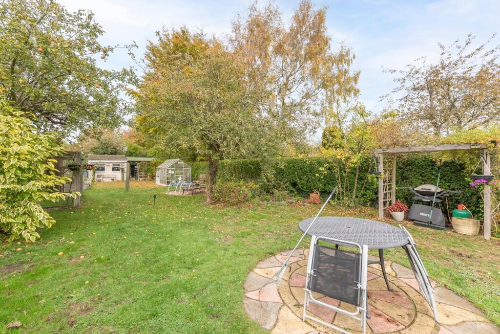
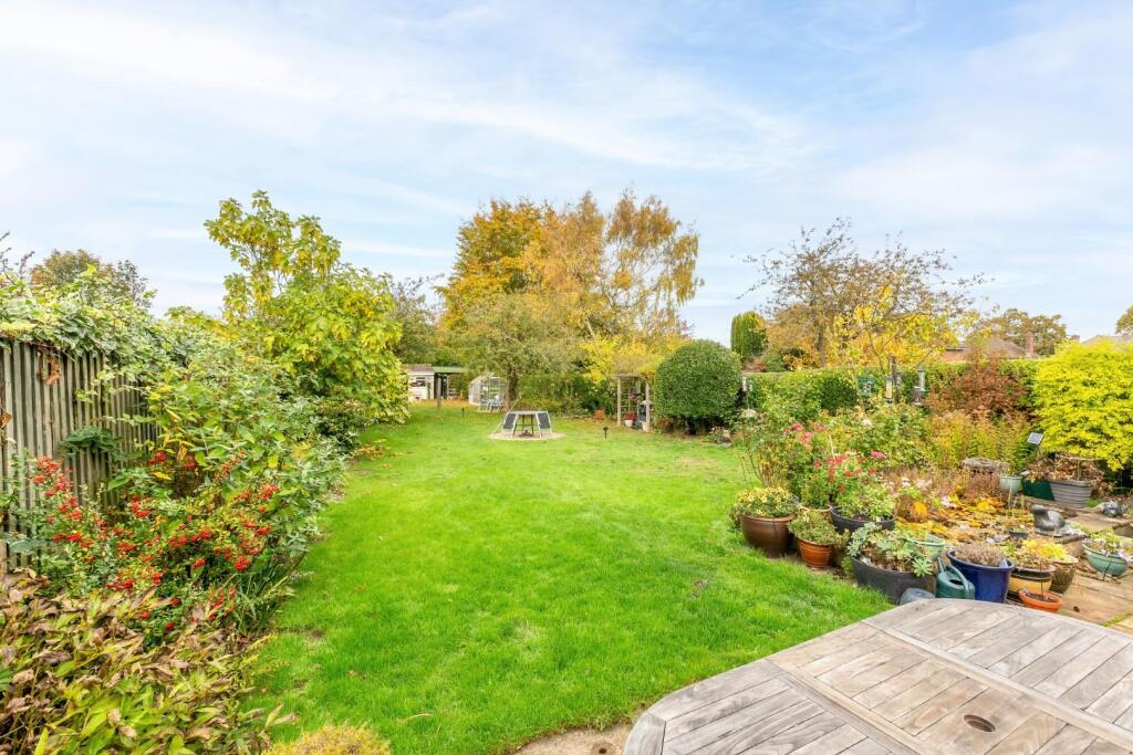
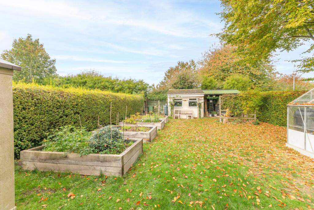
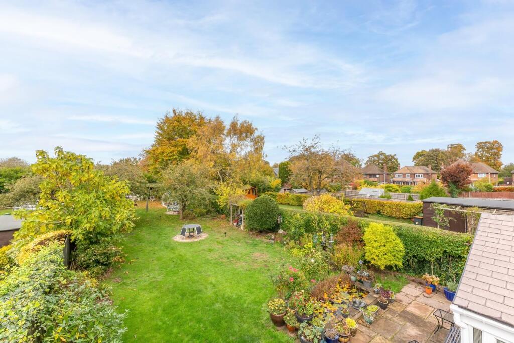
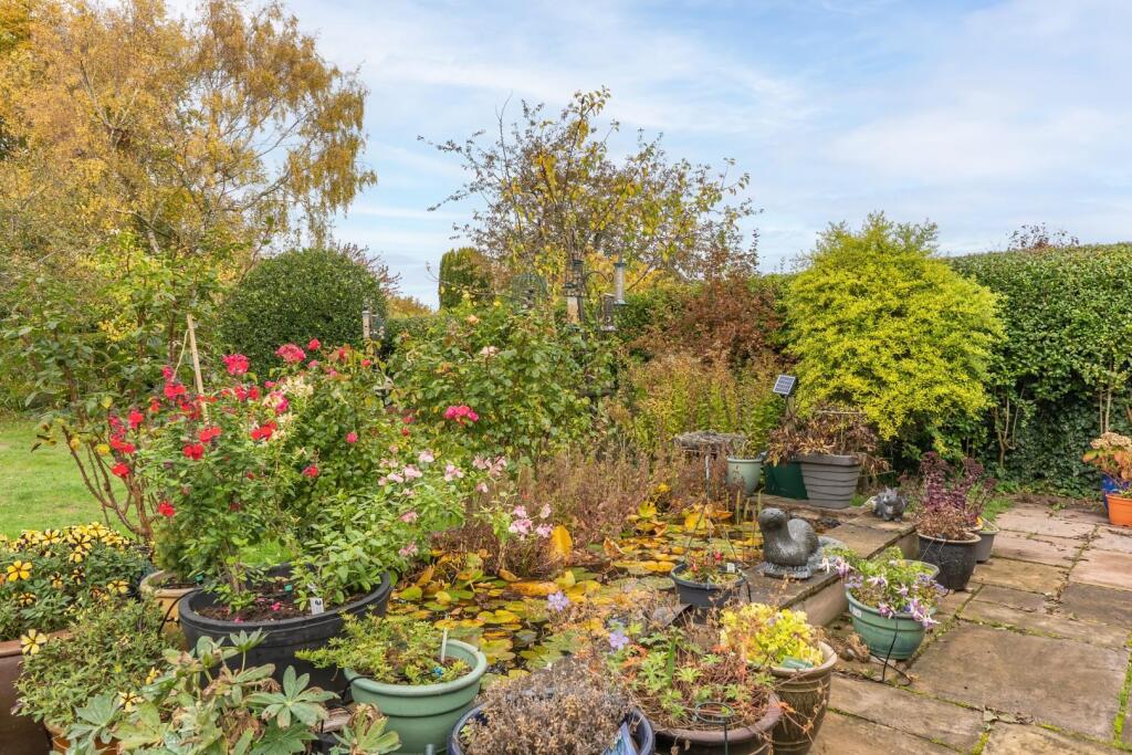
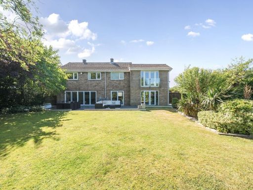
- Extended three/four-bedroom detached family home in a sought-after Dunstable location. The property features a spacious entrance hall, bay-fronted lounge with log burner, modern kitchen with an additional secondary kitchen/utility area, ground-floor home office, utility room and shower room. Upstairs are three well-proportioned bedrooms and a four-piece family bathroom. Externally there is an approximately 120 ft mature rear garden with patio and lawn, and a driveway providing off-road parking for multiple vehicles. Presented throughout and offering flexible accommodation (can provide a fourth bedroom/study), the home represents a solid family purchase: good internal living space, substantial rear garden and generous off-street parking. Overall the plot and accommodation suggest an average-to-large family property in good decorative order, suitable for families seeking convenient access to local amenities and schools. No notable water, sea or exceptional scenic views are indicated in the listing.
Image Descriptions
- house exterior 1930s
- living_room contemporary
Floorplan Description
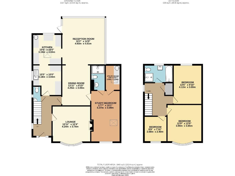
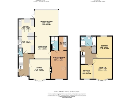
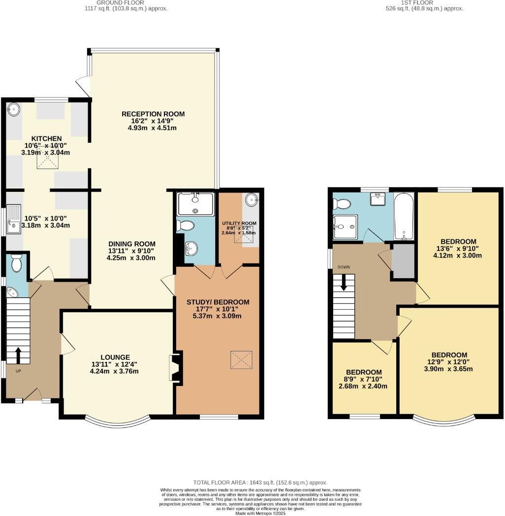
- Two-storey dwelling with reception, lounge, dining room, kitchen, utility/study and three bedrooms.
Rooms
- RECEPTION ROOM: large
- KITCHEN: average
- DINING ROOM: average
- LOUNGE: average
- STUDY/ BEDROOM: large
- UTILITY ROOM: small
- BEDROOM: large
- BEDROOM: large
- BEDROOM: small
Textual Property Features
Detected Visual Features
- 1930s
- detached
- solar panels
- bay windows
- gable roof
- brick exterior
- driveway
- front garden
- potential
- suburban
- contemporary
- living room
- bright
- bay window
- fireplace
- wood flooring
- red accent wall
- natural light
- modern
EPC Details
- Fully double glazed
- Cavity wall, filled cavity
- Boiler and radiators, mains gas
- Low energy lighting in all fixed outlets
- Solid, no insulation (assumed)
Nearby Schools
- St Mary's Catholic Primary School
- Lark Rise Academy
- St. Augustine's Academy
- Beecroft Academy
- Thomas Whitehead Church of England Academy
- The Academy of Central Bedfordshire
- Ardley Hill Academy
- Eaton Bray Academy
- Totternhoe Church of England Academy
- Lancot School
- Hadrian Academy
- The Vale Academy
- Tithe Farm Primary School
- Houstone School
- Chantry Primary Academy
- Priory Academy
- Lime Tree Primary Academy
- Manshead Church of England Academy
- St Christophers Academy
- Queensbury Academy
- Watling Lower School
- Ashton St Peter's VA C of E School
- All Saints Academy Dunstable
- Houghton Regis Primary School
- St Vincent's Catholic Primary School
- Thornhill Primary School
Nearest General Shops
- Id: 6736517161
- Tags:
- Name: Aurora
- Shop: hairdresser
- TagsNormalized:
- Lat: 51.8882677
- Lon: -0.537461
- FullGeoHash: gcpx5vbxh60j
- PartitionGeoHash: gcpx
- Images:
- FoodStandards: null
- Distance: 586.4
,- Id: 75415027
- Tags:
- Addr:
- City: Dunstable
- Country: GB
- Housenumber: 164
- Postcode: LU6 1DL
- Street: Westfield Road
- Amenity: post_office
- Brand: Westfield
- Brand:wikidata: Q608518
- Building: yes
- Fhrs:
- Authority: Central Bedfordshire
- Id: 962599
- Local_authority_id: 66504
- Name: Westfield News
- Opening_hours:
- Shop: mall
- Source: OS OpenData StreetView
- TagsNormalized:
- office
- post office
- westfield
- mall
- shop
- Lat: 51.8881133
- Lon: -0.5378092
- FullGeoHash: gcpx5vbqhjkk
- PartitionGeoHash: gcpx
- Images:
- FoodStandards:
- Id: 962599
- FHRSID: 962599
- LocalAuthorityBusinessID: 66504
- BusinessName: Westfield News
- BusinessType: Retailers - other
- BusinessTypeID: 4613
- AddressLine1: 164 Westfield Road
- AddressLine2: Dunstable
- AddressLine3: null
- AddressLine4: null
- PostCode: LU6 1DL
- RatingValue: Exempt
- RatingKey: fhrs_exempt_en-GB
- RatingDate: 2017-04-12
- LocalAuthorityCode: 702
- LocalAuthorityName: Central Bedfordshire
- LocalAuthorityWebSite: http://www.centralbedfordshire.gov.uk
- LocalAuthorityEmailAddress: env.health@centralbedfordshire.gov.uk
- Scores:
- Hygiene: null
- Structural: null
- ConfidenceInManagement: null
- NewRatingPending: false
- Geocode:
- Longitude: -0.53794400000000
- Latitude: 51.88812500000000
- Distance: 561.2
,- Id: 6717234098
- Tags:
- Name: Chicks Crop Shop
- Shop: hairdresser
- TagsNormalized:
- Lat: 51.8822696
- Lon: -0.5355647
- FullGeoHash: gcpx5ufh0kn1
- PartitionGeoHash: gcpx
- Images:
- FoodStandards: null
- Distance: 388.8
}
Nearest Grocery shops
- Id: 6736517162
- Tags:
- Addr:
- City: Dunstable
- Country: GB
- Housenumber: 154
- Postcode: LU6 1DL
- Street: Westfield Road
- Fhrs:
- Authority: Central Bedfordshire
- Id: 1173434
- Local_authority_id: 67174
- Name: Ron Cherry
- Shop: greengrocer
- TagsNormalized:
- Lat: 51.8881966
- Lon: -0.5375737
- FullGeoHash: gcpx5vbw9sgv
- PartitionGeoHash: gcpx
- Images:
- FoodStandards: null
- Distance: 576
,- Id: 6717234096
- Tags:
- Addr:
- City: Dunstable
- Country: GB
- Housenumber: 165
- Postcode: LU6 1PD
- Street: West Street
- Fhrs:
- Authority: Central Bedfordshire
- Id: 727548
- Local_authority_id: 45058
- Name: Best One
- Shop: convenience
- TagsNormalized:
- Lat: 51.8823226
- Lon: -0.5353716
- FullGeoHash: gcpx5ufhkvyj
- PartitionGeoHash: gcpx
- Images:
- FoodStandards: null
- Distance: 399.4
,- Id: 6717234097
- Tags:
- Name: West Side Stores
- Shop: convenience
- TagsNormalized:
- Lat: 51.8822928
- Lon: -0.5354896
- FullGeoHash: gcpx5ufh60q5
- PartitionGeoHash: gcpx
- Images:
- FoodStandards: null
- Distance: 392.8
}
Nearest Religious buildings
- Id: 505569812
- Tags:
- Addr:
- City: Dunstable
- Country: GB
- Postcode: LU6 1EW
- Street: Leighton Court
- Amenity: school
- Fhrs:
- Authority: Central Bedfordshire
- Id: 450403
- Local_authority_id: 20501
- Name: Ashton St Peter's (Voluntary Aided) Church Of England School
- Ref:
- Source: OS OpenMap Local
- TagsNormalized:
- Lat: 51.885013
- Lon: -0.5286325
- FullGeoHash: gcpx5vrh1grn
- PartitionGeoHash: gcpx
- Images:
- FoodStandards:
- Id: 450403
- FHRSID: 450403
- LocalAuthorityBusinessID: 20501
- BusinessName: Ashton St Peters Lower School
- BusinessType: School/college/university
- BusinessTypeID: 7845
- AddressLine1: Leighton Court
- AddressLine2: Dunstable
- AddressLine3: Beds
- AddressLine4: null
- PostCode: LU6 1EW
- RatingValue: 5
- RatingKey: fhrs_5_en-GB
- RatingDate: 2022-01-10
- LocalAuthorityCode: 702
- LocalAuthorityName: Central Bedfordshire
- LocalAuthorityWebSite: http://www.centralbedfordshire.gov.uk
- LocalAuthorityEmailAddress: env.health@centralbedfordshire.gov.uk
- Scores:
- Hygiene: 0
- Structural: 5
- ConfidenceInManagement: 0
- NewRatingPending: false
- Geocode:
- Longitude: -0.53031802177429
- Latitude: 51.88491821289060
- Distance: 860.1
,- Id: 75415025
- Tags:
- Amenity: place_of_worship
- Building: chapel
- Name: Brethren's Meeting Room
- Religion: christian
- Source: OS OpenData StreetView
- TagsNormalized:
- place of worship
- chapel
- christian
- church
- Lat: 51.8883488
- Lon: -0.5365171
- FullGeoHash: gcpx5vcrd1rc
- PartitionGeoHash: gcpx
- Images:
- FoodStandards: null
- Distance: 623.2
,- Id: 75415026
- Tags:
- Addr:
- City: Dunstable
- Country: GB
- Postcode: LU6 1DR
- Street: Westfield Road
- Amenity: place_of_worship
- Building: church
- Denomination: anglican
- Name: St Fremund the Martyr
- Religion: christian
- Source: OS OpenData StreetView
- Wikidata: Q105085160
- TagsNormalized:
- place of worship
- church
- anglican
- christian
- Lat: 51.8880826
- Lon: -0.5370429
- FullGeoHash: gcpx5vbvvzxv
- PartitionGeoHash: gcpx
- Images:
- FoodStandards: null
- Distance: 580.1
}
Nearest Medical buildings
- Id: 6711067860
- Tags:
- Addr:
- City: Dunstable
- Country: GB
- Housenumber: 116
- Postcode: LU6 1LN
- Street: High Street North
- Amenity: pharmacy
- Brand: Jhoots Pharmacy
- Brand:wikidata: Q91440588
- Fhrs:
- Authority: Central Bedfordshire
- Id: 1173438
- Local_authority_id: 67280
- Healthcare: pharmacy
- Name: Jhoots Pharmacy
- TagsNormalized:
- Lat: 51.8905539
- Lon: -0.5269253
- FullGeoHash: gcpxhn2k3u25
- PartitionGeoHash: gcpx
- Images:
- FoodStandards: null
- Distance: 1243.2
,- Id: 6717234094
- Tags:
- Amenity: doctors
- Name: West Street Surgery
- TagsNormalized:
- Lat: 51.8847431
- Lon: -0.5258578
- FullGeoHash: gcpxhj34d9hh
- PartitionGeoHash: gcpx
- Images:
- FoodStandards: null
- Distance: 1042.7
,- Id: 672122092
- Tags:
- Access: customers
- Amenity: parking
- Fee: no
- Name: Kirby Road Surgery
- Parking: surface
- TagsNormalized:
- Lat: 51.8825428
- Lon: -0.5264768
- FullGeoHash: gcpxhhbtsnyq
- PartitionGeoHash: gcpx
- Images:
- FoodStandards: null
- Distance: 995.1
,- Id: 672122096
- Tags:
- Amenity: doctors
- Building: yes
- Name: Kirby Road Surgery
- Wheelchair: yes
- TagsNormalized:
- Lat: 51.8823384
- Lon: -0.5266693
- FullGeoHash: gcpxhhbkx8yg
- PartitionGeoHash: gcpx
- Images:
- FoodStandards: null
- Distance: 984.5
}
Nearest Airports
- Id: 110273499
- Tags:
- Addr:
- Country: GB
- Postcode: LU2 9LY
- Aerodrome: international
- Aerodrome:type: public
- Aeroway: aerodrome
- Alt_name: London Luton
- Iata: LTN
- Icao: EGGW
- Name: London Luton Airport
- Website: https://www.london-luton.co.uk/
- Wikidata: Q8712
- Wikipedia: en:Luton Airport
- TagsNormalized:
- airport
- international airport
- Lat: 51.8780363
- Lon: -0.3701408
- FullGeoHash: gcpxps47rngh
- PartitionGeoHash: gcpx
- Images:
- FoodStandards: null
- Distance: 11736.5
}
Nearest Leisure Facilities
- Id: 547988665
- Tags:
- Leisure: pitch
- Sport: soccer
- TagsNormalized:
- Lat: 51.8912794
- Lon: -0.5405252
- FullGeoHash: gcpx5ww2sge4
- PartitionGeoHash: gcpx
- Images:
- FoodStandards: null
- Distance: 872
,- Id: 1013703463
- Tags:
- TagsNormalized:
- Lat: 51.8900037
- Lon: -0.5395063
- FullGeoHash: gcpx5wr1htfc
- PartitionGeoHash: gcpx
- Images:
- FoodStandards: null
- Distance: 736
,- Id: 1056654768
- Tags:
- Leisure: pitch
- Sport: soccer
- TagsNormalized:
- Lat: 51.8886724
- Lon: -0.5431447
- FullGeoHash: gcpx5wh3rv9g
- PartitionGeoHash: gcpx
- Images:
- FoodStandards: null
- Distance: 601.7
,- Id: 1079232901
- Tags:
- TagsNormalized:
- Lat: 51.8797821
- Lon: -0.5348636
- FullGeoHash: gcpx5u6t8u2f
- PartitionGeoHash: gcpx
- Images:
- FoodStandards: null
- Distance: 580.8
,- Id: 26567274
- Tags:
- TagsNormalized:
- Lat: 51.8808703
- Lon: -0.5354427
- FullGeoHash: gcpx5ud5gr0y
- PartitionGeoHash: gcpx
- Images:
- FoodStandards: null
- Distance: 471.3
}
Nearest Tourist attractions
- Id: 4635882597
- Tags:
- Man_made: beacon
- Name: Dunstable Downs Beacon
- Tourism: attraction
- TagsNormalized:
- Lat: 51.8664087
- Lon: -0.5385003
- FullGeoHash: gcpx59zzsp35
- PartitionGeoHash: gcpx
- Images:
- FoodStandards: null
- Distance: 1901.1
,- Id: 631738663
- Tags:
- TagsNormalized:
- Lat: 51.8855719
- Lon: -0.5682377
- FullGeoHash: gcpx5j6pr5ek
- PartitionGeoHash: gcpx
- Images:
- FoodStandards: null
- Distance: 1891.1
,- Id: 3891928766
- Tags:
- Addr:
- City: Dunstable
- Country: GB
- Housenumber: 208
- Postcode: LU6 1NX
- Street: West Street
- Amenity: pub
- Fhrs:
- Authority: Central Bedfordshire
- Id: 1067489
- Local_authority_id: 167462
- Name: The Pheasant Inn
- Phone: +44 1582 662 706
- Tourism: guest_house
- Website: https://www.the-pheasant-inn-dunstable.co.uk/
- TagsNormalized:
- bar
- pub
- inn
- guest house
- tourism
- Lat: 51.8837417
- Lon: -0.5308989
- FullGeoHash: gcpx5vjktnmn
- PartitionGeoHash: gcpx
- Images:
- FoodStandards:
- Id: 1067489
- FHRSID: 1067489
- LocalAuthorityBusinessID: 167462
- BusinessName: The Pheasant Inn
- BusinessType: Pub/bar/nightclub
- BusinessTypeID: 7843
- AddressLine1: 208 West Street
- AddressLine2: Dunstable
- AddressLine3: Beds
- AddressLine4: null
- PostCode: LU6 1NX
- RatingValue: 4
- RatingKey: fhrs_4_en-GB
- RatingDate: 2022-02-24
- LocalAuthorityCode: 702
- LocalAuthorityName: Central Bedfordshire
- LocalAuthorityWebSite: http://www.centralbedfordshire.gov.uk
- LocalAuthorityEmailAddress: env.health@centralbedfordshire.gov.uk
- Scores:
- Hygiene: 5
- Structural: 5
- ConfidenceInManagement: 10
- NewRatingPending: false
- Geocode:
- Longitude: -0.53092290000000
- Latitude: 51.88382820000000
- Distance: 687.4
}
Nearest Train stations
- Id: 3956467759
- Tags:
- Name: Cheddington
- Naptan:
- Network: National Rail
- Public_transport: station
- Railway: station
- Ref:
- Wikidata: Q1885115
- Wikipedia: en:Cheddington railway station
- TagsNormalized:
- Lat: 51.8582898
- Lon: -0.6619813
- FullGeoHash: gcpx0btbqtyu
- PartitionGeoHash: gcpx
- Images:
- FoodStandards: null
- Distance: 8770.6
,- Id: 8399259717
- Tags:
- Name: Luton
- Naptan:
- Network: National Rail
- Public_transport: station
- Railway: station
- Ref:
- Wikidata: Q1809595
- Wikipedia: en:Luton railway station
- TagsNormalized:
- Lat: 51.8825271
- Lon: -0.4140848
- FullGeoHash: gcpxnsfmxh5c
- PartitionGeoHash: gcpx
- Images:
- FoodStandards: null
- Distance: 8705
,- Id: 279405840
- Tags:
- Name: Page's Park
- Public_transport: station
- Railway: station
- Source: survey
- Tourism: narrow_gauge_railway
- Usage: tourism
- Wikidata: Q7124203
- TagsNormalized:
- Lat: 51.9087698
- Lon: -0.6514512
- FullGeoHash: gcpx31tws04c
- PartitionGeoHash: gcpx
- Images:
- FoodStandards: null
- Distance: 8091.6
,- Id: 21285573
- Tags:
- Name: Leagrave
- Naptan:
- Network: National Rail
- Public_transport: station
- Railway: station
- Ref:
- Wheelchair: no
- Wikidata: Q12061118
- Wikipedia: en:Leagrave railway station
- TagsNormalized:
- Lat: 51.9054737
- Lon: -0.4585987
- FullGeoHash: gcpxm9453cs5
- PartitionGeoHash: gcpx
- Images:
- FoodStandards: null
- Distance: 6156.1
,- Id: 9725567363
- Tags:
- Name: Whipsnade Central
- Public_transport: station
- Railway: station
- Train: yes
- Usage: tourism
- TagsNormalized:
- Lat: 51.8461109
- Lon: -0.5415762
- FullGeoHash: gcpwgwm9kred
- PartitionGeoHash: gcpw
- Images:
- FoodStandards: null
- Distance: 4151.2
}
Nearest Bus stations and stops
- Id: 9352827689
- Tags:
- Bus: yes
- Highway: bus_stop
- Public_transport: platform
- Shelter: yes
- TagsNormalized:
- Lat: 51.8798902
- Lon: -0.5314687
- FullGeoHash: gcpx5ukyrbkp
- PartitionGeoHash: gcpx
- Images:
- FoodStandards: null
- Distance: 758.4
,- Id: 9350947734
- Tags:
- Bus: yes
- Highway: bus_stop
- Public_transport: platform
- Shelter: no
- TagsNormalized:
- Lat: 51.885803
- Lon: -0.5332447
- FullGeoHash: gcpx5ve8wqxy
- PartitionGeoHash: gcpx
- Images:
- FoodStandards: null
- Distance: 587.5
,- Id: 9352827687
- Tags:
- Bus: yes
- Highway: bus_stop
- Public_transport: platform
- Shelter: no
- TagsNormalized:
- Lat: 51.8815372
- Lon: -0.5342816
- FullGeoHash: gcpx5udzy7db
- PartitionGeoHash: gcpx
- Images:
- FoodStandards: null
- Distance: 501.3
,- Id: 9352827688
- Tags:
- Bus: yes
- Highway: bus_stop
- Public_transport: platform
- Shelter: no
- TagsNormalized:
- Lat: 51.8816198
- Lon: -0.5345397
- FullGeoHash: gcpx5ufb26fm
- PartitionGeoHash: gcpx
- Images:
- FoodStandards: null
- Distance: 481.4
,- Id: 9350947770
- Tags:
- Bus: yes
- Highway: bus_stop
- Public_transport: platform
- Shelter: no
- TagsNormalized:
- Lat: 51.8850735
- Lon: -0.5357342
- FullGeoHash: gcpx5v3ukqxx
- PartitionGeoHash: gcpx
- Images:
- FoodStandards: null
- Distance: 398.4
}
Nearest Hotels
- Id: 742485661
- Tags:
- Addr:
- City: Dunstable
- Country: GB
- Postcode: LU6 3DX
- Street: London Road
- Building: yes
- Fhrs:
- Authority: Central Bedfordshire
- Id: 504656
- Local_authority_id: 85539
- Name: Holiday Inn Express Dunstable
- Operator: Holiday Inn
- Phone: +44 1582 344 499
- Source: survey
- Tourism: hotel
- Website: https://www.hiexdunstable.co.uk/
- TagsNormalized:
- Lat: 51.8735517
- Lon: -0.5007178
- FullGeoHash: gcpxhe73k6vs
- PartitionGeoHash: gcpx
- Images:
- FoodStandards: null
- Distance: 2969.5
,- Id: 249059535
- Tags:
- Addr:
- City: Dunstable
- Country: GB
- Postcode: LU6 3DX
- Street: London Road
- Building: yes
- Fhrs:
- Authority: Central Bedfordshire
- Id: 450867
- Local_authority_id: 70930
- Name: The Highwayman Hotel
- Phone: +44 1582 601 122
- Tourism: hotel
- TagsNormalized:
- Lat: 51.8763426
- Lon: -0.5056293
- FullGeoHash: gcpxh7zc9gpm
- PartitionGeoHash: gcpx
- Images:
- FoodStandards: null
- Distance: 2546.6
,- Id: 1012135604
- Tags:
- Addr:
- City: Dunstable
- Country: GB
- Postcode: LU5 4RT
- Street: Church Street
- Building: yes
- Fhrs:
- Authority: Central Bedfordshire
- Id: 450603
- Local_authority_id: 65872
- Name: The Old Palace Lodge Hotel
- Tourism: hotel
- TagsNormalized:
- Lat: 51.8871657
- Lon: -0.5175751
- FullGeoHash: gcpxhjz0essp
- PartitionGeoHash: gcpx
- Images:
- FoodStandards: null
- Distance: 1653.7
}
Tags
- 1930s
- detached
- solar panels
- bay windows
- gable roof
- brick exterior
- driveway
- front garden
- potential
- suburban
- contemporary
- living room
- bright
- bay window
- fireplace
- wood flooring
- red accent wall
- natural light
- modern
Local Market Stats
- Average Price/sqft: £356
- Avg Income: £50600
- Rental Yield: 3.5%
- Social Housing: 8%
- Planning Success Rate: 85%
AirBnB Data
- 1km average: £71/night
- Listings in 1km: 1
Similar Properties
 5 bedroom detached house for sale in Coombe Drive, Dunstable, Bedfordshire, LU6 — £850,000 • 5 bed • 2 bath • 1737 ft²
 4 bedroom detached house for sale in The Avenue, Dunstable, Bedfordshire, LU6 — £950,000 • 4 bed • 3 bath • 2279 ft²
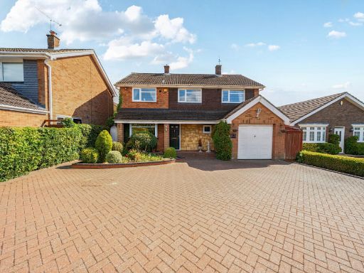 4 bedroom detached house for sale in Totternhoe Road, Dunstable, Bedfordshire, LU6 — £625,000 • 4 bed • 2 bath • 1500 ft²
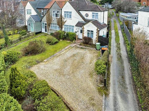 4 bedroom end of terrace house for sale in London Road, Dunstable, LU6 — £350,000 • 4 bed • 2 bath • 988 ft²
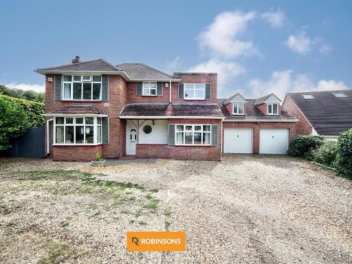 4 bedroom detached house for sale in Totternhoe Road, Dunstable, LU6 — £725,000 • 4 bed • 3 bath • 2040 ft²
 4 bedroom detached house for sale in Garrett Close, Dunstable, LU6 — £485,000 • 4 bed • 2 bath • 1227 ft²
Meta
- {
"@context": "https://schema.org",
"@type": "Residence",
"name": "4 bedroom detached house for sale in Lancot Avenue, Dunstab…",
"description": "",
"url": "https://propertypiper.co.uk/property/76fecca3-6fea-4894-890d-afa8291124fc",
"image": "https://image-a.propertypiper.co.uk/40e58dff-7545-4da7-b85b-c423ae434cc5-1024.jpeg",
"address": {
"@type": "PostalAddress",
"streetAddress": "15 LANCOT AVENUE DUNSTABLE",
"postalCode": "LU6 2AW",
"addressLocality": "Central Bedfordshire",
"addressRegion": "South West Bedfordshire",
"addressCountry": "England"
},
"geo": {
"@type": "GeoCoordinates",
"latitude": 51.8834410702411,
"longitude": -0.5409017930894365
},
"numberOfRooms": 4,
"numberOfBathroomsTotal": 2,
"floorSize": {
"@type": "QuantitativeValue",
"value": 1643,
"unitCode": "FTK"
},
"offers": {
"@type": "Offer",
"price": 700000,
"priceCurrency": "GBP",
"availability": "https://schema.org/InStock"
},
"additionalProperty": [
{
"@type": "PropertyValue",
"name": "Feature",
"value": "1930s"
},
{
"@type": "PropertyValue",
"name": "Feature",
"value": "detached"
},
{
"@type": "PropertyValue",
"name": "Feature",
"value": "solar panels"
},
{
"@type": "PropertyValue",
"name": "Feature",
"value": "bay windows"
},
{
"@type": "PropertyValue",
"name": "Feature",
"value": "gable roof"
},
{
"@type": "PropertyValue",
"name": "Feature",
"value": "brick exterior"
},
{
"@type": "PropertyValue",
"name": "Feature",
"value": "driveway"
},
{
"@type": "PropertyValue",
"name": "Feature",
"value": "front garden"
},
{
"@type": "PropertyValue",
"name": "Feature",
"value": "potential"
},
{
"@type": "PropertyValue",
"name": "Feature",
"value": "suburban"
},
{
"@type": "PropertyValue",
"name": "Feature",
"value": "contemporary"
},
{
"@type": "PropertyValue",
"name": "Feature",
"value": "living room"
},
{
"@type": "PropertyValue",
"name": "Feature",
"value": "bright"
},
{
"@type": "PropertyValue",
"name": "Feature",
"value": "bay window"
},
{
"@type": "PropertyValue",
"name": "Feature",
"value": "fireplace"
},
{
"@type": "PropertyValue",
"name": "Feature",
"value": "wood flooring"
},
{
"@type": "PropertyValue",
"name": "Feature",
"value": "red accent wall"
},
{
"@type": "PropertyValue",
"name": "Feature",
"value": "natural light"
},
{
"@type": "PropertyValue",
"name": "Feature",
"value": "modern"
}
]
}
High Res Floorplan Images
Compatible Floorplan Images
FloorplanImages Thumbnail