SS13 1RE - 1 bedroom flat for sale in Bartlow Side, Burnt Mills, SS13
View on Property Piper
1 bedroom flat for sale in Bartlow Side, Burnt Mills, SS13
Property Details
- Price: £190000
- Bedrooms: 1
- Bathrooms: 1
- Property Type: undefined
- Property SubType: undefined
Brochure Descriptions
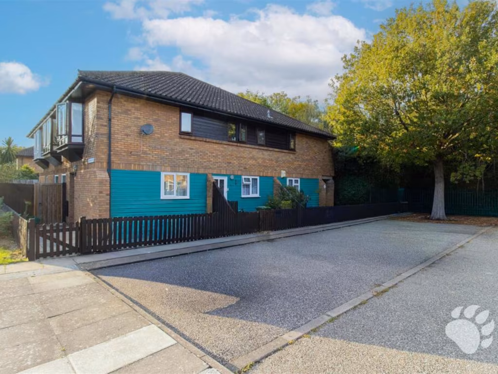
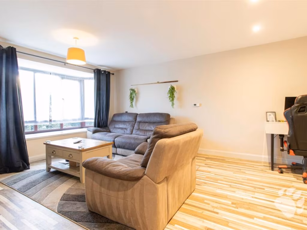
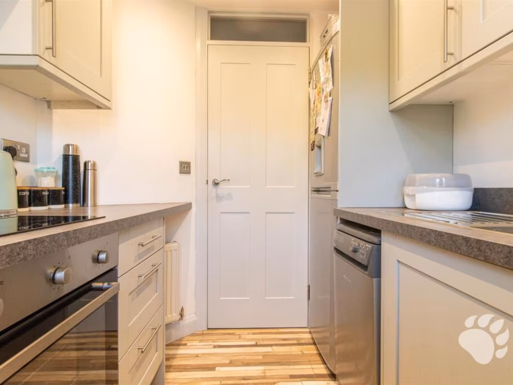
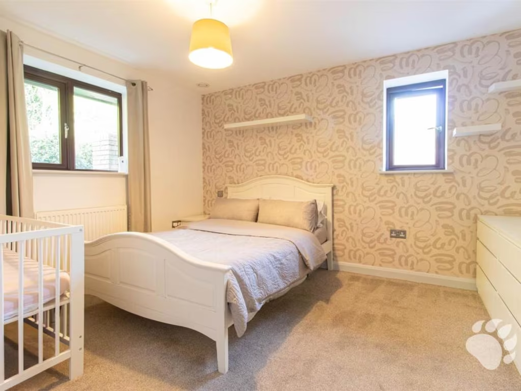
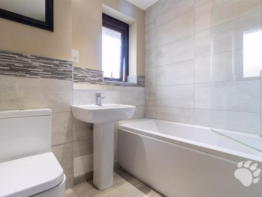
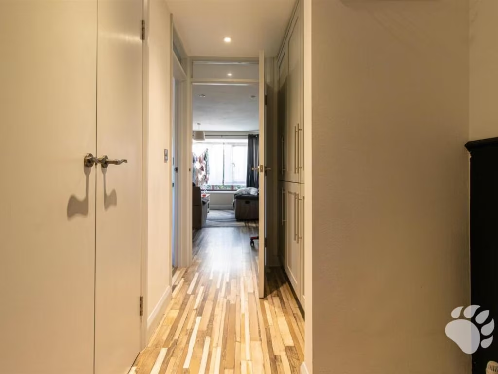
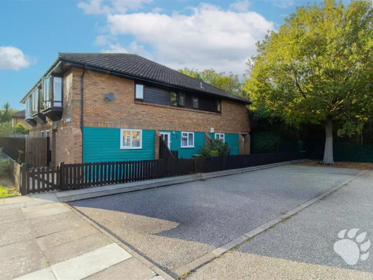
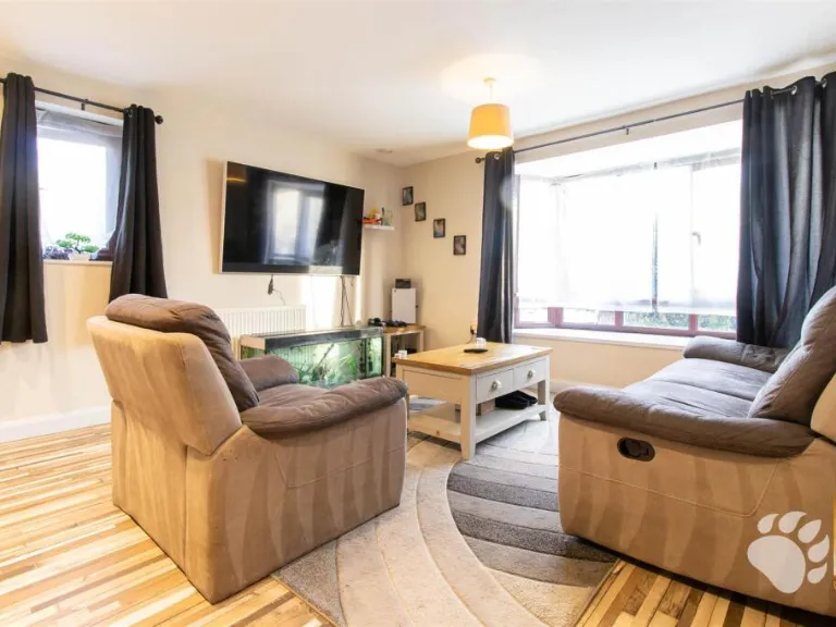
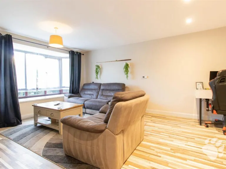
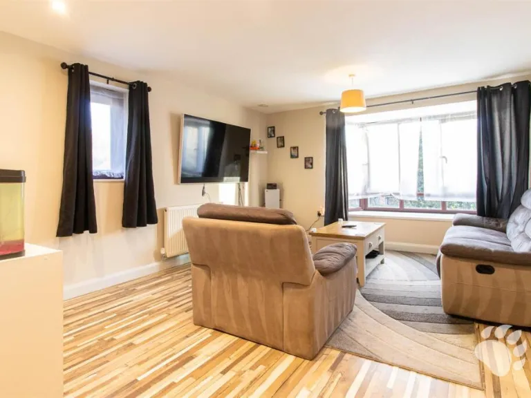
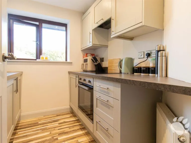
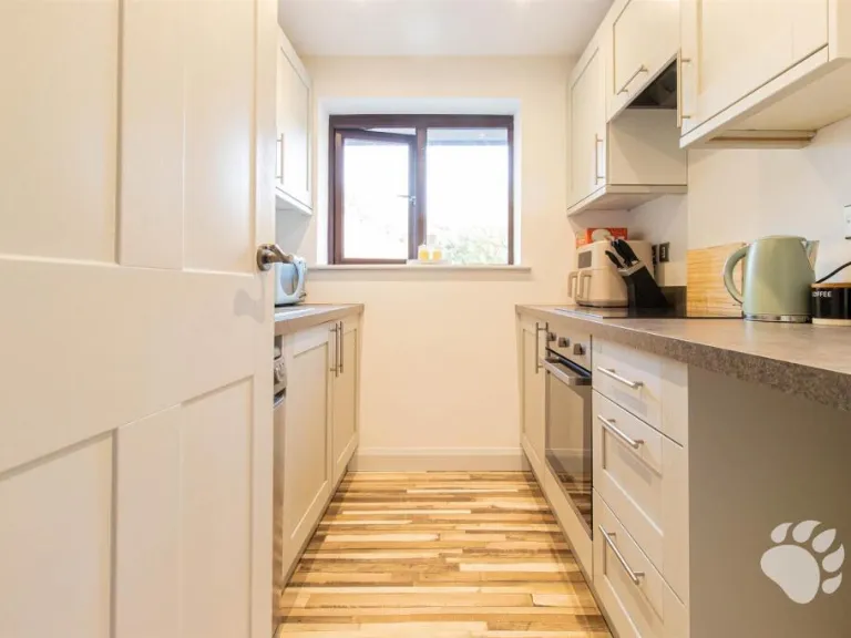
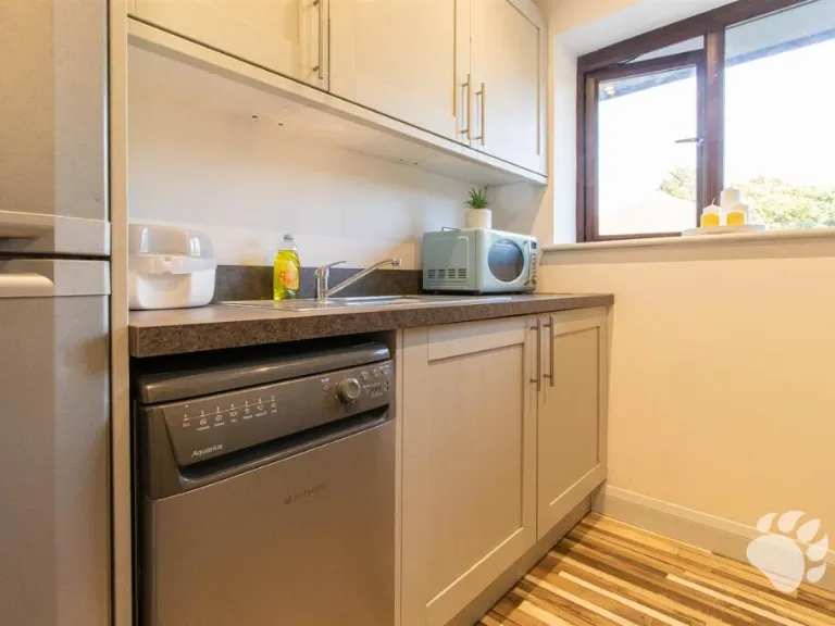
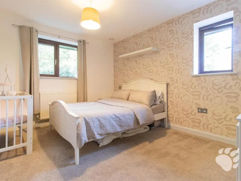
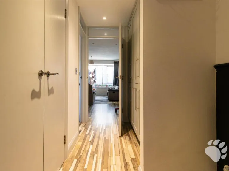
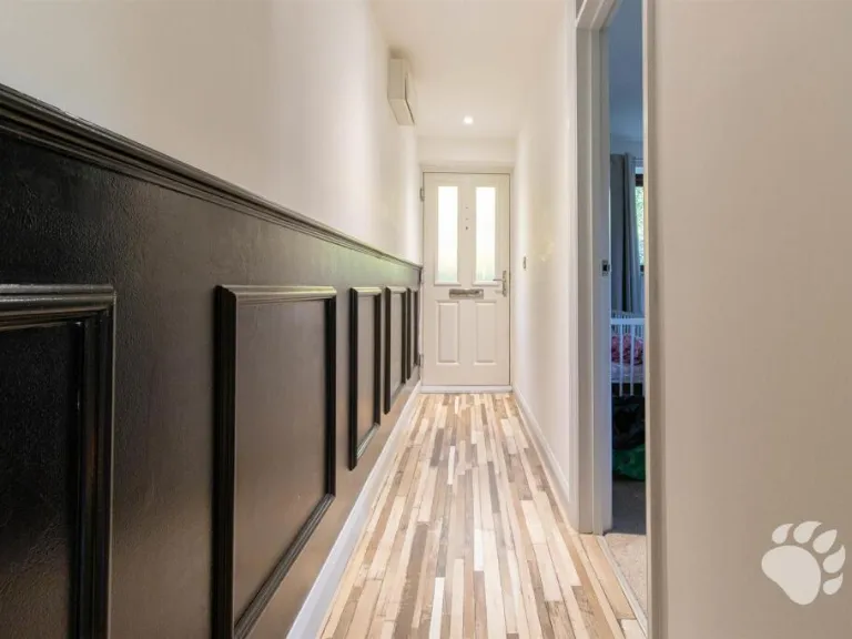
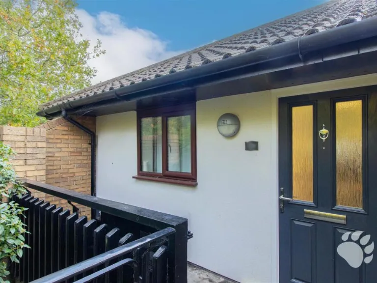
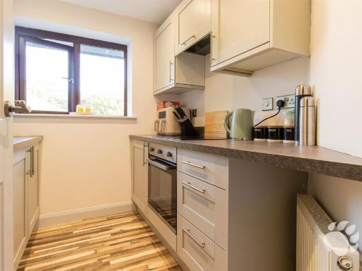
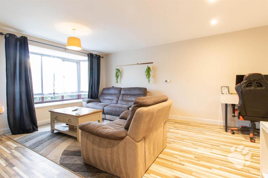
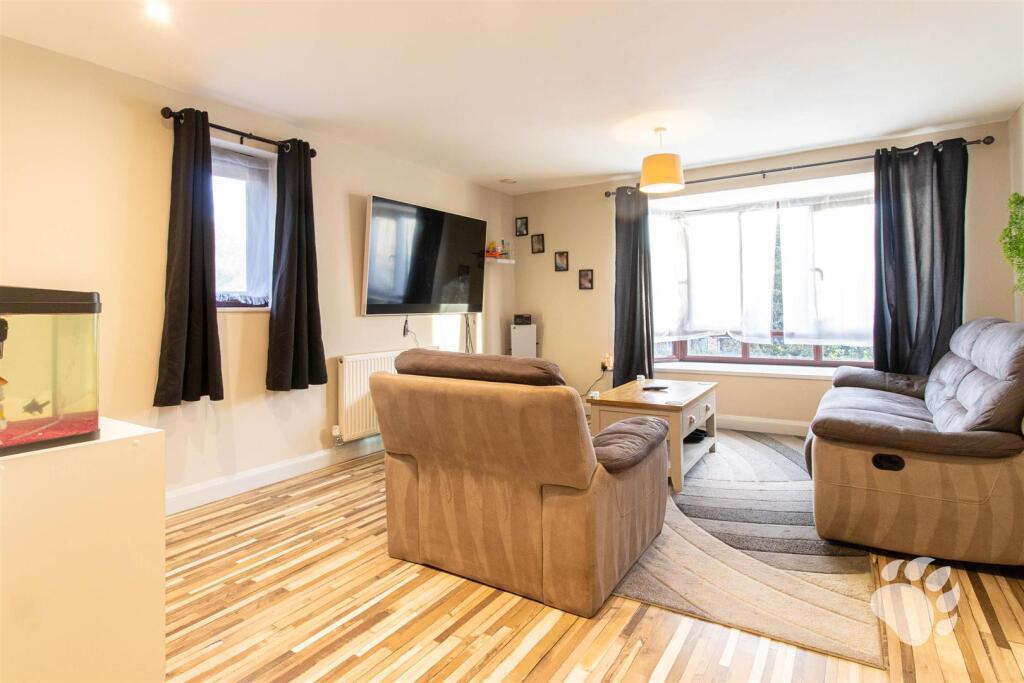
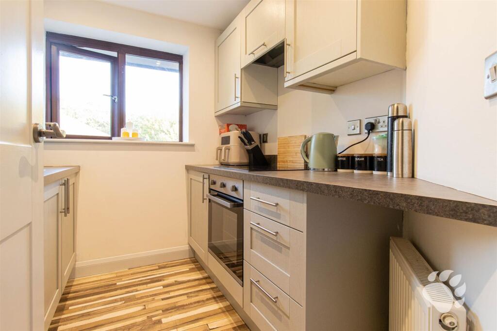
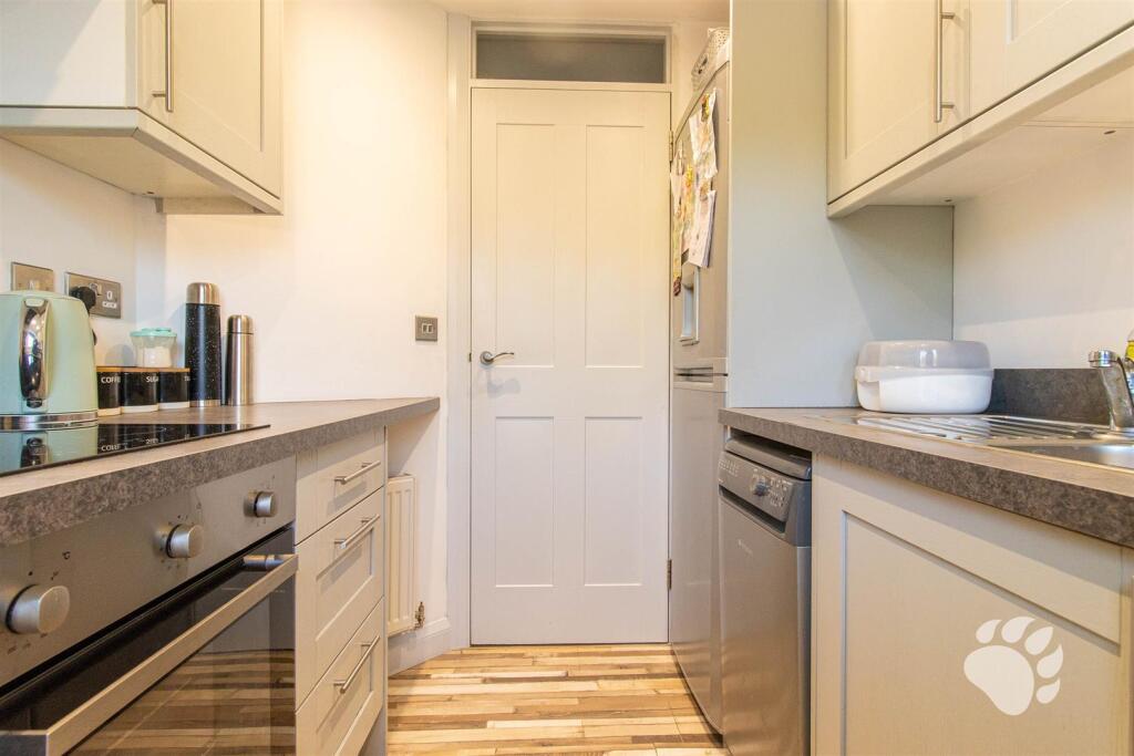
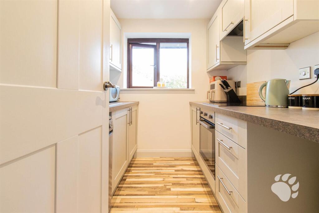
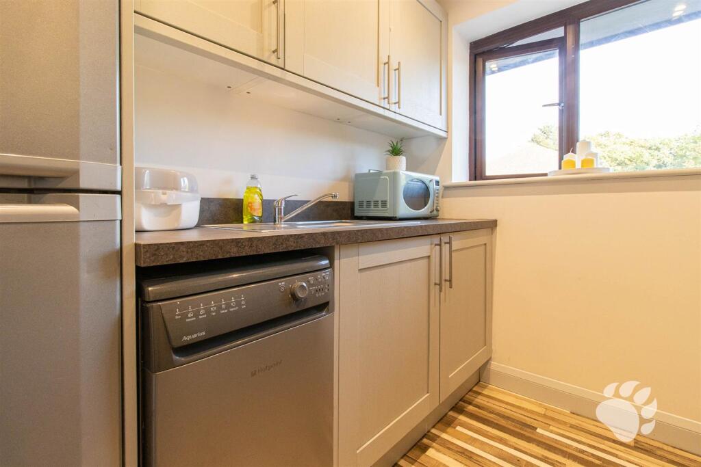
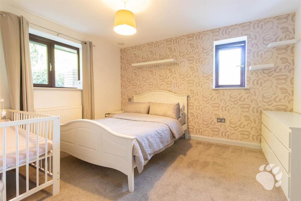
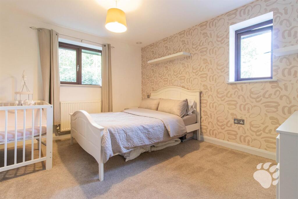
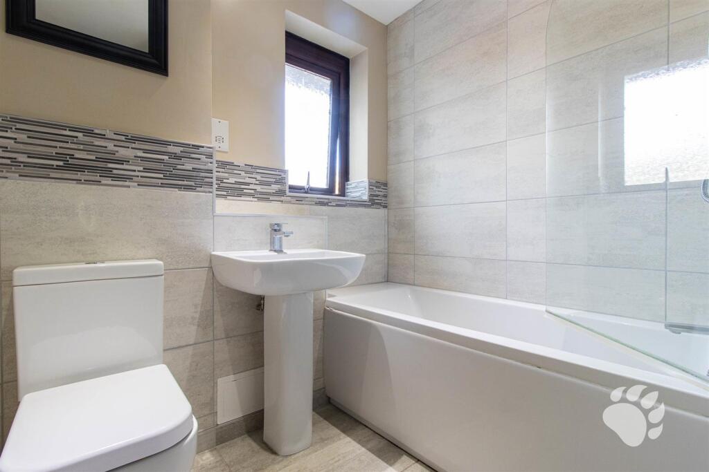
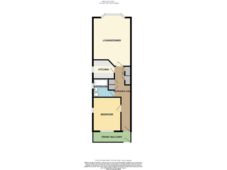
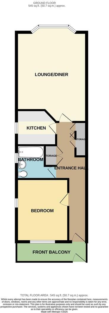
- First‑floor (top floor) one‑bedroom flat located on Bartlow Side, Basildon. Purpose‑built brick block with communal entrance and private front door at first‑floor level. The flat benefits from a front‑facing private balcony, an open lounge/diner (approx. 17'2" x 13'5" max), one double bedroom (approx. 12' x 9'11"), a compact kitchen (approx. 6'10" x 7'7"), and a three‑piece bathroom suite. Externally there is a small fenced forecourt/garden area to the front and a sizable communal parking area with mature trees. Overall the accommodation is compact — suitable for a single occupant or couple, offering good privacy for a block of flats and convenient access to local shops and transport links. Likely to appeal to first‑time buyers or buy‑to‑let investors due to modest footprint, communal parking provision and nearby rail links.
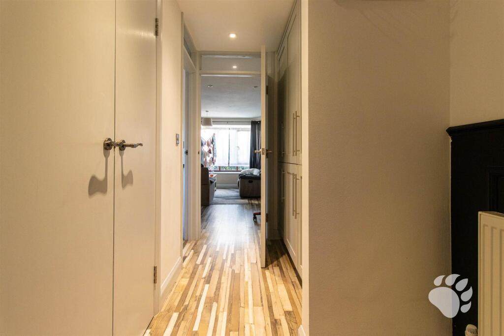
- One-bedroom apartment presented as a compact, single-level flat. Layout (from floor plan): entrance hall, one bedroom to the front with a small front balcony, a bathroom adjacent to the bedroom, a separate kitchen, and a long lounge/diner to the rear with a bay or angled window. No garden is shown; external amenity is a small front balcony. Rooms appear small-to-average in size overall and the property footprint is modest — suitable as a one-bedroom apartment or buy-to-let investment. Location map pinned in Basildon area. No furniture-dependent features included in the description.
Image Descriptions
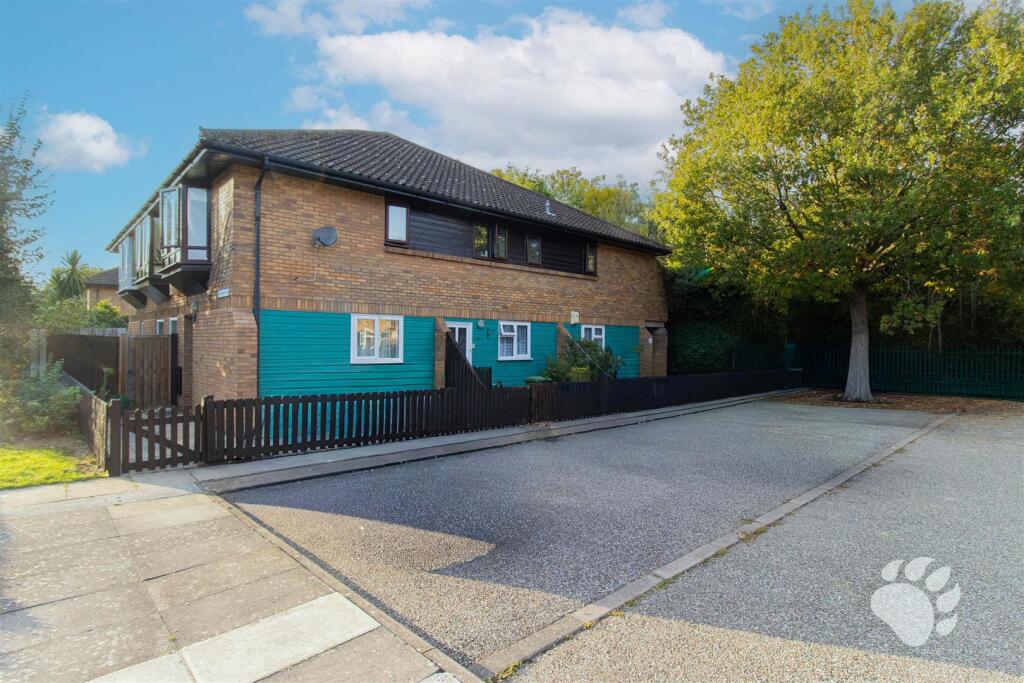
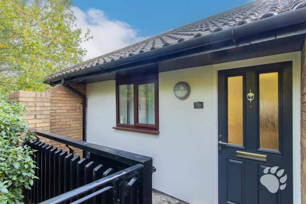
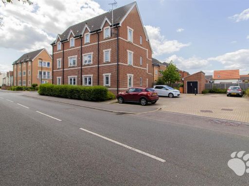
- semi-detached house contemporary
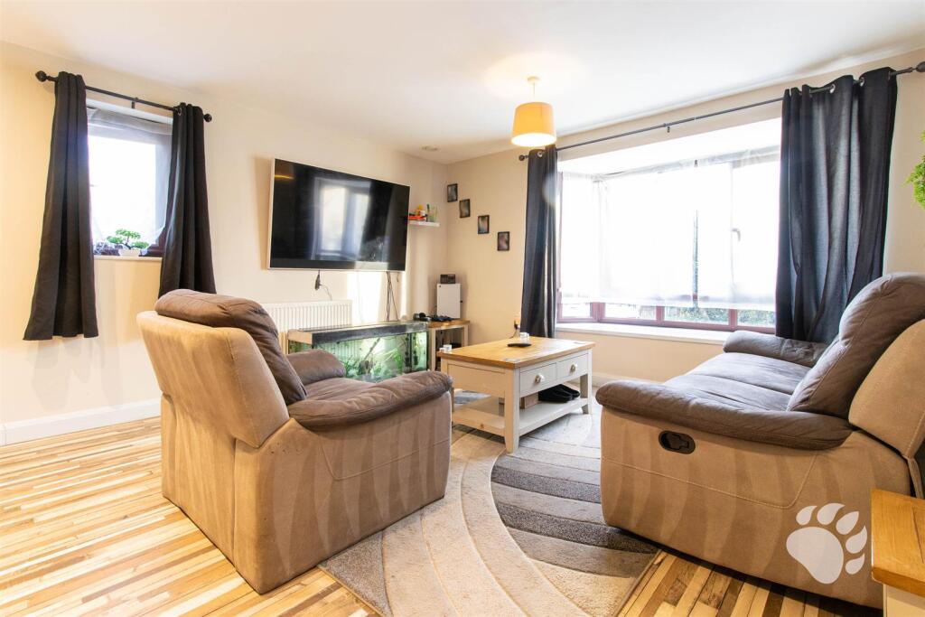
- living room contemporary
Rooms
- LOUNGE/DINER:
- KITCHEN:
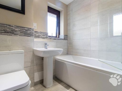
- BATHROOM:
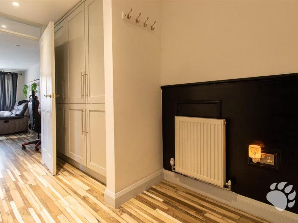
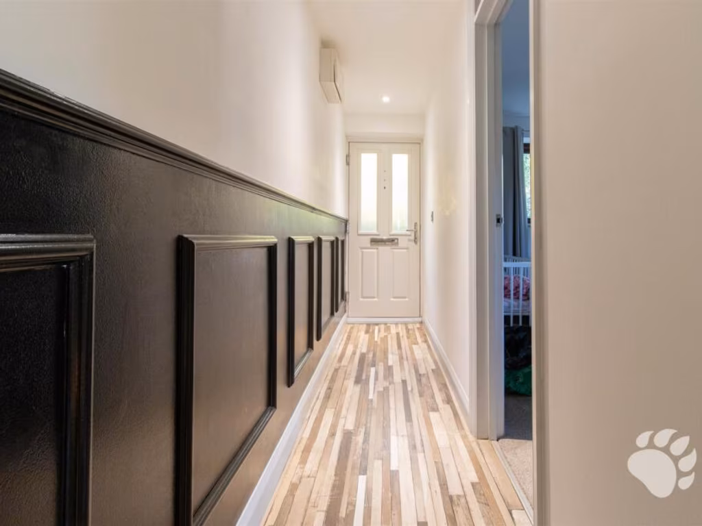
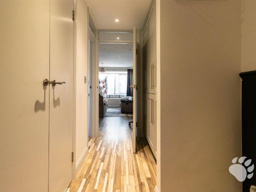
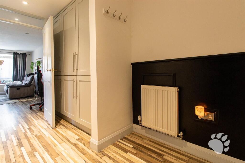
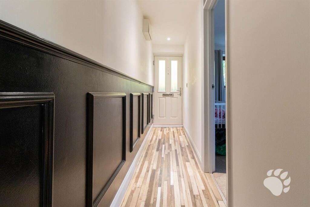
- ENTRANCE HALL:
- BEDROOM:
Textual Property Features
Detected Visual Features
- semi-detached
- contemporary
- two-story
- brickwork
- clean
- well-maintained
- residential
- off-street parking
- living room
- natural light
- large window
- medium room
- standard ceiling
EPC Details
- Fully double glazed
- Cavity wall, as built, insulated (assumed)
- Boiler and radiators, electric
- Low energy lighting in all fixed outlets
- (another dwelling below)
Nearby Schools
- St Margaret's Church of England Academy, Bowers Gifford
- The Bromfords School
- Greensted Primary School & Nursery
- Crays Hill Primary School
- Maple Grove Primary School
- The Basildon Upper Academy
- Northlands Primary School and Nursery
- Briscoe Primary School & Nursery Academy
- Abacus Primary School
- Oakfield Primary School
- Grange Primary School
- The Wickford Church of England School
- Fairhouse Community Primary School
- Felmore Primary School
- Bardfield Academy
- Cherry Tree Primary School
- The Basildon Lower Academy
- Whitmore Primary School and Nursery
- Eversley Primary School
- Montgomerie Primary School
- North Crescent Primary School
- Wickford Primary School
- Vange Primary School and Nursery
- Ryedene Primary and Nursery School
- St Teresa's Catholic Primary School, Basildon
- The Willows Primary School
- De La Salle School
Nearest General Shops
- Id: 10269658709
- Tags:
- Addr:
- City: Pitsea
- Postcode: SS13 3DU
- Street: Northlands Pavement
- Brand: The Range
- Brand:wikidata: Q7759409
- Fhrs:
- Name: The Range
- Shop: houseware
- TagsNormalized:
- Lat: 51.5667564
- Lon: 0.5052138
- FullGeoHash: u10m77ryhk4e
- PartitionGeoHash: u10m
- Images:
- FoodStandards:
- Id: 1257621
- FHRSID: 1257621
- LocalAuthorityBusinessID: 99442
- BusinessName: The Range Home and Leisure
- BusinessType: Retailers - other
- BusinessTypeID: 4613
- AddressLine1: The Range
- AddressLine2: Northlands Pavement
- AddressLine3: Pitsea
- AddressLine4: Basildon
- PostCode: SS13 3DU
- RatingValue: Exempt
- RatingKey: fhrs_exempt_en-GB
- RatingDate: 2021-05-07
- LocalAuthorityCode: 109
- LocalAuthorityName: Basildon
- LocalAuthorityWebSite: http://www.basildon.gov.uk
- LocalAuthorityEmailAddress: ehs@basildon.gov.uk
- Scores:
- Hygiene: null
- Structural: null
- ConfidenceInManagement: null
- NewRatingPending: false
- Geocode:
- Longitude: 0.50403900000000
- Latitude: 51.56632400000000
- Distance: 1465.5
,- Id: 512022913
- Tags:
- Brand:
- Name: Matalan
- Shop: clothes
- TagsNormalized:
- Lat: 51.59188
- Lon: 0.5030167
- FullGeoHash: u10me2n23pkr
- PartitionGeoHash: u10m
- Images:
- FoodStandards: null
- Distance: 1350.2
,- Id: 511085515
- Tags:
- Addr:
- City: Basildon
- Postcode: SS14 3JB
- Street: Cranes Close
- Alt_name: Ontime Service Garage
- Brand: DAF
- Contact:
- Phone: +44 1268 290680
- Website: http://dealers.daf.com/en-gb/dealers/gb/23068-harris-basildon
- Landuse: industrial
- Name: Harris - Basildon
- Service: repair;parts
- Shop: car_repair
- Source: gps;local knowledge
- Source:geometry: bing
- TagsNormalized:
- industrial
- car repair
- repair
- shop
- Lat: 51.5872859
- Lon: 0.4928077
- FullGeoHash: u10m7pnver04
- PartitionGeoHash: u10m
- Images:
- FoodStandards: null
- Distance: 1244.2
}
Nearest Grocery shops
- Id: 616723767
- Tags:
- Building: retail
- Shop: convenience
- TagsNormalized:
- Lat: 51.5683463
- Lon: 0.4910935
- FullGeoHash: u10m75tx7k3z
- PartitionGeoHash: u10m
- Images:
- FoodStandards: null
- Distance: 1663.8
,- Id: 2253720282
- Tags:
- Addr:
- City: Pitsea
- Country: GB
- Housenumber: 106
- Postcode: SS13 2AH
- Street: Rectory Road
- Fhrs:
- Name: Margarets Food & Wine
- Shop: convenience
- TagsNormalized:
- Lat: 51.5718649
- Lon: 0.5099483
- FullGeoHash: u10m7s77fsmj
- PartitionGeoHash: u10m
- Images:
- FoodStandards:
- Id: 96667
- FHRSID: 96667
- LocalAuthorityBusinessID: 296
- BusinessName: Margarets Food & Wine
- BusinessType: Retailers - other
- BusinessTypeID: 4613
- AddressLine1: null
- AddressLine2: 106 Rectory Road
- AddressLine3: Pitsea
- AddressLine4: Basildon
- PostCode: SS13 2AH
- RatingValue: 4
- RatingKey: fhrs_4_en-GB
- RatingDate: 2018-05-24
- LocalAuthorityCode: 109
- LocalAuthorityName: Basildon
- LocalAuthorityWebSite: http://www.basildon.gov.uk
- LocalAuthorityEmailAddress: ehs@basildon.gov.uk
- Scores:
- Hygiene: 5
- Structural: 0
- ConfidenceInManagement: 10
- NewRatingPending: false
- Geocode:
- Longitude: 0.50954000000000
- Latitude: 51.57186400000000
- Distance: 929
,- Id: 509315949
- Tags:
- Addr:
- City: Basildon
- Country: GB
- Housenumber: 132
- Brand: Costcutter
- Brand:wikidata: Q5175072
- Name: Costcutter
- Shop: convenience
- TagsNormalized:
- costcutter
- convenience
- shop
- Lat: 51.5728406
- Lon: 0.5100127
- FullGeoHash: u10m7se3s4m1
- PartitionGeoHash: u10m
- Images:
- FoodStandards: null
- Distance: 826.3
}
Nearest Supermarkets
- Id: 122670239
- Tags:
- Addr:
- City: Pitsea
- Country: GB
- Housename: Old Market Retail Park
- Postcode: SS13 3BB
- Street: High Road
- Alt_name: LIDL Pitsea
- Brand: Lidl
- Brand:wikidata: Q151954
- Brand:wikipedia: en:Lidl
- Building: yes
- Fhrs:
- Name: Lidl
- Shop: supermarket
- TagsNormalized:
- Lat: 51.564544
- Lon: 0.5074713
- FullGeoHash: u10m7e190zwn
- PartitionGeoHash: u10m
- Images:
- FoodStandards:
- Id: 133525
- FHRSID: 133525
- LocalAuthorityBusinessID: 6630
- BusinessName: LIDL
- BusinessType: Retailers - supermarkets/hypermarkets
- BusinessTypeID: 7840
- AddressLine1: Old Market Site
- AddressLine2: High Road
- AddressLine3: Pitsea
- AddressLine4: Essex.
- PostCode: SS13 3BB
- RatingValue: 5
- RatingKey: fhrs_5_en-GB
- RatingDate: 2017-03-16
- LocalAuthorityCode: 109
- LocalAuthorityName: Basildon
- LocalAuthorityWebSite: http://www.basildon.gov.uk
- LocalAuthorityEmailAddress: ehs@basildon.gov.uk
- Scores:
- Hygiene: 5
- Structural: 5
- ConfidenceInManagement: 5
- NewRatingPending: false
- Geocode:
- Longitude: 0.50735700000000
- Latitude: 51.56523700000000
- Distance: 1711.1
,- Id: 620161225
- Tags:
- Brand: ALDI
- Brand:wikidata: Q41171672
- Brand:wikipedia: en:Aldi
- Building: retail
- Contact:
- Website: https://stores.aldi.co.uk/pitsea/northlands-pavement
- Name: Aldi
- Shop: supermarket
- TagsNormalized:
- aldi
- retail
- supermarket
- shop
- Lat: 51.5656669
- Lon: 0.5040835
- FullGeoHash: u10m77ppccpb
- PartitionGeoHash: u10m
- Images:
- FoodStandards: null
- Distance: 1592.3
,- Id: 122542421
- Tags:
- Addr:
- Postcode: SS13 1SA
- Street: Cricketers Way
- Brand: Sainsbury's
- Brand:wikidata: Q152096
- Brand:wikipedia: en:Sainsbury's
- Building: yes
- Name: Sainsbury's
- Shop: supermarket
- TagsNormalized:
- sainsburys
- supermarket
- shop
- Lat: 51.5906605
- Lon: 0.5003169
- FullGeoHash: u10m7ru36hpm
- PartitionGeoHash: u10m
- Images:
- FoodStandards: null
- Distance: 1265.5
}
Nearest Religious buildings
- Id: 149040225
- Tags:
- Amenity: place_of_worship
- Building: church
- Denomination: anglican
- Name: Saint Gabriels
- Religion: christian
- Wikidata: Q105083702
- TagsNormalized:
- place of worship
- church
- anglican
- christian
- Lat: 51.5671003
- Lon: 0.5091551
- FullGeoHash: u10m7edb0hjx
- PartitionGeoHash: u10m
- Images:
- FoodStandards: null
- Distance: 1438.1
,- Id: 147497991
- Tags:
- Amenity: place_of_worship
- Building: yes
- Denomination: anglican
- Name: St Peters
- Religion: christian
- Wikidata: Q17557049
- TagsNormalized:
- place of worship
- anglican
- christian
- church
- Lat: 51.5891742
- Lon: 0.5022491
- FullGeoHash: u10m7rt8xr05
- PartitionGeoHash: u10m
- Images:
- FoodStandards: null
- Distance: 1067.8
,- Id: 614103054
- Tags:
- Amenity: place_of_worship
- Building: yes
- Name: Bread of Life Ministries Miracle Centre
- Religion: christian
- TagsNormalized:
- place of worship
- christian
- church
- Lat: 51.5817445
- Lon: 0.5171229
- FullGeoHash: u10m7y0t3y4g
- PartitionGeoHash: u10m
- Images:
- FoodStandards: null
- Distance: 771
}
Nearest Medical buildings
- Id: 616174844
- Tags:
- Amenity: dentist
- Building: yes
- Healthcare: dentist
- Name: Pitsea Dental Care / Purely Orthodontics
- TagsNormalized:
- dentist
- health
- healthcare
- dental
- orthodontics
- Lat: 51.5634502
- Lon: 0.4973683
- FullGeoHash: u10m76f4veb9
- PartitionGeoHash: u10m
- Images:
- FoodStandards: null
- Distance: 1933.5
,- Id: 6453141759
- Tags:
- Addr:
- City: Pitsea
- Housenumber: 8
- Postcode: SS13 3DU
- Street: Northlands Pavement
- Amenity: pharmacy
- Brand: Boots
- Brand:wikidata: Q6123139
- Brand:wikipedia: en:Boots UK
- Dispensing: yes
- Healthcare: pharmacy
- Name: Boots
- TagsNormalized:
- pharmacy
- boots
- health
- healthcare
- Lat: 51.566187
- Lon: 0.5043028
- FullGeoHash: u10m77r4z1gr
- PartitionGeoHash: u10m
- Images:
- FoodStandards: null
- Distance: 1533.3
,- Id: 616142312
- Tags:
- Amenity: doctors
- Building: yes
- Healthcare: doctor
- TagsNormalized:
- doctor
- doctors
- health
- healthcare
- Lat: 51.5676659
- Lon: 0.5052026
- FullGeoHash: u10m77xgkjdm
- PartitionGeoHash: u10m
- Images:
- FoodStandards: null
- Distance: 1364.6
,- Id: 611793086
- Tags:
- Amenity: doctors
- Building: yes
- Healthcare: doctor
- TagsNormalized:
- doctor
- doctors
- health
- healthcare
- Lat: 51.5768782
- Lon: 0.5105464
- FullGeoHash: u10m7t7c0dfy
- PartitionGeoHash: u10m
- Images:
- FoodStandards: null
- Distance: 444.8
}
Nearest Airports
- Id: 121158889
- Tags:
- Aerodrome: continental
- Aeroway: aerodrome
- Fhrs:
- Authority: City of London Corporation
- Iata: LCY
- Icao: EGLC
- Name: London City Airport
- Operator: London City Airport Limited
- Ref: LCY
- Website: https://www.londoncityairport.com/
- Wikidata: Q8982
- Wikipedia: en:London City Airport
- TagsNormalized:
- airport
- continental airport
- Lat: 51.5042658
- Lon: 0.0539987
- FullGeoHash: u10j10p64702
- PartitionGeoHash: u10j
- Images:
- FoodStandards: null
- Distance: 32394.8
,- Id: 103894219
- Tags:
- Aerodrome: international
- Aeroway: aerodrome
- Iata: SEN
- Icao: EGMC
- Name: London Southend Airport
- Old_name: Southend Municipal Airport
- Ref: SEN
- Wikidata: Q1415441
- TagsNormalized:
- airport
- international airport
- Lat: 51.5701749
- Lon: 0.6924624
- FullGeoHash: u10mru04p937
- PartitionGeoHash: u10m
- Images:
- FoodStandards: null
- Distance: 12906.5
}
Nearest Leisure Facilities
- Id: 614103582
- Tags:
- TagsNormalized:
- Lat: 51.5762572
- Lon: 0.5066311
- FullGeoHash: u10m7t0vmr5w
- PartitionGeoHash: u10m
- Images:
- FoodStandards: null
- Distance: 407.3
,- Id: 611191822
- Tags:
- TagsNormalized:
- Lat: 51.5771836
- Lon: 0.5030203
- FullGeoHash: u10m7mq6c5zh
- PartitionGeoHash: u10m
- Images:
- FoodStandards: null
- Distance: 381.5
,- Id: 611635862
- Tags:
- Leisure: pitch
- Sport: soccer
- TagsNormalized:
- Lat: 51.5770281
- Lon: 0.5074255
- FullGeoHash: u10m7t33zygu
- PartitionGeoHash: u10m
- Images:
- FoodStandards: null
- Distance: 329.5
,- Id: 611161170
- Tags:
- TagsNormalized:
- Lat: 51.5771576
- Lon: 0.5072747
- FullGeoHash: u10m7t36sr53
- PartitionGeoHash: u10m
- Images:
- FoodStandards: null
- Distance: 313.2
,- Id: 615936856
- Tags:
- TagsNormalized:
- Lat: 51.5790051
- Lon: 0.5036023
- FullGeoHash: u10m7mwtqz3n
- PartitionGeoHash: u10m
- Images:
- FoodStandards: null
- Distance: 215.8
}
Nearest Tourist attractions
- Id: 122458146
- Tags:
- Addr:
- Country: GB
- Postcode: SS17 9NR
- Street: High Road
- Building: yes
- Fhrs:
- Name: The Haywain
- Tourism: motel
- TagsNormalized:
- Lat: 51.550828
- Lon: 0.4667812
- FullGeoHash: u10m68eckfc7
- PartitionGeoHash: u10m
- Images:
- FoodStandards:
- Id: 104867
- FHRSID: 104867
- LocalAuthorityBusinessID: 3588
- BusinessName: The Haywain
- BusinessType: Hotel/bed & breakfast/guest house
- BusinessTypeID: 7842
- AddressLine1: null
- AddressLine2: High Road
- AddressLine3: Fobbing, Stanford-Le-Hope
- AddressLine4: Essex
- PostCode: SS17 9NR
- RatingValue: 5
- RatingKey: fhrs_5_en-GB
- RatingDate: 2021-07-29
- LocalAuthorityCode: 109
- LocalAuthorityName: Basildon
- LocalAuthorityWebSite: http://www.basildon.gov.uk
- LocalAuthorityEmailAddress: ehs@basildon.gov.uk
- Scores:
- Hygiene: 0
- Structural: 5
- ConfidenceInManagement: 0
- NewRatingPending: false
- Geocode:
- Longitude: 0.46649900000000
- Latitude: 51.55071600000000
- Distance: 4236.2
,- Id: 138226831
- Tags:
- Building: yes
- Name: Motorboat Museum
- Tourism: museum
- TagsNormalized:
- Lat: 51.551163
- Lon: 0.5060319
- FullGeoHash: u10m7887r3k9
- PartitionGeoHash: u10m
- Images:
- FoodStandards: null
- Distance: 3197.3
,- Id: 5670992121
- Tags:
- Name: 239 Rectory Road
- Tourism: hostel
- TagsNormalized:
- Lat: 51.5782656
- Lon: 0.5110134
- FullGeoHash: u10m7ts15mx4
- PartitionGeoHash: u10m
- Images:
- FoodStandards: null
- Distance: 370.3
}
Nearest Train stations
- Id: 6733268329
- Tags:
- Name: Laindon
- Naptan:
- Network: National Rail
- Public_transport: station
- Railway: station
- Ref:
- Source: NPE
- Wheelchair: yes
- Wikidata: Q2801845
- Wikipedia: en:Laindon railway station
- TagsNormalized:
- Lat: 51.5675954
- Lon: 0.4237157
- FullGeoHash: u10m3ese1292
- PartitionGeoHash: u10m
- Images:
- FoodStandards: null
- Distance: 5873.4
,- Id: 6733461087
- Tags:
- Name: Benfleet
- Name:lt: Benflitas
- Naptan:
- Network: National Rail
- Public_transport: station
- Railway: station
- Ref:
- Source: NPE
- Wikidata: Q2561112
- Wikipedia: en:Benfleet railway station
- TagsNormalized:
- Lat: 51.5441005
- Lon: 0.5616239
- FullGeoHash: u10mhz2fnuc0
- PartitionGeoHash: u10m
- Images:
- FoodStandards: null
- Distance: 5518.6
,- Id: 2940653375
- Tags:
- Name: Wickford
- Naptan:
- Network: National Rail
- Public_transport: station
- Railway: station
- Ref:
- Source: NPE
- Wikidata: Q1857839
- Wikipedia: en:Wickford railway station
- TagsNormalized:
- Lat: 51.6148039
- Lon: 0.519396
- FullGeoHash: u10meu4nnbcd
- PartitionGeoHash: u10m
- Images:
- FoodStandards: null
- Distance: 3982.4
,- Id: 2008917061
- Tags:
- Name: Basildon
- Name:lt: Bazildonas
- Naptan:
- Network: National Rail
- Public_transport: station
- Railway: station
- Ref:
- Wheelchair: yes
- Wikidata: Q2752701
- Wikipedia: en:Basildon railway station
- TagsNormalized:
- Lat: 51.5681417
- Lon: 0.4567961
- FullGeoHash: u10m67swhn7g
- PartitionGeoHash: u10m
- Images:
- FoodStandards: null
- Distance: 3666.9
,- Id: 6733461096
- Tags:
- Name: Pitsea
- Naptan:
- Network: National Rail
- Operator: c2c
- Platforms: 4
- Public_transport: station
- Railway: station
- Ref:
- Source: NPE
- Wikidata: Q2982936
- Wikipedia: en:Pitsea railway station
- TagsNormalized:
- Lat: 51.5602396
- Lon: 0.5079761
- FullGeoHash: u10m7d3bhtq3
- PartitionGeoHash: u10m
- Images:
- FoodStandards: null
- Distance: 2190.8
}
Nearest Hotels
- Id: 122529130
- Tags:
- Addr:
- City: Basildon
- Postcode: SS14 3DG
- Street: Cranes Farm Road
- Brand: Holiday Inn
- Brand:wikidata: Q2717882
- Brand:wikipedia: en:Holiday Inn
- Building: yes
- Internet_access: yes
- Internet_access:fee: customers
- Name: Holiday Inn
- Phone: +44 371 942 9003
- Tourism: hotel
- Website: https://www.ihg.com/holidayinn/hotels/gb/en/reservation
- Wheelchair: yes
- TagsNormalized:
- Lat: 51.5836089
- Lon: 0.4607461
- FullGeoHash: u10m6qx821th
- PartitionGeoHash: u10m
- Images:
- FoodStandards: null
- Distance: 3178.3
,- Id: 122524117
- Tags:
- Addr:
- City: Basildon
- Country: GB
- Postcode: SS14 3TJ
- Street: Festival Way
- Brand: Travelodge
- Brand:wikidata: Q9361374
- Brand:wikipedia: en:Travelodge UK
- Building: yes
- Fhrs:
- Internet_access: wlan
- Internet_access:fee: customers
- Internet_access:ssid: Travelodge WiFi
- Name: Travelodge
- Phone: +44 871 984 6008
- Tourism: hotel
- Website: https://www.travelodge.co.uk/
- TagsNormalized:
- Lat: 51.5851876
- Lon: 0.4646022
- FullGeoHash: u10m6wf36pbw
- PartitionGeoHash: u10m
- Images:
- FoodStandards: null
- Distance: 2944.1
,- Id: 512042262
- Tags:
- Addr:
- City: Basildon
- Postcode: SS13 1BW
- Street: East Mayne
- Brand: Premier Inn
- Brand:wikidata: Q2108626
- Brand:wikipedia: en:Premier Inn
- Internet_access: wlan
- Internet_access:fee: customers
- Internet_access:operator: Virgin Media
- Internet_access:ssid: Premier Inn Free Wi-Fi
- Name: Premier Inn
- Tourism: hotel
- TagsNormalized:
- Lat: 51.5803328
- Lon: 0.4968233
- FullGeoHash: u10m7mcv0yfq
- PartitionGeoHash: u10m
- Images:
- FoodStandards: null
- Distance: 660.5
}
Tags
- semi-detached
- contemporary
- two-story
- brickwork
- clean
- well-maintained
- residential
- off-street parking
- contemporary
- living room
- natural light
- large window
- medium room
- standard ceiling
Local Market Stats
- Average Price/sqft: £326
- Avg Income: £40000
- Rental Yield: 4.9%
- Social Housing: 23%
- Planning Success Rate: 69%
Similar Properties
 1 bedroom flat for sale in Britten Avenue, Basildon, SS14 — £190,000 • 1 bed • 1 bath • 591 ft²
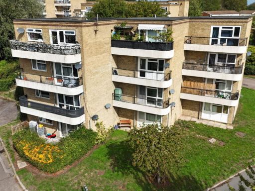 1 bedroom flat for sale in Ryedene Place, Basildon, SS16 4TF, SS16 — £115,000 • 1 bed • 1 bath • 388 ft²
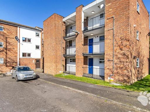 1 bedroom flat for sale in Appleford Court, Pitsea, SS13 — £125,000 • 1 bed • 1 bath • 345 ft²
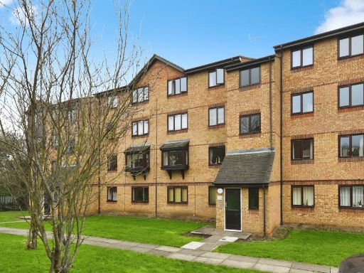 1 bedroom flat for sale in Waterville Drive, Vange, Basildon, Essex, SS16 — £160,000 • 1 bed • 1 bath • 454 ft²
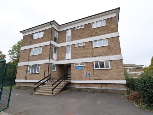 1 bedroom apartment for sale in Swanstead, Basildon, Essex, SS16 — £115,000 • 1 bed • 1 bath
 2 bedroom flat for sale in Timberlog Place, Basildon, SS16 — £200,000 • 2 bed • 2 bath • 549 ft²
Meta
- {
"@context": "https://schema.org",
"@type": "Residence",
"name": "1 bedroom flat for sale in Bartlow Side, Burnt Mills, SS13",
"description": "",
"url": "https://propertypiper.co.uk/property/76537d9b-d2b9-47bd-9591-8f1494096b15",
"image": "https://image-a.propertypiper.co.uk/87ea07f4-5ed2-424a-ac59-cc6706544dbf-1024.jpeg",
"address": {
"@type": "PostalAddress",
"streetAddress": "33 BARTLOW SIDE BASILDON",
"postalCode": "SS13 1RE",
"addressLocality": "Basildon",
"addressRegion": "South Basildon and East Thurrock",
"addressCountry": "England"
},
"geo": {
"@type": "GeoCoordinates",
"latitude": 51.579916547438614,
"longitude": 0.5063589260345829
},
"numberOfRooms": 1,
"numberOfBathroomsTotal": 1,
"floorSize": {
"@type": "QuantitativeValue",
"value": 545,
"unitCode": "FTK"
},
"offers": {
"@type": "Offer",
"price": 190000,
"priceCurrency": "GBP",
"availability": "https://schema.org/InStock"
},
"additionalProperty": [
{
"@type": "PropertyValue",
"name": "Feature",
"value": "semi-detached"
},
{
"@type": "PropertyValue",
"name": "Feature",
"value": "contemporary"
},
{
"@type": "PropertyValue",
"name": "Feature",
"value": "two-story"
},
{
"@type": "PropertyValue",
"name": "Feature",
"value": "brickwork"
},
{
"@type": "PropertyValue",
"name": "Feature",
"value": "clean"
},
{
"@type": "PropertyValue",
"name": "Feature",
"value": "well-maintained"
},
{
"@type": "PropertyValue",
"name": "Feature",
"value": "residential"
},
{
"@type": "PropertyValue",
"name": "Feature",
"value": "off-street parking"
},
{
"@type": "PropertyValue",
"name": "Feature",
"value": "contemporary"
},
{
"@type": "PropertyValue",
"name": "Feature",
"value": "living room"
},
{
"@type": "PropertyValue",
"name": "Feature",
"value": "natural light"
},
{
"@type": "PropertyValue",
"name": "Feature",
"value": "large window"
},
{
"@type": "PropertyValue",
"name": "Feature",
"value": "medium room"
},
{
"@type": "PropertyValue",
"name": "Feature",
"value": "standard ceiling"
}
]
}
High Res Floorplan Images
Compatible Floorplan Images
FloorplanImages Thumbnail