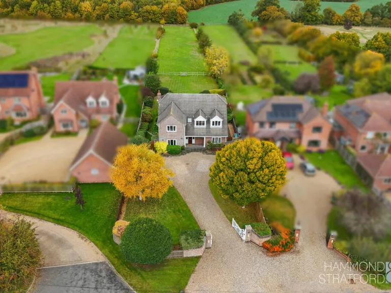
NR16 1AT - 5 bedroom detached house for sale in Wymondham Road, Wrenin…
View on Property Piper
5 bedroom detached house for sale in Wymondham Road, Wreningham, NR16
Property Details
- Price: £875000
- Bedrooms: 5
- Bathrooms: 3
- Property Type: undefined
- Property SubType: undefined
Image Descriptions
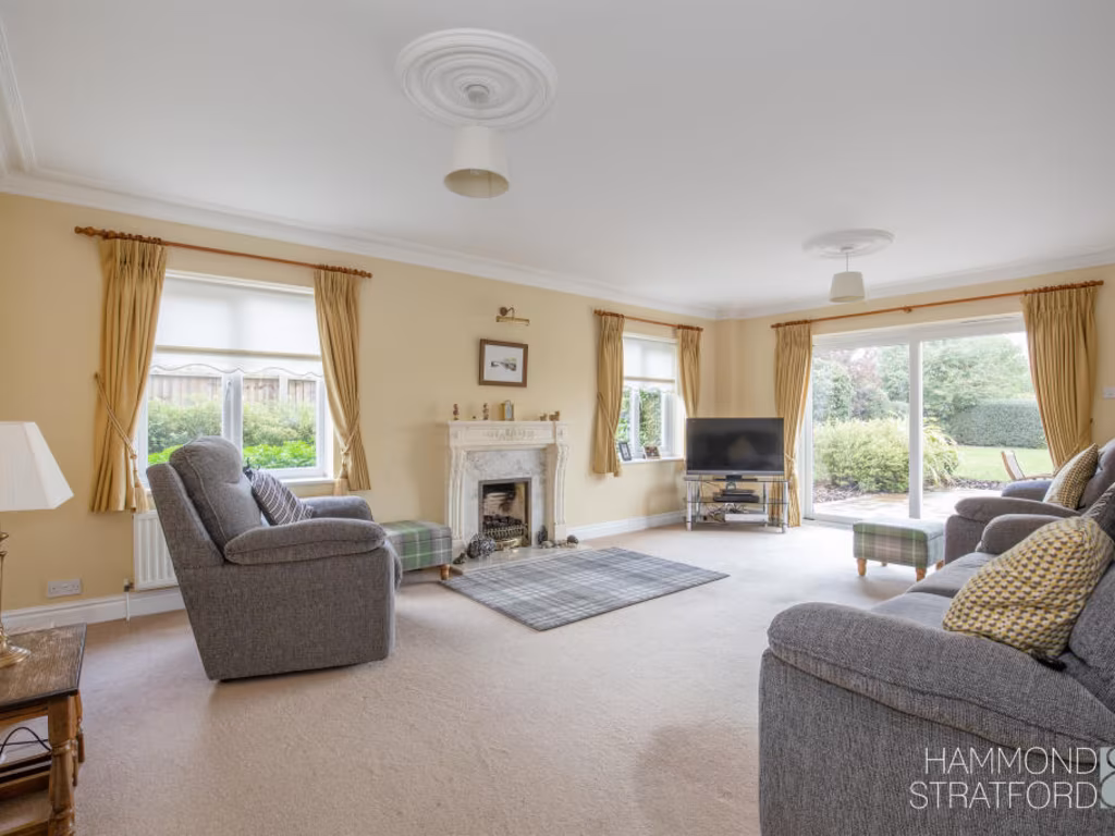
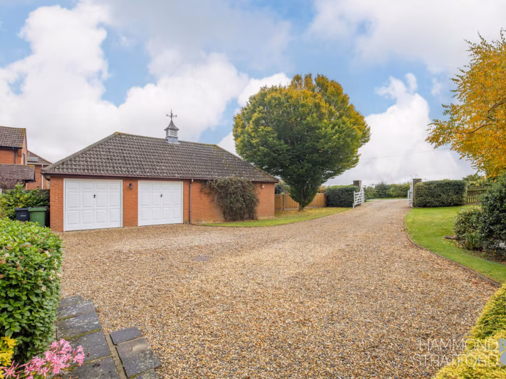
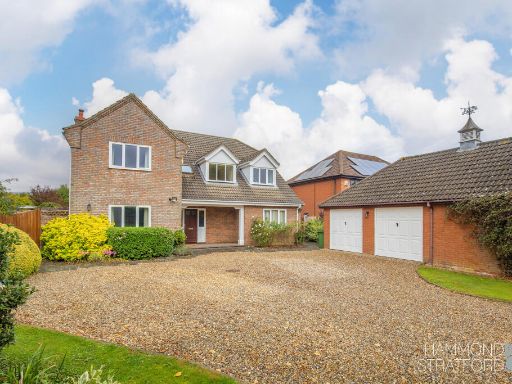
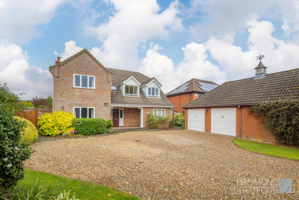
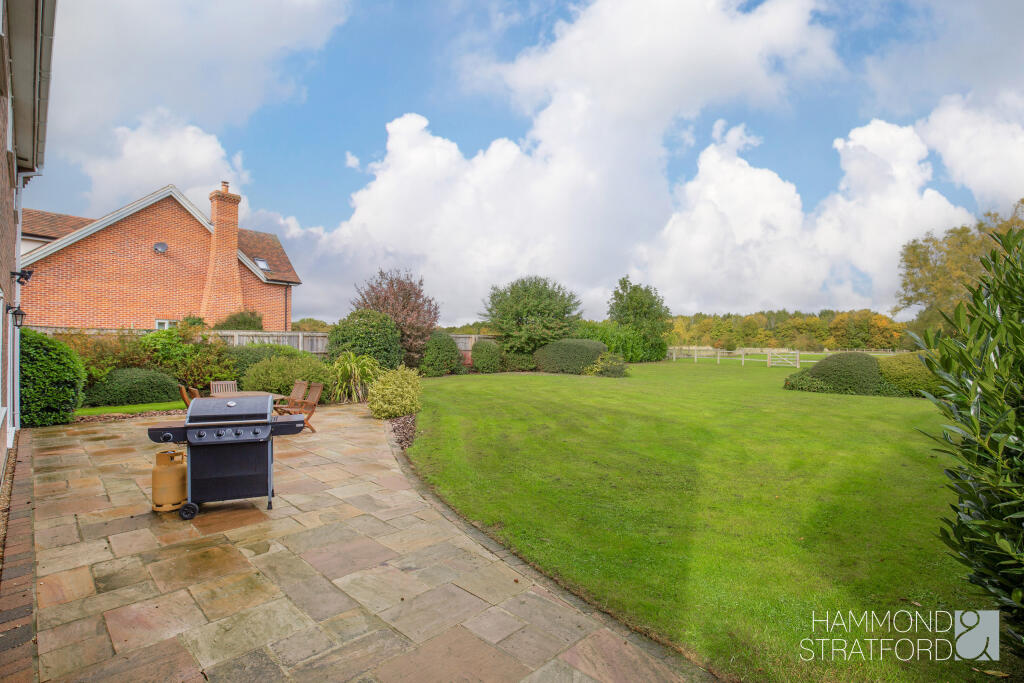
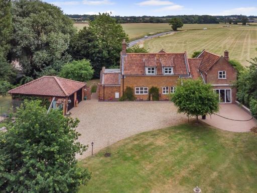
- detached house modern family
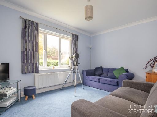
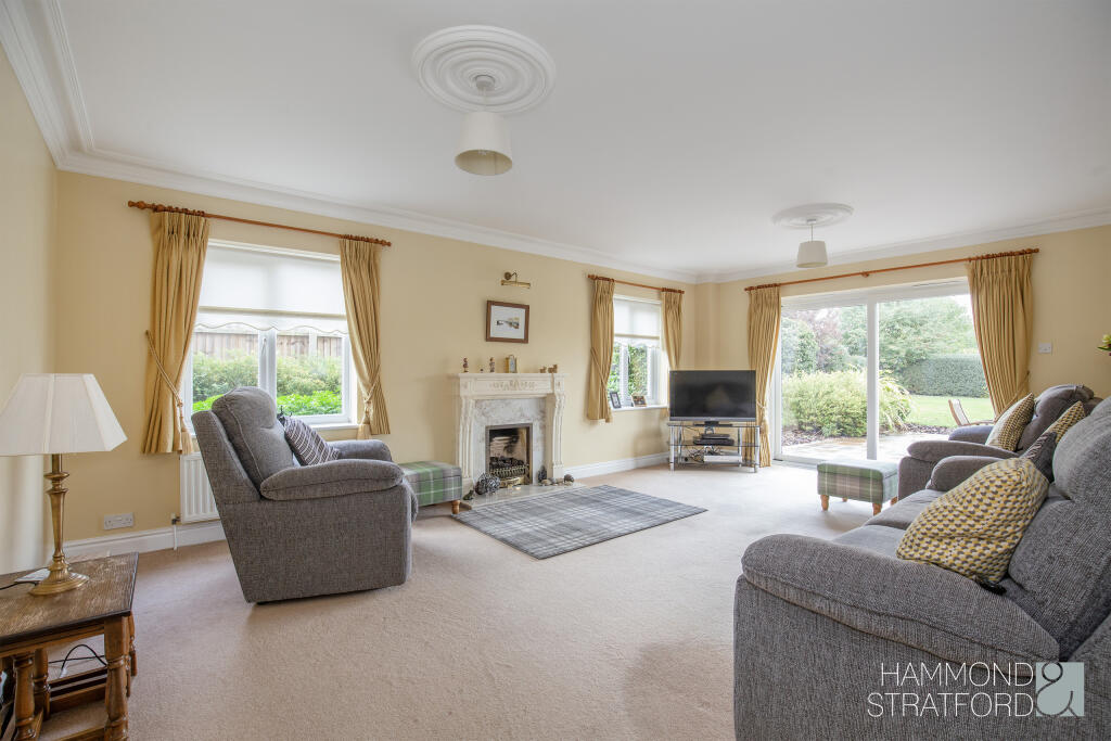
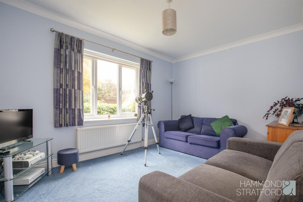
- living room modern
Floorplan Description
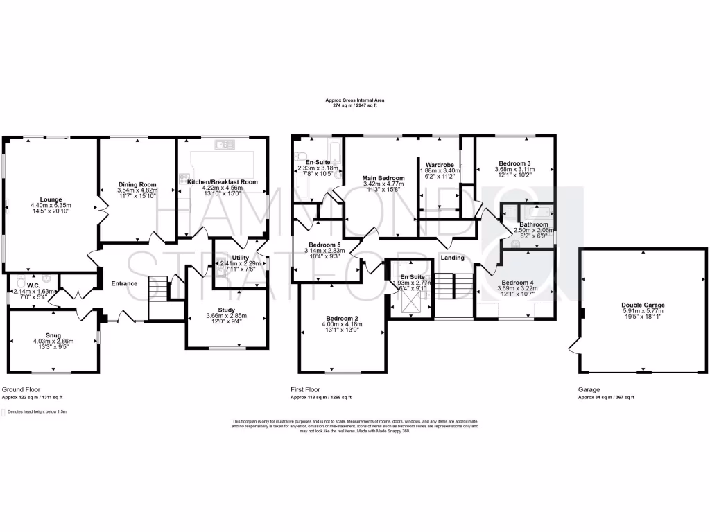
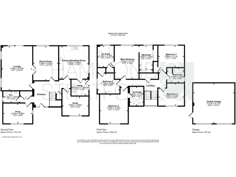
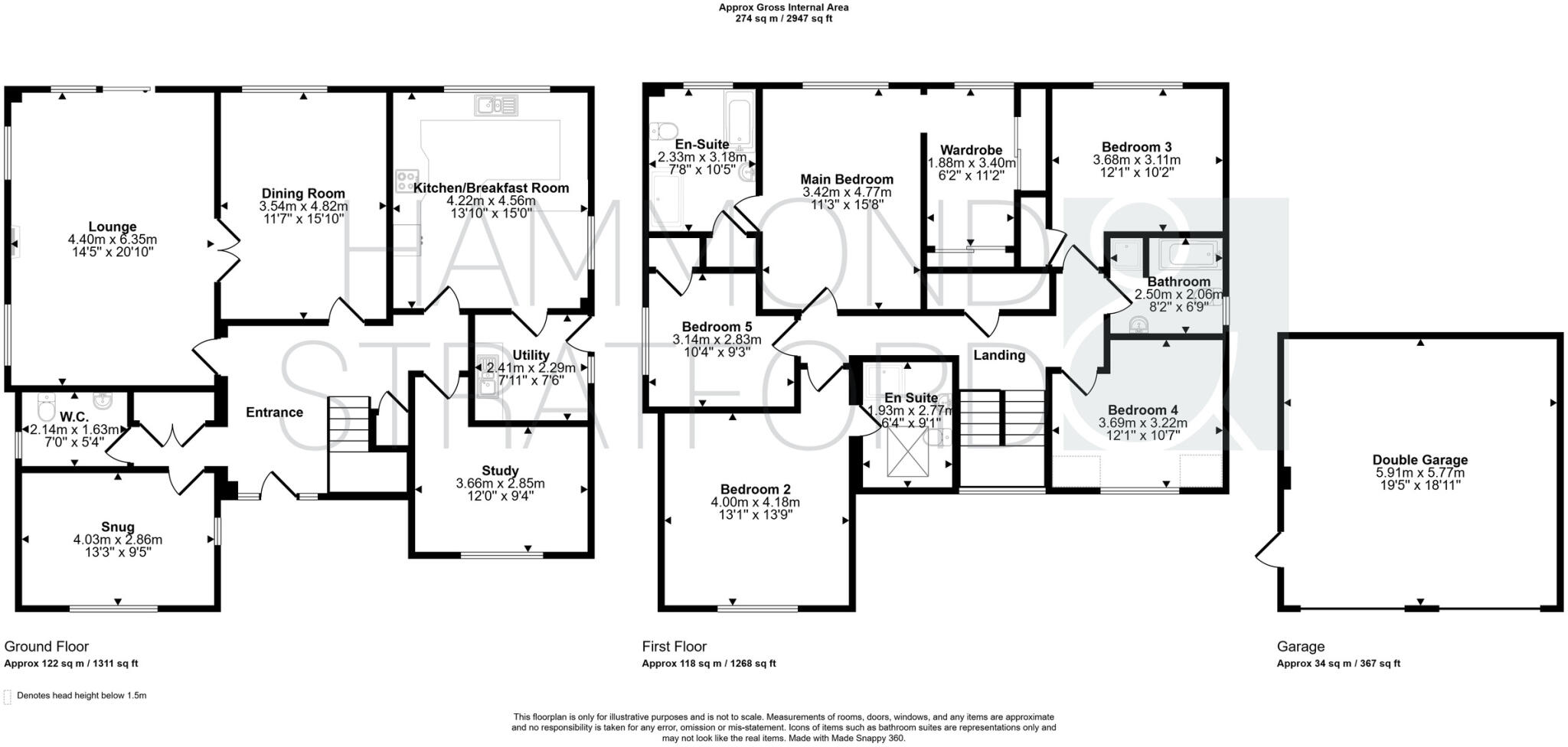
- Two-storey house with detached double garage
Rooms
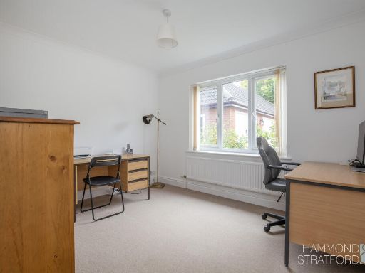
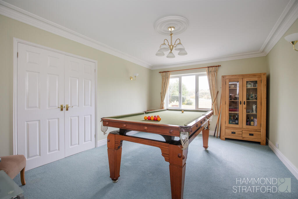
- Lounge:
- Dining Room:
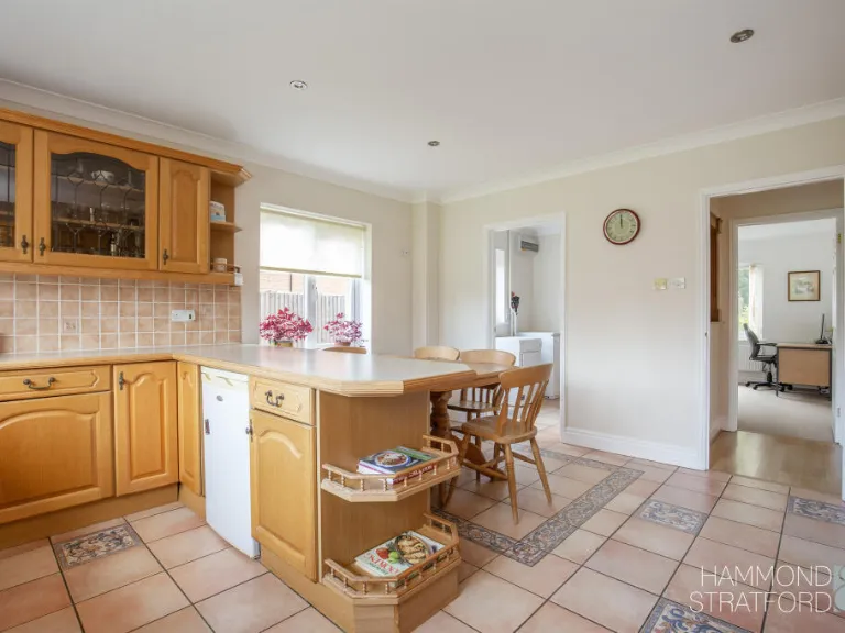
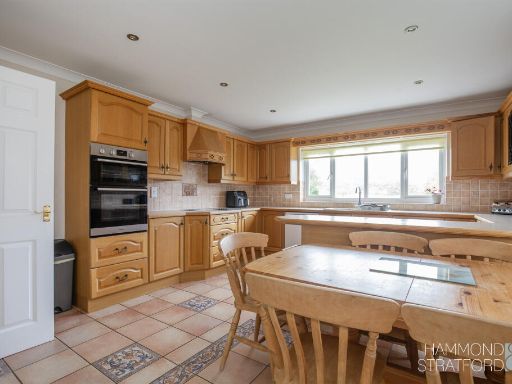
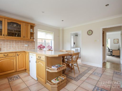
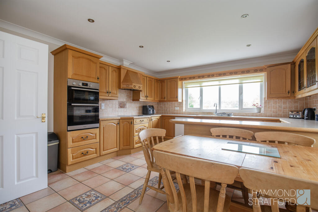
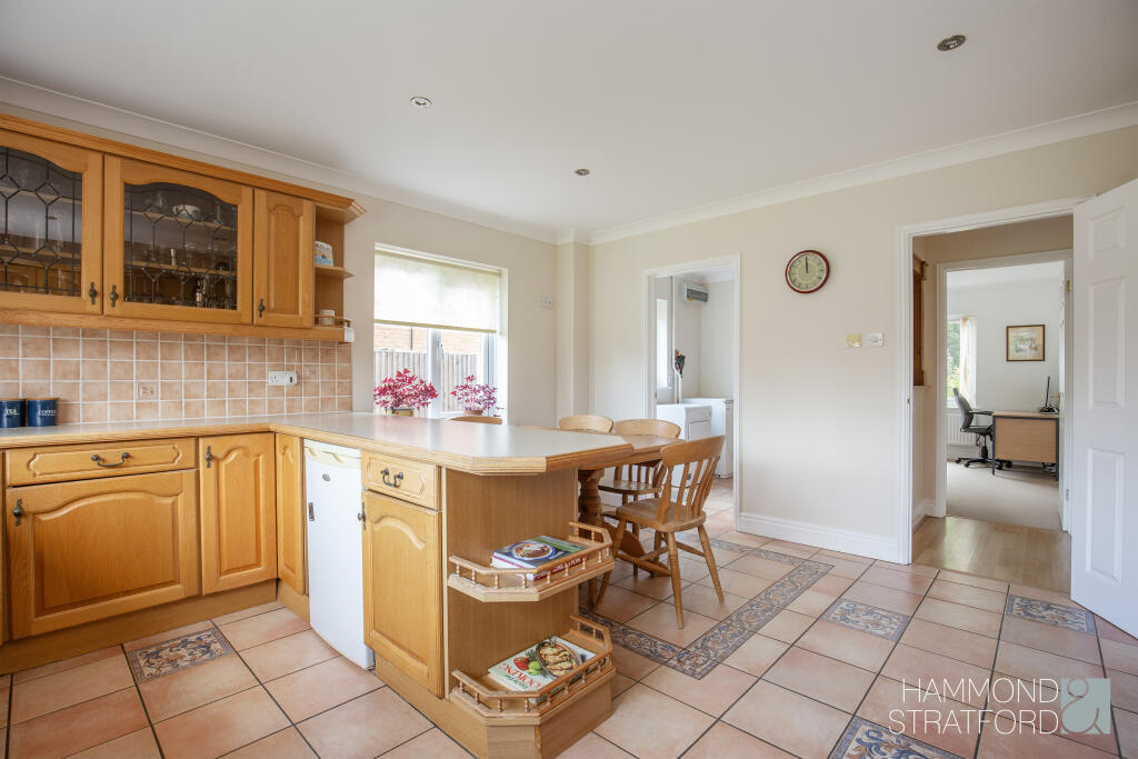
- Kitchen/Breakfast Room:
- Utility:
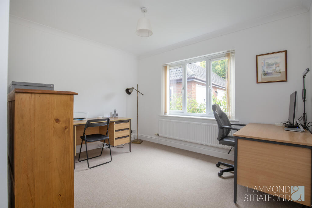
- Study:
- Snug:
- W.C.:
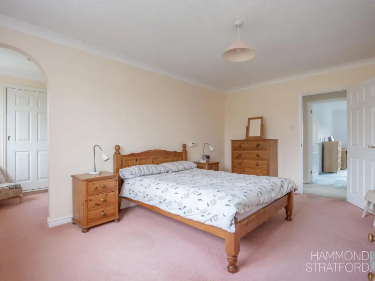
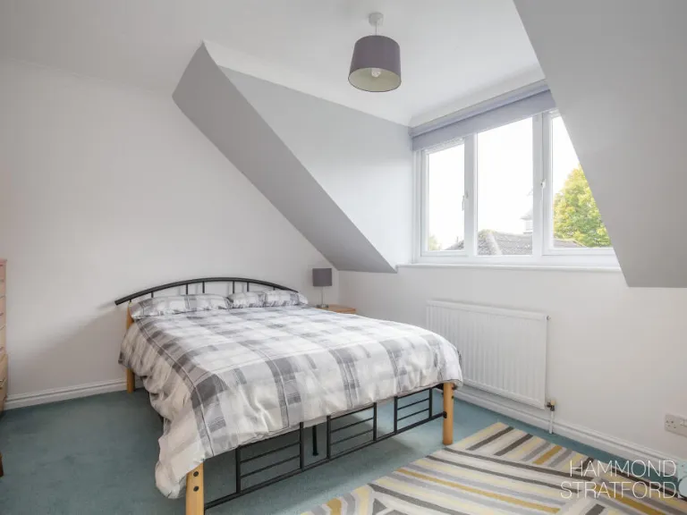
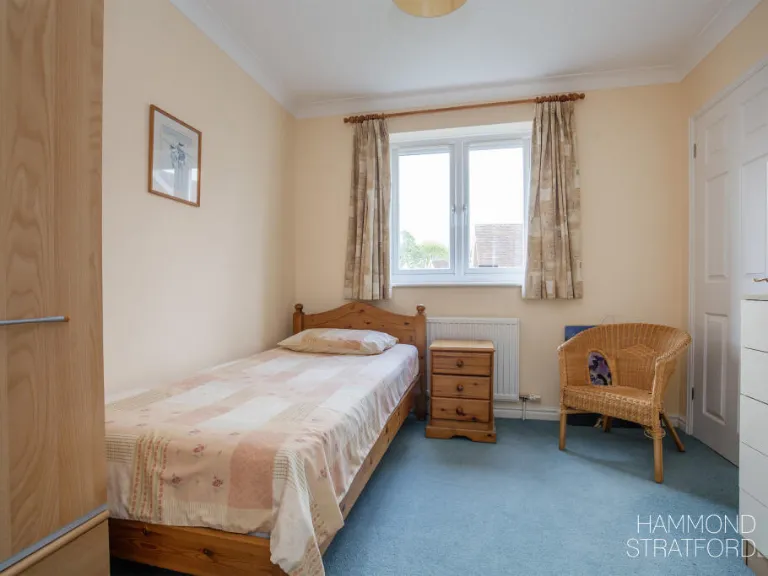
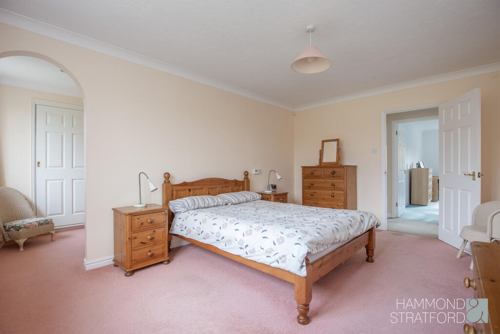
- Main Bedroom:
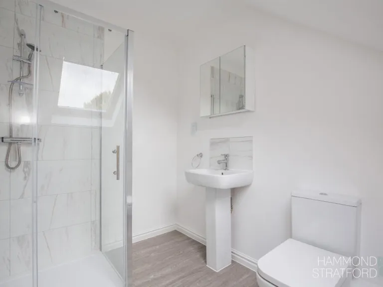
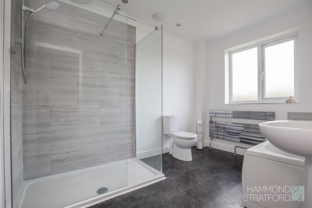
- En-Suite:
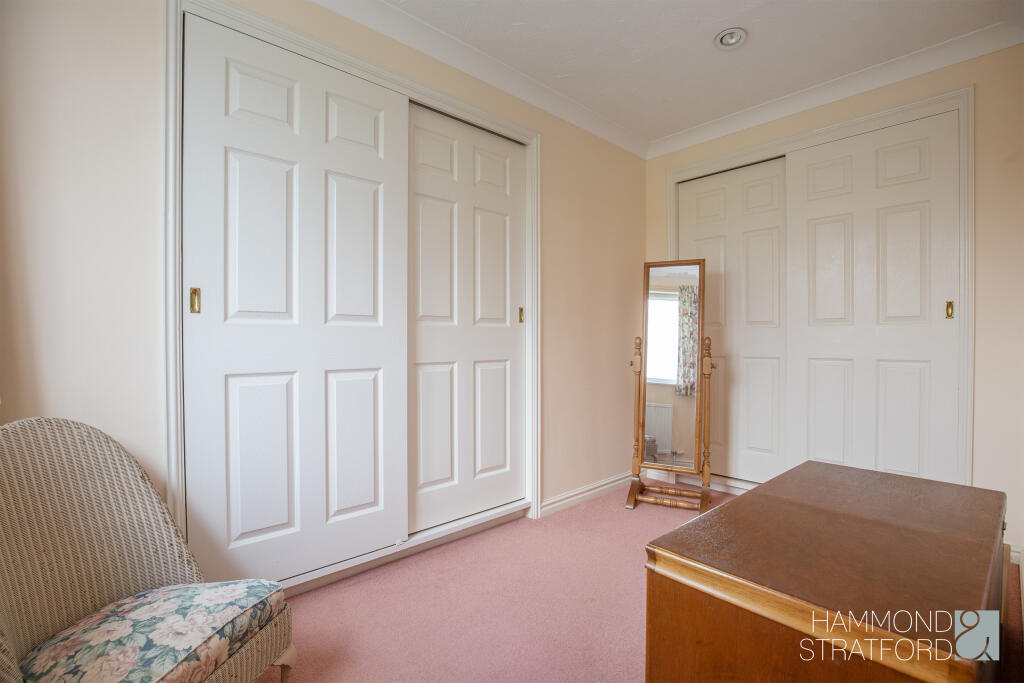
- Wardrobe:
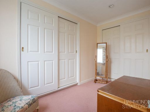
- Bedroom 3:
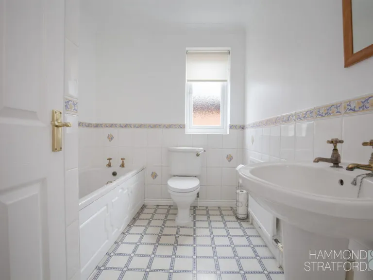
- Bathroom:
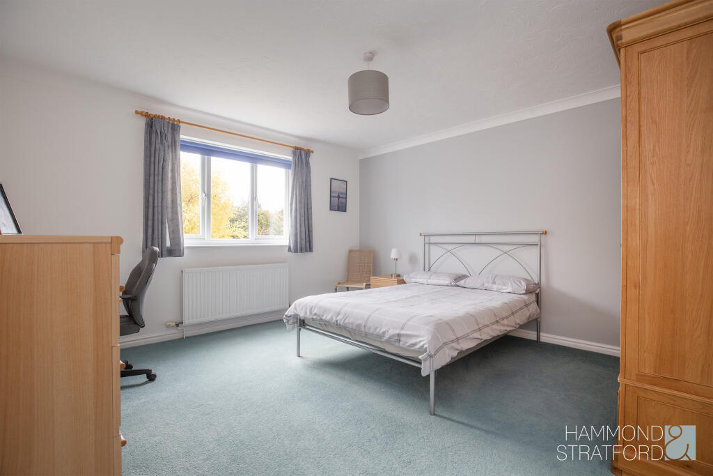
- Bedroom 4:
- En Suite:
- Bedroom 2:
- Bedroom 5:
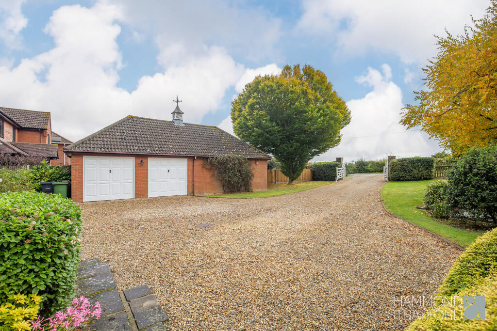
- Double Garage:
Textual Property Features
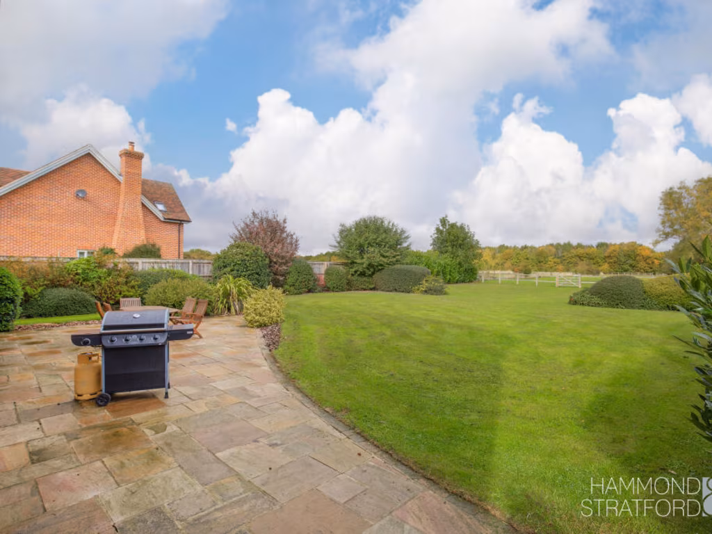
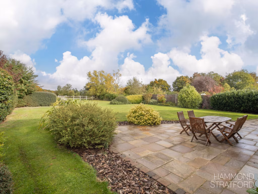
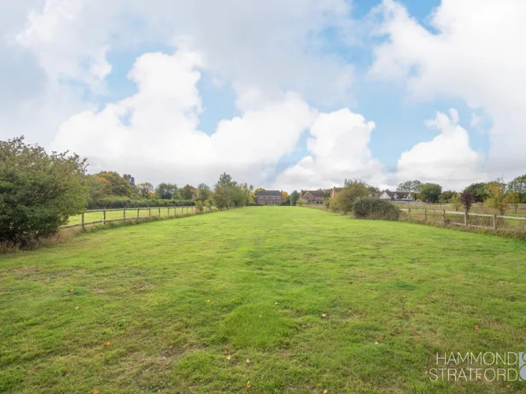
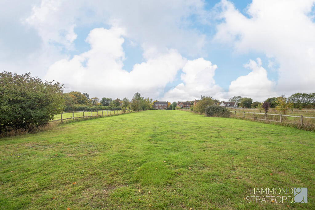
- Has Garden
- Chain Free
- Success
Detected Visual Features
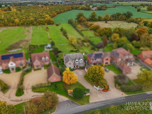
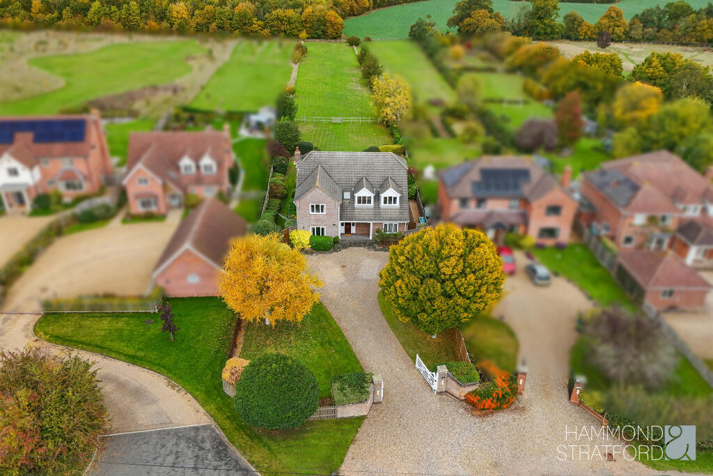
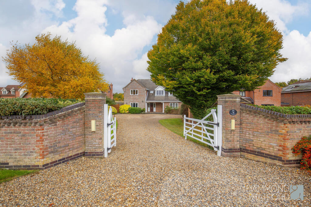
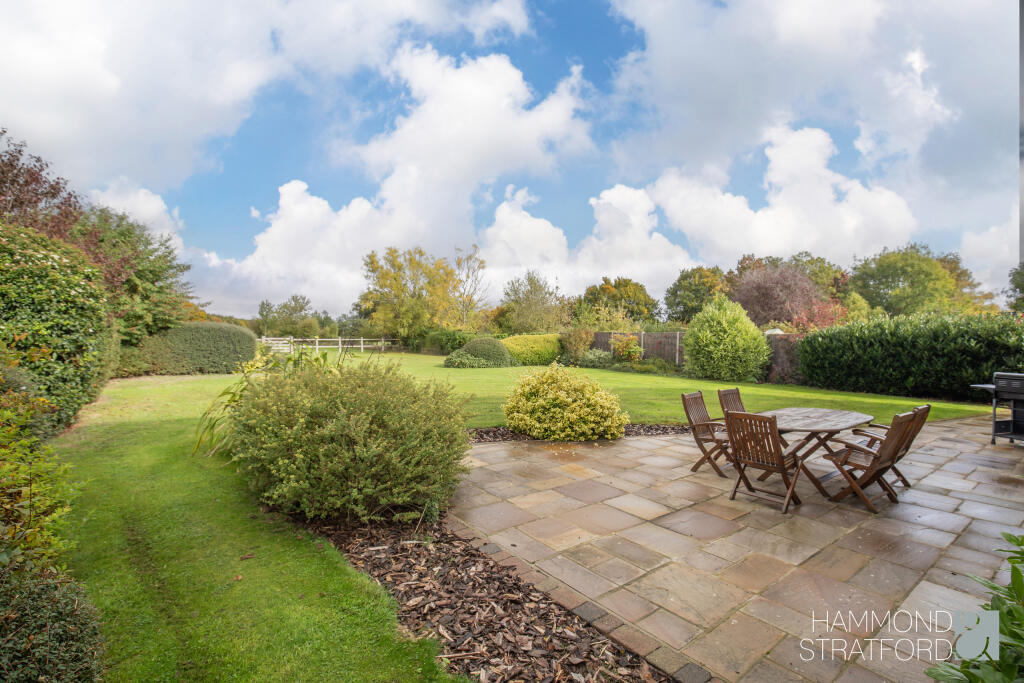
- detached house
- modern family home
- large garden
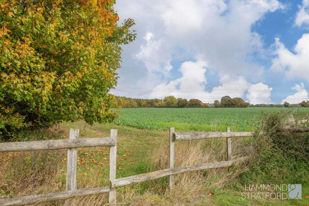
- spacious
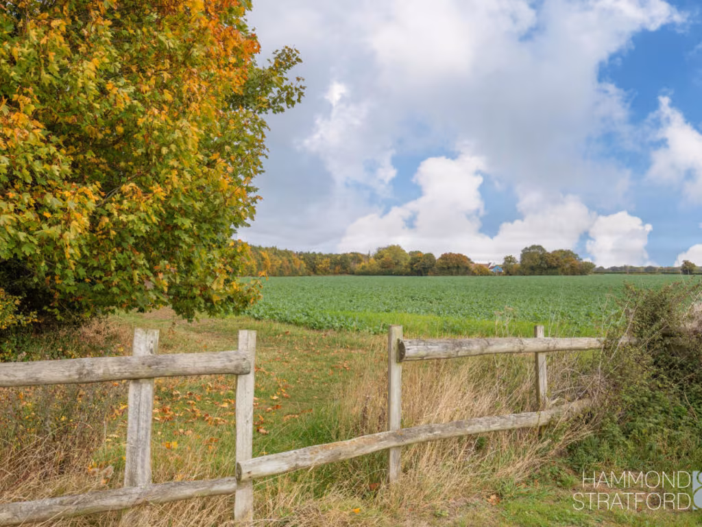
- countryside
- quiet location
- landscaped garden
- driveway
- living room
- modern style
- fireplace
- stone mantle
- ceiling medallion
- picture windows
- sliding glass door
- neutral walls
Nearby Schools
- Forncett St Peter Church of England Voluntary Aided Primary School
- Carleton Rode Church of England Voluntary Aided Primary School
- Newton Flotman Church of England Primary Academy
- Wymondham College Prep School
- Wymondham College
- Robert Kett Primary School
- Hethersett VC Primary School
- Manor Field Infant and Nursery School
- Long Stratton High School
- Bunwell Primary School
- Preston Church of England Voluntary Controlled Primary School
- Hapton Church of England Voluntary Aided Primary School
- Mulbarton Primary School
- Wymondham High Academy
- Little Melton Primary School
- Aslacton Primary School
- Tacolneston Church of England Primary Academy
- Spooner Row Primary School
- Browick Road Primary and Nursery School
- Hethersett, Woodside Primary & Nursery School
- Cringleford CE VA Primary School
- St Mary's Church of England Junior Academy
- Wreningham VC Primary School
- Ashleigh Primary School and Nursery, Wymondham
- Hethersett Academy
- Eaton Primary School
Nearest General Shops
- Id: 9004779046
- Tags:
- Brand: Travis Perkins
- Brand:wikidata: Q2450664
- Brand:wikipedia: en:Travis Perkins
- Name: Travis Perkins
- Shop: doityourself
- TagsNormalized:
- travis perkins
- doityourself
- shop
- Lat: 52.5382927
- Lon: 1.1915038
- FullGeoHash: u12fgh79sp9e
- PartitionGeoHash: u12f
- Images:
- FoodStandards: null
- Distance: 1487.5
,- Id: 1058927128
- Tags:
- Addr:
- City: Ashwellthorpe
- Housename: Ashwellthorpe Stores
- Street: The Street
- Building: yes
- Shop: yes
- TagsNormalized:
- Lat: 52.534126
- Lon: 1.1595894
- FullGeoHash: u12ff7s3kqus
- PartitionGeoHash: u12f
- Images:
- FoodStandards: null
- Distance: 1388.5
,- Id: 323217
- Tags:
- Name: village shop
- Naptan:
- StopAreaCode: 290G2099
- StopAreaType: GPBS
- Verified: no
- Public_transport: stop_area
- Source: naptan_import
- Type: public_transport
- TagsNormalized:
- Lat: 52.5343936
- Lon: 1.1593933
- FullGeoHash: u12ff7s5pbf2
- PartitionGeoHash: u12f
- Images:
- FoodStandards: null
- Distance: 1372.7
}
Nearest Grocery shops
- Id: 346289721
- Tags:
- Addr:
- City: Norwich
- Housenumber: 45
- Postcode: NR14 8AA
- Street: Birchfield Lane
- Village: Mulbarton
- Brand: Budgens
- Brand:wikidata: Q4985016
- Brand:wikipedia: en:Budgens
- Building: yes
- Name: Budgens
- Shop: convenience
- TagsNormalized:
- Lat: 52.5590019
- Lon: 1.2326471
- FullGeoHash: u12gh01d6u06
- PartitionGeoHash: u12g
- Images:
- FoodStandards: null
- Distance: 4434.4
,- Id: 344305013
- Tags:
- Addr:
- City: Wymondham
- Housenumber: 30-31
- Street: Blackthorn Road
- Alcohol: yes
- Building: yes
- Fhrs:
- Name: Wymondham Food and Wine
- Shop: convenience
- Source: Bing
- TagsNormalized:
- Lat: 52.5720427
- Lon: 1.1289087
- FullGeoHash: u12g1dqn37p6
- PartitionGeoHash: u12g
- Images:
- FoodStandards:
- Id: 1426088
- FHRSID: 1426088
- LocalAuthorityBusinessID: 086671/CP
- BusinessName: Wymondham Food And Wine
- BusinessType: Retailers - other
- BusinessTypeID: 4613
- AddressLine1: 30-32 Blackthorn Road
- AddressLine2: Wymondham
- AddressLine3: Norfolk
- AddressLine4: null
- PostCode: NR18 0PY
- RatingValue: 5
- RatingKey: fhrs_5_en-GB
- RatingDate: 2021-11-16
- LocalAuthorityCode: 233
- LocalAuthorityName: South Norfolk
- LocalAuthorityWebSite: https://www.southnorfolkandbroadland.gov.uk/
- LocalAuthorityEmailAddress: FoodandSafety@southnorfolkandbroadland.gov.uk
- Scores:
- Hygiene: 0
- Structural: 0
- ConfidenceInManagement: 5
- NewRatingPending: false
- Geocode:
- Longitude: 1.12783800000000
- Latitude: 52.57180800000000
- Distance: 4240.9
,- Id: 383476761
- Tags:
- Addr:
- Brand: Co-op Food
- Brand:wikidata: Q3277439
- Building: yes
- Name: Co-op Food
- Shop: convenience
- Source: OS_OpenData_VectorMapLocal
- TagsNormalized:
- co-op
- co-op food
- food
- convenience
- shop
- Lat: 52.5636494
- Lon: 1.1178297
- FullGeoHash: u12g12vvrq6n
- PartitionGeoHash: u12g
- Images:
- FoodStandards: null
- Distance: 4239.9
}
Nearest Religious buildings
- Id: 139442711
- Tags:
- Amenity: place_of_worship
- Building: church
- Denomination: anglican
- Listed_status: Grade I
- Material: stone
- Name: All Saints' Church
- Religion: christian
- Short_name: All Saints
- Tower: square
- Website: https://www.achurchnearyou.com/ashwellthorpe-all-saints/
- Wikidata: Q17537599
- TagsNormalized:
- place of worship
- church
- anglican
- christian
- Lat: 52.534698
- Lon: 1.163913
- FullGeoHash: u12ff7xsc1s2
- PartitionGeoHash: u12f
- Images:
- FoodStandards: null
- Distance: 1180.7
,- Id: 289020822
- Tags:
- Amenity: place_of_worship
- Building: church
- Denomination: anglican
- Listed_status: Grade I
- Material: stone
- Name: All Saints
- Religion: christian
- Service_times: Su[1] 09:30-10:30
- Tower: square
- Website: https://www.achurchnearyou.com/wreningham-all-saints/
- Wikidata: Q17537529
- TagsNormalized:
- place of worship
- church
- anglican
- christian
- Lat: 52.5441483
- Lon: 1.1889567
- FullGeoHash: u12fgj3gbenm
- PartitionGeoHash: u12f
- Images:
- FoodStandards: null
- Distance: 1163.2
,- Id: 323933
- Tags:
- Name: Church Road
- Naptan:
- StopAreaCode: 290G1585
- StopAreaType: GPBS
- Verified: no
- Public_transport: stop_area
- Source: naptan_import
- Type: public_transport
- TagsNormalized:
- Lat: 52.542553
- Lon: 1.1806398
- FullGeoHash: u12ffv5dwcuc
- PartitionGeoHash: u12f
- Images:
- FoodStandards: null
- Distance: 627.6
}
Nearest Leisure Facilities
- Id: 264657527
- Tags:
- Bicycle: no
- Dog: no
- Leisure: nature_reserve
- Name: Ashwelltorpe Woods, Lower Wood
- Natural: wood
- Operator: Norfolk Wildlife Trust
- Source: Bing
- Website: https://www.norfolkwildlifetrust.org.uk/wildlife-in-norfolk/nature-reserves/reserves/lower-wood,-ashwellthorpe
- TagsNormalized:
- nature reserve
- leisure
- wood
- Lat: 52.5379161
- Lon: 1.1534462
- FullGeoHash: u12ffhpzt1rv
- PartitionGeoHash: u12f
- Images:
- FoodStandards: null
- Distance: 1421
,- Id: 1058927159
- Tags:
- Access: unknown
- Leisure: pitch
- Sport: tennis
- TagsNormalized:
- Lat: 52.5345595
- Lon: 1.1663675
- FullGeoHash: u12ffe97frdw
- PartitionGeoHash: u12f
- Images:
- FoodStandards: null
- Distance: 1130.6
,- Id: 908722398
- Tags:
- Leisure: playground
- Source: Bing
- TagsNormalized:
- Lat: 52.5416337
- Lon: 1.1822023
- FullGeoHash: u12ffuuv5q3v
- PartitionGeoHash: u12f
- Images:
- FoodStandards: null
- Distance: 761.3
,- Id: 908722399
- Tags:
- Leisure: pitch
- Source: Bing
- Sport: skateboard
- TagsNormalized:
- pitch
- leisure
- skateboard
- sports
- Lat: 52.5417395
- Lon: 1.1822554
- FullGeoHash: u12ffuuvud1s
- PartitionGeoHash: u12f
- Images:
- FoodStandards: null
- Distance: 760.3
,- Id: 908722397
- Tags:
- Hoops: 1
- Leisure: pitch
- Sport: basketball
- TagsNormalized:
- pitch
- leisure
- basketball
- sports
- Lat: 52.5415737
- Lon: 1.1821057
- FullGeoHash: u12ffuuuc51z
- PartitionGeoHash: u12f
- Images:
- FoodStandards: null
- Distance: 757.7
}
Nearest Tourist attractions
- Id: 5771110645
- Tags:
- Addr:
- City: Spooner Row
- Postcode: NR16 1HQ
- State: Norfolk
- Description: Bed and Breakfast Accomodation
- Internet_access: wlan
- Internet_access:fee: no
- Name: The White Hall
- Phone: +44 1508489121
- Tourism: guest_house
- Wheelchair:
- TagsNormalized:
- Lat: 52.5259731
- Lon: 1.1282994
- FullGeoHash: u12fcdj9gr14
- PartitionGeoHash: u12f
- Images:
- FoodStandards: null
- Distance: 3569.3
,- Id: 664420015
- Tags:
- Addr:
- Postcode: NR14 8EU
- Street: Wymondham Road
- Village: Hethel
- Building: yes
- Fhrs:
- Name: Old Thorn Barn
- Source: Bing
- Tourism: guest_house
- Url: https://www.oldthornbarn.co.uk/
- TagsNormalized:
- Lat: 52.5541245
- Lon: 1.1841309
- FullGeoHash: u12ffznmbnzg
- PartitionGeoHash: u12f
- Images:
- FoodStandards:
- Id: 648164
- FHRSID: 648164
- LocalAuthorityBusinessID: P013960
- BusinessName: Old Thorn Barn
- BusinessType: Hotel/bed & breakfast/guest house
- BusinessTypeID: 7842
- AddressLine1: Wymondham Road
- AddressLine2: Hethel
- AddressLine3: Norfolk
- AddressLine4: null
- PostCode: NR14 8EU
- RatingValue: 5
- RatingKey: fhrs_5_en-GB
- RatingDate: 2013-01-14
- LocalAuthorityCode: 233
- LocalAuthorityName: South Norfolk
- LocalAuthorityWebSite: https://www.southnorfolkandbroadland.gov.uk/
- LocalAuthorityEmailAddress: FoodandSafety@southnorfolkandbroadland.gov.uk
- Scores:
- Hygiene: 5
- Structural: 5
- ConfidenceInManagement: 5
- NewRatingPending: false
- Geocode:
- Longitude: 1.18336900000000
- Latitude: 52.55410300000000
- Distance: 1386.3
,- Id: 3694130806
- Tags:
- Name: Claggan
- Phone: +44 1508481798
- Tourism: camp_site
- TagsNormalized:
- Lat: 52.5436486
- Lon: 1.1809339
- FullGeoHash: u12ffv7bvy00
- PartitionGeoHash: u12f
- Images:
- FoodStandards: null
- Distance: 623.5
}
Nearest Hotels
- Id: 383475281
- Tags:
- Addr:
- Building: yes
- Name: Abbey Hotel
- Source: OS_OpenData_VectorMapLocal
- Tourism: guest_house
- Website: http://www.bookdirectrooms.com/MJBHotels/details.aspx?shortname=AbbeyHotelNR18
- TagsNormalized:
- Lat: 52.5708722
- Lon: 1.1095561
- FullGeoHash: u12g14pzw8bg
- PartitionGeoHash: u12g
- Images:
- FoodStandards: null
- Distance: 5146.6
,- Id: 3485385060
- Tags:
- Addr:
- City: Wymondham
- Housenumber: 28
- Postcode: NR18 0BB
- Street: Market Street
- Name: The Town House Hotel
- Tourism: hotel
- Website: http://www.townhouse-hotel.co.uk/
- TagsNormalized:
- Lat: 52.5703172
- Lon: 1.1120646
- FullGeoHash: u12g161u2crm
- PartitionGeoHash: u12g
- Images:
- FoodStandards: null
- Distance: 4972.7
,- Id: 156433437
- Tags:
- Addr:
- City: Norwich
- Country: GB
- Postcode: NR9 3DL
- Street: Ketts Oak
- Village: Hethersett
- Building: yes
- Fhrs:
- Name: Park Farm Hotel
- Source:
- Tourism: hotel
- Wikidata: Q26462837
- TagsNormalized:
- Lat: 52.5884297
- Lon: 1.1690723
- FullGeoHash: u12g4t7mc3g6
- PartitionGeoHash: u12g
- Images:
- FoodStandards: null
- Distance: 4923.2
}
Tags
- detached house
- modern family home
- large garden
- spacious
- countryside
- quiet location
- landscaped garden
- driveway
- living room
- modern style
- fireplace
- stone mantle
- ceiling medallion
- picture windows
- sliding glass door
- neutral walls
Local Market Stats
- Average Price/sqft: £289
- Avg Income: £46300
- Social Housing: 6%
- Planning Success Rate: 71%
AirBnB Data
- 1km average: £82/night
- Listings in 1km: 1
Similar Properties
 4 bedroom detached house for sale in Wymondham Road, Hethel, Norwich, NR14 — £800,000 • 4 bed • 3 bath • 2713 ft²
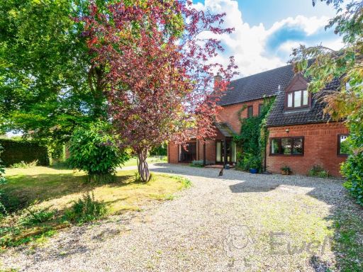 4 bedroom detached house for sale in Wymondham Road, Wreningham, Norwich, Norfolk, NR16 — £700,000 • 4 bed • 2 bath • 2901 ft²
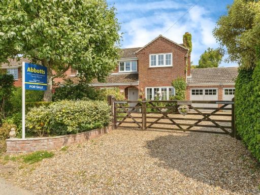 5 bedroom detached house for sale in Milestone Lane, Wicklewood, Wymondham, Norfolk, NR18 — £750,000 • 5 bed • 3 bath • 2054 ft²
 4 bedroom detached house for sale in Greenways Close, Flordon, Norwich, NR15 — £750,000 • 4 bed • 3 bath • 3000 ft²
 5 bedroom detached house for sale in Norwich Road, Wreningham, NR16 — £950,000 • 5 bed • 3 bath • 4192 ft²
 5 bedroom detached house for sale in Black Carr, Spooner Row, Norfolk, NR17 — £850,000 • 5 bed • 3 bath • 2976 ft²
Meta
- {
"@context": "https://schema.org",
"@type": "Residence",
"name": "5 bedroom detached house for sale in Wymondham Road, Wrenin…",
"description": "",
"url": "https://propertypiper.co.uk/property/7527a932-c18a-47c9-935e-52a7889a12a8",
"image": "https://image-a.propertypiper.co.uk/b1f9e377-b764-458e-9656-0ba0e03ea1dc-1024.jpeg",
"address": {
"@type": "PostalAddress",
"streetAddress": "ROSKO HOUSE WYMONDHAM ROAD WRENINGHAM NORWICH",
"postalCode": "NR16 1AT",
"addressLocality": "South Norfolk",
"addressRegion": "South Norfolk",
"addressCountry": "England"
},
"geo": {
"@type": "GeoCoordinates",
"latitude": 52.5441846,
"longitude": 1.1717559
},
"numberOfRooms": 5,
"numberOfBathroomsTotal": 3,
"floorSize": {
"@type": "QuantitativeValue",
"value": 2580,
"unitCode": "FTK"
},
"offers": {
"@type": "Offer",
"price": 875000,
"priceCurrency": "GBP",
"availability": "https://schema.org/InStock"
},
"additionalProperty": [
{
"@type": "PropertyValue",
"name": "Feature",
"value": "detached house"
},
{
"@type": "PropertyValue",
"name": "Feature",
"value": "modern family home"
},
{
"@type": "PropertyValue",
"name": "Feature",
"value": "large garden"
},
{
"@type": "PropertyValue",
"name": "Feature",
"value": "spacious"
},
{
"@type": "PropertyValue",
"name": "Feature",
"value": "countryside"
},
{
"@type": "PropertyValue",
"name": "Feature",
"value": "quiet location"
},
{
"@type": "PropertyValue",
"name": "Feature",
"value": "landscaped garden"
},
{
"@type": "PropertyValue",
"name": "Feature",
"value": "driveway"
},
{
"@type": "PropertyValue",
"name": "Feature",
"value": "living room"
},
{
"@type": "PropertyValue",
"name": "Feature",
"value": "modern style"
},
{
"@type": "PropertyValue",
"name": "Feature",
"value": "fireplace"
},
{
"@type": "PropertyValue",
"name": "Feature",
"value": "stone mantle"
},
{
"@type": "PropertyValue",
"name": "Feature",
"value": "ceiling medallion"
},
{
"@type": "PropertyValue",
"name": "Feature",
"value": "picture windows"
},
{
"@type": "PropertyValue",
"name": "Feature",
"value": "sliding glass door"
},
{
"@type": "PropertyValue",
"name": "Feature",
"value": "neutral walls"
}
]
}
High Res Floorplan Images
Compatible Floorplan Images
FloorplanImages Thumbnail