BS30 8GP - 3 bedroom terraced house for sale in Sunningdale Drive, War…
View on Property Piper
3 bedroom terraced house for sale in Sunningdale Drive, Warmley, Bristol, BS30 8GP, BS30
Property Details
- Price: £325000
- Bedrooms: 3
- Bathrooms: 2
- Property Type: undefined
- Property SubType: undefined
Brochure Descriptions
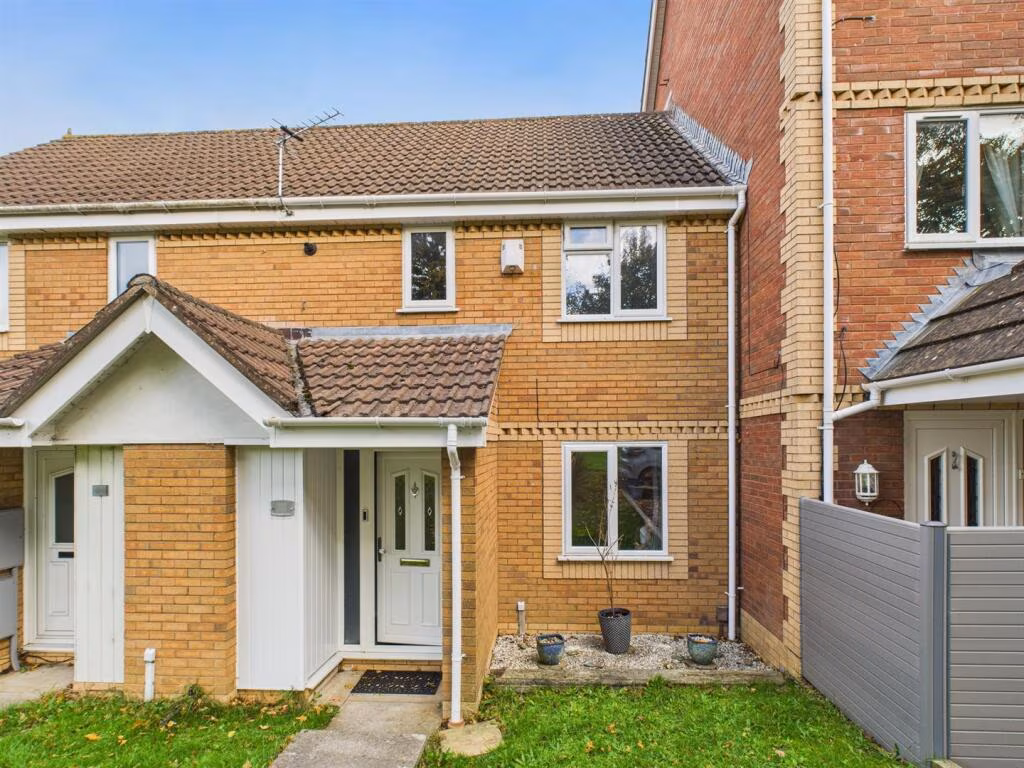
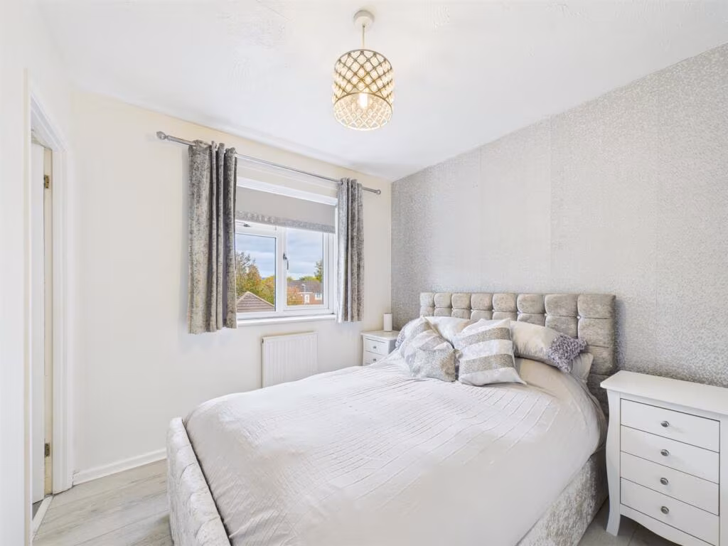
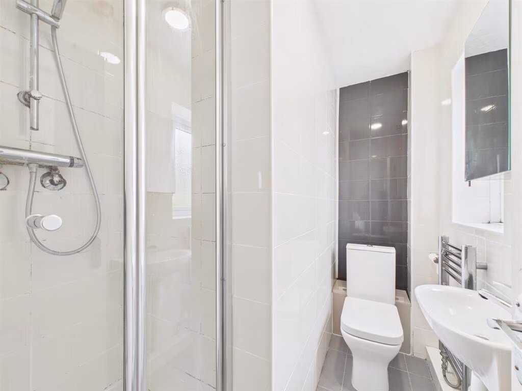
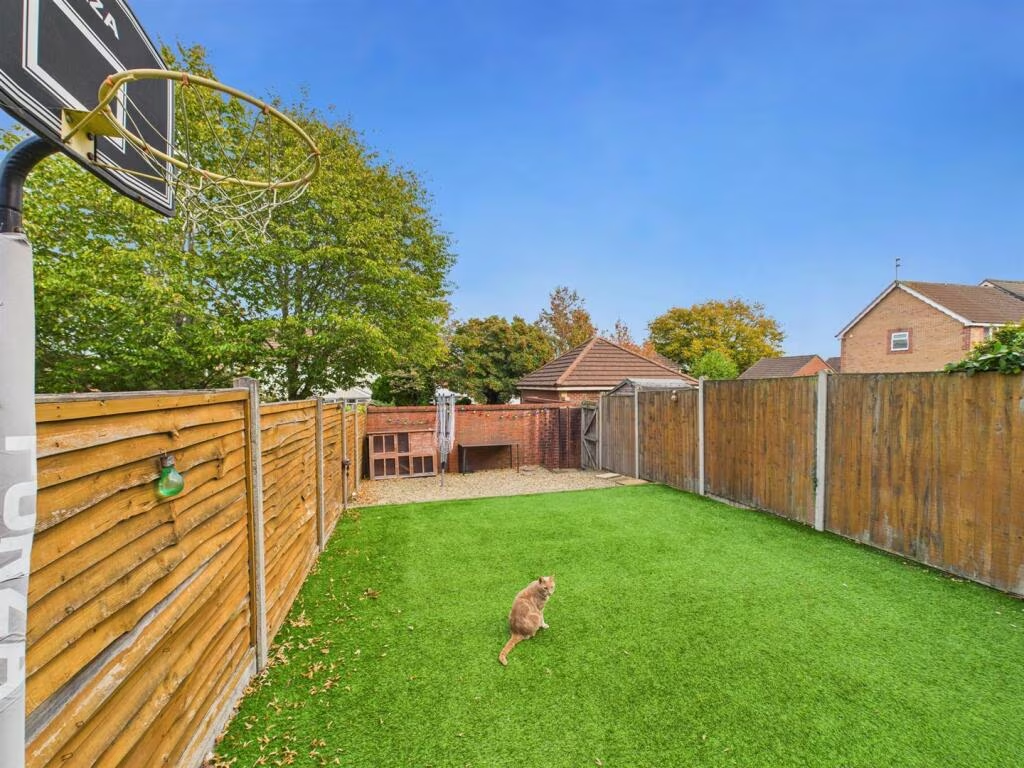
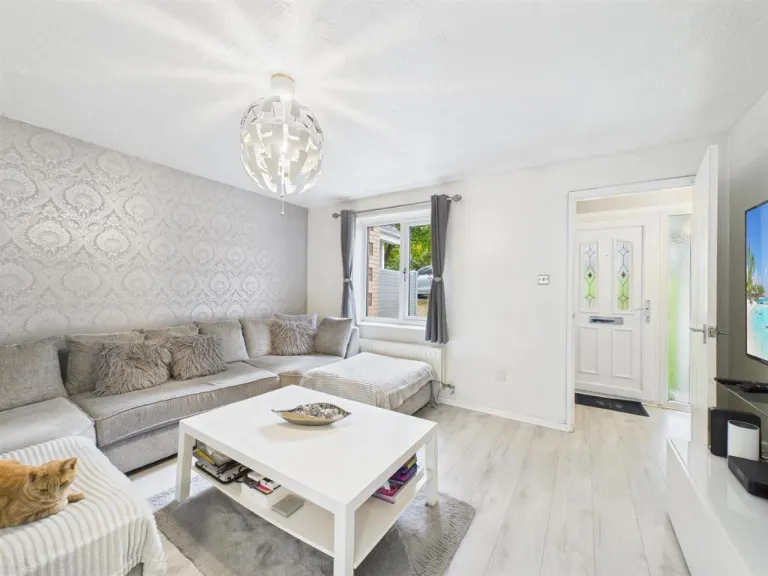
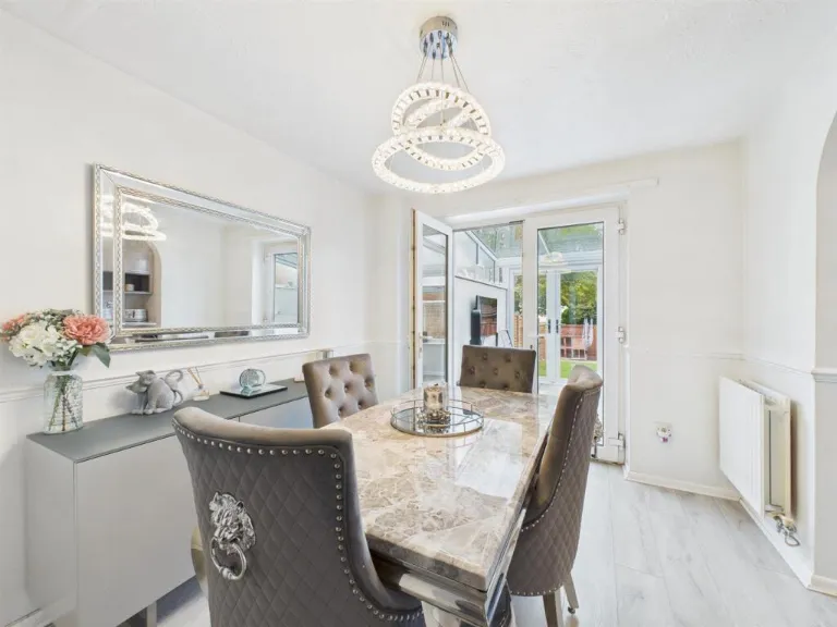
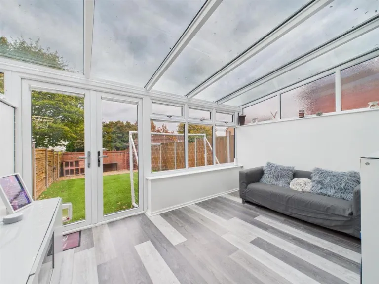
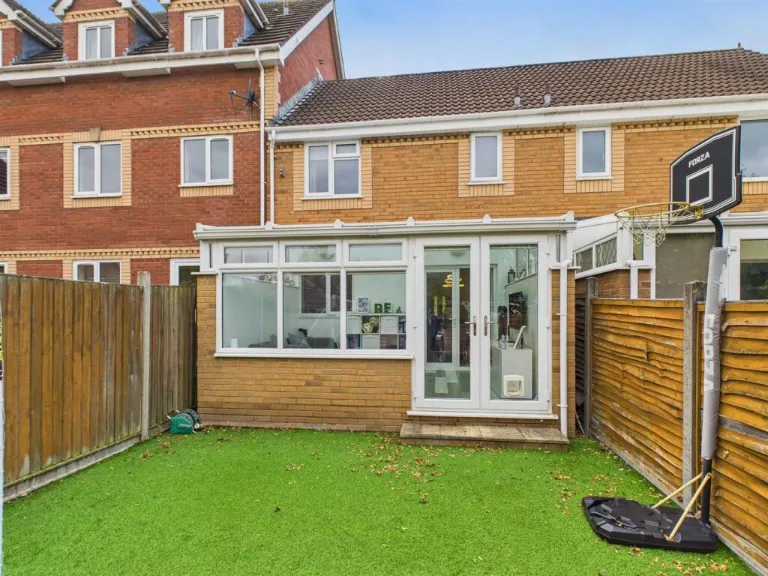
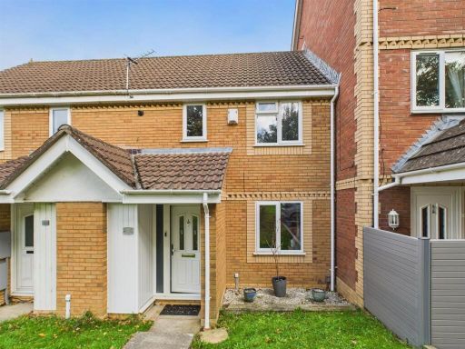
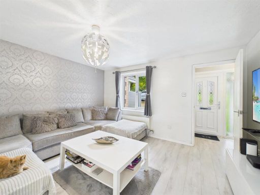
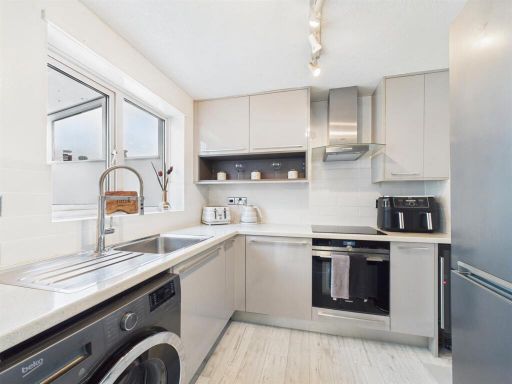
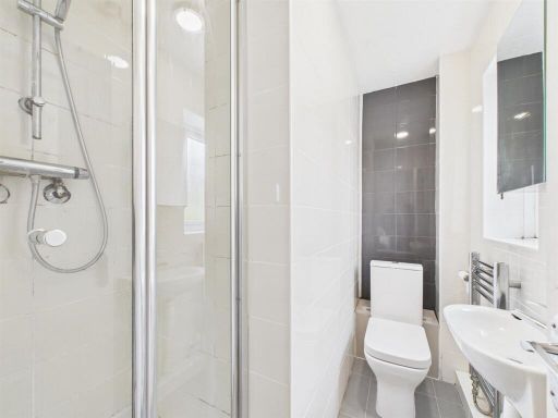
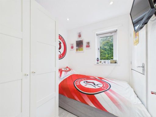
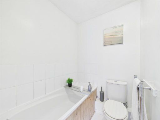
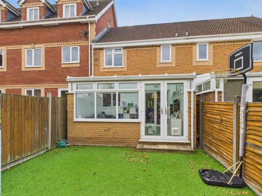
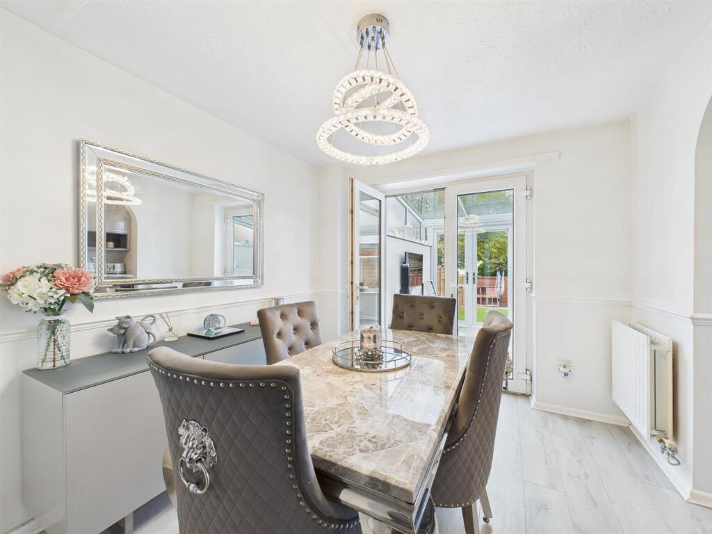
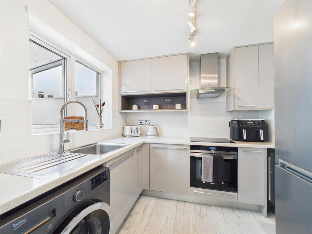
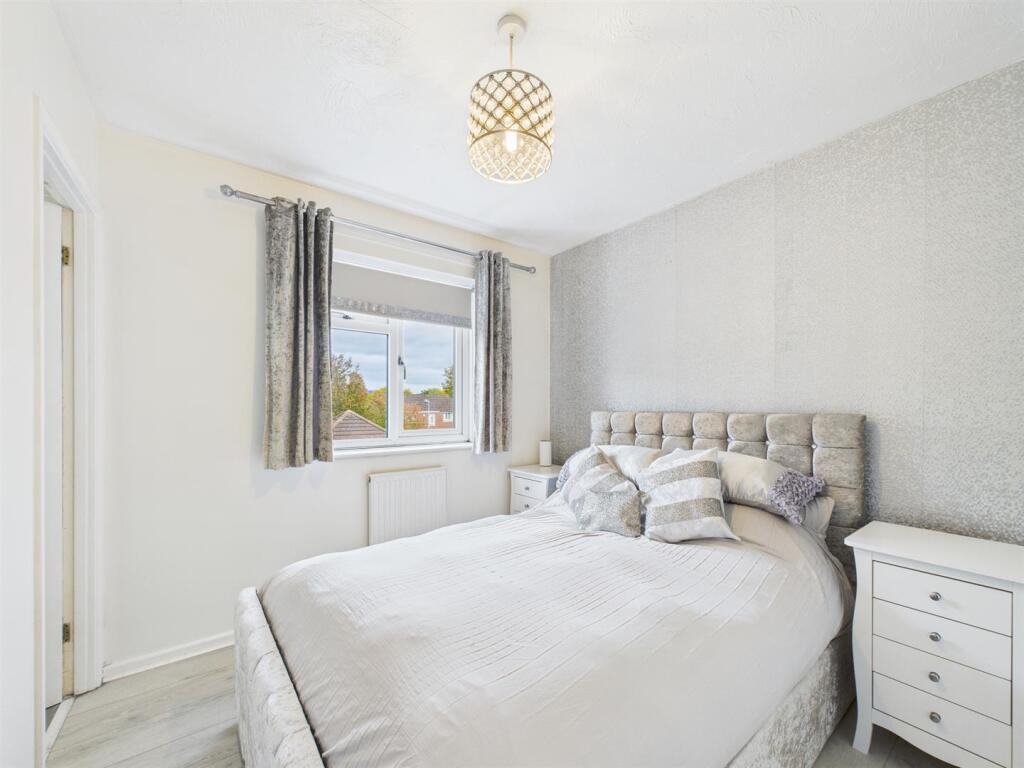
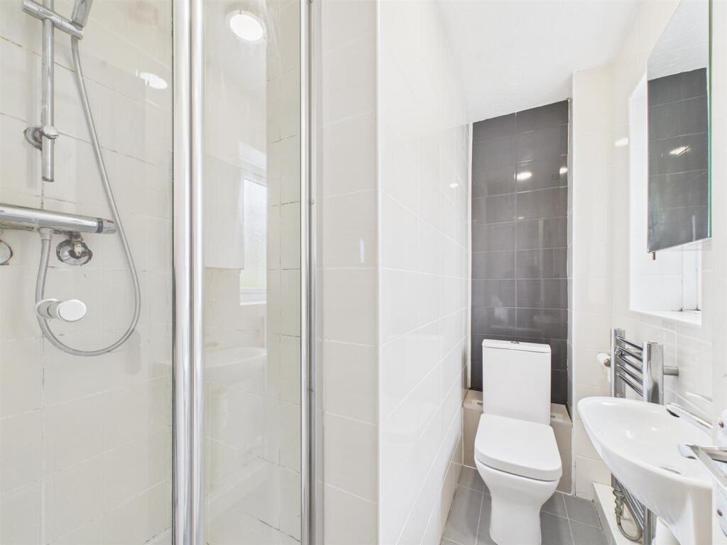
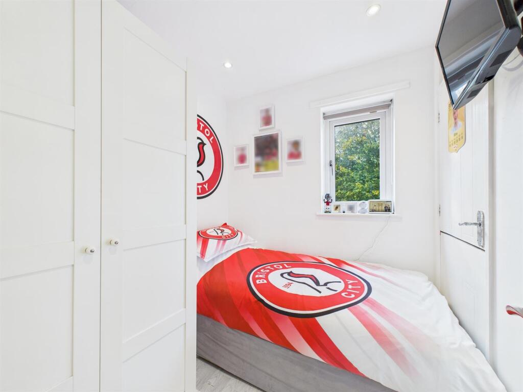
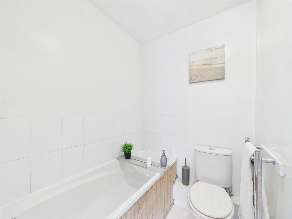
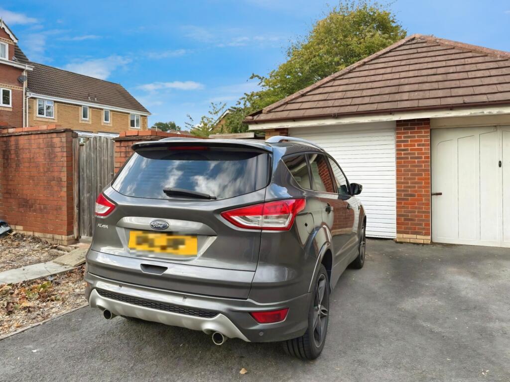
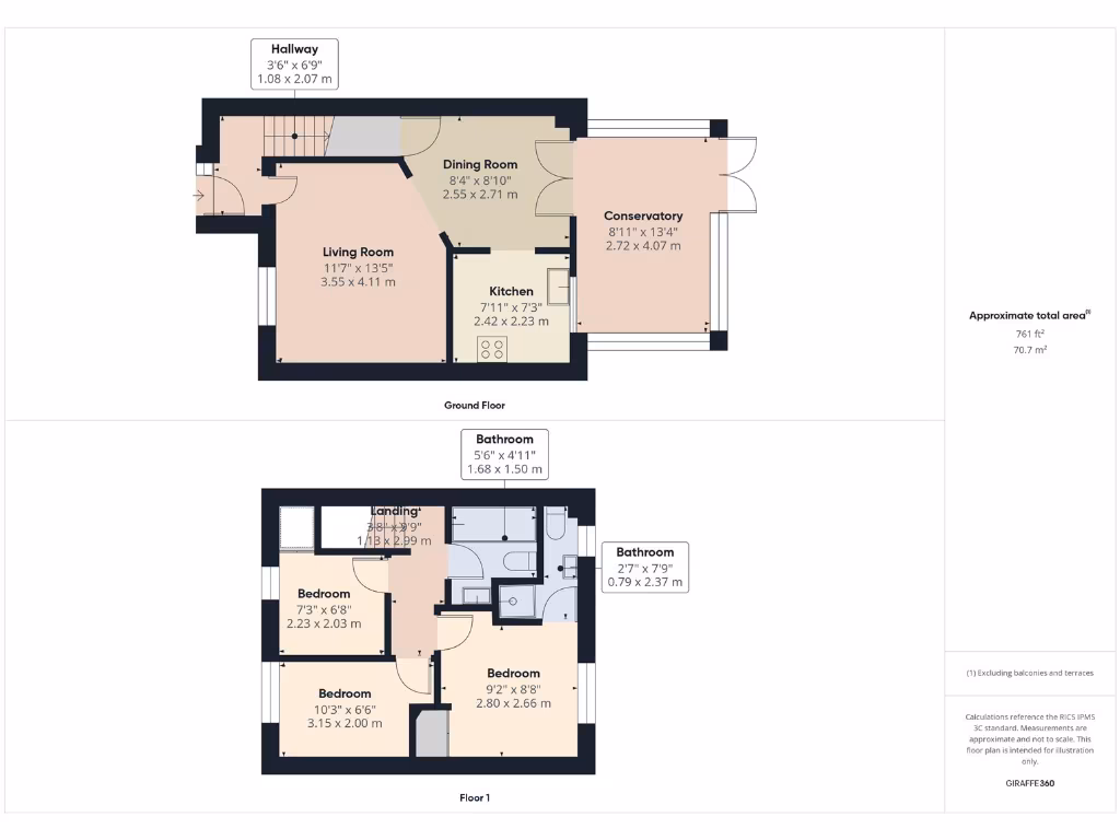
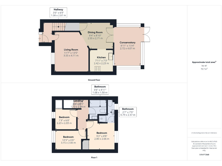
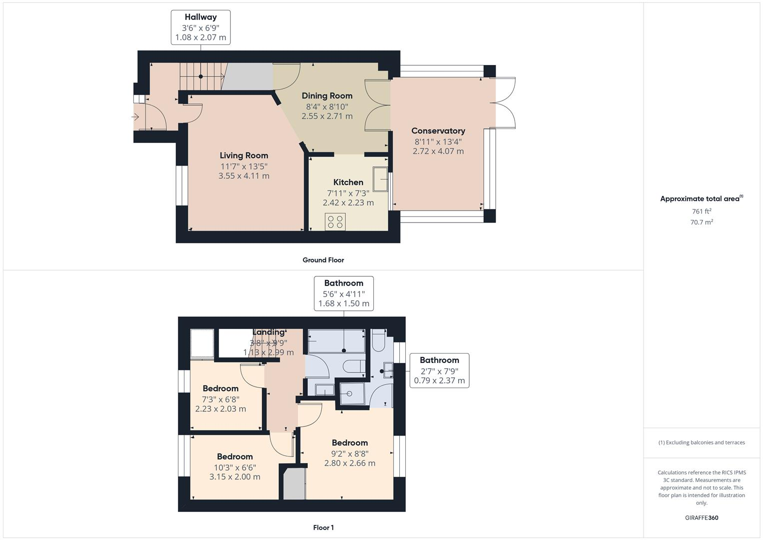
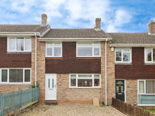
- Mid-terrace/linked two-storey townhouse with small front garden and adjacent driveway/garage. Exterior shows a porch entrance and a tiled roof. Interior floorplan indicates an open-plan lounge through to dining room, modern kitchen and a conservatory. Property appears to offer three bedrooms with an en-suite to the master and a family bathroom. Garden space is small-to-average at the front (rear garden likely present but not shown). Overall size is consistent with a modest family home (average plot and internal footprint for a three-bedroom townhouse).
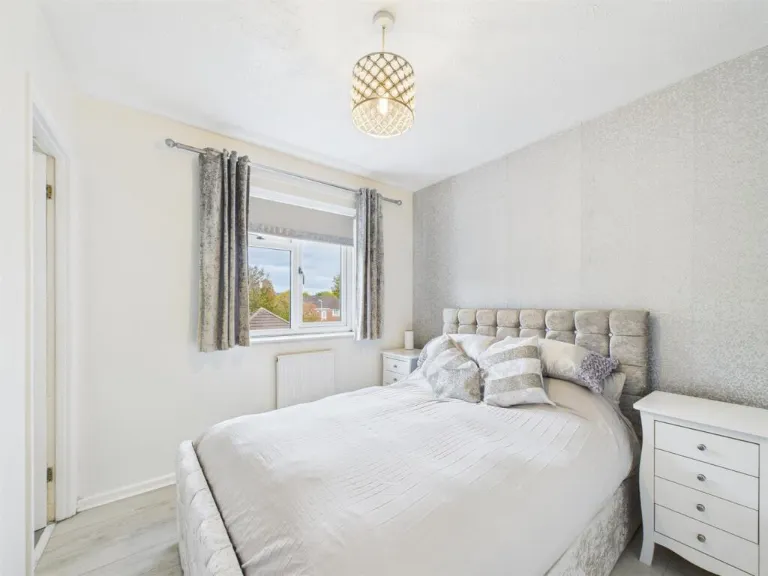
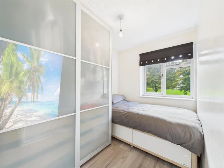
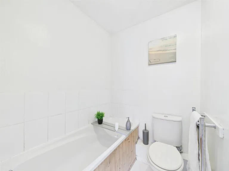
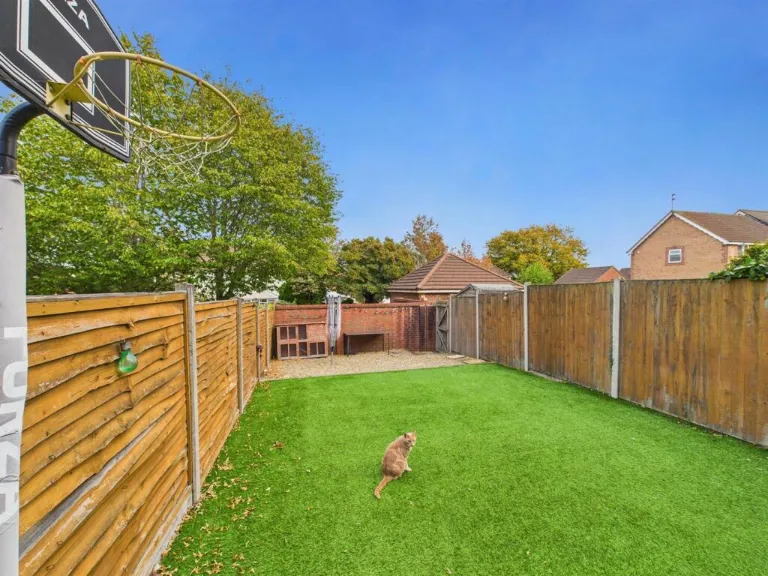
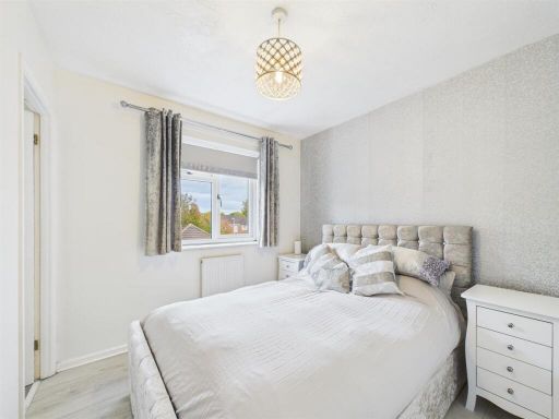
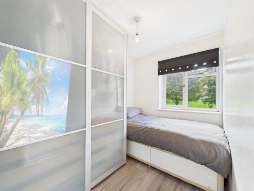
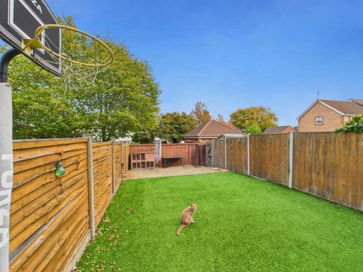
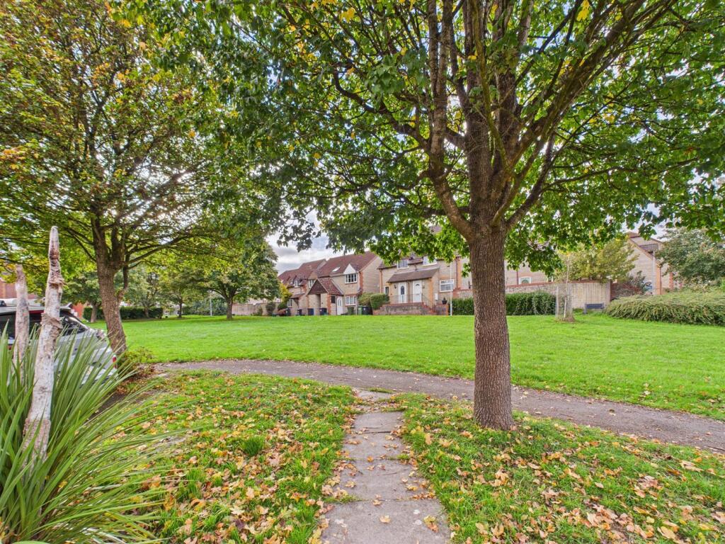
- Three-bedroom mid-terraced family home presented to a good standard. Accommodation arranged over two storeys and briefly comprising entrance hall, open-plan lounge through to a dining area with archway into a modern fitted kitchen and an attached conservatory. First floor offers three bedrooms (master with en‑suite shower) and a separate family bathroom. Externally there are gardens to the front and rear, a driveway and an integral/adjacent garage. The property overlooks a greenspace to the front and benefits from a pleasant rear garden of average size. Overall this is a mid‑sized family property suitable for commuters (close to the Avon ring road with reasonable access to Bristol and Bath) and local amenities; presented in move‑in condition with modern kitchen and bathrooms.
Image Descriptions
- a two-story semi-detached house with a small front lawn modern semi-detached
- living room modern
Floorplan Description
- Two-storey house with living, dining, kitchen and conservatory on ground floor and three bedrooms plus bathrooms on first floor.
Rooms
- Hallway:
- Dining Room:
- Living Room:
- Kitchen:
- Conservatory:
- Bathroom:
- Landing:
- Bathroom:
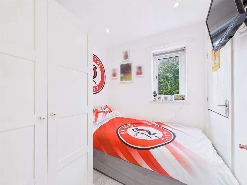
- Bedroom:
- Bedroom:
- Bedroom:
Textual Property Features
Detected Visual Features
- modern
- semi-detached
- two-story
- brick
- front lawn
- residential area
- suburban
- small garden
- light flooring
- textured wallpaper
- central light fixture
- single large window
Nearby Schools
- Somerdale Educate Together Primary Academy
- Kings' Forest Primary School
- The Meadows Primary School
- Longwell Green Primary School
- Sir Bernard Lovell Academy
- Hanham Abbots Junior School
- Samuel White's Infant School
- St Barnabas Church of England Primary School
- Beacon Rise Primary School
- Our Lady of Lourdes Catholic Primary School
- St Stephen's Infant School
- Mangotsfield School
- Mangotsfield Church of England Primary School
- Cadbury Heath Primary School
- Digitech Studio School
- Courtney Primary School
- John Cabot Academy
- King's Oak Academy
- The Tynings Primary School
- St Anne's Church of England Primary School
Nearest General Shops
- Id: 858550171
- Tags:
- Building: yes
- Shop: car_repair
- TagsNormalized:
- Lat: 51.4602663
- Lon: -2.4803784
- FullGeoHash: gcnhz81cfbzv
- PartitionGeoHash: gcnh
- Images:
- FoodStandards: null
- Distance: 732.6
,- Id: 1026929924
- Tags:
- Brand: Coral
- Brand:wikidata: Q54621344
- Brand:wikipedia: en:Coral (bookmaker)
- Building: yes
- Name: Coral
- Shop: bookmaker
- TagsNormalized:
- Lat: 51.4503249
- Lon: -2.4774157
- FullGeoHash: gcnhxwhpb58y
- PartitionGeoHash: gcnh
- Images:
- FoodStandards: null
- Distance: 492.3
,- Id: 8410087077
- Tags:
- Addr:
- City: Bristol
- Housenumber: 3
- Postcode: BS30 8WR
- Street: Crown Road
- Name: Elysium hair & tanning
- Opening_hours: Tu-Sa 09:00-18:00;Tu-Sa 10:00-19:00
- Shop: hairdresser
- Website: www.elysiumhairandtanning.com;www.elysiumhairandtanningstudio.com
- TagsNormalized:
- Lat: 51.4545634
- Lon: -2.4753036
- FullGeoHash: gcnhxxj891zf
- PartitionGeoHash: gcnh
- Images:
- FoodStandards: null
- Distance: 467.4
}
Nearest Grocery shops
- Id: 1042135025
- Tags:
- Brand: Premier
- Brand:wikidata: Q7240340
- Brand:wikipedia: en:Premier Stores
- Building: yes
- Name: Heath Rise
- Operator: Premier
- Shop: convenience
- TagsNormalized:
- premier
- heath
- convenience
- shop
- Lat: 51.44884
- Lon: -2.478743
- FullGeoHash: gcnhxtgp1ngm
- PartitionGeoHash: gcnh
- Images:
- FoodStandards: null
- Distance: 588.6
,- Id: 42503381
- Tags:
- Amenity: fast_food
- Building: yes
- Cuisine: fish_and_chips
- Name: Uncle Joe's Chip Shop
- TagsNormalized:
- fast food
- food
- fish
- chip
- shop
- Lat: 51.4502729
- Lon: -2.4774154
- FullGeoHash: gcnhxwhp8410
- PartitionGeoHash: gcnh
- Images:
- FoodStandards: null
- Distance: 496.8
,- Id: 367156730
- Tags:
- Addr:
- City: Bristol
- Housenumber: 26
- Place: Warmley
- Postcode: BS30 8BJ
- Street: Tower Road South
- Alt_name: Nisa
- Brand: Costcutter
- Brand:wikidata: Q5175072
- Building: yes
- Fhrs:
- Name: Costcutter
- Old_name: Spar
- Shop: convenience
- TagsNormalized:
- costcutter
- convenience
- shop
- Lat: 51.4511928
- Lon: -2.4778702
- FullGeoHash: gcnhxw7svmw0
- PartitionGeoHash: gcnh
- Images:
- FoodStandards: null
- Distance: 399.4
}
Nearest Religious buildings
- Id: 207051599
- Tags:
- Leisure: playground
- Name: Chapel Lane Play Area
- Operator: South Gloucestershire Council
- TagsNormalized:
- Lat: 51.4608055
- Lon: -2.4773246
- FullGeoHash: gcnhz8hhfjky
- PartitionGeoHash: gcnh
- Images:
- FoodStandards: null
- Distance: 846.8
,- Id: 858493945
- Tags:
- Addr:
- City: Bristol
- Postcode: BS15 4NG
- Street: Chapel Lane
- Amenity: place_of_worship
- Building: yes
- Building:levels: 1
- Denomination: congregational
- Name: Warmley Congregational Church
- Religion: christian
- TagsNormalized:
- place of worship
- congregational
- church
- christian
- Lat: 51.4606762
- Lon: -2.4770848
- FullGeoHash: gcnhz8hhptrd
- PartitionGeoHash: gcnh
- Images:
- FoodStandards: null
- Distance: 840
,- Id: 373963085
- Tags:
- Amenity: place_of_worship
- Building: yes
- Denomination: methodist
- Name: Mill Lane Independent Methodist Church
- Religion: christian
- TagsNormalized:
- place of worship
- methodist
- church
- christian
- Lat: 51.4502748
- Lon: -2.4758572
- FullGeoHash: gcnhxwjps675
- PartitionGeoHash: gcnh
- Images:
- FoodStandards: null
- Distance: 570.7
}
Nearest Medical buildings
- Id: 369174526
- Tags:
- Amenity: doctors
- Healthcare: doctor
- Name: Close Farm Surgery
- TagsNormalized:
- doctor
- doctors
- health
- healthcare
- farm
- surgery
- Lat: 51.4499589
- Lon: -2.4666621
- FullGeoHash: gcnhxy5vdx7r
- PartitionGeoHash: gcnh
- Images:
- FoodStandards: null
- Distance: 1138.2
,- Id: 210227577
- Tags:
- Addr:
- City: Cadbury Heath
- Housenumber: 1
- Postcode: BS30 8EN
- Street: School Road
- Amenity: pharmacy
- Building: yes
- Dispensing: yes
- Healthcare: pharmacy
- Name: Cadbury Heath Pharmacy
- Source: survey
- Source:outline: Bing
- Website: https://www.cadburyheathpharmacy.co.uk/
- TagsNormalized:
- pharmacy
- health
- healthcare
- heath
- Lat: 51.4458872
- Lon: -2.483522
- FullGeoHash: gcnhxmrw18ry
- PartitionGeoHash: gcnh
- Images:
- FoodStandards: null
- Distance: 881.2
,- Id: 212348921
- Tags:
- Addr:
- City: Bristol
- Postcode: BS30 8HS
- Amenity: doctors
- Building: yes
- Name: Cadbury Heath Health Centre
- TagsNormalized:
- doctor
- doctors
- health
- health centre
- heath
- Lat: 51.4473308
- Lon: -2.4887061
- FullGeoHash: gcnhxmey2vw4
- PartitionGeoHash: gcnh
- Images:
- FoodStandards: null
- Distance: 854.6
,- Id: 8003607192
- Tags:
- Addr:
- Housenumber: 1
- Street: High Street
- Amenity: pharmacy
- Dispensing: yes
- Healthcare: pharmacy
- Name: Ideal Pharmacy
- TagsNormalized:
- Lat: 51.4601838
- Lon: -2.4790025
- FullGeoHash: gcnhz84c719c
- PartitionGeoHash: gcnh
- Images:
- FoodStandards: null
- Distance: 743.6
}
Nearest Airports
- Id: 47483196
- Tags:
- Aerodrome: international
- Aeroway: aerodrome
- Iata: BRS
- Icao: EGGD
- Internet_access: wlan
- Internet_access:fee: no
- Name: Bristol Airport
- Type: public
- Website: https://www.bristolairport.co.uk/
- Wikidata: Q8725
- Wikipedia: en:Bristol Airport
- TagsNormalized:
- airport
- international airport
- Lat: 51.3830799
- Lon: -2.7186615
- FullGeoHash: gcnh64h24s74
- PartitionGeoHash: gcnh
- Images:
- FoodStandards: null
- Distance: 18200.4
}
Nearest Leisure Facilities
- Id: 206263285
- Tags:
- Barrier: fence
- Leisure: pitch
- Name: Cadbury Heath Football Club
- Sport: soccer
- TagsNormalized:
- pitch
- leisure
- football
- heath
- club
- soccer
- sports
- Lat: 51.451244
- Lon: -2.4812388
- FullGeoHash: gcnhxw3jnzn3
- PartitionGeoHash: gcnh
- Images:
- FoodStandards: null
- Distance: 282.5
,- Id: 156884122
- Tags:
- TagsNormalized:
- Lat: 51.4553415
- Lon: -2.47904
- FullGeoHash: gcnhxx4v44vg
- PartitionGeoHash: gcnh
- Images:
- FoodStandards: null
- Distance: 266.9
,- Id: 156884123
- Tags:
- TagsNormalized:
- Lat: 51.4555749
- Lon: -2.4795839
- FullGeoHash: gcnhxx4qmw2h
- PartitionGeoHash: gcnh
- Images:
- FoodStandards: null
- Distance: 259.7
,- Id: 31171909
- Tags:
- TagsNormalized:
- Lat: 51.4536048
- Lon: -2.4805119
- FullGeoHash: gcnhxwcdzzhk
- PartitionGeoHash: gcnh
- Images:
- FoodStandards: null
- Distance: 98.9
,- Id: 204696571
- Tags:
- TagsNormalized:
- Lat: 51.4535366
- Lon: -2.4825846
- FullGeoHash: gcnhxwb4xd6v
- PartitionGeoHash: gcnh
- Images:
- FoodStandards: null
- Distance: 51.7
}
Nearest Tourist attractions
- Id: 300651814
- Tags:
- Name: Quarry
- Tourism: attraction
- TagsNormalized:
- Lat: 51.4361796
- Lon: -2.4804467
- FullGeoHash: gcnhxe9v3quf
- PartitionGeoHash: gcnh
- Images:
- FoodStandards: null
- Distance: 1956.3
,- Id: 271104014
- Tags:
- TagsNormalized:
- Lat: 51.4604468
- Lon: -2.4751538
- FullGeoHash: gcnhz8jdudxd
- PartitionGeoHash: gcnh
- Images:
- FoodStandards: null
- Distance: 880.1
,- Id: 162014589
- Tags:
- Building: yes
- Name: Kingswood Heritage Museum
- Source:
- Tourism: museum
- Wikidata: Q113370074
- TagsNormalized:
- Lat: 51.4528741
- Lon: -2.4794752
- FullGeoHash: gcnhxwdw8ncm
- PartitionGeoHash: gcnh
- Images:
- FoodStandards: null
- Distance: 195.4
}
Nearest Hotels
- Id: 405395691
- Tags:
- Addr:
- City: Bristol
- Postcode: BS4 4EG
- Street: Langton Court Road
- Suburb: Saint Annes
- Amenity: pub
- Building: yes
- Name: Langton Court Hotel
- Source:
- TagsNormalized:
- Lat: 51.450136
- Lon: -2.548614
- FullGeoHash: gcnhwn0nubrx
- PartitionGeoHash: gcnh
- Images:
- FoodStandards: null
- Distance: 4638.8
,- Id: 392180649
- Tags:
- Building: yes
- Name: The Beeches Hotel
- Tourism: hotel
- TagsNormalized:
- Lat: 51.4305093
- Lon: -2.5348285
- FullGeoHash: gcnhw6dhqjyf
- PartitionGeoHash: gcnh
- Images:
- FoodStandards: null
- Distance: 4486
,- Id: 1736617691
- Tags:
- Addr:
- City: Bristol
- Postcode: BS31 2BA
- Fhrs:
- Name: The Old Manor House
- Tourism: hotel
- Website: http://www.oldmanorhousehotel.co.uk/
- TagsNormalized:
- Lat: 51.4176399
- Lon: -2.5004806
- FullGeoHash: gcnhx071qwf9
- PartitionGeoHash: gcnh
- Images:
- FoodStandards: null
- Distance: 4216.2
}
Tags
- modern
- semi-detached
- two-story
- brick
- front lawn
- residential area
- suburban
- small garden
- modern
- light flooring
- textured wallpaper
- central light fixture
- single large window
Local Market Stats
- Average Price/sqft: £364
- Avg Income: £49800
- Rental Yield: 4.2%
- Social Housing: 6%
- Planning Success Rate: 82%
AirBnB Data
- 1km average: £83/night
- Listings in 1km: 2
Similar Properties
 3 bedroom terraced house for sale in Chiltern Close, Warmley, Bristol, BS30 — £315,000 • 3 bed • 1 bath • 463 ft²
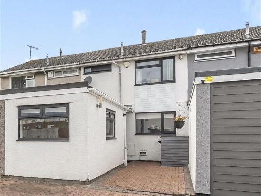 3 bedroom terraced house for sale in Grass Meers Drive, Bristol, BS14 — £300,000 • 3 bed • 1 bath • 955 ft²
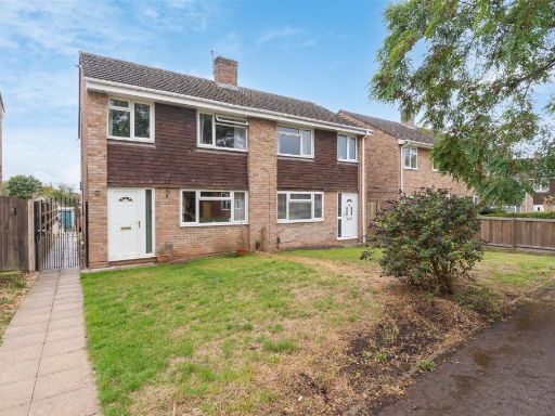 3 bedroom semi-detached house for sale in Malvern Drive, Warmley, BS30 — £339,995 • 3 bed • 1 bath • 805 ft²
 3 bedroom semi-detached house for sale in Ashcombe Crescent, Warmley, Bristol, BS30 — £362,500 • 3 bed • 2 bath • 749 ft²
 3 bedroom end of terrace house for sale in Grass Meers Drive, Bristol, BS14 — £320,000 • 3 bed • 1 bath • 1073 ft²
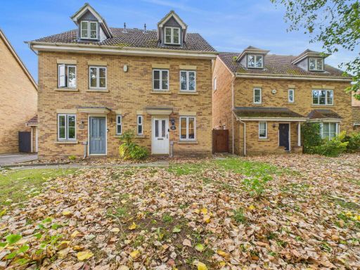 3 bedroom semi-detached house for sale in Lanes End, Bristol, BS4 — £375,000 • 3 bed • 2 bath • 995 ft²
Meta
- {
"@context": "https://schema.org",
"@type": "Residence",
"name": "3 bedroom terraced house for sale in Sunningdale Drive, War…",
"description": "",
"url": "https://propertypiper.co.uk/property/74ccdf18-dfe8-4804-b484-59a428fea3ef",
"image": "https://image-a.propertypiper.co.uk/92f97005-3aa4-4c0b-ad0f-1fa150c0cc94-1024.jpeg",
"address": {
"@type": "PostalAddress",
"streetAddress": "11 SUNNINGDALE DRIVE WARMLEY BRISTOL",
"postalCode": "BS30 8GP",
"addressLocality": "South Gloucestershire",
"addressRegion": "Kingswood",
"addressCountry": "England"
},
"geo": {
"@type": "GeoCoordinates",
"latitude": 51.4537487,
"longitude": -2.4819208
},
"numberOfRooms": 3,
"numberOfBathroomsTotal": 2,
"floorSize": {
"@type": "QuantitativeValue",
"value": 761,
"unitCode": "FTK"
},
"offers": {
"@type": "Offer",
"price": 325000,
"priceCurrency": "GBP",
"availability": "https://schema.org/InStock"
},
"additionalProperty": [
{
"@type": "PropertyValue",
"name": "Feature",
"value": "modern"
},
{
"@type": "PropertyValue",
"name": "Feature",
"value": "semi-detached"
},
{
"@type": "PropertyValue",
"name": "Feature",
"value": "two-story"
},
{
"@type": "PropertyValue",
"name": "Feature",
"value": "brick"
},
{
"@type": "PropertyValue",
"name": "Feature",
"value": "front lawn"
},
{
"@type": "PropertyValue",
"name": "Feature",
"value": "residential area"
},
{
"@type": "PropertyValue",
"name": "Feature",
"value": "suburban"
},
{
"@type": "PropertyValue",
"name": "Feature",
"value": "small garden"
},
{
"@type": "PropertyValue",
"name": "Feature",
"value": "modern"
},
{
"@type": "PropertyValue",
"name": "Feature",
"value": "light flooring"
},
{
"@type": "PropertyValue",
"name": "Feature",
"value": "textured wallpaper"
},
{
"@type": "PropertyValue",
"name": "Feature",
"value": "central light fixture"
},
{
"@type": "PropertyValue",
"name": "Feature",
"value": "single large window"
}
]
}
High Res Floorplan Images
Compatible Floorplan Images
FloorplanImages Thumbnail