SL9 7AT - 4 bedroom semidetached house for sale in Landrecies, Oxford…
View on Property Piper
4 bedroom semi-detached house for sale in Landrecies, Oxford Road, Gerrards Cross, SL9
Property Details
- Price: £1245000
- Bedrooms: 4
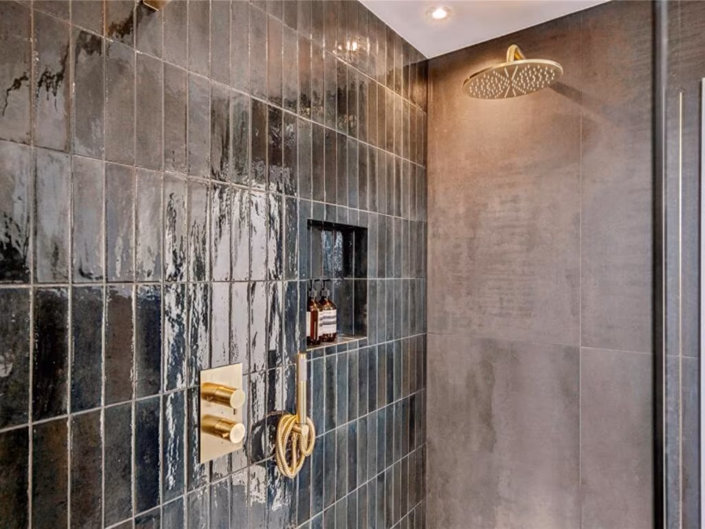
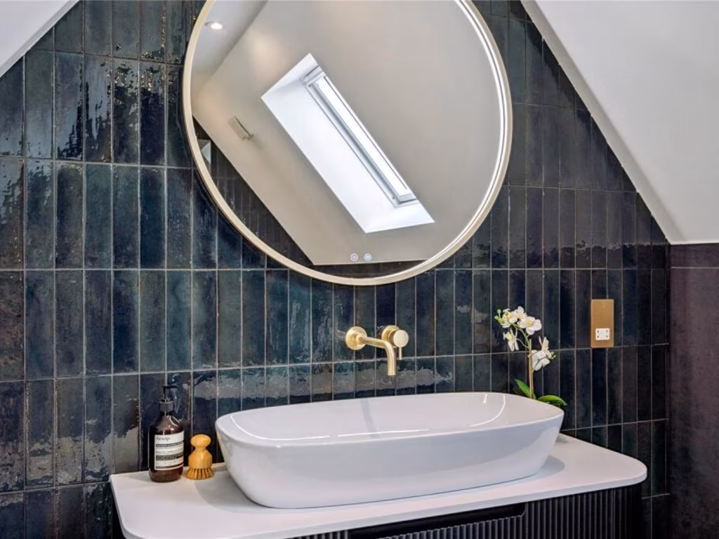
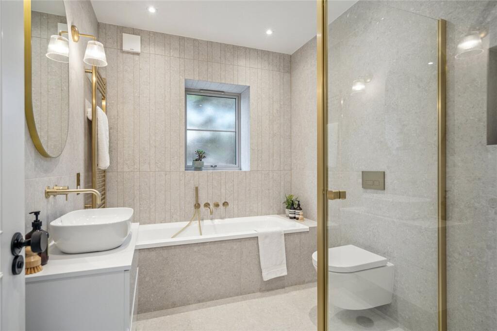
- Bathrooms: 2
- Property Type: undefined
- Property SubType: undefined
Brochure Descriptions
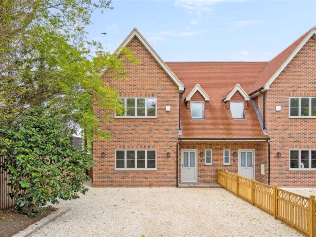
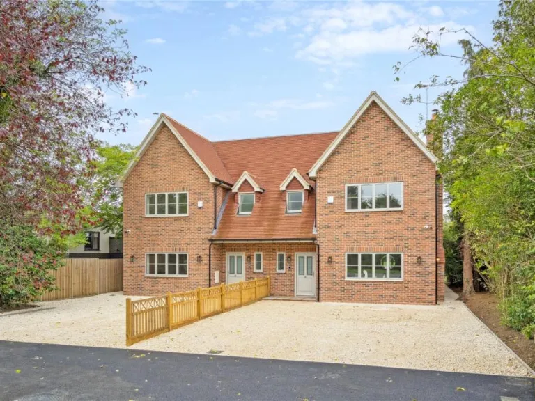
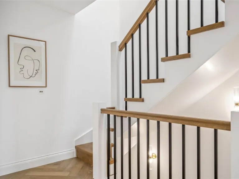
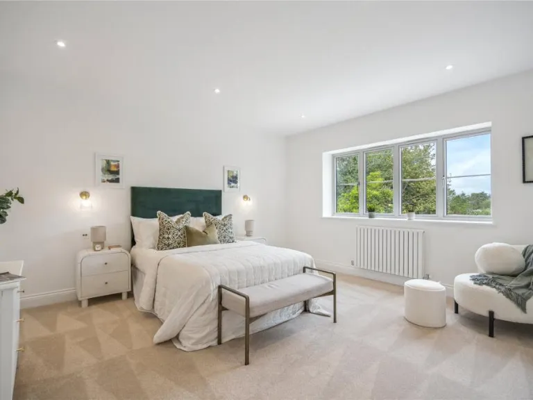
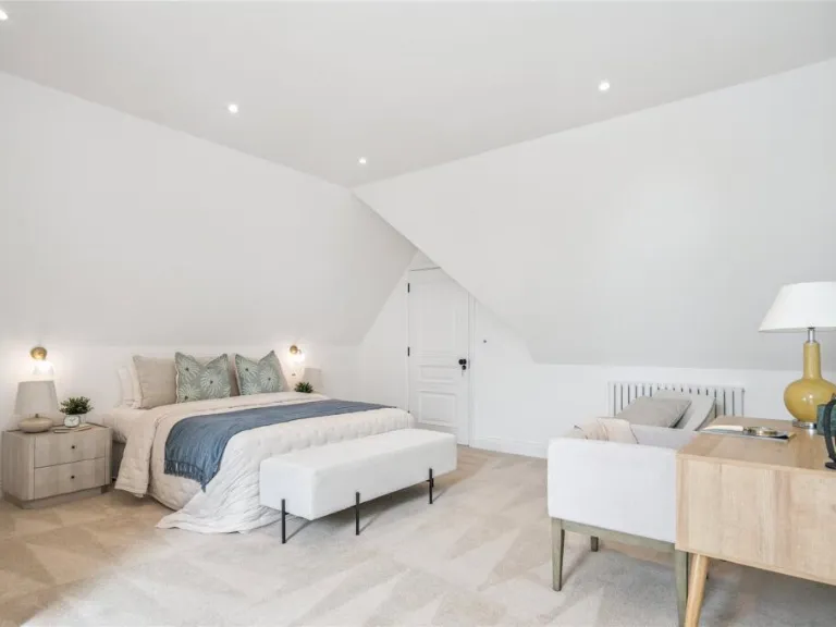
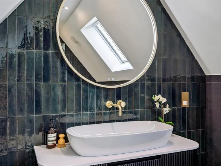
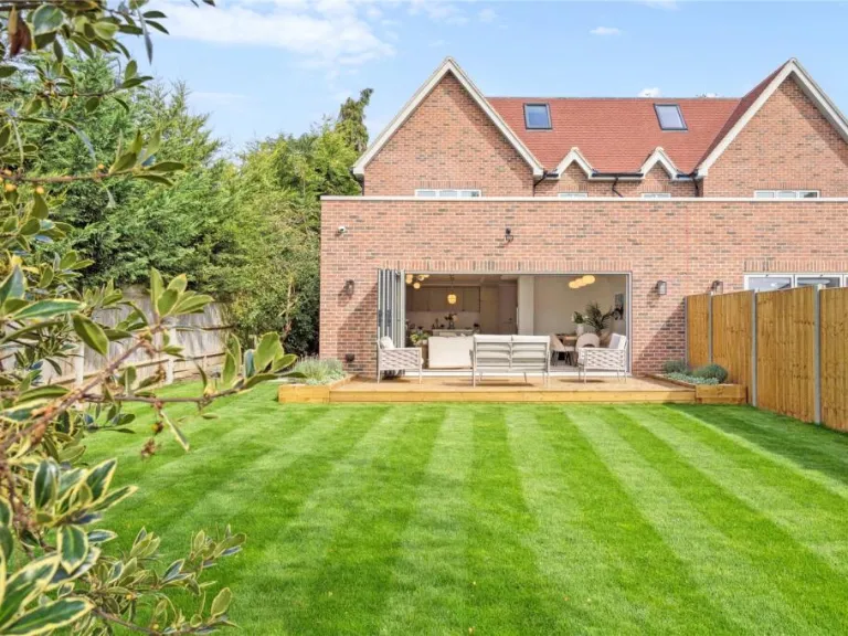
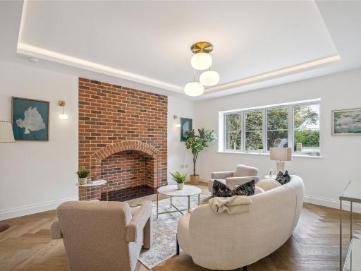
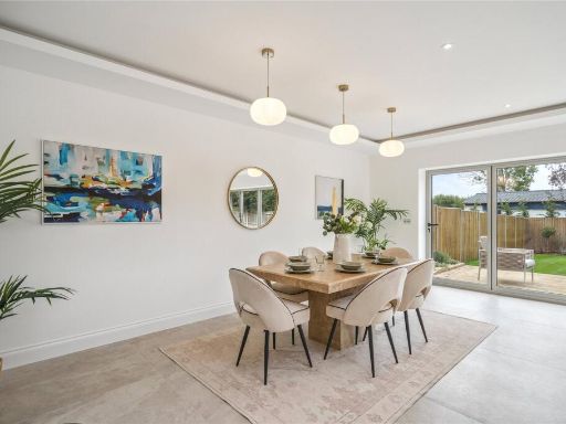
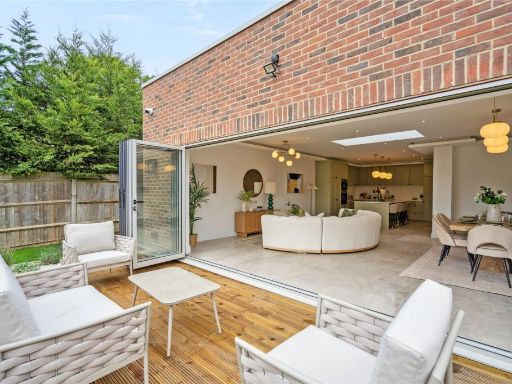
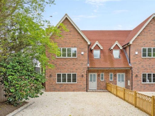
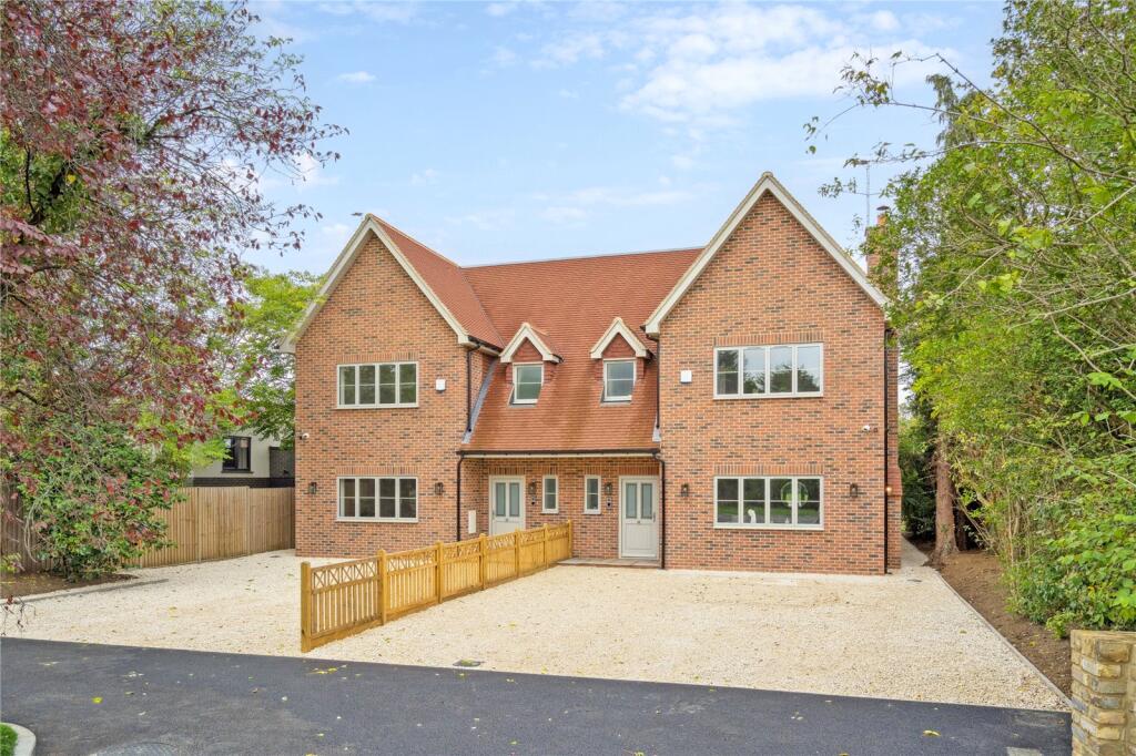
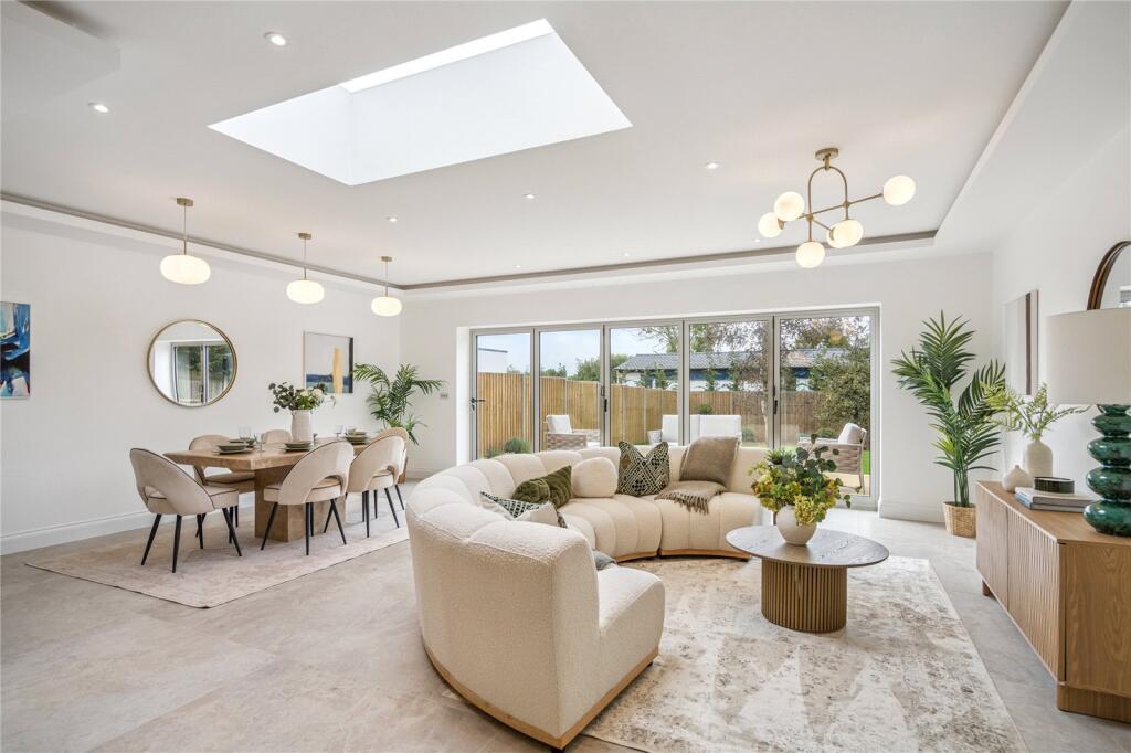
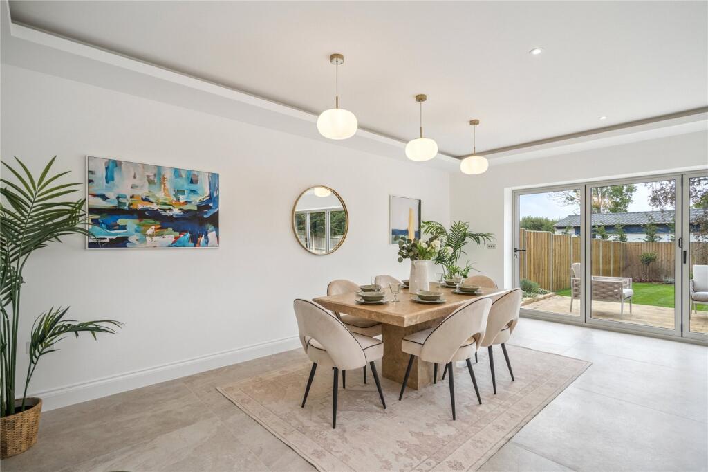
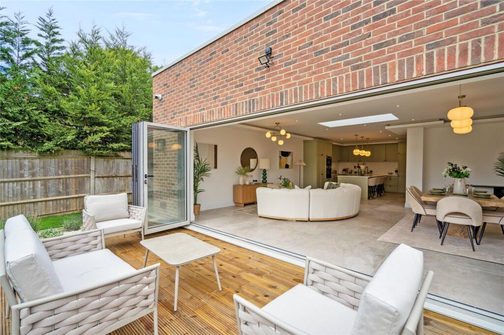
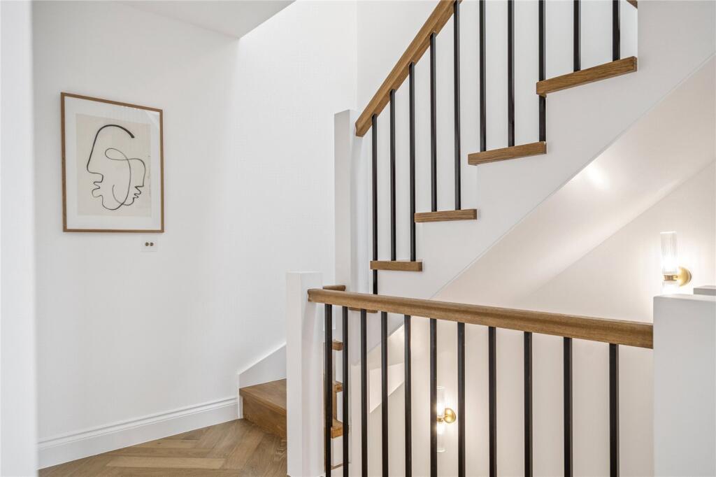
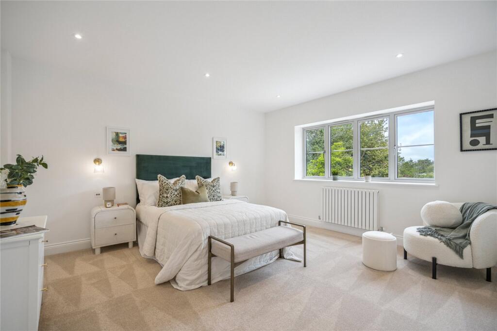
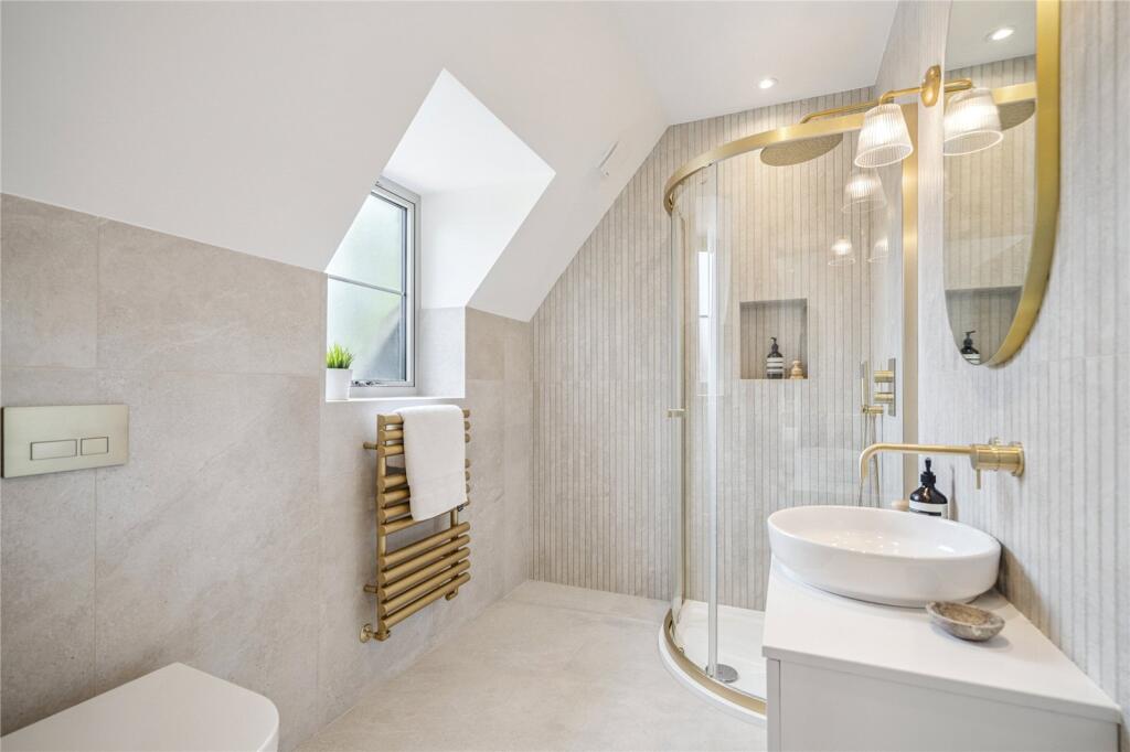
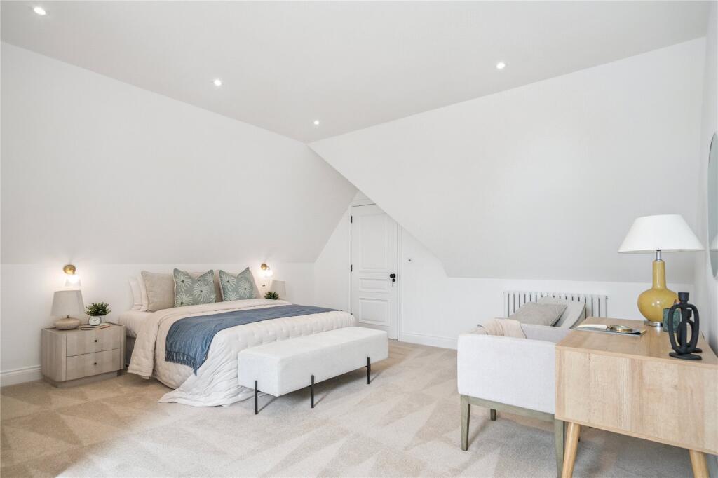
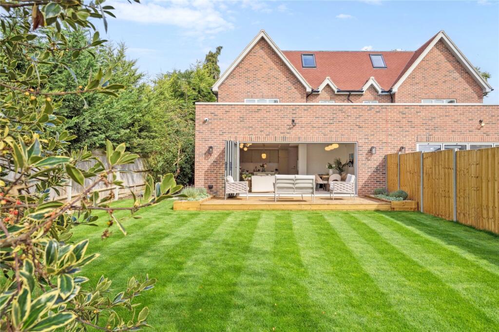
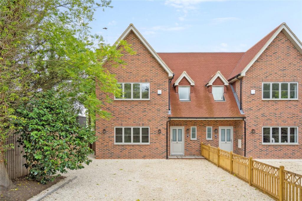
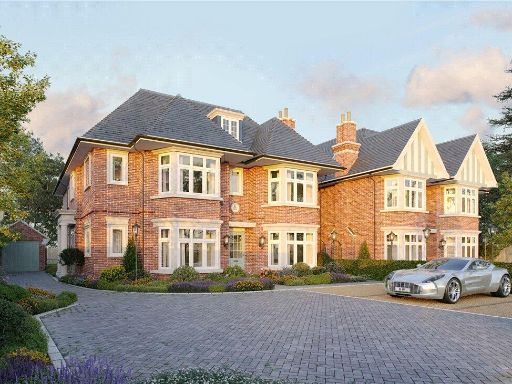
- Recently constructed (or newly finished) pair of semi-detached dwellings built in red brick with pitched tiled roofs. Each unit appears to be two storeys plus attic space (dormer windows) and has its own front entrance. The site benefits from a wide frontage with a large shared/individual gravel parking area providing multiple car spaces, a private driveway and low timber fencing dividing the front forecourt. Mature trees and hedging screen the site on both flanks giving a sense of seclusion and privacy. The setting suggests a suburban or semi-rural location with a generous plot depth possible to the rear (not visible). Overall impression: modern, well-finished homes suitable for family occupation; plot and front parking are large, internal living space likely to be above average for semi-detached stock in the area.
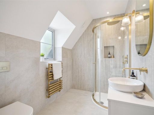
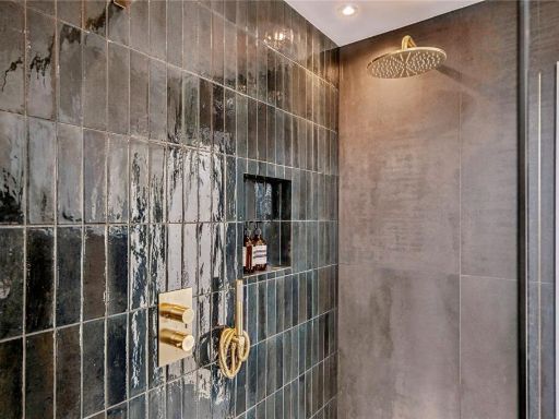
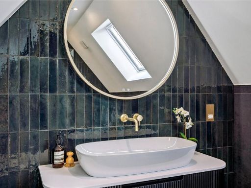
- Not possible to identify a specific residential street address from the provided images. The material is a marketing pack page showing agent contact details and a local area map. The map indicates a semi-rural / edge-of-village location with a small cluster of residential buildings, surrounding open agricultural or greenfield land, and a railway or major transport corridor running nearby. The plan suggests parcels of land consistent with a small new-build development or a conversion site rather than an individual historic dwelling. From the imagery you can infer: a setting with countryside views and limited immediate urban frontage; likely low to medium density development; proximity to transport infrastructure (rail/road) which is a positive for accessibility but may have amenity/noise considerations. Internal layout, number of rooms, garden size and total accommodation cannot be determined from these images. Overall impression (valuator style): a modest-sized development plot in a semi-rural edge location offering potential for good outlooks and commuter access; valuation would require confirmation of exact plot boundaries, accommodation schedule, construction specification and any planning conditions.
Image Descriptions
- newly-built detached house Modern
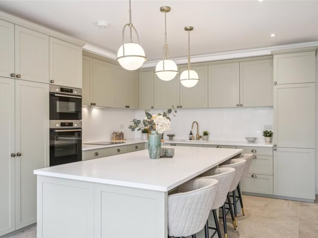
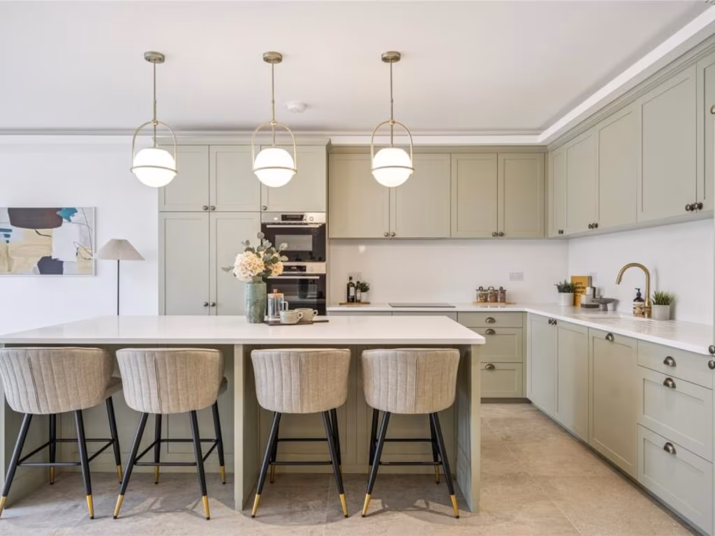
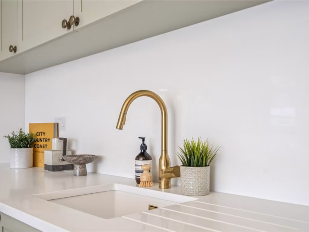
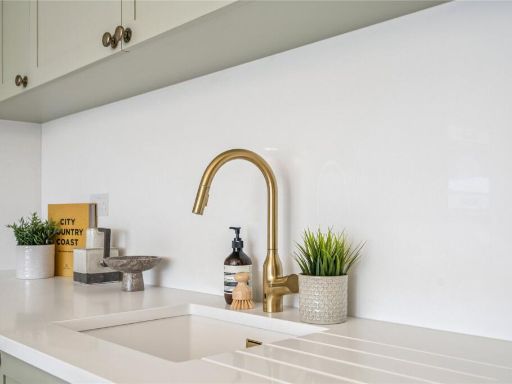
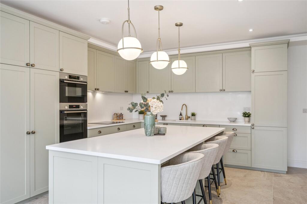
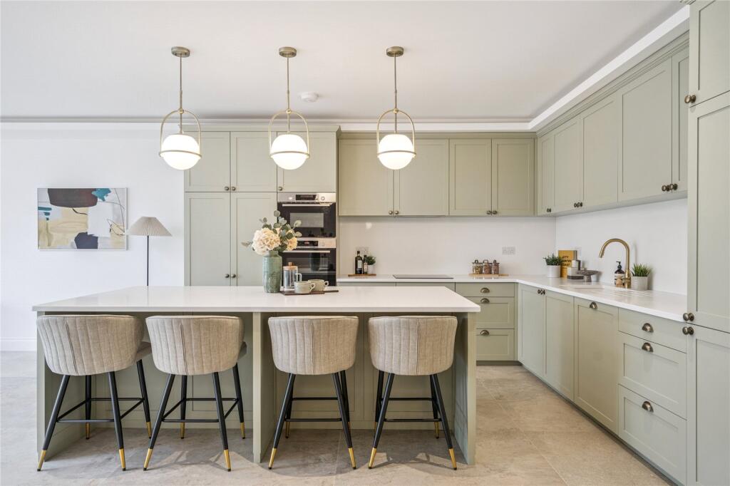
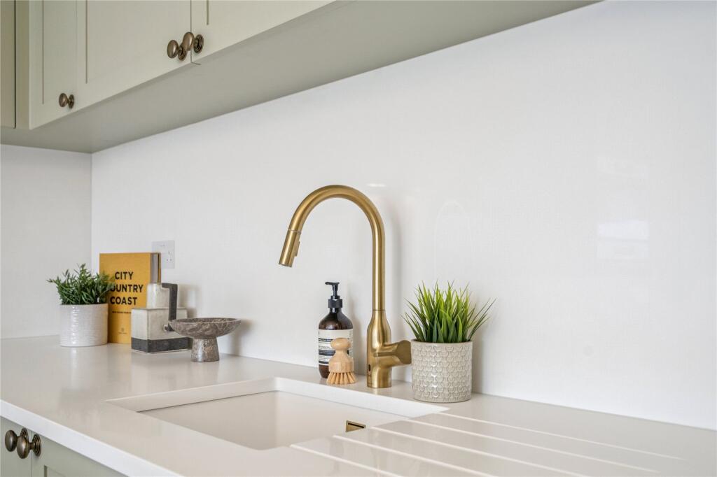
- kitchen modern
Floorplan Description
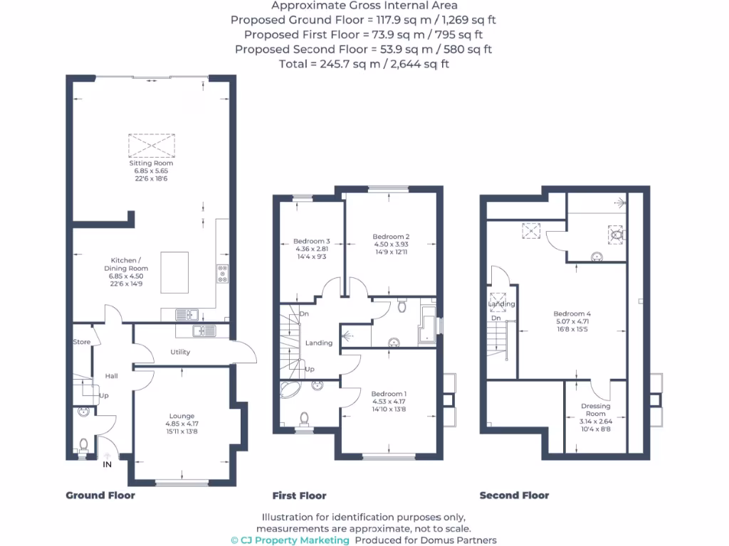
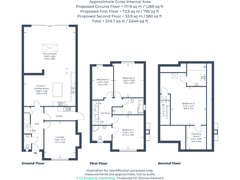
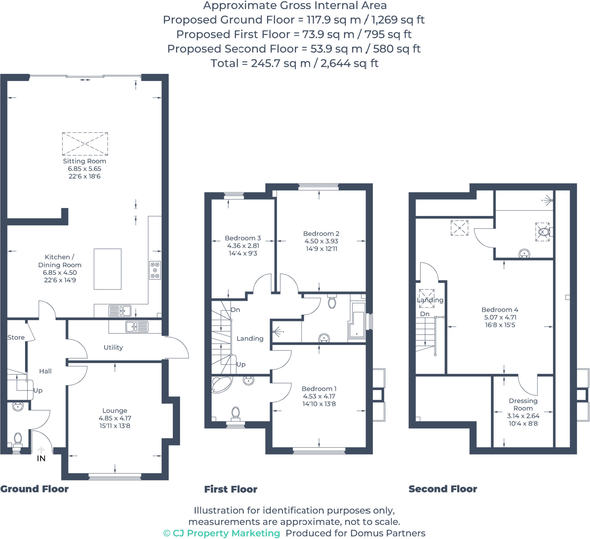
- Three-storey residential property shown over Ground, First and Second floors
Rooms
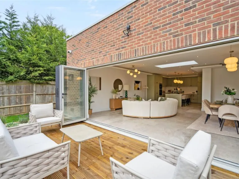
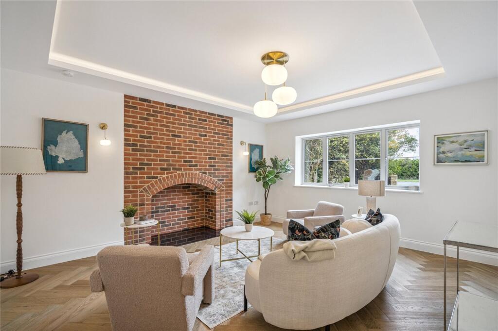
- Sitting Room:
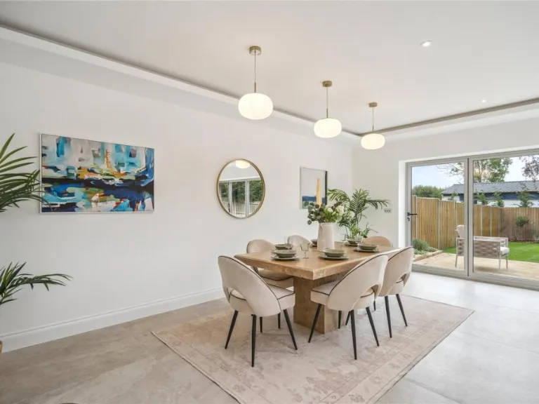
- Kitchen / Dining Room:
- Lounge:
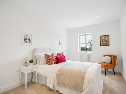
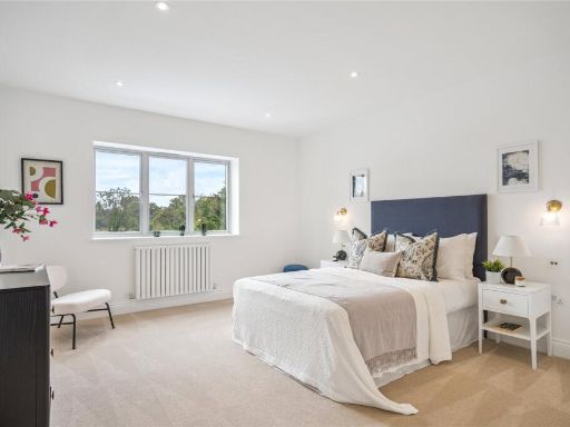
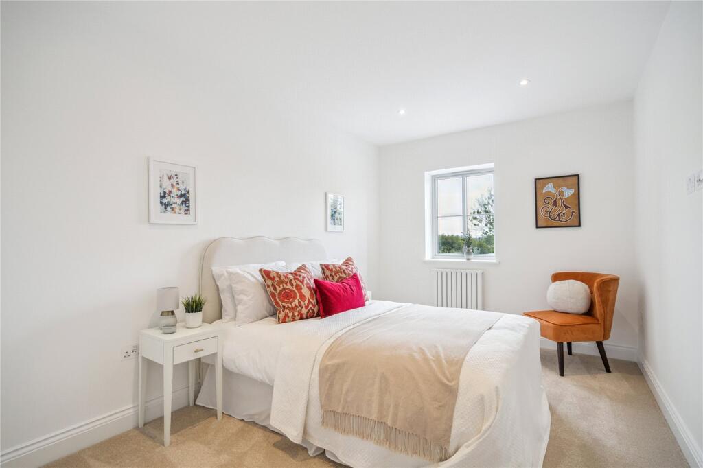
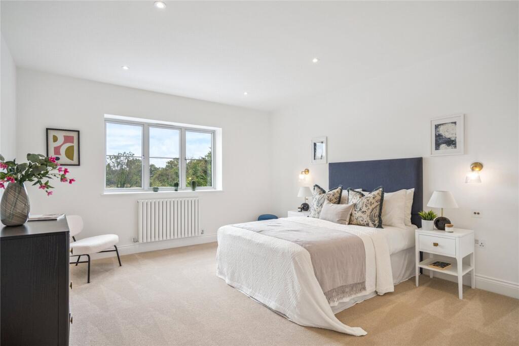
- Bedroom 3:
- Bedroom 2:
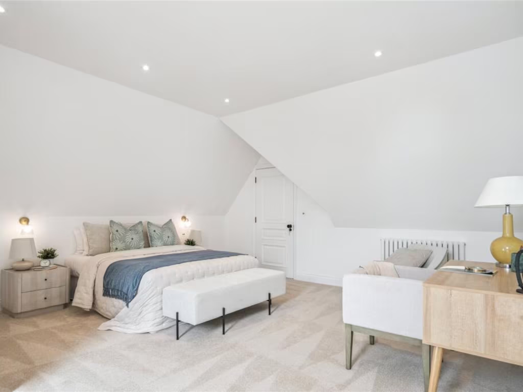
- Bedroom 1:
- Bedroom 4:
- Dressing Room:
Textual Property Features
- Is New Build
- Has Garden
- Success
Detected Visual Features
- modern
- detached
- newly built
- brick facade
- garage potential
- double fronted
- driveway
- off-street parking
- spacious
- modern kitchen
- island
- integrated appliances
- pendant lighting
- white countertops
- contemporary design
Nearby Schools
- Harefield Infant School
- Wexham Court Primary School
- International School of Creative Arts
- Fulmer Infant School
- The Gerrards Cross CofE School
- St Mary's School
- Chalfont St Peter CofE Academy
- Chalfont St Peter Infant School
- Maple Cross Junior Mixed Infant and Nursery School
- Iver Village Infant Academy
- Iver Heath Infant School and Nursery
- Gayhurst School
- Thorpe House School
- Maltman's Green School
- Robertswood School
- Chalfont St Giles Junior School
- Whitehall Infant School
- St Mary's Catholic Primary School
- Harefield Junior School
- Wexham School
- Iver Heath Junior School
- Pioneer Secondary Academy
- Denham Village School
- Denham Green E-ACT Primary Academy
- The Chalfonts Community College
- The Iver Village Junior School
- The Stoke Poges School
- Teikyo School UK
- St Joseph's Catholic Primary School
Nearest General Shops
- Id: 60038728
- Tags:
- Landuse: commercial
- Name: Tendercare Nurseries
- Shop: garden_centre
- TagsNormalized:
- nurseries
- garden centre
- shop
- Lat: 51.5667131
- Lon: -0.5050998
- FullGeoHash: gcptke2jyk43
- PartitionGeoHash: gcpt
- Images:
- FoodStandards: null
- Distance: 2385.1
,- Id: 8944638388
- Tags:
- Addr:
- City: Gerrards Cross
- Housenumber: 21 / 25
- Postcode: SL9 7QA
- Street: Packhorse Road
- Brand: Screwfix
- Brand:wikidata: Q7439115
- Brand:wikipedia: en:Screwfix
- Name: Screwfix
- Opening_hours: Mo-Fr 07:00-20:00; Sa 07:00-18:00; Su 09:00-16:00
- Phone: +443330112112
- Shop: doityourself
- Website: https://www.screwfix.com/jsp/tradeCounter/tradeCounterDetailsPage.jsp?id=688
- TagsNormalized:
- Lat: 51.5871441
- Lon: -0.5546299
- FullGeoHash: gcpt7rhhuhtv
- PartitionGeoHash: gcpt
- Images:
- FoodStandards: null
- Distance: 1844.2
,- Id: 2943325411
- Tags:
- Addr:
- City: Gerrards Cross
- Housenumber: 17
- Postcode: SL9 7QA
- Street: Packhorse Road
- Name: EXCEL DRY CLEANERS
- Opening_hours: 09:00-17:30
- Shop: dry_cleaning
- TagsNormalized:
- Lat: 51.5870098
- Lon: -0.5547755
- FullGeoHash: gcpt7rhh0g97
- PartitionGeoHash: gcpt
- Images:
- FoodStandards: null
- Distance: 1839.6
}
Nearest Grocery shops
- Id: 5172804985
- Tags:
- Brand: Spar
- Brand:wikidata: Q610492
- Brand:wikipedia: en:Spar (retailer)
- Name: Spar
- Shop: convenience
- TagsNormalized:
- Lat: 51.5688804
- Lon: -0.5044847
- FullGeoHash: gcptkebds8hc
- PartitionGeoHash: gcpt
- Images:
- FoodStandards: null
- Distance: 2348.5
,- Id: 997181877
- Tags:
- Addr:
- City: Gerrards Cross
- Postcode: SL9 7RD
- Street: Oxford Road
- Brand: M&S Simply Food
- Brand:wikidata: Q714491
- Brand:wikipedia: en:Marks & Spencer
- Building: yes
- Contact:
- Website: https://www.marksandspencer.com/stores/gerrards-cross-bp-1215
- Name: M&S Simply Food
- Opening_hours: 24/7
- Phone: +443330148555
- Shop: convenience
- TagsNormalized:
- m&s simply food
- food
- convenience
- shop
- Lat: 51.5878275
- Lon: -0.563568
- FullGeoHash: gcpt7pm8guj1
- PartitionGeoHash: gcpt
- Images:
- FoodStandards: null
- Distance: 2342.6
,- Id: 5172804987
- Tags:
- Addr:
- City: Denham
- Housename: Denham Flying Horse
- Postcode: UB9 4DG
- Street: Oxford Road
- Brand: M&S Simply Food
- Brand:wikidata: Q714491
- Brand:wikipedia: en:Marks & Spencer
- Name: M&S Simply Food
- Opening_hours: 24/7
- Shop: convenience
- Website: https://www.marksandspencer.com/stores/flying-horse-bp-1250
- TagsNormalized:
- m&s simply food
- food
- convenience
- shop
- Lat: 51.5684239
- Lon: -0.5051299
- FullGeoHash: gcptke8pvdgy
- PartitionGeoHash: gcpt
- Images:
- FoodStandards: null
- Distance: 2320
}
Nearest Religious buildings
- Id: 824555735
- Tags:
- Amenity: place_of_worship
- Building: church
- Denomination: anglican
- Name: St Mark's Hall
- Religion: christian
- Wikidata: Q105083090
- TagsNormalized:
- place of worship
- church
- anglican
- christian
- Lat: 51.5831477
- Lon: -0.5009903
- FullGeoHash: gcptkw7jw5dt
- PartitionGeoHash: gcpt
- Images:
- FoodStandards: null
- Distance: 2677.6
,- Id: 824558813
- Tags:
- Amenity: place_of_worship
- Building: church
- Denomination: anglican
- Name: St James
- Religion: christian
- Wikidata: Q17540147
- TagsNormalized:
- place of worship
- church
- anglican
- christian
- Lat: 51.5612187
- Lon: -0.5601691
- FullGeoHash: gcpt762jg5gd
- PartitionGeoHash: gcpt
- Images:
- FoodStandards: null
- Distance: 2174.2
,- Id: 822228162
- Tags:
- Amenity: place_of_worship
- Building: church
- Denomination: anglican
- Name: St James
- Religion: christian
- Wikidata: Q7593484
- TagsNormalized:
- place of worship
- church
- anglican
- christian
- Lat: 51.5813309
- Lon: -0.5568504
- FullGeoHash: gcpt7q4e03n0
- PartitionGeoHash: gcpt
- Images:
- FoodStandards: null
- Distance: 1551.3
}
Nearest Medical buildings
- Id: 9612517835
- Tags:
- Addr:
- City: Denham
- Housenumber: 2
- Postcode: UB9 5JF
- Street: Ashcroft Drive
- Amenity: dentist
- Healthcare: dentist
- Name: Dental Art
- Opening_hours: Mo 09:00-19:00; Tu 09:00-17:00; We 09:00-17:00; Th 09:00-19:00; Fr 09:00-17:00; Sa 09:00-16:00
- Phone: +441494681367
- Website: https://www.dentalartlimited.co.uk/
- TagsNormalized:
- dentist
- health
- healthcare
- dental
- art
- Lat: 51.5809482
- Lon: -0.5028282
- FullGeoHash: gcptkw1bg38j
- PartitionGeoHash: gcpt
- Images:
- FoodStandards: null
- Distance: 2478.7
,- Id: 522524883
- Tags:
- Amenity: pharmacy
- Brand: Boots
- Brand:wikidata: Q6123139
- Brand:wikipedia: en:Boots (company)
- Dispensing: yes
- Healthcare: pharmacy
- Name: Boots
- Operator: Boots
- TagsNormalized:
- pharmacy
- boots
- health
- healthcare
- Lat: 51.5889688
- Lon: -0.5525114
- FullGeoHash: gcpt7rmxt8c9
- PartitionGeoHash: gcpt
- Images:
- FoodStandards: null
- Distance: 1917.8
,- Id: 522524893
- Tags:
- Amenity: pharmacy
- Dispensing: yes
- Healthcare: pharmacy
- Name: Health and Beauty Pharmacy
- TagsNormalized:
- pharmacy
- health
- healthcare
- beauty
- Lat: 51.5891579
- Lon: -0.5520079
- FullGeoHash: gcpt7rw09k11
- PartitionGeoHash: gcpt
- Images:
- FoodStandards: null
- Distance: 1916.6
,- Id: 1069563815
- Tags:
- Addr:
- City: Gerrards Cross
- Housenumber: 1
- Postcode: SL9 8BS
- Street: Oak End Way
- Amenity: dentist
- Building: yes
- Healthcare: dentist
- Name: Oakend Dental Clinic
- Website: http://www.oakenddental.com/
- TagsNormalized:
- dentist
- health
- healthcare
- clinic
- dental
- Lat: 51.5891292
- Lon: -0.5510384
- FullGeoHash: gcpt7rw8ryey
- PartitionGeoHash: gcpt
- Images:
- FoodStandards: null
- Distance: 1879
}
Nearest Airports
- Id: 14001268
- Tags:
- Access: yes
- Aerodrome: international
- Aerodrome:type: public
- Aeroway: aerodrome
- Alt_name: London Heathrow
- Alt_name_2: London Heathrow Airport
- Ele: 25
- Iata: LHR
- Icao: EGLL
- Int_name: Heathrow Airport
- Name: London Heathrow Airport
- Note: area still approx
- Old_name: London Airport
- Operator: Heathrow Airport Limited
- Rank_aci:
- Ref: LHR
- Short_name: Heathrow
- Type: multipolygon
- Website: https://www.heathrow.com/
- Wikidata: Q8691
- Wikipedia: en:Heathrow Airport
- TagsNormalized:
- airport
- international airport
- Lat: 51.4677522
- Lon: -0.4547736
- FullGeoHash: gcpsv9kv7h2h
- PartitionGeoHash: gcps
- Images:
- FoodStandards: null
- Distance: 13177
}
Nearest Leisure Facilities
- Id: 873066466
- Tags:
- Leisure: pitch
- Sport: equestrian
- TagsNormalized:
- pitch
- leisure
- equestrian
- sports
- Lat: 51.5662006
- Lon: -0.5508982
- FullGeoHash: gcpt77qfghs8
- PartitionGeoHash: gcpt
- Images:
- FoodStandards: null
- Distance: 1328.2
,- Id: 1063069658
- Tags:
- Access: private
- Leisure: swimming_pool
- TagsNormalized:
- swimming
- swimming pool
- pool
- leisure
- Lat: 51.5751068
- Lon: -0.5184526
- FullGeoHash: gcptkhyqz0tx
- PartitionGeoHash: gcpt
- Images:
- FoodStandards: null
- Distance: 1297.2
,- Id: 1070290843
- Tags:
- TagsNormalized:
- swimming
- swimming pool
- pool
- leisure
- Lat: 51.5812315
- Lon: -0.5505358
- FullGeoHash: gcpt7qp47w6z
- PartitionGeoHash: gcpt
- Images:
- FoodStandards: null
- Distance: 1181.3
,- Id: 1063069659
- Tags:
- Access: private
- Leisure: swimming_pool
- TagsNormalized:
- swimming
- swimming pool
- pool
- leisure
- Lat: 51.5728273
- Lon: -0.5224146
- FullGeoHash: gcptkhe96zg6
- PartitionGeoHash: gcpt
- Images:
- FoodStandards: null
- Distance: 1040.5
,- Id: 873066465
- Tags:
- Leisure: pitch
- Sport: equestrian
- TagsNormalized:
- pitch
- leisure
- equestrian
- sports
- Lat: 51.5724846
- Lon: -0.5392005
- FullGeoHash: gcpt7srr7xyv
- PartitionGeoHash: gcpt
- Images:
- FoodStandards: null
- Distance: 270.9
}
Nearest Tourist attractions
- Id: 12422896
- Tags:
- Name: Wyatt's Covert Caravan Site
- Tourism: caravan_site
- Type: multipolygon
- TagsNormalized:
- Lat: 51.5933957
- Lon: -0.5070583
- FullGeoHash: gcpts2qc2djc
- PartitionGeoHash: gcpt
- Images:
- FoodStandards: null
- Distance: 2952.1
,- Id: 434857394
- Tags:
- Addr:
- City: Denham
- Housename: The Bungalow
- Postcode: UB9 5DF
- Street: Hangar Road
- Building: house
- Description: This house is famous for being the location of Auntie Mable's cottage in the BBC childrens' series Come Outside.
- Name: The Bungalow
- Tourism: yes
- TagsNormalized:
- Lat: 51.5918796
- Lon: -0.5089572
- FullGeoHash: gcpts2j2krqj
- PartitionGeoHash: gcpt
- Images:
- FoodStandards: null
- Distance: 2740.2
,- Id: 9124468261
- Tags:
- Amenity: telephone
- Booth: K6
- Covered: booth
- Listed_status: Grade II
- Man_made: telephone_box
- Tourism: museum
- TagsNormalized:
- Lat: 51.5613521
- Lon: -0.5598788
- FullGeoHash: gcpt762q9usj
- PartitionGeoHash: gcpt
- Images:
- FoodStandards: null
- Distance: 2149.4
}
Nearest Bus stations and stops
- Id: 5173036167
- Tags:
- Bus: yes
- Highway: bus_stop
- Name: Village Road
- Naptan:
- Public_transport: platform
- Ref: 49652
- TagsNormalized:
- Lat: 51.5710847
- Lon: -0.5049679
- FullGeoHash: gcptks0r36ux
- PartitionGeoHash: gcpt
- Images:
- FoodStandards: null
- Distance: 2261.5
,- Id: 5511454155
- Tags:
- Bus: yes
- Highway: bus_stop
- Name: Village Road
- Naptan:
- Public_transport: platform
- Ref: 77195
- TagsNormalized:
- Lat: 51.5716855
- Lon: -0.5049717
- FullGeoHash: gcptks26c6cy
- PartitionGeoHash: gcpt
- Images:
- FoodStandards: null
- Distance: 2250.7
,- Id: 2598974206
- Tags:
- Highway: bus_stop
- Public_transport: platform
- TagsNormalized:
- Lat: 51.560975
- Lon: -0.5613106
- FullGeoHash: gcpt74rk2w2k
- PartitionGeoHash: gcpt
- Images:
- FoodStandards: null
- Distance: 2250.6
,- Id: 2598974207
- Tags:
- Bench: yes
- Bin: yes
- Highway: bus_stop
- Public_transport: platform
- Shelter: no
- Tactile_paving: no
- TagsNormalized:
- Lat: 51.5612635
- Lon: -0.5608358
- FullGeoHash: gcpt74rw5s4t
- PartitionGeoHash: gcpt
- Images:
- FoodStandards: null
- Distance: 2204.7
,- Id: 8614955458
- Tags:
- Highway: bus_stop
- Name: Community Centre
- Physically_present: no
- Public_transport: platform
- TagsNormalized:
- Lat: 51.578552
- Lon: -0.5160296
- FullGeoHash: gcptkm84zdur
- PartitionGeoHash: gcpt
- Images:
- FoodStandards: null
- Distance: 1528.4
}
Nearest Hotels
- Id: 375749137
- Tags:
- Addr:
- City: Denham
- Postcode: UB9 5DG
- Street: Tilehouse Lane
- Name: Denham Grove
- Operator: De Vere
- Tourism: hotel
- Website: https://www.denhamgrove.com/partner/denham-grove/
- TagsNormalized:
- Lat: 51.5976997
- Lon: -0.5104398
- FullGeoHash: gcpts3h63uk7
- PartitionGeoHash: gcpt
- Images:
- FoodStandards: null
- Distance: 3166.6
,- Id: 30954989
- Tags:
- Addr:
- City: Gerrards Cross
- Country: GB
- Postcode: SL9 7PA
- Street: Oxford Road
- Name: The Bull Hotel
- Tourism: hotel
- Wikidata: Q111368789
- TagsNormalized:
- Lat: 51.5868749
- Lon: -0.5635593
- FullGeoHash: gcpt7pjek47x
- PartitionGeoHash: gcpt
- Images:
- FoodStandards: null
- Distance: 2277.1
,- Id: 339580602
- Tags:
- Amenity: pub
- Name: Ethorpe Hotel
- Tourism: hotel
- TagsNormalized:
- Lat: 51.5894793
- Lon: -0.5520055
- FullGeoHash: gcpt7rw43rfz
- PartitionGeoHash: gcpt
- Images:
- FoodStandards: null
- Distance: 1946.9
}
Tags
- modern
- detached
- newly built
- brick facade
- garage potential
- double fronted
- driveway
- off-street parking
- spacious
- modern kitchen
- island
- integrated appliances
- pendant lighting
- white countertops
- contemporary design
Local Market Stats
- Average Price/sqft: £572
- Avg Income: £72700
- Rental Yield: 3%
- Social Housing: 5%
- Planning Success Rate: 83%
Similar Properties
 5 bedroom house for sale in Packhorse Road, Gerrards Cross, Buckinghamshire, SL9 — £1,595,000 • 5 bed • 3 bath • 2444 ft²
 4 bedroom house for sale in Oxford Road, Gerrards Cross, SL9 — £1,395,000 • 4 bed • 3 bath • 2644 ft²
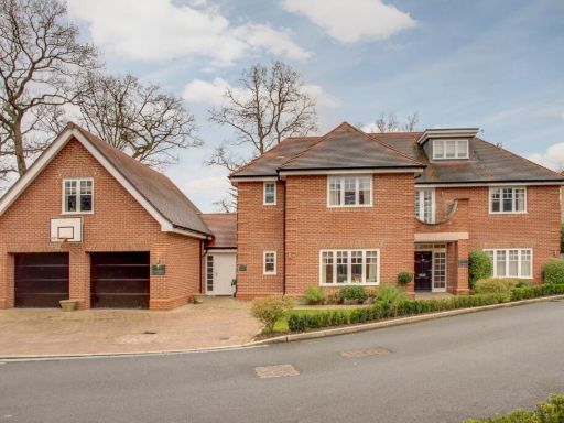 7 bedroom detached house for sale in The Spinney, Gerrards Cross, Buckinghamshire, SL9 — £2,450,000 • 7 bed • 6 bath • 4437 ft²
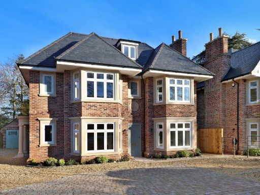 5 bedroom semi-detached house for sale in Packhorse Road, Gerrards Cross, Buckinghamshire, SL9 — £1,595,000 • 5 bed • 3 bath • 2353 ft²
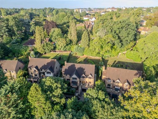 5 bedroom detached house for sale in Rouse Court, Gerrards Cross, SL9 — £1,500,000 • 5 bed • 4 bath • 3446 ft²
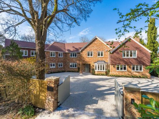 6 bedroom detached house for sale in Hedgerley Lane, Gerrards Cross, SL9 — £3,450,000 • 6 bed • 4 bath • 6069 ft²
Meta
- {
"@context": "https://schema.org",
"@type": "Residence",
"name": "4 bedroom semidetached house for sale in Landrecies, Oxford…",
"description": "",
"url": "https://propertypiper.co.uk/property/7300b18f-9cdd-4e7d-ad8c-1877cde9eff6",
"image": "https://image-a.propertypiper.co.uk/95b3616e-1464-4ce5-b5f3-06a7fa0ac285-1024.jpeg",
"address": {
"@type": "PostalAddress",
"streetAddress": "Landrecies, Oxford Road, GERRARDS CROSS",
"postalCode": "SL9 7AT",
"addressLocality": "Buckinghamshire",
"addressRegion": "Beaconsfield",
"addressCountry": "England"
},
"geo": {
"@type": "GeoCoordinates",
"latitude": 51.57458113324055,
"longitude": -0.5372041323009018
},
"numberOfRooms": 4,
"numberOfBathroomsTotal": 2,
"floorSize": {
"@type": "QuantitativeValue",
"value": 2644,
"unitCode": "FTK"
},
"offers": {
"@type": "Offer",
"price": 1245000,
"priceCurrency": "GBP",
"availability": "https://schema.org/InStock"
},
"additionalProperty": [
{
"@type": "PropertyValue",
"name": "Feature",
"value": "modern"
},
{
"@type": "PropertyValue",
"name": "Feature",
"value": "detached"
},
{
"@type": "PropertyValue",
"name": "Feature",
"value": "newly built"
},
{
"@type": "PropertyValue",
"name": "Feature",
"value": "brick facade"
},
{
"@type": "PropertyValue",
"name": "Feature",
"value": "garage potential"
},
{
"@type": "PropertyValue",
"name": "Feature",
"value": "double fronted"
},
{
"@type": "PropertyValue",
"name": "Feature",
"value": "driveway"
},
{
"@type": "PropertyValue",
"name": "Feature",
"value": "off-street parking"
},
{
"@type": "PropertyValue",
"name": "Feature",
"value": "spacious"
},
{
"@type": "PropertyValue",
"name": "Feature",
"value": "modern kitchen"
},
{
"@type": "PropertyValue",
"name": "Feature",
"value": "island"
},
{
"@type": "PropertyValue",
"name": "Feature",
"value": "integrated appliances"
},
{
"@type": "PropertyValue",
"name": "Feature",
"value": "pendant lighting"
},
{
"@type": "PropertyValue",
"name": "Feature",
"value": "white countertops"
},
{
"@type": "PropertyValue",
"name": "Feature",
"value": "contemporary design"
}
]
}
High Res Floorplan Images
Compatible Floorplan Images
FloorplanImages Thumbnail