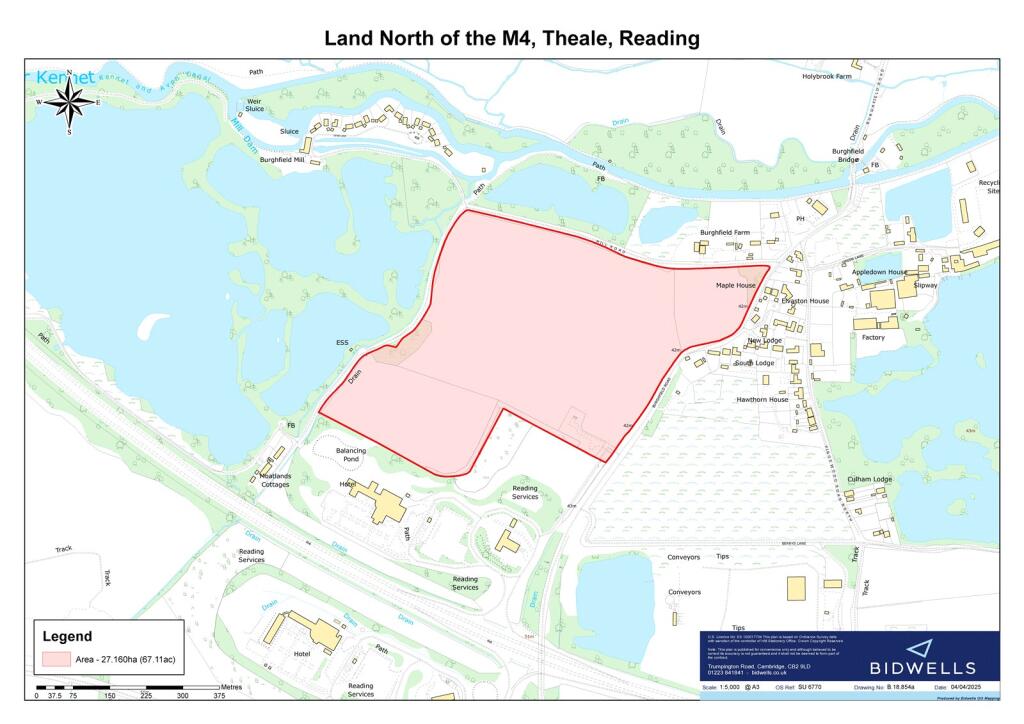
Summary - Theale, Reading, Berkshire RG30 3UQ
1 bed 1 bath Land
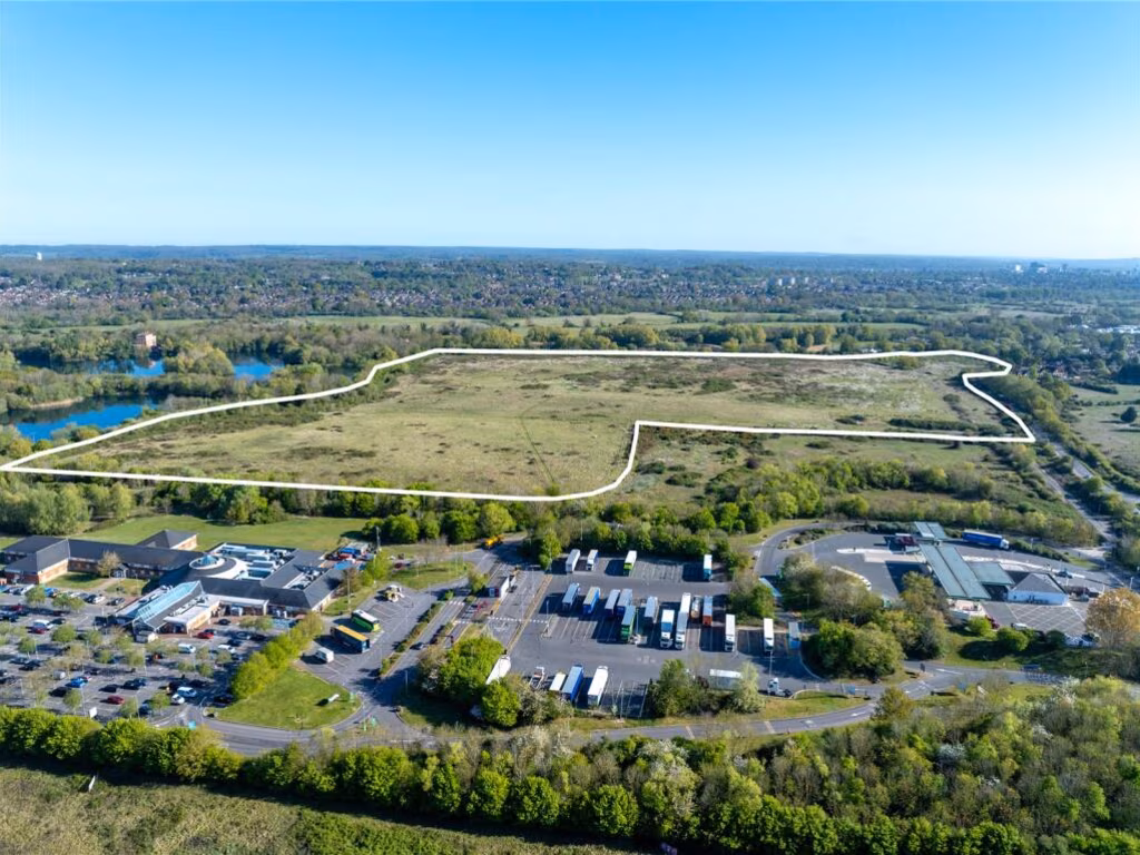
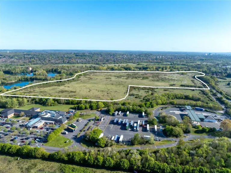
67-acre freehold block with motorway access and mixed flood constraints; planning opportunity.
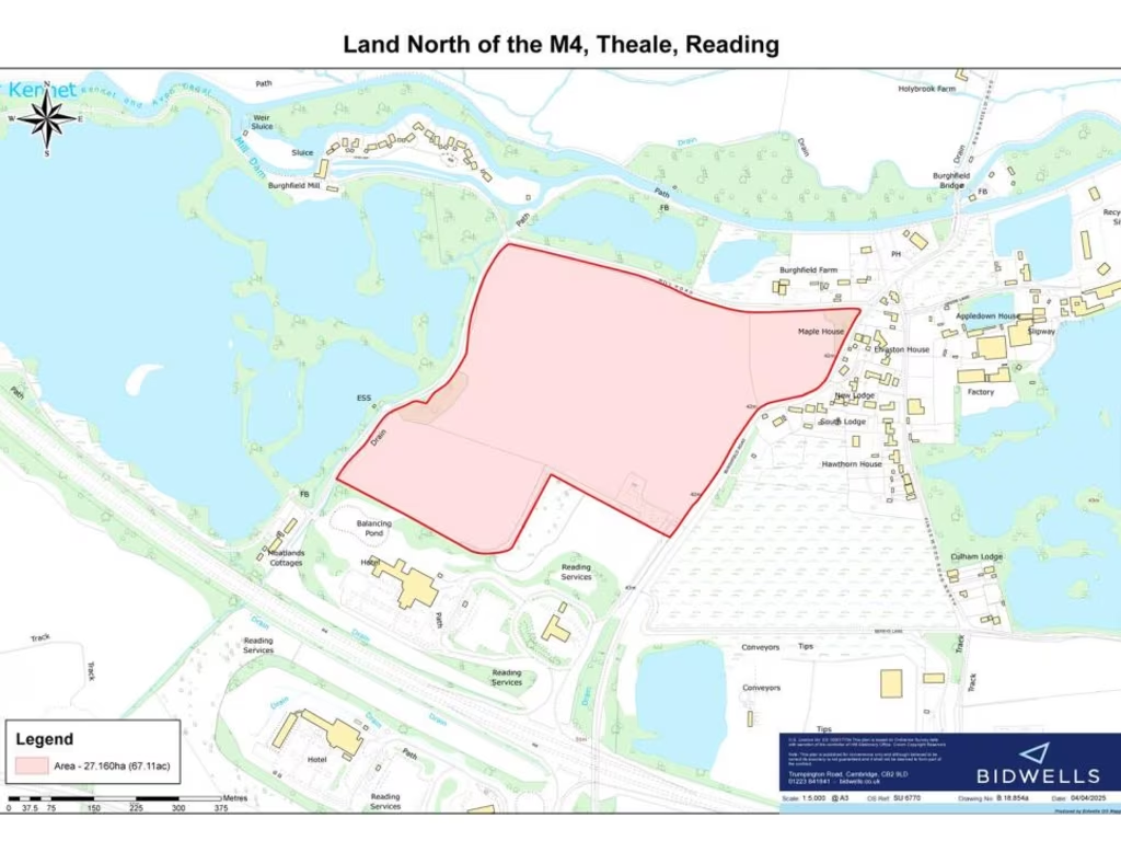
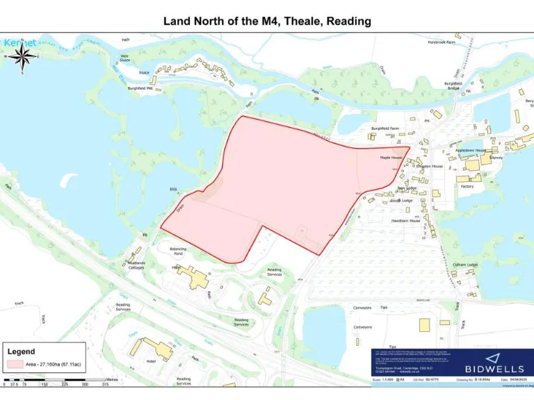
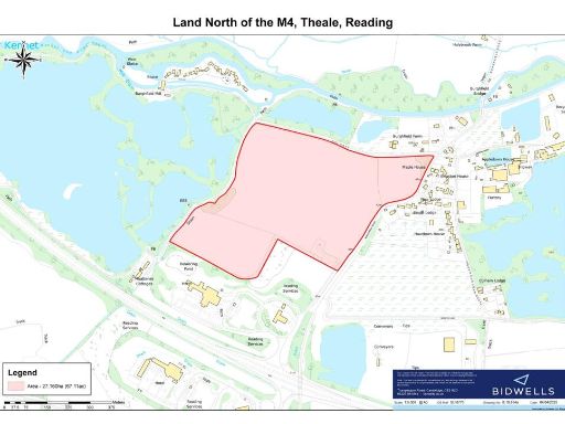
- Freehold land extending approximately 67.11 acres (27.16 ha)
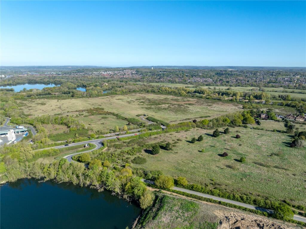
- Adjoins M4 eastbound Reading Services; strong road access
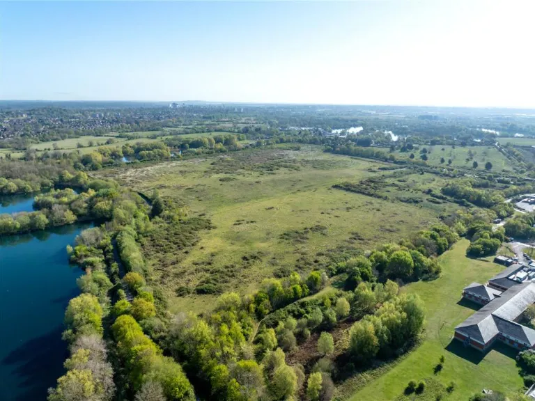
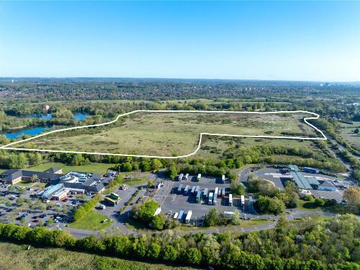
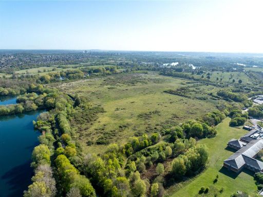
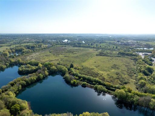
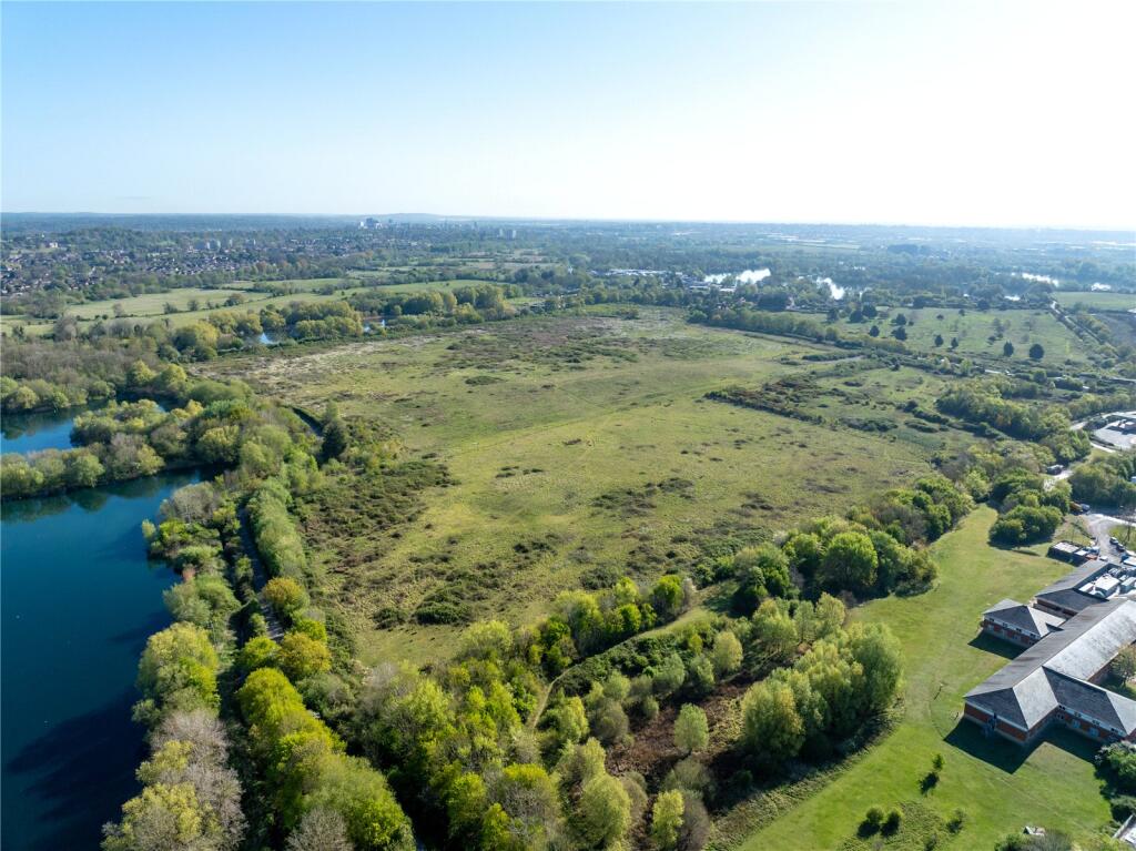
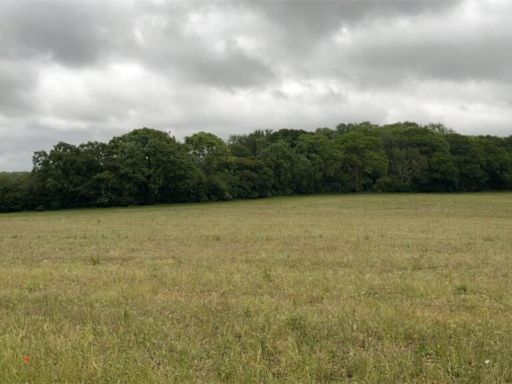
- Former quarry restored to farmland; mix of grassland and scrub
- About 50% lies in Flood Zone 2 or Flood Zone 3
- Southwest land Grade 3; northern section Grade 4 agricultural
- Potential for alternative uses subject to planning permission
- Excellent mobile signal but very slow broadband speeds
- Local crime levels above average; hamlet/isolated setting
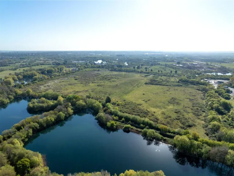
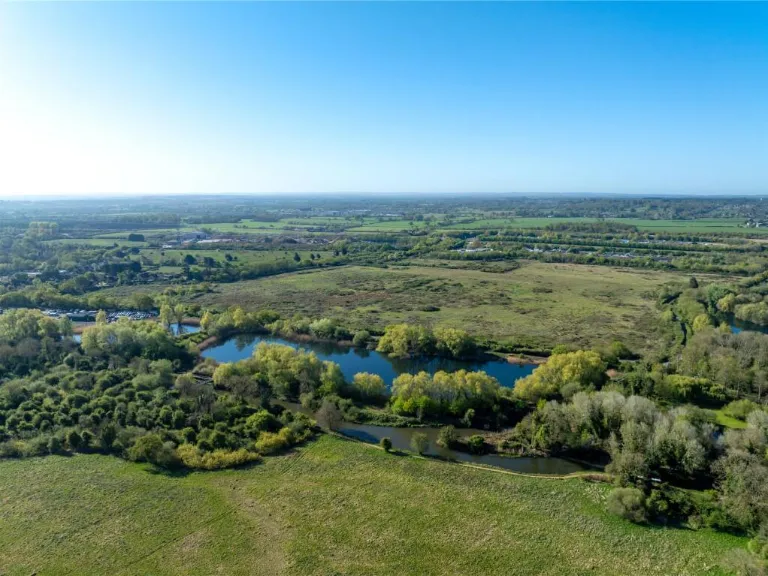
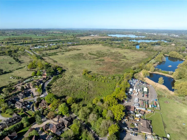
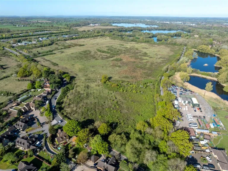
A substantial freehold landholding of approximately 67.11 acres (27.16 hectares) positioned immediately north of the M4 near Theale, offering clear scale for agricultural, recreational or larger redevelopment projects (subject to planning). The site was a former quarry restored to farmland and includes a mix of open grassland and scrub, with ponds and lakes on the eastern and northern boundaries that provide natural interest and potential amenity value.
The parcel benefits from excellent mobile signal and direct proximity to motorway services and local transport routes, making it accessible for logistics, leisure or mixed-use concepts. The site contains areas graded as Agricultural Grade 3 (southwest) and Grade 4 (north), indicating reasonable arable potential in parts. There is explicit potential for alternative uses but any change of use or development will require formal planning permission from the local authority.
Buyers should note important constraints: roughly half the land lies within Flood Zone 2 or Flood Zone 3, which will materially affect developable area and will necessitate specialist flood-risk assessment and mitigation. Broadband speeds are very slow across the site, and recorded local crime is above average. The location is effectively a hamlet/isolated setting, so services are nearby but limited on-site. These factors mean the plot suits buyers prepared to manage environmental and planning complexity rather than simple, immediate development.
Overall this is a strategic, large-scale holding for investors, developers or agricultural users who can carry out due diligence on flood risk, planning viability and infrastructure requirements. Its size, motorway adjacency and mixed land quality create clear opportunities — combined with significant constraints that must be resolved before most development scenarios can proceed.
 Land for sale in Thatcham, Berkshire, RG18 — £80,000 • 1 bed • 1 bath
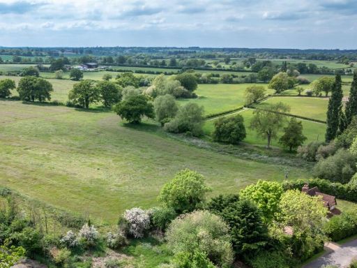 Land for sale in Lot 6 - The Beech Hill Estate, Beech Hill, Reading, Berkshire, RG7 — £300,000 • 1 bed • 1 bath
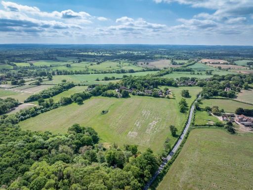 Land for sale in Lot 4 - The Beech Hill Estate, Beech Hill, Reading, Berkshire, RG7 — £200,000 • 1 bed • 1 bath
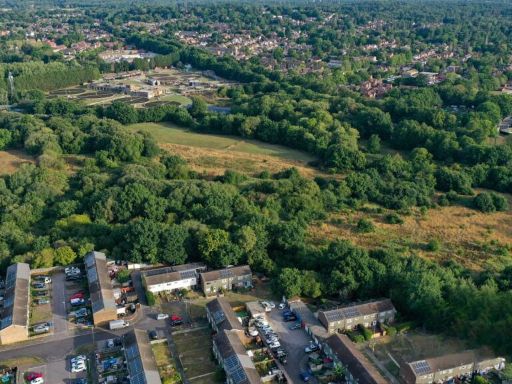 Land for sale in Swan Lane, Darby Green, Sandhurst, GU47 — £35,000 • 1 bed • 1 bath
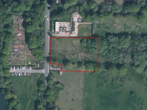 Land for sale in Swan Lane, Sandhurst, GU47 — £295,000 • 1 bed • 1 bath
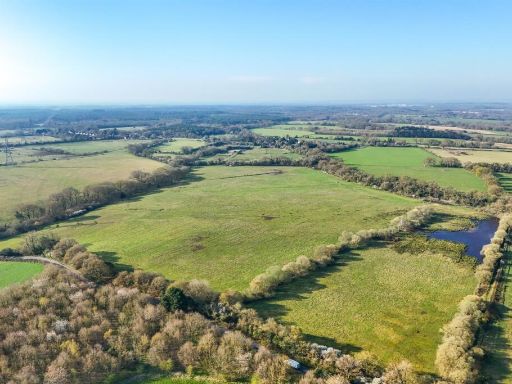 Land for sale in Land at Glebe Farm, Sulhamstead Road, Ufton Nervet, RG7 — £560,000 • 1 bed • 1 bath