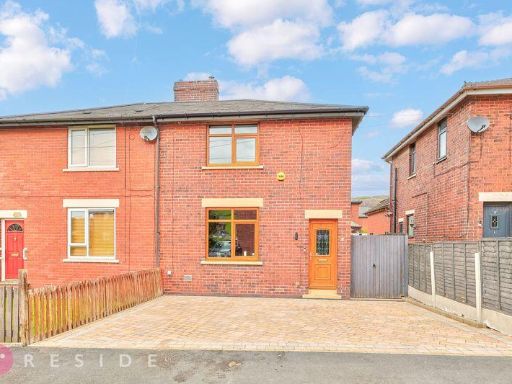
OL16 3UL - 3 bedroom semidetached house for sale in Pearson Close, Mil…
View on Property Piper
3 bedroom semi-detached house for sale in Pearson Close, Milnrow, Rochdale, Greater Manchester, OL16
Property Details
- Price: £225000
- Bedrooms: 3
- Bathrooms: 1
- Property Type: undefined
- Property SubType: undefined
Image Descriptions
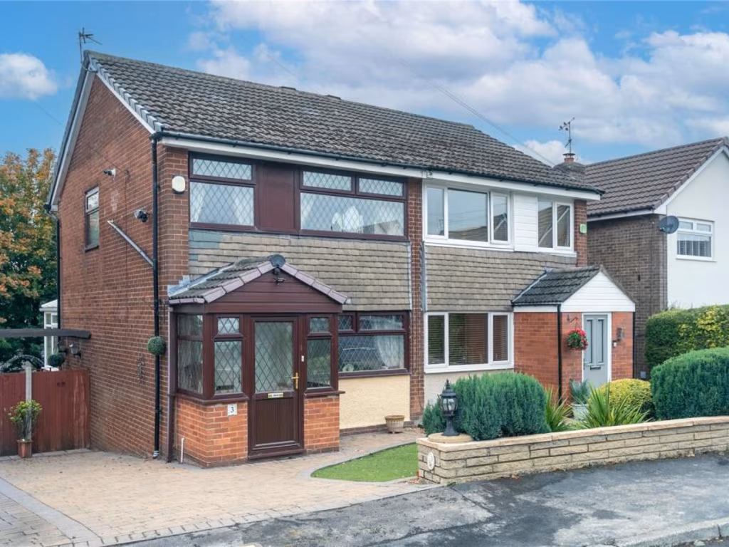
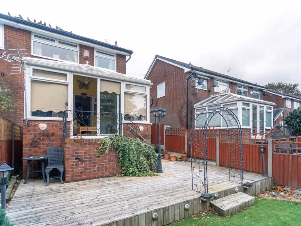
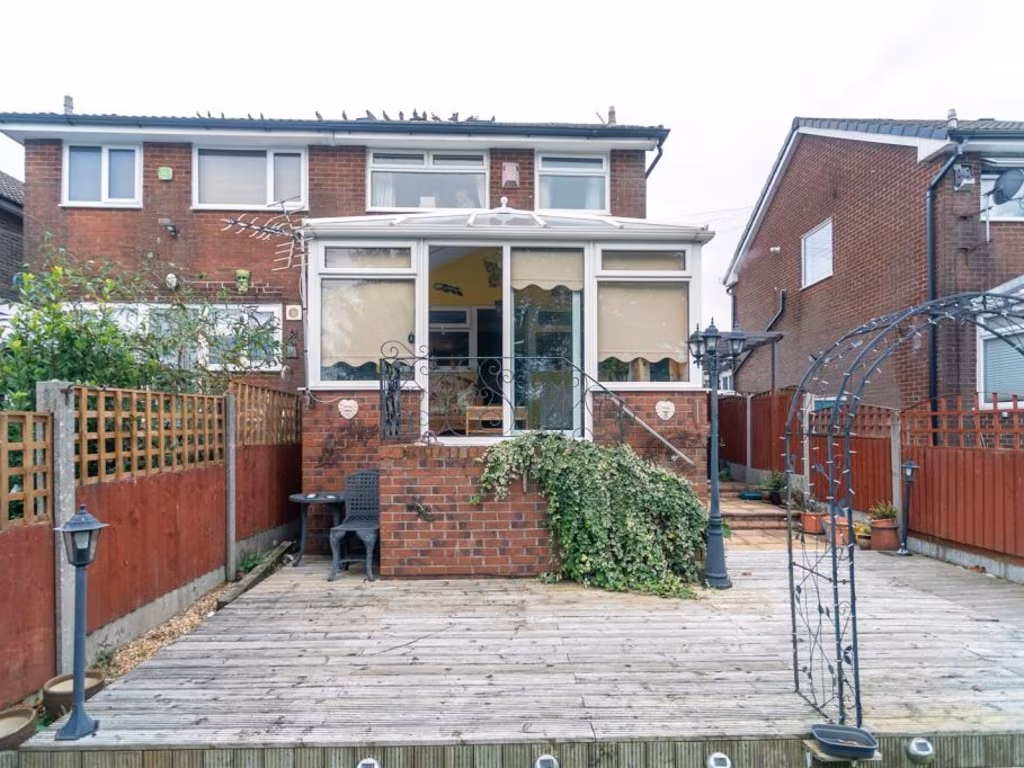
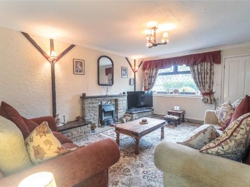
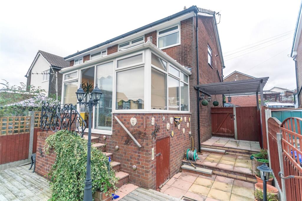
- semi-detached house mid-20th century
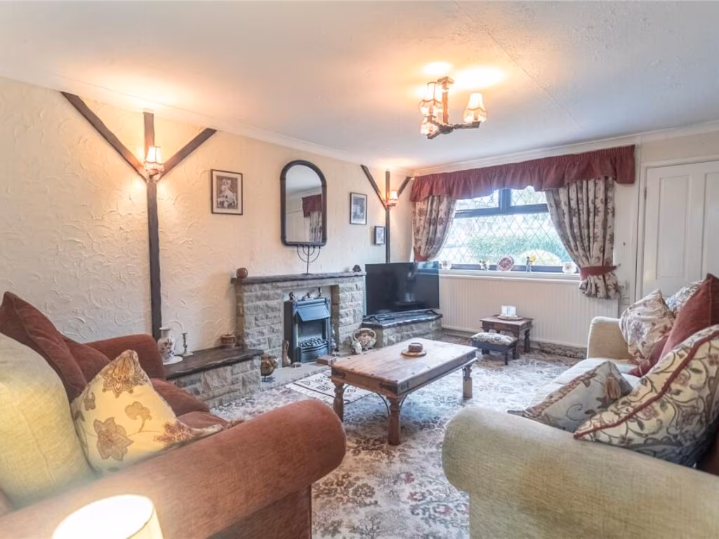
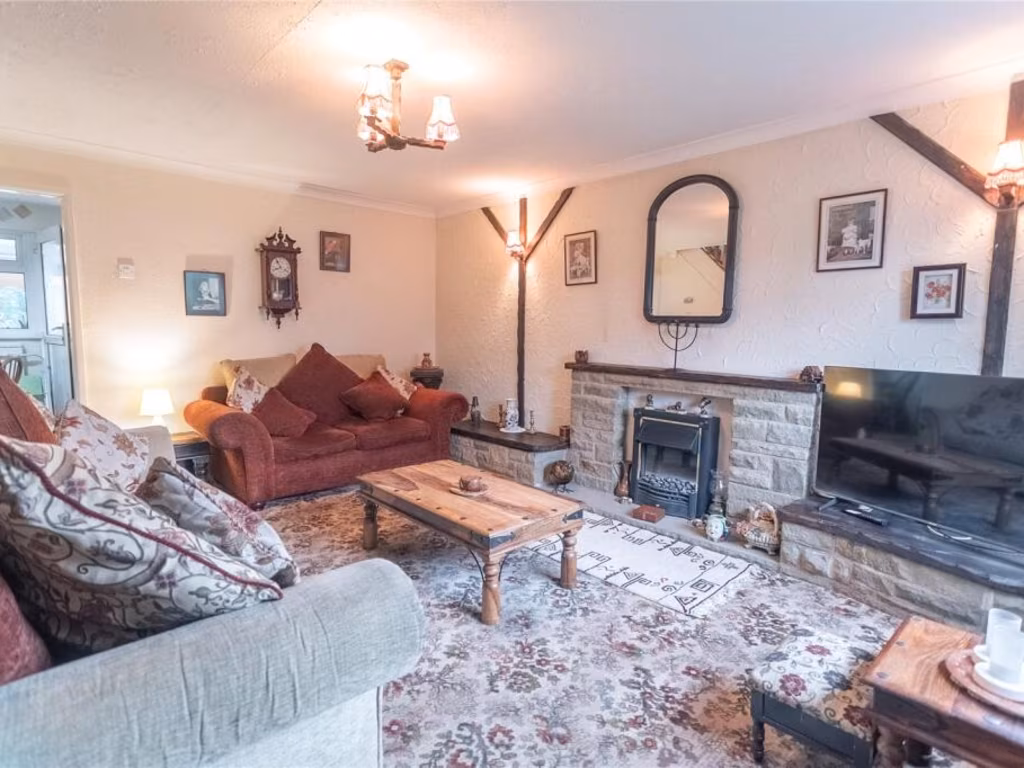
- living room mid-century
Floorplan Description
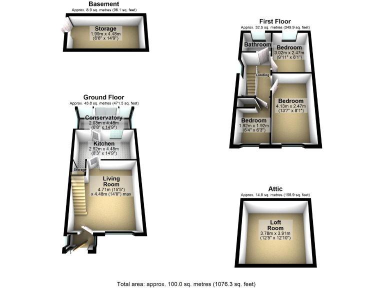
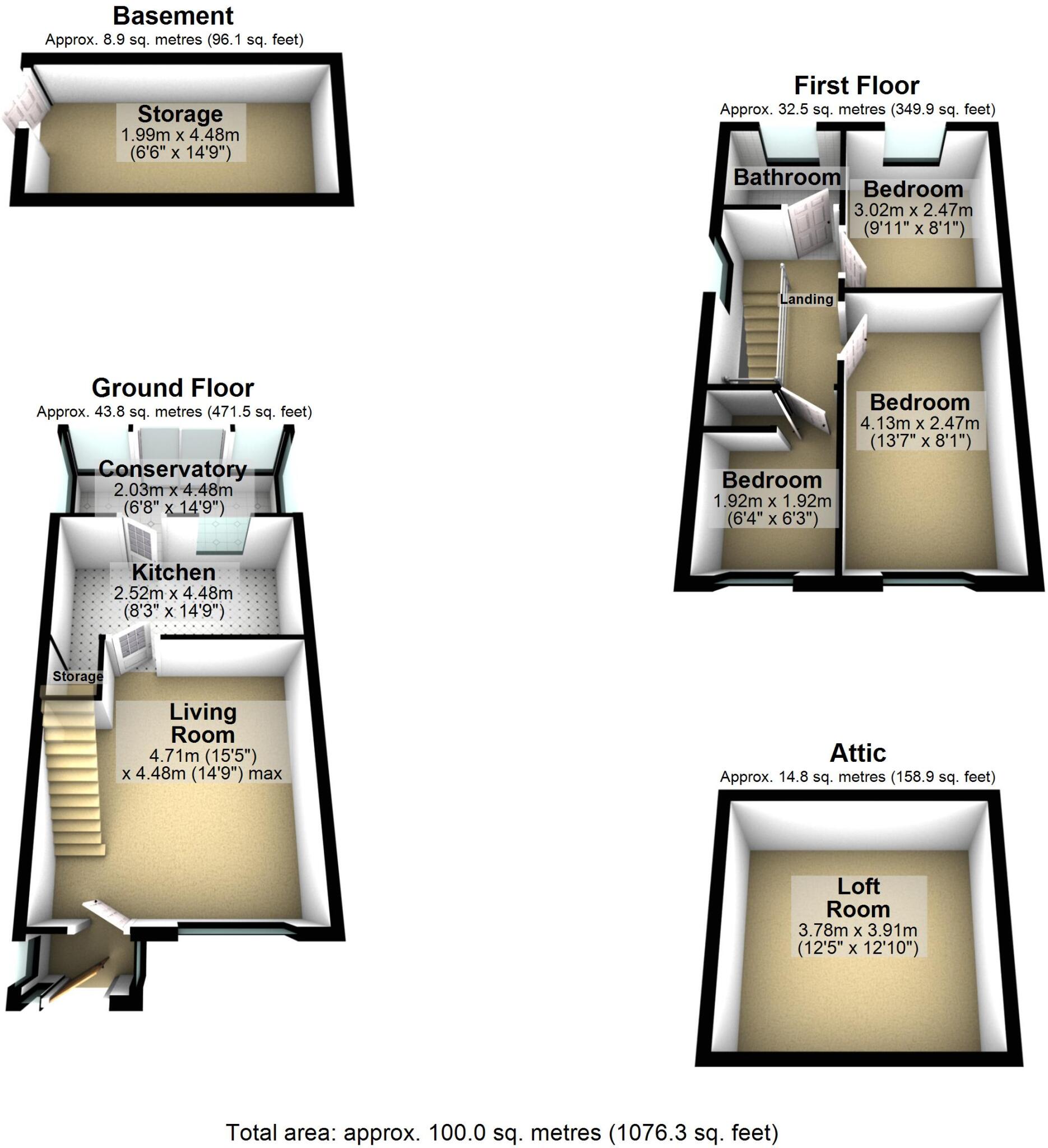
- Four-floor property including basement and attic.
Rooms
- Storage:
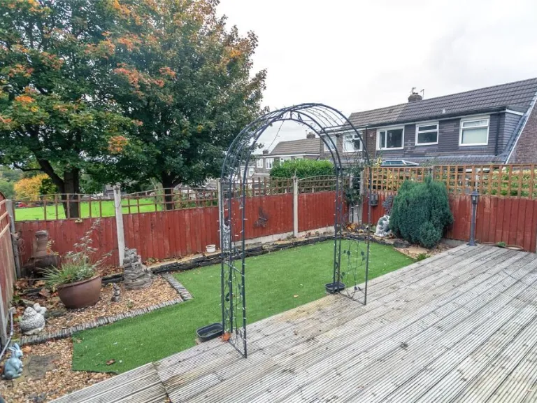
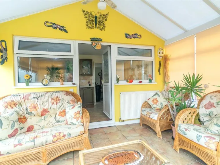
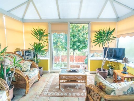
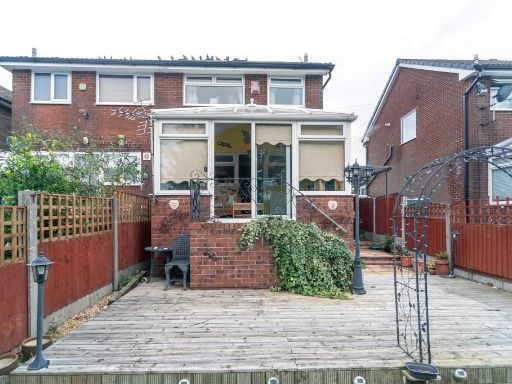
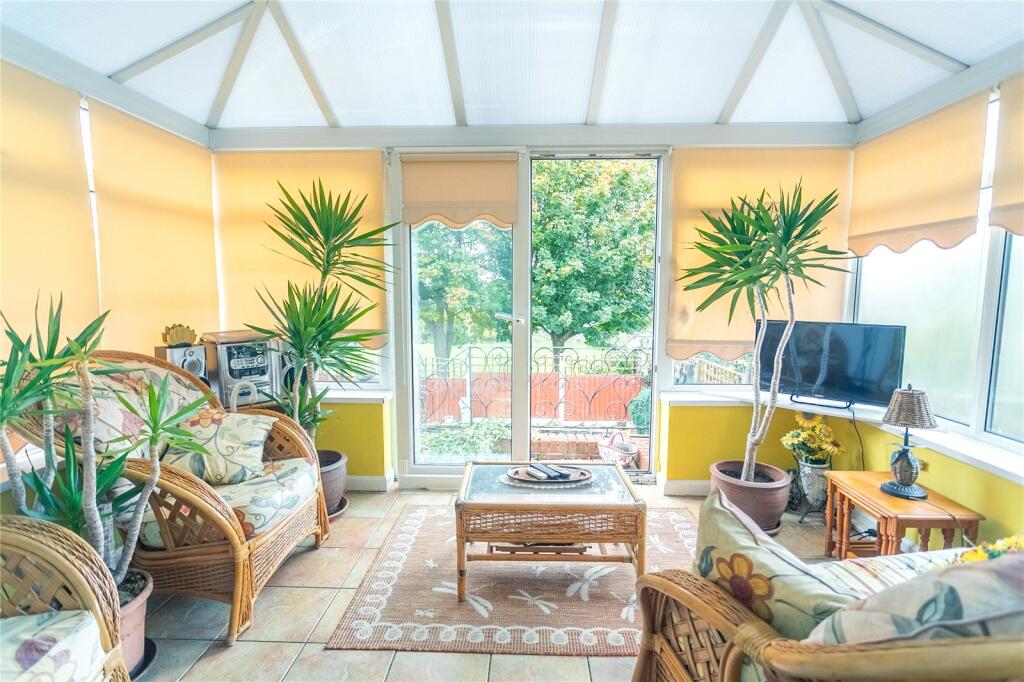
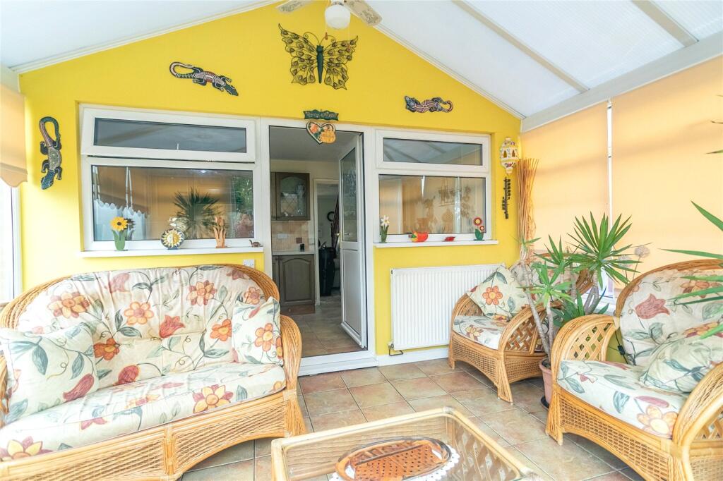
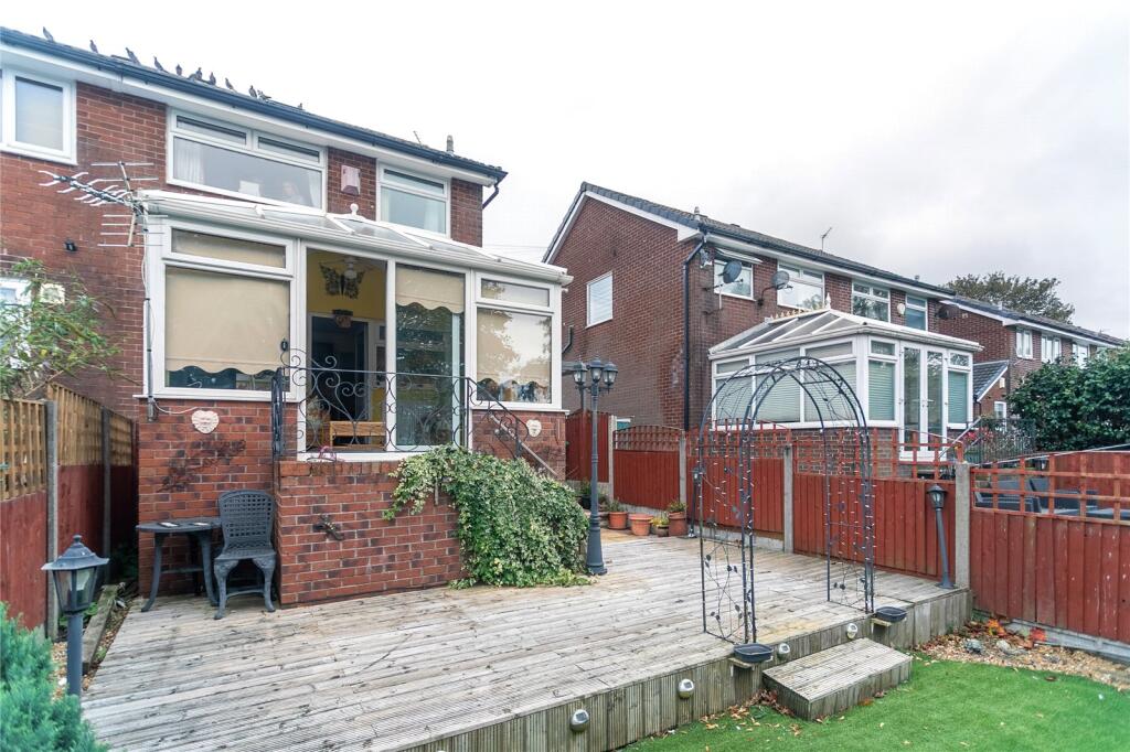
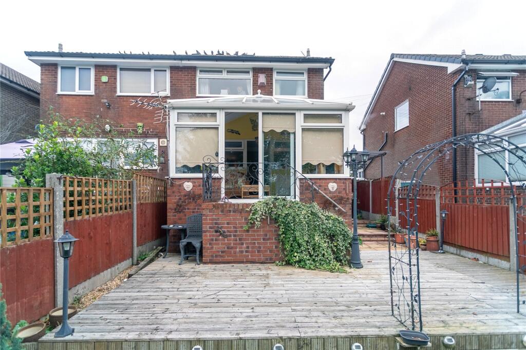
- Conservatory:
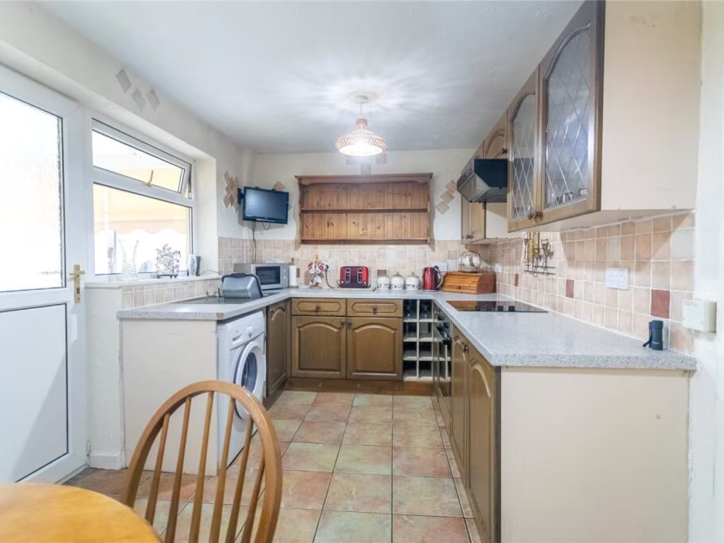
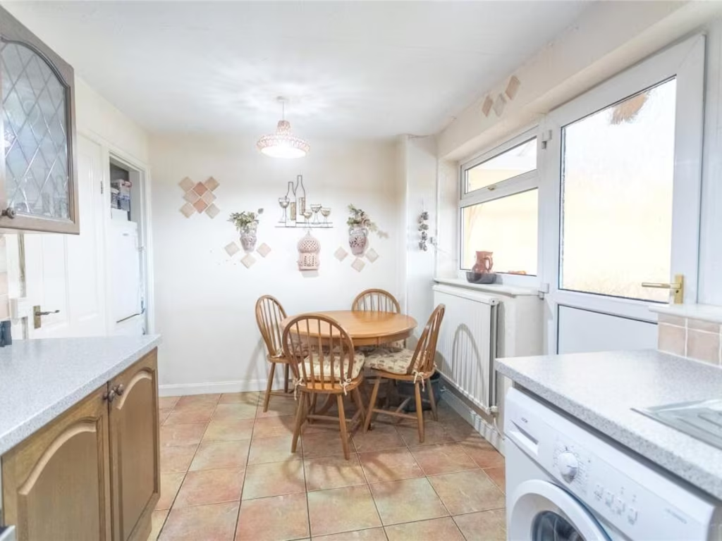
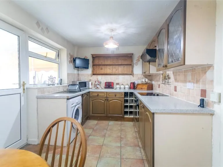
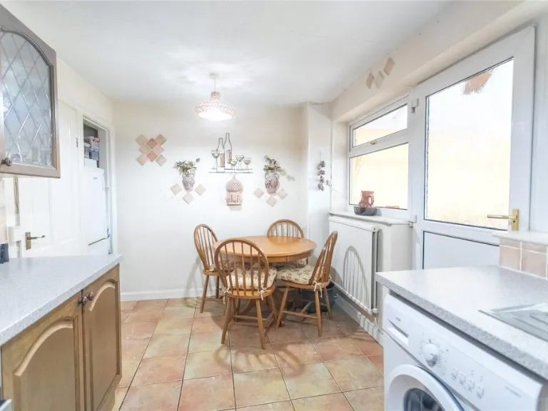
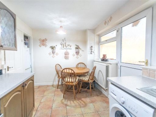
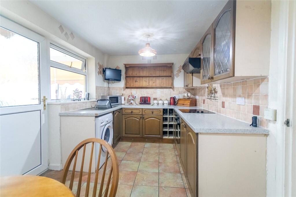
- Kitchen:
- Living Room:
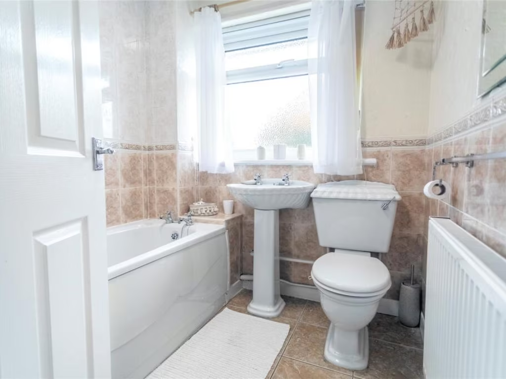
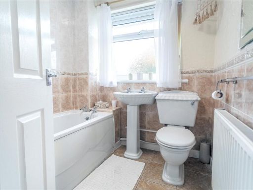
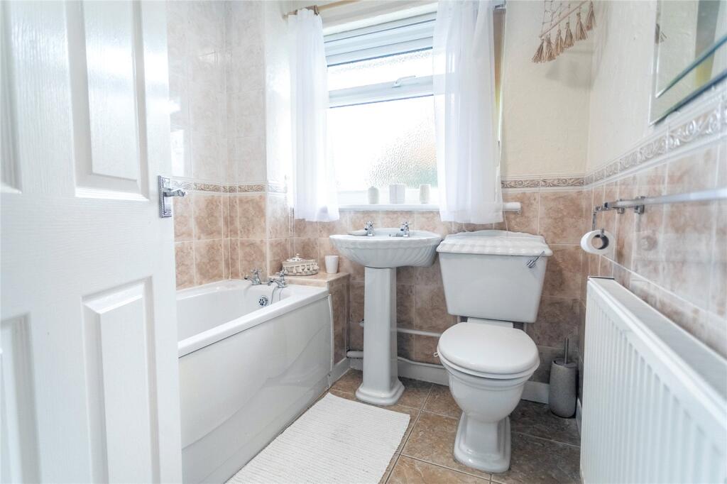
- Bathroom:
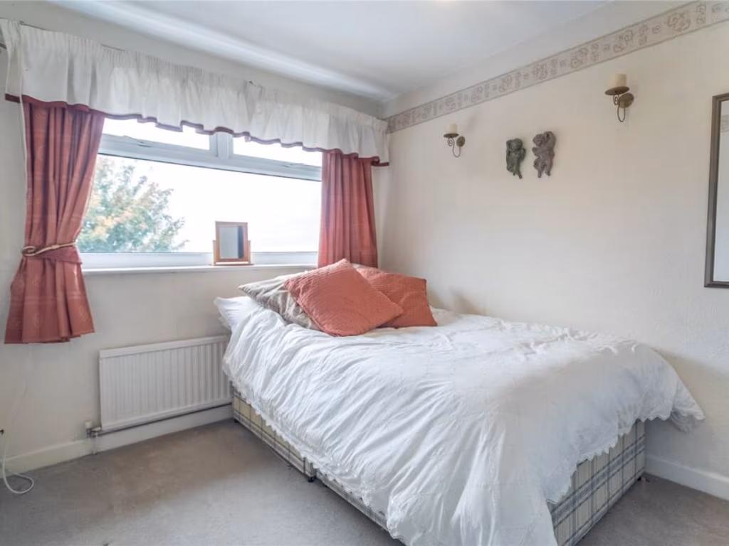
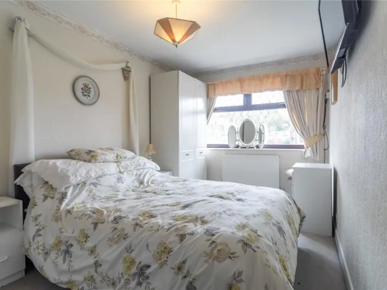
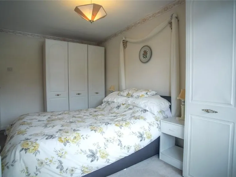
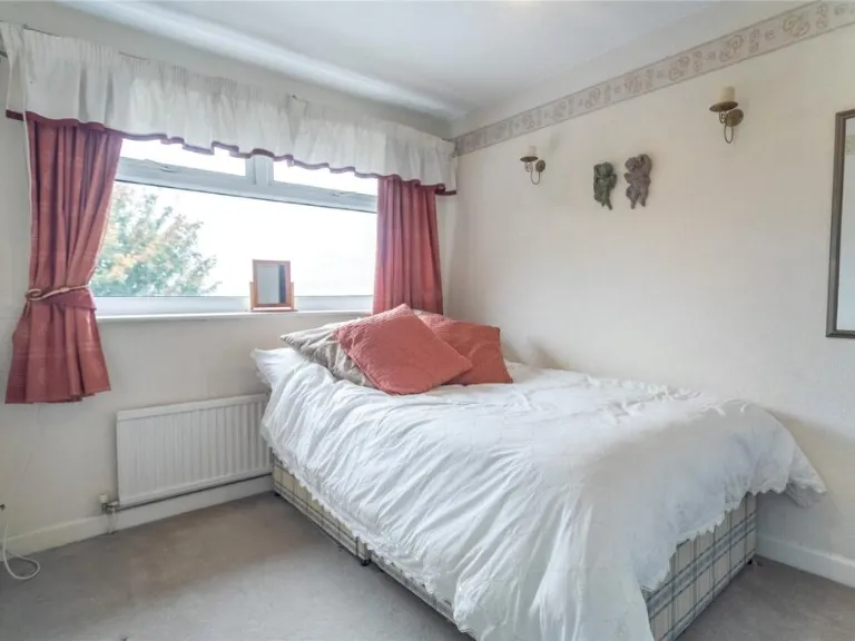
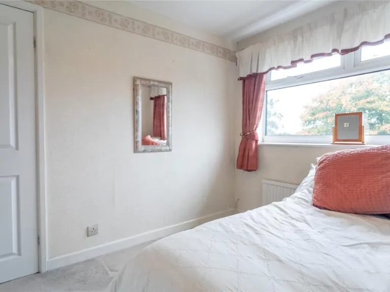
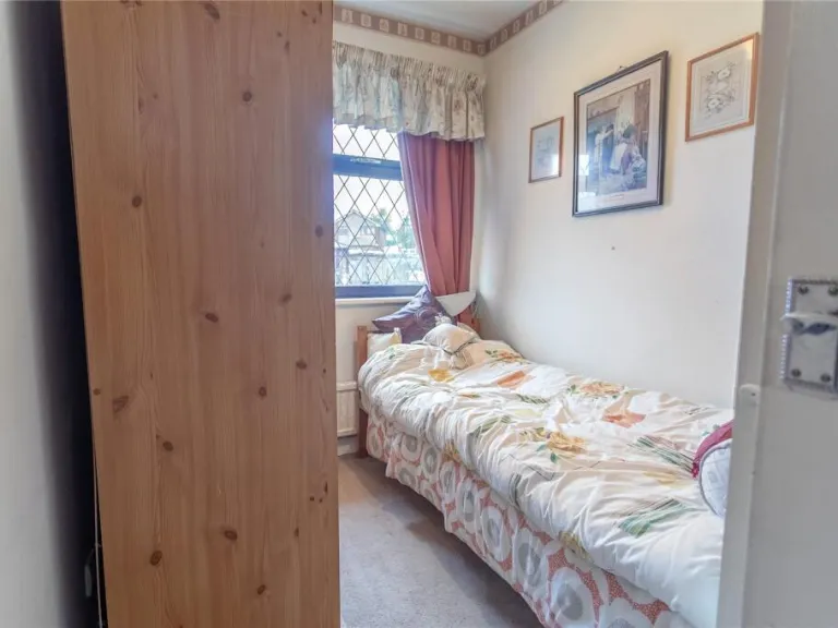
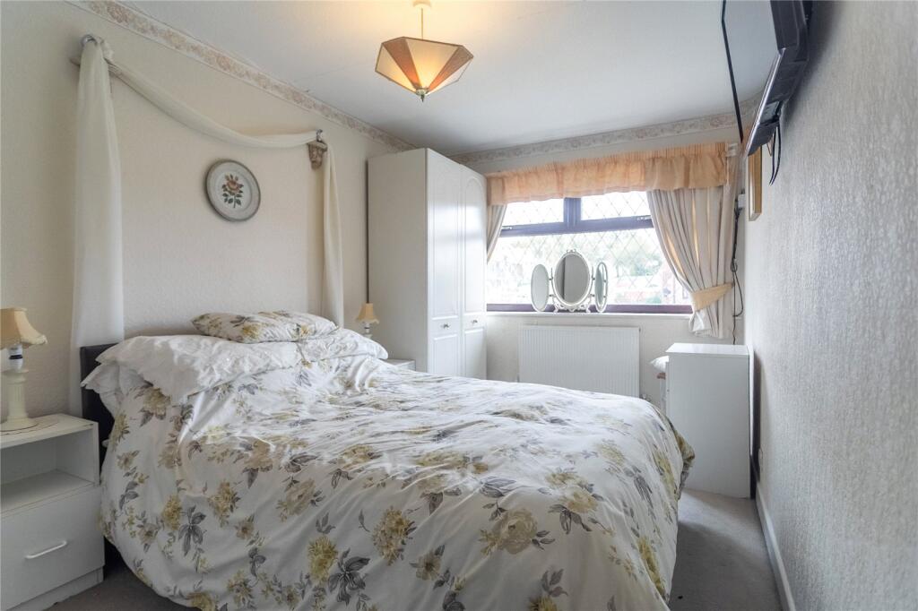
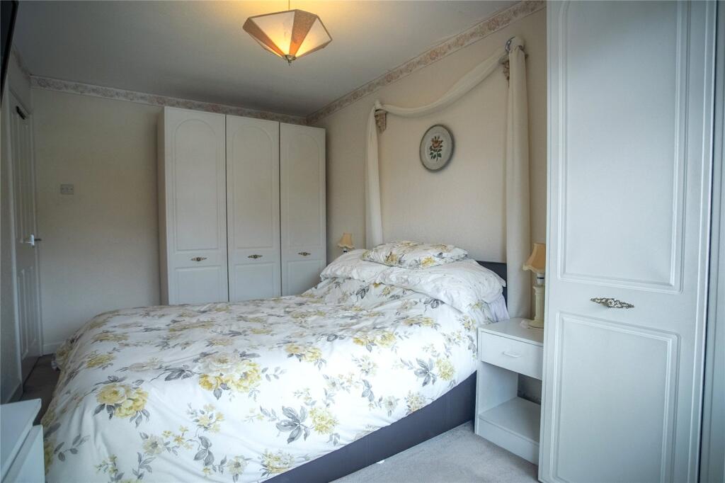
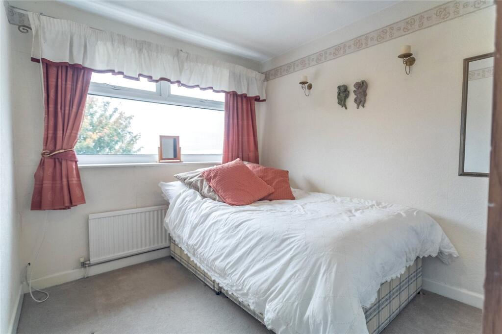
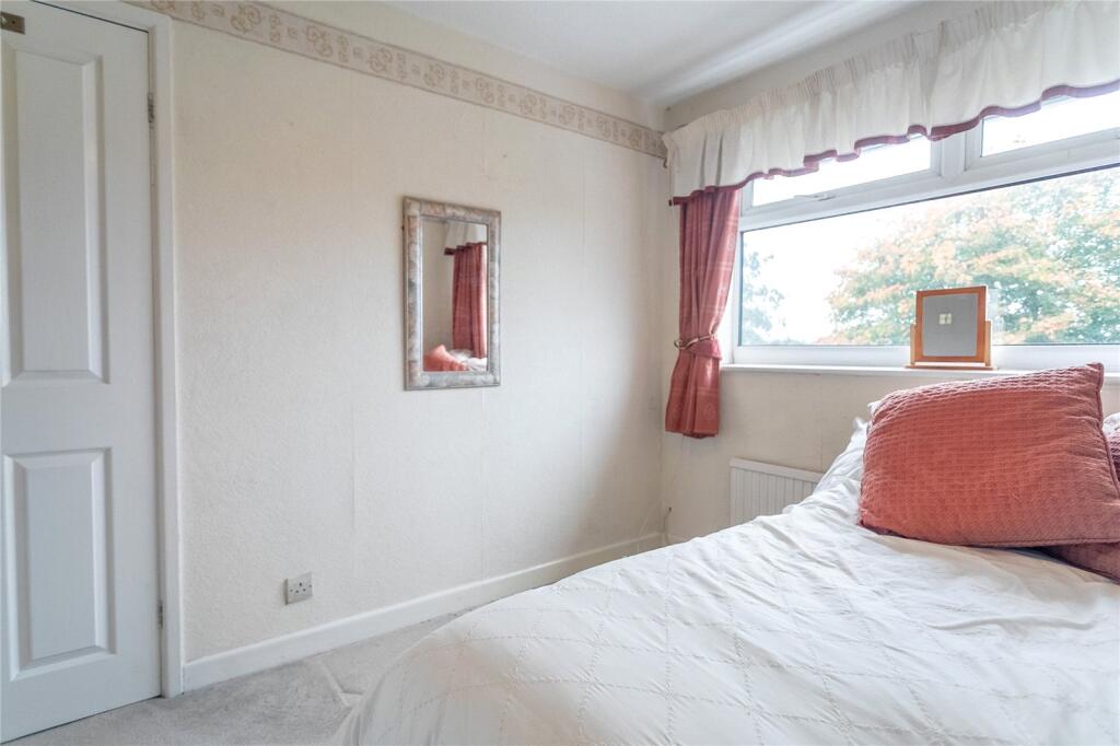
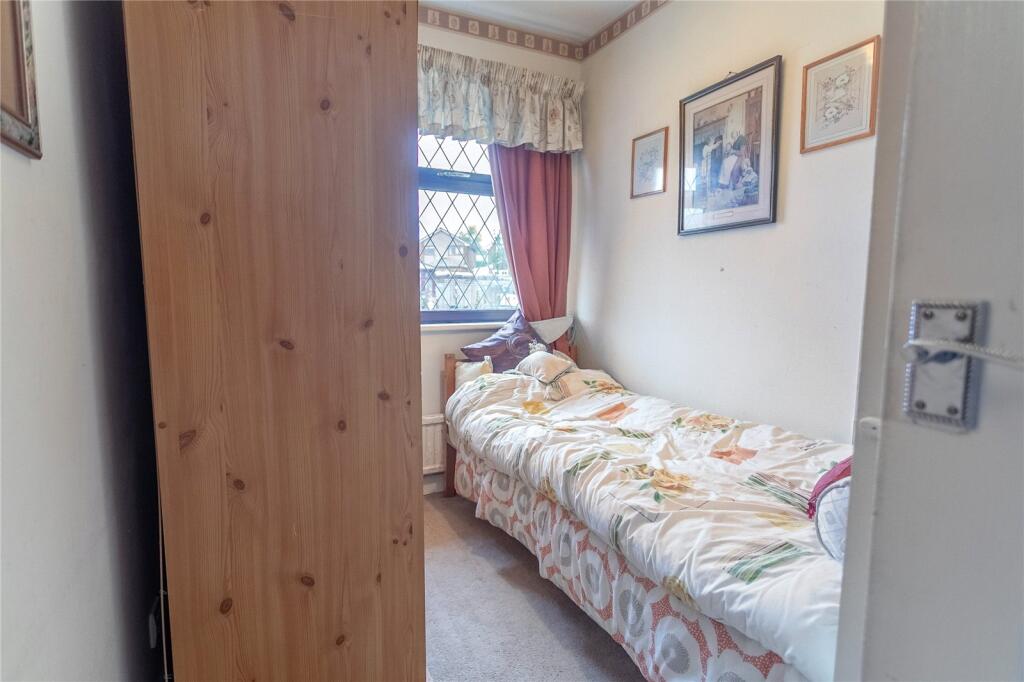
- Bedroom:
- Bedroom:
- Bedroom:
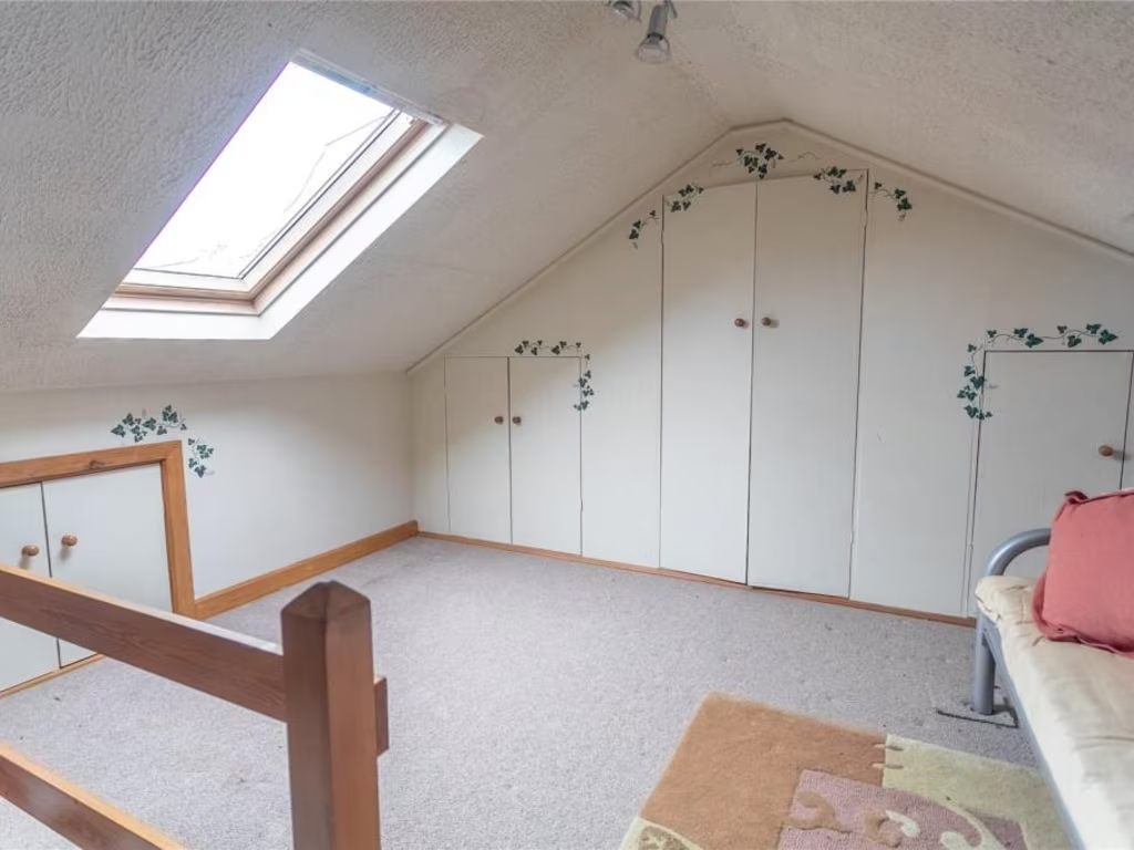
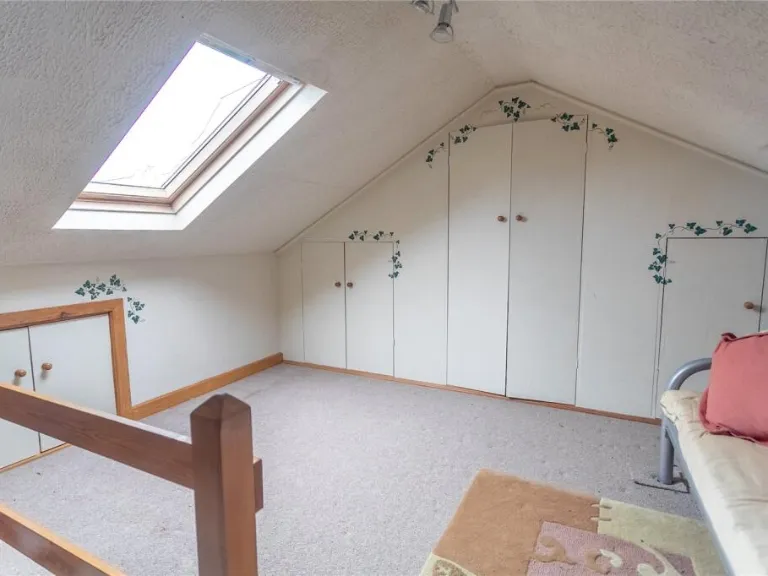
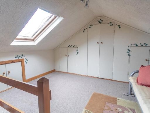
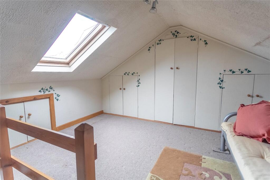
- Loft Room:
Textual Property Features
Detected Visual Features
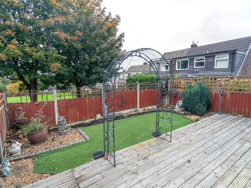
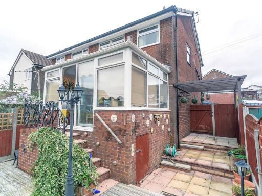
- semi-detached
- brickwork
- bay windows
- porch
- conservatory
- driveway
- family home
- suburban
- upvc windows
- low maintenance garden
- gated entrance
- mid-century
- exposed beams
- textured walls
- fireplace
- living room
- bay window
- decorative curtains
- standard ceiling
- medium room
Nearby Schools
- Lowerplace Primary School
- St Peter's Church of England Primary School
- Hollingworth Academy
- Milnrow Parish Church of England Primary School
- Hamer Community Primary School
- Smithy Bridge Foundation Primary School
- Holy Trinity Church of England Primary School
- Littleborough Community Primary School
- St Mary's CofE Primary School High Crompton
- Newhey Community Primary School
- St Thomas' Church of England Primary School
- Crossgates Primary School
- Kentmere Primary Academy
- Wardle Academy
- St Mary's Roman Catholic Primary School, Littleborough
- Beal Vale Primary School
- The Crompton House Church of England Academy
- Thornham St James CofE Primary School
- Kingsway Park High School
- Moorhouse Academy
- Alice Ingham Catholic Primary School, A Voluntary Academy
- St Andrew's Church of England Primary School and Nursery
- Rushcroft Primary School
- Sacred Heart Roman Catholic Primary School Rochdale
- Belfield Community School
- Heybrook Primary School
Nearest Bars And Restaurants
- Id: 564098997
- Tags:
- Amenity: restaurant
- Building: yes
- Cuisine: italian
- TagsNormalized:
- Lat: 53.6192767
- Lon: -2.1115639
- FullGeoHash: gcw3pcn6uvxu
- PartitionGeoHash: gcw3
- Images:
- FoodStandards: null
- Distance: 594.1
,- Id: 245454847
- Tags:
- Addr:
- Postcode: OL16 3JW
- Street: Wildhouse Lane
- Amenity: restaurant
- Cuisine: italian
- Name: Bellavista
- Phone: +44 1706 342479
- Source: survey
- TagsNormalized:
- Lat: 53.6192474
- Lon: -2.1113895
- FullGeoHash: gcw3pcndc01v
- PartitionGeoHash: gcw3
- Images:
- FoodStandards: null
- Distance: 588.4
,- Id: 2117057218
- Tags:
- Addr:
- Housenumber: 12-18
- Postcode: OL16 4HS
- Street: Dale Street
- Amenity: fast_food
- Cuisine: fish_and_chips
- Name: David's Fish and Chips
- Opening_hours: Mo-Sa
- Phone: +44 1706 759991
- Wheelchair: yes
- TagsNormalized:
- Lat: 53.6107556
- Lon: -2.112212
- FullGeoHash: gcw2zztcmcht
- PartitionGeoHash: gcw2
- Images:
- FoodStandards: null
- Distance: 410
,- Id: 1390184893
- Tags:
- Addr:
- Housenumber: 3
- Postcode: OL16 3LH
- Street: Dale Street
- Amenity: pub
- Name: The Bobbin
- Phone: +44 1706 357200
- Wheelchair: yes
- TagsNormalized:
- Lat: 53.6112045
- Lon: -2.1123896
- FullGeoHash: gcw2zztgcub5
- PartitionGeoHash: gcw2
- Images:
- FoodStandards: null
- Distance: 371.6
,- Id: 243082188
- Tags:
- Amenity: pub
- Created_by: JOSM
- Name: The Gallows
- Wheelchair: limited
- TagsNormalized:
- Lat: 53.6142687
- Lon: -2.1086345
- FullGeoHash: gcw9000tc204
- PartitionGeoHash: gcw9
- Images:
- FoodStandards: null
- Distance: 61.4
}
Nearest General Shops
- Id: 5085687767
- Tags:
- Addr:
- Housenumber: 104
- Postcode: OL16 4HX
- Street: Dale Street
- Name: Fades&Blades
- Phone: +44 7847 910517
- Shop: hairdresser
- Wheelchair: limited
- Wheelchair:description: 1 Step up.
- TagsNormalized:
- Lat: 53.6085624
- Lon: -2.1084744
- FullGeoHash: gcw8bp0ssbrd
- PartitionGeoHash: gcw8
- Images:
- FoodStandards: null
- Distance: 616.7
,- Id: 5085687804
- Tags:
- Addr:
- Housenumber: 38A
- Postcode: OL16 4HS
- Street: Dale Street
- Name: The Mens Room
- Phone: +44 7976 186 665
- Shop: hairdresser
- Website: https://www.facebook.com/TheMensRoom
- Wheelchair: yes
- TagsNormalized:
- Lat: 53.6103979
- Lon: -2.1114569
- FullGeoHash: gcw2zzqrpqx8
- PartitionGeoHash: gcw2
- Images:
- FoodStandards: null
- Distance: 428.6
,- Id: 1535571303
- Tags:
- Name: Bridge St Barbers
- Shop: hairdresser
- TagsNormalized:
- Lat: 53.6113613
- Lon: -2.1136323
- FullGeoHash: gcw2zzsuuf1e
- PartitionGeoHash: gcw2
- Images:
- FoodStandards: null
- Distance: 406.4
}
Nearest Grocery shops
- Id: 2117057238
- Tags:
- TagsNormalized:
- Lat: 53.6003772
- Lon: -2.0978273
- FullGeoHash: gcw8bm8kv4d8
- PartitionGeoHash: gcw8
- Images:
- FoodStandards: null
- Distance: 1706.9
,- Id: 1960669849
- Tags:
- Shop: convenience
- Wheelchair: yes
- TagsNormalized:
- Lat: 53.6071413
- Lon: -2.1070473
- FullGeoHash: gcw8bncsnprt
- PartitionGeoHash: gcw8
- Images:
- FoodStandards: null
- Distance: 787.8
,- Id: 359735089
- Tags:
- Building: yes
- Name: The Co-operative Food
- Operator: The Co-operative Group
- Shop: supermarket
- Wheelchair: yes
- TagsNormalized:
- the co-operative food
- food
- shop
- Lat: 53.6098786
- Lon: -2.1106401
- FullGeoHash: gcw2zzrh4t8w
- PartitionGeoHash: gcw2
- Images:
- FoodStandards: null
- Distance: 472.6
}
Nearest Supermarkets
- Id: 175773411
- Tags:
- Addr:
- Country: GB
- Postcode: OL16 4AT
- Brand: Morrisons
- Brand:wikidata: Q922344
- Brand:wikipedia: en:Morrisons
- Building: yes
- Contact:
- Website: https://my.morrisons.com/storefinder/53
- Name: Morrisons
- Shop: supermarket
- TagsNormalized:
- Lat: 53.6121275
- Lon: -2.1356151
- FullGeoHash: gcw2zruck8cv
- PartitionGeoHash: gcw2
- Images:
- FoodStandards: null
- Distance: 1735.9
,- Id: 5086260296
- Tags:
- Addr:
- Country: GB
- Housename: Kiingsway Retail Park
- Postcode: OL16 5AF
- Street: Kingsway
- Unit: 2
- Brand: Asda
- Brand:wikidata: Q297410
- Brand:wikipedia: en:Asda
- Contact:
- Website: https://storelocator.asda.com/north-west/rochdale/unit-2-kingsway-retail-park
- Fhrs:
- Fixme: order of shop nodes is not accurate
- Name: Asda
- Operator: Asda Stores Ltd
- Shop: supermarket
- Source:
- TagsNormalized:
- Lat: 53.6153269
- Lon: -2.1284088
- FullGeoHash: gcw3p865umr6
- PartitionGeoHash: gcw3
- Images:
- FoodStandards:
- Id: 42822
- FHRSID: 42822
- LocalAuthorityBusinessID: 10538
- BusinessName: Asda
- BusinessType: Retailers - supermarkets/hypermarkets
- BusinessTypeID: 7840
- AddressLine1: Unit 2 Asda Rochdale Kingsway, Kingsway Retail Park
- AddressLine2: Kingsway
- AddressLine3: Rochdale
- AddressLine4: null
- PostCode: OL16 5AF
- RatingValue: 5
- RatingKey: fhrs_5_en-GB
- RatingDate: 2022-07-21
- LocalAuthorityCode: 419
- LocalAuthorityName: Rochdale
- LocalAuthorityWebSite: http://www.rochdale.gov.uk
- LocalAuthorityEmailAddress: environmental.health2@rochdale.gov.uk
- Scores:
- Hygiene: 0
- Structural: 0
- ConfidenceInManagement: 0
- NewRatingPending: false
- Geocode:
- Longitude: -2.12828207015991
- Latitude: 53.61478424072270
- Distance: 1254.6
,- Id: 4716376559
- Tags:
- Addr:
- Postcode: OL16 4GJ
- Street: Elizabethan Way
- Brand: ALDI
- Brand:wikidata: Q41171672
- Brand:wikipedia: en:Aldi
- Contact:
- Website: https://stores.aldi.co.uk/milnrow/elizabethan-way
- Name: Aldi
- Shop: supermarket
- Source:
- Addr:
- Postcode: code-point_open
- TagsNormalized:
- Lat: 53.6095297
- Lon: -2.1145592
- FullGeoHash: gcw2zzk4phwm
- PartitionGeoHash: gcw2
- Images:
- FoodStandards: null
- Distance: 605.4
}
Nearest Religious buildings
- Id: 522075989
- Tags:
- Amenity: place_of_worship
- Building: church
- Denomination: anglican
- Name: St Ann
- Religion: christian
- Source: survey
- Source:geometry: Bing
- Wikidata: Q26367855
- TagsNormalized:
- place of worship
- church
- anglican
- christian
- Lat: 53.6165041
- Lon: -2.1283421
- FullGeoHash: gcw3p8d4y0c1
- PartitionGeoHash: gcw3
- Images:
- FoodStandards: null
- Distance: 1271.5
,- Id: 403866058
- Tags:
- Amenity: place_of_worship
- Building: church
- Denomination: anglican
- Name: Milnrow Parish
- Religion: christian
- Source: Bing
- Wheelchair: no
- Wikidata: Q26551725
- TagsNormalized:
- place of worship
- church
- anglican
- parish
- christian
- Lat: 53.6121775
- Lon: -2.1091948
- FullGeoHash: gcw8bpb1s4nr
- PartitionGeoHash: gcw8
- Images:
- FoodStandards: null
- Distance: 212
,- Id: 403866057
- Tags:
- Addr:
- Amenity: school
- Name: Milnrow Parish Church of England Primary School
- Ref:
- Wikidata: Q66135542
- TagsNormalized:
- Lat: 53.6125396
- Lon: -2.1105009
- FullGeoHash: gcw2zzz5tv8r
- PartitionGeoHash: gcw2
- Images:
- FoodStandards: null
- Distance: 182.9
}
Nearest Medical buildings
- Id: 2116631999
- Tags:
- Amenity: pharmacy
- Healthcare: pharmacy
- TagsNormalized:
- Lat: 53.6125073
- Lon: -2.1362469
- FullGeoHash: gcw2zru7mzdz
- PartitionGeoHash: gcw2
- Images:
- FoodStandards: null
- Distance: 1772.6
,- Id: 2722196513
- Tags:
- Addr:
- Housenumber: 44-48
- Postcode: OL16 4EG
- Street: Newhey Road
- Amenity: doctors
- Emergency: no
- Healthcare: doctor
- Name: Milnrow Village Practice
- Phone: +44 1706 641409
- Website: http://www.milnrowvillagepractice.co.uk/
- Wheelchair: yes
- TagsNormalized:
- doctor
- doctors
- health
- healthcare
- Lat: 53.6063583
- Lon: -2.1056846
- FullGeoHash: gcw8bndxtvry
- PartitionGeoHash: gcw8
- Images:
- FoodStandards: null
- Distance: 894.3
,- Id: 2117057265
- Tags:
- Amenity: pharmacy
- Healthcare: pharmacy
- Wheelchair: yes
- TagsNormalized:
- Lat: 53.6076234
- Lon: -2.1077059
- FullGeoHash: gcw8bncpnck9
- PartitionGeoHash: gcw8
- Images:
- FoodStandards: null
- Distance: 727.1
,- Id: 2117057266
- Tags:
- Amenity: pharmacy
- Healthcare: pharmacy
- Wheelchair: yes
- TagsNormalized:
- Lat: 53.6077062
- Lon: -2.1089773
- FullGeoHash: gcw8bnbr928x
- PartitionGeoHash: gcw8
- Images:
- FoodStandards: null
- Distance: 709
}
Nearest Leisure Facilities
- Id: 503608105
- Tags:
- TagsNormalized:
- Lat: 53.6194731
- Lon: -2.1086761
- FullGeoHash: gcw9010s061p
- PartitionGeoHash: gcw9
- Images:
- FoodStandards: null
- Distance: 602.7
,- Id: 503608115
- Tags:
- TagsNormalized:
- Lat: 53.6194869
- Lon: -2.1096211
- FullGeoHash: gcw3pcpu4kb6
- PartitionGeoHash: gcw3
- Images:
- FoodStandards: null
- Distance: 601.8
,- Id: 433799055
- Tags:
- Leisure: pitch
- Sport: bowls
- TagsNormalized:
- Lat: 53.614254
- Lon: -2.1181808
- FullGeoHash: gcw3pb1tdv3f
- PartitionGeoHash: gcw3
- Images:
- FoodStandards: null
- Distance: 572.6
,- Id: 403867092
- Tags:
- Leisure: pitch
- Surface: grass
- TagsNormalized:
- Lat: 53.6153251
- Lon: -2.1068661
- FullGeoHash: gcw9003gfmnb
- PartitionGeoHash: gcw9
- Images:
- FoodStandards: null
- Distance: 222.8
,- Id: 403866055
- Tags:
- Leisure: pitch
- Surface: grass
- TagsNormalized:
- Lat: 53.6128063
- Lon: -2.1101193
- FullGeoHash: gcw2zzzmnxmn
- PartitionGeoHash: gcw2
- Images:
- FoodStandards: null
- Distance: 146.7
}
Nearest Tourist attractions
- Id: 411612022
- Tags:
- Building: yes
- Name: Hollingworth Visitor Centre
- Tourism: attraction
- TagsNormalized:
- Lat: 53.6340945
- Lon: -2.0924952
- FullGeoHash: gcw907u31rf7
- PartitionGeoHash: gcw9
- Images:
- FoodStandards: null
- Distance: 2492.8
,- Id: 876163243
- Tags:
- Name: Roch Vale Caravan Park
- Tourism: caravan_site
- TagsNormalized:
- Lat: 53.6157824
- Lon: -2.1460443
- FullGeoHash: gcw3p0mq9d1r
- PartitionGeoHash: gcw3
- Images:
- FoodStandards: null
- Distance: 2417.6
,- Id: 1297389543
- Tags:
- Name: Hollingworth Lake Caravan park
- Tourism: caravan_site
- TagsNormalized:
- Lat: 53.6259707
- Lon: -2.0893044
- FullGeoHash: gcw906q9gtmx
- PartitionGeoHash: gcw9
- Images:
- FoodStandards: null
- Distance: 1877.5
}
Nearest Hotels
- Id: 403894006
- Tags:
- Amenity: pub
- Building: pub
- Name: Kingsway Hotel
- Source: Bing
- TagsNormalized:
- Lat: 53.607137
- Lon: -2.136712
- FullGeoHash: gcw2zquh5n8h
- PartitionGeoHash: gcw2
- Images:
- FoodStandards: null
- Distance: 1953.5
,- Id: 75919514
- Tags:
- Access: customers
- Amenity: parking
- Fee: yes
- Name: Beach Hotel Carpark
- Parking: surface
- TagsNormalized:
- Lat: 53.6309174
- Lon: -2.1027909
- FullGeoHash: gcw905hy9rt7
- PartitionGeoHash: gcw9
- Images:
- FoodStandards: null
- Distance: 1924.5
,- Id: 1126664457
- Tags:
- Addr:
- Brand: Premier Inn
- Brand:wikidata: Q2108626
- Building: yes
- Internet_access: wlan
- Internet_access:fee: customers
- Internet_access:operator: Virgin Media
- Internet_access:ssid: Premier Inn Free Wi-Fi
- Name: Premier Inn
- Tourism: hotel
- Wheelchair: yes
- TagsNormalized:
- Lat: 53.6031239
- Lon: -2.1047323
- FullGeoHash: gcw8bn5ku4tc
- PartitionGeoHash: gcw8
- Images:
- FoodStandards: null
- Distance: 1257.7
}
Tags
- semi-detached
- brickwork
- bay windows
- porch
- conservatory
- driveway
- family home
- suburban
- upvc windows
- low maintenance garden
- gated entrance
- mid-century
- exposed beams
- textured walls
- fireplace
- living room
- bay window
- decorative curtains
- standard ceiling
- medium room
Local Market Stats
- Average Price/sqft: £186
- Avg Income: £37100
- Rental Yield: 4.5%
- Social Housing: 14%
- Planning Success Rate: 46%
Similar Properties
 3 bedroom semi-detached house for sale in HIGHBANK ROAD, Newhey, Rochdale OL16 3RS, OL16 — £210,000 • 3 bed • 1 bath • 712 ft²
 3 bedroom detached house for sale in NEWHEY ROAD, Milnrow, Rochdale OL16 3SA, OL16 — £375,000 • 3 bed • 2 bath • 1033 ft²
 3 bedroom terraced house for sale in Rochdale Road, Milnrow, Rochdale, OL16 — £225,000 • 3 bed • 1 bath • 1530 ft²
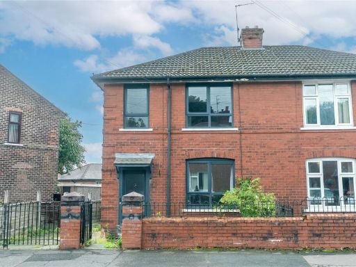 3 bedroom semi-detached house for sale in Ings Avenue, Rooley Moor, Greater Manchester, OL12 — £160,000 • 3 bed • 1 bath • 800 ft²
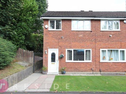 3 bedroom semi-detached house for sale in MELBOURNE CLOSE, Buersil, Rochdale OL11 2EJ, OL11 — £195,000 • 3 bed • 1 bath • 691 ft²
 3 bedroom town house for sale in Pennine Drive, Rochdale, Greater Manchester, OL16 — £220,000 • 3 bed • 1 bath • 1406 ft²
Meta
- {
"@context": "https://schema.org",
"@type": "Residence",
"name": "3 bedroom semidetached house for sale in Pearson Close, Mil…",
"description": "",
"url": "https://propertypiper.co.uk/property/71d8254d-8f29-4e34-b967-1629ad3e1019",
"image": "https://image-a.propertypiper.co.uk/10a63a5e-1313-453e-b02f-05ee3ca6e259-1024.jpeg",
"address": {
"@type": "PostalAddress",
"streetAddress": "12 PEARSON CLOSE MILNROW ROCHDALE",
"postalCode": "OL16 3UL",
"addressLocality": "Rochdale",
"addressRegion": "Rochdale",
"addressCountry": "England"
},
"geo": {
"@type": "GeoCoordinates",
"latitude": 53.61407483539242,
"longitude": -2.109505711491389
},
"numberOfRooms": 3,
"numberOfBathroomsTotal": 1,
"floorSize": {
"@type": "QuantitativeValue",
"value": 1076,
"unitCode": "FTK"
},
"offers": {
"@type": "Offer",
"price": 225000,
"priceCurrency": "GBP",
"availability": "https://schema.org/InStock"
},
"additionalProperty": [
{
"@type": "PropertyValue",
"name": "Feature",
"value": "semi-detached"
},
{
"@type": "PropertyValue",
"name": "Feature",
"value": "brickwork"
},
{
"@type": "PropertyValue",
"name": "Feature",
"value": "bay windows"
},
{
"@type": "PropertyValue",
"name": "Feature",
"value": "porch"
},
{
"@type": "PropertyValue",
"name": "Feature",
"value": "conservatory"
},
{
"@type": "PropertyValue",
"name": "Feature",
"value": "driveway"
},
{
"@type": "PropertyValue",
"name": "Feature",
"value": "family home"
},
{
"@type": "PropertyValue",
"name": "Feature",
"value": "suburban"
},
{
"@type": "PropertyValue",
"name": "Feature",
"value": "upvc windows"
},
{
"@type": "PropertyValue",
"name": "Feature",
"value": "low maintenance garden"
},
{
"@type": "PropertyValue",
"name": "Feature",
"value": "gated entrance"
},
{
"@type": "PropertyValue",
"name": "Feature",
"value": "mid-century"
},
{
"@type": "PropertyValue",
"name": "Feature",
"value": "exposed beams"
},
{
"@type": "PropertyValue",
"name": "Feature",
"value": "textured walls"
},
{
"@type": "PropertyValue",
"name": "Feature",
"value": "fireplace"
},
{
"@type": "PropertyValue",
"name": "Feature",
"value": "living room"
},
{
"@type": "PropertyValue",
"name": "Feature",
"value": "bay window"
},
{
"@type": "PropertyValue",
"name": "Feature",
"value": "decorative curtains"
},
{
"@type": "PropertyValue",
"name": "Feature",
"value": "standard ceiling"
},
{
"@type": "PropertyValue",
"name": "Feature",
"value": "medium room"
}
]
}
High Res Floorplan Images
Compatible Floorplan Images
FloorplanImages Thumbnail