B77 1JF - 3 bedroom detached bungalow for sale in Morpeth, Dosthill,…
View on Property Piper
3 bedroom detached bungalow for sale in Morpeth, Dosthill, B77
Property Details
- Price: £405000
- Bedrooms: 3
- Bathrooms: 1
- Property Type: undefined
- Property SubType: undefined
Brochure Descriptions
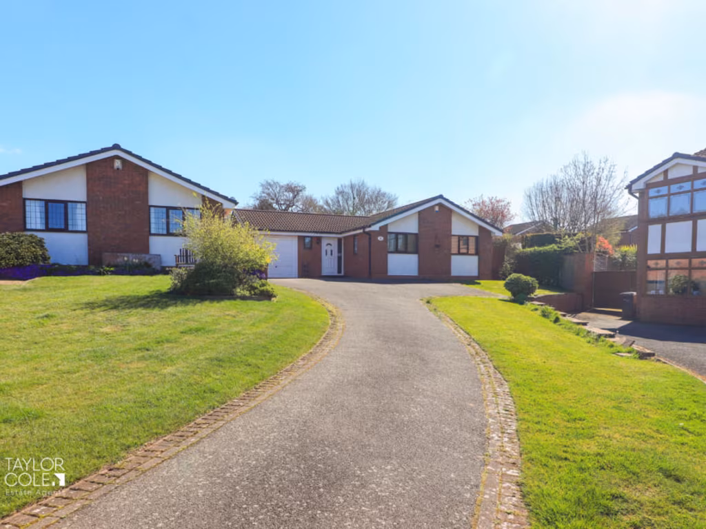
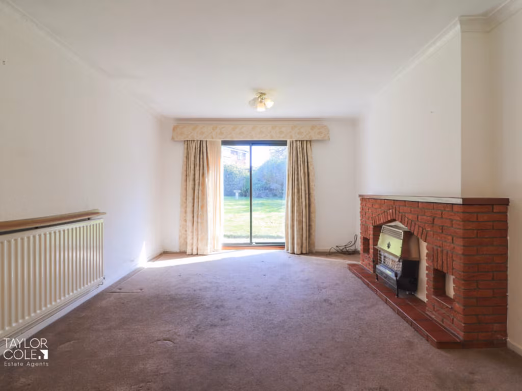
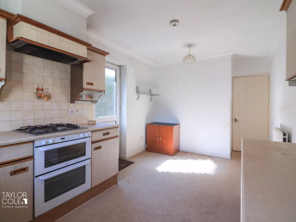
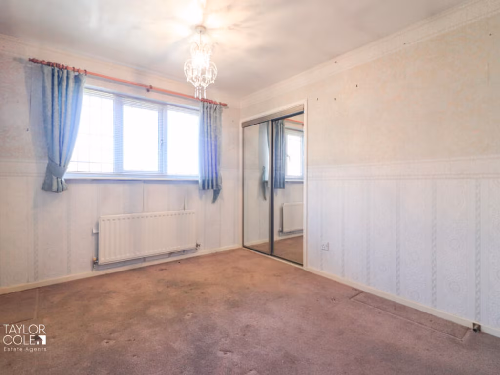
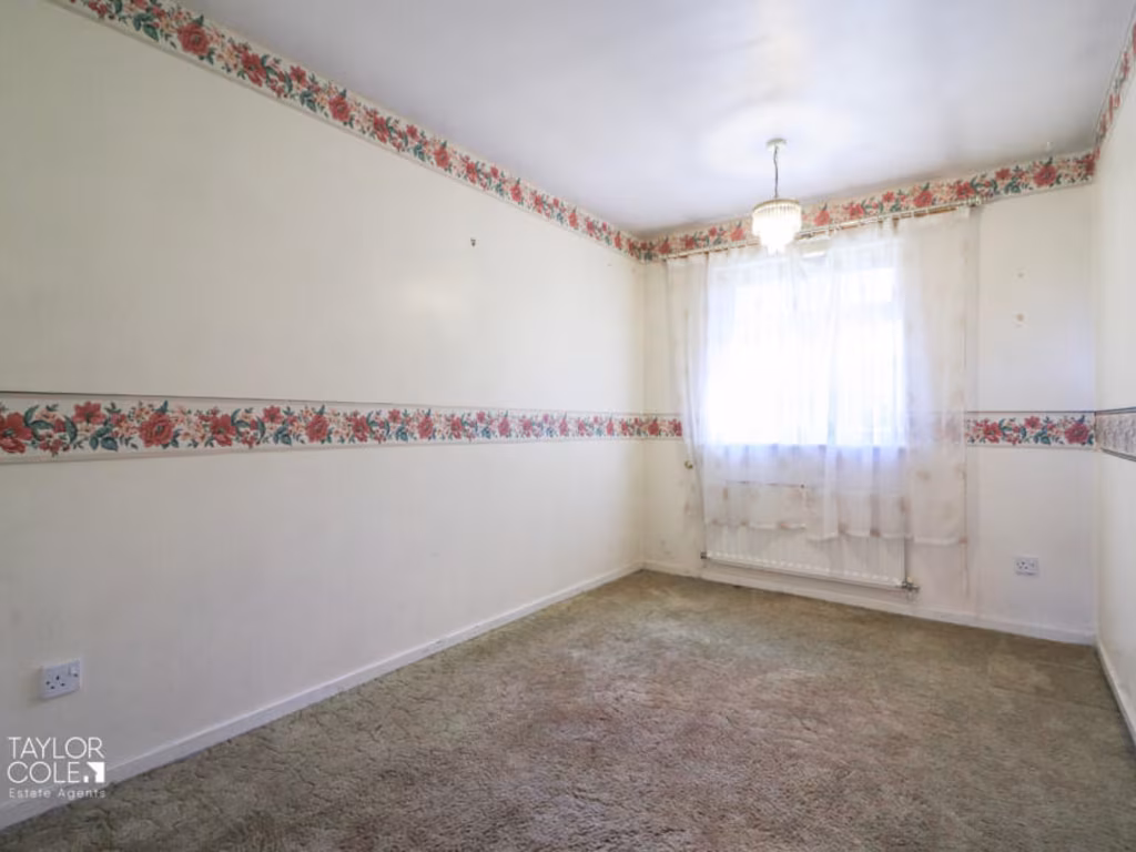
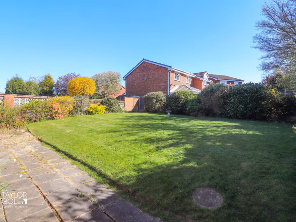
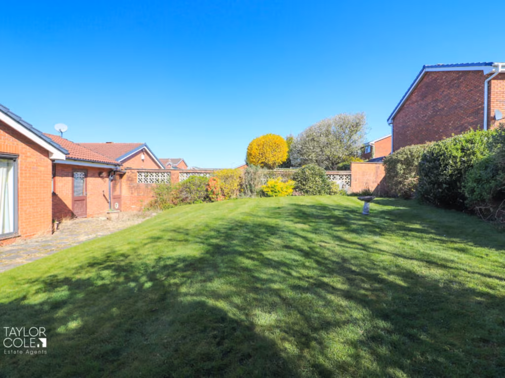
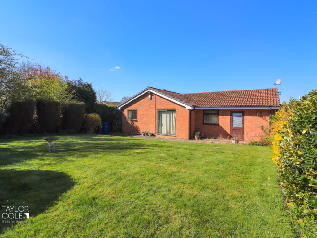
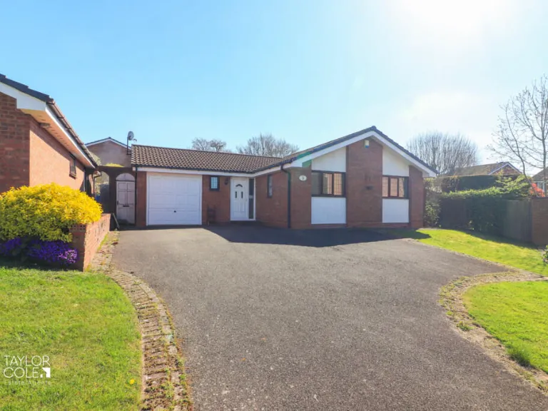
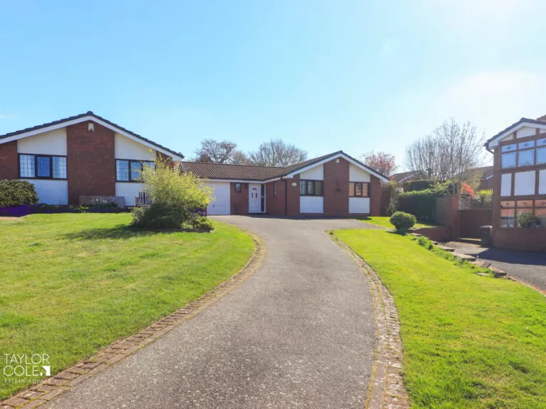
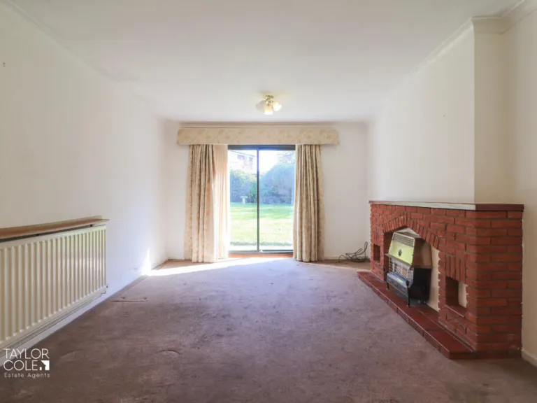
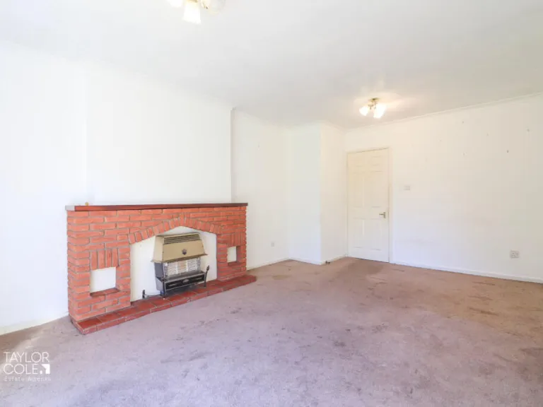
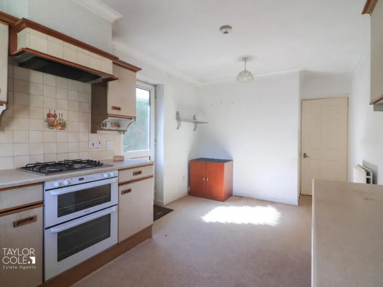
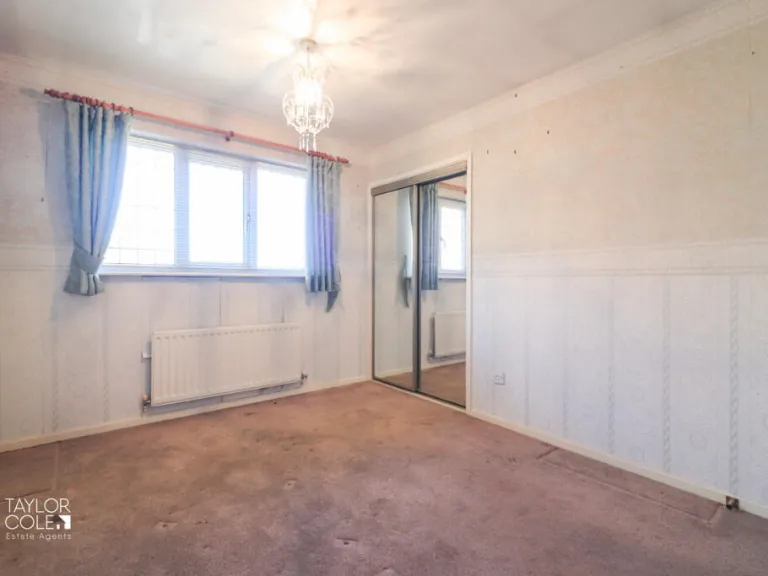
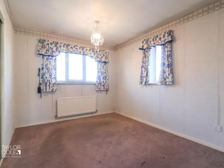
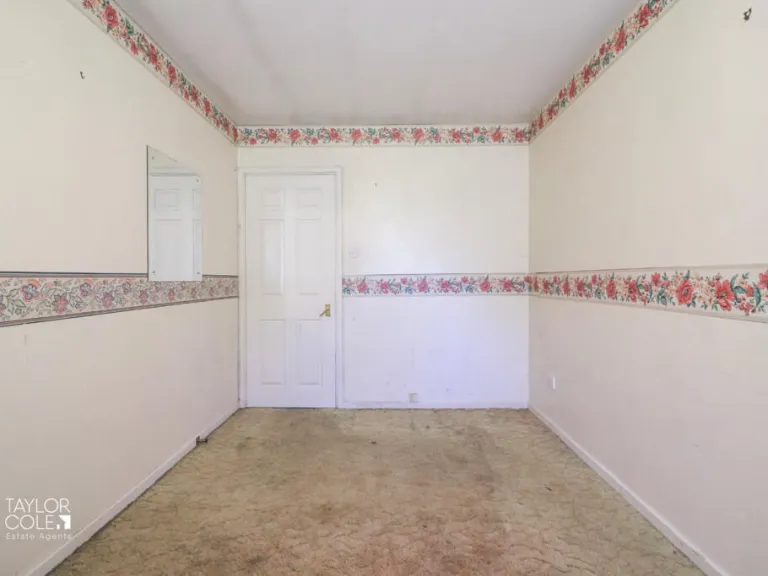
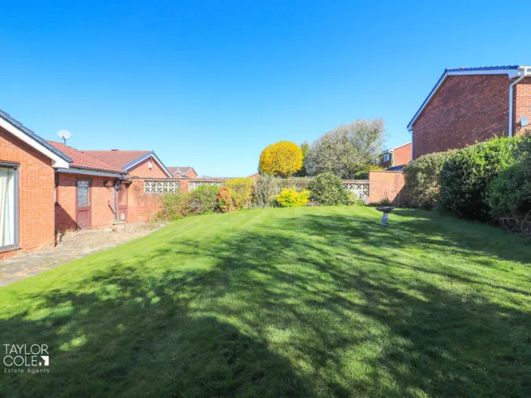
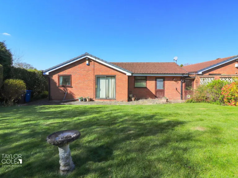
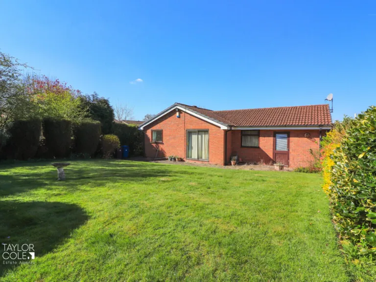
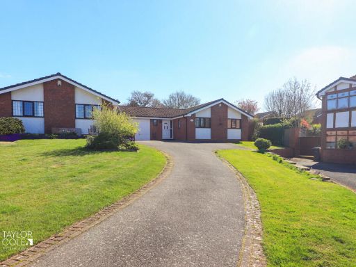
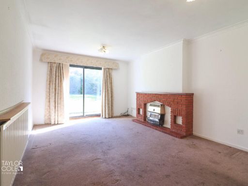
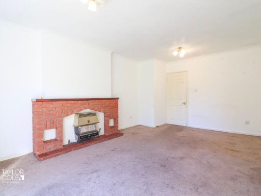
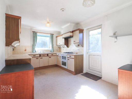
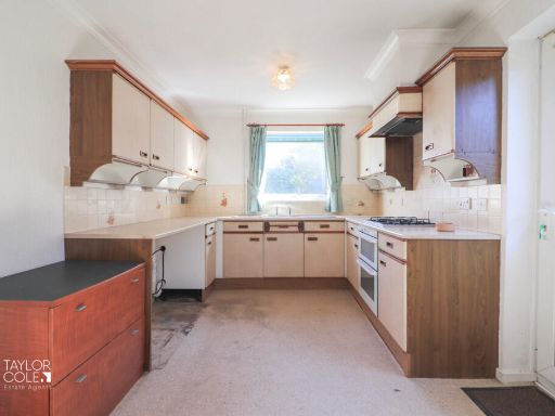
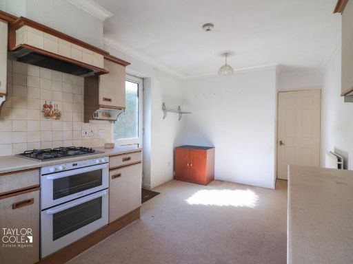
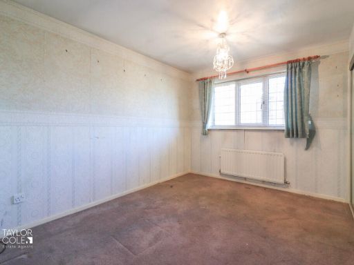
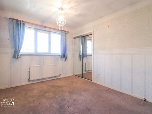
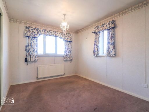
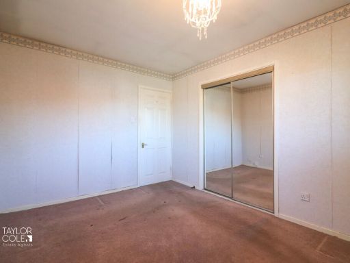
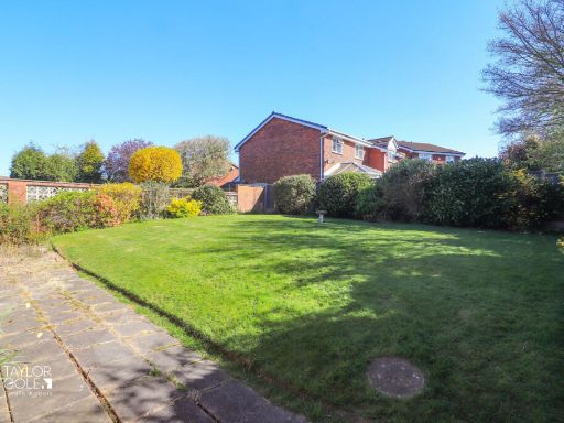
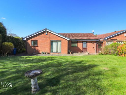
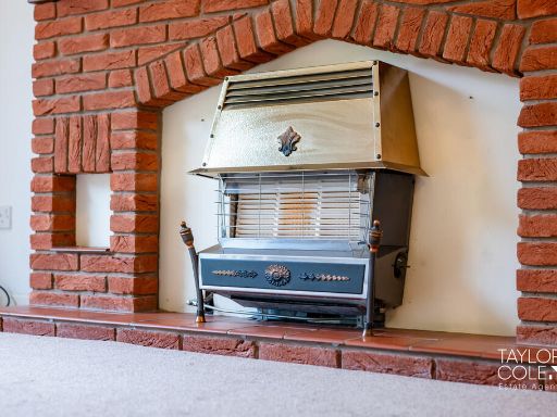
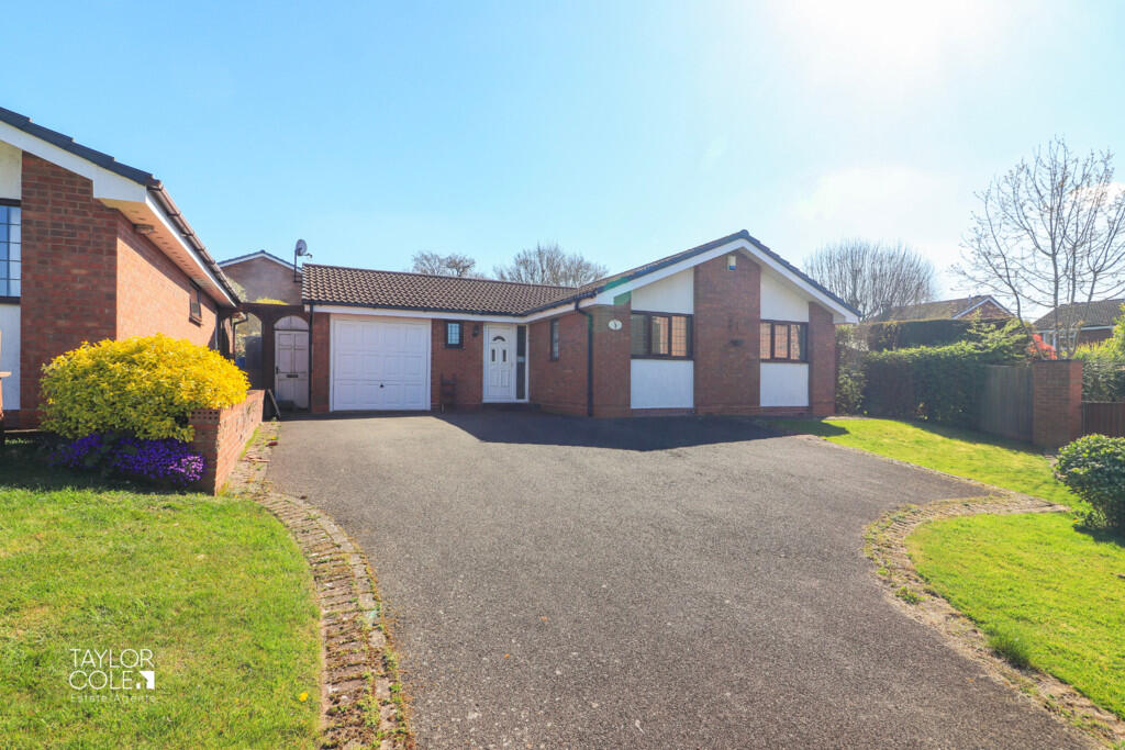
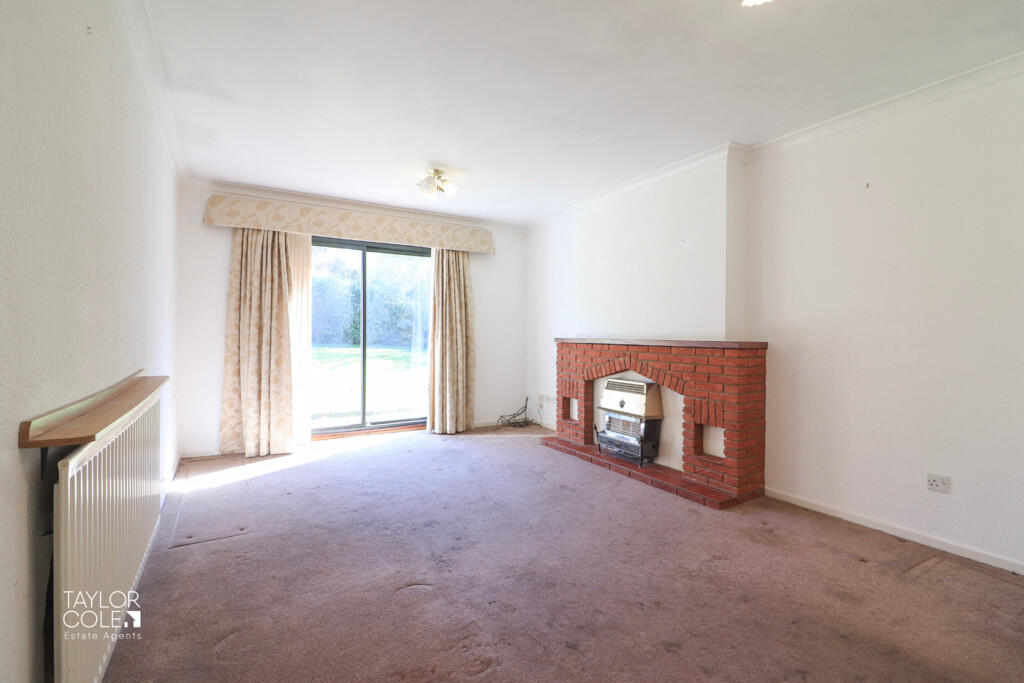
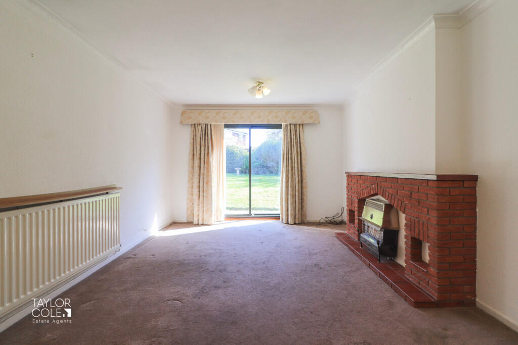
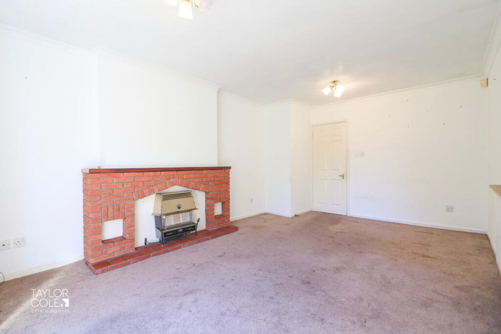
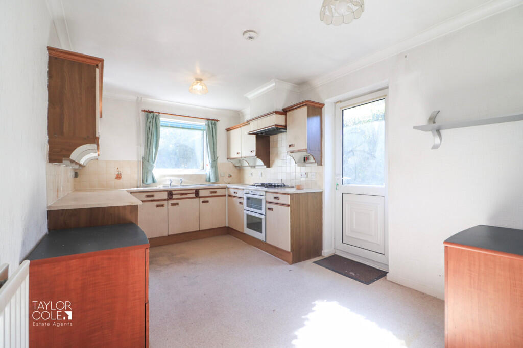
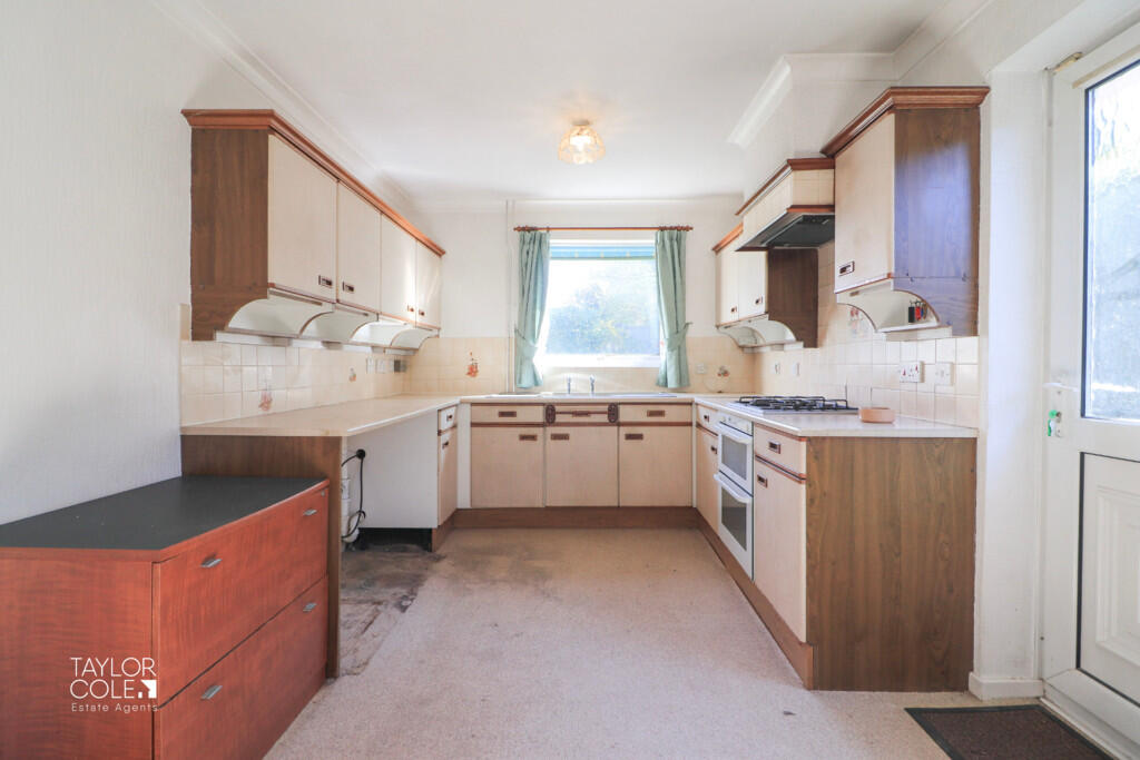
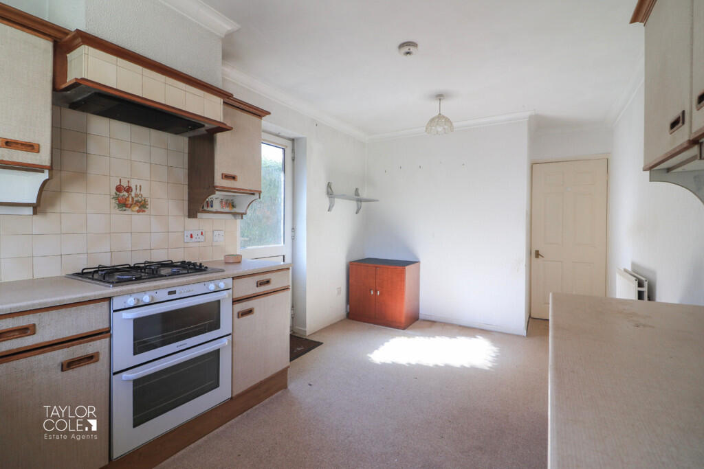
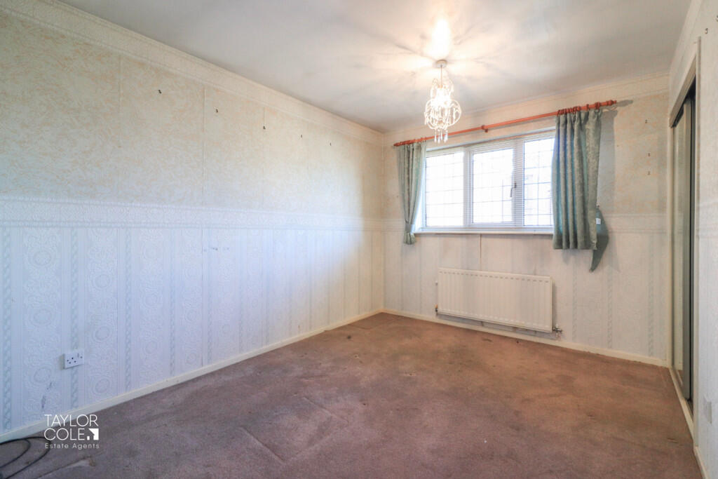
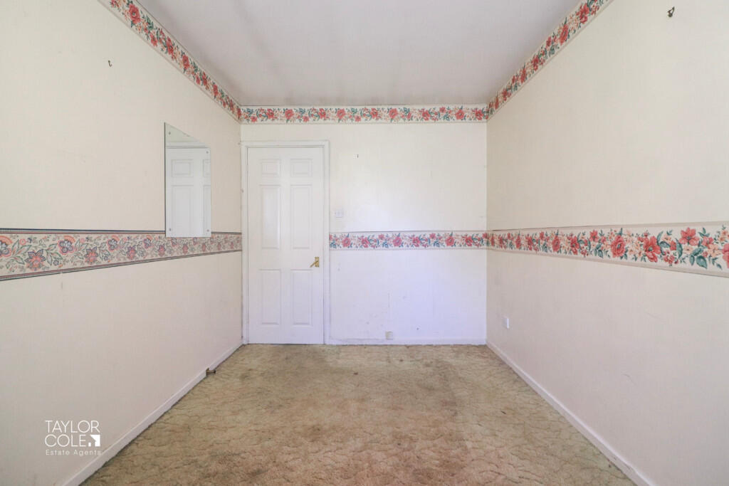
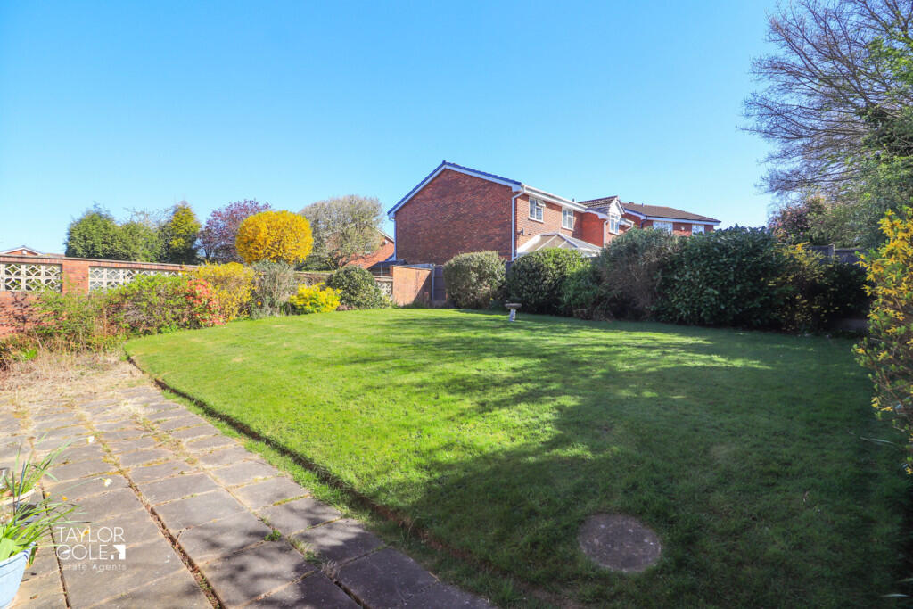
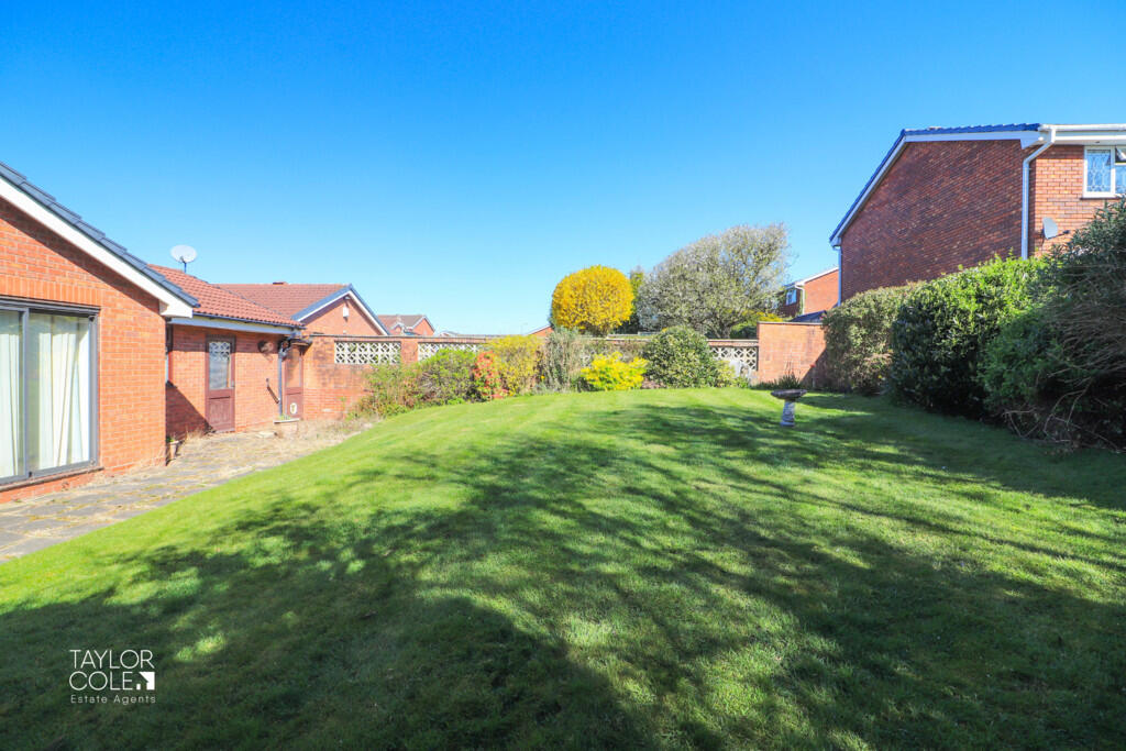
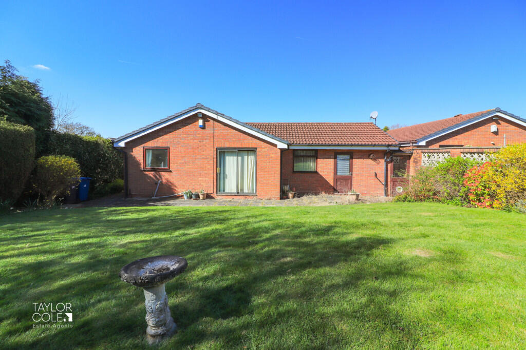
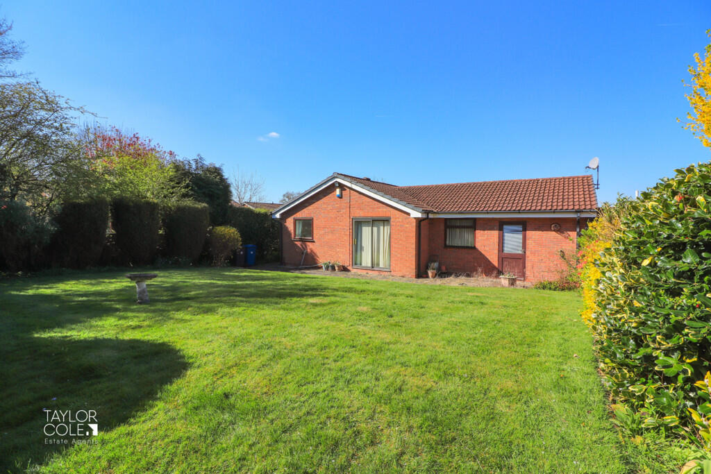
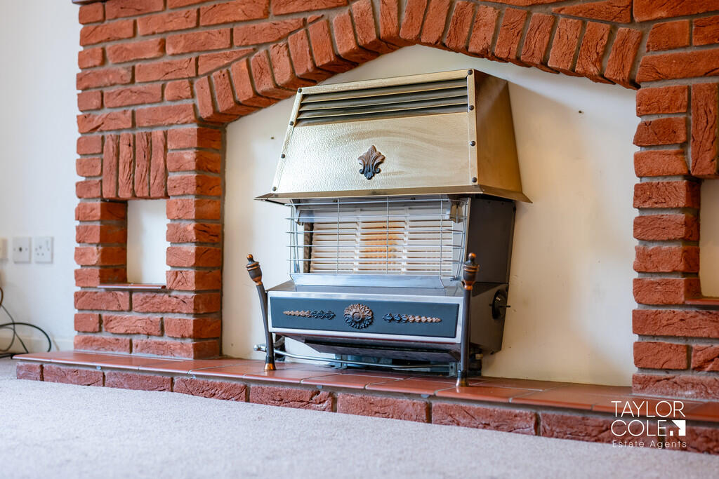
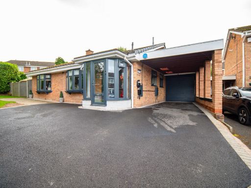
- The property is a charming single-story detached bungalow with a brick exterior, offering a cozy and tranquil living environment. It features large windows ensuring plenty of natural light fills the interior spaces. The driveway offers ample parking space, and there is a well-maintained garden with mature shrubs enhancing the property's curb appeal. Inside, the rooms are of average size, providing a comfortable yet manageable living space. The living room has a feature fireplace adding character to the space. The kitchen is spacious with room for dining, boasting practical countertops and a good layout for culinary activities. The property is well-suited for individuals or small families seeking a peaceful residence in a suburban setting.
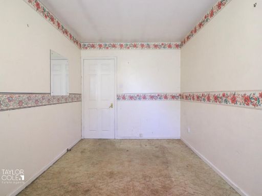
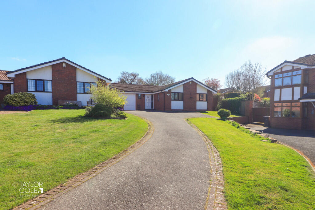
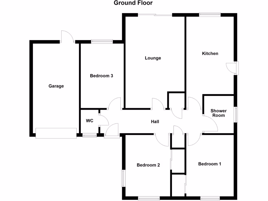
- The property is a spacious detached bungalow situated in an area that appears to be residential. It includes a well-maintained large garden with lush green grass, ideal for families who enjoy outdoor spaces. The bungalow has a corresponding floor plan that features three bedrooms, a lounge, kitchen, bathroom, and an attached garage, indicating a significantly comfortable and convenient living experience. The layout suggests average to large-sized rooms and an efficient use of space, making it suitable for a growing family or those seeking a single-level living environment. The garden offers potential for beautiful landscaping and outdoor activities.
Image Descriptions
- bungalow property with attached garage modern bungalow
- bungalow modern
Floorplan Description
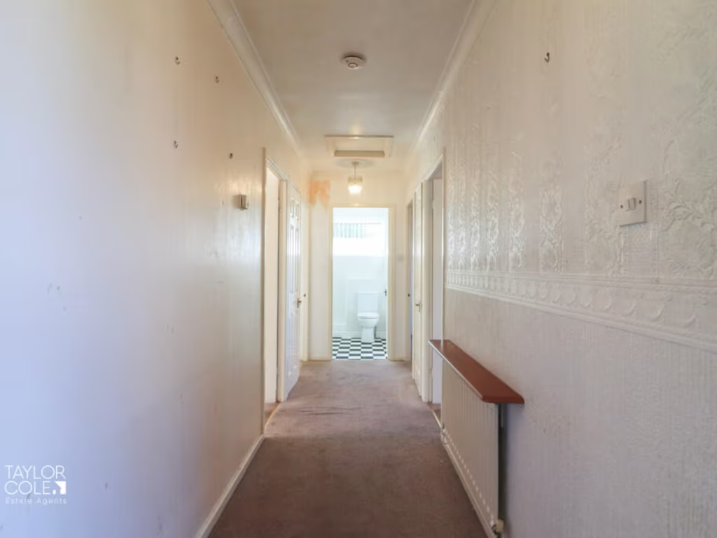
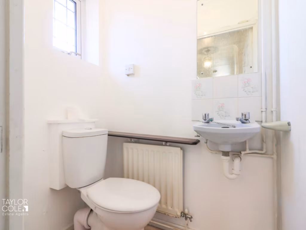
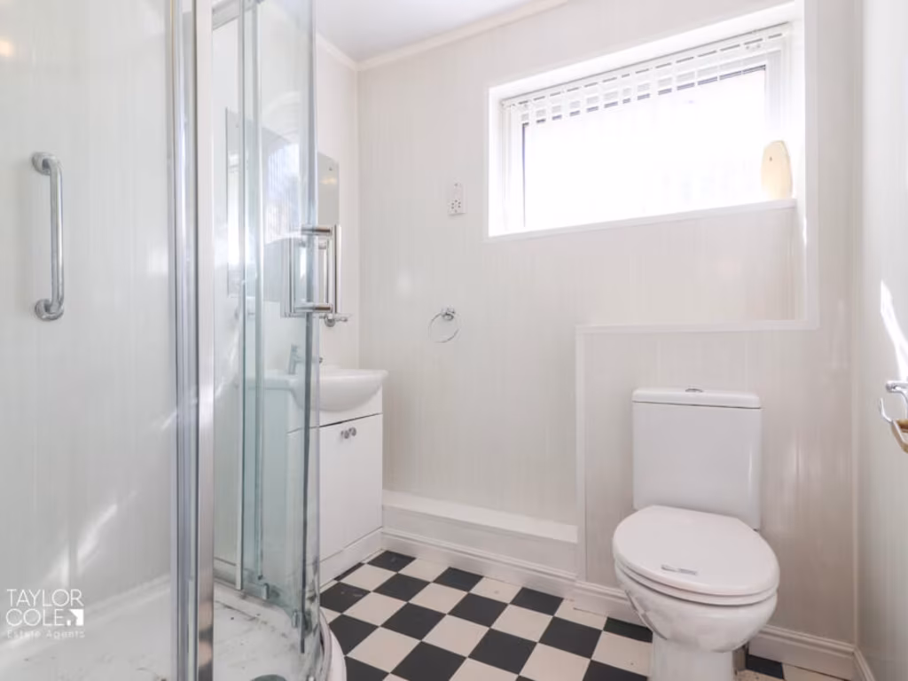
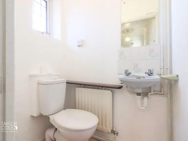
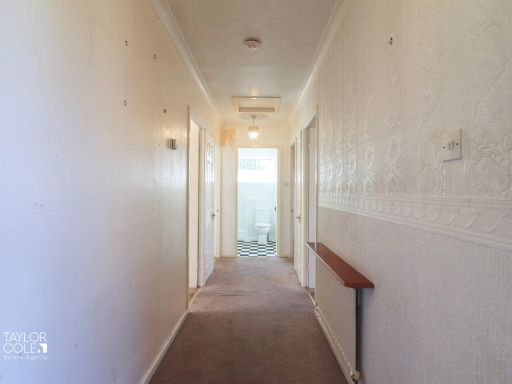
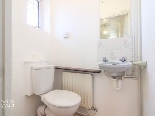
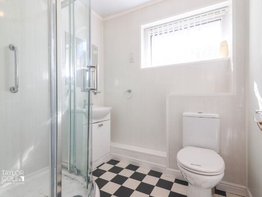
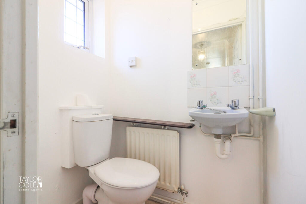
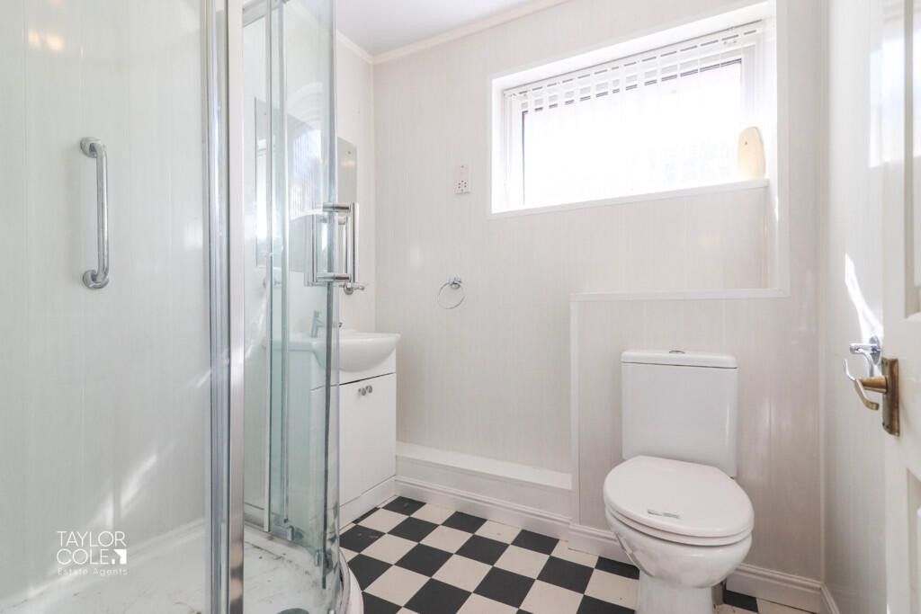
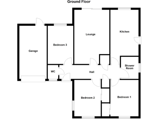
- A property with three bedrooms, lounge, kitchen, shower room, WC, and hall.
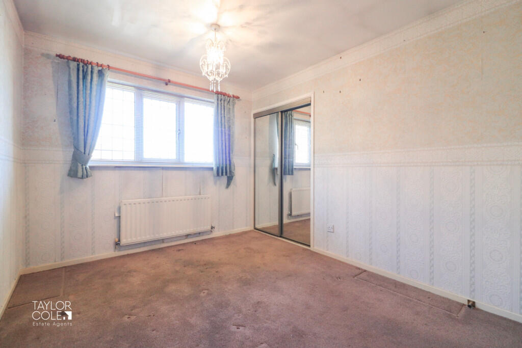
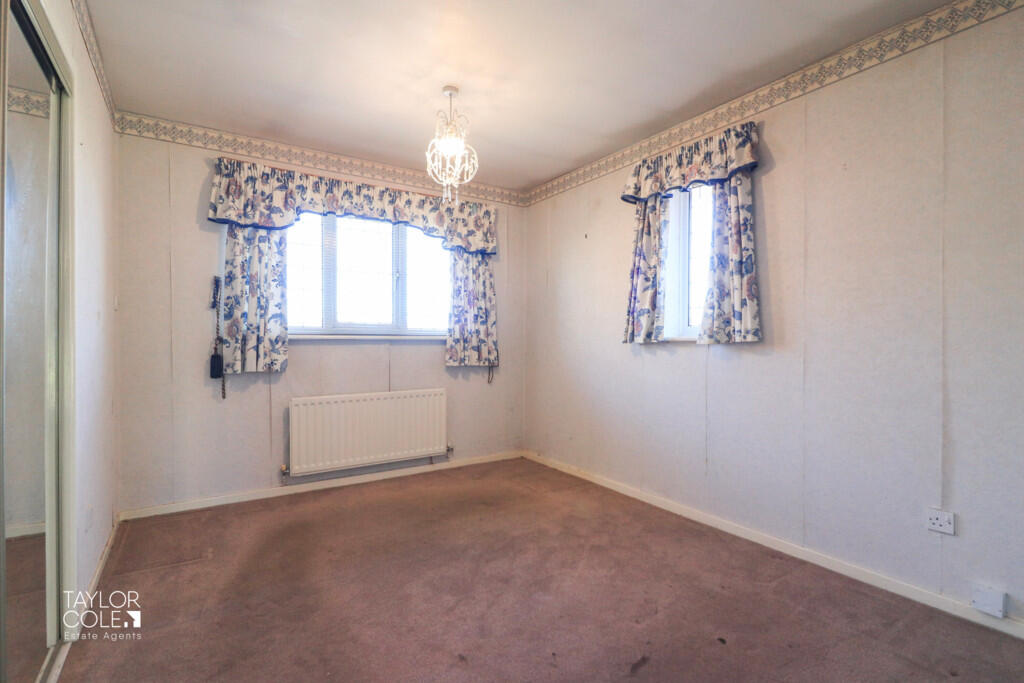
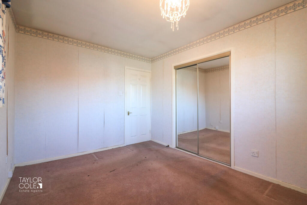
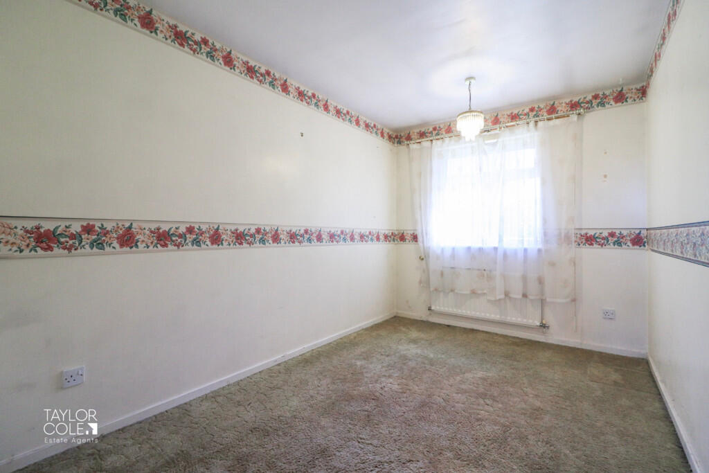
Rooms
- Lounge:
- Kitchen:
- Bedroom 1:
- Bedroom 2:
- Bedroom 3:
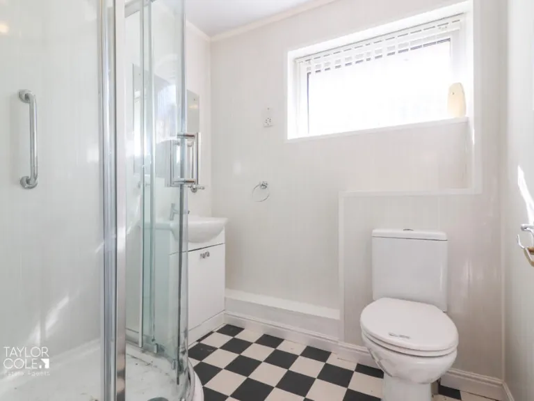
- Shower Room:
- WC:
Textual Property Features
Detected Visual Features
- bungalow
- modern
- garage
- driveway
- garden
- single-story
- brick exterior
- quiet neighborhood
EPC Details
- Fully double glazed
- Cavity wall, as built, insulated (assumed)
- Boiler and radiators, mains gas
- No low energy lighting
- Solid, no insulation (assumed)
Nearby Schools
- Manor Primary Academy
- Three Peaks Primary Academy
- Oakhill Primary School
- Lakeside Primary School
- William MacGregor Primary School
- Landau Forte Academy, Amington
- Moorgate Primary Academy
- Landau Forte Academy, QEMS
- Dosthill Primary School
- Wilnecote Junior Academy
- St Gabriel's Catholic Primary School
- Stoneydelph Primary School
- Hanbury's Farm Community Primary School
- Glascote Academy
- Ashcroft Infants' School
- Heathfields Infant Academy
- Bird's Bush Primary School
- Amington Heath Primary School and Nursery
- Florendine Primary School
- Ankermoor Primary Academy
- Flax Hill Junior Academy
- The Wilnecote School
- Two Gates Primary School
- Tamworth Enterprise College and AET Academy
- The Woodlands Community Primary School
Nearest Bars And Restaurants
- Id: 516306587
- Tags:
- Amenity: pub
- Landuse: retail
- Name: Plough and Harrow
- Source: survey
- TagsNormalized:
- Lat: 52.6139588
- Lon: -1.6965642
- FullGeoHash: gcqg36hde0y1
- PartitionGeoHash: gcqg
- Images:
- FoodStandards: null
- Distance: 891.1
,- Id: 4264421861
- Tags:
- Amenity: fast_food
- Brand: Subway
- Brand:wikidata: Q244457
- Brand:wikipedia: en:Subway (restaurant)
- Contact:
- Website: https://restaurants.subway.com/united-kingdom/en/tamworth/drayton-services-watling-street-fazeley
- Cuisine: sandwich
- Name: Subway
- Takeaway: yes
- TagsNormalized:
- fast food
- food
- sandwich
- takeaway
- Lat: 52.6139692
- Lon: -1.6930382
- FullGeoHash: gcqg36p4t6ep
- PartitionGeoHash: gcqg
- Images:
- FoodStandards: null
- Distance: 736.5
,- Id: 201142042
- Tags:
- Amenity: fast_food
- Brand: McDonald's
- Brand:wikidata: Q38076
- Brand:wikipedia: en:McDonald's
- Building: yes
- Contact:
- Website: https://www.mcdonalds.com/gb/en-gb/location/tamworth/tamworth-wilnecote/watling-street/8261384.html
- Cuisine: burger
- Drive_through: yes
- Name: McDonald's
- Takeaway: yes
- TagsNormalized:
- fast food
- food
- mcdonalds
- burgers
- drive through
- takeaway
- Lat: 52.6108299
- Lon: -1.6776638
- FullGeoHash: gcqg3cd279e0
- PartitionGeoHash: gcqg
- Images:
- FoodStandards: null
- Distance: 678.1
,- Id: 1274424419
- Tags:
- Amenity: pub
- Name: Bull's Head
- Source: survey
- TagsNormalized:
- Lat: 52.6119964
- Lon: -1.6829224
- FullGeoHash: gcqg39wx14fp
- PartitionGeoHash: gcqg
- Images:
- FoodStandards: null
- Distance: 475.4
,- Id: 189037847
- Tags:
- Amenity: pub
- Building: public
- Name: Two Gates Working Mens Club
- TagsNormalized:
- Lat: 52.6115288
- Lon: -1.6837107
- FullGeoHash: gcqg39tuqey3
- PartitionGeoHash: gcqg
- Images:
- FoodStandards: null
- Distance: 402.6
}
Nearest General Shops
- Id: 135165498
- Tags:
- Addr:
- City: Tamworth
- Housenumber: 365
- Postcode: B77 5AD
- Street: Watling Street
- Building: yes
- Name: Motor World
- Shop: car_parts
- TagsNormalized:
- Lat: 52.6102996
- Lon: -1.6777285
- FullGeoHash: gcqg3c6m4ndv
- PartitionGeoHash: gcqg
- Images:
- FoodStandards: null
- Distance: 653.5
,- Id: 135165855
- Tags:
- Building: yes
- Name: Mainly Ford
- Shop: car_parts
- TagsNormalized:
- Lat: 52.6094822
- Lon: -1.677589
- FullGeoHash: gcqg3c62mq6c
- PartitionGeoHash: gcqg
- Images:
- FoodStandards: null
- Distance: 640.5
,- Id: 1275767781
- Tags:
- Addr:
- Alt_name: Gents Hairdressers
- Name: Alan at the Top
- Shop: hairdresser
- Source: survey
- TagsNormalized:
- Lat: 52.6113763
- Lon: -1.6825747
- FullGeoHash: gcqg39wg3pmk
- PartitionGeoHash: gcqg
- Images:
- FoodStandards: null
- Distance: 436.1
}
Nearest Grocery shops
- Id: 142662541
- Tags:
- Addr:
- City: Tamworth
- Postcode: B77 1LE
- Street: High Street
- Brand: Tesco Express
- Brand:wikidata: Q98456772
- Brand:wikipedia: en:Tesco
- Building: yes
- Contact:
- Website: https://www.tesco.com/store-locator/tamworth/high-st
- Name: Tesco Express
- Opening_hours: Mo-Su 06:00-00:00
- Payment:
- Cash: yes
- Credit_cards: yes
- Debit_cards: yes
- Shop: convenience
- TagsNormalized:
- tesco
- tesco express
- convenience
- shop
- Lat: 52.6008902
- Lon: -1.6825494
- FullGeoHash: gcqg1xwy3u8h
- PartitionGeoHash: gcqg
- Images:
- FoodStandards: null
- Distance: 894.4
,- Id: 4264421860
- Tags:
- Brand: Londis
- Brand:wikidata: Q21008564
- Brand:wikipedia: en:Londis (United Kingdom)
- Name: Londis
- Shop: convenience
- TagsNormalized:
- Lat: 52.6140018
- Lon: -1.6930329
- FullGeoHash: gcqg36p4v2z1
- PartitionGeoHash: gcqg
- Images:
- FoodStandards: null
- Distance: 739.3
,- Id: 1484662719
- Tags:
- TagsNormalized:
- Lat: 52.6145844
- Lon: -1.6834608
- FullGeoHash: gcqg3dnnht2t
- PartitionGeoHash: gcqg
- Images:
- FoodStandards: null
- Distance: 718
}
Nearest Supermarkets
- Id: 239848845
- Tags:
- Addr:
- Housenumber: 148
- Postcode: B77 2AF
- Street: Glascote Road
- Brand: Co-op Food
- Brand:wikidata: Q3277439
- Brand:wikipedia: en:Co-op Food
- Building: yes
- Name: Co-op Food
- Old_name: The Anchor Inn
- Opening_hours: Mo-Sa 07:00-23:00, Su 08:00-22:00
- Operator: Tamworth Co-operative Society
- Shop: supermarket
- Source: Bing
- TagsNormalized:
- co-op
- co-op food
- food
- supermarket
- shop
- Lat: 52.6287304
- Lon: -1.6795106
- FullGeoHash: gcqg3uc08d6j
- PartitionGeoHash: gcqg
- Images:
- FoodStandards: null
- Distance: 2306.7
,- Id: 129531208
- Tags:
- Addr:
- City: Tamworth
- Postcode: B78 3HB
- Street: Ventura Park Road
- Brand: Asda
- Brand:wikidata: Q297410
- Brand:wikipedia: en:Asda
- Building: yes
- Contact:
- Facebook: https://www.facebook.com/asda/
- Twitter: @asda
- Website: https://storelocator.asda.com/west-midlands/tamworth/ventura-road
- Fhrs:
- Name: Asda
- Operator: Asda Stores Ltd
- Shop: supermarket
- TagsNormalized:
- Lat: 52.6255592
- Lon: -1.7013336
- FullGeoHash: gcqg3k1nh538
- PartitionGeoHash: gcqg
- Images:
- FoodStandards: null
- Distance: 2133.5
,- Id: 135098163
- Tags:
- Addr:
- City: Tamworth
- Postcode: B77 2NY
- Street: Marlborough Way
- Brand: Morrisons
- Brand:wikidata: Q922344
- Brand:wikipedia: en:Morrisons
- Building: yes
- Name: Morrisons
- Opening_hours: Mo-Sa 06:00-22:00; Su 10:00-16:00
- Phone: +44 1827 284082
- Shop: supermarket
- Source: bing
- Website: https://my.morrisons.com/storefinder/73
- TagsNormalized:
- Lat: 52.6109278
- Lon: -1.6746524
- FullGeoHash: gcqg3cs8cgb8
- PartitionGeoHash: gcqg
- Images:
- FoodStandards: null
- Distance: 872.6
}
Nearest Religious buildings
- Id: 135166613
- Tags:
- Amenity: place_of_worship
- Building: church
- Denomination: anglican
- Name: Holy Trinity Church
- Religion: christian
- Wikidata: Q26491488
- TagsNormalized:
- place of worship
- church
- anglican
- christian
- Lat: 52.6090945
- Lon: -1.6676197
- FullGeoHash: gcqg611wjwh8
- PartitionGeoHash: gcqg
- Images:
- FoodStandards: null
- Distance: 1305.8
,- Id: 641722177
- Tags:
- Amenity: place_of_worship
- Denomination: seventh_day_adventist
- Religion: christian
- TagsNormalized:
- place of worship
- adventist
- seventh day adventist
- christian
- church
- Lat: 52.6087735
- Lon: -1.6690381
- FullGeoHash: gcqg610skd4v
- PartitionGeoHash: gcqg
- Images:
- FoodStandards: null
- Distance: 1208.6
,- Id: 242311022
- Tags:
- Addr:
- Housenumber: st. pauls fazeley
- Amenity: place_of_worship
- Building: yes
- Denomination: anglican
- Name: St Pauls Church
- Religion: christian
- Source: Bing
- Survey:
- Wikidata: Q26290564
- TagsNormalized:
- place of worship
- anglican
- church
- christian
- Lat: 52.613039
- Lon: -1.7003316
- FullGeoHash: gcqg33cv5mkf
- PartitionGeoHash: gcqg
- Images:
- FoodStandards: null
- Distance: 1037.1
}
Nearest Medical buildings
- Id: 135097286
- Tags:
- Addr:
- City: Tamworth
- Postcode: B78 3HL
- Street: Ventura Park Road
- Amenity: clinic
- Building: yes
- Healthcare: clinic
- Name: IVI Midland
- Phone: +44 1827 311170
- Source: bing
- Website: http://www.ivi.uk/clinics/midland/
- TagsNormalized:
- Lat: 52.6267351
- Lon: -1.7079438
- FullGeoHash: gcqg3hkkfn2y
- PartitionGeoHash: gcqg
- Images:
- FoodStandards: null
- Distance: 2476.3
,- Id: 7522870275
- Tags:
- Amenity: pharmacy
- Brand: Asda
- Brand:wikidata: Q297410
- Brand:wikipedia: en:Asda
- Contact:
- Phone: +44 1827 302180
- Website: https://storelocator.asda.com/west-midlands/tamworth/ventura-road/pharmacy
- Dispensing: yes
- Fixme: Location not accurate
- Healthcare: pharmacy
- Name: Asda
- Operator: Asda Stores Ltd
- TagsNormalized:
- pharmacy
- asda
- health
- healthcare
- Lat: 52.6251849
- Lon: -1.7017114
- FullGeoHash: gcqg3k0ggm2p
- PartitionGeoHash: gcqg
- Images:
- FoodStandards: null
- Distance: 2108.4
,- Id: 793143380
- Tags:
- Addr:
- City: Tamworth
- Postcode: B77 2LB
- Street: Derwent
- Amenity: doctors
- Building: yes
- Healthcare: doctor
- Name: Tri-Links Medical Practice - Belgrave Surgery
- Operator: NHS
- Phone: +44 1827 285414
- Website: https://www.tri-linkssurgery.nhs.uk/
- TagsNormalized:
- doctor
- doctors
- health
- healthcare
- surgery
- Lat: 52.6187499
- Lon: -1.6809706
- FullGeoHash: gcqg3dzyqtcm
- PartitionGeoHash: gcqg
- Images:
- FoodStandards: null
- Distance: 1210.7
,- Id: 641722176
- Tags:
- Amenity: pharmacy
- Healthcare: pharmacy
- Name: Easons
- Opening_hours: Mo-Fr 09:00-18:30; Sa 09:00-13:00
- TagsNormalized:
- Lat: 52.6091856
- Lon: -1.6713053
- FullGeoHash: gcqg3cnyxz02
- PartitionGeoHash: gcqg
- Images:
- FoodStandards: null
- Distance: 1058
}
Nearest Airports
- Id: 2437117
- Tags:
- Aerodrome: international
- Aerodrome:type: public
- Aeroway: aerodrome
- Ele: 104
- Iata: BHX
- Icao: EGBB
- Internet_access: wlan
- Is_in: Birmingham,England,UK
- Name: Birmingham Airport
- Ref: BHX
- Type: multipolygon
- Website: https://www.birminghamairport.co.uk/
- Wikidata: Q8719
- Wikipedia: en:Birmingham Airport
- TagsNormalized:
- airport
- international airport
- Lat: 52.4543817
- Lon: -1.7468974
- FullGeoHash: gcqf2jpbym6y
- PartitionGeoHash: gcqf
- Images:
- FoodStandards: null
- Distance: 17608.6
,- Id: 11359528
- Tags:
- Aerodrome: international
- Aerodrome:type: public
- Aeroway: aerodrome
- Iata: EMA
- Icao: EGNX
- Is_in: Castle Donington,England,UK
- Name: East Midlands Airport
- Old_name: RAF Castle Donington
- Operator: Manchester Airports Holdings Limited
- Operator:type: private
- Ref: EMA
- Type: multipolygon
- Website: https://www.eastmidlandsairport.com/
- Wikidata: Q8977
- Wikipedia: en:East Midlands Airport
- TagsNormalized:
- airport
- international airport
- Lat: 52.8281122
- Lon: -1.3322143
- FullGeoHash: gcrh99jfj1vh
- PartitionGeoHash: gcrh
- Images:
- FoodStandards: null
- Distance: 34164.9
}
Nearest Leisure Facilities
- Id: 239848914
- Tags:
- Leisure: pitch
- Source: Bing
- Sport: soccer
- TagsNormalized:
- Lat: 52.6099069
- Lon: -1.6965711
- FullGeoHash: gcqg33kdgj2y
- PartitionGeoHash: gcqg
- Images:
- FoodStandards: null
- Distance: 670
,- Id: 239848915
- Tags:
- Leisure: pitch
- Source: Bing
- Sport: soccer
- TagsNormalized:
- Lat: 52.6099062
- Lon: -1.6955042
- FullGeoHash: gcqg33m6gvk6
- PartitionGeoHash: gcqg
- Images:
- FoodStandards: null
- Distance: 600.2
,- Id: 142662441
- Tags:
- TagsNormalized:
- Lat: 52.6041236
- Lon: -1.6867286
- FullGeoHash: gcqg387c0r7u
- PartitionGeoHash: gcqg
- Images:
- FoodStandards: null
- Distance: 484.7
,- Id: 112016414
- Tags:
- Barrier: fence
- Leisure: park
- Source: OS OpenData StreetView;GPS;survey
- TagsNormalized:
- Lat: 52.6126321
- Lon: -1.6870293
- FullGeoHash: gcqg39gdc37z
- PartitionGeoHash: gcqg
- Images:
- FoodStandards: null
- Distance: 461.6
,- Id: 965450036
- Tags:
- TagsNormalized:
- Lat: 52.6051892
- Lon: -1.6854012
- FullGeoHash: gcqg38kxrq1b
- PartitionGeoHash: gcqg
- Images:
- FoodStandards: null
- Distance: 380.3
}
Nearest Tourist attractions
- Id: 86833625
- Tags:
- Building: yes
- Name: Bryan's Slot Machine Museum
- Tourism: attraction
- TagsNormalized:
- Lat: 52.6128948
- Lon: -1.7085596
- FullGeoHash: gcqg31gu7dmw
- PartitionGeoHash: gcqg
- Images:
- FoodStandards: null
- Distance: 1540.6
,- Id: 1010552083
- Tags:
- Name: Discover Thomas & Friends Exhibition
- Tourism: attraction
- TagsNormalized:
- Lat: 52.6136392
- Lon: -1.70756
- FullGeoHash: gcqg34h8dvny
- PartitionGeoHash: gcqg
- Images:
- FoodStandards: null
- Distance: 1506.3
,- Id: 516306561
- Tags:
- Building: yes
- Source: Bing
- Tourism: hostel
- TagsNormalized:
- Lat: 52.6139898
- Lon: -1.6954552
- FullGeoHash: gcqg36j6tn8f
- PartitionGeoHash: gcqg
- Images:
- FoodStandards: null
- Distance: 840.5
}
Nearest Train stations
- Id: 2598492716
- Tags:
- Name: Polesworth
- Naptan:
- Network: National Rail
- Public_transport: station
- Railway: station
- Ref:
- Source: NPE
- Wikidata: Q2749317
- Wikipedia: en:Polesworth railway station
- TagsNormalized:
- Lat: 52.6258348
- Lon: -1.6107049
- FullGeoHash: gcqg7k5peyek
- PartitionGeoHash: gcqg
- Images:
- FoodStandards: null
- Distance: 5496
,- Id: 392821344
- Tags:
- Name: Harvesters
- Public_transport: station
- Railway: station
- Usage: tourism
- TagsNormalized:
- Lat: 52.5615629
- Lon: -1.6990466
- FullGeoHash: gcqg12dc337p
- PartitionGeoHash: gcqg
- Images:
- FoodStandards: null
- Distance: 5280.9
,- Id: 763170872
- Tags:
- Name: Far Leys Station
- Notes: Officially opened 15 May 2010
- Public_transport: station
- Railway: station
- Usage: tourism
- TagsNormalized:
- Lat: 52.5657715
- Lon: -1.6934055
- FullGeoHash: gcqg13qcuf12
- PartitionGeoHash: gcqg
- Images:
- FoodStandards: null
- Distance: 4769.2
,- Id: 7153786344
- Tags:
- Addr:
- Postcode: B79 7JT
- Street: Victoria Road
- Name: Tamworth
- Name:ur: ٹیم ورتھ
- Naptan:
- Network: National Rail
- Operator: London Northwestern Railway
- Public_transport: station
- Railway: station
- Ref:
- Train: yes
- Wikidata: Q768018
- Wikipedia: en:Tamworth railway station
- TagsNormalized:
- Lat: 52.6375245
- Lon: -1.6870818
- FullGeoHash: gcqg3w7eb1u8
- PartitionGeoHash: gcqg
- Images:
- FoodStandards: null
- Distance: 3229.5
,- Id: 252862890
- Tags:
- Name: Wilnecote
- Naptan:
- Network: National Rail
- Note: Operator refers to the station not the train services
- Operator: London Midland
- Public_transport: station
- Railway: station
- Ref:
- Source: NPE
- Wikidata: Q2247229
- Wikipedia: en:Wilnecote railway station
- TagsNormalized:
- Lat: 52.6105794
- Lon: -1.6797073
- FullGeoHash: gcqg3c2ygfz6
- PartitionGeoHash: gcqg
- Images:
- FoodStandards: null
- Distance: 540.7
}
Nearest Hotels
- Id: 894147319
- Tags:
- Addr:
- Postcode: B78 3HQ
- Street: Bonehill Road
- Brand: Premier Inn
- Brand:wikidata: Q2108626
- Name: Premier Inn - Tamworth Central
- Source: survey
- Tourism: hotel
- Website: https://www.premierinn.com/gb/en/hotels/england/staffordshire/tamworth/tamworth-central.html
- Wheelchair: yes
- TagsNormalized:
- Lat: 52.6290794
- Lon: -1.7013177
- FullGeoHash: gcqg3kc4s7mx
- PartitionGeoHash: gcqg
- Images:
- FoodStandards: null
- Distance: 2487.8
,- Id: 304205629
- Tags:
- Addr:
- City: Tamworth
- Housename: Leisure Island
- Postcode: B79 7ND
- Street: Riverdrive
- Brand: Holiday Inn Express
- Brand:wikidata: Q5880423
- Brand:wikipedia: en:Holiday Inn Express
- Building: yes
- Contact:
- Phone: +44 1827 303220
- Website: http://www.hiextamworth.co.uk/
- Name: Holiday Inn Express
- Source: Local observation
- Tourism: hotel
- TagsNormalized:
- Lat: 52.6284807
- Lon: -1.6932274
- FullGeoHash: gcqg3kxp0gy5
- PartitionGeoHash: gcqg
- Images:
- FoodStandards: null
- Distance: 2264.1
,- Id: 239162688
- Tags:
- Building: yes
- Name: Drayton Manor Park Hotel
- Start_date: 2011
- Tourism: hotel
- TagsNormalized:
- Lat: 52.609005
- Lon: -1.7156881
- FullGeoHash: gcqg2cnttt64
- PartitionGeoHash: gcqg
- Images:
- FoodStandards: null
- Distance: 1942.7
}
Tags
- bungalow
- modern
- garage
- driveway
- garden
- single-story
- bungalow
- modern
- single-story
- brick exterior
- driveway
- garden
- quiet neighborhood
Local Market Stats
- Average Price/sqft: £257
- Avg Income: £42700
- Rental Yield: 4.3%
- Social Housing: 14%
- Planning Success Rate: 90%
Similar Properties
 3 bedroom detached bungalow for sale in Scammerton, Wilnecote, B77 — £365,000 • 3 bed • 1 bath • 829 ft²
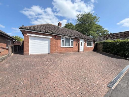 2 bedroom detached bungalow for sale in Leacliffe Way, Streetly/Aldridge, Walsall, WS9 — £400,000 • 2 bed • 1 bath
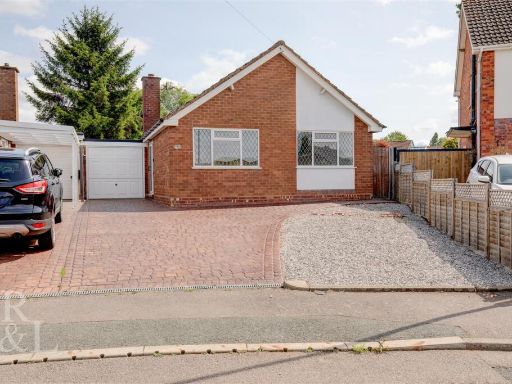 2 bedroom detached bungalow for sale in Lansdowne Crescent, Two Gates, Tamworth, B77 — £279,950 • 2 bed • 1 bath • 910 ft²
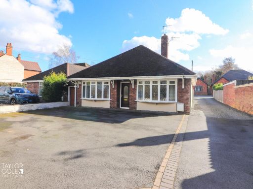 2 bedroom detached bungalow for sale in Tamworth Road, Amington, B77 — £320,000 • 2 bed • 1 bath • 991 ft²
 2 bedroom detached bungalow for sale in Windermere Drive, Streetly, Sutton Coldfield, B74 — £350,000 • 2 bed • 2 bath • 1088 ft²
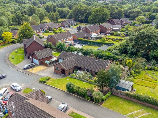 4 bedroom detached bungalow for sale in Chandlers Drive, Amington, B77 — £635,000 • 4 bed • 3 bath • 2000 ft²
Meta
- {
"@context": "https://schema.org",
"@type": "Residence",
"name": "3 bedroom detached bungalow for sale in Morpeth, Dosthill,…",
"description": "",
"url": "https://propertypiper.co.uk/property/715d6ca5-35fa-483e-b2fe-1f8b6e45e1f1",
"image": "https://image-a.propertypiper.co.uk/ff713772-1391-4ec5-8ee5-2e3d29b912b5-1024.jpeg",
"address": {
"@type": "PostalAddress",
"streetAddress": "2, MORPETH, TAMWORTH",
"postalCode": "B77 1JF",
"addressLocality": "Tamworth",
"addressRegion": "Tamworth",
"addressCountry": "England"
},
"geo": {
"@type": "GeoCoordinates",
"latitude": 52.6084811,
"longitude": -1.686931
},
"numberOfRooms": 3,
"numberOfBathroomsTotal": 1,
"floorSize": {
"@type": "QuantitativeValue",
"value": 786,
"unitCode": "FTK"
},
"offers": {
"@type": "Offer",
"price": 405000,
"priceCurrency": "GBP",
"availability": "https://schema.org/InStock"
},
"additionalProperty": [
{
"@type": "PropertyValue",
"name": "Feature",
"value": "bungalow"
},
{
"@type": "PropertyValue",
"name": "Feature",
"value": "modern"
},
{
"@type": "PropertyValue",
"name": "Feature",
"value": "garage"
},
{
"@type": "PropertyValue",
"name": "Feature",
"value": "driveway"
},
{
"@type": "PropertyValue",
"name": "Feature",
"value": "garden"
},
{
"@type": "PropertyValue",
"name": "Feature",
"value": "single-story"
},
{
"@type": "PropertyValue",
"name": "Feature",
"value": "bungalow"
},
{
"@type": "PropertyValue",
"name": "Feature",
"value": "modern"
},
{
"@type": "PropertyValue",
"name": "Feature",
"value": "single-story"
},
{
"@type": "PropertyValue",
"name": "Feature",
"value": "brick exterior"
},
{
"@type": "PropertyValue",
"name": "Feature",
"value": "driveway"
},
{
"@type": "PropertyValue",
"name": "Feature",
"value": "garden"
},
{
"@type": "PropertyValue",
"name": "Feature",
"value": "quiet neighborhood"
}
]
}
High Res Floorplan Images
Compatible Floorplan Images
FloorplanImages Thumbnail