CM77 7UH - 4 bedroom detached house for sale in Derwent Way, White Cou…
View on Property Piper
4 bedroom detached house for sale in Derwent Way, White Court, Great Notley, CM77
Property Details
- Price: £485000
- Bedrooms: 4
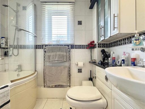
- Bathrooms: 3
- Property Type: undefined
- Property SubType: undefined
Brochure Descriptions
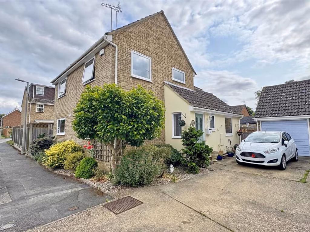
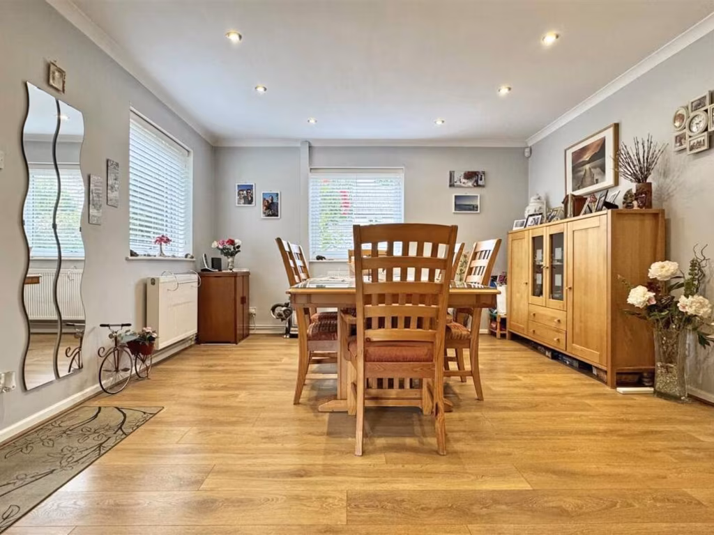
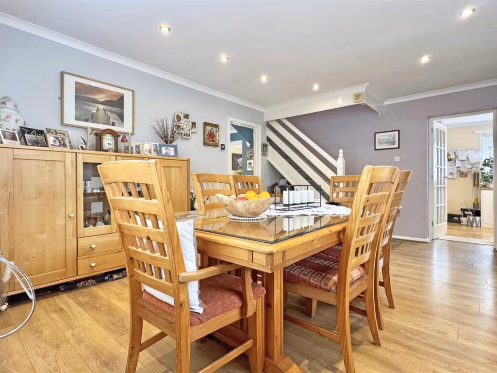
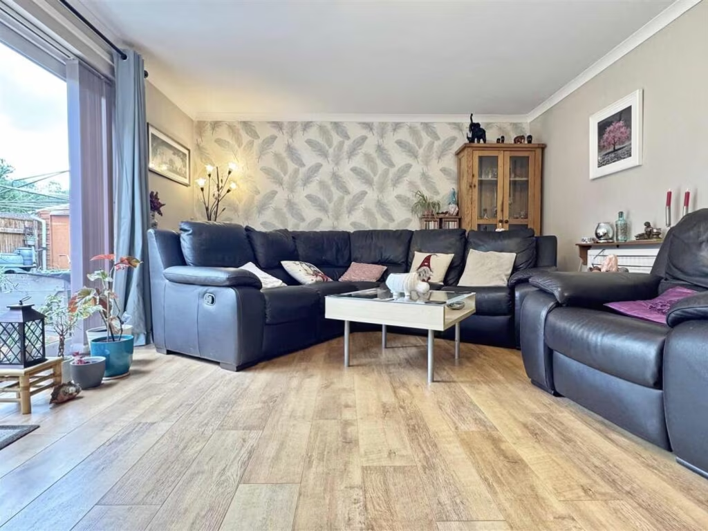
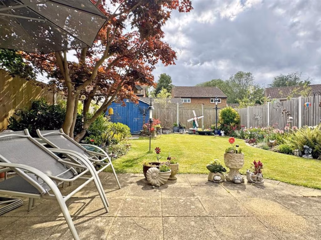
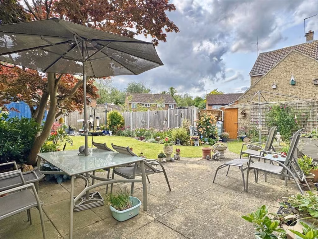
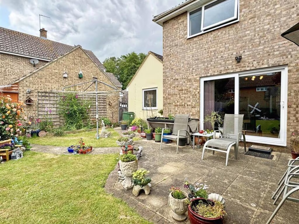
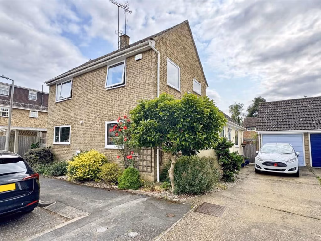
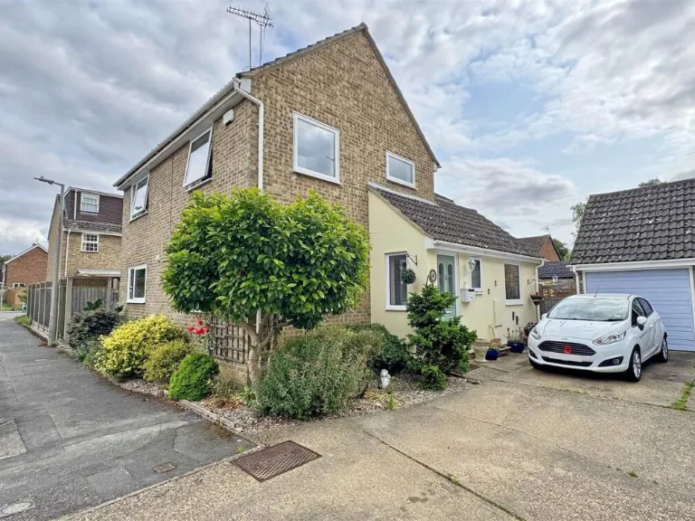
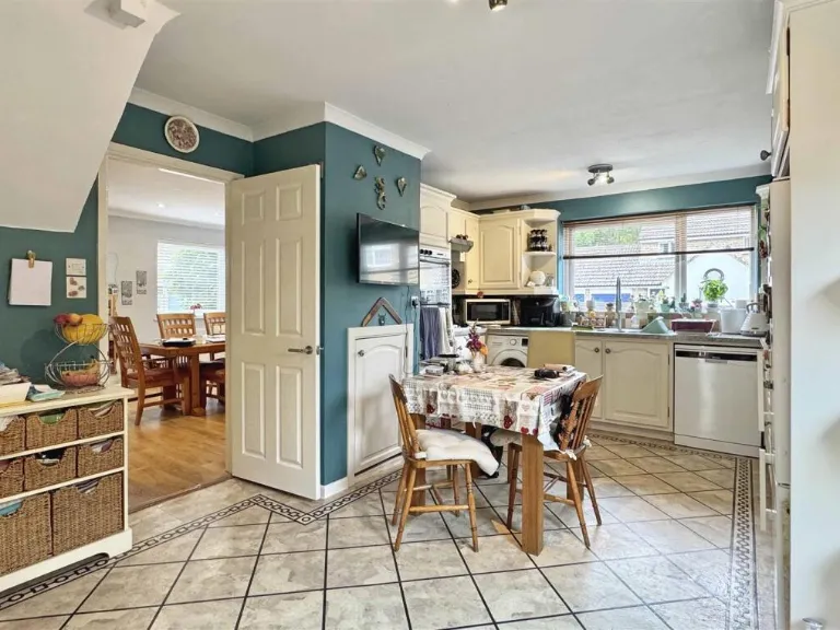
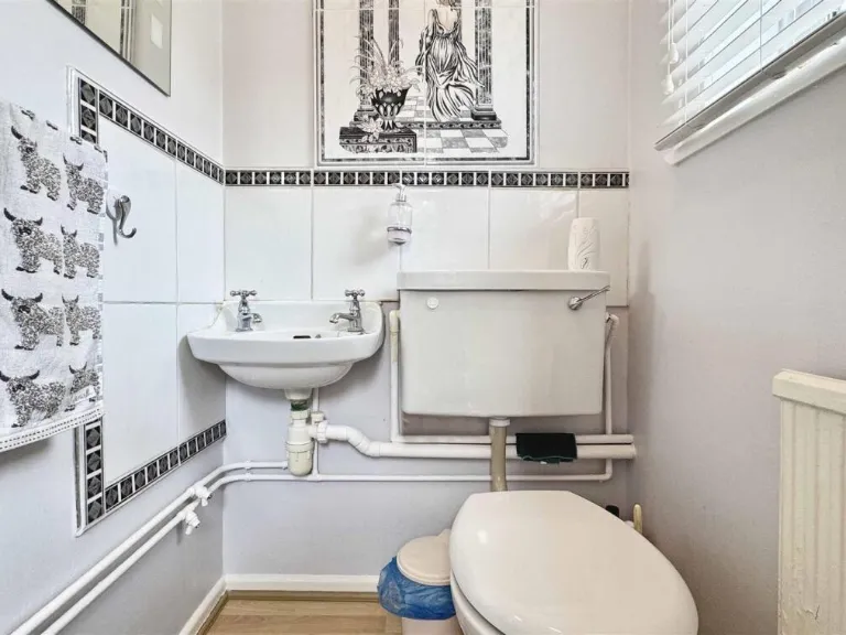
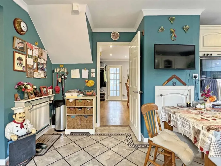
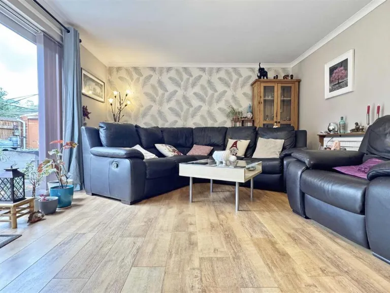
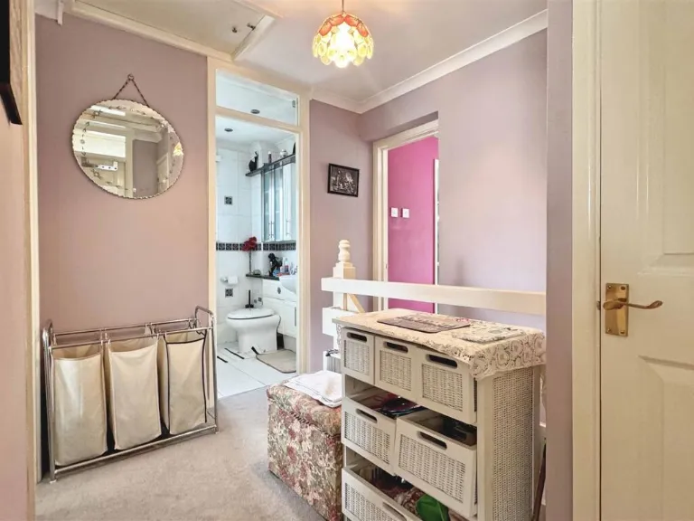
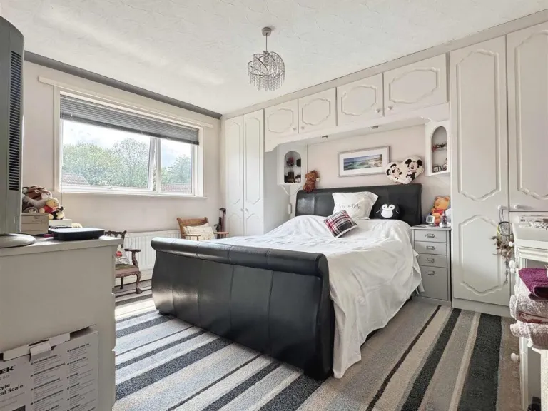
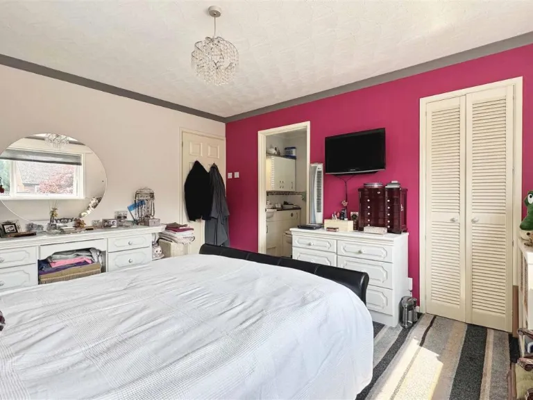
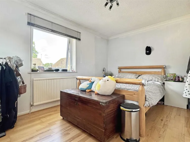
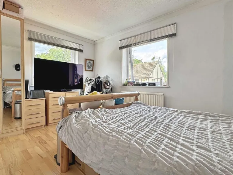
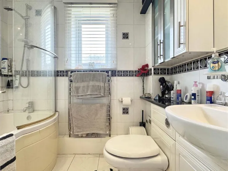
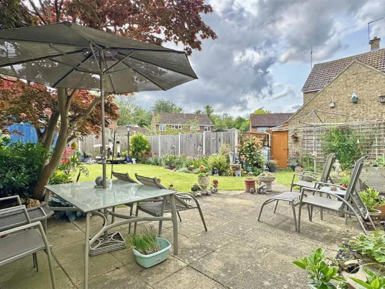
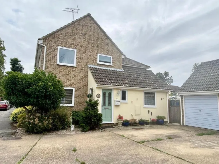
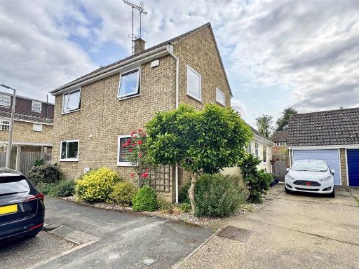
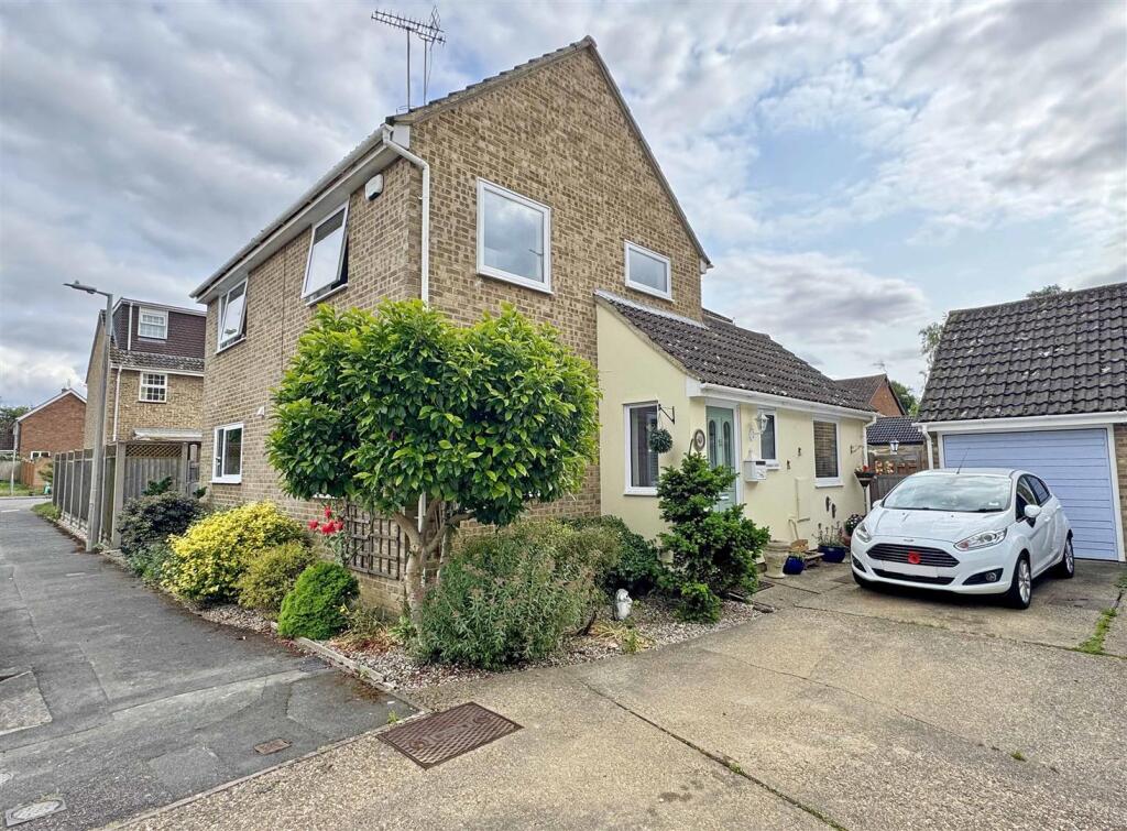
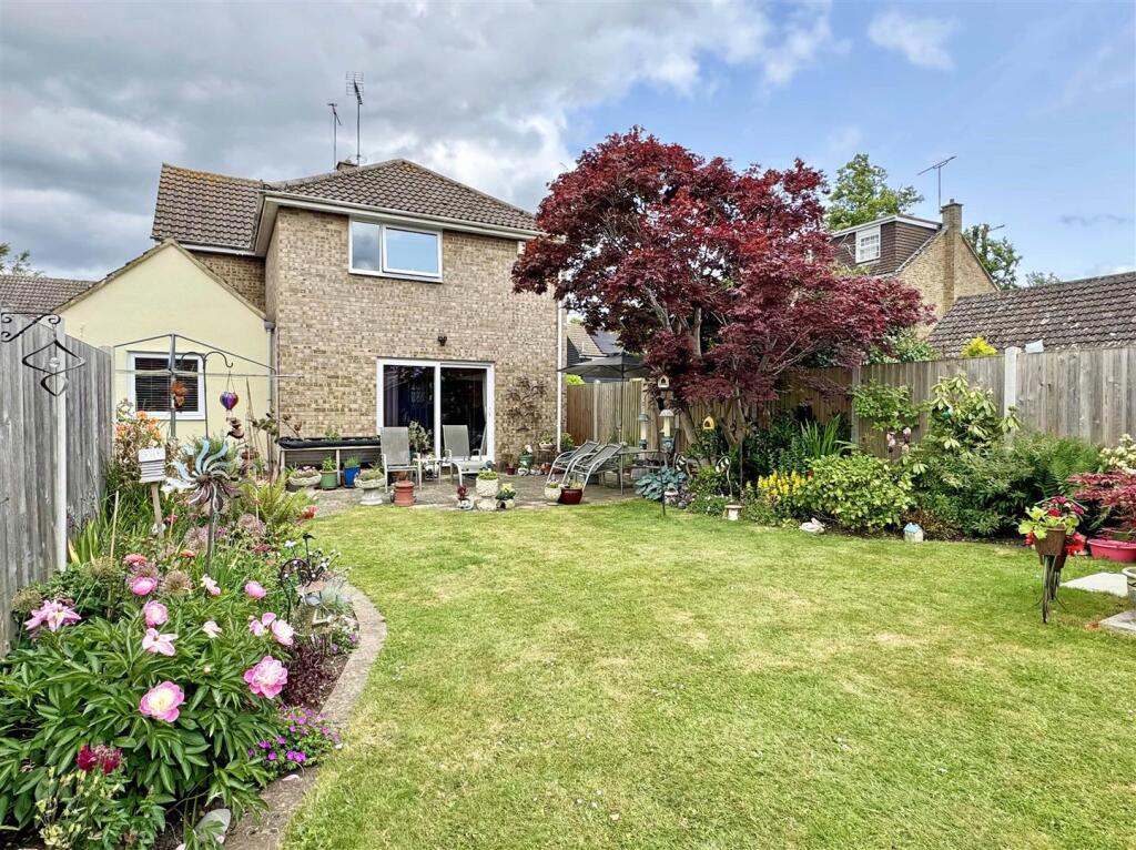
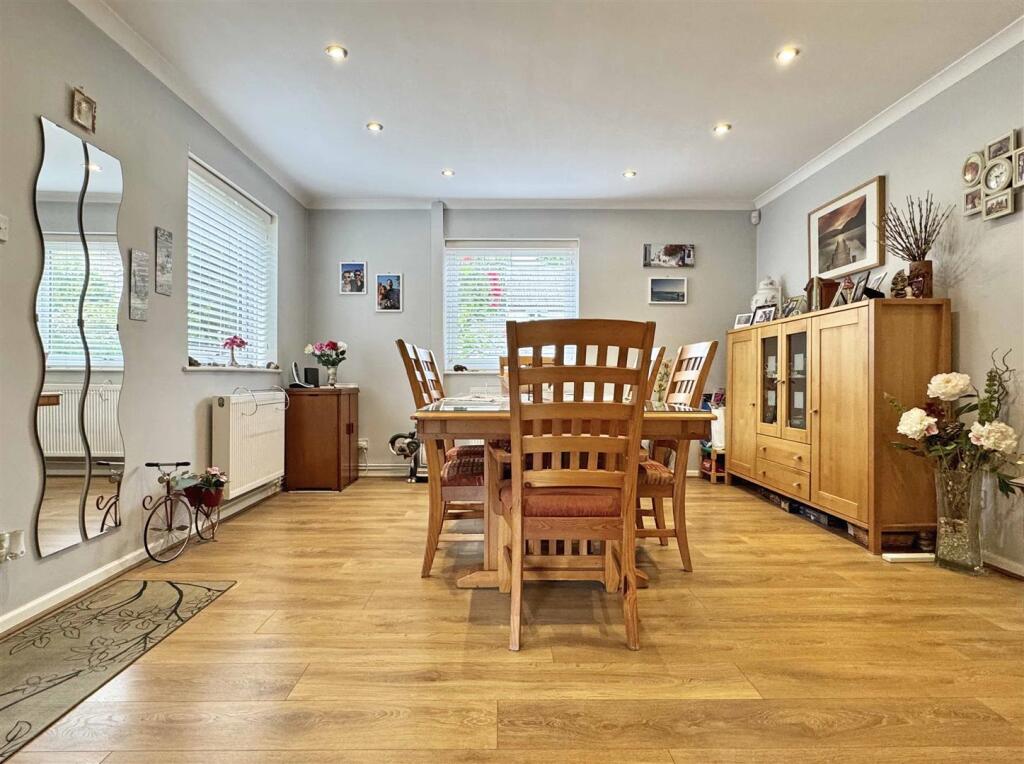
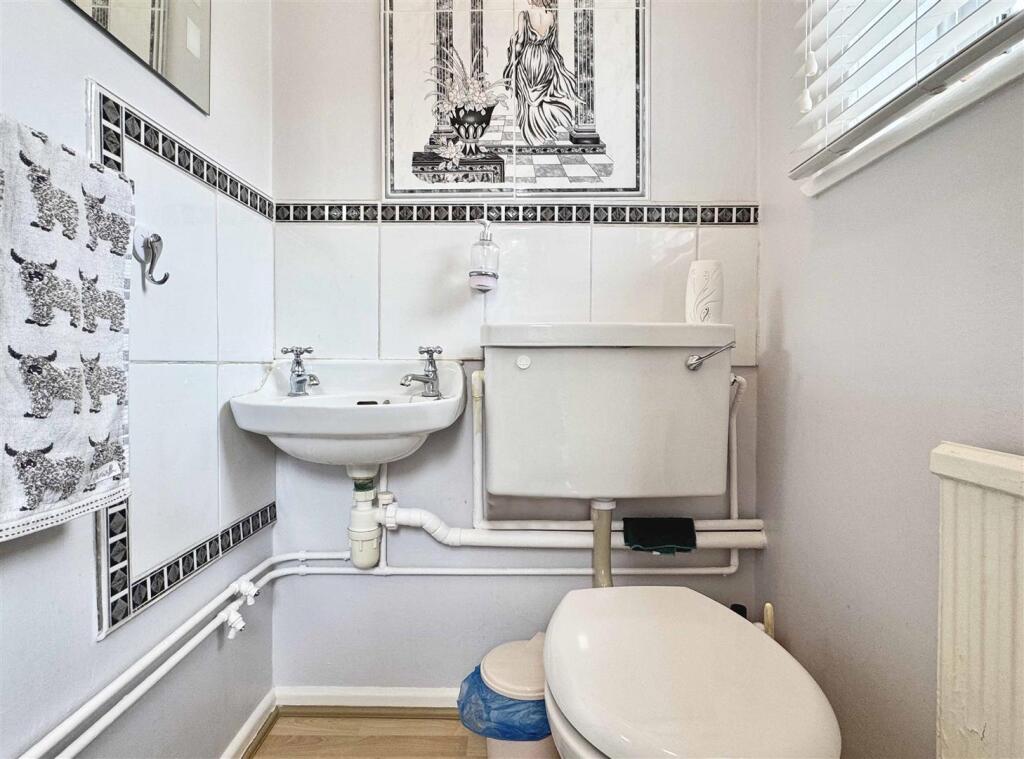
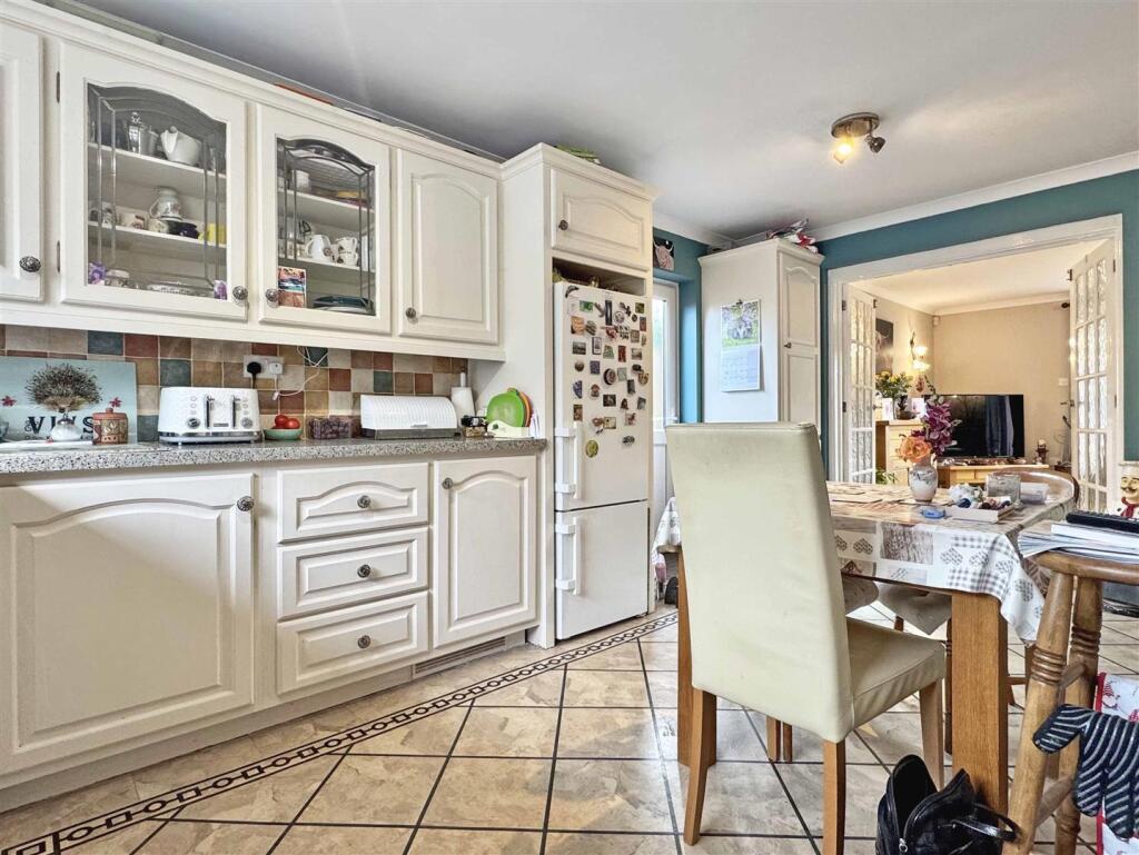
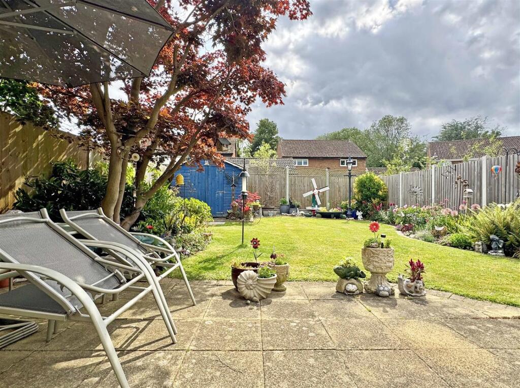
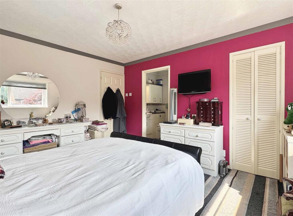
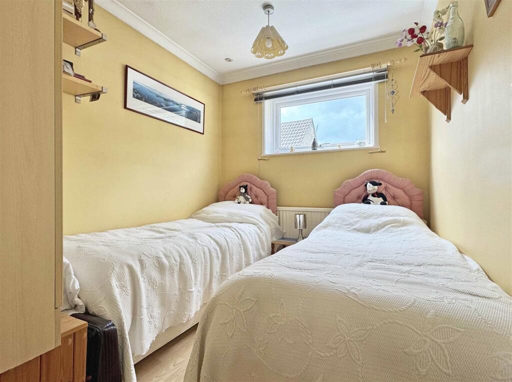
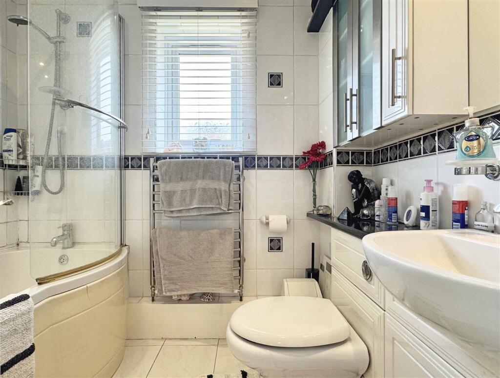
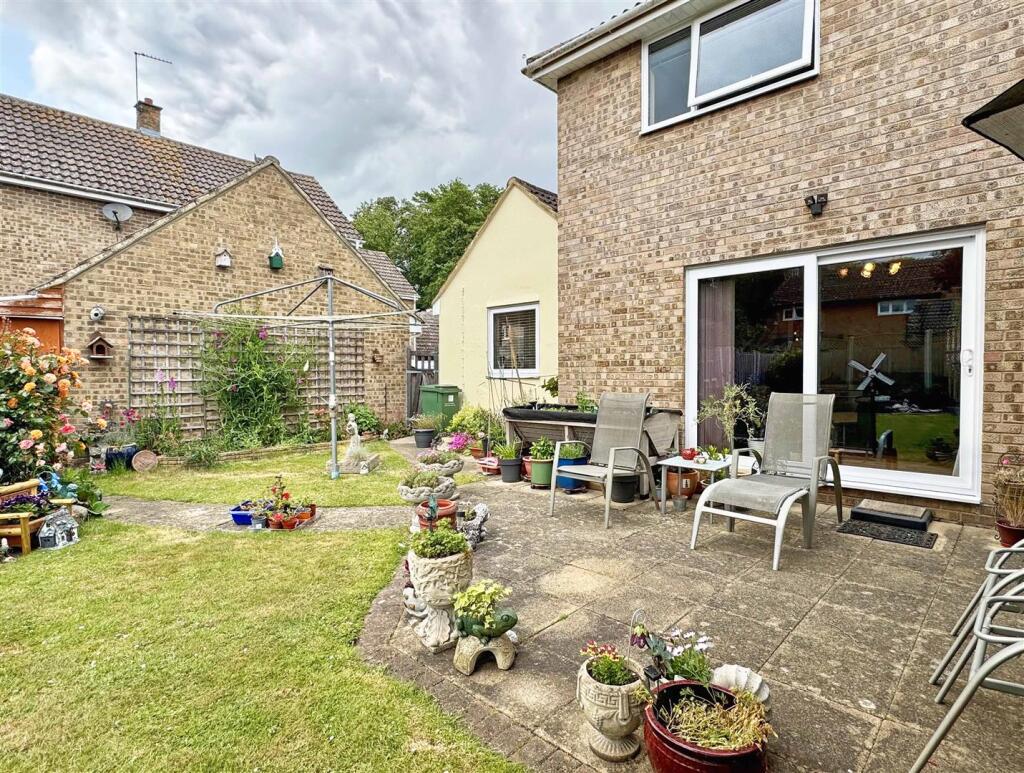
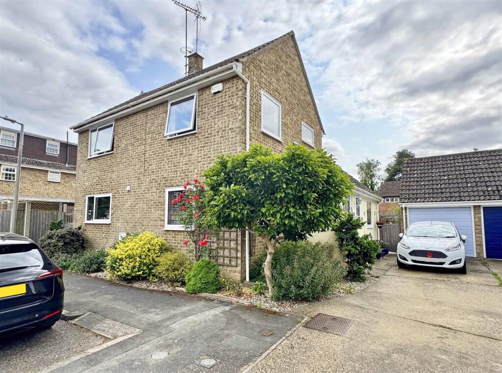
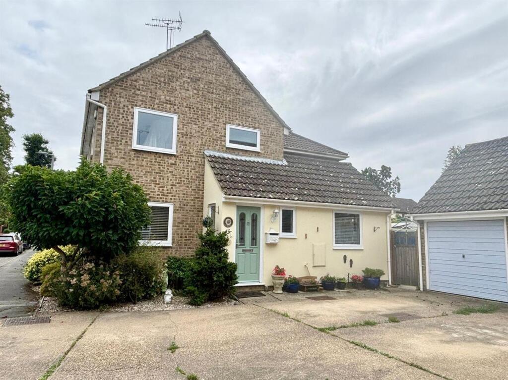
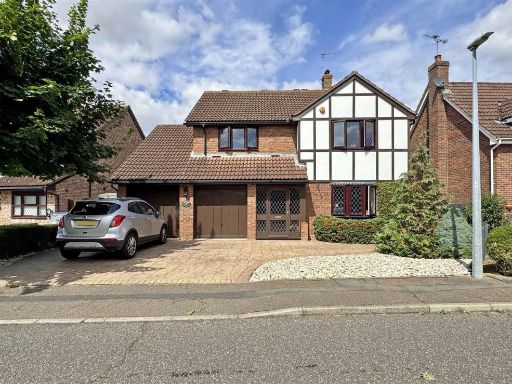
- This charming property is a four-double-bedroom detached house situated in a quiet cul-de-sac within the coveted White Court area. The property boasts a sizeable plot, ideal for families seeking space and privacy. It features a south-facing garden with lush greenery that is generously sized and ideal for children or pets. Inside, there are three reception rooms, offering ample space for entertaining or relaxation. The dining room benefits from dual aspects, enhancing the natural light, and there is a substantial 16-foot kitchen/breakfast room. The master bedroom includes an en-suite, and there are two additional family bathrooms. With a garage and driveway accommodating up to two vehicles, this residence offers both comfort and convenience. The overall property size is large, ideal for a growing family, with versatile living spaces throughout.
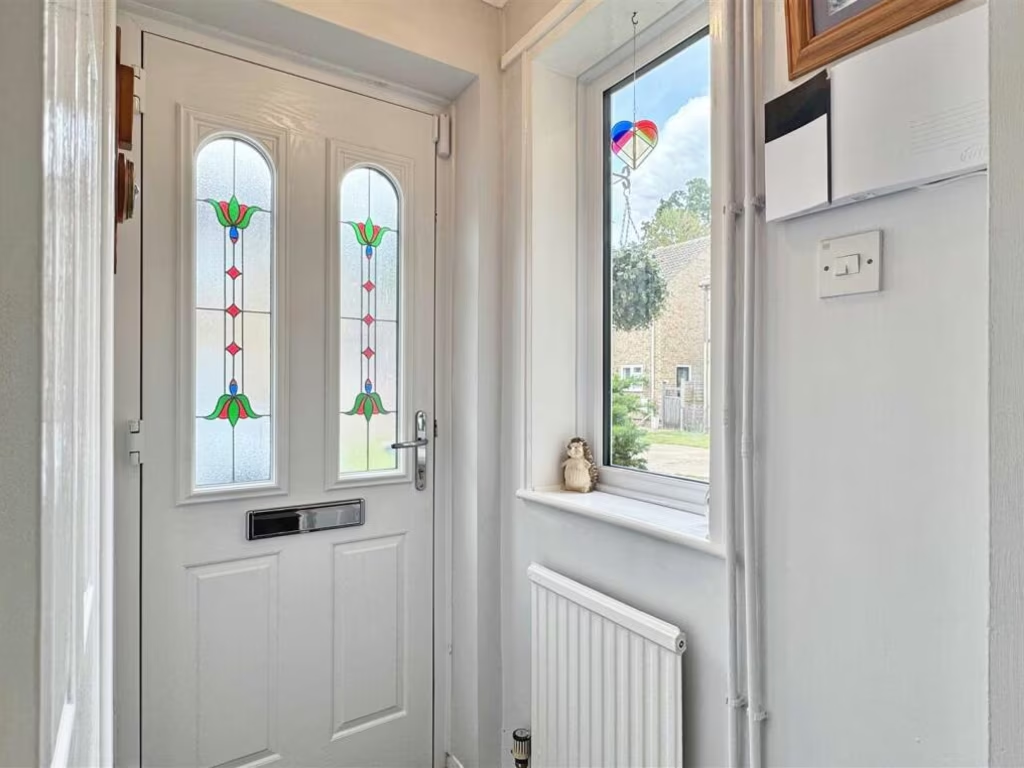
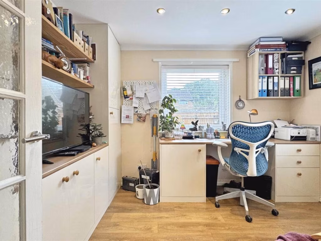
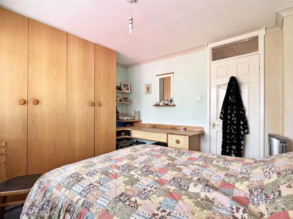
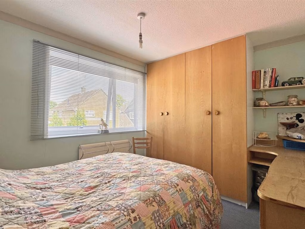
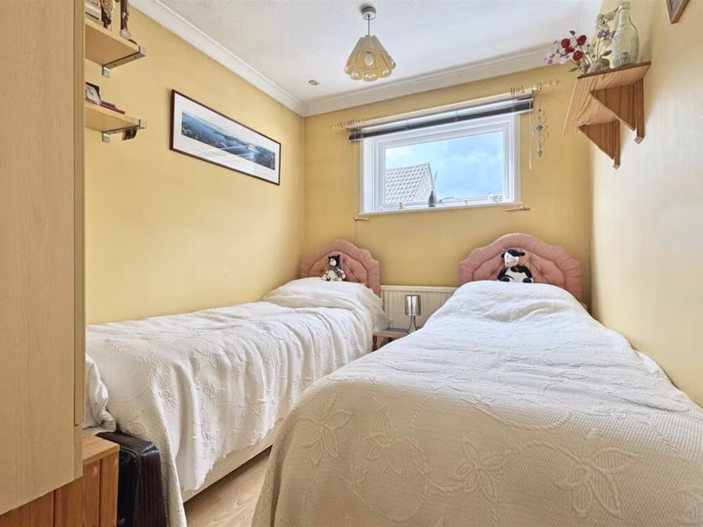
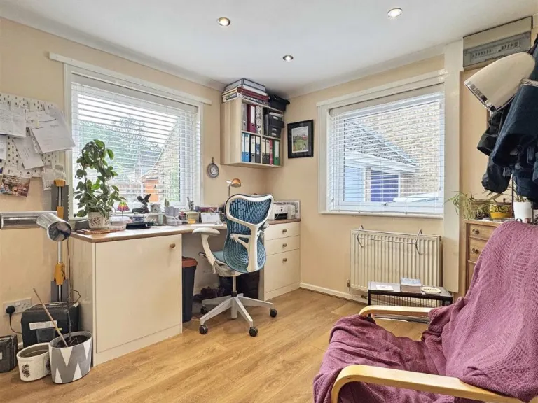
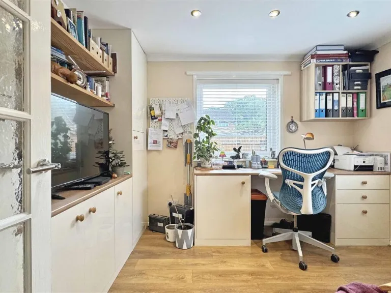
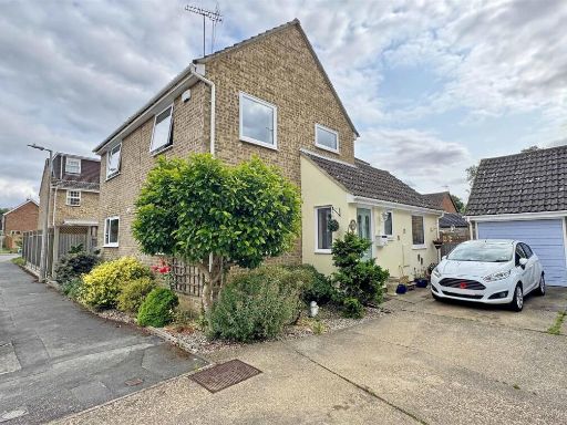
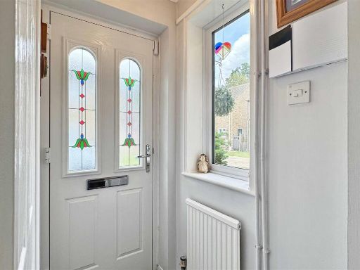
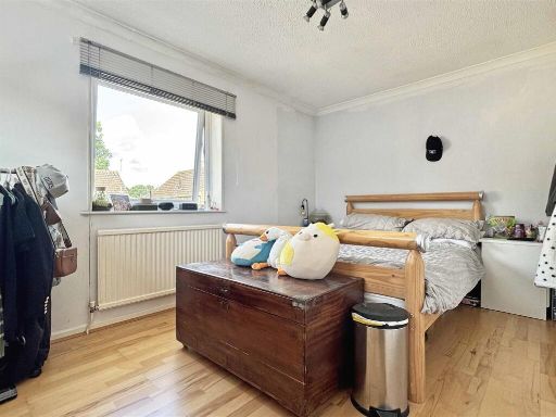
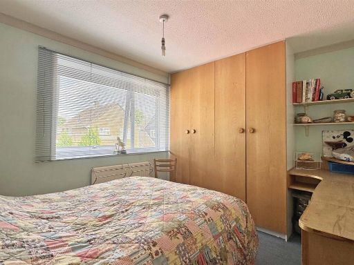
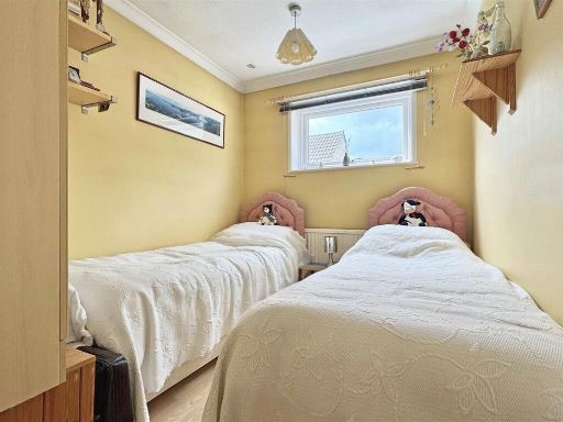
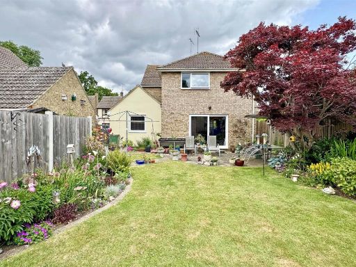
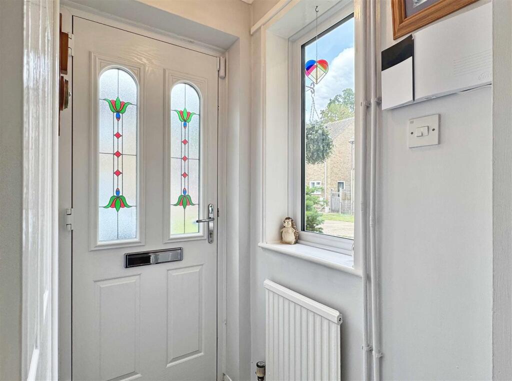
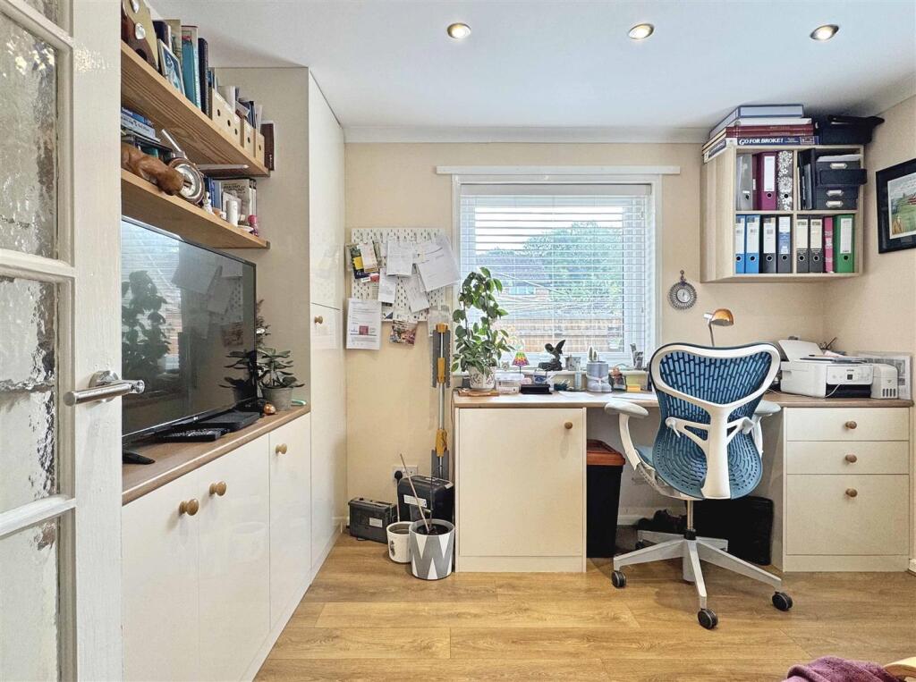
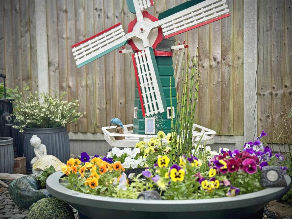
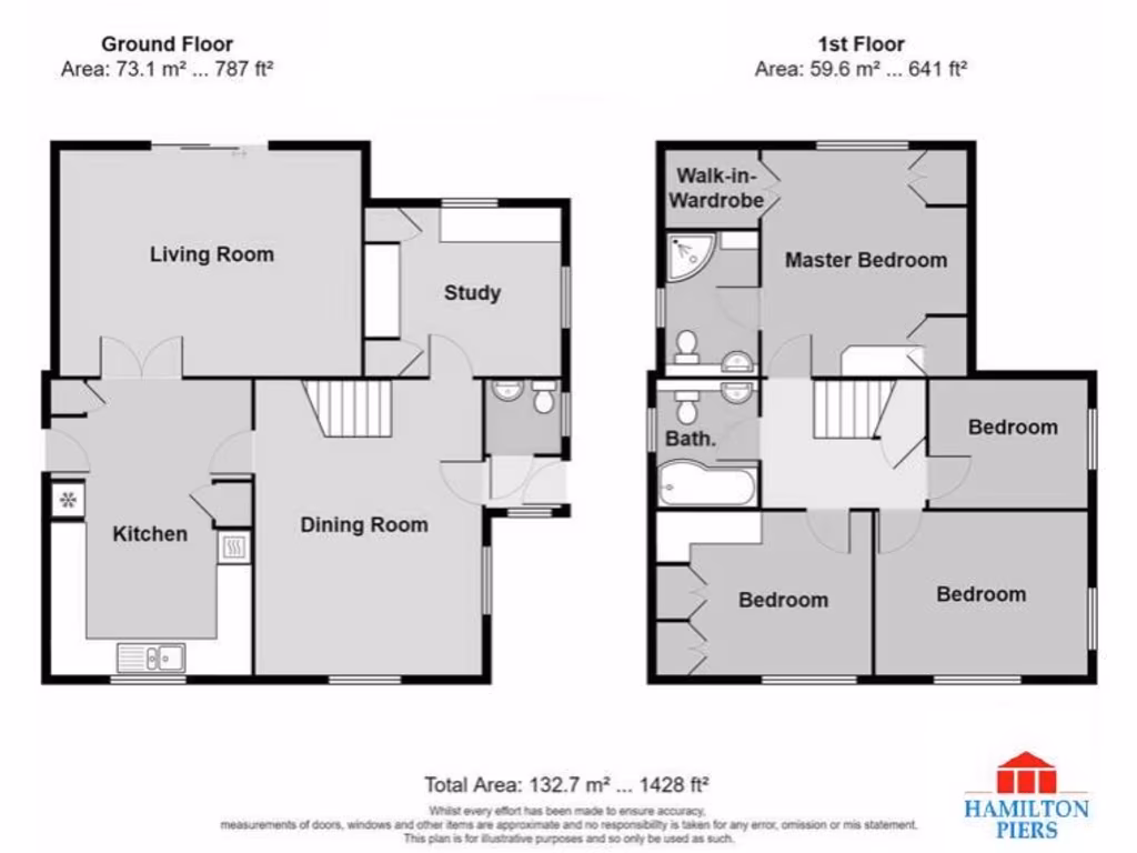
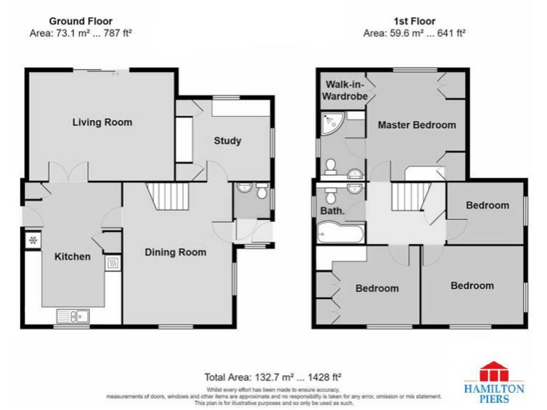
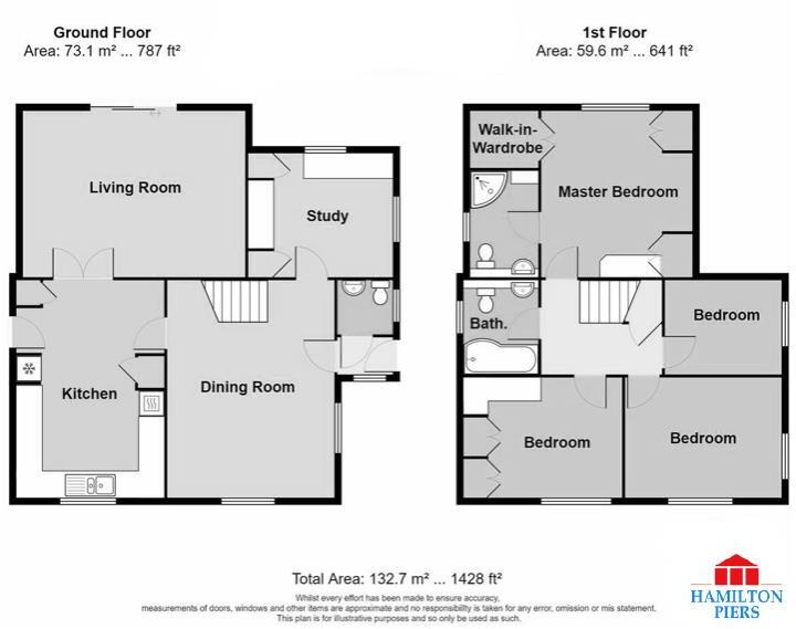
- This detached property, located at Derwent Way, offers spacious family accommodation over two floors. The ground floor features an entry porch that leads into a cloakroom and a generous dining room with dual aspect windows. There is a dedicated study or playroom, as well as a kitchen/breakfast room equipped with modern appliances and ample storage, opening up to a cozy lounge. The upper floor houses a master bedroom with en-suite and built-in wardrobes, along with three additional bedrooms equipped with double glazed windows and varying floor finishes. The property boasts a south-facing rear garden, reasonably sized, enclosed, and ideal for family activities and outdoor entertainment. Additionally, there is a garage and driveway providing off-street parking, ensuring convenience and security. The entire property is tastefully decorated, lending itself well to family living with ample natural light and a comfortable setting.
Image Descriptions
- suburban house modern suburban
- exterior mid-20th century
Floorplan Description
- A two-story property with separate living, dining, and kitchen areas on the ground floor and three bedrooms on the first floor.
Rooms
- Living Room: large
- Study: small
- Kitchen: average
- Dining Room: average
- Master Bedroom: large
- Bedroom: average
- Bedroom: average
Textual Property Features
Detected Visual Features
- modern house
- suburban
- semi-detached
- brick exterior
- two-story
- driveway
- small front garden
- residential neighborhood
- mid-20th century
- brick
- pitched roof
- backyard
- garden
- shed
- patio
- lawn
EPC Details
- Fully double glazed
- Cavity wall, filled cavity
- Boiler and radiators, mains gas
- Low energy lighting in 75% of fixed outlets
- Solid, no insulation (assumed)
Nearby Schools
- Beckers Green Primary School
- Great Waltham Church of England Voluntary Controlled Primary School
- Terling Church of England Voluntary Aided Primary School
- White Notley Church of England Voluntary Controlled Primary School
- St Michael's Church of England Voluntary Aided Primary School
- Rayne Primary and Nursery School
- Great Bradfords Junior School
- Great Bradfords Infant and Nursery School
- Tabor Academy
- Stisted Church of England Primary Academy
- Felsted Primary School
- Cressing Primary School
- Notley Green Primary School
- John Ray Junior School
- Lyons Hall School
- Bocking Primary School
- Ford End Church of England Primary School
- Acorn Academy
- Great Leighs Primary School
- Silver End Academy
- White Court School
- Notley High School and Braintree Sixth Form
- Alec Hunter Academy
- St Francis Catholic Primary School, Braintree
- John Bunyan Primary School and Nursery
- Shalford Primary School
- Little Waltham Church of England Voluntary Aided Primary School
- Felsted School
Nearest General Shops
- Id: 8195998067
- Tags:
- Addr:
- City: Braintree
- Housename: Gridserve Electric Forecourt
- Postcode: CM77 7AP
- Street: Edison Way
- Brand: WHSmith
- Brand:wikidata: Q1548712
- Brand:wikipedia: en:WHSmith
- Level: 0
- Name: WHSmith
- Opening_hours: Mo-Su 07:00-20:00
- Shop: books
- Website: https://www.whsmith.co.uk/
- TagsNormalized:
- Lat: 51.8527565
- Lon: 0.522104
- FullGeoHash: u10qgzs0jyku
- PartitionGeoHash: u10q
- Images:
- FoodStandards: null
- Distance: 1223.6
,- Id: 8195998062
- Tags:
- Addr:
- City: Braintree
- Housename: Gridserve Electric Forecourt
- Postcode: CM77 7AP
- Street: Edison Way
- Level: 1
- Name: EV Showcase
- Opening_hours: Mo-Su 07:00-20:00
- Operator: GRIDSERVE
- Phone: +44 333 1234 333
- Second_hand: no
- Shop: car
- Website: https://gridserve.com/find-your-new-ev/
- TagsNormalized:
- Lat: 51.8527701
- Lon: 0.5221539
- FullGeoHash: u10qgzs0r0fj
- PartitionGeoHash: u10q
- Images:
- FoodStandards: null
- Distance: 1220.4
,- Id: 8195998028
- Tags:
- Addr:
- City: Braintree
- Housename: Gridserve Electric Forecourt
- Postcode: CM77 7AP
- Street: Edison Way
- Brand:
- Name: techexpress
- Opening_hours: Mo-Su 07:00-20:00
- Shop: electronics
- TagsNormalized:
- Lat: 51.8527946
- Lon: 0.5221461
- FullGeoHash: u10qgzs0qvs2
- PartitionGeoHash: u10q
- Images:
- FoodStandards: null
- Distance: 1218.5
}
Nearest Grocery shops
- Id: 746246670
- Tags:
- Addr:
- City: Braintree
- Postcode: CM77 7AB
- Street: Notley Cross
- Brand: M&S Simply Food
- Brand:wikidata: Q714491
- Brand:wikipedia: en:Marks & Spencer
- Building: retail
- Contact:
- Website: https://www.marksandspencer.com/stores/braintree-bp-1864
- Name: M&S Simply Food
- Opening_hours: 24/7
- Phone: +44 1376 327773
- Shop: convenience
- TagsNormalized:
- m&s simply food
- food
- retail
- convenience
- shop
- Lat: 51.8678999
- Lon: 0.5389003
- FullGeoHash: u10rh622mm34
- PartitionGeoHash: u10r
- Images:
- FoodStandards: null
- Distance: 820.3
,- Id: 3843410381
- Tags:
- Addr:
- City: Braintree
- Postcode: CM77 7AE
- Street: Priory Lane
- Brand: Co-op Food
- Brand:wikidata: Q3277439
- Brand:wikipedia: en:Co-op Food
- Name: Co-op Food
- Opening_hours: Mo-Sa 07:30-21:00; Su 08:00-21:00
- Operator: The Co-operative Group
- Operator:wikidata: Q117202
- Phone: +44 1376 334644
- Shop: convenience
- Website: https://www.coop.co.uk/
- TagsNormalized:
- co-op
- co-op food
- food
- convenience
- shop
- Lat: 51.8657389
- Lon: 0.5282775
- FullGeoHash: u10rh1bevf2r
- PartitionGeoHash: u10r
- Images:
- FoodStandards: null
- Distance: 559.8
,- Id: 664909032
- Tags:
- Brand: Spar
- Brand:wikidata: Q610492
- Building: yes
- Name: Spar
- Shop: convenience
- TagsNormalized:
- Lat: 51.8607122
- Lon: 0.5354018
- FullGeoHash: u10rh0vyec2w
- PartitionGeoHash: u10r
- Images:
- FoodStandards: null
- Distance: 201.2
}
Nearest Religious buildings
- Id: 534920602
- Tags:
- Amenity: place_of_worship
- Religion: christian
- TagsNormalized:
- place of worship
- christian
- church
- Lat: 51.8764957
- Lon: 0.5476404
- FullGeoHash: u10rh7yf2zwq
- PartitionGeoHash: u10r
- Images:
- FoodStandards: null
- Distance: 1948.7
,- Id: 144343880
- Tags:
- Amenity: place_of_worship
- Denomination: anglican
- Name: St Peter and St Paul, Black Notley
- Religion: christian
- Wikidata: Q17557479
- TagsNormalized:
- place of worship
- anglican
- paul
- christian
- church
- Lat: 51.8572891
- Lon: 0.5564193
- FullGeoHash: u10rh8m4te26
- PartitionGeoHash: u10r
- Images:
- FoodStandards: null
- Distance: 1689.4
,- Id: 151298240
- Tags:
- Amenity: place_of_worship
- Building: church
- Denomination: anglican;methodist;united_reformed;baptist
- Name: The Church in Great Notley
- Religion: christian
- Wikidata: Q105107573
- TagsNormalized:
- place of worship
- church
- anglican
- methodist
- united reformed
- baptist
- christian
- Lat: 51.8657446
- Lon: 0.5275686
- FullGeoHash: u10rh1b5v5x9
- PartitionGeoHash: u10r
- Images:
- FoodStandards: null
- Distance: 588.7
}
Nearest Medical buildings
- Id: 1693859187
- Tags:
- Amenity: pharmacy
- Brand: Boots
- Brand:wikidata: Q6123139
- Dispensing: yes
- Drive_through: no
- Healthcare: pharmacy
- Name: Boots
- TagsNormalized:
- pharmacy
- boots
- health
- healthcare
- Lat: 51.8465365
- Lon: 0.6224046
- FullGeoHash: u10qynm5znft
- PartitionGeoHash: u10q
- Images:
- FoodStandards: null
- Distance: 6376.2
,- Id: 130073956
- Tags:
- Addr:
- City: Braintree
- Country: GB
- Housename: St Michael's House
- Postcode: CM7 1EY
- Street: St Michael's Lane
- Amenity: dentist
- Building: yes
- Healthcare: dentist
- Name: Dr R Patel
- TagsNormalized:
- Lat: 51.8777261
- Lon: 0.5504731
- FullGeoHash: u10rhs0cdvn6
- PartitionGeoHash: u10r
- Images:
- FoodStandards: null
- Distance: 2169.1
,- Id: 715548760
- Tags:
- Addr:
- City: Braintree
- Street: Chadwick Drive
- Amenity: hospital
- Emergency: no
- Healthcare: hospital
- Healthcare:speciality: maternity
- Name: Braintree Community Hospital
- Operator: NHS
- Operator:type: government
- Operator:wikidata: Q918396
- TagsNormalized:
- hospital
- health
- healthcare
- maternity
- Lat: 51.8795775
- Lon: 0.5408639
- FullGeoHash: u10rhk3u7n1q
- PartitionGeoHash: u10r
- Images:
- FoodStandards: null
- Distance: 2079.1
,- Id: 546893183
- Tags:
- Addr:
- City: Braintree
- Postcode: CM7 2AE
- Street: Mace Avenue
- Amenity: doctors
- Building: yes
- Healthcare: doctor
- Name: Blandford Medical Centre
- Opening_hours: Mo-Fr 08:00-18:30; Sa-Su off
- Operator: NHS England
- Phone: +44 1376 347100
- Website: http://www.blandfordmedicalcentre.co.uk/
- TagsNormalized:
- doctor
- doctors
- health
- healthcare
- Lat: 51.8789889
- Lon: 0.5408255
- FullGeoHash: u10rhk3c40kx
- PartitionGeoHash: u10r
- Images:
- FoodStandards: null
- Distance: 2015.3
}
Nearest Airports
- Id: 495488524
- Tags:
- Aerodrome: international
- Aerodrome:type: public
- Aeroway: aerodrome
- Alt_name: Stansted
- Iata: STN
- Icao: EGSS
- Is_in: Essex,England,UK
- Name: London Stansted Airport
- Ref: STN
- Source: Gagravarr_Airports
- Website: https://www.stanstedairport.com/
- Wikidata: Q8709
- Wikipedia: en:London Stansted Airport
- TagsNormalized:
- airport
- international airport
- Lat: 51.8869677
- Lon: 0.2429264
- FullGeoHash: u10pjt8zkxg4
- PartitionGeoHash: u10p
- Images:
- FoodStandards: null
- Distance: 20100.1
}
Nearest Leisure Facilities
- Id: 314883335
- Tags:
- TagsNormalized:
- Lat: 51.8594245
- Lon: 0.528589
- FullGeoHash: u10rh08zj12s
- PartitionGeoHash: u10r
- Images:
- FoodStandards: null
- Distance: 374.2
,- Id: 319370269
- Tags:
- TagsNormalized:
- Lat: 51.8641075
- Lon: 0.5297856
- FullGeoHash: u10rh19f2fku
- PartitionGeoHash: u10r
- Images:
- FoodStandards: null
- Distance: 351.7
,- Id: 314600108
- Tags:
- TagsNormalized:
- Lat: 51.8619957
- Lon: 0.5286461
- FullGeoHash: u10rh10yn2en
- PartitionGeoHash: u10r
- Images:
- FoodStandards: null
- Distance: 290
,- Id: 314832737
- Tags:
- TagsNormalized:
- Lat: 51.8627087
- Lon: 0.532072
- FullGeoHash: u10rh176njte
- PartitionGeoHash: u10r
- Images:
- FoodStandards: null
- Distance: 138
,- Id: 314832736
- Tags:
- TagsNormalized:
- Lat: 51.8622002
- Lon: 0.5324184
- FullGeoHash: u10rh15xnnzf
- PartitionGeoHash: u10r
- Images:
- FoodStandards: null
- Distance: 76.7
}
Nearest Tourist attractions
- Id: 304742773
- Tags:
- Name: Felstar Vineyard and Brewery
- Tourism: attraction
- TagsNormalized:
- Lat: 51.8578882
- Lon: 0.492156
- FullGeoHash: u10r50qqh540
- PartitionGeoHash: u10r
- Images:
- FoodStandards: null
- Distance: 2821.3
,- Id: 3414742549
- Tags:
- Name: Braintree Museum
- Tourism: museum
- Wikidata: Q85400375
- TagsNormalized:
- Lat: 51.8783949
- Lon: 0.5541701
- FullGeoHash: u10rhs5t91ep
- PartitionGeoHash: u10r
- Images:
- FoodStandards: null
- Distance: 2378.6
,- Id: 382474329
- Tags:
- Name: Friends of Flitch Way railway carriage museum
- Tourism: museum
- TagsNormalized:
- Lat: 51.8731961
- Lon: 0.5066241
- FullGeoHash: u10r5e0zm0w7
- PartitionGeoHash: u10r
- Images:
- FoodStandards: null
- Distance: 2215.4
}
Nearest Train stations
- Id: 55420748
- Tags:
- Name: Cressing
- Naptan:
- Network: National Rail
- Public_transport: station
- Railway: station
- Ref:
- Train: yes
- Wikidata: Q1886114
- Wikipedia: en:Cressing railway station
- TagsNormalized:
- Lat: 51.852306
- Lon: 0.5779203
- FullGeoHash: u10qvpkvdd2t
- PartitionGeoHash: u10q
- Images:
- FoodStandards: null
- Distance: 3264.4
,- Id: 187038971
- Tags:
- Amenity: shelter
- Building: train_station
- TagsNormalized:
- shelter
- station
- train
- train station
- Lat: 51.8692466
- Lon: 0.5682988
- FullGeoHash: u10rhftb626k
- PartitionGeoHash: u10r
- Images:
- FoodStandards: null
- Distance: 2582.7
,- Id: 55420882
- Tags:
- Addr:
- Postcode: CM77 8YH
- Street: Chapel Hill Retail Park
- Name: Braintree Freeport
- Naptan:
- Network: National Rail
- Note: FIXME location approximate, judged from landsat
- Public_transport: station
- Railway: station
- Ref:
- Train: yes
- Wikidata: Q2540597
- Wikipedia: en:Braintree Freeport railway station
- TagsNormalized:
- Lat: 51.8692939
- Lon: 0.5681965
- FullGeoHash: u10rhft8xcnn
- PartitionGeoHash: u10r
- Images:
- FoodStandards: null
- Distance: 2577.8
,- Id: 1997260503
- Tags:
- Name: Braintree
- Name:lt: Breintris
- Naptan:
- Network: National Rail
- Old_name: Braintree and Bocking
- Public_transport: station
- Railway: station
- Ref:
- Train: yes
- Wikidata: Q2716690
- Wikipedia: en:Braintree railway station (England)
- TagsNormalized:
- Lat: 51.8753105
- Lon: 0.5567303
- FullGeoHash: u10rhet7sfb0
- PartitionGeoHash: u10r
- Images:
- FoodStandards: null
- Distance: 2244.5
,- Id: 187033767
- Tags:
- Amenity: cafe
- Building: train_station
- Name: Cafe Alexander
- TagsNormalized:
- cafe
- station
- train
- train station
- Lat: 51.8753588
- Lon: 0.5565999
- FullGeoHash: u10rhet7ceyb
- PartitionGeoHash: u10r
- Images:
- FoodStandards: null
- Distance: 2241.6
}
Nearest Hotels
- Id: 104310066
- Tags:
- Brand: Premier Inn
- Brand:wikidata: Q2108626
- Brand:wikipedia: en:Premier Inn
- Building: yes
- Internet_access: wlan
- Internet_access:fee: customers
- Internet_access:operator: Virgin Media
- Internet_access:ssid: Premier Inn Free Wi-Fi
- Name: Premier Inn
- Tourism: hotel
- Wheelchair: yes
- TagsNormalized:
- Lat: 51.8691903
- Lon: 0.5819277
- FullGeoHash: u10rj4rxzvus
- PartitionGeoHash: u10r
- Images:
- FoodStandards: null
- Distance: 3478
,- Id: 10661255737
- Tags:
- Brand: Travelodge
- Brand:wikidata: Q9361374
- Internet_access: wlan
- Internet_access:fee: customers
- Internet_access:ssid: Travelodge WiFi
- Name: Travelodge
- Tourism: hotel
- TagsNormalized:
- Lat: 51.8774746
- Lon: 0.5545117
- FullGeoHash: u10rhs5b1n1y
- PartitionGeoHash: u10r
- Images:
- FoodStandards: null
- Distance: 2314
,- Id: 146338280
- Tags:
- Addr:
- Brand: Holiday Inn Express
- Brand:wikidata: Q5880423
- Brand:wikipedia: en:Holiday Inn Express
- Building: hotel
- Key: FLP BP Alt Tues
- Name: Holiday Inn Express
- Source:
- Tourism: hotel
- TagsNormalized:
- Lat: 51.8684265
- Lon: 0.5365901
- FullGeoHash: u10rh4qerrqx
- PartitionGeoHash: u10r
- Images:
- FoodStandards: null
- Distance: 807.1
}
Tags
- modern house
- suburban
- semi-detached
- brick exterior
- two-story
- driveway
- small front garden
- residential neighborhood
- mid-20th century
- brick
- two-story
- pitched roof
- backyard
- garden
- shed
- patio
- lawn
Local Market Stats
- Average Price/sqft: £368
- Avg Income: £52400
- Rental Yield: 3.8%
- Social Housing: 9%
- Planning Success Rate: 72%
Similar Properties
 4 bedroom detached house for sale in Torver Close, White Court, Great Notley, Braintree, CM77 — £565,000 • 4 bed • 3 bath • 1687 ft²
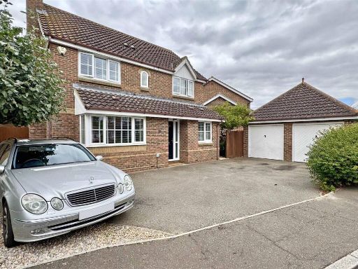 4 bedroom detached house for sale in Pintail Crescent, Great Notley, Braintree, CM77 — £524,995 • 4 bed • 3 bath • 1171 ft²
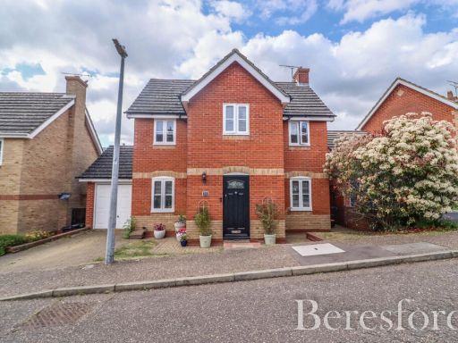 4 bedroom detached house for sale in Guernsey Way, Braintree, CM7 — £450,000 • 4 bed • 2 bath • 1023 ft²
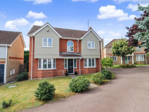 4 bedroom detached house for sale in Westergreen Meadow, Braintree, CM7 — £650,000 • 4 bed • 2 bath • 1166 ft²
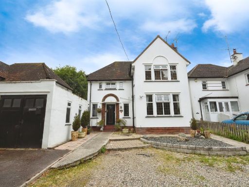 4 bedroom detached house for sale in Courtauld Road, BRAINTREE, CM7 — £600,000 • 4 bed • 2 bath • 1507 ft²
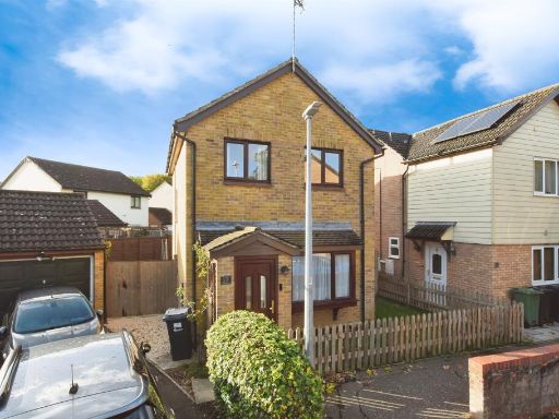 3 bedroom detached house for sale in Buttermere, Great Notley, Braintree, CM77 — £375,000 • 3 bed • 1 bath • 980 ft²
Meta
- {
"@context": "https://schema.org",
"@type": "Residence",
"name": "4 bedroom detached house for sale in Derwent Way, White Cou…",
"description": "",
"url": "https://propertypiper.co.uk/property/7034a931-b5b3-4e17-b9ce-3d59b0b2fc8e",
"image": "https://image-a.propertypiper.co.uk/d0b95769-4c73-405a-860c-64cfde16290c-1024.jpeg",
"address": {
"@type": "PostalAddress",
"streetAddress": "25 Derwent Way, Great Notley",
"postalCode": "CM77 7UH",
"addressLocality": "Braintree",
"addressRegion": "Braintree",
"addressCountry": "England"
},
"geo": {
"@type": "GeoCoordinates",
"latitude": 51.861553888242184,
"longitude": 0.5328078679921455
},
"numberOfRooms": 4,
"numberOfBathroomsTotal": 3,
"floorSize": {
"@type": "QuantitativeValue",
"value": 1428,
"unitCode": "FTK"
},
"offers": {
"@type": "Offer",
"price": 485000,
"priceCurrency": "GBP",
"availability": "https://schema.org/InStock"
},
"additionalProperty": [
{
"@type": "PropertyValue",
"name": "Feature",
"value": "modern house"
},
{
"@type": "PropertyValue",
"name": "Feature",
"value": "suburban"
},
{
"@type": "PropertyValue",
"name": "Feature",
"value": "semi-detached"
},
{
"@type": "PropertyValue",
"name": "Feature",
"value": "brick exterior"
},
{
"@type": "PropertyValue",
"name": "Feature",
"value": "two-story"
},
{
"@type": "PropertyValue",
"name": "Feature",
"value": "driveway"
},
{
"@type": "PropertyValue",
"name": "Feature",
"value": "small front garden"
},
{
"@type": "PropertyValue",
"name": "Feature",
"value": "residential neighborhood"
},
{
"@type": "PropertyValue",
"name": "Feature",
"value": "mid-20th century"
},
{
"@type": "PropertyValue",
"name": "Feature",
"value": "brick"
},
{
"@type": "PropertyValue",
"name": "Feature",
"value": "two-story"
},
{
"@type": "PropertyValue",
"name": "Feature",
"value": "pitched roof"
},
{
"@type": "PropertyValue",
"name": "Feature",
"value": "backyard"
},
{
"@type": "PropertyValue",
"name": "Feature",
"value": "garden"
},
{
"@type": "PropertyValue",
"name": "Feature",
"value": "shed"
},
{
"@type": "PropertyValue",
"name": "Feature",
"value": "patio"
},
{
"@type": "PropertyValue",
"name": "Feature",
"value": "lawn"
}
]
}
High Res Floorplan Images
Compatible Floorplan Images
FloorplanImages Thumbnail