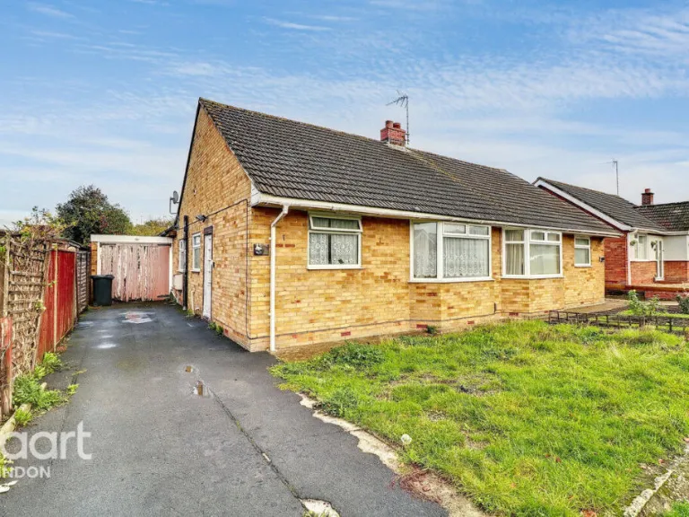
SN4 9EA - 2 bedroom bungalow for sale in Kennet Road, Swindon, SN4
View on Property Piper
2 bedroom bungalow for sale in Kennet Road, Swindon, SN4
Property Details
- Price: £290000
- Bedrooms: 2
- Bathrooms: 1
- Property Type: undefined
- Property SubType: undefined
Image Descriptions
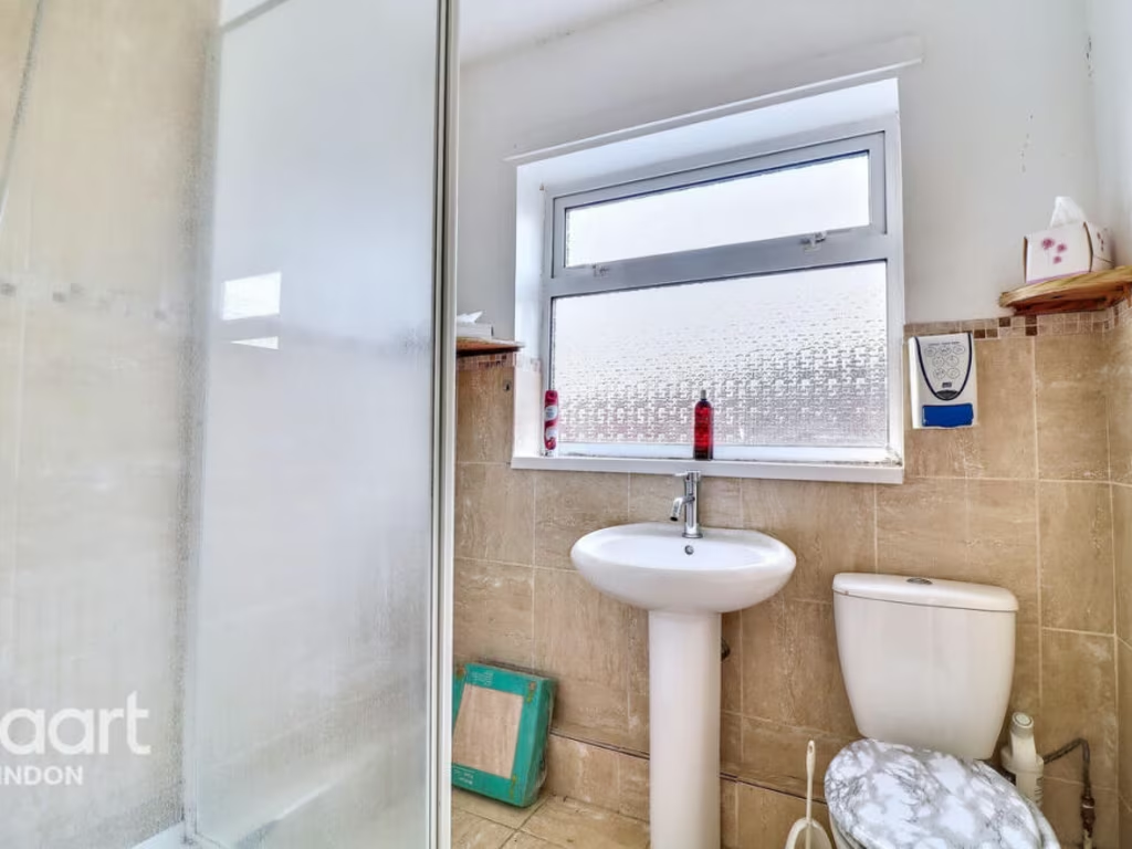
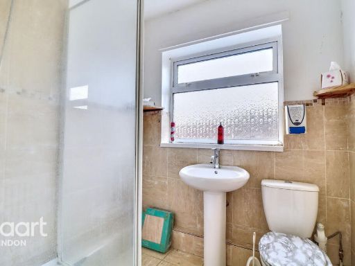
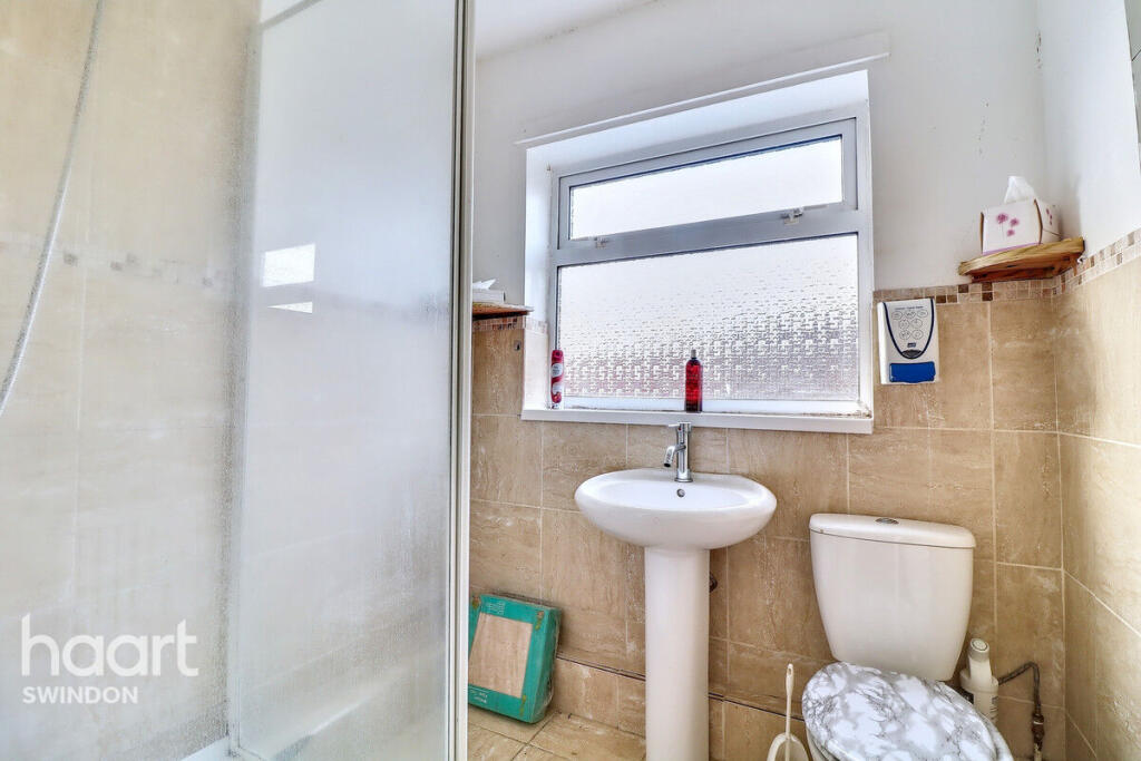
- bathroom modern
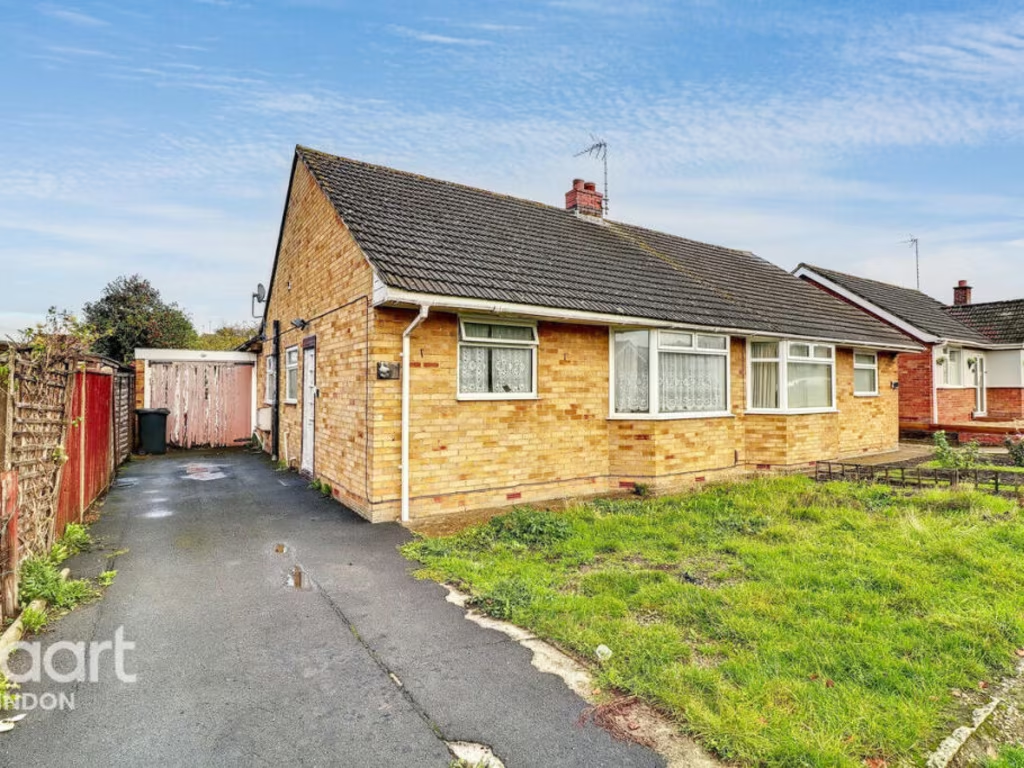
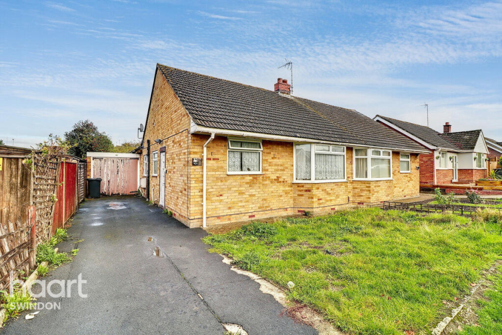
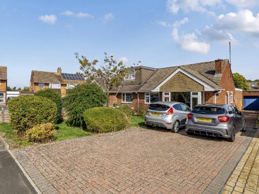
- single-story house mid-20th century, bungalow
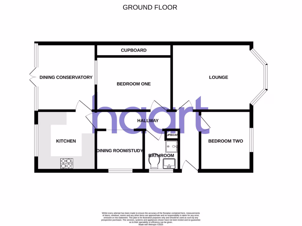
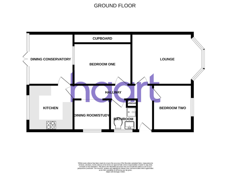
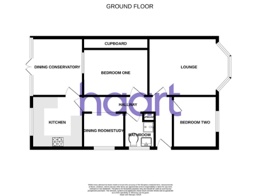
Floorplan Description
- Ground floor plan showing labelled rooms.
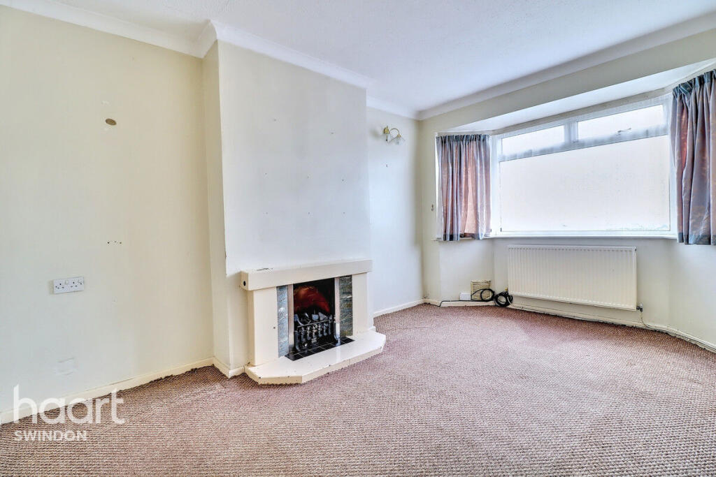
Rooms
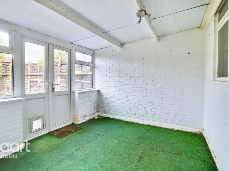
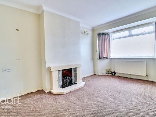
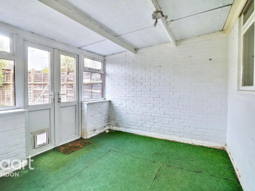
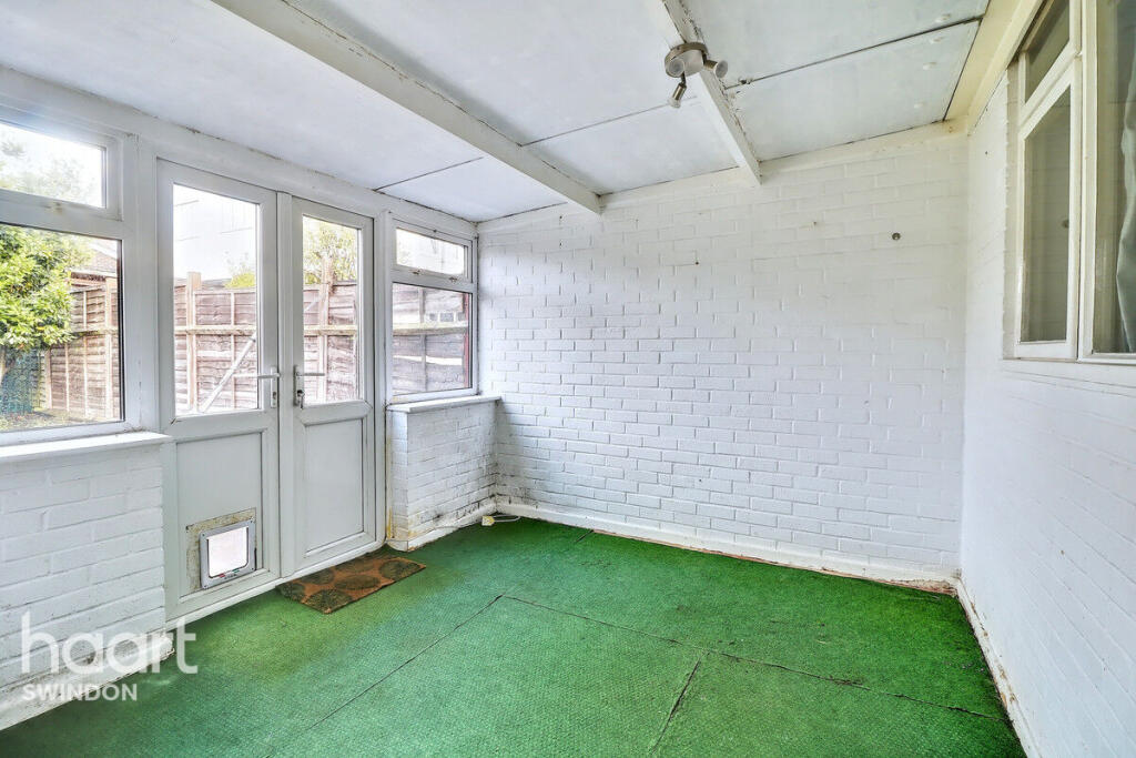
- DINING CONSERVATORY:
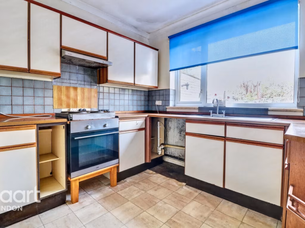
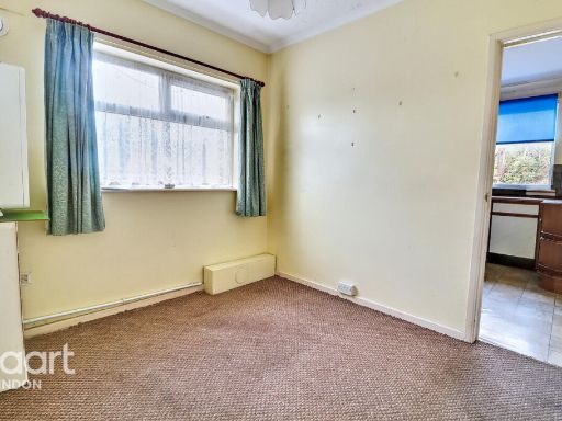
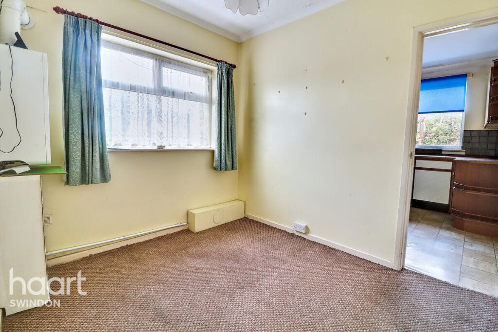
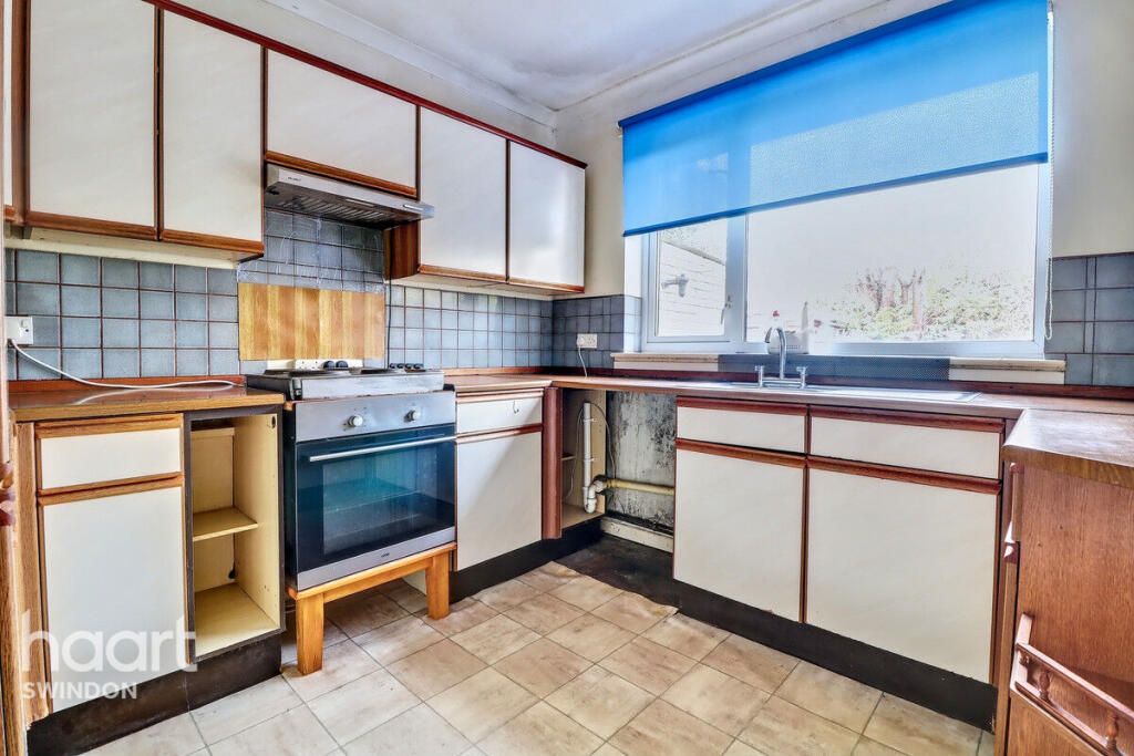
- KITCHEN:
- DINING ROOM/STUDY:
- CUPBOARD:
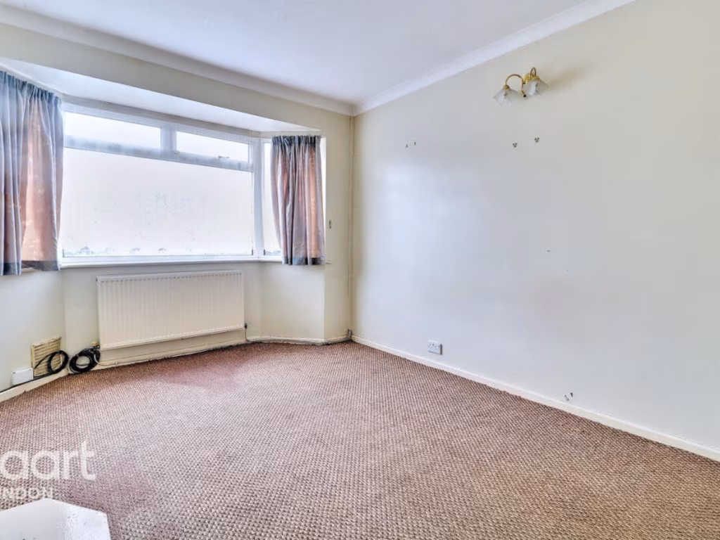
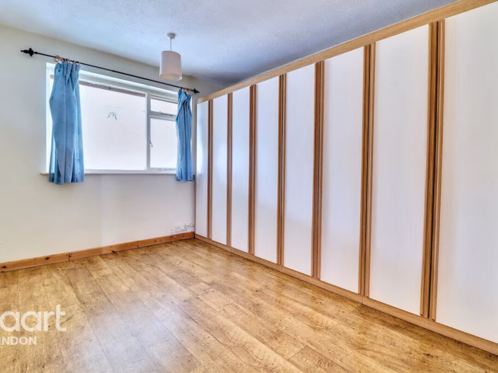
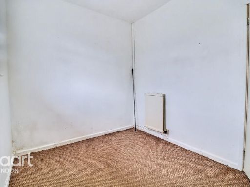
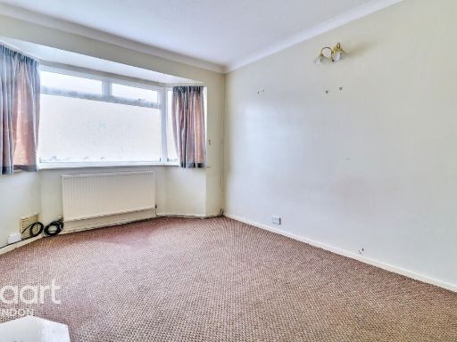
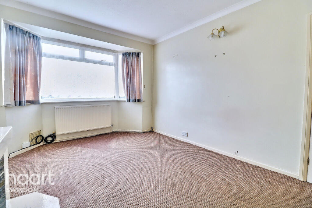
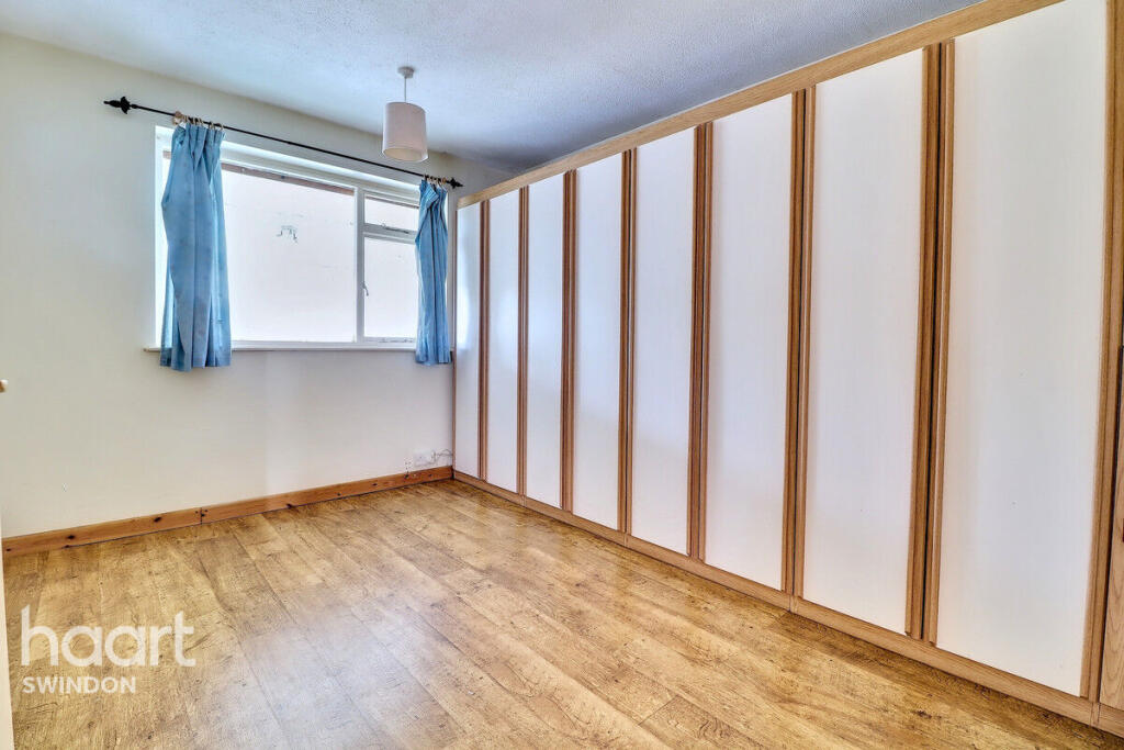
- BEDROOM ONE:
- HALLWAY:
- BATHROOM:
- UPBOAR:
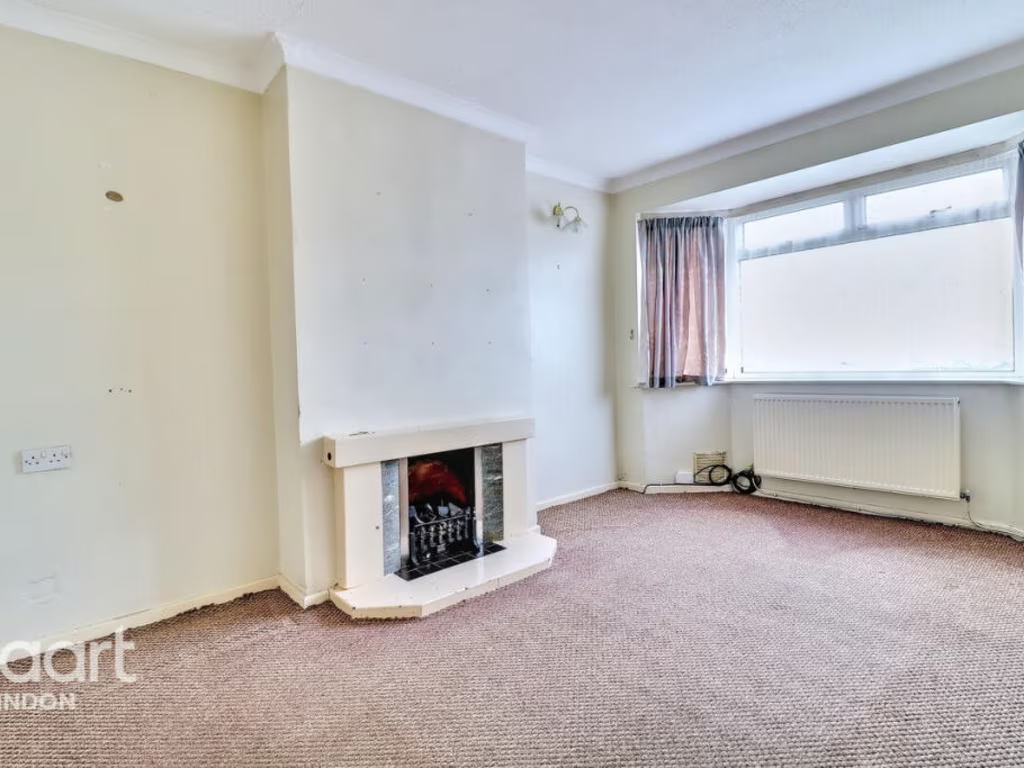
- LOUNGE:
- BEDROOM TWO:
Textual Property Features
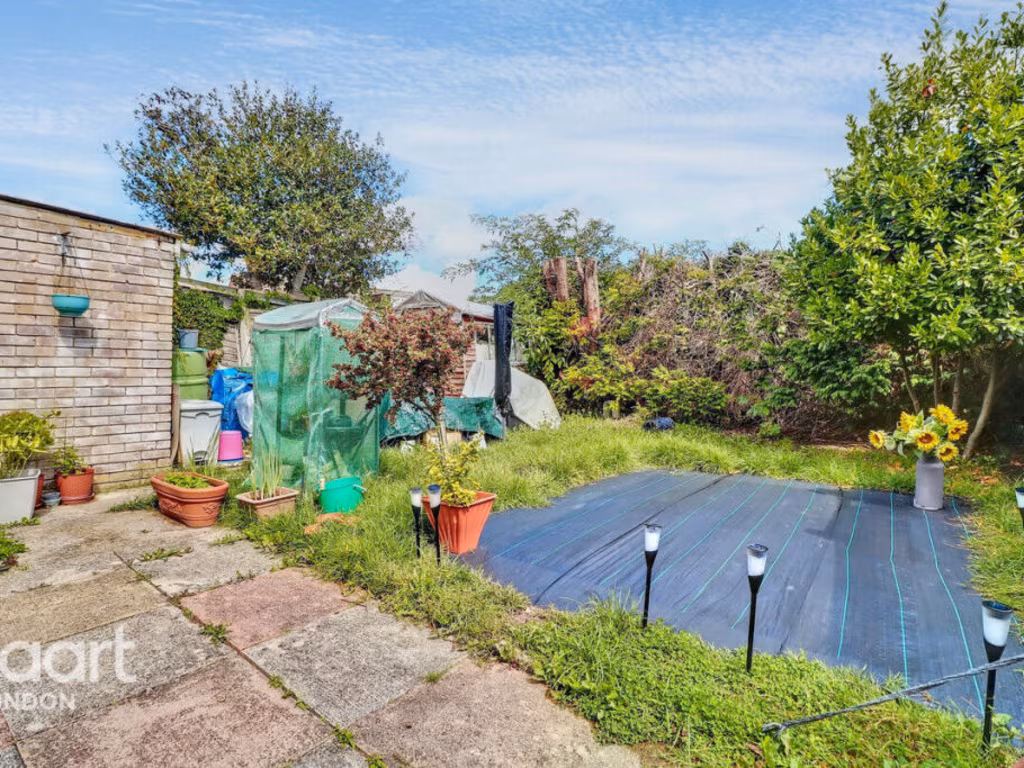
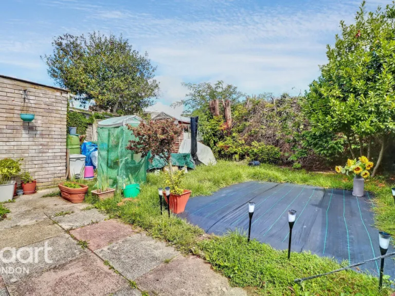
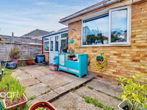
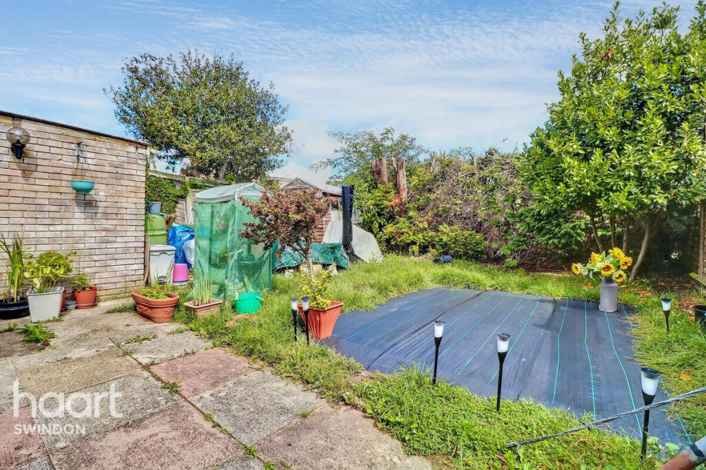
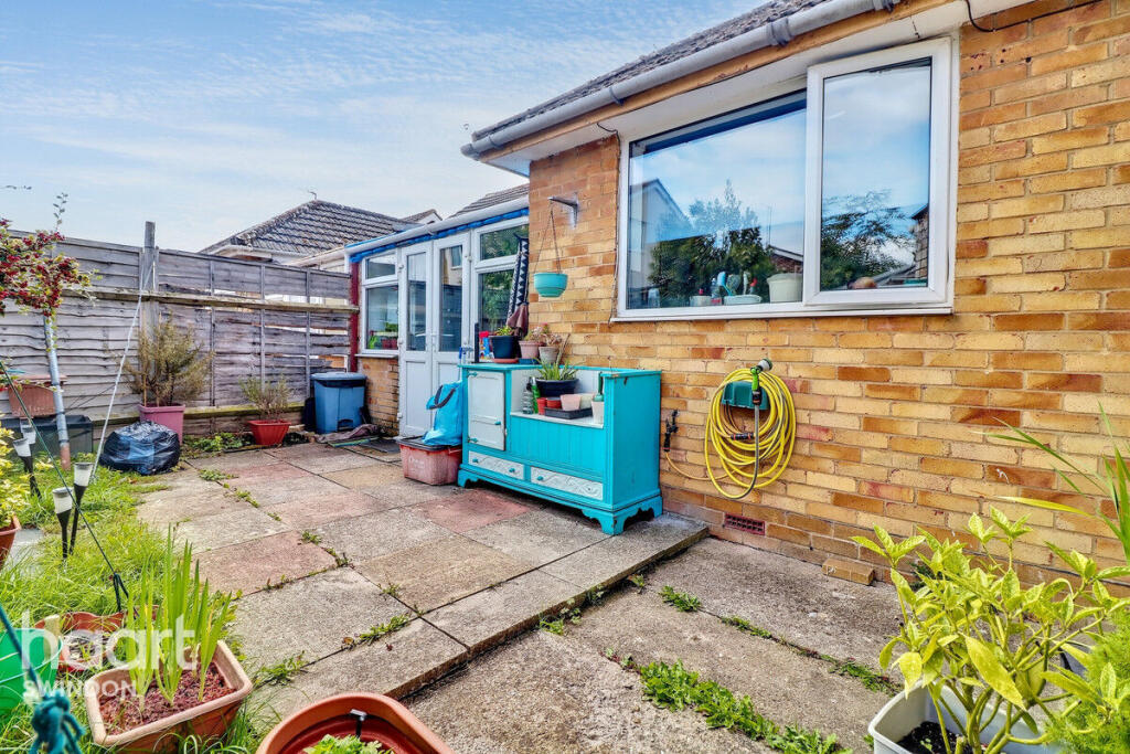
- Has Garden
- Chain Free
- Success
Detected Visual Features
- modern bathroom
- small bathroom
- frosted window
- beige tile
- shower cubicle
- pedestal sink
- white sanitation ware
- bungalow
- mid-20th century
- single-story
- driveway
- garage potential
- garden
- front lawn
- brick exterior
EPC Details
- Fully double glazed
- Cavity wall, filled cavity
- Boiler and radiators, mains gas
- Low energy lighting in all fixed outlets
- Suspended, no insulation (assumed)
Nearby Schools
- The Commonweal School
- Millbrook Primary School
- Oliver Tomkins Church of England Junior School
- Oliver Tomkins Church of England Infant and Nursery School
- Lainesmead Primary School and Nursery
- Mountford Manor Primary School
- Ferndale Primary School & Nursery
- Gorse Hill Primary School
- Lawn Primary and Nursery School
- Holy Rood Catholic Primary School
- Drove Primary School
- St Mary's Catholic Primary School
- Wroughton Infant School
- East Wichel Primary School & Nursery
- Kingfisher CE Academy
- Lethbridge Primary School
- Hazelwood Academy
- UTC Swindon
- Holy Cross Catholic Primary School
- St Joseph's Catholic College
- The Ridgeway School & Sixth Form College
- Wroughton Junior School
- The Croft Primary School
- King William Street Church of England Primary School
- Lawn Manor Academy
- Robert Le Kyng Primary School
- Westlea Primary School
Nearest General Shops
- Id: 271935117
- Tags:
- Addr:
- Brand: McColl's
- Brand:wikidata: Q16997477
- Building: retail
- Fhrs:
- Name: Martin McColl
- Shop: variety_store
- Source:
- TagsNormalized:
- mccolls
- retail
- variety store
- shop
- Lat: 51.5244466
- Lon: -1.7944178
- FullGeoHash: gcntp5trehcp
- PartitionGeoHash: gcnt
- Images:
- FoodStandards:
- Id: 253590
- FHRSID: 253590
- LocalAuthorityBusinessID: F12GSS5-6E/1
- BusinessName: Martins
- BusinessType: Retailers - other
- BusinessTypeID: 4613
- AddressLine1: 5-6 Ellendune Centre
- AddressLine2: Wroughton
- AddressLine3: Wiltshire
- AddressLine4: SN4 9LN
- PostCode: null
- RatingValue: 5
- RatingKey: fhrs_5_en-GB
- RatingDate: 2020-09-07
- LocalAuthorityCode: 881
- LocalAuthorityName: Swindon
- LocalAuthorityWebSite: http://www.swindon.gov.uk/
- LocalAuthorityEmailAddress: foodhealth&safety@swindon.gov.uk
- Scores:
- Hygiene: 0
- Structural: 5
- ConfidenceInManagement: 0
- NewRatingPending: false
- Geocode:
- Longitude: -1.79440700000000
- Latitude: 51.52454900000000
- Distance: 535.1
,- Id: 271935116
- Tags:
- Building: retail
- Name: Prospect Hospice
- Shop: yes
- TagsNormalized:
- Lat: 51.5244913
- Lon: -1.7943305
- FullGeoHash: gcntp5trvj64
- PartitionGeoHash: gcnt
- Images:
- FoodStandards: null
- Distance: 529.7
,- Id: 271934801
- Tags:
- Building: yes
- Name: Haine & Smith
- Shop: optician
- TagsNormalized:
- Lat: 51.5245199
- Lon: -1.794275
- FullGeoHash: gcntp5v2n6et
- PartitionGeoHash: gcnt
- Images:
- FoodStandards: null
- Distance: 526.2
}
Nearest Grocery shops
- Id: 133170115
- Tags:
- Building: yes
- Name: The Co-operative Food
- Shop: supermarket
- Source: Bing;survey
- TagsNormalized:
- the co-operative food
- food
- shop
- Lat: 51.5225308
- Lon: -1.7943189
- FullGeoHash: gcntp5mkmrfg
- PartitionGeoHash: gcnt
- Images:
- FoodStandards: null
- Distance: 747.2
,- Id: 146965658
- Tags:
- Addr:
- City: Wroughton
- Housenumber: 47
- Postcode: SN4 0SA
- Street: Devizes Road
- Building: yes
- Disused:
- Name: Morrisons
- Opening_hours: 06:00-23:00
- Shop: convenience
- Website: https://www.morrisons.com/
- TagsNormalized:
- Lat: 51.5245513
- Lon: -1.7875076
- FullGeoHash: gcntp7f2k098
- PartitionGeoHash: gcnt
- Images:
- FoodStandards: null
- Distance: 678.1
,- Id: 41146446
- Tags:
- Addr:
- Brand: Tesco Express
- Brand:wikidata: Q98456772
- Brand:wikipedia: en:Tesco
- Contact:
- Website: https://www.tesco.com/store-locator/wroughton/1-9-elendune-shopping-centre
- Fhrs:
- Name: Tesco Express
- Shop: convenience
- Source:
- TagsNormalized:
- tesco
- tesco express
- convenience
- shop
- Lat: 51.5244401
- Lon: -1.7939365
- FullGeoHash: gcntp5txw5zc
- PartitionGeoHash: gcnt
- Images:
- FoodStandards:
- Id: 253890
- FHRSID: 253890
- LocalAuthorityBusinessID: F78GSS9ELL/1
- BusinessName: Tesco
- BusinessType: Retailers - supermarkets/hypermarkets
- BusinessTypeID: 7840
- AddressLine1: 9 Ellendune Centre
- AddressLine2: Wroughton
- AddressLine3: Swindon
- AddressLine4: null
- PostCode: SN4 9LN
- RatingValue: 5
- RatingKey: fhrs_5_en-GB
- RatingDate: 2022-07-28
- LocalAuthorityCode: 881
- LocalAuthorityName: Swindon
- LocalAuthorityWebSite: http://www.swindon.gov.uk/
- LocalAuthorityEmailAddress: foodhealth&safety@swindon.gov.uk
- Scores:
- Hygiene: 0
- Structural: 0
- ConfidenceInManagement: 0
- NewRatingPending: false
- Geocode:
- Longitude: -1.79440700000000
- Latitude: 51.52454900000000
- Distance: 534.1
}
Nearest Supermarkets
- Id: 194704196
- Tags:
- Brand: M&S Foodhall
- Brand:wikidata: Q714491
- Building: yes
- Contact:
- Website: https://www.marksandspencer.com/stores/swindon-mannington-simply-food-1223
- Name: M&S Foodhall
- Operator: Marks & Spencer
- Shop: supermarket
- Wheelchair: yes
- TagsNormalized:
- m&s foodhall
- supermarket
- shop
- Lat: 51.5544733
- Lon: -1.8129975
- FullGeoHash: gcntq9pyd47h
- PartitionGeoHash: gcnt
- Images:
- FoodStandards: null
- Distance: 3104.7
,- Id: 167862437
- Tags:
- Addr:
- Postcode: SN1 3EG
- Street: High Street
- Brand: Co-op Food
- Brand:wikidata: Q3277439
- Brand:wikipedia: en:Co-op Food
- Building: yes
- Fhrs:
- Name: Co-op Food
- Shop: supermarket
- Toilets:
- Website: https://www.storelocate.co.uk/co-op-food/old-town.html
- Wheelchair: yes
- TagsNormalized:
- co-op
- co-op food
- food
- supermarket
- shop
- Lat: 51.5511247
- Lon: -1.774112
- FullGeoHash: gcntr8s5h4nj
- PartitionGeoHash: gcnt
- Images:
- FoodStandards:
- Id: 253751
- FHRSID: 253751
- LocalAuthorityBusinessID: 04/00105/FOOD
- BusinessName: The Midcounties Co-operative Foodstore
- BusinessType: Retailers - supermarkets/hypermarkets
- BusinessTypeID: 7840
- AddressLine1: 30 High Street
- AddressLine2: Old Town
- AddressLine3: Swindon
- AddressLine4: null
- PostCode: SN1 3EG
- RatingValue: 4
- RatingKey: fhrs_4_en-GB
- RatingDate: 2021-08-11
- LocalAuthorityCode: 881
- LocalAuthorityName: Swindon
- LocalAuthorityWebSite: http://www.swindon.gov.uk/
- LocalAuthorityEmailAddress: foodhealth&safety@swindon.gov.uk
- Scores:
- Hygiene: 0
- Structural: 10
- ConfidenceInManagement: 10
- NewRatingPending: false
- Geocode:
- Longitude: -1.77363204956055
- Latitude: 51.55171966552730
- Distance: 2787.4
,- Id: 590874360
- Tags:
- Brand: Waitrose & Partners
- Brand:wikidata: Q771734
- Brand:wikipedia: en:Waitrose & Partners
- Name: Waitrose
- Operator: Waitrose & Partners
- Shop: supermarket
- Toilets:
- Wheelchair: yes
- TagsNormalized:
- Lat: 51.5443768
- Lon: -1.8078961
- FullGeoHash: gcntnz7ebbqb
- PartitionGeoHash: gcnt
- Images:
- FoodStandards: null
- Distance: 1945.9
}
Nearest Religious buildings
- Id: 147754217
- Tags:
- Amenity: community_hall
- Building: yes
- Name: Wroughton Parish Church Hall
- TagsNormalized:
- community hall
- church
- church hall
- parish
- Lat: 51.5227505
- Lon: -1.7911148
- FullGeoHash: gcntp5rvb0b4
- PartitionGeoHash: gcnt
- Images:
- FoodStandards: null
- Distance: 744.9
,- Id: 147754205
- Tags:
- Amenity: place_of_worship
- Building: church
- Denomination: catholic
- Name: Saint Josephs Church
- Religion: christian
- TagsNormalized:
- place of worship
- church
- catholic
- christian
- Lat: 51.523634
- Lon: -1.7901613
- FullGeoHash: gcntp786yjwb
- PartitionGeoHash: gcnt
- Images:
- FoodStandards: null
- Distance: 671.8
,- Id: 147754232
- Tags:
- Amenity: place_of_worship
- Denomination: jehovahs_witness
- Name: Gospel Hall
- Religion: christian
- TagsNormalized:
- place of worship
- jehovah
- jehovahs witness
- christian
- church
- Lat: 51.5240537
- Lon: -1.7979291
- FullGeoHash: gcntp5dv35yb
- PartitionGeoHash: gcnt
- Images:
- FoodStandards: null
- Distance: 644.6
}
Nearest Medical buildings
- Id: 2552436001
- Tags:
- Addr:
- City: Swindon
- Postcode: SN1 4GB
- Street: Curie Avenue
- Amenity: pharmacy
- Name: Lloyd's Pharmacy
- Operator: Lloyds
- TagsNormalized:
- Lat: 51.5499389
- Lon: -1.7962516
- FullGeoHash: gcntr0kh0m1e
- PartitionGeoHash: gcnt
- Images:
- FoodStandards: null
- Distance: 2307.8
,- Id: 761054038
- Tags:
- Addr:
- City: Swindon
- Housename: Unit A, Staldon Court
- Postcode: SN1 7BY
- Amenity: dentist
- Building: yes
- Healthcare: dentist
- Healthcare:speciality: dentistry
- Name: Wichelstowe Dental Care
- Operator: Wichelstowe Dental Care
- TagsNormalized:
- dentist
- health
- healthcare
- dentistry
- dental
- Lat: 51.5418531
- Lon: -1.7911987
- FullGeoHash: gcntpnztn1c3
- PartitionGeoHash: gcnt
- Images:
- FoodStandards: null
- Distance: 1413.6
,- Id: 168808829
- Tags:
- Addr:
- Housenumber: 252
- Postcode: SN1 4RW
- Street: Croft Road
- Amenity: veterinary
- Building: yes
- Name: Drove Veterinary Hospital
- Opening_hours: Mo-Sa 00:00-24:00
- Website: https://www.drovevets.co.uk/
- TagsNormalized:
- Lat: 51.5394766
- Lon: -1.7859972
- FullGeoHash: gcntpq7rpnzc
- PartitionGeoHash: gcnt
- Images:
- FoodStandards: null
- Distance: 1258.7
,- Id: 147754215
- Tags:
- Amenity: doctors
- Building: yes
- Name: Wroughton Health Centre
- TagsNormalized:
- doctor
- doctors
- health
- health centre
- Lat: 51.5242761
- Lon: -1.7918334
- FullGeoHash: gcntp5xnxm0n
- PartitionGeoHash: gcnt
- Images:
- FoodStandards: null
- Distance: 568.2
}
Nearest Leisure Facilities
- Id: 271290650
- Tags:
- Leisure: pitch
- Sport: basketball
- TagsNormalized:
- pitch
- leisure
- basketball
- sports
- Lat: 51.5311626
- Lon: -1.7989632
- FullGeoHash: gcntphfnc0gy
- PartitionGeoHash: gcnt
- Images:
- FoodStandards: null
- Distance: 417.8
,- Id: 271290646
- Tags:
- Leisure: pitch
- Sport: soccer
- Surface: grass
- TagsNormalized:
- Lat: 51.5315627
- Lon: -1.7981422
- FullGeoHash: gcntpj49h5xc
- PartitionGeoHash: gcnt
- Images:
- FoodStandards: null
- Distance: 397.4
,- Id: 183625675
- Tags:
- TagsNormalized:
- Lat: 51.5286707
- Lon: -1.7970352
- FullGeoHash: gcntphe2q03m
- PartitionGeoHash: gcnt
- Images:
- FoodStandards: null
- Distance: 234.5
,- Id: 271491225
- Tags:
- Leisure: pitch
- Sport: tennis
- TagsNormalized:
- Lat: 51.5311785
- Lon: -1.7925939
- FullGeoHash: gcntphywvecj
- PartitionGeoHash: gcnt
- Images:
- FoodStandards: null
- Distance: 230.3
,- Id: 271491223
- Tags:
- Leisure: sports_centre
- Name: Ridgeway Leisure Centre
- TagsNormalized:
- sports
- sports centre
- leisure
- Lat: 51.530791
- Lon: -1.7920877
- FullGeoHash: gcntphzh97dt
- PartitionGeoHash: gcnt
- Images:
- FoodStandards: null
- Distance: 208
}
Nearest Tourist attractions
- Id: 2385422255
- Tags:
- Name: Jessamine Cottage
- Note: STC2013
- Source: survey
- Tourism: guest_house
- TagsNormalized:
- Lat: 51.556996
- Lon: -1.7738412
- FullGeoHash: gcntr9sm688h
- PartitionGeoHash: gcnt
- Images:
- FoodStandards: null
- Distance: 3379.9
,- Id: 2191010050
- Tags:
- Name: Swindon Museum
- Tourism: museum
- Wikidata: Q7658442
- TagsNormalized:
- Lat: 51.5527232
- Lon: -1.7776537
- FullGeoHash: gcntr8cs3sjk
- PartitionGeoHash: gcnt
- Images:
- FoodStandards: null
- Distance: 2839
,- Id: 982210108
- Tags:
- Access: permit
- Addr:
- City: Swindon
- Housename: Chilton Farm
- Locality: Wroughton
- Postcode: SN4 9LU
- Group_only: yes
- Name: Chilton Farm County Guide Campsite
- Operator: Girl Guiding Wiltshire North
- Start_date: 1952
- Tourism: camp_site
- Website: https://www.girlguidingwiltshirenorth.org.uk/chilton-farm-3/
- TagsNormalized:
- Lat: 51.5176978
- Lon: -1.8191297
- FullGeoHash: gcntnde274yt
- PartitionGeoHash: gcnt
- Images:
- FoodStandards: null
- Distance: 2173.8
}
Nearest Train stations
- Id: 6605264910
- Tags:
- Addr:
- City: Great Bedwyn
- Street: The Knapp
- Internet_access: no
- Name: Bedwyn
- Naptan:
- Network: National Rail
- Operator: Great Western
- Public_transport: station
- Railway: station
- Ref:
- Source: NPE
- Wheelchair: yes
- Wheelchair:description: Wheelchair ramps available. Step-free between platforms via steep ramp from platform 1 (terminating trains) and narrow bridge. Platform 2 (towards Reading & Paddington) has level access from car park and bus stop.
- Wikidata: Q2453952
- Wikipedia: en:Bedwyn railway station
- TagsNormalized:
- Lat: 51.3795602
- Lon: -1.5988756
- FullGeoHash: gcnu797exkpy
- PartitionGeoHash: gcnu
- Images:
- FoodStandards: null
- Distance: 21433.3
,- Id: 6606028830
- Tags:
- Name: Pewsey
- Naptan:
- Network: National Rail
- Public_transport: station
- Railway: station
- Ref:
- Source: NPE
- Wikidata: Q2028949
- Wikipedia: en:Pewsey railway station
- TagsNormalized:
- Lat: 51.3422381
- Lon: -1.7706724
- FullGeoHash: gcnspdwdhqfg
- PartitionGeoHash: gcns
- Images:
- FoodStandards: null
- Distance: 20855.4
,- Id: 772988317
- Tags:
- Name: Hayes Knoll
- Public_transport: station
- Railway: station
- Usage: tourism
- Wikidata: Q15223394
- TagsNormalized:
- Lat: 51.61365
- Lon: -1.8471715
- FullGeoHash: gcnttgyzmc9n
- PartitionGeoHash: gcnt
- Images:
- FoodStandards: null
- Distance: 10085.2
,- Id: 772988283
- Tags:
- Name: Blunsdon
- Public_transport: station
- Railway: station
- Usage: tourism
- Wikidata: Q4930769
- TagsNormalized:
- Lat: 51.6073804
- Lon: -1.843859
- FullGeoHash: gcntw4c6fbzp
- PartitionGeoHash: gcnt
- Images:
- FoodStandards: null
- Distance: 9352.9
,- Id: 2320417076
- Tags:
- Name: Taw Valley Halt
- Public_transport: station
- Railway: station
- Usage: tourism
- Wikidata: Q7689188
- TagsNormalized:
- Lat: 51.5916289
- Lon: -1.8289729
- FullGeoHash: gcntqrupjbdv
- PartitionGeoHash: gcnt
- Images:
- FoodStandards: null
- Distance: 7351.5
}
Nearest Hotels
- Id: 271438998
- Tags:
- Addr:
- Postcode: SN4 0QJ
- Street: Whittingham Drive
- Building: yes
- Fhrs:
- Name: Alexandra House
- Operator: Principal Hayley
- Source:
- Tourism: hotel
- TagsNormalized:
- Lat: 51.5122421
- Lon: -1.7729648
- FullGeoHash: gcntp9sbwcvt
- PartitionGeoHash: gcnt
- Images:
- FoodStandards: null
- Distance: 2376.1
,- Id: 168660930
- Tags:
- Addr:
- Postcode: SN3 1SH
- Street: Pipers Way
- Building: hotel
- Fhrs:
- Name: Marriott Swindon
- Source: Bing
- Source:addr: FHRS Open Data
- Tourism: hotel
- Wikidata: Q111368729
- TagsNormalized:
- Lat: 51.5455261
- Lon: -1.7732299
- FullGeoHash: gcntpxsf2wxb
- PartitionGeoHash: gcnt
- Images:
- FoodStandards: null
- Distance: 2301.6
,- Id: 133170117
- Tags:
- Building: yes
- Name: The Ivy Hotel
- Source: Bing;survey
- Tourism: hotel
- Website: http://www.theivyhotel.co.uk/
- TagsNormalized:
- Lat: 51.5262421
- Lon: -1.7871889
- FullGeoHash: gcntpk4d57xq
- PartitionGeoHash: gcnt
- Images:
- FoodStandards: null
- Distance: 564.5
}
Tags
- modern bathroom
- small bathroom
- frosted window
- beige tile
- shower cubicle
- pedestal sink
- white sanitation ware
- bungalow
- mid-20th century
- single-story
- driveway
- garage potential
- garden
- front lawn
- brick exterior
Local Market Stats
- Average Price/sqft: £312
- Avg Income: £52200
- Rental Yield: 4.5%
- Social Housing: 9%
- Planning Success Rate: 87%
Similar Properties
 2 bedroom semi-detached bungalow for sale in Beaufort Road, Wroughton, Swindon, SN4 — £275,000 • 2 bed • 1 bath • 777 ft²
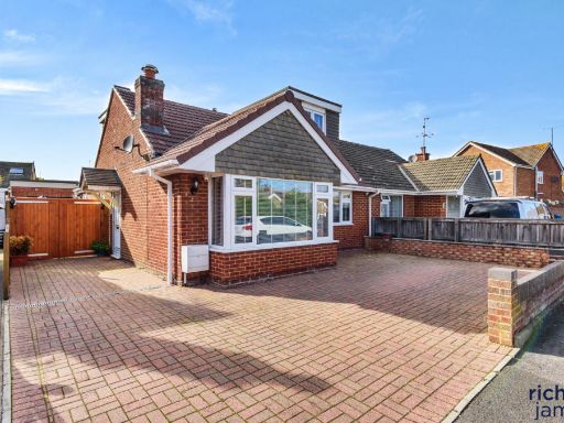 4 bedroom semi-detached bungalow for sale in Beaufort Road, Wroughton, Swindon, SN4 — £365,000 • 4 bed • 2 bath • 1026 ft²
 3 bedroom bungalow for sale in Priors Hill, Wroughton, Swindon, SN4 — £300,000 • 3 bed • 2 bath • 891 ft²
 2 bedroom semi-detached bungalow for sale in Hereford Lawns, Swindon, SN3 — £300,000 • 2 bed • 1 bath • 700 ft²
 4 bedroom semi-detached bungalow for sale in Wharf Road, Wroughton, Swindon, SN4 — £375,000 • 4 bed • 3 bath • 1119 ft²
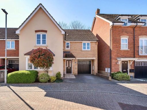 4 bedroom detached house for sale in Wainwright Mews, Wroughton, SN4 — £515,000 • 4 bed • 2 bath • 1339 ft²
Meta
- {
"@context": "https://schema.org",
"@type": "Residence",
"name": "2 bedroom bungalow for sale in Kennet Road, Swindon, SN4",
"description": "",
"url": "https://propertypiper.co.uk/property/6ef3bfea-c09a-45b7-afe2-e61b2d6a14ba",
"image": "https://image-a.propertypiper.co.uk/97d667b8-59a0-4f32-b7b5-cdfb8f460169-1024.jpeg",
"address": {
"@type": "PostalAddress",
"streetAddress": "56 KENNET ROAD WROUGHTON SWINDON",
"postalCode": "SN4 9EA",
"addressLocality": "Swindon",
"addressRegion": "South Swindon",
"addressCountry": "England"
},
"geo": {
"@type": "GeoCoordinates",
"latitude": 51.5292419,
"longitude": -1.7937726
},
"numberOfRooms": 2,
"numberOfBathroomsTotal": 1,
"offers": {
"@type": "Offer",
"price": 290000,
"priceCurrency": "GBP",
"availability": "https://schema.org/InStock"
},
"additionalProperty": [
{
"@type": "PropertyValue",
"name": "Feature",
"value": "modern bathroom"
},
{
"@type": "PropertyValue",
"name": "Feature",
"value": "small bathroom"
},
{
"@type": "PropertyValue",
"name": "Feature",
"value": "frosted window"
},
{
"@type": "PropertyValue",
"name": "Feature",
"value": "beige tile"
},
{
"@type": "PropertyValue",
"name": "Feature",
"value": "shower cubicle"
},
{
"@type": "PropertyValue",
"name": "Feature",
"value": "pedestal sink"
},
{
"@type": "PropertyValue",
"name": "Feature",
"value": "white sanitation ware"
},
{
"@type": "PropertyValue",
"name": "Feature",
"value": "bungalow"
},
{
"@type": "PropertyValue",
"name": "Feature",
"value": "mid-20th century"
},
{
"@type": "PropertyValue",
"name": "Feature",
"value": "single-story"
},
{
"@type": "PropertyValue",
"name": "Feature",
"value": "driveway"
},
{
"@type": "PropertyValue",
"name": "Feature",
"value": "garage potential"
},
{
"@type": "PropertyValue",
"name": "Feature",
"value": "garden"
},
{
"@type": "PropertyValue",
"name": "Feature",
"value": "front lawn"
},
{
"@type": "PropertyValue",
"name": "Feature",
"value": "brick exterior"
}
]
}
High Res Floorplan Images
Compatible Floorplan Images
FloorplanImages Thumbnail