S20 8FJ - 3 bedroom detached house for sale in Waterfield Mews, Westf…
View on Property Piper
3 bedroom detached house for sale in Waterfield Mews, Westfield, Sheffield, S20
Property Details
- Price: £215000
- Bedrooms: 3
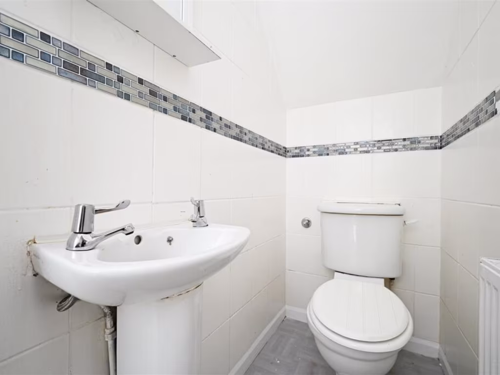
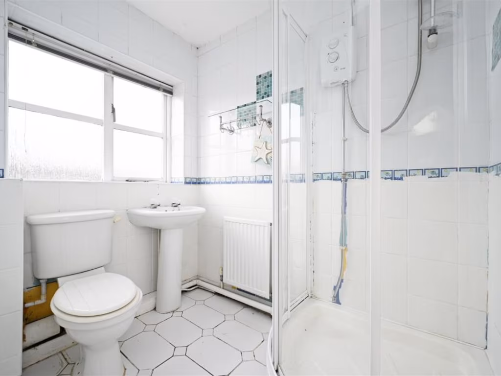
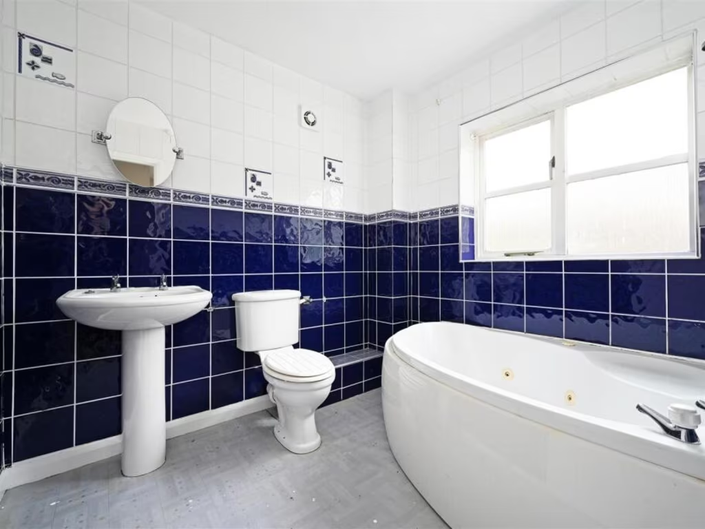
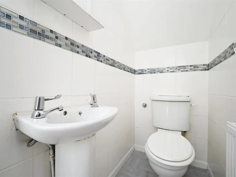
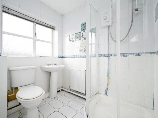
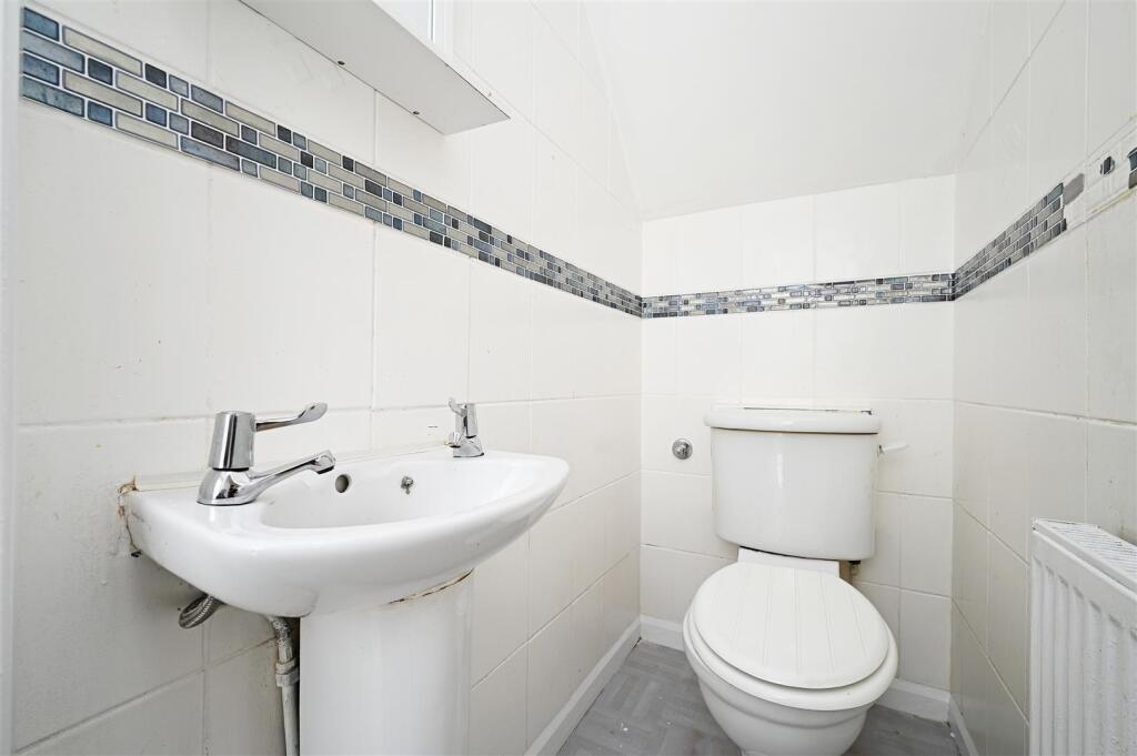
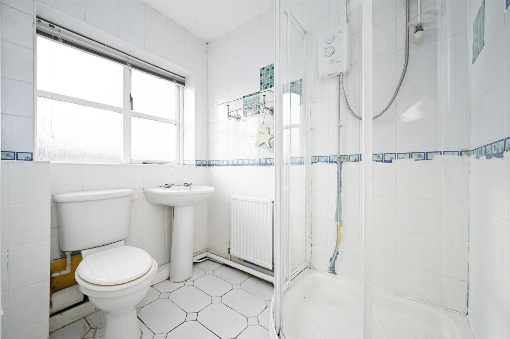
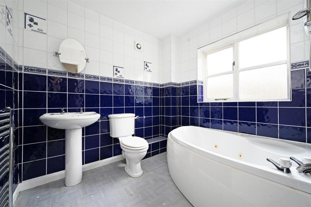
- Bathrooms: 2
- Property Type: undefined
- Property SubType: undefined
Brochure Descriptions
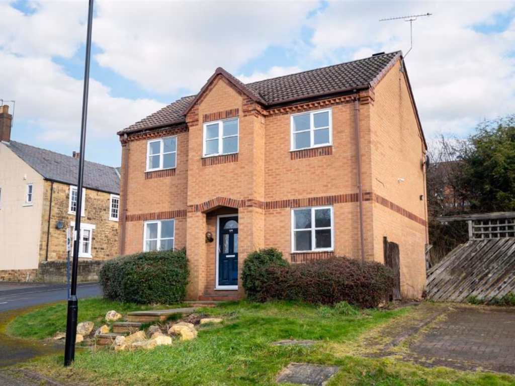
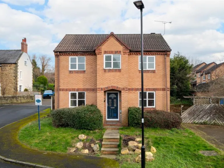
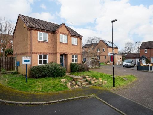
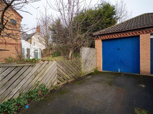
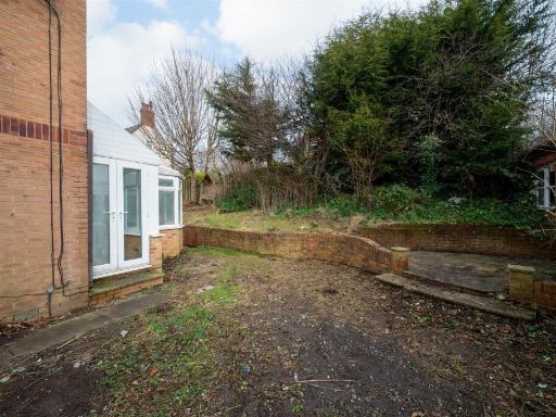
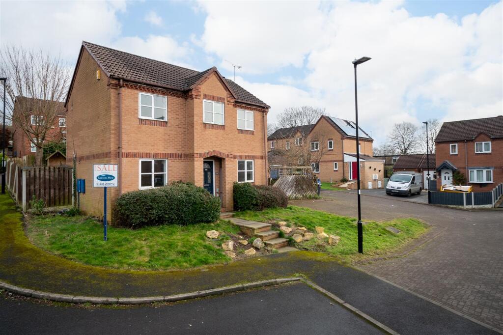
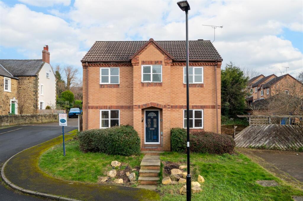
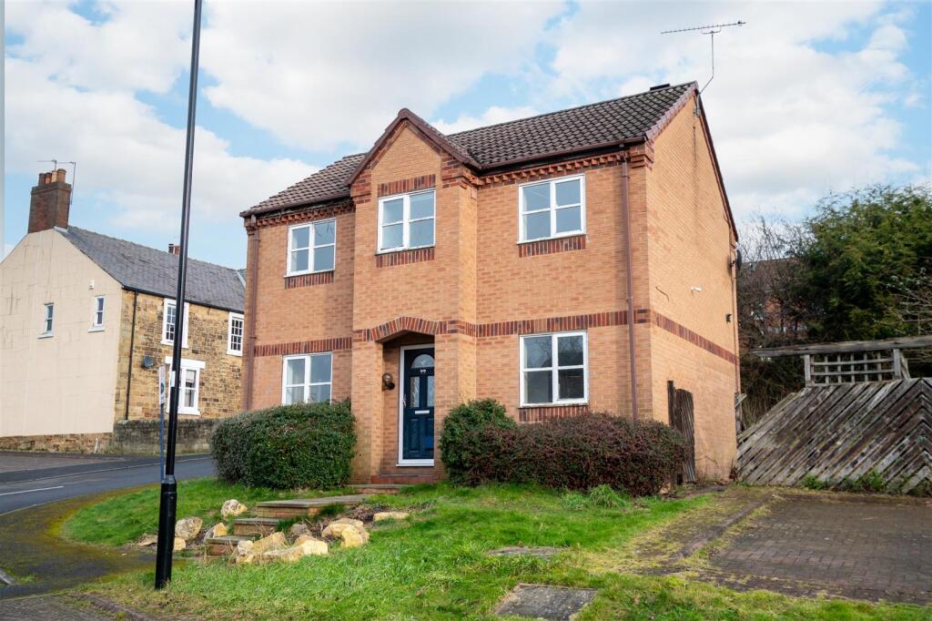
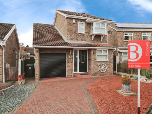
- This semi-detached property is situated in a quiet and well-maintained residential area. The house is constructed with brick, featuring symmetrical windows and a hipped roof typical of modern suburban designs. The front garden is small but inviting, with neatly trimmed hedges and a small grassed area leading to the front steps. The property appears to be of a decent size, typical of a family home, with ample living space distributed over two levels. Side access suggests the potential for a moderate-sized rear garden, suitable for outdoor activities or entertaining. The surrounding neighborhood has a suburban feel, with similar style homes and paved roads, offering a peaceful environment.
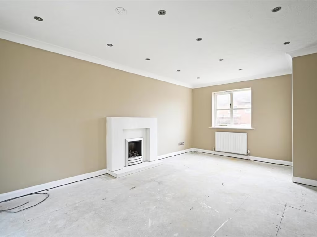
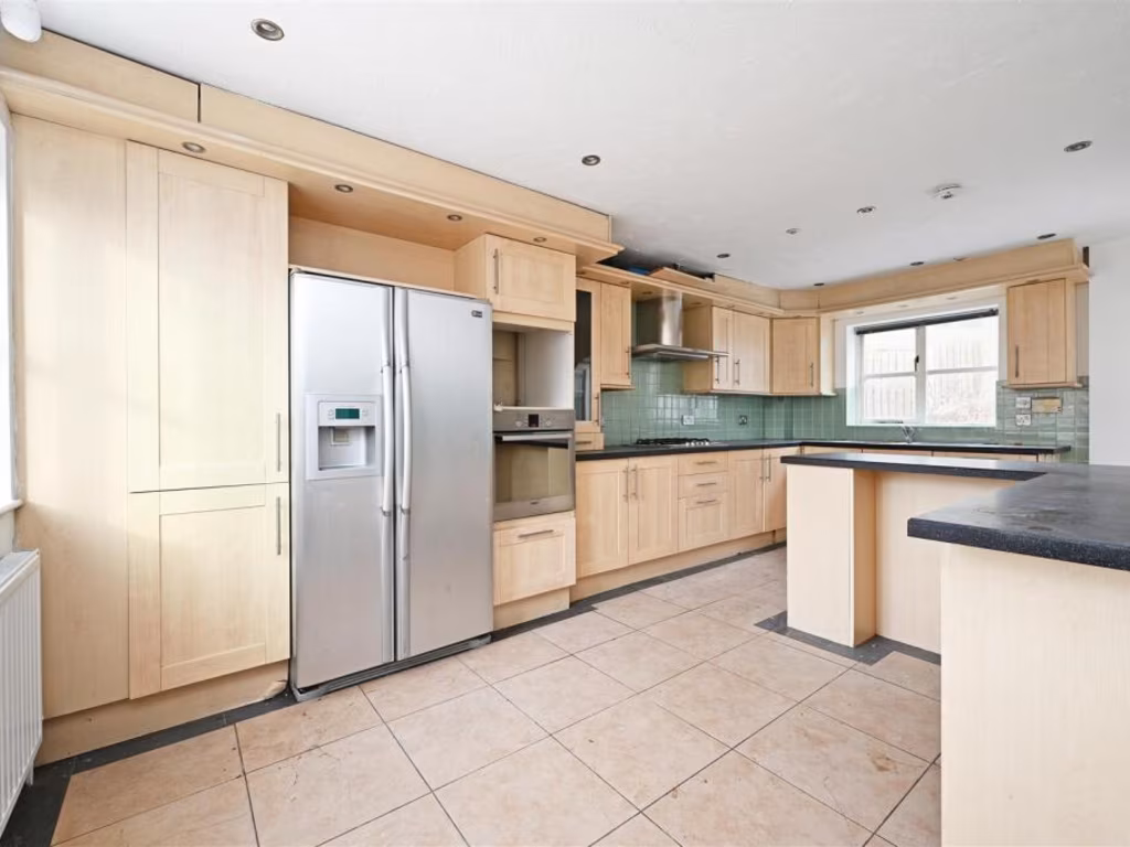
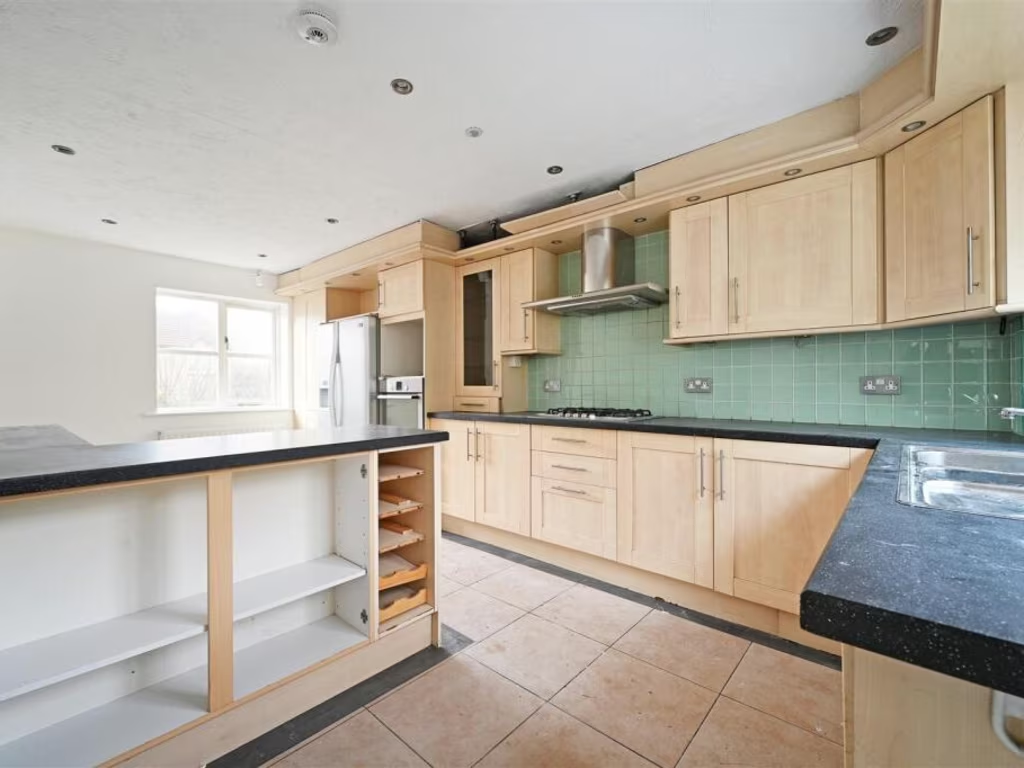
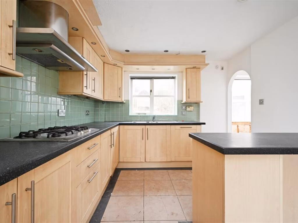
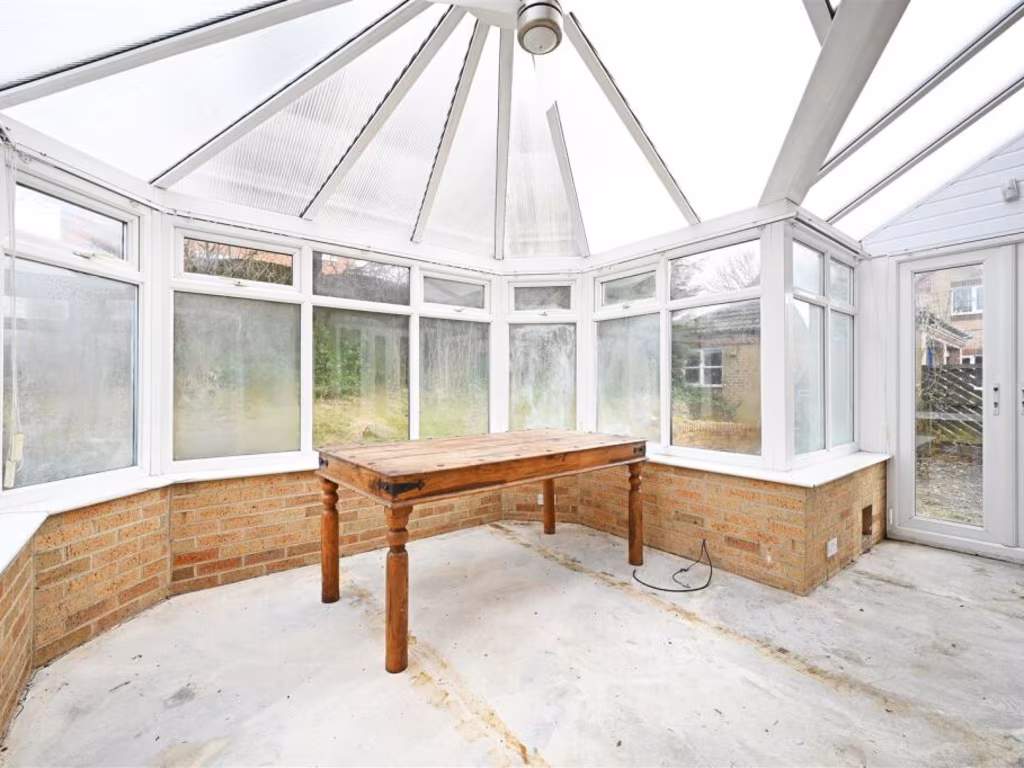
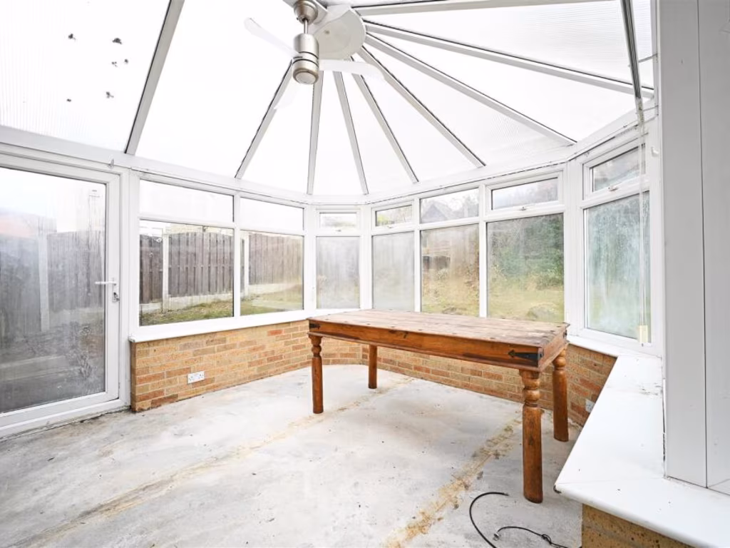
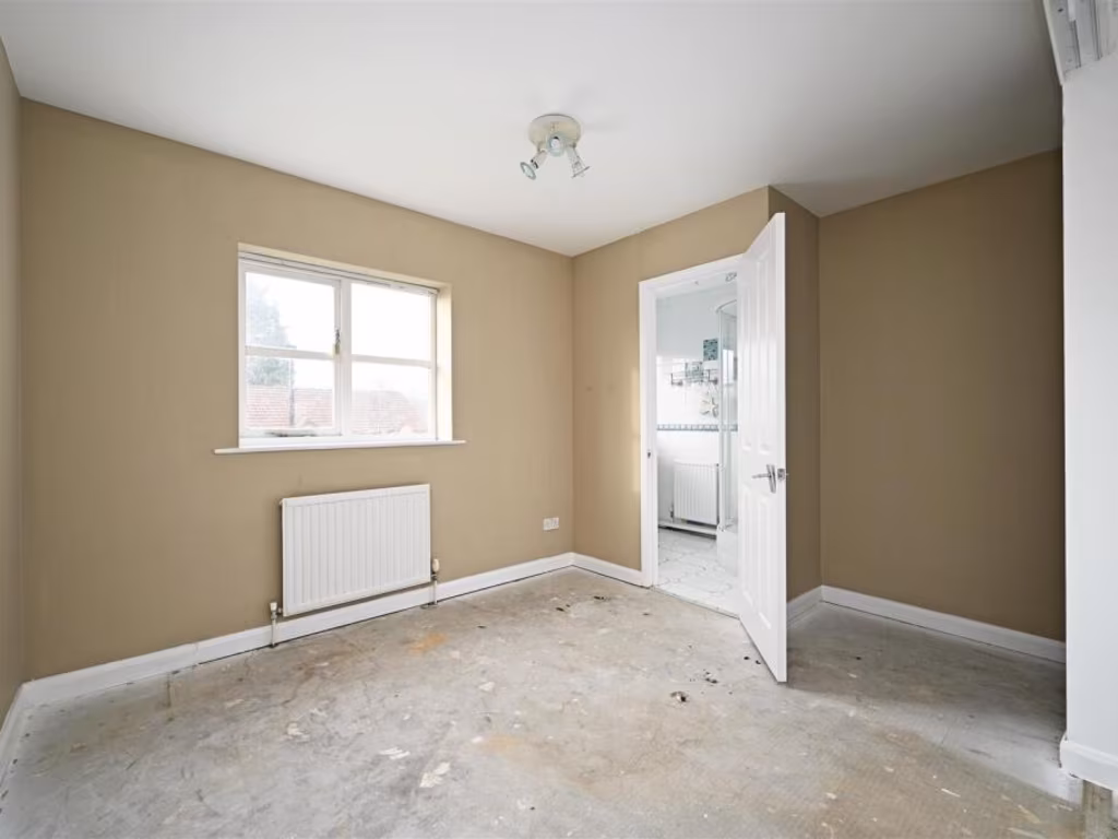
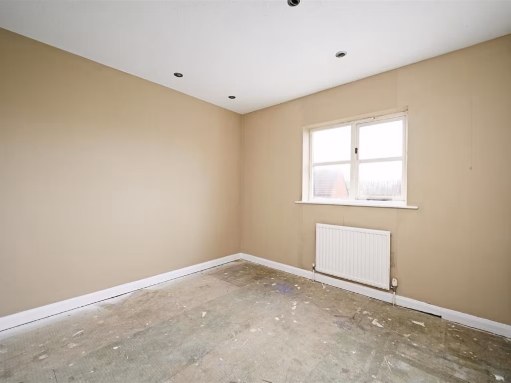
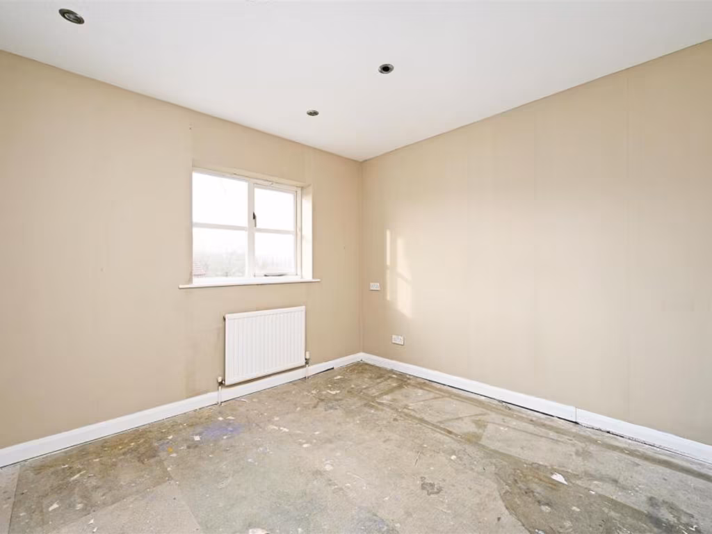
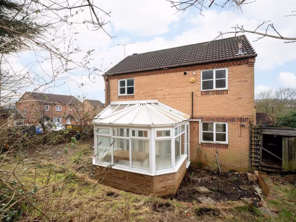
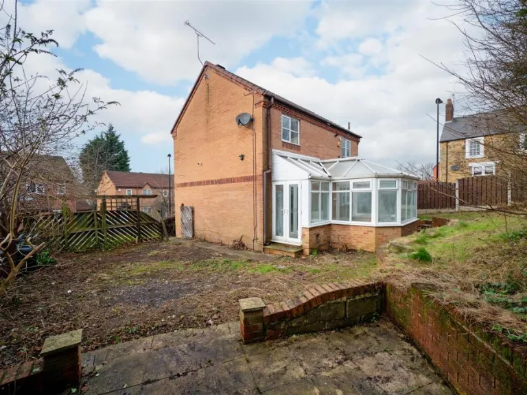
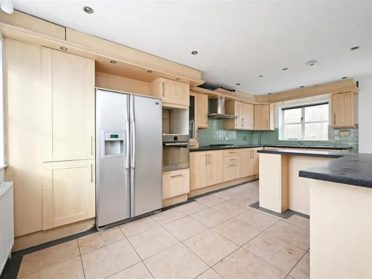
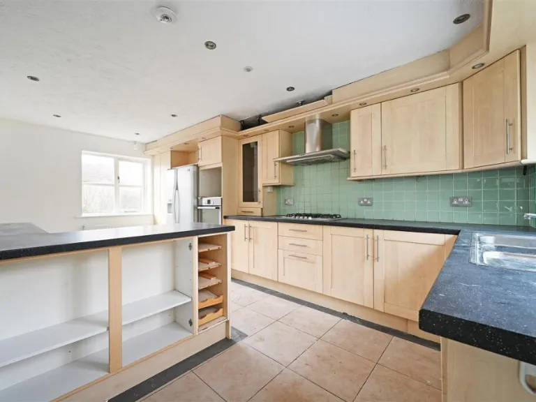
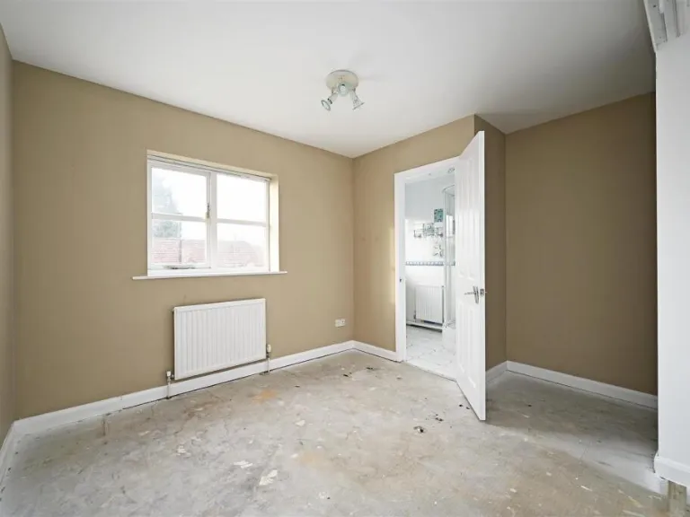
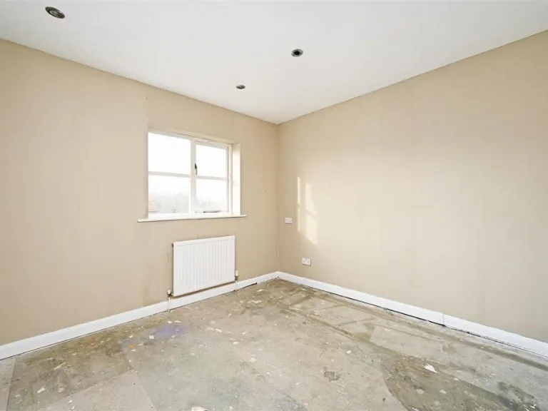
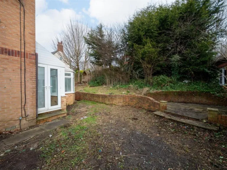
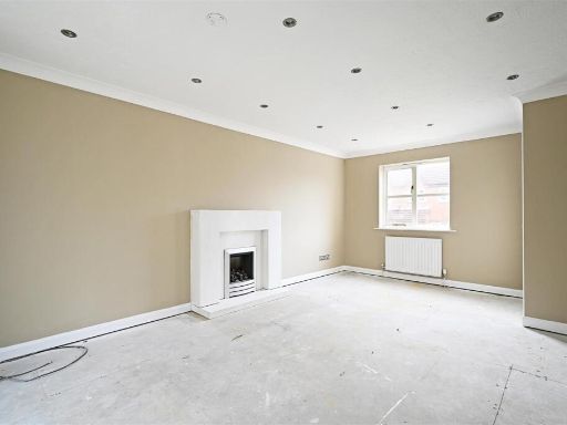
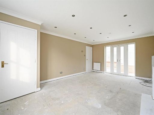
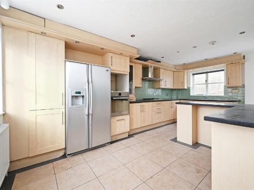
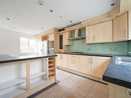
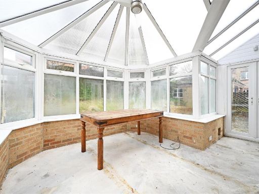
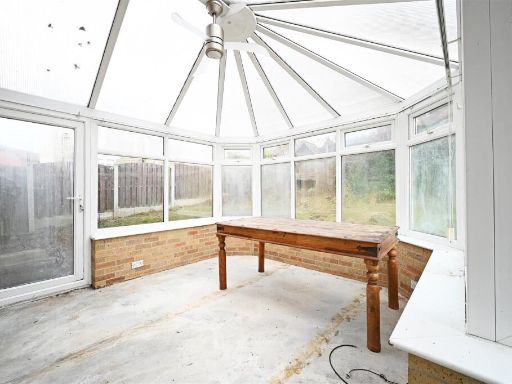
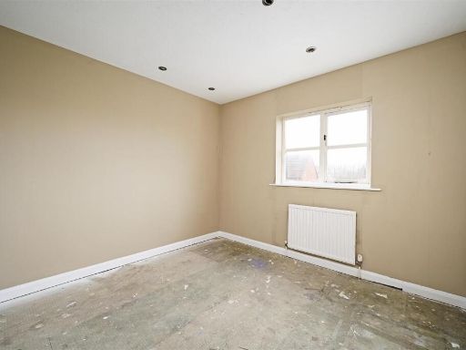
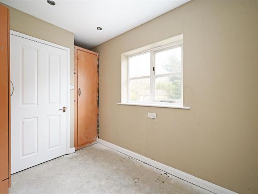
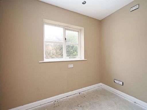
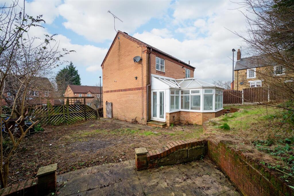
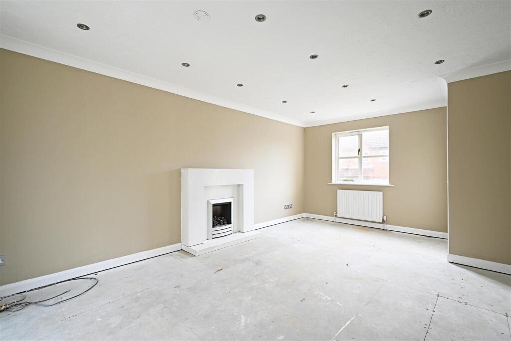
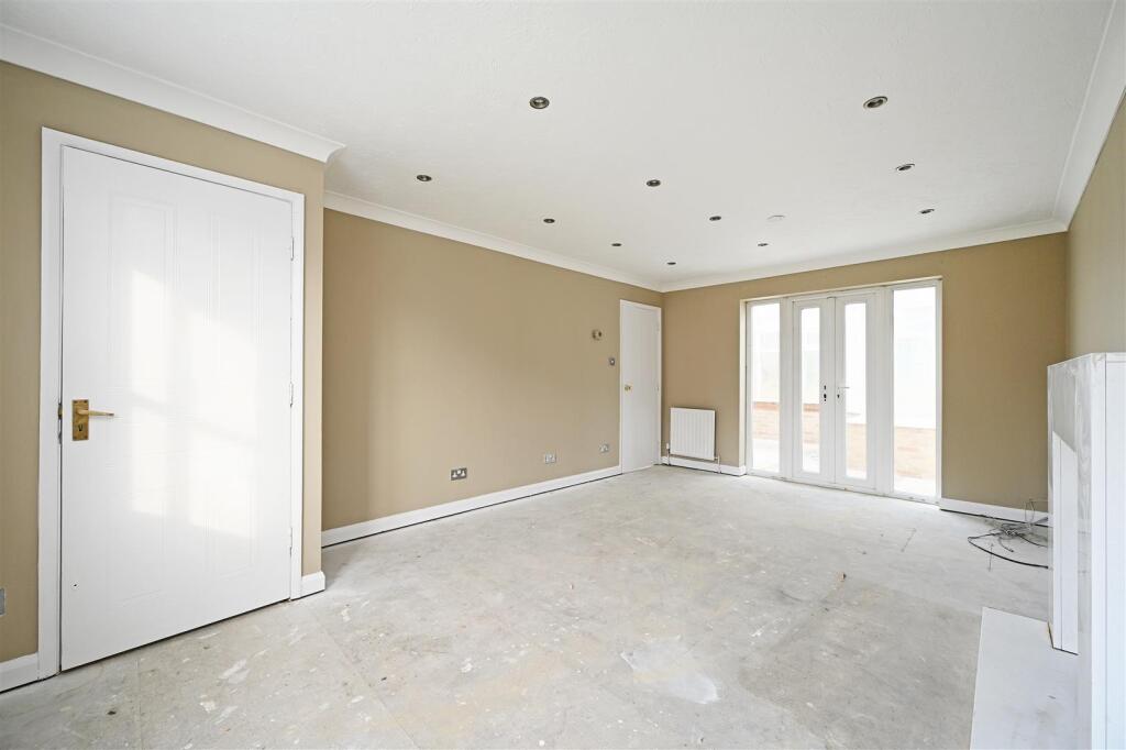
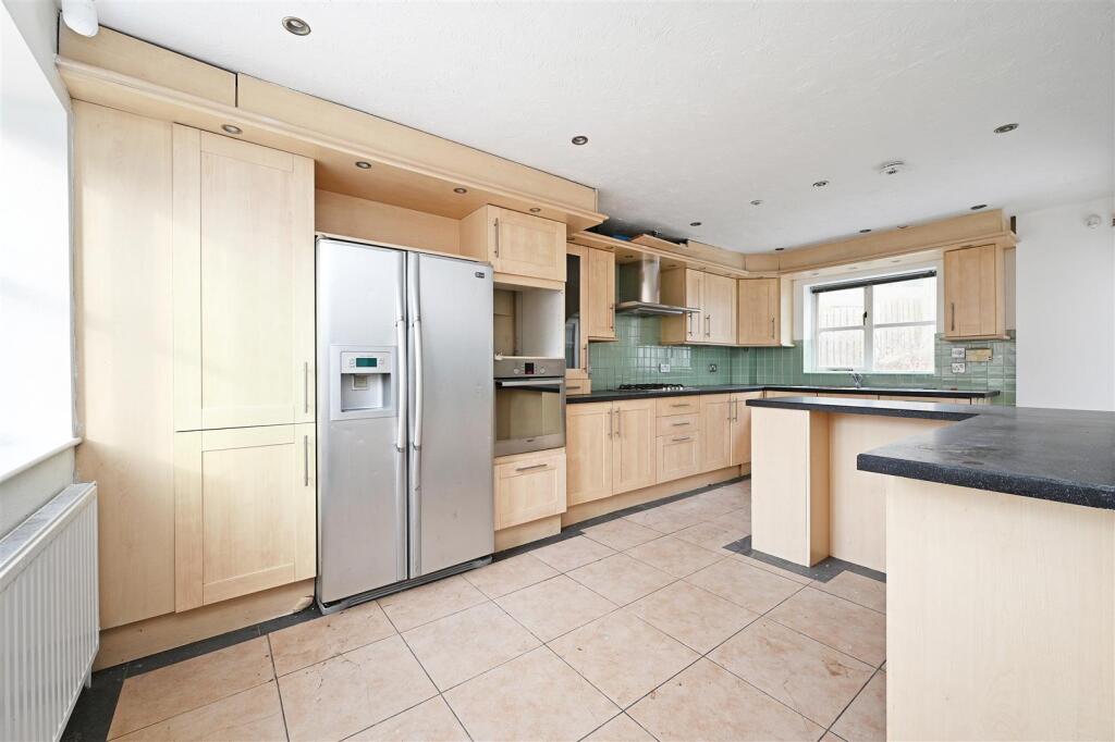
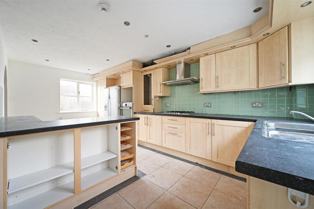
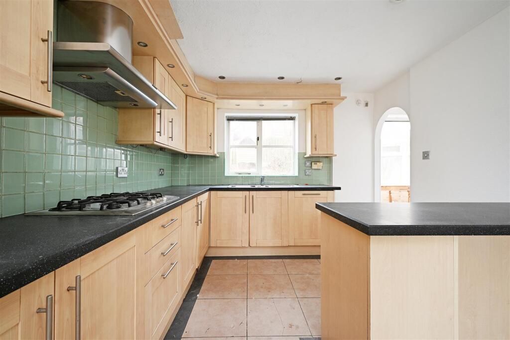
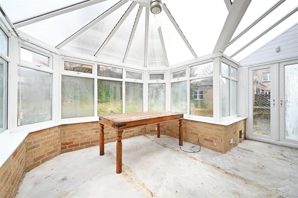
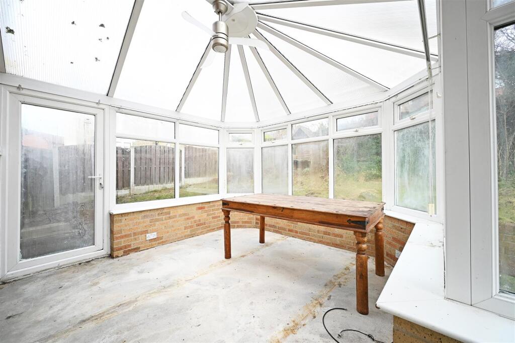
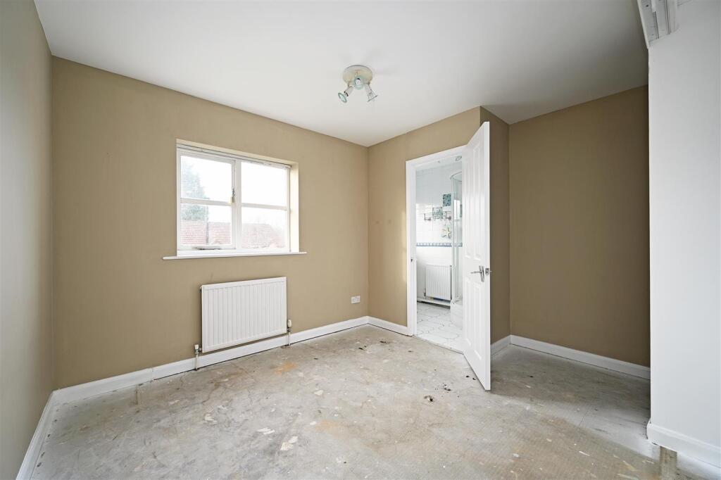
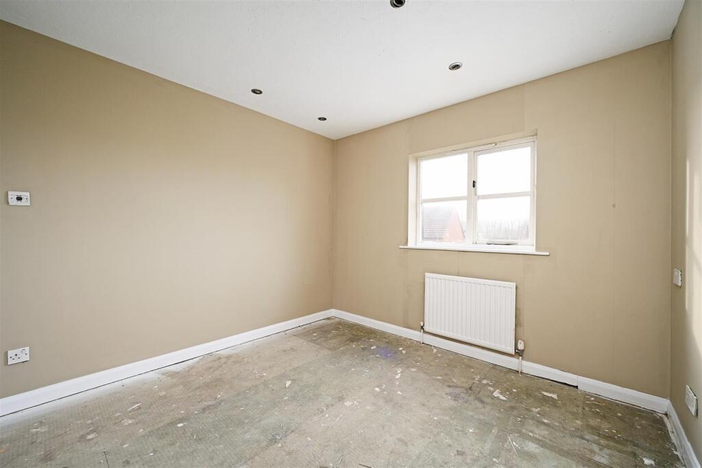
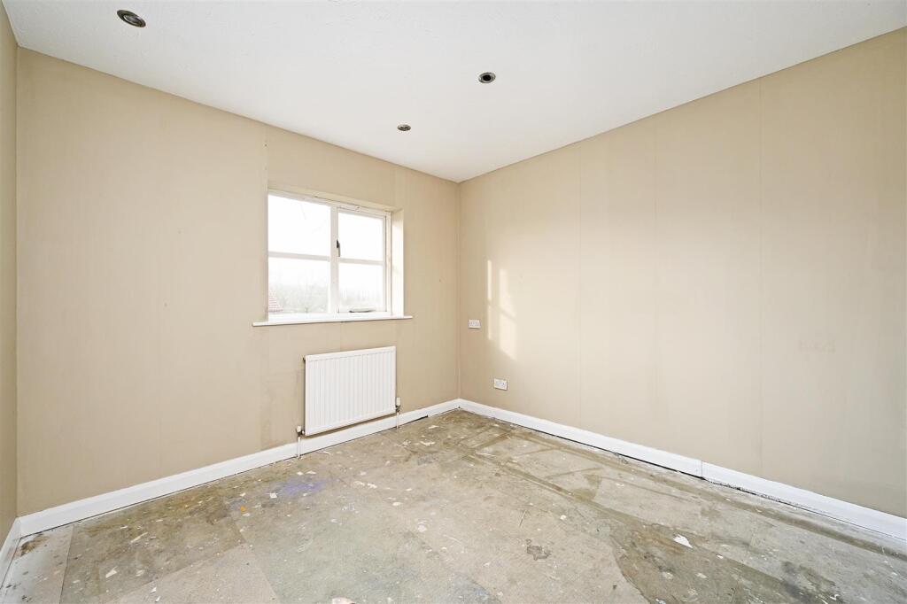
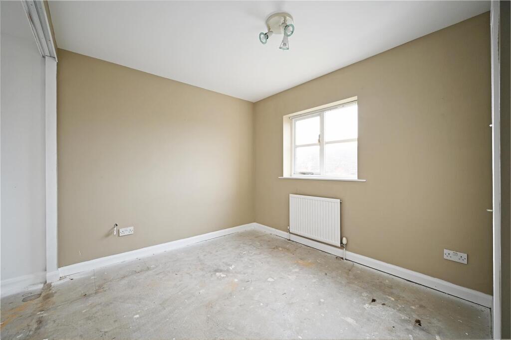
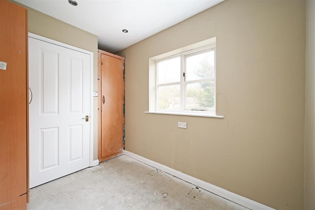
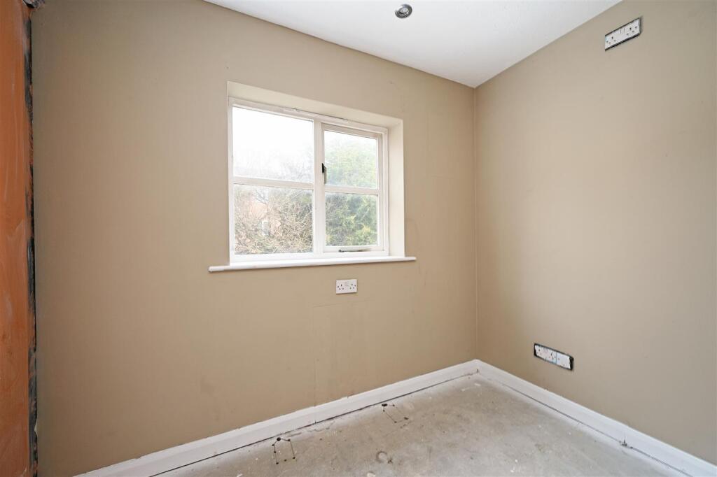
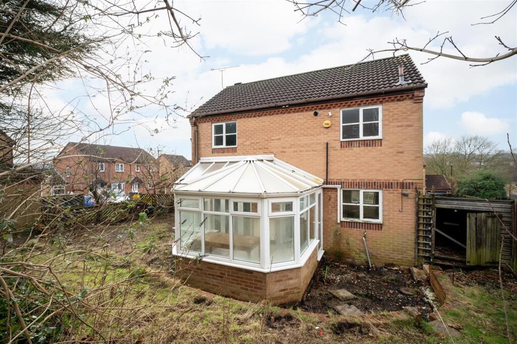
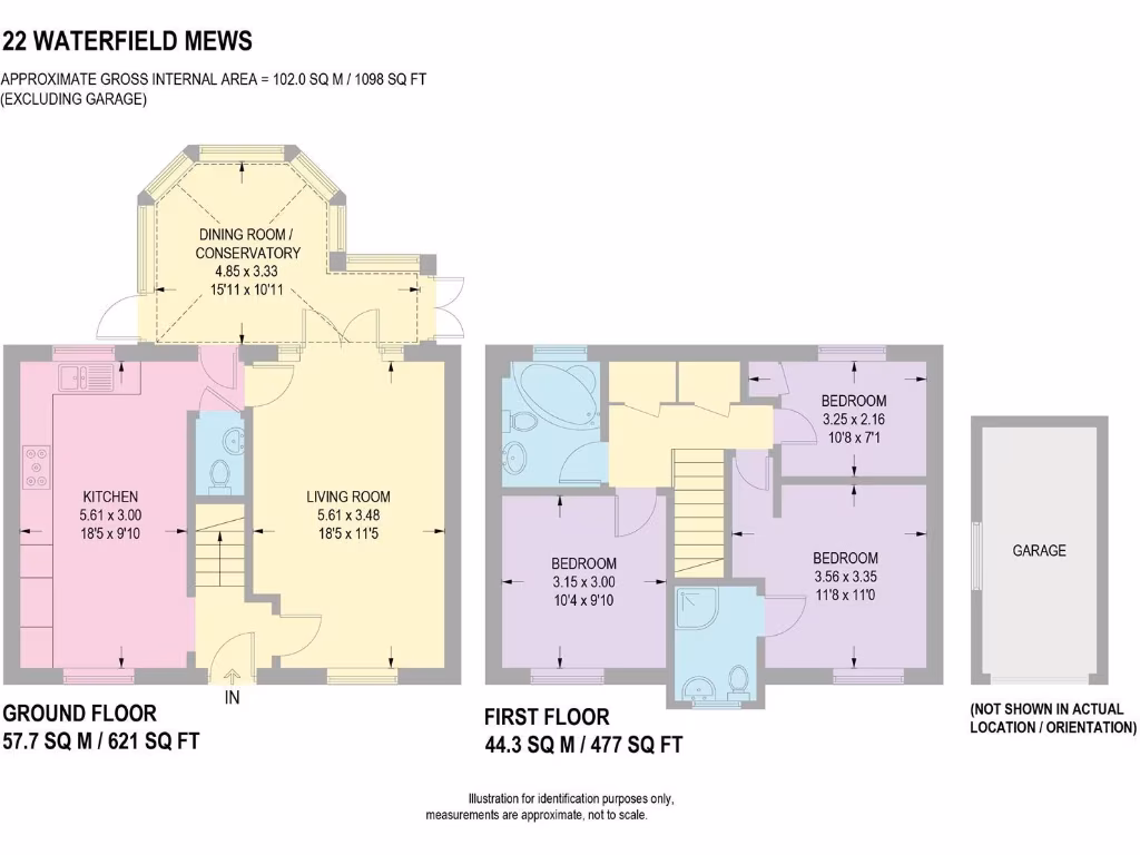
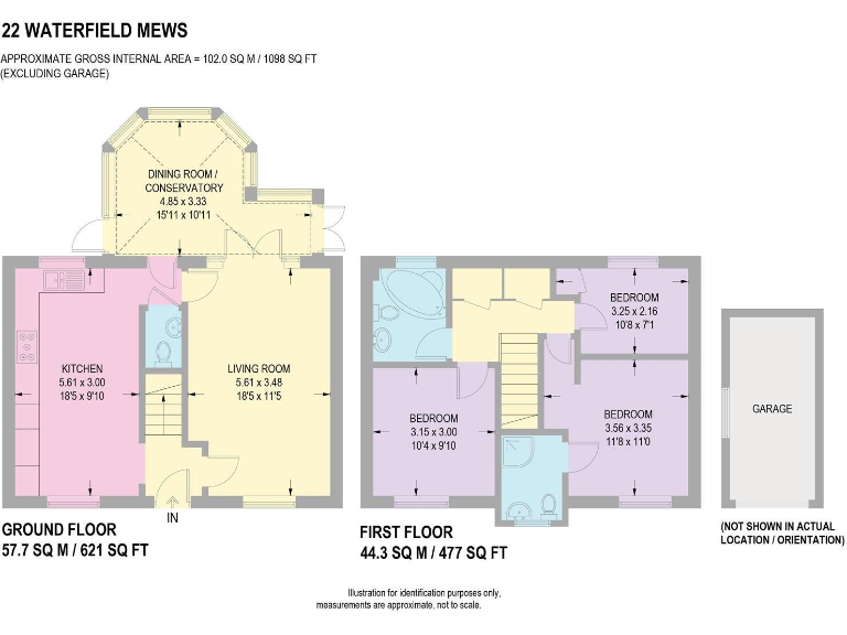
- This charming two-story property features a modest yet inviting design with an approximate gross internal area of 102.0 square meters (1098 square feet) excluding the garage. The ground floor includes a spacious kitchen and a living room with access to a dining room/conservatory, which adds a touch of elegance and provides a wonderful view of the surrounding area. The first floor houses two reasonably sized bedrooms and a third smaller bedroom, ideal for an office or a nursery. The overall property size is average, offering balanced room proportions suitable for a small family or individuals valuing comfort and practicality.
Image Descriptions
- detached house modern
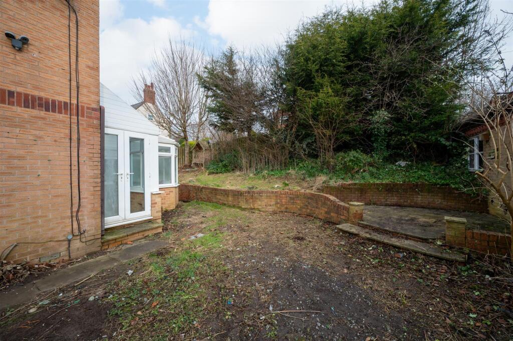
- house with conservatory contemporary
Floorplan Description
- A two-story residence with three bedrooms and a dining conservatory, excluding a garage.
Rooms
- Dining Room / Conservatory: average
- Living Room: average
- Kitchen: average
- Bedroom 1: average
- Bedroom 2: small
- Bedroom 3: small
Textual Property Features
- Has Garden
- Chain Free
- Success
Detected Visual Features
- detached house
- modern style
- two-story
- brick construction
- residential area
- front garden
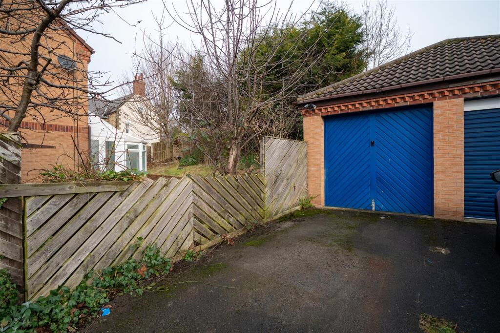
- garage
- potential garden maintenance
- detached
- modern construction
- conservatory
- brick exterior
- garden
- outdoor space
- DIY potential
- modernization needed
EPC Details
- Fully double glazed
- Solid brick, as built, no insulation (assumed)
- Boiler and radiators, mains gas
- Low energy lighting in 20% of fixed outlets
- To unheated space, no insulation (assumed)
Nearby Schools
- St Giles CofE Primary School
- Birley Spa Primary Academy
- Swallownest Primary School
- Immaculate Conception Catholic Primary
- Birk Hill Infant & Nursery School
- Halfway Junior School
- Killamarsh Junior School
- Shortbrook Primary School
- Waterthorpe Infant School
- Rainbow Forge Primary Academy
- Beighton Nursery Infant School
- Reignhead Primary School
- Woodhouse West Primary School
- Brunswick Community Primary School
- Renishaw Primary School
- Mount St Mary's College
- Eckington School
- Mosborough Primary School
- St John Fisher Primary, A Catholic Voluntary Academy
- Aston Fence Junior and Infant School
- Eckington Junior School
- Camms CofE (Aided) Primary School
- Killamarsh Infant School
- Halfway Nursery Infant School
- Emmanuel Anglican/Methodist Junior School
- Westfield School
- Brook House Junior
- Aston Academy
- Handsworth Grange Community Sports College
Nearest General Shops
- Id: 1062673673
- Tags:
- Brand: Toytown
- Brand:wikidata: Q24887651
- Name: Toytown
- Shop: toys
- TagsNormalized:
- Lat: 53.341347
- Lon: -1.3528686
- FullGeoHash: gcrp3nqzggu1
- PartitionGeoHash: gcrp
- Images:
- FoodStandards: null
- Distance: 908.3
,- Id: 1062673675
- Tags:
- Brand: Boots
- Brand:wikidata: Q6123139
- Name: Boots
- Shop: chemist
- TagsNormalized:
- Lat: 53.3413592
- Lon: -1.3526525
- FullGeoHash: gcrp3nrpbyj1
- PartitionGeoHash: gcrp
- Images:
- FoodStandards: null
- Distance: 906
,- Id: 1062673672
- Tags:
- Brand: Wilko
- Brand:wikidata: Q8002536
- Name: Wilko
- Shop: variety_store
- TagsNormalized:
- Lat: 53.3412285
- Lon: -1.3531948
- FullGeoHash: gcrp3nqxhm8y
- PartitionGeoHash: gcrp
- Images:
- FoodStandards: null
- Distance: 901.7
}
Nearest Supermarkets
- Id: 361121881
- Tags:
- Addr:
- City: Sheffield
- Postcode: S20 7JZ
- Street: Beighton Road East
- Brand: Asda
- Brand:wikidata: Q297410
- Brand:wikipedia: en:Asda
- Building: yes
- Contact:
- Phone: +44 114 229 1001
- Website: https://storelocator.asda.com/yorkshire-&-humber/sheffield/beighton-road-east
- Fhrs:
- Name: Asda
- Opening_hours: Mo 08:00-24:00; Tu-Fr 00:00-24:00; Sa 00:00-22:00; Su 10:00-16:00
- Operator: Asda Stores Ltd
- Shop: supermarket
- Wheelchair: yes
- TagsNormalized:
- Lat: 53.3441932
- Lon: -1.3602345
- FullGeoHash: gcrp3p182nre
- PartitionGeoHash: gcrp
- Images:
- FoodStandards:
- Id: 914936
- FHRSID: 914936
- LocalAuthorityBusinessID: 41173
- BusinessName: Asda Sheffield Mosborough Superstore
- BusinessType: Retailers - supermarkets/hypermarkets
- BusinessTypeID: 7840
- AddressLine1: null
- AddressLine2: Beighton Road East
- AddressLine3: Sheffield
- AddressLine4: null
- PostCode: S20 7AB
- RatingValue: 5
- RatingKey: fhrs_5_en-GB
- RatingDate: 2021-11-25
- LocalAuthorityCode: 425
- LocalAuthorityName: Sheffield
- LocalAuthorityWebSite: https://www.sheffield.gov.uk
- LocalAuthorityEmailAddress: healthprotection@sheffield.gov.uk
- Scores:
- Hygiene: 0
- Structural: 0
- ConfidenceInManagement: 0
- NewRatingPending: false
- Geocode:
- Longitude: -1.36084902286530
- Latitude: 53.34432601928710
- Distance: 1397.7
,- Id: 71213950
- Tags:
- Addr:
- City: Sheffield
- Postcode: S20 8GN
- Street: Oxclose Park Road North
- Brand: Morrisons
- Brand:wikidata: Q922344
- Brand:wikipedia: en:Morrisons
- Building: supermarket
- Name: Morrisons
- Shop: supermarket
- Website: https://my.morrisons.com/storefinder/101
- TagsNormalized:
- Lat: 53.3251595
- Lon: -1.3431174
- FullGeoHash: gcrp37tcx45n
- PartitionGeoHash: gcrp
- Images:
- FoodStandards: null
- Distance: 1009.8
,- Id: 1039453251
- Tags:
- Brand: Sainsbury's
- Brand:wikidata: Q152096
- Brand:wikipedia: en:Sainsbury's
- Name: Sainsbury's
- Shop: supermarket
- TagsNormalized:
- sainsburys
- supermarket
- shop
- Lat: 53.3416996
- Lon: -1.3498857
- FullGeoHash: gcrp3q91cms2
- PartitionGeoHash: gcrp
- Images:
- FoodStandards: null
- Distance: 916.2
}
Nearest Religious buildings
- Id: 365506275
- Tags:
- Amenity: place_of_worship
- Building: yes
- Denomination: gospel
- Name: Beighton Gospel Hall
- Religion: christian
- TagsNormalized:
- place of worship
- christian
- church
- Lat: 53.342777
- Lon: -1.3376822
- FullGeoHash: gcrp3wcbjwrg
- PartitionGeoHash: gcrp
- Images:
- FoodStandards: null
- Distance: 1289
,- Id: 204722804
- Tags:
- Amenity: place_of_worship
- Building: church
- Denomination: anglican
- Name: St Mark's Church
- Religion: christian
- Source: Bing
- Wikidata: Q105103016
- TagsNormalized:
- place of worship
- church
- anglican
- christian
- Lat: 53.3247362
- Lon: -1.3614837
- FullGeoHash: gcrp352x55k1
- PartitionGeoHash: gcrp
- Images:
- FoodStandards: null
- Distance: 1265.9
,- Id: 834642914
- Tags:
- Amenity: place_of_worship
- Building: church
- Denomination: anglican
- Name: Emmanuel Church
- Religion: christian
- Wikidata: Q105103042
- TagsNormalized:
- place of worship
- church
- anglican
- christian
- Lat: 53.3373348
- Lon: -1.3525528
- FullGeoHash: gcrp3jz07pze
- PartitionGeoHash: gcrp
- Images:
- FoodStandards: null
- Distance: 482.5
}
Nearest Medical buildings
- Id: 4322691259
- Tags:
- Amenity: veterinary
- Name: Springfield Veterinary Surgery
- TagsNormalized:
- Lat: 53.3429979
- Lon: -1.3535836
- FullGeoHash: gcrp3ny37pwc
- PartitionGeoHash: gcrp
- Images:
- FoodStandards: null
- Distance: 1097.9
,- Id: 4322663439
- Tags:
- Amenity: pharmacy
- Brand: Lloyds Pharmacy
- Brand:wikidata: Q6662870
- Healthcare: pharmacy
- Name: Lloyds Pharmacy
- TagsNormalized:
- pharmacy
- lloyds pharmacy
- health
- healthcare
- Lat: 53.3414888
- Lon: -1.352072
- FullGeoHash: gcrp3nx2wqnn
- PartitionGeoHash: gcrp
- Images:
- FoodStandards: null
- Distance: 911.2
,- Id: 372916019
- Tags:
- Addr:
- Housename: Sothall Pharmacy
- Housenumber: 26
- Postcode: S20 1HQ
- Street: Eckington Road
- Amenity: pharmacy
- Dispensing: yes
- Healthcare: pharmacy
- Name: Sothall Pharmacy
- Website: https://www.nhs.uk/Services/pharmacies/Overview/DefaultView.aspx?id=4040
- TagsNormalized:
- Lat: 53.3385512
- Lon: -1.3402783
- FullGeoHash: gcrp3tbp9685
- PartitionGeoHash: gcrp
- Images:
- FoodStandards: null
- Distance: 821.3
,- Id: 365648844
- Tags:
- Amenity: pharmacy
- Building: yes
- Healthcare: pharmacy
- Name: Sothall Pharmacy
- TagsNormalized:
- Lat: 53.3385463
- Lon: -1.3402785
- FullGeoHash: gcrp3tbp91xy
- PartitionGeoHash: gcrp
- Images:
- FoodStandards: null
- Distance: 820.9
}
Nearest Airports
- Id: 100889514
- Tags:
- Addr:
- Aerodrome: international
- Aerodrome:type: public
- Area: yes
- Cities_served: Doncaster, Sheffield
- Closest_town: Doncaster
- Disused:
- Ele: 17
- Iata: DSA
- Icao: EGCN
- Ifr: yes
- Is_in: Finningley
- Name: Doncaster Sheffield Airport
- Old_iata: FNY
- Old_icao: EGXI
- Old_name: RAF Finningley
- Old_operator: Royal Air Force
- Old_type: military
- Operator: Doncaster Sheffield Airport Limited/Peel Airports
- Source: wikipedia
- Tower_frequency: 128.775
- Vfr: yes
- Website: https://www.robinhoodairport.com/
- Wikidata: Q8996
- Wikipedia: en:Robin Hood Airport Doncaster Sheffield
- TagsNormalized:
- airport
- international airport
- Lat: 53.4761577
- Lon: -1.0054086
- FullGeoHash: gcx21p5chq34
- PartitionGeoHash: gcx2
- Images:
- FoodStandards: null
- Distance: 27771.9
}
Nearest Leisure Facilities
- Id: 696672579
- Tags:
- Leisure: pitch
- Source: Maxar-Premium
- Sport: soccer
- TagsNormalized:
- Lat: 53.3310058
- Lon: -1.357283
- FullGeoHash: gcrp3heeth03
- PartitionGeoHash: gcrp
- Images:
- FoodStandards: null
- Distance: 599.4
,- Id: 361048229
- Tags:
- TagsNormalized:
- Lat: 53.3372662
- Lon: -1.3430099
- FullGeoHash: gcrp3my01e54
- PartitionGeoHash: gcrp
- Images:
- FoodStandards: null
- Distance: 591.8
,- Id: 367814595
- Tags:
- Leisure: park
- Name: Thorpe Green Park
- TagsNormalized:
- Lat: 53.3373402
- Lon: -1.3551185
- FullGeoHash: gcrp3jv0x2y7
- PartitionGeoHash: gcrp
- Images:
- FoodStandards: null
- Distance: 580.5
,- Id: 363117962
- Tags:
- TagsNormalized:
- Lat: 53.3291868
- Lon: -1.3524649
- FullGeoHash: gcrp3hr1j2cn
- PartitionGeoHash: gcrp
- Images:
- FoodStandards: null
- Distance: 521.7
,- Id: 5943415657
- Tags:
- TagsNormalized:
- Lat: 53.3367719
- Lon: -1.3547418
- FullGeoHash: gcrp3jtt0nzm
- PartitionGeoHash: gcrp
- Images:
- FoodStandards: null
- Distance: 517.4
}
Nearest Tourist attractions
- Id: 8078513587
- Tags:
- TagsNormalized:
- Lat: 53.3484843
- Lon: -1.3210616
- FullGeoHash: gcrp3zy13n30
- PartitionGeoHash: gcrp
- Images:
- FoodStandards: null
- Distance: 2508.2
,- Id: 8108150140
- Tags:
- TagsNormalized:
- Lat: 53.3413368
- Lon: -1.3204435
- FullGeoHash: gcrp3yqrz3vu
- PartitionGeoHash: gcrp
- Images:
- FoodStandards: null
- Distance: 2103.5
,- Id: 8108150165
- Tags:
- TagsNormalized:
- Lat: 53.3405606
- Lon: -1.3209165
- FullGeoHash: gcrp3yq5k3jm
- PartitionGeoHash: gcrp
- Images:
- FoodStandards: null
- Distance: 2040.1
}
Nearest Train stations
- Id: 3157354104
- Tags:
- Name: Darnall
- Naptan:
- Network: National Rail
- Operator: Northern Rail
- Public_transport: station
- Railway: station
- Ref:
- Source: wikipedia
- Wikidata: Q2975270
- Wikipedia: en:Darnall railway station
- TagsNormalized:
- Lat: 53.3845451
- Lon: -1.4123572
- FullGeoHash: gcqzxy7e98qp
- PartitionGeoHash: gcqz
- Images:
- FoodStandards: null
- Distance: 7056.4
,- Id: 102031003
- Tags:
- Building: train_station
- Name: Barrow Hill Roundhouse
- Railway: turntable
- Tourism: attraction
- Wikidata: Q4863884
- Wikipedia: en:Barrow Hill Engine Shed
- TagsNormalized:
- station
- train
- train station
- railway
- attraction
- tourism
- Lat: 53.2744292
- Lon: -1.381839
- FullGeoHash: gcrp0d3f0c6h
- PartitionGeoHash: gcrp
- Images:
- FoodStandards: null
- Distance: 6912.7
,- Id: 1716256015
- Tags:
- Name: Roundhouse Halt
- Public_transport: station
- Railway: station
- Usage: tourism
- Website: https://www.barrowhill.org/
- TagsNormalized:
- Lat: 53.2746594
- Lon: -1.3813376
- FullGeoHash: gcrp0d65ks21
- PartitionGeoHash: gcrp
- Images:
- FoodStandards: null
- Distance: 6878
,- Id: 3157350618
- Tags:
- Name: Kiveton Bridge
- Naptan:
- Network: National Rail
- Operator: Northern Rail
- Public_transport: station
- Railway: station
- Ref:
- Source: wikipedia
- Wikidata: Q3448631
- Wikipedia: en:Kiveton Bridge railway station
- TagsNormalized:
- Lat: 53.3409362
- Lon: -1.2670815
- FullGeoHash: gcrp7nmm6z5w
- PartitionGeoHash: gcrp
- Images:
- FoodStandards: null
- Distance: 5518.7
,- Id: 3157353528
- Tags:
- Name: Woodhouse
- Naptan:
- Network: National Rail
- Operator: Northern Rail
- Public_transport: station
- Railway: station
- Ref:
- Source: wikipedia
- Wikidata: Q2497249
- Wikipedia: en:Woodhouse railway station
- TagsNormalized:
- Lat: 53.3637962
- Lon: -1.3573689
- FullGeoHash: gcrp94edeh87
- PartitionGeoHash: gcrp
- Images:
- FoodStandards: null
- Distance: 3415
}
Nearest Hotels
- Id: 615926937
- Tags:
- Amenity: pub
- Name: West End Hotel
- TagsNormalized:
- Lat: 53.3144871
- Lon: -1.3189468
- FullGeoHash: gcrp3cxe6k9z
- PartitionGeoHash: gcrp
- Images:
- FoodStandards: null
- Distance: 2916.6
,- Id: 363773497
- Tags:
- Amenity: pub
- Building: yes
- Name: The Royal Hotel
- TagsNormalized:
- Lat: 53.3090001
- Lon: -1.3552534
- FullGeoHash: gcrp30t5kmcu
- PartitionGeoHash: gcrp
- Images:
- FoodStandards: null
- Distance: 2749.8
,- Id: 343389600
- Tags:
- Addr:
- City: Sheffield
- Country: GB
- Postcode: S20 5EA
- Street: High Street
- Fhrs:
- Name: Mosborough Hall Hotel
- Operator: Best Westen
- Tourism: hotel
- TagsNormalized:
- Lat: 53.3215943
- Lon: -1.3567463
- FullGeoHash: gcrp34uhc98e
- PartitionGeoHash: gcrp
- Images:
- FoodStandards: null
- Distance: 1411
}
Tags
- detached house
- modern style
- two-story
- brick construction
- residential area
- front garden
- garage
- potential garden maintenance
- detached
- modern construction
- conservatory
- brick exterior
- garden
- outdoor space
- DIY potential
- modernization needed
Local Market Stats
- Average Price/sqft: £238
- Avg Income: £41300
- Rental Yield: 4.8%
- Social Housing: 13%
- Planning Success Rate: 89%
Similar Properties
 3 bedroom detached house for sale in Rothbury Close, Sothall, Sheffield, South Yorkshire, S20 — £260,000 • 3 bed • 2 bath • 946 ft²
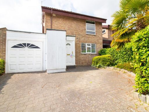 3 bedroom link detached house for sale in Waterthorpe Crescent, Westfield, S20 — £215,000 • 3 bed • 1 bath • 926 ft²
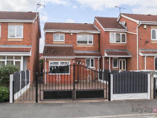 3 bedroom detached house for sale in Rufford Rise, Sothall, Sheffield, S20 — £250,000 • 3 bed • 1 bath • 754 ft²
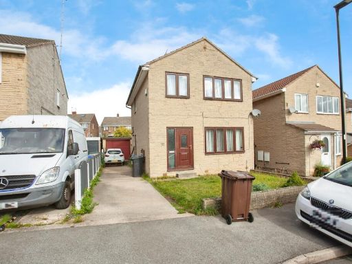 3 bedroom detached house for sale in Taunton Avenue, Sheffield, South Yorkshire, S9 — £250,000 • 3 bed • 1 bath • 920 ft²
 4 bedroom detached house for sale in Bramshill Court, Sothall, S20 — £330,000 • 4 bed • 2 bath • 1146 ft²
 4 bedroom detached house for sale in Beckton Avenue, Waterthorpe, Sheffield, S20 — £340,000 • 4 bed • 2 bath • 1432 ft²
Meta
- {
"@context": "https://schema.org",
"@type": "Residence",
"name": "3 bedroom detached house for sale in Waterfield Mews, Westf…",
"description": "",
"url": "https://propertypiper.co.uk/property/6ec6b0aa-fcd0-43db-9bc5-ad5a88098be4",
"image": "https://image-a.propertypiper.co.uk/37eef343-ef02-45f9-be38-8ec923e37b03-1024.jpeg",
"address": {
"@type": "PostalAddress",
"streetAddress": "22 WATERFIELD MEWS WESTFIELD SHEFFIELD",
"postalCode": "S20 8FJ",
"addressLocality": "Sheffield",
"addressRegion": "Sheffield South East",
"addressCountry": "England"
},
"geo": {
"@type": "GeoCoordinates",
"latitude": 53.3334685,
"longitude": -1.349254
},
"numberOfRooms": 3,
"numberOfBathroomsTotal": 2,
"floorSize": {
"@type": "QuantitativeValue",
"value": 1098,
"unitCode": "FTK"
},
"offers": {
"@type": "Offer",
"price": 215000,
"priceCurrency": "GBP",
"availability": "https://schema.org/InStock"
},
"additionalProperty": [
{
"@type": "PropertyValue",
"name": "Feature",
"value": "detached house"
},
{
"@type": "PropertyValue",
"name": "Feature",
"value": "modern style"
},
{
"@type": "PropertyValue",
"name": "Feature",
"value": "two-story"
},
{
"@type": "PropertyValue",
"name": "Feature",
"value": "brick construction"
},
{
"@type": "PropertyValue",
"name": "Feature",
"value": "residential area"
},
{
"@type": "PropertyValue",
"name": "Feature",
"value": "front garden"
},
{
"@type": "PropertyValue",
"name": "Feature",
"value": "garage"
},
{
"@type": "PropertyValue",
"name": "Feature",
"value": "potential garden maintenance"
},
{
"@type": "PropertyValue",
"name": "Feature",
"value": "detached"
},
{
"@type": "PropertyValue",
"name": "Feature",
"value": "modern construction"
},
{
"@type": "PropertyValue",
"name": "Feature",
"value": "conservatory"
},
{
"@type": "PropertyValue",
"name": "Feature",
"value": "brick exterior"
},
{
"@type": "PropertyValue",
"name": "Feature",
"value": "garden"
},
{
"@type": "PropertyValue",
"name": "Feature",
"value": "outdoor space"
},
{
"@type": "PropertyValue",
"name": "Feature",
"value": "DIY potential"
},
{
"@type": "PropertyValue",
"name": "Feature",
"value": "modernization needed"
}
]
}
High Res Floorplan Images
Compatible Floorplan Images
FloorplanImages Thumbnail