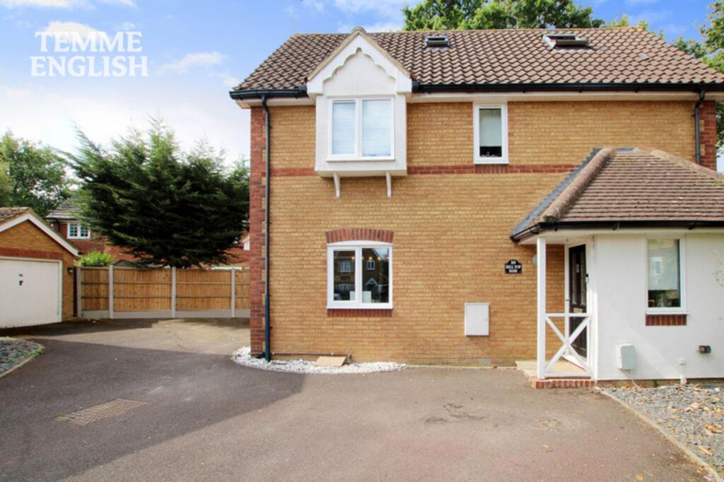
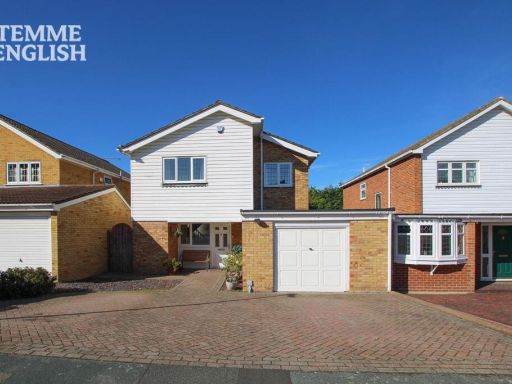
SS16 6UP - 5 bedroom detached house for sale in Hill Top Rise, Langdon…
View on Property Piper
5 bedroom detached house for sale in Hill Top Rise, Langdon Hills, SS16
Property Details
- Price: £525000
- Bedrooms: 5
- Bathrooms: 3
- Property Type: undefined
- Property SubType: undefined
Image Descriptions
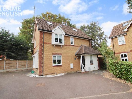
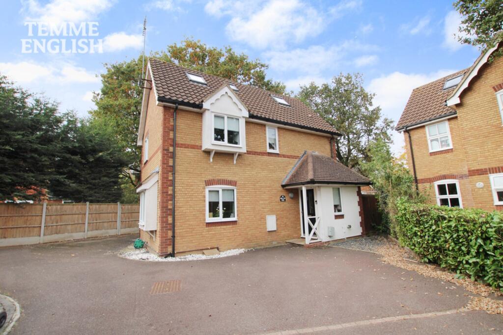
- detached house modern
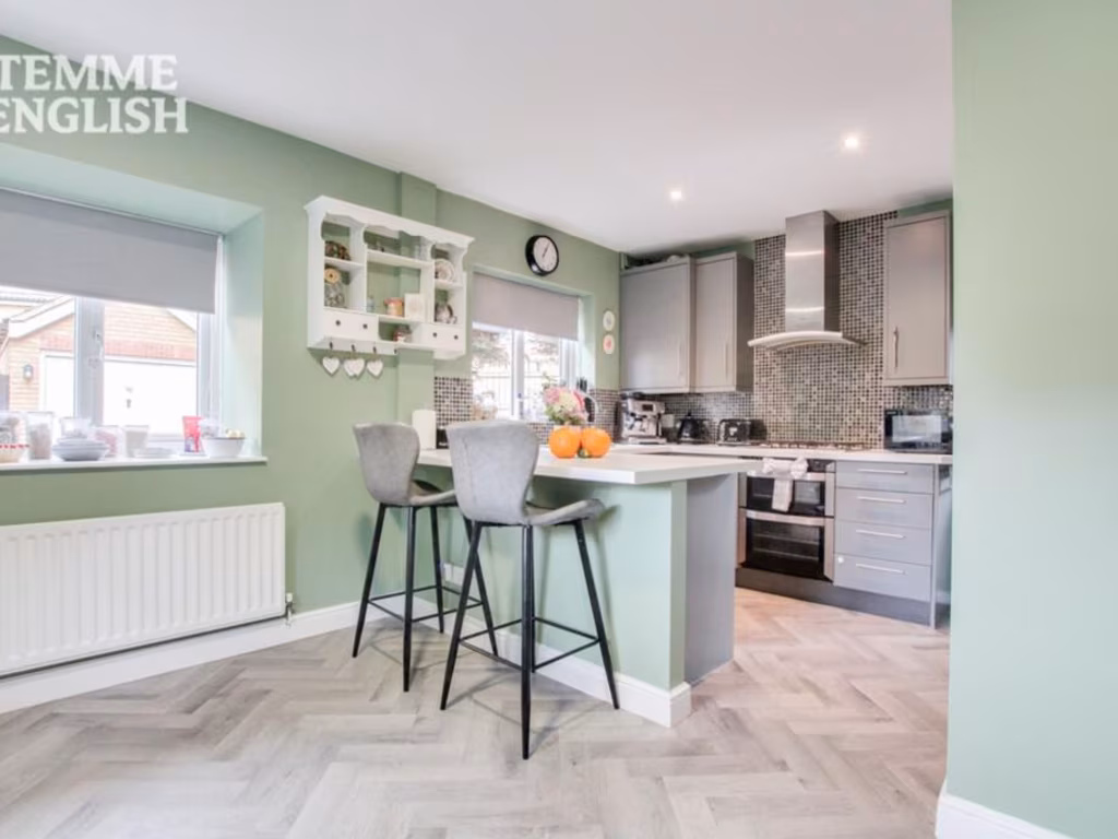
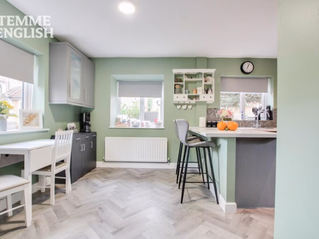
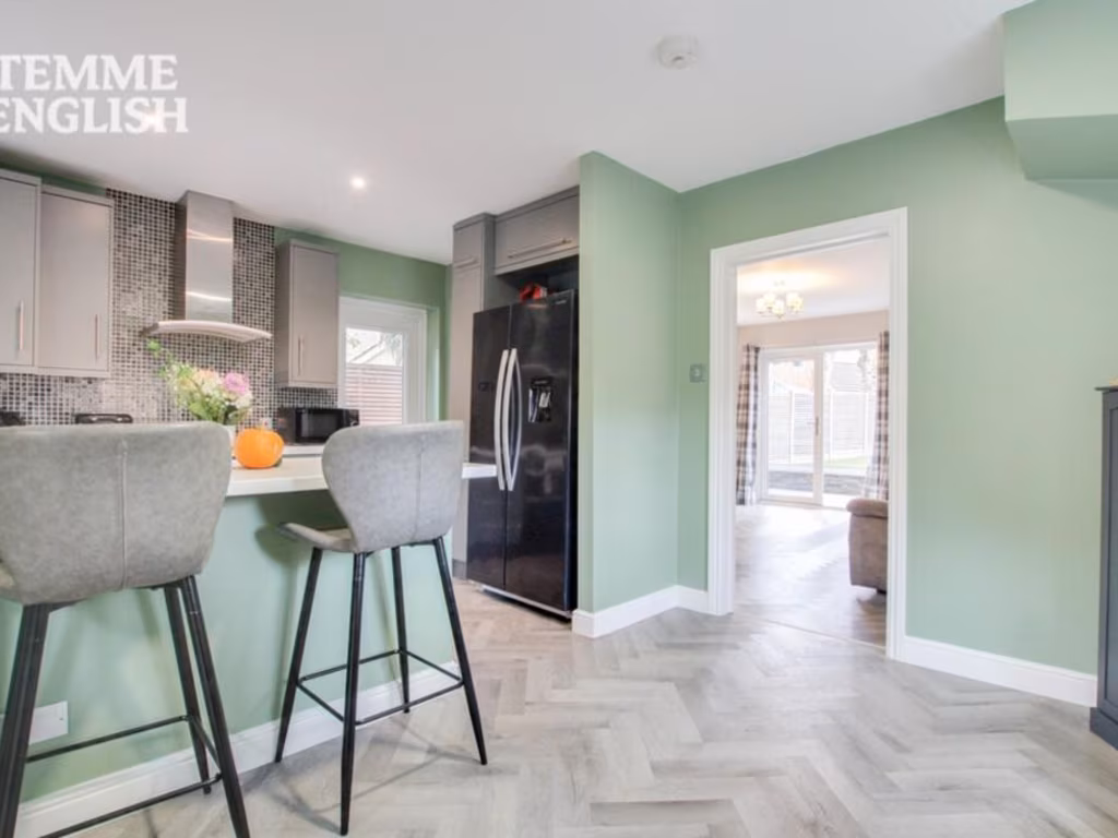
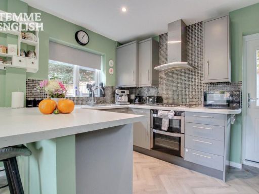
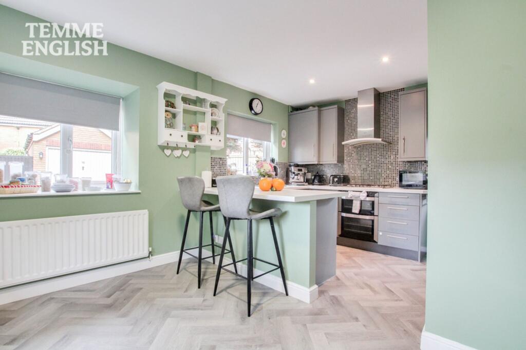
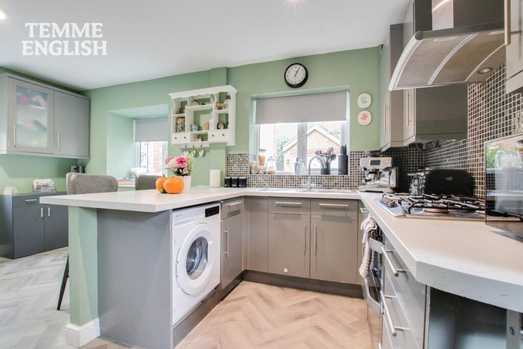
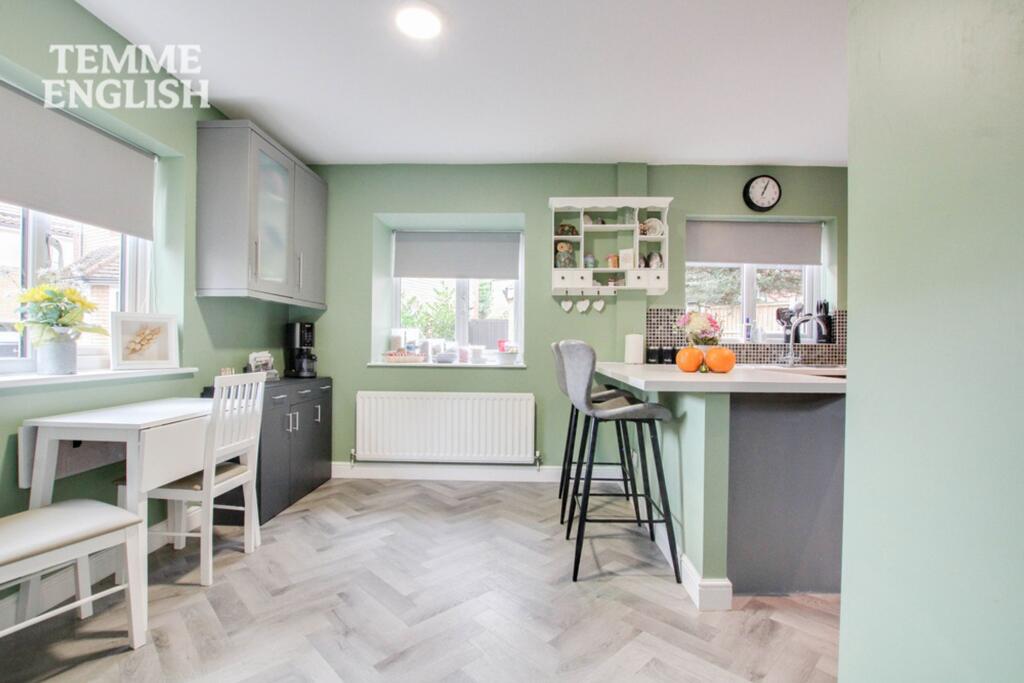
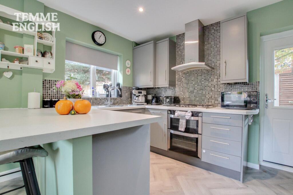
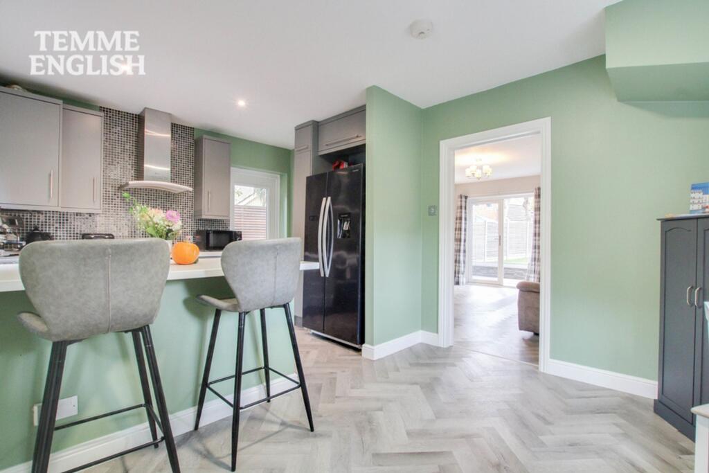
- kitchen contemporary
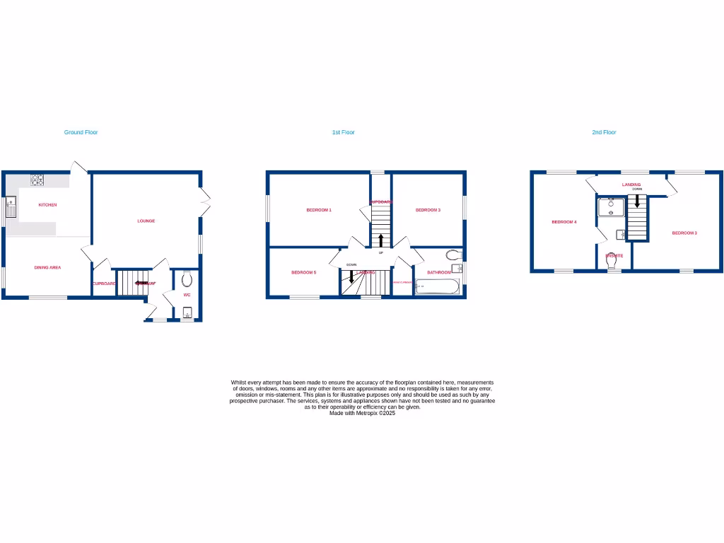
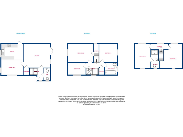
Rooms
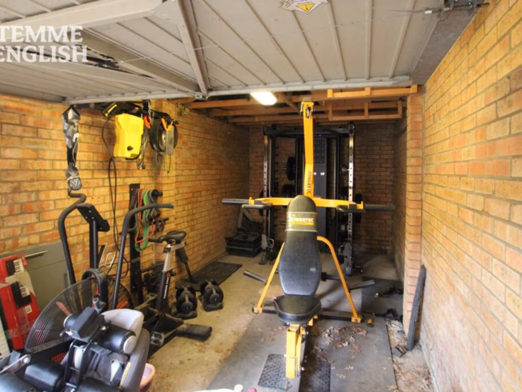
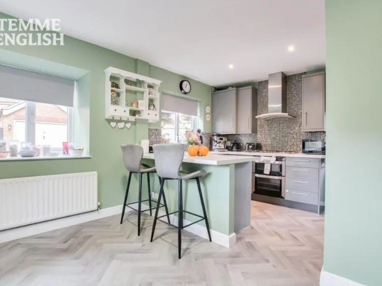
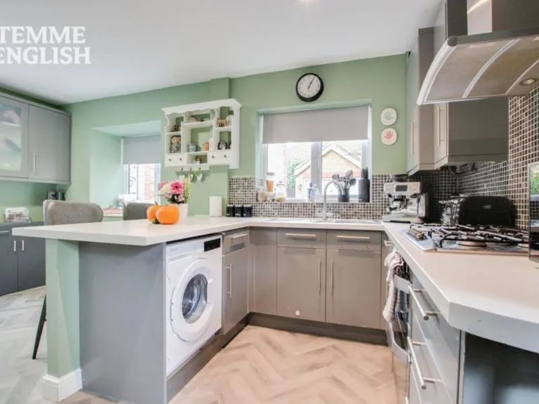
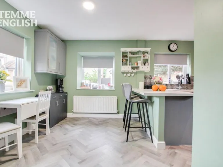
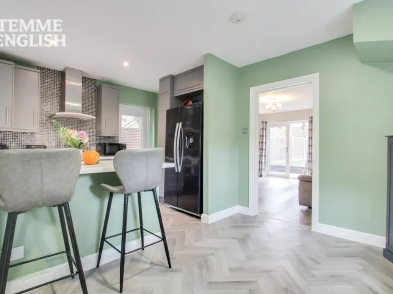
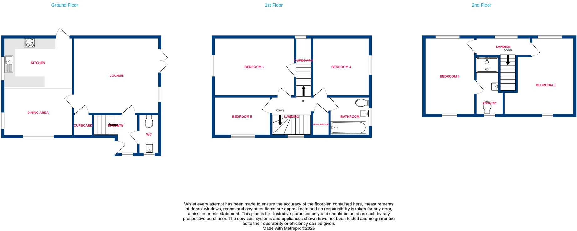
- KITCHEN:
- DINING AREA:
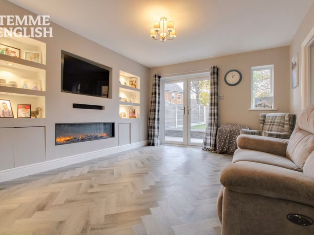
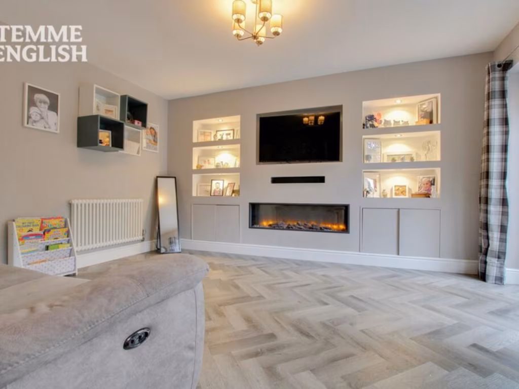
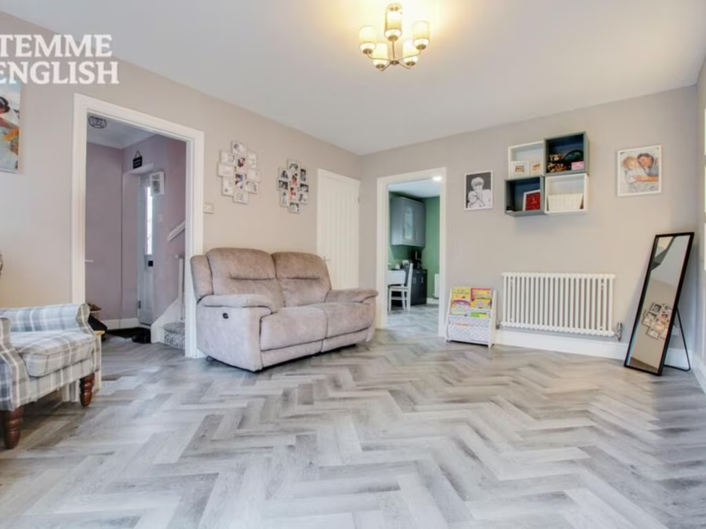
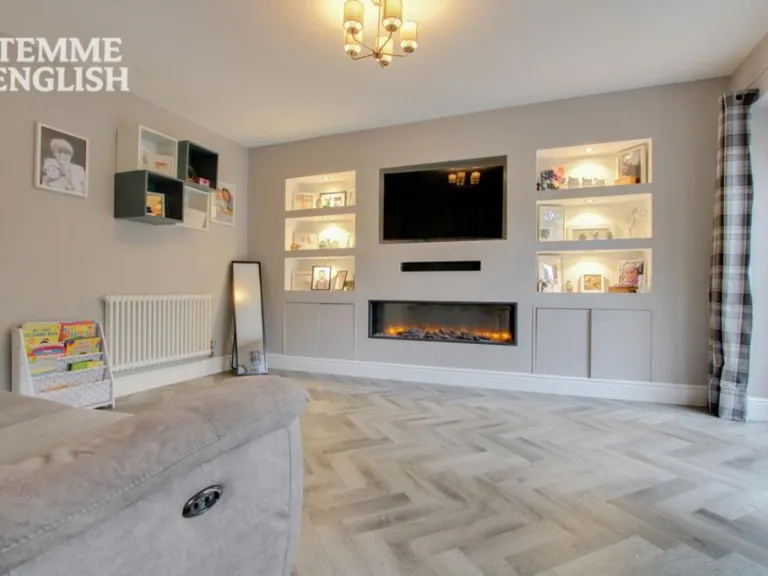
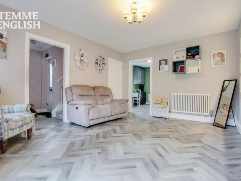
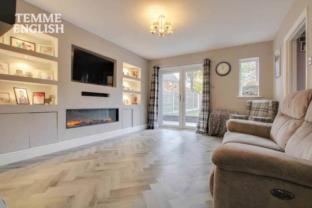
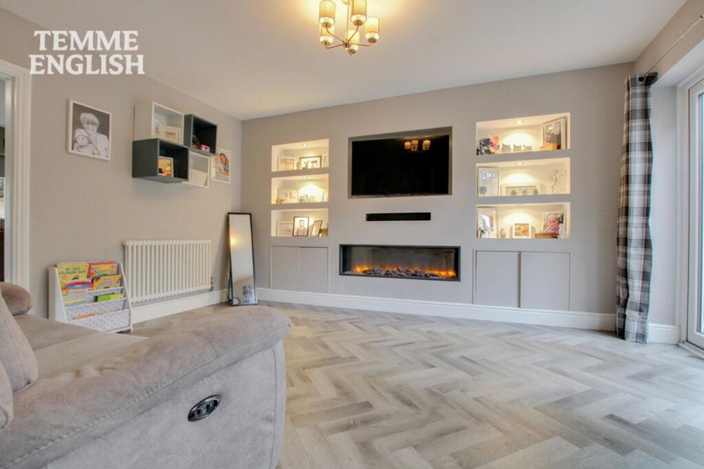
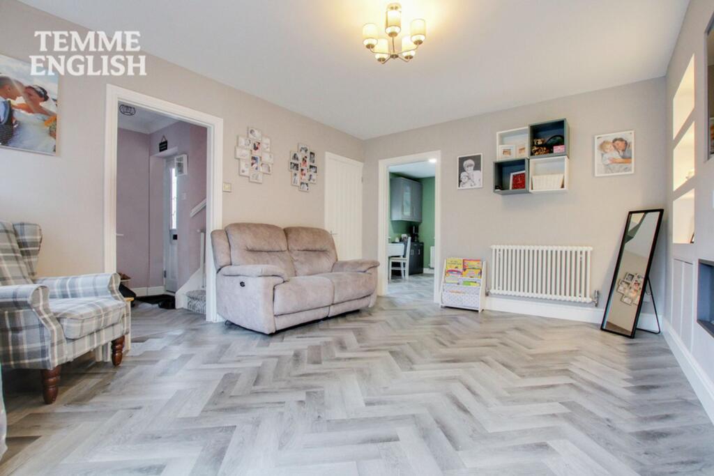
- LOUNGE:
- CUPBOARD:
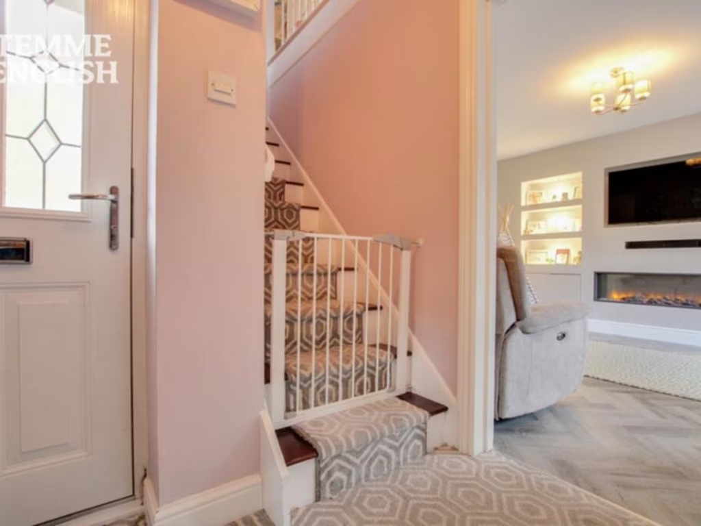
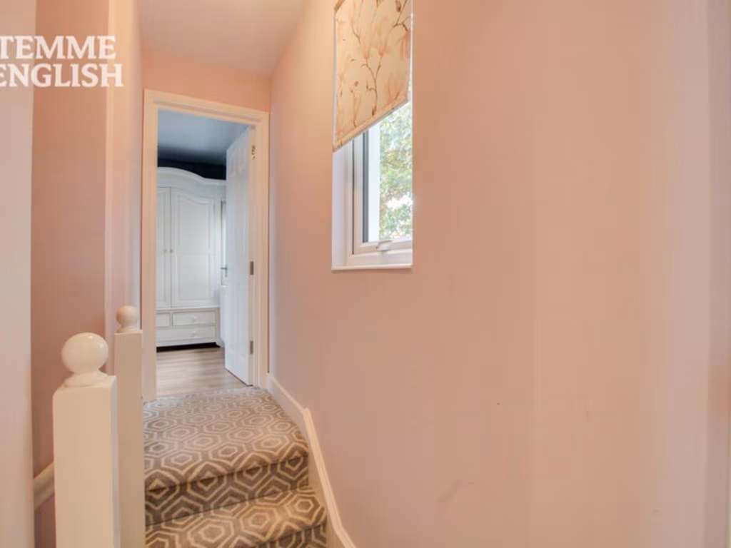
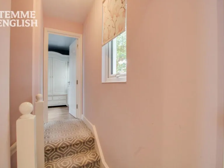
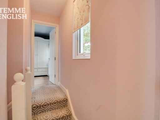
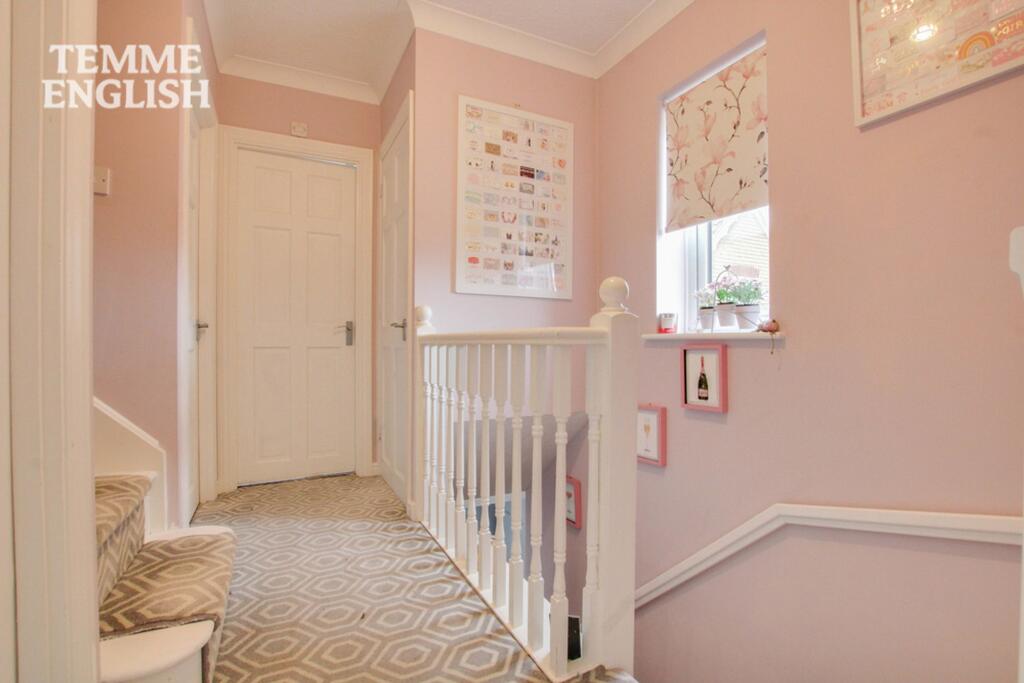
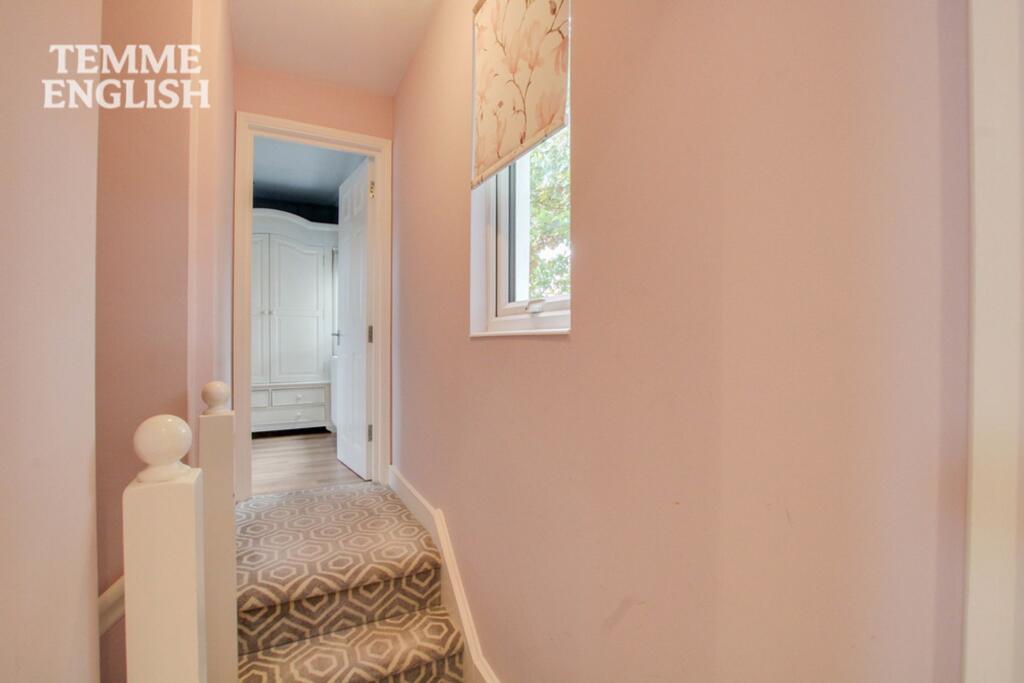
- HALLWAY:
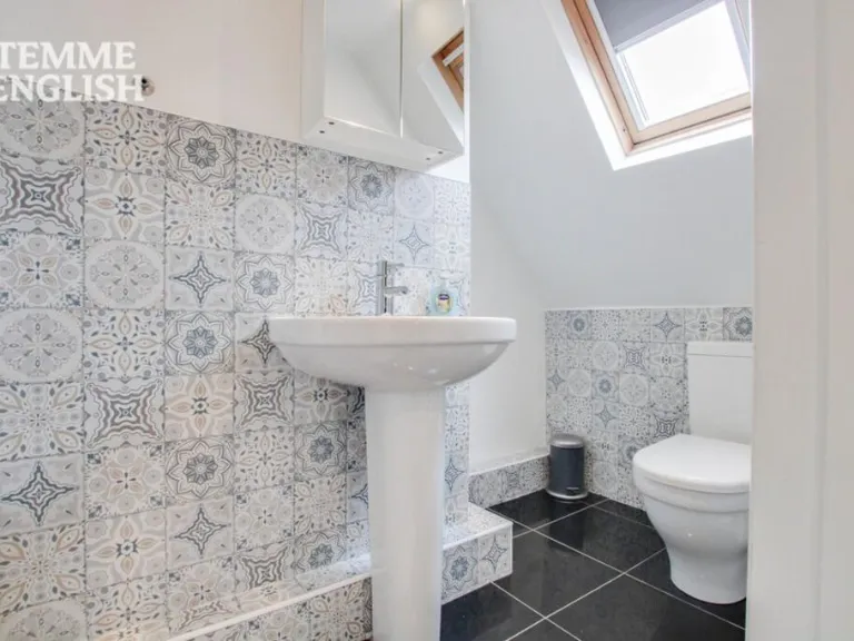
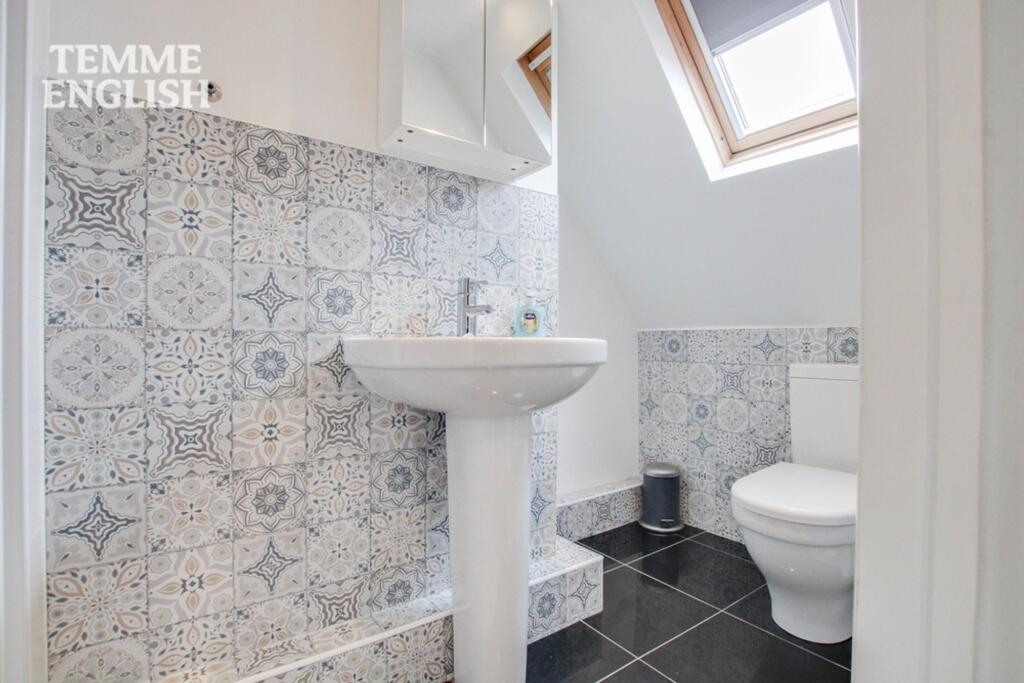
- WC:
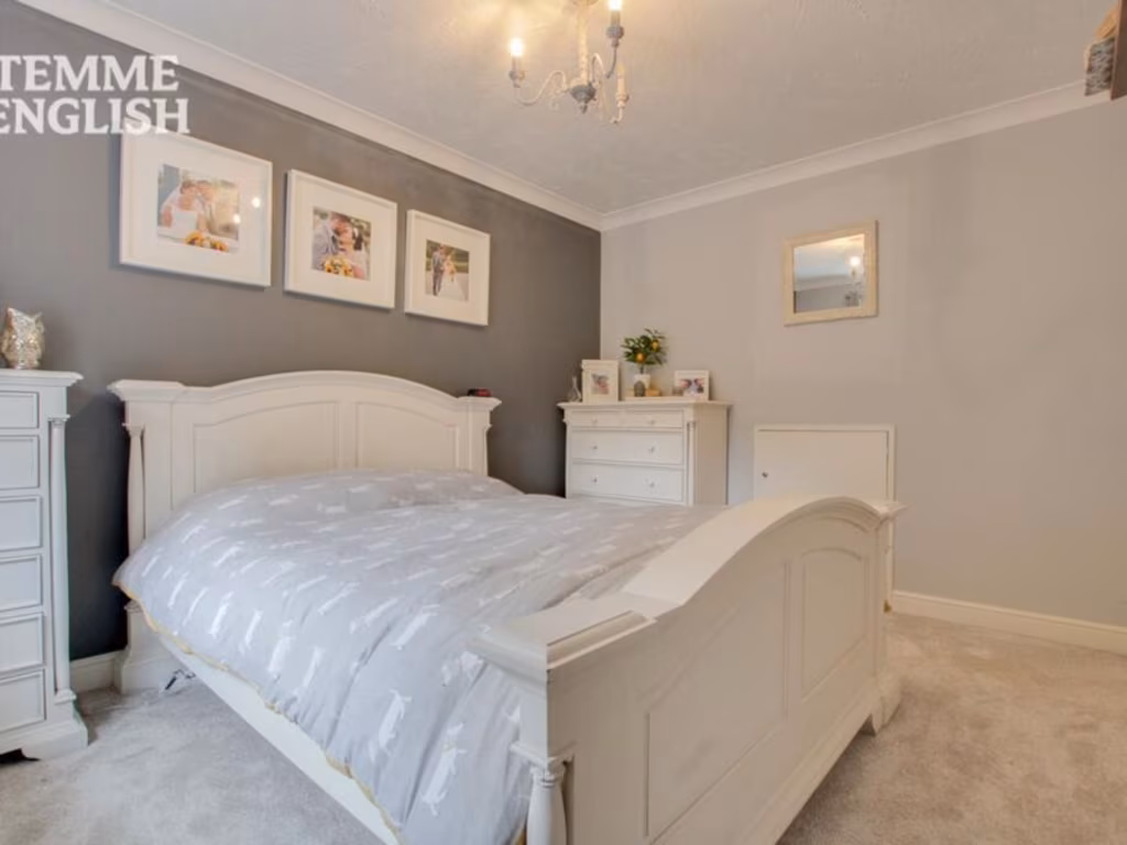
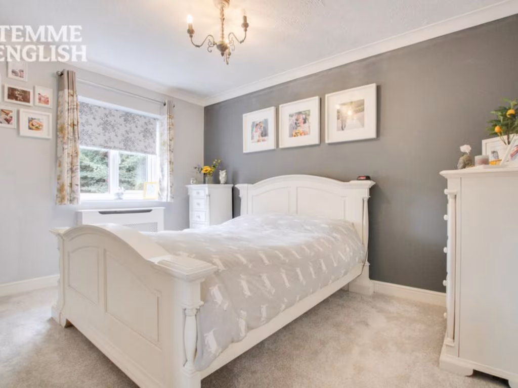
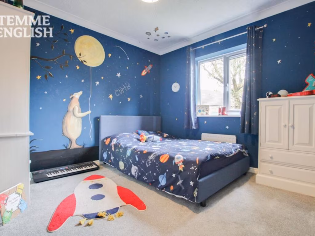
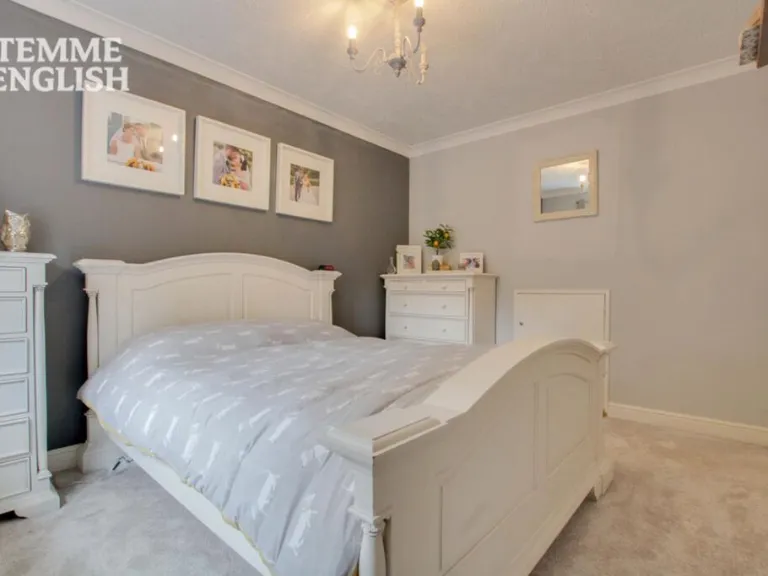
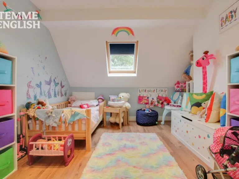
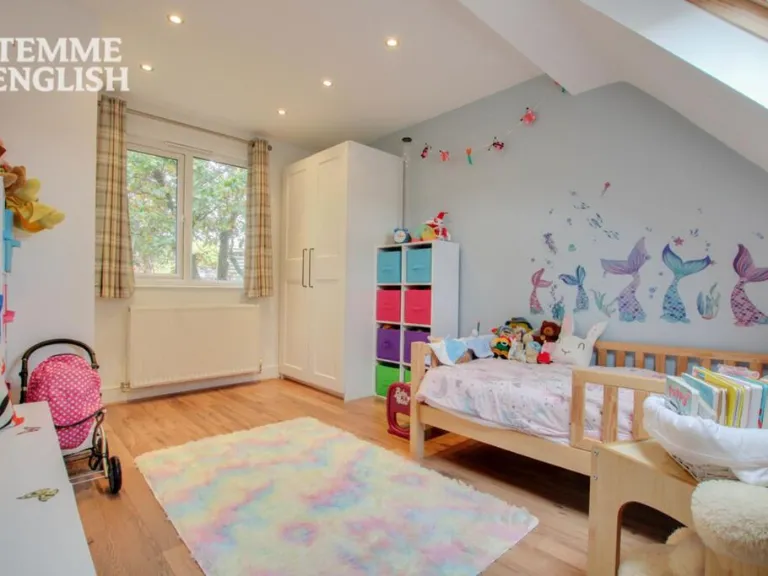
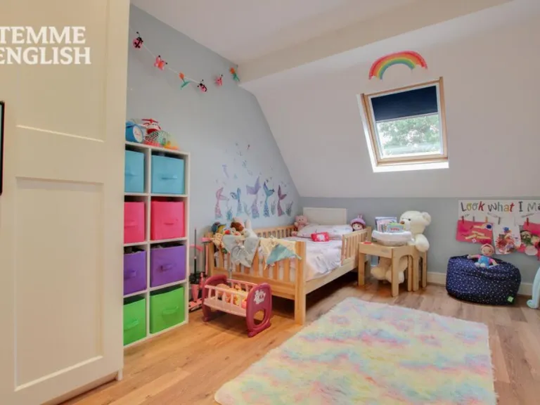
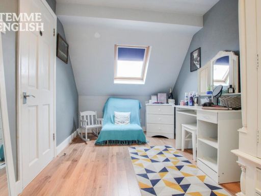
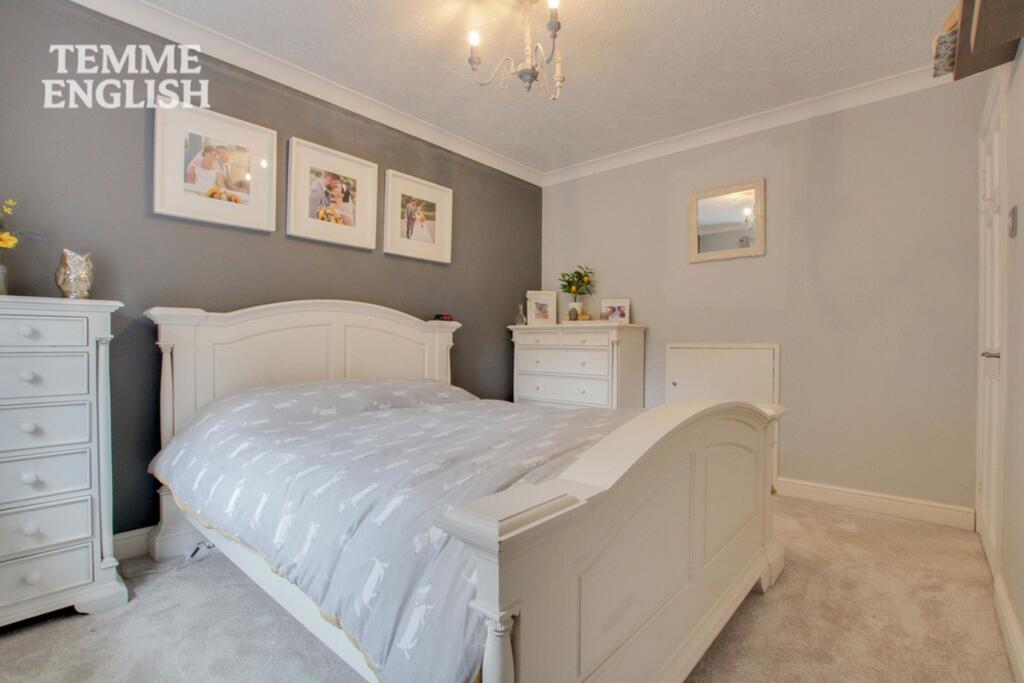
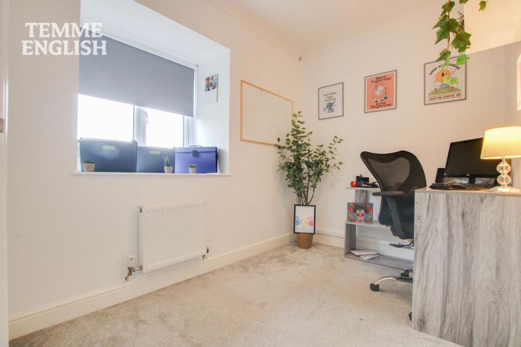
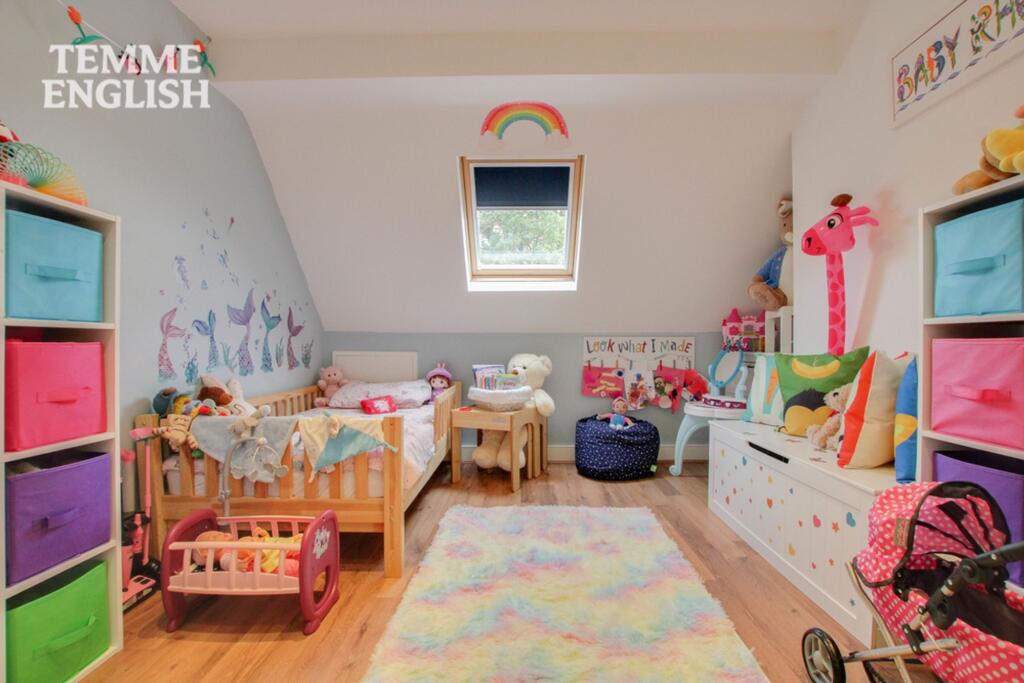
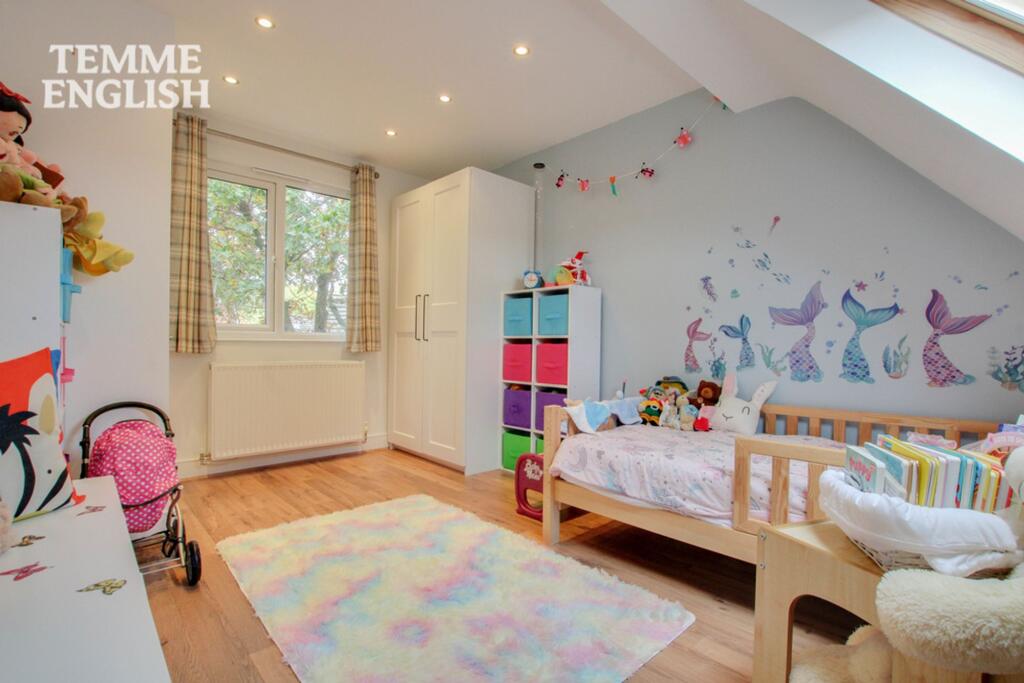
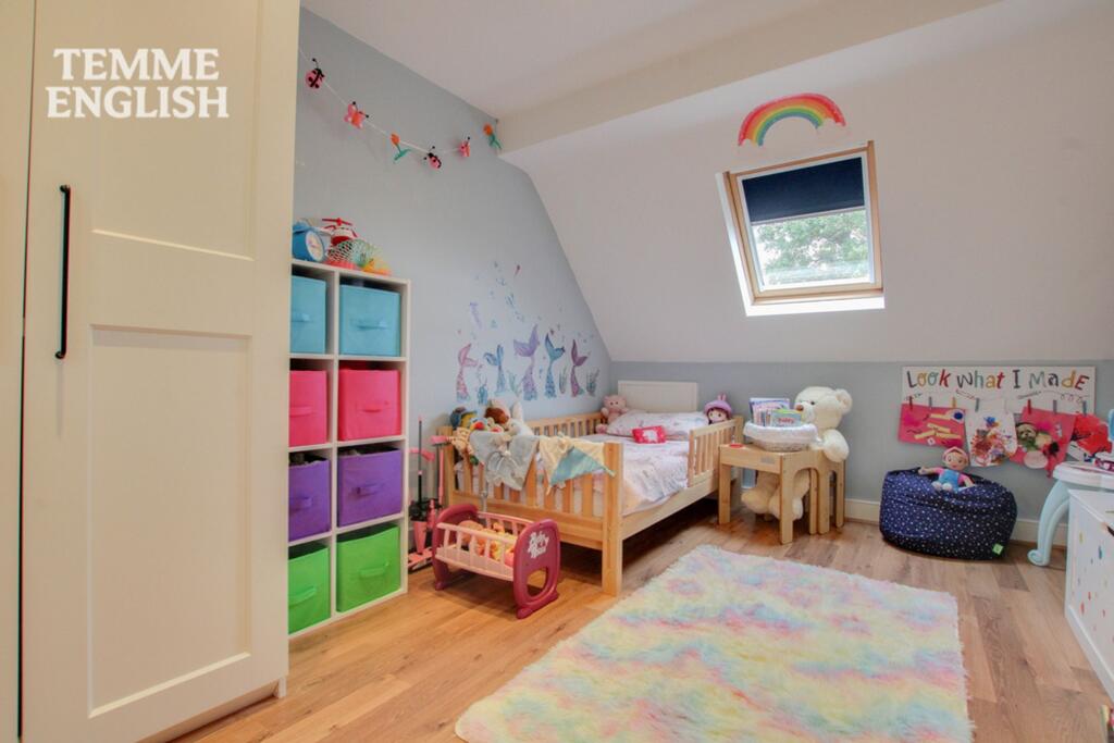
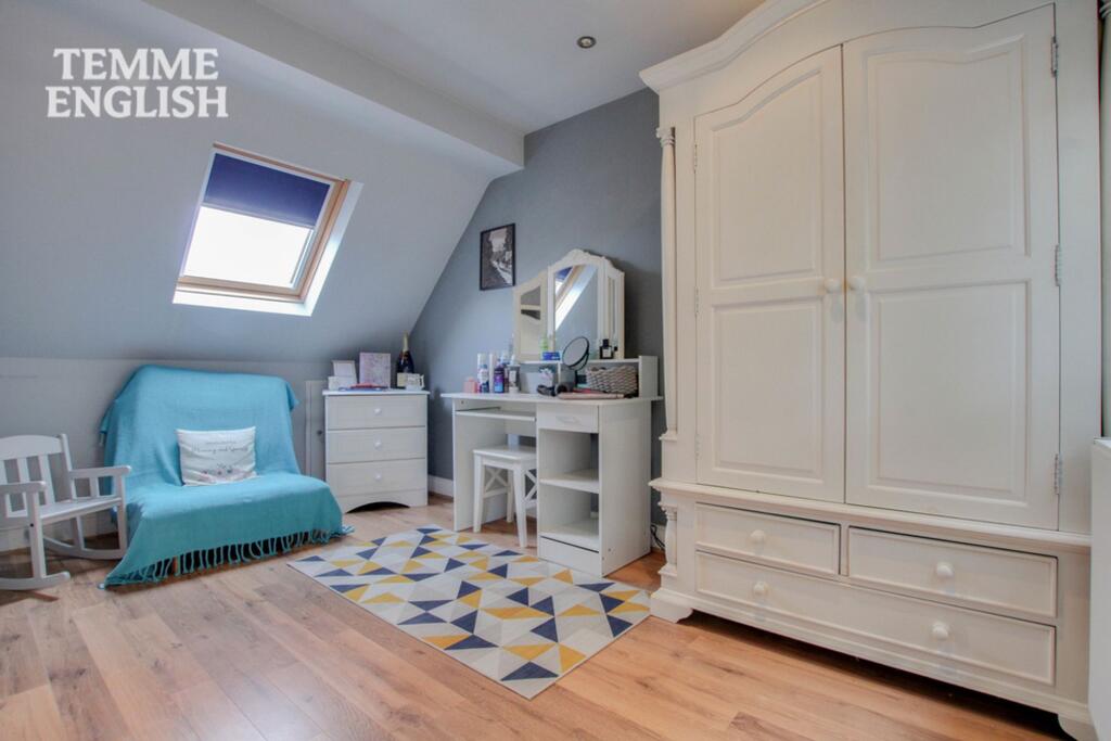
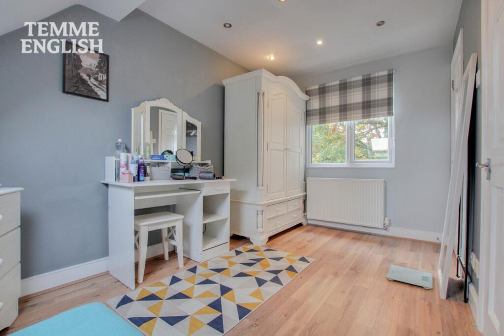
- BEDROOM 1:
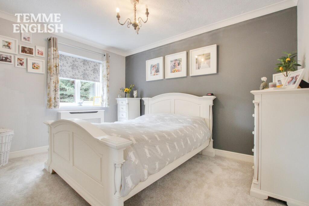
- BEDROOM 3:
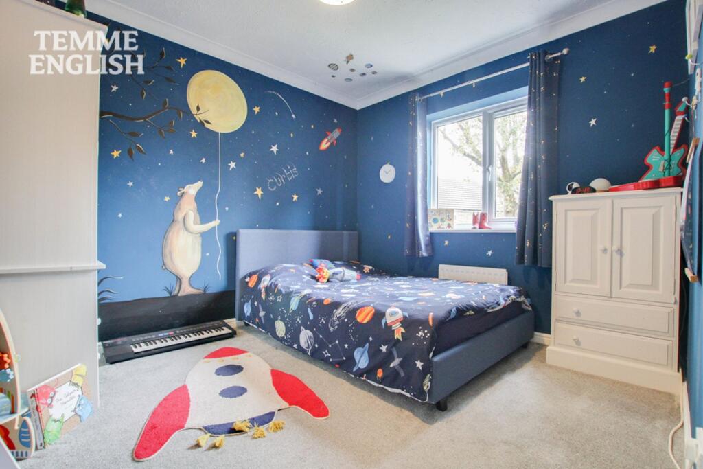
- BEDROOM 5:
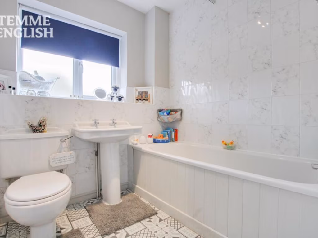
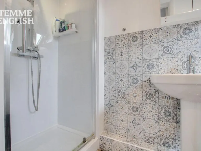
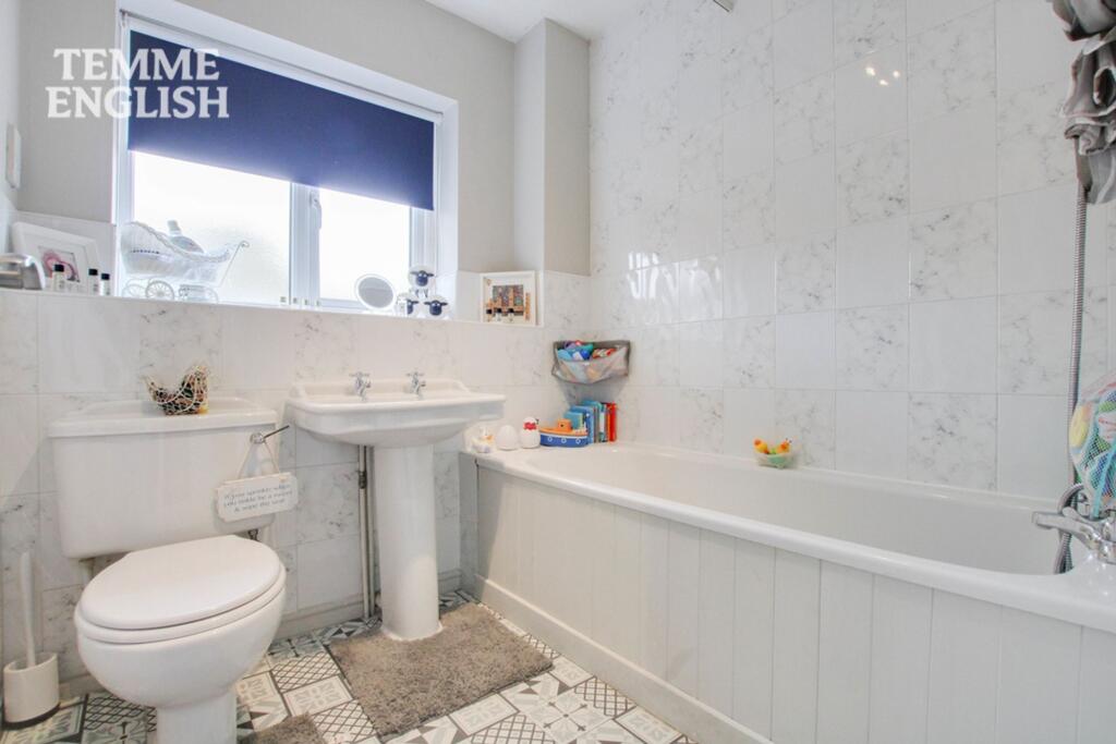
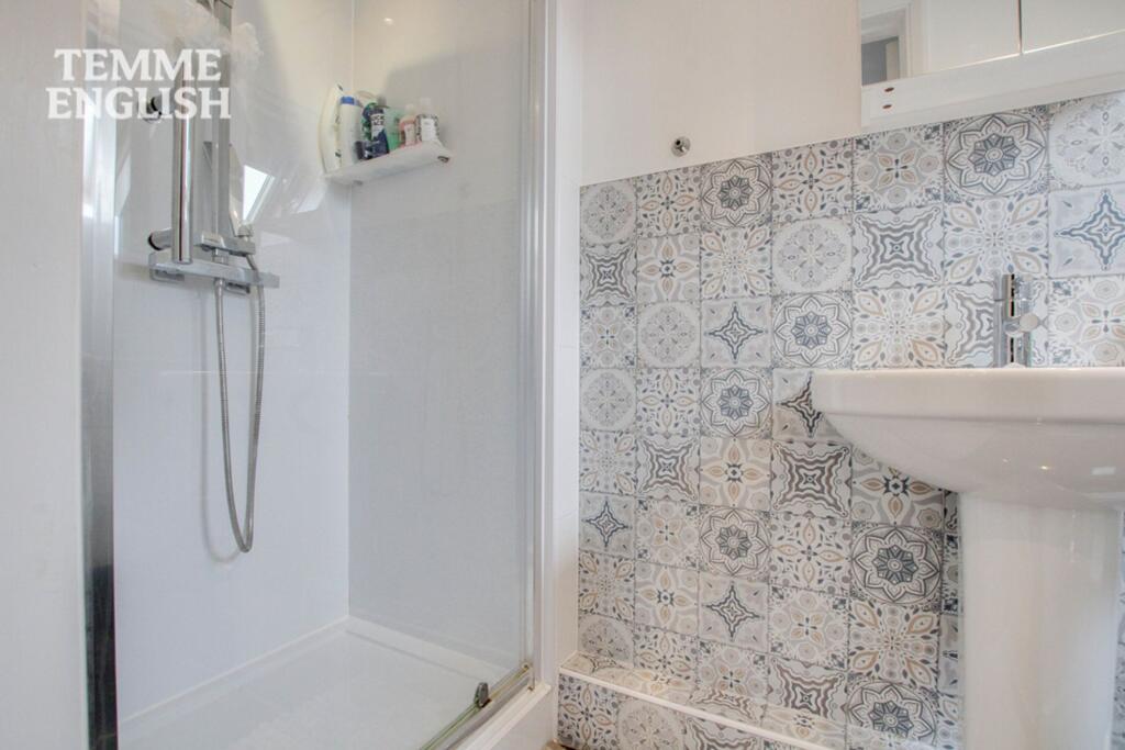
- BATHROOM:
- LANDING:
- BEDROOM 4:
- BEDROOM 3:
- ENSUITE:
- LANDING:
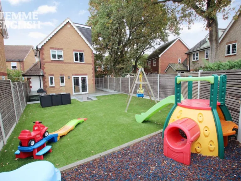
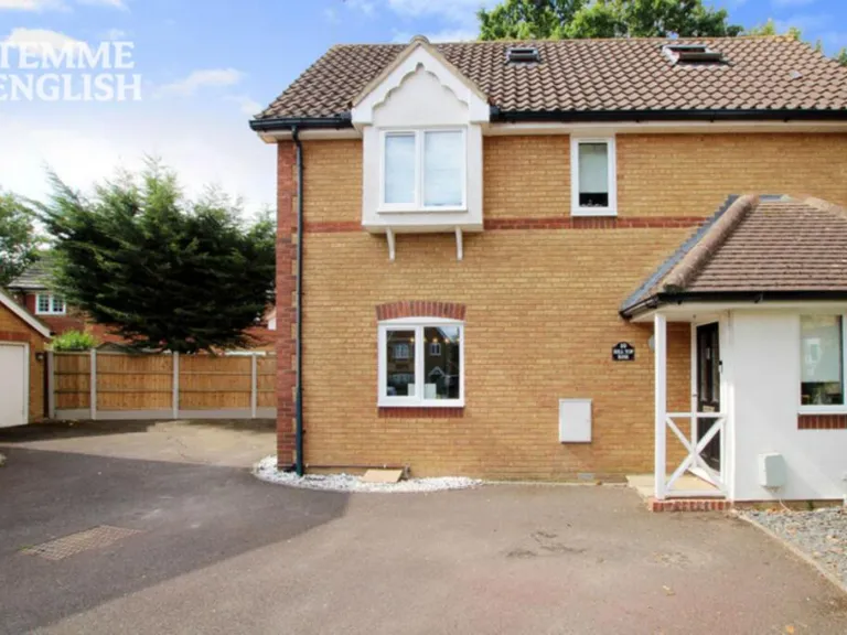
Textual Property Features
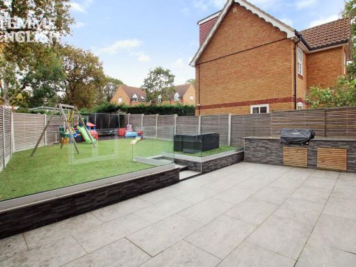
Detected Visual Features
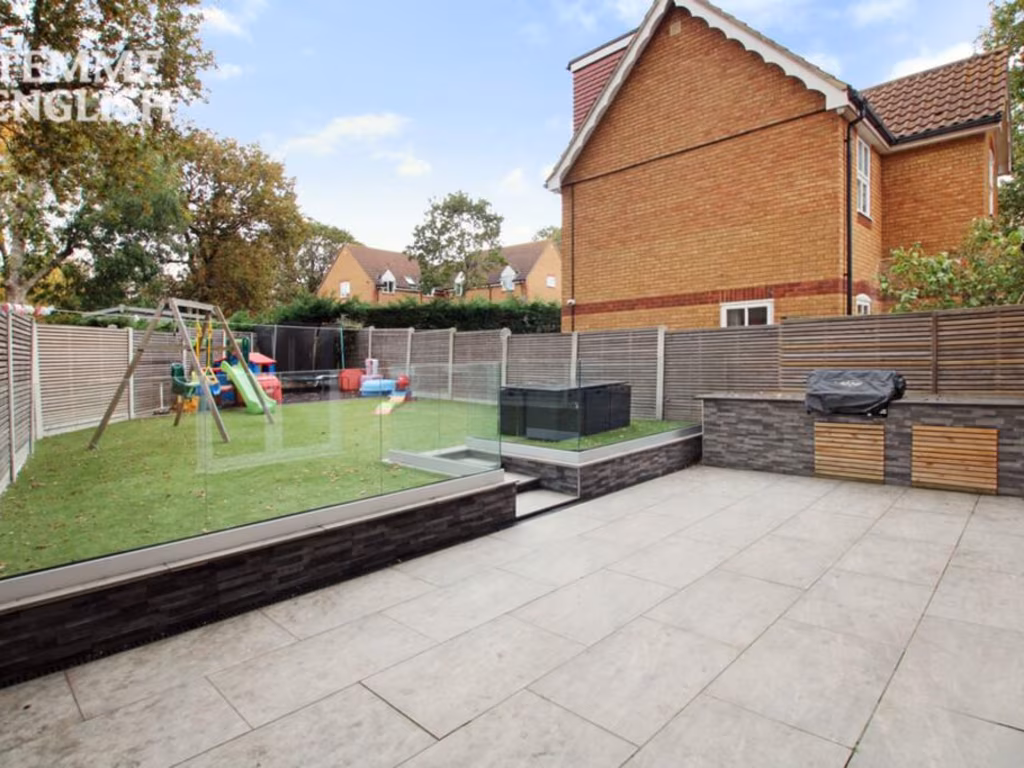
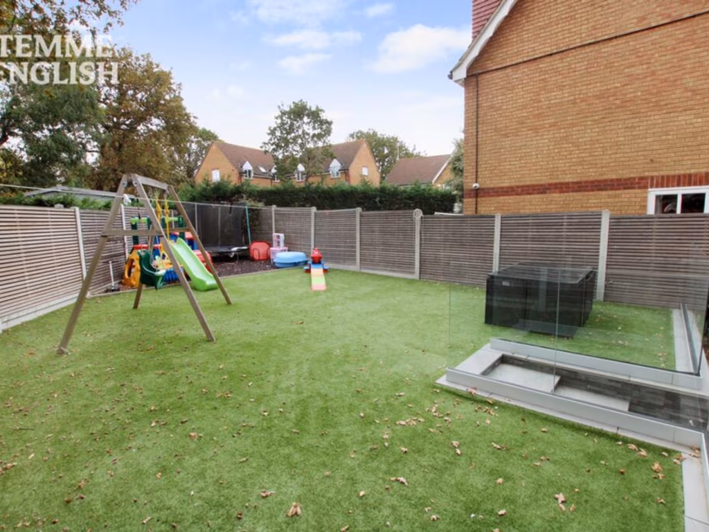
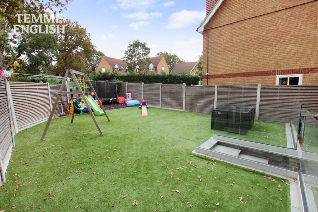
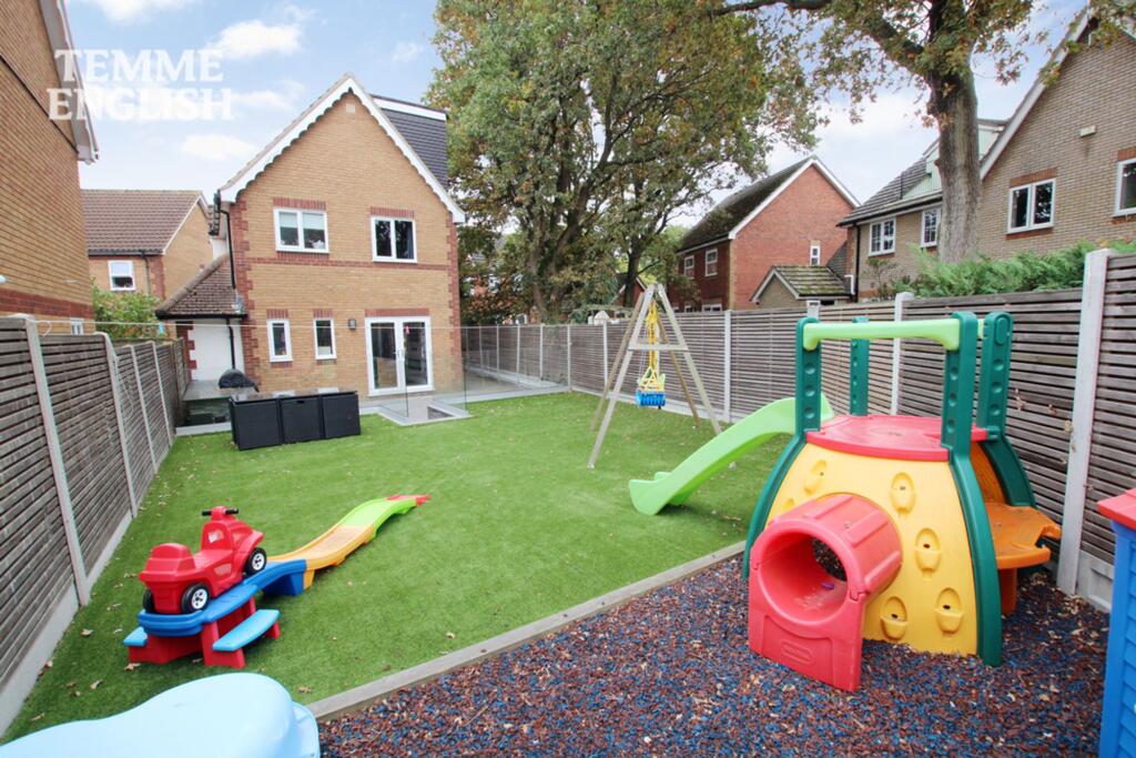
- modern
- detached house
- three-storey
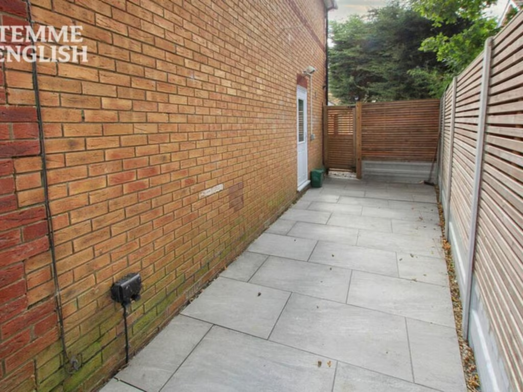
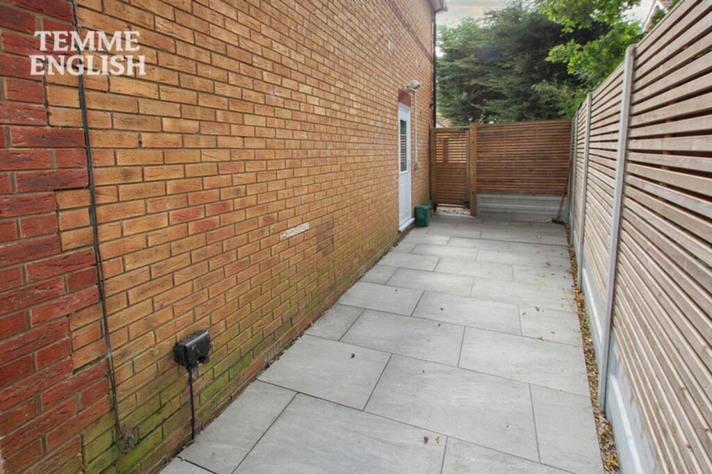
- brick exterior
- gabled roof
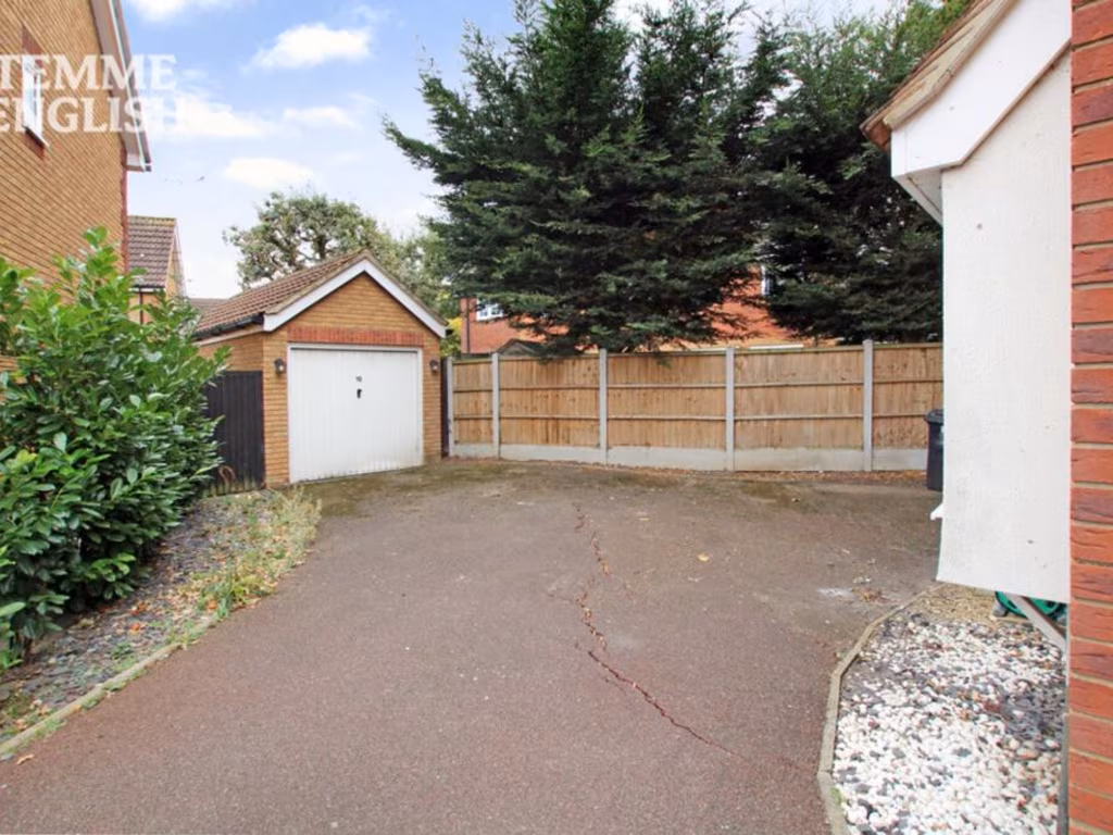
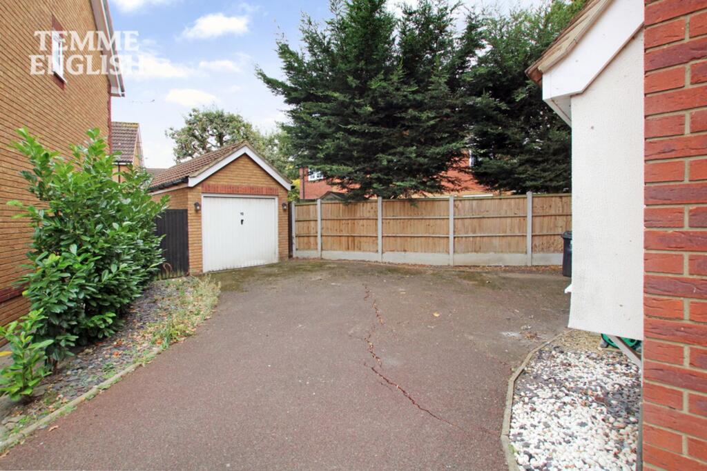
- private driveway
- residential area
- family home
- modern kitchen
- grey cabinets
- breakfast bar
- tiled backsplash
- spotlights
- herringbone floor
EPC Details
- Fully double glazed
- Cavity wall, as built, insulated (assumed)
- Boiler and radiators, mains gas
- Low energy lighting in 20% of fixed outlets
- Solid, limited insulation (assumed)
Nearby Schools
- Horndon-On-the-Hill CofE Primary School
- Bulphan Church of England Academy
- Lee Chapel Primary School
- Merrylands Primary School
- West Horndon Primary School
- South Green Junior School
- Ortu Hassenbrook Academy
- Arthur Bugler Primary School
- Graham James Primary Academy
- Giffards Primary School
- Ortu Gable Hall School
- Great Berry Primary School
- The James Hornsby School
- South Green Infant School
- Quilters Infant School
- Stanford-Le-Hope Primary School
- St Joseph's Catholic Primary School
- Abbots Hall Primary School
- Woodlands School
- Millhouse Primary School
- Laindon Park Primary School & Nursery
- Noak Bridge Primary School
- The Billericay School
- St Clere's School
- St Anne Line Catholic Junior School
- Janet Duke Primary School
- The Phoenix Primary School
Nearest Bars And Restaurants
- Id: 498961348
- Tags:
- Amenity: pub
- Building: yes
- Name: Plough & Tractor
- TagsNormalized:
- Lat: 51.5726349
- Lon: 0.4420356
- FullGeoHash: u10m6h9bk5vw
- PartitionGeoHash: u10m
- Images:
- FoodStandards: null
- Distance: 3044
,- Id: 246291822
- Tags:
- Amenity: fast_food
- Brand: McDonald's
- Brand:wikidata: Q38076
- Brand:wikipedia: en:McDonald's
- Building: yes
- Contact:
- Website: https://www.mcdonalds.com/gb/en-gb/location/laindon/laindon/fortune-of-war-roundabout/8261143.html
- Cuisine: burger
- Drive_through: yes
- Name: McDonald's
- Takeaway: yes
- TagsNormalized:
- fast food
- food
- mcdonalds
- burgers
- drive through
- takeaway
- Lat: 51.5842189
- Lon: 0.4240913
- FullGeoHash: u10m3wsgf537
- PartitionGeoHash: u10m
- Images:
- FoodStandards: null
- Distance: 2866.6
,- Id: 29011539
- Tags:
- Amenity: restaurant
- Name: Friern Manor
- Source: npe
- TagsNormalized:
- Lat: 51.5779615
- Lon: 0.3896688
- FullGeoHash: u10m2v7xruyh
- PartitionGeoHash: u10m
- Images:
- FoodStandards: null
- Distance: 1852.2
,- Id: 617885085
- Tags:
- Amenity: restaurant
- Brand: Miller & Carter
- Brand:wikidata: Q87067401
- Building: yes
- Cuisine: steak
- Name: Miller & Carter
- TagsNormalized:
- restaurant
- miller & carter
- Lat: 51.5541235
- Lon: 0.4227935
- FullGeoHash: u10m395uec1t
- PartitionGeoHash: u10m
- Images:
- FoodStandards: null
- Distance: 1796.7
,- Id: 618748343
- Tags:
- Amenity: pub
- Brand: Hungry Horse
- Brand:wikidata: Q5943510
- Brand:wikipedia: en:Hungry Horse
- Building: yes
- Contact:
- Website: https://www.hungryhorse.co.uk/pubs/essex/four-seasons/
- Name: Hungry Horse
- TagsNormalized:
- Lat: 51.5755058
- Lon: 0.4108764
- FullGeoHash: u10m3m51n55e
- PartitionGeoHash: u10m
- Images:
- FoodStandards: null
- Distance: 1567.7
}
Nearest General Shops
- Id: 9379645239
- Tags:
- Addr:
- City: Basildon
- Housename: Barn Mews
- Postcode: SS15 4DB
- Street: Dunton Road
- Name: Barn Mews Well-Being Clinic
- Shop: massage
- TagsNormalized:
- Lat: 51.5885317
- Lon: 0.4190509
- FullGeoHash: u10m3x3hux6f
- PartitionGeoHash: u10m
- Images:
- FoodStandards: null
- Distance: 3119.7
,- Id: 892414780
- Tags:
- TagsNormalized:
- Lat: 51.5483597
- Lon: 0.3651861
- FullGeoHash: u10m221fvqwr
- PartitionGeoHash: u10m
- Images:
- FoodStandards: null
- Distance: 2948.4
,- Id: 892412814
- Tags:
- Building: yes
- Shop: laundry
- TagsNormalized:
- Lat: 51.5483756
- Lon: 0.3653192
- FullGeoHash: u10m2245099w
- PartitionGeoHash: u10m
- Images:
- FoodStandards: null
- Distance: 2939.7
}
Nearest Grocery shops
- Id: 6594427575
- Tags:
- Addr:
- Housenumber: 16A
- Street: Woolmer Green
- Air_conditioning: yes
- Name: Trinity Food and Wine
- Opening_hours: Mo-Sa 06:00-18:00
- Payment:
- Cards: yes
- Cash: yes
- Coins: yes
- Credit_cards: yes
- Debit_cards: yes
- Mastercard: yes
- Notes: yes
- Visa: yes
- Visa_debit: yes
- Shop: supermarket
- TagsNormalized:
- Lat: 51.5754393
- Lon: 0.4380948
- FullGeoHash: u10m3vp08qep
- PartitionGeoHash: u10m
- Images:
- FoodStandards: null
- Distance: 2927
,- Id: 9568587004
- Tags:
- TagsNormalized:
- Lat: 51.5797818
- Lon: 0.4186205
- FullGeoHash: u10m3tbf484p
- PartitionGeoHash: u10m
- Images:
- FoodStandards: null
- Distance: 2246.5
,- Id: 271215677
- Tags:
- Amenity: post_office
- Brand: McColl's
- Brand:wikidata: Q16997477
- Shop: convenience
- TagsNormalized:
- office
- post office
- mccolls
- convenience
- shop
- Lat: 51.5614971
- Lon: 0.4211918
- FullGeoHash: u10m3d6xqrxq
- PartitionGeoHash: u10m
- Images:
- FoodStandards: null
- Distance: 1409.9
}
Nearest Religious buildings
- Id: 500212442
- Tags:
- Amenity: place_of_worship
- Building: yes
- Denomination: methodist
- Name: Langdon Hills Methodist Church
- Religion: christian
- Source: OS OpenMap Local
- TagsNormalized:
- place of worship
- methodist
- church
- christian
- Lat: 51.5643686
- Lon: 0.4227333
- FullGeoHash: u10m3e5b4quz
- PartitionGeoHash: u10m
- Images:
- FoodStandards: null
- Distance: 1518
,- Id: 10096459527
- Tags:
- Amenity: community_centre
- Name: Saint Mary's Church Hall
- TagsNormalized:
- community centre
- church
- church hall
- Lat: 51.5616651
- Lon: 0.4215289
- FullGeoHash: u10m3ddbqr48
- PartitionGeoHash: u10m
- Images:
- FoodStandards: null
- Distance: 1431.3
,- Id: 149862160
- Tags:
- Amenity: place_of_worship
- Denomination: anglican
- Name: St John, Great Berry
- Religion: christian
- Wikidata: Q105083652
- TagsNormalized:
- place of worship
- anglican
- christian
- church
- Lat: 51.5641212
- Lon: 0.4049601
- FullGeoHash: u10m34yyu2bh
- PartitionGeoHash: u10m
- Images:
- FoodStandards: null
- Distance: 314.1
}
Nearest Medical buildings
- Id: 498961344
- Tags:
- Addr:
- City: Basildon
- Housenumber: 188-190
- Postcode: SS15 5NG
- Street: Great Knightleys
- Amenity: dentist
- Building: yes
- Healthcare: dentist
- Name: Great Knightleys Dental Care
- Opening_hours: Mo, Th 09:00-13:00, 14:00-19:00; Tu-We, Fr 09:00-13:00, 14:00-17:00; Sa 09:00-15:00; Su off
- Operator: Southern Dental
- Phone: +44 1268 541966
- Wheelchair: yes
- TagsNormalized:
- dentist
- health
- healthcare
- dental
- Lat: 51.5724748
- Lon: 0.4411914
- FullGeoHash: u10m6h3r2w05
- PartitionGeoHash: u10m
- Images:
- FoodStandards: null
- Distance: 2983.1
,- Id: 621735410
- Tags:
- Amenity: doctors
- Building: yes
- Healthcare: doctor
- Name: Knights Surgery
- Operator: NHS
- TagsNormalized:
- doctor
- doctors
- health
- healthcare
- surgery
- Lat: 51.5757138
- Lon: 0.4367081
- FullGeoHash: u10m3vn421ch
- PartitionGeoHash: u10m
- Images:
- FoodStandards: null
- Distance: 2858.4
,- Id: 612321698
- Tags:
- Amenity: hospital
- Healthcare: hospital
- Name: Laindon Health Centre
- TagsNormalized:
- hospital
- health
- healthcare
- health centre
- Lat: 51.5732518
- Lon: 0.4233551
- FullGeoHash: u10m3ss7byuq
- PartitionGeoHash: u10m
- Images:
- FoodStandards: null
- Distance: 1935.7
,- Id: 500212445
- Tags:
- Amenity: hospital
- Healthcare: hospital
- Name: Oaklands Nursing Home
- Source: OS OpenMap Local
- TagsNormalized:
- hospital
- health
- healthcare
- nursing home
- Lat: 51.5641831
- Lon: 0.4043534
- FullGeoHash: u10m34yrnh7t
- PartitionGeoHash: u10m
- Images:
- FoodStandards: null
- Distance: 280.9
}
Nearest Airports
- Id: 121158889
- Tags:
- Aerodrome: continental
- Aeroway: aerodrome
- Fhrs:
- Authority: City of London Corporation
- Iata: LCY
- Icao: EGLC
- Name: London City Airport
- Operator: London City Airport Limited
- Ref: LCY
- Website: https://www.londoncityairport.com/
- Wikidata: Q8982
- Wikipedia: en:London City Airport
- TagsNormalized:
- airport
- continental airport
- Lat: 51.5042658
- Lon: 0.0539987
- FullGeoHash: u10j10p64702
- PartitionGeoHash: u10j
- Images:
- FoodStandards: null
- Distance: 24863.9
,- Id: 103894219
- Tags:
- Aerodrome: international
- Aeroway: aerodrome
- Iata: SEN
- Icao: EGMC
- Name: London Southend Airport
- Old_name: Southend Municipal Airport
- Ref: SEN
- Wikidata: Q1415441
- TagsNormalized:
- airport
- international airport
- Lat: 51.5701749
- Lon: 0.6924624
- FullGeoHash: u10mru04p937
- PartitionGeoHash: u10m
- Images:
- FoodStandards: null
- Distance: 20168.4
}
Nearest Leisure Facilities
- Id: 617665918
- Tags:
- Leisure: pitch
- Sport: tennis
- Surface: asphalt
- TagsNormalized:
- Lat: 51.5635449
- Lon: 0.4142631
- FullGeoHash: u10m36vemj2y
- PartitionGeoHash: u10m
- Images:
- FoodStandards: null
- Distance: 926.3
,- Id: 617665919
- Tags:
- Leisure: pitch
- Sport: basketball
- Surface: asphalt
- TagsNormalized:
- pitch
- leisure
- basketball
- sports
- Lat: 51.5634941
- Lon: 0.4139417
- FullGeoHash: u10m36v7jecr
- PartitionGeoHash: u10m
- Images:
- FoodStandards: null
- Distance: 903.7
,- Id: 617665920
- Tags:
- TagsNormalized:
- Lat: 51.5633335
- Lon: 0.4135087
- FullGeoHash: u10m36v45qn3
- PartitionGeoHash: u10m
- Images:
- FoodStandards: null
- Distance: 872.6
,- Id: 617665935
- Tags:
- TagsNormalized:
- Lat: 51.5648973
- Lon: 0.406901
- FullGeoHash: u10m370733x3
- PartitionGeoHash: u10m
- Images:
- FoodStandards: null
- Distance: 473
,- Id: 139262845
- Tags:
- TagsNormalized:
- Lat: 51.5655203
- Lon: 0.4046551
- FullGeoHash: u10m35nwvjsw
- PartitionGeoHash: u10m
- Images:
- FoodStandards: null
- Distance: 394.7
}
Nearest Tourist attractions
- Id: 122458146
- Tags:
- Addr:
- Country: GB
- Postcode: SS17 9NR
- Street: High Road
- Building: yes
- Fhrs:
- Name: The Haywain
- Tourism: motel
- TagsNormalized:
- Lat: 51.550828
- Lon: 0.4667812
- FullGeoHash: u10m68eckfc7
- PartitionGeoHash: u10m
- Images:
- FoodStandards:
- Id: 104867
- FHRSID: 104867
- LocalAuthorityBusinessID: 3588
- BusinessName: The Haywain
- BusinessType: Hotel/bed & breakfast/guest house
- BusinessTypeID: 7842
- AddressLine1: null
- AddressLine2: High Road
- AddressLine3: Fobbing, Stanford-Le-Hope
- AddressLine4: Essex
- PostCode: SS17 9NR
- RatingValue: 5
- RatingKey: fhrs_5_en-GB
- RatingDate: 2021-07-29
- LocalAuthorityCode: 109
- LocalAuthorityName: Basildon
- LocalAuthorityWebSite: http://www.basildon.gov.uk
- LocalAuthorityEmailAddress: ehs@basildon.gov.uk
- Scores:
- Hygiene: 0
- Structural: 5
- ConfidenceInManagement: 0
- NewRatingPending: false
- Geocode:
- Longitude: 0.46649900000000
- Latitude: 51.55071600000000
- Distance: 4745.8
,- Id: 60874521
- Tags:
- Amenity: pub
- Name: Ye Olde Plough House
- Tourism: motel
- TagsNormalized:
- Lat: 51.553197
- Lon: 0.3667253
- FullGeoHash: u10m22gp1k6n
- PartitionGeoHash: u10m
- Images:
- FoodStandards: null
- Distance: 2595.2
,- Id: 343354569
- Tags:
- Amenity: cafe
- Information: office
- Name: Plotlands Visitor Centre
- Operator: Essex Wildlife Trust
- Tourism: information
- TagsNormalized:
- Lat: 51.5608417
- Lon: 0.3929624
- FullGeoHash: u10m2fq5stw1
- PartitionGeoHash: u10m
- Images:
- FoodStandards: null
- Distance: 592.7
}
Nearest Train stations
- Id: 6733461096
- Tags:
- Name: Pitsea
- Naptan:
- Network: National Rail
- Operator: c2c
- Platforms: 4
- Public_transport: station
- Railway: station
- Ref:
- Source: NPE
- Wikidata: Q2982936
- Wikipedia: en:Pitsea railway station
- TagsNormalized:
- Lat: 51.5602396
- Lon: 0.5079761
- FullGeoHash: u10m7d3bhtq3
- PartitionGeoHash: u10m
- Images:
- FoodStandards: null
- Distance: 7406.8
,- Id: 6735092344
- Tags:
- Name: Stanford-le-Hope
- Naptan:
- Network: National Rail
- Operator: c2c
- Public_transport: station
- Railway: station
- Ref:
- Wikidata: Q2062756
- Wikipedia: en:Stanford-le-Hope railway station
- TagsNormalized:
- Lat: 51.5141935
- Lon: 0.4229093
- FullGeoHash: u10m19ggyt8j
- PartitionGeoHash: u10m
- Images:
- FoodStandards: null
- Distance: 5619.2
,- Id: 2008923738
- Tags:
- Name: West Horndon
- Naptan:
- Network: National Rail
- Public_transport: station
- Railway: station
- Ref:
- Wikidata: Q1808174
- Wikipedia: en:West Horndon railway station
- TagsNormalized:
- Lat: 51.5678537
- Lon: 0.3406801
- FullGeoHash: u10jrg8hd2tm
- PartitionGeoHash: u10j
- Images:
- FoodStandards: null
- Distance: 4200.3
,- Id: 2008917061
- Tags:
- Name: Basildon
- Name:lt: Bazildonas
- Naptan:
- Network: National Rail
- Public_transport: station
- Railway: station
- Ref:
- Wheelchair: yes
- Wikidata: Q2752701
- Wikipedia: en:Basildon railway station
- TagsNormalized:
- Lat: 51.5681417
- Lon: 0.4567961
- FullGeoHash: u10m67swhn7g
- PartitionGeoHash: u10m
- Images:
- FoodStandards: null
- Distance: 3907.6
,- Id: 6733268329
- Tags:
- Name: Laindon
- Naptan:
- Network: National Rail
- Public_transport: station
- Railway: station
- Ref:
- Source: NPE
- Wheelchair: yes
- Wikidata: Q2801845
- Wikipedia: en:Laindon railway station
- TagsNormalized:
- Lat: 51.5675954
- Lon: 0.4237157
- FullGeoHash: u10m3ese1292
- PartitionGeoHash: u10m
- Images:
- FoodStandards: null
- Distance: 1662.6
}
Nearest Hotels
- Id: 122529130
- Tags:
- Addr:
- City: Basildon
- Postcode: SS14 3DG
- Street: Cranes Farm Road
- Brand: Holiday Inn
- Brand:wikidata: Q2717882
- Brand:wikipedia: en:Holiday Inn
- Building: yes
- Internet_access: yes
- Internet_access:fee: customers
- Name: Holiday Inn
- Phone: +44 371 942 9003
- Tourism: hotel
- Website: https://www.ihg.com/holidayinn/hotels/gb/en/reservation
- Wheelchair: yes
- TagsNormalized:
- Lat: 51.5836089
- Lon: 0.4607461
- FullGeoHash: u10m6qx821th
- PartitionGeoHash: u10m
- Images:
- FoodStandards: null
- Distance: 4736.3
,- Id: 607501652
- Tags:
- Addr:
- Country: GB
- Postcode: SS14 3AE
- Street: Burches
- Fhrs:
- Name: Hotel Campanile
- Tourism: hotel
- TagsNormalized:
- Lat: 51.5843737
- Lon: 0.4426479
- FullGeoHash: u10m6ndkf2np
- PartitionGeoHash: u10m
- Images:
- FoodStandards: null
- Distance: 3748.7
,- Id: 121238688
- Tags:
- Brand: Travelodge
- Brand:wikidata: Q9361374
- Brand:wikipedia: en:Travelodge UK
- Building: yes
- Name: Travelodge
- Tourism: hotel
- TagsNormalized:
- Lat: 51.5800253
- Lon: 0.3546221
- FullGeoHash: u10m2jf5rm97
- PartitionGeoHash: u10m
- Images:
- FoodStandards: null
- Distance: 3726.3
}
Tags
- modern
- detached house
- three-storey
- brick exterior
- gabled roof
- private driveway
- residential area
- family home
- modern kitchen
- grey cabinets
- breakfast bar
- tiled backsplash
- spotlights
- herringbone floor
Local Market Stats
- Average Price/sqft: £382
- Avg Income: £47700
- Rental Yield: 4.9%
- Social Housing: 19%
- Planning Success Rate: 80%
AirBnB Data
- 1km average: £110/night
- Listings in 1km: 1
Similar Properties
 4 bedroom detached house for sale in The Durdans, Langdon Hills, SS16 — £600,000 • 4 bed • 2 bath • 1313 ft²
 4 bedroom semi-detached house for sale in Russetts, Basildon, SS16 — £550,000 • 4 bed • 2 bath • 1434 ft²
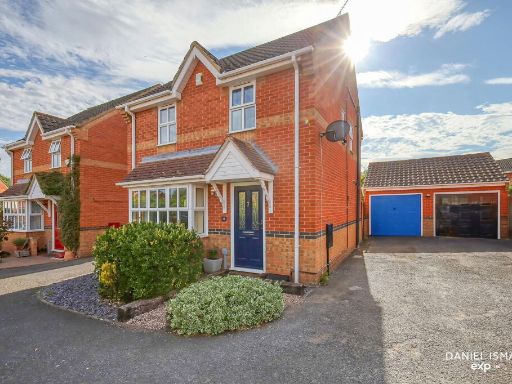 3 bedroom detached house for sale in Northampton Grove, Langdon Hills, Basildon, SS16 6ED, SS16 — £475,000 • 3 bed • 2 bath • 1109 ft²
 5 bedroom detached house for sale in Great Berry Lane, Langdon Hills, Basildon, SS16 6BW, SS16 — £1,000,000 • 5 bed • 2 bath • 2367 ft²
 4 bedroom detached house for sale in Reeves Close, LANGDON HILLS, Basildon, Essex, SS16 — £775,000 • 4 bed • 4 bath • 2217 ft²
 3 bedroom semi-detached house for sale in Great Berry Lane, Langdon Hills, SS16 — £500,000 • 3 bed • 1 bath • 1195 ft²
Meta
- {
"@context": "https://schema.org",
"@type": "Residence",
"name": "5 bedroom detached house for sale in Hill Top Rise, Langdon…",
"description": "",
"url": "https://propertypiper.co.uk/property/6bf52886-2587-49cc-9d00-a2b71a9cbfa3",
"image": "https://image-a.propertypiper.co.uk/80ed9321-7d78-404d-bc76-7373cfd9f125-1024.jpeg",
"address": {
"@type": "PostalAddress",
"streetAddress": "10 HILL TOP RISE LANGDON HILLS BASILDON",
"postalCode": "SS16 6UP",
"addressLocality": "Basildon",
"addressRegion": "South Basildon and East Thurrock",
"addressCountry": "England"
},
"geo": {
"@type": "GeoCoordinates",
"latitude": 51.56284062118608,
"longitude": 0.40091034577632473
},
"numberOfRooms": 5,
"numberOfBathroomsTotal": 3,
"floorSize": {
"@type": "QuantitativeValue",
"value": 1174,
"unitCode": "FTK"
},
"offers": {
"@type": "Offer",
"price": 525000,
"priceCurrency": "GBP",
"availability": "https://schema.org/InStock"
},
"additionalProperty": [
{
"@type": "PropertyValue",
"name": "Feature",
"value": "modern"
},
{
"@type": "PropertyValue",
"name": "Feature",
"value": "detached house"
},
{
"@type": "PropertyValue",
"name": "Feature",
"value": "three-storey"
},
{
"@type": "PropertyValue",
"name": "Feature",
"value": "brick exterior"
},
{
"@type": "PropertyValue",
"name": "Feature",
"value": "gabled roof"
},
{
"@type": "PropertyValue",
"name": "Feature",
"value": "private driveway"
},
{
"@type": "PropertyValue",
"name": "Feature",
"value": "residential area"
},
{
"@type": "PropertyValue",
"name": "Feature",
"value": "family home"
},
{
"@type": "PropertyValue",
"name": "Feature",
"value": "modern kitchen"
},
{
"@type": "PropertyValue",
"name": "Feature",
"value": "grey cabinets"
},
{
"@type": "PropertyValue",
"name": "Feature",
"value": "breakfast bar"
},
{
"@type": "PropertyValue",
"name": "Feature",
"value": "tiled backsplash"
},
{
"@type": "PropertyValue",
"name": "Feature",
"value": "spotlights"
},
{
"@type": "PropertyValue",
"name": "Feature",
"value": "herringbone floor"
}
]
}
High Res Floorplan Images
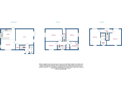
Compatible Floorplan Images
FloorplanImages Thumbnail