B23 6BQ - 1 bedroom flat for sale in Gravelly Hill North, Erdington,…
View on Property Piper
1 bedroom flat for sale in Gravelly Hill North, Erdington, Birmingham, B23
Property Details
- Price: £85000
- Bedrooms: 1
- Bathrooms: 1
- Property Type: undefined
- Property SubType: undefined
Image Descriptions
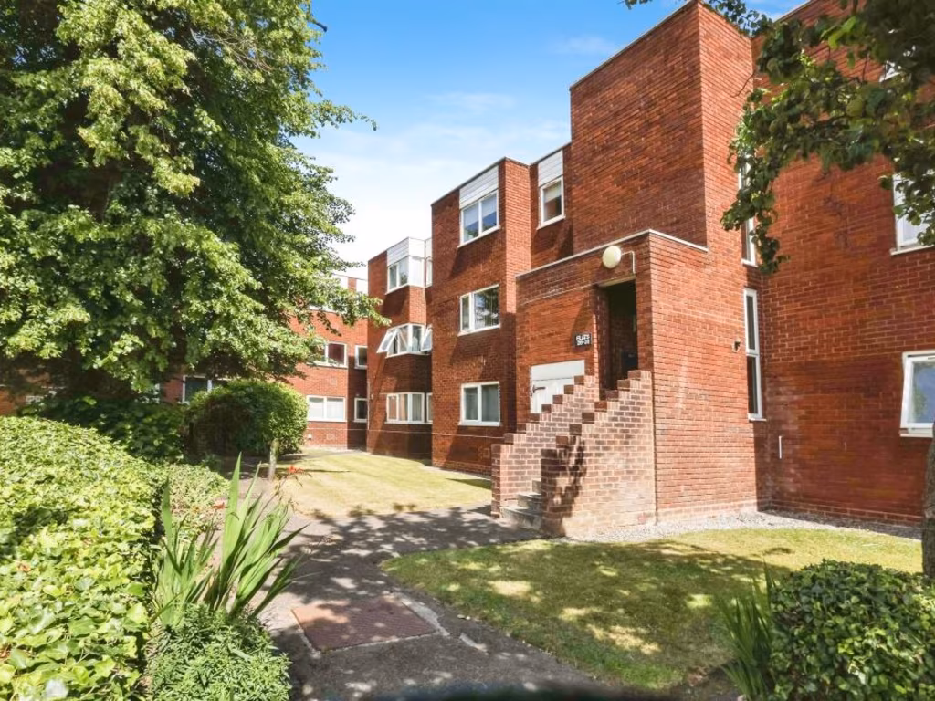
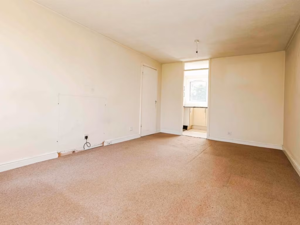
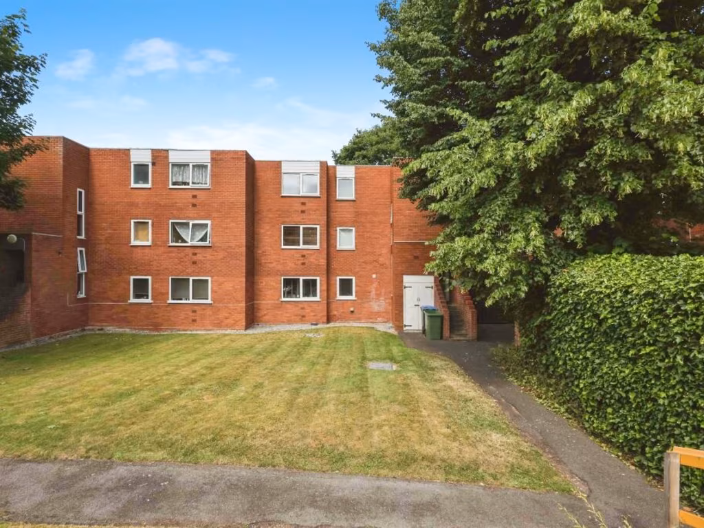
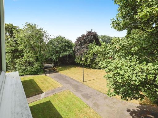
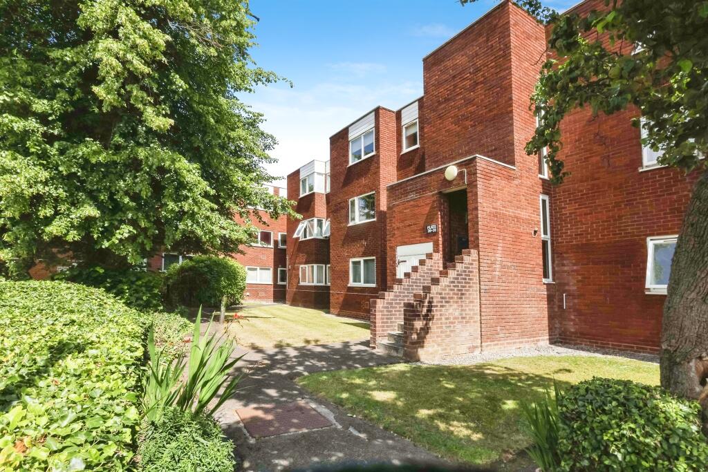
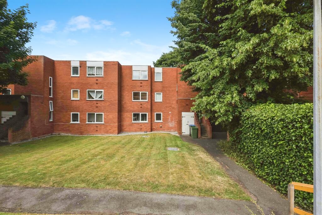
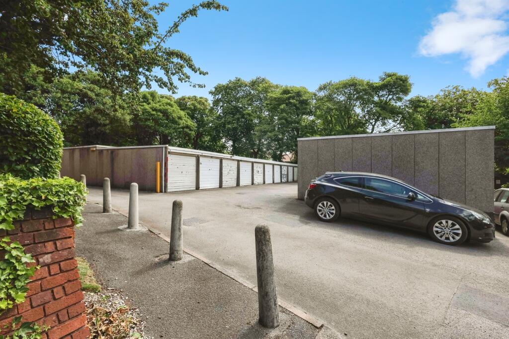
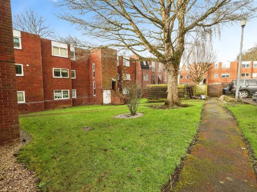
- apartment complex Mid-20th Century
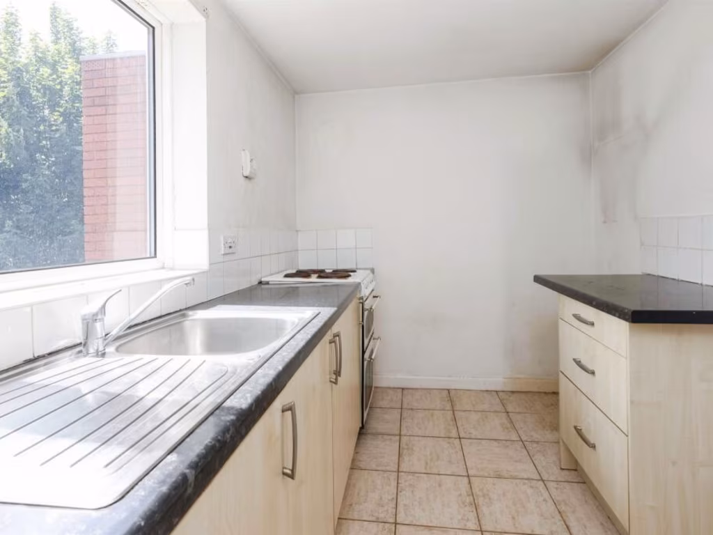
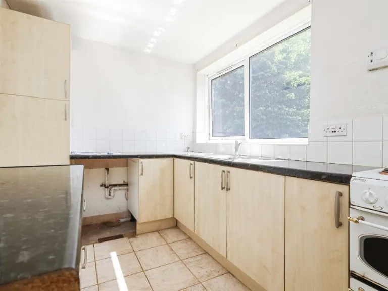
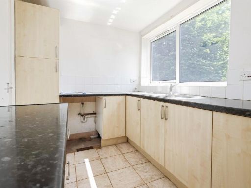
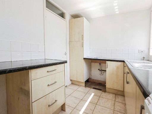
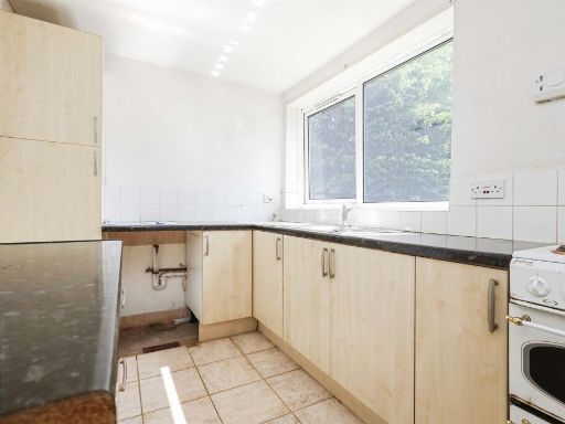
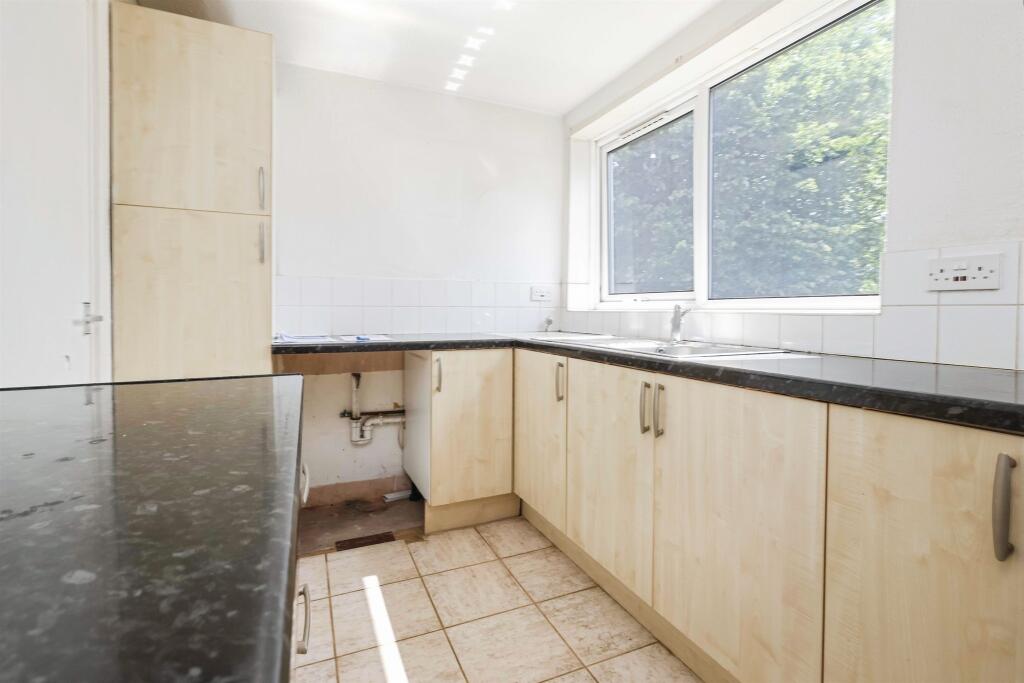
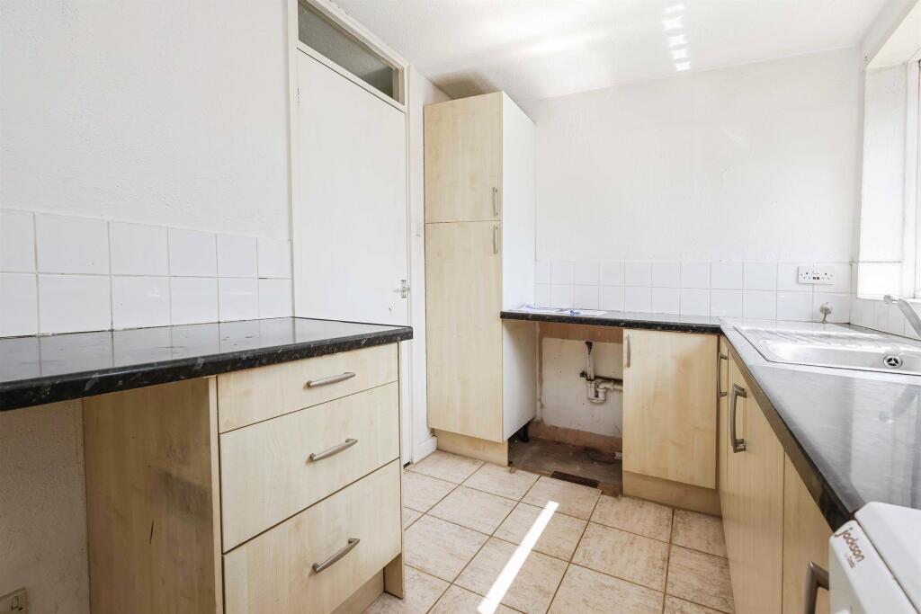
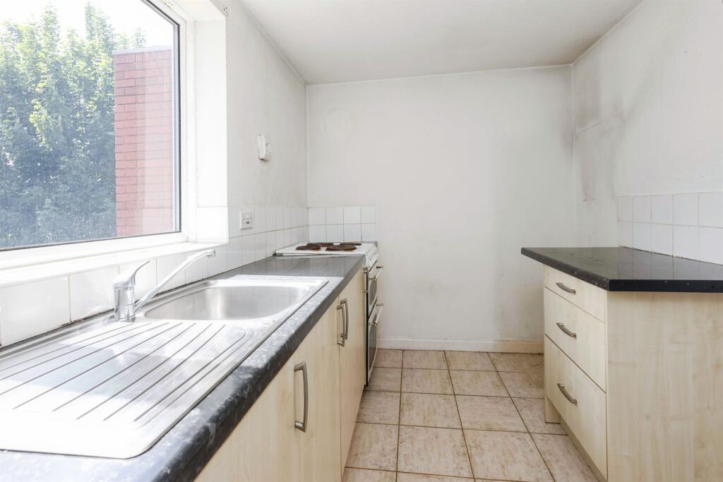
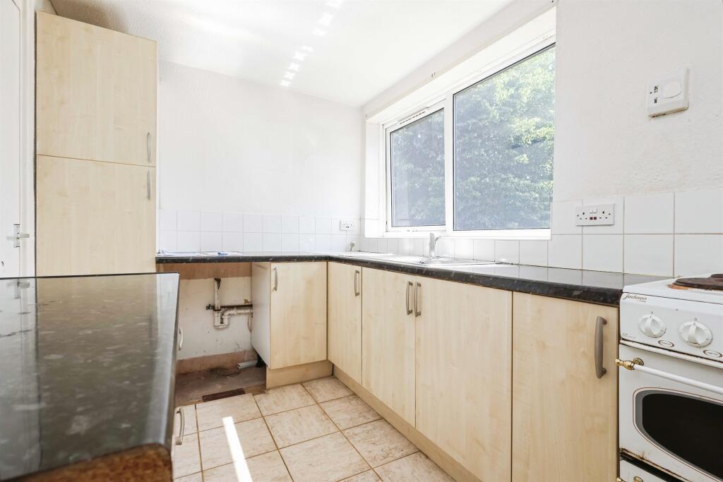
- kitchen modern
Floorplan Description
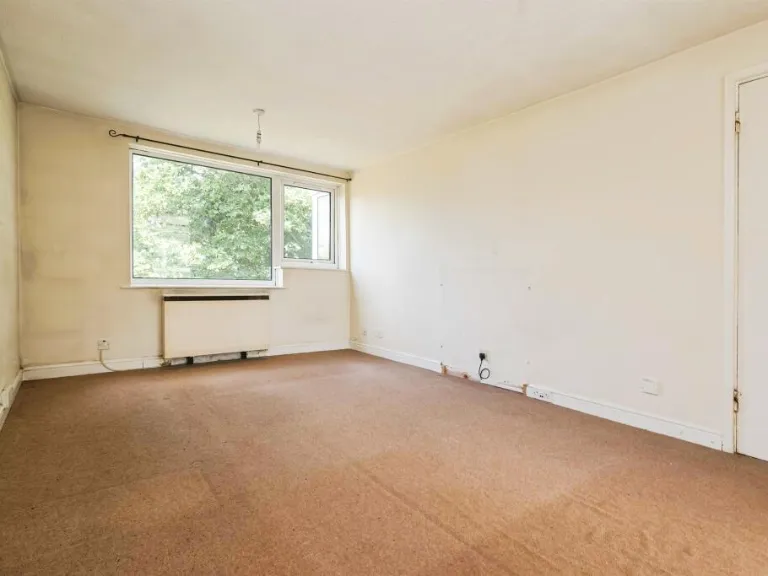
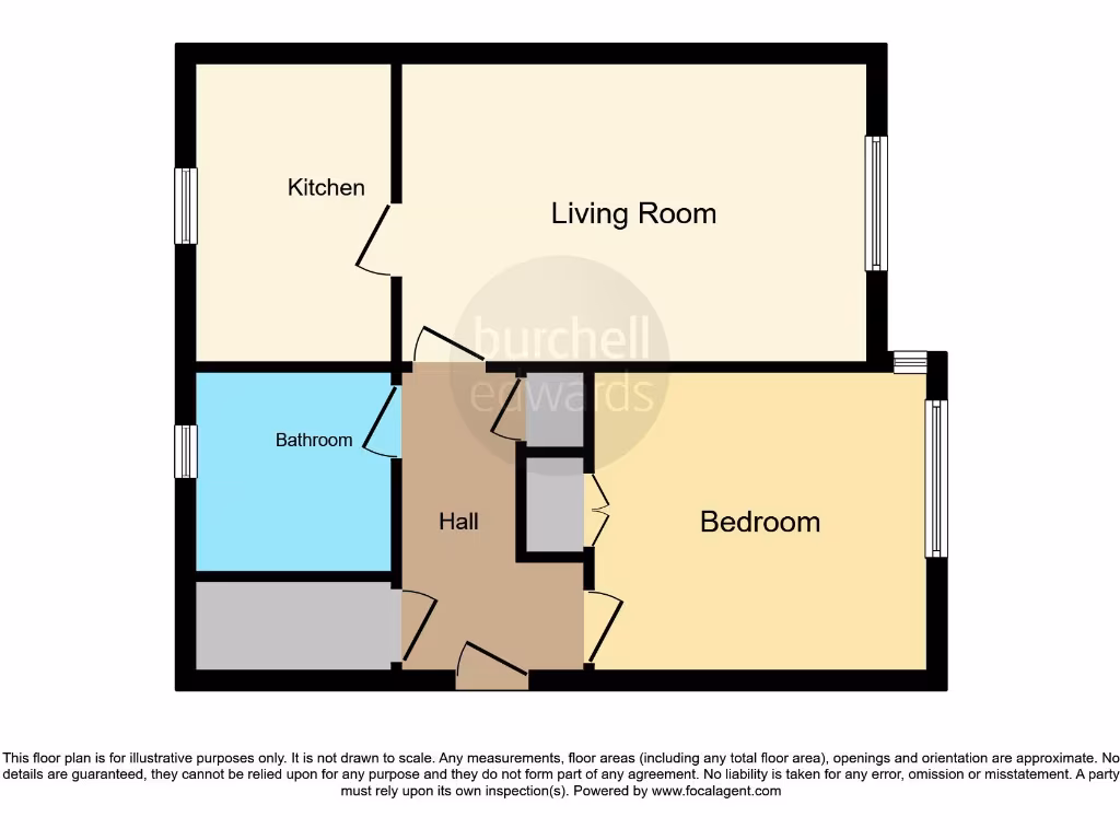
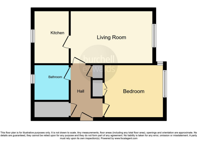
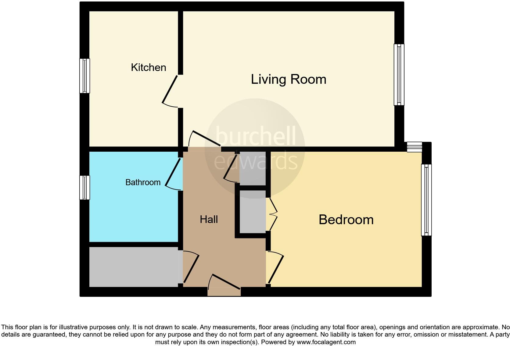
- A flat with a kitchen, living room, bedroom, and bathroom.
Rooms
- Kitchen:
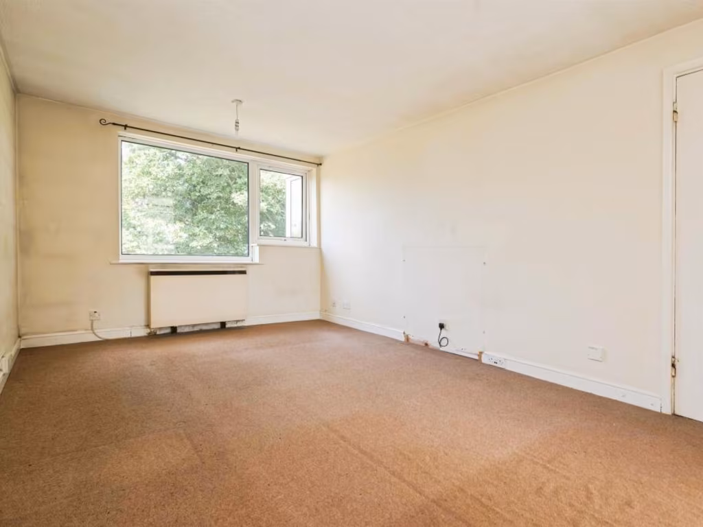
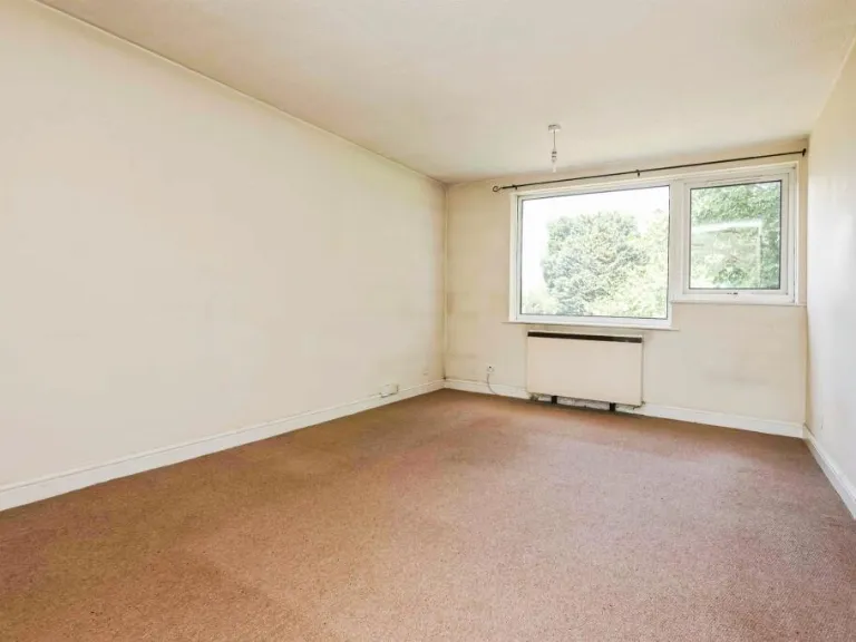
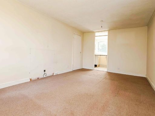
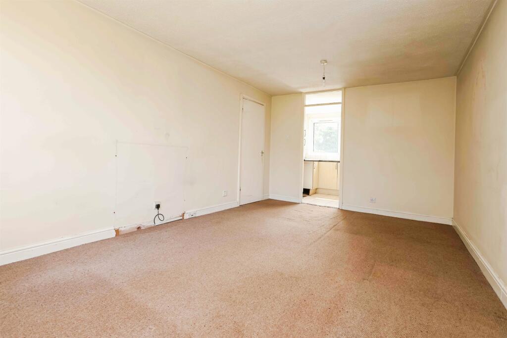
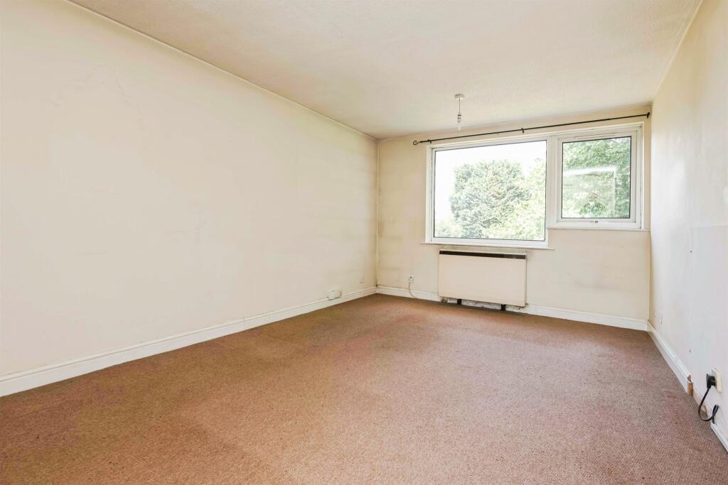
- Living Room:
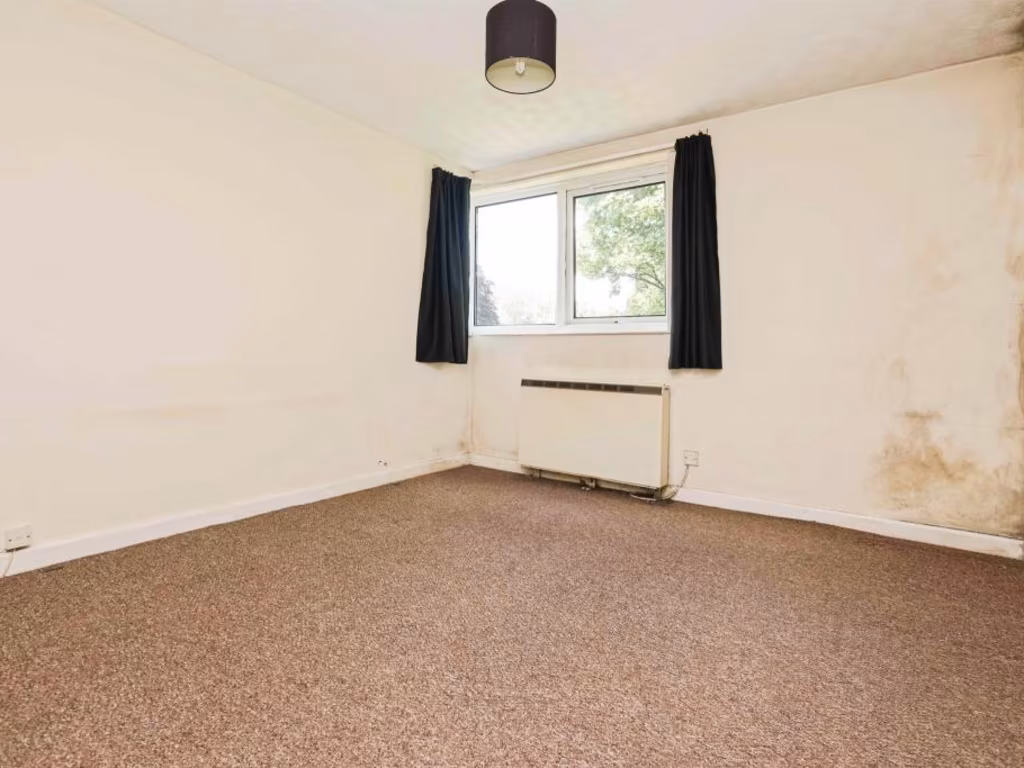
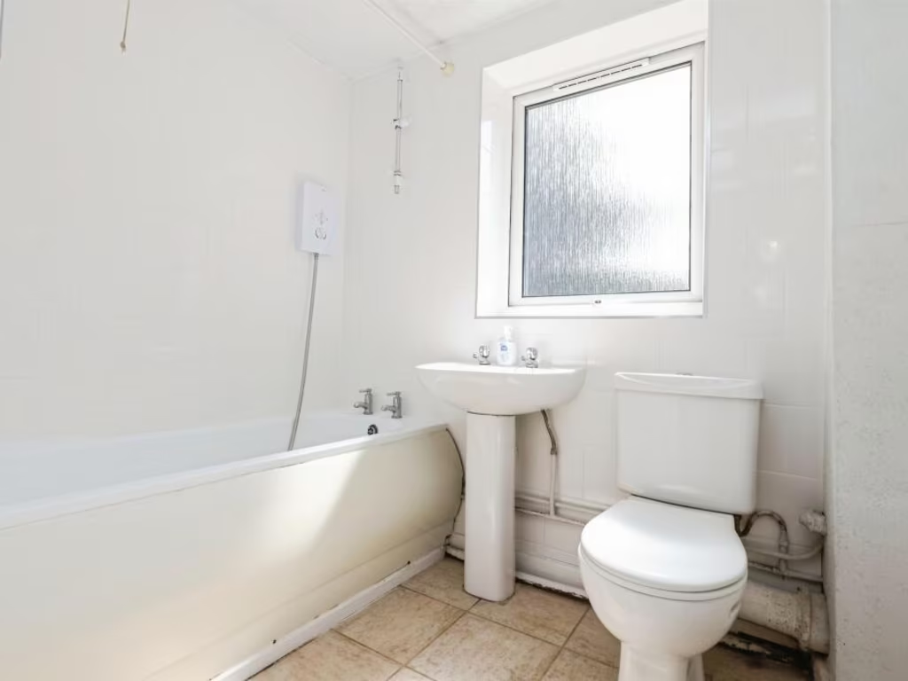
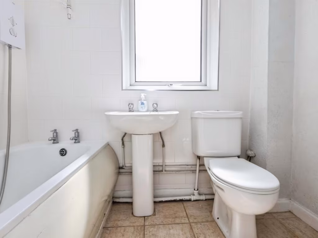
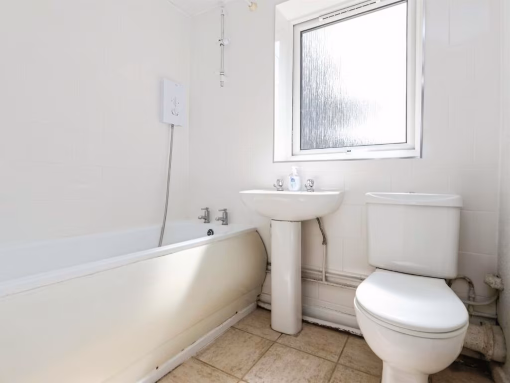
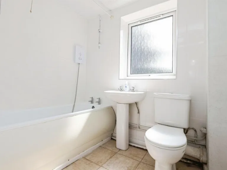
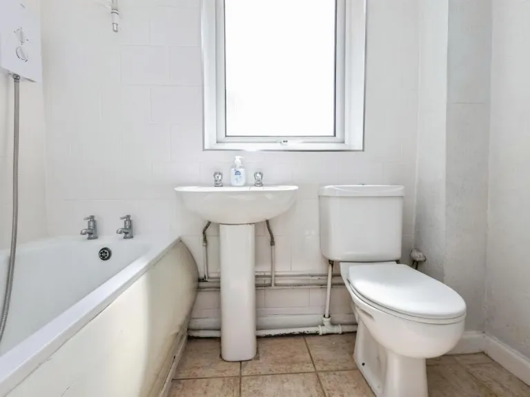
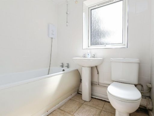
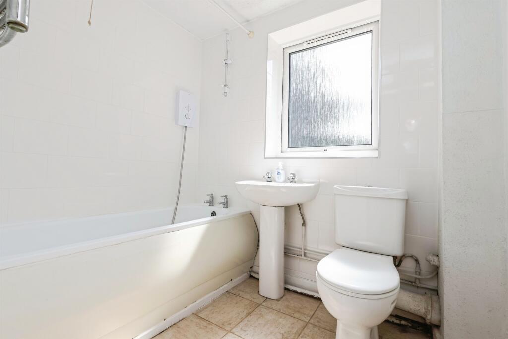
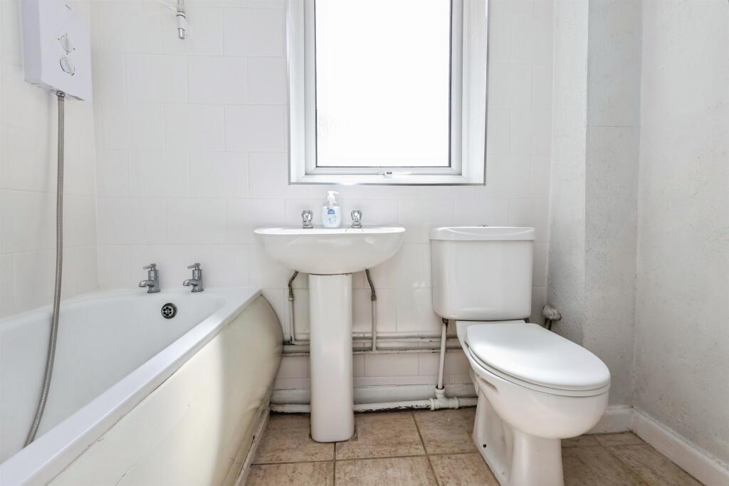
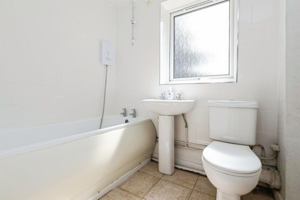
- Bathroom:
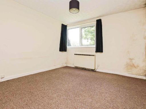
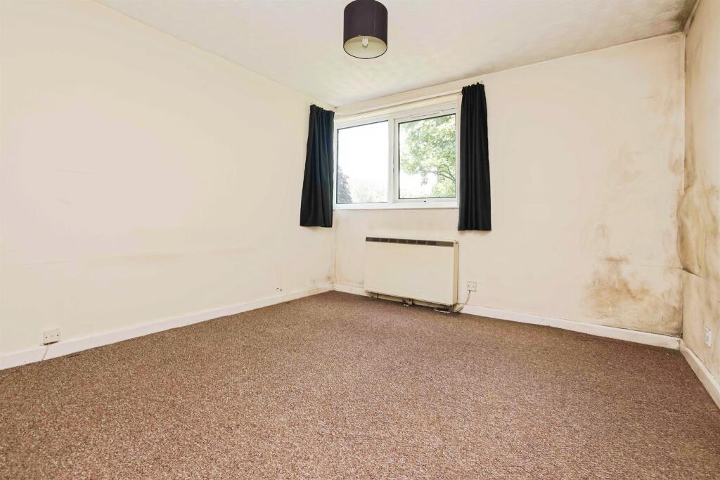
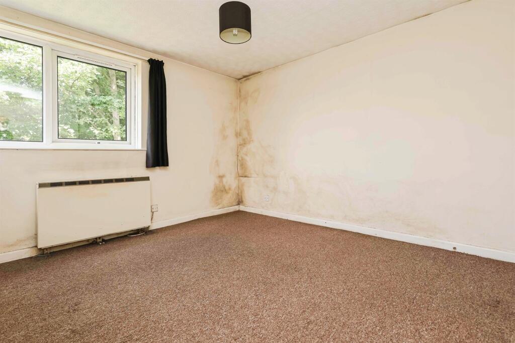
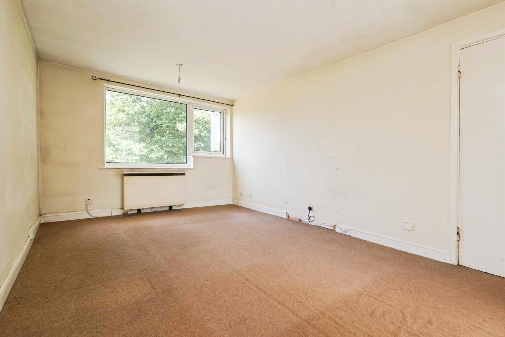
- Bedroom:
Textual Property Features
Detected Visual Features
- apartment
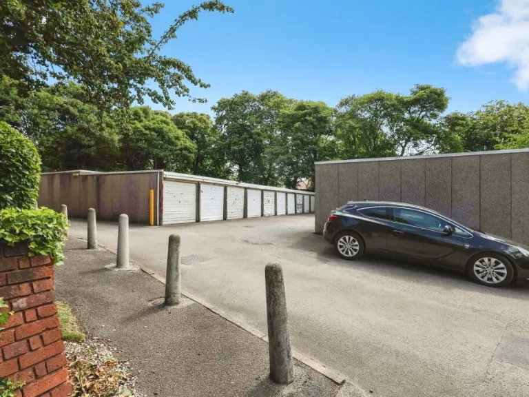
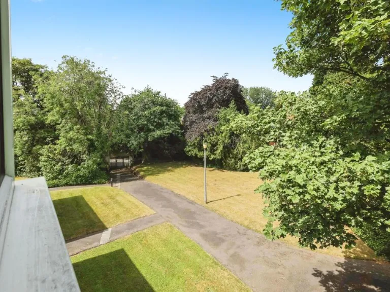
- brick exterior
- low-rise
- mid-20th century
- urban
- complex
- modern kitchen
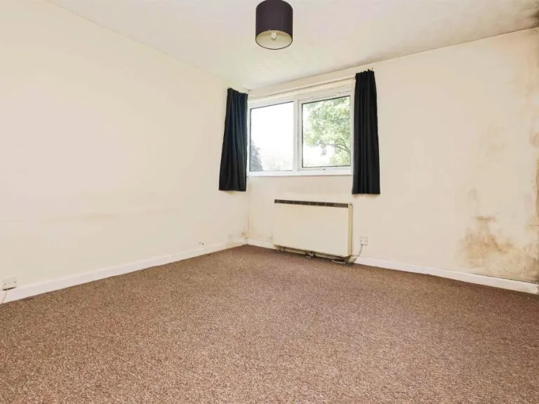
- standard ceiling
- small kitchen
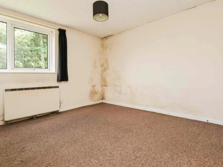
- dated fittings
- maintenance needed
EPC Details
- Fully double glazed
- Cavity wall, as built, partial insulation (assumed)
- Electric storage heaters
- Low energy lighting in 88% of fixed outlets
- (another dwelling below)
Nearby Schools
- Erdington Hall Primary School
- St Mary and St John Junior and Infant School
- St Peter and St Paul RC Junior and Infant School
- Marsh Hill Primary School
- Highclare School
- St Edmund Campion Catholic School
- St Margaret Mary RC Junior and Infant School
- Abbey Catholic Primary School
- Nansen Primary School
- Highfield Junior and Infant School
- St Clement's Church of England Academy
- Erdington Academy
- Featherstone Primary School
- Osborne Primary School
- E-ACT Nechells Academy
- Slade Primary School
- Birches Green Primary School
- Saint Barnabas Church of England Primary School
- Brookvale Primary School
- Stockland Green School
- Imedia School
- Oasis Academy Short Heath
- Rockwood Academy
- Leigh Primary School
Nearest General Shops
- Id: 219544976
- Tags:
- Building: retail
- Name: Durrani Supermarket
- Shop: supermarket
- TagsNormalized:
- Lat: 52.5145974
- Lon: -1.8575348
- FullGeoHash: gcqdtxzrsq3x
- PartitionGeoHash: gcqd
- Images:
- FoodStandards: null
- Distance: 534.2
,- Id: 219544986
- Tags:
- Building: retail
- Shop: alcohol
- TagsNormalized:
- Lat: 52.514467
- Lon: -1.8574941
- FullGeoHash: gcqdtxzqvq0j
- PartitionGeoHash: gcqd
- Images:
- FoodStandards: null
- Distance: 532.4
,- Id: 219544981
- Tags:
- Building: retail
- Name: Naz Barbers
- Shop: hairdresser
- TagsNormalized:
- retail
- barber
- hairdresser
- shop
- Lat: 52.5145135
- Lon: -1.857431
- FullGeoHash: gcqdtxzrnwz5
- PartitionGeoHash: gcqd
- Images:
- FoodStandards: null
- Distance: 527.7
}
Nearest Grocery shops
- Id: 144844331
- Tags:
- Addr:
- City: Birmingham
- Postcode: B23 6DS
- Brand: Tesco Express
- Brand:wikidata: Q98456772
- Building: retail
- Contact:
- Website: https://www.tesco.com/store-locator/birmingham/gravelly-hill
- Name: Tesco Express
- Note: shape and position is approximate
- Shop: convenience
- TagsNormalized:
- tesco
- tesco express
- retail
- convenience
- shop
- Lat: 52.5218372
- Lon: -1.8451072
- FullGeoHash: gcqdy123vuh6
- PartitionGeoHash: gcqd
- Images:
- FoodStandards: null
- Distance: 835.9
,- Id: 670990846
- Tags:
- Addr:
- City: Birmingham
- Housename: Powick Road
- Postcode: B23 7PG
- Brand: Spar
- Brand:wikidata: Q610492
- Brand:wikipedia: en:SPAR (retailer)
- Building: yes
- Name: Spar
- Note: ATM / Cash Point on Outside
- Shop: convenience
- TagsNormalized:
- Lat: 52.5102303
- Lon: -1.8586696
- FullGeoHash: gcqdtxnw3b7k
- PartitionGeoHash: gcqd
- Images:
- FoodStandards: null
- Distance: 797.5
,- Id: 143918667
- Tags:
- Addr:
- City: Birmingham
- Housenumber: 339-341
- Postcode: B23 7JX
- Street: Slade Road
- Building: retail
- Name: Hayers Food Store
- Shop: supermarket
- TagsNormalized:
- Lat: 52.5187843
- Lon: -1.8564843
- FullGeoHash: gcqdvbb0hfbz
- PartitionGeoHash: gcqd
- Images:
- FoodStandards: null
- Distance: 636.7
}
Nearest Religious buildings
- Id: 64798195
- Tags:
- Amenity: place_of_worship
- Name: Ghausia Mosque Trust
- Religion: muslim
- TagsNormalized:
- place of worship
- mosque
- muslim
- Lat: 52.5162826
- Lon: -1.8562277
- FullGeoHash: gcqdvb23db8k
- PartitionGeoHash: gcqd
- Images:
- FoodStandards: null
- Distance: 472.7
,- Id: 142828546
- Tags:
- Addr:
- City: Birmingham
- Postcode: B23 7NE
- Street: Hunton Hill
- Amenity: place_of_worship
- Building: place_of_worship
- Denomination: evangelical
- Name: Slade Evangelical Church
- Religion: christian
- TagsNormalized:
- place of worship
- evangelical
- church
- christian
- Lat: 52.5170349
- Lon: -1.8553103
- FullGeoHash: gcqdvb3jbhu7
- PartitionGeoHash: gcqd
- Images:
- FoodStandards: null
- Distance: 453.7
,- Id: 160893130
- Tags:
- Amenity: place_of_worship
- Building: church
- Name: SS Mary and John
- Religion: christian
- TagsNormalized:
- place of worship
- church
- christian
- Lat: 52.5163151
- Lon: -1.8482288
- FullGeoHash: gcqdvbq1tnsw
- PartitionGeoHash: gcqd
- Images:
- FoodStandards: null
- Distance: 189.5
}
Nearest Medical buildings
- Id: 6498206048
- Tags:
- Amenity: pharmacy
- Healthcare: pharmacy
- TagsNormalized:
- Lat: 52.509582
- Lon: -1.837605
- FullGeoHash: gcqdwpjfkxw3
- PartitionGeoHash: gcqd
- Images:
- FoodStandards: null
- Distance: 1003.7
,- Id: 122666227
- Tags:
- Addr:
- City: Birmingham
- Postcode: B23 6DW
- Street: Reservoir Road
- Amenity: hospital
- Emergency: no
- Healthcare: hospital
- Name: Northcroft Hospital
- Source: visual survey;bing
- TagsNormalized:
- Lat: 52.5232292
- Lon: -1.8551237
- FullGeoHash: gcqdvc91urxd
- PartitionGeoHash: gcqd
- Images:
- FoodStandards: null
- Distance: 1002.9
,- Id: 4373925092
- Tags:
- Addr:
- City: Birmingham
- Housenumber: 127
- Postcode: B23 7SH
- Street: George Road
- Email: info@spartanhealthclub.co.uk
- Leisure: sauna
- Name: Spartan Health Club
- Name:en: Spartan Health Club
- Opening_hours: Mo-Fr 11:00-22:00; Sa 11:00-18:30; Su 12:00-20:30
- Phone: +44 121 382 3345
- Website: http://www.spartanhealthclub.co.uk
- TagsNormalized:
- Lat: 52.517227
- Lon: -1.8612334
- FullGeoHash: gcqdv8kxn0ev
- PartitionGeoHash: gcqd
- Images:
- FoodStandards: null
- Distance: 827.2
,- Id: 278336905
- Tags:
- Amenity: hospital
- Healthcare: hospital
- Source: survey
- TagsNormalized:
- Lat: 52.5198048
- Lon: -1.8522665
- FullGeoHash: gcqdvbgnp11y
- PartitionGeoHash: gcqd
- Images:
- FoodStandards: null
- Distance: 579
}
Nearest Airports
- Id: 2437117
- Tags:
- Aerodrome: international
- Aerodrome:type: public
- Aeroway: aerodrome
- Ele: 104
- Iata: BHX
- Icao: EGBB
- Internet_access: wlan
- Is_in: Birmingham,England,UK
- Name: Birmingham Airport
- Ref: BHX
- Type: multipolygon
- Website: https://www.birminghamairport.co.uk/
- Wikidata: Q8719
- Wikipedia: en:Birmingham Airport
- TagsNormalized:
- airport
- international airport
- Lat: 52.4543817
- Lon: -1.7468974
- FullGeoHash: gcqf2jpbym6y
- PartitionGeoHash: gcqf
- Images:
- FoodStandards: null
- Distance: 9675.6
}
Nearest Leisure Facilities
- Id: 144834819
- Tags:
- Access: private
- Barrier: fence
- Leisure: garden
- TagsNormalized:
- Lat: 52.5158704
- Lon: -1.8502135
- FullGeoHash: gcqdvbhxnguc
- PartitionGeoHash: gcqd
- Images:
- FoodStandards: null
- Distance: 120
,- Id: 144812354
- Tags:
- Access: private
- Barrier: fence
- Leisure: garden
- TagsNormalized:
- Lat: 52.5150333
- Lon: -1.8512907
- FullGeoHash: gcqdvb5fjz9x
- PartitionGeoHash: gcqd
- Images:
- FoodStandards: null
- Distance: 112.8
,- Id: 144812356
- Tags:
- Access: private
- Barrier: fence
- Leisure: garden
- TagsNormalized:
- Lat: 52.5149766
- Lon: -1.8512127
- FullGeoHash: gcqdvb5czt5v
- PartitionGeoHash: gcqd
- Images:
- FoodStandards: null
- Distance: 106.6
,- Id: 144812352
- Tags:
- Access: private
- Barrier: fence
- Leisure: garden
- TagsNormalized:
- Lat: 52.5149304
- Lon: -1.8511068
- FullGeoHash: gcqdvbh1dhd9
- PartitionGeoHash: gcqd
- Images:
- FoodStandards: null
- Distance: 98.9
,- Id: 160893152
- Tags:
- TagsNormalized:
- Lat: 52.5152588
- Lon: -1.8484684
- FullGeoHash: gcqdvbjgx9f0
- PartitionGeoHash: gcqd
- Images:
- FoodStandards: null
- Distance: 92.2
}
Nearest Tourist attractions
- Id: 101941111
- Tags:
- Addr:
- City: Birmingham
- Housenumber: 747
- Postcode: B24 0BY
- Street: Chester Road
- Building: retail
- Name: Glen Guest House
- Tourism: guest_house
- TagsNormalized:
- Lat: 52.5327856
- Lon: -1.8268702
- FullGeoHash: gcqdy7m9wv4b
- PartitionGeoHash: gcqd
- Images:
- FoodStandards: null
- Distance: 2520.8
,- Id: 156322414
- Tags:
- Addr:
- City: Birmingham
- Housenumber: 85
- Postcode: B23 5XA
- Street: Sutton Road
- Building: commercial
- Name: Sutton Guest House
- Tourism: guest_house
- TagsNormalized:
- Lat: 52.5311669
- Lon: -1.8309054
- FullGeoHash: gcqdy74b0z3b
- PartitionGeoHash: gcqd
- Images:
- FoodStandards: null
- Distance: 2214
,- Id: 142828588
- Tags:
- Addr:
- City: Birmingham
- Housenumber: 249-253
- Postcode: B23 7QY
- Street: Slade Road
- Building: residential
- Fhrs:
- Name: Rugby House B&B
- Tourism: guest_house
- TagsNormalized:
- residential
- rugby
- guest house
- tourism
- Lat: 52.5164325
- Lon: -1.8557578
- FullGeoHash: gcqdvb2dmswd
- PartitionGeoHash: gcqd
- Images:
- FoodStandards:
- Id: 601895
- FHRSID: 601895
- LocalAuthorityBusinessID: PI/000472498
- BusinessName: Rugby House
- BusinessType: Hotel/bed & breakfast/guest house
- BusinessTypeID: 7842
- AddressLine1: Rugby House
- AddressLine2: 249-251 Slade Road
- AddressLine3: Stockland Green
- AddressLine4: Birmingham
- PostCode: B23 7QY
- RatingValue: 4
- RatingKey: fhrs_4_en-GB
- RatingDate: 2020-03-01
- LocalAuthorityCode: 402
- LocalAuthorityName: Birmingham
- LocalAuthorityWebSite: http://www.birmingham.gov.uk/environmental-health
- LocalAuthorityEmailAddress: Admin.EH@birmingham.gov.uk
- Scores:
- Hygiene: 5
- Structural: 5
- ConfidenceInManagement: 10
- NewRatingPending: false
- Geocode:
- Longitude: -1.85584800000000
- Latitude: 52.51677800000000
- Distance: 449.2
}
Nearest Train stations
- Id: 653033
- Tags:
- Name: Chester Road
- Naptan:
- Network: National Rail
- Public_transport: station
- Railway: station
- Ref:
- West_midlands_fare_zone: 3
- Wheelchair: yes
- Wikidata: Q2405727
- Wikipedia: en:Chester Road railway station
- TagsNormalized:
- Lat: 52.5357946
- Lon: -1.8324576
- FullGeoHash: gcqdy7cehtut
- PartitionGeoHash: gcqd
- Images:
- FoodStandards: null
- Distance: 2603.6
,- Id: 7790315845
- Tags:
- Name: Witton
- Naptan:
- Network: National Rail
- Public_transport: station
- Railway: station
- Ref:
- Source: NPE
- West_midlands_fare_zone: 2
- Wheelchair: yes
- Wikidata: Q2791793
- Wikipedia: en:Witton railway station
- TagsNormalized:
- Lat: 52.512194
- Lon: -1.8839327
- FullGeoHash: gcqdtps1tnmy
- PartitionGeoHash: gcqd
- Images:
- FoodStandards: null
- Distance: 2338.5
,- Id: 5920221964
- Tags:
- Name: Aston
- Naptan:
- Network: National Rail
- Public_transport: station
- Railway: station
- Ref:
- West_midlands_fare_zone: 2
- Wikidata: Q1978485
- Wikipedia: en:Aston railway station
- TagsNormalized:
- Lat: 52.5044169
- Lon: -1.8720459
- FullGeoHash: gcqdtqhu6htq
- PartitionGeoHash: gcqd
- Images:
- FoodStandards: null
- Distance: 1908.4
,- Id: 653032
- Tags:
- Name: Erdington
- Naptan:
- Network: National Rail
- Public_transport: station
- Railway: station
- Ref:
- West_midlands_fare_zone: 3
- Wheelchair: yes
- Wikidata: Q2415516
- Wikipedia: en:Erdington railway station
- TagsNormalized:
- Lat: 52.5285663
- Lon: -1.8392253
- FullGeoHash: gcqdy4s9nfqp
- PartitionGeoHash: gcqd
- Images:
- FoodStandards: null
- Distance: 1680.7
,- Id: 653044
- Tags:
- Name: Gravelly Hill
- Naptan:
- Network: National Rail
- Public_transport: station
- Railway: station
- Ref:
- West_midlands_fare_zone: 2
- Wikidata: Q2098592
- Wikipedia: en:Gravelly Hill railway station
- TagsNormalized:
- Lat: 52.5153876
- Lon: -1.8527077
- FullGeoHash: gcqdvb4ukcc1
- PartitionGeoHash: gcqd
- Images:
- FoodStandards: null
- Distance: 215.4
}
Nearest Hotels
- Id: 186553622
- Tags:
- Addr:
- City: Birmingham
- Postcode: B7 5SB
- Street: Cuckoo Road
- Brand: Holiday Inn Express
- Brand:wikidata: Q5880423
- Brand:wikipedia: en:Holiday Inn Express
- Building: yes
- Name: Holiday Inn Express Star City
- Tourism: hotel
- TagsNormalized:
- Lat: 52.5022281
- Lon: -1.8565642
- FullGeoHash: gcqdtv8pdutm
- PartitionGeoHash: gcqd
- Images:
- FoodStandards: null
- Distance: 1479.1
,- Id: 9063640167
- Tags:
- Addr:
- City: Birmingham
- Housenumber: 130
- Postcode: B24 8BJ
- Street: Wood End Road
- Fhrs:
- Name: Rollason Wood Hotel
- Tourism: hotel
- TagsNormalized:
- Lat: 52.5179037
- Lon: -1.8398425
- FullGeoHash: gcqdy0s6bwcf
- PartitionGeoHash: gcqd
- Images:
- FoodStandards: null
- Distance: 745.7
,- Id: 144834791
- Tags:
- Addr:
- City: Birmingham
- Housenumber: 19
- Postcode: B23 6BT
- Street: Gravelly Hill North
- Building: residential
- Name: Rossmore Hotel
- Tourism: hotel
- TagsNormalized:
- Lat: 52.5161606
- Lon: -1.8498554
- FullGeoHash: gcqdvbkbz1zu
- PartitionGeoHash: gcqd
- Images:
- FoodStandards: null
- Distance: 146.7
}
Tags
- apartment
- brick exterior
- low-rise
- mid-20th century
- urban
- complex
- modern kitchen
- standard ceiling
- small kitchen
- dated fittings
- maintenance needed
Local Market Stats
- Average Price/sqft: £200
- Avg Income: £37700
- Rental Yield: 5.8%
- Social Housing: 24%
- Planning Success Rate: 77%
AirBnB Data
- 1km average: £45/night
- Listings in 1km: 1
Similar Properties
 1 bedroom ground floor flat for sale in Wheelwright Road, Birmingham, B24 — £115,000 • 1 bed • 1 bath • 506 ft²
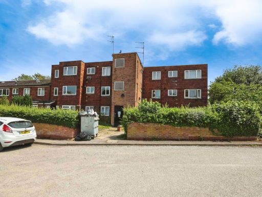 1 bedroom flat for sale in Gravelly Lane, Birmingham, West Midlands, B23 — £90,000 • 1 bed • 1 bath • 471 ft²
 1 bedroom flat for sale in Hollywell Road, BIRMINGHAM, B26 — £130,000 • 1 bed • 1 bath • 419 ft²
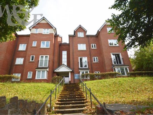 2 bedroom flat for sale in City Gate, Erdington, Birmingham, B23 — £135,000 • 2 bed • 2 bath • 776 ft²
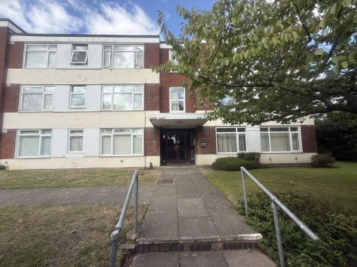 1 bedroom flat for sale in Arden Court, Kingsbury Road, Birmingham, B24 9NQ, B24 — £110,000 • 1 bed • 1 bath • 526 ft²
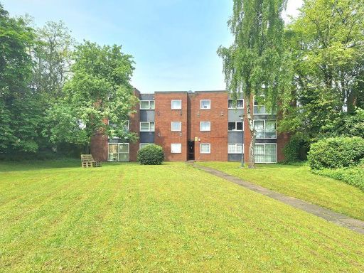 2 bedroom flat for sale in Parkfield House, Gravelly Hill, Birmingham B23 7NR, B23 — £110,000 • 2 bed • 1 bath • 625 ft²
Meta
- {
"@context": "https://schema.org",
"@type": "Residence",
"name": "1 bedroom flat for sale in Gravelly Hill North, Erdington,…",
"description": "",
"url": "https://propertypiper.co.uk/property/6b5e069e-f792-4d4a-b83a-3e2200fa2430",
"image": "https://image-a.propertypiper.co.uk/4dbad2f8-ac94-4970-b138-dca533b8363e-1024.jpeg",
"address": {
"@type": "PostalAddress",
"streetAddress": "GREEN COURT, 2 FLAT 35 GRAVELLY HILL NORTH ERDINGTON BIRMINGHAM",
"postalCode": "B23 6BQ",
"addressLocality": "Birmingham",
"addressRegion": "Birmingham, Erdington",
"addressCountry": "England"
},
"geo": {
"@type": "GeoCoordinates",
"latitude": 52.51484690461908,
"longitude": -1.8496517563873807
},
"numberOfRooms": 1,
"numberOfBathroomsTotal": 1,
"floorSize": {
"@type": "QuantitativeValue",
"value": 506,
"unitCode": "FTK"
},
"offers": {
"@type": "Offer",
"price": 85000,
"priceCurrency": "GBP",
"availability": "https://schema.org/InStock"
},
"additionalProperty": [
{
"@type": "PropertyValue",
"name": "Feature",
"value": "apartment"
},
{
"@type": "PropertyValue",
"name": "Feature",
"value": "brick exterior"
},
{
"@type": "PropertyValue",
"name": "Feature",
"value": "low-rise"
},
{
"@type": "PropertyValue",
"name": "Feature",
"value": "mid-20th century"
},
{
"@type": "PropertyValue",
"name": "Feature",
"value": "urban"
},
{
"@type": "PropertyValue",
"name": "Feature",
"value": "complex"
},
{
"@type": "PropertyValue",
"name": "Feature",
"value": "modern kitchen"
},
{
"@type": "PropertyValue",
"name": "Feature",
"value": "standard ceiling"
},
{
"@type": "PropertyValue",
"name": "Feature",
"value": "small kitchen"
},
{
"@type": "PropertyValue",
"name": "Feature",
"value": "dated fittings"
},
{
"@type": "PropertyValue",
"name": "Feature",
"value": "maintenance needed"
}
]
}
High Res Floorplan Images
Compatible Floorplan Images
FloorplanImages Thumbnail