SS0 0SE - 2 bedroom semidetached bungalow for sale in Carlingford Dri…
View on Property Piper
2 bedroom semi-detached bungalow for sale in Carlingford Drive, Westcliff-On-Sea, SS0
Property Details
- Price: £325000
- Bedrooms: 2
- Bathrooms: 1
- Property Type: undefined
- Property SubType: undefined
Image Descriptions
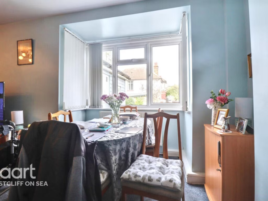
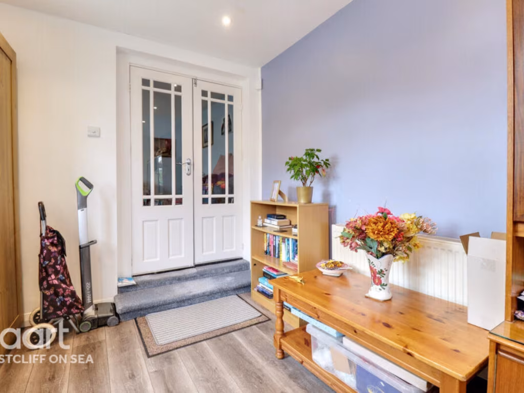
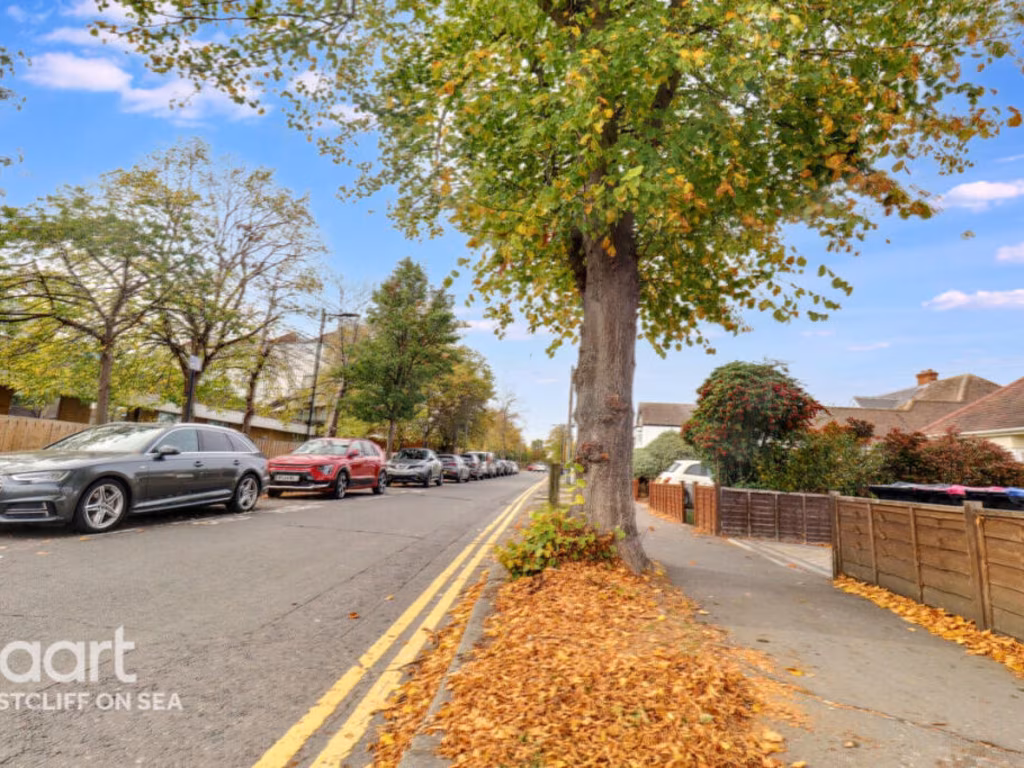
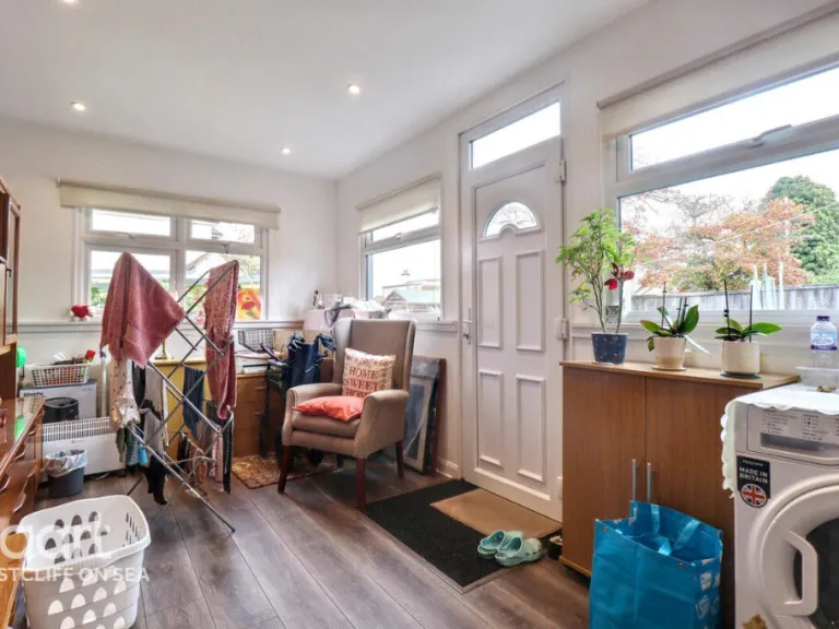
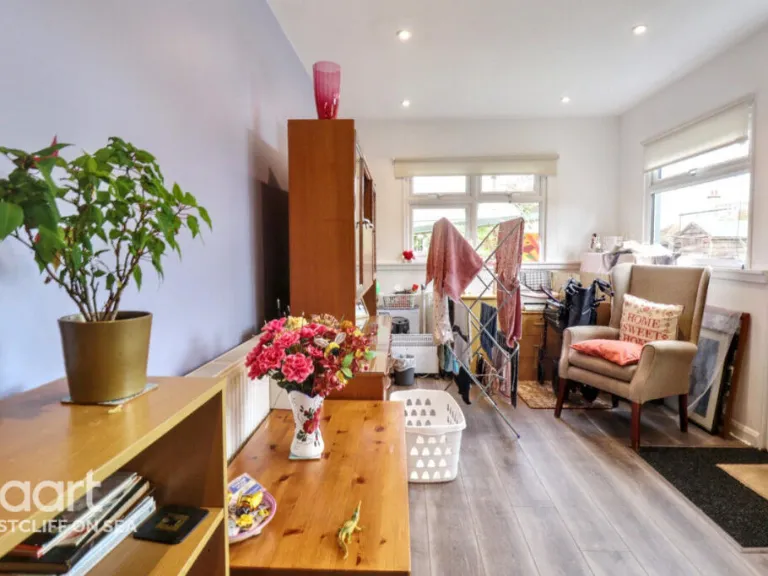
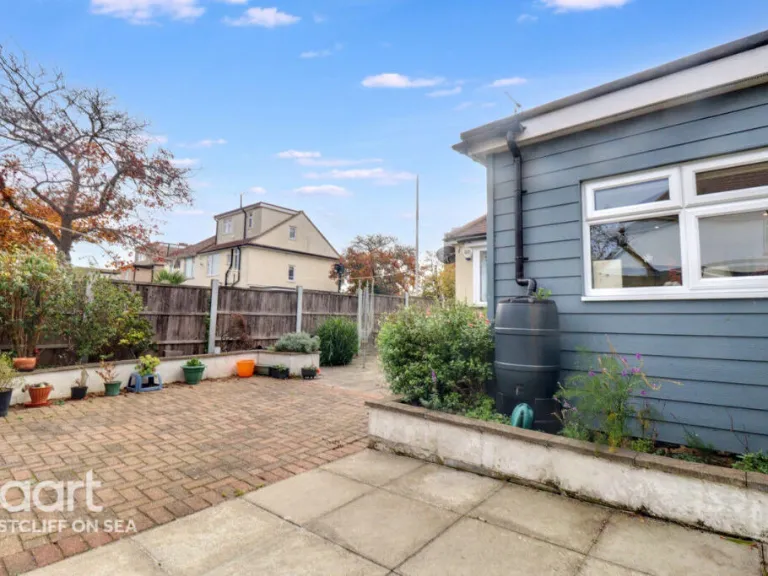
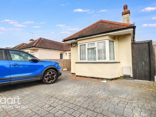
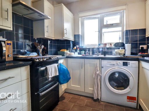
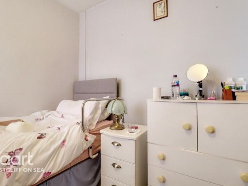
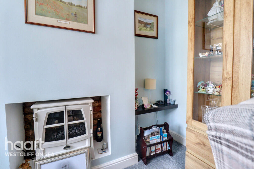
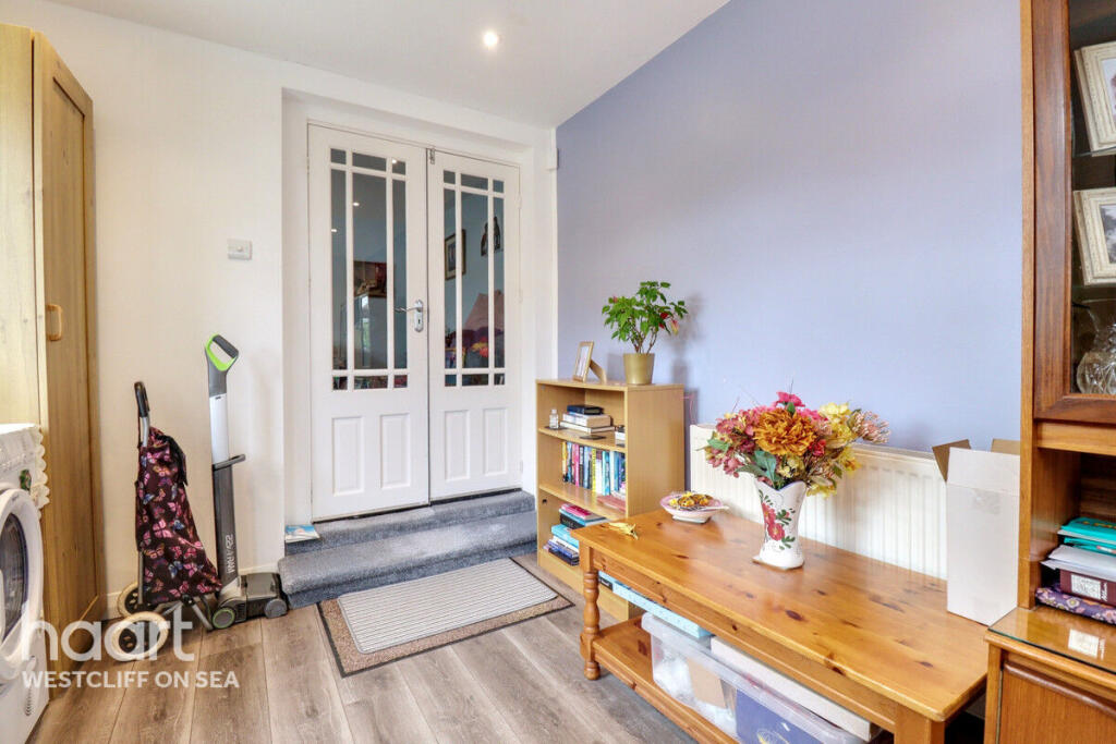
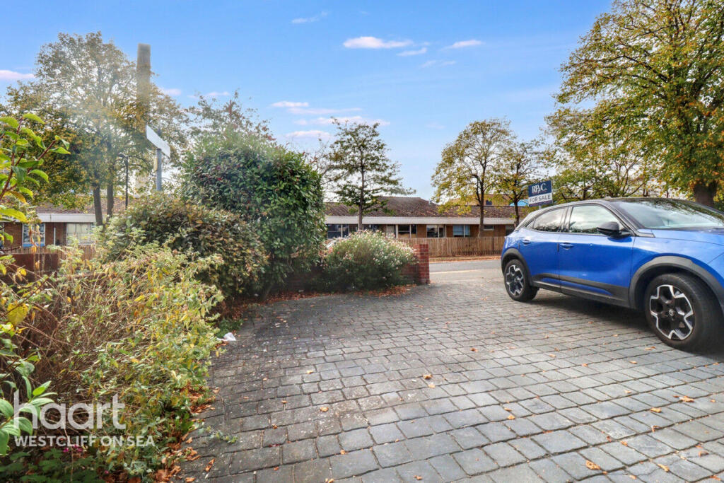
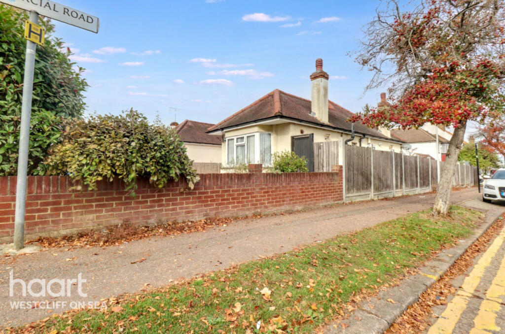
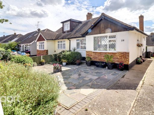
- bungalow traditional
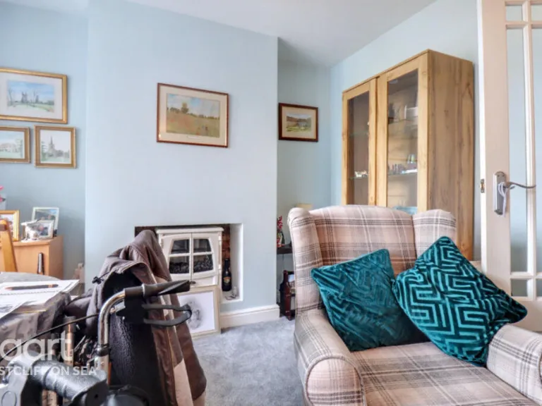
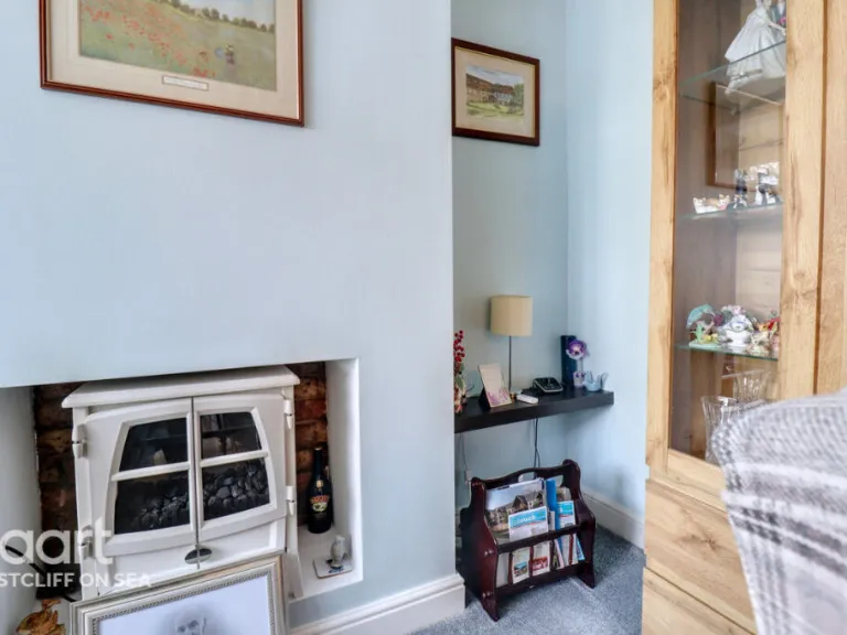
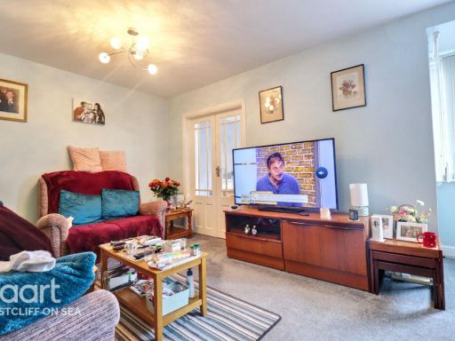
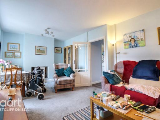
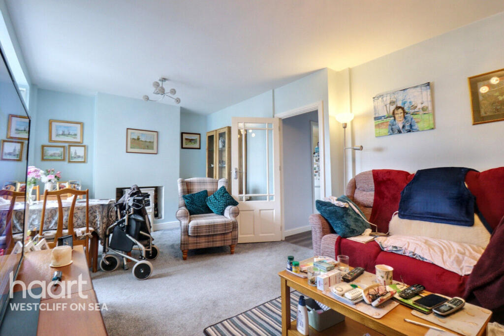
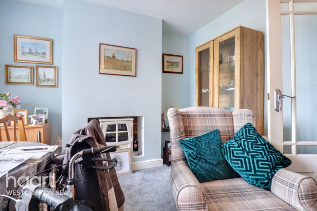
- living room mid-century modern
Floorplan Description
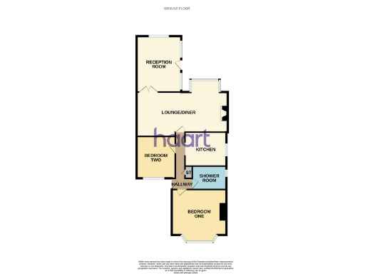
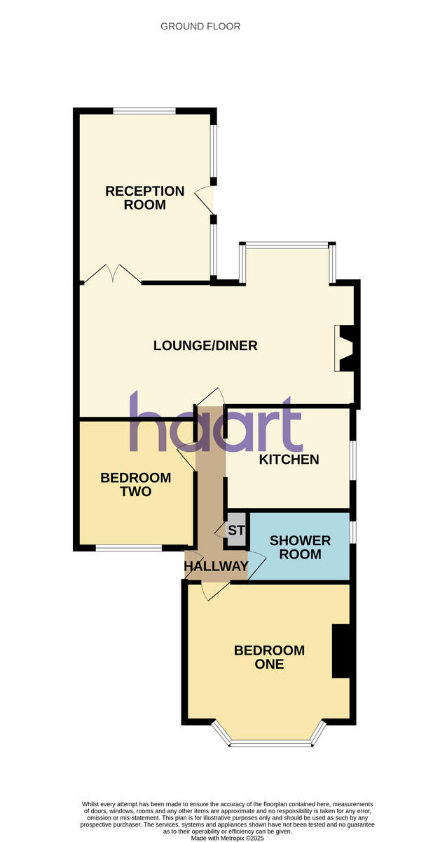
- Ground floor flat layout plan
Rooms
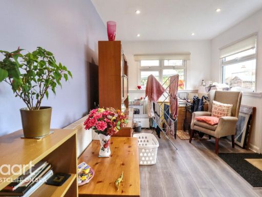
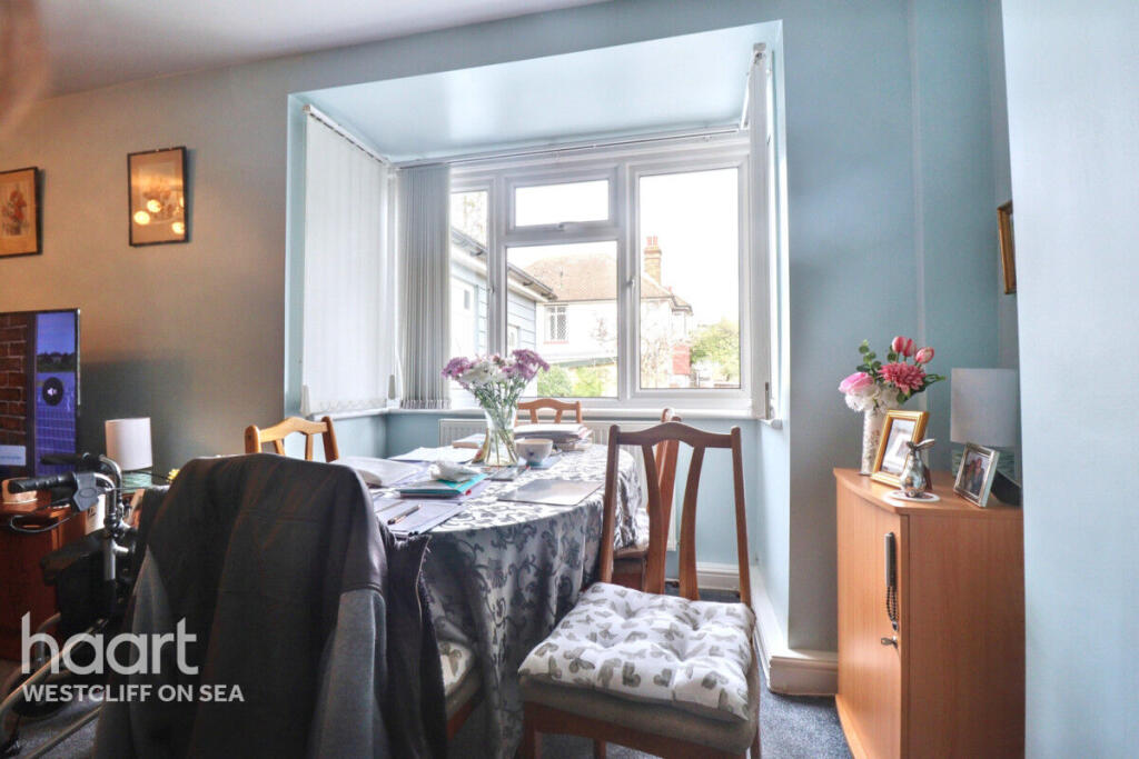
- RECEPTION ROOM:
- LOUNGE/DINER:
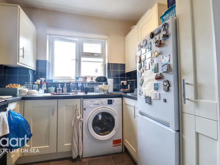
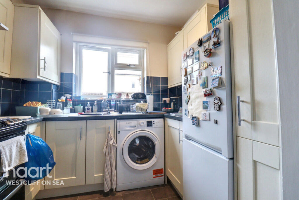
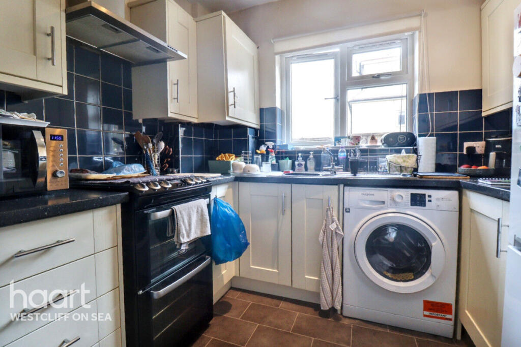
- KITCHEN:
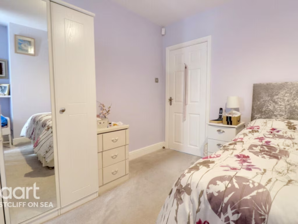
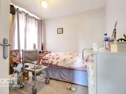
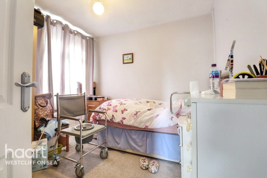
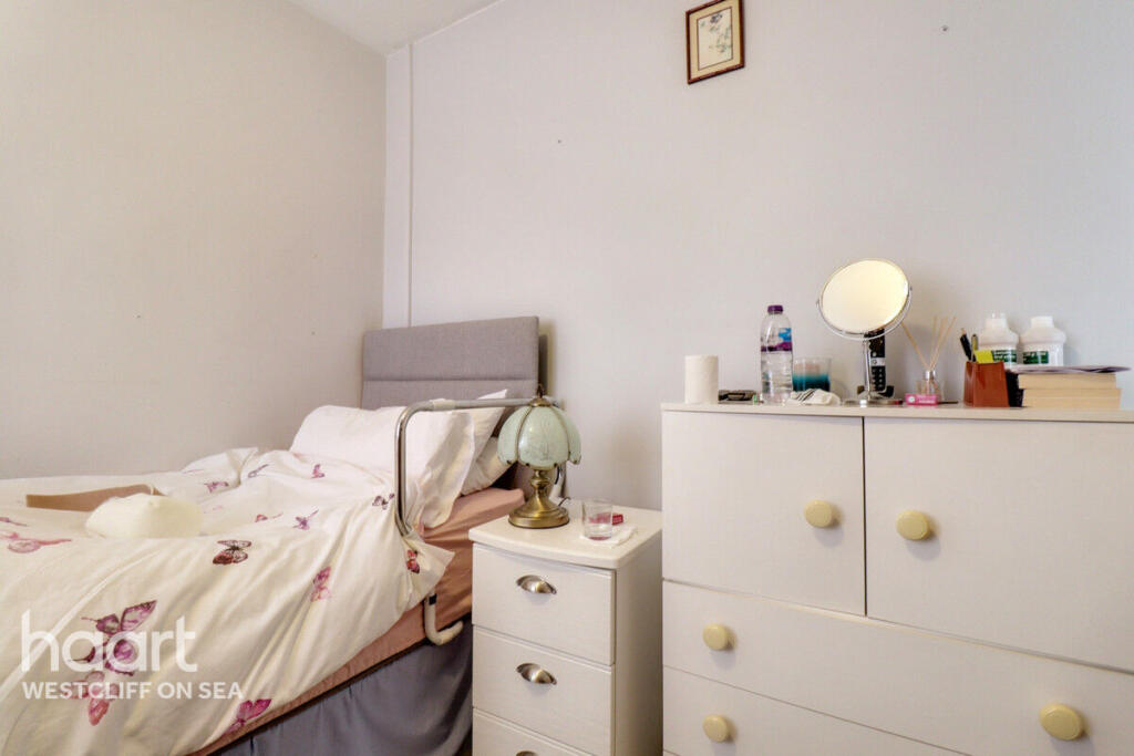
- BEDROOM TWO:
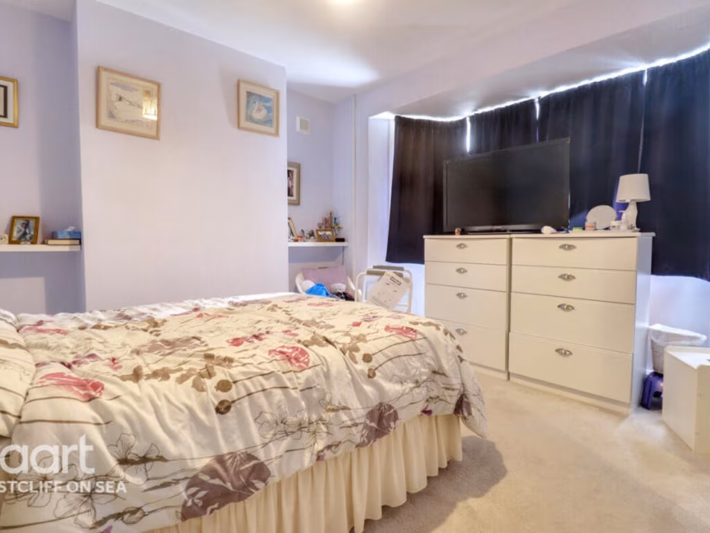
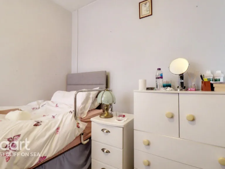
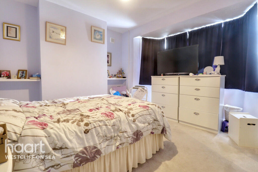
- BEDROOM ONE:
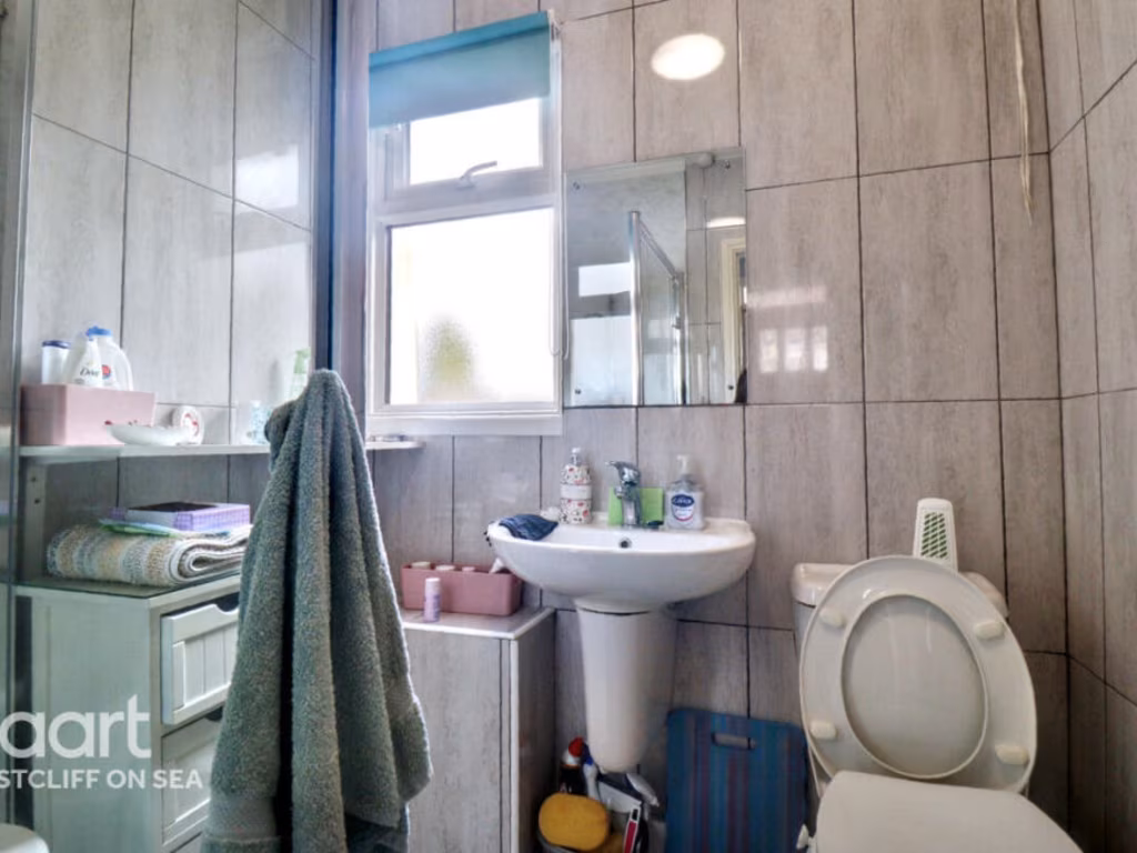
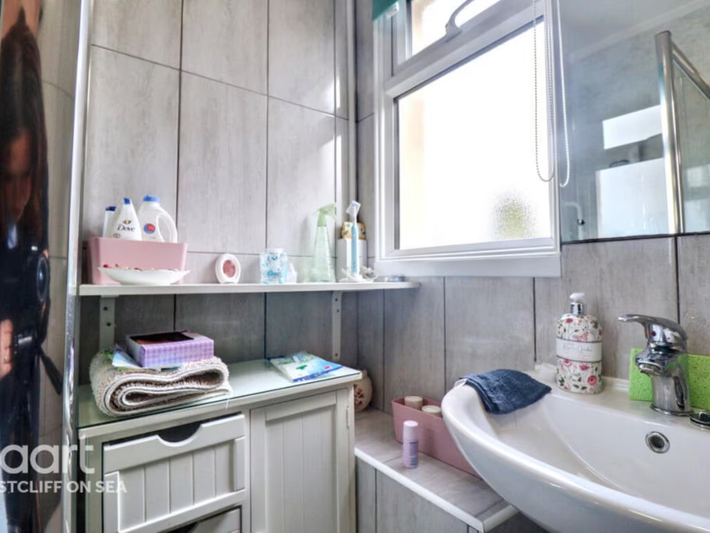
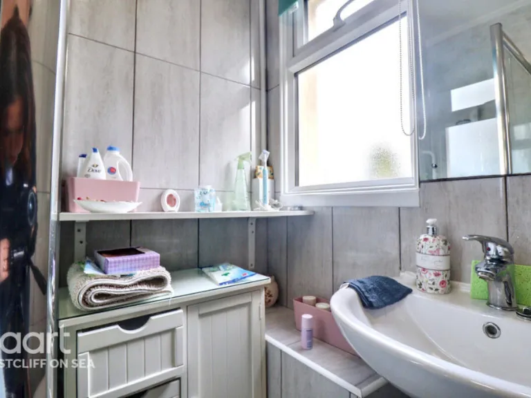
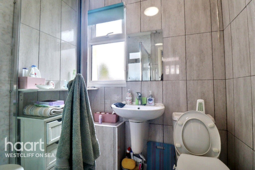
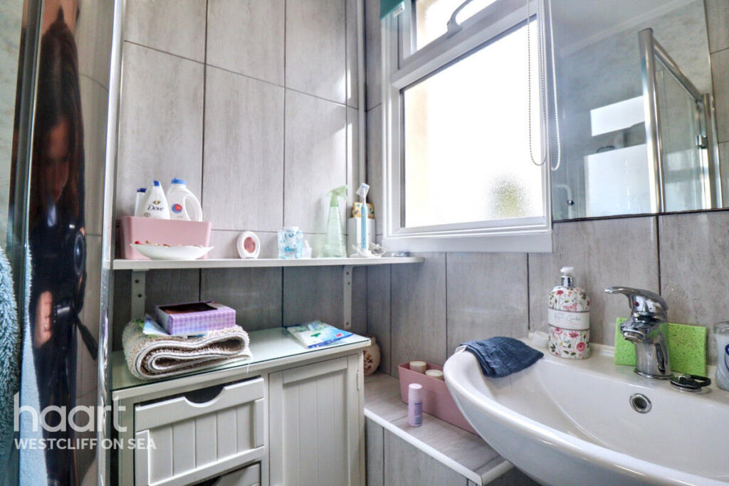
- SHOWER ROOM:
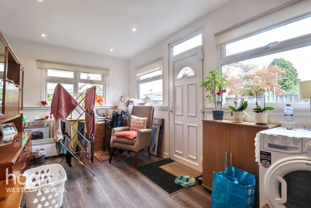
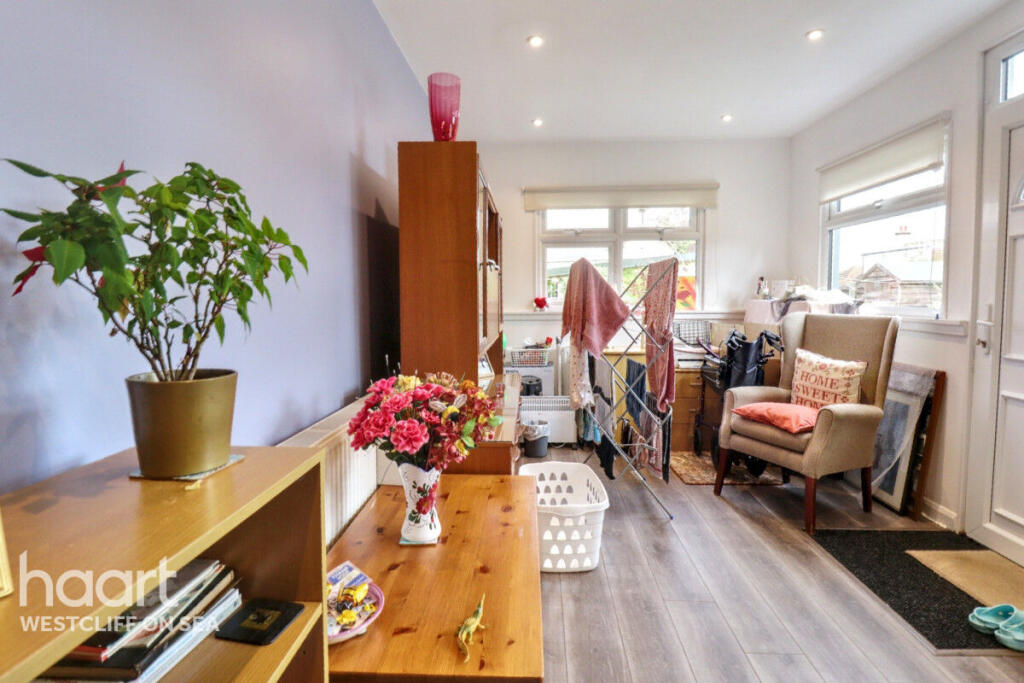
- HALLWAY:
- ST:
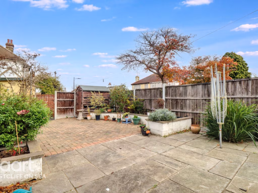
Textual Property Features
Detected Visual Features
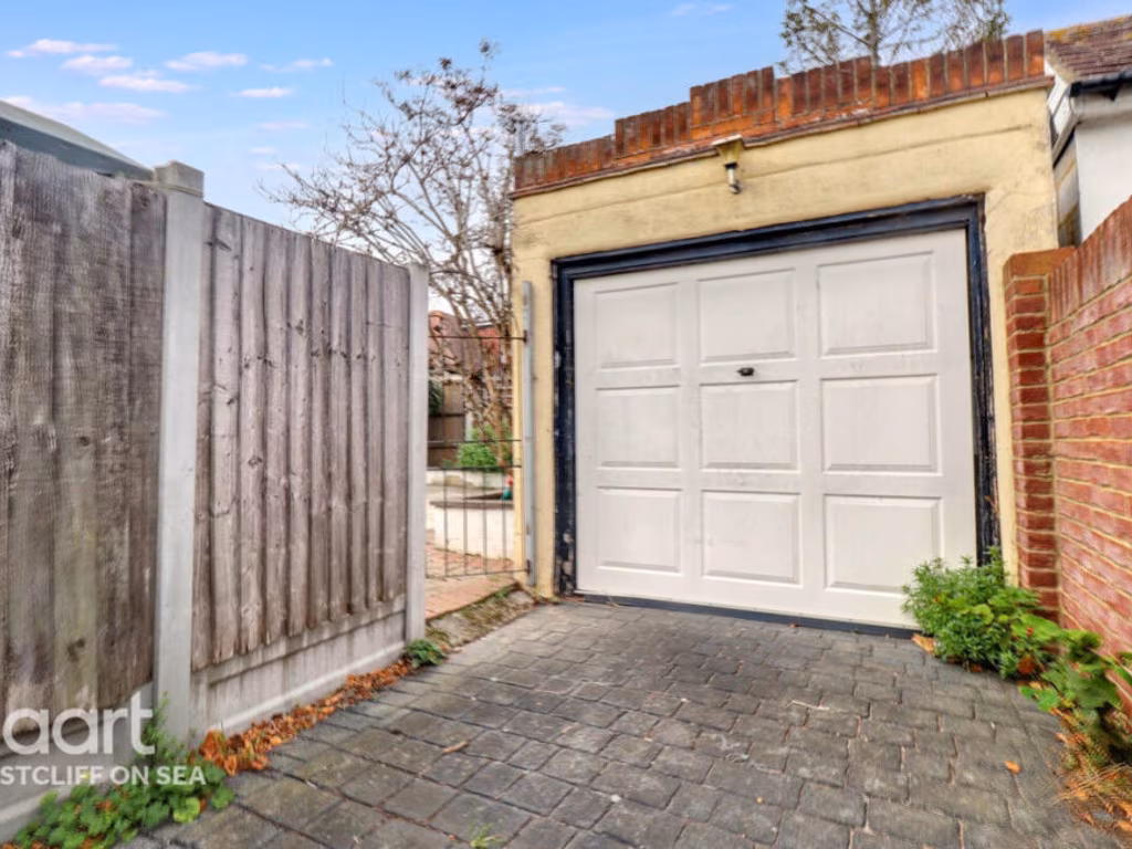
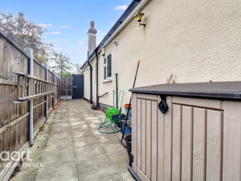
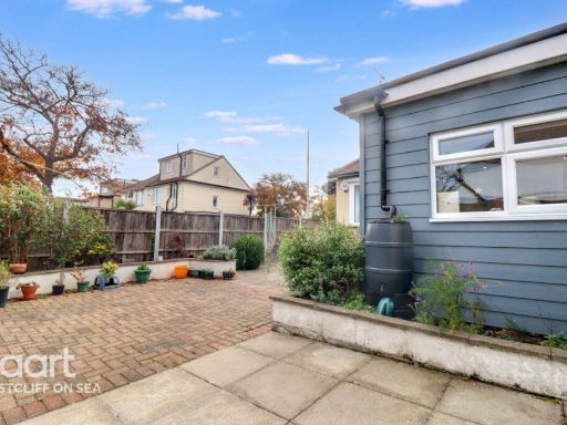
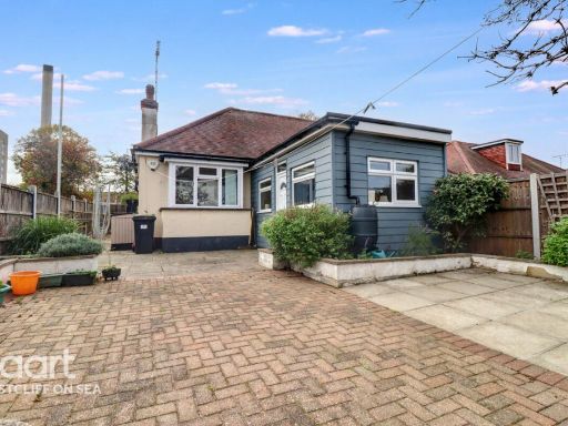
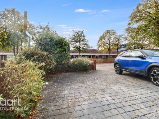
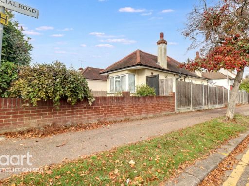
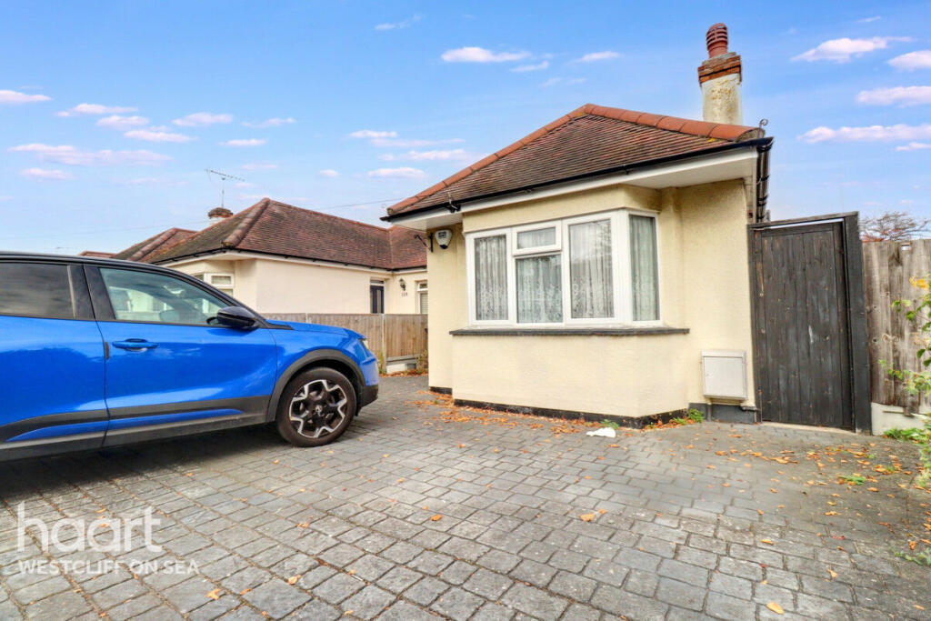
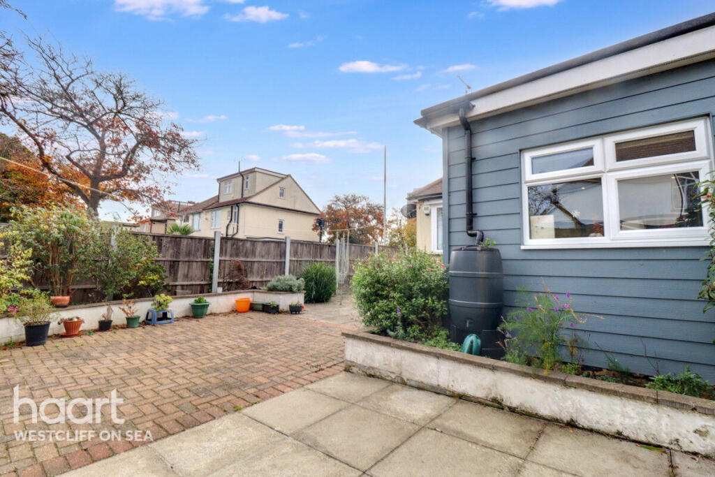
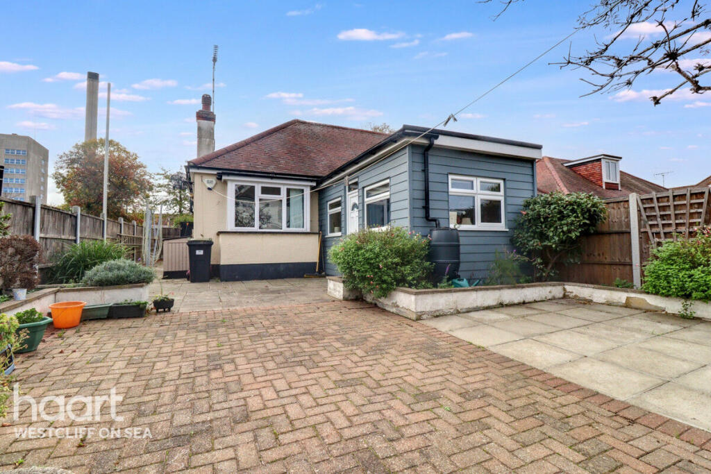
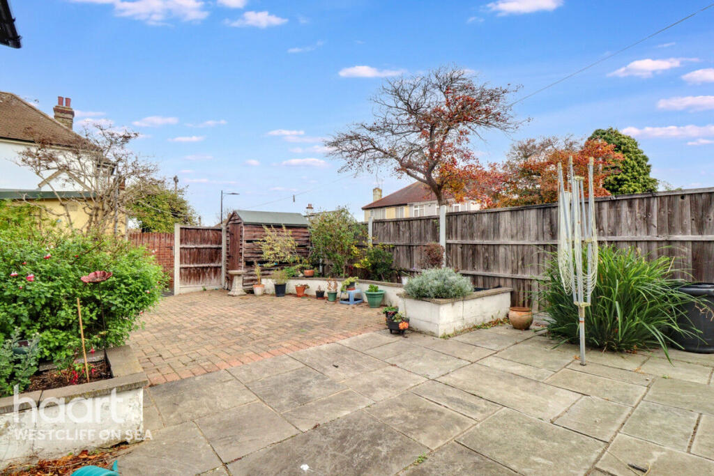
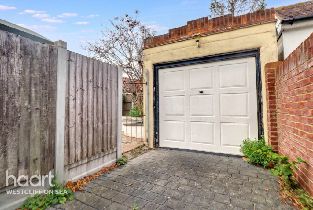
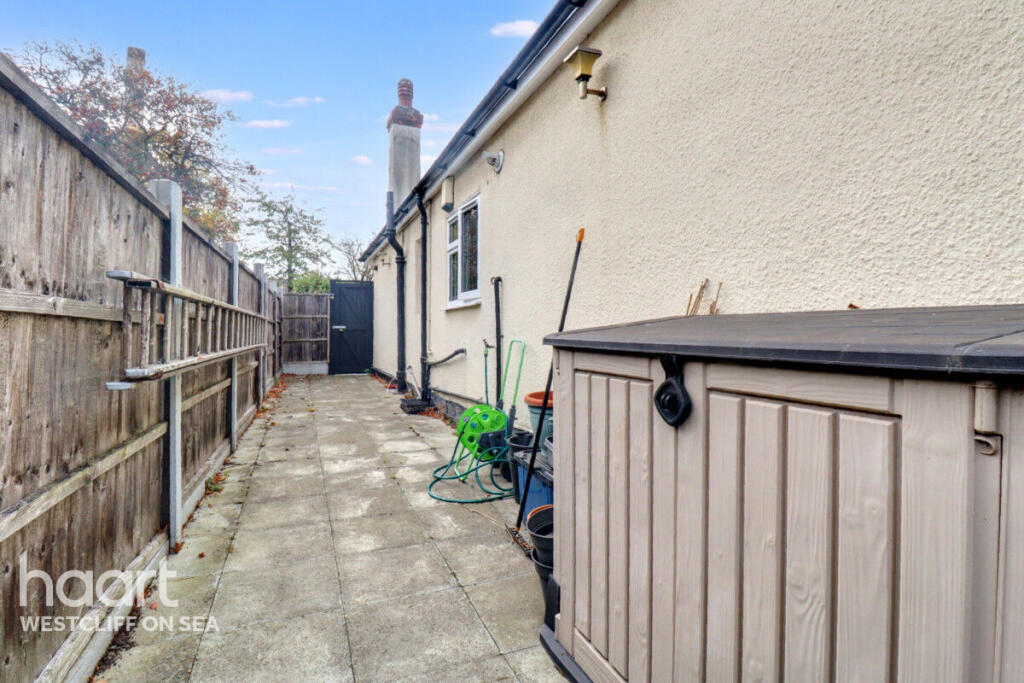
- bungalow
- single-story
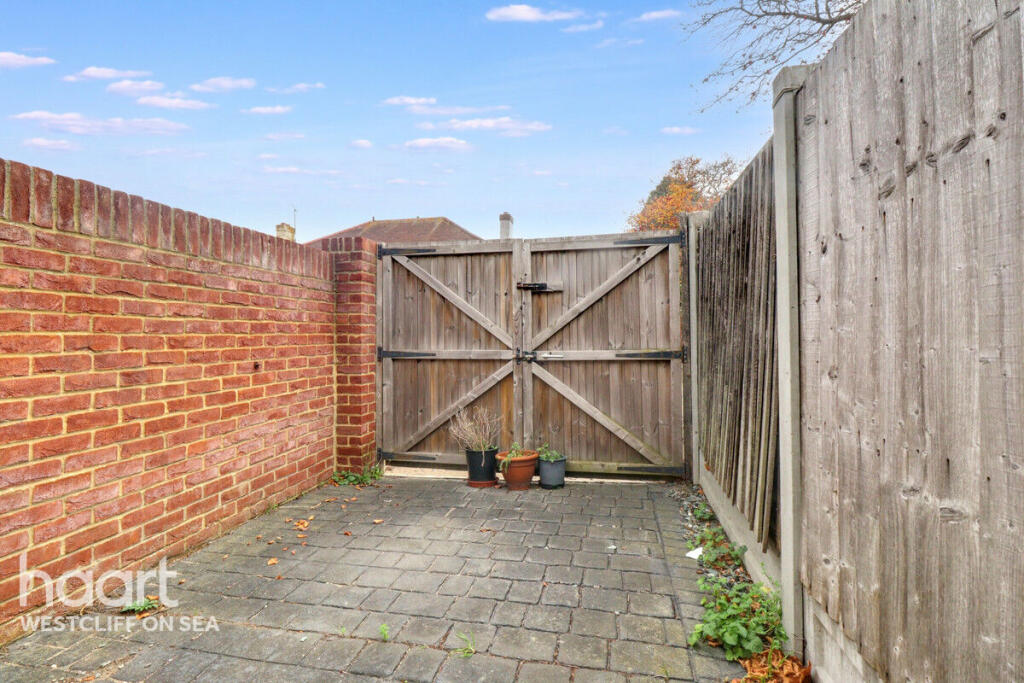
- detached
- driveway
- off-street parking
- pebble dash exterior
- dated exterior
- roof tiles
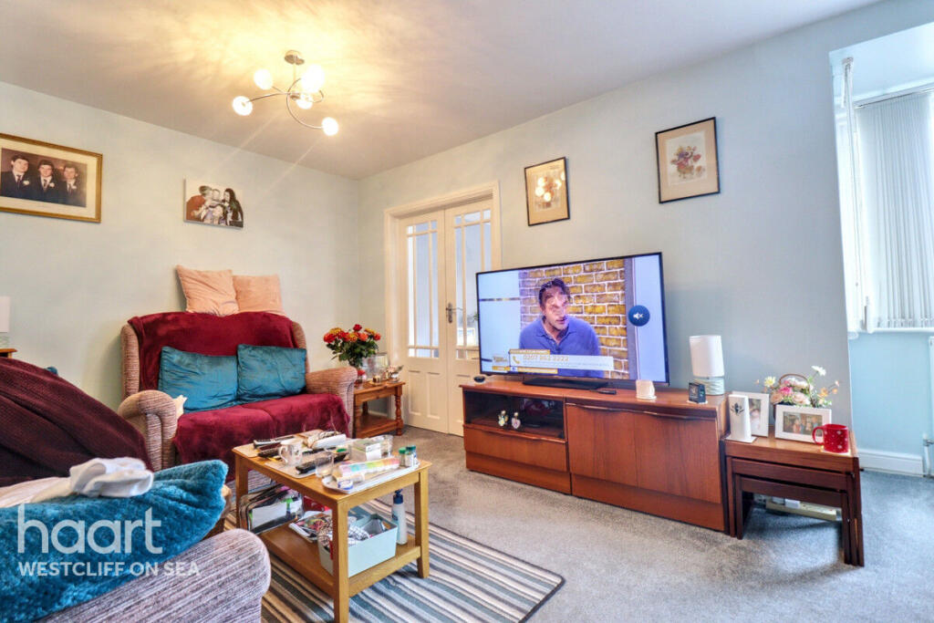
- mid-century modern
- living room
- standard ceiling
- French doors
- TV area
- laminated flooring
EPC Details
- Fully double glazed
- Solid brick, as built, no insulation (assumed)
- Boiler and radiators, mains gas
- Low energy lighting in 57% of fixed outlets
- Solid, no insulation (assumed)
Nearby Schools
- St Bernard's High School
- Westcliff High School for Boys Academy
- Blenheim Primary School
- Earls Hall Primary School
- Westcliff High School for Girls
- Chase High School
- The Eastwood Academy
- Milton Hall Primary School and Nursery
- St Helen's Catholic Primary School
- St Mary's, Prittlewell, CofE Primary School
- Saint Pierre School
- Chalkwell Hall Infant School
- Our Lady of Lourdes Catholic Primary School
- Darlinghurst Academy
- Southend High School for Boys
- St Thomas More High School
- Prince Avenue Academy and Nursery
- Eastwood Primary School & Nursery
- Heycroft Primary School
- Rochford Primary and Nursery School
- Beis Chinuch Lebonos Westcliff
- Chalkwell Hall Junior School
- Westborough Academy
- Southend YMCA Community School
Nearest General Shops
- Id: 1237307020
- Tags:
- Shop: alcohol
- Wheelchair: yes
- TagsNormalized:
- Lat: 51.5585004
- Lon: 0.6968085
- FullGeoHash: u10mrcgqhc44
- PartitionGeoHash: u10m
- Images:
- FoodStandards: null
- Distance: 658.1
,- Id: 9200915763
- Tags:
- Name: Essex Motorcycles
- Shop: motorcycle
- TagsNormalized:
- Lat: 51.5596026
- Lon: 0.6869305
- FullGeoHash: u10mrdhhqws9
- PartitionGeoHash: u10m
- Images:
- FoodStandards: null
- Distance: 480.7
,- Id: 996465254
- Tags:
- Building: yes
- Name: Essex Motorcycles
- Shop: motorcycle
- TagsNormalized:
- Lat: 51.5595709
- Lon: 0.6868737
- FullGeoHash: u10mrdhhm2dh
- PartitionGeoHash: u10m
- Images:
- FoodStandards: null
- Distance: 478.3
}
Nearest Grocery shops
- Id: 184518151
- Tags:
- Building: retail
- Shop: convenience
- TagsNormalized:
- Lat: 51.5508729
- Lon: 0.6802786
- FullGeoHash: u10mr2x3eehq
- PartitionGeoHash: u10m
- Images:
- FoodStandards: null
- Distance: 770.1
,- Id: 5818752516
- Tags:
- Name: Ray Dons
- Shop: convenience
- TagsNormalized:
- Lat: 51.5577041
- Lon: 0.6958082
- FullGeoHash: u10mrcf9ms8h
- PartitionGeoHash: u10m
- Images:
- FoodStandards: null
- Distance: 554.3
,- Id: 642437046
- Tags:
- Brand: Costcutter
- Brand:wikidata: Q5175072
- Brand:wikipedia: en:Costcutter
- Name: Costcutter
- Shop: convenience
- TagsNormalized:
- costcutter
- convenience
- shop
- Lat: 51.5566249
- Lon: 0.6835721
- FullGeoHash: u10mr99g07kq
- PartitionGeoHash: u10m
- Images:
- FoodStandards: null
- Distance: 377.9
}
Nearest Religious buildings
- Id: 89507510
- Tags:
- Amenity: place_of_worship
- Building: yes
- Denomination: catholic
- Name: St John Fisher Catholic Church
- Religion: christian
- TagsNormalized:
- place of worship
- catholic
- church
- christian
- Lat: 51.5565513
- Lon: 0.702113
- FullGeoHash: u10mrcx68mtr
- PartitionGeoHash: u10m
- Images:
- FoodStandards: null
- Distance: 937.1
,- Id: 615332803
- Tags:
- Amenity: place_of_worship
- Building: yes
- Denomination: baptist
- Name: Earls Hall Baptist Church
- Religion: christian
- TagsNormalized:
- place of worship
- baptist
- church
- christian
- Lat: 51.5572913
- Lon: 0.6958697
- FullGeoHash: u10mrcdwyzwn
- PartitionGeoHash: u10m
- Images:
- FoodStandards: null
- Distance: 538.8
,- Id: 14360349
- Tags:
- Amenity: place_of_worship
- Building: yes
- Denomination: anglican
- Name: St Peter, Westcliff
- Religion: christian
- Type: multipolygon
- Wikidata: Q105083710
- TagsNormalized:
- place of worship
- anglican
- christian
- church
- Lat: 51.5552128
- Lon: 0.6833952
- FullGeoHash: u10mr93duk0r
- PartitionGeoHash: u10m
- Images:
- FoodStandards: null
- Distance: 366.2
}
Nearest Medical buildings
- Id: 672996278
- Tags:
- Amenity: pharmacy
- Healthcare: pharmacy
- TagsNormalized:
- Lat: 51.557412
- Lon: 0.6744166
- FullGeoHash: u10mr3epen1q
- PartitionGeoHash: u10m
- Images:
- FoodStandards: null
- Distance: 1010.8
,- Id: 161482615
- Tags:
- Addr:
- City: Westcliff-on-Sea
- Housenumber: 314
- Postcode: SS0 0AF
- Street: Southbourne Grove
- Amenity: doctors
- Building: yes
- Description: GP's Surgery -- no emergency services, appointments usually required
- Healthcare: doctor
- Healthcare:speciality: general
- Name: Southbourne Grove Surgery
- Operator: Dr Chaturvedie
- TagsNormalized:
- doctor
- doctors
- health
- healthcare
- general
- surgery
- Lat: 51.5568257
- Lon: 0.6786884
- FullGeoHash: u10mr3whq8fu
- PartitionGeoHash: u10m
- Images:
- FoodStandards: null
- Distance: 708.4
,- Id: 5818752515
- Tags:
- Amenity: pharmacy
- Dispensing: yes
- Healthcare: pharmacy
- TagsNormalized:
- Lat: 51.5579651
- Lon: 0.6959153
- FullGeoHash: u10mrcffbj21
- PartitionGeoHash: u10m
- Images:
- FoodStandards: null
- Distance: 574.7
,- Id: 49654985
- Tags:
- Addr:
- City: Southend-on-Sea
- Postcode: SS0 0RY
- Street: Prittlewell Chase
- Amenity: hospital
- Contact:
- Emergency: yes
- Healthcare: hospital
- Name: Southend University Hospital
- Operator: Mid and South Essex NHS Foundation Trust
- Operator:type: government
- Ref:
- Website: https://www.mse.nhs.uk/
- Wheelchair: yes
- Wikidata: Q7569543
- Wikipedia: en:Southend University Hospital NHS Foundation Trust
- TagsNormalized:
- hospital
- health
- healthcare
- university
- Lat: 51.5542589
- Lon: 0.6881484
- FullGeoHash: u10mr9jj742t
- PartitionGeoHash: u10m
- Images:
- FoodStandards: null
- Distance: 134.2
}
Nearest Airports
- Id: 103894219
- Tags:
- Aerodrome: international
- Aeroway: aerodrome
- Iata: SEN
- Icao: EGMC
- Name: London Southend Airport
- Old_name: Southend Municipal Airport
- Ref: SEN
- Wikidata: Q1415441
- TagsNormalized:
- airport
- international airport
- Lat: 51.5701749
- Lon: 0.6924624
- FullGeoHash: u10mru04p937
- PartitionGeoHash: u10m
- Images:
- FoodStandards: null
- Distance: 1661.5
,- Id: 121158889
- Tags:
- Aerodrome: continental
- Aeroway: aerodrome
- Fhrs:
- Authority: City of London Corporation
- Iata: LCY
- Icao: EGLC
- Name: London City Airport
- Operator: London City Airport Limited
- Ref: LCY
- Website: https://www.londoncityairport.com/
- Wikidata: Q8982
- Wikipedia: en:London City Airport
- TagsNormalized:
- airport
- continental airport
- Lat: 51.5042658
- Lon: 0.0539987
- FullGeoHash: u10j10p64702
- PartitionGeoHash: u10j
- Images:
- FoodStandards: null
- Distance: 44271.1
}
Nearest Leisure Facilities
- Id: 311781318
- Tags:
- Leisure: pitch
- Sport: soccer
- TagsNormalized:
- Lat: 51.5525611
- Lon: 0.6821738
- FullGeoHash: u10mr8bervct
- PartitionGeoHash: u10m
- Images:
- FoodStandards: null
- Distance: 550.9
,- Id: 311781321
- Tags:
- Leisure: pitch
- Sport: soccer
- TagsNormalized:
- Lat: 51.5522129
- Lon: 0.6826873
- FullGeoHash: u10mr8c17v08
- PartitionGeoHash: u10m
- Images:
- FoodStandards: null
- Distance: 546.7
,- Id: 311781328
- Tags:
- Leisure: pitch
- Sport: soccer
- TagsNormalized:
- Lat: 51.552538
- Lon: 0.6824595
- FullGeoHash: u10mr8bgq3we
- PartitionGeoHash: u10m
- Images:
- FoodStandards: null
- Distance: 536.4
,- Id: 311781325
- Tags:
- Leisure: pitch
- Sport: soccer
- TagsNormalized:
- Lat: 51.5525144
- Lon: 0.6827504
- FullGeoHash: u10mr8c5jjpw
- PartitionGeoHash: u10m
- Images:
- FoodStandards: null
- Distance: 522
,- Id: 1079142513
- Tags:
- Leisure: pitch
- Sport: tennis
- TagsNormalized:
- Lat: 51.5546645
- Lon: 0.6838548
- FullGeoHash: u10mr91zwyp0
- PartitionGeoHash: u10m
- Images:
- FoodStandards: null
- Distance: 344.1
}
Nearest Tourist attractions
- Id: 50831146
- Tags:
- Addr:
- City: Southend-on-Sea
- Housename: Southend Central Museum
- Postcode: SS2 6EW
- Street: Victoria Avenue
- Building: yes
- Name: Southend Central Museum
- Tourism: museum
- Website: http://www.southendmuseums.co.uk/
- Wheelchair: no
- Wikidata: Q7569537
- Wikipedia: en:Southend Central Museum
- TagsNormalized:
- Lat: 51.542265
- Lon: 0.7107781
- FullGeoHash: u10t0nvx6qdd
- PartitionGeoHash: u10t
- Images:
- FoodStandards: null
- Distance: 2115.1
,- Id: 50831165
- Tags:
- Addr:
- City: Southend-on-Sea
- Housename: Beecroft Art Gallery
- Postcode: SS2 6EX
- Street: Victoria Avenue
- Alt_name: Southend Central Library
- Building: yes
- Name: Beecroft Art Gallery
- Operator: Southend-on-Sea Borough Council
- Tourism: gallery
- Wheelchair: yes
- TagsNormalized:
- Lat: 51.5427289
- Lon: 0.7106109
- FullGeoHash: u10t0pj6nmjf
- PartitionGeoHash: u10t
- Images:
- FoodStandards: null
- Distance: 2071.3
,- Id: 212452014
- Tags:
- Building: yes
- Name: Prittlewell Priory
- Tourism: museum
- Website: http://www.southendmuseums.co.uk/prittlewell/
- Wheelchair: limited
- Wikidata: Q7245990
- Wikipedia: en:Prittlewell Priory
- TagsNormalized:
- Lat: 51.5537511
- Lon: 0.7053951
- FullGeoHash: u10t211dkgu8
- PartitionGeoHash: u10t
- Images:
- FoodStandards: null
- Distance: 1170.3
}
Nearest Train stations
- Id: 6733461094
- Tags:
- Name: Chalkwell
- Naptan:
- Network: National Rail
- Public_transport: station
- Railway: station
- Ref:
- Source: NPE
- Wikidata: Q744484
- Wikipedia: en:Chalkwell railway station
- TagsNormalized:
- Lat: 51.5386117
- Lon: 0.6698419
- FullGeoHash: u10mpnrf0mw6
- PartitionGeoHash: u10m
- Images:
- FoodStandards: null
- Distance: 2278.1
,- Id: 7140234411
- Tags:
- Addr:
- Name: Southend Victoria
- Naptan:
- Network: National Rail
- Public_transport: station
- Railway: station
- Ref:
- Website: http://www.nationalrail.co.uk/stations/sov/details.html
- Wikidata: Q3254036
- Wikipedia: en:Southend Victoria railway station
- TagsNormalized:
- Lat: 51.5429361
- Lon: 0.7114814
- FullGeoHash: u10t0pn56ewy
- PartitionGeoHash: u10t
- Images:
- FoodStandards: null
- Distance: 2100.5
,- Id: 7140234412
- Tags:
- Name: Westcliff
- Naptan:
- Network: National Rail
- Public_transport: station
- Railway: station
- Ref:
- Wikidata: Q2319277
- Wikipedia: en:Westcliff railway station
- TagsNormalized:
- Lat: 51.5374449
- Lon: 0.6915156
- FullGeoHash: u10mpwpe3kp3
- PartitionGeoHash: u10m
- Images:
- FoodStandards: null
- Distance: 2008.2
,- Id: 6083524594
- Tags:
- Name: Southend Airport
- Naptan:
- Network: National Rail
- Public_transport: station
- Railway: station
- Ref:
- Wikidata: Q7569535
- Wikipedia: en:Southend Airport railway station
- TagsNormalized:
- Lat: 51.569686
- Lon: 0.7052992
- FullGeoHash: u10t25cx4wjp
- PartitionGeoHash: u10t
- Images:
- FoodStandards: null
- Distance: 1958.6
,- Id: 314994462
- Tags:
- Name: Prittlewell
- Naptan:
- Network: National Rail
- Public_transport: station
- Railway: station
- Ref:
- Wikidata: Q1880808
- Wikipedia: en:Prittlewell railway station
- TagsNormalized:
- Lat: 51.5505931
- Lon: 0.7106494
- FullGeoHash: u10t20mrzr49
- PartitionGeoHash: u10t
- Images:
- FoodStandards: null
- Distance: 1610.8
}
Nearest Bus stations and stops
- Id: 1585264750
- Tags:
- Bus: yes
- Highway: bus_stop
- Local_ref: A
- Name: Southend Hospital
- Public_transport: platform
- TagsNormalized:
- Lat: 51.5530576
- Lon: 0.6878847
- FullGeoHash: u10mr8uykfkp
- PartitionGeoHash: u10m
- Images:
- FoodStandards: null
- Distance: 268.3
,- Id: 2411565911
- Tags:
- Bus: yes
- Highway: bus_stop
- Local_ref: C
- Name: Southend Hospital
- Public_transport: platform
- TagsNormalized:
- Lat: 51.5530576
- Lon: 0.6881583
- FullGeoHash: u10mr8vn762p
- PartitionGeoHash: u10m
- Images:
- FoodStandards: null
- Distance: 265
,- Id: 2411565913
- Tags:
- Bus: yes
- Highway: bus_stop
- Local_ref: D
- Name: Southend Hospital
- Public_transport: platform
- TagsNormalized:
- Lat: 51.5530559
- Lon: 0.6883755
- FullGeoHash: u10mr8vq261v
- PartitionGeoHash: u10m
- Images:
- FoodStandards: null
- Distance: 263.6
,- Id: 1831540353
- Tags:
- Bus: yes
- Highway: bus_stop
- Public_transport: platform
- TagsNormalized:
- Lat: 51.5562518
- Lon: 0.6899759
- FullGeoHash: u10mr9w2vtgm
- PartitionGeoHash: u10m
- Images:
- FoodStandards: null
- Distance: 128.8
,- Id: 1831540358
- Tags:
- Bus: yes
- Highway: bus_stop
- Public_transport: platform
- TagsNormalized:
- Lat: 51.5562201
- Lon: 0.6895213
- FullGeoHash: u10mr9w0g002
- PartitionGeoHash: u10m
- Images:
- FoodStandards: null
- Distance: 106.3
}
Nearest Hotels
- Id: 764337091
- Tags:
- Brand: Holiday Inn
- Brand:wikidata: Q2717882
- Brand:wikipedia: en:Holiday Inn
- Building: yes
- Name: Holiday Inn Southend
- Tourism: hotel
- TagsNormalized:
- Lat: 51.5668326
- Lon: 0.7015931
- FullGeoHash: u10mrgqys63d
- PartitionGeoHash: u10m
- Images:
- FoodStandards: null
- Distance: 1551.6
,- Id: 1050176048
- Tags:
- Name: Clifton Lodge
- Tourism: hotel
- TagsNormalized:
- Lat: 51.5435658
- Lon: 0.6988235
- FullGeoHash: u10mpzhz5c0d
- PartitionGeoHash: u10m
- Images:
- FoodStandards: null
- Distance: 1492.9
,- Id: 94207804
- Tags:
- Addr:
- City: Southend-on-Sea
- Postcode: SS2 6GB
- Street: Thanet Grange
- Brand: Premier Inn
- Brand:wikidata: Q2108626
- Brand:wikipedia: en:Premier Inn
- Building: yes
- Internet_access: wlan
- Internet_access:fee: customers
- Internet_access:operator: Virgin Media
- Internet_access:ssid: Premier Inn Free Wi-Fi
- Name: Premier Inn
- Operator: Whitbread
- Phone: +44 333 321 9014
- Smoking: outside
- Source: Bing
- Tourism: hotel
- Website: https://www.premierinn.com/gb/en/home.html
- TagsNormalized:
- Lat: 51.5625626
- Lon: 0.6818252
- FullGeoHash: u10mrd8mxwmd
- PartitionGeoHash: u10m
- Images:
- FoodStandards: null
- Distance: 925
}
Tags
- bungalow
- single-story
- detached
- driveway
- off-street parking
- pebble dash exterior
- dated exterior
- roof tiles
- mid-century modern
- living room
- standard ceiling
- French doors
- TV area
- laminated flooring
Local Market Stats
- Average Price/sqft: £335
- Avg Income: £43700
- Rental Yield: 4.6%
- Social Housing: 9%
- Planning Success Rate: 16%
AirBnB Data
- 1km average: £47/night
- Listings in 1km: 2
Similar Properties
 2 bedroom semi-detached bungalow for sale in Eastwood Park Drive, Leigh-On-Sea, SS9 — £365,000 • 2 bed • 1 bath
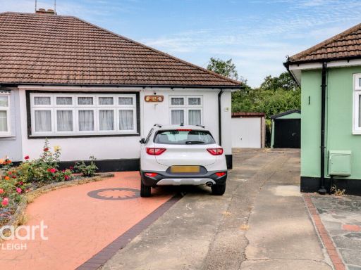 2 bedroom semi-detached bungalow for sale in Briarwood Close, Leigh-on-Sea, SS9 — £400,000 • 2 bed • 1 bath • 840 ft²
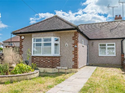 2 bedroom bungalow for sale in Oakengrange Drive, Southend-on-Sea, Essex, SS2 — £375,000 • 2 bed • 1 bath • 700 ft²
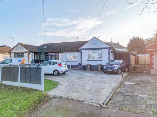 2 bedroom semi-detached bungalow for sale in EASTWOOD OLD ROAD, Leigh-On-Sea, SS9 — £450,000 • 2 bed • 1 bath • 785 ft²
 2 bedroom detached bungalow for sale in North Crescent, Southend-On-Sea, SS2 — £350,000 • 2 bed • 1 bath • 786 ft²
 2 bedroom semi-detached bungalow for sale in Leicester Avenue, Rochford, SS4 — £350,000 • 2 bed • 1 bath • 791 ft²
Meta
- {
"@context": "https://schema.org",
"@type": "Residence",
"name": "2 bedroom semidetached bungalow for sale in Carlingford Dri…",
"description": "",
"url": "https://propertypiper.co.uk/property/6ac51eab-2d3f-4f7c-a372-d303528ec3f0",
"image": "https://image-a.propertypiper.co.uk/5791ed46-ba4a-4a0f-9c96-66ac37d5664e-1024.jpeg",
"address": {
"@type": "PostalAddress",
"streetAddress": "151, Carlingford Drive",
"postalCode": "SS0 0SE",
"addressLocality": "Southend-on-Sea",
"addressRegion": "Southend West",
"addressCountry": "England"
},
"geo": {
"@type": "GeoCoordinates",
"latitude": 51.55541891892387,
"longitude": 0.6886818346618359
},
"numberOfRooms": 2,
"numberOfBathroomsTotal": 1,
"floorSize": {
"@type": "QuantitativeValue",
"value": 786,
"unitCode": "FTK"
},
"offers": {
"@type": "Offer",
"price": 325000,
"priceCurrency": "GBP",
"availability": "https://schema.org/InStock"
},
"additionalProperty": [
{
"@type": "PropertyValue",
"name": "Feature",
"value": "bungalow"
},
{
"@type": "PropertyValue",
"name": "Feature",
"value": "single-story"
},
{
"@type": "PropertyValue",
"name": "Feature",
"value": "detached"
},
{
"@type": "PropertyValue",
"name": "Feature",
"value": "driveway"
},
{
"@type": "PropertyValue",
"name": "Feature",
"value": "off-street parking"
},
{
"@type": "PropertyValue",
"name": "Feature",
"value": "pebble dash exterior"
},
{
"@type": "PropertyValue",
"name": "Feature",
"value": "dated exterior"
},
{
"@type": "PropertyValue",
"name": "Feature",
"value": "roof tiles"
},
{
"@type": "PropertyValue",
"name": "Feature",
"value": "mid-century modern"
},
{
"@type": "PropertyValue",
"name": "Feature",
"value": "living room"
},
{
"@type": "PropertyValue",
"name": "Feature",
"value": "standard ceiling"
},
{
"@type": "PropertyValue",
"name": "Feature",
"value": "French doors"
},
{
"@type": "PropertyValue",
"name": "Feature",
"value": "TV area"
},
{
"@type": "PropertyValue",
"name": "Feature",
"value": "laminated flooring"
}
]
}
High Res Floorplan Images
Compatible Floorplan Images
FloorplanImages Thumbnail