OL8 3QA - 2 bedroom semidetached bungalow for sale in Montgomery Stre…
View on Property Piper
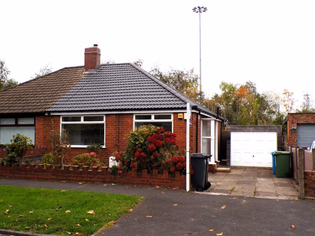
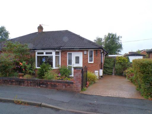
2 bedroom semi-detached bungalow for sale in Montgomery Street, Hollinwood, Oldham, OL8
Property Details
- Price: £234950
- Bedrooms: 2
- Bathrooms: 1
- Property Type: undefined
- Property SubType: undefined
Brochure Descriptions
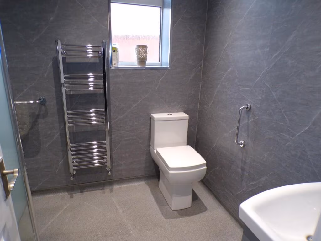
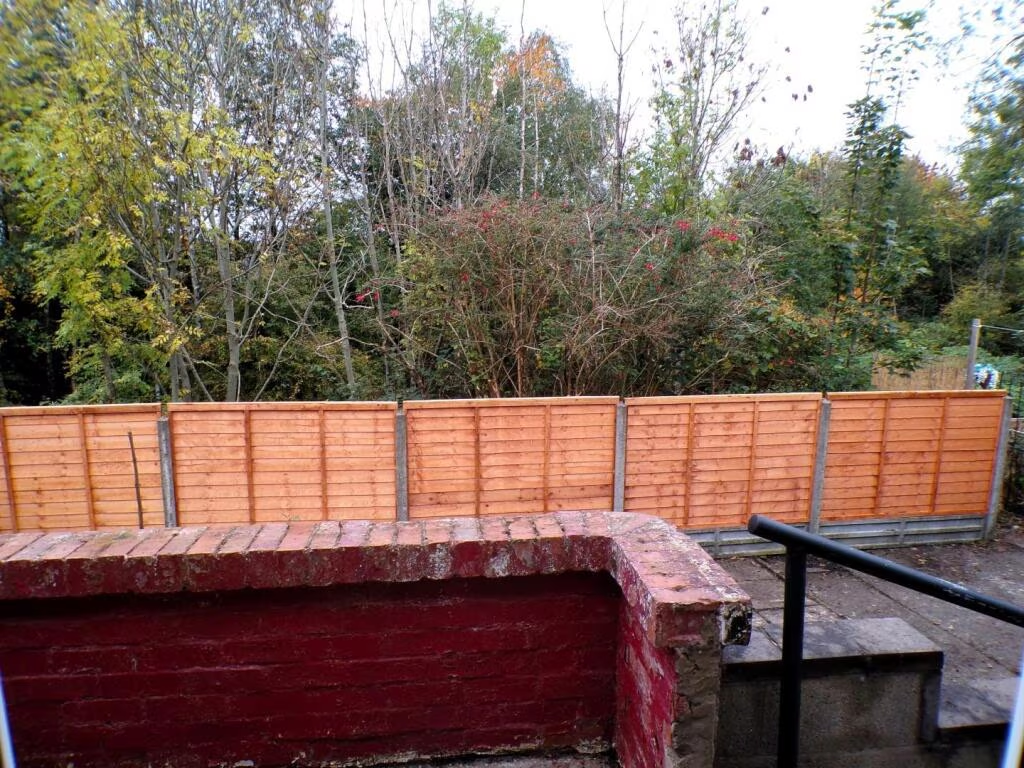
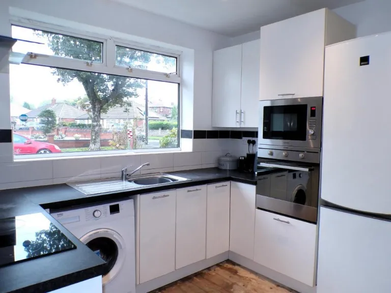
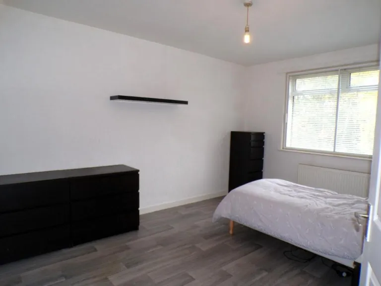
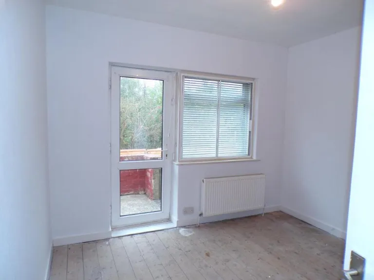
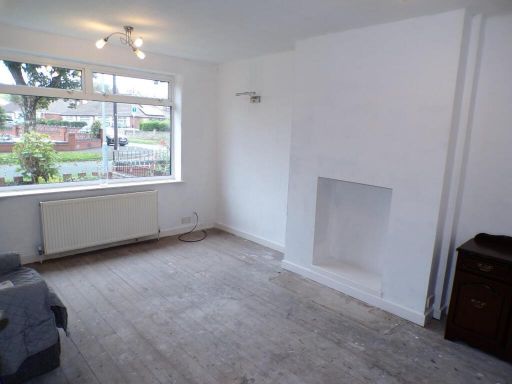
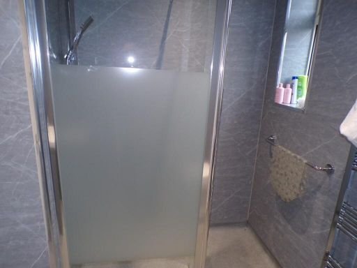
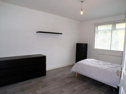
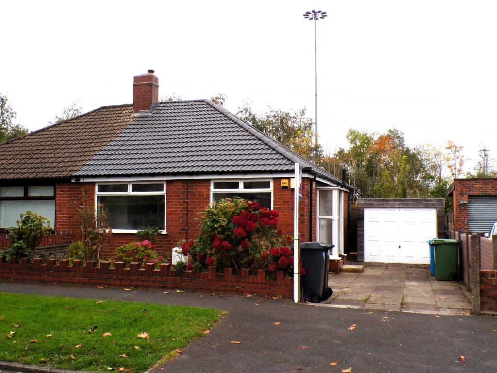
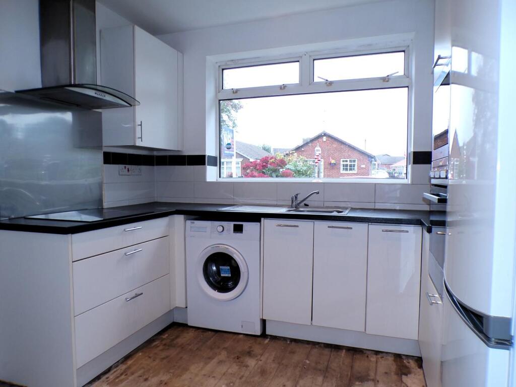
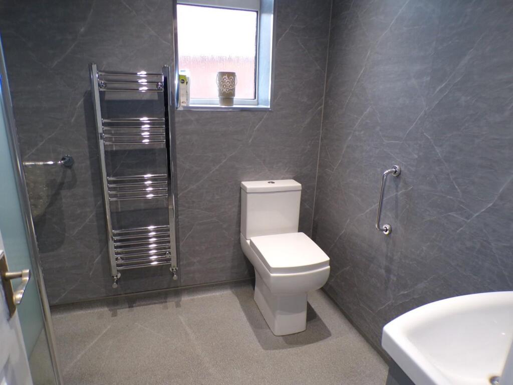
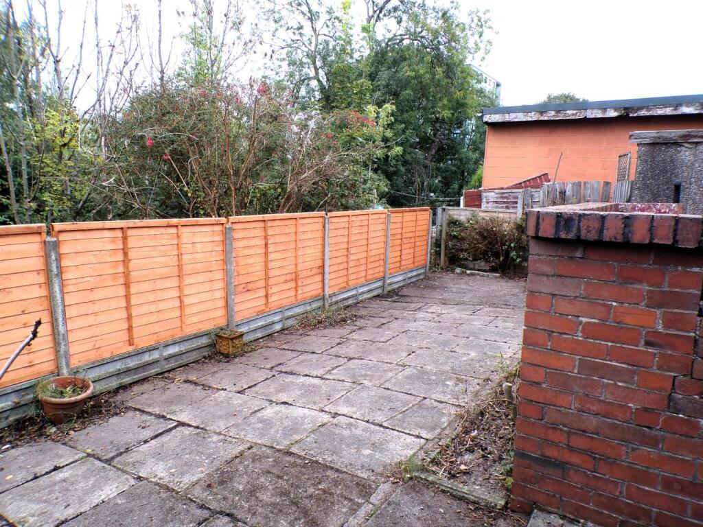
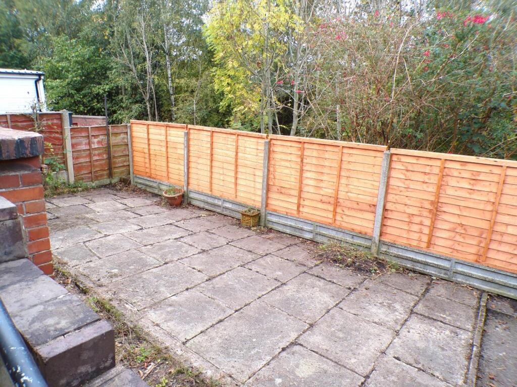
- Single-storey detached/semi-detached brick bungalow presented for sale. Exterior includes a front lawn, driveway leading to a single garage and a low-maintenance paved rear yard with boundary fencing (garden size: small to average). Interiors are neutrally decorated and appear recently refreshed: a fitted kitchen with integrated appliances and utility space, a bright front living room, two bedrooms of small-to-average size and a modern shower room with tiled finishes. Overall the property footprint is modest — suitable for a small family, downsizer or investor — and benefits from off-street parking and a private rear yard. No exceptional views visible (suburban street and neighbouring gardens).
Image Descriptions
- semi-detached bungalow mid-20th century
- room 20th Century
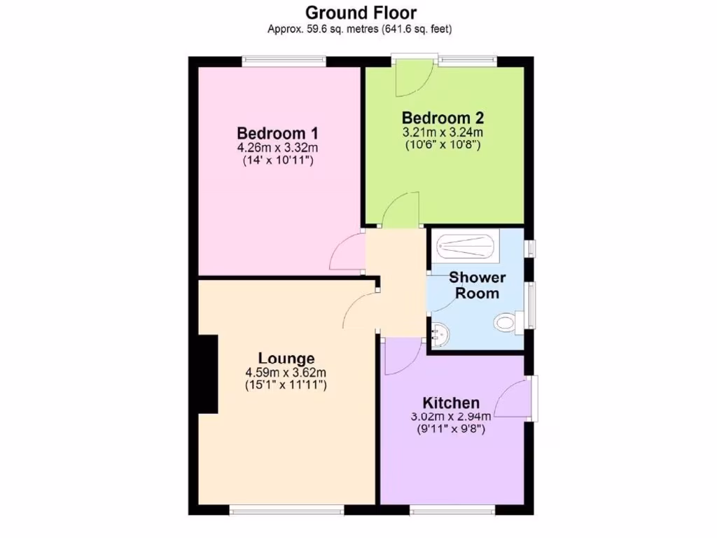
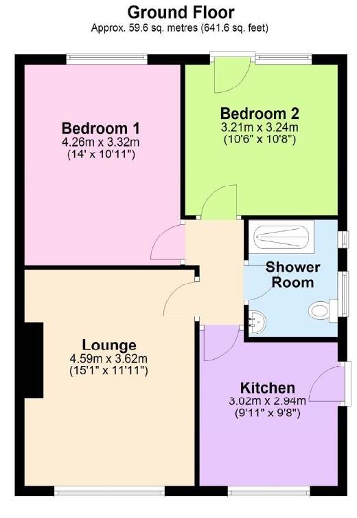
Rooms
- Bedroom 1:
- Bedroom 2:
- Lounge:
- Kitchen:
- Shower Room:
Textual Property Features
- Has Garden
- Chain Free
- Success
Detected Visual Features
- semi-detached
- bungalow
- mid-20th century
- garage
- driveway
- low maintenance
- single-story
- brick exterior
- detached
- large window
- natural light
- minimalist
- potential
- wood floors
- needs work
- update needed
- plaster issues
Nearby Schools
- St Mary's RC Primary School
- Co-op Academy Failsworth
- St John's Church of England Primary School
- Oasis Academy Limeside
- St Margaret's CofE Junior Infant and Nursery School
- Lyndhurst Primary and Nursery School
- Whitegate End Primary and Nursery School
- Yew Tree Community School
- Coppice Primary Academy
- Werneth Primary School
- St Thomas CofE Primary School
- Holy Family RC Primary School
- Limehurst Community Primary School
- Higher Failsworth Primary School
- Darul Hadis Latifiah Northwest
- Christ Church CofE Primary School
- Oasis Academy Oldham
- Stanley Road Primary School
- Hulme Grammar School
- Woodhouses Voluntary Primary School
- Corpus Christi RC Primary School
- Freehold Community Academy
- Blessed John Henry Newman Roman Catholic College
- Westwood High
- Laurus Ryecroft
Nearest General Shops
- Id: 35963805
- Tags:
- Building: yes
- Name: Housing Units
- Shop: furniture
- TagsNormalized:
- Lat: 53.5163063
- Lon: -2.1516104
- FullGeoHash: gcw2rn35pfe1
- PartitionGeoHash: gcw2
- Images:
- FoodStandards: null
- Distance: 883
,- Id: 287027024
- Tags:
- Name: Cooperative
- Shop: supermarket
- TagsNormalized:
- Lat: 53.5148479
- Lon: -2.1505149
- FullGeoHash: gcw2rn4496ey
- PartitionGeoHash: gcw2
- Images:
- FoodStandards: null
- Distance: 857
,- Id: 35963808
- Tags:
- Building: retail
- Name: Housing Units
- Shop: furniture
- TagsNormalized:
- Lat: 53.5171285
- Lon: -2.1509554
- FullGeoHash: gcw2rn3xz5g6
- PartitionGeoHash: gcw2
- Images:
- FoodStandards: null
- Distance: 828.7
}
Nearest Supermarkets
- Id: 381802171
- Tags:
- Brand: ALDI
- Brand:wikidata: Q41171672
- Brand:wikipedia: en:Aldi
- Building: yes
- Contact:
- Website: https://stores.aldi.co.uk/failsworth/sisson-street
- Name: Aldi
- Shop: supermarket
- TagsNormalized:
- Lat: 53.5099764
- Lon: -2.1588876
- FullGeoHash: gcw2qv5ynq8d
- PartitionGeoHash: gcw2
- Images:
- FoodStandards: null
- Distance: 1599.3
,- Id: 166300578
- Tags:
- Brand: Morrisons
- Brand:wikidata: Q922344
- Brand:wikipedia: en:Morrisons
- Contact:
- Website: https://my.morrisons.com/storefinder/57
- Name: Morrisons
- Shop: supermarket
- TagsNormalized:
- Lat: 53.5213768
- Lon: -2.1536829
- FullGeoHash: gcw2qzr8xec8
- PartitionGeoHash: gcw2
- Images:
- FoodStandards: null
- Distance: 1087.8
,- Id: 654817482
- Tags:
- Addr:
- City: Oldham
- Country: GB
- Postcode: OL8 4JZ
- Street: Hollins Road
- Brand: Asda
- Brand:wikidata: Q297410
- Brand:wikipedia: en:Asda
- Building: retail
- Contact:
- Website: https://storelocator.asda.com/north-west/oldham/hollins-road
- Fhrs:
- Name: Asda
- Old_name: Netto
- Operator: Asda Stores Ltd
- Shop: supermarket
- Source: Bing
- TagsNormalized:
- asda
- retail
- supermarket
- shop
- Lat: 53.5199464
- Lon: -2.1346659
- FullGeoHash: gcw2rrj869je
- PartitionGeoHash: gcw2
- Images:
- FoodStandards:
- Id: 117624
- FHRSID: 117624
- LocalAuthorityBusinessID: 46864
- BusinessName: Asda Supermarket
- BusinessType: Retailers - supermarkets/hypermarkets
- BusinessTypeID: 7840
- AddressLine1: null
- AddressLine2: Hollins Road
- AddressLine3: Oldham
- AddressLine4: null
- PostCode: OL8 4JZ
- RatingValue: 5
- RatingKey: fhrs_5_en-GB
- RatingDate: 2019-09-10
- LocalAuthorityCode: 418
- LocalAuthorityName: Oldham
- LocalAuthorityWebSite: https://www.oldham.gov.uk
- LocalAuthorityEmailAddress: FHRS@oldham.gov.uk
- Scores:
- Hygiene: 0
- Structural: 0
- ConfidenceInManagement: 0
- NewRatingPending: false
- Geocode:
- Longitude: -2.13285600000000
- Latitude: 53.52145300000000
- Distance: 355.9
}
Nearest Religious buildings
- Id: 303818349
- Tags:
- Amenity: place_of_worship
- Created_by: xybot
- Denomination: salvation_army
- Name: Salvation Army Community Church
- Religion: christian
- TagsNormalized:
- place of worship
- salvation army
- church
- christian
- Lat: 53.5161039
- Lon: -2.1488011
- FullGeoHash: gcw2rn73ckcf
- PartitionGeoHash: gcw2
- Images:
- FoodStandards: null
- Distance: 706
,- Id: 254848322
- Tags:
- Addr:
- Amenity: place_of_worship
- Building: chapel
- Denomination: baptist
- Name: Beulah Baptist Chapel
- Religion: christian
- Source: local_knowledge
- Source:postcode: ONS Postcode Open Data
- TagsNormalized:
- place of worship
- chapel
- baptist
- christian
- church
- Lat: 53.5195745
- Lon: -2.1391126
- FullGeoHash: gcw2rqfq55f1
- PartitionGeoHash: gcw2
- Images:
- FoodStandards: null
- Distance: 216
,- Id: 1139557730
- Tags:
- Amenity: place_of_worship
- Denomination: catholic
- Name: Holy Family Church
- Religion: christian
- Source: NaPTAN
- Source:location: OS OpenData StreetView
- TagsNormalized:
- place of worship
- catholic
- church
- christian
- Lat: 53.5171194
- Lon: -2.1358851
- FullGeoHash: gcw2rqkxy60s
- PartitionGeoHash: gcw2
- Images:
- FoodStandards: null
- Distance: 180.6
}
Nearest Medical buildings
- Id: 3566928911
- Tags:
- Amenity: doctors
- Healthcare: doctor
- TagsNormalized:
- doctor
- doctors
- health
- healthcare
- Lat: 53.5096916
- Lon: -2.1567321
- FullGeoHash: gcw2qvjs83rz
- PartitionGeoHash: gcw2
- Images:
- FoodStandards: null
- Distance: 1499.3
,- Id: 3566930658
- Tags:
- Amenity: pharmacy
- Healthcare: pharmacy
- TagsNormalized:
- Lat: 53.5098798
- Lon: -2.1569199
- FullGeoHash: gcw2qvjmshef
- PartitionGeoHash: gcw2
- Images:
- FoodStandards: null
- Distance: 1497.2
,- Id: 287021782
- Tags:
- Amenity: pharmacy
- Healthcare: pharmacy
- Name: Whitworth Chemists
- TagsNormalized:
- pharmacy
- health
- healthcare
- chemist
- Lat: 53.5287839
- Lon: -2.1344696
- FullGeoHash: gcw2x2tez281
- PartitionGeoHash: gcw2
- Images:
- FoodStandards: null
- Distance: 1263.3
,- Id: 655056448
- Tags:
- Addr:
- Housenumber: 872-874
- Postcode: OL8 4SR
- Street: Hollins Road
- Amenity: dentist
- Building: yes
- Healthcare: dentist
- Old_amenity: pub
- Old_fhrs:
- Old_name: Gardener's Arms
- Source:
- Addr: FHRS Open Data
- Old_amenity: FHRS Open Data;Bing;Naptan
- TagsNormalized:
- Lat: 53.5199715
- Lon: -2.1396876
- FullGeoHash: gcw2rr1bmtv3
- PartitionGeoHash: gcw2
- Images:
- FoodStandards: null
- Distance: 268.4
}
Nearest Airports
- Id: 1224469
- Tags:
- Addr:
- City: Manchester
- Country: GB
- Postcode: M90 1QX
- Aerodrome: international
- Aeroway: aerodrome
- Arp: yes
- Atis: 128.175
- Iata: MAN
- Icao: EGCC
- Name: Manchester Airport
- Note: rough sketched outline referring to Yahoo imagery - true boundary is where?
- Old_name: Ringway
- Operator: Manchester Airport PLC
- Size: 18720000
- Source:
- Tower_frequency: 118.625,119.400
- Type: multipolygon
- Website: https://www.manchesterairport.co.uk/
- Wikidata: Q8694
- Wikipedia: en:Manchester Airport
- TagsNormalized:
- airport
- international airport
- Lat: 53.3503197
- Lon: -2.2798822
- FullGeoHash: gcqrs05u4ukt
- PartitionGeoHash: gcqr
- Images:
- FoodStandards: null
- Distance: 20834.1
}
Nearest Leisure Facilities
- Id: 469217785
- Tags:
- Leisure: park
- Name: Incline Park
- TagsNormalized:
- Lat: 53.5217074
- Lon: -2.1374787
- FullGeoHash: gcw2rr7d91kk
- PartitionGeoHash: gcw2
- Images:
- FoodStandards: null
- Distance: 453.3
,- Id: 1073616870
- Tags:
- TagsNormalized:
- Lat: 53.5217074
- Lon: -2.1374787
- FullGeoHash: gcw2rr7d91kk
- PartitionGeoHash: gcw2
- Images:
- FoodStandards: null
- Distance: 453.3
,- Id: 907821829
- Tags:
- TagsNormalized:
- Lat: 53.5207641
- Lon: -2.1420504
- FullGeoHash: gcw2rr0jn9e3
- PartitionGeoHash: gcw2
- Images:
- FoodStandards: null
- Distance: 418
,- Id: 469217782
- Tags:
- Leisure: park
- Name: Roman Road Dog Park
- TagsNormalized:
- Lat: 53.5182829
- Lon: -2.1340554
- FullGeoHash: gcw2rqwn8ghb
- PartitionGeoHash: gcw2
- Images:
- FoodStandards: null
- Distance: 298.6
,- Id: 218114792
- Tags:
- Leisure: pitch
- Sport: bowls
- TagsNormalized:
- Lat: 53.5156449
- Lon: -2.136163
- FullGeoHash: gcw2rqhrpz32
- PartitionGeoHash: gcw2
- Images:
- FoodStandards: null
- Distance: 271.6
}
Nearest Tourist attractions
- Id: 430960768
- Tags:
- TagsNormalized:
- Lat: 53.4920869
- Lon: -2.1682959
- FullGeoHash: gcw2q9vjgp9r
- PartitionGeoHash: gcw2
- Images:
- FoodStandards: null
- Distance: 3462.5
,- Id: 10022209197
- Tags:
- Addr:
- City: Oldham
- Housename: Oldham Council Gallery
- Housenumber: 35
- Postcode: OL1 1AL
- Street: Greaves Street
- Name: Gallery Oldham
- Tourism: gallery
- Website: galleryoldham.org.uk
- Wikidata: Q5518996
- Wikipedia: en:Gallery Oldham
- TagsNormalized:
- Lat: 53.5402163
- Lon: -2.1092273
- FullGeoHash: gcw8848n77wn
- PartitionGeoHash: gcw8
- Images:
- FoodStandards: null
- Distance: 3164.8
,- Id: 380800562
- Tags:
- TagsNormalized:
- Lat: 53.4958601
- Lon: -2.1284094
- FullGeoHash: gcw2rdd5urng
- PartitionGeoHash: gcw2
- Images:
- FoodStandards: null
- Distance: 2514.7
}
Nearest Hotels
- Id: 506267752
- Tags:
- Addr:
- City: Oldham
- Housename: Smokies Park
- Postcode: OL8 3HX
- Street: Ashton Road
- Brand: Holiday Inn
- Brand:wikidata: Q2717882
- Name: Smokies Park
- Tourism: hotel
- TagsNormalized:
- Lat: 53.5110642
- Lon: -2.1079492
- FullGeoHash: gcw82j3h91r5
- PartitionGeoHash: gcw8
- Images:
- FoodStandards: null
- Distance: 2146.6
,- Id: 166164543
- Tags:
- Brand: Travelodge
- Brand:wikidata: Q9361374
- Brand:wikipedia: en:Travelodge UK
- Building: motel
- Internet_access: wlan
- Internet_access:fee: customers
- Internet_access:ssid: Travelodge WiFi
- Name: Travelodge
- Tourism: hotel
- TagsNormalized:
- Lat: 53.5283191
- Lon: -2.1600418
- FullGeoHash: gcw2wbe153uj
- PartitionGeoHash: gcw2
- Images:
- FoodStandards: null
- Distance: 1854.2
,- Id: 646934397
- Tags:
- Brand: Premier Inn
- Brand:wikidata: Q2108626
- Building: yes
- Building:levels: 1.5
- Internet_access: wlan
- Internet_access:fee: customers
- Internet_access:operator: Virgin Media
- Internet_access:ssid: Premier Inn Free Wi-Fi
- Name: Premier Inn
- Roof:
- Levels: 0.25
- Shape: hipped
- Tourism: hotel
- TagsNormalized:
- Lat: 53.5228004
- Lon: -2.1641629
- FullGeoHash: gcw2qz80gm5h
- PartitionGeoHash: gcw2
- Images:
- FoodStandards: null
- Distance: 1792.7
}
Tags
- semi-detached
- bungalow
- mid-20th century
- garage
- driveway
- low maintenance
- single-story
- brick exterior
- detached
- large window
- natural light
- minimalist
- potential
- wood floors
- needs work
- update needed
- plaster issues
Local Market Stats
- Average Price/sqft: £153
- Avg Income: £35100
- Rental Yield: 6.3%
- Social Housing: 32%
- Planning Success Rate: 90%
AirBnB Data
- 1km average: £50/night
- Listings in 1km: 1
Similar Properties
 2 bedroom semi-detached bungalow for sale in Lulworth Crescent, Failsworth, Manchester, M35 — £259,950 • 2 bed • 1 bath • 750 ft²
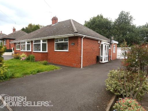 2 bedroom bungalow for sale in North Gate, Oldham, Greater Manchester, OL8 — £235,000 • 2 bed • 2 bath • 682 ft²
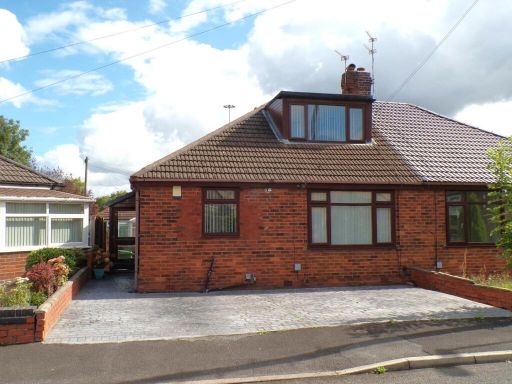 2 bedroom semi-detached bungalow for sale in Teasdale Close, Chadderton, Oldham, OL9 — £244,950 • 2 bed • 2 bath • 863 ft²
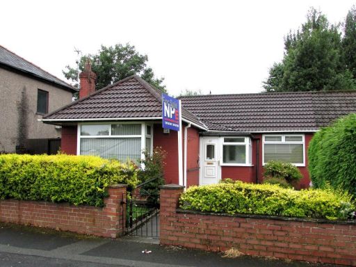 2 bedroom semi-detached bungalow for sale in Mather Street, Failsworth, Manchester, M35 — £219,950 • 2 bed • 1 bath • 688 ft²
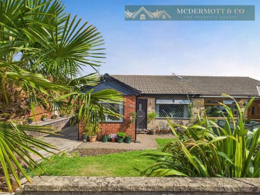 4 bedroom semi-detached bungalow for sale in Beaufont Drive, Oldham, OL4 — £249,950 • 4 bed • 1 bath • 1040 ft²
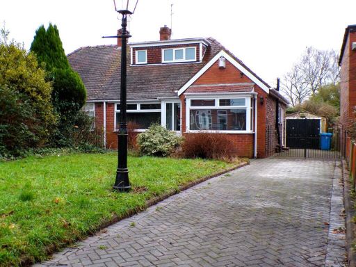 3 bedroom semi-detached bungalow for sale in Wyndale Drive, Failsworth, Manchester, M35 — £254,950 • 3 bed • 1 bath • 974 ft²
Meta
- {
"@context": "https://schema.org",
"@type": "Residence",
"name": "2 bedroom semidetached bungalow for sale in Montgomery Stre…",
"description": "",
"url": "https://propertypiper.co.uk/property/6ac29378-0abb-44c5-a9a9-2a3c3a4d44ec",
"image": "https://image-a.propertypiper.co.uk/7375a1a0-c93e-4613-b42c-e4a89e1467e6-1024.jpeg",
"address": {
"@type": "PostalAddress",
"streetAddress": "60 MONTGOMERY STREET OLDHAM",
"postalCode": "OL8 3QA",
"addressLocality": "Oldham",
"addressRegion": "Oldham West and Royton",
"addressCountry": "England"
},
"geo": {
"@type": "GeoCoordinates",
"latitude": 53.517672089045895,
"longitude": -2.1384539831162566
},
"numberOfRooms": 2,
"numberOfBathroomsTotal": 1,
"floorSize": {
"@type": "QuantitativeValue",
"value": 641,
"unitCode": "FTK"
},
"offers": {
"@type": "Offer",
"price": 234950,
"priceCurrency": "GBP",
"availability": "https://schema.org/InStock"
},
"additionalProperty": [
{
"@type": "PropertyValue",
"name": "Feature",
"value": "semi-detached"
},
{
"@type": "PropertyValue",
"name": "Feature",
"value": "bungalow"
},
{
"@type": "PropertyValue",
"name": "Feature",
"value": "mid-20th century"
},
{
"@type": "PropertyValue",
"name": "Feature",
"value": "garage"
},
{
"@type": "PropertyValue",
"name": "Feature",
"value": "driveway"
},
{
"@type": "PropertyValue",
"name": "Feature",
"value": "low maintenance"
},
{
"@type": "PropertyValue",
"name": "Feature",
"value": "single-story"
},
{
"@type": "PropertyValue",
"name": "Feature",
"value": "brick exterior"
},
{
"@type": "PropertyValue",
"name": "Feature",
"value": "detached"
},
{
"@type": "PropertyValue",
"name": "Feature",
"value": "large window"
},
{
"@type": "PropertyValue",
"name": "Feature",
"value": "natural light"
},
{
"@type": "PropertyValue",
"name": "Feature",
"value": "minimalist"
},
{
"@type": "PropertyValue",
"name": "Feature",
"value": "potential"
},
{
"@type": "PropertyValue",
"name": "Feature",
"value": "wood floors"
},
{
"@type": "PropertyValue",
"name": "Feature",
"value": "needs work"
},
{
"@type": "PropertyValue",
"name": "Feature",
"value": "update needed"
},
{
"@type": "PropertyValue",
"name": "Feature",
"value": "plaster issues"
}
]
}
High Res Floorplan Images
Compatible Floorplan Images
FloorplanImages Thumbnail