NN10 0HT - 2 bedroom detached bungalow for sale in Grafton Road, Rushd…
View on Property Piper
2 bedroom detached bungalow for sale in Grafton Road, Rushden, NN10
Property Details
- Price: £190000
- Bedrooms: 2
- Bathrooms: 1
- Property Type: undefined
- Property SubType: undefined
Brochure Descriptions
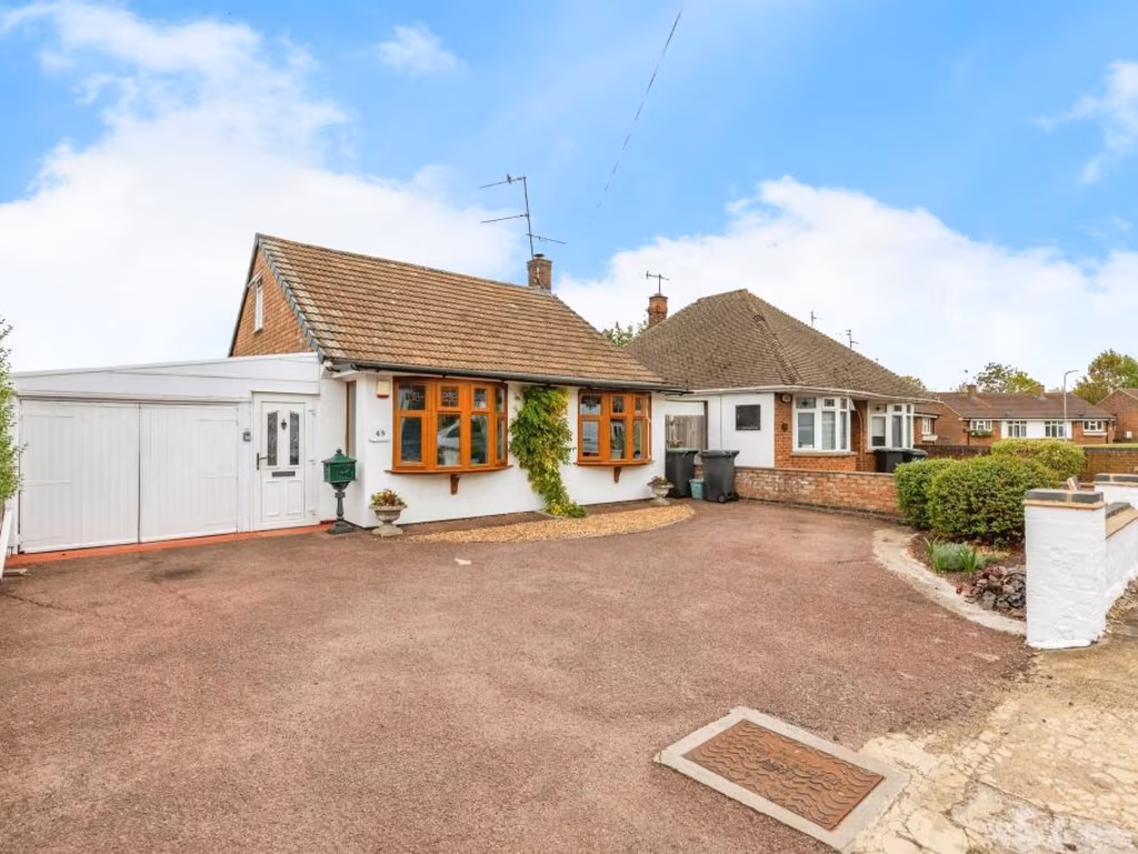
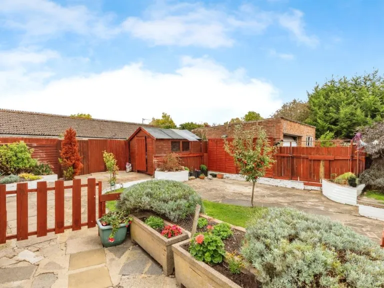
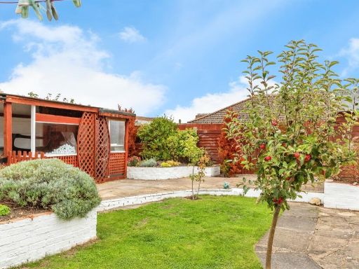
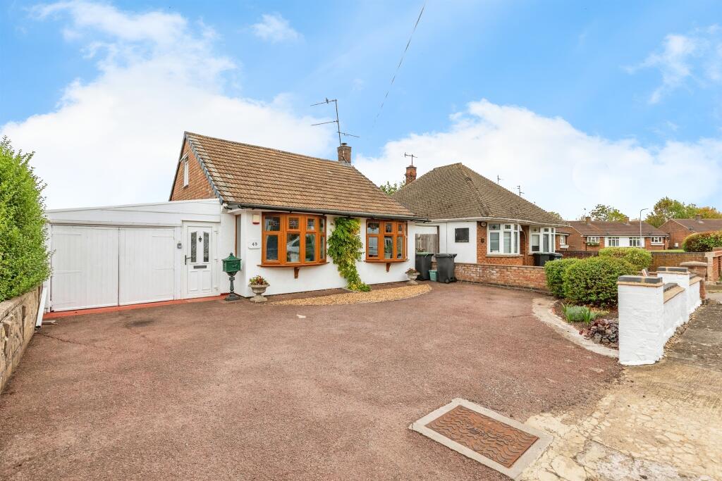
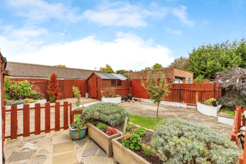
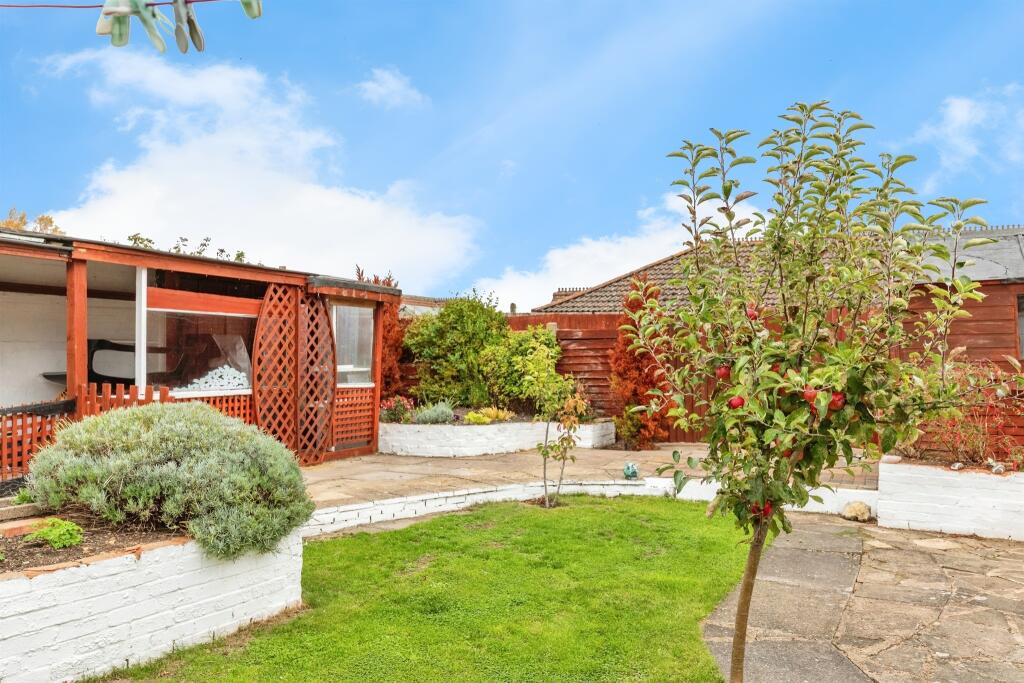
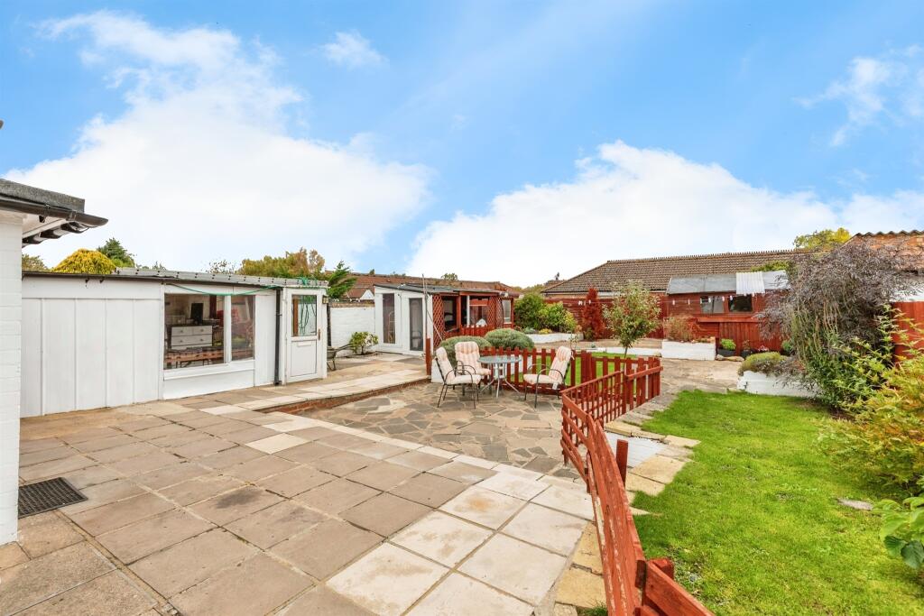
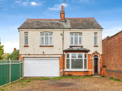
- Single-storey detached bungalow presented in good order. The property has a large tarmac driveway providing off-street parking for multiple vehicles and an attached single garage. External finish is painted render with tiled roof and timber-framed bay windows to the front. Plot size appears to be average for a suburban bungalow plot with a modest front garden and planted borders; rear garden not visible. Location on a residential road with neighbouring bungalows; no notable distant views (typical suburban outlook). Overall the property would be classed as a medium-sized bungalow suitable for downsizers or small families, offering good curb appeal and practical parking/garage accommodation.
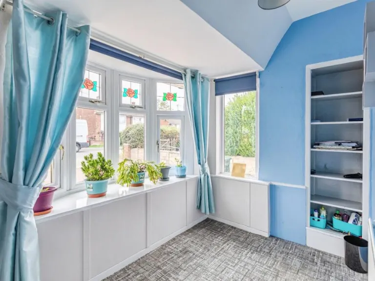
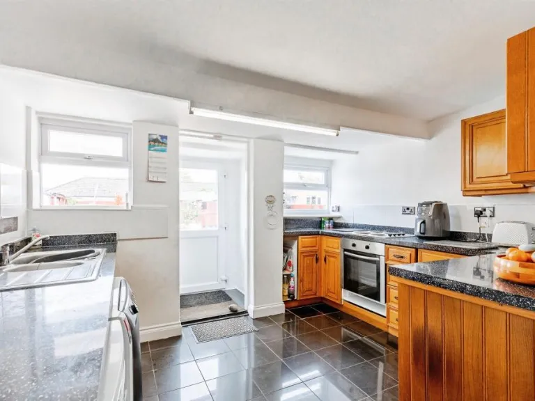
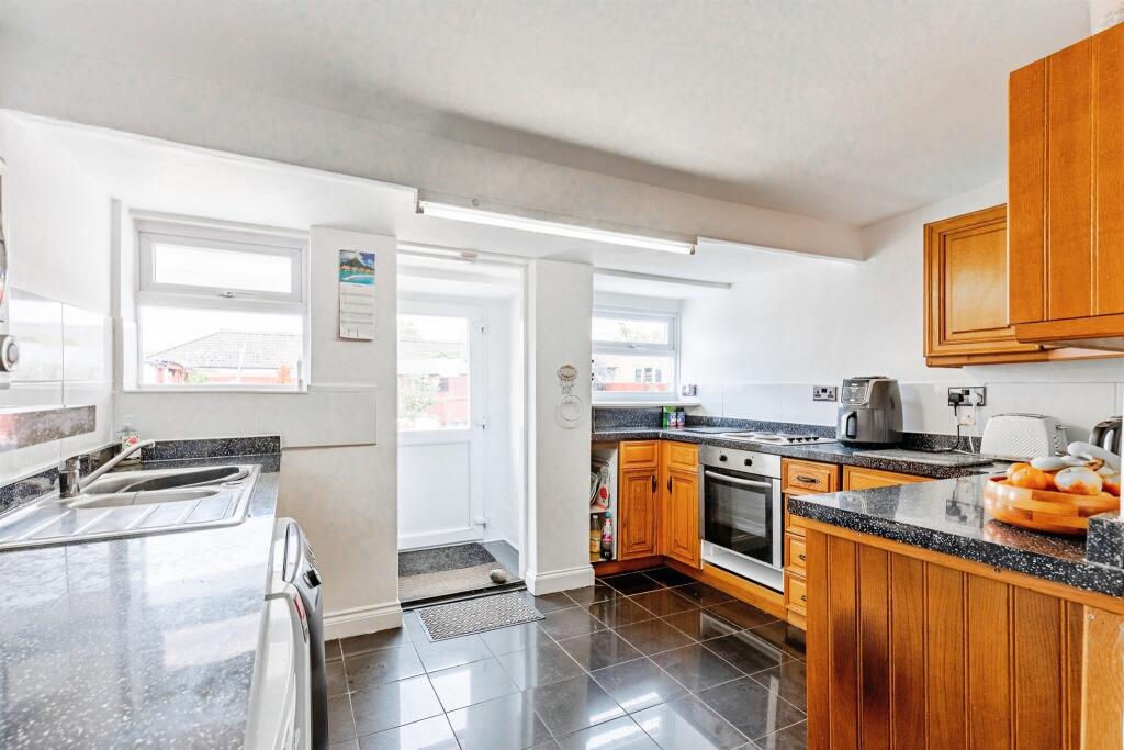
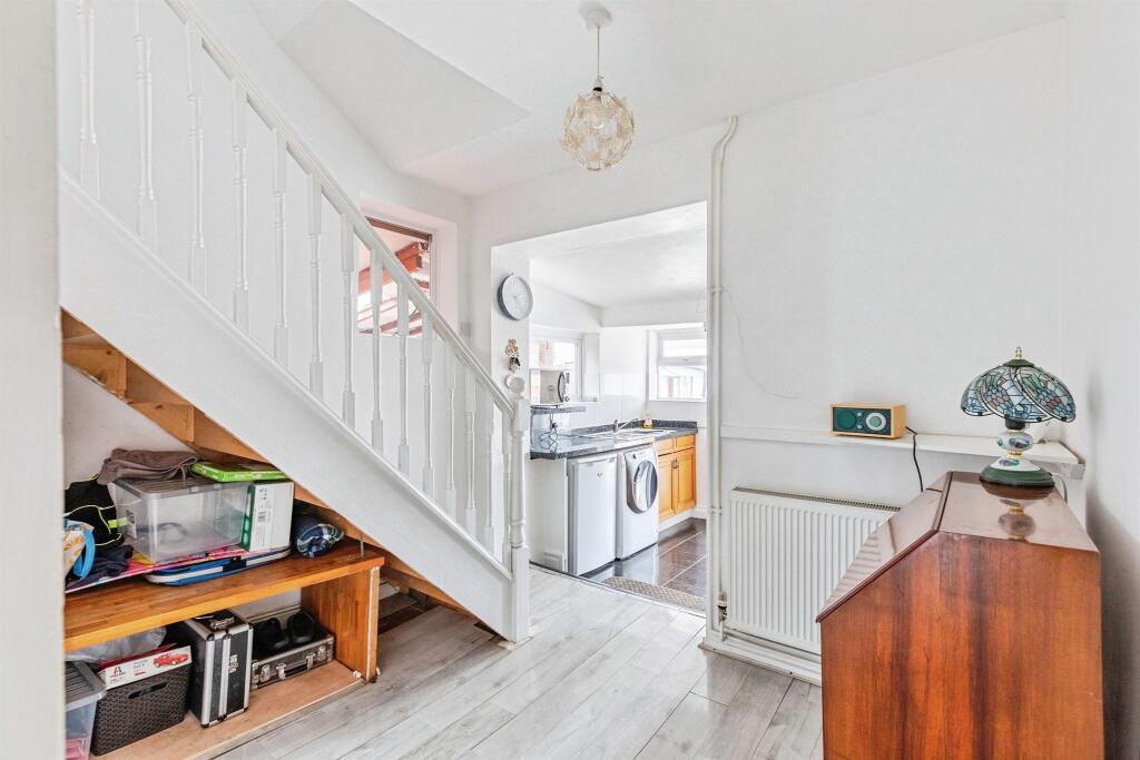
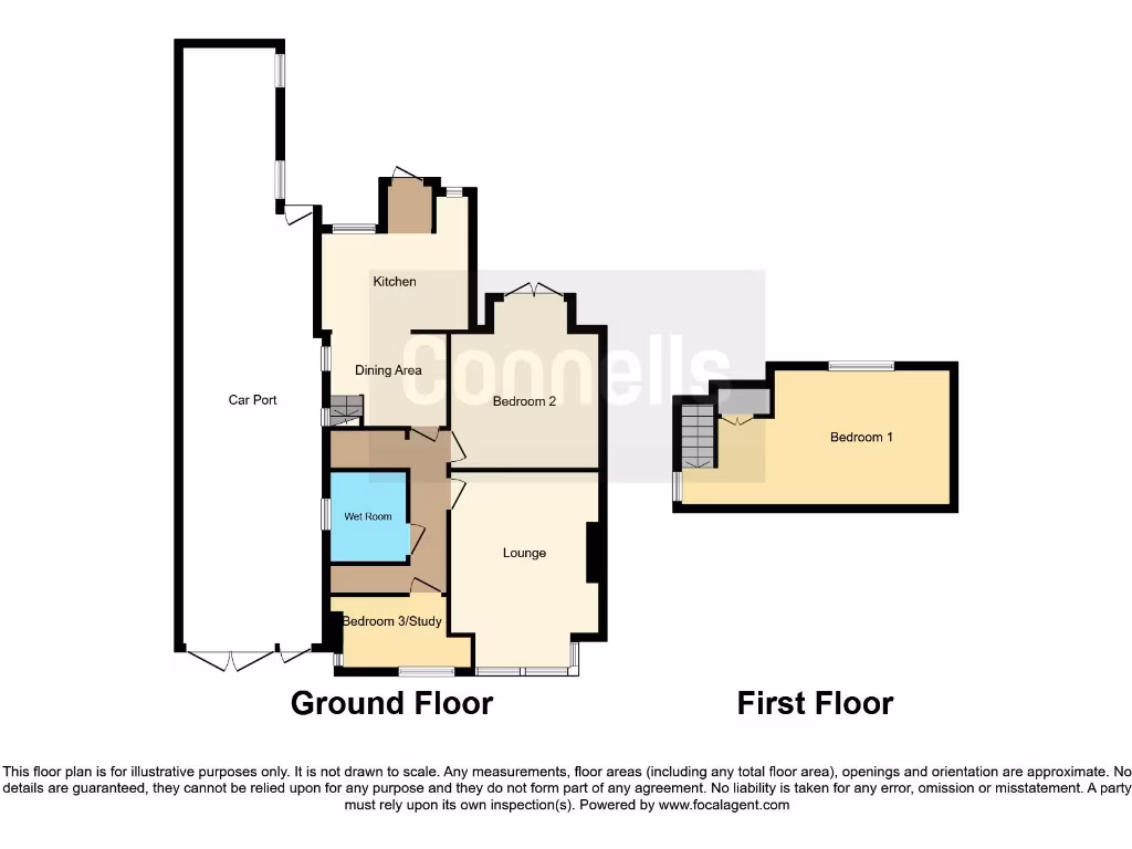
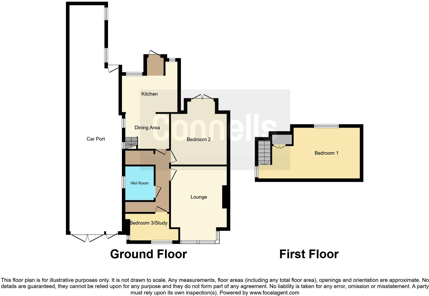
- Two-storey residential property shown on a single-sheet floorplan. Ground floor: lounge, dining area adjacent to kitchen, bedroom 2, bedroom 3/study and a wet room; external car port runs along one side. First floor: principal bedroom (Bedroom 1) accessed by an internal staircase. No external garden area is clearly shown on the plan; parking is provided by the car port. Overall property footprint and internal layout indicate a modest semi-detached or terraced house suitable for a small family or as an investment let. Room sizes appear average for the type (no measurements provided). Construction/finish details, floor area and exact site boundaries are not shown so a full valuation would require inspection and measured floor area.
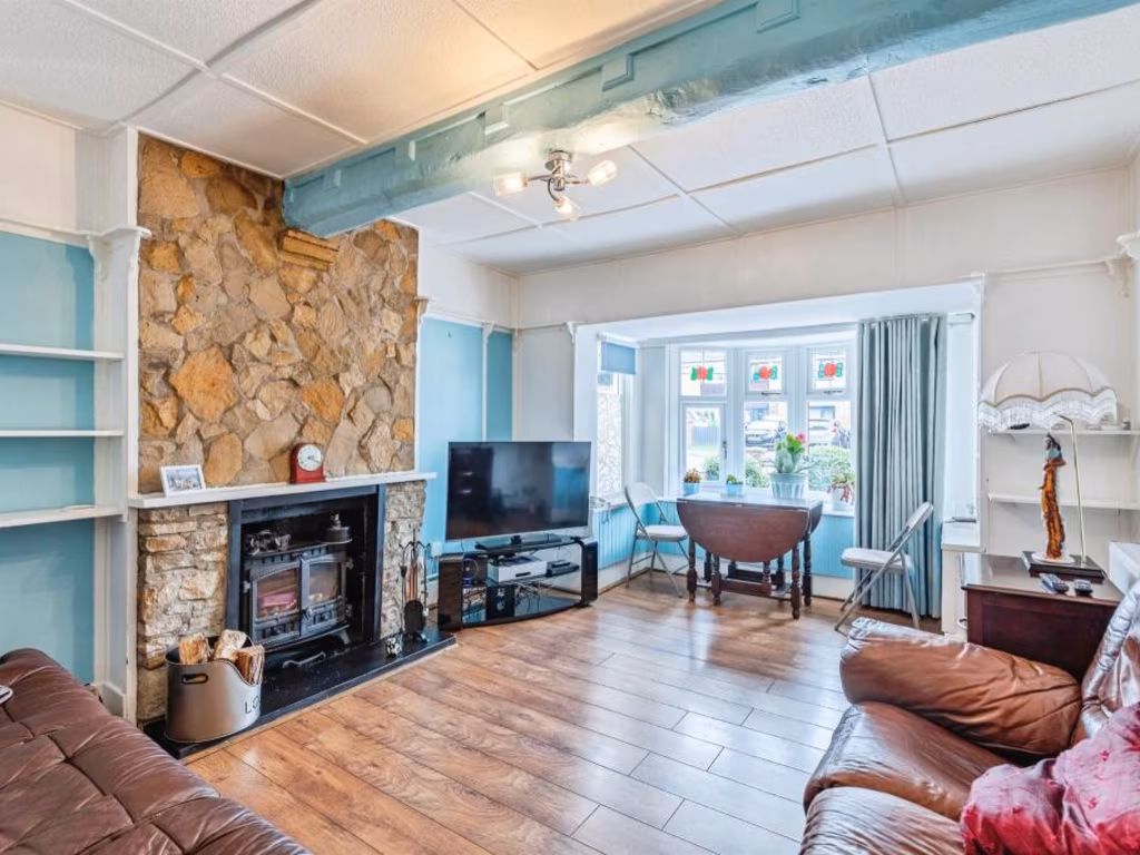
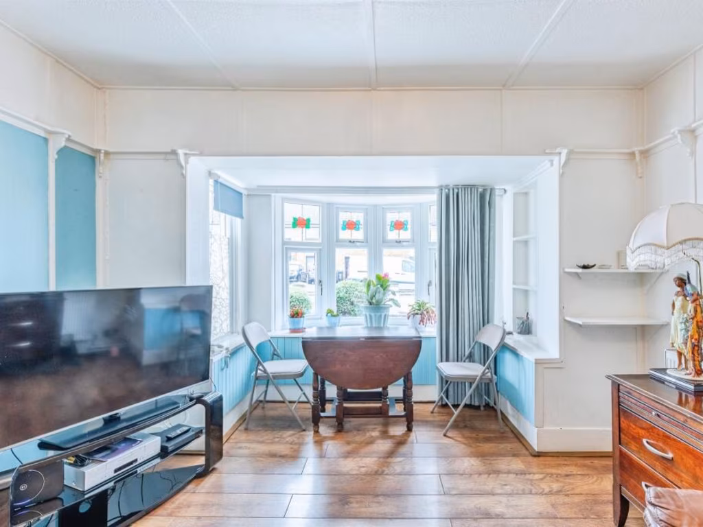
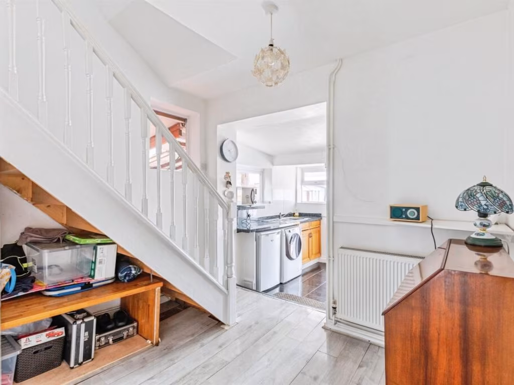
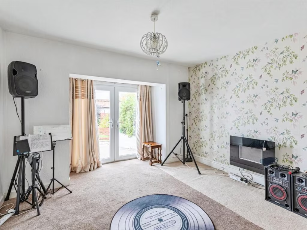
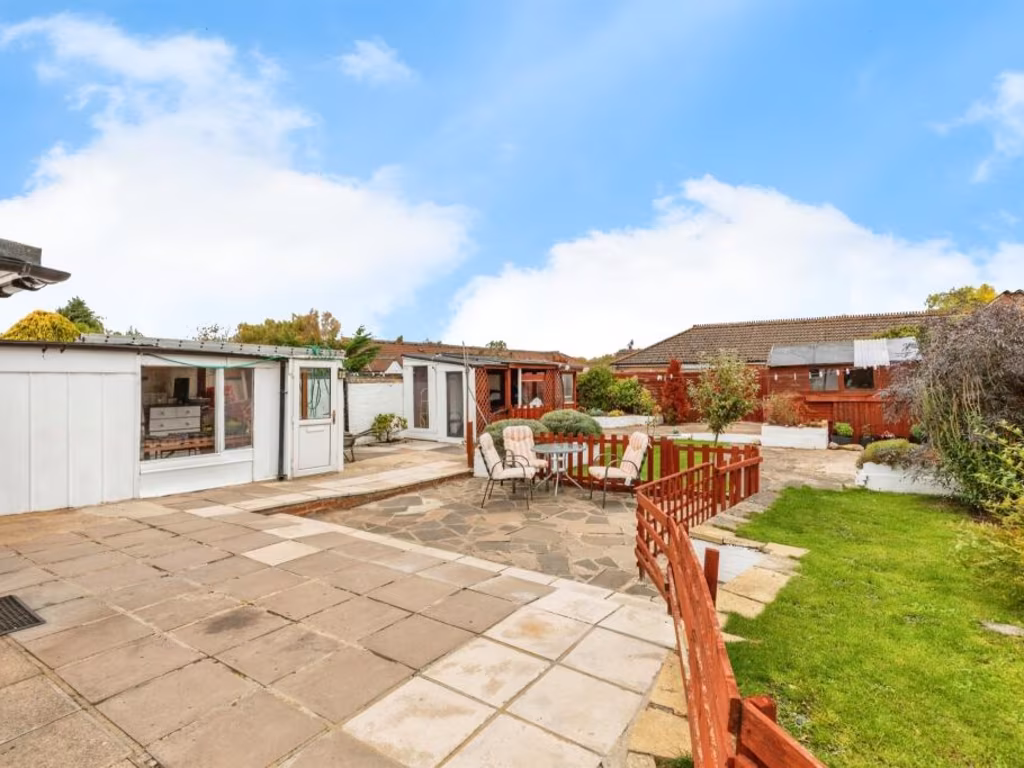
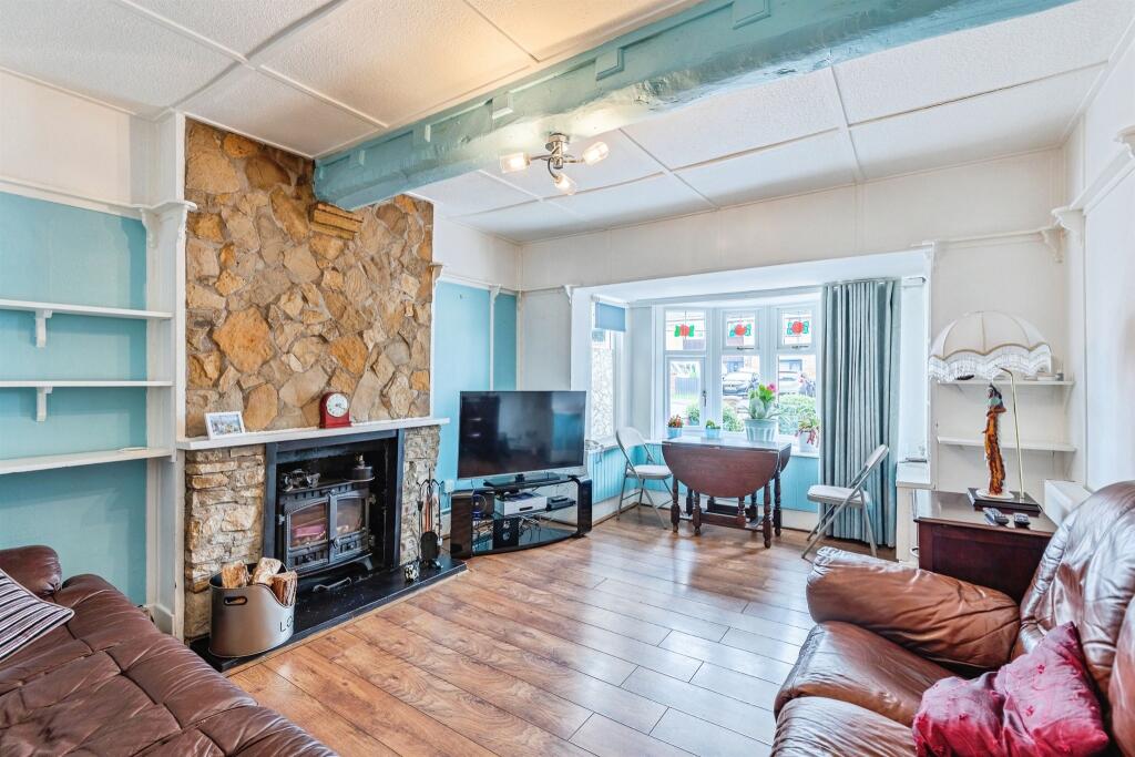
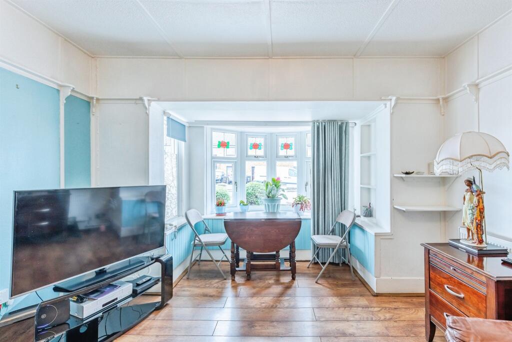
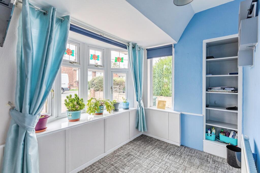
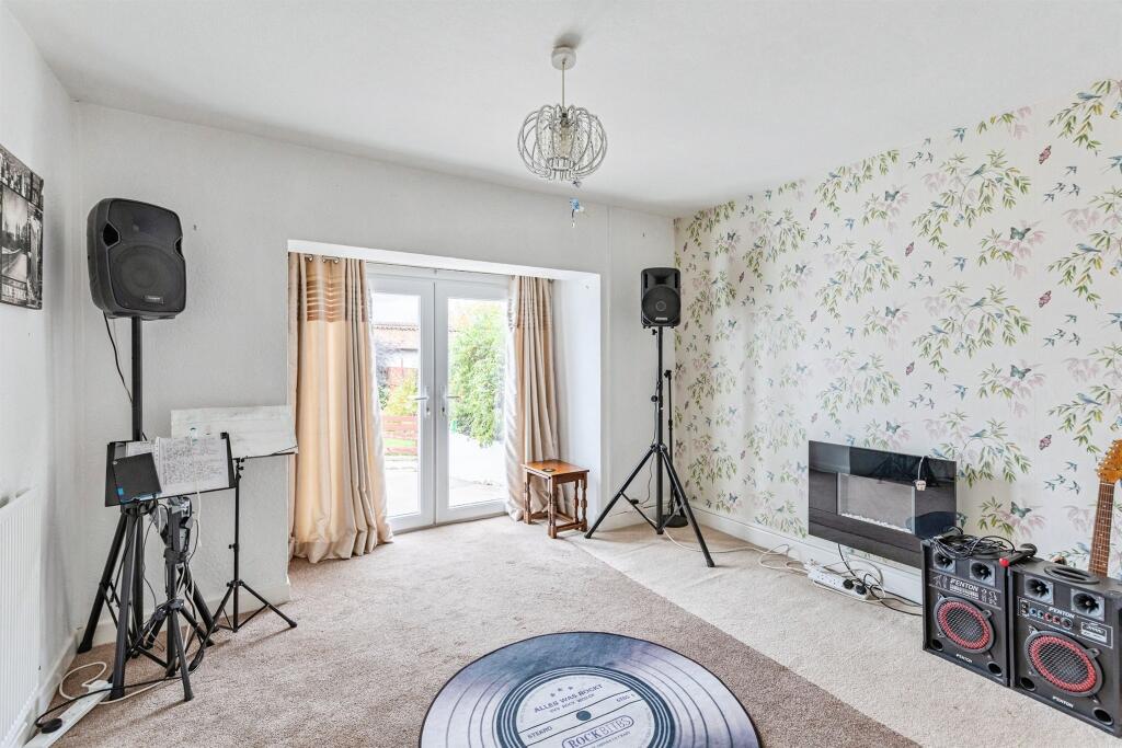
- Mid‑terrace/terraced residential property (two/three bedroom potential) arranged over two floors. Versatile accommodation with a main reception room to the front featuring bay window and fireplace, plus additional reception/bedroom space. Property benefits from front and rear gardens, a carport/workshop and off‑street parking. Outbuildings provide useful storage/workshop space. Overall plot and garden size: small to average for a town property. Internal room sizes appear average (living room/reception of average proportions, smaller secondary rooms). No exceptional or long-range views visible (typical residential street outlook). Suitable for an owner‑occupier seeking a period town house requiring minor modernisation, or as an investment given the additional outbuildings and parking. Potential for modest value uplift after cosmetic updating and reconfiguration of rooms to formalise a three‑bed layout.
Image Descriptions
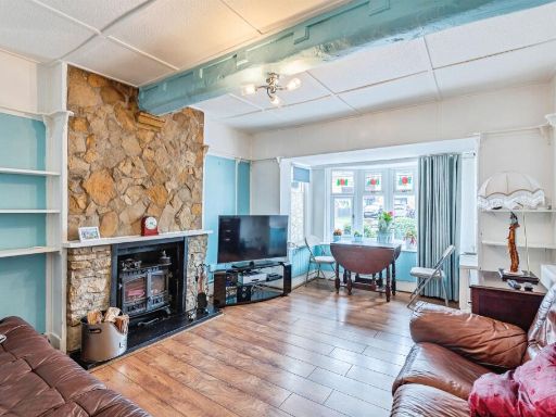
- house exterior bungalow
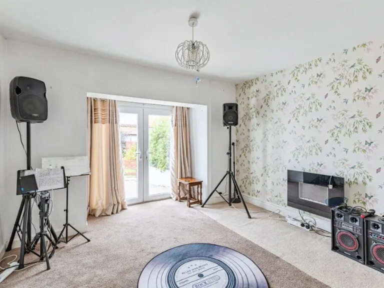
- living room eclectic
Floorplan Description
- Two-storey house plan showing ground floor rooms and a first-floor Bedroom 1, with an attached car port.
Rooms
- Kitchen:
- Dining Area:
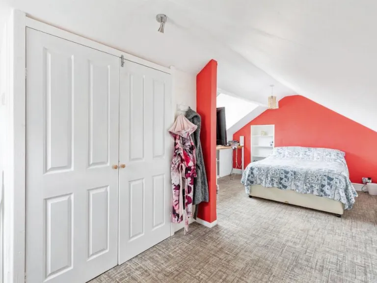
- Bedroom 2:
- Lounge:
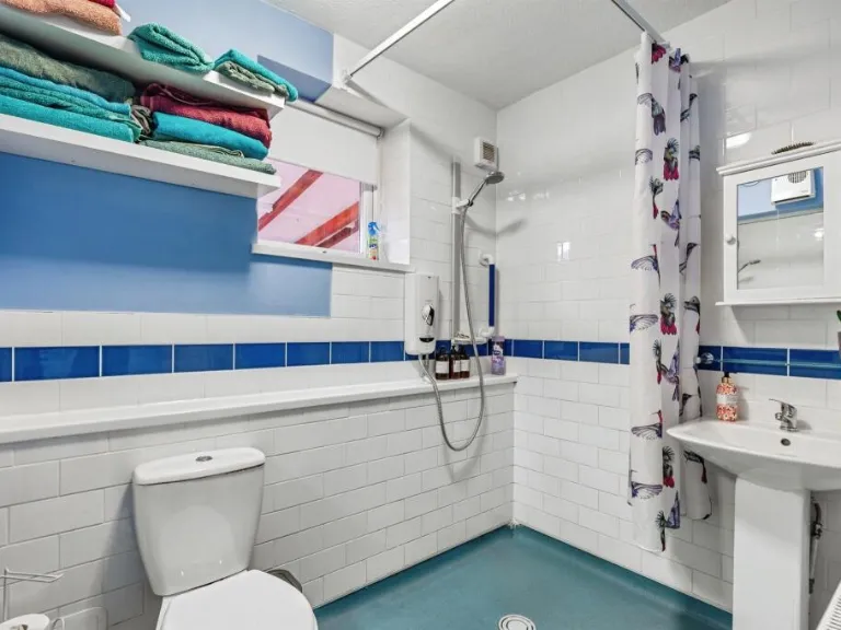
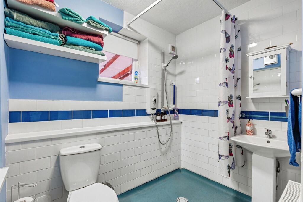
- Wet Room:
- Bedroom 3/Study:
- Bedroom 1:
Textual Property Features
- Is Auction
- Has Garden
- Success
Detected Visual Features
- bungalow
- detached
- single-story
- large driveway
- garage
- front garden
- residential
- suburban
- family home
- stone fireplace
- fireplace surround
- bay window
- stained glass windows
- wood flooring
- ceiling beams
- living room
EPC Details
- Fully double glazed
- Cavity wall, filled cavity
- Boiler and radiators, mains gas
- Low energy lighting in all fixed outlets
- Solid, no insulation (assumed)
Nearby Schools
- Sharnbrook Primary
- Wollaston School
- St Lawrence Church of England Primary School
- South End Junior School
- Rushden Primary Academy
- Alfred Lord Tennyson School-2 sites (Tennyson Rd and Alfred St)
- Rushden Academy
- Irthlingborough Nursery and Infant School
- Huxlow Academy
- Finedon Mulso Church of England Junior School
- Raunds Park Infant School
- Manor School
- Windmill Primary School
- South End Infant School
- Newton Road School
- Denfield Park Primary School
- Henry Chichele Primary School
- Christopher Reeves CofE VA Primary School
- Irthlingborough Junior School
- Stanwick Academy
- Finedon Infant School
- St Peter's Church of England Academy
- Sharnbrook Academy
- Irchester Community Primary School
- The Ferrers School
- Stanton Cross Primary School
Nearest General Shops
- Id: 6387797379
- Tags:
- Addr:
- City: Rushden
- Country: GB
- Housenumber: 52
- Postcode: NN10 0EH
- Street: Robinson Road
- Craft: upholsterer
- Name: J C Pine
- Shop: furniture
- TagsNormalized:
- Lat: 52.2908131
- Lon: -0.5919662
- FullGeoHash: gcr96x2bn4n4
- PartitionGeoHash: gcr9
- Images:
- FoodStandards: null
- Distance: 658.3
,- Id: 6387797364
- Tags:
- Name: Rushden Reptile Centre
- Shop: pet
- TagsNormalized:
- Lat: 52.2942631
- Lon: -0.5890667
- FullGeoHash: gcr96xgh1v0n
- PartitionGeoHash: gcr9
- Images:
- FoodStandards: null
- Distance: 619.8
,- Id: 6379743041
- Tags:
- Addr:
- City: Rushden
- Country: GB
- Housenumber: 128
- Postcode: NN10 0HL
- Street: Newton Road
- Name: Images
- Shop: beauty
- TagsNormalized:
- Lat: 52.2884325
- Lon: -0.5868083
- FullGeoHash: gcr96wudnqk1
- PartitionGeoHash: gcr9
- Images:
- FoodStandards: null
- Distance: 385.4
}
Nearest Religious buildings
- Id: 72340037
- Tags:
- Addr:
- City: Rushden
- Country: GB
- Postcode: NN10 0RW
- Street: Park Road
- Amenity: place_of_worship
- Building: yes
- Name: The Heritage Chapel and Halls
- Polling_station: 2021
- Religion: christian
- Source: OS_OpenData_StreetView
- TagsNormalized:
- place of worship
- chapel
- christian
- church
- Lat: 52.2881769
- Lon: -0.5950623
- FullGeoHash: gcr96qy8wn9k
- PartitionGeoHash: gcr9
- Images:
- FoodStandards: null
- Distance: 906.7
,- Id: 72340051
- Tags:
- Addr:
- City: Rushden
- Country: GB
- Postcode: NN10 0LH
- Street: Park Road
- Amenity: place_of_worship
- Building: yes
- Name: Park Road Baptist Church
- Religion: christian
- Source: OS_OpenData_StreetView
- TagsNormalized:
- place of worship
- baptist
- church
- christian
- Lat: 52.28779
- Lon: -0.5935807
- FullGeoHash: gcr96qxy2wd0
- PartitionGeoHash: gcr9
- Images:
- FoodStandards: null
- Distance: 825.7
,- Id: 681272132
- Tags:
- Addr:
- City: Rushden
- Country: GB
- Postcode: NN10 0LH
- Street: Park Road
- Amenity: community_centre
- Name: Park Road Baptist Church Community Halls
- TagsNormalized:
- community centre
- baptist
- church
- community hall
- Lat: 52.2875508
- Lon: -0.5933923
- FullGeoHash: gcr96qxvhcyt
- PartitionGeoHash: gcr9
- Images:
- FoodStandards: null
- Distance: 824.1
}
Nearest Medical buildings
- Id: 4483126515
- Tags:
- Addr:
- City: Rushden
- Country: GB
- Housename: Harborough Field Surgery
- Housenumber: 160
- Postcode: NN10 0GP
- Street: Newton Road
- Amenity: pharmacy
- Fhrs:
- Authority: North Northamptonshire
- Id: 17602
- Local_authority_id: 06/00013/COM
- Healthcare: pharmacy
- Name: Harborough Field Pharmacy
- Ref: 1091292
- TagsNormalized:
- Lat: 52.2863512
- Lon: -0.5818259
- FullGeoHash: gcr96y2q46r1
- PartitionGeoHash: gcr9
- Images:
- FoodStandards:
- Id: 17602
- FHRSID: 17602
- LocalAuthorityBusinessID: 06/00013/COM
- BusinessName: Harborough Field Pharmacy
- BusinessType: Retailers - other
- BusinessTypeID: 4613
- AddressLine1: Pharmacy
- AddressLine2: Harborough Field Surgery
- AddressLine3: 160 Newton Road
- AddressLine4: Rushden
- PostCode: NN10 0GP
- RatingValue: Exempt
- RatingKey: fhrs_exempt_en-GB
- RatingDate: 2019-03-28
- LocalAuthorityCode: 235
- LocalAuthorityName: North Northamptonshire
- LocalAuthorityWebSite: https://www.corby.gov.uk/home/business/food-businesses
- LocalAuthorityEmailAddress: envhealth.cbc@northnorthants.gov.uk
- Scores:
- Hygiene: null
- Structural: null
- ConfidenceInManagement: null
- NewRatingPending: false
- Geocode:
- Longitude: -0.58209300000000
- Latitude: 52.28635600000000
- Distance: 465.8
,- Id: 5835087566
- Tags:
- Addr:
- City: Rushden
- Country: GB
- Housenumber: 160
- Postcode: NN10 0GP
- Street: Newton Road
- Amenity: dentist
- Healthcare: dentist
- Name: IDH Limited
- Phone: +44 1933317834
- Website: https://www.mydentist.co.uk
- TagsNormalized:
- Lat: 52.2864292
- Lon: -0.5820769
- FullGeoHash: gcr96y2ns8u5
- PartitionGeoHash: gcr9
- Images:
- FoodStandards: null
- Distance: 456.3
,- Id: 218451478
- Tags:
- Amenity: parking
- Name: GP Surgery car park
- Parking: surface
- TagsNormalized:
- Lat: 52.2866294
- Lon: -0.5822163
- FullGeoHash: gcr96y2p9qhj
- PartitionGeoHash: gcr9
- Images:
- FoodStandards: null
- Distance: 433.8
,- Id: 2276994599
- Tags:
- Amenity: parking
- Emergency: no
- Name: Harborough Fields GP Surgery
- TagsNormalized:
- Lat: 52.2867212
- Lon: -0.5821521
- FullGeoHash: gcr96y804z7c
- PartitionGeoHash: gcr9
- Images:
- FoodStandards: null
- Distance: 423.7
}
Nearest Tourist attractions
- Id: 6172487802
- Tags:
- Addr:
- City: Wellingborough
- Country: GB
- Housename: Redlands Farm
- Postcode: NN9 6QZ
- Street: Nene Valley Way
- Village: Stanwick
- Name: Redlands Farm Bed & Breakfast
- Tourism: guest_house
- Website: http://www.redlandsfarmbandb.co.uk/
- TagsNormalized:
- bed
- farm
- guest house
- tourism
- Lat: 52.3230881
- Lon: -0.5831058
- FullGeoHash: gcr9dtpkhdsf
- PartitionGeoHash: gcr9
- Images:
- FoodStandards: null
- Distance: 3620.7
,- Id: 2268883574
- Tags:
- Addr:
- City: Rushden
- Country: GB
- Housename: The Old Stable Block
- Postcode: NN10 9EP
- Street: Hall Avenue
- Name: Rushden Hall and Museum
- Tourism: museum
- Website: https://rushdenmuseum.co.uk/
- TagsNormalized:
- Lat: 52.2867668
- Lon: -0.6001055
- FullGeoHash: gcr96qe02xbc
- PartitionGeoHash: gcr9
- Images:
- FoodStandards: null
- Distance: 1281.4
,- Id: 303713489
- Tags:
- Addr:
- City: Rushden
- Country: GB
- Housename: Old Railway Station
- Postcode: NN10 0AW
- Street: Station Approach
- Fhrs:
- Authority: North Northamptonshire
- Id: 555167
- Local_authority_id: 13/00030/COM
- Name: Rushden Historical Transport Society
- Polling_station: 2021
- Tourism: museum
- Usage: tourism
- Wikidata: Q7380791
- Wikipedia: en:Rushden Transport Museum
- TagsNormalized:
- Lat: 52.2943289
- Lon: -0.5983327
- FullGeoHash: gcr96ruk9c6y
- PartitionGeoHash: gcr9
- Images:
- FoodStandards:
- Id: 555167
- FHRSID: 555167
- LocalAuthorityBusinessID: 13/00030/COM
- BusinessName: Rushden Historical Buffet Carriage
- BusinessType: Other catering premises
- BusinessTypeID: 7841
- AddressLine1: Old Railway Station
- AddressLine2: Station Approach
- AddressLine3: Rushden
- AddressLine4: Northamptonshire
- PostCode: NN10 0AW
- RatingValue: 5
- RatingKey: fhrs_5_en-GB
- RatingDate: 2019-05-29
- LocalAuthorityCode: 235
- LocalAuthorityName: North Northamptonshire
- LocalAuthorityWebSite: https://www.corby.gov.uk/home/business/food-businesses
- LocalAuthorityEmailAddress: envhealth.cbc@northnorthants.gov.uk
- Scores:
- Hygiene: 0
- Structural: 5
- ConfidenceInManagement: 0
- NewRatingPending: false
- Geocode:
- Longitude: -0.59737000000000
- Latitude: 52.29422600000000
- Distance: 1169.4
}
Nearest Bus stations and stops
- Id: 9435146442
- Tags:
- Highway: bus_stop
- Name: Pet Shop (o/s)
- Naptan:
- AtcoCode: 300000304QS
- CommonName: Pet Shop
- Indicator: o/s
- Landmark: Pet Shop
- NaptanCode: nthatdmw
- Street: Upper Queen Street
- Public_transport: platform
- TagsNormalized:
- Lat: 52.2944058
- Lon: -0.5889729
- FullGeoHash: gcr96xghgzvc
- PartitionGeoHash: gcr9
- Images:
- FoodStandards: null
- Distance: 625.9
,- Id: 9435146450
- Tags:
- Highway: bus_stop
- Name: Cromwell Road (adj)
- Naptan:
- AtcoCode: 300000304CR
- CommonName: Cromwell Road
- Indicator: adj
- Landmark: Cromwell Road
- NaptanCode: nthataja
- Street: Newton Road
- Public_transport: platform
- TagsNormalized:
- Lat: 52.2894858
- Lon: -0.5911669
- FullGeoHash: gcr96x182fdh
- PartitionGeoHash: gcr9
- Images:
- FoodStandards: null
- Distance: 614.3
,- Id: 9435146451
- Tags:
- Highway: bus_stop
- Name: Cemetery (opp)
- Naptan:
- AtcoCode: 300000304CE
- CommonName: Cemetery
- Indicator: opp
- Landmark: Cemetery
- NaptanCode: nthatagd
- Street: Newton Road
- Public_transport: platform
- TagsNormalized:
- Lat: 52.2884424
- Lon: -0.5859017
- FullGeoHash: gcr96wv6780h
- PartitionGeoHash: gcr9
- Images:
- FoodStandards: null
- Distance: 337.6
,- Id: 9435146444
- Tags:
- Highway: bus_stop
- Name: Mallery Close (opp)
- Naptan:
- AtcoCode: 300000304SH
- CommonName: Mallery Close
- Indicator: opp
- Landmark: Mallery Close
- NaptanCode: nthatdta
- Street: Short Stocks
- Public_transport: platform
- TagsNormalized:
- Lat: 52.2921386
- Lon: -0.5858722
- FullGeoHash: gcr96xmru1nj
- PartitionGeoHash: gcr9
- Images:
- FoodStandards: null
- Distance: 301.8
,- Id: 9430246779
- Tags:
- Highway: bus_stop
- Name: 34 Grafton Road (o/s)
- Naptan:
- AtcoCode: 300000304GR
- CommonName: 34 Grafton Road
- Indicator: o/s
- Landmark: Number 34
- NaptanCode: nthatamw
- Street: Grafton Road
- Public_transport: platform
- TagsNormalized:
- Lat: 52.290585
- Lon: -0.5829433
- FullGeoHash: gcr96xpw8rtc
- PartitionGeoHash: gcr9
- Images:
- FoodStandards: null
- Distance: 44.3
}
Nearest Hotels
- Id: 813566697
- Tags:
- Addr:
- City: Rushden
- Country: GB
- Postcode: NN10 6AN
- Street: A45 Nene Valley Way
- Brand: Travelodge
- Brand:wikidata: Q9361374
- Brand:wikipedia: en:Travelodge UK
- Fhrs:
- Authority: North Northamptonshire
- Id: 967197
- Local_authority_id: 05/00039/COM
- Name: Travelodge Wellingborough Rushden
- Source: website
- Tourism: hotel
- TagsNormalized:
- Lat: 52.299078
- Lon: -0.6289118
- FullGeoHash: gcr998y01qc2
- PartitionGeoHash: gcr9
- Images:
- FoodStandards: null
- Distance: 3309.4
,- Id: 3127824307
- Tags:
- Addr:
- City: Rushden
- Country: GB
- Housenumber: 4
- Postcode: NN10 8DZ
- Street: College Street
- Town: Higham Ferrers
- Amenity: pub
- Fhrs:
- Authority: North Northamptonshire
- Id: 6560
- Local_authority_id: 02290/0004/2/000
- Name: The Green Dragon
- Source: survey
- Source:addr: FHRS Open Data
- Tourism: hotel
- Wikidata: Q26292186
- TagsNormalized:
- Lat: 52.3068082
- Lon: -0.59263
- FullGeoHash: gcr9dd0mnxz0
- PartitionGeoHash: gcr9
- Images:
- FoodStandards: null
- Distance: 1941.6
,- Id: 4509507690
- Tags:
- Addr:
- City: Rushden
- Country: GB
- Housenumber: 5
- Postcode: NN10 8BP
- Street: Market Square
- Town: Higham Ferrers
- Name: The Old House
- Tourism: hotel
- TagsNormalized:
- Lat: 52.30622
- Lon: -0.5931187
- FullGeoHash: gcr9dd01g64e
- PartitionGeoHash: gcr9
- Images:
- FoodStandards: null
- Distance: 1893.4
}
Tags
- bungalow
- detached
- single-story
- large driveway
- garage
- front garden
- residential
- suburban
- family home
- stone fireplace
- fireplace surround
- bay window
- stained glass windows
- wood flooring
- ceiling beams
- living room
Local Market Stats
- Average Price/sqft: £255
- Avg Income: £42500
- Rental Yield: 4.2%
- Social Housing: 12%
- Planning Success Rate: 80%
Similar Properties
 4 bedroom detached house for sale in Beech Road, Rushden, NN10 — £235,000 • 4 bed • 1 bath • 1163 ft²
 3 bedroom semi-detached house for sale in Batsmans Drive, Rushden, NN10 — £200,000 • 3 bed • 1 bath • 765 ft²
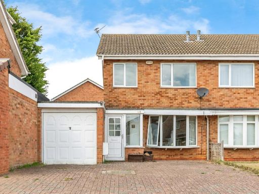 3 bedroom semi-detached house for sale in Oakley Drive, Wellingborough, NN8 — £200,000 • 3 bed • 1 bath • 817 ft²
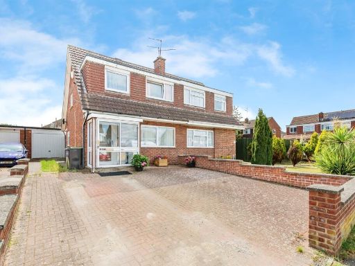 3 bedroom semi-detached house for sale in Grangeway, Rushden, NN10 — £200,000 • 3 bed • 1 bath • 776 ft²
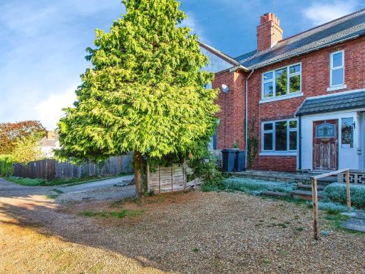 3 bedroom terraced house for sale in Manor Farm Road, Raunds, Wellingborough, NN9 — £170,000 • 3 bed • 1 bath • 754 ft²
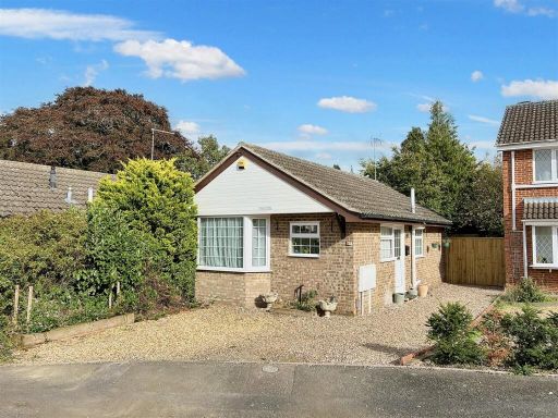 2 bedroom detached bungalow for sale in Keats Way, Rushden, NN10 — £250,000 • 2 bed • 1 bath • 603 ft²
Meta
- {
"@context": "https://schema.org",
"@type": "Residence",
"name": "2 bedroom detached bungalow for sale in Grafton Road, Rushd…",
"description": "",
"url": "https://propertypiper.co.uk/property/6787c4f3-ab64-40e8-8d29-724f3e29313b",
"image": "https://image-a.propertypiper.co.uk/52c5f7e2-bb75-4ac4-bce4-5dd88b1e3dfb-1024.jpeg",
"address": {
"@type": "PostalAddress",
"streetAddress": "49 GRAFTON ROAD RUSHDEN",
"postalCode": "NN10 0HT",
"addressLocality": "North Northamptonshire",
"addressRegion": "Wellingborough",
"addressCountry": "England"
},
"geo": {
"@type": "GeoCoordinates",
"latitude": 52.290530545402895,
"longitude": -0.5822983184097087
},
"numberOfRooms": 2,
"numberOfBathroomsTotal": 1,
"floorSize": {
"@type": "QuantitativeValue",
"value": 969,
"unitCode": "FTK"
},
"offers": {
"@type": "Offer",
"price": 190000,
"priceCurrency": "GBP",
"availability": "https://schema.org/InStock"
},
"additionalProperty": [
{
"@type": "PropertyValue",
"name": "Feature",
"value": "bungalow"
},
{
"@type": "PropertyValue",
"name": "Feature",
"value": "detached"
},
{
"@type": "PropertyValue",
"name": "Feature",
"value": "single-story"
},
{
"@type": "PropertyValue",
"name": "Feature",
"value": "large driveway"
},
{
"@type": "PropertyValue",
"name": "Feature",
"value": "garage"
},
{
"@type": "PropertyValue",
"name": "Feature",
"value": "front garden"
},
{
"@type": "PropertyValue",
"name": "Feature",
"value": "residential"
},
{
"@type": "PropertyValue",
"name": "Feature",
"value": "suburban"
},
{
"@type": "PropertyValue",
"name": "Feature",
"value": "family home"
},
{
"@type": "PropertyValue",
"name": "Feature",
"value": "stone fireplace"
},
{
"@type": "PropertyValue",
"name": "Feature",
"value": "fireplace surround"
},
{
"@type": "PropertyValue",
"name": "Feature",
"value": "bay window"
},
{
"@type": "PropertyValue",
"name": "Feature",
"value": "stained glass windows"
},
{
"@type": "PropertyValue",
"name": "Feature",
"value": "wood flooring"
},
{
"@type": "PropertyValue",
"name": "Feature",
"value": "ceiling beams"
},
{
"@type": "PropertyValue",
"name": "Feature",
"value": "living room"
}
]
}
High Res Floorplan Images
Compatible Floorplan Images
FloorplanImages Thumbnail