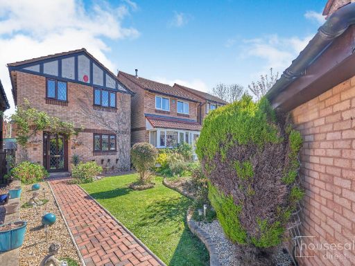
DY8 4NF - 4 bedroom detached house for sale in Burns Close Amblecote,…
View on Property Piper
4 bedroom detached house for sale in Burns Close Amblecote, Stourbridge, DY8
Property Details
- Price: £254000
- Bedrooms: 4
- Bathrooms: 1
- Property Type: undefined
- Property SubType: undefined
Image Descriptions
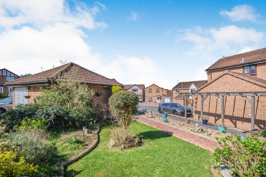
- semi-detached house modern suburban
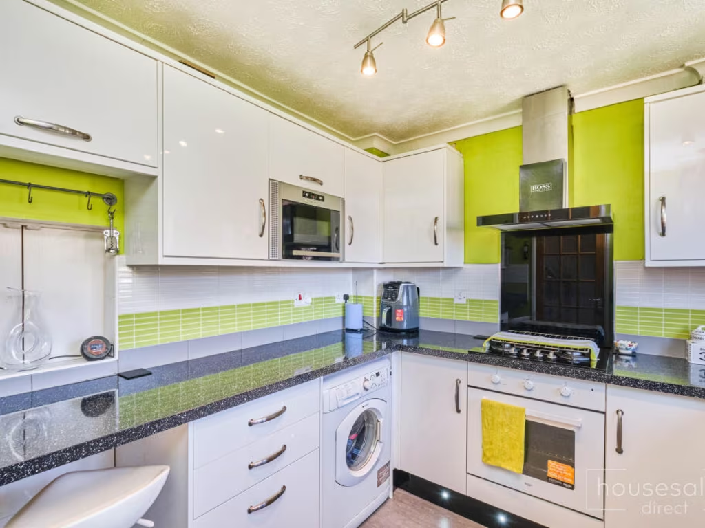
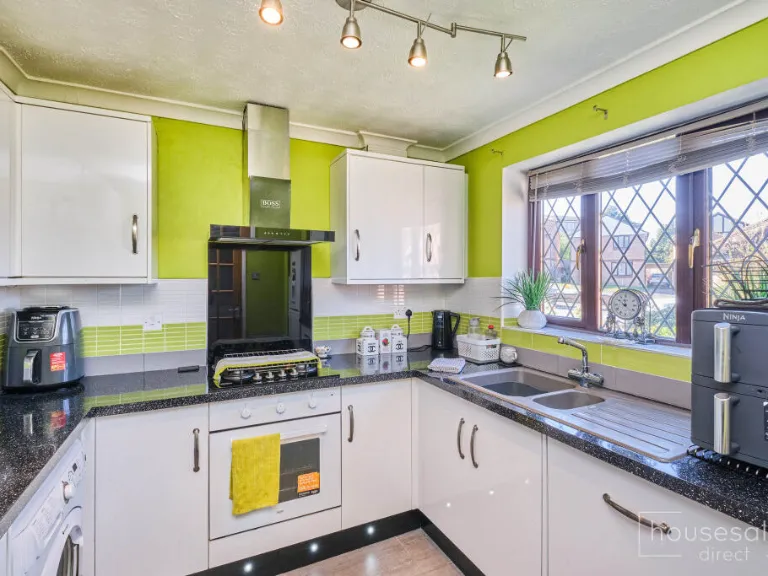
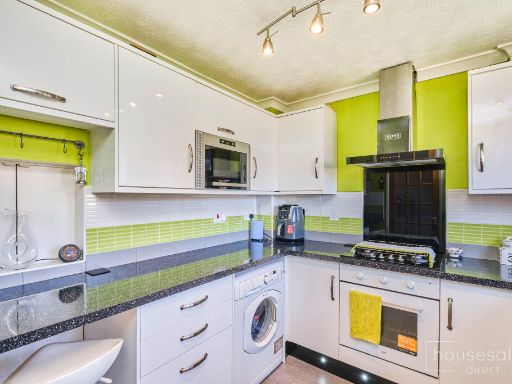
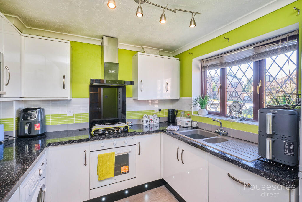
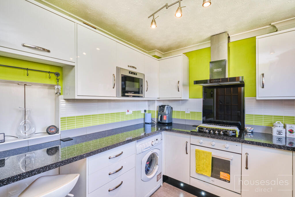
- kitchen contemporary
Floorplan Description
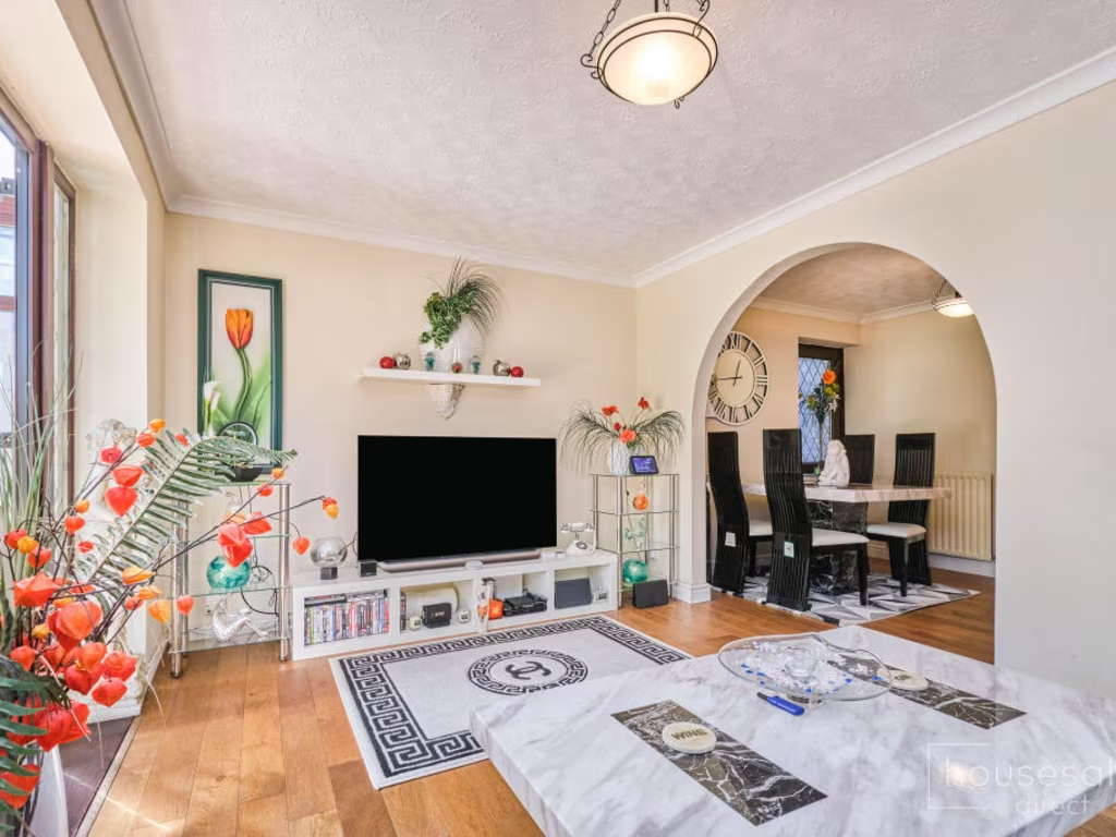
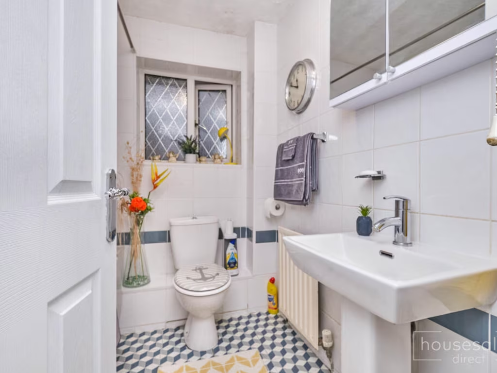
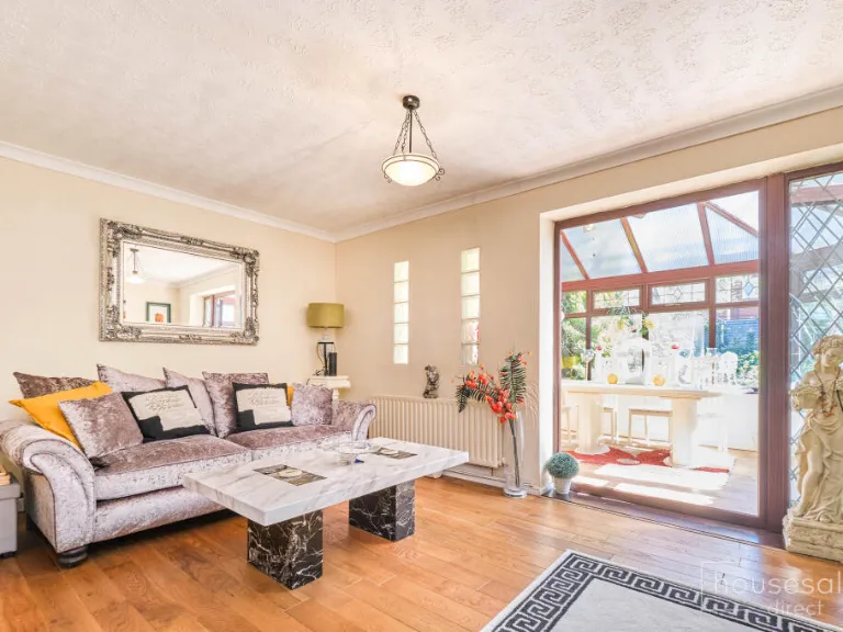
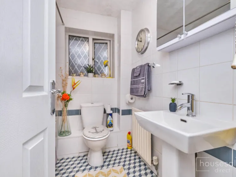
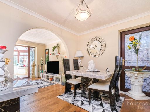
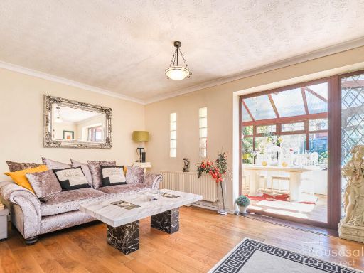
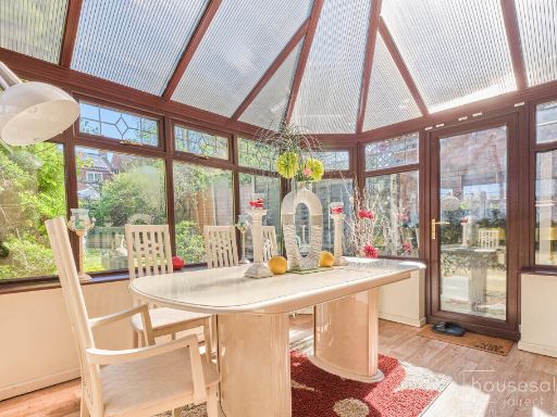
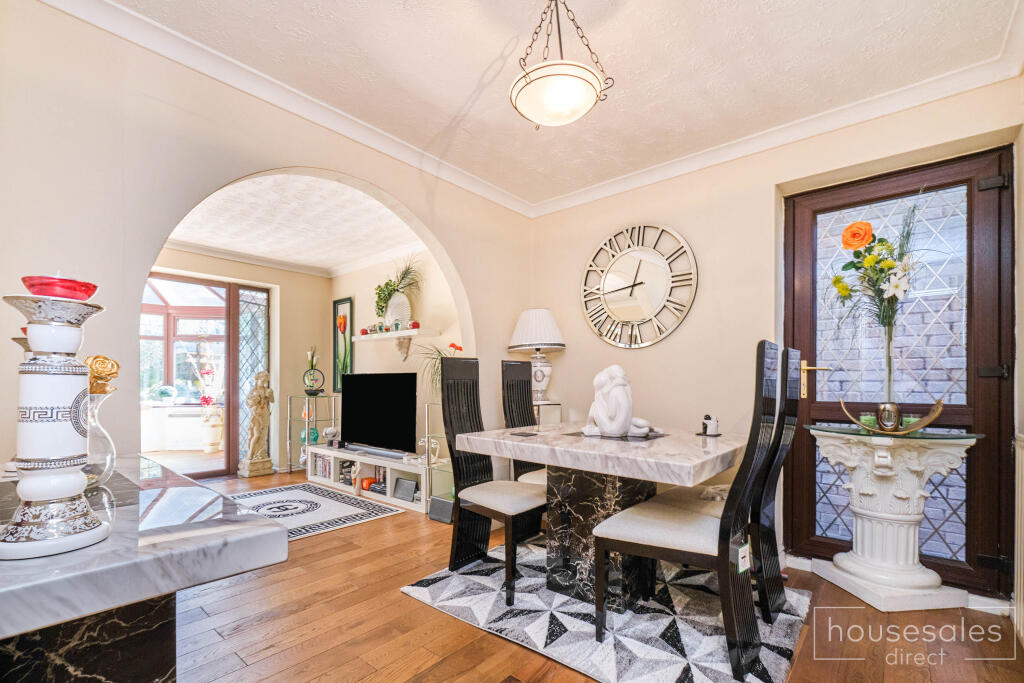
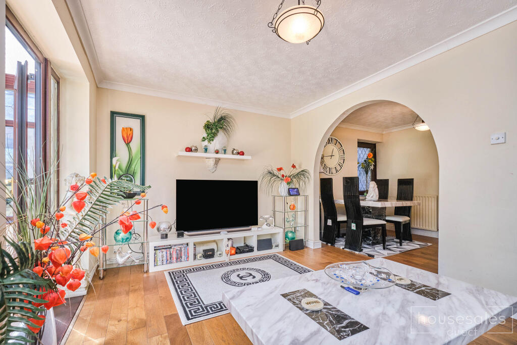
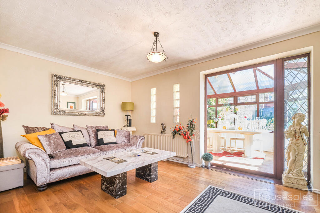
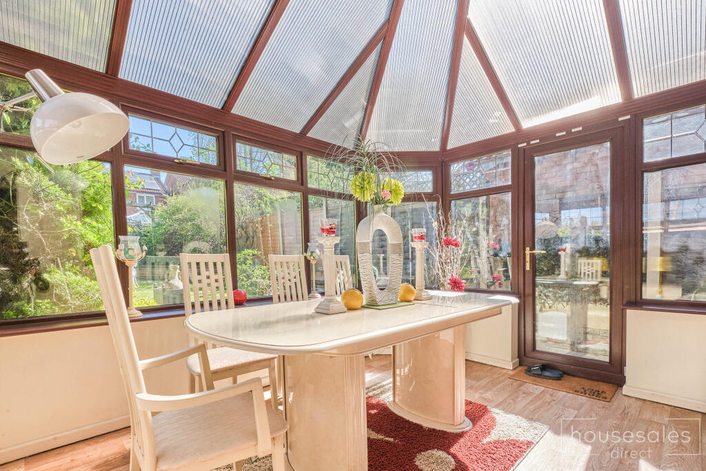
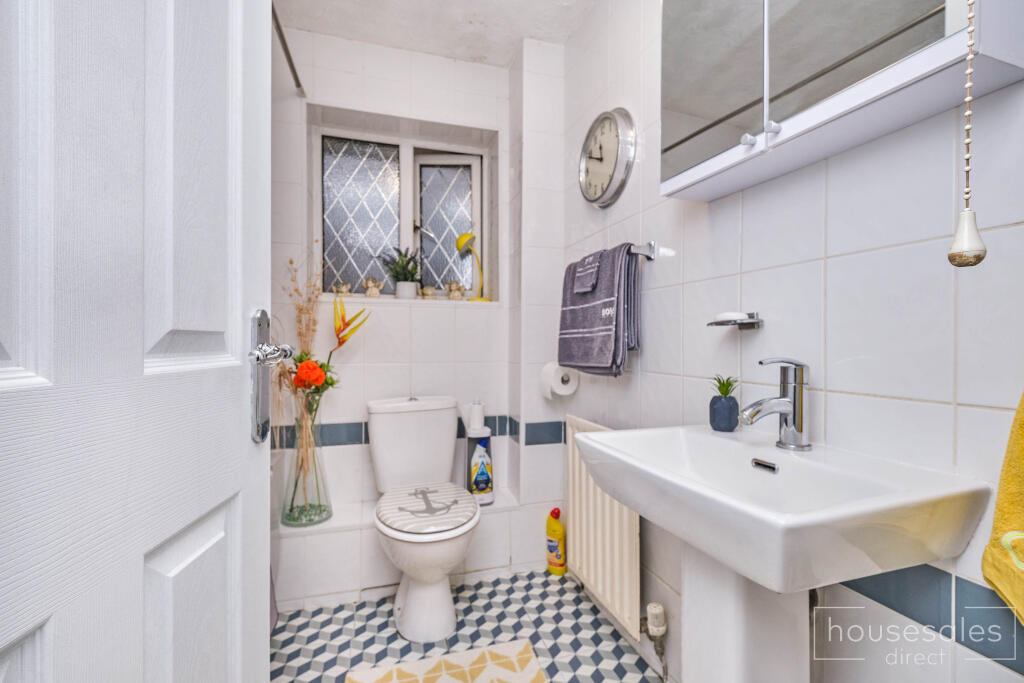
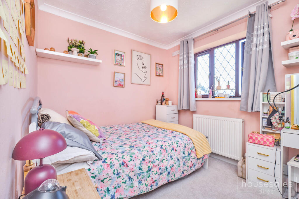
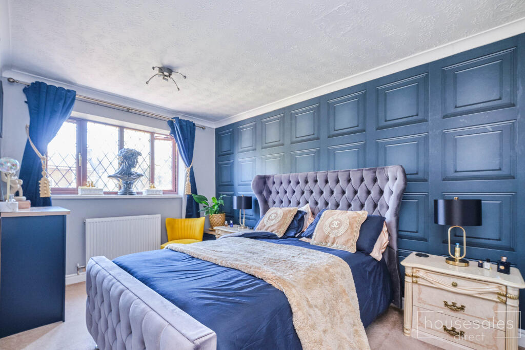
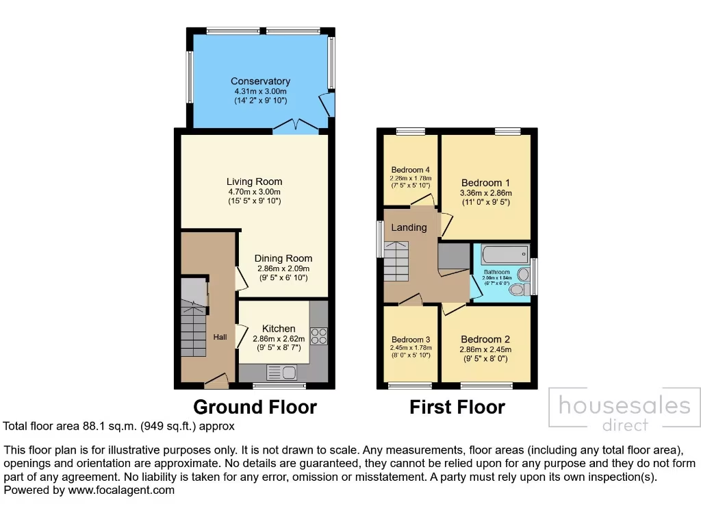
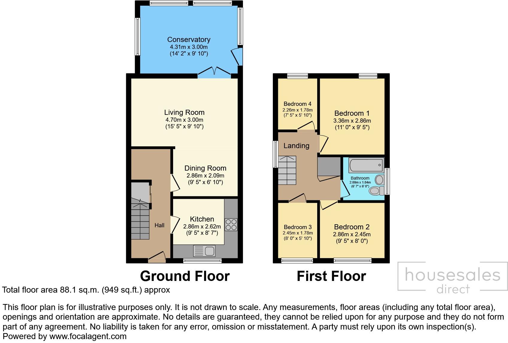
- A 4-bedroom family home with a conservatory, living room, dining room, and kitchen on the ground floor. Includes a bathroom on the first floor.
Rooms
- Conservatory:
- Living Room:
- Dining Room:
- Kitchen:
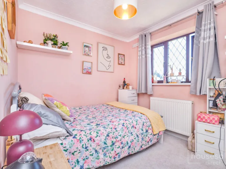
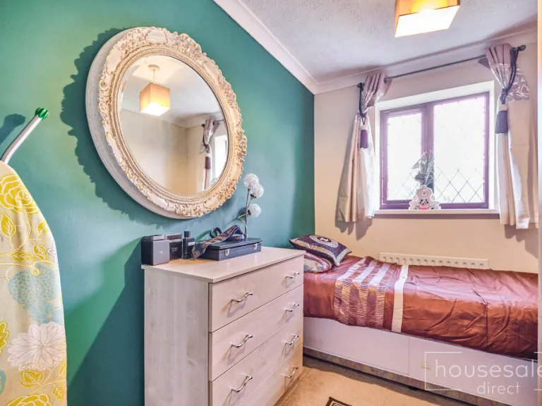
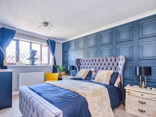
- Bedroom 1:
- Bedroom 2:
- Bedroom 3:
- Bedroom 4:
- Bathroom:
Textual Property Features
Detected Visual Features
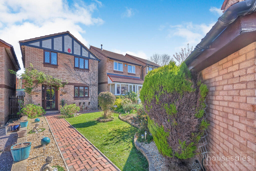
- modern suburban
- semi-detached
- brickwork
- bay window
- front lawn
- driveway
- modern kitchen
- contemporary style
- white cabinetry
- black countertops
- track lighting
- gas stove
- extractor fan
- wall-mounted oven
- tiled backsplash
EPC Details
- Fully double glazed
- Cavity wall, filled cavity
- Boiler and radiators, mains gas
- Low energy lighting in 38% of fixed outlets
- Solid, no insulation (assumed)
Nearby Schools
- Rufford Primary School
- Peters Hill Primary School
- Brook Primary School
- Brockmoor Primary School
- Amblecote Primary School
- Fairhaven Primary School
- Dingle Community Primary School
- The Crestwood School
- Crestwood Park Primary School
- Ham Dingle Primary Academy
- Oldswinford C of E Primary School
- Old Swinford Hospital
- Redhill School
- St James's CofE Primary School
- The Wordsley School
- St Joseph's RC Primary School
- Elmfield Rudolf Steiner School Limited
- The Pedmore High School
- Greenfield Primary School
- Thorns Collegiate Academy
- Ashwood Park Primary School
- Brierley Hill Primary School
- Bromley Hills Primary School
- The Bromley-Pensnett Primary School
Nearest General Shops
- Id: 321824488
- Tags:
- Building: retail
- Shop: car
- Source: bing
- TagsNormalized:
- Lat: 52.4646107
- Lon: -2.1501018
- FullGeoHash: gcq6rnfkdbrc
- PartitionGeoHash: gcq6
- Images:
- FoodStandards: null
- Distance: 621
,- Id: 150357881
- Tags:
- Brand: Toyota
- Building: yes
- Name: Marshall Toyota (Stourbridge)
- Shop: car;car_repair
- Source: visual survey;bing
- TagsNormalized:
- toyota
- car repair
- repair
- shop
- Lat: 52.4713677
- Lon: -2.1503128
- FullGeoHash: gcq6x045y5fs
- PartitionGeoHash: gcq6
- Images:
- FoodStandards: null
- Distance: 598.8
,- Id: 150357891
- Tags:
- Building: yes
- Shop: car_repair
- Source: visual survey;bing
- TagsNormalized:
- Lat: 52.471252
- Lon: -2.1498679
- FullGeoHash: gcq6x04e0qq6
- PartitionGeoHash: gcq6
- Images:
- FoodStandards: null
- Distance: 566.8
}
Nearest Religious buildings
- Id: 150357835
- Tags:
- Amenity: place_of_worship
- Building: yes
- Denomination: methodist
- Name: Amblecote & Wordsley Methodist Church
- Religion: christian
- Source: visual survey;bing
- TagsNormalized:
- place of worship
- methodist
- church
- christian
- Lat: 52.4700942
- Lon: -2.1552843
- FullGeoHash: gcq6qzys6nrx
- PartitionGeoHash: gcq6
- Images:
- FoodStandards: null
- Distance: 849.3
,- Id: 150357838
- Tags:
- Addr:
- Housenumber: 102-104
- Postcode: DY8 4BS
- Street: Brettell Lane
- Amenity: place_of_worship
- Building: yes
- Fhrs:
- Name: Amblecote Christian Centre
- Religion: christian
- Source: visual survey;bing
- Source:addr: FHRS Open Data
- TagsNormalized:
- place of worship
- christian
- church
- Lat: 52.4708496
- Lon: -2.1526835
- FullGeoHash: gcq6x002yg6c
- PartitionGeoHash: gcq6
- Images:
- FoodStandards:
- Id: 500135
- FHRSID: 500135
- LocalAuthorityBusinessID: PI/000008066
- BusinessName: Amblecote Christian Centre
- BusinessType: Restaurant/Cafe/Canteen
- BusinessTypeID: 1
- AddressLine1: 102-104
- AddressLine2: Brettell Lane
- AddressLine3: Brierley Hill
- AddressLine4: Stourbridge
- PostCode: DY8 4BS
- RatingValue: 5
- RatingKey: fhrs_5_en-GB
- RatingDate: 2019-02-14
- LocalAuthorityCode: 409
- LocalAuthorityName: Dudley
- LocalAuthorityWebSite: http://www.dudley.gov.uk
- LocalAuthorityEmailAddress: Food.DUE@dudley.gov.uk
- Scores:
- Hygiene: 0
- Structural: 5
- ConfidenceInManagement: 5
- NewRatingPending: false
- Geocode:
- Longitude: -2.15327400000000
- Latitude: 52.47071000000000
- Distance: 709.9
,- Id: 321824552
- Tags:
- Amenity: place_of_worship
- Building: church
- Denomination: anglican
- Name: Holy Trinity
- Religion: christian
- Source: bing
- Wikidata: Q105105461
- TagsNormalized:
- place of worship
- church
- anglican
- christian
- Lat: 52.4630078
- Lon: -2.1489701
- FullGeoHash: gcq6rne5jm7z
- PartitionGeoHash: gcq6
- Images:
- FoodStandards: null
- Distance: 703.2
}
Nearest Medical buildings
- Id: 884159067
- Tags:
- Amenity: clinic
- Building: yes
- Healthcare: clinic
- Name: Stourside Hospital
- Note: Have marked general footprint of car park and building, but further tracing of car park and building as distinct will be needed when satellite imagery becomes available.
- Operator: Ramsay Health Care
- Operator:type: private
- TagsNormalized:
- clinic
- health
- healthcare
- hospital
- Lat: 52.4604308
- Lon: -2.1530998
- FullGeoHash: gcq6rn0hjjh7
- PartitionGeoHash: gcq6
- Images:
- FoodStandards: null
- Distance: 1099.7
,- Id: 4396023380
- Tags:
- Addr:
- City: Stourbridge
- Housenumber: 5
- Postcode: DY8 1TE
- Street: Lower High Street
- Contact:
- Email: heroessauna@live.com
- Leisure: sauna
- Name: Heroes Health Club
- Note: OPEN 7 DAYS A WEEK NOON TILL LATE closes around 9.30 pm
- Phone: +44 1384 442039
- Website: https://www.heroessauna.co.uk/
- TagsNormalized:
- Lat: 52.4599872
- Lon: -2.1487343
- FullGeoHash: gcq6rn53df7t
- PartitionGeoHash: gcq6
- Images:
- FoodStandards: null
- Distance: 992.6
,- Id: 322012534
- Tags:
- Addr:
- City: Brierley Hill
- Postcode: DY5 3RJ
- Street: Squires Court
- Amenity: doctors
- Building: yes
- Healthcare: doctor
- Name: Withymoor Surgery
- Phone: +44 844 3878760
- Source: bing
- TagsNormalized:
- doctor
- doctors
- health
- healthcare
- surgery
- Lat: 52.4713507
- Lon: -2.1303197
- FullGeoHash: gcq6x80ezbwq
- PartitionGeoHash: gcq6
- Images:
- FoodStandards: null
- Distance: 934.1
,- Id: 150357872
- Tags:
- Amenity: dentist
- Building: yes
- Healthcare: dentist
- Source: visual survey;bing
- TagsNormalized:
- Lat: 52.4697594
- Lon: -2.1548027
- FullGeoHash: gcq6qzyft2nd
- PartitionGeoHash: gcq6
- Images:
- FoodStandards: null
- Distance: 809.1
}
Nearest Leisure Facilities
- Id: 265039586
- Tags:
- Leisure: park
- Source: bing
- TagsNormalized:
- Lat: 52.4703838
- Lon: -2.1369814
- FullGeoHash: gcq6rrgyhsrp
- PartitionGeoHash: gcq6
- Images:
- FoodStandards: null
- Distance: 479.9
,- Id: 268592460
- Tags:
- Leisure: park
- Source: bing
- TagsNormalized:
- Lat: 52.4720013
- Lon: -2.1412062
- FullGeoHash: gcq6x20zd3bz
- PartitionGeoHash: gcq6
- Images:
- FoodStandards: null
- Distance: 438.7
,- Id: 321824430
- Tags:
- Leisure: pitch
- Sport: soccer
- TagsNormalized:
- Lat: 52.4682622
- Lon: -2.1471127
- FullGeoHash: gcq6rps9b8ux
- PartitionGeoHash: gcq6
- Images:
- FoodStandards: null
- Distance: 270.2
,- Id: 385669138
- Tags:
- Leisure: park
- Source: bing
- TagsNormalized:
- Lat: 52.466557
- Lon: -2.1407291
- FullGeoHash: gcq6rr1pv7he
- PartitionGeoHash: gcq6
- Images:
- FoodStandards: null
- Distance: 247.1
,- Id: 268592459
- Tags:
- Leisure: park
- Source: bing
- TagsNormalized:
- Lat: 52.4703606
- Lon: -2.1424905
- FullGeoHash: gcq6rpzyh25k
- PartitionGeoHash: gcq6
- Images:
- FoodStandards: null
- Distance: 240.4
}
Nearest Train stations
- Id: 21281240
- Tags:
- Name: Hagley
- Naptan:
- Network: National Rail
- Public_transport: station
- Railway: station
- Ref:
- Source: NPE
- Wikidata: Q2763246
- Wikipedia: en:Hagley railway station
- TagsNormalized:
- Lat: 52.4224267
- Lon: -2.1465358
- FullGeoHash: gcq6pphyy0dg
- PartitionGeoHash: gcq6
- Images:
- FoodStandards: null
- Distance: 5098.7
,- Id: 21281285
- Tags:
- Name: Cradley Heath
- Naptan:
- Network: National Rail
- Public_transport: station
- Railway: station
- Ref:
- Source: NPE
- West_midlands_fare_zone: 5
- Wikidata: Q1924927
- Wikipedia: en:Cradley Heath railway station
- TagsNormalized:
- Lat: 52.4694408
- Lon: -2.0906252
- FullGeoHash: gcqd2rv8susv
- PartitionGeoHash: gcqd
- Images:
- FoodStandards: null
- Distance: 3558.8
,- Id: 21281257
- Tags:
- Name: Stourbridge Junction
- Naptan:
- Network: National Rail
- Public_transport: station
- Railway: station
- Ref:
- Source: NPE
- West_midlands_fare_zone: 5
- Wikidata: Q2045806
- Wikipedia: en:Stourbridge Junction railway station
- TagsNormalized:
- Lat: 52.4476157
- Lon: -2.1340314
- FullGeoHash: gcq6r7y192ny
- PartitionGeoHash: gcq6
- Images:
- FoodStandards: null
- Distance: 2373.9
,- Id: 21281283
- Tags:
- Name: Lye
- Naptan:
- Network: National Rail
- Public_transport: station
- Railway: station
- Ref:
- Source: NPE
- West_midlands_fare_zone: 5
- Wikidata: Q2044178
- Wikipedia: en:Lye railway station
- TagsNormalized:
- Lat: 52.4599417
- Lon: -2.1160497
- FullGeoHash: gcq6ry51k3yv
- PartitionGeoHash: gcq6
- Images:
- FoodStandards: null
- Distance: 2052.9
,- Id: 21281267
- Tags:
- Name: Stourbridge Town
- Naptan:
- Network: National Rail
- Public_transport: station
- Railway: station
- Ref:
- Source: NPE
- West_midlands_fare_zone: 5
- Wikidata: Q2746016
- Wikipedia: en:Stourbridge Town railway station
- TagsNormalized:
- Lat: 52.4556424
- Lon: -2.1419647
- FullGeoHash: gcq6rm22287r
- PartitionGeoHash: gcq6
- Images:
- FoodStandards: null
- Distance: 1402.3
}
Nearest Hotels
- Id: 55493030
- Tags:
- Addr:
- City: Dudley
- Place: Merry Hill
- Postcode: DY5 1UR
- Street: Level Street
- Building: yes
- Fhrs:
- Name: Copthorne Hotel Merry Hill Dudley
- Source: OS_OpenData_StreetView;survey
- Tourism: hotel
- TagsNormalized:
- Lat: 52.4849637
- Lon: -2.1153333
- FullGeoHash: gcq6xfeej4m5
- PartitionGeoHash: gcq6
- Images:
- FoodStandards: null
- Distance: 2646.4
,- Id: 2026517
- Tags:
- Addr:
- Postcode: DY8 1DW
- Street: High Street
- Building: yes
- Fhrs:
- Name: The Talbot Hotel
- Tourism: hotel
- Type: multipolygon
- Website: http://www.thetalbot-hotel.co.uk/
- Wikidata: Q26627023
- TagsNormalized:
- Lat: 52.4570133
- Lon: -2.146694
- FullGeoHash: gcq6rjsb62hc
- PartitionGeoHash: gcq6
- Images:
- FoodStandards: null
- Distance: 1270.8
,- Id: 705992803
- Tags:
- Brand: Premier Inn
- Brand:wikidata: Q2108626
- Brand:wikipedia: en:Premier Inn
- Building: yes
- Internet_access: wlan
- Internet_access:fee: customers
- Internet_access:operator: Virgin Media
- Internet_access:ssid: Premier Inn Free Wi-Fi
- Name: Premier Inn
- Tourism: hotel
- TagsNormalized:
- Lat: 52.4575842
- Lon: -2.1409961
- FullGeoHash: gcq6rm8gx4mw
- PartitionGeoHash: gcq6
- Images:
- FoodStandards: null
- Distance: 1192.9
}
Tags
- modern suburban
- semi-detached
- brickwork
- bay window
- front lawn
- driveway
- modern kitchen
- contemporary style
- white cabinetry
- black countertops
- track lighting
- gas stove
- extractor fan
- wall-mounted oven
- tiled backsplash
Local Market Stats
- Average Price/sqft: £265
- Avg Income: £41400
- Rental Yield: 3.5%
- Social Housing: 8%
- Planning Success Rate: 90%
AirBnB Data
- 1km average: £85/night
- Listings in 1km: 1
Similar Properties
 4 bedroom detached house for sale in Cranbourne Road, Stourbridge, DY8 1QZ, DY8 — £450,000 • 4 bed • 2 bath • 1577 ft²
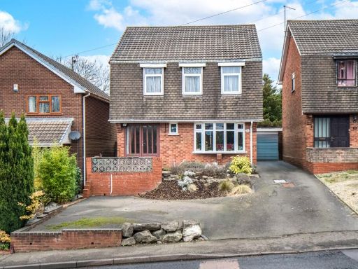 4 bedroom detached house for sale in Oldnall Road, Stourbridge, West Midlands, DY9 — £350,000 • 4 bed • 1 bath • 1077 ft²
 4 bedroom link detached house for sale in Wolverley Avenue, Stourbridge, DY8 3PJ, DY8 — £410,000 • 4 bed • 1 bath • 1322 ft²
 5 bedroom detached house for sale in Coney Green, Stourbridge, DY8 1LA, DY8 — £360,000 • 5 bed • 1 bath • 1206 ft²
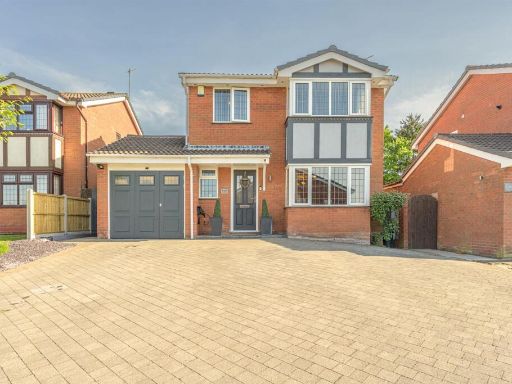 4 bedroom detached house for sale in Lythwood Drive, Brierley Hill, DY5 3QW, DY5 — £390,000 • 4 bed • 2 bath • 806 ft²
 3 bedroom detached house for sale in Burns Close, Amblecote, Stourbridge, West Midlands, DY8 — £260,000 • 3 bed • 1 bath • 999 ft²
Meta
- {
"@context": "https://schema.org",
"@type": "Residence",
"name": "4 bedroom detached house for sale in Burns Close Amblecote,…",
"description": "",
"url": "https://propertypiper.co.uk/property/672b9385-1a43-42cb-a15d-c422d8f92967",
"image": "https://image-a.propertypiper.co.uk/398de263-815f-4a78-8e38-38c841f984d1-1024.jpeg",
"address": {
"@type": "PostalAddress",
"streetAddress": "17 BURNS CLOSE STOURBRIDGE ",
"postalCode": "DY8 4NF",
"addressLocality": "Dudley",
"addressRegion": "Stourbridge",
"addressCountry": "England"
},
"geo": {
"@type": "GeoCoordinates",
"latitude": 52.46823333831336,
"longitude": -2.143124581869485
},
"numberOfRooms": 4,
"numberOfBathroomsTotal": 1,
"floorSize": {
"@type": "QuantitativeValue",
"value": 949,
"unitCode": "FTK"
},
"offers": {
"@type": "Offer",
"price": 254000,
"priceCurrency": "GBP",
"availability": "https://schema.org/InStock"
},
"additionalProperty": [
{
"@type": "PropertyValue",
"name": "Feature",
"value": "modern suburban"
},
{
"@type": "PropertyValue",
"name": "Feature",
"value": "semi-detached"
},
{
"@type": "PropertyValue",
"name": "Feature",
"value": "brickwork"
},
{
"@type": "PropertyValue",
"name": "Feature",
"value": "bay window"
},
{
"@type": "PropertyValue",
"name": "Feature",
"value": "front lawn"
},
{
"@type": "PropertyValue",
"name": "Feature",
"value": "driveway"
},
{
"@type": "PropertyValue",
"name": "Feature",
"value": "modern kitchen"
},
{
"@type": "PropertyValue",
"name": "Feature",
"value": "contemporary style"
},
{
"@type": "PropertyValue",
"name": "Feature",
"value": "white cabinetry"
},
{
"@type": "PropertyValue",
"name": "Feature",
"value": "black countertops"
},
{
"@type": "PropertyValue",
"name": "Feature",
"value": "track lighting"
},
{
"@type": "PropertyValue",
"name": "Feature",
"value": "gas stove"
},
{
"@type": "PropertyValue",
"name": "Feature",
"value": "extractor fan"
},
{
"@type": "PropertyValue",
"name": "Feature",
"value": "wall-mounted oven"
},
{
"@type": "PropertyValue",
"name": "Feature",
"value": "tiled backsplash"
}
]
}
High Res Floorplan Images
Compatible Floorplan Images
FloorplanImages Thumbnail