SS7 2EH - 5 bedroom semidetached house for sale in Woodfield Road, Be…
View on Property Piper
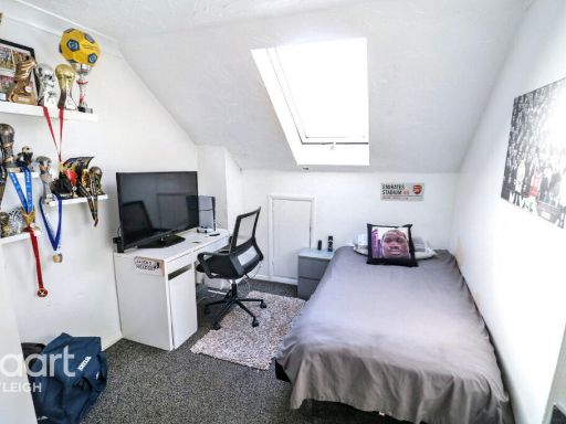
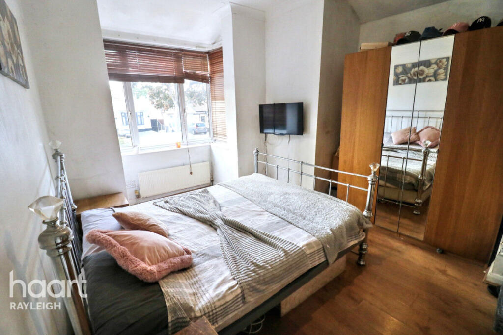
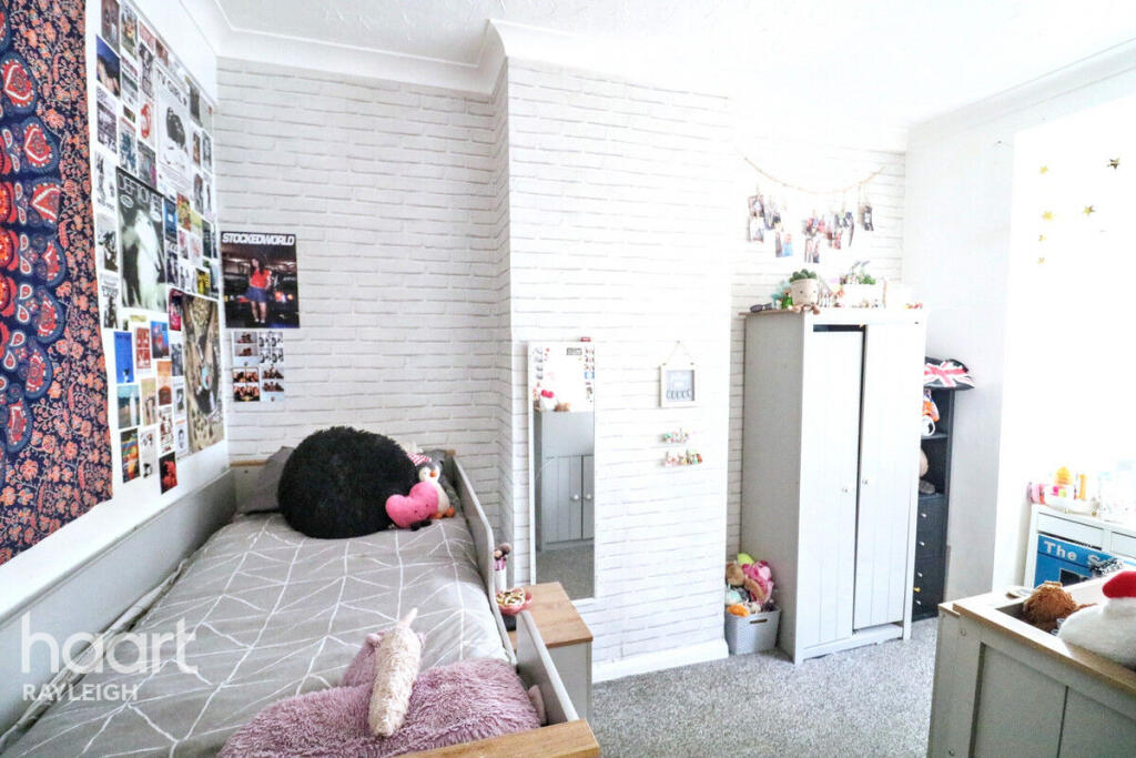
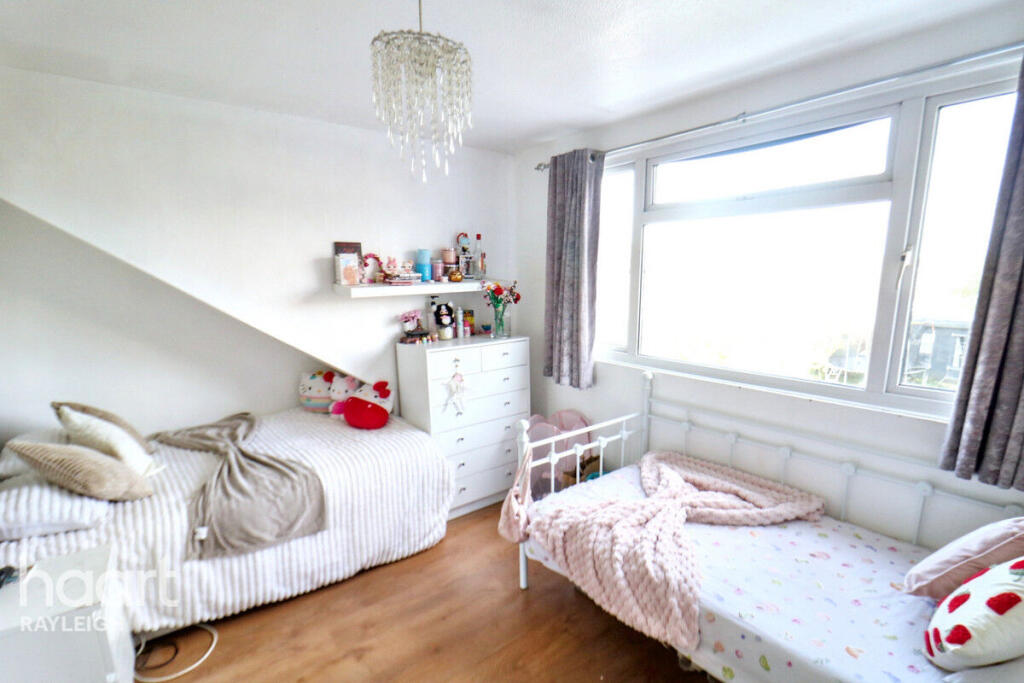
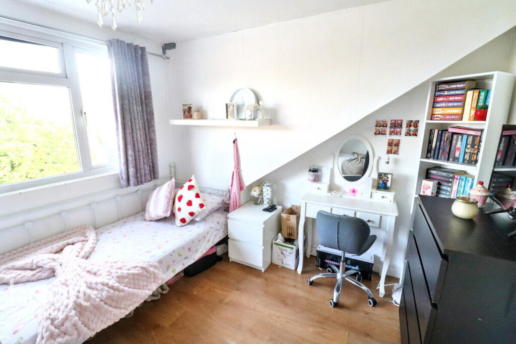
5 bedroom semi-detached house for sale in Woodfield Road, Benfleet, SS7
Property Details
- Price: £525000
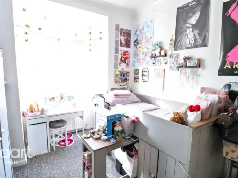
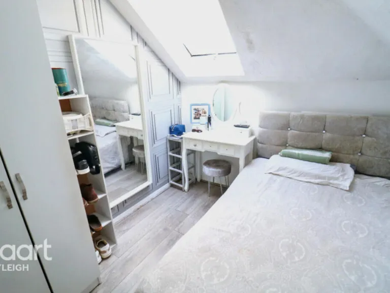
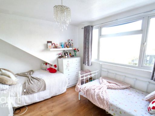
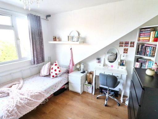
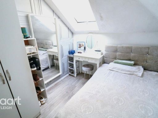
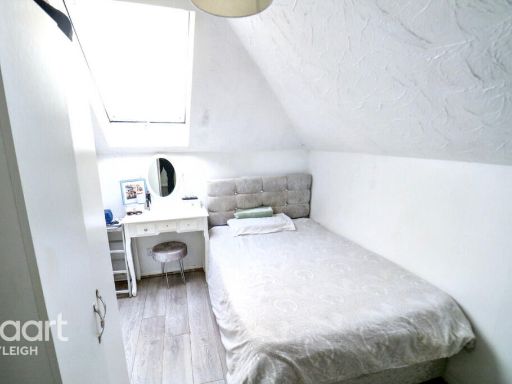
- Bedrooms: 5
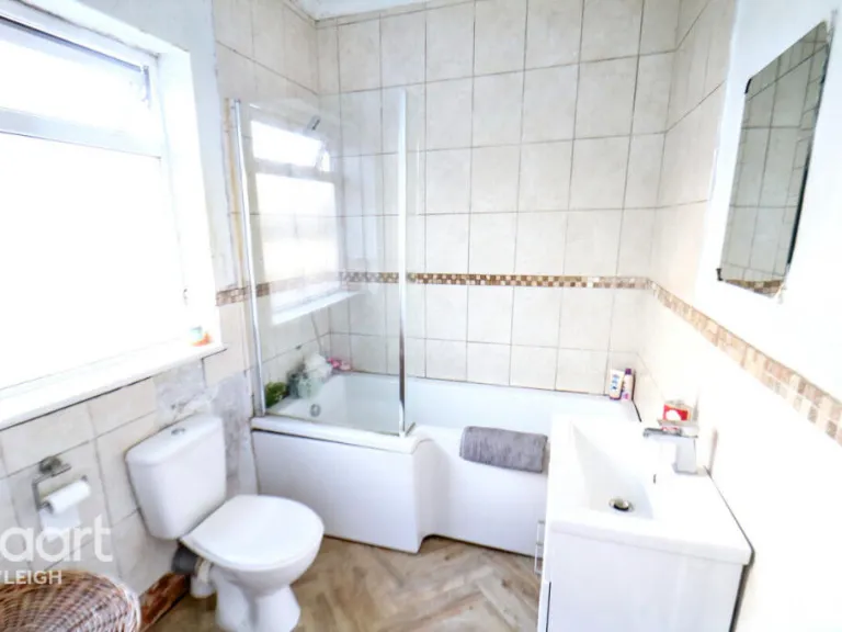
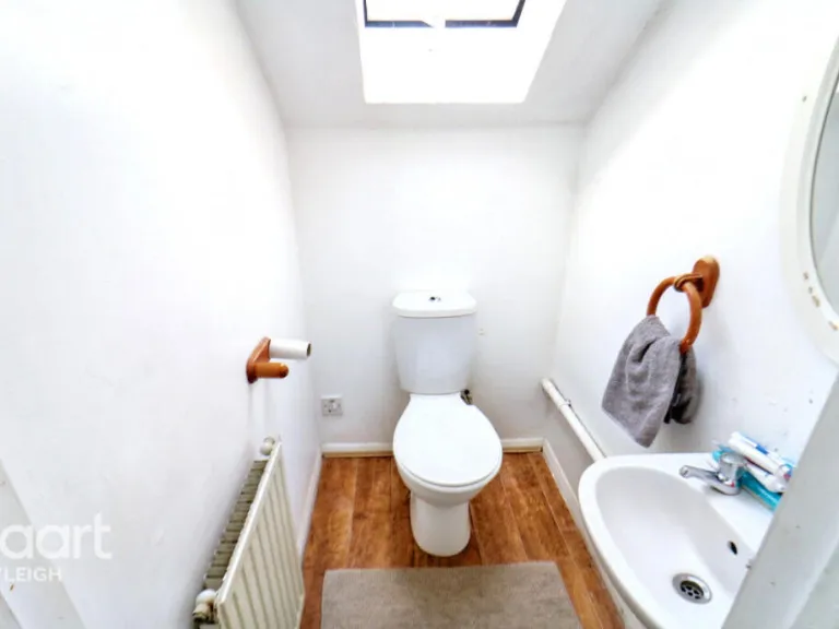
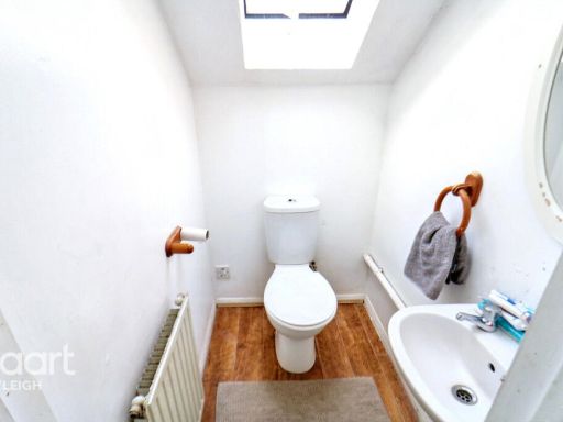
- Bathrooms: 1
- Property Type: undefined
- Property SubType: undefined
Image Descriptions
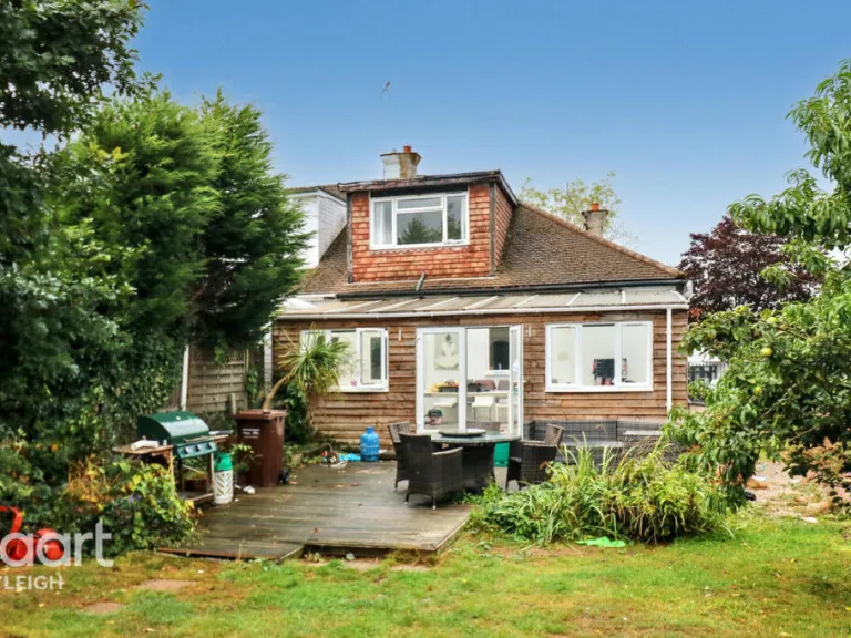
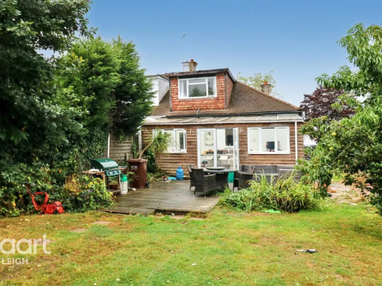
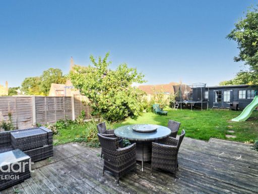
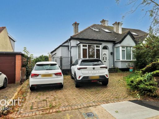
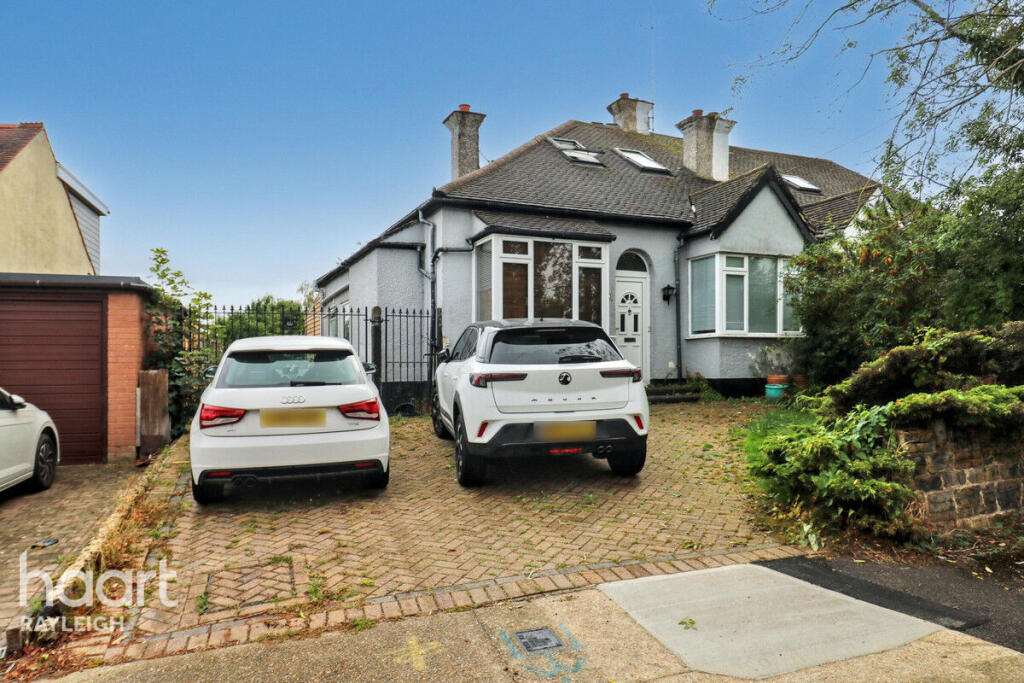
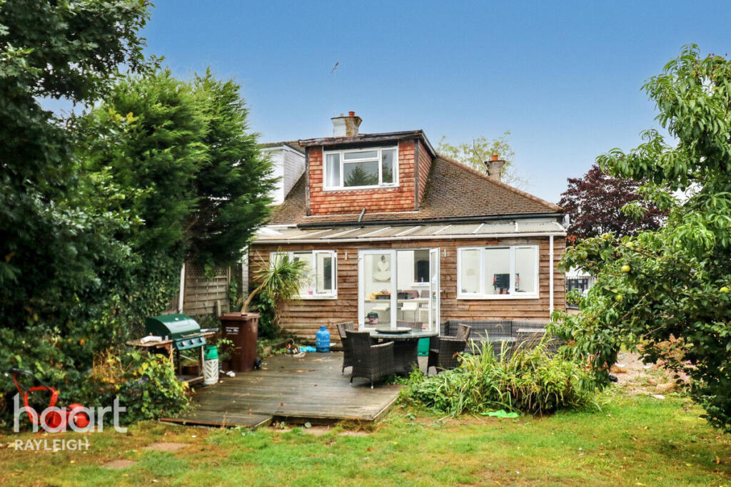
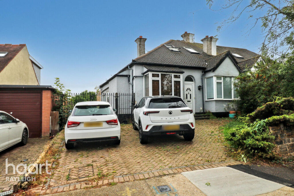
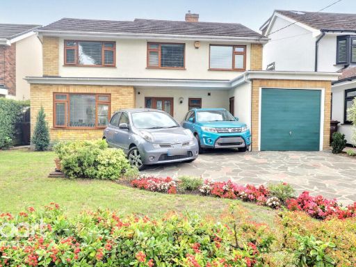
- house exterior 20th Century Semi-Detached
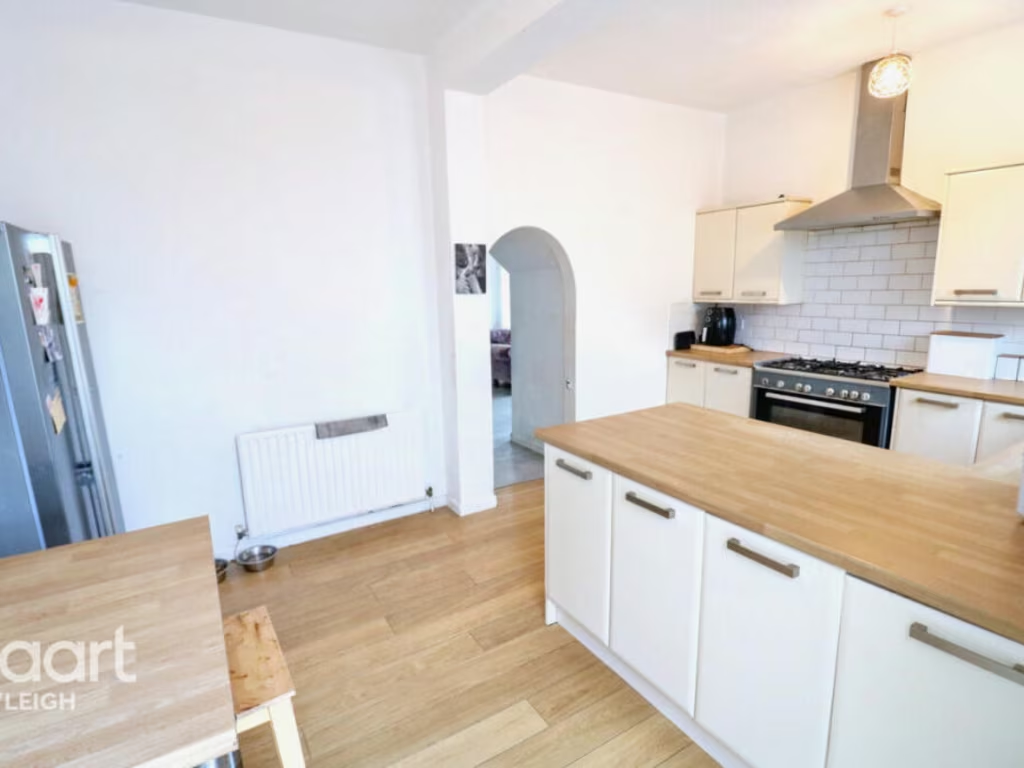
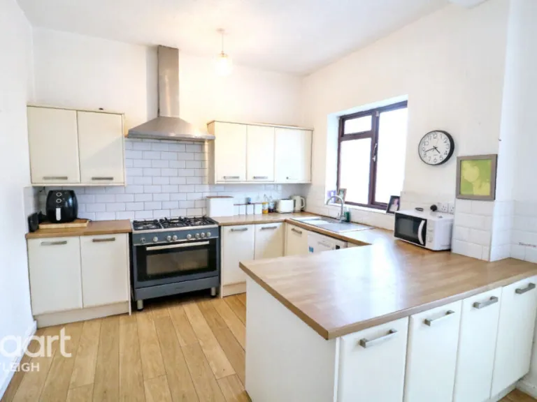
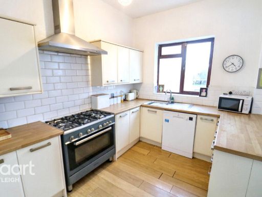
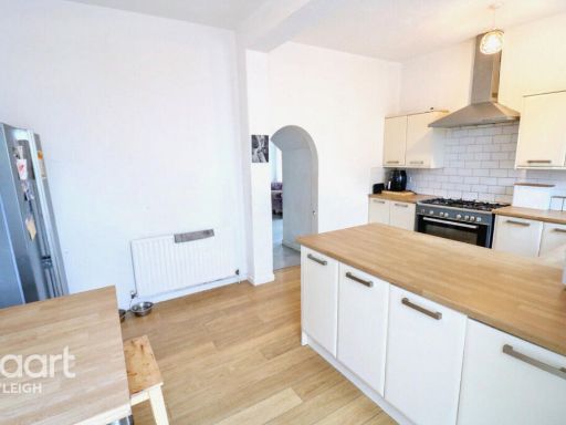
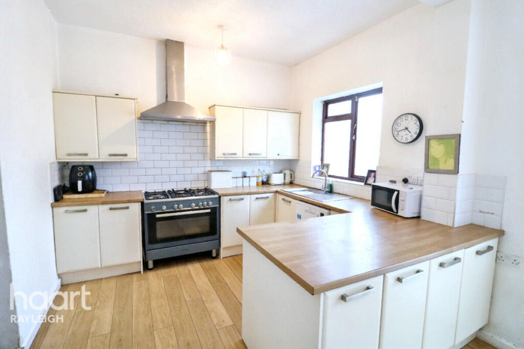
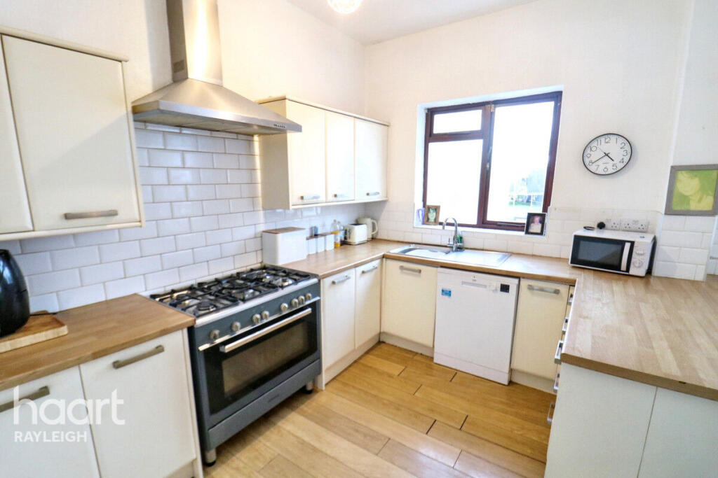
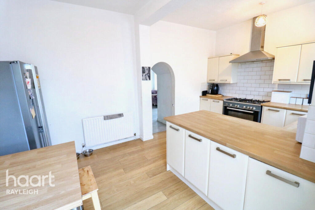
- kitchen modern
Textual Property Features
Detected Visual Features
- semi-detached
- 20th century
- two-storey
- bay window
- chimney
- driveway
- brick facade
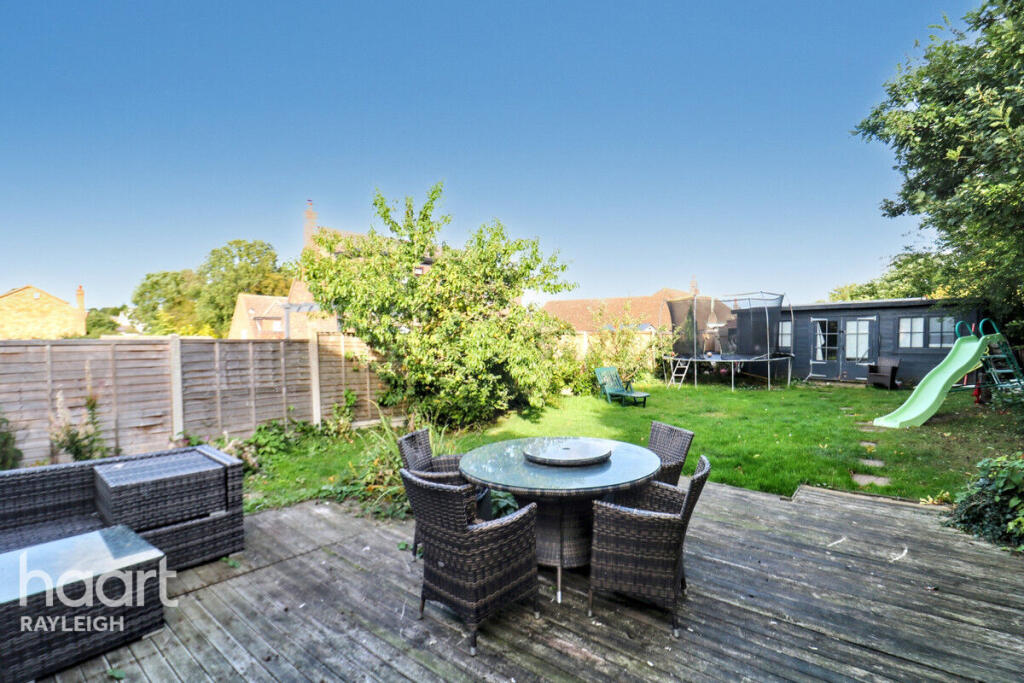
- garden
- garage
- potential
- residential area
- modern kitchen
- wood flooring
- modern appliances
- white cabinets
- stainless steel extractor
- subway tile backsplash
EPC Details
- Fully double glazed
- Cavity wall, as built, insulated (assumed)
- Boiler and underfloor heating, mains gas
- Low energy lighting in all fixed outlets
- Suspended, insulated (assumed)
Nearby Schools
- Castle View School
- Belfairs Academy
- The King John School
- Blenheim Primary School
- Fairways Primary School
- Edwards Hall Primary School
- Rayleigh Primary School
- The FitzWimarc School
- Leigh North Street Primary School
- Westcliff High School for Girls
- Hadleigh Junior School
- Westwood Academy
- The Eastwood Academy
- Grove Wood Primary School
- Leigh Beck Junior School
- West Leigh Infant School
- Darlinghurst Academy
- Hadleigh Infant and Nursery School
- Eastwood Primary School & Nursery
- Thundersley Primary School
- The Deanes
- Heycroft Primary School
- Leigh Beck Infant School and Nursery Academy
- St. Michael's School
- West Leigh Junior School
- Wyburns Primary School
- Edward Francis Primary School
Nearest Bars And Restaurants
- Id: 10693578050
- Tags:
- Amenity: cafe
- Brand: Costa
- Brand:wikidata: Q608845
- Cuisine: coffee_shop
- Name: Costa
- Survey:
- Takeaway: yes
- TagsNormalized:
- Lat: 51.5529474
- Lon: 0.6109174
- FullGeoHash: u10mmbuvemvj
- PartitionGeoHash: u10m
- Images:
- FoodStandards: null
- Distance: 919.6
,- Id: 699867494
- Tags:
- Amenity: restaurant
- Building: yes
- Name: Alebro
- TagsNormalized:
- Lat: 51.5480393
- Lon: 0.6336891
- FullGeoHash: u10mq2j3n4bz
- PartitionGeoHash: u10m
- Images:
- FoodStandards: null
- Distance: 845.6
,- Id: 1120565578
- Tags:
- Addr:
- City: Hadleigh
- Housename: 305-307
- Postcode: SS7 2BN
- Street: London Road
- Air_conditioning: yes
- Amenity: restaurant
- Bar: yes
- Brewery: yes
- Building: yes
- Capacity: 40
- Cuisine: indian
- Diet:
- Halal: yes
- Non-vegetarian: yes
- Vegan: yes
- Vegetarian: yes
- Name: mall road
- Opening_hours: Mo off; Tu-Th 17:30-22:30; Fr-Sa 17:30-23:00; Su 17:30-22:00
- Phone: +44 1702 389435
- Website: https://www.mallroadrestaurant.com/
- TagsNormalized:
- restaurant
- indian
- halal
- vegetarian
- vegan
- mall
- Lat: 51.5524867
- Lon: 0.6121083
- FullGeoHash: u10mmbvep0j1
- PartitionGeoHash: u10m
- Images:
- FoodStandards: null
- Distance: 838.2
,- Id: 4081379249
- Tags:
- Amenity: restaurant
- Cuisine: thai
- Name: Tudor House
- TagsNormalized:
- Lat: 51.5486391
- Lon: 0.6301034
- FullGeoHash: u10mq24ud6z1
- PartitionGeoHash: u10m
- Images:
- FoodStandards: null
- Distance: 620.4
,- Id: 4081379239
- Tags:
- Amenity: restaurant
- Name: Affinity 1777
- TagsNormalized:
- Lat: 51.5486709
- Lon: 0.6298591
- FullGeoHash: u10mq24sub8z
- PartitionGeoHash: u10m
- Images:
- FoodStandards: null
- Distance: 606.7
}
Nearest General Shops
- Id: 707221346
- Tags:
- TagsNormalized:
- Lat: 51.5523225
- Lon: 0.612403
- FullGeoHash: u10mmbvfn12y
- PartitionGeoHash: u10m
- Images:
- FoodStandards: null
- Distance: 819
,- Id: 4081379208
- Tags:
- TagsNormalized:
- Lat: 51.5486108
- Lon: 0.63046
- FullGeoHash: u10mq25h6v91
- PartitionGeoHash: u10m
- Images:
- FoodStandards: null
- Distance: 639.1
,- Id: 4081379233
- Tags:
- TagsNormalized:
- Lat: 51.5488593
- Lon: 0.6306316
- FullGeoHash: u10mq25jygc5
- PartitionGeoHash: u10m
- Images:
- FoodStandards: null
- Distance: 627.4
}
Nearest Grocery shops
- Id: 10693578047
- Tags:
- Name: Meat & Two Veg
- Shop: butcher;greengrocer
- TagsNormalized:
- meat
- butcher
- greengrocer
- grocer
- shop
- Lat: 51.5530742
- Lon: 0.6107055
- FullGeoHash: u10mmbuwqmx4
- PartitionGeoHash: u10m
- Images:
- FoodStandards: null
- Distance: 934.6
,- Id: 427174969
- Tags:
- Brand: Premier
- Brand:wikidata: Q7240340
- Brand:wikipedia: en:Premier Stores
- Name: Premier
- Shop: convenience
- TagsNormalized:
- Lat: 51.5486525
- Lon: 0.6306531
- FullGeoHash: u10mq25hxm31
- PartitionGeoHash: u10m
- Images:
- FoodStandards: null
- Distance: 644.9
,- Id: 4081379240
- Tags:
- Brand: Tesco Express
- Brand:wikidata: Q98456772
- Brand:wikipedia: en:Tesco
- Contact:
- Website: https://www.tesco.com/store-locator/leigh-on-sea/1781-1799-london-rd
- Name: Tesco Express
- Operator: Tesco Stores Ltd
- Shop: convenience
- TagsNormalized:
- tesco
- tesco express
- convenience
- shop
- Lat: 51.548926
- Lon: 0.6294596
- FullGeoHash: u10mq24q72r1
- PartitionGeoHash: u10m
- Images:
- FoodStandards: null
- Distance: 567.2
}
Nearest Supermarkets
- Id: 638840405
- Tags:
- Brand: Waitrose
- Brand:wikidata: Q771734
- Brand:wikipedia: en:Waitrose
- Building: yes
- Name: Waitrose
- Official_name: Waitrose & Partners
- Operator: Waitrose & Partners
- Shop: supermarket
- Wheelchair: yes
- TagsNormalized:
- Lat: 51.548437
- Lon: 0.6546787
- FullGeoHash: u10mqbherj5u
- PartitionGeoHash: u10m
- Images:
- FoodStandards: null
- Distance: 2162.6
,- Id: 179085882
- Tags:
- Addr:
- City: Benfleet
- Postcode: SS7 2RB
- Street: London Road
- Brand: Morrisons
- Brand:wikidata: Q922344
- Brand:wikipedia: en:Morrisons
- Building: yes
- Contact:
- Website: https://my.morrisons.com/storefinder/284
- Name: Morrisons
- Shop: supermarket
- Source:
- Addr:
- Postcode: code-point_open
- TagsNormalized:
- Lat: 51.5544512
- Lon: 0.6073683
- FullGeoHash: u10mmc4q2wq8
- PartitionGeoHash: u10m
- Images:
- FoodStandards: null
- Distance: 1178.5
,- Id: 842268436
- Tags:
- Addr:
- Country: GB
- Housenumber: 272-274
- Postcode: SS7 2DE
- Street: London Road
- Brand: Lidl
- Brand:wikidata: Q151954
- Brand:wikipedia: en:Lidl
- Building: supermarket
- Fhrs:
- Name: Lidl
- Shop: supermarket
- Survey:
- TagsNormalized:
- Lat: 51.5520623
- Lon: 0.6112635
- FullGeoHash: u10mmbv0e2zn
- PartitionGeoHash: u10m
- Images:
- FoodStandards:
- Id: 39352
- FHRSID: 39352
- LocalAuthorityBusinessID: 100091600051
- BusinessName: Lidl
- BusinessType: Retailers - supermarkets/hypermarkets
- BusinessTypeID: 7840
- AddressLine1: 272-274 London Road
- AddressLine2: Hadleigh
- AddressLine3: Benfleet
- AddressLine4: Essex
- PostCode: SS7 2DE
- RatingValue: 5
- RatingKey: fhrs_5_en-GB
- RatingDate: 2023-01-04
- LocalAuthorityCode: 112
- LocalAuthorityName: Castle Point
- LocalAuthorityWebSite: http://www.castlepoint.gov.uk
- LocalAuthorityEmailAddress: environmentalhealth@castlepoint.gov.uk
- Scores:
- Hygiene: 0
- Structural: 0
- ConfidenceInManagement: 0
- NewRatingPending: false
- Geocode:
- Longitude: 0.61038900000000
- Latitude: 51.55242200000000
- Distance: 899.9
}
Nearest Religious buildings
- Id: 147379605
- Tags:
- Amenity: place_of_worship
- Building: yes
- Denomination: anglican
- Name: St James the Less, Hadleigh
- Religion: christian
- Wikidata: Q17536388
- TagsNormalized:
- place of worship
- anglican
- christian
- church
- Lat: 51.5530985
- Lon: 0.609616
- FullGeoHash: u10mmbgyt44e
- PartitionGeoHash: u10m
- Images:
- FoodStandards: null
- Distance: 1009.9
,- Id: 4081351082
- Tags:
- Amenity: place_of_worship
- Name: Highlands Methodist Church
- Religion: christian
- TagsNormalized:
- place of worship
- church
- methodist
- christian
- Lat: 51.5490928
- Lon: 0.6303769
- FullGeoHash: u10mq25p0z7h
- PartitionGeoHash: u10m
- Images:
- FoodStandards: null
- Distance: 596.6
,- Id: 149057895
- Tags:
- Amenity: place_of_worship
- Denomination: anglican
- Name: St Barnabas, Hadleigh
- Religion: christian
- Wikidata: Q105083580
- TagsNormalized:
- place of worship
- anglican
- christian
- church
- Lat: 51.5510757
- Lon: 0.6223778
- FullGeoHash: u10mq0t4y3n8
- PartitionGeoHash: u10m
- Images:
- FoodStandards: null
- Distance: 234.7
}
Nearest Medical buildings
- Id: 10693578045
- Tags:
- Amenity: pharmacy
- Fixme: Name?
- TagsNormalized:
- Lat: 51.5535345
- Lon: 0.6099987
- FullGeoHash: u10mmch1jgru
- PartitionGeoHash: u10m
- Images:
- FoodStandards: null
- Distance: 986
,- Id: 699861478
- Tags:
- Amenity: doctors
- Building: yes
- Healthcare: doctor
- TagsNormalized:
- doctor
- doctors
- health
- healthcare
- Lat: 51.5481677
- Lon: 0.6363078
- FullGeoHash: u10mq2p3g4cm
- PartitionGeoHash: u10m
- Images:
- FoodStandards: null
- Distance: 984.8
,- Id: 10693578046
- Tags:
- Amenity: pharmacy
- Name: Daynite Pharmacy
- Survey:
- TagsNormalized:
- Lat: 51.5531034
- Lon: 0.6106639
- FullGeoHash: u10mmbuwte00
- PartitionGeoHash: u10m
- Images:
- FoodStandards: null
- Distance: 937.5
,- Id: 699867493
- Tags:
- Amenity: clinic
- Building: yes
- Healthcare: clinic
- Name: Leigh Medical Centre
- TagsNormalized:
- Lat: 51.5480325
- Lon: 0.6339006
- FullGeoHash: u10mq2j94cwx
- PartitionGeoHash: u10m
- Images:
- FoodStandards: null
- Distance: 857.4
}
Nearest Airports
- Id: 121158889
- Tags:
- Aerodrome: continental
- Aeroway: aerodrome
- Fhrs:
- Authority: City of London Corporation
- Iata: LCY
- Icao: EGLC
- Name: London City Airport
- Operator: London City Airport Limited
- Ref: LCY
- Website: https://www.londoncityairport.com/
- Wikidata: Q8982
- Wikipedia: en:London City Airport
- TagsNormalized:
- airport
- continental airport
- Lat: 51.5042658
- Lon: 0.0539987
- FullGeoHash: u10j10p64702
- PartitionGeoHash: u10j
- Images:
- FoodStandards: null
- Distance: 39814.2
,- Id: 103894219
- Tags:
- Aerodrome: international
- Aeroway: aerodrome
- Iata: SEN
- Icao: EGMC
- Name: London Southend Airport
- Old_name: Southend Municipal Airport
- Ref: SEN
- Wikidata: Q1415441
- TagsNormalized:
- airport
- international airport
- Lat: 51.5701749
- Lon: 0.6924624
- FullGeoHash: u10mru04p937
- PartitionGeoHash: u10m
- Images:
- FoodStandards: null
- Distance: 5095.7
}
Nearest Leisure Facilities
- Id: 101076976
- Tags:
- TagsNormalized:
- Lat: 51.5547611
- Lon: 0.6310729
- FullGeoHash: u10mq3783040
- PartitionGeoHash: u10m
- Images:
- FoodStandards: null
- Distance: 519.4
,- Id: 101077665
- Tags:
- TagsNormalized:
- Lat: 51.5564351
- Lon: 0.6238751
- FullGeoHash: u10mq1w6124f
- PartitionGeoHash: u10m
- Images:
- FoodStandards: null
- Distance: 399.4
,- Id: 101077671
- Tags:
- TagsNormalized:
- Lat: 51.5547424
- Lon: 0.626277
- FullGeoHash: u10mq3201k9c
- PartitionGeoHash: u10m
- Images:
- FoodStandards: null
- Distance: 254.1
,- Id: 843524803
- Tags:
- TagsNormalized:
- Lat: 51.5532863
- Lon: 0.6211811
- FullGeoHash: u10mq0urdt45
- PartitionGeoHash: u10m
- Images:
- FoodStandards: null
- Distance: 215.5
,- Id: 843524802
- Tags:
- TagsNormalized:
- Lat: 51.5532403
- Lon: 0.6212452
- FullGeoHash: u10mq0urkh9c
- PartitionGeoHash: u10m
- Images:
- FoodStandards: null
- Distance: 210
}
Nearest Tourist attractions
- Id: 5940883085
- Tags:
- Amenity: camera_obscura
- Name: Camera Obscura
- Tourism: artwork
- Website: http://www.heinrichpalmer.co.uk/page49.htm
- TagsNormalized:
- Lat: 51.5493079
- Lon: 0.5965974
- FullGeoHash: u10mm862mxrr
- PartitionGeoHash: u10m
- Images:
- FoodStandards: null
- Distance: 1949.9
,- Id: 555564630
- Tags:
- Name: Hadleigh Castle Rare Breeds Centre
- Operator: The Salvation Army
- Tourism: zoo
- Zoo: petting_zoo
- TagsNormalized:
- Lat: 51.5466476
- Lon: 0.6059055
- FullGeoHash: u10mjzc0yxef
- PartitionGeoHash: u10m
- Images:
- FoodStandards: null
- Distance: 1441.8
,- Id: 171388060
- Tags:
- Access: yes
- Historic: ruins
- Historic:civilization: middle-ages
- Historic:period: medieval
- Name: Hadleigh Castle
- Tourism: attraction
- Wikidata: Q2898656
- Wikipedia: en:Hadleigh Castle
- TagsNormalized:
- Lat: 51.5445746
- Lon: 0.6091344
- FullGeoHash: u10mjz7scv5s
- PartitionGeoHash: u10m
- Images:
- FoodStandards: null
- Distance: 1390.9
}
Nearest Train stations
- Id: 6083524594
- Tags:
- Name: Southend Airport
- Naptan:
- Network: National Rail
- Public_transport: station
- Railway: station
- Ref:
- Wikidata: Q7569535
- Wikipedia: en:Southend Airport railway station
- TagsNormalized:
- Lat: 51.569686
- Lon: 0.7052992
- FullGeoHash: u10t25cx4wjp
- PartitionGeoHash: u10t
- Images:
- FoodStandards: null
- Distance: 5909.3
,- Id: 7140234412
- Tags:
- Name: Westcliff
- Naptan:
- Network: National Rail
- Public_transport: station
- Railway: station
- Ref:
- Wikidata: Q2319277
- Wikipedia: en:Westcliff railway station
- TagsNormalized:
- Lat: 51.5374449
- Lon: 0.6915156
- FullGeoHash: u10mpwpe3kp3
- PartitionGeoHash: u10m
- Images:
- FoodStandards: null
- Distance: 4959
,- Id: 6733461087
- Tags:
- Name: Benfleet
- Name:lt: Benflitas
- Naptan:
- Network: National Rail
- Public_transport: station
- Railway: station
- Ref:
- Source: NPE
- Wikidata: Q2561112
- Wikipedia: en:Benfleet railway station
- TagsNormalized:
- Lat: 51.5441005
- Lon: 0.5616239
- FullGeoHash: u10mhz2fnuc0
- PartitionGeoHash: u10m
- Images:
- FoodStandards: null
- Distance: 4436.2
,- Id: 56151624
- Tags:
- Name: Rayleigh
- Naptan:
- Network: National Rail
- Public_transport: station
- Railway: station
- Ref:
- Source: NPE
- Wheelchair: yes
- Wheelchair:description: Book in advance. Access to train via ramp. Use entrance from Station Road for trains to London and booking hall. Use entrance from The Approach for trains to Southend.
- Wikidata: Q2290604
- Wikipedia: en:Rayleigh railway station
- TagsNormalized:
- Lat: 51.5894866
- Lon: 0.6002479
- FullGeoHash: u10mmxt4dc36
- PartitionGeoHash: u10m
- Images:
- FoodStandards: null
- Distance: 4397.8
,- Id: 6733461094
- Tags:
- Name: Chalkwell
- Naptan:
- Network: National Rail
- Public_transport: station
- Railway: station
- Ref:
- Source: NPE
- Wikidata: Q744484
- Wikipedia: en:Chalkwell railway station
- TagsNormalized:
- Lat: 51.5386117
- Lon: 0.6698419
- FullGeoHash: u10mpnrf0mw6
- PartitionGeoHash: u10m
- Images:
- FoodStandards: null
- Distance: 3529.9
}
Nearest Hotels
- Id: 702967806
- Tags:
- Amenity: pub
- Fixme: check location
- Name: The Oysterfleet
- Source: http://www.geograph.org.uk/photo/1207207
- Tourism: hotel
- TagsNormalized:
- Lat: 51.5239306
- Lon: 0.5920254
- FullGeoHash: u10mj7xhehy1
- PartitionGeoHash: u10m
- Images:
- FoodStandards: null
- Distance: 3911.2
,- Id: 9103089222
- Tags:
- Addr:
- Country: GB
- Housenumber: 33
- Postcode: SS6 7JD
- Street: Eastwood Road
- Amenity: pub
- Fhrs:
- Name: Crafty Casks
- Survey:
- Tourism: hotel
- TagsNormalized:
- Lat: 51.5850262
- Lon: 0.6060175
- FullGeoHash: u10mmyc291z7
- PartitionGeoHash: u10m
- Images:
- FoodStandards: null
- Distance: 3792.5
,- Id: 135551062
- Tags:
- Addr:
- Postcode: SS6 7SP
- Street: Arterial Road
- Brand: Premier Inn
- Brand:wikidata: Q2108626
- Brand:wikipedia: en:Premier Inn
- Building: yes
- Contact:
- Fax: +44 871 527 8059
- Phone: +44 871 527 8058
- Website: http://www.premierinn.com/en/hotel/BASCOL/basildon-rayleigh
- Fhrs:
- Internet_access: yes
- Internet_access:fee: customers
- Internet_access:operator: Virgin Media
- Internet_access:ssid: Premier Inn Free Wi-Fi
- Name: Premier Inn
- Operator: Premier Inn
- Smoking: no
- Source:
- Tourism: hotel
- Wheelchair: yes
- TagsNormalized:
- Lat: 51.5772666
- Lon: 0.6005668
- FullGeoHash: u10mmtm765r5
- PartitionGeoHash: u10m
- Images:
- FoodStandards: null
- Distance: 3169.2
}
Tags
- semi-detached
- 20th century
- two-storey
- bay window
- chimney
- driveway
- brick facade
- garden
- garage
- potential
- residential area
- modern kitchen
- wood flooring
- modern appliances
- white cabinets
- stainless steel extractor
- subway tile backsplash
Local Market Stats
- Average Price/sqft: £390
- Avg Income: £47500
- Rental Yield: 4.1%
- Social Housing: 2%
- Planning Success Rate: 77%
Similar Properties
 5 bedroom detached house for sale in Western Road, Benfleet, SS7 — £625,000 • 5 bed • 2 bath • 1389 ft²
 5 bedroom detached house for sale in Southfield Close, Hadleigh, Essex, SS7 — £600,000 • 5 bed • 2 bath
 3 bedroom semi-detached house for sale in Hadleigh, SS7 — £415,000 • 3 bed • 1 bath • 898 ft²
 4 bedroom semi-detached house for sale in The Avenue, Hadleigh, Benfleet, Essex, SS7 — £475,000 • 4 bed • 2 bath • 1268 ft²
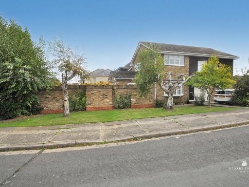 4 bedroom detached house for sale in Conifers, Hadleigh, SS7 — £650,000 • 4 bed • 2 bath • 1415 ft²
 3 bedroom semi-detached house for sale in Church Road, Benfleet, SS7 — £425,000 • 3 bed • 1 bath • 1050 ft²
Meta
- {
"@context": "https://schema.org",
"@type": "Residence",
"name": "5 bedroom semidetached house for sale in Woodfield Road, Be…",
"description": "",
"url": "https://propertypiper.co.uk/property/665ff270-3f37-4ddf-b195-cfefe63c4182",
"image": "https://image-a.propertypiper.co.uk/c4c3088e-39da-4947-9fe1-86caed4f3387-1024.jpeg",
"address": {
"@type": "PostalAddress",
"streetAddress": "60 WOODFIELD ROAD BENFLEET",
"postalCode": "SS7 2EH",
"addressLocality": "Castle Point",
"addressRegion": "Castle Point",
"addressCountry": "England"
},
"geo": {
"@type": "GeoCoordinates",
"latitude": 51.55284994924696,
"longitude": 0.6242176253828046
},
"numberOfRooms": 5,
"numberOfBathroomsTotal": 1,
"offers": {
"@type": "Offer",
"price": 525000,
"priceCurrency": "GBP",
"availability": "https://schema.org/InStock"
},
"additionalProperty": [
{
"@type": "PropertyValue",
"name": "Feature",
"value": "semi-detached"
},
{
"@type": "PropertyValue",
"name": "Feature",
"value": "20th century"
},
{
"@type": "PropertyValue",
"name": "Feature",
"value": "two-storey"
},
{
"@type": "PropertyValue",
"name": "Feature",
"value": "bay window"
},
{
"@type": "PropertyValue",
"name": "Feature",
"value": "chimney"
},
{
"@type": "PropertyValue",
"name": "Feature",
"value": "driveway"
},
{
"@type": "PropertyValue",
"name": "Feature",
"value": "brick facade"
},
{
"@type": "PropertyValue",
"name": "Feature",
"value": "garden"
},
{
"@type": "PropertyValue",
"name": "Feature",
"value": "garage"
},
{
"@type": "PropertyValue",
"name": "Feature",
"value": "potential"
},
{
"@type": "PropertyValue",
"name": "Feature",
"value": "residential area"
},
{
"@type": "PropertyValue",
"name": "Feature",
"value": "modern kitchen"
},
{
"@type": "PropertyValue",
"name": "Feature",
"value": "wood flooring"
},
{
"@type": "PropertyValue",
"name": "Feature",
"value": "modern appliances"
},
{
"@type": "PropertyValue",
"name": "Feature",
"value": "white cabinets"
},
{
"@type": "PropertyValue",
"name": "Feature",
"value": "stainless steel extractor"
},
{
"@type": "PropertyValue",
"name": "Feature",
"value": "subway tile backsplash"
}
]
}
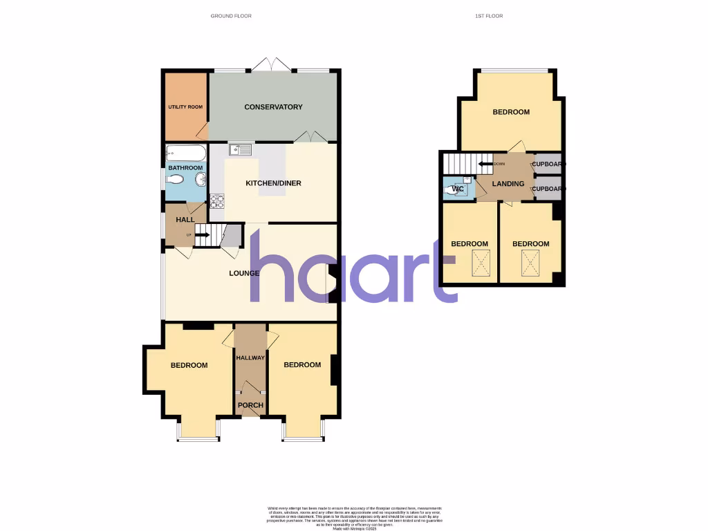
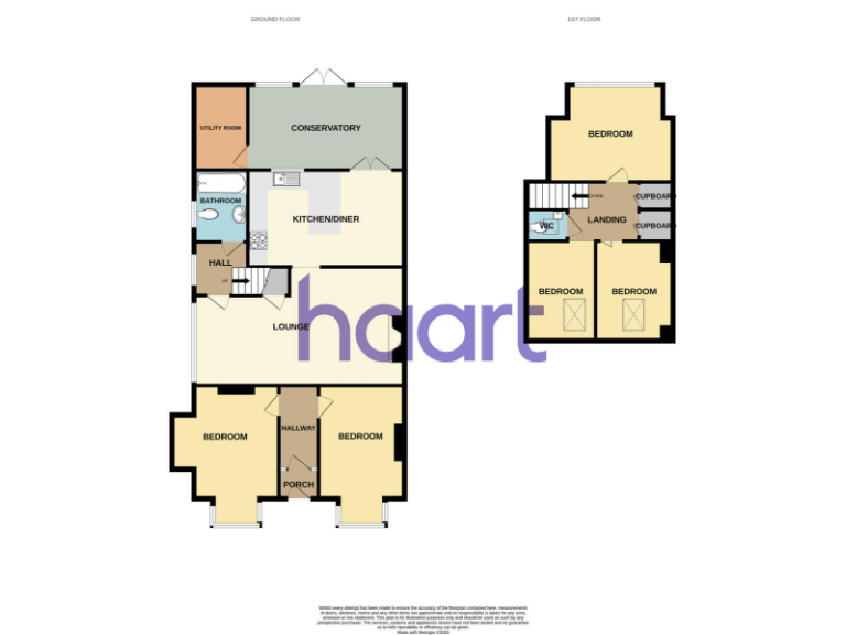
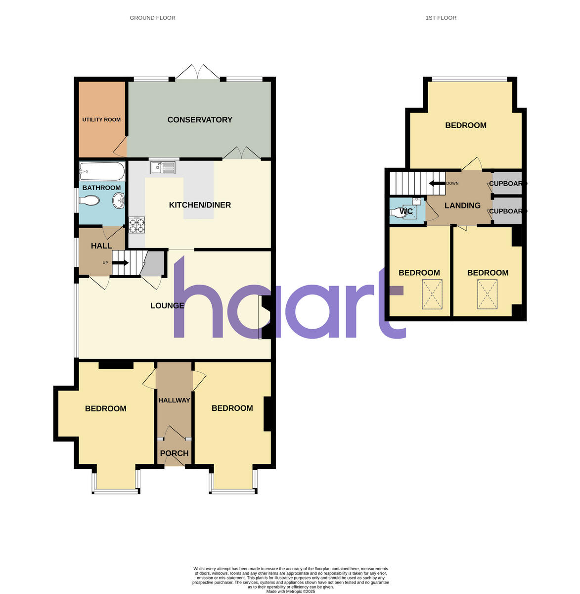
High Res Floorplan Images
Compatible Floorplan Images
FloorplanImages Thumbnail