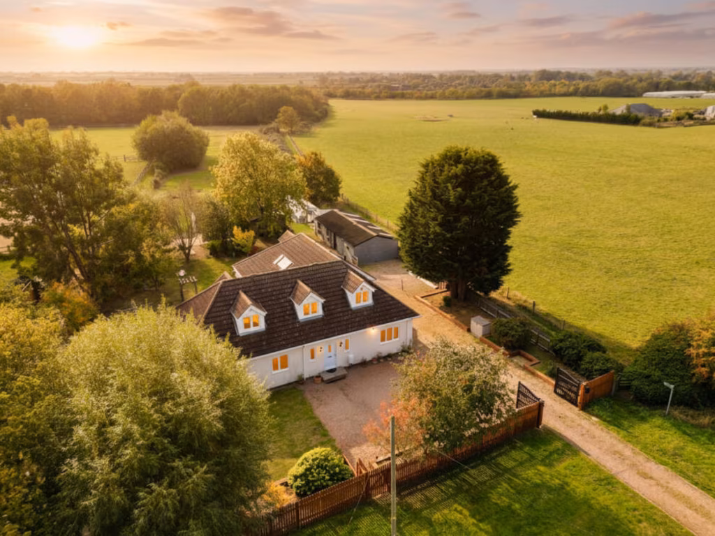
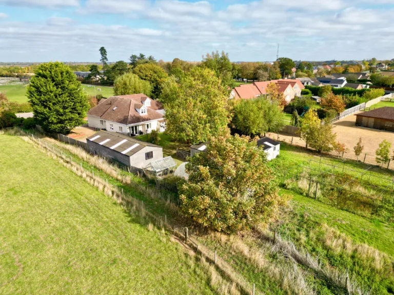
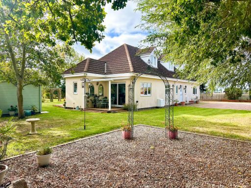
PE15 0TX - 5 bedroom detached house for sale in Benwick Road, Doddingt…
View on Property Piper
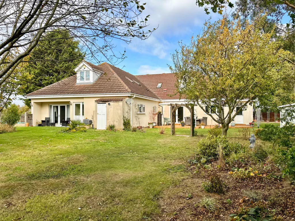
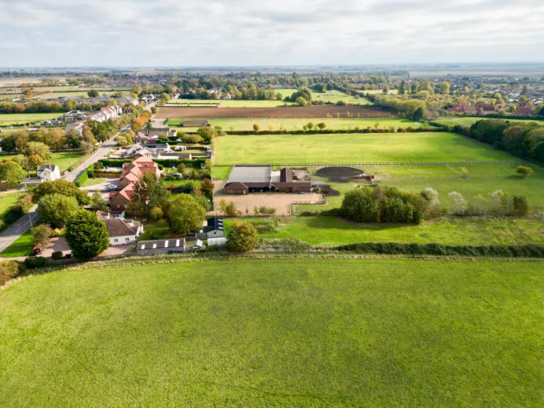
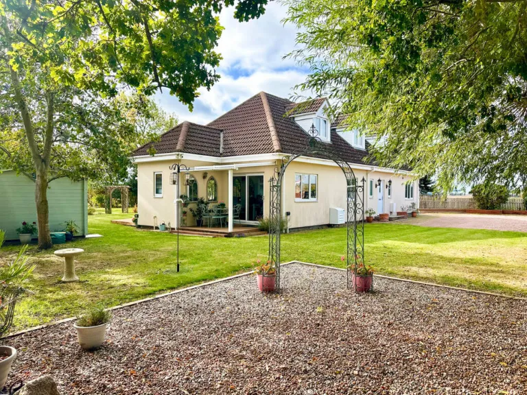
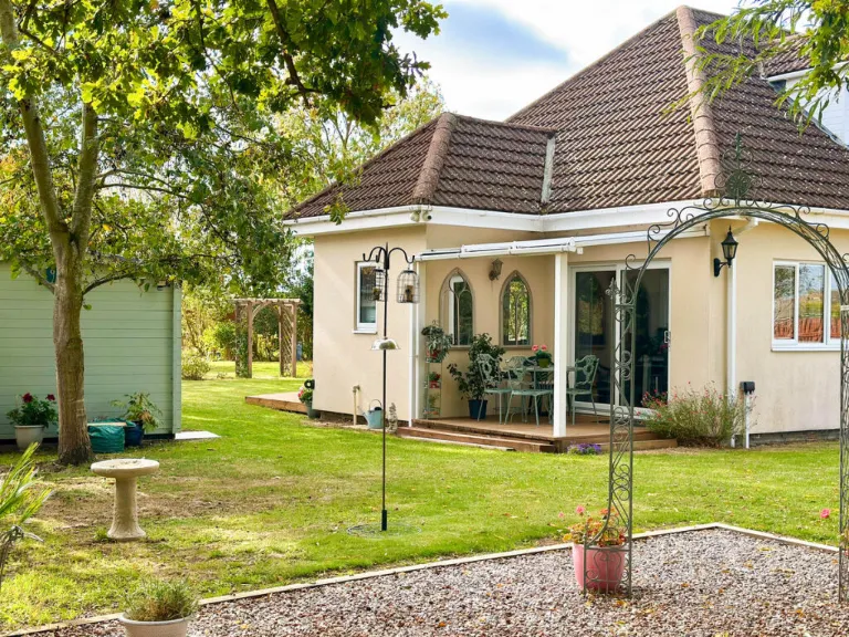
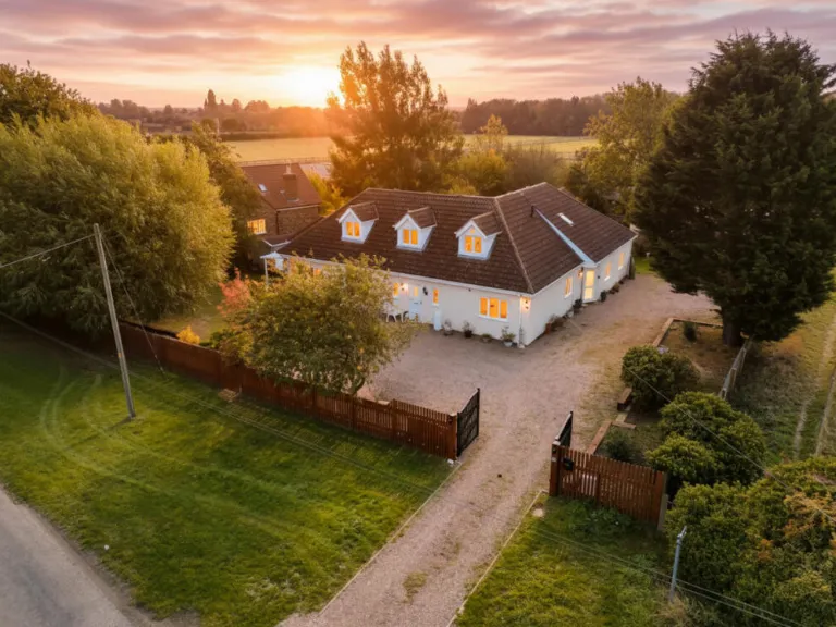
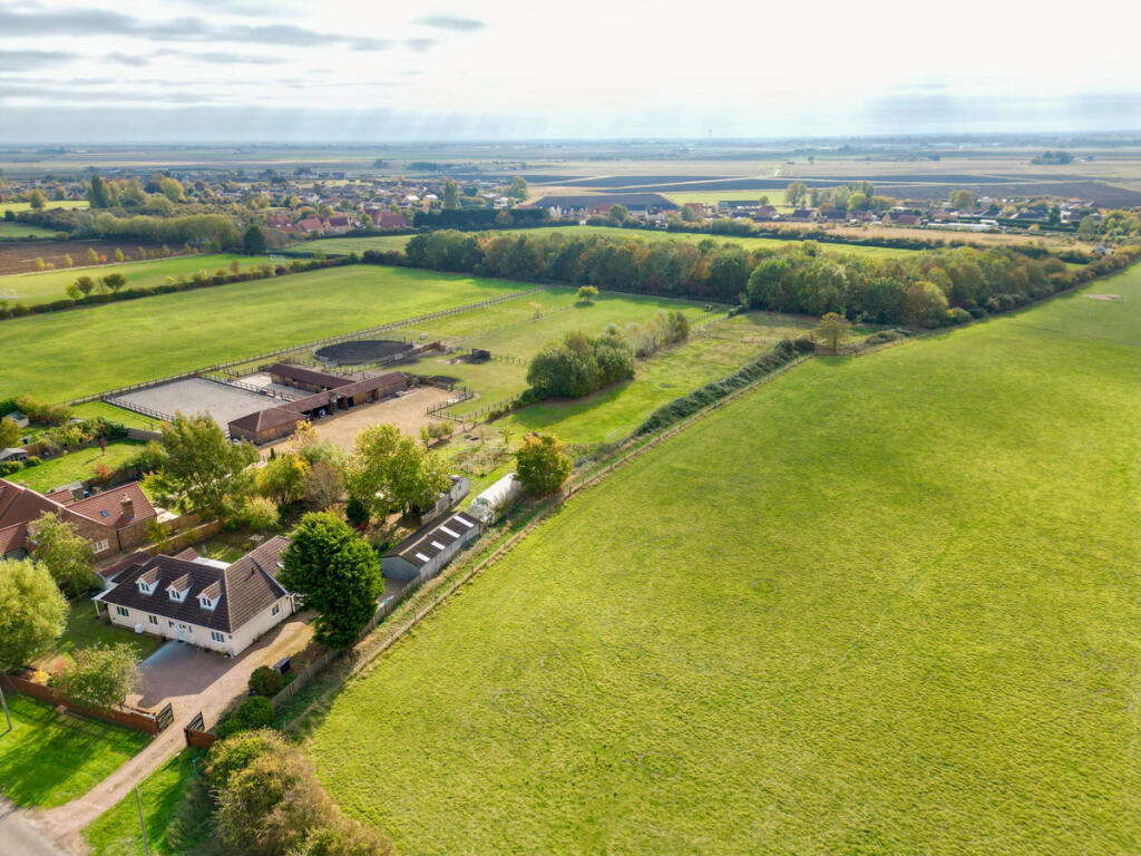
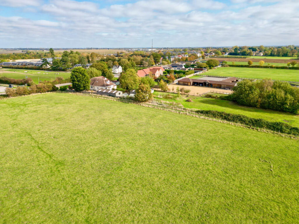
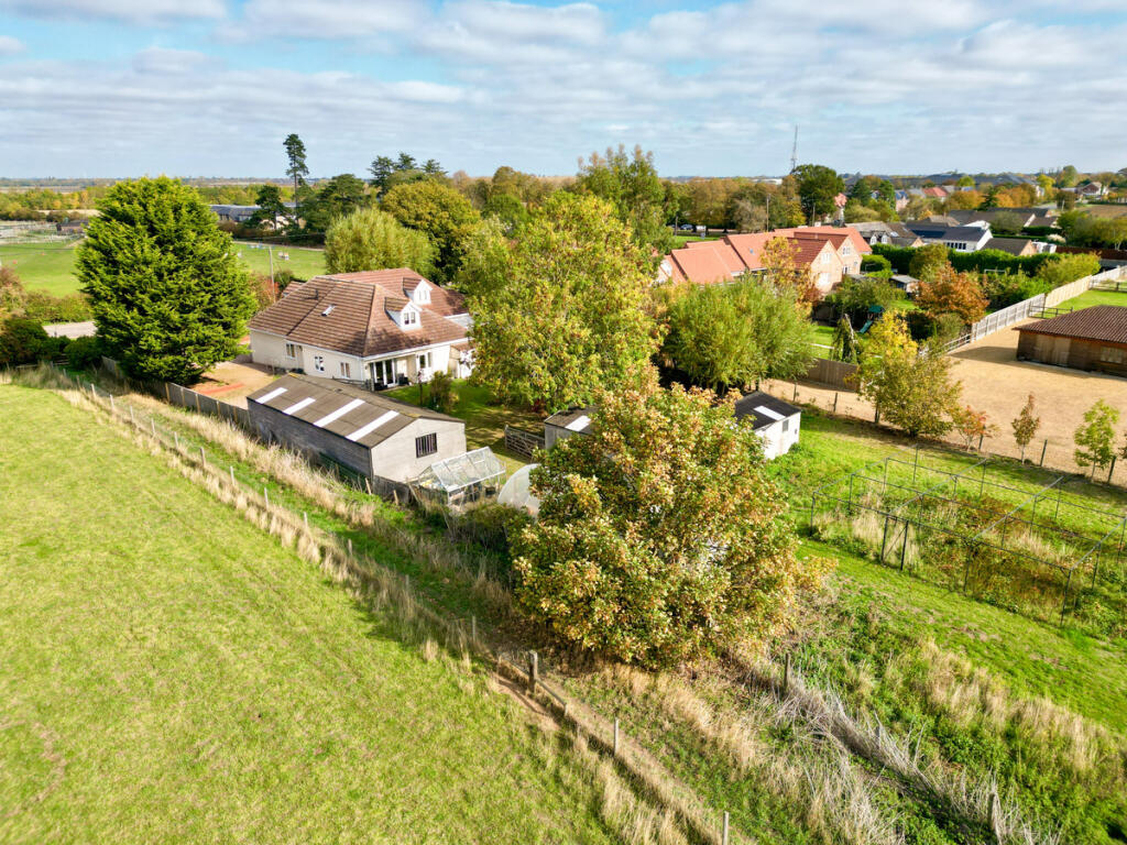
5 bedroom detached house for sale in Benwick Road, Doddington, PE15
Property Details
- Price: £850000
- Bedrooms: 5
- Bathrooms: 3
- Property Type: undefined
- Property SubType: undefined
Image Descriptions
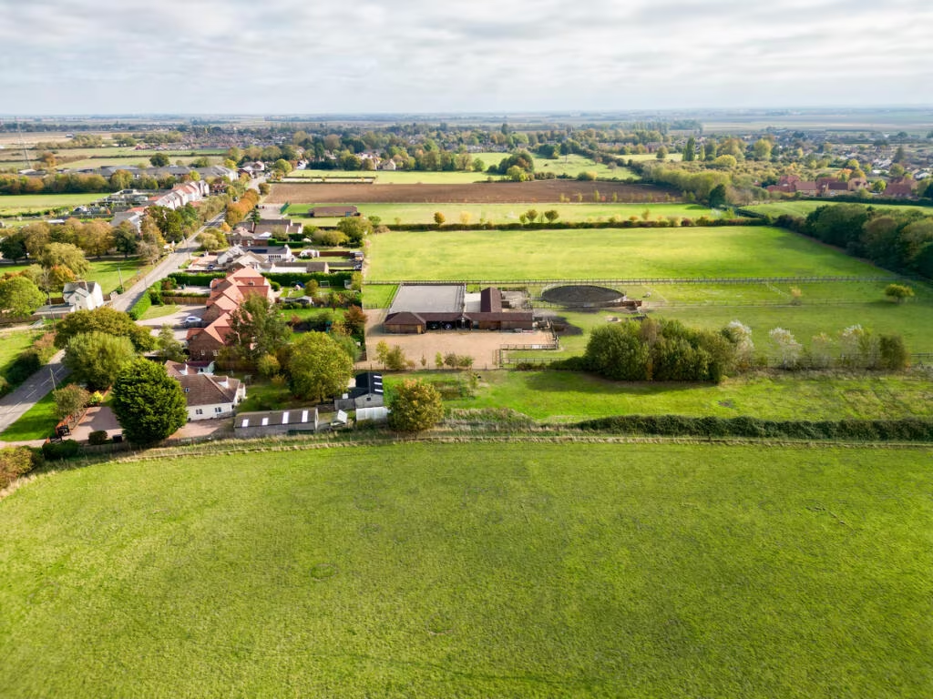
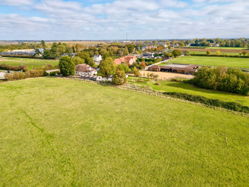
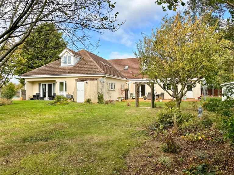
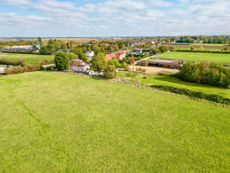
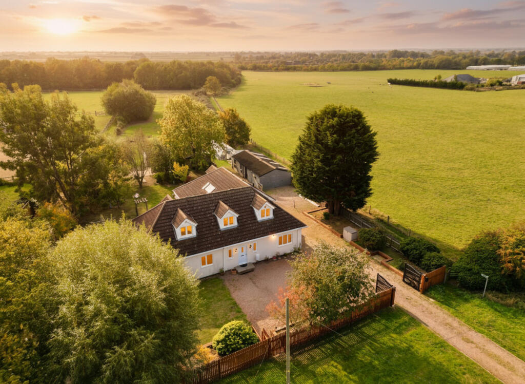
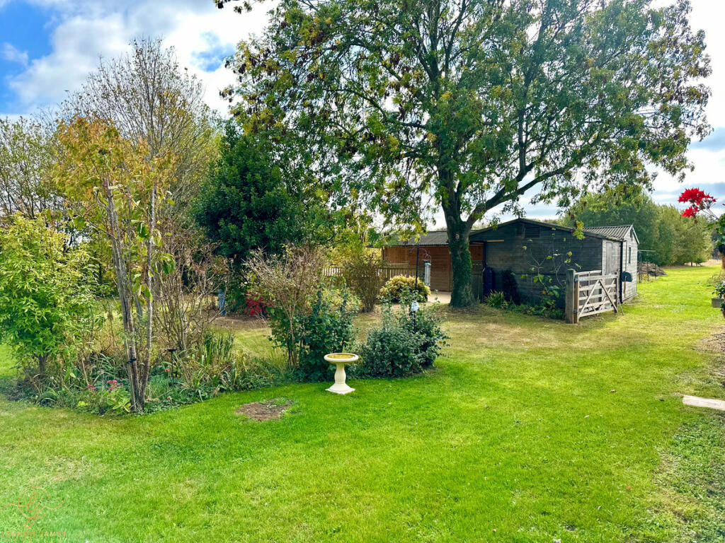
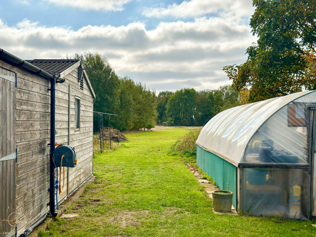
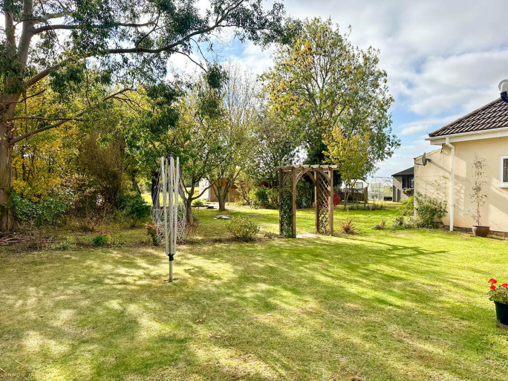
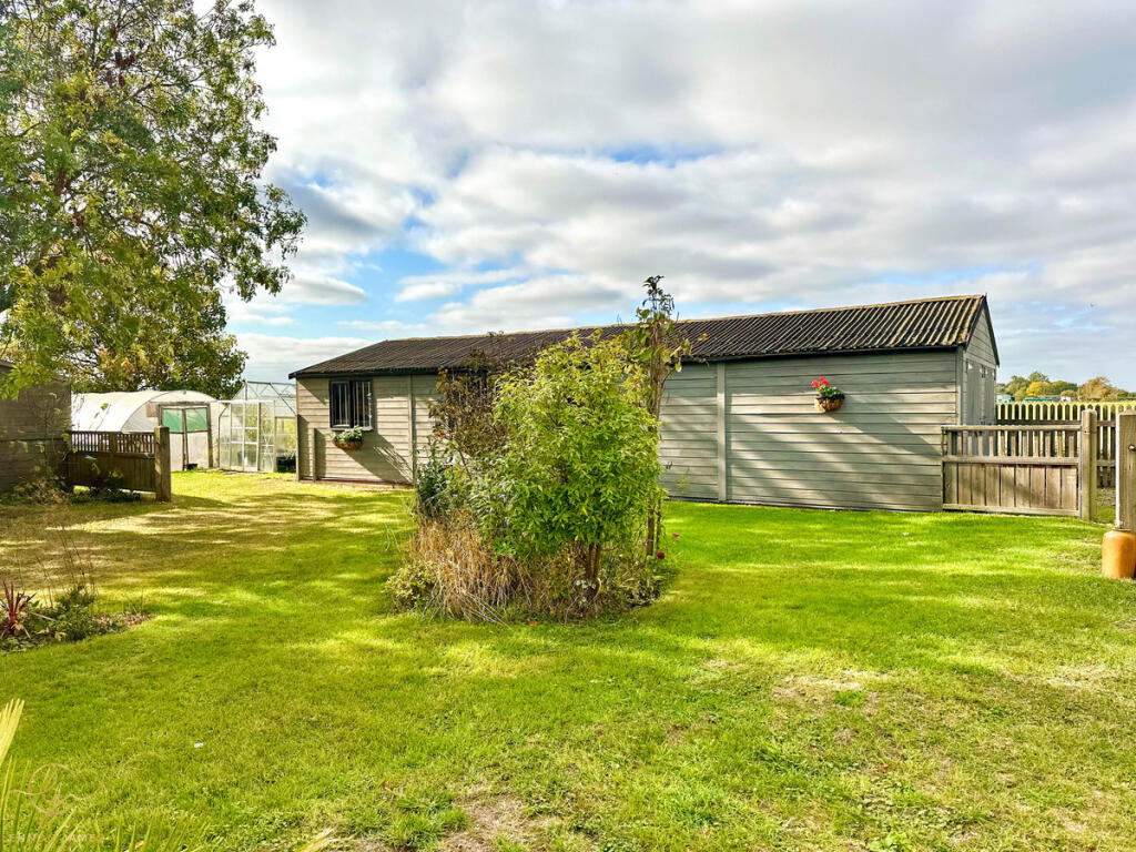
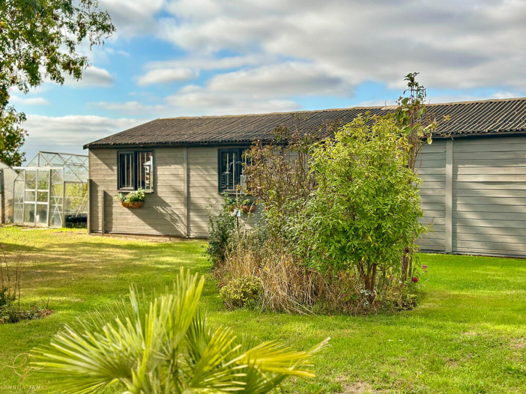
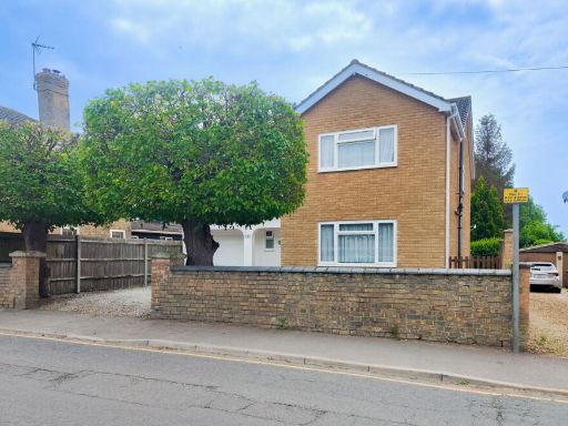
- detached_house Modern
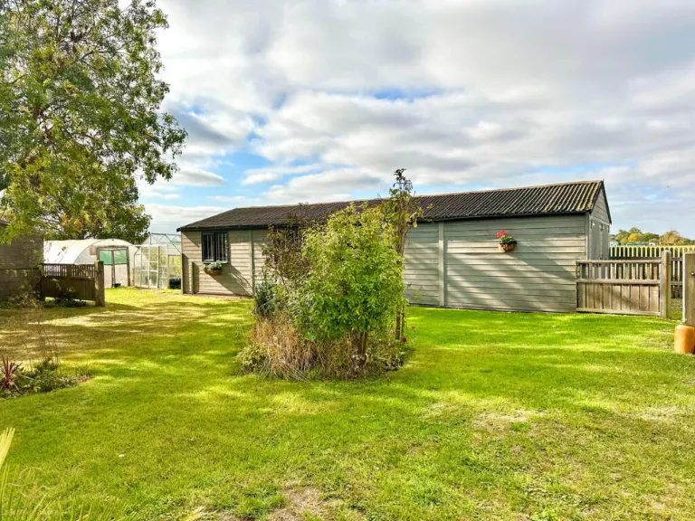
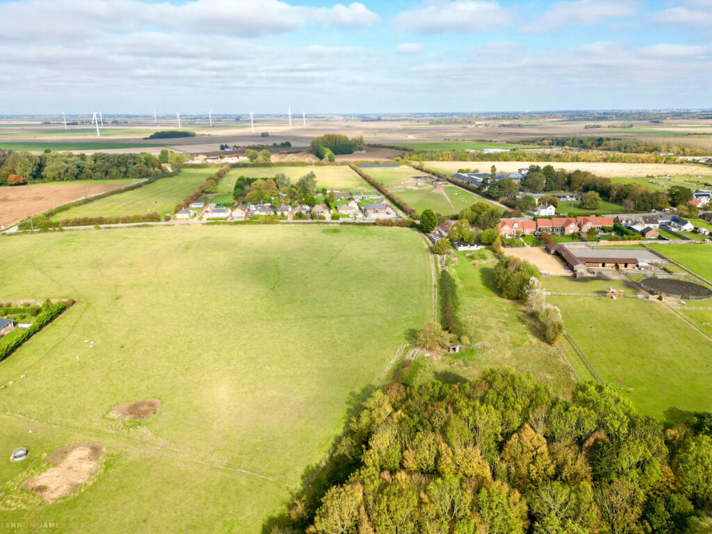
- property with equestrian facilities rural
Floorplan Description
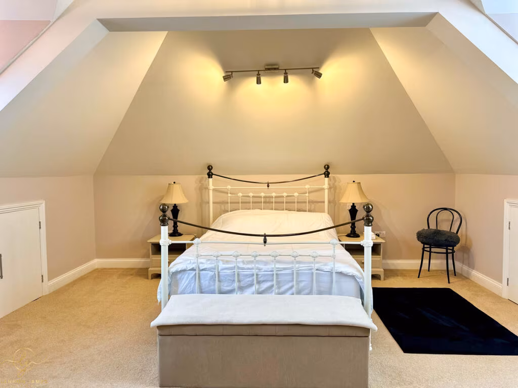
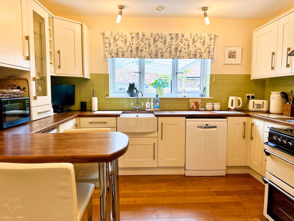
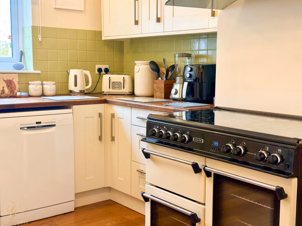
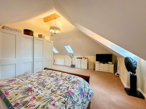
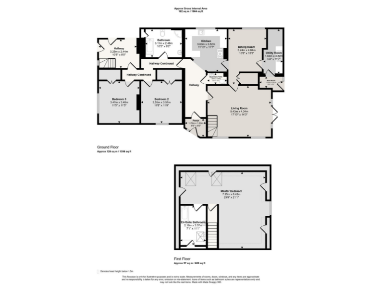
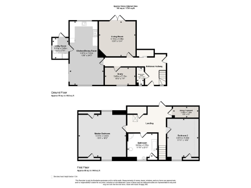
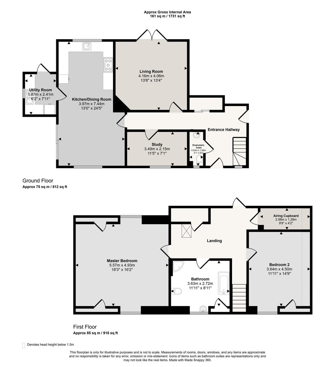
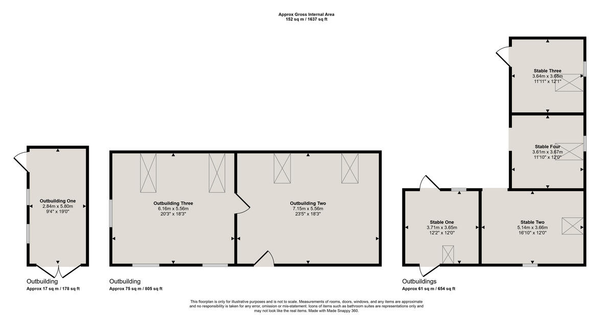
- Two-storey house with living room, dining room, kitchen, utility, downstairs WC and four bedrooms (one en-suite).
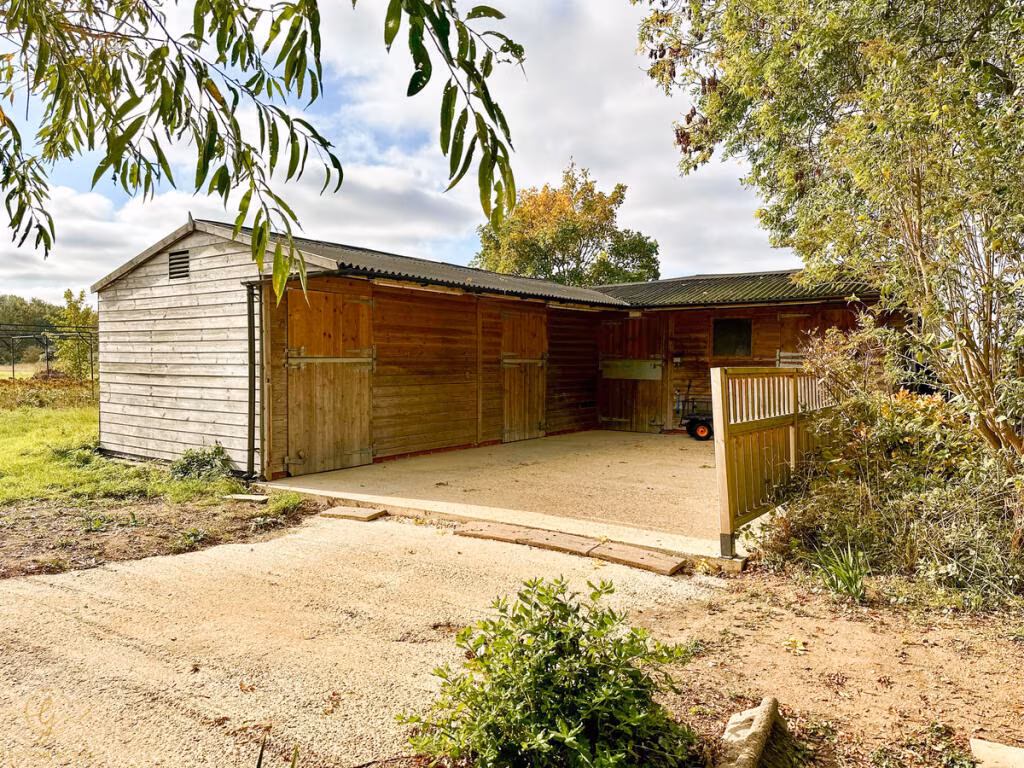
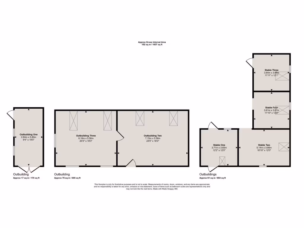
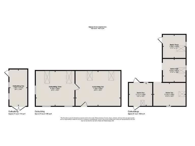
- Collection of outbuildings and stables shown with individual room dimensions.
Rooms
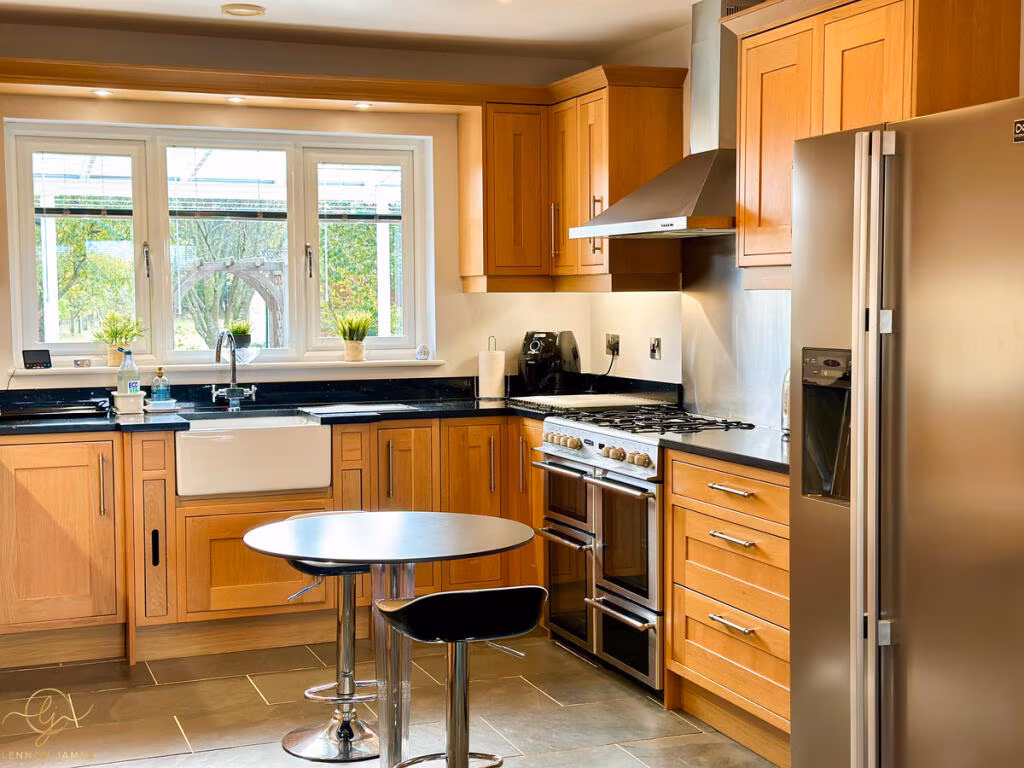
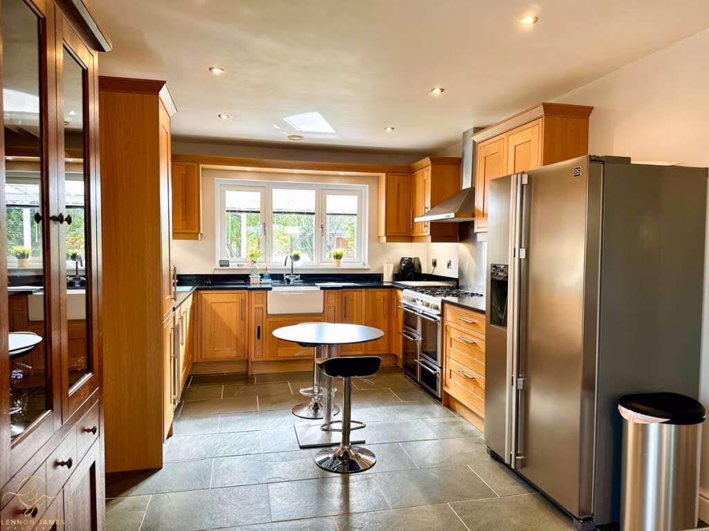
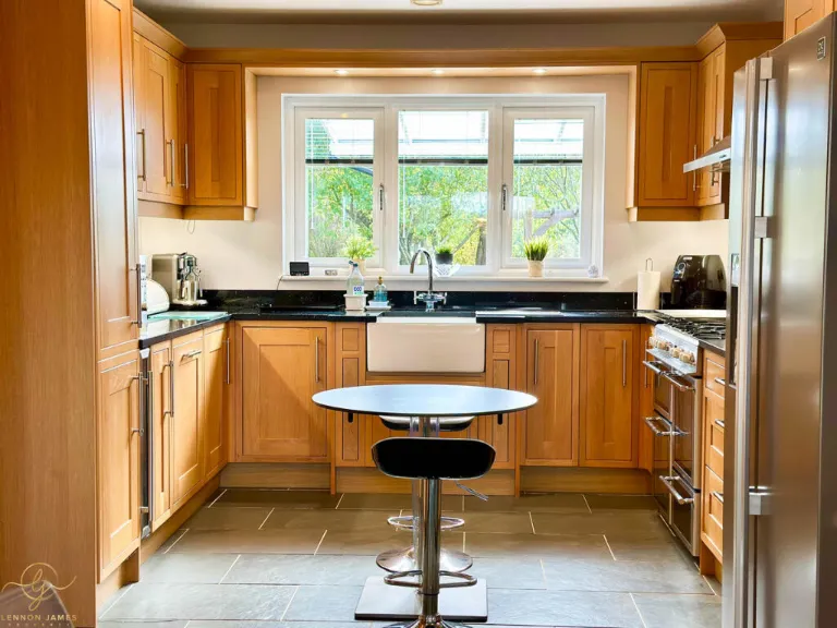
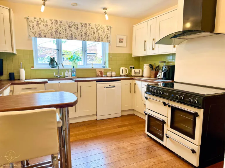
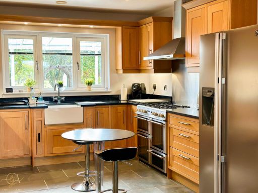
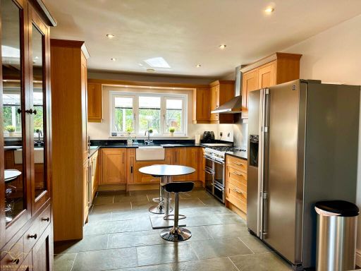
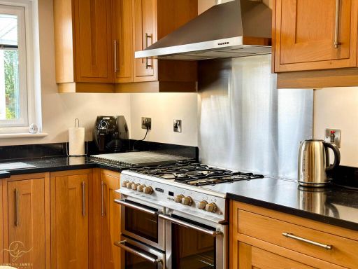
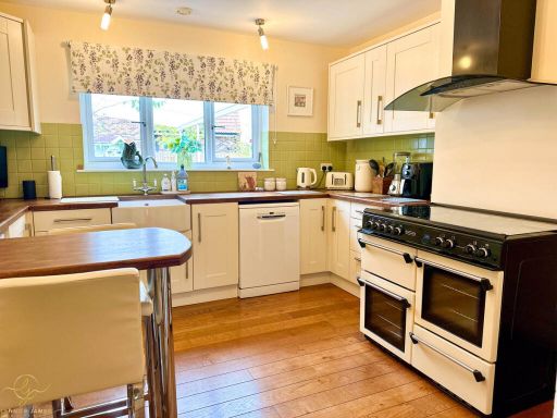
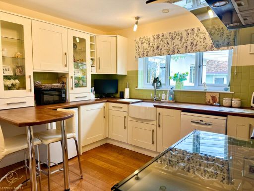
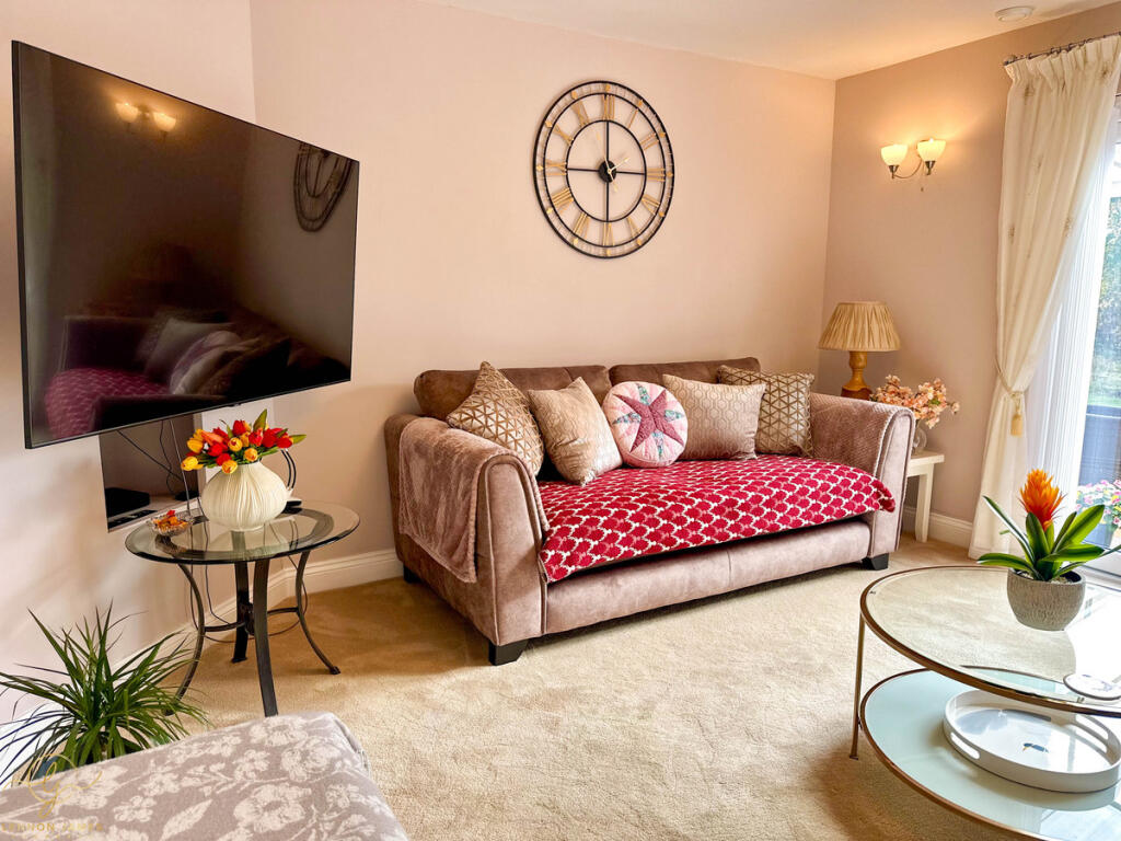
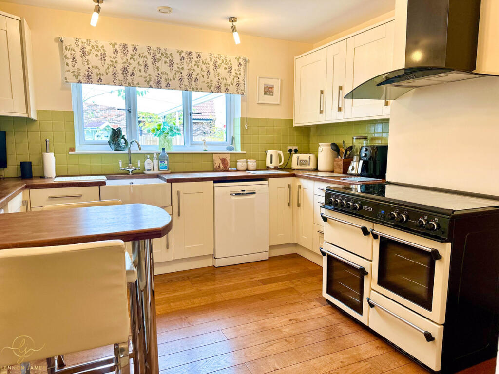
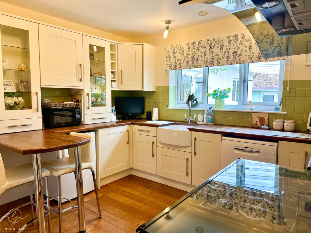
- Kitchen/Dining Room:
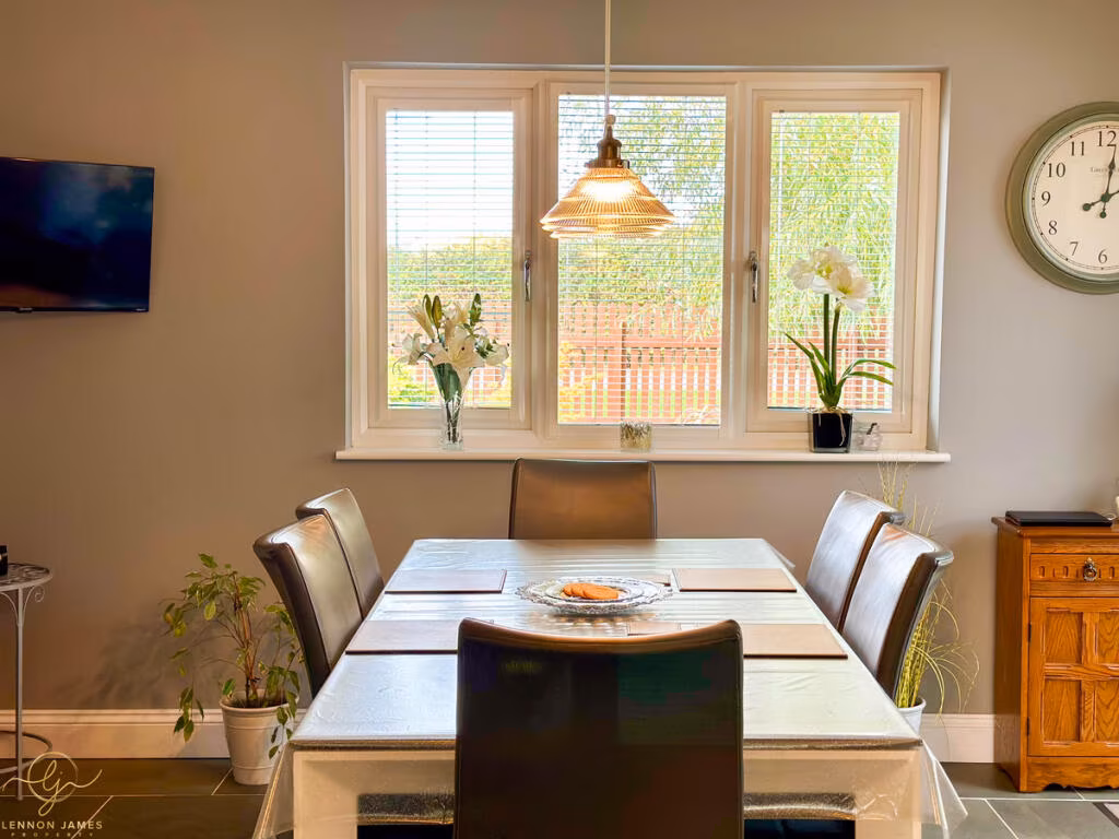
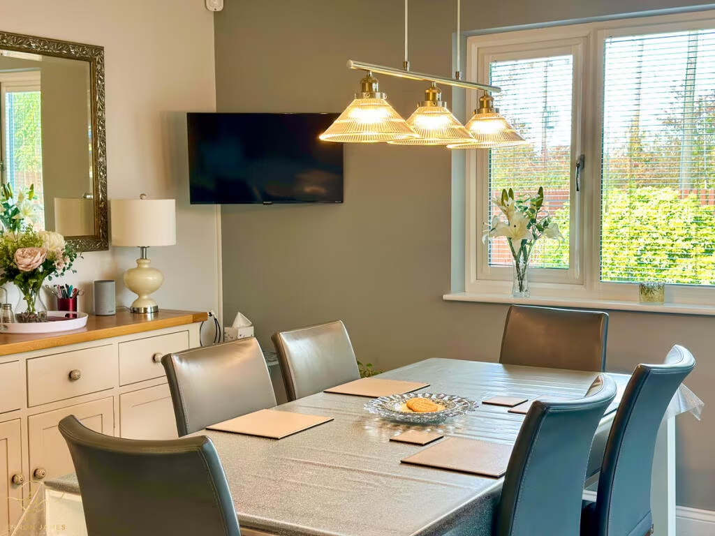
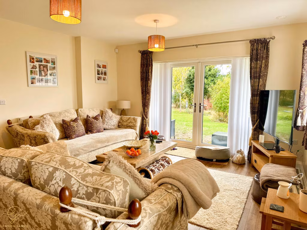
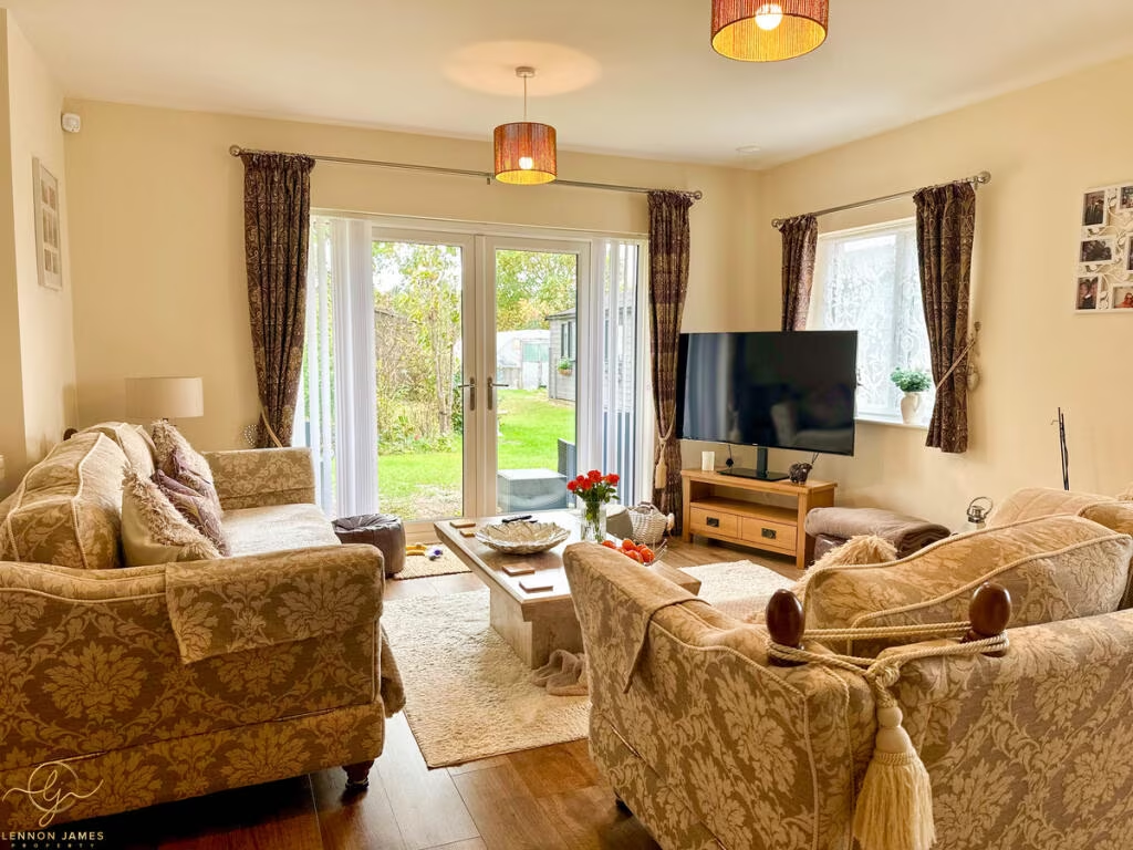
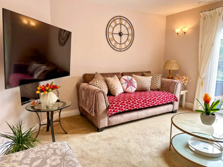
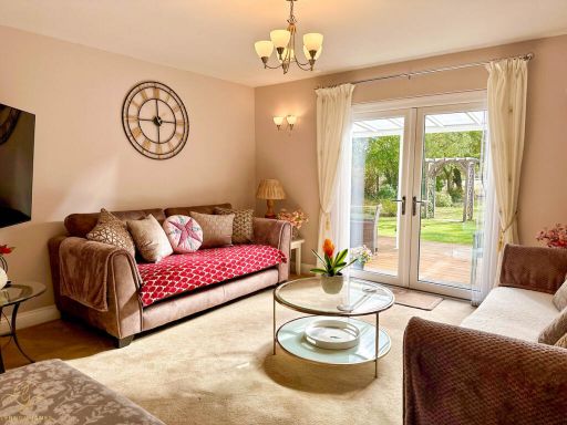
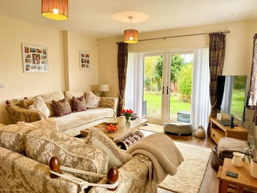
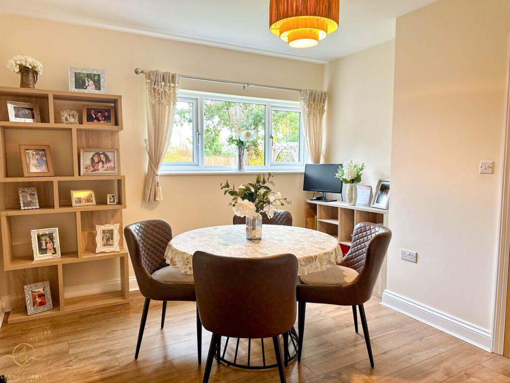
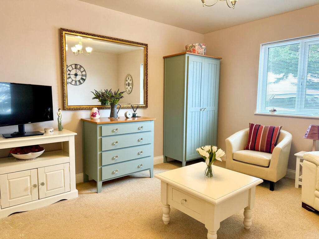
- Living Room:
- Utility Room:
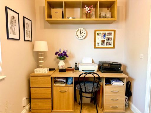
- Study:
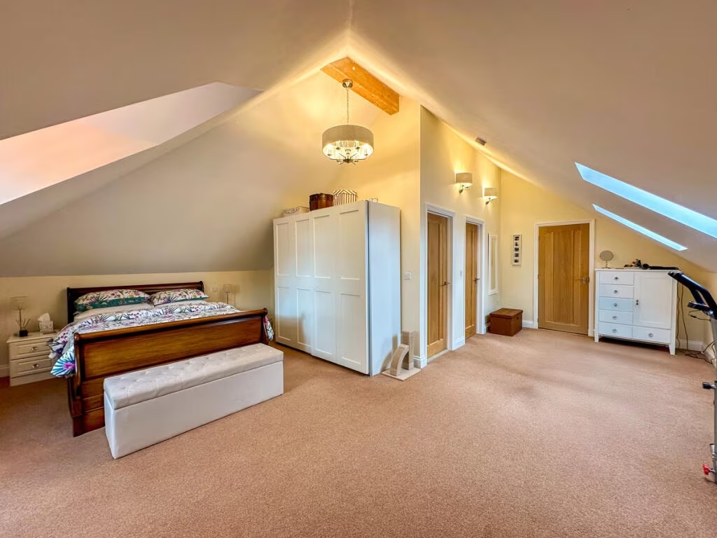
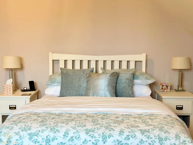
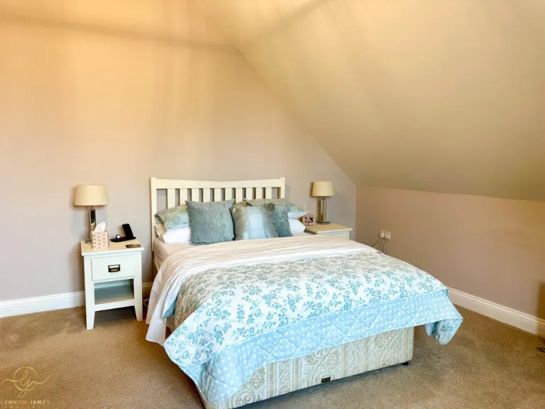
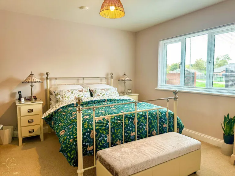
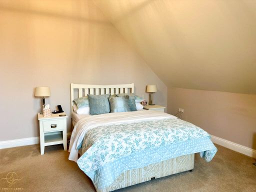
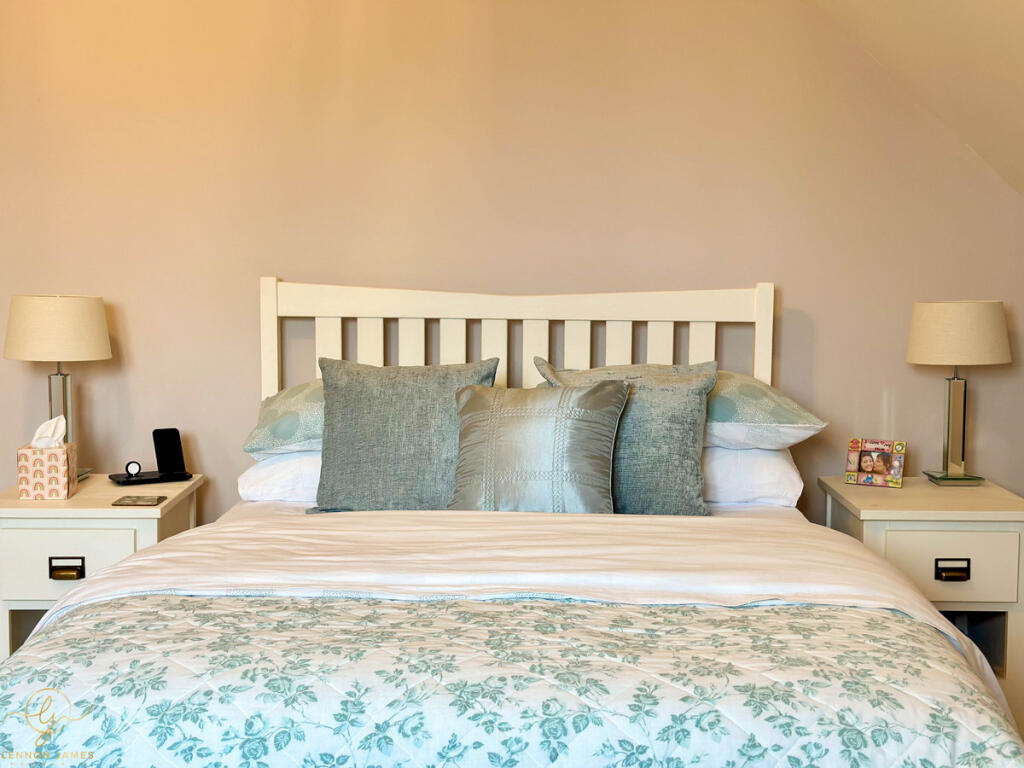
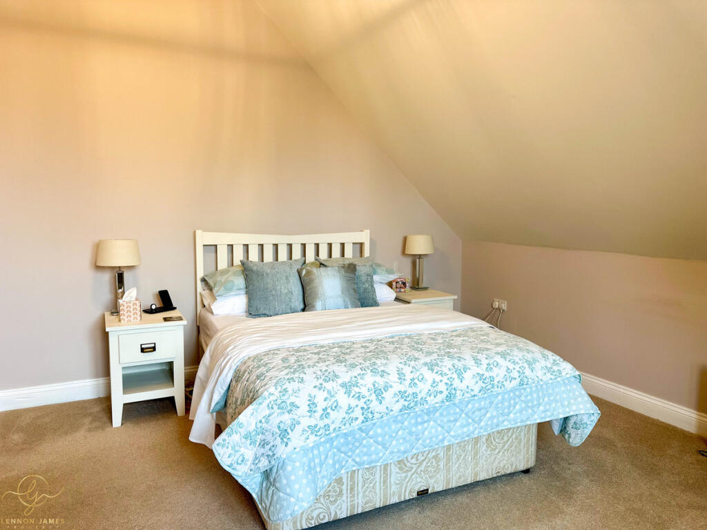
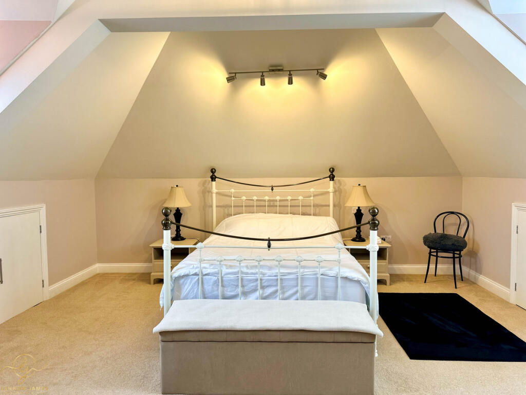
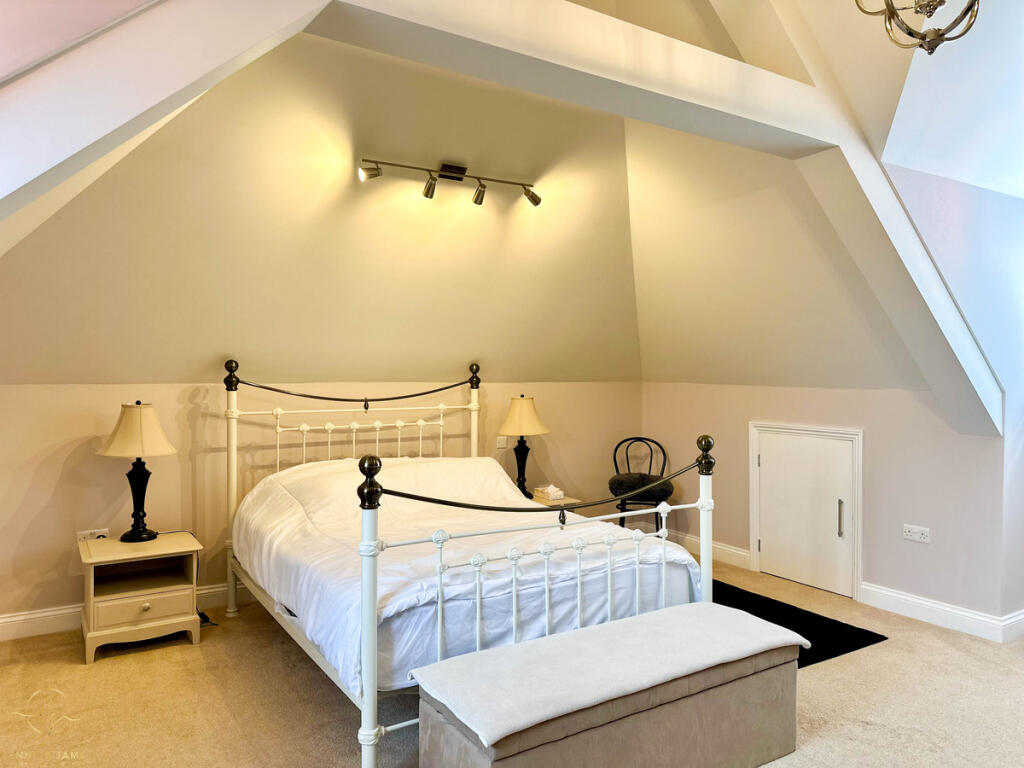
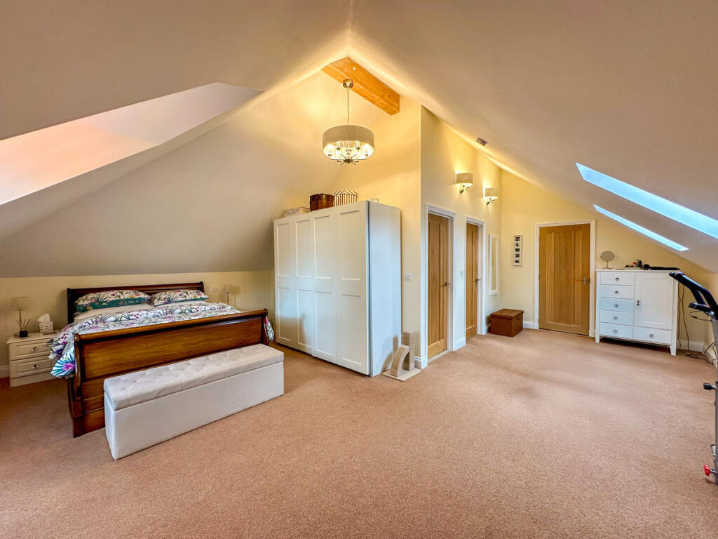
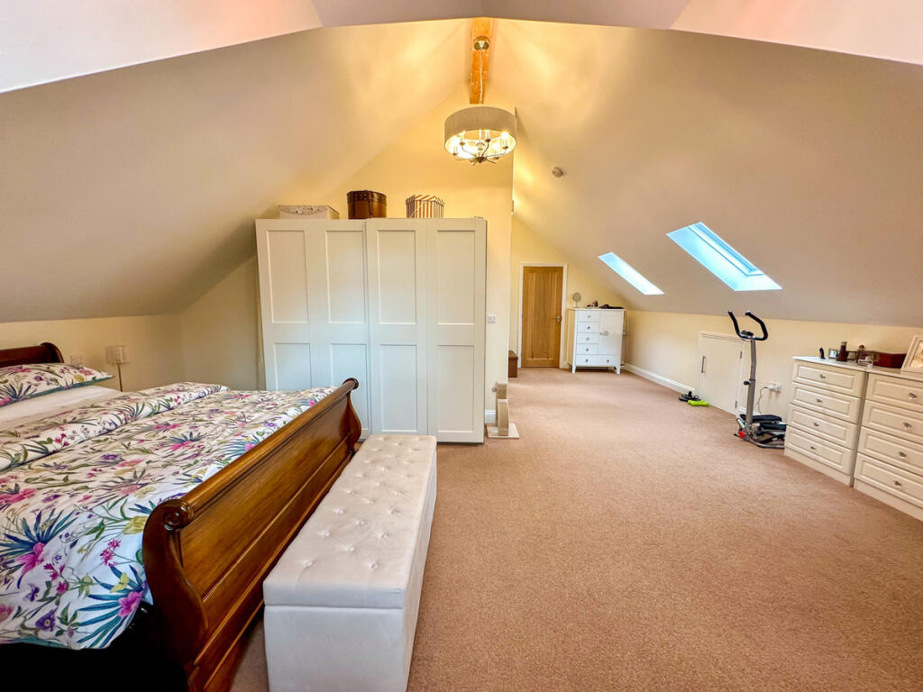
- Master Bedroom:
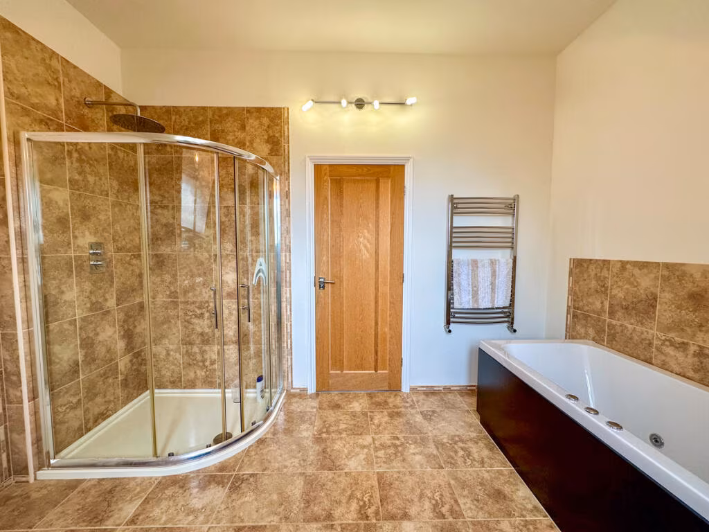
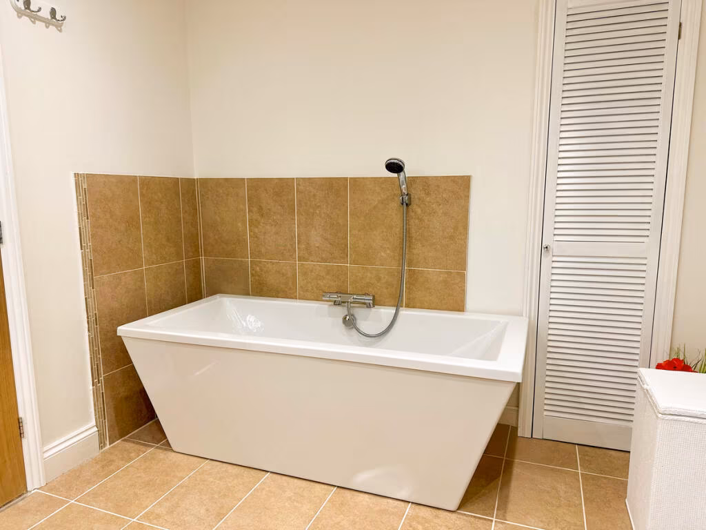
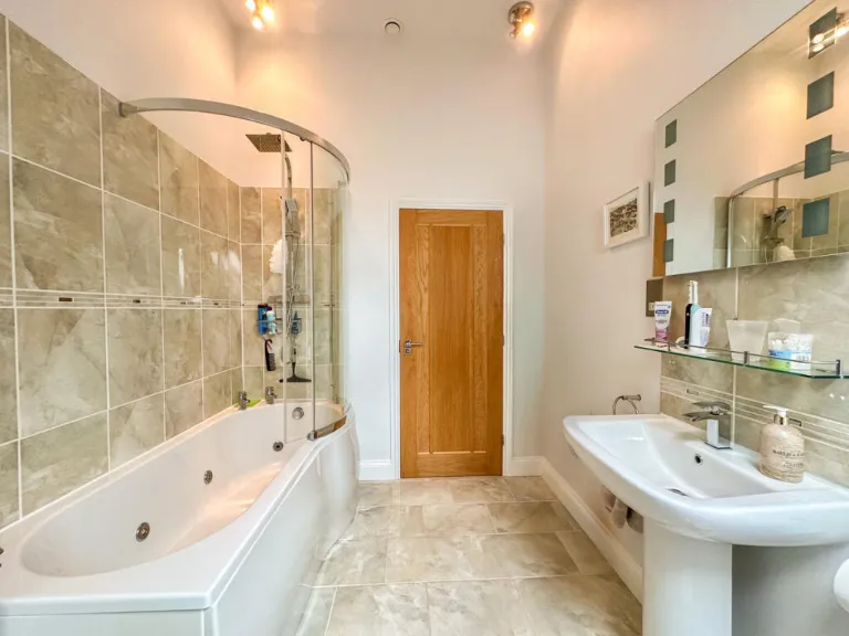
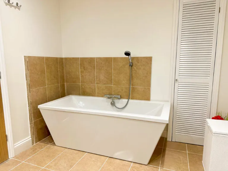
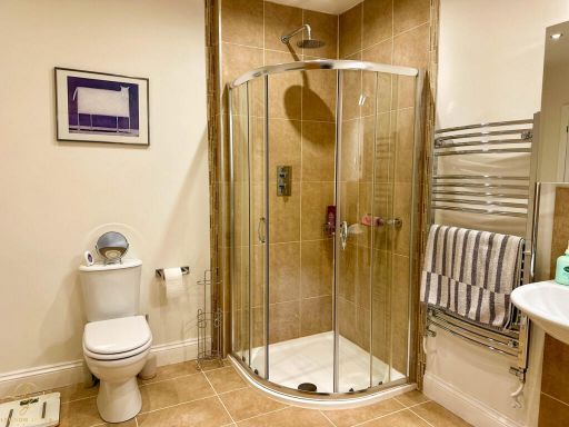
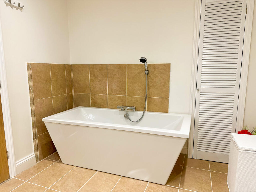
- Bathroom:
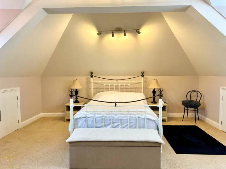
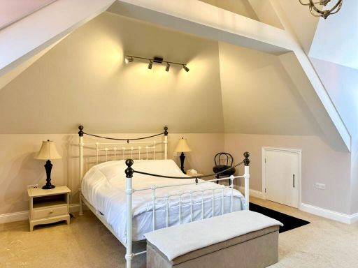
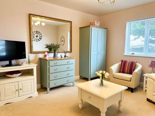
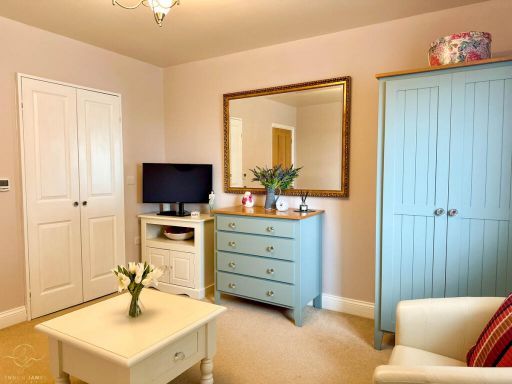
- Bedroom 2:
- Airing Cupboard:
- Hallway:
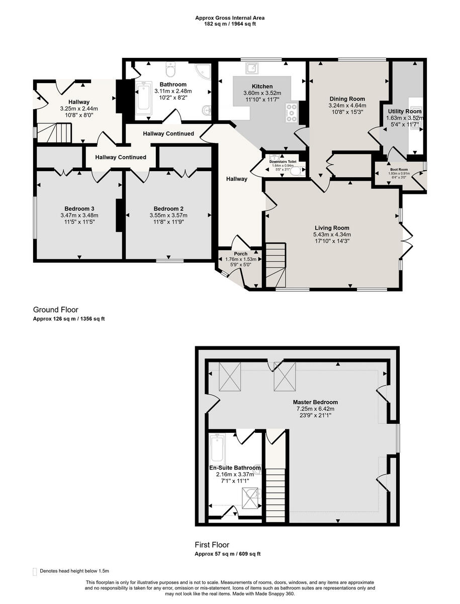
- Bathroom:
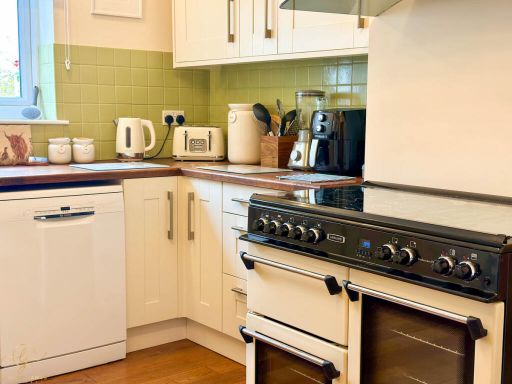
- Kitchen:
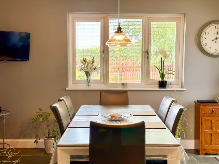
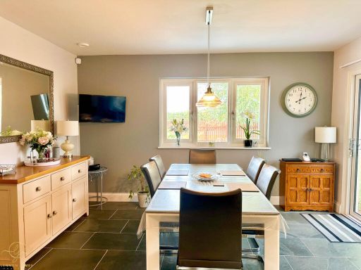
- Dining Room:
- Utility Room:
- Boot Room:
- Downstairs Toilet:
- Living Room:
- Porch:
- Bedroom 2:
- Bedroom 3:
- En-Suite Bathroom:
- Master Bedroom:
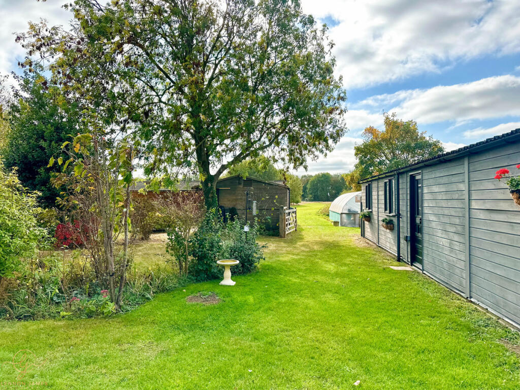
- Outbuilding One:
- Outbuilding Three:
- Outbuilding Two:
- Stable One:
- Stable Two:
- Stable Three:
- Stable Four:
Textual Property Features
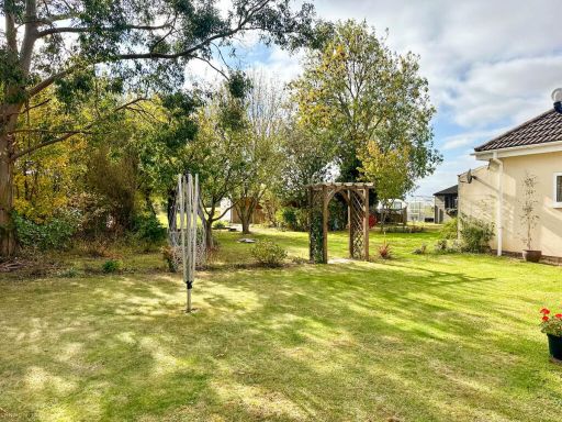
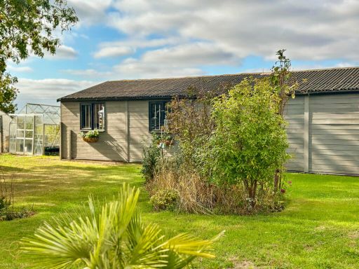
Detected Visual Features
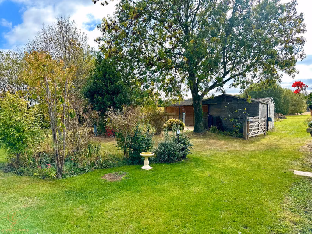
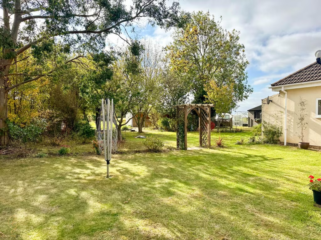
- detached
- modern
- country
- spacious
- garage
- garden
- light
- expansive
- landscaped
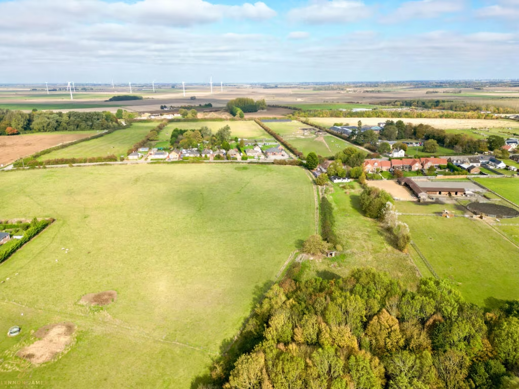
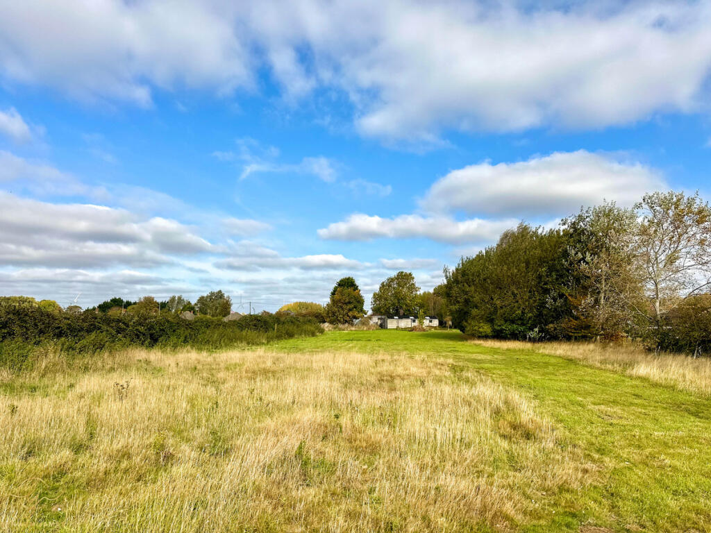
- equestrian property
- rural
- agriculture
- farmland
- outbuildings
- stables
- paddock
- open fields
- country living
EPC Details
- Fully double glazed
- Solid brick, with external insulation
- Boiler and underfloor heating, mains gas
- Low energy lighting in all fixed outlets
- Solid, no insulation (assumed)
Nearby Schools
- Benwick Primary School
- Glebelands Primary Academy
- Lionel Walden Primary School
- Neale-Wade Academy
- Cromwell Community College
- Cavalry Primary School
- Westwood Primary School
- All Saints Interchurch Academy
- Kingsfield Primary School
- Thomas Eaton Primary Academy
- Burrowmoor Primary School
Nearest Bars And Restaurants
- Id: 619006054
- Tags:
- Amenity: pub
- Name: The Anchor Inn
- TagsNormalized:
- Lat: 52.510751
- Lon: 0.0839229
- FullGeoHash: u1249zm1793q
- PartitionGeoHash: u124
- Images:
- FoodStandards: null
- Distance: 2788
,- Id: 967262148
- Tags:
- Amenity: cafe
- Building: yes
- Name: Lakeside Cafe
- TagsNormalized:
- Lat: 52.4989804
- Lon: 0.0322304
- FullGeoHash: u1248tpkxp28
- PartitionGeoHash: u124
- Images:
- FoodStandards: null
- Distance: 1095.8
,- Id: 620774369
- Tags:
- Amenity: fast_food
- Cuisine: fish_and_chips
- Name: Doddington Fish Bar
- TagsNormalized:
- Lat: 52.4969631
- Lon: 0.0626618
- FullGeoHash: u1249kv8uphn
- PartitionGeoHash: u124
- Images:
- FoodStandards: null
- Distance: 976.9
,- Id: 129997706
- Tags:
- Amenity: pub
- Name: The Three Tuns
- TagsNormalized:
- Lat: 52.4955171
- Lon: 0.0599657
- FullGeoHash: u1249ke8t39t
- PartitionGeoHash: u124
- Images:
- FoodStandards: null
- Distance: 837.2
,- Id: 129997699
- Tags:
- Amenity: pub
- Name: The George
- Operator: Elgood's
- TagsNormalized:
- Lat: 52.4964694
- Lon: 0.0603204
- FullGeoHash: u1249keyje4j
- PartitionGeoHash: u124
- Images:
- FoodStandards: null
- Distance: 830.3
}
Nearest General Shops
- Id: 969324824
- Tags:
- Building: yes
- Name: Megaplants
- Shop: garden_centre
- TagsNormalized:
- Lat: 52.5034632
- Lon: 0.053138
- FullGeoHash: u1249jywy4yt
- PartitionGeoHash: u124
- Images:
- FoodStandards: null
- Distance: 678
,- Id: 620774317
- Tags:
- Name: Doddington Garden Centre
- Shop: garden_centre
- TagsNormalized:
- Lat: 52.4928362
- Lon: 0.0528632
- FullGeoHash: u1249hn2zvcs
- PartitionGeoHash: u124
- Images:
- FoodStandards: null
- Distance: 660.8
,- Id: 953745085
- Tags:
- Building: yes
- Name: Defland
- Shop: garden_centre
- Website: https://www.delfland.co.uk/acatalog/Retail-Shop.html
- TagsNormalized:
- Lat: 52.4978357
- Lon: 0.0412426
- FullGeoHash: u1248uyn11bs
- PartitionGeoHash: u124
- Images:
- FoodStandards: null
- Distance: 482.3
}
Nearest Grocery shops
- Id: 8827551097
- Tags:
- Brand: Spar
- Brand:wikidata: Q610492
- Brand:wikipedia: en:Spar (retailer)
- Name: Spar Express
- Shop: convenience
- TagsNormalized:
- Lat: 52.5040549
- Lon: 0.079397
- FullGeoHash: u1249y1f614x
- PartitionGeoHash: u124
- Images:
- FoodStandards: null
- Distance: 2203
,- Id: 620774370
- Tags:
- Brand: One Stop
- Brand:wikidata: Q65954217
- Name: One Stop
- Shop: convenience
- TagsNormalized:
- Lat: 52.496944
- Lon: 0.0622833
- FullGeoHash: u1249kv2g79u
- PartitionGeoHash: u124
- Images:
- FoodStandards: null
- Distance: 951.8
,- Id: 620774365
- Tags:
- Name: Doddington Newsagent and General Stores
- Shop: convenience
- TagsNormalized:
- general
- newsagent
- convenience
- shop
- Lat: 52.4967108
- Lon: 0.061186
- FullGeoHash: u1249ksx98pt
- PartitionGeoHash: u124
- Images:
- FoodStandards: null
- Distance: 882.4
}
Nearest Supermarkets
- Id: 587574012
- Tags:
- Addr:
- Country: GB
- Postcode: PE15 5AN
- Street: Dartford Road
- Brand: Lidl
- Brand:wikidata: Q151954
- Brand:wikipedia: en:Lidl
- Building: retail
- Fhrs:
- Name: Lidl
- Noaddress: yes
- Opening_hours: Mo-Sa 08:00-22:00; Su 10:00-16:00
- Shop: supermarket
- TagsNormalized:
- lidl
- retail
- supermarket
- shop
- Lat: 52.5513
- Lon: 0.0848537
- FullGeoHash: u124cytv90re
- PartitionGeoHash: u124
- Images:
- FoodStandards:
- Id: 774480
- FHRSID: 774480
- LocalAuthorityBusinessID: 2008/000272
- BusinessName: Lidl Great Britain Ltd
- BusinessType: Retailers - supermarkets/hypermarkets
- BusinessTypeID: 7840
- AddressLine1: Lidl
- AddressLine2: Dartford Road
- AddressLine3: March
- AddressLine4: Cambridgeshire
- PostCode: PE15 5AN
- RatingValue: 5
- RatingKey: fhrs_5_en-GB
- RatingDate: 2022-01-05
- LocalAuthorityCode: 029
- LocalAuthorityName: Fenland
- LocalAuthorityWebSite: http://www.fenland.gov.uk/article/2117/Food-Safety
- LocalAuthorityEmailAddress: environmentalservicerequests@fenland.gov.uk
- Scores:
- Hygiene: 5
- Structural: 5
- ConfidenceInManagement: 0
- NewRatingPending: false
- Geocode:
- Longitude: 0.08691300000000
- Latitude: 52.55135500000000
- Distance: 6409.6
,- Id: 626657650
- Tags:
- Brand: Tesco
- Brand:wikidata: Q487494
- Brand:wikipedia: en:Tesco
- Building: retail
- Fhrs:
- Name: Tesco
- Old_name: Jack's
- Shop: supermarket
- Website: https://www.tesco.com/store-locator/cambridgeshire/fenland-way
- TagsNormalized:
- tesco
- retail
- supermarket
- shop
- Lat: 52.4576857
- Lon: 0.0409281
- FullGeoHash: u1242vtu1tqh
- PartitionGeoHash: u124
- Images:
- FoodStandards: null
- Distance: 4522.6
,- Id: 48781345
- Tags:
- Addr:
- Brand: ALDI
- Brand:wikidata: Q41171672
- Brand:wikipedia: en:Aldi
- Building: yes
- Contact:
- Website: https://stores.aldi.co.uk/chatteris/99-bridge-street
- Name: Aldi
- Shop: supermarket
- TagsNormalized:
- Lat: 52.4640657
- Lon: 0.0455941
- FullGeoHash: u1243nc1q6tq
- PartitionGeoHash: u124
- Images:
- FoodStandards: null
- Distance: 3789.8
}
Nearest Religious buildings
- Id: 234724337
- Tags:
- Amenity: place_of_worship
- Building: church
- Denomination: anglican
- Name: St Peter (Wimblington Parish Church)
- Religion: christian
- Wikidata: Q26419526
- TagsNormalized:
- place of worship
- church
- anglican
- parish
- christian
- Lat: 52.5081809
- Lon: 0.0850339
- FullGeoHash: u1249yvfm6mg
- PartitionGeoHash: u124
- Images:
- FoodStandards: null
- Distance: 2723.8
,- Id: 234725393
- Tags:
- Amenity: place_of_worship
- Building: church
- Denomination: anglican
- Name: Saint Mary, (Doddington Parish Church)
- Religion: christian
- Wikidata: Q17543676
- TagsNormalized:
- place of worship
- church
- anglican
- parish
- christian
- Lat: 52.4949295
- Lon: 0.0610631
- FullGeoHash: u1249kkmnu5g
- PartitionGeoHash: u124
- Images:
- FoodStandards: null
- Distance: 930.1
,- Id: 516166295
- Tags:
- Addr:
- City: March
- Country: GB
- Housename: Doddington Methodist Church
- Place: Doddington
- Postcode: PE15 0SP
- Street: New Street
- Amenity: place_of_worship
- Building: church
- Denomination: methodist
- Name: Doddington Methodist Church
- Religion: christian
- TagsNormalized:
- place of worship
- church
- methodist
- christian
- Lat: 52.4966543
- Lon: 0.0597509
- FullGeoHash: u1249kex0m9s
- PartitionGeoHash: u124
- Images:
- FoodStandards: null
- Distance: 788.3
}
Nearest Medical buildings
- Id: 667143149
- Tags:
- Amenity: pharmacy
- Healthcare: pharmacy
- TagsNormalized:
- Lat: 52.4575344
- Lon: 0.0520843
- FullGeoHash: u1243jtgm9hv
- PartitionGeoHash: u124
- Images:
- FoodStandards: null
- Distance: 4518.5
,- Id: 667143168
- Tags:
- Amenity: doctors
- Healthcare: doctor
- TagsNormalized:
- doctor
- doctors
- health
- healthcare
- Lat: 52.457597
- Lon: 0.0522448
- FullGeoHash: u1243jw59kud
- PartitionGeoHash: u124
- Images:
- FoodStandards: null
- Distance: 4512.1
,- Id: 534683810
- Tags:
- Amenity: doctors
- Building: yes
- Healthcare: doctor
- TagsNormalized:
- doctor
- doctors
- health
- healthcare
- Lat: 52.4986441
- Lon: 0.0556978
- FullGeoHash: u1249m0dcbe6
- PartitionGeoHash: u124
- Images:
- FoodStandards: null
- Distance: 500.7
,- Id: 534683833
- Tags:
- Addr:
- City: Doddington
- Country: GB
- Postcode: PE15 0UG
- Amenity: hospital
- Fhrs:
- Healthcare: hospital
- Name: Doddington Community Hospital
- TagsNormalized:
- Lat: 52.4995234
- Lon: 0.0552064
- FullGeoHash: u1249m0pykkz
- PartitionGeoHash: u124
- Images:
- FoodStandards: null
- Distance: 489.9
}
Nearest Leisure Facilities
- Id: 460081179
- Tags:
- Leisure: park
- Name: Doddington Pocket Park
- TagsNormalized:
- Lat: 52.4953026
- Lon: 0.0493054
- FullGeoHash: u1249h7zkcsv
- PartitionGeoHash: u124
- Images:
- FoodStandards: null
- Distance: 318.4
,- Id: 460081186
- Tags:
- Leisure: pitch
- Sport: soccer
- TagsNormalized:
- Lat: 52.4966371
- Lon: 0.0514896
- FullGeoHash: u1249htrpf3q
- PartitionGeoHash: u124
- Images:
- FoodStandards: null
- Distance: 267.9
,- Id: 911348370
- Tags:
- Leisure: pitch
- Sport: bowls
- TagsNormalized:
- Lat: 52.4980195
- Lon: 0.0515306
- FullGeoHash: u1249hvx0u0h
- PartitionGeoHash: u124
- Images:
- FoodStandards: null
- Distance: 215.3
,- Id: 166351526
- Tags:
- TagsNormalized:
- Lat: 52.498275
- Lon: 0.0514702
- FullGeoHash: u1249jj2x7fb
- PartitionGeoHash: u124
- Images:
- FoodStandards: null
- Distance: 211.8
,- Id: 166351190
- Tags:
- Access: private
- Leisure: swimming_pool
- TagsNormalized:
- swimming
- swimming pool
- pool
- leisure
- Lat: 52.4978495
- Lon: 0.050251
- FullGeoHash: u1249huw4umy
- PartitionGeoHash: u124
- Images:
- FoodStandards: null
- Distance: 131.6
}
Nearest Tourist attractions
- Id: 967262143
- Tags:
- Building: yes
- Name: Beaver Den
- Tourism: chalet
- TagsNormalized:
- Lat: 52.4982461
- Lon: 0.0323188
- FullGeoHash: u1248tp83n6s
- PartitionGeoHash: u124
- Images:
- FoodStandards: null
- Distance: 1085.6
,- Id: 967262144
- Tags:
- Building: yes
- Name: Otter Holt
- Tourism: chalet
- TagsNormalized:
- Lat: 52.4980468
- Lon: 0.0323244
- FullGeoHash: u1248szx31nz
- PartitionGeoHash: u124
- Images:
- FoodStandards: null
- Distance: 1085.1
,- Id: 967262147
- Tags:
- Name: Caravan Club
- Tourism: camp_site
- TagsNormalized:
- Lat: 52.4998706
- Lon: 0.0328681
- FullGeoHash: u1248trcvvhn
- PartitionGeoHash: u124
- Images:
- FoodStandards: null
- Distance: 1066.5
}
Nearest Hotels
- Id: 3800721882
- Tags:
- Addr:
- City: March
- Housenumber: 32
- Postcode: PE15 9JS
- Street: High Street
- Amenity: pub
- Fhrs:
- Name: Ye Olde Griffin Hotel
- Website: http://www.thegriffinhotel.co.uk
- TagsNormalized:
- Lat: 52.5487872
- Lon: 0.0883543
- FullGeoHash: u124fn0qfgct
- PartitionGeoHash: u124
- Images:
- FoodStandards: null
- Distance: 6251.6
,- Id: 273886966
- Tags:
- Addr:
- City: March
- Postcode: PE15 9LB
- Street: High Street
- Fhrs:
- Name: Oliver Cromwell Hotel
- Source: survey
- Source:addr: FHRS Open Data
- Tourism: hotel
- TagsNormalized:
- Lat: 52.5462372
- Lon: 0.0866718
- FullGeoHash: u124cvz058e4
- PartitionGeoHash: u124
- Images:
- FoodStandards: null
- Distance: 5946.8
,- Id: 619004910
- Tags:
- Addr:
- Housenumber: 2
- Postcode: PE16 6BE
- Street: High Street
- Amenity: pub
- Name: The George Hotel
- TagsNormalized:
- Lat: 52.4549465
- Lon: 0.0498353
- FullGeoHash: u1243jhk1nzb
- PartitionGeoHash: u124
- Images:
- FoodStandards: null
- Distance: 4800.2
}
Tags
- detached
- modern
- country
- spacious
- garage
- garden
- light
- expansive
- landscaped
- equestrian property
- rural
- agriculture
- farmland
- outbuildings
- stables
- paddock
- open fields
- country living
Local Market Stats
- Average Price/sqft: £241
- Avg Income: £41500
- Rental Yield: 4.5%
- Social Housing: 8%
- Planning Success Rate: 83%
Similar Properties
 4 bedroom detached house for sale in High Street, Doddington, March, PE15 0TF, PE15 — £425,000 • 4 bed • 3 bath • 2024 ft²
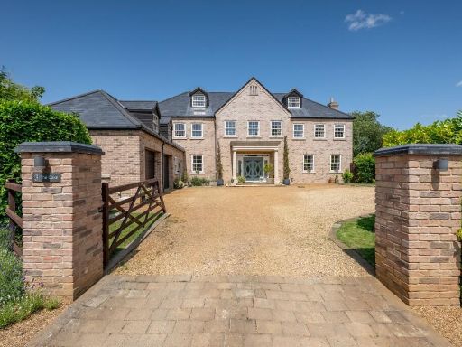 6 bedroom detached house for sale in Doddington, PE15 — £850,000 • 6 bed • 6 bath • 5496 ft²
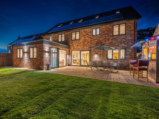 7 bedroom detached house for sale in May Meadows, Doddington, PE15 0WJ, PE15 — £700,000 • 7 bed • 6 bath • 3465 ft²
 5 bedroom detached house for sale in May Meadows, Doddington, March, PE15 — £550,000 • 5 bed • 3 bath • 2519 ft²
 7 bedroom detached house for sale in Newgate Street, Doddington, PE15 — £775,000 • 7 bed • 4 bath • 2726 ft²
 3 bedroom semi-detached house for sale in Harvest Close, Doddington, PE15 — £250,000 • 3 bed • 2 bath • 872 ft²
Meta
- {
"@context": "https://schema.org",
"@type": "Residence",
"name": "5 bedroom detached house for sale in Benwick Road, Doddingt…",
"description": "",
"url": "https://propertypiper.co.uk/property/6470a424-db7a-4635-8f85-fd6b9c645d5f",
"image": "https://image-a.propertypiper.co.uk/3288cf14-749d-46d6-9e27-8a9754ef6ce2-1024.jpeg",
"address": {
"@type": "PostalAddress",
"streetAddress": "62 Benwick Road, Doddington",
"postalCode": "PE15 0TX",
"addressLocality": "Fenland",
"addressRegion": "North East Cambridgeshire",
"addressCountry": "England"
},
"geo": {
"@type": "GeoCoordinates",
"latitude": 52.49810634313349,
"longitude": 0.048353577799538534
},
"numberOfRooms": 5,
"numberOfBathroomsTotal": 3,
"floorSize": {
"@type": "QuantitativeValue",
"value": 5332,
"unitCode": "FTK"
},
"offers": {
"@type": "Offer",
"price": 850000,
"priceCurrency": "GBP",
"availability": "https://schema.org/InStock"
},
"additionalProperty": [
{
"@type": "PropertyValue",
"name": "Feature",
"value": "detached"
},
{
"@type": "PropertyValue",
"name": "Feature",
"value": "modern"
},
{
"@type": "PropertyValue",
"name": "Feature",
"value": "country"
},
{
"@type": "PropertyValue",
"name": "Feature",
"value": "spacious"
},
{
"@type": "PropertyValue",
"name": "Feature",
"value": "garage"
},
{
"@type": "PropertyValue",
"name": "Feature",
"value": "garden"
},
{
"@type": "PropertyValue",
"name": "Feature",
"value": "light"
},
{
"@type": "PropertyValue",
"name": "Feature",
"value": "expansive"
},
{
"@type": "PropertyValue",
"name": "Feature",
"value": "landscaped"
},
{
"@type": "PropertyValue",
"name": "Feature",
"value": "equestrian property"
},
{
"@type": "PropertyValue",
"name": "Feature",
"value": "rural"
},
{
"@type": "PropertyValue",
"name": "Feature",
"value": "agriculture"
},
{
"@type": "PropertyValue",
"name": "Feature",
"value": "farmland"
},
{
"@type": "PropertyValue",
"name": "Feature",
"value": "outbuildings"
},
{
"@type": "PropertyValue",
"name": "Feature",
"value": "stables"
},
{
"@type": "PropertyValue",
"name": "Feature",
"value": "paddock"
},
{
"@type": "PropertyValue",
"name": "Feature",
"value": "open fields"
},
{
"@type": "PropertyValue",
"name": "Feature",
"value": "country living"
}
]
}
High Res Floorplan Images
Compatible Floorplan Images
FloorplanImages Thumbnail