CM14 4PU - 5 bedroom detached house for sale in Wansford Close, Brentw…
View on Property Piper
5 bedroom detached house for sale in Wansford Close, Brentwood, Essex, CM14
Property Details
- Price: £1150000
- Bedrooms: 5
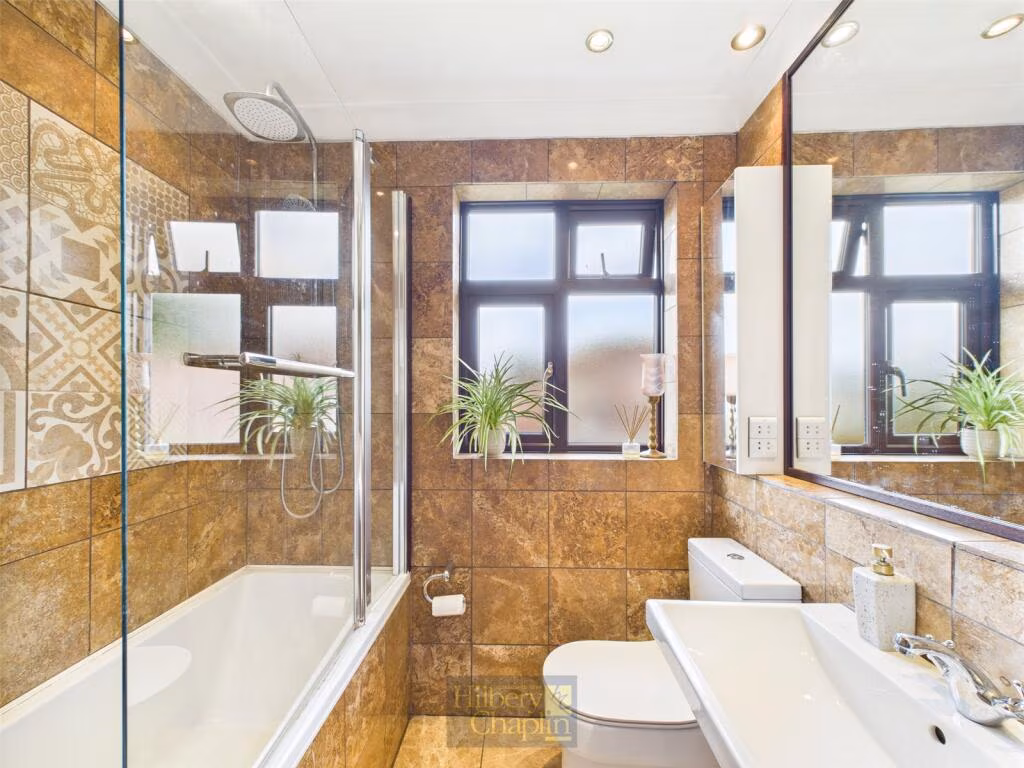
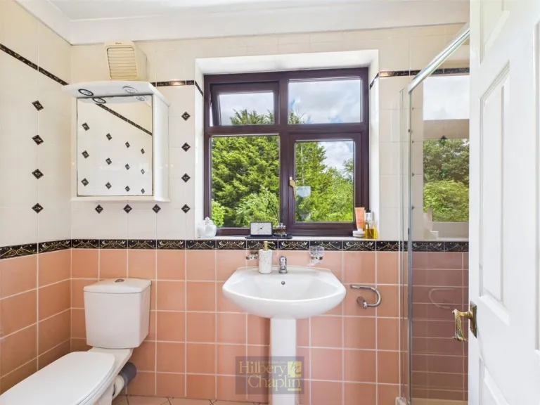
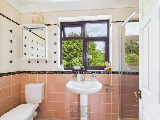
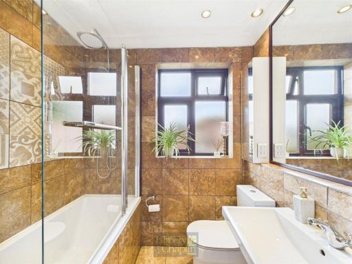
- Bathrooms: 1
- Property Type: undefined
- Property SubType: undefined
Brochure Descriptions
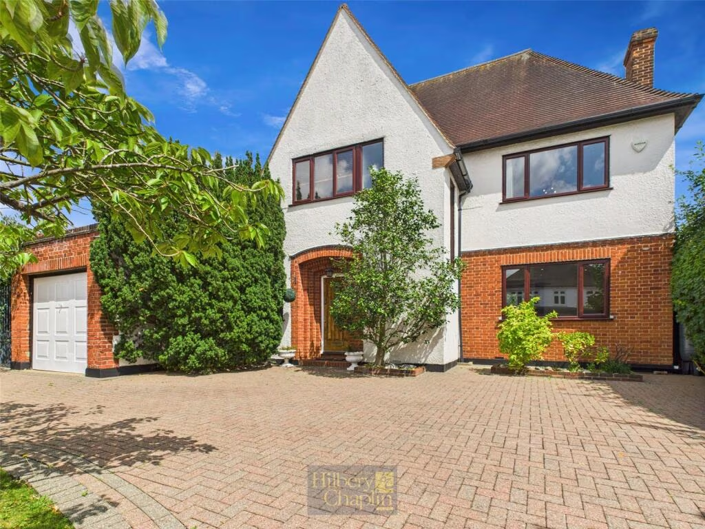
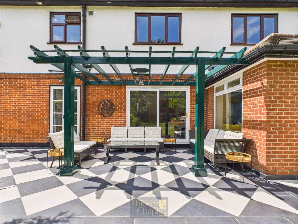
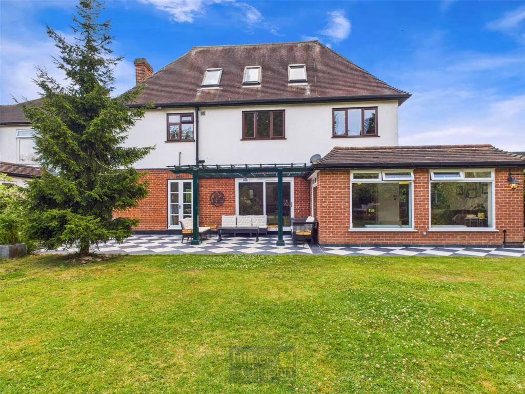
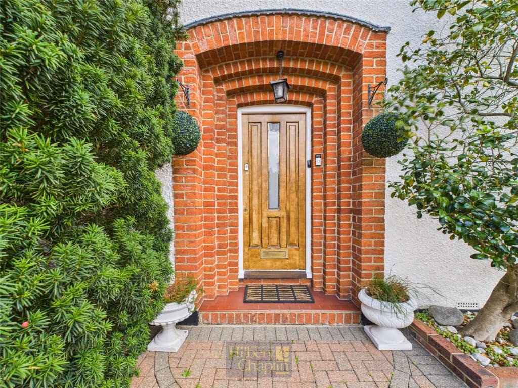
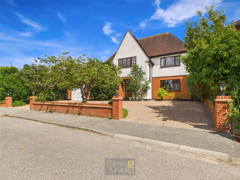
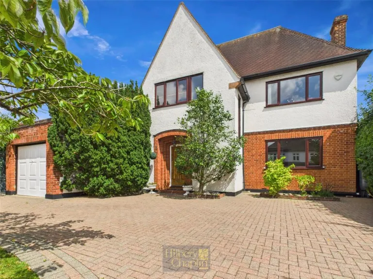
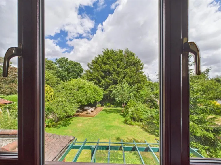
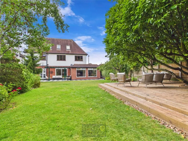
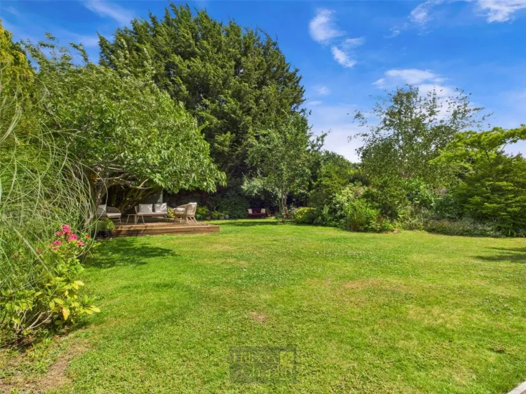
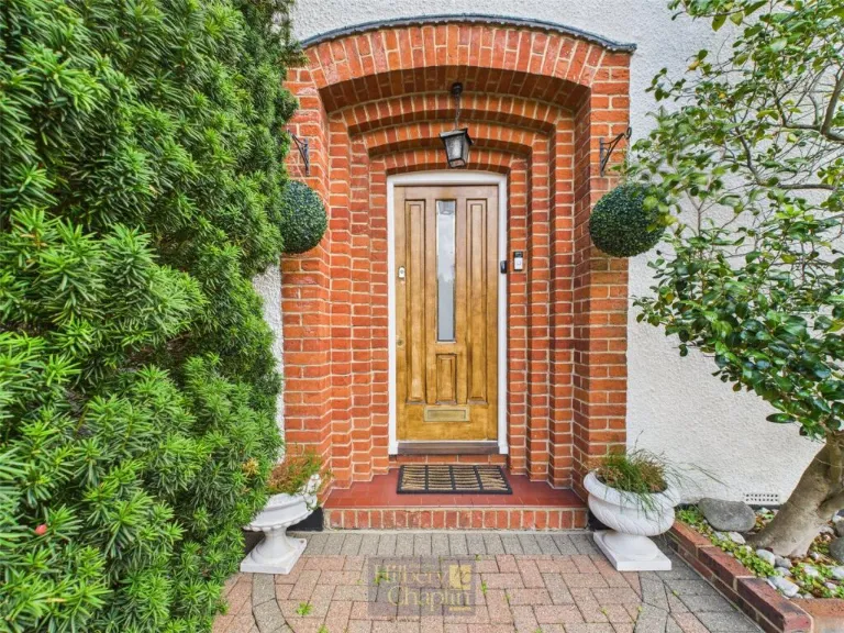
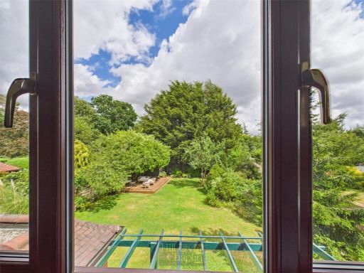
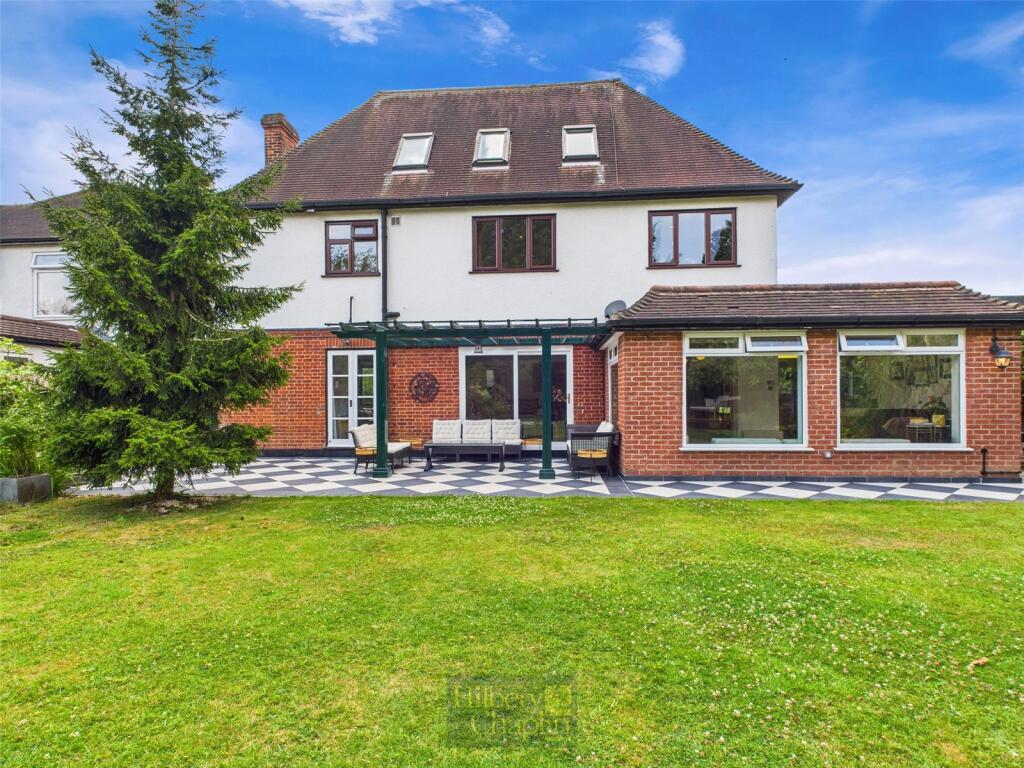
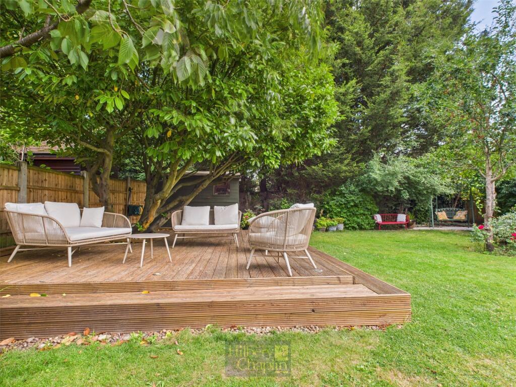
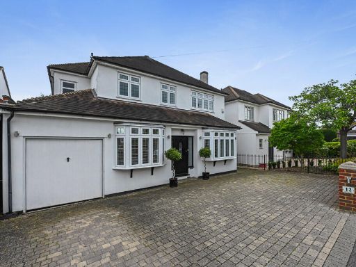
- The property is a detached house with a classic design featuring a large brick driveway, capable of accommodating multiple vehicles. The house is adorned with a traditional white and red brick exterior. It includes a large garage attached to the side of the house. The garden appears well-maintained, and the property overall suggests a spacious and elegant atmosphere with average room sizes. The setting is in a suburban area, likely providing a quiet and peaceful living environment.
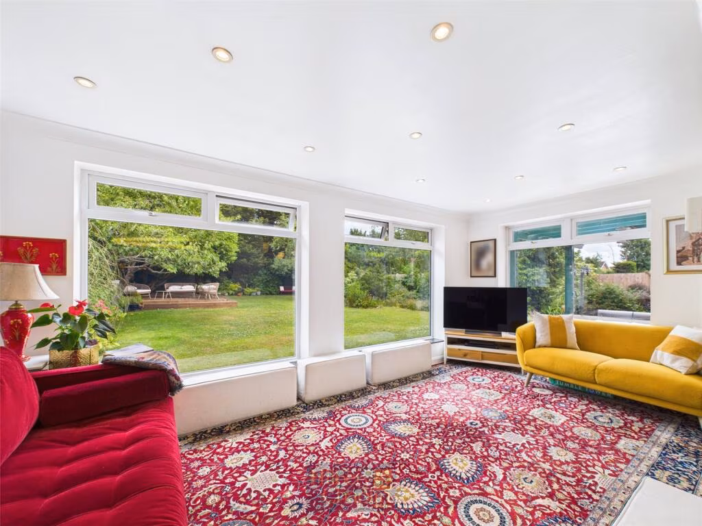
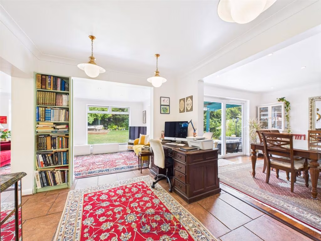
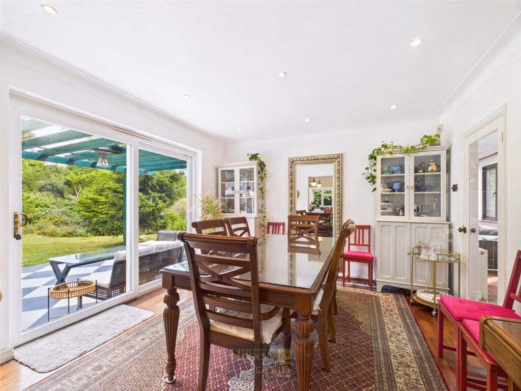
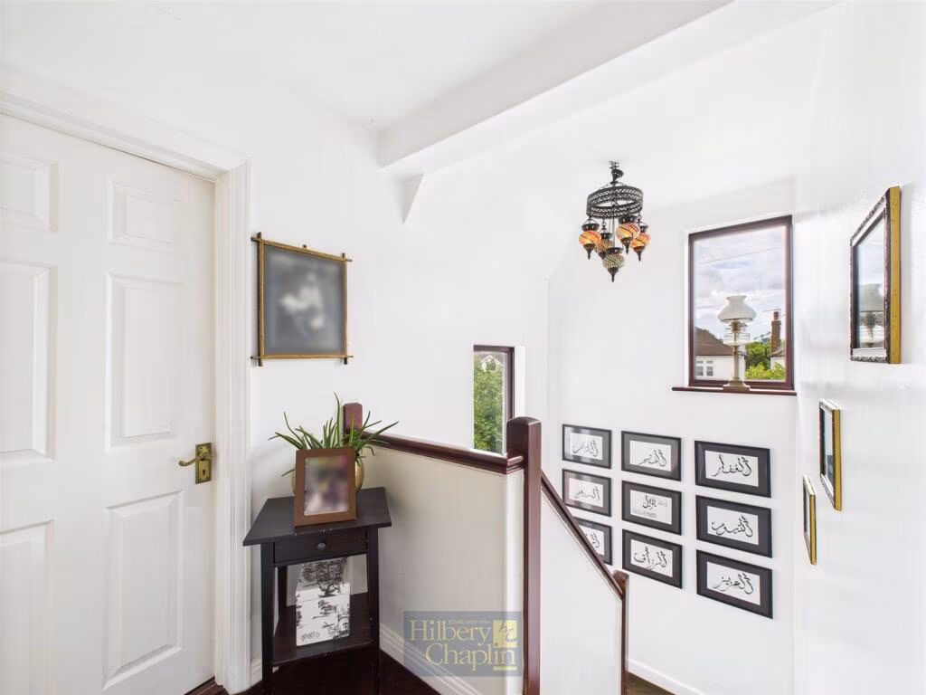
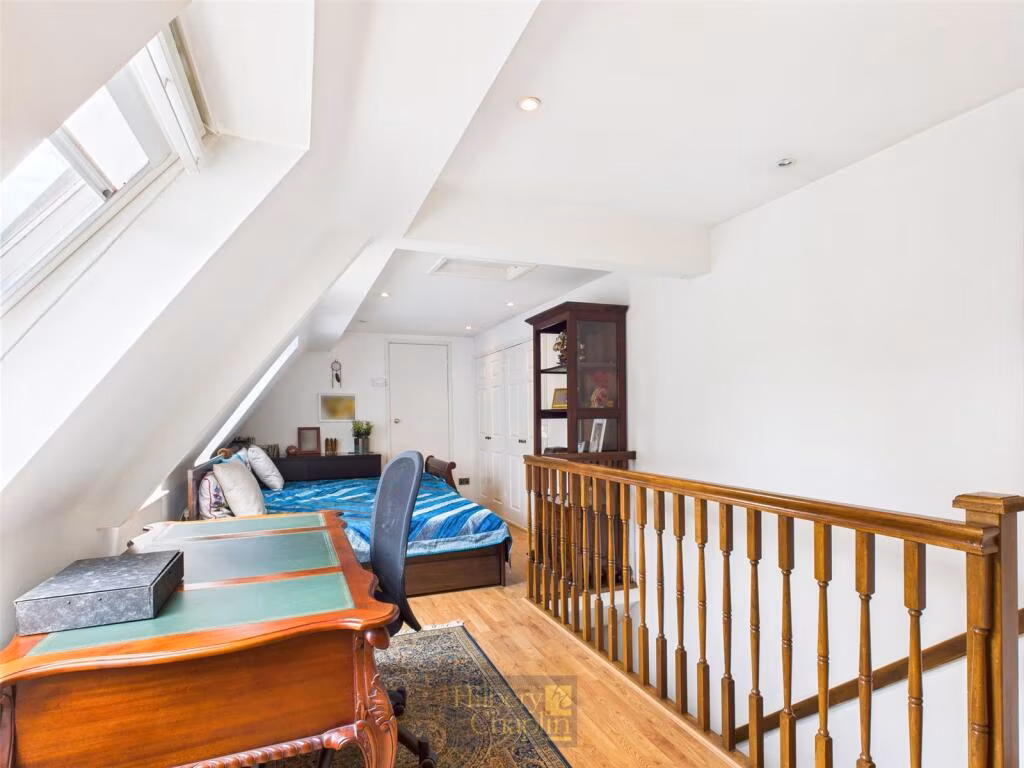
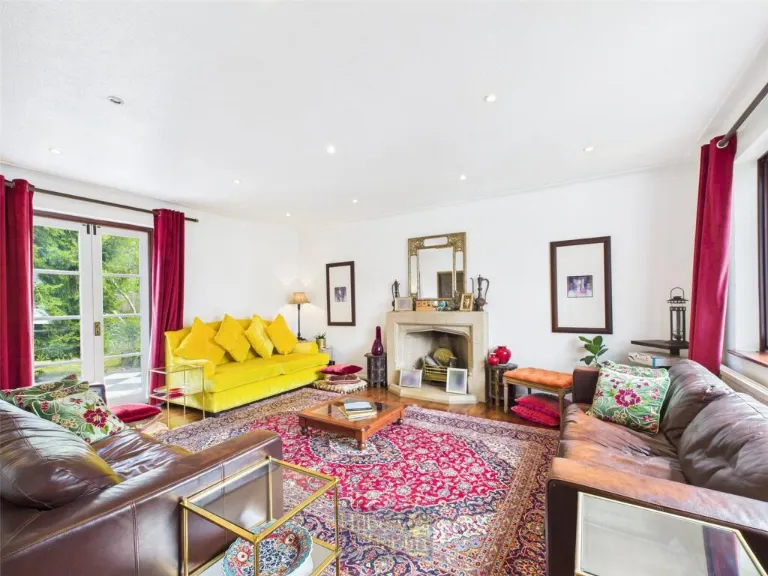
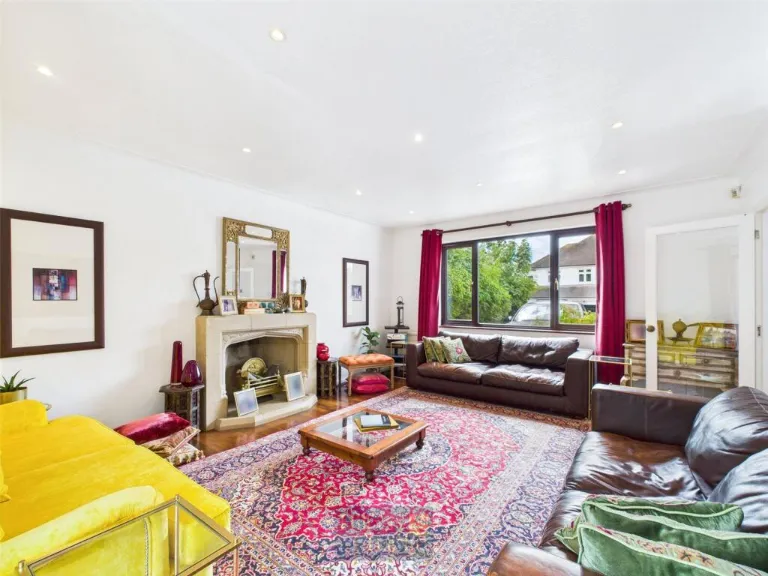
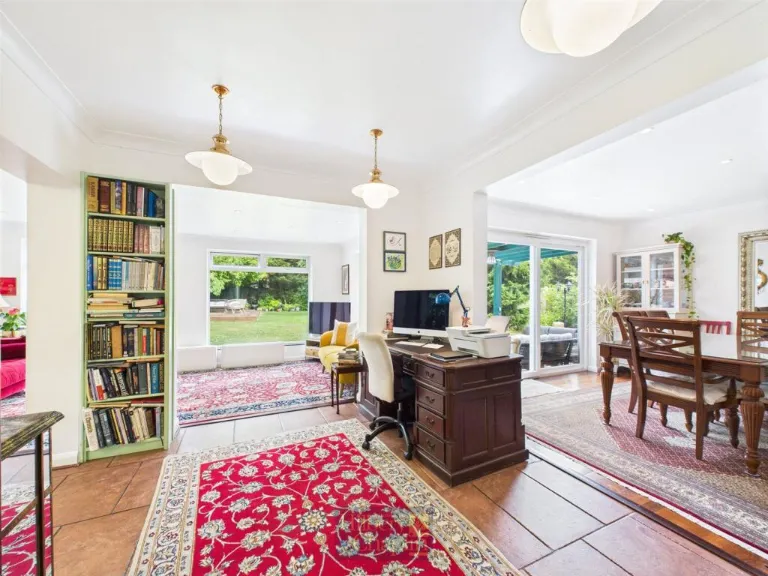
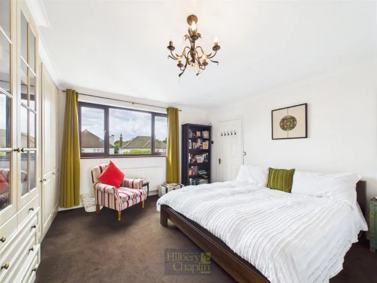
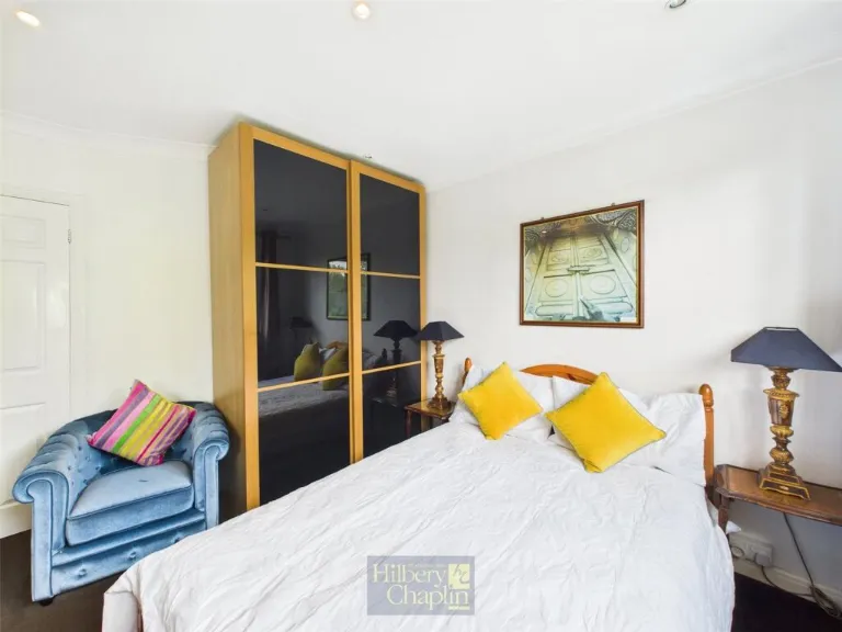
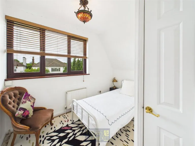
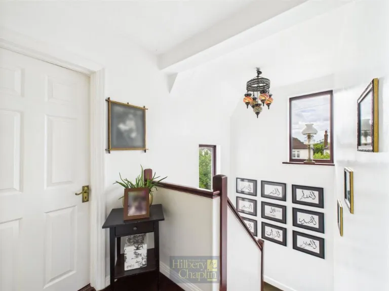
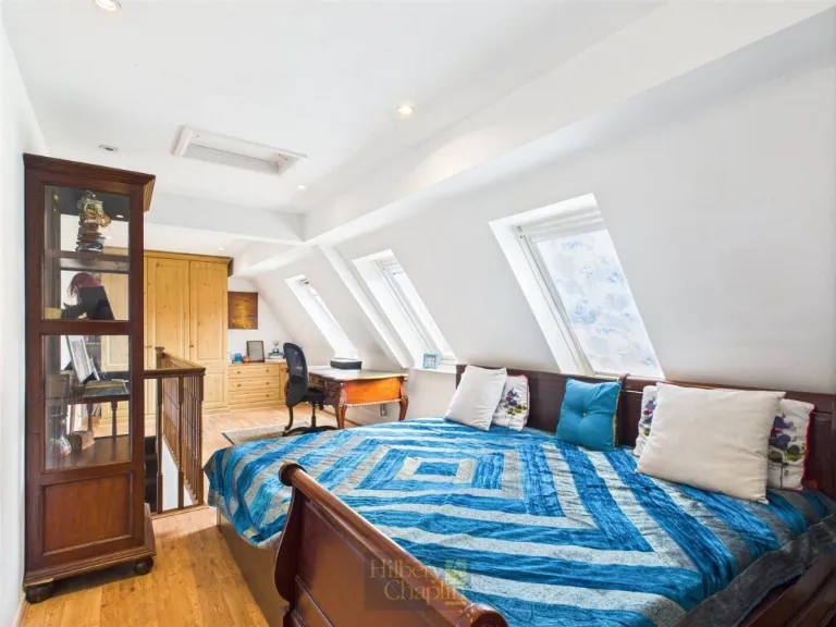
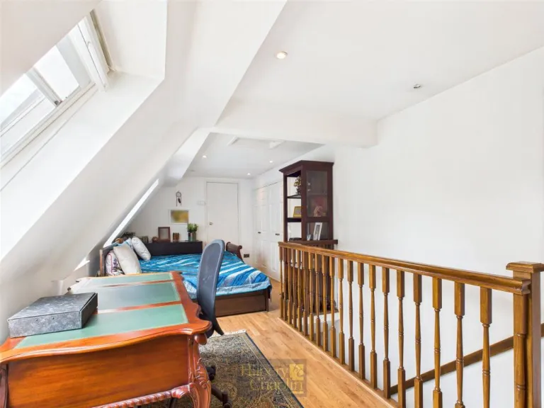
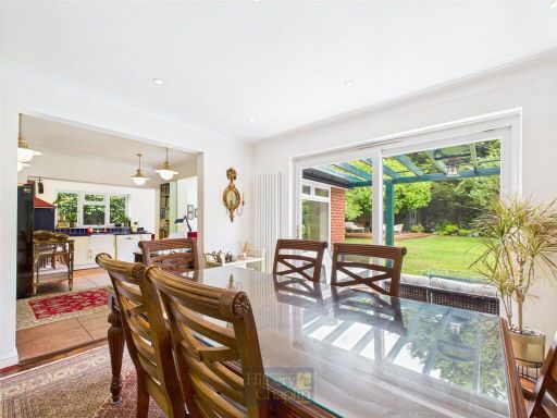
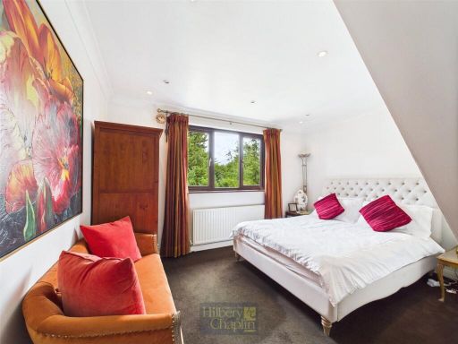
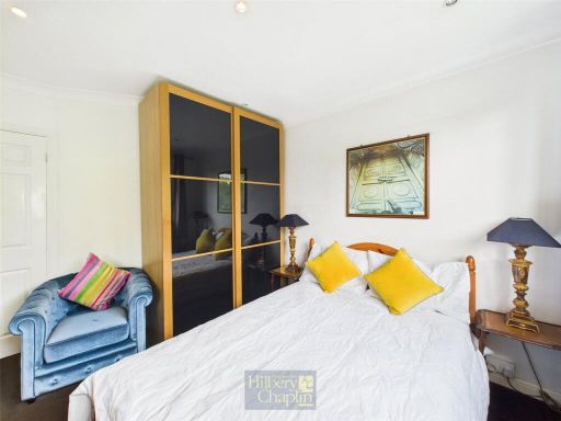
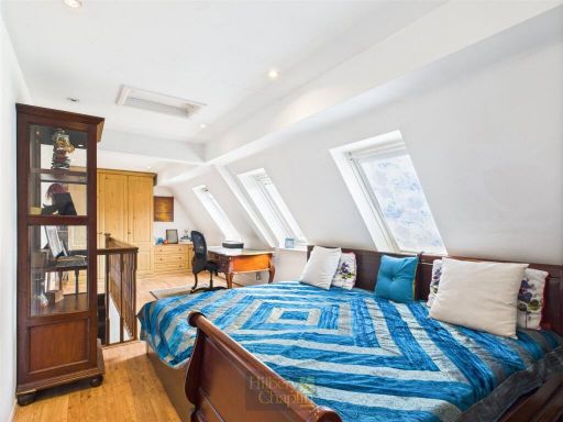
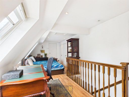
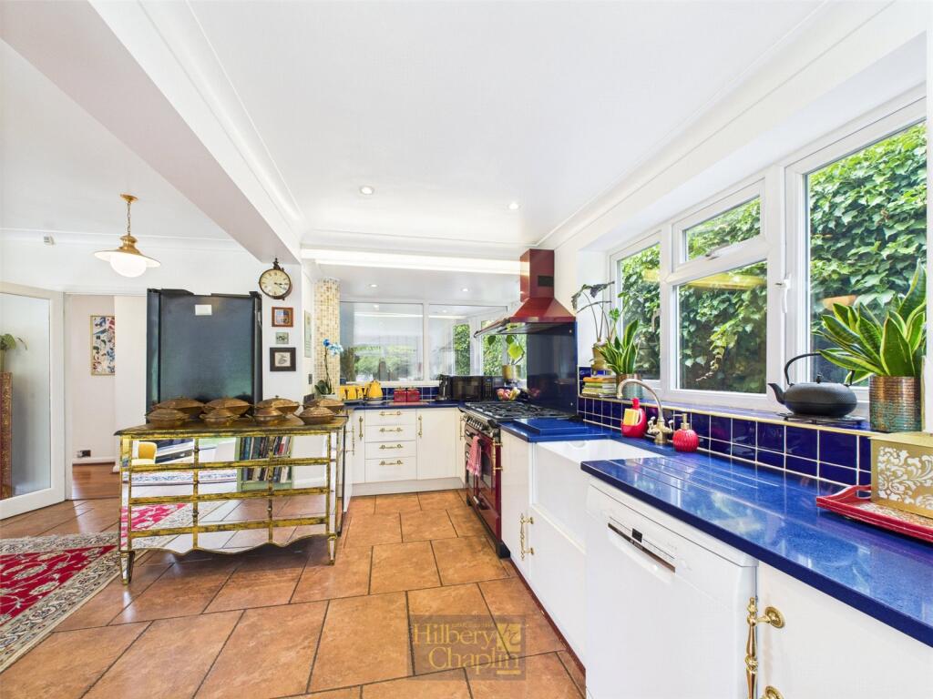
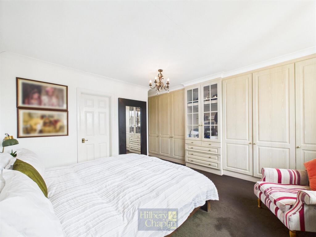
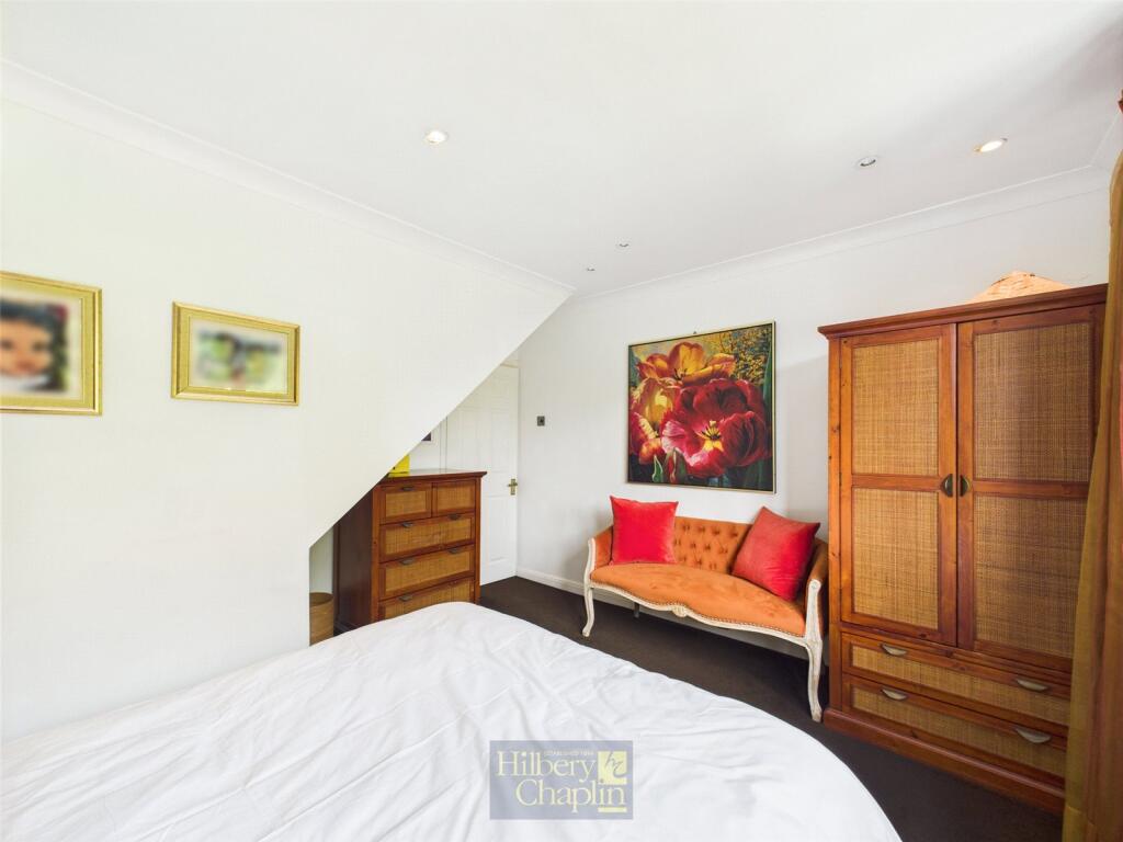
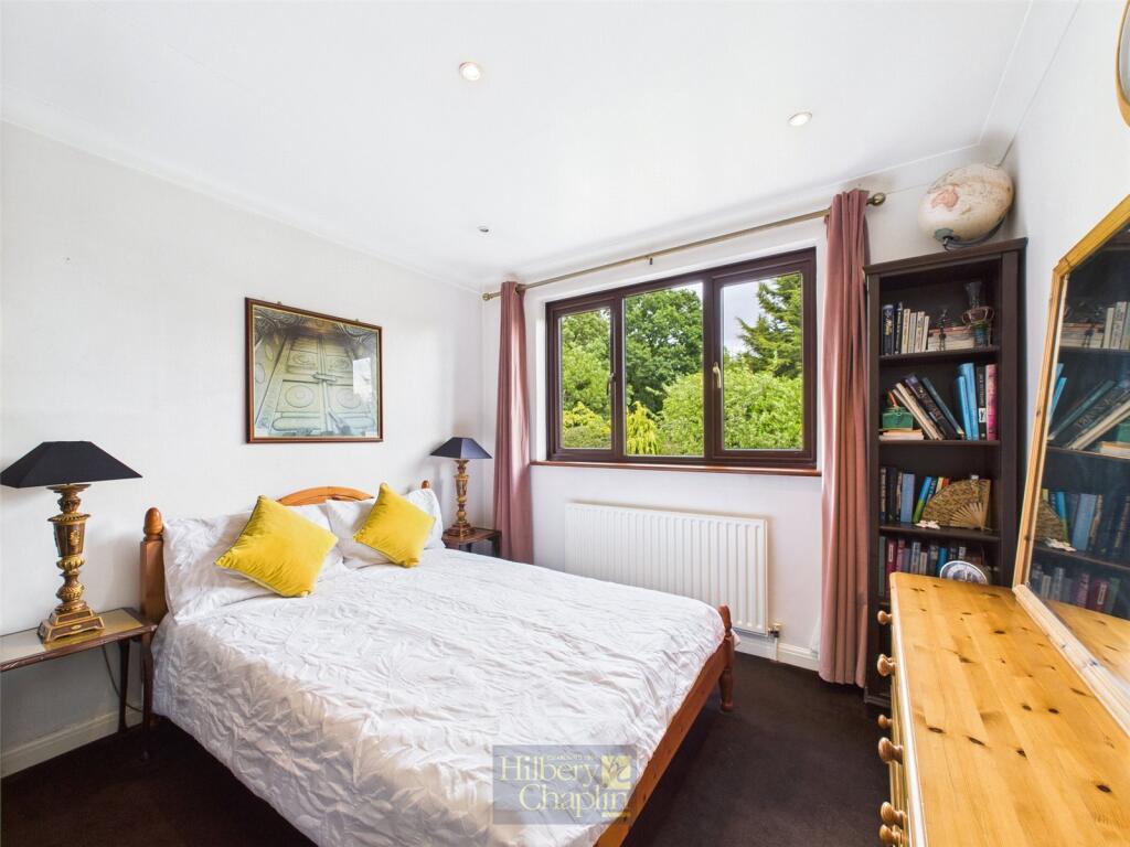
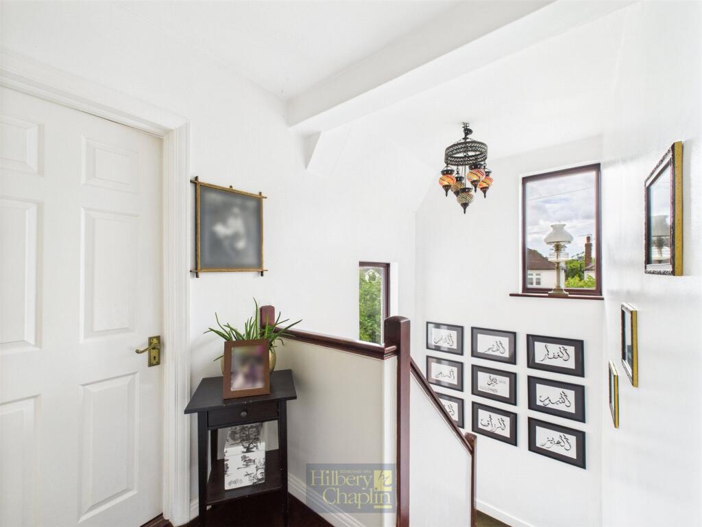
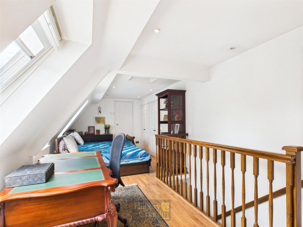
- The property is a multi-level family home featuring spacious living areas. The kitchen and dining room on the ground floor are well-sized, offering an optimal layout for entertaining and family gatherings. Upstairs, the layout includes several bedrooms with one offering en suite facilities, suggesting a potential for luxury living accommodations. While there is no clear view depicted in the image, the arrangement implies it might be suitable for a suburban area. The space can be described as large with a functional interplay of the rooms.
Image Descriptions
- detached house Tudor Revival
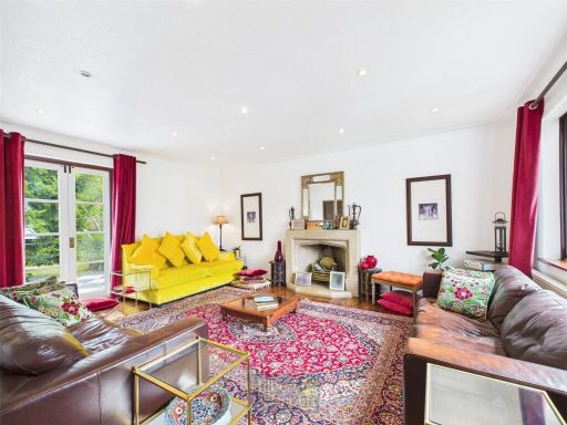
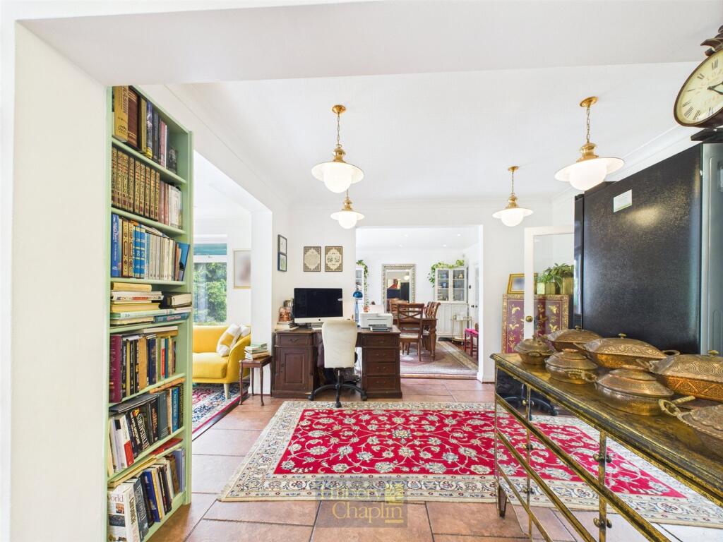
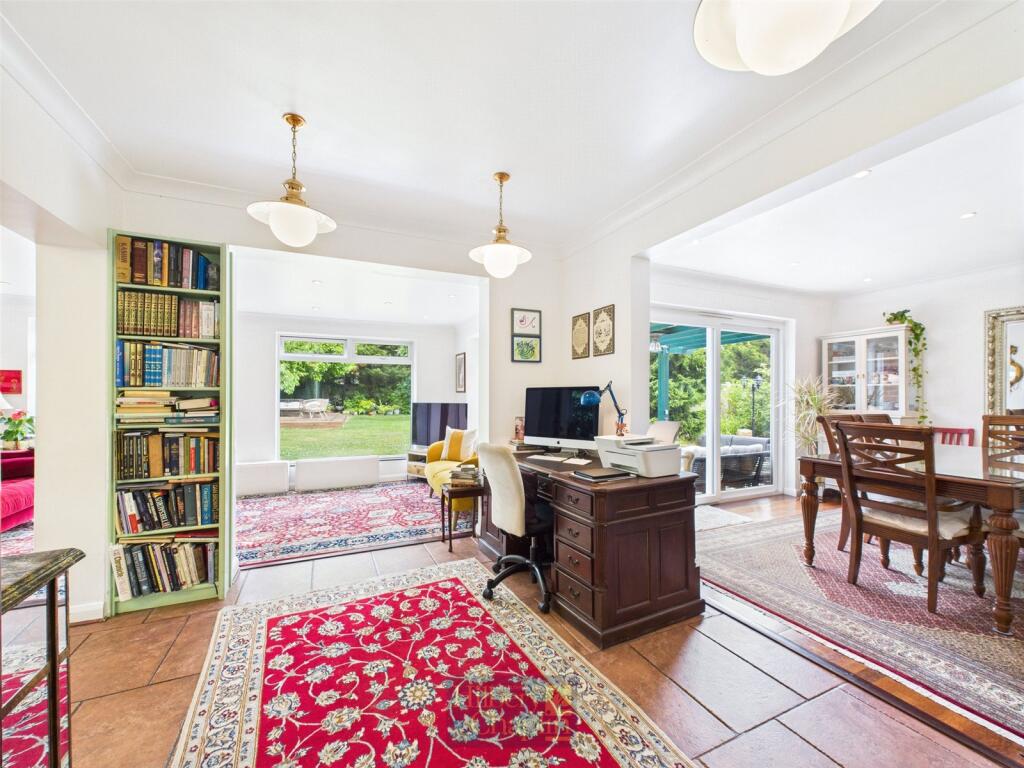
- living room contemporary
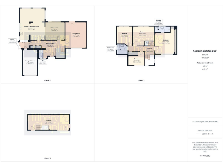
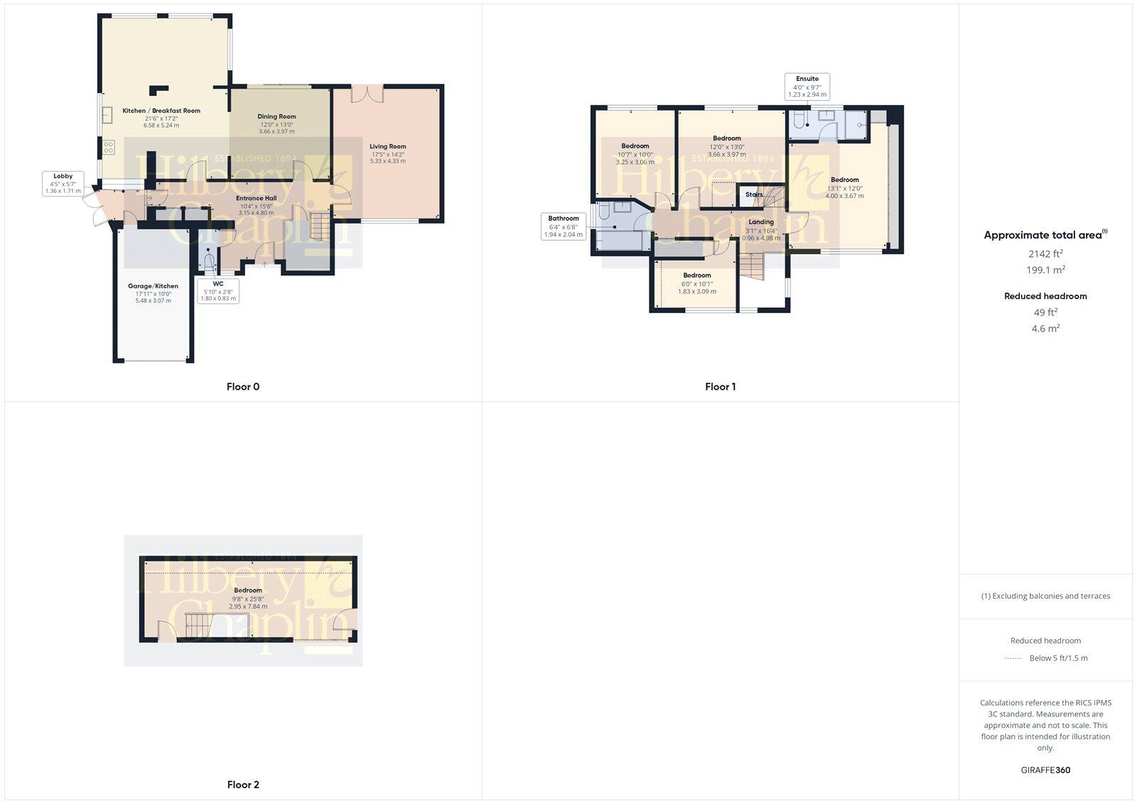
Floorplan Description
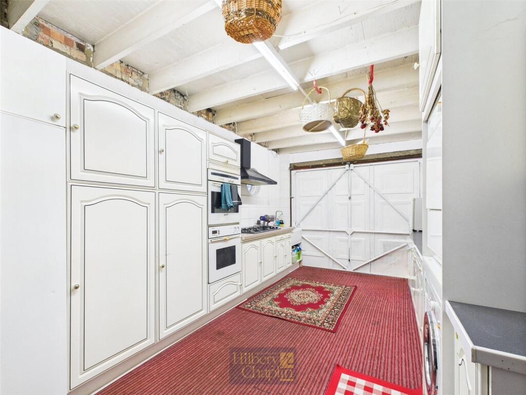
- A multi-story property with kitchen/breakfast room, multiple bedrooms, living areas, and a garage/kitchen space.
Rooms
- Kitchen / Breakfast Room:
- Dining Room:
- Living Room:
- Garage/Kitchen:
- Lobby:
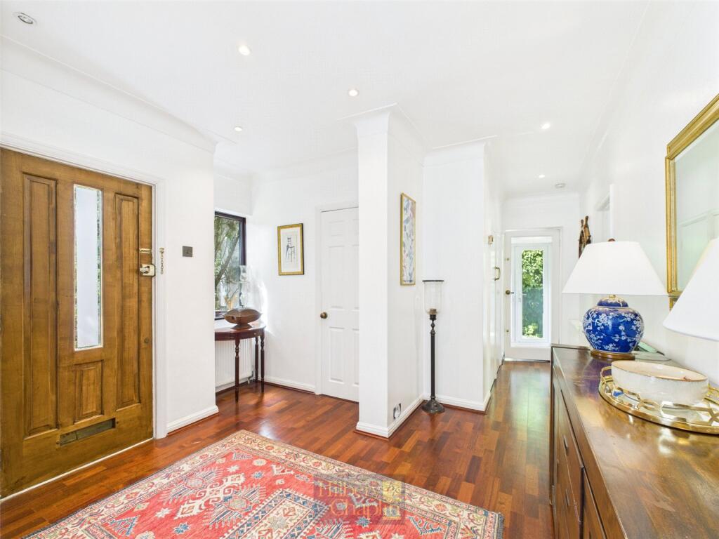
- Entrance Hall:
- WC:
- Bedroom:
- Bedroom:
- Bedroom:
- Bedroom:
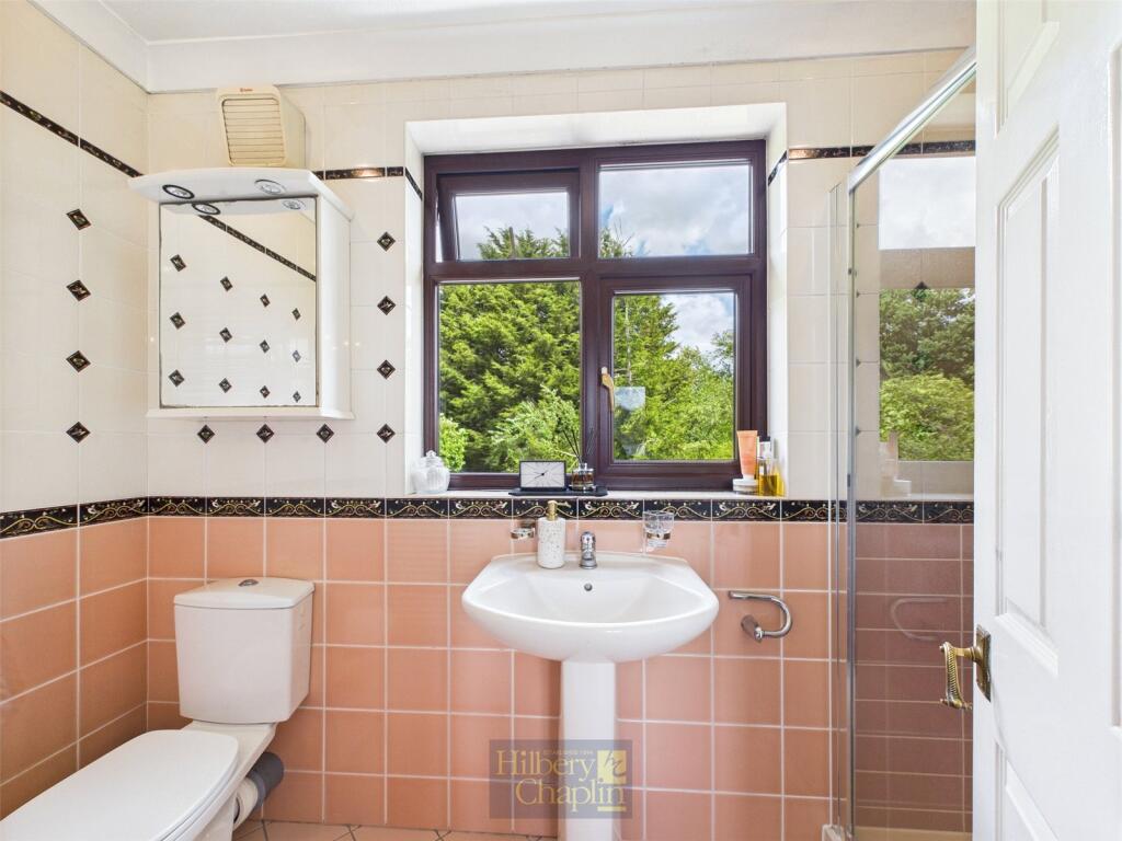
- Bathroom:
- Ensuite:
- Landing:
- Bedroom:
Textual Property Features
Detected Visual Features
- detached house
- Tudor Revival
- double-storey
- brickwork
- timber
- gable roof
- large driveway
- suburban
- family home
- contemporary
- living room
- fireplace
- large room
- natural light
- sliding doors
EPC Details
- High performance glazing
- Average thermal transmittance 0.17 W/m-¦K
- Air source heat pump, underfloor, electric, Air source heat pump, underfloor, electric
- Good lighting efficiency
- Average thermal transmittance 0.12 W/m-¦K
Nearby Schools
- Harold Wood Primary School
- Harold Court Primary School
- Warley Primary School
- Drapers' Academy
- Drapers' Maylands Primary School
- Brentwood School
- Larchwood Primary School
- Kelvedon Hatch Community Primary School
- Engayne Primary School
- Woodlands School
- Brentwood County High School
- Hogarth Primary School
- Brentwood Ursuline Convent High School
- St Helen's Catholic Junior School
- St Thomas of Canterbury Church of England Aided Primary School, Brentwood
- Becket Keys Church of England Free School
- St Helen's Catholic Infant School
- Shenfield St. Mary's Church of England Primary School
- Hall Mead School
- Ursuline Preparatory School
- Mead Primary School
- Drapers' Pyrgo Priory School
- Holly Trees Primary School
- St Peter's Church of England Voluntary Aided Primary School, South Weald
- Bentley St Paul's Church of England Primary School
- Doddinghurst Infant School
- Doddinghurst Church of England Junior School
Nearest General Shops
- Id: 551333110
- Tags:
- Brand: Ford
- Brand:wikidata: Q44294
- Brand:wikipedia: en:Ford Motor Company
- Building: yes
- Name: Ford
- Shop: car
- TagsNormalized:
- Lat: 51.6122914
- Lon: 0.276938
- FullGeoHash: u10jw79xmh7y
- PartitionGeoHash: u10j
- Images:
- FoodStandards: null
- Distance: 359.2
,- Id: 5324550359
- Tags:
- Brand: Ford
- Brand:wikidata: Q44294
- Brand:wikipedia: en:Ford Motor Company
- Name: Ford
- Shop: car
- TagsNormalized:
- Lat: 51.6122942
- Lon: 0.2769384
- FullGeoHash: u10jw79xmhup
- PartitionGeoHash: u10j
- Images:
- FoodStandards: null
- Distance: 358.9
,- Id: 551332297
- Tags:
- Brand: Kwik Fit
- Brand:wikidata: Q958053
- Brand:wikipedia: en:Kwik Fit
- Building: yes
- Name: Kwik Fit
- Shop: car_repair
- TagsNormalized:
- kwik fit
- car repair
- repair
- shop
- Lat: 51.6125138
- Lon: 0.2776724
- FullGeoHash: u10jw7f0wjzt
- PartitionGeoHash: u10j
- Images:
- FoodStandards: null
- Distance: 319.5
}
Nearest Grocery shops
- Id: 6153540138
- Tags:
- Brand: Nisa Local
- Brand:wikidata: Q16999069
- Brand:wikipedia: en:Nisa (retailer)
- Name: Nisa Local
- Shop: convenience
- TagsNormalized:
- nisa
- nisa local
- convenience
- shop
- Lat: 51.6195418
- Lon: 0.2991826
- FullGeoHash: u10jwv1cekn8
- PartitionGeoHash: u10j
- Images:
- FoodStandards: null
- Distance: 1479.3
,- Id: 1804140976
- Tags:
- Name: Brentwood Superstore
- Shop: convenience
- TagsNormalized:
- Lat: 51.6131055
- Lon: 0.298725
- FullGeoHash: u10jwgcs0u1w
- PartitionGeoHash: u10j
- Images:
- FoodStandards: null
- Distance: 1391.4
,- Id: 1126075161
- Tags:
- Addr:
- City: Brentwood
- Postcode: CM14 5NF
- Street: Brook Street
- Brand: Shell
- Brand:wikidata: Q110716465
- Building: yes
- Name: Shell
- Old_name: Total
- Opening_hours: 24/7
- Phone: +44 1277 221048
- Shop: convenience
- Website: https://www.shell.co.uk/
- TagsNormalized:
- Lat: 51.6089624
- Lon: 0.2647253
- FullGeoHash: u10jw50gbxck
- PartitionGeoHash: u10j
- Images:
- FoodStandards: null
- Distance: 1204.3
}
Nearest Supermarkets
- Id: 851847846
- Tags:
- Brand: Lidl
- Brand:wikidata: Q151954
- Brand:wikipedia: en:Lidl
- Building: yes
- Name: Lidl
- Shop: supermarket
- TagsNormalized:
- Lat: 51.605772
- Lon: 0.2243121
- FullGeoHash: u10jt4e36v5h
- PartitionGeoHash: u10j
- Images:
- FoodStandards: null
- Distance: 3913.9
,- Id: 1428201890
- Tags:
- Brand: Co-op Food
- Brand:wikidata: Q3277439
- Brand:wikipedia: en:Co-op Food
- Name: Co-op Food
- Operator: The Co-operative Group
- Operator:wikidata: Q117202
- Shop: supermarket
- TagsNormalized:
- co-op
- co-op food
- food
- supermarket
- shop
- Lat: 51.630841
- Lon: 0.3288155
- FullGeoHash: u10jxrp7myqe
- PartitionGeoHash: u10j
- Images:
- FoodStandards: null
- Distance: 3856.6
,- Id: 147247984
- Tags:
- Addr:
- City: Brentwood
- Housenumber: 51
- Postcode: CM14 4WQ
- Street: William Hunter Way
- Branch: Brentwood Superstore
- Brand: Sainsbury's
- Brand:wikidata: Q152096
- Brand:wikipedia: en:Sainsbury's
- Building: yes
- Name: Sainsbury's
- Opening_hours: Mo-Sa 08:00-21:00; Su 10:00-16:00
- Phone: +441277264758
- Shop: supermarket
- TagsNormalized:
- sainsburys
- supermarket
- shop
- Lat: 51.6222311
- Lon: 0.3026374
- FullGeoHash: u10jwvs37cqg
- PartitionGeoHash: u10j
- Images:
- FoodStandards: null
- Distance: 1812.7
}
Nearest Religious buildings
- Id: 2052846107
- Tags:
- Amenity: place_of_worship
- Name: Brentwood Baptist Church
- Religion: christian
- TagsNormalized:
- place of worship
- baptist
- church
- christian
- Lat: 51.6166221
- Lon: 0.2991732
- FullGeoHash: u10jwu9be5z8
- PartitionGeoHash: u10j
- Images:
- FoodStandards: null
- Distance: 1408.8
,- Id: 147077329
- Tags:
- Amenity: place_of_worship
- Building: church
- Denomination: anglican
- Name: St Peter, South Weald
- Religion: christian
- Wikidata: Q17544988
- TagsNormalized:
- place of worship
- church
- anglican
- christian
- Lat: 51.621719
- Lon: 0.2684294
- FullGeoHash: u10jwj7qqcgk
- PartitionGeoHash: u10j
- Images:
- FoodStandards: null
- Distance: 1016
,- Id: 122842212
- Tags:
- Amenity: place_of_worship
- Building: yes
- Place_of_worship: cemetery_chapel
- Religion: christian
- TagsNormalized:
- place of worship
- christian
- church
- Lat: 51.617479
- Lon: 0.2897615
- FullGeoHash: u10jwsdvxgmz
- PartitionGeoHash: u10j
- Images:
- FoodStandards: null
- Distance: 789.7
}
Nearest Medical buildings
- Id: 779654814
- Tags:
- Amenity: hospital
- Healthcare: hospital
- TagsNormalized:
- Lat: 51.6268413
- Lon: 0.2943732
- FullGeoHash: u10jwwqk5ku8
- PartitionGeoHash: u10j
- Images:
- FoodStandards: null
- Distance: 1671.6
,- Id: 834823319
- Tags:
- Addr:
- City: Brentwood
- Postcode: CM14 4FZ
- Street: Geary Drive
- Amenity: doctors
- Building: yes
- Healthcare: doctor
- Healthcare:speciality: general
- Name: The Brambles Surgery
- TagsNormalized:
- doctor
- doctors
- health
- healthcare
- general
- surgery
- Lat: 51.6265803
- Lon: 0.2948608
- FullGeoHash: u10jwwqdwu05
- PartitionGeoHash: u10j
- Images:
- FoodStandards: null
- Distance: 1671.4
,- Id: 7880162219
- Tags:
- Amenity: pharmacy
- Brand: Day Lewis Pharmacy
- Brand:wikidata: Q62563772
- Dispensing: yes
- Healthcare: pharmacy
- Name: Day Lewis Pharmacy
- TagsNormalized:
- pharmacy
- day lewis pharmacy
- health
- healthcare
- Lat: 51.6079076
- Lon: 0.2956558
- FullGeoHash: u10jwdzmc72b
- PartitionGeoHash: u10j
- Images:
- FoodStandards: null
- Distance: 1419.5
,- Id: 7880162793
- Tags:
- Amenity: doctors
- Description: Medical Doctors
- Healthcare: doctor
- Name: Beechwood Surgery
- TagsNormalized:
- doctor
- doctors
- health
- healthcare
- surgery
- Lat: 51.6080283
- Lon: 0.2956853
- FullGeoHash: u10jwdzq9cyb
- PartitionGeoHash: u10j
- Images:
- FoodStandards: null
- Distance: 1413.4
}
Nearest Airports
- Id: 121158889
- Tags:
- Aerodrome: continental
- Aeroway: aerodrome
- Fhrs:
- Authority: City of London Corporation
- Iata: LCY
- Icao: EGLC
- Name: London City Airport
- Operator: London City Airport Limited
- Ref: LCY
- Website: https://www.londoncityairport.com/
- Wikidata: Q8982
- Wikipedia: en:London City Airport
- TagsNormalized:
- airport
- continental airport
- Lat: 51.5042658
- Lon: 0.0539987
- FullGeoHash: u10j10p64702
- PartitionGeoHash: u10j
- Images:
- FoodStandards: null
- Distance: 19851.5
,- Id: 103894219
- Tags:
- Aerodrome: international
- Aeroway: aerodrome
- Iata: SEN
- Icao: EGMC
- Name: London Southend Airport
- Old_name: Southend Municipal Airport
- Ref: SEN
- Wikidata: Q1415441
- TagsNormalized:
- airport
- international airport
- Lat: 51.5701749
- Lon: 0.6924624
- FullGeoHash: u10mru04p937
- PartitionGeoHash: u10m
- Images:
- FoodStandards: null
- Distance: 29006.9
}
Nearest Leisure Facilities
- Id: 647079162
- Tags:
- Leisure: park
- Name: Warley Country Park
- TagsNormalized:
- Lat: 51.6086527
- Lon: 0.285728
- FullGeoHash: u10jwe041ynh
- PartitionGeoHash: u10j
- Images:
- FoodStandards: null
- Distance: 876.2
,- Id: 666862764
- Tags:
- Leisure: pitch
- Sport: bowls
- TagsNormalized:
- Lat: 51.6121318
- Lon: 0.2879435
- FullGeoHash: u10jwe9wmwdn
- PartitionGeoHash: u10j
- Images:
- FoodStandards: null
- Distance: 717.3
,- Id: 666862768
- Tags:
- Leisure: pitch
- Sport: bowls
- TagsNormalized:
- Lat: 51.6122206
- Lon: 0.288007
- FullGeoHash: u10jwe9wzp38
- PartitionGeoHash: u10j
- Images:
- FoodStandards: null
- Distance: 716.4
,- Id: 883131853
- Tags:
- Leisure: park
- Name: River Road Play Space
- TagsNormalized:
- Lat: 51.6134656
- Lon: 0.2738073
- FullGeoHash: u10jw5zqhpmd
- PartitionGeoHash: u10j
- Images:
- FoodStandards: null
- Distance: 404.8
,- Id: 878679786
- Tags:
- TagsNormalized:
- Lat: 51.6163144
- Lon: 0.280692
- FullGeoHash: u10jwkkqud7h
- PartitionGeoHash: u10j
- Images:
- FoodStandards: null
- Distance: 169.3
}
Nearest Tourist attractions
- Id: 1333615707
- Tags:
- Addr:
- Housenumber: Old MacDonald's Farm
- Street: Weald Road
- Name: Old Macdonald Farm
- Opening_hours: Apr 1 - Sep 30: 10:00- 17:00; Oct 1 - Mar 31: Mo-Su 10:00-16:00
- Tourism: zoo
- Website: https://www.omdfarm.co.uk/
- TagsNormalized:
- Lat: 51.6258833
- Lon: 0.2375653
- FullGeoHash: u10jtqhyxdjt
- PartitionGeoHash: u10j
- Images:
- FoodStandards: null
- Distance: 3086.2
,- Id: 839838612
- Tags:
- TagsNormalized:
- Lat: 51.6109422
- Lon: 0.3118325
- FullGeoHash: u10jx57pd0zn
- PartitionGeoHash: u10j
- Images:
- FoodStandards: null
- Distance: 2325.9
,- Id: 1693796694
- Tags:
- Name: Brentwood Museum
- Tourism: museum
- Wikidata: Q85670944
- TagsNormalized:
- Lat: 51.609047
- Lon: 0.2973171
- FullGeoHash: u10jwg0krzxt
- PartitionGeoHash: u10j
- Images:
- FoodStandards: null
- Distance: 1449.8
}
Nearest Hotels
- Id: 871921485
- Tags:
- Brand: Premier Inn
- Brand:wikidata: Q2108626
- Name: Premier Inn Brentwood
- Tourism: hotel
- Wheelchair: yes
- TagsNormalized:
- Lat: 51.6148915
- Lon: 0.2990756
- FullGeoHash: u10jwu1y8cnu
- PartitionGeoHash: u10j
- Images:
- FoodStandards: null
- Distance: 1395
,- Id: 230091681
- Tags:
- Addr:
- City: Brentwood
- Postcode: CM14 5NF
- Street: Brook Street
- Brand: Holiday Inn
- Brand:wikidata: Q2717882
- Brand:wikipedia: en:Holiday Inn
- Building: yes
- Email: reservations@hibrentwood.co.uk
- Internet_access: yes
- Internet_access:fee: yes
- Name: Holiday Inn
- Phone: +44 371 942 9012
- Tourism: hotel
- Website: https://www.ihg.com/holidayinn/destinations/gb/en/united-kingdom-hotels
- TagsNormalized:
- Lat: 51.6110526
- Lon: 0.269098
- FullGeoHash: u10jw5ebnmw0
- PartitionGeoHash: u10j
- Images:
- FoodStandards: null
- Distance: 823.5
,- Id: 122844791
- Tags:
- Name: The Marygreen Manor Hotel
- Tourism: hotel
- Website: http://www.marygreenmanor.co.uk
- Wikidata: Q111369018
- TagsNormalized:
- Lat: 51.6127357
- Lon: 0.2787487
- FullGeoHash: u10jw7fczr60
- PartitionGeoHash: u10j
- Images:
- FoodStandards: null
- Distance: 283.9
}
Tags
- detached house
- Tudor Revival
- double-storey
- brickwork
- timber
- gable roof
- large driveway
- suburban
- family home
- contemporary
- living room
- fireplace
- large room
- natural light
- sliding doors
Local Market Stats
- Average Price/sqft: £486
- Avg Income: £56600
- Rental Yield: 3.9%
- Social Housing: 13%
- Planning Success Rate: 74%
AirBnB Data
- 1km average: £120/night
- Listings in 1km: 1
Similar Properties
 5 bedroom detached house for sale in Wansford Close, Brentwood, CM14 — £1,000,000 • 5 bed • 3 bath • 2570 ft²
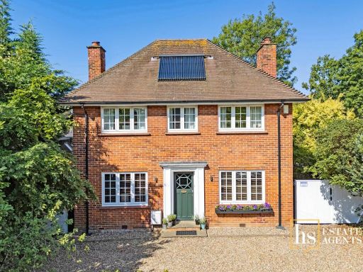 5 bedroom detached house for sale in Hillside Walk, Brentwood, CM14 — £1,400,000 • 5 bed • 2 bath • 1947 ft²
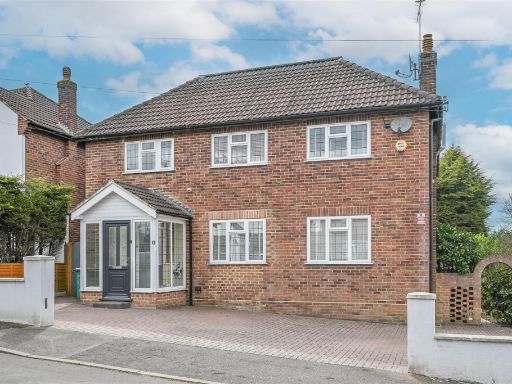 4 bedroom detached house for sale in Linkway Road, Brentwood, CM14 — £925,000 • 4 bed • 4 bath • 2382 ft²
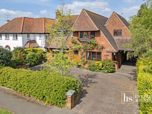 4 bedroom detached house for sale in South Weald Road, Brentwood, CM14 — £1,500,000 • 4 bed • 3 bath • 2562 ft²
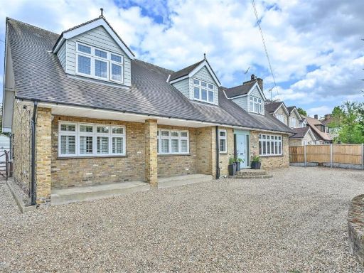 6 bedroom detached house for sale in **SIGNATURE HOME** Brook Road, Brentwood, CM14 — £1,295,000 • 6 bed • 3 bath • 3074 ft²
 4 bedroom detached house for sale in Nags Head Lane, Brentwood, Essex, CM14 — £950,000 • 4 bed • 3 bath • 1924 ft²
Meta
- {
"@context": "https://schema.org",
"@type": "Residence",
"name": "5 bedroom detached house for sale in Wansford Close, Brentw…",
"description": "",
"url": "https://propertypiper.co.uk/property/644b4206-a439-493e-aa5e-748dfbb5caef",
"image": "https://image-a.propertypiper.co.uk/b31518e0-fba5-440c-b0a6-cf490f573b30-1024.jpeg",
"address": {
"@type": "PostalAddress",
"streetAddress": "11 WANSFORD CLOSE BRENTWOOD ",
"postalCode": "CM14 4PU",
"addressLocality": "Brentwood",
"addressRegion": "Brentwood and Ongar",
"addressCountry": "England"
},
"geo": {
"@type": "GeoCoordinates",
"latitude": 51.6152875,
"longitude": 0.2788823
},
"numberOfRooms": 5,
"numberOfBathroomsTotal": 1,
"floorSize": {
"@type": "QuantitativeValue",
"value": 2142,
"unitCode": "FTK"
},
"offers": {
"@type": "Offer",
"price": 1150000,
"priceCurrency": "GBP",
"availability": "https://schema.org/InStock"
},
"additionalProperty": [
{
"@type": "PropertyValue",
"name": "Feature",
"value": "detached house"
},
{
"@type": "PropertyValue",
"name": "Feature",
"value": "Tudor Revival"
},
{
"@type": "PropertyValue",
"name": "Feature",
"value": "double-storey"
},
{
"@type": "PropertyValue",
"name": "Feature",
"value": "brickwork"
},
{
"@type": "PropertyValue",
"name": "Feature",
"value": "timber"
},
{
"@type": "PropertyValue",
"name": "Feature",
"value": "gable roof"
},
{
"@type": "PropertyValue",
"name": "Feature",
"value": "large driveway"
},
{
"@type": "PropertyValue",
"name": "Feature",
"value": "suburban"
},
{
"@type": "PropertyValue",
"name": "Feature",
"value": "family home"
},
{
"@type": "PropertyValue",
"name": "Feature",
"value": "contemporary"
},
{
"@type": "PropertyValue",
"name": "Feature",
"value": "living room"
},
{
"@type": "PropertyValue",
"name": "Feature",
"value": "fireplace"
},
{
"@type": "PropertyValue",
"name": "Feature",
"value": "large room"
},
{
"@type": "PropertyValue",
"name": "Feature",
"value": "natural light"
},
{
"@type": "PropertyValue",
"name": "Feature",
"value": "sliding doors"
}
]
}
High Res Floorplan Images
Compatible Floorplan Images
FloorplanImages Thumbnail