B73 5RH - 4 bedroom detached house for sale in Nadin Road, Sutton Col…
View on Property Piper
4 bedroom detached house for sale in Nadin Road, Sutton Coldfield, B73 5RH, B73
Property Details
- Price: £620000
- Bedrooms: 4
- Bathrooms: 1
- Property Type: undefined
- Property SubType: undefined
Brochure Descriptions
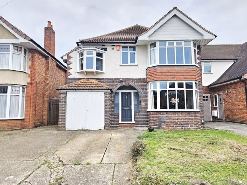
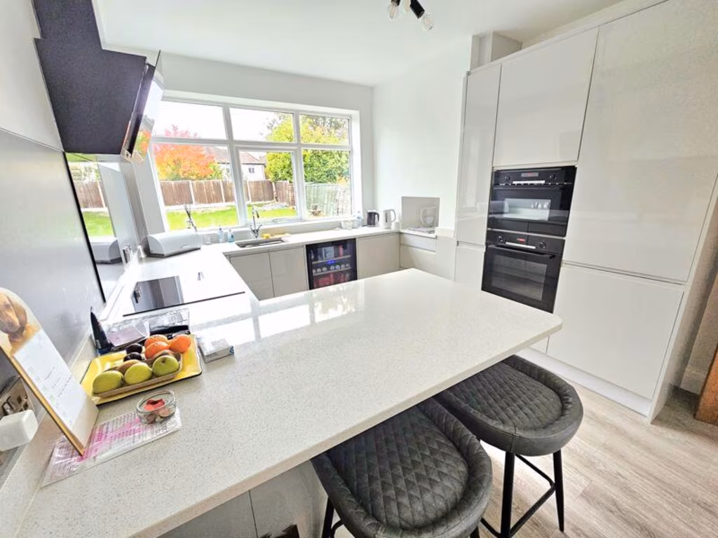
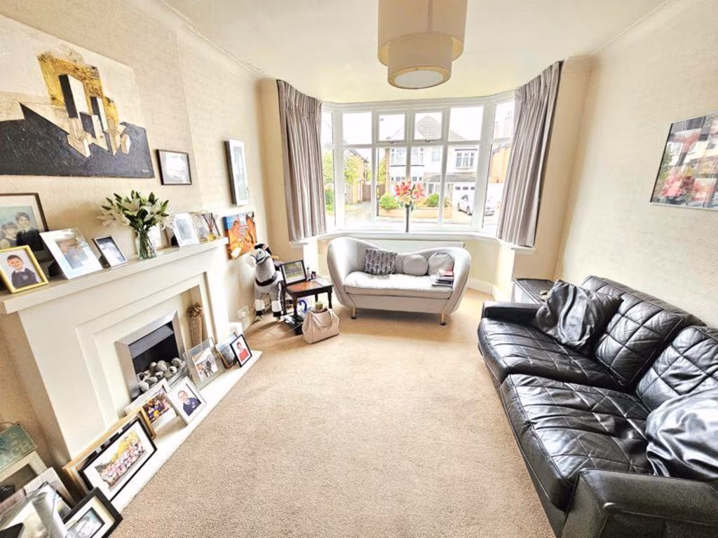
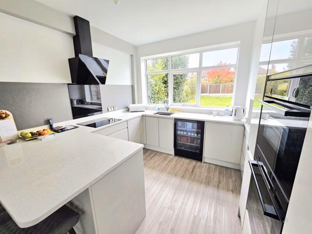
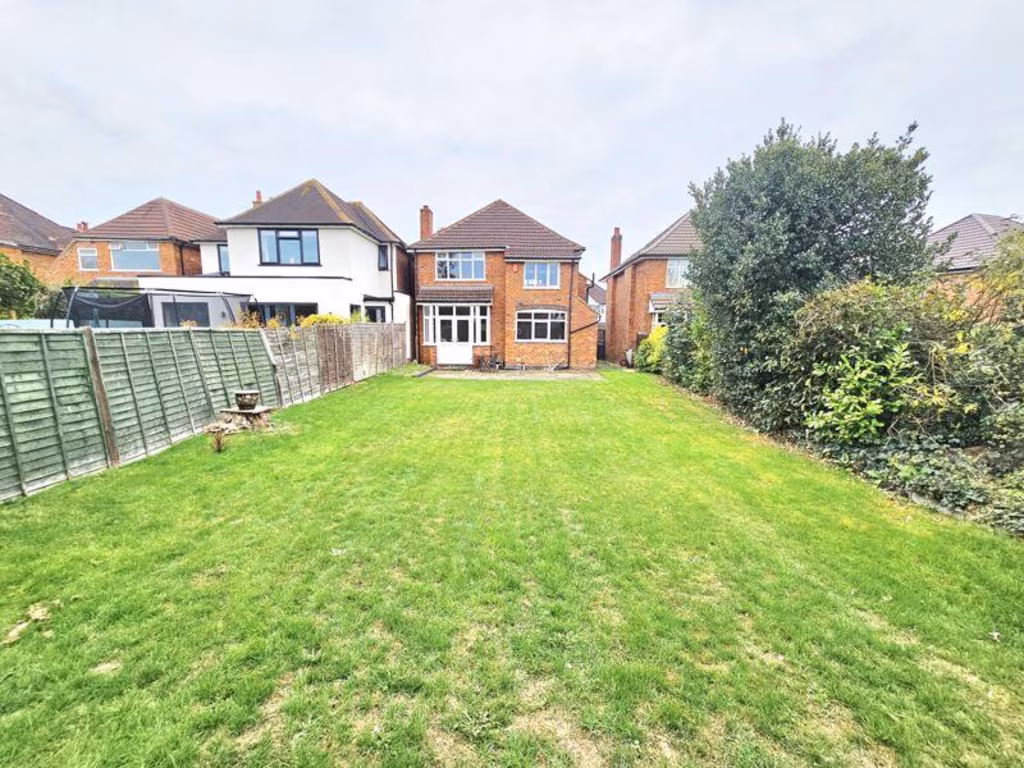
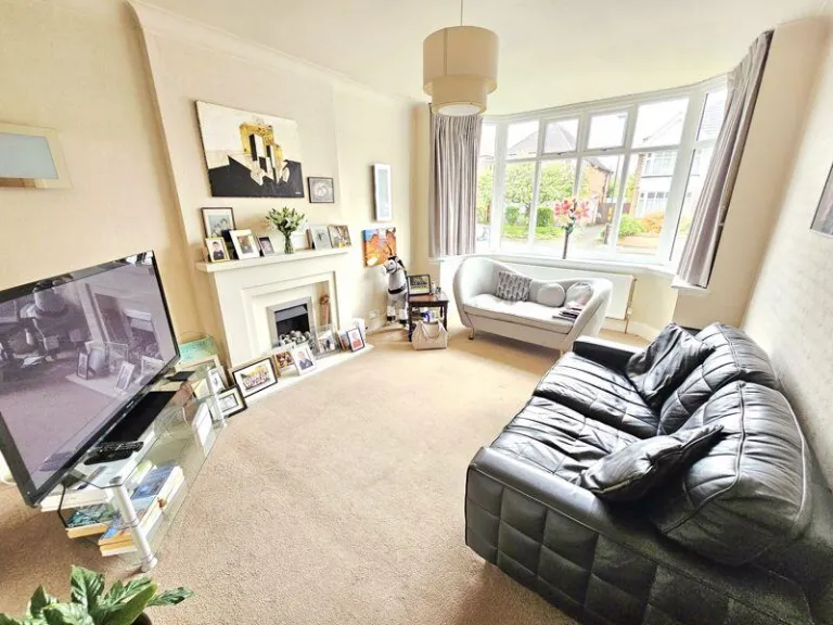
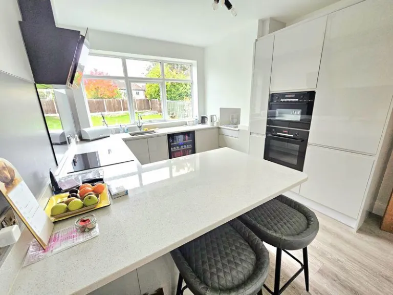
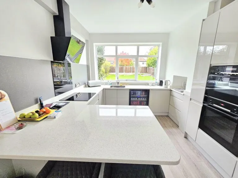
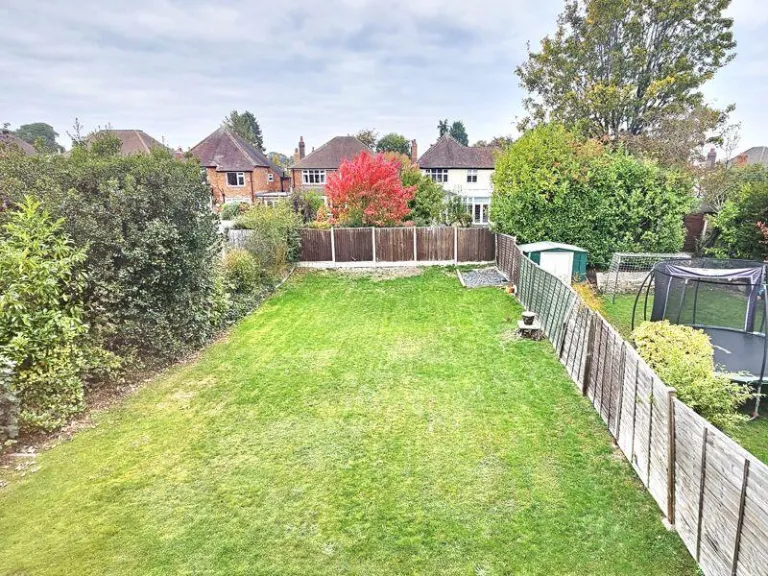
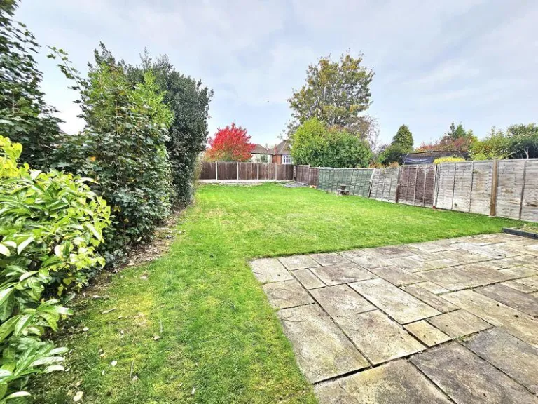
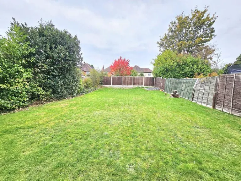
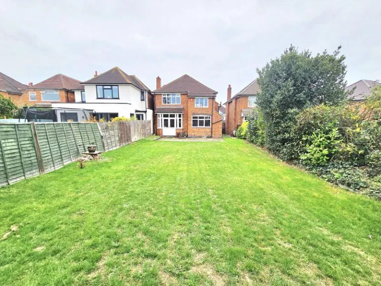
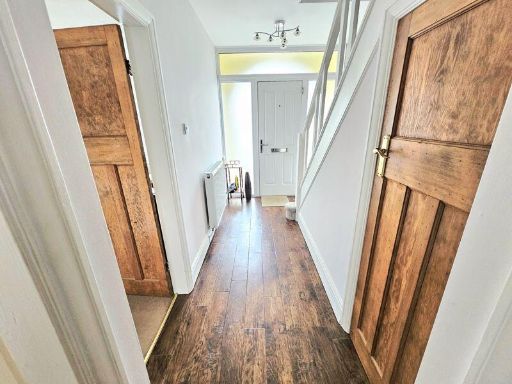
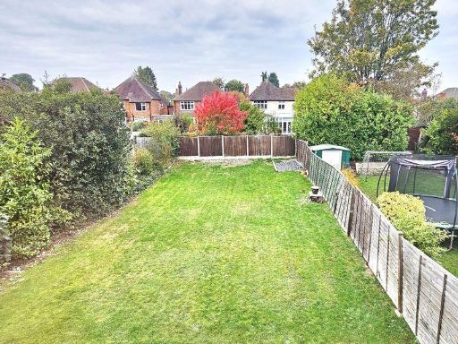
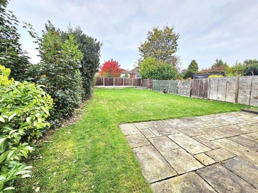
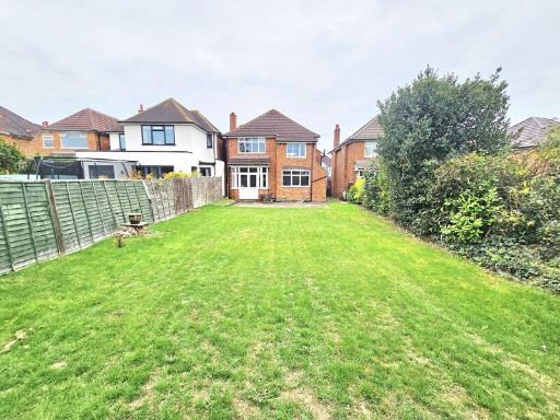
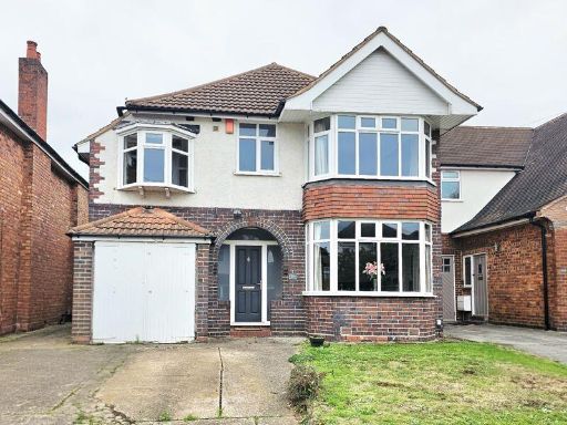
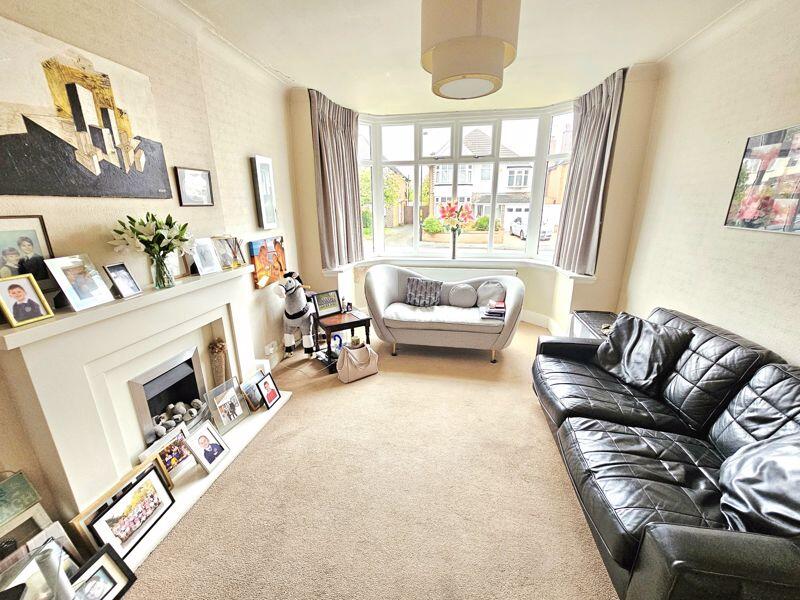
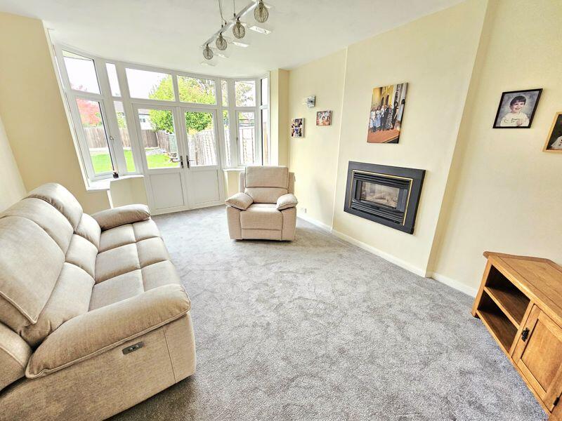
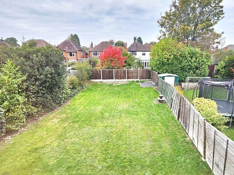
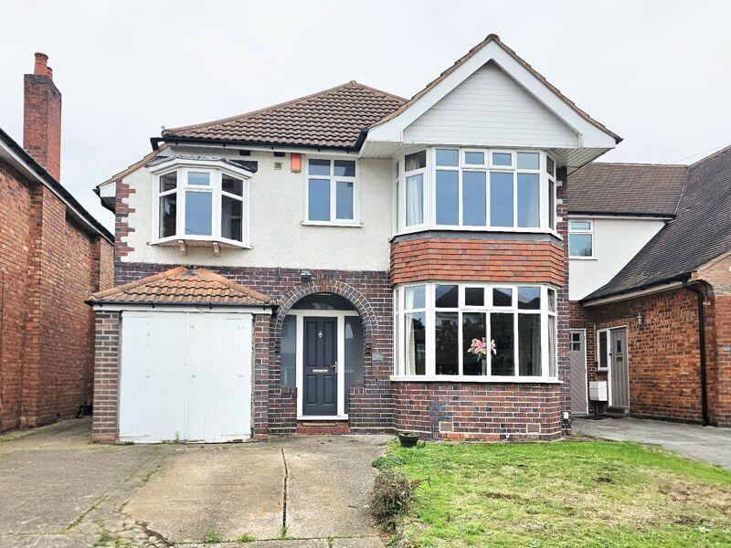
- Mid-20th century bay-fronted, two-storey semi-detached family house presented from the front elevation. Property has a single integral garage to the left with a driveway providing off-street parking for two cars and a small front lawn. External finish is mixed brick and roughcast render beneath a tiled roof; prominent bay windows to the ground and first floors indicate traditional room layouts with good natural light. Likely accommodation: entrance hall, front and rear reception rooms (one bay-fronted), kitchen off the rear, and first-floor bedrooms and bathroom (typical 3-bedroom plan). Garden to the front is small/average; rear garden not visible. Overall plot and house appear medium-sized and would suit a family; property offers scope for modernisation and potential to reconfigure or extend subject to planning. No exceptional views visible (street/residential setting).
Image Descriptions
- detached suburban house 1930s
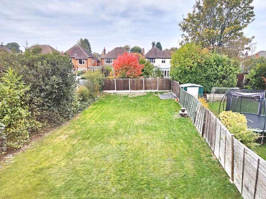
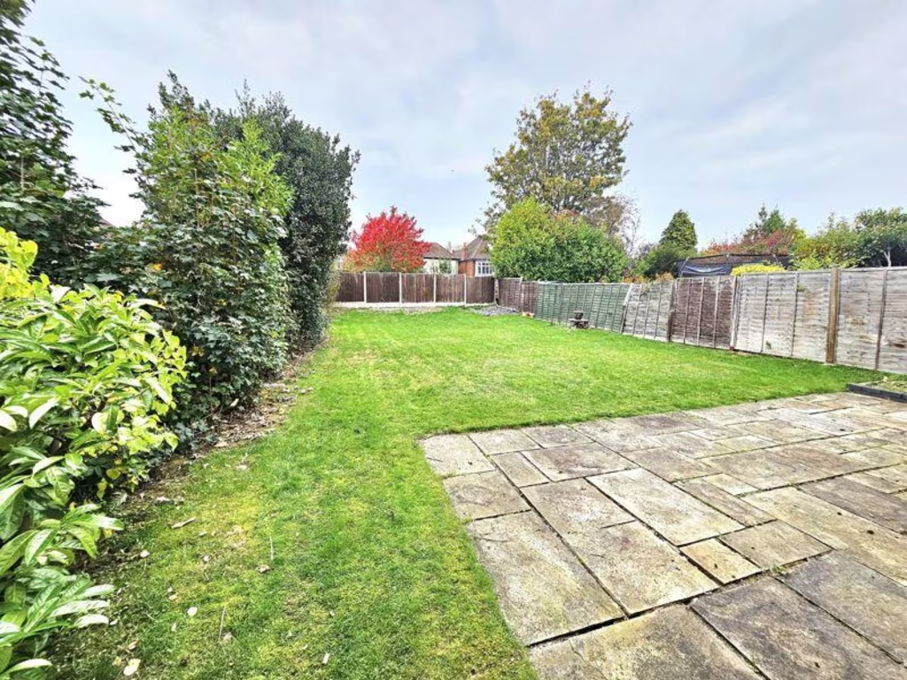
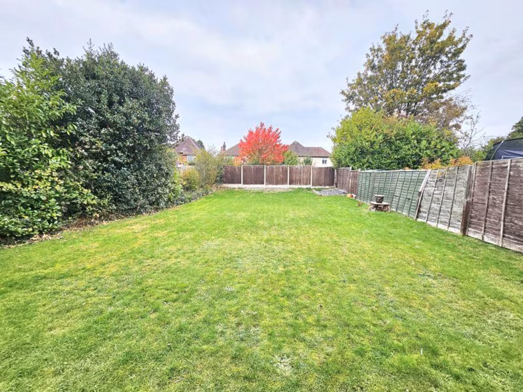
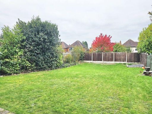
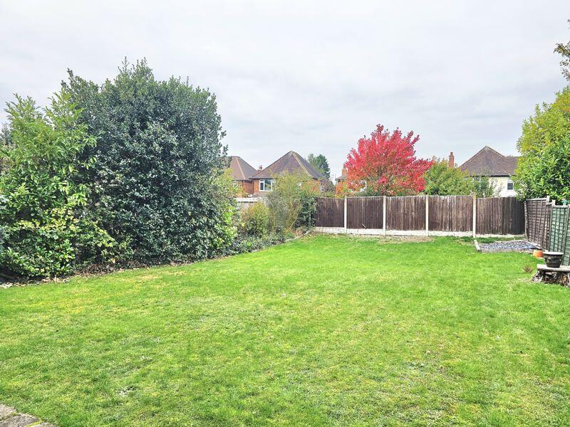
- residential garden
Floorplan Description
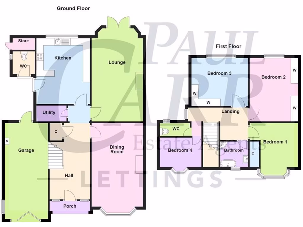
- Floorplan showing a ground floor and first floor layout with labeled rooms
Rooms
- Store:
- WC:
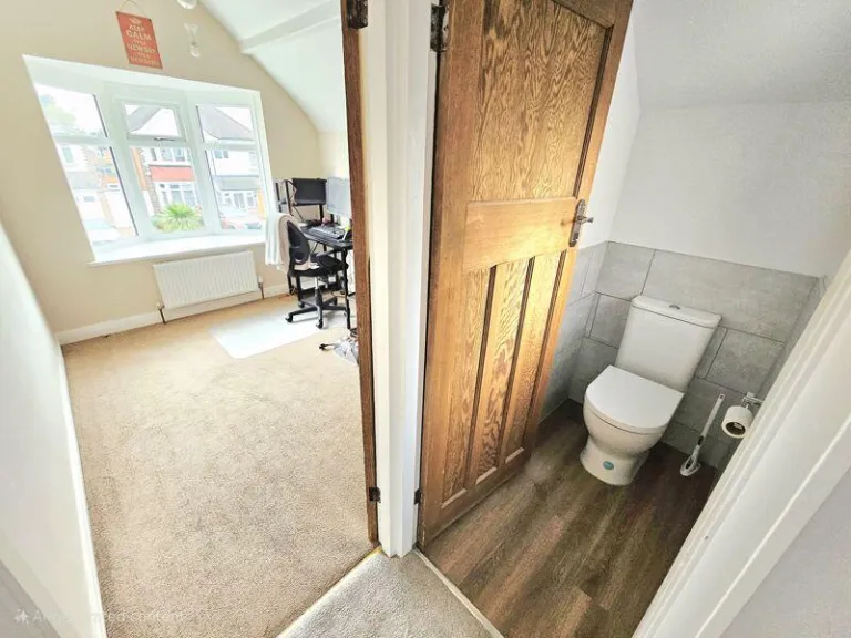
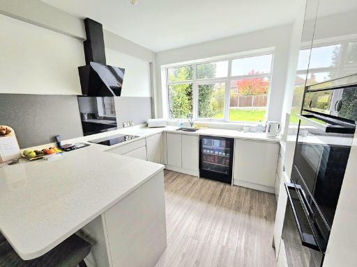
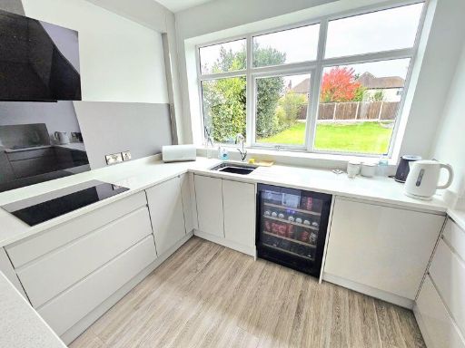
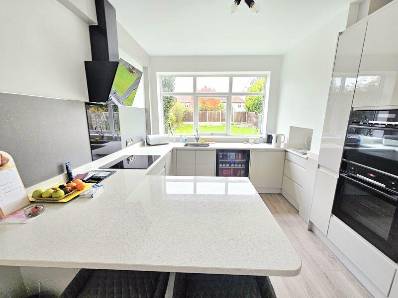
- Kitchen:
- Lounge:
- Utility:
- Garage:
- C:
- Dining Room:
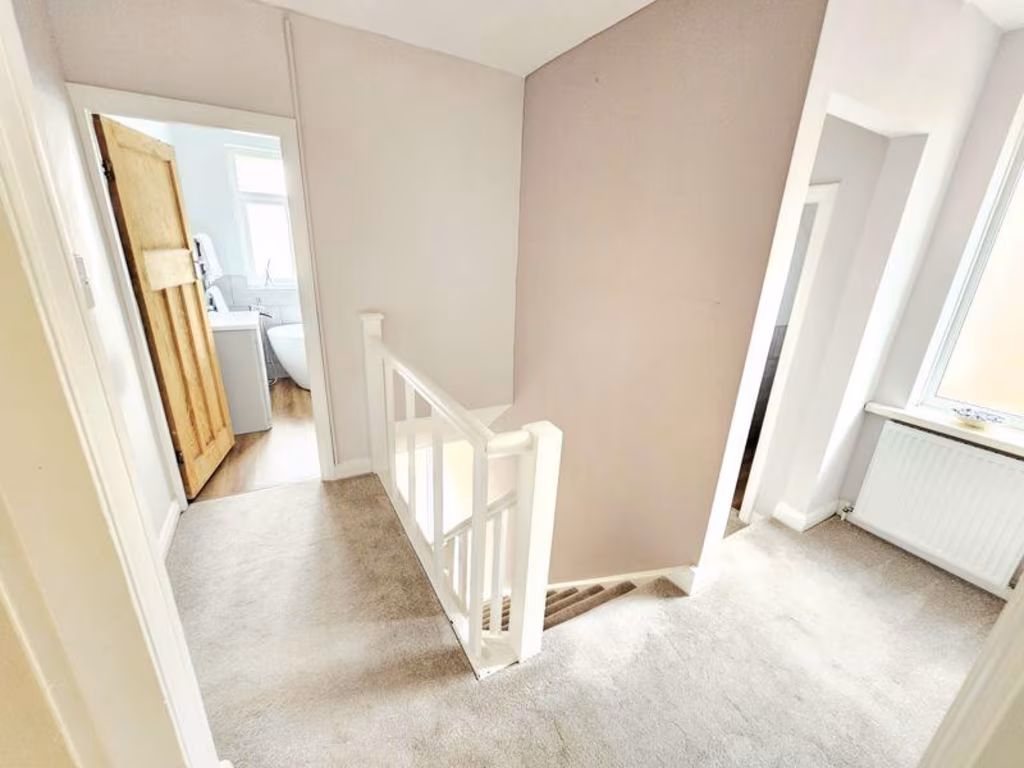
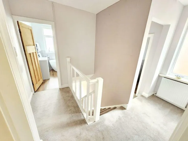
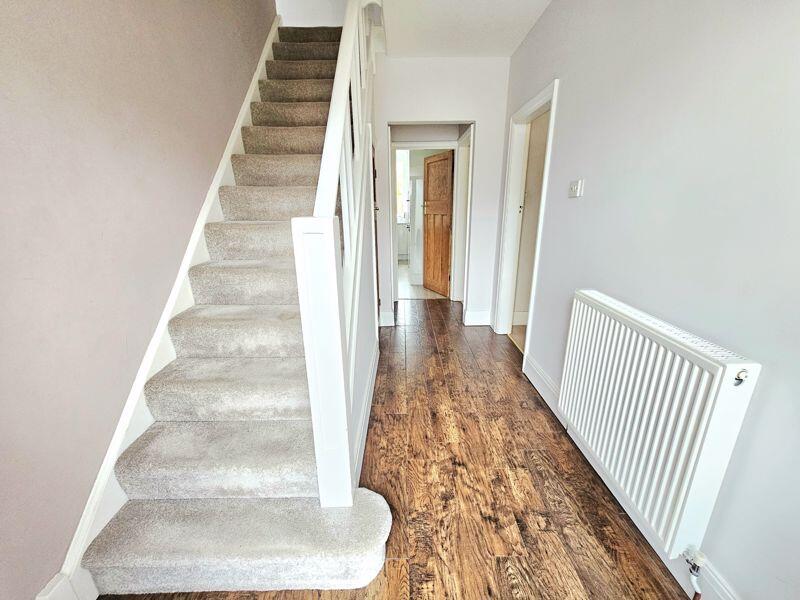
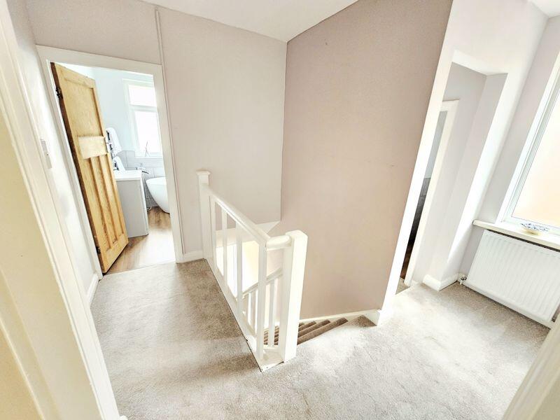
- Hall:
- Porch:
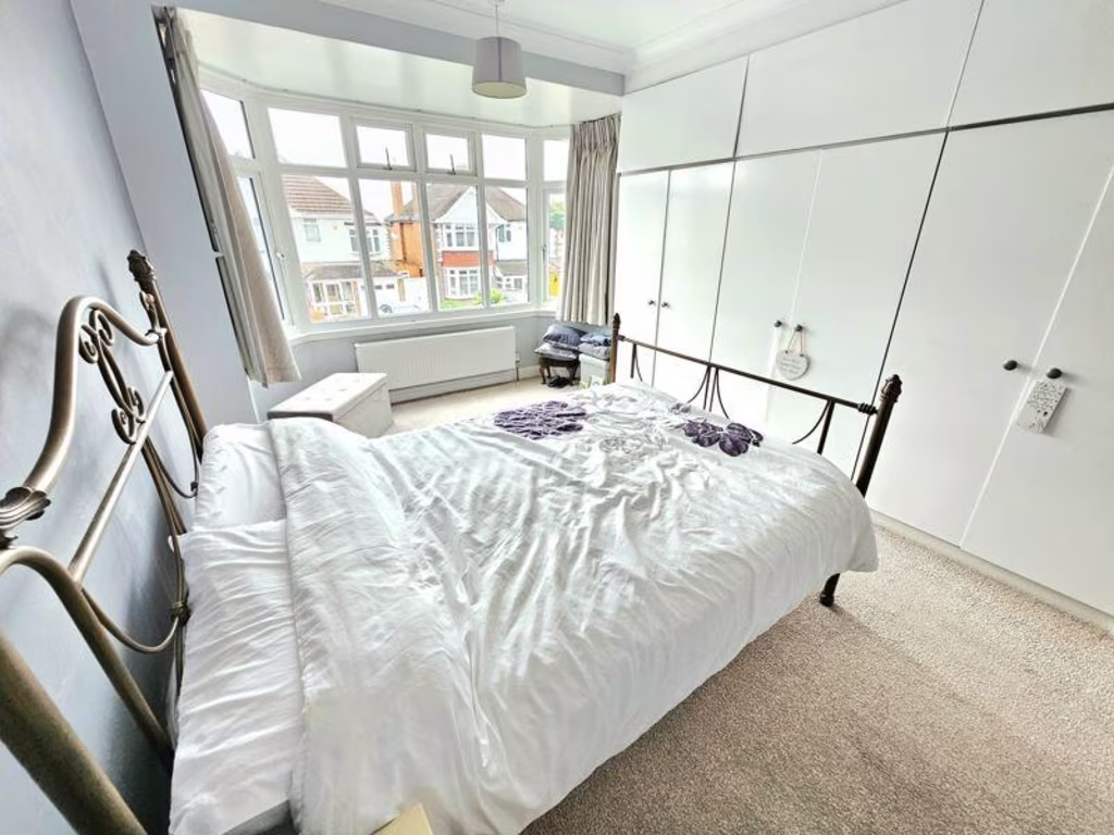
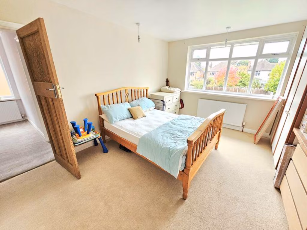
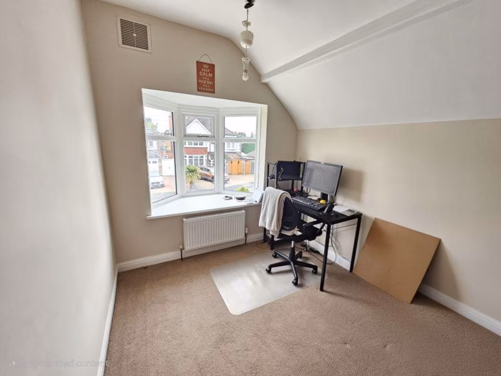
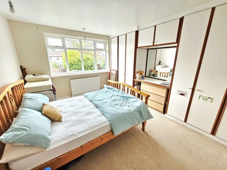
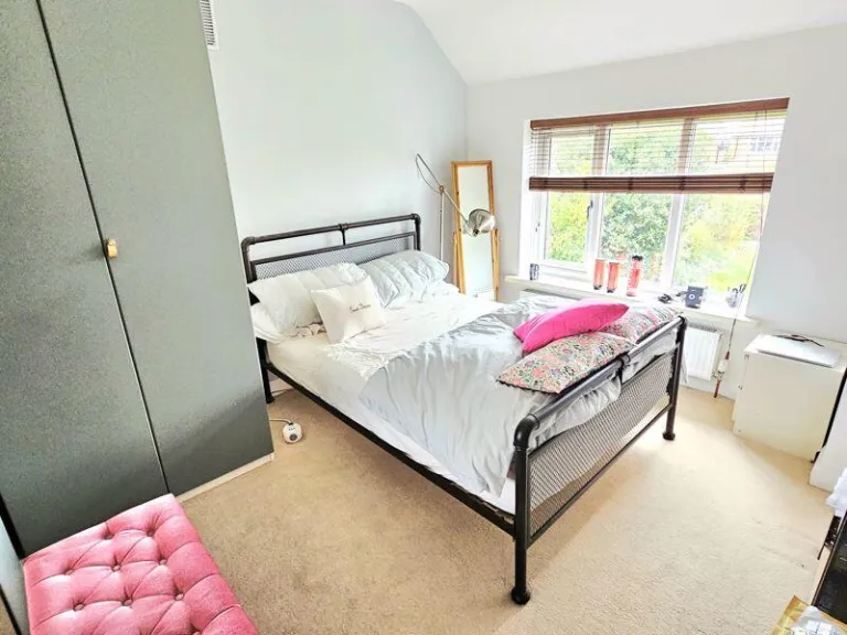
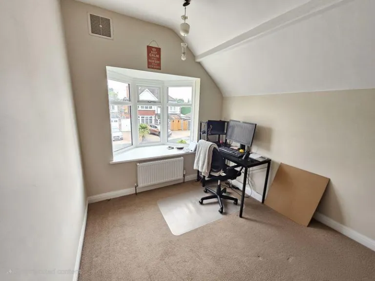
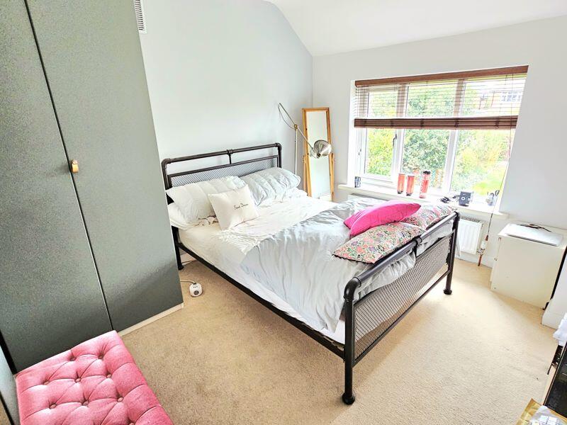
- Bedroom 3:
- Bedroom 2:
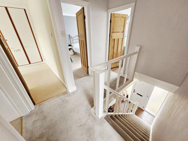
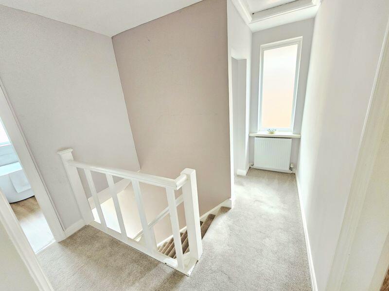
- Landing:
- Bedroom 4:
- Bedroom 1:
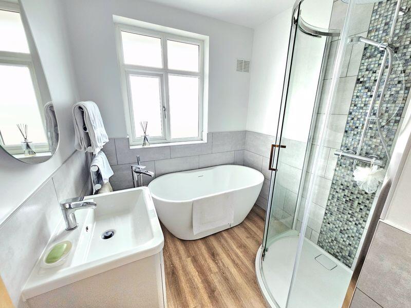
- Bathroom:
- WC:
Textual Property Features
Detected Visual Features
- 1930s house
- detached
- suburban
- bay windows
- brickwork
- garage
- garden
- fixer-upper
- dated exterior
- residential garden
- fenced yard
- mature trees
- family-friendly
- outdoor space
- lawn
EPC Details
- Fully double glazed
- Cavity wall, filled cavity
- Boiler and radiators, mains gas
- Low energy lighting in all fixed outlets
- Suspended, no insulation (assumed)
Nearby Schools
- St Mary and St John Junior and Infant School
- St Peter and St Paul RC Junior and Infant School
- Highclare School
- St Edmund Campion Catholic School
- Yenton Primary School
- St Margaret Mary RC Junior and Infant School
- Wylde Green Primary School
- Bishop Walsh Catholic School
- Sutton Coldfield Grammar School for Girls
- Abbey Catholic Primary School
- Boldmere Infant School and Nursery
- Erdington Academy
- Featherstone Primary School
- Osborne Primary School
- Boldmere Junior School
- Birches Green Primary School
- Saint Barnabas Church of England Primary School
- Imedia School
- Penns Primary School
- Oasis Academy Short Heath
- St Nicholas Catholic Primary School
- Maney Hill Primary School
- Town Junior School
- Holland House Infant School and Nursery
- Plantsbrook School
Nearest General Shops
- Id: 145043124
- Tags:
- Addr:
- City: Sutton Coldfield
- Housenumber: 370
- Street: Boldmere Road
- Building: retail
- Name: On The Tiles
- Shop: loft_conversions
- TagsNormalized:
- Lat: 52.5379264
- Lon: -1.8365447
- FullGeoHash: gcqdyhnxt7m4
- PartitionGeoHash: gcqd
- Images:
- FoodStandards: null
- Distance: 456
,- Id: 145043011
- Tags:
- Addr:
- City: Sutton Coldfield
- Housenumber: 366
- Street: Boldmere Road
- Building: retail
- Name: Decorative Plaster
- Shop: plaster_mouldings
- TagsNormalized:
- Lat: 52.5379866
- Lon: -1.8366503
- FullGeoHash: gcqdyhnxfyw3
- PartitionGeoHash: gcqd
- Images:
- FoodStandards: null
- Distance: 450.3
,- Id: 140065404
- Tags:
- Addr:
- City: Sutton Coldfield
- Housenumber: 361
- Postcode: B73 5HE
- Street: Boldmere Road
- Building: retail
- Name: TC's Gents Hair Design
- Shop: hairdresser
- TagsNormalized:
- Lat: 52.538101
- Lon: -1.8361174
- FullGeoHash: gcqdyhqbx7ge
- PartitionGeoHash: gcqd
- Images:
- FoodStandards: null
- Distance: 433.9
}
Nearest Grocery shops
- Id: 99347659
- Tags:
- Addr:
- City: Sutton Coldfield
- Housename: The Lanes Shopping Centre
- Postcode: B72 1YG
- Street: Birmingham Road
- Brand: Spar
- Brand:wikidata: Q610492
- Brand:wikipedia: en:SPAR (retailer)
- Building: retail
- Name: Spar
- Shop: convenience
- Source: BING & survey
- TagsNormalized:
- spar
- retail
- convenience
- shop
- Lat: 52.5375752
- Lon: -1.8274365
- FullGeoHash: gcqdykjm99ue
- PartitionGeoHash: gcqd
- Images:
- FoodStandards: null
- Distance: 745
,- Id: 159990287
- Tags:
- Addr:
- City: Sutton Coldfield
- Housenumber: 120
- Postcode: B73 5UB
- Street: Boldmere Road
- Brand: Tesco Express
- Brand:wikidata: Q98456772
- Building: yes
- Contact:
- Website: https://www.tesco.com/store-locator/sutton-coldfield/120-boldmere-rd
- Name: Tesco Express
- Shop: convenience
- TagsNormalized:
- tesco
- tesco express
- convenience
- shop
- Lat: 52.5468644
- Lon: -1.8411515
- FullGeoHash: gcqdyjg7dj3z
- PartitionGeoHash: gcqd
- Images:
- FoodStandards: null
- Distance: 654.4
,- Id: 145043119
- Tags:
- Addr:
- City: Sutton Coldfield
- Housenumber: 392
- Street: Boldmere Road
- Building: retail
- Name: Joshua's
- Shop: convenience
- Source:
- Postal_code: inferred from adjacent addresses
- TagsNormalized:
- Lat: 52.5373805
- Lon: -1.8363012
- FullGeoHash: gcqdyhnu7jdd
- PartitionGeoHash: gcqd
- Images:
- FoodStandards: null
- Distance: 514.7
}
Nearest Religious buildings
- Id: 145043000
- Tags:
- Addr:
- City: Sutton Coldfield
- Postcode: B73 5HU
- Street: Chester Road
- Amenity: place_of_worship
- Building: place_of_worship
- Denomination: baptist
- Fhrs:
- Id: 599973
- Local_authority_id: PI/000335558
- Name: Chester Road Baptist Church
- Religion: christian
- Source:
- TagsNormalized:
- place of worship
- baptist
- church
- christian
- Lat: 52.537114
- Lon: -1.8363691
- FullGeoHash: gcqdyhnfc7zu
- PartitionGeoHash: gcqd
- Images:
- FoodStandards: null
- Distance: 544.6
,- Id: 148691394
- Tags:
- Amenity: place_of_worship
- Building: yes
- Name: Livingwell Centre
- TagsNormalized:
- Lat: 52.5382943
- Lon: -1.8400064
- FullGeoHash: gcqdyhk1sxzv
- PartitionGeoHash: gcqd
- Images:
- FoodStandards: null
- Distance: 503.7
,- Id: 139263957
- Tags:
- Addr:
- City: Sutton Coldfield
- Street: Church Road
- Amenity: place_of_worship
- Building: church
- Denomination: anglican
- Name: St Michaels Church Boldmere
- Religion: christian
- Wikidata: Q105084637
- TagsNormalized:
- place of worship
- church
- anglican
- christian
- Lat: 52.5420805
- Lon: -1.839312
- FullGeoHash: gcqdyhuxuctw
- PartitionGeoHash: gcqd
- Images:
- FoodStandards: null
- Distance: 243.5
}
Nearest Airports
- Id: 2437117
- Tags:
- Aerodrome: international
- Aerodrome:type: public
- Aeroway: aerodrome
- Ele: 104
- Iata: BHX
- Icao: EGBB
- Internet_access: wlan
- Is_in: Birmingham,England,UK
- Name: Birmingham Airport
- Ref: BHX
- Type: multipolygon
- Website: https://www.birminghamairport.co.uk/
- Wikidata: Q8719
- Wikipedia: en:Birmingham Airport
- TagsNormalized:
- airport
- international airport
- Lat: 52.4543817
- Lon: -1.7468974
- FullGeoHash: gcqf2jpbym6y
- PartitionGeoHash: gcqf
- Images:
- FoodStandards: null
- Distance: 11448.1
}
Nearest Leisure Facilities
- Id: 140062063
- Tags:
- Access: private
- Barrier: fence
- Leisure: garden
- TagsNormalized:
- Lat: 52.5421239
- Lon: -1.835326
- FullGeoHash: gcqdyjp81cc9
- PartitionGeoHash: gcqd
- Images:
- FoodStandards: null
- Distance: 29.8
,- Id: 140062038
- Tags:
- Access: private
- Barrier: fence
- Leisure: garden
- TagsNormalized:
- Lat: 52.5420175
- Lon: -1.8361297
- FullGeoHash: gcqdyhyzrjfq
- PartitionGeoHash: gcqd
- Images:
- FoodStandards: null
- Distance: 28.2
,- Id: 140062055
- Tags:
- Access: private
- Barrier: fence
- Leisure: garden
- TagsNormalized:
- Lat: 52.5420986
- Lon: -1.8354602
- FullGeoHash: gcqdyhzrytjd
- PartitionGeoHash: gcqd
- Images:
- FoodStandards: null
- Distance: 20.6
,- Id: 140062086
- Tags:
- Access: private
- Barrier: fence
- Leisure: garden
- TagsNormalized:
- Lat: 52.5420704
- Lon: -1.8356059
- FullGeoHash: gcqdyhzrerc4
- PartitionGeoHash: gcqd
- Images:
- FoodStandards: null
- Distance: 11
,- Id: 140062194
- Tags:
- Access: private
- Barrier: fence
- Leisure: garden
- TagsNormalized:
- Lat: 52.542051
- Lon: -1.8357685
- FullGeoHash: gcqdyhzpxkpy
- PartitionGeoHash: gcqd
- Images:
- FoodStandards: null
- Distance: 7.2
}
Nearest Tourist attractions
- Id: 156322414
- Tags:
- Addr:
- City: Birmingham
- Housenumber: 85
- Postcode: B23 5XA
- Street: Sutton Road
- Building: commercial
- Name: Sutton Guest House
- Tourism: guest_house
- TagsNormalized:
- Lat: 52.5311669
- Lon: -1.8309054
- FullGeoHash: gcqdy74b0z3b
- PartitionGeoHash: gcqd
- Images:
- FoodStandards: null
- Distance: 1247.3
,- Id: 101941111
- Tags:
- Addr:
- City: Birmingham
- Housenumber: 747
- Postcode: B24 0BY
- Street: Chester Road
- Building: retail
- Name: Glen Guest House
- Tourism: guest_house
- TagsNormalized:
- Lat: 52.5327856
- Lon: -1.8268702
- FullGeoHash: gcqdy7m9wv4b
- PartitionGeoHash: gcqd
- Images:
- FoodStandards: null
- Distance: 1186
,- Id: 101940954
- Tags:
- Addr:
- City: Birmingham
- Housenumber: 745
- Postcode: B24 0BY
- Street: Chester Road
- Building: retail
- Fhrs:
- Name: Chester Guest House
- Tourism: guest_house
- TagsNormalized:
- Lat: 52.5328294
- Lon: -1.8269549
- FullGeoHash: gcqdy7m9uv5t
- PartitionGeoHash: gcqd
- Images:
- FoodStandards: null
- Distance: 1178.9
}
Nearest Train stations
- Id: 653044
- Tags:
- Name: Gravelly Hill
- Naptan:
- Network: National Rail
- Public_transport: station
- Railway: station
- Ref:
- West_midlands_fare_zone: 2
- Wikidata: Q2098592
- Wikipedia: en:Gravelly Hill railway station
- TagsNormalized:
- Lat: 52.5153876
- Lon: -1.8527077
- FullGeoHash: gcqdvb4ukcc1
- PartitionGeoHash: gcqd
- Images:
- FoodStandards: null
- Distance: 3174.2
,- Id: 653041
- Tags:
- Name: Sutton Coldfield
- Naptan:
- Network: National Rail
- Public_transport: station
- Railway: station
- Ref:
- West_midlands_fare_zone: 4
- Wikidata: Q525739
- Wikipedia: en:Sutton Coldfield railway station
- TagsNormalized:
- Lat: 52.5647207
- Lon: -1.8252548
- FullGeoHash: gcqen3ngsqpk
- PartitionGeoHash: gcqe
- Images:
- FoodStandards: null
- Distance: 2624
,- Id: 653032
- Tags:
- Name: Erdington
- Naptan:
- Network: National Rail
- Public_transport: station
- Railway: station
- Ref:
- West_midlands_fare_zone: 3
- Wheelchair: yes
- Wikidata: Q2415516
- Wikipedia: en:Erdington railway station
- TagsNormalized:
- Lat: 52.5285663
- Lon: -1.8392253
- FullGeoHash: gcqdy4s9nfqp
- PartitionGeoHash: gcqd
- Images:
- FoodStandards: null
- Distance: 1512.1
,- Id: 653033
- Tags:
- Name: Chester Road
- Naptan:
- Network: National Rail
- Public_transport: station
- Railway: station
- Ref:
- West_midlands_fare_zone: 3
- Wheelchair: yes
- Wikidata: Q2405727
- Wikipedia: en:Chester Road railway station
- TagsNormalized:
- Lat: 52.5357946
- Lon: -1.8324576
- FullGeoHash: gcqdy7cehtut
- PartitionGeoHash: gcqd
- Images:
- FoodStandards: null
- Distance: 723.9
,- Id: 27181044
- Tags:
- Name: Wylde Green
- Naptan:
- Network: National Rail
- Public_transport: station
- Railway: station
- Ref:
- West_midlands_fare_zone: 4
- Wheelchair: yes
- Wheelchair:description: Book ramps before travelling.
- Wikidata: Q1840659
- Wikipedia: en:Wylde Green railway station
- TagsNormalized:
- Lat: 52.545628
- Lon: -1.8314247
- FullGeoHash: gcqdymdkkxnb
- PartitionGeoHash: gcqd
- Images:
- FoodStandards: null
- Distance: 497.2
}
Nearest Hotels
- Id: 98900137
- Tags:
- Addr:
- City: Sutton Coldfield
- Housenumber: 138
- Postcode: B72 1LY
- Street: Birmingham Road
- Building: hotel
- Fhrs:
- Name: Standbridge Hotel
- Tourism: hotel
- TagsNormalized:
- Lat: 52.5512583
- Lon: -1.8263531
- FullGeoHash: gcqdyqwj6bs6
- PartitionGeoHash: gcqd
- Images:
- FoodStandards: null
- Distance: 1208.9
,- Id: 83402499
- Tags:
- Addr:
- City: Sutton Coldfield
- Country: GB
- Postcode: B73 5UP
- Street: Boldmere Road
- Brand: Travelodge
- Brand:wikidata: Q9361374
- Brand:wikipedia: en:Travelodge UK
- Building: retail
- Contact:
- Website: https://www.travelodge.co.uk/hotels/181/Birmingham-Sutton-Coldfield-hotel
- Fhrs:
- Authority: Birmingham
- Id: 600797
- Local_authority_id: PI/000438786
- Internet_access: wlan
- Internet_access:fee: customers
- Internet_access:ssid: Travelodge WiFi
- Name: Travelodge
- Source: visual survey; estimate
- Tourism: hotel
- TagsNormalized:
- Lat: 52.5480639
- Lon: -1.8401067
- FullGeoHash: gcqdynh4dmhf
- PartitionGeoHash: gcqd
- Images:
- FoodStandards: null
- Distance: 737.2
,- Id: 99040915
- Tags:
- Addr:
- City: Sutton Coldfield
- Housename: Westfield Court Hotel
- Housenumber: ?
- Postcode: B72 1DJ
- Street: Birmingham Road
- Building: hotel
- Fhrs:
- Name: Westfield Court Hotel
- Tourism: hotel
- TagsNormalized:
- Lat: 52.5417645
- Lon: -1.8259565
- FullGeoHash: gcqdykymunu1
- PartitionGeoHash: gcqd
- Images:
- FoodStandards: null
- Distance: 660.4
}
Tags
- 1930s house
- detached
- suburban
- bay windows
- brickwork
- garage
- garden
- fixer-upper
- dated exterior
- residential garden
- fenced yard
- mature trees
- suburban
- family-friendly
- outdoor space
- lawn
Local Market Stats
- Average Price/sqft: £324
- Avg Income: £52400
- Rental Yield: 3.4%
- Social Housing: 9%
- Planning Success Rate: 86%
AirBnB Data
- 1km average: £50/night
- Listings in 1km: 1
Similar Properties
 4 bedroom detached house for sale in Hillcrest Road, Sutton Coldfield, B72 1EG, B72 — £515,000 • 4 bed • 2 bath • 1174 ft²
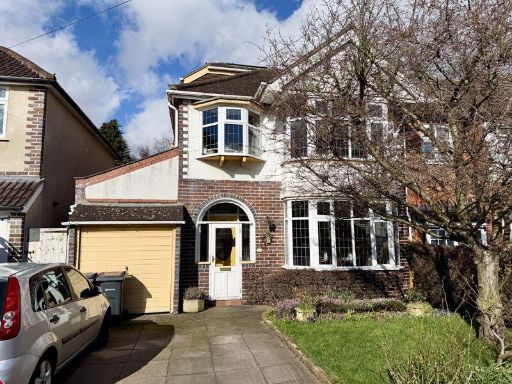 4 bedroom detached house for sale in New Church Road, Sutton Coldfield, B73 5RT, B73 — £495,000 • 4 bed • 1 bath • 1456 ft²
 4 bedroom detached house for sale in Beacon Road, Sutton Coldfield, B73 5SX, B73 — £585,000 • 4 bed • 1 bath
 4 bedroom detached house for sale in Potter Close, New Oscott, Birmingham, B23 5YU, B23 — £375,000 • 4 bed • 2 bath
 3 bedroom semi-detached house for sale in Moss Drive, Sutton Coldfield, Birmingham, B72 1JQ, B72 — £425,000 • 3 bed • 1 bath
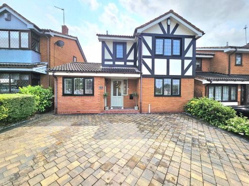 4 bedroom detached house for sale in Roddis Close, New Oscott, Birmingham, B23 5XD, B23 — £400,000 • 4 bed • 3 bath • 1066 ft²
Meta
- {
"@context": "https://schema.org",
"@type": "Residence",
"name": "4 bedroom detached house for sale in Nadin Road, Sutton Col…",
"description": "",
"url": "https://propertypiper.co.uk/property/643f5f9b-8868-4d62-a9fa-38d240f95544",
"image": "https://image-a.propertypiper.co.uk/3a188a40-ca30-49a9-8f62-252ac8a2b608-1024.jpeg",
"address": {
"@type": "PostalAddress",
"streetAddress": "18 NADIN ROAD, SUTTON COLDFIELD",
"postalCode": "B73 5RH",
"addressLocality": "Birmingham",
"addressRegion": "Sutton Coldfield",
"addressCountry": "England"
},
"geo": {
"@type": "GeoCoordinates",
"latitude": 52.54199586699453,
"longitude": -1.8357137727266337
},
"numberOfRooms": 4,
"numberOfBathroomsTotal": 1,
"floorSize": {
"@type": "QuantitativeValue",
"value": 1335,
"unitCode": "FTK"
},
"offers": {
"@type": "Offer",
"price": 620000,
"priceCurrency": "GBP",
"availability": "https://schema.org/InStock"
},
"additionalProperty": [
{
"@type": "PropertyValue",
"name": "Feature",
"value": "1930s house"
},
{
"@type": "PropertyValue",
"name": "Feature",
"value": "detached"
},
{
"@type": "PropertyValue",
"name": "Feature",
"value": "suburban"
},
{
"@type": "PropertyValue",
"name": "Feature",
"value": "bay windows"
},
{
"@type": "PropertyValue",
"name": "Feature",
"value": "brickwork"
},
{
"@type": "PropertyValue",
"name": "Feature",
"value": "garage"
},
{
"@type": "PropertyValue",
"name": "Feature",
"value": "garden"
},
{
"@type": "PropertyValue",
"name": "Feature",
"value": "fixer-upper"
},
{
"@type": "PropertyValue",
"name": "Feature",
"value": "dated exterior"
},
{
"@type": "PropertyValue",
"name": "Feature",
"value": "residential garden"
},
{
"@type": "PropertyValue",
"name": "Feature",
"value": "fenced yard"
},
{
"@type": "PropertyValue",
"name": "Feature",
"value": "mature trees"
},
{
"@type": "PropertyValue",
"name": "Feature",
"value": "suburban"
},
{
"@type": "PropertyValue",
"name": "Feature",
"value": "family-friendly"
},
{
"@type": "PropertyValue",
"name": "Feature",
"value": "outdoor space"
},
{
"@type": "PropertyValue",
"name": "Feature",
"value": "lawn"
}
]
}
High Res Floorplan Images
Compatible Floorplan Images
FloorplanImages Thumbnail