ME10 5LD - 6 bedroom detached house for sale in Trona Court, Sittingbo…
View on Property Piper
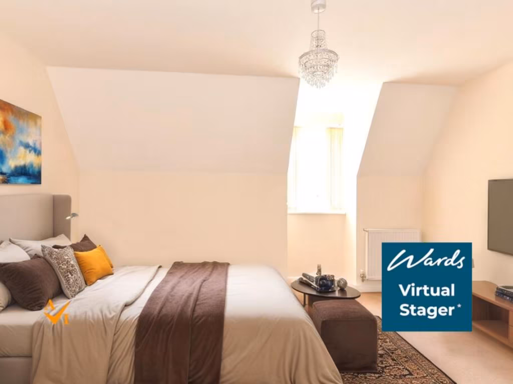
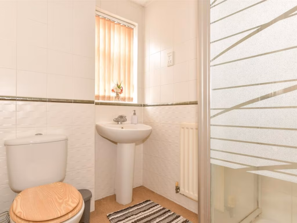
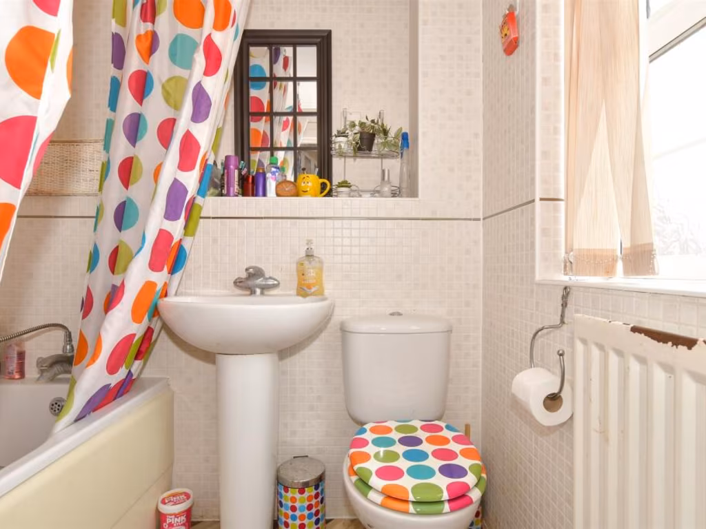
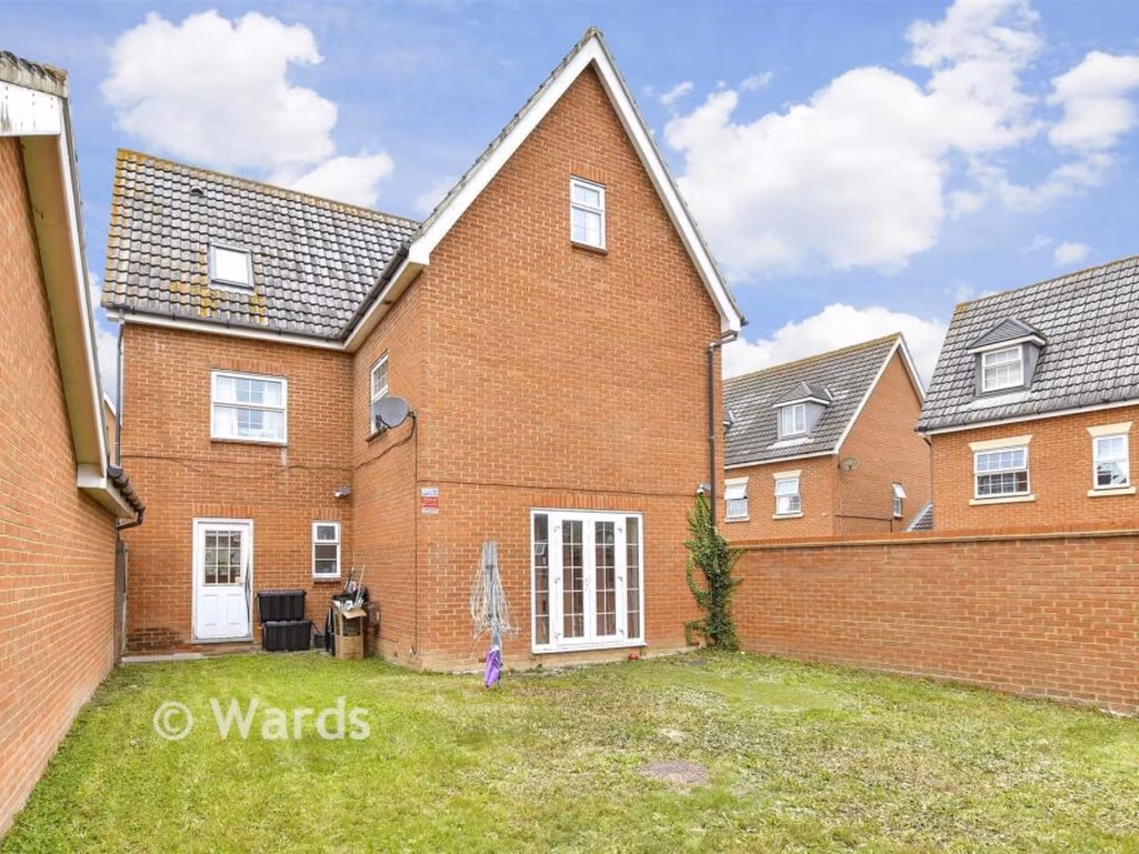
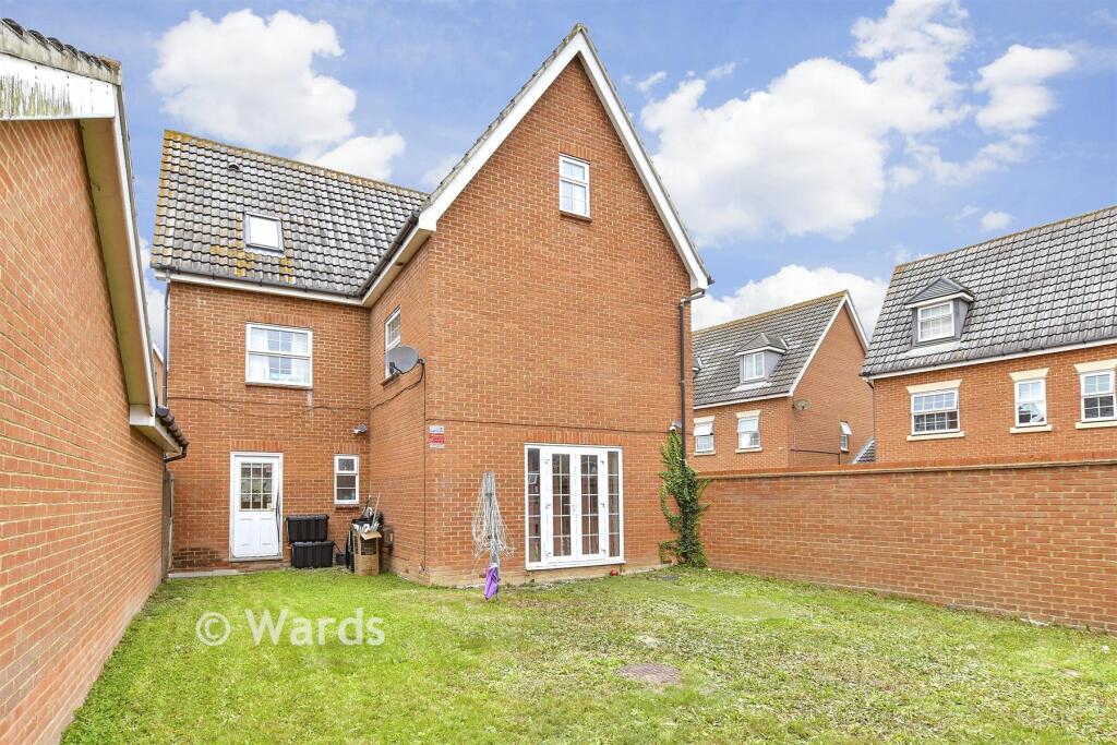
6 bedroom detached house for sale in Trona Court, Sittingbourne, Kent, ME10
Property Details
- Price: £485000
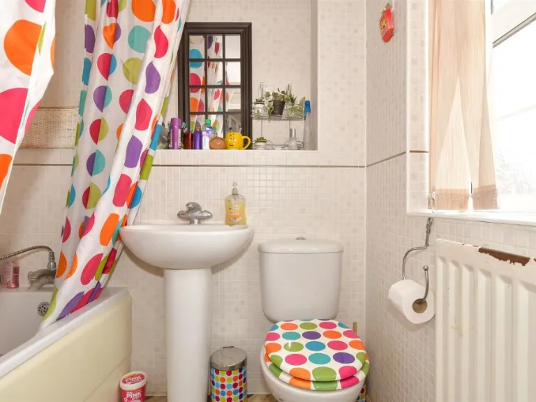
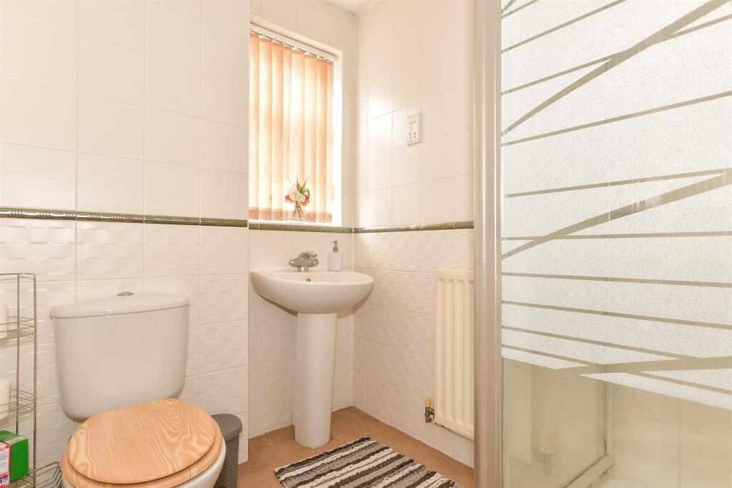
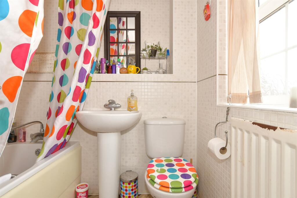
- Bedrooms: 6
- Bathrooms: 3
- Property Type: undefined
- Property SubType: undefined
Image Descriptions
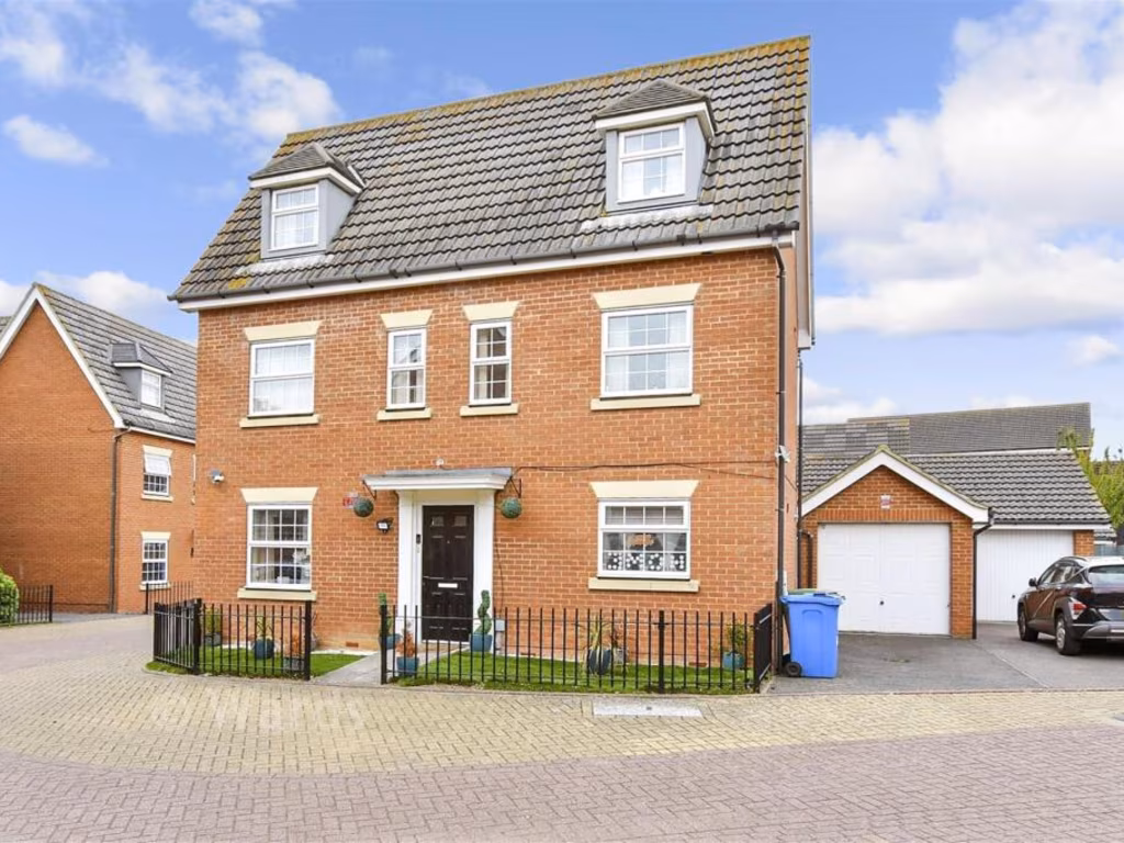
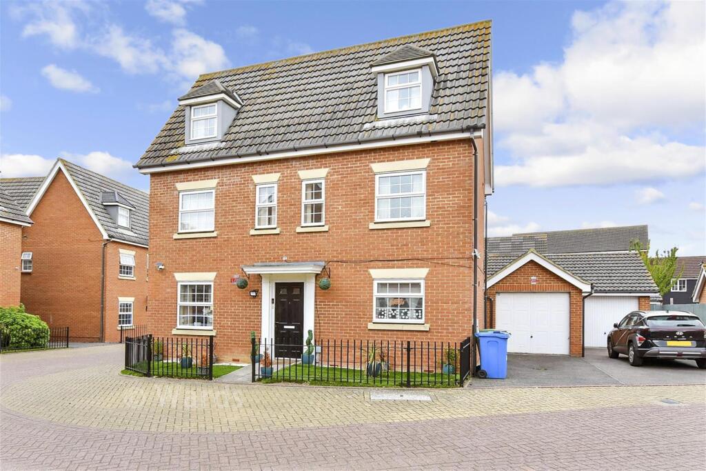
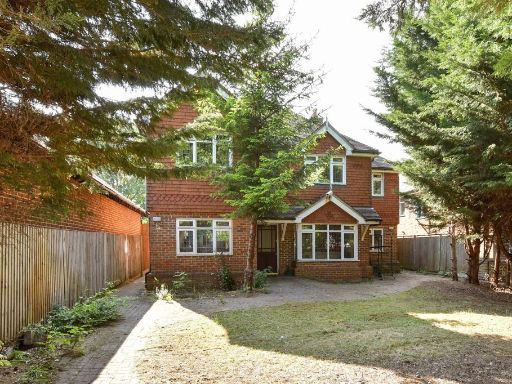
- detached house modern
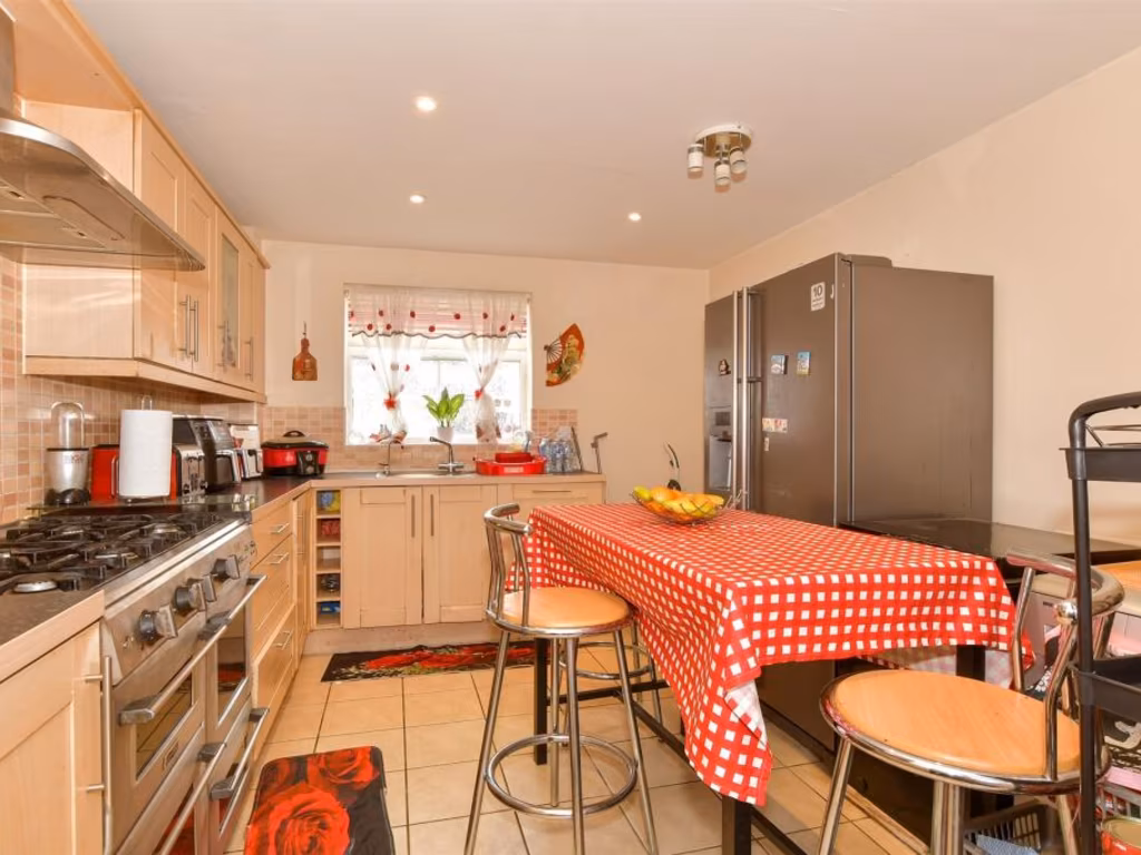
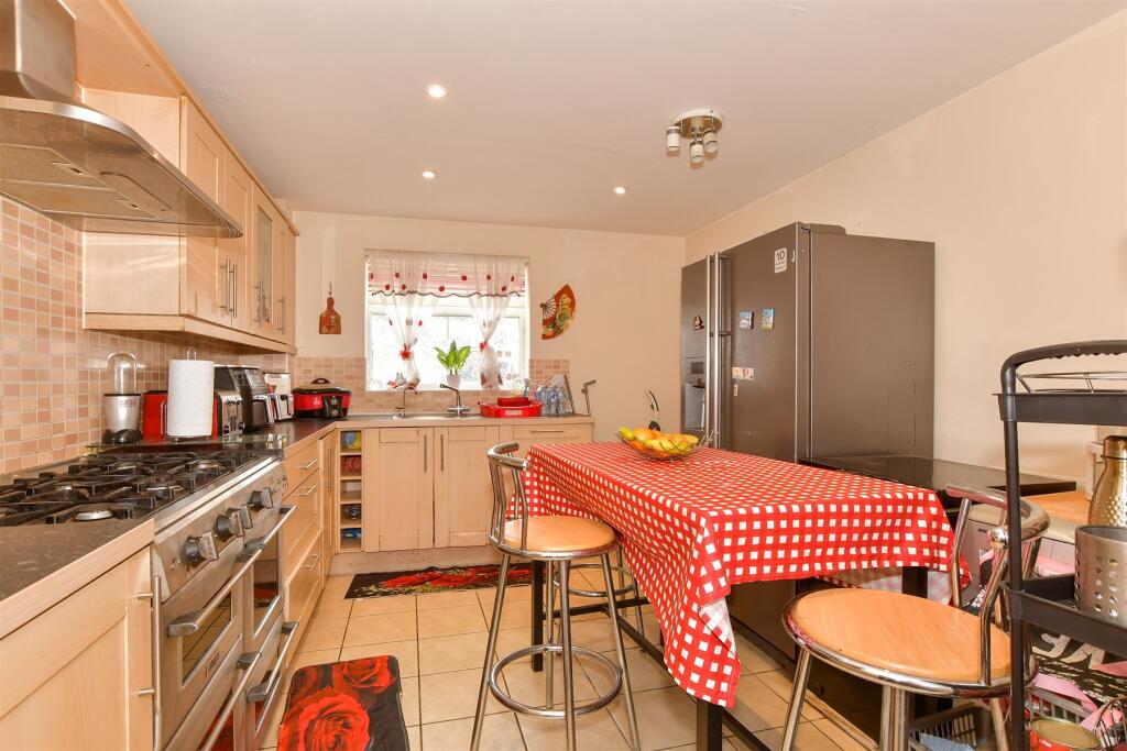
- kitchen contemporary
Floorplan Description
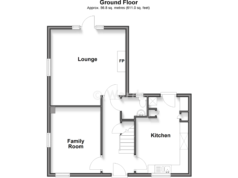
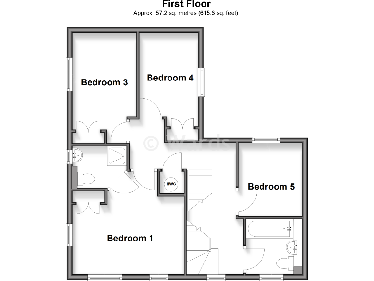
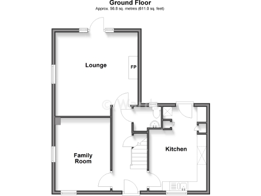
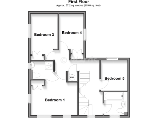
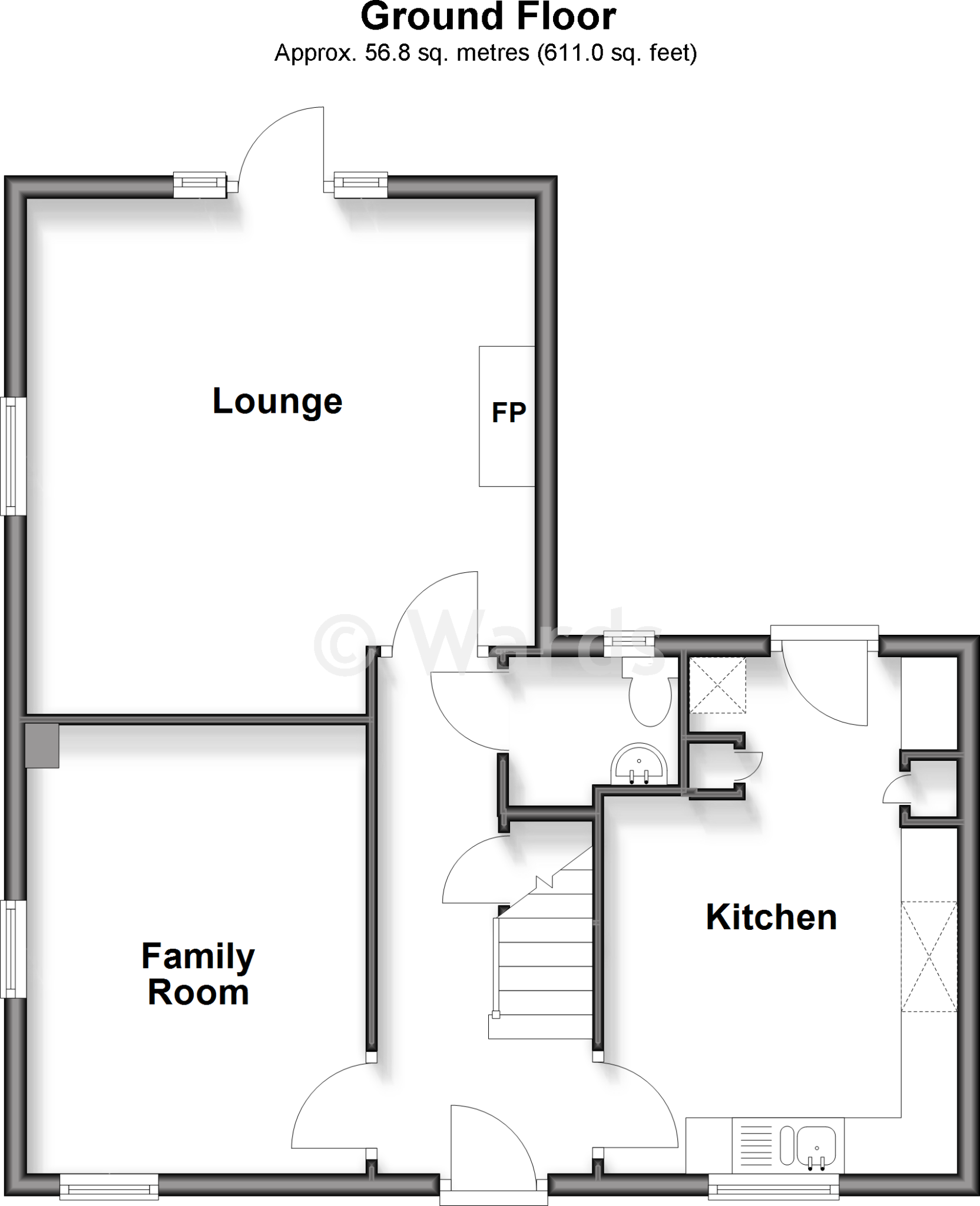
- Ground floor plan showing Lounge, Family Room and Kitchen.
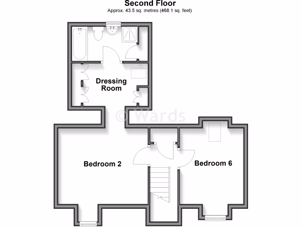
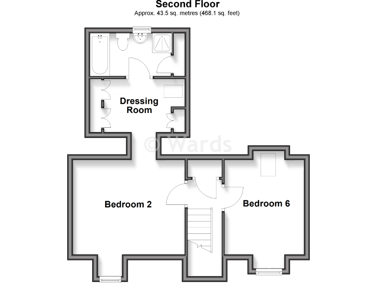
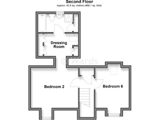
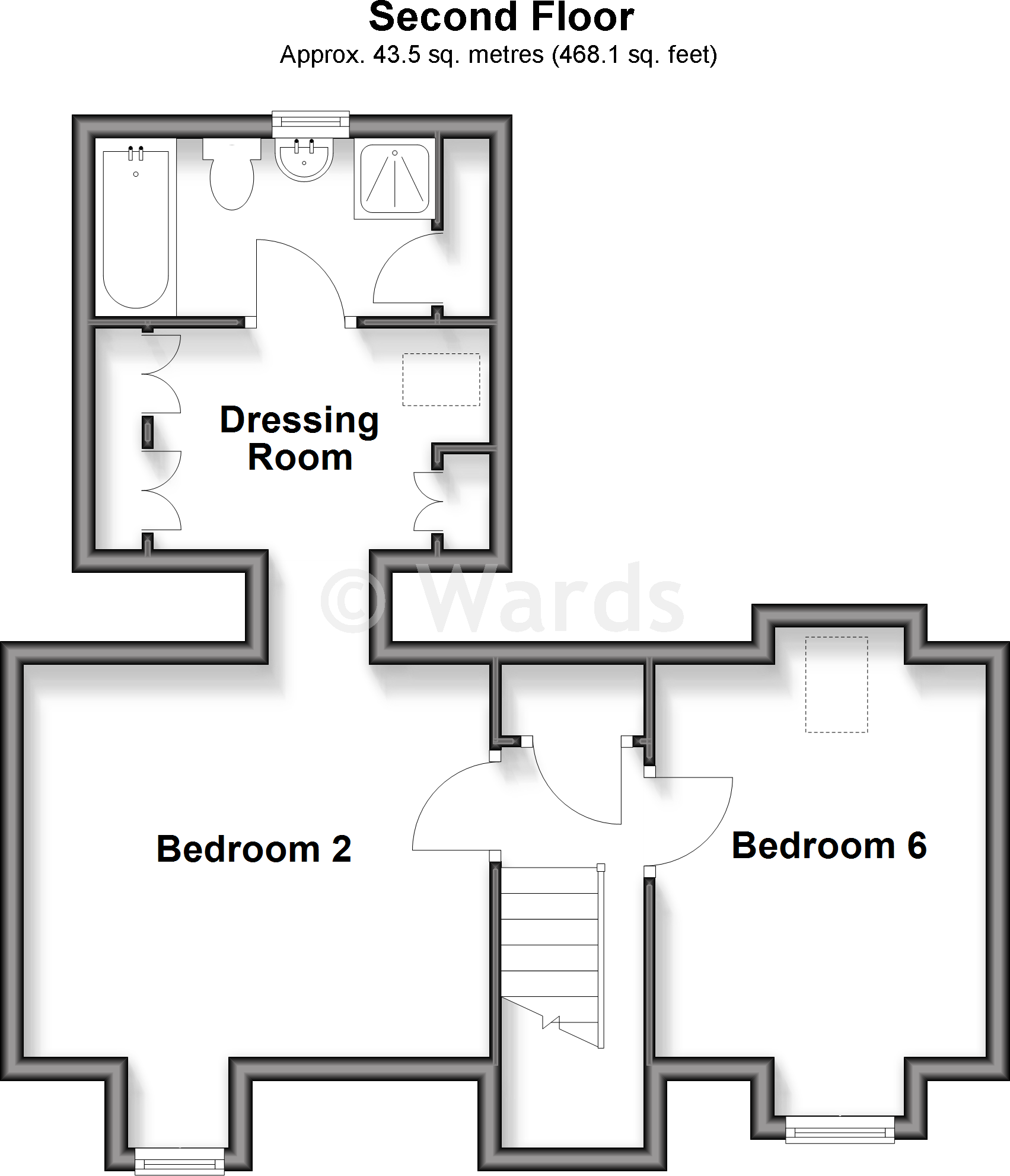
- Floor plan showing Dressing Room, Bedroom 2, Bedroom 6 and a staircase/landing area (labels visible).
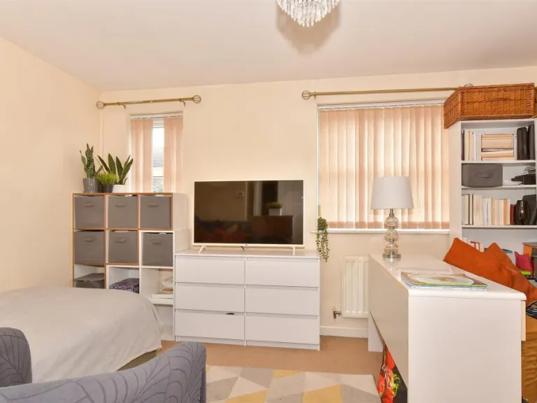
Rooms
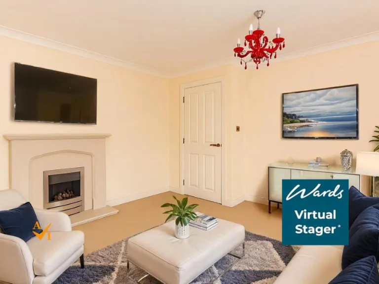
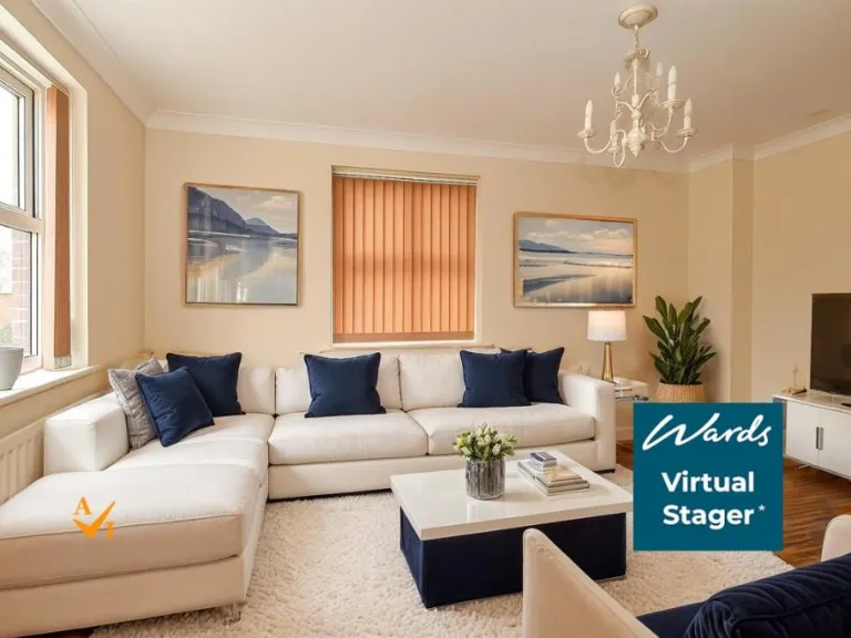
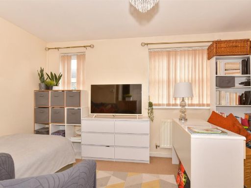
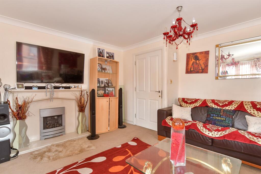
- Lounge:
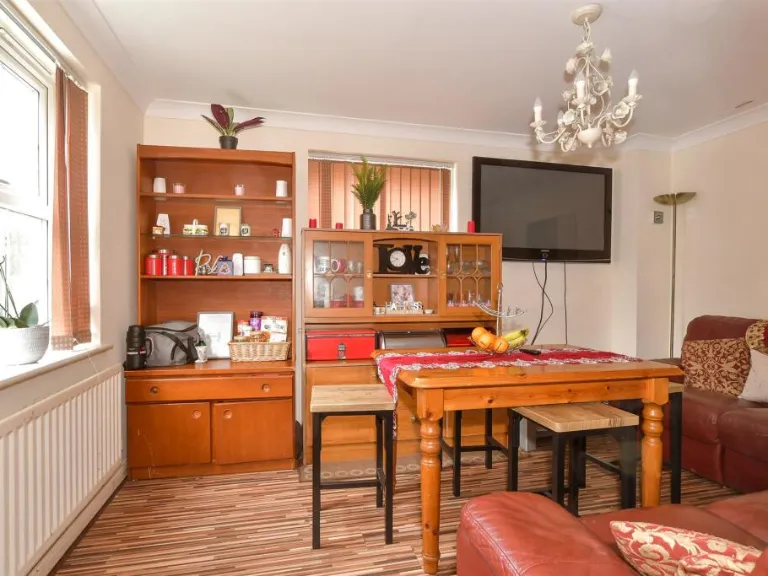
- Family Room:
- Kitchen:
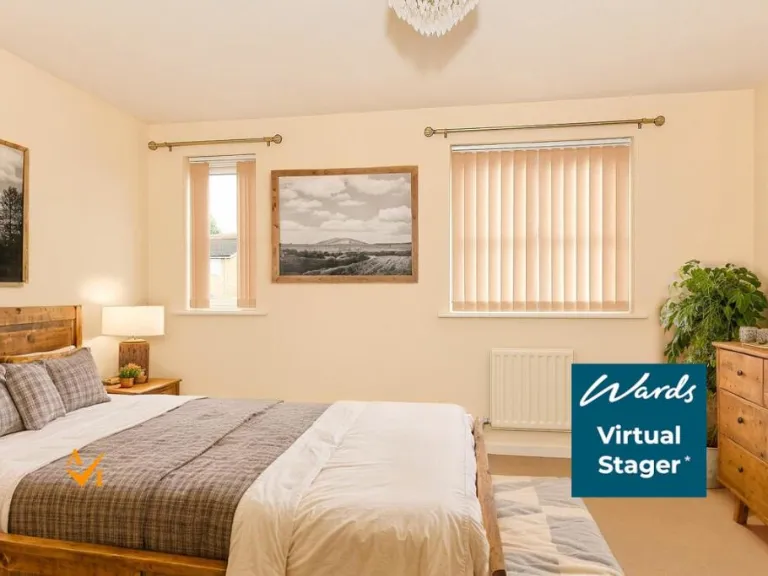
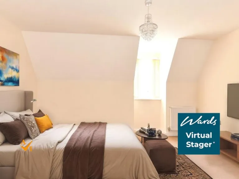
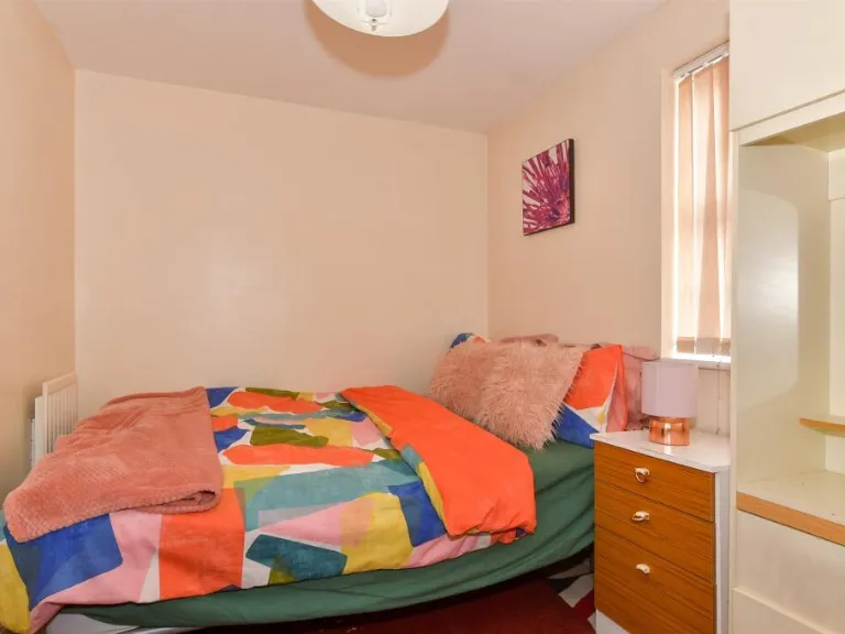
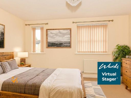
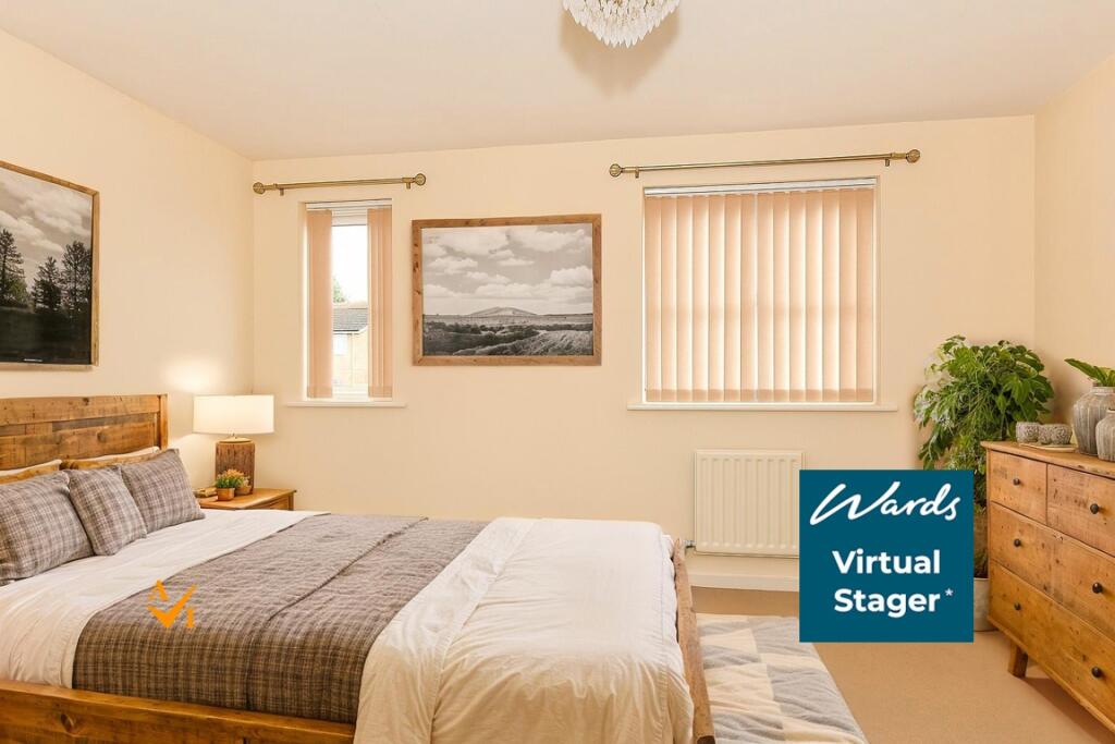
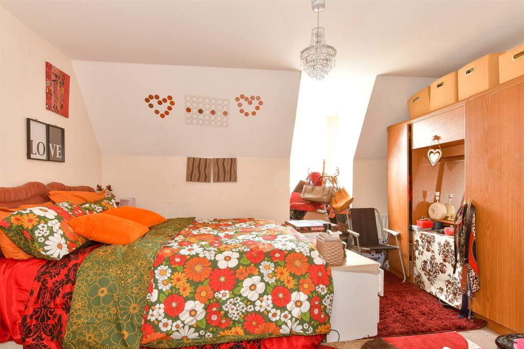
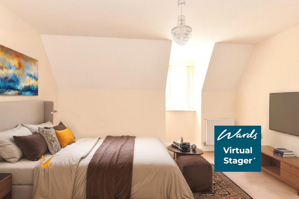
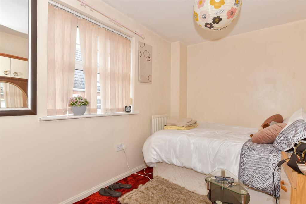
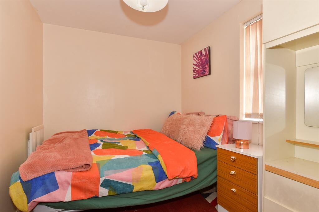
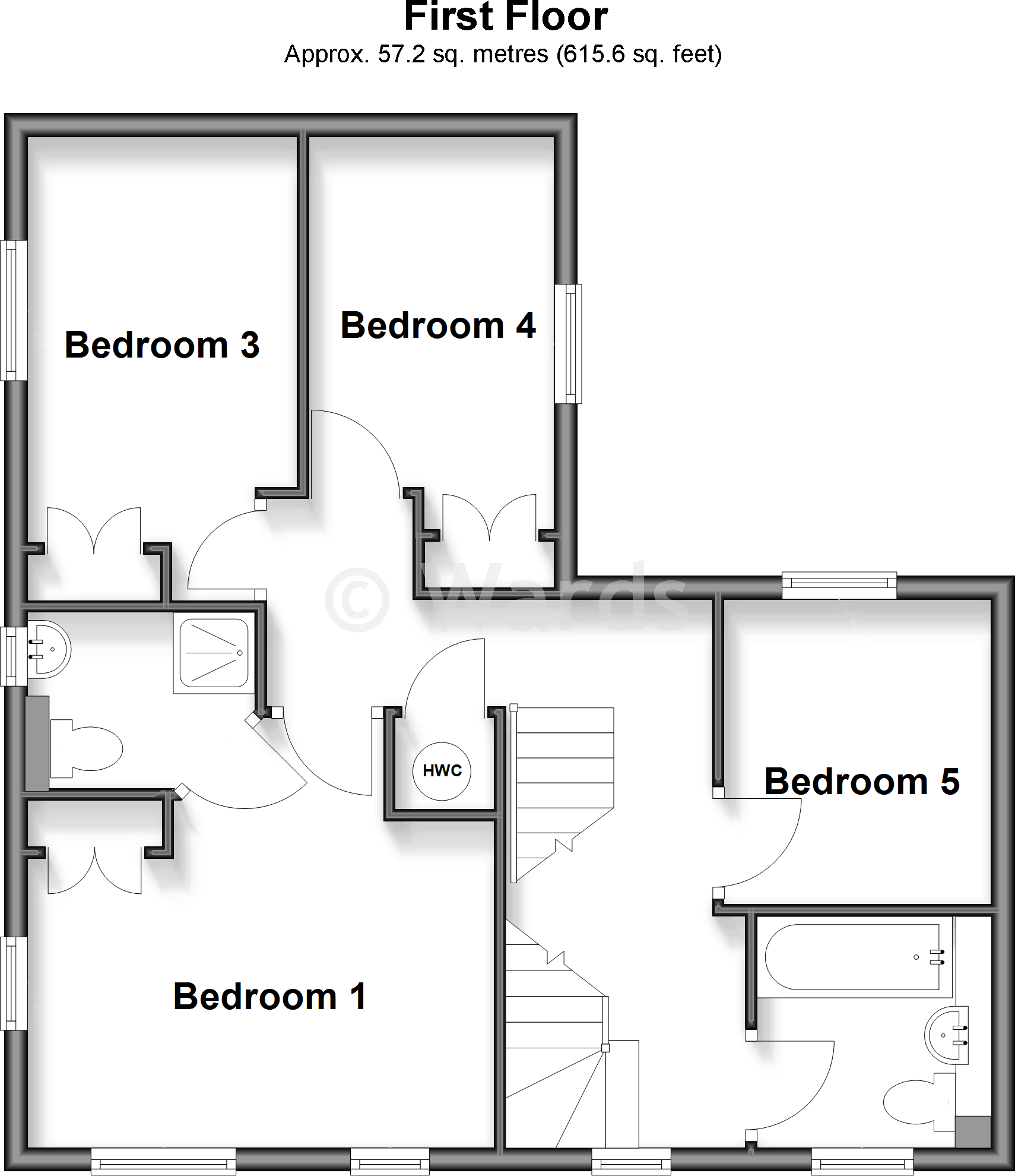
- Bedroom 1:
- Bedroom 3:
- Bedroom 4:
- Bedroom 5:
- HWC:
- Dressing Room:
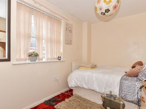
- Bedroom 2:
- Bedroom 6:
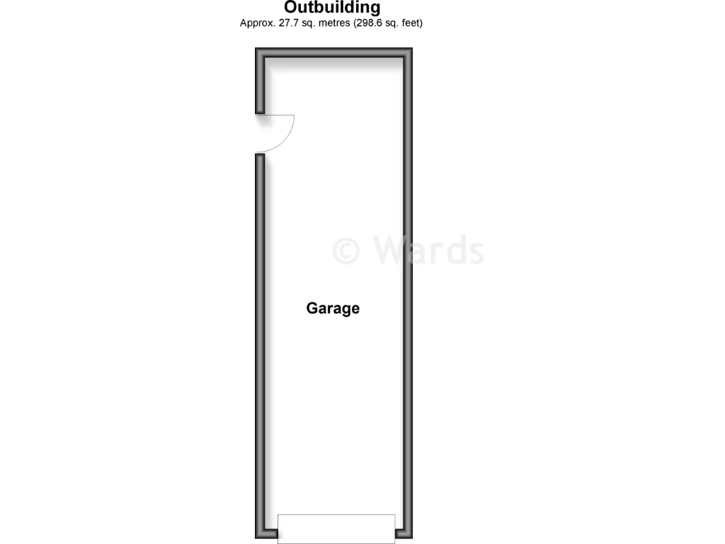
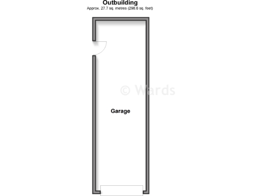
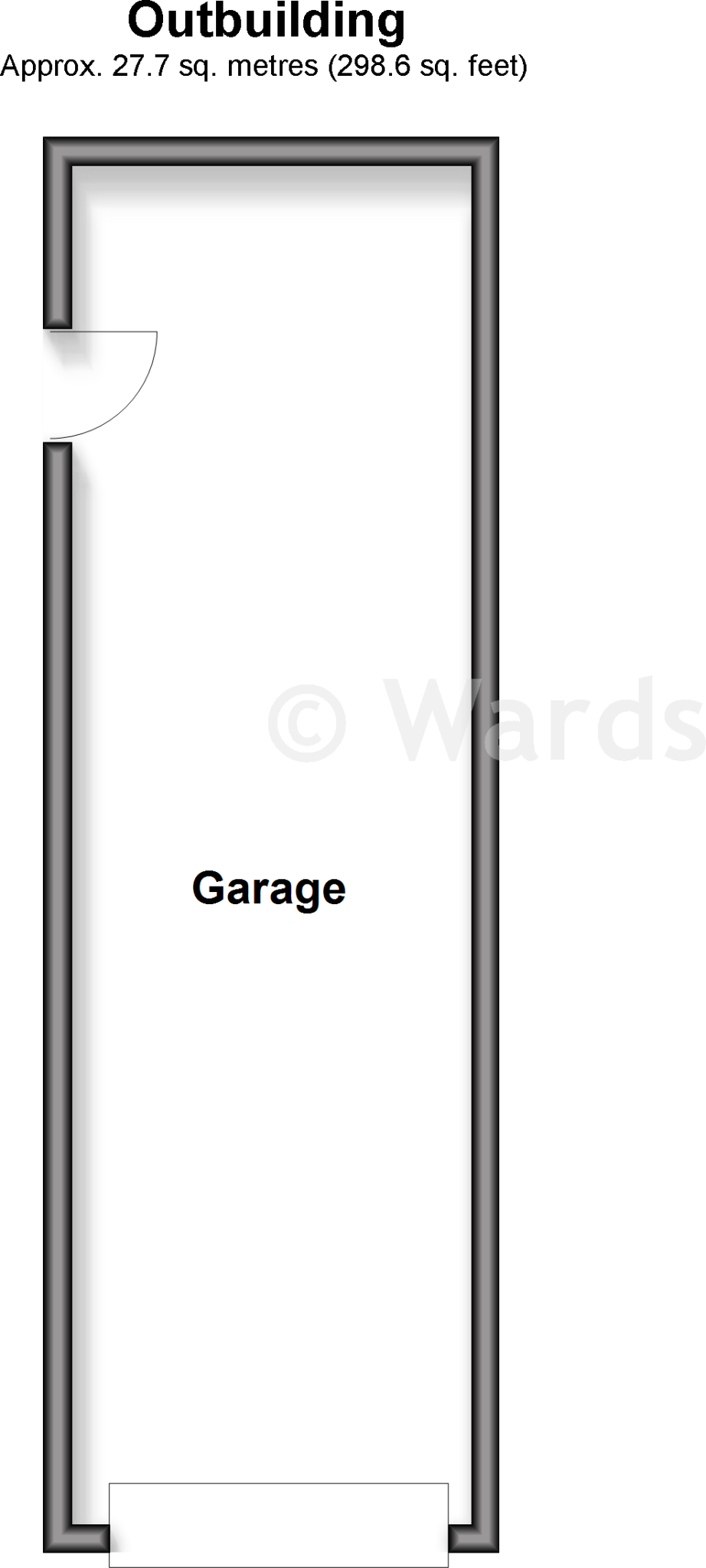
- Garage:
Textual Property Features
Detected Visual Features
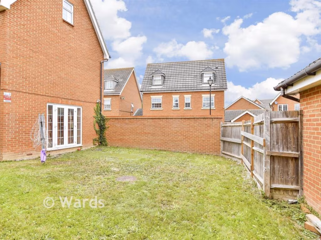
- modern
- detached
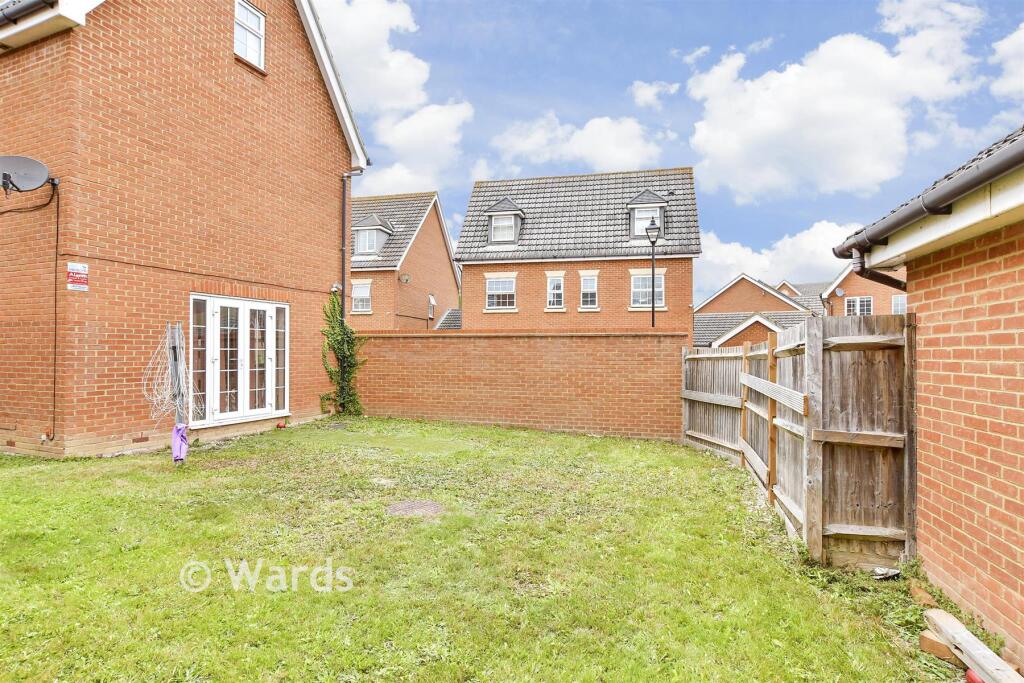
- brick exterior
- three stories
- dormer windows
- pitched roof
- driveway
- garage
- fenced garden
- kitchen
- contemporary
- spacious
- well-lit
- modern appliances
- tiled floor
- built-in cabinetry
- natural light
- undercabinet lighting
EPC Details
- Fully double glazed
- Cavity wall, as built, insulated (assumed)
- Boiler and radiators, mains gas
- Low energy lighting in 44% of fixed outlets
- Suspended, insulated (assumed)
Nearby Schools
- Minterne Junior School
- South Avenue Primary School
- Westlands School
- Grove Park Primary School
- Rodmersham School
- St Peter's Catholic Primary School
- Borden Church of England Primary School
- VTC Independent School
- Bobbing Village School
- Kemsley Primary Academy
- The Oaks Infant School
- The Sittingbourne School
- Bapchild and Tonge Church of England Primary School and Nursery
- Highsted Grammar School
- Milton Court Primary Academy
- Bredgar Church of England Primary School
- Tunstall Church of England (Aided) Primary School
- Fulston Manor School
- Canterbury Road Primary School
- Lansdowne Primary School
- Borden Grammar School
- Westlands Primary School
- Sunny Bank Primary School
- Regis Manor Primary School
- Newington Church of England Primary School
- Lower Halstow Primary School
- Iwade School
Nearest General Shops
- Id: 4938338273
- Tags:
- Female: yes
- Level: 0
- Male: no
- Name: Nu u 2 ltd.
- Shop: hairdresser
- Unisex: no
- TagsNormalized:
- Lat: 51.3502724
- Lon: 0.7325881
- FullGeoHash: u10s0sj3n896
- PartitionGeoHash: u10s
- Images:
- FoodStandards: null
- Distance: 617.4
,- Id: 49799723
- Tags:
- Building: commercial
- Shop: car_repair
- Source: local_knowledge
- TagsNormalized:
- Lat: 51.3473255
- Lon: 0.7264348
- FullGeoHash: u10s0e2zz5jp
- PartitionGeoHash: u10s
- Images:
- FoodStandards: null
- Distance: 540
,- Id: 677027253
- Tags:
- Addr:
- City: Sittingbourne
- Country: GB
- Postcode: ME10 5AB
- Street: Quartz Way
- Unit: 1
- Fhrs:
- Authority: Swale
- Id: 713964
- Inspectiondate: 2016-01-26
- Rating: 5
- Name: One Stop
- Shop: supermarket
- TagsNormalized:
- Lat: 51.3501961
- Lon: 0.7170724
- FullGeoHash: u10s0k40sfrg
- PartitionGeoHash: u10s
- Images:
- FoodStandards: null
- Distance: 527.3
}
Nearest Grocery shops
- Id: 4938338269
- Tags:
- Addr:
- City: Sittingbourne
- Housenumber: 79-81
- Postcode: ME10 2AR
- Street: High Street
- Fhrs:
- Authority: Swale
- Id: 924974
- Inspectiondate: 2016-11-02
- Rating: 3
- Level: 0
- Name: Kent Mart
- Shop: convenience
- TagsNormalized:
- Lat: 51.3491744
- Lon: 0.7322183
- FullGeoHash: u10s0ev4tgvs
- PartitionGeoHash: u10s
- Images:
- FoodStandards:
- Id: 924974
- FHRSID: 924974
- LocalAuthorityBusinessID: 16/500932/MIXED
- BusinessName: Kent Mart
- BusinessType: Retailers - other
- BusinessTypeID: 4613
- AddressLine1: 79 - 81 High Street
- AddressLine2: Milton Regis
- AddressLine3: Sittingbourne
- AddressLine4: Kent
- PostCode: ME10 2AR
- RatingValue: 4
- RatingKey: fhrs_4_en-GB
- RatingDate: 2018-10-19
- LocalAuthorityCode: 189
- LocalAuthorityName: Swale
- LocalAuthorityWebSite: http://www.swale.gov.uk
- LocalAuthorityEmailAddress: EHAdmin@MidKent.gov.uk
- Scores:
- Hygiene: 5
- Structural: 10
- ConfidenceInManagement: 0
- NewRatingPending: false
- Geocode:
- Longitude: 0.73217200000000
- Latitude: 51.34920300000000
- Distance: 642.2
,- Id: 3679929359
- Tags:
- Brand: McColl's
- Brand:wikidata: Q16997477
- Brand:wikipedia: en:McColl's
- Contact:
- Website: https://www.mccolls.co.uk/storelocator/milton-regis-97-high-st/
- Level: 0
- Name: McColl's
- Shop: convenience
- Wheelchair: yes
- TagsNormalized:
- Lat: 51.3496618
- Lon: 0.7321778
- FullGeoHash: u10s0evjkyz2
- PartitionGeoHash: u10s
- Images:
- FoodStandards: null
- Distance: 615.3
,- Id: 178679179
- Tags:
- Addr:
- City: Sittingbourne
- Postcode: ME10 2DD
- Street: Quinton Road
- Building: yes
- Fhrs:
- Authority: Swale
- Id: 713679
- Inspectiondate: 2015-10-28
- Rating: 4
- Level: 0
- Name: JD's General Store
- Shop: convenience
- Wheelchair: yes
- TagsNormalized:
- Lat: 51.3541192
- Lon: 0.720854
- FullGeoHash: u10s0kszmjet
- PartitionGeoHash: u10s
- Images:
- FoodStandards: null
- Distance: 330.1
}
Nearest Supermarkets
- Id: 69936201
- Tags:
- Addr:
- City: Sittingbourne
- Country: GB
- Postcode: ME10 2PD
- Street: Mill Way
- Brand: Asda
- Brand:wikidata: Q297410
- Brand:wikipedia: en:Asda
- Building: yes
- Contact:
- Facebook: https://www.facebook.com/asda/
- Twitter: @asda
- Website: https://storelocator.asda.com/south-east/sittingbourne/mill-way-trinity-trading-estate
- Fhrs:
- Name: Asda
- Operator: Asda Stores Ltd
- Shop: supermarket
- Wheelchair: yes
- TagsNormalized:
- Lat: 51.3514903
- Lon: 0.7419418
- FullGeoHash: u10s0uk207xg
- PartitionGeoHash: u10s
- Images:
- FoodStandards:
- Id: 714536
- FHRSID: 714536
- LocalAuthorityBusinessID: PI/000101973/SW
- BusinessName: Asda
- BusinessType: Retailers - supermarkets/hypermarkets
- BusinessTypeID: 7840
- AddressLine1: Mill Way
- AddressLine2: Sittingbourne
- AddressLine3: Kent
- AddressLine4: null
- PostCode: ME10 2PB
- RatingValue: 5
- RatingKey: fhrs_5_en-GB
- RatingDate: 2022-08-09
- LocalAuthorityCode: 189
- LocalAuthorityName: Swale
- LocalAuthorityWebSite: http://www.swale.gov.uk
- LocalAuthorityEmailAddress: EHAdmin@MidKent.gov.uk
- Scores:
- Hygiene: 5
- Structural: 5
- ConfidenceInManagement: 5
- NewRatingPending: false
- Geocode:
- Longitude: 0.75830000638962
- Latitude: 51.16965866088870
- Distance: 1238.8
,- Id: 319926842
- Tags:
- Brand: Morrisons
- Brand:wikidata: Q922344
- Brand:wikipedia: en:Morrisons
- Building: yes
- Contact:
- Website: https://my.morrisons.com/storefinder/558
- Name: Morrisons
- Operator: Morrisons
- Shop: supermarket
- TagsNormalized:
- Lat: 51.3431655
- Lon: 0.7324567
- FullGeoHash: u10s0dtre7z2
- PartitionGeoHash: u10s
- Images:
- FoodStandards: null
- Distance: 1136.7
,- Id: 5337326626
- Tags:
- Brand: M&S Foodhall
- Brand:wikidata: Q714491
- Brand:wikipedia: en:Marks & Spencer
- Contact:
- Website: https://www.marksandspencer.com/stores/sittingbourne-foodhall-1968
- Name: M&S Foodhall
- Operator: Marks & Spencer
- Shop: supermarket
- TagsNormalized:
- m&s foodhall
- supermarket
- shop
- Lat: 51.3449611
- Lon: 0.7356968
- FullGeoHash: u10s0epdnfrr
- PartitionGeoHash: u10s
- Images:
- FoodStandards: null
- Distance: 1119.2
}
Nearest Religious buildings
- Id: 48388542
- Tags:
- Amenity: place_of_worship
- Building: yes
- Name: Sittingbourne Islamic Cultural Centre
- Religion: muslim
- TagsNormalized:
- place of worship
- islamic
- muslim
- mosque
- Lat: 51.3419066
- Lon: 0.7288394
- FullGeoHash: u10s0dd8r1n4
- PartitionGeoHash: u10s
- Images:
- FoodStandards: null
- Distance: 1165.2
,- Id: 177856381
- Tags:
- Amenity: community_centre
- Building: yes
- Name: Church Hall
- TagsNormalized:
- community centre
- church
- church hall
- Lat: 51.3550085
- Lon: 0.7399024
- FullGeoHash: u10s0ufu8grn
- PartitionGeoHash: u10s
- Images:
- FoodStandards: null
- Distance: 1147.2
,- Id: 71265492
- Tags:
- Amenity: place_of_worship
- Building: yes
- Denomination: anglican
- Name: Bobbing Church
- Religion: christian
- Wikidata: Q17530109
- TagsNormalized:
- place of worship
- anglican
- church
- christian
- Lat: 51.3537406
- Lon: 0.71025
- FullGeoHash: u10s0htjnp0g
- PartitionGeoHash: u10s
- Images:
- FoodStandards: null
- Distance: 983.2
}
Nearest Medical buildings
- Id: 60964531
- Tags:
- Addr:
- Housenumber: 32
- Postcode: ME10 1ND
- Street: London Road
- Amenity: doctors
- Building: yes
- Name: The London Road Medical Centre
- Source: OS_OpenData_StreetView
- Website: https://www.thelondonroadmedicalcentre.nhs.uk/
- TagsNormalized:
- Lat: 51.3417863
- Lon: 0.7269524
- FullGeoHash: u10s0d3re4wu
- PartitionGeoHash: u10s
- Images:
- FoodStandards: null
- Distance: 1148.5
,- Id: 4938338260
- Tags:
- Amenity: pharmacy
- Dispensing: yes
- Level: 0
- Name: Lloyds Pharmacy
- TagsNormalized:
- Lat: 51.3491237
- Lon: 0.732514
- FullGeoHash: u10s0ev6kf6n
- PartitionGeoHash: u10s
- Images:
- FoodStandards: null
- Distance: 662.9
,- Id: 4938338253
- Tags:
- Amenity: dentist
- Name: Milton Regis Dental Clinic
- TagsNormalized:
- Lat: 51.3495129
- Lon: 0.7321381
- FullGeoHash: u10s0evhs4cx
- PartitionGeoHash: u10s
- Images:
- FoodStandards: null
- Distance: 619.9
,- Id: 677027240
- Tags:
- Amenity: pharmacy
- Name: Kamsons
- TagsNormalized:
- Lat: 51.3502833
- Lon: 0.7168819
- FullGeoHash: u10s0k410d9g
- PartitionGeoHash: u10s
- Images:
- FoodStandards: null
- Distance: 536.1
}
Nearest Airports
- Id: 103894219
- Tags:
- Aerodrome: international
- Aeroway: aerodrome
- Iata: SEN
- Icao: EGMC
- Name: London Southend Airport
- Old_name: Southend Municipal Airport
- Ref: SEN
- Wikidata: Q1415441
- TagsNormalized:
- airport
- international airport
- Lat: 51.5701749
- Lon: 0.6924624
- FullGeoHash: u10mru04p937
- PartitionGeoHash: u10m
- Images:
- FoodStandards: null
- Distance: 24363.1
}
Nearest Leisure Facilities
- Id: 4938338267
- Tags:
- Leisure: fitness_centre
- Name: The Fitness Centre
- TagsNormalized:
- fitness
- fitness centre
- leisure
- Lat: 51.3513717
- Lon: 0.7287587
- FullGeoHash: u10s0s4xmm3z
- PartitionGeoHash: u10s
- Images:
- FoodStandards: null
- Distance: 328.8
,- Id: 177692223
- Tags:
- Building: yes
- Covered: yes
- Leisure: pitch
- Sport: bowls
- TagsNormalized:
- Lat: 51.3508555
- Lon: 0.7279691
- FullGeoHash: u10s0s4h6vm0
- PartitionGeoHash: u10s
- Images:
- FoodStandards: null
- Distance: 294.3
,- Id: 222130739
- Tags:
- Leisure: pitch
- Sport: soccer
- Surface: asphalt
- TagsNormalized:
- Lat: 51.3514743
- Lon: 0.7278327
- FullGeoHash: u10s0s3bp8x7
- PartitionGeoHash: u10s
- Images:
- FoodStandards: null
- Distance: 263.5
,- Id: 151369106
- Tags:
- TagsNormalized:
- Lat: 51.3516389
- Lon: 0.7220914
- FullGeoHash: u10s0kmbczq3
- PartitionGeoHash: u10s
- Images:
- FoodStandards: null
- Distance: 145.3
,- Id: 517352800
- Tags:
- TagsNormalized:
- Lat: 51.3516322
- Lon: 0.7225289
- FullGeoHash: u10s0kq0unh9
- PartitionGeoHash: u10s
- Images:
- FoodStandards: null
- Distance: 116.3
}
Nearest Tourist attractions
- Id: 2114963016
- Tags:
- Addr:
- City: Sittingbourne
- Postcode: ME10 3DL
- Email: secretary@sittingbourne-museum.co.uk
- Museum: history
- Name: Sittingbourne Heritage Museum
- Source: Local Knowledge
- Tourism: museum
- Website: https://www.sittingbourne-museum.co.uk/
- Wikidata: Q113370157
- TagsNormalized:
- Lat: 51.33878
- Lon: 0.7434355
- FullGeoHash: u10s0cvq561x
- PartitionGeoHash: u10s
- Images:
- FoodStandards: null
- Distance: 1987.1
,- Id: 69939548
- Tags:
- Building: yes
- Tourism: museum
- TagsNormalized:
- Lat: 51.3453609
- Lon: 0.7442443
- FullGeoHash: u10s0gjuqjhb
- PartitionGeoHash: u10s
- Images:
- FoodStandards: null
- Distance: 1578.7
,- Id: 60588366
- Tags:
- Addr:
- City: Sittingbourne
- Housenumber: 74
- Postcode: ME10 1NS
- Street: London Road
- Building: yes
- Fhrs:
- Authority: Swale
- Id: 771569
- Inspectiondate: 2017-04-25
- Rating: 5
- Name: The Beaumont
- Source: local_knowledge
- Tourism: guest_house
- TagsNormalized:
- Lat: 51.3425723
- Lon: 0.7213878
- FullGeoHash: u10s06tk1t1t
- PartitionGeoHash: u10s
- Images:
- FoodStandards: null
- Distance: 1061.2
}
Nearest Train stations
- Id: 4373177416
- Tags:
- Name: Warren Wood
- Public_transport: station
- Railway: station
- Usage: tourism
- TagsNormalized:
- Lat: 51.2951704
- Lon: 0.6864127
- FullGeoHash: u107zd5b48f6
- PartitionGeoHash: u107
- Images:
- FoodStandards: null
- Distance: 6836.9
,- Id: 855651597
- Tags:
- Name: Swale
- Naptan:
- Network: National Rail
- Old_name: Kings Ferry Bridge Halt;Swale Halt
- Public_transport: station
- Railway: station
- Ref:
- Train: yes
- Wikidata: Q2191551
- Wikipedia: en:Swale railway station
- TagsNormalized:
- Lat: 51.3889653
- Lon: 0.7468492
- FullGeoHash: u10s2gpf6v7n
- PartitionGeoHash: u10s
- Images:
- FoodStandards: null
- Distance: 4406.8
,- Id: 90219136
- Tags:
- Name: Kemsley Down
- Network: Sittingbourne and Kemsley Light Railway
- Operator: Sittingbourne and Kemsley Light Railway
- Public_transport: station
- Railway: station
- Tourism: heritage_railway
- Train: yes
- Usage: tourism
- TagsNormalized:
- station
- railway
- tourism
- train
- Lat: 51.3618635
- Lon: 0.7567947
- FullGeoHash: u10s1nphd971
- PartitionGeoHash: u10s
- Images:
- FoodStandards: null
- Distance: 2522
,- Id: 3726061852
- Tags:
- Addr:
- Postcode: ME10 3ED
- Street: St. Michaels Road
- Name: Sittingbourne
- Naptan:
- Network: National Rail
- Platforms: 3
- Public_transport: station
- Railway: station
- Ref:
- Train: yes
- Wheelchair: yes
- Wikidata: Q1919614
- Wikipedia: en:Sittingbourne railway station
- TagsNormalized:
- Lat: 51.342078
- Lon: 0.7351464
- FullGeoHash: u10s0dx361hb
- PartitionGeoHash: u10s
- Images:
- FoodStandards: null
- Distance: 1339.6
,- Id: 2315856087
- Tags:
- Name: Sittingbourne Viaduct
- Public_transport: station
- Railway: station
- Train: yes
- Usage: tourism
- Wheelchair: no
- TagsNormalized:
- Lat: 51.345203
- Lon: 0.7336166
- FullGeoHash: u10s0en5qx84
- PartitionGeoHash: u10s
- Images:
- FoodStandards: null
- Distance: 1000
}
Nearest Hotels
- Id: 1065733958
- Tags:
- Addr:
- City: Sittingbourne
- Postcode: ME10 3JY
- Street: St. Michael's Road
- Brand: Travelodge
- Brand:wikidata: Q9361374
- Building: yes
- Fhrs:
- Authority: Swale
- Id: 1225090
- Local_authority_id: 20/500088/MIXED
- Internet_access: wlan
- Internet_access:fee: customers
- Internet_access:ssid: Travelodge WiFi
- Name: Travelodge Sittingbourne
- Tourism: hotel
- TagsNormalized:
- Lat: 51.3414003
- Lon: 0.7347998
- FullGeoHash: u10s0drj64dq
- PartitionGeoHash: u10s
- Images:
- FoodStandards: null
- Distance: 1389.1
,- Id: 957647645
- Tags:
- Brand: Premier Inn
- Brand:wikidata: Q2108626
- Brand:wikipedia: en:Premier Inn
- Contact:
- Website: https://www.premierinn.com/gb/en/hotels/england/kent/sittingbourne/sittingbourne-kent.html
- Internet_access: wlan
- Internet_access:fee: customers
- Internet_access:operator: Virgin Media
- Internet_access:ssid: Premier Inn Free Wi-Fi
- Name: Premier Inn
- Tourism: hotel
- TagsNormalized:
- Lat: 51.3509135
- Lon: 0.7063789
- FullGeoHash: u10s0h4kgb46
- PartitionGeoHash: u10s
- Images:
- FoodStandards: null
- Distance: 1237.5
,- Id: 50215002
- Tags:
- Addr:
- City: Sittingbourne
- Housenumber: 70
- Postcode: ME10 1NT
- Street: London Road
- Brand: Holiday Inn
- Brand:wikidata: Q2717882
- Brand:wikipedia: en:Holiday Inn
- Building: yes
- Fhrs:
- Authority: Swale
- Id: 836417
- Inspectiondate: 2015-12-15
- Rating: 5
- Name: The Coniston
- Source: local_knowledge
- Tourism: hotel
- TagsNormalized:
- Lat: 51.3427572
- Lon: 0.7220099
- FullGeoHash: u10s06tv0p9s
- PartitionGeoHash: u10s
- Images:
- FoodStandards: null
- Distance: 1033.9
}
Tags
- modern
- detached
- brick exterior
- three stories
- dormer windows
- pitched roof
- driveway
- garage
- fenced garden
- kitchen
- contemporary
- spacious
- well-lit
- modern appliances
- tiled floor
- built-in cabinetry
- natural light
- undercabinet lighting
Local Market Stats
- Average Price/sqft: £322
- Avg Income: £49700
- Rental Yield: 4.6%
- Social Housing: 13%
- Planning Success Rate: 85%
Similar Properties
 5 bedroom detached house for sale in Maidstone Road, Chatham, Kent, ME4 — £850,000 • 5 bed • 3 bath • 1706 ft²
 4 bedroom detached house for sale in Anatase Close, Sittingbourne, Kent, ME10 — £500,000 • 4 bed • 3 bath • 1217 ft²
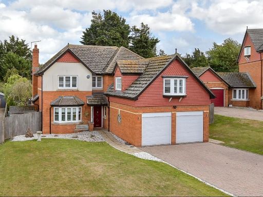 5 bedroom detached house for sale in Oak Tree Close, Eastchurch, Sheerness, Kent, ME12 — £650,000 • 5 bed • 2 bath • 2272 ft²
 3 bedroom detached house for sale in Crossways, Sittingbourne, Kent, ME10 — £475,000 • 3 bed • 1 bath • 1400 ft²
 4 bedroom detached house for sale in Broadview Avenue, Rainham, Gillingham, Kent, ME8 — £800,000 • 4 bed • 2 bath • 1755 ft²
 3 bedroom detached house for sale in Cinnabar Drive, Sittingbourne, Kent, ME10 — £400,000 • 3 bed • 2 bath • 1357 ft²
Meta
- {
"@context": "https://schema.org",
"@type": "Residence",
"name": "6 bedroom detached house for sale in Trona Court, Sittingbo…",
"description": "",
"url": "https://propertypiper.co.uk/property/63780561-2a1e-4649-870b-69d35bb627c9",
"image": "https://image-a.propertypiper.co.uk/abcd9a28-056f-4e0a-9cad-3907c022da63-1024.jpeg",
"address": {
"@type": "PostalAddress",
"streetAddress": "6 Trona Court",
"postalCode": "ME10 5LD",
"addressLocality": "Swale",
"addressRegion": "Sittingbourne and Sheppey",
"addressCountry": "England"
},
"geo": {
"@type": "GeoCoordinates",
"latitude": 51.35196181003482,
"longitude": 0.7241189560060727
},
"numberOfRooms": 6,
"numberOfBathroomsTotal": 3,
"floorSize": {
"@type": "QuantitativeValue",
"value": 1658,
"unitCode": "FTK"
},
"offers": {
"@type": "Offer",
"price": 485000,
"priceCurrency": "GBP",
"availability": "https://schema.org/InStock"
},
"additionalProperty": [
{
"@type": "PropertyValue",
"name": "Feature",
"value": "modern"
},
{
"@type": "PropertyValue",
"name": "Feature",
"value": "detached"
},
{
"@type": "PropertyValue",
"name": "Feature",
"value": "brick exterior"
},
{
"@type": "PropertyValue",
"name": "Feature",
"value": "three stories"
},
{
"@type": "PropertyValue",
"name": "Feature",
"value": "dormer windows"
},
{
"@type": "PropertyValue",
"name": "Feature",
"value": "pitched roof"
},
{
"@type": "PropertyValue",
"name": "Feature",
"value": "driveway"
},
{
"@type": "PropertyValue",
"name": "Feature",
"value": "garage"
},
{
"@type": "PropertyValue",
"name": "Feature",
"value": "fenced garden"
},
{
"@type": "PropertyValue",
"name": "Feature",
"value": "kitchen"
},
{
"@type": "PropertyValue",
"name": "Feature",
"value": "contemporary"
},
{
"@type": "PropertyValue",
"name": "Feature",
"value": "spacious"
},
{
"@type": "PropertyValue",
"name": "Feature",
"value": "well-lit"
},
{
"@type": "PropertyValue",
"name": "Feature",
"value": "modern appliances"
},
{
"@type": "PropertyValue",
"name": "Feature",
"value": "tiled floor"
},
{
"@type": "PropertyValue",
"name": "Feature",
"value": "built-in cabinetry"
},
{
"@type": "PropertyValue",
"name": "Feature",
"value": "natural light"
},
{
"@type": "PropertyValue",
"name": "Feature",
"value": "undercabinet lighting"
}
]
}
High Res Floorplan Images
Compatible Floorplan Images
FloorplanImages Thumbnail