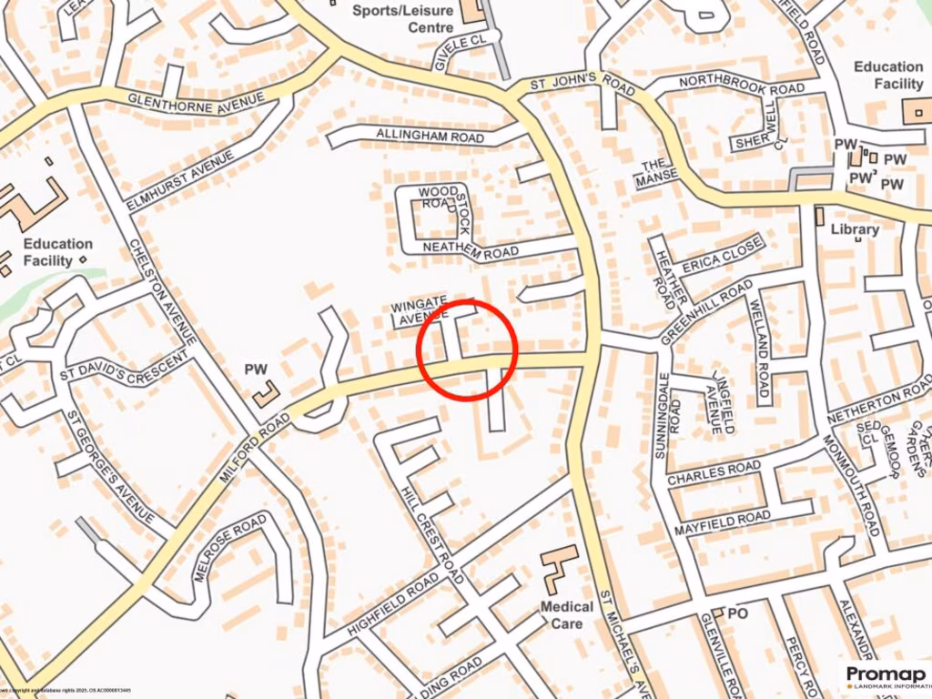
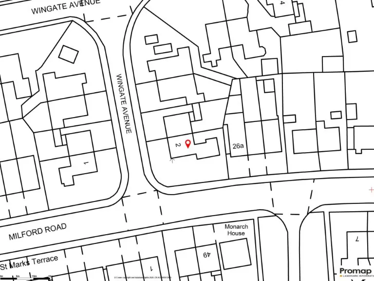
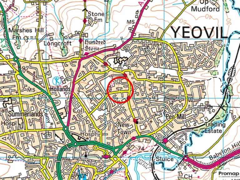
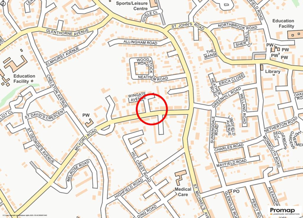
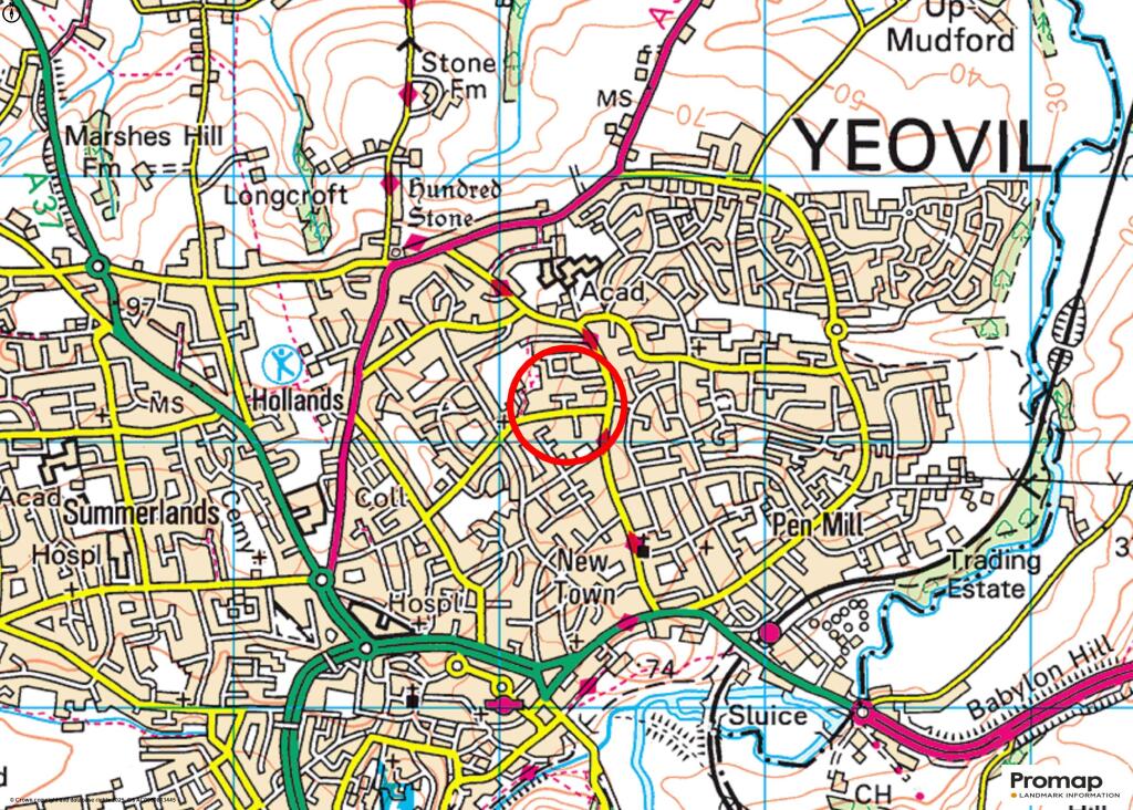
BA21 4QH - 3 bedroom semidetached house for sale in Wingate Avenue, Ye…
View on Property Piper
3 bedroom semi-detached house for sale in Wingate Avenue, Yeovil, Somerset, BA21 4QH, BA21
Property Details
- Price: £220000
- Bedrooms: 3
- Bathrooms: 1
- Property Type: undefined
- Property SubType: undefined
Image Descriptions
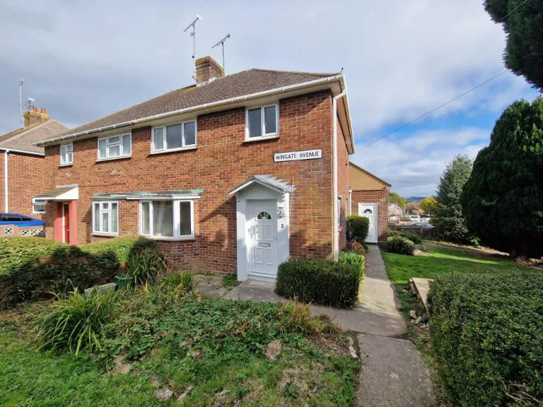
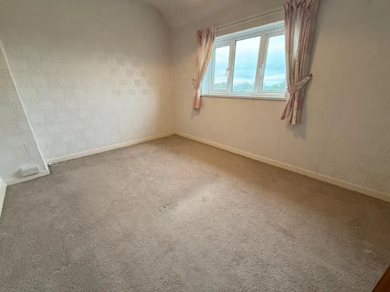
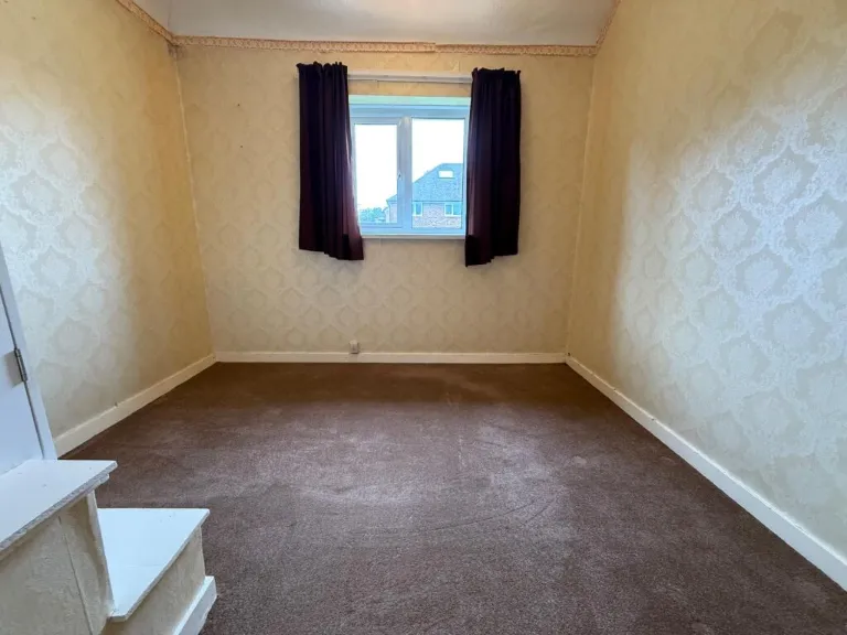
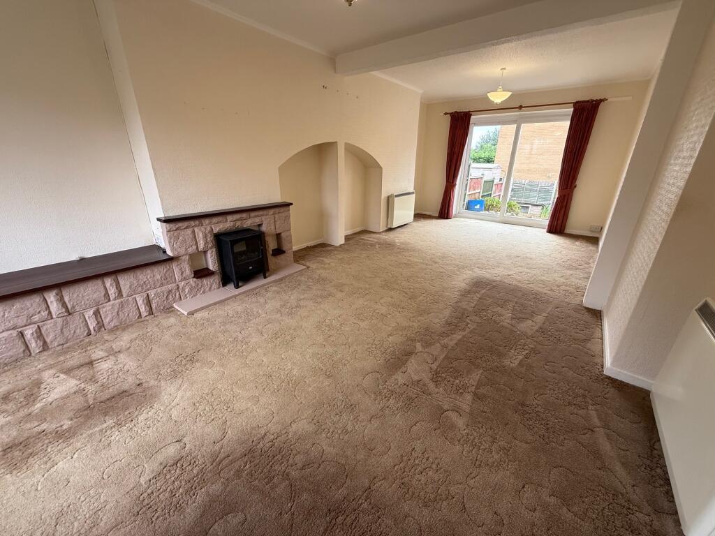
- exterior property post-war semi-detached
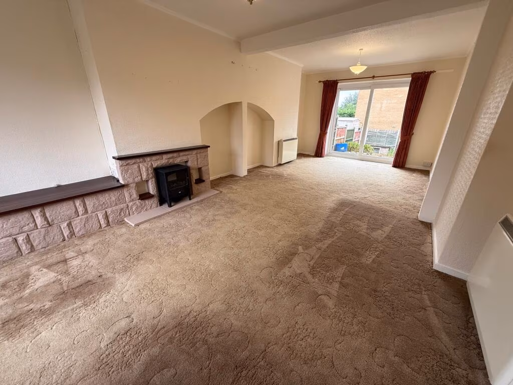
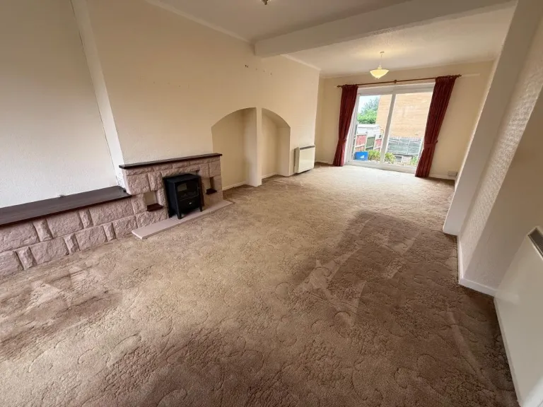
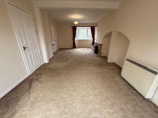
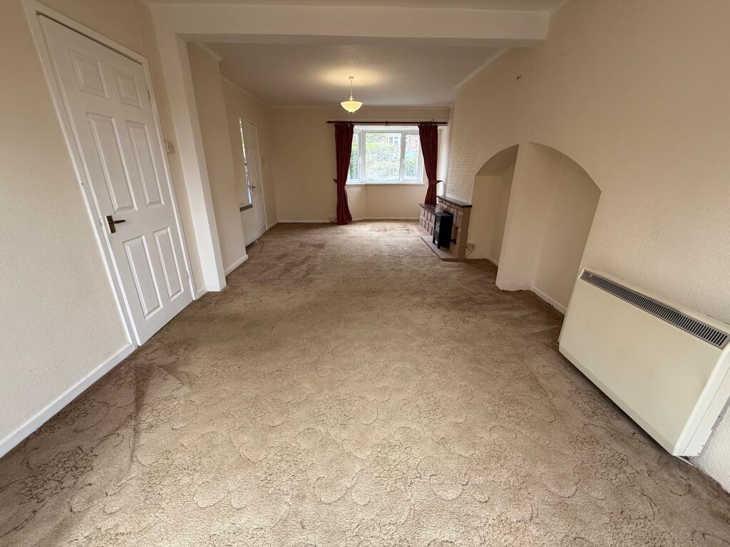
- living room mid-century
Floorplan Description
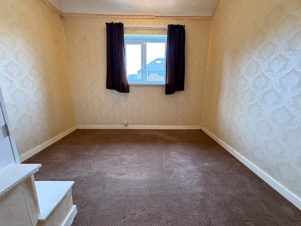
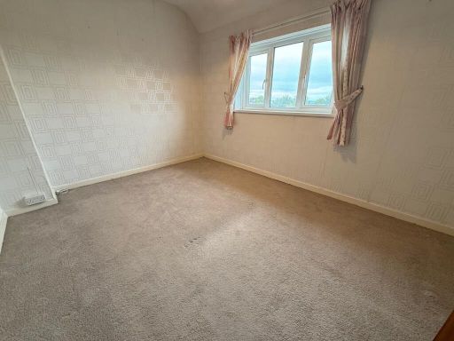
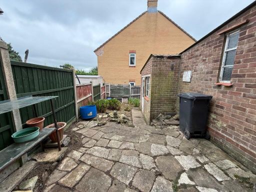
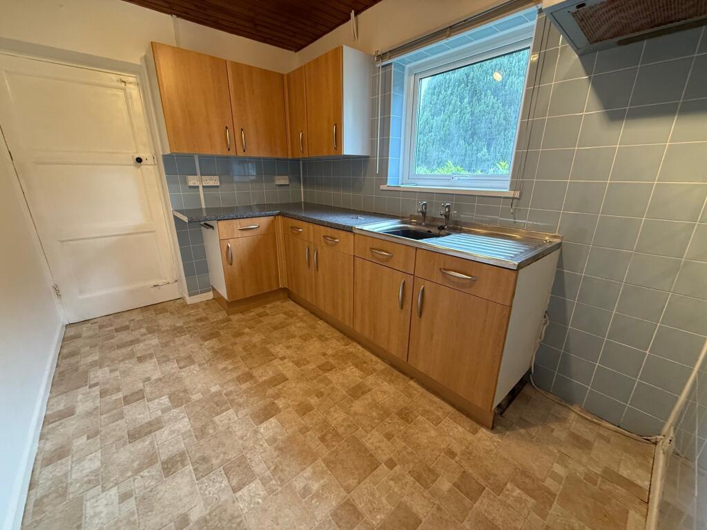
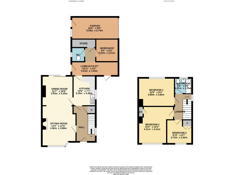
- Two-storey house with living/dining, kitchen and utility/ancillary rooms plus three bedrooms and bathroom upstairs.
Rooms
- GARAGE:
- WORKSHOP:
- LOBBY/UTILITY:
- DINING ROOM:
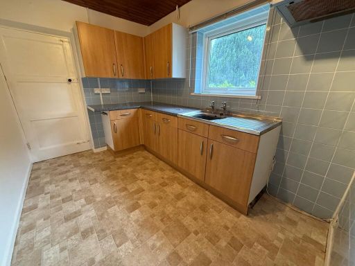
- KITCHEN:
- SITTING ROOM:
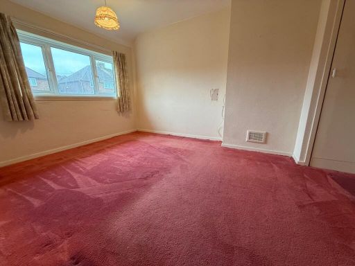
- BEDROOM 1:
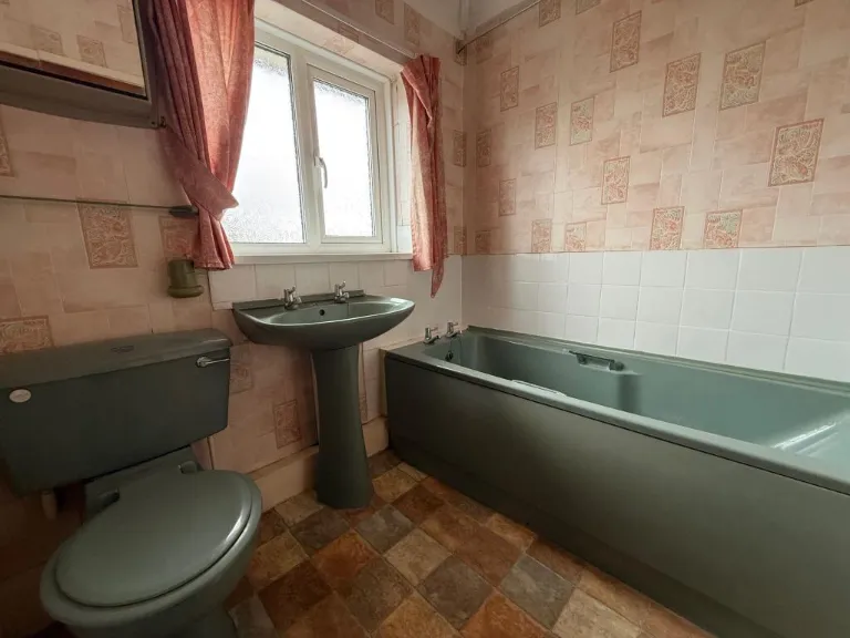
- BATHROOM:
- BEDROOM 2:
- BEDROOM 3:
Textual Property Features
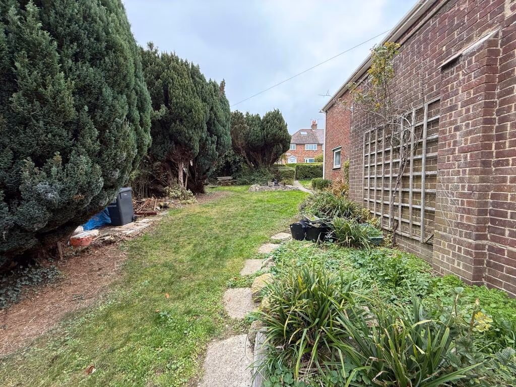
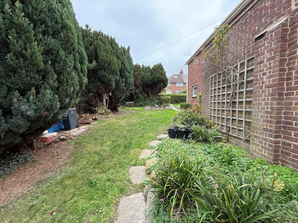
- Has Garden
- Chain Free
- Success
Detected Visual Features
- semi-detached
- brick
- post-war
- front garden
- side path
- residential
- family home
- corner property
- driveway
- mid-century
- living room
- fireplace
- stone surround
- large window
- natural light
- sliding doors
- neutral paint
- dated upholstery
- requires modernization
EPC Details
- Fully double glazed
- Cavity wall, filled cavity
- Boiler and radiators, mains gas
- Low energy lighting in all fixed outlets
- Solid, no insulation (assumed)
Nearby Schools
- Countess Gytha Primary School
- West Coker CofE VC Primary School
- Barwick and Stoford Community Primary School
- Oaklands Primary School
- Kingfisher Primary School
- Westfield Academy
- Milford Infants' School
- Buckler's Mead School
- Primrose Lane Primary School
- St Andrew's Church of England Primary School
- St Mary's Church of England Primary School, Bradford Abbas
- Holy Trinity Church School
- Reckleford Infant School and Nursery
- St Gildas Catholic Primary School
- Preston School Academy
- Birchfield Community Primary School
- Trent Young's CofE Primary School
- Ilchester Community School
- Thornford CofE Primary School
- Huish Primary School
- St. Michael's Academy
- Preston CofE Primary School
- Milford Junior School
- Chilthorne Domer Church School
- East Coker Community Primary School
Nearest General Shops
- Id: 4680609619
- Tags:
- Brand: Spar
- Brand:wikidata: Q610492
- Brand:wikipedia: en:Spar (retailer)
- Name: Spar
- Shop: supermarket
- TagsNormalized:
- Lat: 50.9439907
- Lon: -2.6291529
- FullGeoHash: gcn1u4jd221t
- PartitionGeoHash: gcn1
- Images:
- FoodStandards: null
- Distance: 975.3
,- Id: 707478746
- Tags:
- Brand: Volvo
- Brand:wikidata: Q215293
- Name: Volvo Dealership
- Shop: car
- TagsNormalized:
- Lat: 50.9442417
- Lon: -2.6296758
- FullGeoHash: gcn1u4j5sngw
- PartitionGeoHash: gcn1
- Images:
- FoodStandards: null
- Distance: 959.1
,- Id: 3634990613
- Tags:
- Name: The Co-operative
- Shop: supermarket
- TagsNormalized:
- Lat: 50.9573369
- Lon: -2.6297702
- FullGeoHash: gcn1uht01bj4
- PartitionGeoHash: gcn1
- Images:
- FoodStandards: null
- Distance: 621.7
}
Nearest Grocery shops
- Id: 416525359
- Tags:
- Addr:
- City: Yeovil
- Country: GB
- County: Somerset
- Postcode: BA21 4HA
- Street: Sherborne Road
- Unit: 1
- Alt_name: Farmfoods Yeovil
- Brand: Farmfoods
- Brand:wikidata: Q5435841
- Brand:wikipedia: en:Farmfoods
- Building: yes
- Building:levels: 1
- Fhrs:
- Name: Farmfoods
- Opening_hours: Mo-Fr 08:00-21:00; Sa 08:00-19:00; Su 10:00-16:00
- Shop: frozen_food
- Website: https://www.farmfoods.co.uk/store-finder.php?branch_code=843
- TagsNormalized:
- farmfoods
- frozen food
- food
- shop
- Lat: 50.9426579
- Lon: -2.6236559
- FullGeoHash: gcn1u3cd2rsr
- PartitionGeoHash: gcn1
- Images:
- FoodStandards:
- Id: 111304
- FHRSID: 111304
- LocalAuthorityBusinessID: 40776
- BusinessName: Farm Foods Ltd
- BusinessType: Retailers - supermarkets/hypermarkets
- BusinessTypeID: 7840
- AddressLine1: null
- AddressLine2: Sherborne Road
- AddressLine3: Yeovil
- AddressLine4: Somerset
- PostCode: BA21 4HA
- RatingValue: 5
- RatingKey: fhrs_5_en-GB
- RatingDate: 2022-07-26
- LocalAuthorityCode: 283
- LocalAuthorityName: South Somerset
- LocalAuthorityWebSite: http://www.southsomerset.gov.uk/food
- LocalAuthorityEmailAddress: food.safety@southsomerset.gov.uk
- Scores:
- Hygiene: 0
- Structural: 0
- ConfidenceInManagement: 0
- NewRatingPending: false
- Geocode:
- Longitude: -2.62376200000000
- Latitude: 50.94260800000000
- Distance: 1096
,- Id: 551904756
- Tags:
- Brand: Tesco Express
- Brand:wikidata: Q98456772
- Brand:wikipedia: en:Tesco
- Building: yes
- Contact:
- Website: https://www.tesco.com/store-locator/yeovil/2-cavalier-way
- Name: Tesco Express
- Shop: convenience
- TagsNormalized:
- tesco
- tesco express
- convenience
- shop
- Lat: 50.9565683
- Lon: -2.6118168
- FullGeoHash: gcn1us65s2b1
- PartitionGeoHash: gcn1
- Images:
- FoodStandards: null
- Distance: 1060
,- Id: 707434834
- Tags:
- TagsNormalized:
- Lat: 50.9548216
- Lon: -2.6311392
- FullGeoHash: gcn1uhh1650q
- PartitionGeoHash: gcn1
- Images:
- FoodStandards: null
- Distance: 477.2
}
Nearest Religious buildings
- Id: 371507298
- Tags:
- Addr:
- City: Yeovil
- Postcode: BA20 1JZ
- Street: Vicarage Street
- Amenity: place_of_worship
- Building: church
- Denomination: methodist
- Heritage: 2
- Heritage:operator: Historic England
- Historic: heritage
- Listed_status: Grade II
- Name: Vicarage Street Methodist Church
- Ref:
- Religion: christian
- Start_date: 1869
- Website: https://historicengland.org.uk/listing/the-list/list-entry/1056491
- TagsNormalized:
- place of worship
- church
- methodist
- christian
- Lat: 50.9416464
- Lon: -2.6285328
- FullGeoHash: gcn1u1tuwepv
- PartitionGeoHash: gcn1
- Images:
- FoodStandards: null
- Distance: 1220.2
,- Id: 813630139
- Tags:
- Amenity: place_of_worship
- Building: church
- Denomination: anglican
- Name: St Michael & All Angels
- Religion: christian
- Wikidata: Q105091013
- TagsNormalized:
- place of worship
- church
- anglican
- christian
- Lat: 50.9475744
- Lon: -2.6200155
- FullGeoHash: gcn1u6spjhnz
- PartitionGeoHash: gcn1
- Images:
- FoodStandards: null
- Distance: 662.8
,- Id: 3750743120
- Tags:
- Addr:
- City: Yeovil
- Housenumber: 64
- Street: Chelston Avenue
- Amenity: place_of_worship
- Building: chapel
- Denomination: methodist
- Name: Saint Mark's Methodist Church
- Religion: christian
- TagsNormalized:
- place of worship
- chapel
- methodist
- church
- christian
- Lat: 50.9514104
- Lon: -2.6276232
- FullGeoHash: gcn1u5qt7zq1
- PartitionGeoHash: gcn1
- Images:
- FoodStandards: null
- Distance: 190.3
}
Nearest Medical buildings
- Id: 9162326813
- Tags:
- Amenity: pharmacy
- Brand: Boots
- Brand:wikidata: Q6123139
- Brand:wikipedia: en:Boots (company)
- Dispensing: yes
- Healthcare: pharmacy
- Name: Boots
- TagsNormalized:
- pharmacy
- boots
- health
- healthcare
- Lat: 50.9413277
- Lon: -2.6298054
- FullGeoHash: gcn1u1t49pfb
- PartitionGeoHash: gcn1
- Images:
- FoodStandards: null
- Distance: 1273.4
,- Id: 9168494864
- Tags:
- Amenity: dentist
- Healthcare: dentist
- Name: Yeovil Dental Clinic
- TagsNormalized:
- dentist
- health
- healthcare
- clinic
- dental
- Lat: 50.942812
- Lon: -2.6338689
- FullGeoHash: gcn1u1f56kmn
- PartitionGeoHash: gcn1
- Images:
- FoodStandards: null
- Distance: 1222.7
,- Id: 588062929
- Tags:
- Addr:
- City: Yeovil
- Postcode: BA21 3BA
- Street: Marsh Lane
- Amenity: doctors
- Building: yes
- Healthcare: doctor
- Name: Ryalls Park Medica Practice
- Website: https://www.ryallsparkmc.nhs.uk/
- TagsNormalized:
- doctor
- doctors
- health
- healthcare
- Lat: 50.951836
- Lon: -2.6407526
- FullGeoHash: gcn1ggmpfn8h
- PartitionGeoHash: gcn1
- Images:
- FoodStandards: null
- Distance: 1073.2
,- Id: 56651847
- Tags:
- Addr:
- City: Yeovil
- Housename: Yeovil District Hospital
- Postcode: BA21 4AT
- Street: Higher Kingston
- Amenity: hospital
- Building: yes
- Emergency: yes
- Healthcare: hospital
- Name: Yeovil District Hospital
- Operator: Yeovil District Hospital NHS Foundation Trust
- Operator:type: public
- Operator:wikidata: Q8052494
- Source: OS_OpenData_StreetView
- Wikidata: Q50575533
- Wikipedia: en:Yeovil District Hospital
- TagsNormalized:
- Lat: 50.9446945
- Lon: -2.6344481
- FullGeoHash: gcn1u41wkgm5
- PartitionGeoHash: gcn1
- Images:
- FoodStandards: null
- Distance: 1067.5
}
Nearest Leisure Facilities
- Id: 404254899
- Tags:
- Leisure: pitch
- Sport: cricket
- TagsNormalized:
- pitch
- leisure
- cricket
- sports
- Lat: 50.9564276
- Lon: -2.6259954
- FullGeoHash: gcn1uhrf9yef
- PartitionGeoHash: gcn1
- Images:
- FoodStandards: null
- Distance: 444.1
,- Id: 404254961
- Tags:
- Leisure: pitch
- Sport: soccer
- TagsNormalized:
- Lat: 50.9561162
- Lon: -2.6231301
- FullGeoHash: gcn1uk3buss3
- PartitionGeoHash: gcn1
- Images:
- FoodStandards: null
- Distance: 439.4
,- Id: 196215131
- Tags:
- TagsNormalized:
- Lat: 50.9557008
- Lon: -2.6257034
- FullGeoHash: gcn1uk0n2xje
- PartitionGeoHash: gcn1
- Images:
- FoodStandards: null
- Distance: 362.1
,- Id: 499543762
- Tags:
- Leisure: park
- Name: Milford Park
- TagsNormalized:
- Lat: 50.9530649
- Lon: -2.6275185
- FullGeoHash: gcn1u5wxn7sp
- PartitionGeoHash: gcn1
- Images:
- FoodStandards: null
- Distance: 159.5
,- Id: 4908099137
- Tags:
- TagsNormalized:
- Lat: 50.9531945
- Lon: -2.6270936
- FullGeoHash: gcn1u5xpb7ch
- PartitionGeoHash: gcn1
- Images:
- FoodStandards: null
- Distance: 141.2
}
Nearest Tourist attractions
- Id: 692804940
- Tags:
- Addr:
- City: Sherborne
- Country: GB
- Housenumber: 12
- Place: Saxon Maybank
- Postcode: DT9 6JN
- Building: yes
- Tourism: chalet
- TagsNormalized:
- Lat: 50.9373964
- Lon: -2.5882695
- FullGeoHash: gcn1v0g7bfym
- PartitionGeoHash: gcn1
- Images:
- FoodStandards: null
- Distance: 3097
,- Id: 4008326307
- Tags:
- Amenity: bbq
- Tourism: picnic_site
- TagsNormalized:
- bbq
- picnic
- picnic site
- tourism
- Lat: 50.936061
- Lon: -2.6354663
- FullGeoHash: gcn1u08uj1vz
- PartitionGeoHash: gcn1
- Images:
- FoodStandards: null
- Distance: 1952.3
,- Id: 2229563863
- Tags:
- TagsNormalized:
- Lat: 50.9401784
- Lon: -2.6231143
- FullGeoHash: gcn1u33uj180
- PartitionGeoHash: gcn1
- Images:
- FoodStandards: null
- Distance: 1374.2
}
Nearest Train stations
- Id: 9991604554
- Tags:
- Name: Common Lane
- Network: Gartell Light Railway
- Operator: Gartell Light Railway
- Public_transport: station
- Railway: station
- Train: yes
- Usage: tourism
- TagsNormalized:
- Lat: 50.9949551
- Lon: -2.4024297
- FullGeoHash: gcn6176e5kds
- PartitionGeoHash: gcn6
- Images:
- FoodStandards: null
- Distance: 16315.7
,- Id: 9991604612
- Tags:
- Name: Pinesway Junction
- Public_transport: station
- Railway: station
- Train: yes
- Usage: tourism
- TagsNormalized:
- Lat: 50.9936437
- Lon: -2.4036374
- FullGeoHash: gcn6171ex0nj
- PartitionGeoHash: gcn6
- Images:
- FoodStandards: null
- Distance: 16193.2
,- Id: 6011304340
- Tags:
- Name: Templecombe
- Naptan:
- Network: National Rail
- Public_transport: station
- Railway: station
- Ref:
- Wikidata: Q1901020
- Wikipedia: en:Templecombe railway station
- TagsNormalized:
- Lat: 51.001594
- Lon: -2.4172852
- FullGeoHash: gcn60uxcc4jw
- PartitionGeoHash: gcn6
- Images:
- FoodStandards: null
- Distance: 15565.7
,- Id: 6013523221
- Tags:
- Name: Sherborne
- Naptan:
- Network: National Rail
- Public_transport: station
- Railway: station
- Ref:
- Source: gps_survey
- Wikidata: Q2407888
- Wikipedia: en:Sherborne railway station
- TagsNormalized:
- Lat: 50.943979
- Lon: -2.5129696
- FullGeoHash: gcn1yf445tfp
- PartitionGeoHash: gcn1
- Images:
- FoodStandards: null
- Distance: 7936.8
,- Id: 42267217
- Tags:
- Name: Yeovil Pen Mill
- Naptan:
- Network: National Rail
- Public_transport: station
- Railway: station
- Ref:
- Source: NPE
- Wikidata: Q2213897
- Wikipedia: en:Yeovil Pen Mill railway station
- TagsNormalized:
- Lat: 50.9446866
- Lon: -2.61304
- FullGeoHash: gcn1ud1nrcbh
- PartitionGeoHash: gcn1
- Images:
- FoodStandards: null
- Distance: 1225.7
}
Nearest Bus stations and stops
- Id: 9160895976
- Tags:
- Bus: yes
- Covered: no
- Highway: bus_stop
- Public_transport: platform
- Shelter: yes
- TagsNormalized:
- Lat: 50.9415128
- Lon: -2.632281
- FullGeoHash: gcn1u1e5z6m0
- PartitionGeoHash: gcn1
- Images:
- FoodStandards: null
- Distance: 1306.4
,- Id: 4508521989
- Tags:
- Bus: yes
- Highway: bus_stop
- Public_transport: platform
- TagsNormalized:
- Lat: 50.944804
- Lon: -2.6357778
- FullGeoHash: gcn1u40wvzv9
- PartitionGeoHash: gcn1
- Images:
- FoodStandards: null
- Distance: 1115.6
,- Id: 7916713810
- Tags:
- Bus: yes
- Highway: bus_stop
- Public_transport: platform
- TagsNormalized:
- Lat: 50.9447442
- Lon: -2.6332035
- FullGeoHash: gcn1u44w9uth
- PartitionGeoHash: gcn1
- Images:
- FoodStandards: null
- Distance: 1013.8
,- Id: 4390654624
- Tags:
- Bus: yes
- Highway: bus_stop
- Public_transport: platform
- TagsNormalized:
- Lat: 50.9569434
- Lon: -2.6332663
- FullGeoHash: gcn1uh6t8qwr
- PartitionGeoHash: gcn1
- Images:
- FoodStandards: null
- Distance: 740.7
,- Id: 4390654625
- Tags:
- Bus: yes
- Highway: bus_stop
- Public_transport: platform
- TagsNormalized:
- Lat: 50.9568356
- Lon: -2.6332236
- FullGeoHash: gcn1uh6t16wh
- PartitionGeoHash: gcn1
- Images:
- FoodStandards: null
- Distance: 730.4
}
Nearest Hotels
- Id: 4254706158
- Tags:
- Addr:
- City: Yeovil
- Housenumber: 8
- Postcode: BA20 1QE
- Street: South Street
- Name: The Keep
- Smoking: separated
- Tourism: hotel
- TagsNormalized:
- Lat: 50.9406477
- Lon: -2.6325911
- FullGeoHash: gcn1u17nb0vz
- PartitionGeoHash: gcn1
- Images:
- FoodStandards: null
- Distance: 1404
,- Id: 4022695679
- Tags:
- Brand: Premier Inn
- Brand:wikidata: Q2108626
- Internet_access: wlan
- Internet_access:fee: customers
- Internet_access:operator: Virgin Media
- Internet_access:ssid: Premier Inn Free Wi-Fi
- Name: Premier Inn Yeovil Town Centre
- Tourism: hotel
- TagsNormalized:
- Lat: 50.9409385
- Lon: -2.6256842
- FullGeoHash: gcn1u3803p5y
- PartitionGeoHash: gcn1
- Images:
- FoodStandards: null
- Distance: 1279.9
,- Id: 712890046
- Tags:
- Amenity: pub
- Name: Pen Mill Hotel
- TagsNormalized:
- Lat: 50.9448398
- Lon: -2.6157217
- FullGeoHash: gcn1u6pr1q2w
- PartitionGeoHash: gcn1
- Images:
- FoodStandards: null
- Distance: 1086.9
}
Tags
- semi-detached
- brick
- post-war
- front garden
- side path
- residential
- family home
- corner property
- driveway
- mid-century
- living room
- fireplace
- stone surround
- large window
- natural light
- sliding doors
- neutral paint
- dated upholstery
- requires modernization
Local Market Stats
- Average Price/sqft: £244
- Avg Income: £44500
- Rental Yield: 4.9%
- Social Housing: 10%
- Planning Success Rate: 76%
AirBnB Data
- 1km average: £80/night
- Listings in 1km: 1
Similar Properties
 3 bedroom semi-detached house for sale in High Lea, Yeovil, Somerset, BA21 — £325,000 • 3 bed • 2 bath • 1153 ft²
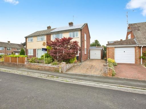 2 bedroom semi-detached house for sale in Kenmore Drive, Yeovil, Somerset, BA21 — £215,000 • 2 bed • 1 bath • 744 ft²
 3 bedroom semi-detached house for sale in Glenthorne Avenue, Yeovil, Somerset, BA21 — £300,000 • 3 bed • 1 bath • 646 ft²
 4 bedroom semi-detached house for sale in Monmouth Road, YEOVIL, BA21 — £250,000 • 4 bed • 1 bath • 852 ft²
 3 bedroom semi-detached house for sale in St Marys Crescent, Yeovil, BA21 — £270,000 • 3 bed • 1 bath • 895 ft²
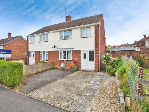 4 bedroom semi-detached house for sale in Monmouth Road, YEOVIL, Somerset, BA21 — £257,000 • 4 bed • 1 bath • 1068 ft²
Meta
- {
"@context": "https://schema.org",
"@type": "Residence",
"name": "3 bedroom semidetached house for sale in Wingate Avenue, Ye…",
"description": "",
"url": "https://propertypiper.co.uk/property/635a83cb-2102-45e8-ae0a-b7ce93786df4",
"image": "https://image-a.propertypiper.co.uk/0354586d-9e46-4054-ab3f-0c74b57917a4-1024.jpeg",
"address": {
"@type": "PostalAddress",
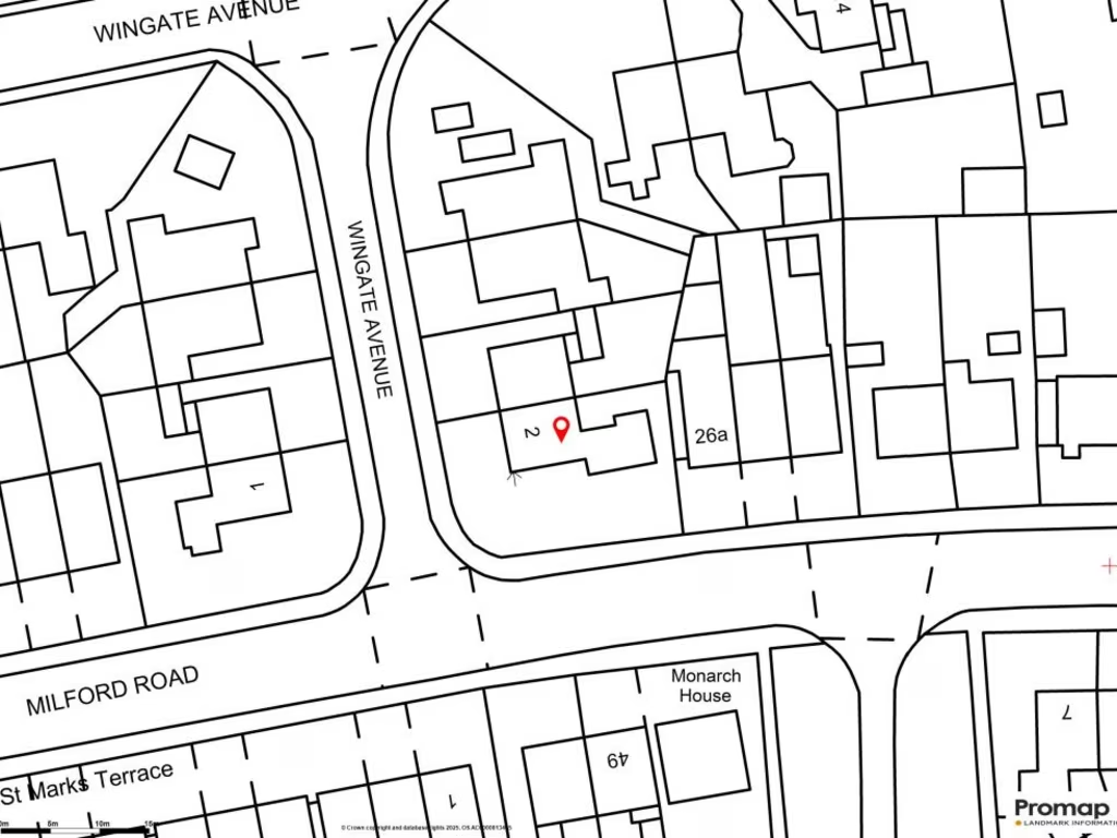
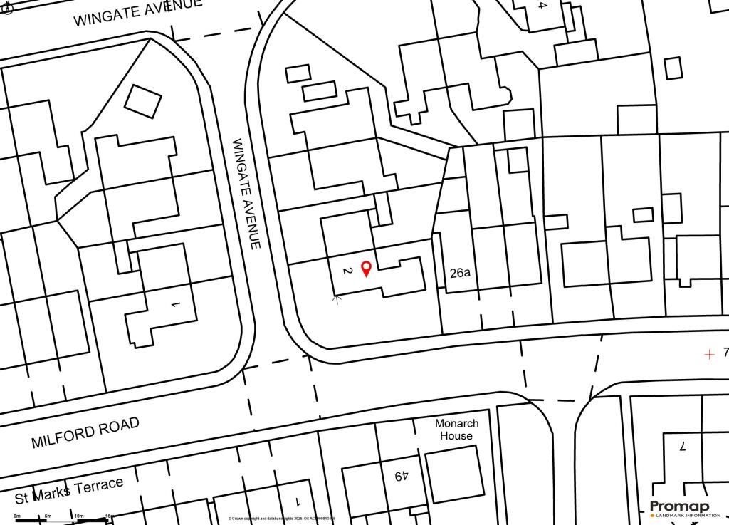
"streetAddress": "27, WINGATE AVENUE, YEOVIL",
"postalCode": "BA21 4QH",
"addressLocality": "South Somerset",
"addressRegion": "Yeovil",
"addressCountry": "England"
},
"geo": {
"@type": "GeoCoordinates",
"latitude": 50.9524482,
"longitude": -2.6254631
},
"numberOfRooms": 3,
"numberOfBathroomsTotal": 1,
"floorSize": {
"@type": "QuantitativeValue",
"value": 893,
"unitCode": "FTK"
},
"offers": {
"@type": "Offer",
"price": 220000,
"priceCurrency": "GBP",
"availability": "https://schema.org/InStock"
},
"additionalProperty": [
{
"@type": "PropertyValue",
"name": "Feature",
"value": "semi-detached"
},
{
"@type": "PropertyValue",
"name": "Feature",
"value": "brick"
},
{
"@type": "PropertyValue",
"name": "Feature",
"value": "post-war"
},
{
"@type": "PropertyValue",
"name": "Feature",
"value": "front garden"
},
{
"@type": "PropertyValue",
"name": "Feature",
"value": "side path"
},
{
"@type": "PropertyValue",
"name": "Feature",
"value": "residential"
},
{
"@type": "PropertyValue",
"name": "Feature",
"value": "family home"
},
{
"@type": "PropertyValue",
"name": "Feature",
"value": "corner property"
},
{
"@type": "PropertyValue",
"name": "Feature",
"value": "driveway"
},
{
"@type": "PropertyValue",
"name": "Feature",
"value": "mid-century"
},
{
"@type": "PropertyValue",
"name": "Feature",
"value": "living room"
},
{
"@type": "PropertyValue",
"name": "Feature",
"value": "fireplace"
},
{
"@type": "PropertyValue",
"name": "Feature",
"value": "stone surround"
},
{
"@type": "PropertyValue",
"name": "Feature",
"value": "large window"
},
{
"@type": "PropertyValue",
"name": "Feature",
"value": "natural light"
},
{
"@type": "PropertyValue",
"name": "Feature",
"value": "sliding doors"
},
{
"@type": "PropertyValue",
"name": "Feature",
"value": "neutral paint"
},
{
"@type": "PropertyValue",
"name": "Feature",
"value": "dated upholstery"
},
{
"@type": "PropertyValue",
"name": "Feature",
"value": "requires modernization"
}
]
}
High Res Floorplan Images
Compatible Floorplan Images
FloorplanImages Thumbnail