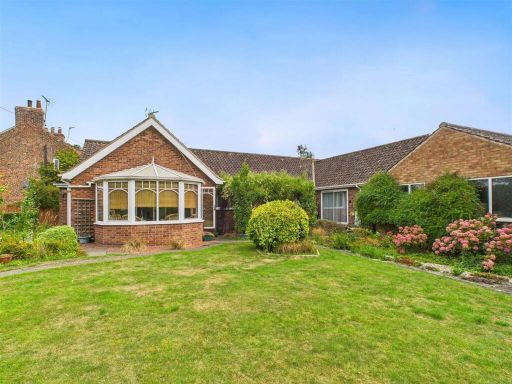
YO25 9TE - 4 bedroom detached bungalow for sale in 41 The Green, Lund,…
View on Property Piper
4 bedroom detached bungalow for sale in 41 The Green, Lund, Driffield, YO25 9TE, YO25
Property Details
- Price: £595000
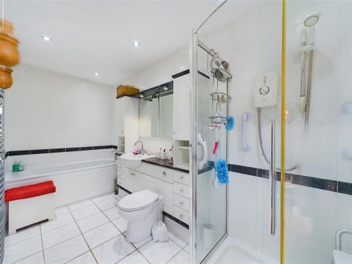
- Bedrooms: 4
- Bathrooms: 3
- Property Type: undefined
- Property SubType: undefined
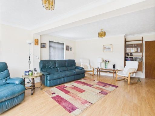
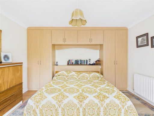
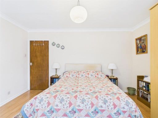
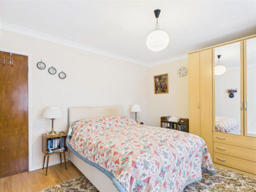
Image Descriptions
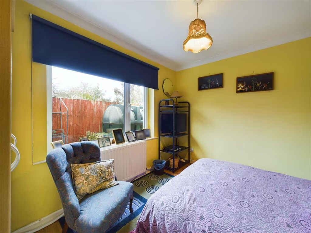
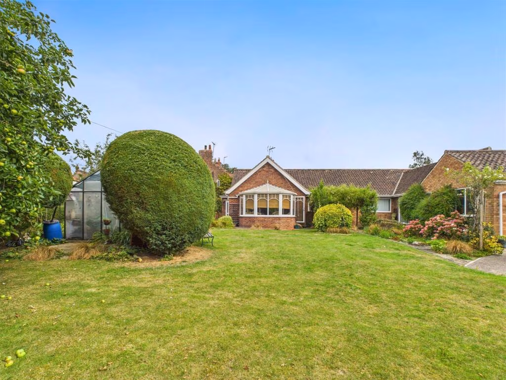
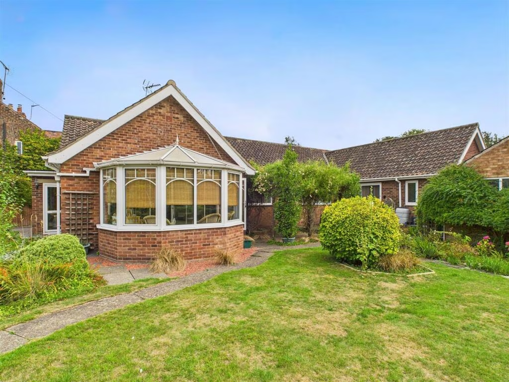
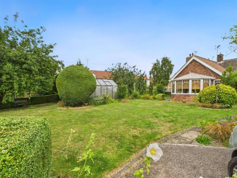
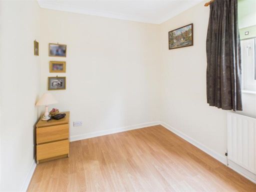
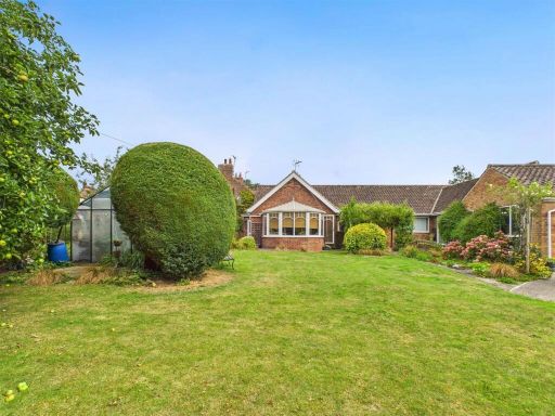
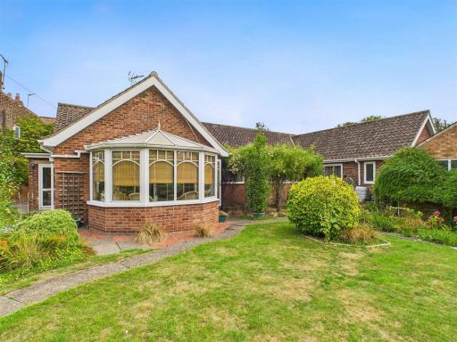
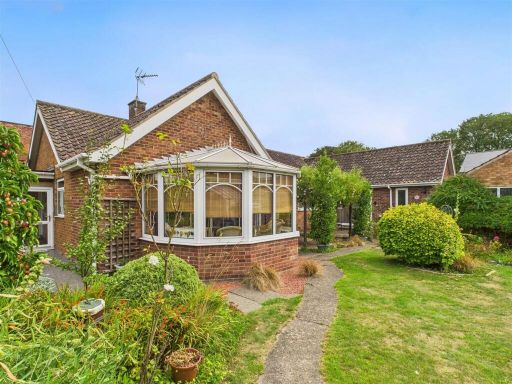
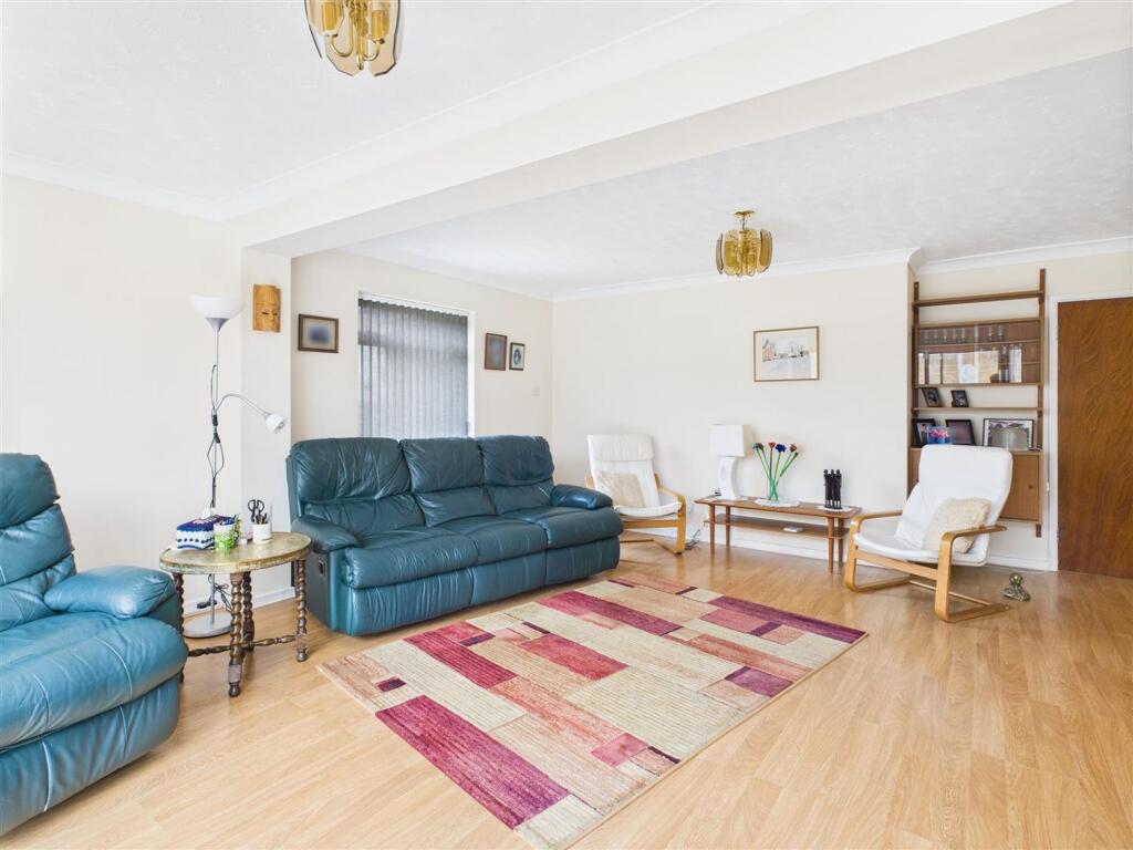
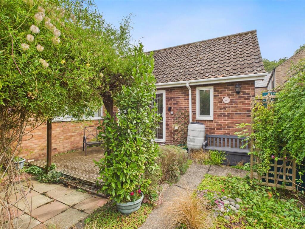
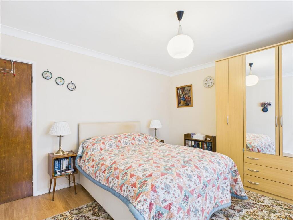
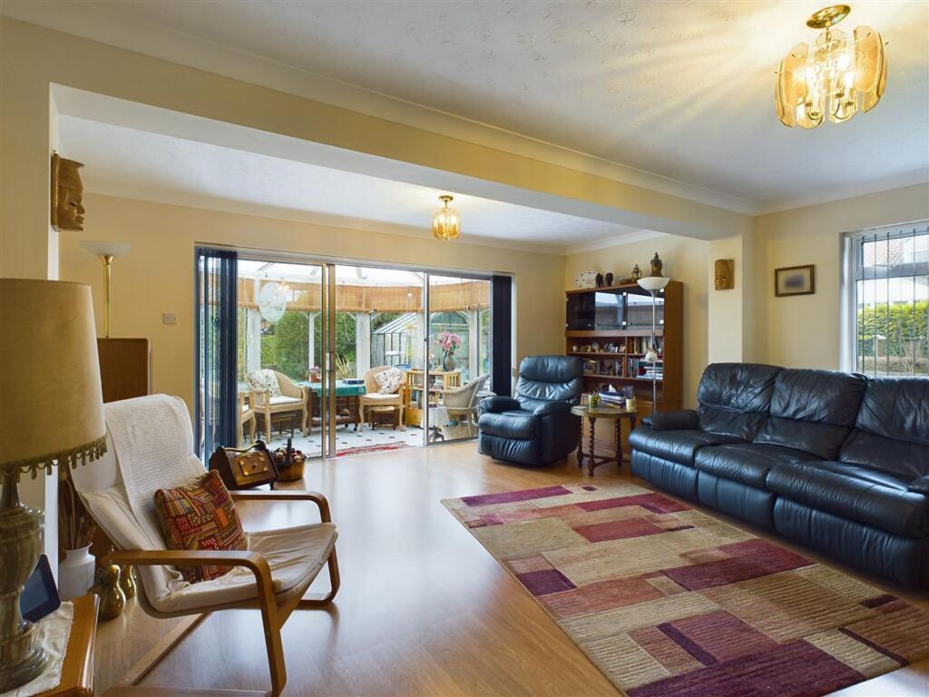
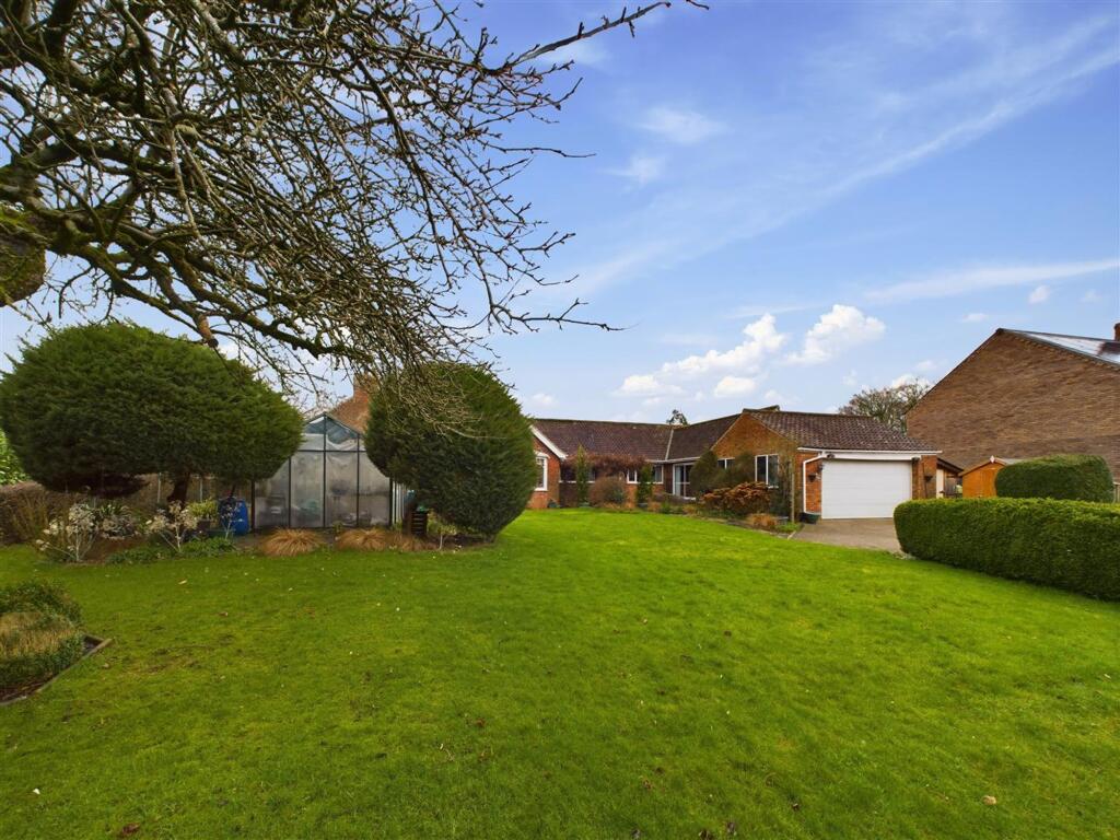
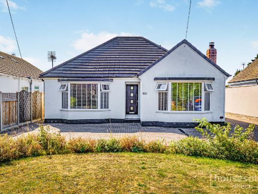
- bungalow Mid-20th Century
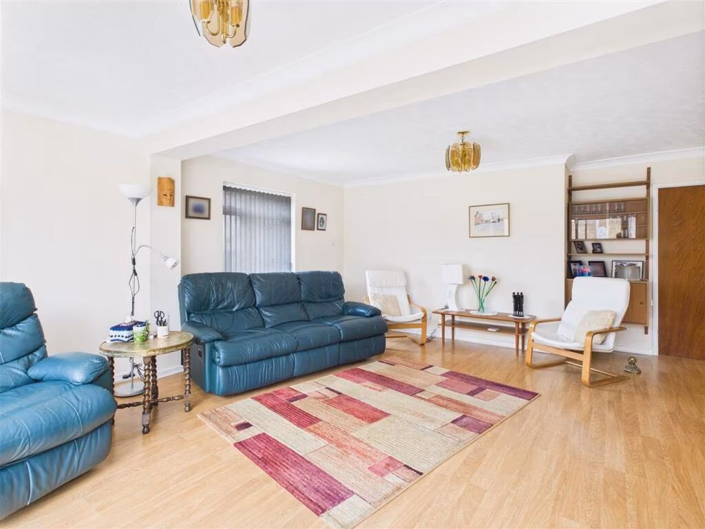
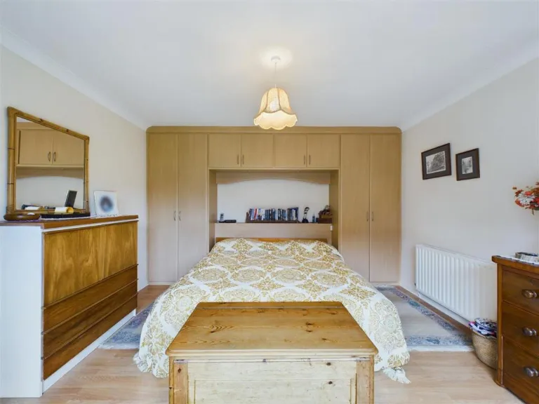
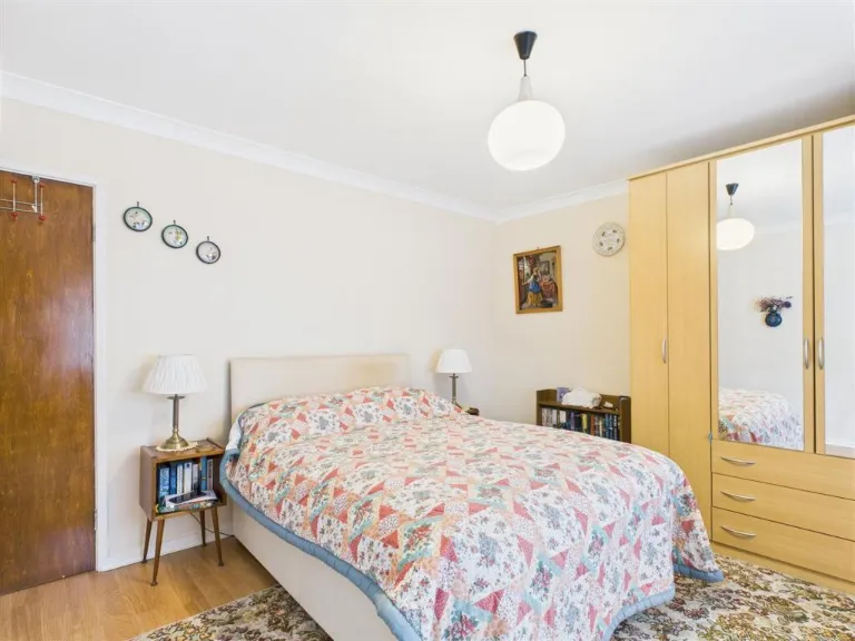
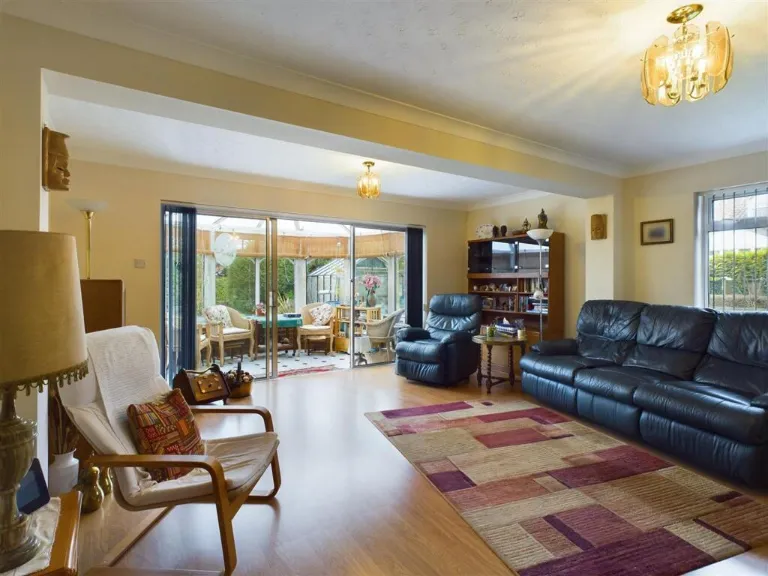
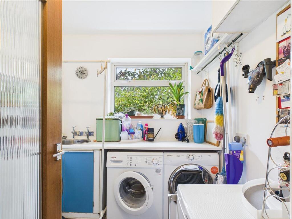
- living room Contemporary
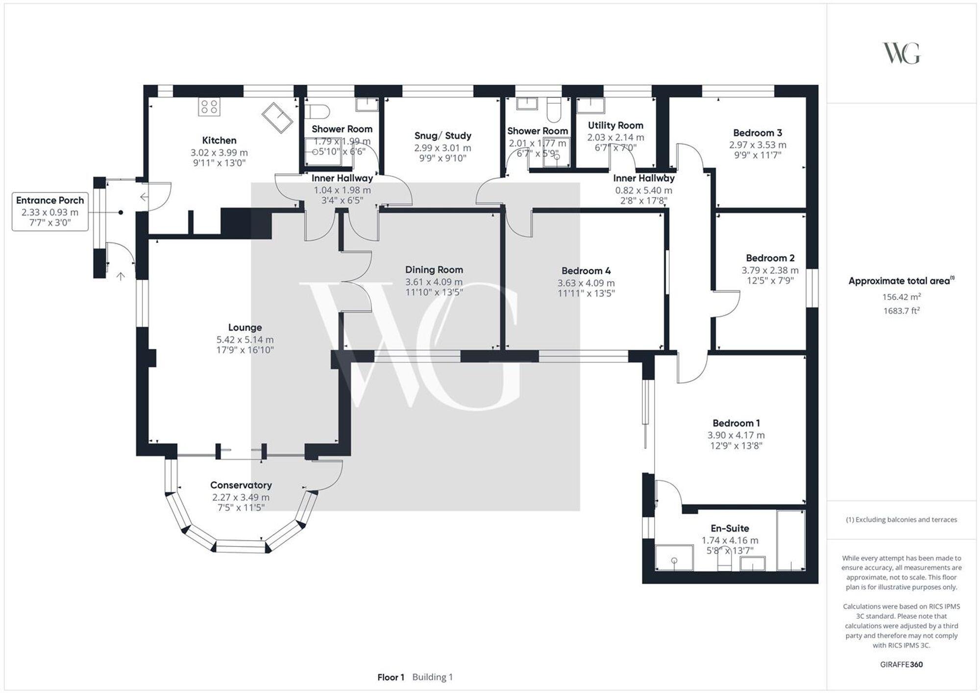
Floorplan Description
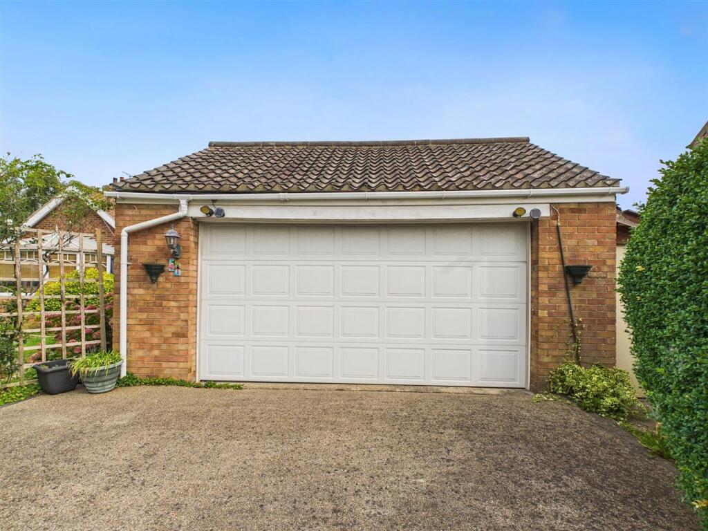
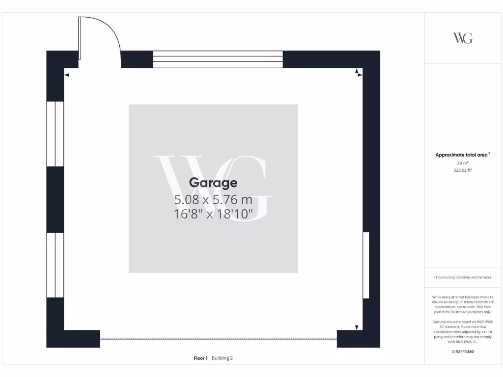
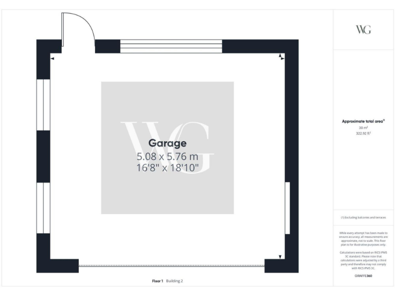
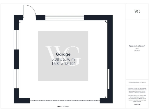
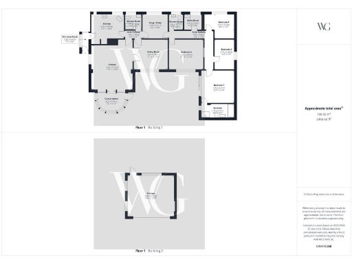
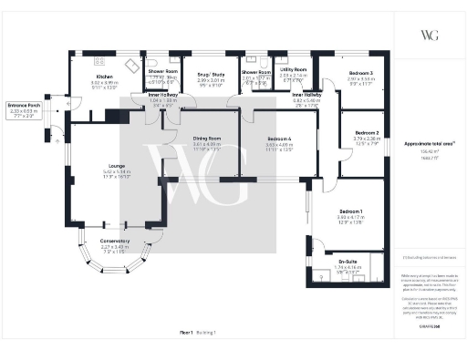
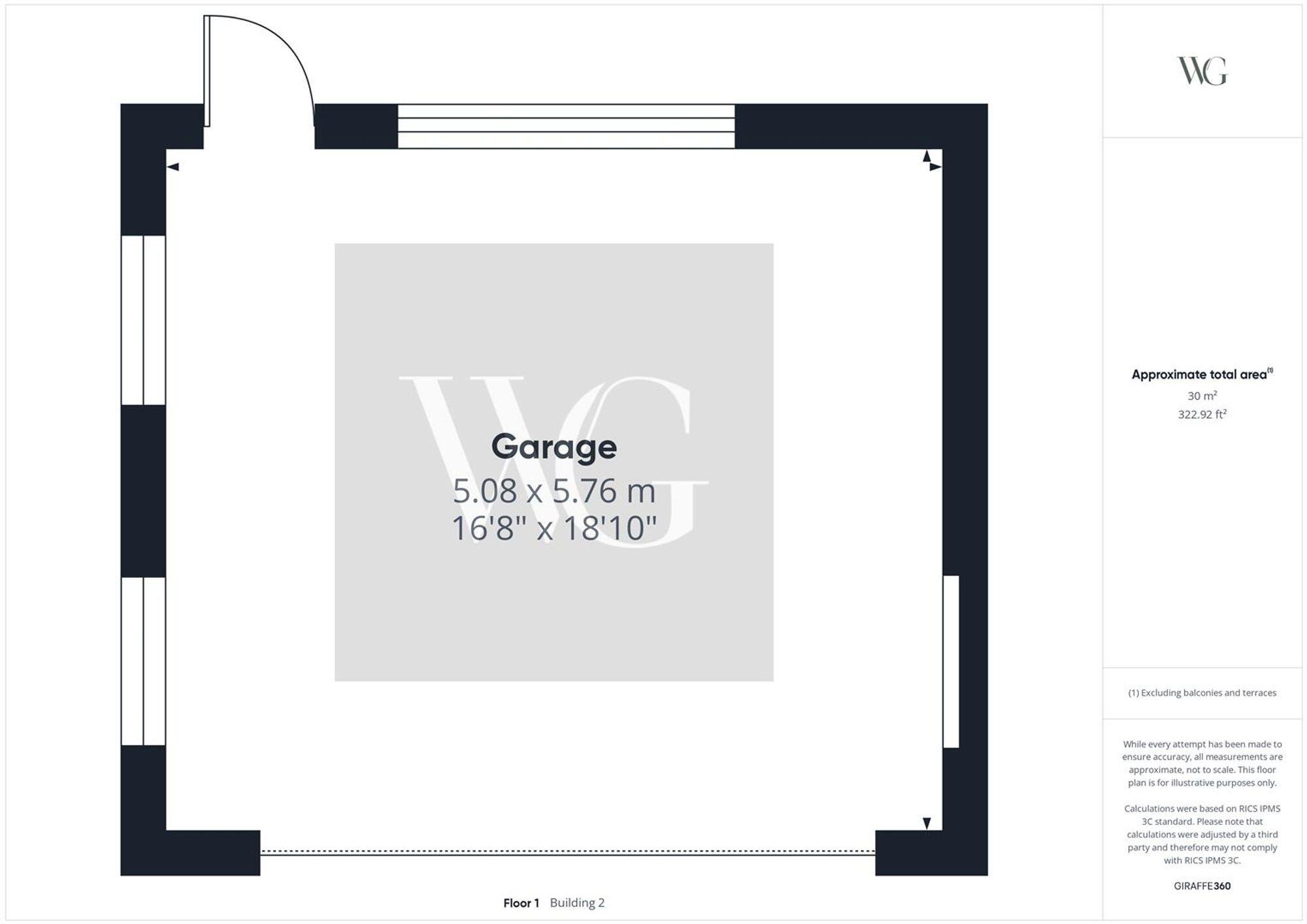
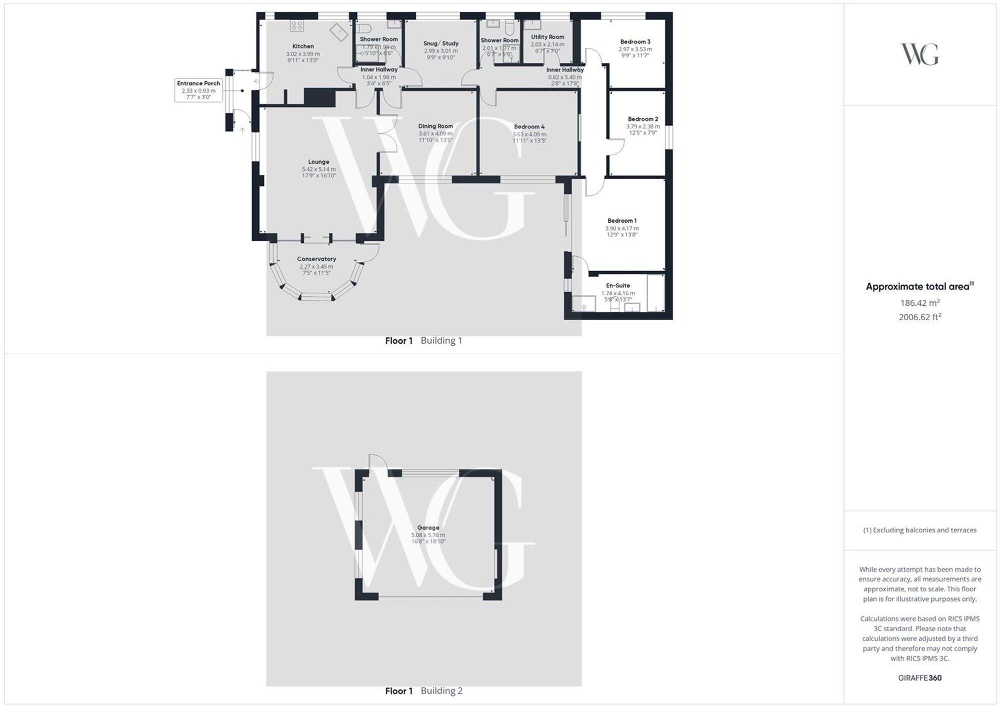
- Garage
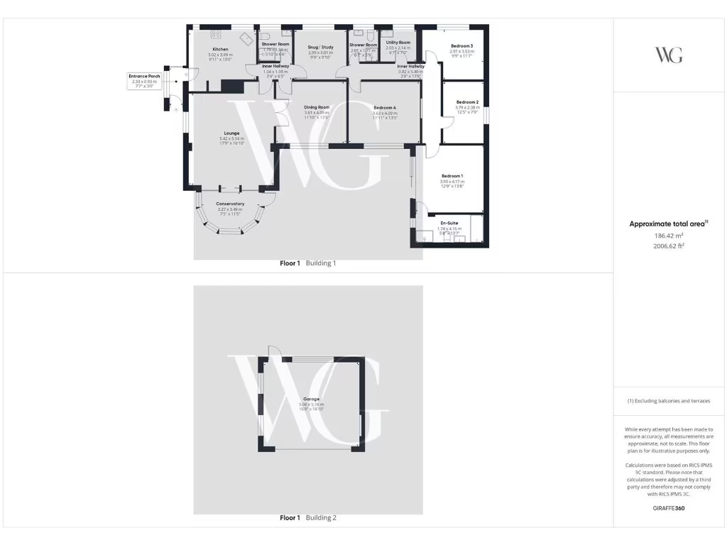
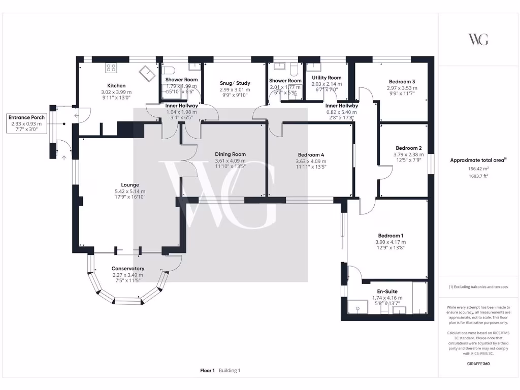
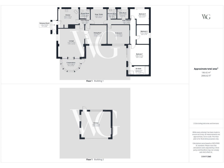
- Floor plan showing rooms for Building 1 and a separate garage in Building 2.
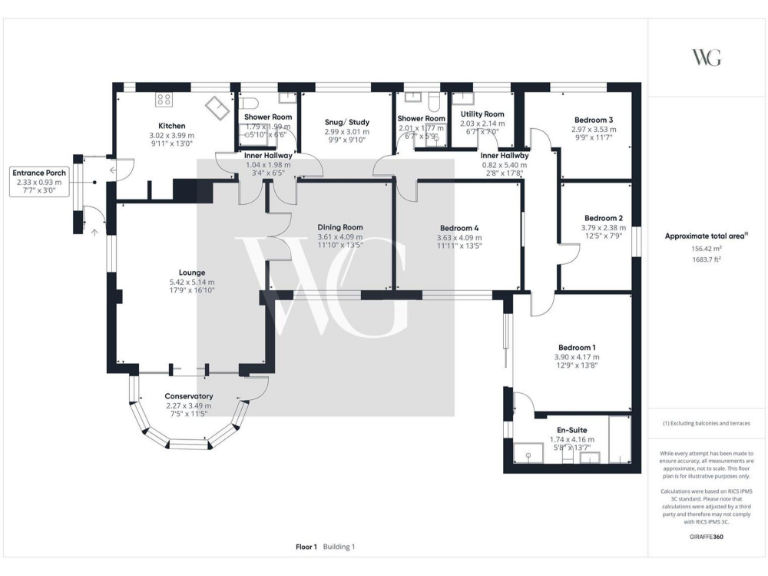
- Single-floor dwelling plan with multiple bedrooms, living and utility spaces
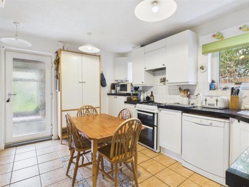
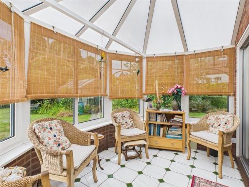
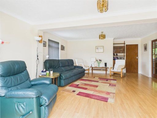
Rooms
- Garage:
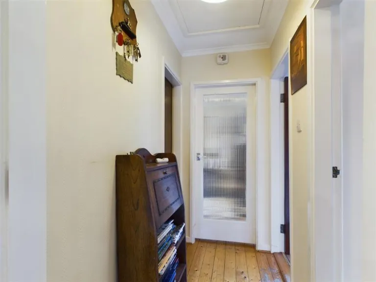
- Entrance Porch:
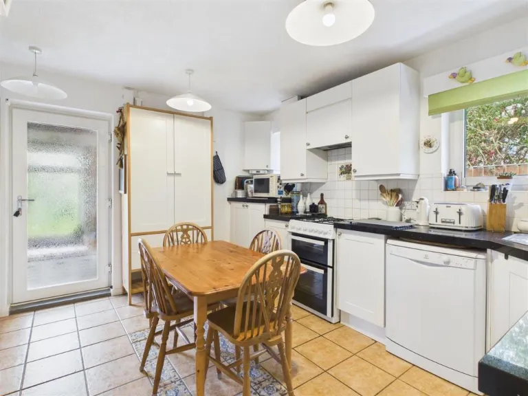
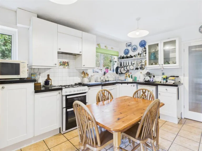
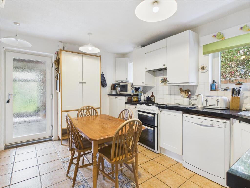
- Kitchen:
- Lounge:
- Conservatory:
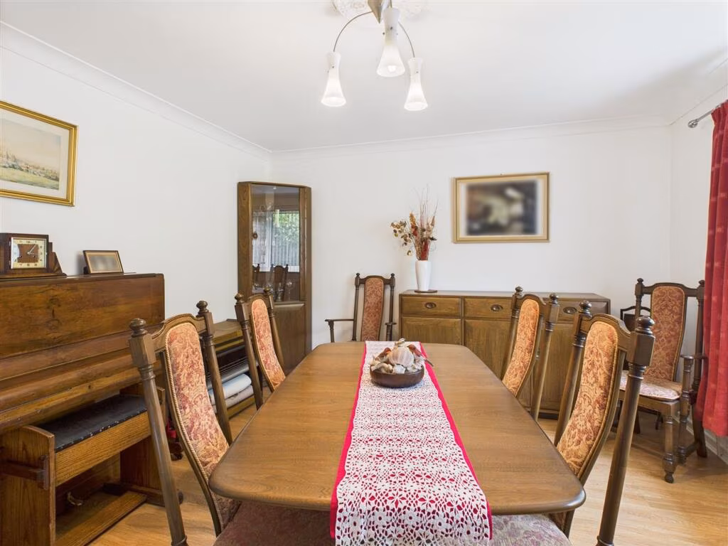
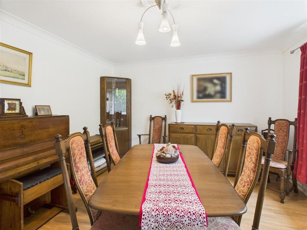
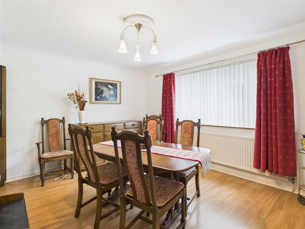
- Dining Room:
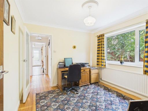
- Snug / Study:
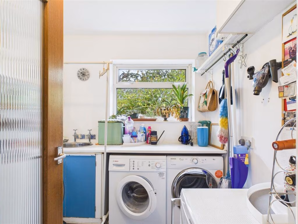
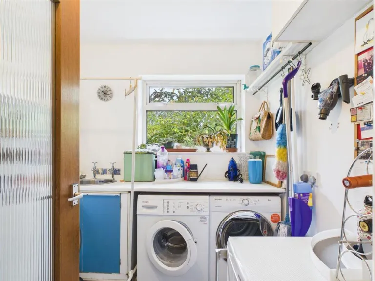
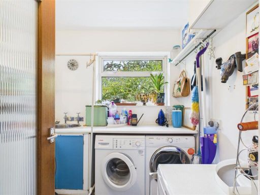
- Utility Room:
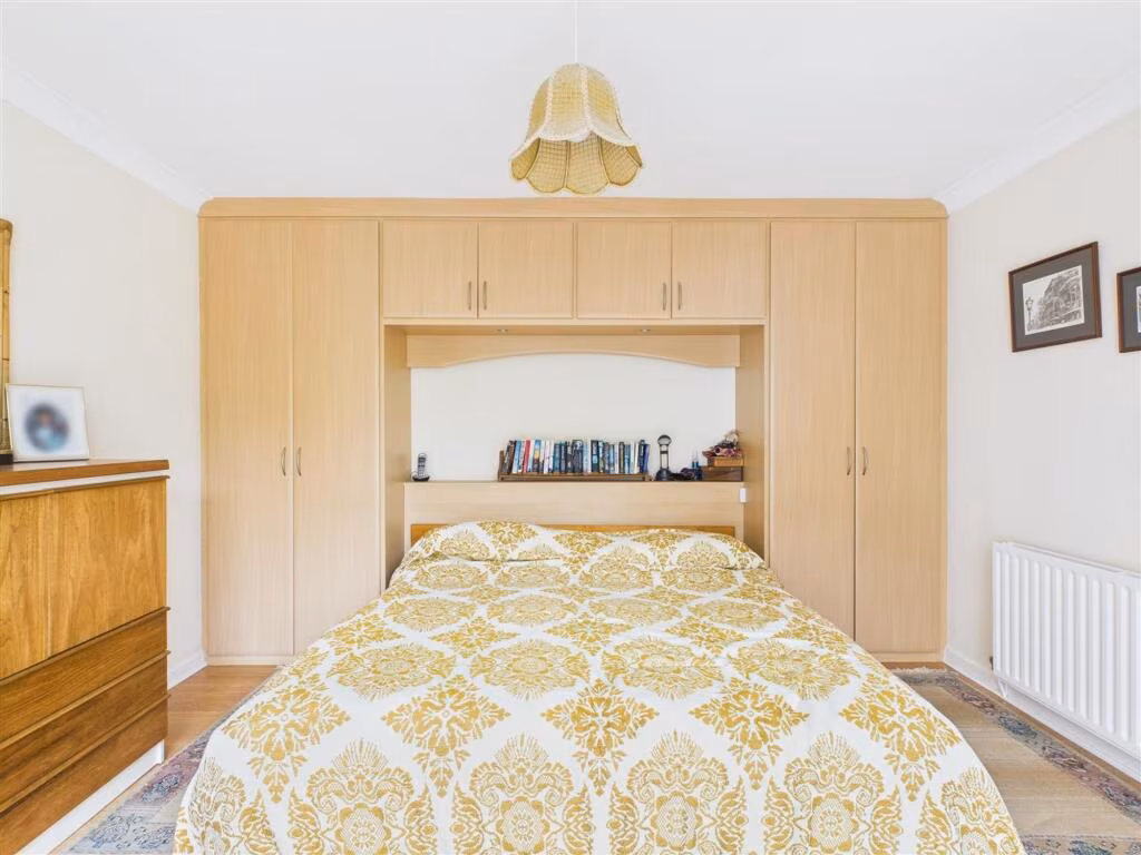
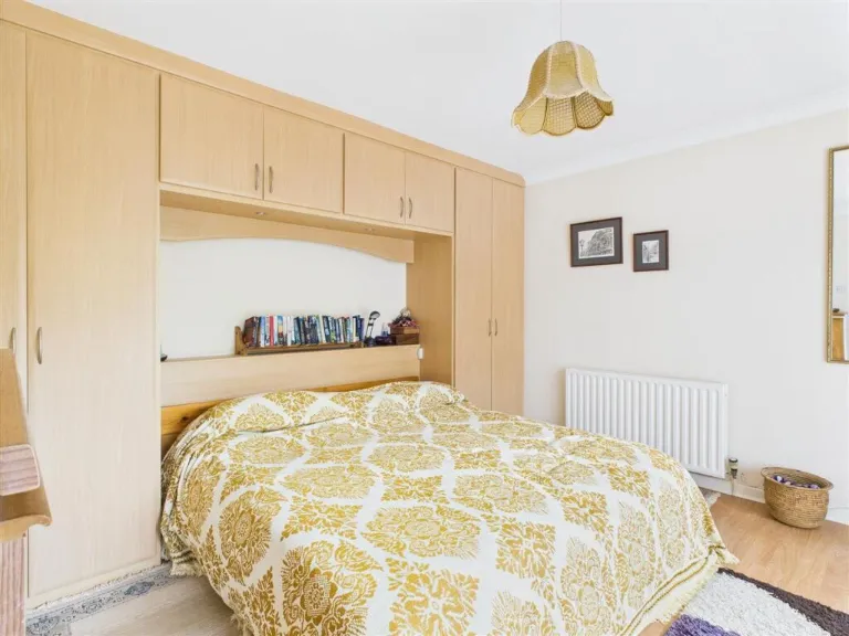
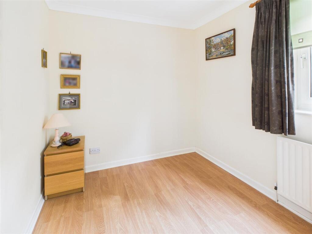
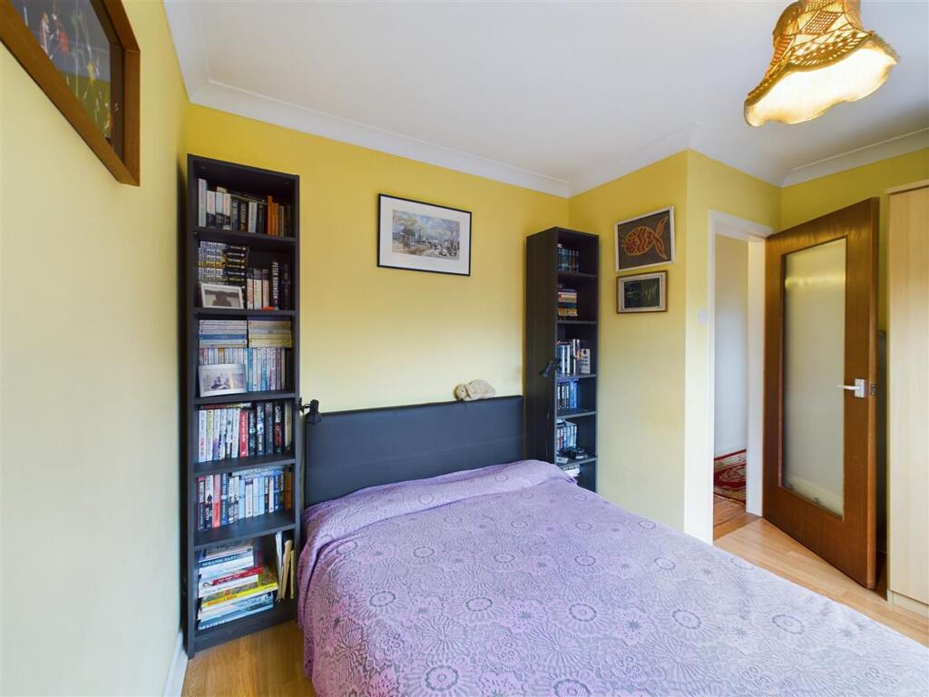
- Bedroom 4:
- Bedroom 1:
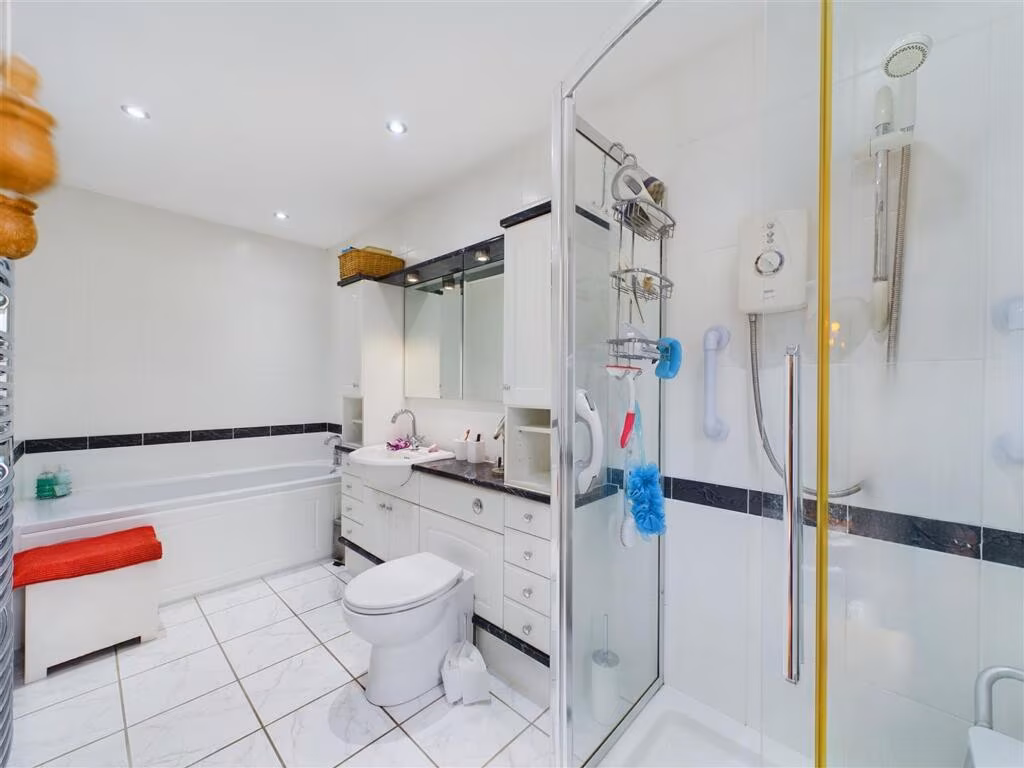
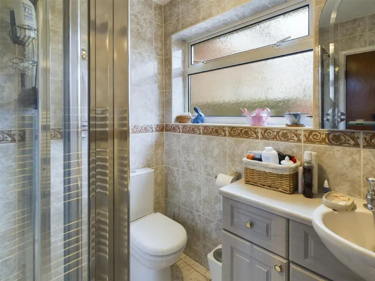
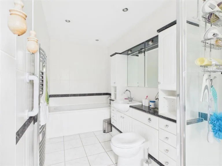
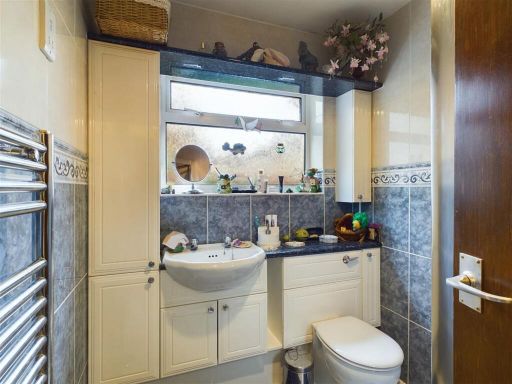
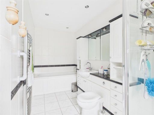
- En-Suite:
- Bedroom 2:
- Bedroom 3:
- Garage:
- Entrance Porch:
- Kitchen:
- Shower Room:
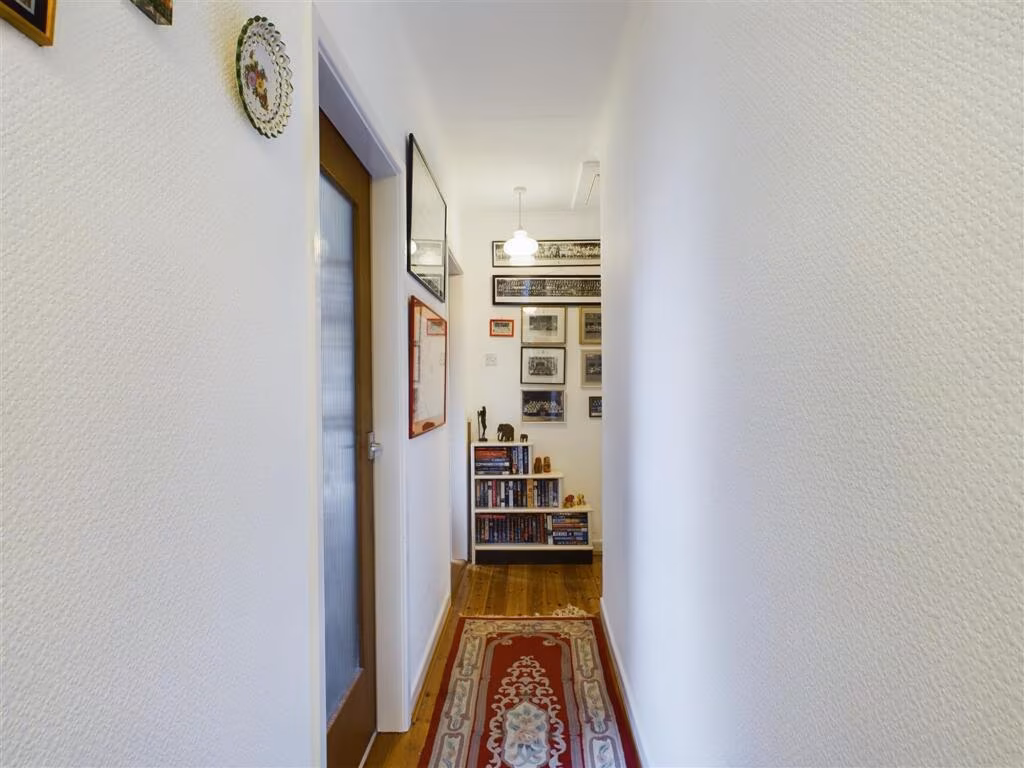
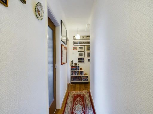
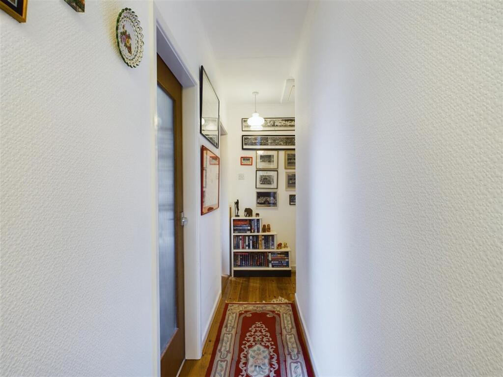
- Inner Hallway:
- Snug/ Study:
- Shower Room:
- Utility Room:
- Inner Hallway:
- Bedroom 3:
- Bedroom 2:
- Dining Room:
- Bedroom 4:
- Lounge:
- Conservatory:
- Bedroom 1:
- En-Suite:
Textual Property Features
- Is New Build
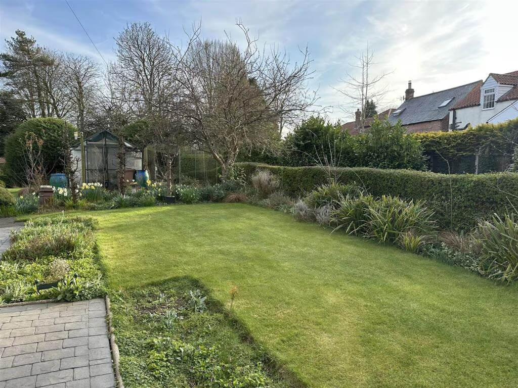
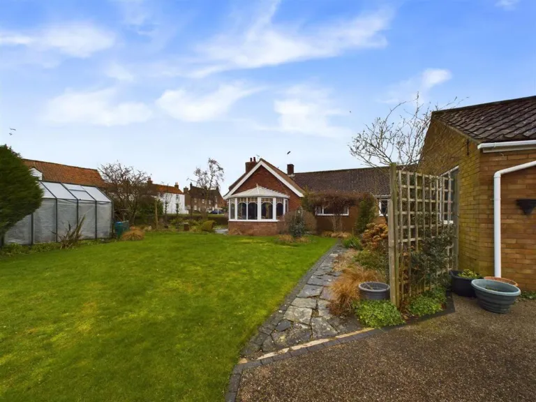
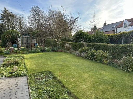
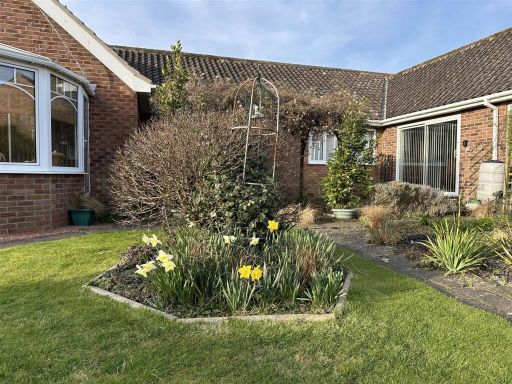
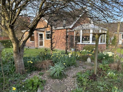
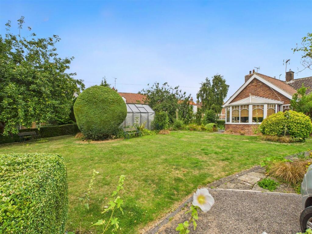
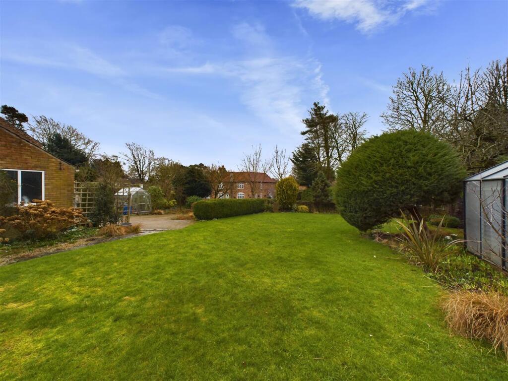
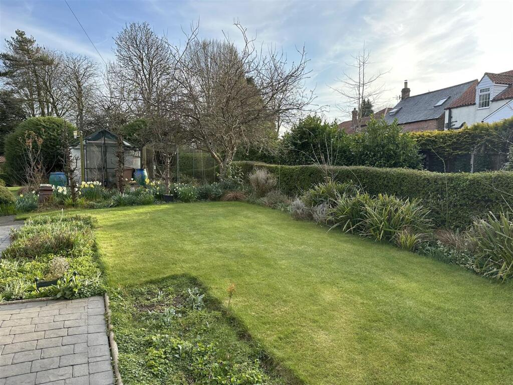
- Has Garden
- Chain Free
- Success
Detected Visual Features
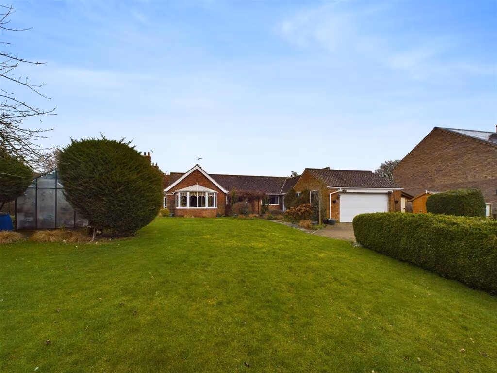
- bungalow
- single-story
- brick construction
- conservatory
- gabled roof
- front garden
- mid-20th century
- suburban
- contemporary
- modern
- bright
- spacious
- living room
- laminate flooring
- open plan
EPC Details
- Partial double glazing
- Solid brick, with internal insulation
- Boiler and radiators, oil
- Low energy lighting in 61% of fixed outlets
- Solid, no insulation (assumed)
Nearby Schools
- Molescroft Primary School
- Lockington Church of England Voluntary Controlled Primary School
- Beswick and Watton CofE (VC) School
- Cherry Burton Church of England Voluntary Controlled Primary School
- Leconfield Primary School
- St Mary's Church of England Voluntary Controlled Primary School, Beverley
- Longcroft School and Sixth Form College
- Middleton-on-the-Wolds Church of England Voluntary Controlled Primary School
- Hutton Cranswick Community Primary School
Nearest Bars And Restaurants
- Id: 316639506
- Tags:
- Amenity: pub
- Building: pub
- Name: Light Dragoon
- TagsNormalized:
- Lat: 53.8786432
- Lon: -0.5119524
- FullGeoHash: gcxds271yeh9
- PartitionGeoHash: gcxd
- Images:
- FoodStandards: null
- Distance: 4573.4
,- Id: 419237066
- Tags:
- Amenity: fast_food
- Cuisine: chinese
- Name: Marble
- TagsNormalized:
- Lat: 53.9339998
- Lon: -0.5615156
- FullGeoHash: gcxdg4rh7dr8
- PartitionGeoHash: gcxd
- Images:
- FoodStandards: null
- Distance: 2970.2
,- Id: 304801449
- Tags:
- Addr:
- City: Middleton on the Wolds
- Postcode: YO25 9UF
- Amenity: pub
- Building: yes
- Name: Robin Hood
- TagsNormalized:
- Lat: 53.9334824
- Lon: -0.5599903
- FullGeoHash: gcxdg621r3bf
- PartitionGeoHash: gcxd
- Images:
- FoodStandards: null
- Distance: 2855.2
,- Id: 151032429
- Tags:
- Addr:
- Postcode: HU17 7PN
- Street: West End
- Village: South Dalton
- Amenity: restaurant
- Amenity_1: pub
- Cuisine: fine_dining
- Name: The Pipe and Glass Inn
- Phone: +441430810246
- Stars: 1
- Website: https://www.pipeandglass.co.uk/
- TagsNormalized:
- Lat: 53.8953088
- Lon: -0.5352627
- FullGeoHash: gcxdeg64zmxp
- PartitionGeoHash: gcxd
- Images:
- FoodStandards: null
- Distance: 2758.8
,- Id: 25990971
- Tags:
- Addr:
- City: Lund
- Housenumber: 19
- Postcode: YO25 9TE
- Street: The Green
- Amenity: pub
- Name: Wellington
- TagsNormalized:
- Lat: 53.9199992
- Lon: -0.5238993
- FullGeoHash: gcxdspfdb227
- PartitionGeoHash: gcxd
- Images:
- FoodStandards: null
- Distance: 91.6
}
Nearest General Shops
- Id: 753494329
- Tags:
- Amenity: cafe
- Building: yes
- Name: Cranswick Farm Shop
- TagsNormalized:
- Lat: 53.9570009
- Lon: -0.4463722
- FullGeoHash: gcxdvydfqcbz
- PartitionGeoHash: gcxd
- Images:
- FoodStandards: null
- Distance: 6584.6
,- Id: 316131755
- Tags:
- Building: yes
- Name: Kiplingcotes Furniture
- Shop: furniture
- TagsNormalized:
- Lat: 53.883177
- Lon: -0.5878714
- FullGeoHash: gcxdd95um85q
- PartitionGeoHash: gcxd
- Images:
- FoodStandards: null
- Distance: 5801.6
,- Id: 3256637641
- Tags:
- TagsNormalized:
- Lat: 53.9665305
- Lon: -0.5337239
- FullGeoHash: gcxe5b73g66t
- PartitionGeoHash: gcxe
- Images:
- FoodStandards: null
- Distance: 5305.4
}
Nearest Grocery shops
- Id: 798166277
- Tags:
- Brand: Londis
- Brand:wikidata: Q21008564
- Building: retail
- Shop: convenience
- TagsNormalized:
- londis
- retail
- convenience
- shop
- Lat: 53.9814945
- Lon: -0.5048907
- FullGeoHash: gcxehe02gpyj
- PartitionGeoHash: gcxe
- Images:
- FoodStandards: null
- Distance: 7038.6
,- Id: 265753815
- Tags:
- Addr:
- City: Hutton Cranswick
- Housenumber: 41
- Postcode: YO25 9QN
- Street: Main Street
- Brand: Spar
- Brand:wikidata: Q610492
- Brand:wikipedia: en:Spar (retailer)
- Designation: Hutton Cranswick
- Name: Spar
- Shop: convenience
- TagsNormalized:
- Lat: 53.9568931
- Lon: -0.4402939
- FullGeoHash: gcxdvyx3smvh
- PartitionGeoHash: gcxd
- Images:
- FoodStandards: null
- Distance: 6888.1
,- Id: 317369818
- Tags:
- Addr:
- City: Beverley
- Housenumber: 40
- Postcode: HU17 7RF
- Street: Main Street
- Village: Cherry Burton
- Amenity: post_office
- Brand: Costcutter
- Brand:wikidata: Q5175072
- Brand:wikipedia: en:Costcutter
- Building: retail
- Contact:
- Website: https://store-locator.costcutter.co.uk/costcutter-50703d97b588
- Name: Costcutter
- Opening_hours: Mo-Su 07:00-20:00
- Opening_hours:post_office: Mo-Fr 08:30-17:30; Sa 09:00-12:30
- Ref:
- Shop: convenience
- TagsNormalized:
- office
- post office
- costcutter
- retail
- convenience
- shop
- Lat: 53.8661288
- Lon: -0.4960128
- FullGeoHash: gcxdkwnbfn4n
- PartitionGeoHash: gcxd
- Images:
- FoodStandards: null
- Distance: 6173
}
Nearest Religious buildings
- Id: 304210746
- Tags:
- Amenity: place_of_worship
- Building: church
- Denomination: methodist
- Name: Lockington Methodist Chapel
- Religion: christian
- TagsNormalized:
- place of worship
- church
- methodist
- chapel
- christian
- Lat: 53.9124694
- Lon: -0.4864269
- FullGeoHash: gcxdsymyckty
- PartitionGeoHash: gcxd
- Images:
- FoodStandards: null
- Distance: 2557.2
,- Id: 144277567
- Tags:
- Amenity: place_of_worship
- Building: church
- Denomination: anglican
- Name: St Marys
- Religion: christian
- Wikidata: Q17534045
- TagsNormalized:
- place of worship
- church
- anglican
- christian
- Lat: 53.8972074
- Lon: -0.5295368
- FullGeoHash: gcxdegwmuzst
- PartitionGeoHash: gcxd
- Images:
- FoodStandards: null
- Distance: 2472
,- Id: 304081213
- Tags:
- Amenity: place_of_worship
- Building: church
- Denomination: anglican
- Name: All Saints Parish Church
- Religion: christian
- Wikidata: Q17554732
- TagsNormalized:
- place of worship
- church
- anglican
- parish
- christian
- Lat: 53.9203825
- Lon: -0.5242199
- FullGeoHash: gcxdspfkbzc6
- PartitionGeoHash: gcxd
- Images:
- FoodStandards: null
- Distance: 137
}
Nearest Medical buildings
- Id: 332143035
- Tags:
- Amenity: clinic
- Building: yes
- Emergency: no
- Healthcare: clinic
- Name: Beverley Health Centre
- Website: https://www.beverleyhealthcentre.nhs.uk/
- TagsNormalized:
- clinic
- health
- healthcare
- health centre
- Lat: 53.84528
- Lon: -0.4326857
- FullGeoHash: gcxdq4hzmxwn
- PartitionGeoHash: gcxd
- Images:
- FoodStandards: null
- Distance: 10157.1
,- Id: 140968943
- Tags:
- Amenity: doctors
- Building: yes
- Name: Beverley & Molescroft Surgery
- TagsNormalized:
- Lat: 53.856113
- Lon: -0.4329941
- FullGeoHash: gcxdqhhwwe05
- PartitionGeoHash: gcxd
- Images:
- FoodStandards: null
- Distance: 9196.3
,- Id: 3433580090
- Tags:
- Addr:
- City: Molescroft
- Postcode: HU17 7JY
- Street: Pighill Lane
- Amenity: pharmacy
- Dispensing: yes
- Drive_through: no
- Healthcare: pharmacy
- Name: Molescroft Pharmacy
- Opening_hours: Mo-Fr 09:00-18:00
- Operator: Lincolnshire Co-operative
- TagsNormalized:
- Lat: 53.8571063
- Lon: -0.4397464
- FullGeoHash: gcxdmuru3hm3
- PartitionGeoHash: gcxd
- Images:
- FoodStandards: null
- Distance: 8829.7
,- Id: 185489375
- Tags:
- Addr:
- City: Molescroft
- Postcode: HU17 7JY
- Street: Pighill Lane
- Amenity: doctors
- Building: yes
- Healthcare: doctor
- Name: North Beverley Medical Centre
- TagsNormalized:
- doctor
- doctors
- health
- healthcare
- Lat: 53.8571438
- Lon: -0.4399045
- FullGeoHash: gcxdmurst7r2
- PartitionGeoHash: gcxd
- Images:
- FoodStandards: null
- Distance: 8820
}
Nearest Leisure Facilities
- Id: 1087948156
- Tags:
- TagsNormalized:
- Lat: 53.9338821
- Lon: -0.4839044
- FullGeoHash: gcxdufreshqd
- PartitionGeoHash: gcxd
- Images:
- FoodStandards: null
- Distance: 3080.3
,- Id: 1087948155
- Tags:
- TagsNormalized:
- Lat: 53.9332427
- Lon: -0.4839014
- FullGeoHash: gcxdufpxum0u
- PartitionGeoHash: gcxd
- Images:
- FoodStandards: null
- Distance: 3043.3
,- Id: 759879249
- Tags:
- Leisure: playground
- Operator: The School
- Surface: asphalt
- TagsNormalized:
- Lat: 53.9106326
- Lon: -0.4799254
- FullGeoHash: gcxdtn4s0ym9
- PartitionGeoHash: gcxd
- Images:
- FoodStandards: null
- Distance: 3025
,- Id: 683867938
- Tags:
- TagsNormalized:
- Lat: 53.9334318
- Lon: -0.5603872
- FullGeoHash: gcxdg4rcn03h
- PartitionGeoHash: gcxd
- Images:
- FoodStandards: null
- Distance: 2873.7
,- Id: 1023804246
- Tags:
- Leisure: pitch
- Sport: tennis
- TagsNormalized:
- Lat: 53.9194399
- Lon: -0.5255736
- FullGeoHash: gcxdsp9r90pg
- PartitionGeoHash: gcxd
- Images:
- FoodStandards: null
- Distance: 121.3
}
Nearest Tourist attractions
- Id: 365923219
- Tags:
- Amenity: telephone
- Booth: K6
- Covered: booth
- Man_made: telephone_box
- Tourism: information
- TagsNormalized:
- Lat: 53.9648693
- Lon: -0.4408324
- FullGeoHash: gcxejbnbpug8
- PartitionGeoHash: gcxe
- Images:
- FoodStandards: null
- Distance: 7435.2
,- Id: 305426174
- Tags:
- Name: The Waggons
- Tourism: chalet
- TagsNormalized:
- Lat: 53.9023012
- Lon: -0.6082717
- FullGeoHash: gcxddht5djpx
- PartitionGeoHash: gcxd
- Images:
- FoodStandards: null
- Distance: 5843.9
,- Id: 304104844
- Tags:
- Addr:
- City: Watton
- Postcode: YO25 9HY
- Street: Beverley Road
- Name: Fountain House Farm Campsite
- Tents: yes
- Tourism: camp_site
- TagsNormalized:
- campsite
- farm
- fountain
- tourism
- Lat: 53.9305293
- Lon: -0.4549007
- FullGeoHash: gcxdv9ub0536
- PartitionGeoHash: gcxd
- Images:
- FoodStandards: null
- Distance: 4683
}
Nearest Hotels
- Id: 286962826
- Tags:
- Name: Market Cross Hotel
- Tourism: hotel
- TagsNormalized:
- Lat: 53.8429177
- Lon: -0.4331958
- FullGeoHash: gcxdq1u99z3f
- PartitionGeoHash: gcxd
- Images:
- FoodStandards: null
- Distance: 10351.6
,- Id: 1093318046
- Tags:
- Building: yes
- Name: The Beverley Arms
- Tourism: hotel
- Wikidata: Q26629913
- TagsNormalized:
- Lat: 53.8438024
- Lon: -0.4344086
- FullGeoHash: gcxdq1gwvs32
- PartitionGeoHash: gcxd
- Images:
- FoodStandards: null
- Distance: 10225.4
,- Id: 2940824098
- Tags:
- Name: The Inn on the Bar
- Tourism: hotel
- TagsNormalized:
- Lat: 53.8452375
- Lon: -0.4360758
- FullGeoHash: gcxdq44rnxy2
- PartitionGeoHash: gcxd
- Images:
- FoodStandards: null
- Distance: 10032
}
Tags
- bungalow
- single-story
- brick construction
- conservatory
- gabled roof
- front garden
- mid-20th century
- suburban
- contemporary
- modern
- bright
- spacious
- living room
- laminate flooring
- open plan
Local Market Stats
- Average Price/sqft: £216
- Avg Income: £41500
- Rental Yield: 3.2%
- Social Housing: 7%
- Planning Success Rate: 94%
Similar Properties
 2 bedroom detached bungalow for sale in Hull Bridge Road, Beverley, HU17 — £285,000 • 2 bed • 1 bath • 1163 ft²
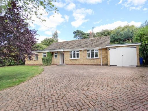 3 bedroom detached bungalow for sale in South Glebe, Lockington, YO25 — £495,000 • 3 bed • 1 bath • 1300 ft²
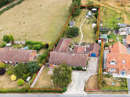 4 bedroom detached bungalow for sale in Church Lane, Seaton Ross, York, YO42 4LS, YO42 — £575,000 • 4 bed • 2 bath • 2000 ft²
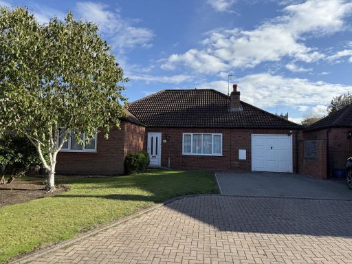 3 bedroom detached bungalow for sale in Crossfield Close, York, YO43 — £399,995 • 3 bed • 2 bath • 1421 ft²
 4 bedroom detached bungalow for sale in Alma Cottage Main Street, Tickton, Beverley, HU17 — £1,000,000 • 4 bed • 3 bath • 4664 ft²
 2 bedroom bungalow for sale in Hollycroft, Barmston, Driffield, East Yorkshire, YO25 — £165,000 • 2 bed • 1 bath • 736 ft²
Meta
- {
"@context": "https://schema.org",
"@type": "Residence",
"name": "4 bedroom detached bungalow for sale in 41 The Green, Lund,…",
"description": "",
"url": "https://propertypiper.co.uk/property/5dfb9bc9-05ff-4d54-80d5-5cdc90f98207",
"image": "https://image-a.propertypiper.co.uk/c0497553-edb5-45d6-9bbd-6afdeee75e52-1024.jpeg",
"address": {
"@type": "PostalAddress",
"streetAddress": "41, THE GREEN, DRIFFIELD, LUND",
"postalCode": "YO25 9TE",
"addressLocality": "East Riding of Yorkshire",
"addressRegion": "Beverley and Holderness",
"addressCountry": "England"
},
"geo": {
"@type": "GeoCoordinates",
"latitude": 53.9191785,
"longitude": -0.5237757
},
"numberOfRooms": 4,
"numberOfBathroomsTotal": 3,
"floorSize": {
"@type": "QuantitativeValue",
"value": 3029,
"unitCode": "FTK"
},
"offers": {
"@type": "Offer",
"price": 595000,
"priceCurrency": "GBP",
"availability": "https://schema.org/InStock"
},
"additionalProperty": [
{
"@type": "PropertyValue",
"name": "Feature",
"value": "bungalow"
},
{
"@type": "PropertyValue",
"name": "Feature",
"value": "single-story"
},
{
"@type": "PropertyValue",
"name": "Feature",
"value": "brick construction"
},
{
"@type": "PropertyValue",
"name": "Feature",
"value": "conservatory"
},
{
"@type": "PropertyValue",
"name": "Feature",
"value": "gabled roof"
},
{
"@type": "PropertyValue",
"name": "Feature",
"value": "front garden"
},
{
"@type": "PropertyValue",
"name": "Feature",
"value": "mid-20th century"
},
{
"@type": "PropertyValue",
"name": "Feature",
"value": "suburban"
},
{
"@type": "PropertyValue",
"name": "Feature",
"value": "contemporary"
},
{
"@type": "PropertyValue",
"name": "Feature",
"value": "modern"
},
{
"@type": "PropertyValue",
"name": "Feature",
"value": "bright"
},
{
"@type": "PropertyValue",
"name": "Feature",
"value": "spacious"
},
{
"@type": "PropertyValue",
"name": "Feature",
"value": "living room"
},
{
"@type": "PropertyValue",
"name": "Feature",
"value": "laminate flooring"
},
{
"@type": "PropertyValue",
"name": "Feature",
"value": "open plan"
}
]
}
High Res Floorplan Images
Compatible Floorplan Images
FloorplanImages Thumbnail