SE16 6QN - 2 bedroom flat for sale in Somerford Way, Canada Water, SE16
View on Property Piper
2 bedroom flat for sale in Somerford Way, Canada Water, SE16
Property Details
- Price: £400000
- Bedrooms: 2
- Bathrooms: 1
- Property Type: undefined
- Property SubType: undefined
Image Descriptions
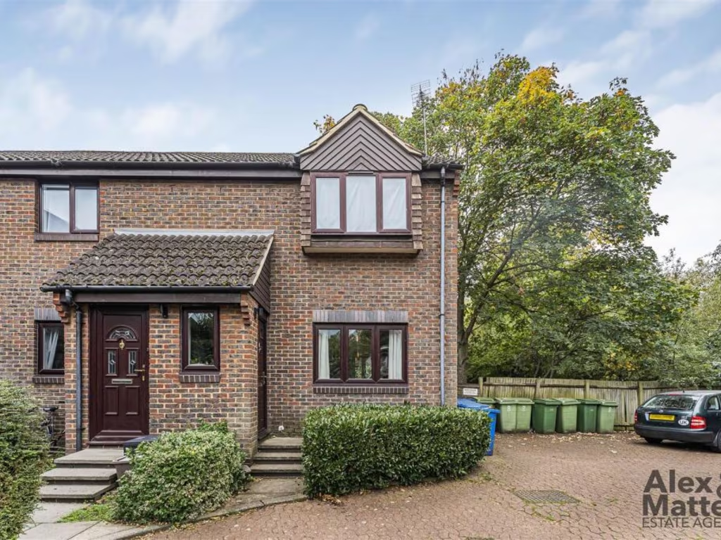
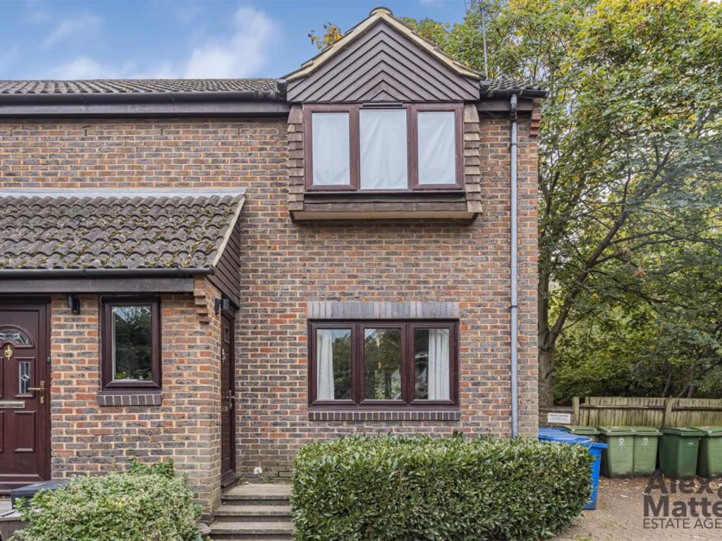
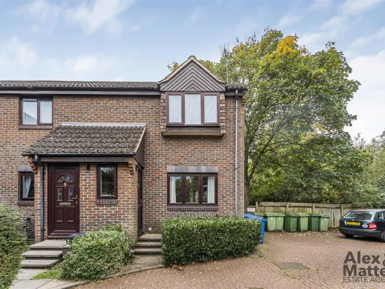
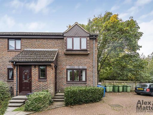
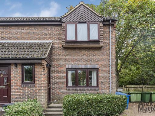
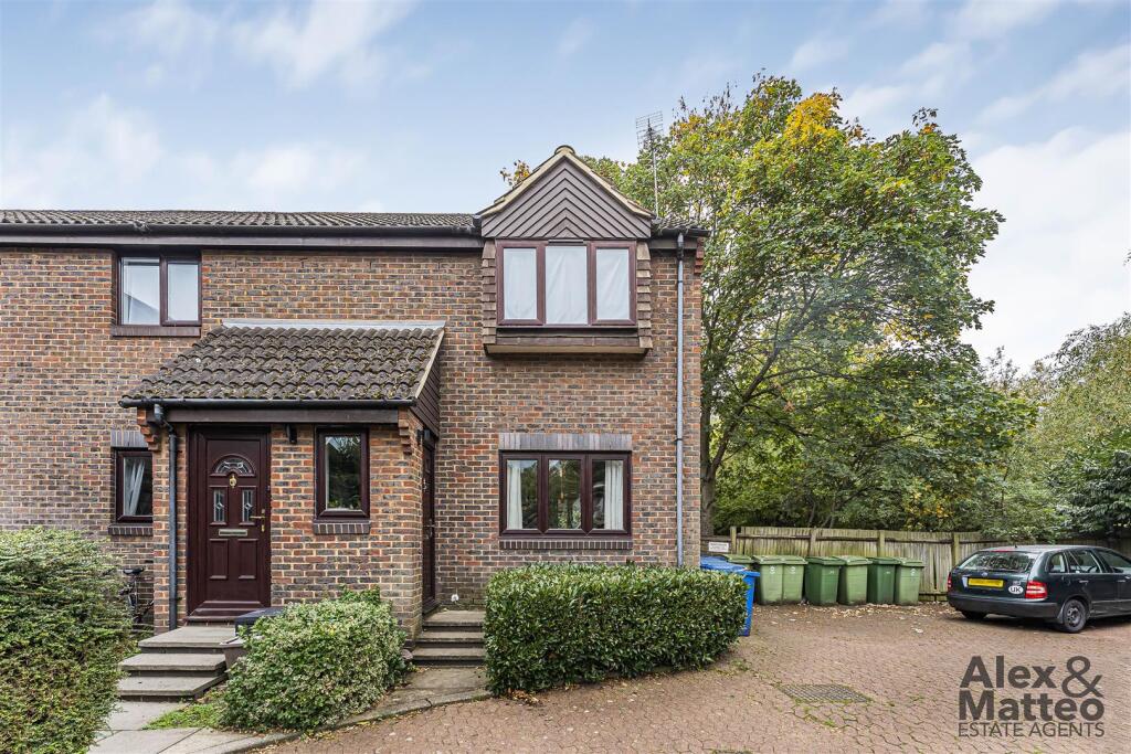
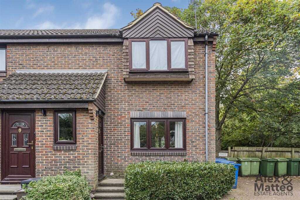
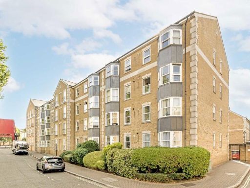
- semi-detached house modern
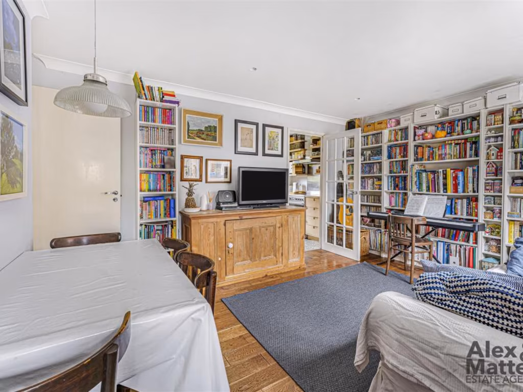
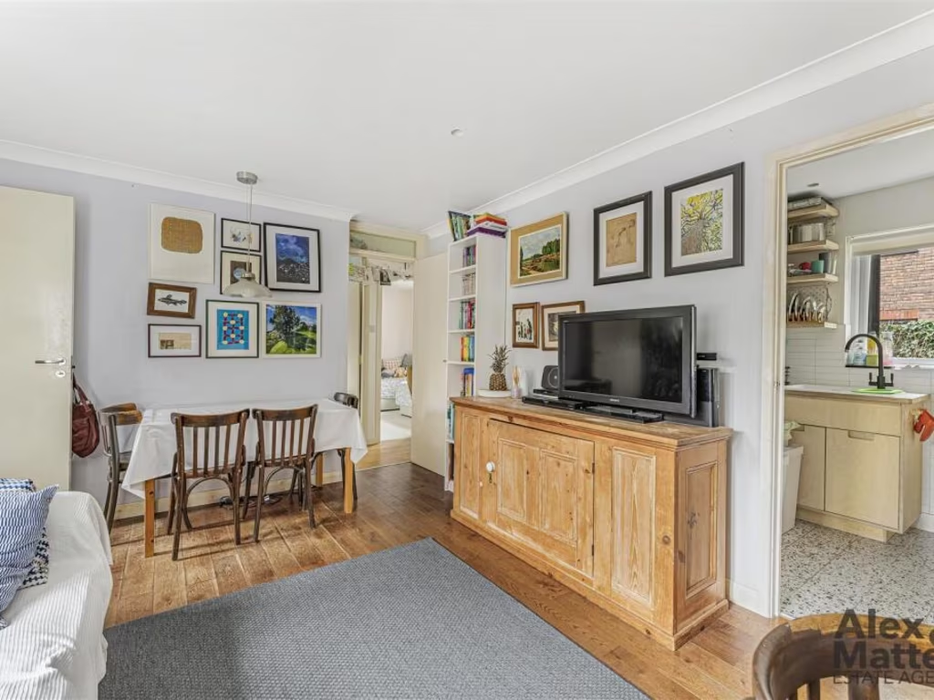
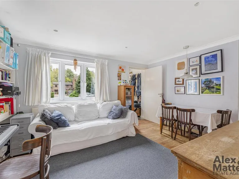
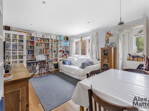
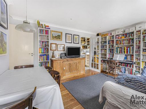
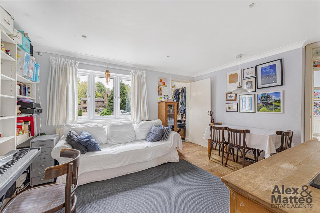
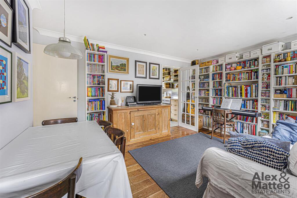
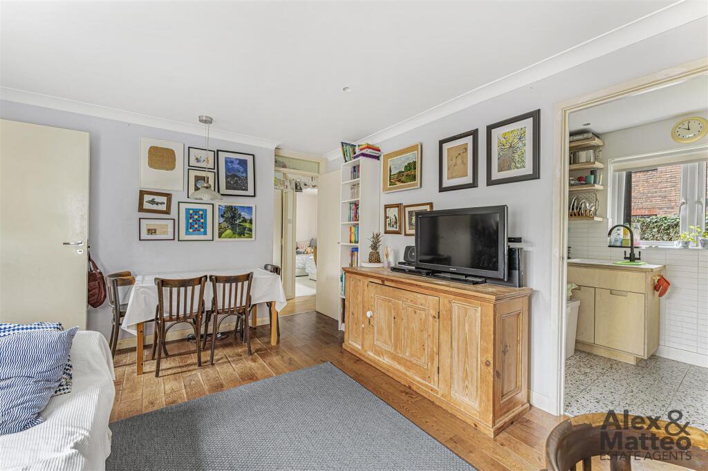
- living room or dining area modern
Floorplan Description
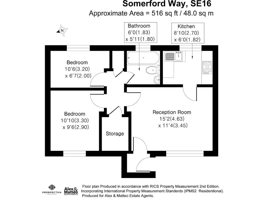
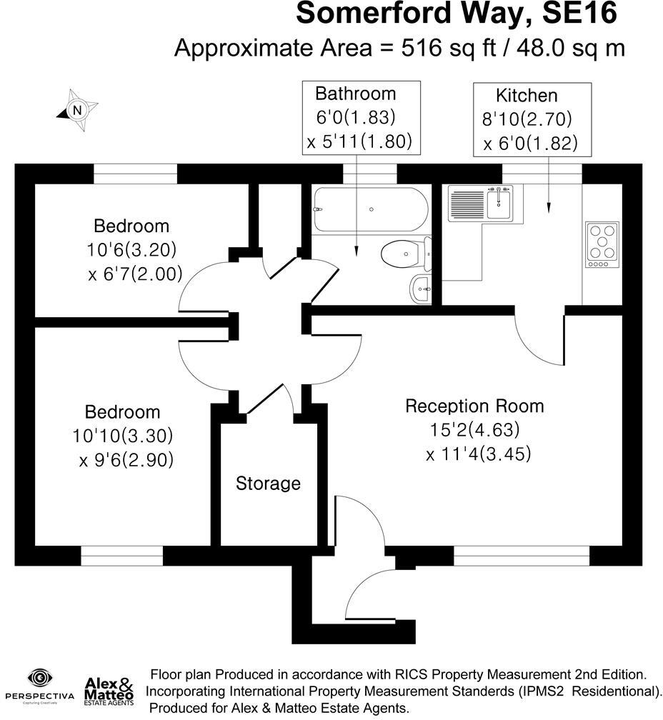
- Floor plan for a single-floor property at Somerford Way, SE16
Rooms
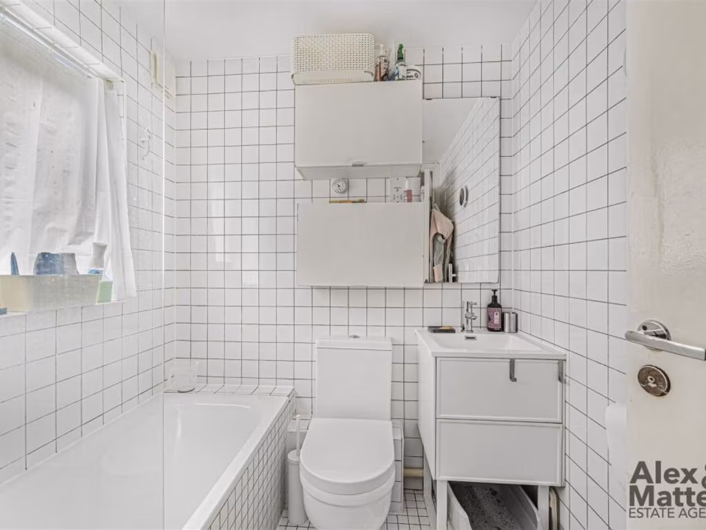
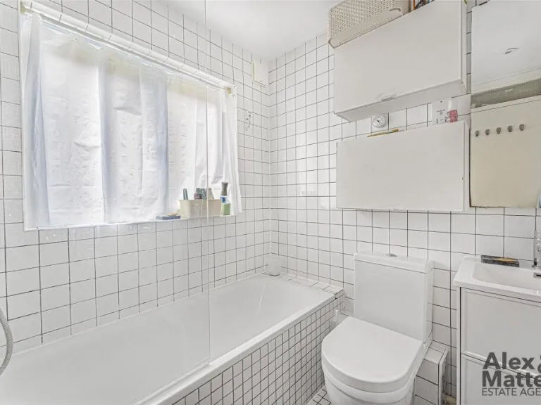
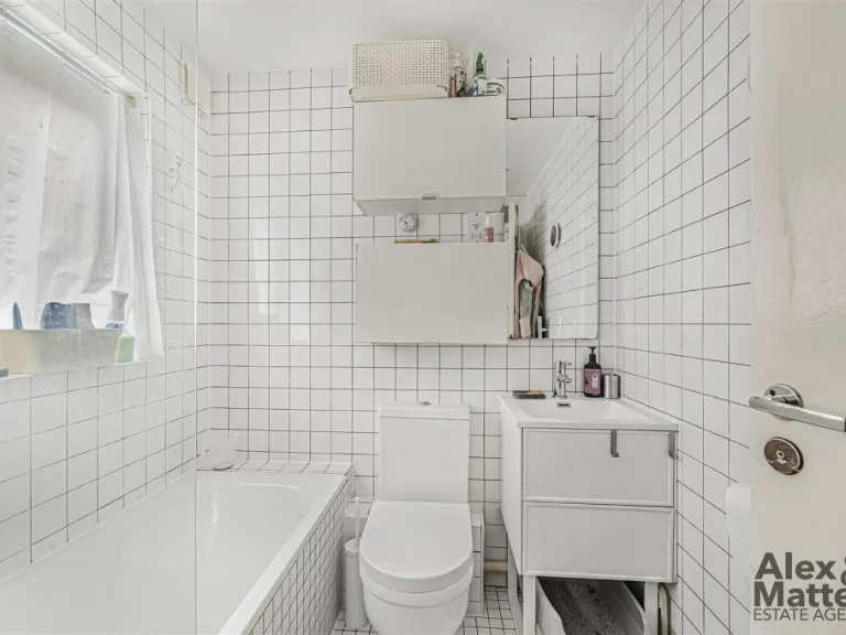
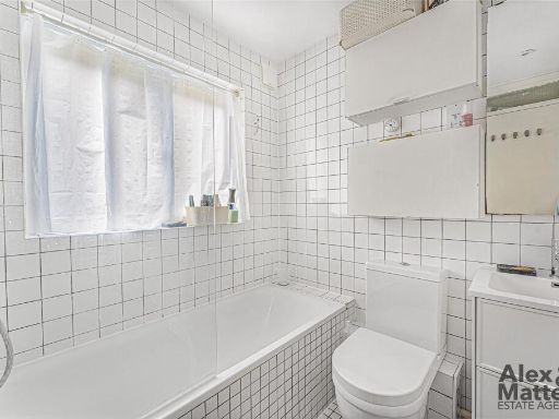
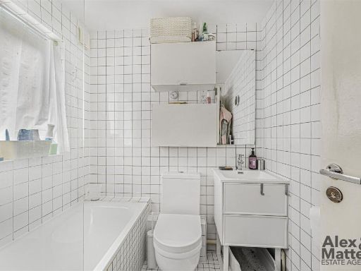
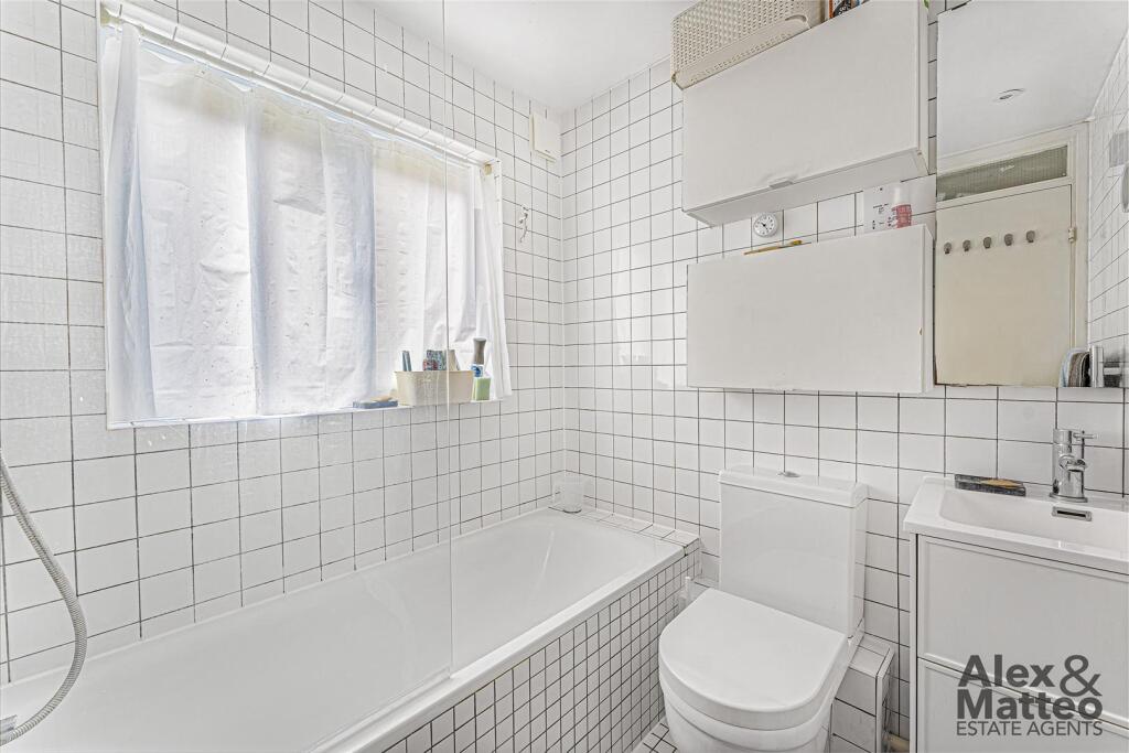
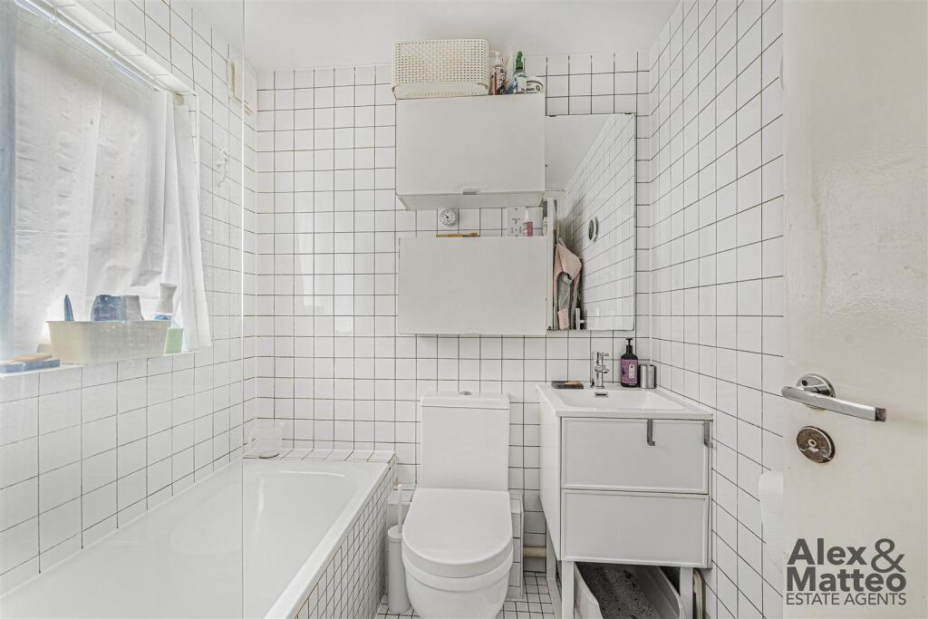
- Bathroom:
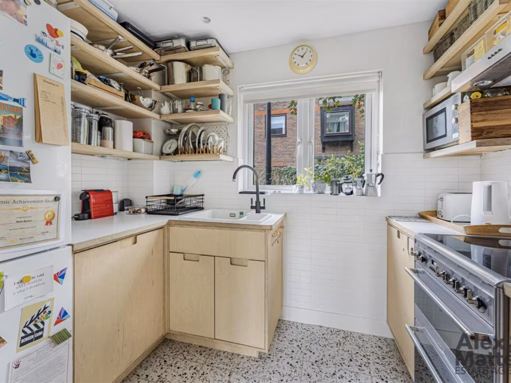
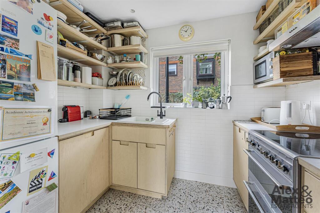
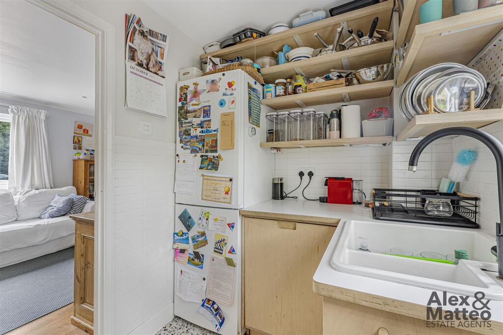
- Kitchen:
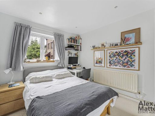
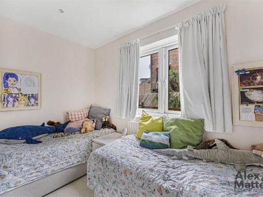
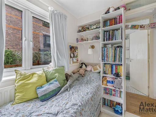
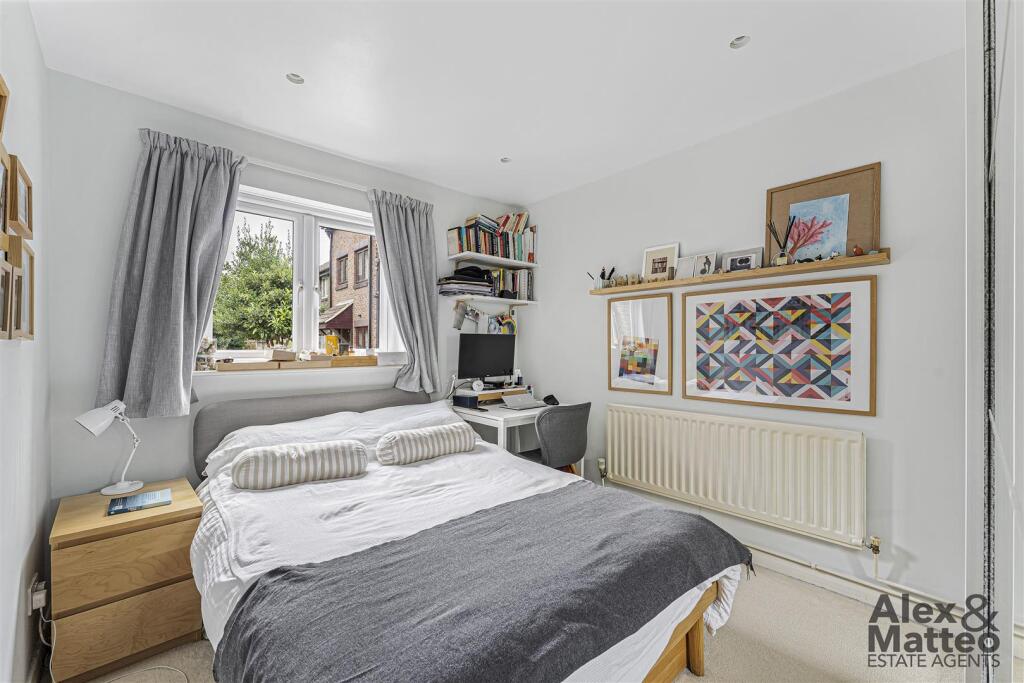
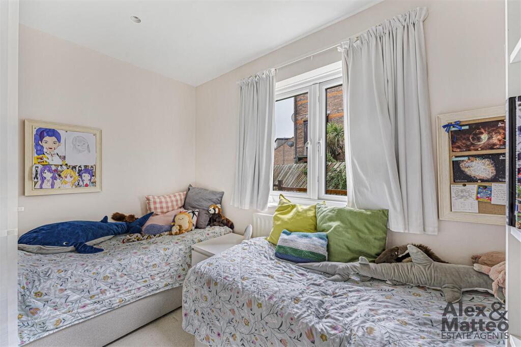
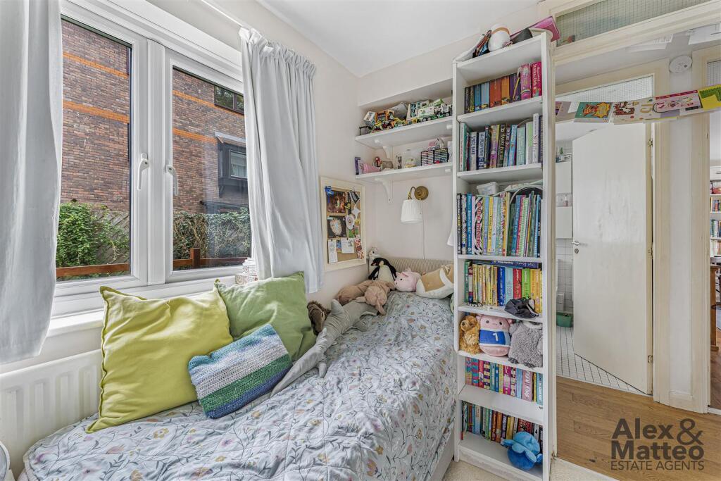
- Bedroom:
- Bedroom:
- Reception Room:
- Storage:
Textual Property Features
Detected Visual Features
- semi-detached
- modern
- two-storey
- brickwork
- well-maintained
- suburban
- paved driveway
- trees
- bushes
- living room
- dining area
- standard ceiling
- laminate flooring
- double-glazed windows
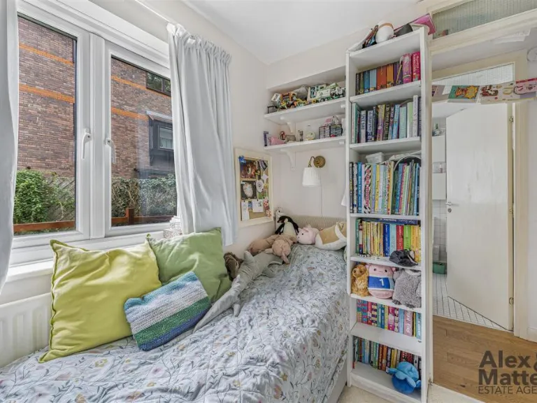
- medium-sized
- built-in shelves
- bookcase
EPC Details
- Fully double glazed
- Cavity wall, as built, insulated (assumed)
- Room heaters, electric
- Low energy lighting in all fixed outlets
- (another dwelling below)
Nearby Schools
- Redriff Primary School
- Bacon's College
- Cyril Jackson Primary School
- Blue Gate Fields Infants' School
- Blue Gate Fields Junior School
- Rotherhithe Primary School
- St Joseph's Catholic Primary School
- Arnhem Wharf Primary School
- Stepney Greencoat Church of England Primary School
- Cayley Primary School
- Halley Primary School
- Twin Oaks Primary School
- Deptford Park Primary School
- Seven Mills Primary School
- Albion Primary School
- St John's Roman Catholic Primary School
- St Peter's London Docks CofE Primary School
- Sir William Burrough Primary School
- Marion Richardson Primary School
- Stepney All Saints Church of England Secondary School
- Mulberry Stepney Green Mathematics and Computing College
- Alfred Salter Primary School
- Peter Hills with St Mary's and St Paul's CofE Primary School
- Grinling Gibbons Primary School
- Marathon Science School
- St Edmund's Catholic School
- Southwark Park Primary School
Nearest General Shops
- Id: 8892650334
- Tags:
- Addr:
- City: London
- Housenumber: 9
- Postcode: SE16 7FU
- Street: Maritime Street
- Brand: Decathlon
- Brand:wikidata: Q509349
- Brand:wikipedia: en:Decathlon Group
- Name: Decathlon Surrey Quays
- Shop: sports
- Sport: cycling;bicycle;fitness;football;hiking
- TagsNormalized:
- decathlon
- sports
- shop
- cycling
- bicycle
- fitness
- football
- Lat: 51.4977514
- Lon: -0.0473629
- FullGeoHash: gcpuyyvs0kes
- PartitionGeoHash: gcpu
- Images:
- FoodStandards: null
- Distance: 605.9
,- Id: 729958296
- Tags:
- Addr:
- City: London
- Postcode: SE16 2XU
- Street: Surrey Quays Road
- Brand: Decathlon
- Brand:wikidata: Q509349
- Brand:wikipedia: en:Decathlon (retailer)
- Building: retail
- Name: Decathlon
- Opening_hours: Mo-Fr 09:00-21:00
- Phone: +44 20 7394 2000
- Postal_code: SE16 2XU
- Shop: sports
- Website: https://www.decathlon.co.uk/
- TagsNormalized:
- decathlon
- retail
- sports
- shop
- Lat: 51.4977406
- Lon: -0.047342
- FullGeoHash: gcpuyyvs0feh
- PartitionGeoHash: gcpu
- Images:
- FoodStandards: null
- Distance: 604.7
,- Id: 248549872
- Tags:
- Created_by: Potlatch 0.7b
- Name: The Specialist
- Shop: dry_cleaning
- TagsNormalized:
- Lat: 51.495753
- Lon: -0.0391581
- FullGeoHash: gcpuzne2x81e
- PartitionGeoHash: gcpu
- Images:
- FoodStandards: null
- Distance: 365
}
Nearest Grocery shops
- Id: 248549891
- Tags:
- Addr:
- City: London
- Housenumber: 8
- Postcode: SE16 7PL
- Street: Russell Place
- Fhrs:
- Name: Crighton News
- Shop: convenience
- Source:
- TagsNormalized:
- Lat: 51.4957263
- Lon: -0.0393555
- FullGeoHash: gcpuzne26gnk
- PartitionGeoHash: gcpu
- Images:
- FoodStandards: null
- Distance: 369
,- Id: 248553723
- Tags:
- Brand: Mace
- Brand:wikidata: Q75240338
- Name: Mace
- Shop: convenience
- TagsNormalized:
- Lat: 51.4968089
- Lon: -0.0350531
- FullGeoHash: gcpuznwqxhyw
- PartitionGeoHash: gcpu
- Images:
- FoodStandards: null
- Distance: 360.9
,- Id: 6822681935
- Tags:
- Brand: Nisa Local
- Brand:wikidata: Q16999069
- Brand:wikipedia: en:Nisa (retailer)
- Name: Nisa Local
- Shop: convenience
- Wheelchair: yes
- TagsNormalized:
- nisa
- nisa local
- convenience
- shop
- Lat: 51.4962428
- Lon: -0.0408754
- FullGeoHash: gcpuznd5re3j
- PartitionGeoHash: gcpu
- Images:
- FoodStandards: null
- Distance: 340
}
Nearest Religious buildings
- Id: 107882988
- Tags:
- Amenity: place_of_worship
- Building: yes
- Denomination: lutheran
- Name: Finnish Church in London
- Name:fi: Lontoon merimieskirkko
- Religion: christian
- TagsNormalized:
- place of worship
- church
- christian
- Lat: 51.5000163
- Lon: -0.0525062
- FullGeoHash: gcpuyz3c2dbe
- PartitionGeoHash: gcpu
- Images:
- FoodStandards: null
- Distance: 951.3
,- Id: 361411796
- Tags:
- Amenity: place_of_worship
- Building: church
- Denomination: anglican
- Name: Holy Trinity
- Religion: christian
- Wikidata: Q28803238
- TagsNormalized:
- place of worship
- church
- anglican
- christian
- Lat: 51.5004766
- Lon: -0.0347052
- FullGeoHash: gcpuzpqsp29v
- PartitionGeoHash: gcpu
- Images:
- FoodStandards: null
- Distance: 329.2
,- Id: 392987699
- Tags:
- Amenity: place_of_worship
- Building: church
- Denomination: catholic
- Name: Our Lady of the Immaculate Conception
- Religion: christian
- TagsNormalized:
- place of worship
- church
- catholic
- christian
- Lat: 51.5000581
- Lon: -0.0417891
- FullGeoHash: gcpuzp39d4xu
- PartitionGeoHash: gcpu
- Images:
- FoodStandards: null
- Distance: 233
}
Nearest Medical buildings
- Id: 2290169594
- Tags:
- Amenity: pharmacy
- Brand: Superdrug
- Brand:wikidata: Q7643261
- Brand:wikipedia: en:Superdrug
- Contact:
- Website: https://www.superdrug.com/store/surrey-quays
- Healthcare: pharmacy
- Name: Superdrug
- Wheelchair: yes
- TagsNormalized:
- pharmacy
- superdrug
- health
- healthcare
- Lat: 51.4953854
- Lon: -0.0472721
- FullGeoHash: gcpuyymw67x7
- PartitionGeoHash: gcpu
- Images:
- FoodStandards: null
- Distance: 709.8
,- Id: 2290169590
- Tags:
- Amenity: pharmacy
- Brand: Boots
- Brand:wikidata: Q6123139
- Brand:wikipedia: en:Boots UK
- Healthcare: pharmacy
- Name: Boots
- Opening_hours: Mo-Sa 09:00-19:00; Su 11:00-17:00
- Wheelchair: yes
- TagsNormalized:
- pharmacy
- boots
- health
- healthcare
- Lat: 51.495001
- Lon: -0.0462926
- FullGeoHash: gcpuyyqk17cw
- PartitionGeoHash: gcpu
- Images:
- FoodStandards: null
- Distance: 682.5
,- Id: 9980479851
- Tags:
- Amenity: dentist
- Healthcare: dentist
- Name: Canada Water Dental Health
- Website: https://www.canadawaterdental.co.uk/
- TagsNormalized:
- dentist
- health
- healthcare
- dental
- water
- Lat: 51.4986106
- Lon: -0.0477841
- FullGeoHash: gcpuyzj1nscd
- PartitionGeoHash: gcpu
- Images:
- FoodStandards: null
- Distance: 619.8
,- Id: 1165341225
- Tags:
- Amenity: health_centre
- Healthcare: centre
- Name: Surrey Docks Health Centre
- TagsNormalized:
- health
- health centre
- healthcare
- Lat: 51.500762
- Lon: -0.0372341
- FullGeoHash: gcpuzpkvsmu5
- PartitionGeoHash: gcpu
- Images:
- FoodStandards: null
- Distance: 222.9
}
Nearest Airports
- Id: 260720166
- Tags:
- Aerodrome: international
- Aeroway: aerodrome
- Alt_name: Gatwick Airport
- Ele: 62
- Iata: LGW
- Icao: EGKK
- Internet_access: wlan
- Internet_access:fee: no
- Internet_access:ssid: Gatwick FREE Wi-Fi
- Name: London Gatwick Airport
- Operator: Gatwick Airport Limited
- Ref: LGW
- Website: https://www.gatwickairport.com/
- Wikidata: Q8703
- Wikipedia: en:Gatwick Airport
- TagsNormalized:
- airport
- international airport
- Lat: 51.1540917
- Lon: -0.1883773
- FullGeoHash: gcpg58qf4mzd
- PartitionGeoHash: gcpg
- Images:
- FoodStandards: null
- Distance: 39737.6
,- Id: 121158889
- Tags:
- Aerodrome: continental
- Aeroway: aerodrome
- Fhrs:
- Authority: City of London Corporation
- Iata: LCY
- Icao: EGLC
- Name: London City Airport
- Operator: London City Airport Limited
- Ref: LCY
- Website: https://www.londoncityairport.com/
- Wikidata: Q8982
- Wikipedia: en:London City Airport
- TagsNormalized:
- airport
- continental airport
- Lat: 51.5042658
- Lon: 0.0539987
- FullGeoHash: u10j10p64702
- PartitionGeoHash: u10j
- Images:
- FoodStandards: null
- Distance: 6453.5
,- Id: 14001268
- Tags:
- Access: yes
- Aerodrome: international
- Aerodrome:type: public
- Aeroway: aerodrome
- Alt_name: London Heathrow
- Alt_name_2: London Heathrow Airport
- Ele: 25
- Iata: LHR
- Icao: EGLL
- Int_name: Heathrow Airport
- Name: London Heathrow Airport
- Note: area still approx
- Old_name: London Airport
- Operator: Heathrow Airport Limited
- Rank_aci:
- Ref: LHR
- Short_name: Heathrow
- Type: multipolygon
- Website: https://www.heathrow.com/
- Wikidata: Q8691
- Wikipedia: en:Heathrow Airport
- TagsNormalized:
- airport
- international airport
- Lat: 51.4677522
- Lon: -0.4547736
- FullGeoHash: gcpsv9kv7h2h
- PartitionGeoHash: gcps
- Images:
- FoodStandards: null
- Distance: 29009.8
}
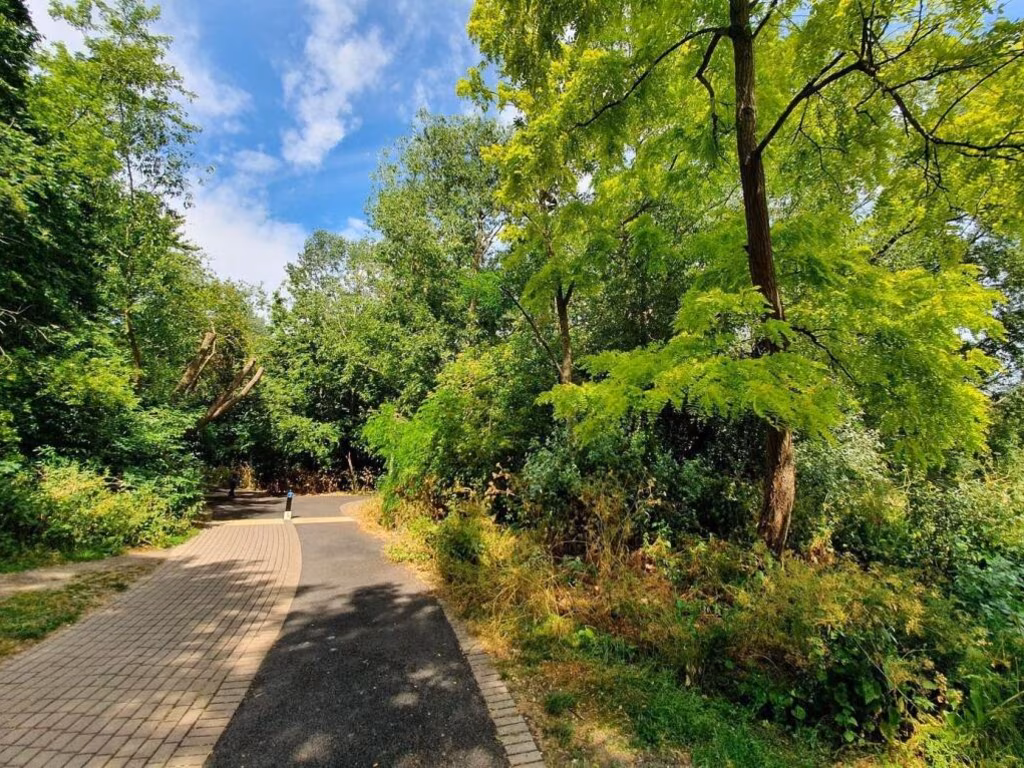
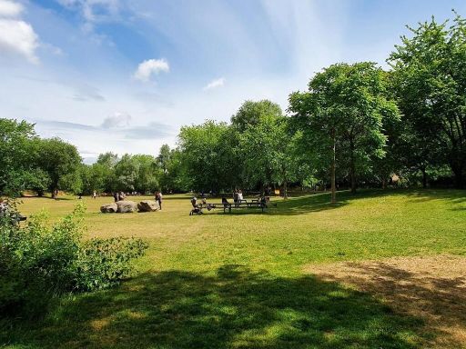
Nearest Leisure Facilities
- Id: 943069332
- Tags:
- TagsNormalized:
- Lat: 51.5015146
- Lon: -0.0370633
- FullGeoHash: gcpuzpt4065t
- PartitionGeoHash: gcpu
- Images:
- FoodStandards: null
- Distance: 302.8
,- Id: 442077645
- Tags:
- TagsNormalized:
- Lat: 51.4963328
- Lon: -0.0386188
- FullGeoHash: gcpuzneguh5w
- PartitionGeoHash: gcpu
- Images:
- FoodStandards: null
- Distance: 300.4
,- Id: 754030806
- Tags:
- TagsNormalized:
- Lat: 51.4989242
- Lon: -0.0351447
- FullGeoHash: gcpuzpn6vp60
- PartitionGeoHash: gcpu
- Images:
- FoodStandards: null
- Distance: 257.1
,- Id: 122228352
- Tags:
- Leisure: park
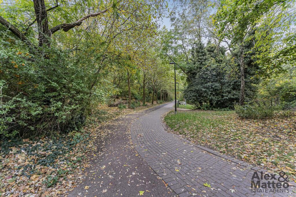
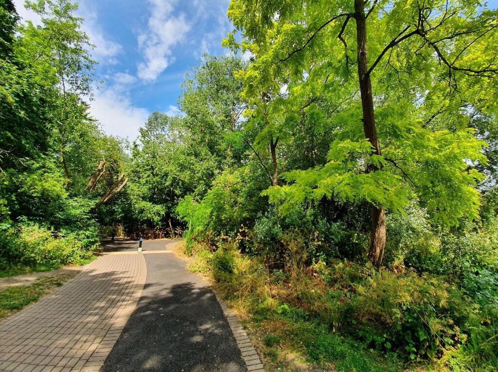
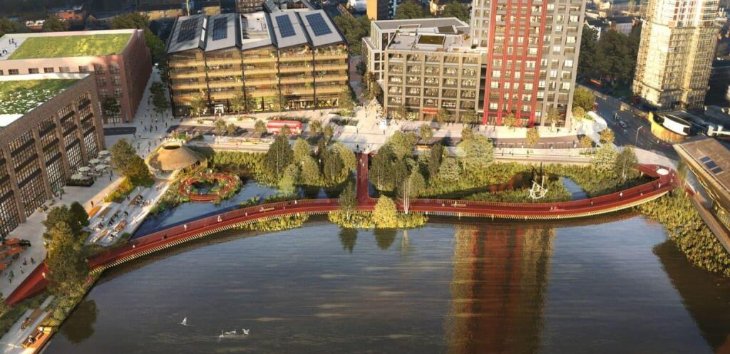
- Name: Russia Dock Woodland
- Wikidata: Q2176986
- Wikipedia: en:Russia Dock Woodland
- TagsNormalized:
- Lat: 51.5007623
- Lon: -0.0388587
- FullGeoHash: gcpuzp7twtbv
- PartitionGeoHash: gcpu
- Images:
- FoodStandards: null
- Distance: 192.6
,- Id: 943069908
- Tags:
- Access: yes
- Leisure: playground
- Name: Natural Play Area
- Playground:
- TagsNormalized:
- Lat: 51.5001598
- Lon: -0.039107
- FullGeoHash: gcpuzp7d0txe
- PartitionGeoHash: gcpu
- Images:
- FoodStandards: null
- Distance: 126.8
}
Nearest Tourist attractions
- Id: 9936301385
- Tags:
- Addr:
- City: London
- Housenumber: 15
- Postcode: E14 8FQ
- Street: Westferry Road
- Name: Cove
- Phone: +44 330 202 0505
- Tourism: apartment
- Website: https://www.staycove.com/en/london/landmark-pinnacle-apartments
- TagsNormalized:
- Lat: 51.5027181
- Lon: -0.0256262
- FullGeoHash: gcpuzrv34fe8
- PartitionGeoHash: gcpu
- Images:
- FoodStandards: null
- Distance: 1003.3
,- Id: 47309139
- Tags:
- Building: yes
- Name: London Thameside
- Operator: Youth Hostel Association
- Source: Paul Lowe
- Tourism: hostel
- TagsNormalized:
- Lat: 51.504417
- Lon: -0.0462984
- FullGeoHash: gcpvnbn6cpjq
- PartitionGeoHash: gcpv
- Images:
- FoodStandards: null
- Distance: 790.1
,- Id: 101941765
- Tags:
- Landuse: farmyard
- Name: Surrey Docks Farm
- Tourism: attraction
- Website: https://www.surreydocksfarm.org.uk/
- Wikidata: Q16900913
- Wikipedia: en:Surrey Docks Farm
- TagsNormalized:
- farmyard
- farm
- attraction
- tourism
- Lat: 51.4997077
- Lon: -0.0333975
- FullGeoHash: gcpuzppxtc34
- PartitionGeoHash: gcpu
- Images:
- FoodStandards: null
- Distance: 385.2
}
Nearest Bus stations and stops
- Id: 469767929
- Tags:
- Bus: yes
- Highway: bus_stop
- Name: Downtown Road
- Naptan:
- AtcoCode: 490006186N
- Bearing: N
- CommonName: Downtown Road
- Street: SALTER ROAD
- Public_transport: platform
- Ref: 71126
- TagsNormalized:
- Lat: 51.500165
- Lon: -0.0353642
- FullGeoHash: gcpuzpq4pywd
- PartitionGeoHash: gcpu
- Images:
- FoodStandards: null
- Distance: 272.6
,- Id: 469776571
- Tags:
- Bus: yes
- Highway: bus_stop
- Name: Onega Gate
- Naptan:
- AtcoCode: 490010596E
- Bearing: N
- CommonName: Onega Way
- Street: REDRIFF ROAD
- Public_transport: platform
- Ref: 52042
- TagsNormalized:
- Lat: 51.4966633
- Lon: -0.0393713
- FullGeoHash: gcpuznemf9fd
- PartitionGeoHash: gcpu
- Images:
- FoodStandards: null
- Distance: 265.6
,- Id: 469776576
- Tags:
- Bus: yes
- Highway: bus_stop
- Name: Onega Gate
- Naptan:
- AtcoCode: 490010596W
- Bearing: N
- CommonName: Onega Way
- Street: REDRIFF ROAD
- Public_transport: platform
- Ref: 50855
- TagsNormalized:
- Lat: 51.4967007
- Lon: -0.0389833
- FullGeoHash: gcpuznew58gc
- PartitionGeoHash: gcpu
- Images:
- FoodStandards: null
- Distance: 259.2
,- Id: 469773542
- Tags:
- Bus: yes
- Highway: bus_stop
- Name: Shipwright Road
- Naptan:
- AtcoCode: 490008899N
- Bearing: N
- CommonName: Lady Dock Path The Ship York
- Street: SALTER ROAD
- Public_transport: platform
- Ref: 59439
- TagsNormalized:
- Lat: 51.4987997
- Lon: -0.0360774
- FullGeoHash: gcpuzpjdr24d
- PartitionGeoHash: gcpu
- Images:
- FoodStandards: null
- Distance: 194
,- Id: 469773543
- Tags:
- Bus: yes
- Highway: bus_stop
- Name: Shipwright Road
- Naptan:
- AtcoCode: 490008899S
- Bearing: N
- CommonName: Lady Dock Path The Ship York
- Street: REDRIFF ROAD
- Public_transport: platform
- Ref: 54508
- TagsNormalized:
- Lat: 51.4980406
- Lon: -0.0368008
- FullGeoHash: gcpuznvjy6x6
- PartitionGeoHash: gcpu
- Images:
- FoodStandards: null
- Distance: 179.8
}
Nearest Hotels
- Id: 142296525
- Tags:
- Addr:
- City: London
- Housename: Britannia International Hotel
- Housenumber: 163
- Postcode: E14 9SJ
- Street: Marsh Wall
- Building: yes
- Building:colour: #7F6D5E
- Fhrs:
- Id: 112359
- Local_authority_id: 4158
- Name: Britannia International Hotel Restaurant
- Name: Hotel Britannia International
- Note: Outline is of ground floor only
- Operator: Britannia Hotels
- Source: Bing
- Source:addr:postcode: FHRS Open Data
- Source:operator: branded signs etc. in rooms
- Tourism: hotel
- Website: https://www.britanniahotels.com/hotels/international-london/
- Wheelchair: yes
- TagsNormalized:
- Lat: 51.5017442
- Lon: -0.0234132
- FullGeoHash: gcpuzrwgqkvy
- PartitionGeoHash: gcpu
- Images:
- FoodStandards: null
- Distance: 1110.7
,- Id: 365809829
- Tags:
- Addr:
- City: London
- Housenumber: 40
- Postcode: E14 9TP
- Street: Marsh Wall
- Brand: Novotel
- Brand:wikidata: Q420545
- Brand:wikipedia: en:Novotel
- Building: yes
- Building:levels: 39
- Fhrs:
- Id: 947323
- Local_authority_id: 197139
- Name: Novotel Hotel Restaurant
- Name: Novotel London Canary Wharf
- Source:
- Tourism: hotel
- Wikidata: Q28404263
- Wikipedia: en:40 Marsh Wall
- TagsNormalized:
- Lat: 51.5011982
- Lon: -0.0233408
- FullGeoHash: gcpuzrx00p5v
- PartitionGeoHash: gcpu
- Images:
- FoodStandards: null
- Distance: 1100.6
,- Id: 816295453
- Tags:
- Addr:
- City: London
- Housenumber: 265A
- Postcode: SE16 5HW
- Street: Rotherhithe Street
- Brand: DoubleTree
- Brand:wikidata: Q2504643
- Brand:wikipedia: en:DoubleTree
- Contact:
- Facebook: https://www.facebook.com/DoubleTreeDockLDN
- Phone: +44 20 7231 1001
- Twitter: https://twitter.com/DoubleTreeDock
- Internet_access: wlan
- Name: DoubleTree by Hilton Hotel London - Docklands Riverside
- Official_name: DoubleTree by Hilton
- Operator: Hilton Hotels
- Rooms: 378
- Smoking: no
- Stars: 4
- Tourism: hotel
- Website: https://www.hilton.com/en/hotels/lonnddi-doubletree-london-docklands-riverside/?WT.mc_id=zELWAKN0EMEA1DT2DMH3LocalSearch4DGGenericx6LONNDDI
- Wikidata: Q17444904
- TagsNormalized:
- Lat: 51.5046535
- Lon: -0.033173
- FullGeoHash: gcpvp0pu7523
- PartitionGeoHash: gcpv
- Images:
- FoodStandards: null
- Distance: 738.7
}
Tags
- semi-detached
- modern
- two-storey
- brickwork
- well-maintained
- suburban
- paved driveway
- trees
- bushes
- modern
- living room
- dining area
- standard ceiling
- laminate flooring
- double-glazed windows
- medium-sized
- built-in shelves
- bookcase
Local Market Stats
- Average Price/sqft: £677
- Avg Income: £63700
- Rental Yield: 5.5%
- Social Housing: 36%
- Planning Success Rate: 86%
AirBnB Data
- 1km average: £155/night
- Listings in 1km: 31
Similar Properties
 2 bedroom flat for sale in Clarence Mews, Rotherhtihe, SE16 — £495,000 • 2 bed • 2 bath • 749 ft²
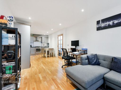 1 bedroom apartment for sale in 392 Rotherhithe Street, SE16 — £325,000 • 1 bed • 1 bath • 521 ft²
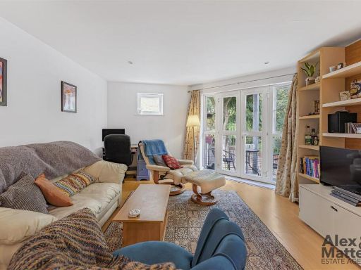 2 bedroom flat for sale in Elgar Street, Canada Water, SE16 — £375,000 • 2 bed • 2 bath • 652 ft²
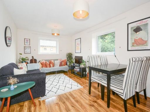 2 bedroom apartment for sale in Farrow Place, Canada Water, SE16 — £425,000 • 2 bed • 1 bath • 580 ft²
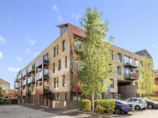 2 bedroom flat for sale in Blondin Way, Rotherhithe, SE16 — £450,000 • 2 bed • 1 bath • 650 ft²
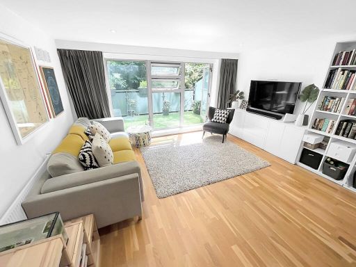 2 bedroom duplex for sale in Rotherhithe Street, London, SE16 — £500,000 • 2 bed • 2 bath • 1056 ft²
Meta
- {
"@context": "https://schema.org",
"@type": "Residence",
"name": "2 bedroom flat for sale in Somerford Way, Canada Water, SE16",
"description": "",
"url": "https://propertypiper.co.uk/property/5d8b8621-70fc-48b6-97b5-36bb07fd7c10",
"image": "https://image-a.propertypiper.co.uk/261f999a-0c9b-4485-b8d6-26c0f74ec5e4-1024.jpeg",
"address": {
"@type": "PostalAddress",
"streetAddress": "51 SOMERFORD WAY LONDON",
"postalCode": "SE16 6QN",
"addressLocality": "Southwark",
"addressRegion": "Bermondsey and Old Southwark",
"addressCountry": "England"
},
"geo": {
"@type": "GeoCoordinates",
"latitude": 51.49903019326973,
"longitude": -0.03885515367750794
},
"numberOfRooms": 2,
"numberOfBathroomsTotal": 1,
"floorSize": {
"@type": "QuantitativeValue",
"value": 516,
"unitCode": "FTK"
},
"offers": {
"@type": "Offer",
"price": 400000,
"priceCurrency": "GBP",
"availability": "https://schema.org/InStock"
},
"additionalProperty": [
{
"@type": "PropertyValue",
"name": "Feature",
"value": "semi-detached"
},
{
"@type": "PropertyValue",
"name": "Feature",
"value": "modern"
},
{
"@type": "PropertyValue",
"name": "Feature",
"value": "two-storey"
},
{
"@type": "PropertyValue",
"name": "Feature",
"value": "brickwork"
},
{
"@type": "PropertyValue",
"name": "Feature",
"value": "well-maintained"
},
{
"@type": "PropertyValue",
"name": "Feature",
"value": "suburban"
},
{
"@type": "PropertyValue",
"name": "Feature",
"value": "paved driveway"
},
{
"@type": "PropertyValue",
"name": "Feature",
"value": "trees"
},
{
"@type": "PropertyValue",
"name": "Feature",
"value": "bushes"
},
{
"@type": "PropertyValue",
"name": "Feature",
"value": "modern"
},
{
"@type": "PropertyValue",
"name": "Feature",
"value": "living room"
},
{
"@type": "PropertyValue",
"name": "Feature",
"value": "dining area"
},
{
"@type": "PropertyValue",
"name": "Feature",
"value": "standard ceiling"
},
{
"@type": "PropertyValue",
"name": "Feature",
"value": "laminate flooring"
},
{
"@type": "PropertyValue",
"name": "Feature",
"value": "double-glazed windows"
},
{
"@type": "PropertyValue",
"name": "Feature",
"value": "medium-sized"
},
{
"@type": "PropertyValue",
"name": "Feature",
"value": "built-in shelves"
},
{
"@type": "PropertyValue",
"name": "Feature",
"value": "bookcase"
}
]
}
High Res Floorplan Images
Compatible Floorplan Images
FloorplanImages Thumbnail