BR1 5JU - 2 bedroom end of terrace house for sale in Northover, Londo…
View on Property Piper
2 bedroom end of terrace house for sale in Northover, London, BR1
Property Details
- Price: £365000
- Bedrooms: 2
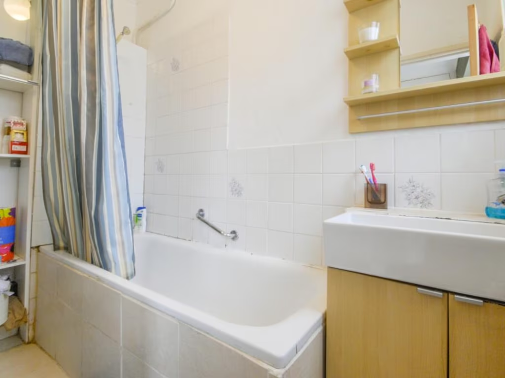
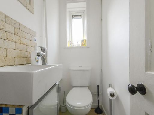
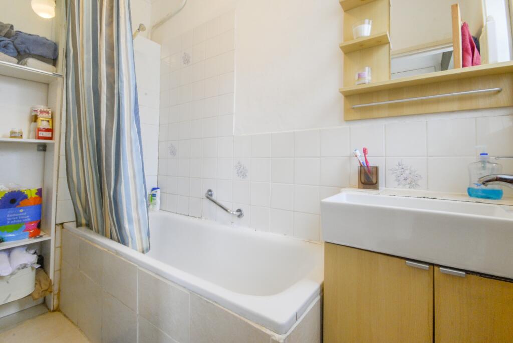
- Bathrooms: 2
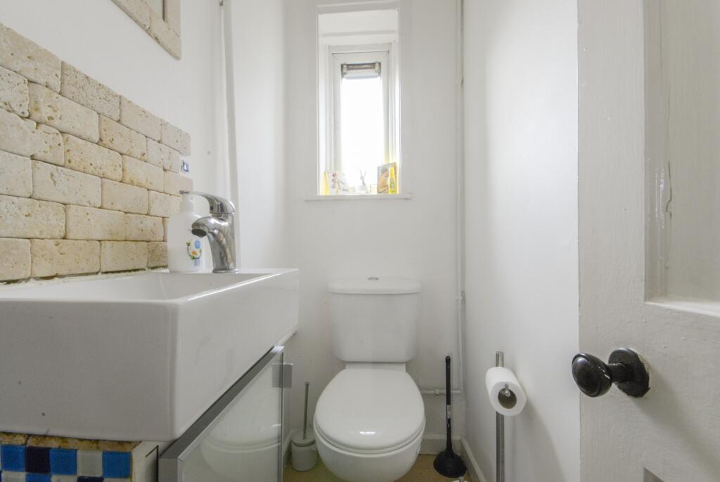
- Property Type: undefined
- Property SubType: undefined
Image Descriptions
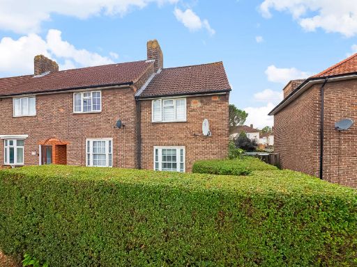
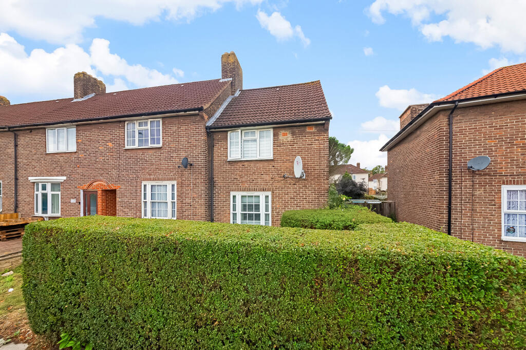
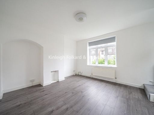
- semi-detached house post-war
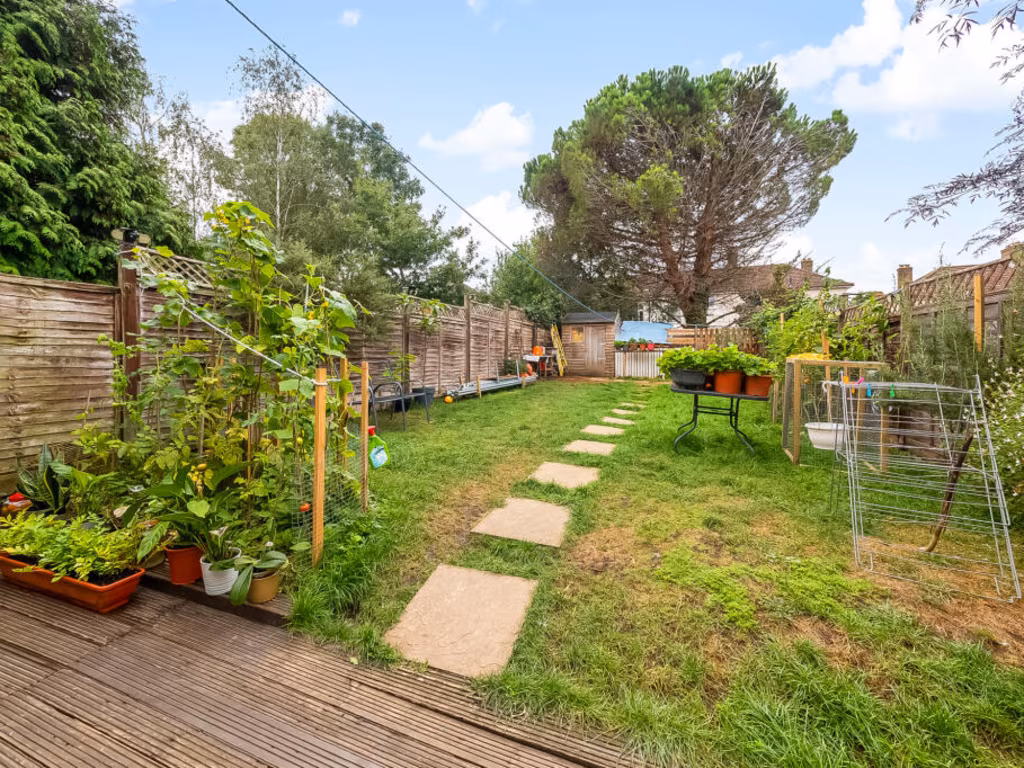
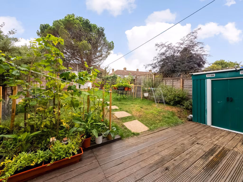
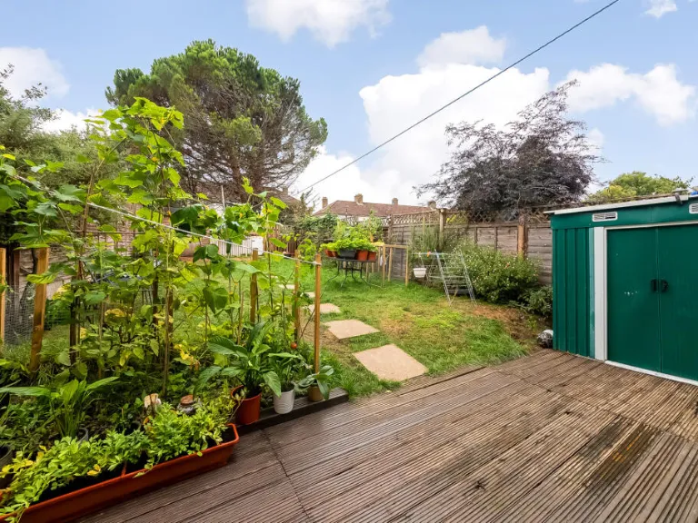
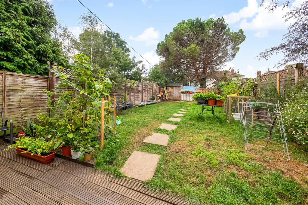
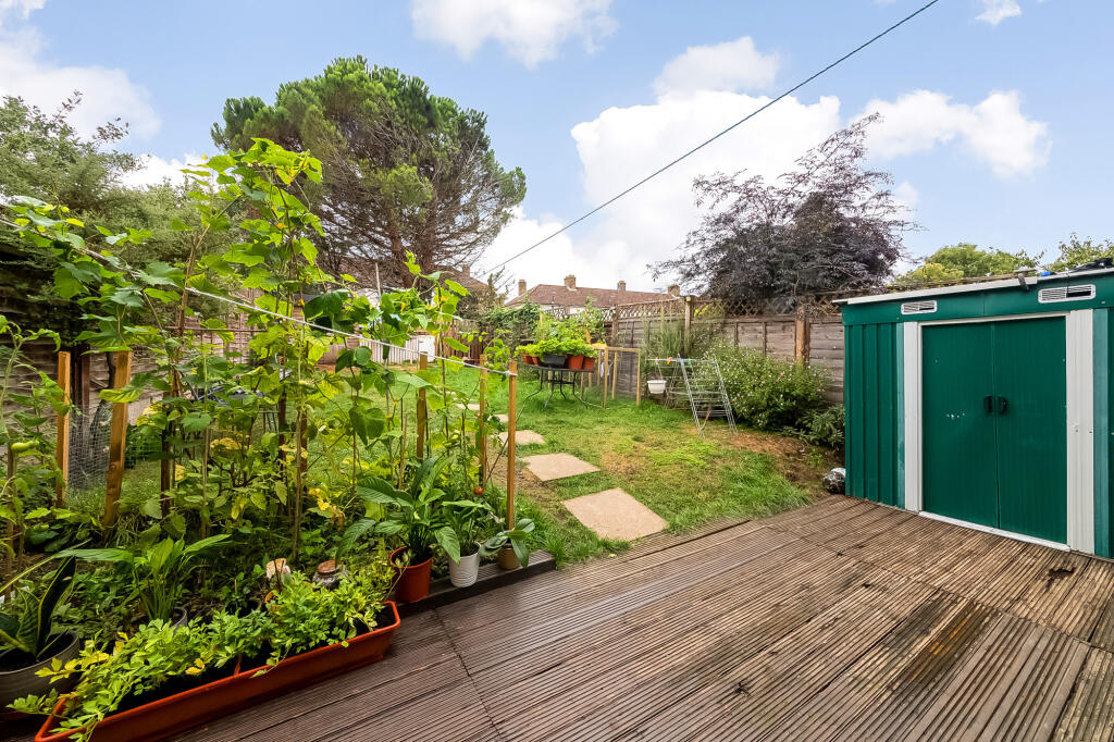
- back garden contemporary
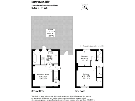
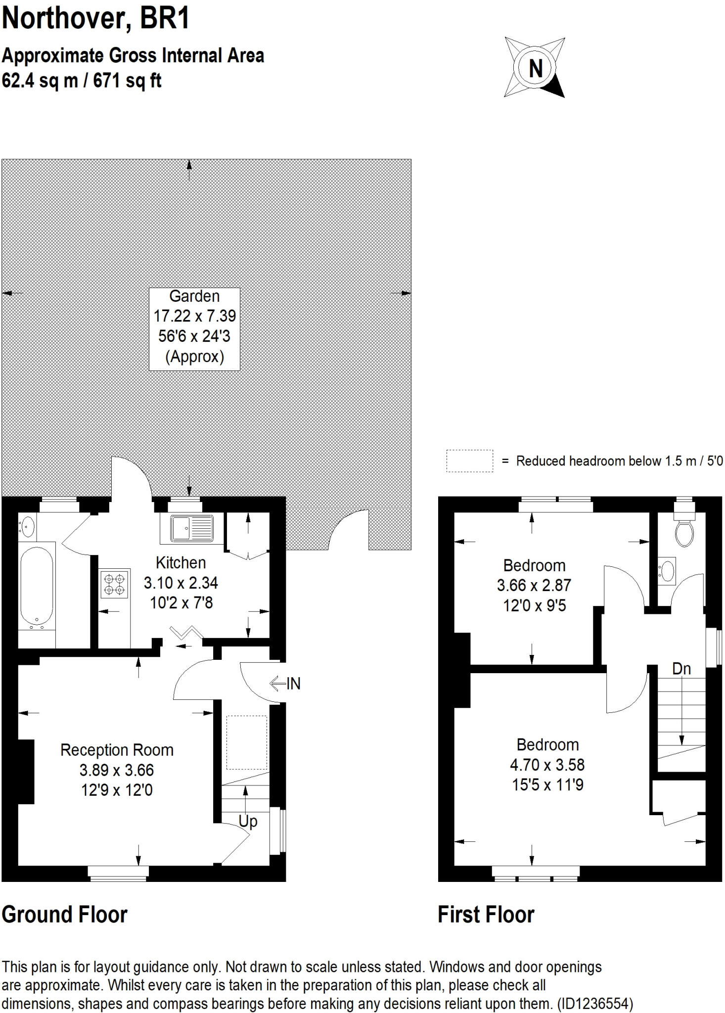
Floorplan Description
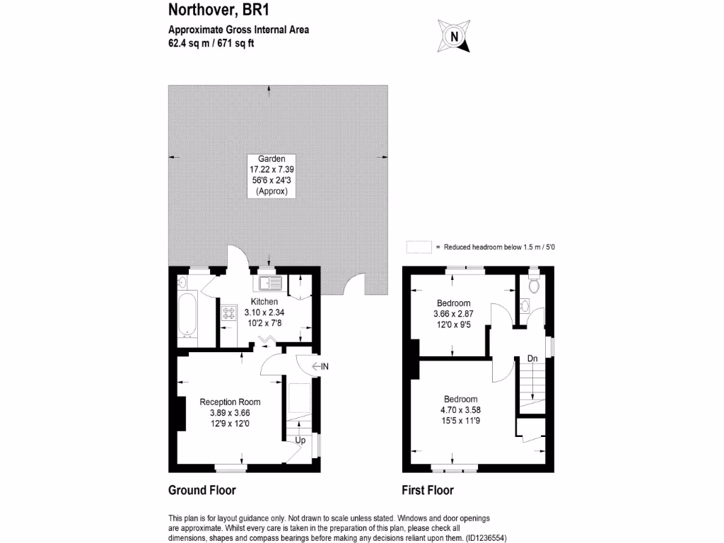
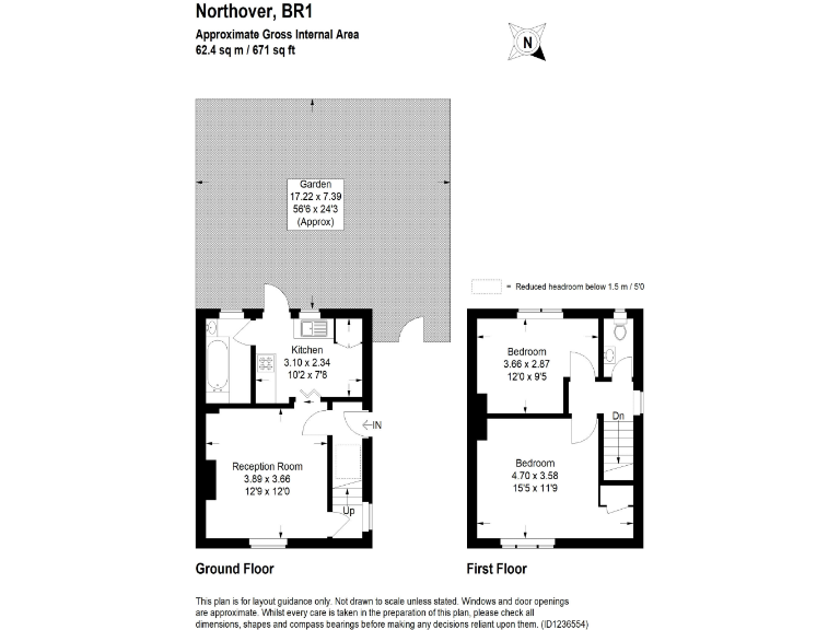
- Two-bedroom property with kitchen and reception room over two floors
Rooms
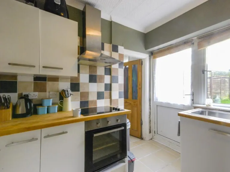
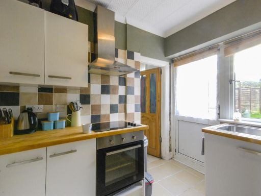
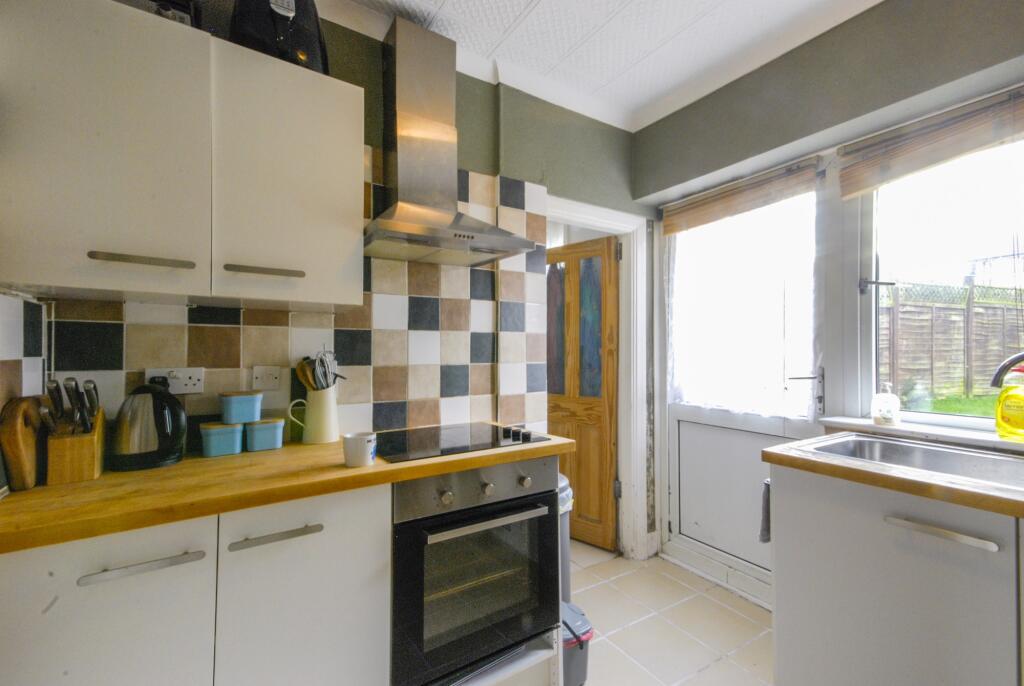
- Kitchen:
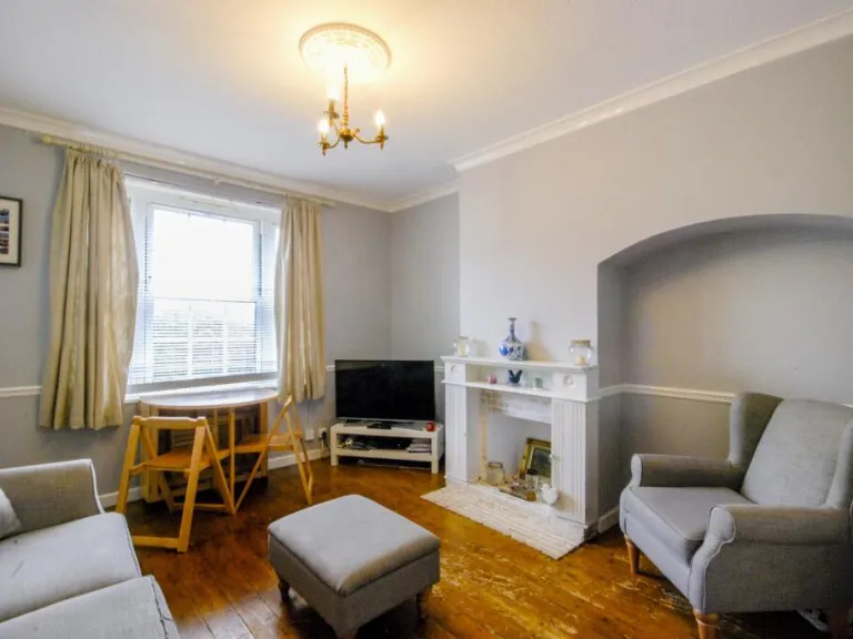
- Reception Room:
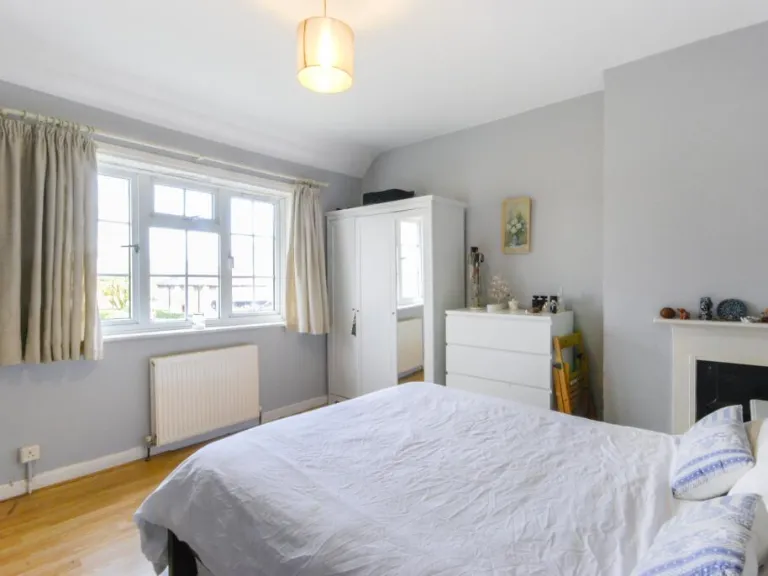
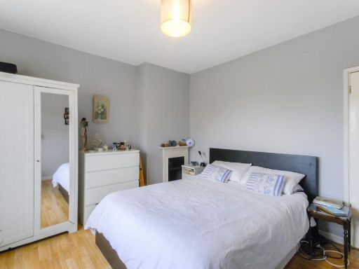
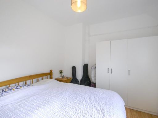
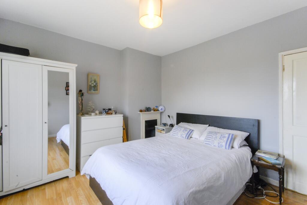
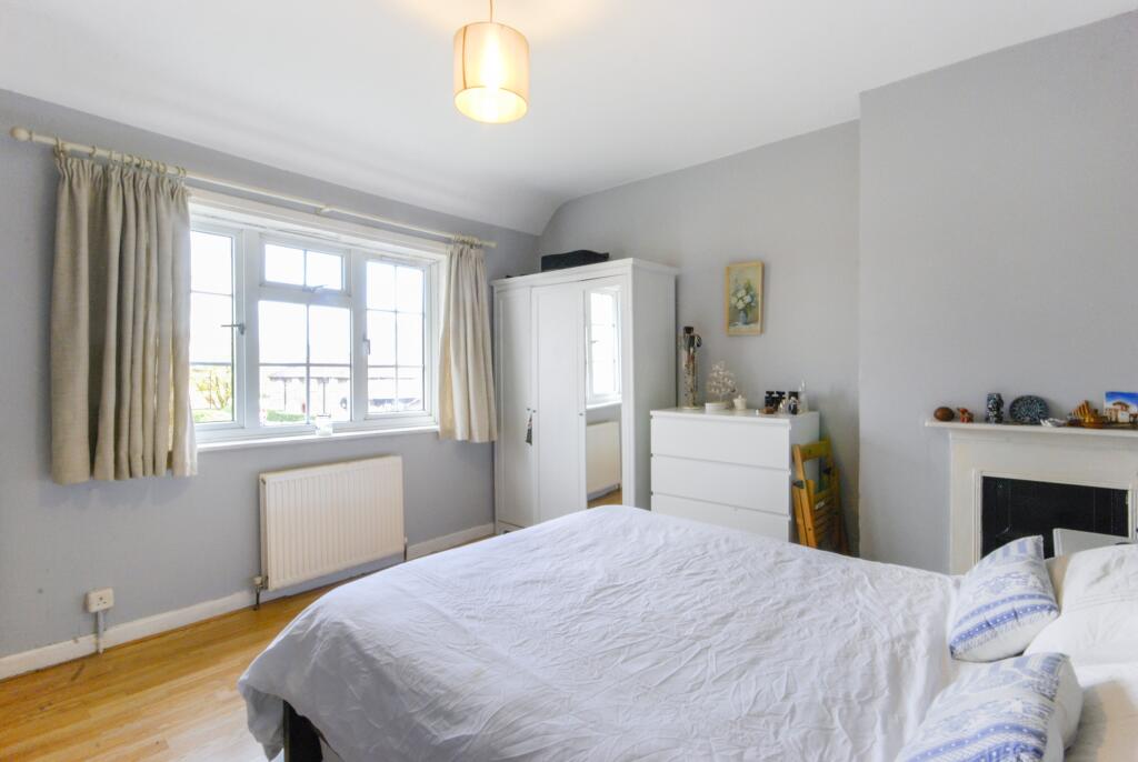
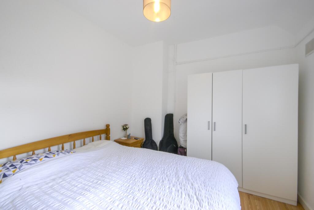
- Bedroom:
- Bedroom:
Textual Property Features
- Has Garden
- Chain Free
- Success
Detected Visual Features
- semi-detached
- post-war
- two-story
- brick exterior
- pitched roof
- hedge
- garden
- contemporary
- fenced
- landscaped
- decking
- shed
- plants
- trees
EPC Details
- Fully double glazed
- Cavity wall, as built, no insulation (assumed)
- Boiler and radiators, mains gas
- Low energy lighting in all fixed outlets
- Suspended, no insulation (assumed)
Nearby Schools
- Burnt Ash Primary School
- Haberdashers' Knights Academy
- Sandhurst Primary School
- Baring Primary School
- Horn Park Primary School
- Colfe's School
- Parish Church of England Primary School
- Good Shepherd RC School
- Downderry Primary School
- Haberdashers' Knights Primary
- Forster Park Primary School
- St Winifred's RC Primary School
- Brindishe Lee School
- Rangefield Primary School
- Launcelot Primary School
- Marvels Lane Primary School
- Cooper's Lane Primary School
- Trinity Church of England School, Lewisham
- Education-My Life Matters
- Brindishe Manor School
- St John Baptist Southend Church of England Primary School
- Torridon Primary School
Nearest General Shops
- Id: 519977198
- Tags:
- Building: yes
- Name: Burnt Ash Ceilings
- Shop: hardware
- TagsNormalized:
- Lat: 51.4394313
- Lon: 0.020639
- FullGeoHash: u10h8kr02uvx
- PartitionGeoHash: u10h
- Images:
- FoodStandards: null
- Distance: 1134.2
,- Id: 427599477
- Tags:
- Building: yes
- Name: Vikas Off Liscence
- Shop: alcohol
- TagsNormalized:
- Lat: 51.4386947
- Lon: 0.0211546
- FullGeoHash: u10h8kpkhgwj
- PartitionGeoHash: u10h
- Images:
- FoodStandards: null
- Distance: 1096.9
,- Id: 996123203
- Tags:
- Addr:
- Housenumber: 410
- Postcode: BR1 5HR
- Street: Downham Way
- Amenity: post_office
- Branch: Downham Way
- Brand: Post Office
- Brand:wikidata: Q1783168
- Building: yes
- Check_date: 2020-02-20
- Contact:
- Website: https://www.postoffice.co.uk/branch-finder/0630128/downham-way
- Fhrs:
- Fixme: shop type not known
- Name: Downham Way Post Office
- Ref:
- Shop: yes
- TagsNormalized:
- Lat: 51.4270205
- Lon: 0.0137997
- FullGeoHash: u10h86401e3y
- PartitionGeoHash: u10h
- Images:
- FoodStandards:
- Id: 256245
- FHRSID: 256245
- LocalAuthorityBusinessID: PI/000173193
- BusinessName: Downham Way News
- BusinessType: Retailers - other
- BusinessTypeID: 4613
- AddressLine1: 410 Downham Way
- AddressLine2: Bromley
- AddressLine3: null
- AddressLine4: null
- PostCode: BR1 5HR
- RatingValue: 4
- RatingKey: fhrs_4_en-GB
- RatingDate: 2019-03-02
- LocalAuthorityCode: 523
- LocalAuthorityName: Lewisham
- LocalAuthorityWebSite: http://www.lewisham.gov.uk/myservices/business/food-safety/Pages/default.aspx
- LocalAuthorityEmailAddress: david.edwards@lewisham.gov.uk
- Scores:
- Hygiene: 5
- Structural: 5
- ConfidenceInManagement: 10
- NewRatingPending: false
- Geocode:
- Longitude: 0.01382300000000
- Latitude: 51.42743700000000
- Distance: 565.5
}
Nearest Grocery shops
- Id: 427599476
- Tags:
- Addr:
- City: London Borough of Lewisham
- Housenumber: 246
- Postcode: SE12 0QD
- Street: Burnt Ash Hill
- Building: yes
- Fhrs:
- Name: Londis, Lee Newsagents
- Shop: convenience
- Source:
- TagsNormalized:
- londis
- newsagent
- convenience
- shop
- Lat: 51.4386102
- Lon: 0.0212304
- FullGeoHash: u10h8kp7weyt
- PartitionGeoHash: u10h
- Images:
- FoodStandards:
- Id: 714719
- FHRSID: 714719
- LocalAuthorityBusinessID: PI/000197120
- BusinessName: Londis
- BusinessType: Retailers - other
- BusinessTypeID: 4613
- AddressLine1: 246 Burnt Ash Hill
- AddressLine2: London
- AddressLine3: null
- AddressLine4: null
- PostCode: SE12 0QD
- RatingValue: 4
- RatingKey: fhrs_4_en-GB
- RatingDate: 2020-02-10
- LocalAuthorityCode: 523
- LocalAuthorityName: Lewisham
- LocalAuthorityWebSite: http://www.lewisham.gov.uk/myservices/business/food-safety/Pages/default.aspx
- LocalAuthorityEmailAddress: david.edwards@lewisham.gov.uk
- Scores:
- Hygiene: 10
- Structural: 0
- ConfidenceInManagement: 10
- NewRatingPending: false
- Geocode:
- Longitude: 0.02160600000000
- Latitude: 51.43788800000000
- Distance: 1093.8
,- Id: 686367141
- Tags:
- Brand: Tesco Express
- Brand:wikidata: Q98456772
- Contact:
- Website: https://www.tesco.com/store-locator/london/340-baring-rd
- Name: Tesco Express
- Name:fa: تسکو اکسپرس
- Shop: convenience
- TagsNormalized:
- tesco
- tesco express
- convenience
- shop
- Lat: 51.4326725
- Lon: 0.0210095
- FullGeoHash: u10h87p3191f
- PartitionGeoHash: u10h
- Images:
- FoodStandards: null
- Distance: 759.8
,- Id: 10592086043
- Tags:
- Brand: Sainsbury's Local
- Brand:wikidata: Q13218434
- Name: Sainsbury's Local
- Shop: convenience
- TagsNormalized:
- sainsburys
- sainsburys local
- convenience
- shop
- Lat: 51.4317125
- Lon: 0.0210272
- FullGeoHash: u10h86z73yp5
- PartitionGeoHash: u10h
- Images:
- FoodStandards: null
- Distance: 751.4
}
Nearest Religious buildings
- Id: 398998828
- Tags:
- Addr:
- City: Bromley
- Postcode: BR1 5LW
- Street: Ballamore Road
- Amenity: school
- Capacity: 440
- Isced:
- Max_age: 11
- Min_age: 3
- Name: Haberdashers' Aske's Knights Temple Grove
- Old_name: Knights Temple Grove Primary School
- Phone: +44 20 84619249
- Ref:
- Ref:edubase:group: 3279
- School:
- Boarding: no
- Gender: mixed
- Trust: yes
- Type: academy
- School:trust:name: Haberdashers' Aske's Federation Trust
- School:trust:type: multi_academy
- Website: https://www.habsknightstg.org.uk
- TagsNormalized:
- Lat: 51.432608
- Lon: 0.0159494
- FullGeoHash: u10h8758eth9
- PartitionGeoHash: u10h
- Images:
- FoodStandards: null
- Distance: 415.2
,- Id: 996024660
- Tags:
- Addr:
- City: London
- Housename: Ahmadiyya Muslim Association UK
- Housenumber: 301
- Postcode: SE6 1TP
- Street: Verdant Lane
- Amenity: place_of_worship
- Building: yes
- Denomination: ahmadiyya
- Name: Tahir Mosque
- Name:ur: مسجد طاہر
- Religion: muslim
- TagsNormalized:
- place of worship
- mosque
- muslim
- Lat: 51.4339062
- Lon: 0.0099213
- FullGeoHash: u10h85r0ppjc
- PartitionGeoHash: u10h
- Images:
- FoodStandards: null
- Distance: 259.2
,- Id: 881241393
- Tags:
- Amenity: place_of_worship
- Building: church
- Denomination: anglican
- Name: St Luke
- Religion: christian
- Wikidata: Q105076079
- TagsNormalized:
- place of worship
- church
- anglican
- christian
- Lat: 51.4308855
- Lon: 0.0115748
- FullGeoHash: u10h868qteyy
- PartitionGeoHash: u10h
- Images:
- FoodStandards: null
- Distance: 123.3
}
Nearest Medical buildings
- Id: 244064921
- Tags:
- Amenity: medical_centre
- Healthcare: centre
- Name: Marvels Lane Clinic
- TagsNormalized:
- Lat: 51.4352128
- Lon: 0.025864
- FullGeoHash: u10h8e6zfdte
- PartitionGeoHash: u10h
- Images:
- FoodStandards: null
- Distance: 1159.1
,- Id: 686459702
- Tags:
- Amenity: medical_centre
- Healthcare: centre
- Name: Baring Road medical Centre
- Note: Colposcopy Clinic
- TagsNormalized:
- Lat: 51.435425
- Lon: 0.0195058
- FullGeoHash: u10h87w1nd0t
- PartitionGeoHash: u10h
- Images:
- FoodStandards: null
- Distance: 774.4
,- Id: 612024075
- Tags:
- Amenity: doctors
- Name: Downham Family Medical Practice
- TagsNormalized:
- Lat: 51.4264622
- Lon: 0.0128855
- FullGeoHash: u10h83cku72h
- PartitionGeoHash: u10h
- Images:
- FoodStandards: null
- Distance: 599.1
,- Id: 996118947
- Tags:
- Addr:
- City: Bromley
- Housenumber: 443
- Postcode: BR1 5HS
- Street: Downham Way
- Amenity: pharmacy
- Building: yes
- Fhrs:
- Id: 1034848
- Local_authority_id: PI/000295669
- Healthcare: pharmacy
- Name: Day Lewis
- Operator: Day Lewis PLC
- TagsNormalized:
- Lat: 51.427684
- Lon: 0.0131464
- FullGeoHash: u10h861efr4s
- PartitionGeoHash: u10h
- Images:
- FoodStandards:
- Id: 1034848
- FHRSID: 1034848
- LocalAuthorityBusinessID: PI/000295669
- BusinessName: Day Lewis PLC
- BusinessType: Retailers - other
- BusinessTypeID: 4613
- AddressLine1: 443 Downham Way
- AddressLine2: Bromley
- AddressLine3: null
- AddressLine4: null
- PostCode: BR1 5HS
- RatingValue: Exempt
- RatingKey: fhrs_exempt_en-GB
- RatingDate: 2017-11-21
- LocalAuthorityCode: 523
- LocalAuthorityName: Lewisham
- LocalAuthorityWebSite: http://www.lewisham.gov.uk/myservices/business/food-safety/Pages/default.aspx
- LocalAuthorityEmailAddress: david.edwards@lewisham.gov.uk
- Scores:
- Hygiene: null
- Structural: null
- ConfidenceInManagement: null
- NewRatingPending: false
- Geocode:
- Longitude: 0.01309100000000
- Latitude: 51.42780100000000
- Distance: 479.4
}
Nearest Airports
- Id: 260720166
- Tags:
- Aerodrome: international
- Aeroway: aerodrome
- Alt_name: Gatwick Airport
- Ele: 62
- Iata: LGW
- Icao: EGKK
- Internet_access: wlan
- Internet_access:fee: no
- Internet_access:ssid: Gatwick FREE Wi-Fi
- Name: London Gatwick Airport
- Operator: Gatwick Airport Limited
- Ref: LGW
- Website: https://www.gatwickairport.com/
- Wikidata: Q8703
- Wikipedia: en:Gatwick Airport
- TagsNormalized:
- airport
- international airport
- Lat: 51.1540917
- Lon: -0.1883773
- FullGeoHash: gcpg58qf4mzd
- PartitionGeoHash: gcpg
- Images:
- FoodStandards: null
- Distance: 33803.8
,- Id: 121158889
- Tags:
- Aerodrome: continental
- Aeroway: aerodrome
- Fhrs:
- Authority: City of London Corporation
- Iata: LCY
- Icao: EGLC
- Name: London City Airport
- Operator: London City Airport Limited
- Ref: LCY
- Website: https://www.londoncityairport.com/
- Wikidata: Q8982
- Wikipedia: en:London City Airport
- TagsNormalized:
- airport
- continental airport
- Lat: 51.5042658
- Lon: 0.0539987
- FullGeoHash: u10j10p64702
- PartitionGeoHash: u10j
- Images:
- FoodStandards: null
- Distance: 8633
,- Id: 103894219
- Tags:
- Aerodrome: international
- Aeroway: aerodrome
- Iata: SEN
- Icao: EGMC
- Name: London Southend Airport
- Old_name: Southend Municipal Airport
- Ref: SEN
- Wikidata: Q1415441
- TagsNormalized:
- airport
- international airport
- Lat: 51.5701749
- Lon: 0.6924624
- FullGeoHash: u10mru04p937
- PartitionGeoHash: u10m
- Images:
- FoodStandards: null
- Distance: 49676.9
}
Nearest Leisure Facilities
- Id: 1034511032
- Tags:
- Leisure: park
- Name: Reigate Road Open Space
- TagsNormalized:
- Lat: 51.4345836
- Lon: 0.0132801
- FullGeoHash: u10h873sjmq6
- PartitionGeoHash: u10h
- Images:
- FoodStandards: null
- Distance: 396.6
,- Id: 9530038573
- Tags:
- TagsNormalized:
- picnic
- picnic table
- leisure
- Lat: 51.4346257
- Lon: 0.0130042
- FullGeoHash: u10h873krj0t
- PartitionGeoHash: u10h
- Images:
- FoodStandards: null
- Distance: 390.7
,- Id: 4413501
- Tags:
- Access: yes
- Leisure: playground
- Name: Reigate Road Playground
- TagsNormalized:
- Lat: 51.4344695
- Lon: 0.0131174
- FullGeoHash: u10h873e98j1
- PartitionGeoHash: u10h
- Images:
- FoodStandards: null
- Distance: 379.9
,- Id: 54517276
- Tags:
- Landuse: grass
- Leisure: green
- TagsNormalized:
- Lat: 51.4287884
- Lon: 0.0131807
- FullGeoHash: u10h863d7jh0
- PartitionGeoHash: u10h
- Images:
- FoodStandards: null
- Distance: 373.4
,- Id: 8222245571
- Tags:
- Access: yes
- Leisure: playground
- TagsNormalized:
- Lat: 51.4304705
- Lon: 0.0083561
- FullGeoHash: u10h84wh4wwf
- PartitionGeoHash: u10h
- Images:
- FoodStandards: null
- Distance: 177.3
}
Nearest Tourist attractions
- Id: 5574814462
- Tags:
- Name: Via Lewisham
- Tourism: hostel
- TagsNormalized:
- Lat: 51.4573779
- Lon: 0.0037276
- FullGeoHash: u10h8pd8yy7x
- PartitionGeoHash: u10h
- Images:
- FoodStandards: null
- Distance: 2903.2
,- Id: 10026375890
- Tags:
- Addr:
- City: London
- Housenumber: 16
- Postcode: SE12 8TF
- Street: Eltham Road
- Contact:
- Instagram: https://www.instagram.com/museumofneoliberalism/
- Twitter: https://twitter.com/museumofneolib
- Email: email@museumofneoliberalism.com
- Fee: no
- Museum: history
- Name: Museum of Neoliberalism
- Opening_hours: Th-Su 11:00-19:00 "appointment only, book through website"
- Phone: +44 20 3759 4845
- Tourism: museum
- Website: http://museumofneoliberalism.com
- TagsNormalized:
- Lat: 51.4560698
- Lon: 0.0123647
- FullGeoHash: u10h8r3124eu
- PartitionGeoHash: u10h
- Images:
- FoodStandards: null
- Distance: 2727.2
,- Id: 768475632
- Tags:
- Addr:
- Housenumber: 30
- Street: Bromley Road
- Building: yes
- Name: The Croft
- Tourism: apartment
- TagsNormalized:
- Lat: 51.4420026
- Lon: -0.0208878
- FullGeoHash: gcpuxs8z3k2f
- PartitionGeoHash: gcpu
- Images:
- FoodStandards: null
- Distance: 2446.1
}
Nearest Hotels
- Id: 4737232921
- Tags:
- Addr:
- Name: Nadja's Home
- Tourism: hotel
- TagsNormalized:
- Lat: 51.4475449
- Lon: -0.0054614
- FullGeoHash: gcpuxvsp8trx
- PartitionGeoHash: gcpu
- Images:
- FoodStandards: null
- Distance: 2080.3
,- Id: 539644959
- Tags:
- Addr:
- City: London Borough of Bromley
- Housename: Bromley Court Hotel
- Postcode: BR1 4JD
- Street: Coniston Road
- Building: yes
- Fhrs:
- Name: Bromley Court Hotel
- Phone: +44 20 8461 8600
- Source:
- Tourism: hotel
- TagsNormalized:
- Lat: 51.4167004
- Lon: 0.0018655
- FullGeoHash: u10h8017grxh
- PartitionGeoHash: u10h
- Images:
- FoodStandards: null
- Distance: 1752.5
,- Id: 5340962869
- Tags:
- Addr:
- City: Bromley
- Postcode: BR1 4JD
- Street: Coniston Road
- Fhrs:
- Name: Bromley Court Hotel
- Source:
- Tourism: hotel
- TagsNormalized:
- Lat: 51.4168577
- Lon: 0.0021527
- FullGeoHash: u10h801sfhvp
- PartitionGeoHash: u10h
- Images:
- FoodStandards: null
- Distance: 1729.5
}
Tags
- semi-detached
- post-war
- two-story
- brick exterior
- pitched roof
- hedge
- garden
- garden
- contemporary
- fenced
- landscaped
- decking
- shed
- plants
- trees
Local Market Stats
- Average Price/sqft: £498
- Avg Income: £56600
- Rental Yield: 4.2%
- Social Housing: 12%
- Planning Success Rate: 74%
AirBnB Data
- 1km average: £97/night
- Listings in 1km: 4
Similar Properties
 2 bedroom end of terrace house for sale in Ballamore Road, Bromley, BR1 — £400,000 • 2 bed • 1 bath • 662 ft²
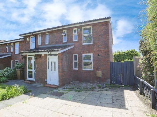 2 bedroom end of terrace house for sale in Le May Avenue, London, SE12 — £467,000 • 2 bed • 1 bath • 846 ft²
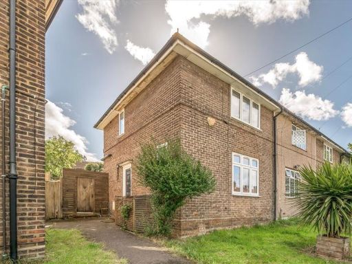 2 bedroom terraced house for sale in Ballamore Road, Bromley, BR1 — £400,000 • 2 bed • 1 bath • 646 ft²
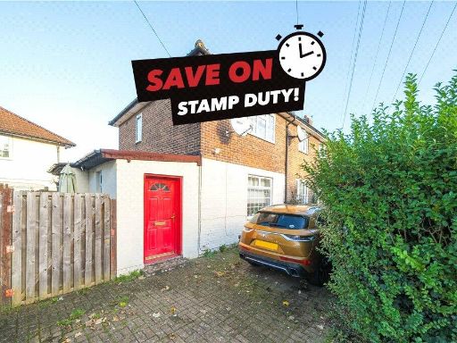 2 bedroom house for sale in Shroffold Road, Bromley, BR1 — £400,000 • 2 bed • 1 bath • 808 ft²
 2 bedroom terraced house for sale in Castleton Road, Eltham, SE9 — £400,000 • 2 bed • 1 bath • 919 ft²
 2 bedroom terraced house for sale in Gittens Close, Bromley, BR1 — £375,000 • 2 bed • 1 bath • 728 ft²
Meta
- {
"@context": "https://schema.org",
"@type": "Residence",
"name": "2 bedroom end of terrace house for sale in Northover, Londo…",
"description": "",
"url": "https://propertypiper.co.uk/property/580d6132-b046-49dc-bdeb-a01b8fe31e37",
"image": "https://image-a.propertypiper.co.uk/0ba4f824-2720-4a09-bd87-caeab9ed3326-1024.jpeg",
"address": {
"@type": "PostalAddress",
"streetAddress": "119 NORTHOVER BROMLEY",
"postalCode": "BR1 5JU",
"addressLocality": "Lewisham",
"addressRegion": "Lewisham East",
"addressCountry": "England"
},
"geo": {
"@type": "GeoCoordinates",
"latitude": 51.43158140932411,
"longitude": 0.010190444068235235
},
"numberOfRooms": 2,
"numberOfBathroomsTotal": 2,
"floorSize": {
"@type": "QuantitativeValue",
"value": 672,
"unitCode": "FTK"
},
"offers": {
"@type": "Offer",
"price": 365000,
"priceCurrency": "GBP",
"availability": "https://schema.org/InStock"
},
"additionalProperty": [
{
"@type": "PropertyValue",
"name": "Feature",
"value": "semi-detached"
},
{
"@type": "PropertyValue",
"name": "Feature",
"value": "post-war"
},
{
"@type": "PropertyValue",
"name": "Feature",
"value": "two-story"
},
{
"@type": "PropertyValue",
"name": "Feature",
"value": "brick exterior"
},
{
"@type": "PropertyValue",
"name": "Feature",
"value": "pitched roof"
},
{
"@type": "PropertyValue",
"name": "Feature",
"value": "hedge"
},
{
"@type": "PropertyValue",
"name": "Feature",
"value": "garden"
},
{
"@type": "PropertyValue",
"name": "Feature",
"value": "garden"
},
{
"@type": "PropertyValue",
"name": "Feature",
"value": "contemporary"
},
{
"@type": "PropertyValue",
"name": "Feature",
"value": "fenced"
},
{
"@type": "PropertyValue",
"name": "Feature",
"value": "landscaped"
},
{
"@type": "PropertyValue",
"name": "Feature",
"value": "decking"
},
{
"@type": "PropertyValue",
"name": "Feature",
"value": "shed"
},
{
"@type": "PropertyValue",
"name": "Feature",
"value": "plants"
},
{
"@type": "PropertyValue",
"name": "Feature",
"value": "trees"
}
]
}
High Res Floorplan Images
Compatible Floorplan Images
FloorplanImages Thumbnail