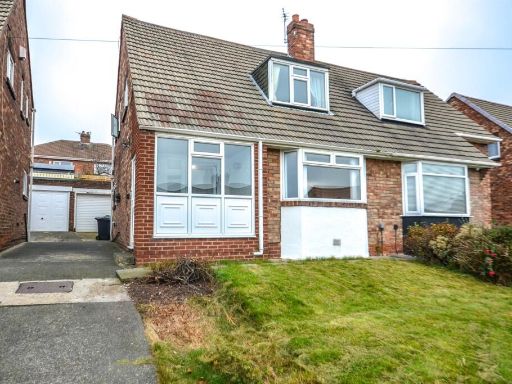
NE34 7SX - 3 bedroom semidetached house for sale in Allendale Drive, S…
View on Property Piper
3 bedroom semi-detached house for sale in Allendale Drive, South Shields, NE34
Property Details
- Price: £160750
- Bedrooms: 3
- Bathrooms: 1
- Property Type: undefined
- Property SubType: undefined
Image Descriptions
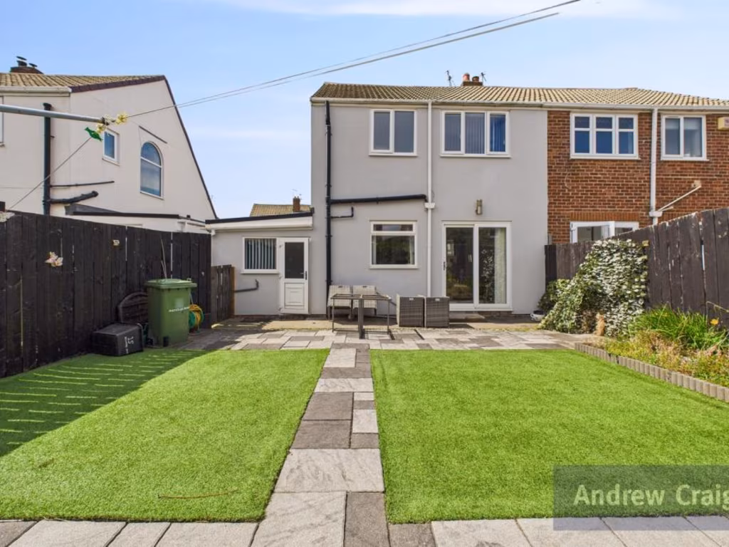
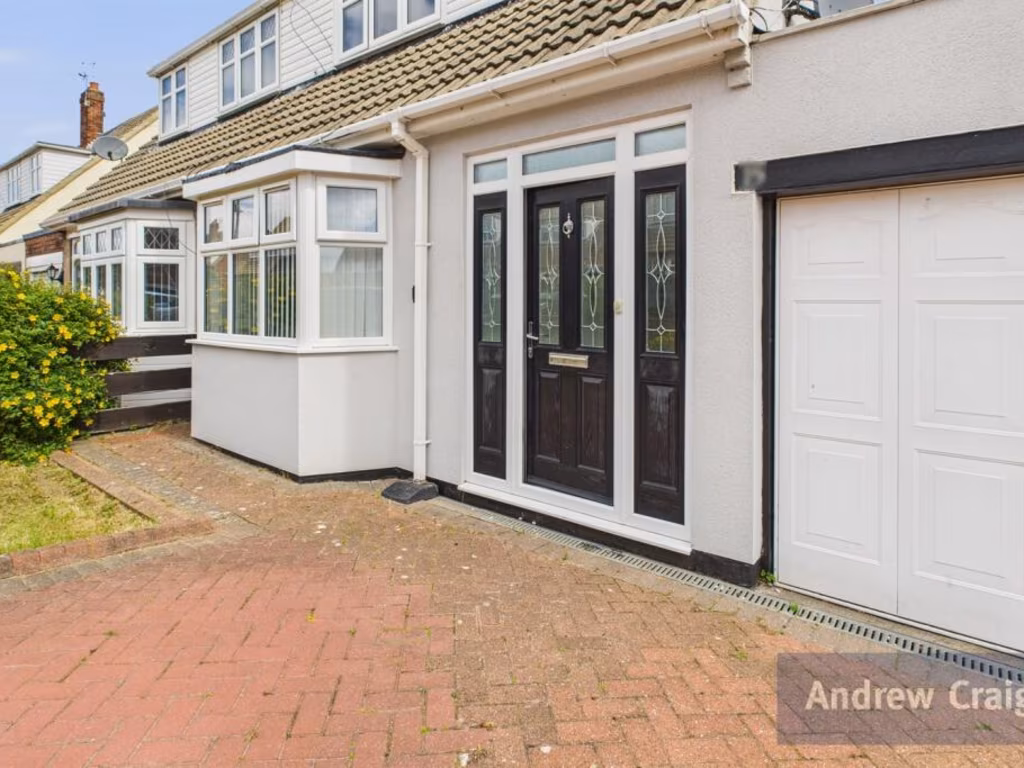
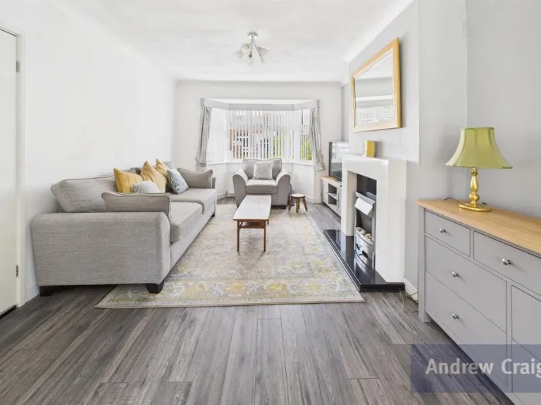
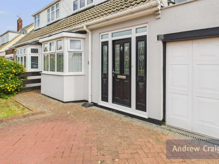
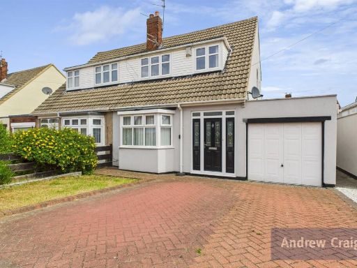
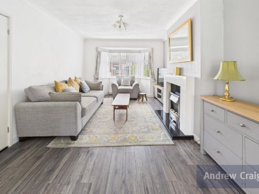
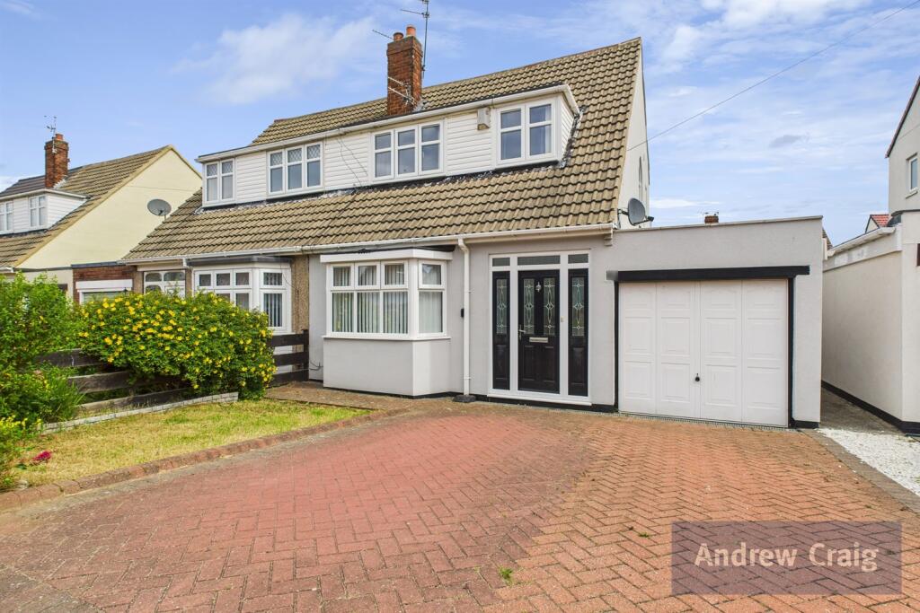
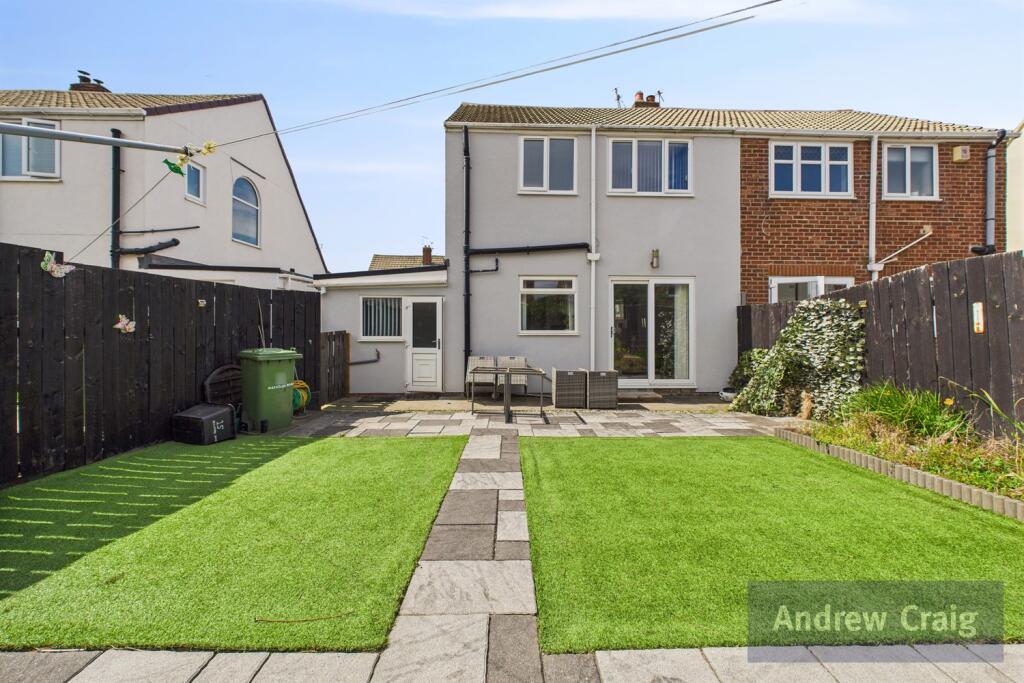
- semi-detached house traditional
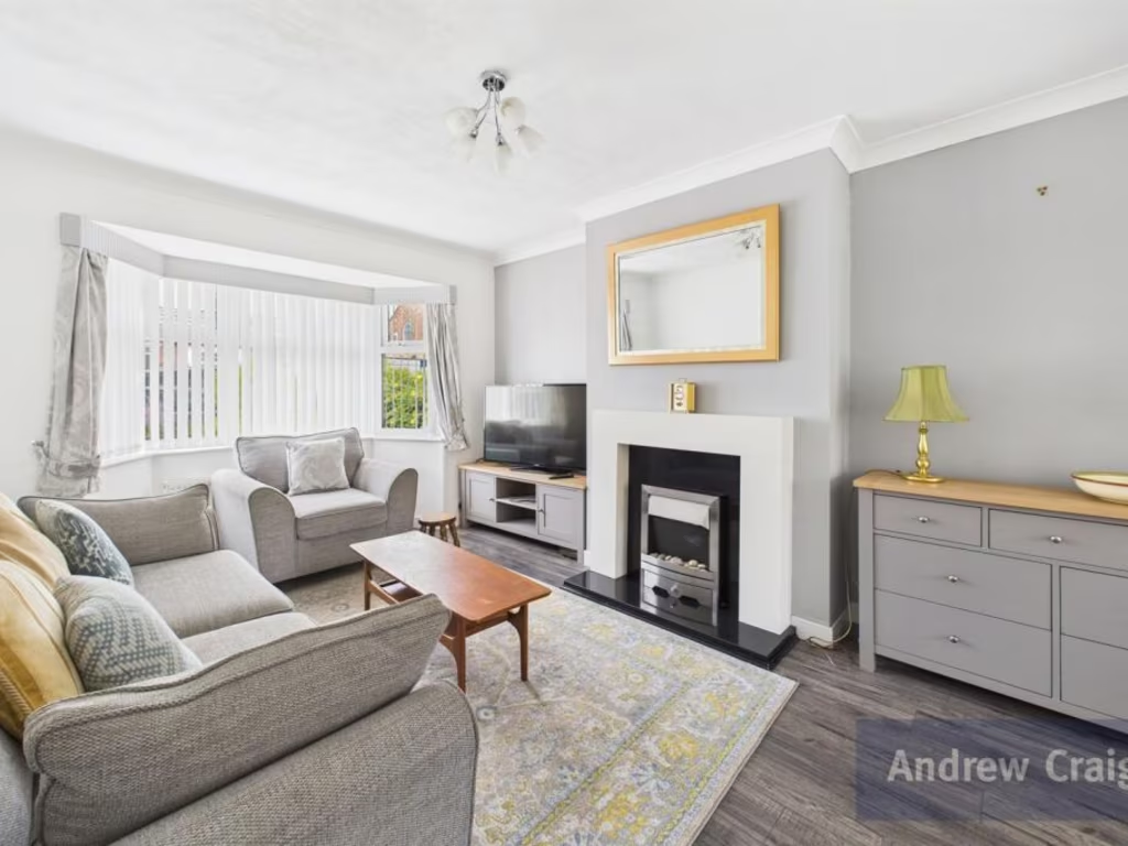
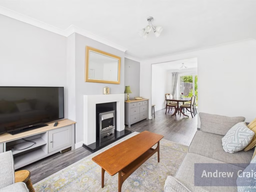
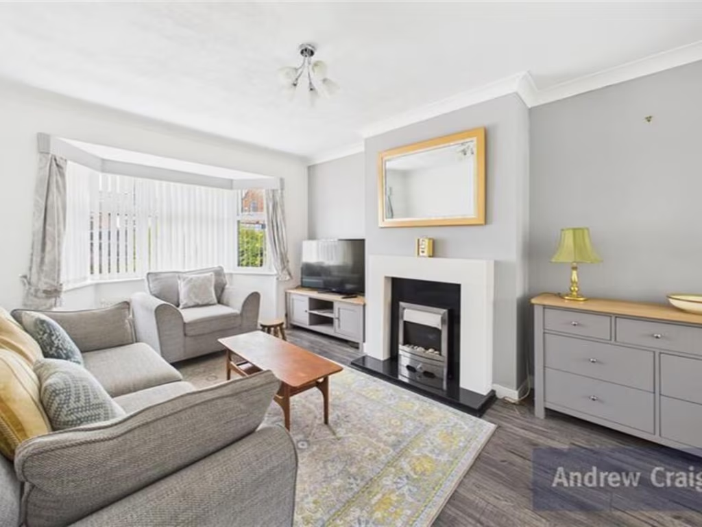
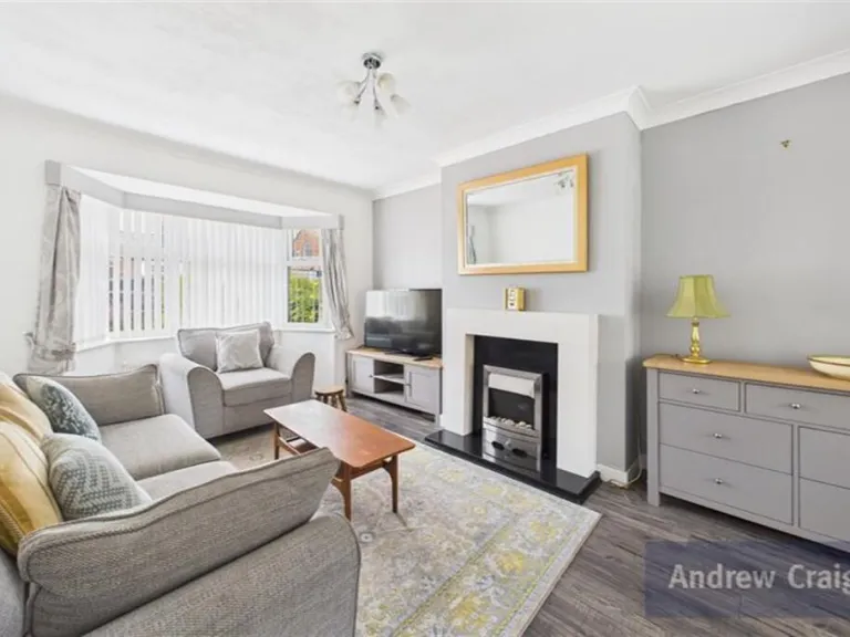
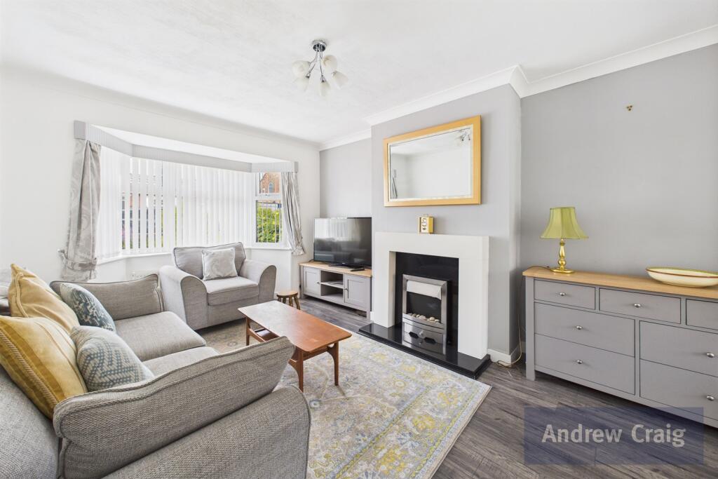
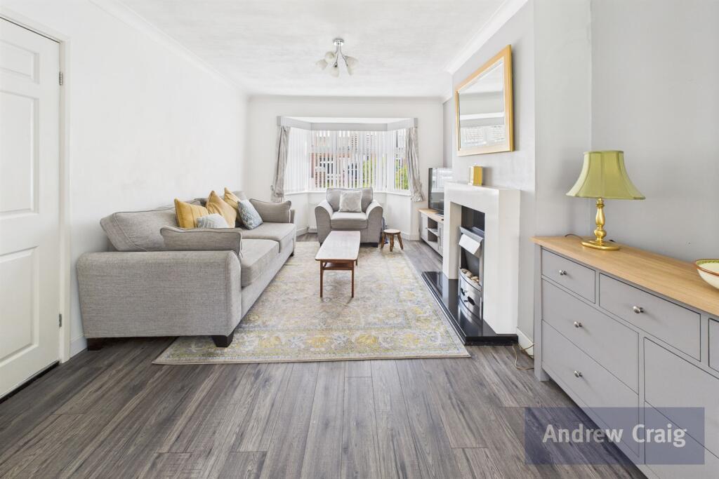
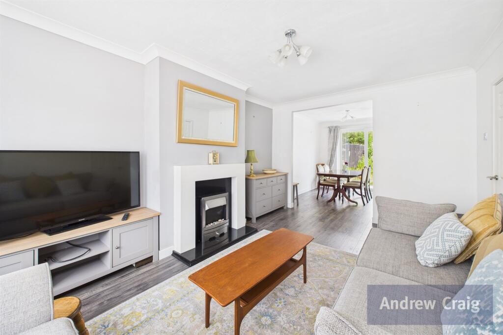
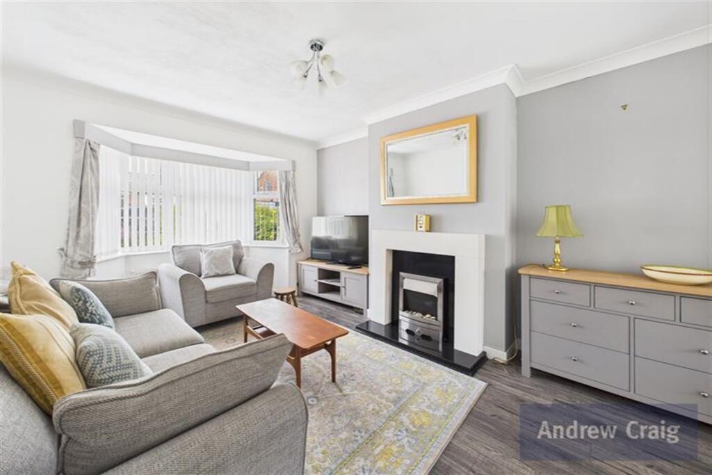
- living room modern
Floorplan Description
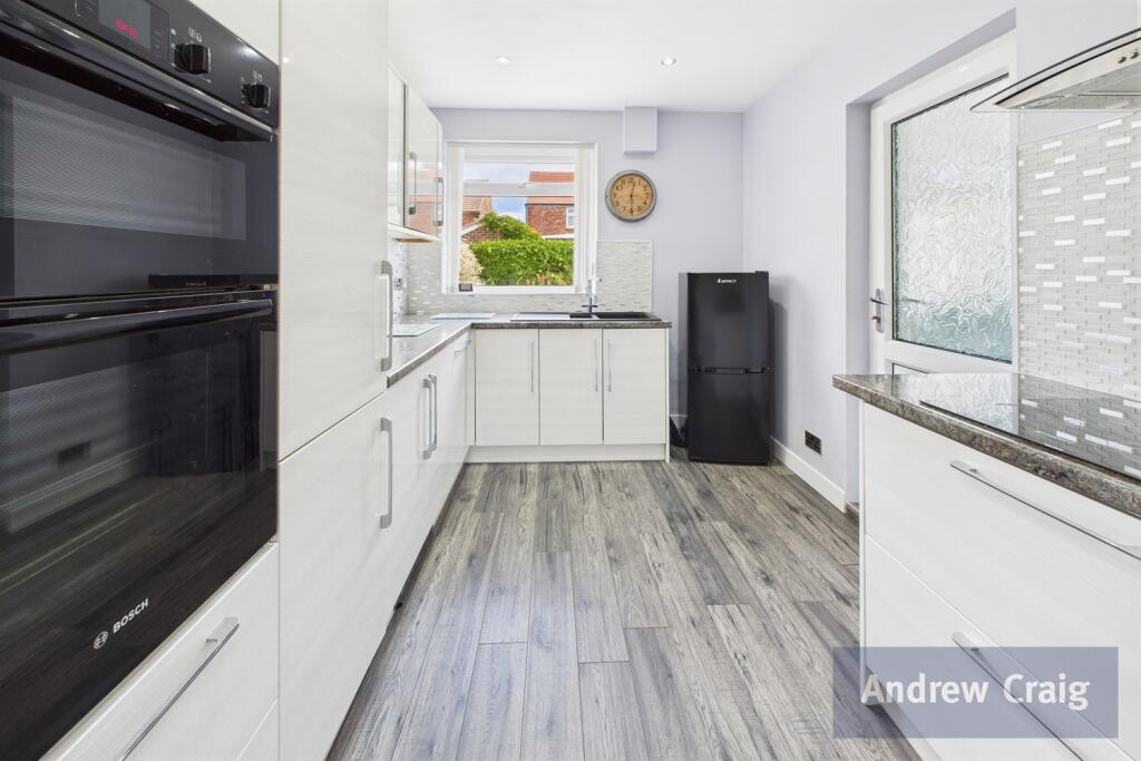
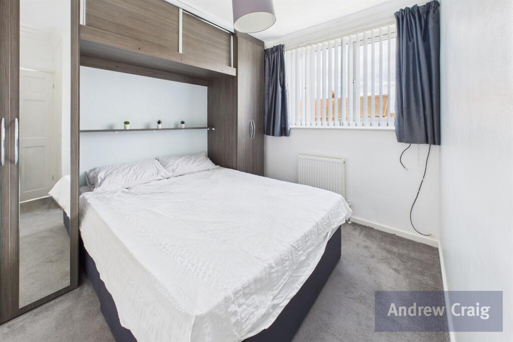
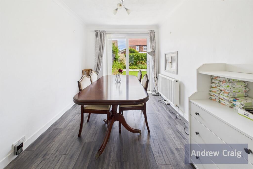
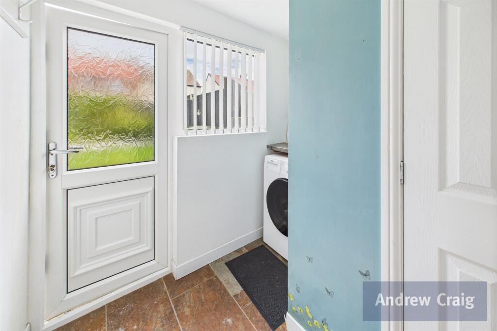
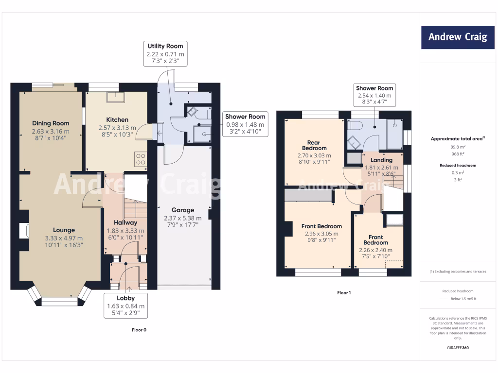
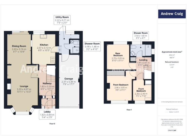
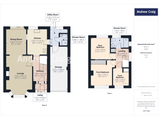
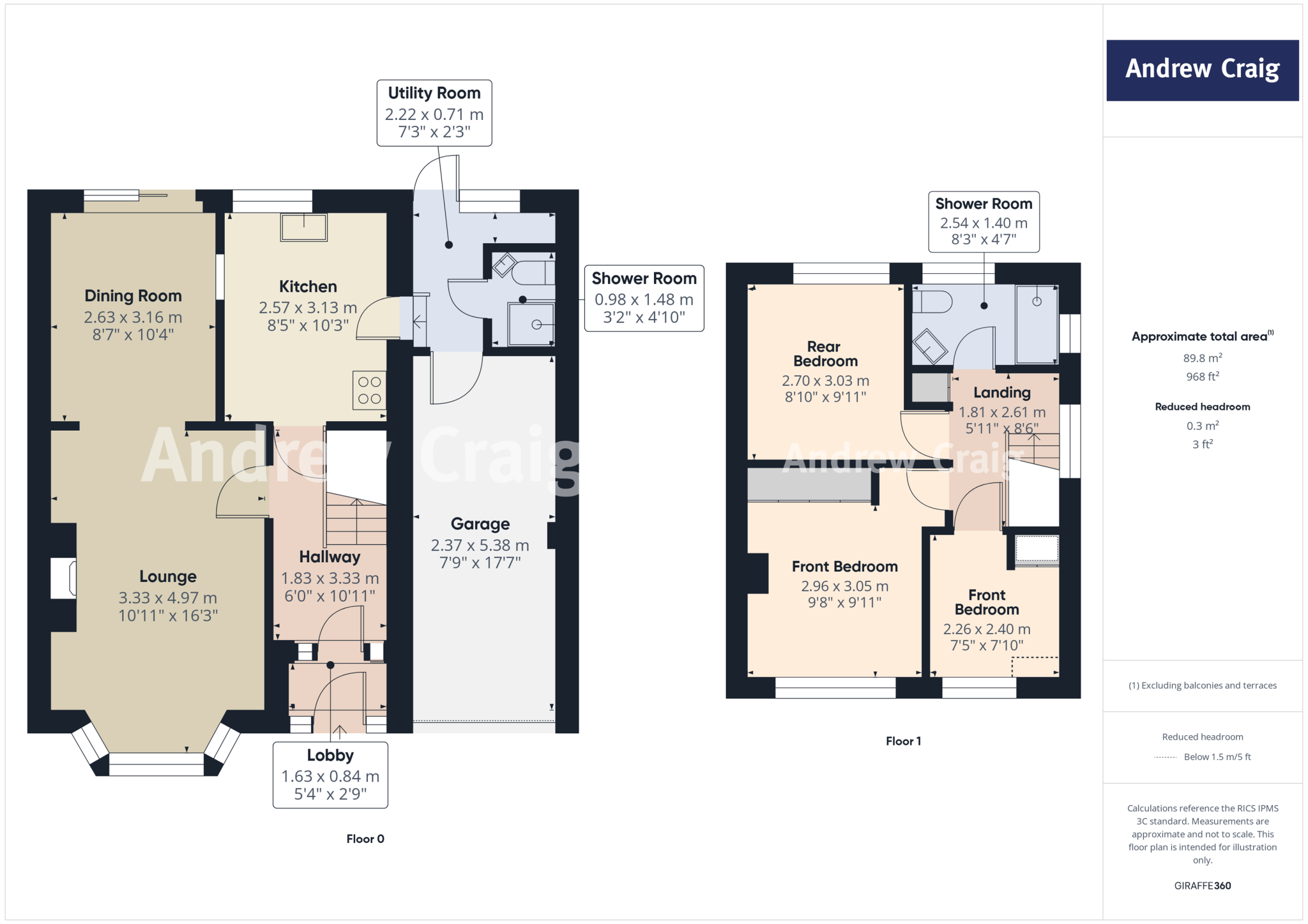
- Two-story home with 3 bedrooms and 2 shower rooms, including a lounge, dining room, utility room, and kitchen.
Rooms
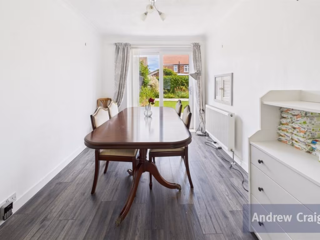
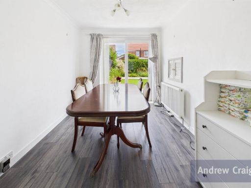
- Dining Room: average
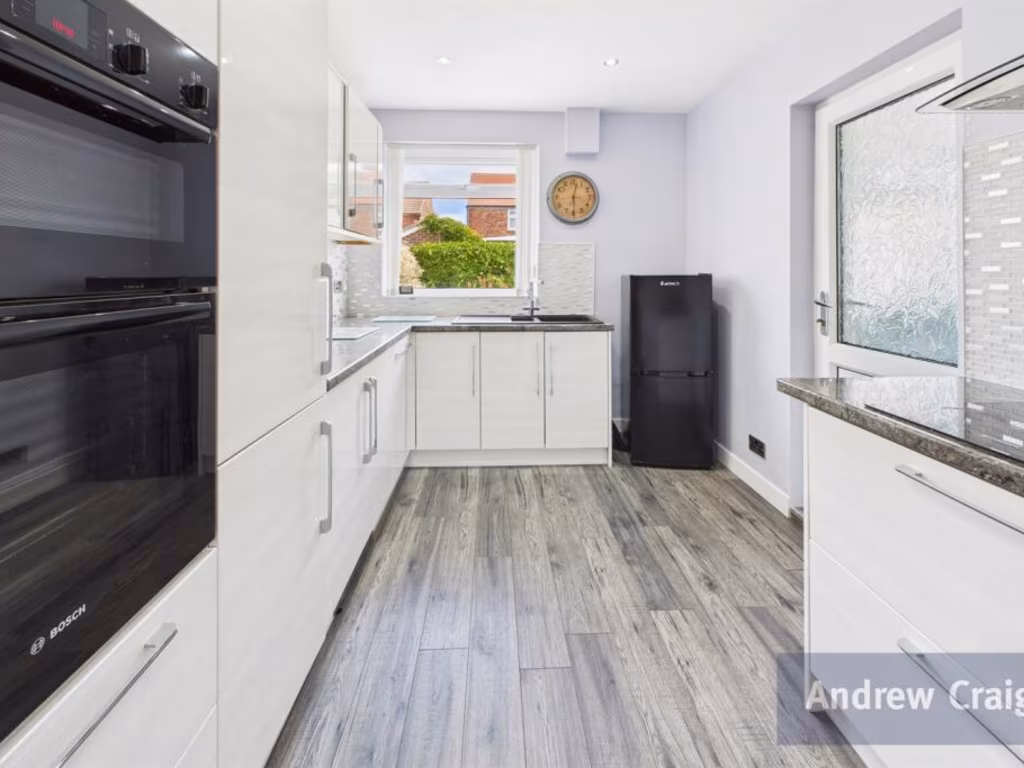
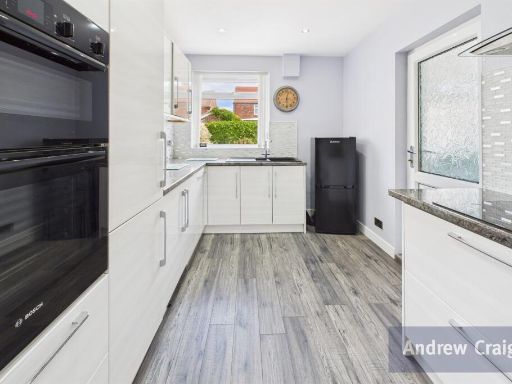
- Kitchen: average
- Lounge: large
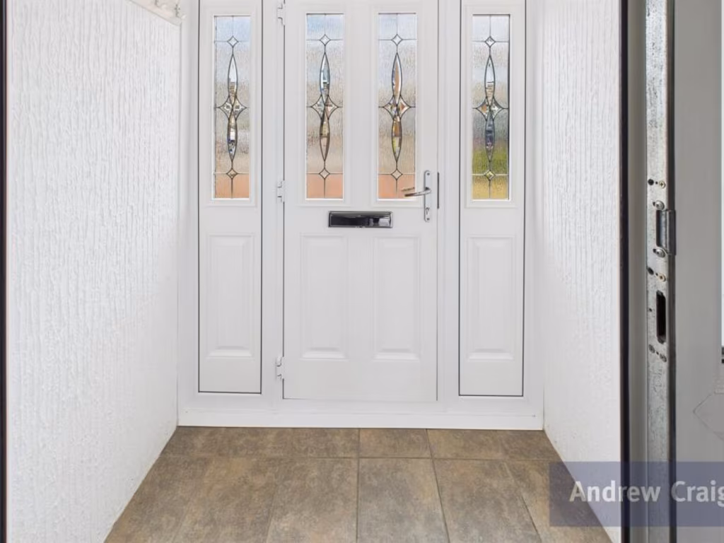
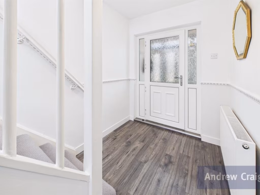
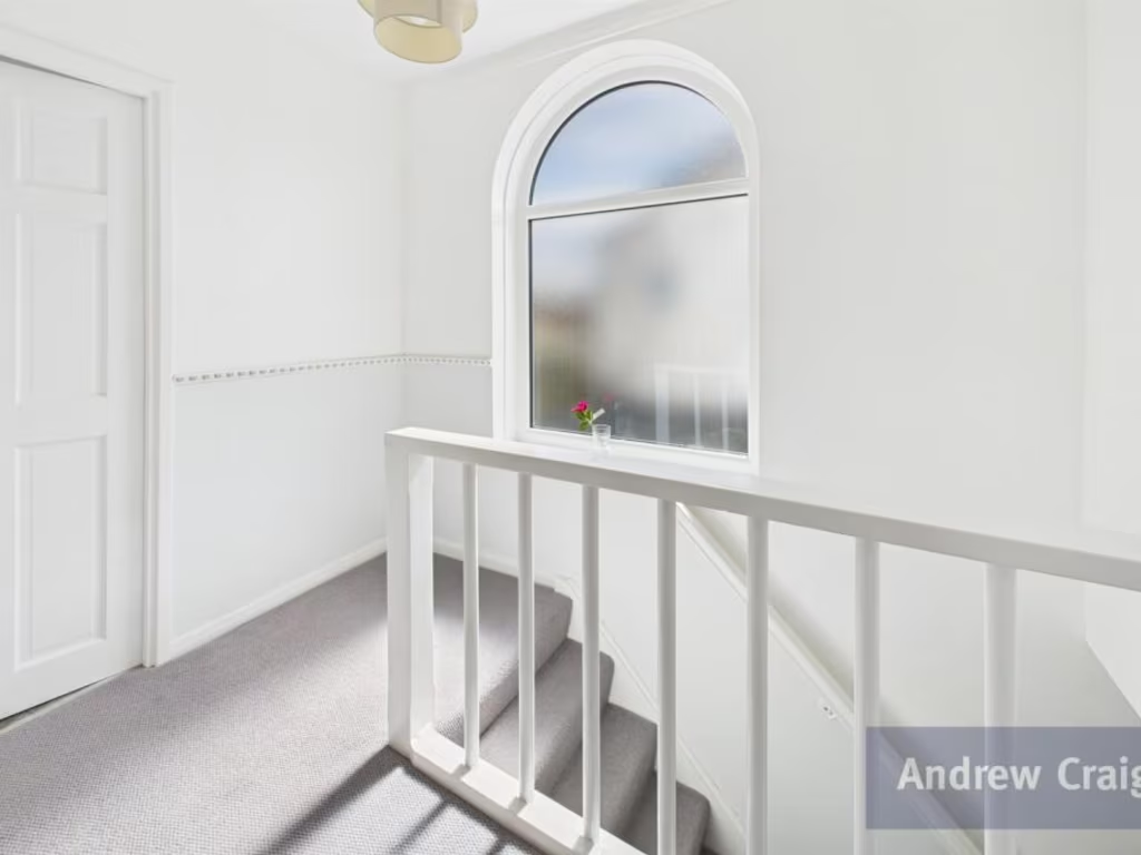
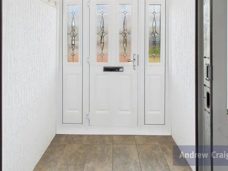
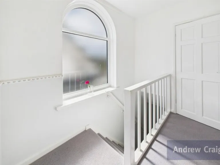
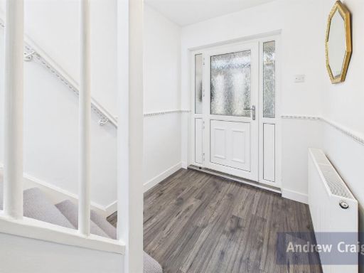
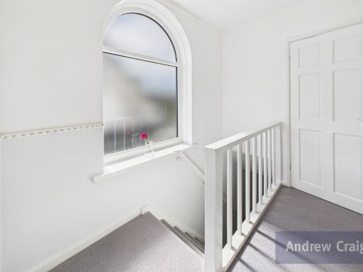
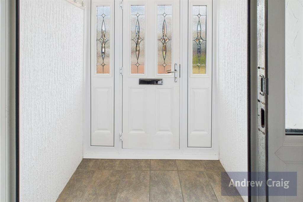
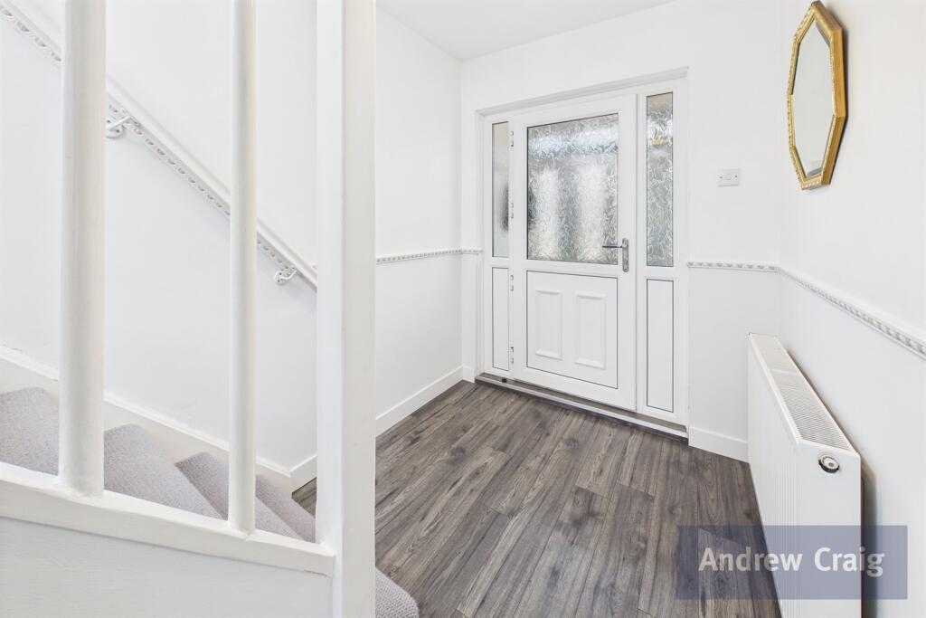
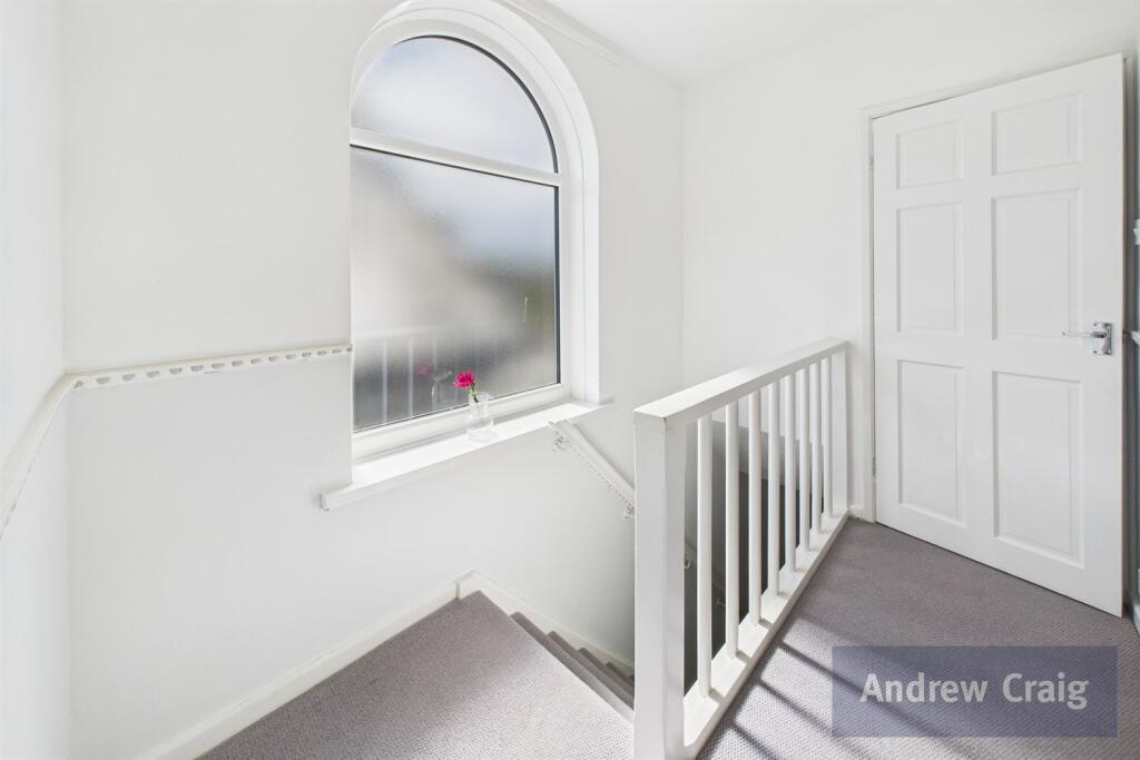
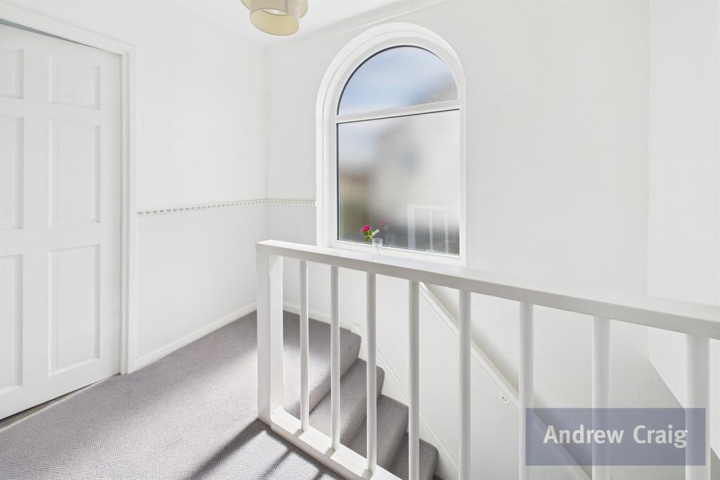
- Hallway: average
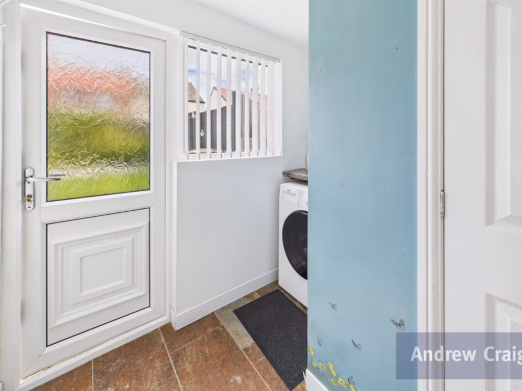
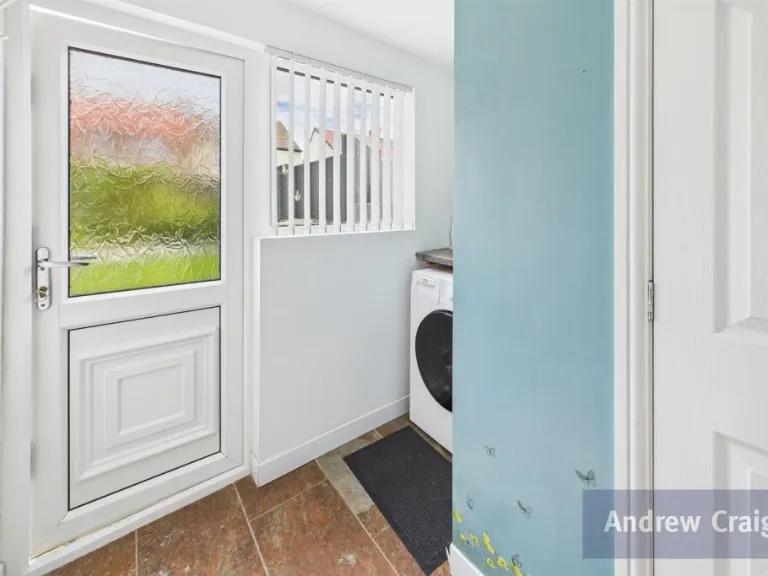
- Utility Room: small
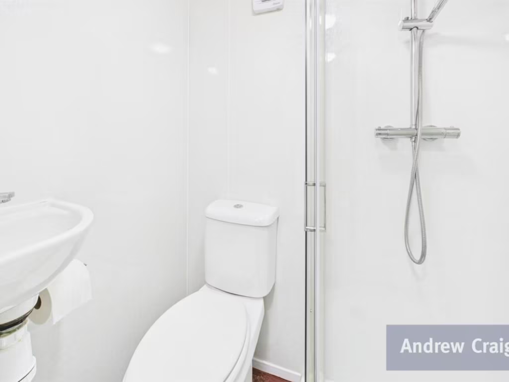
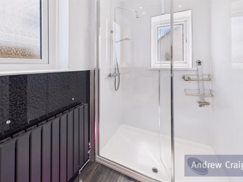
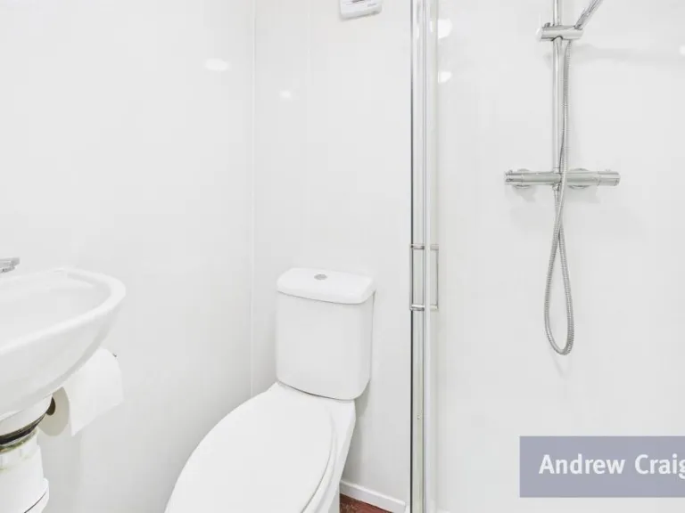
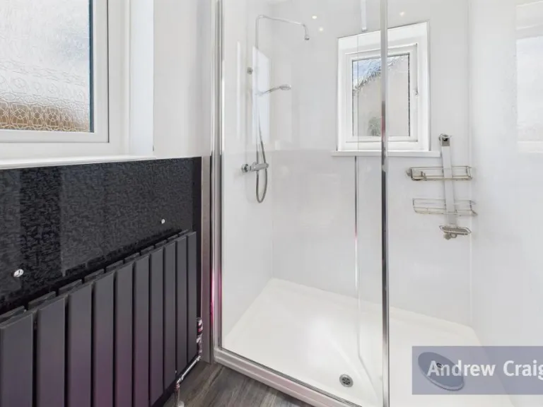
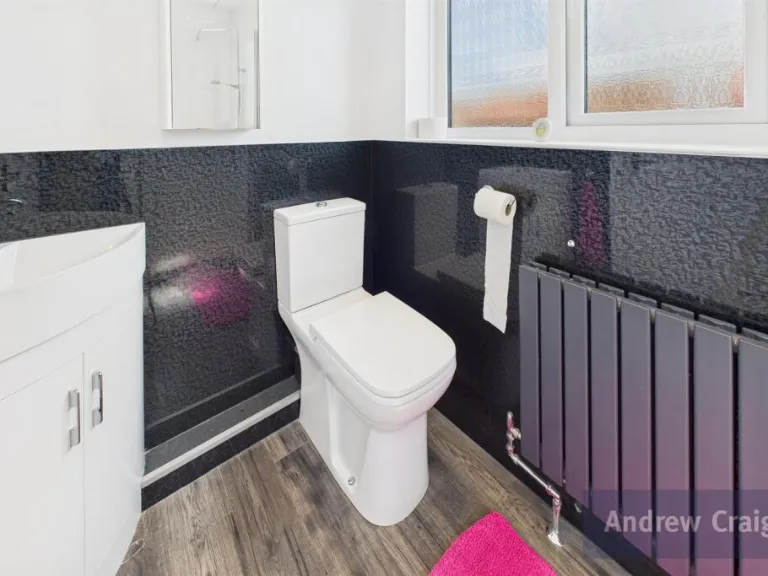
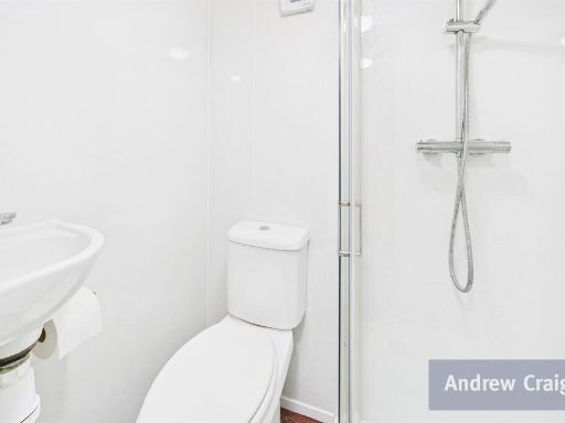
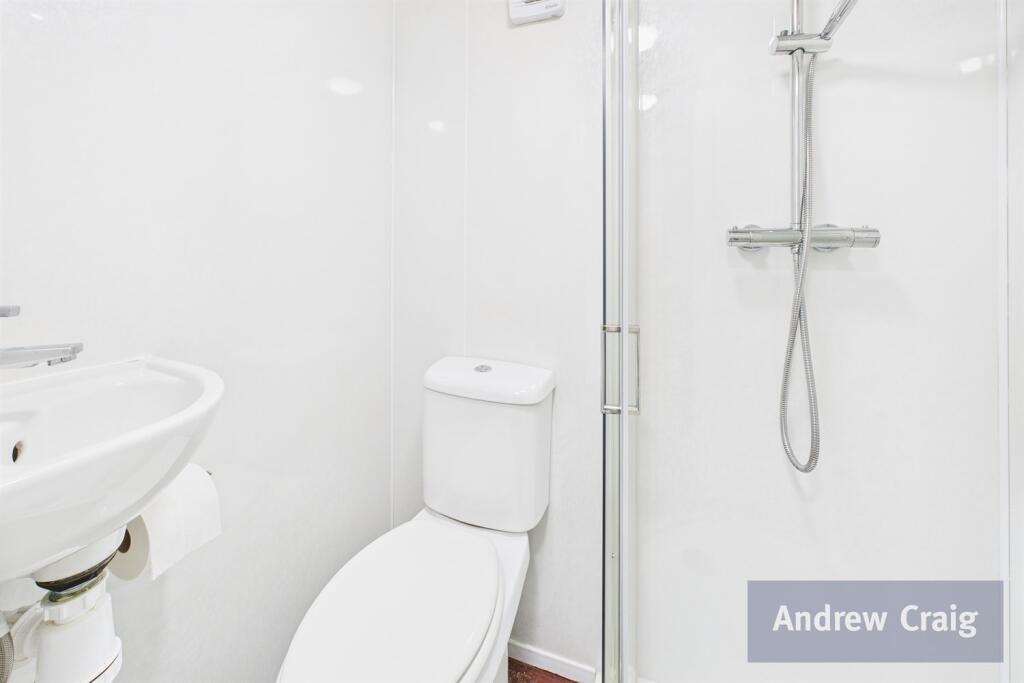
- Shower Room (Ground Floor): small
- Garage: large
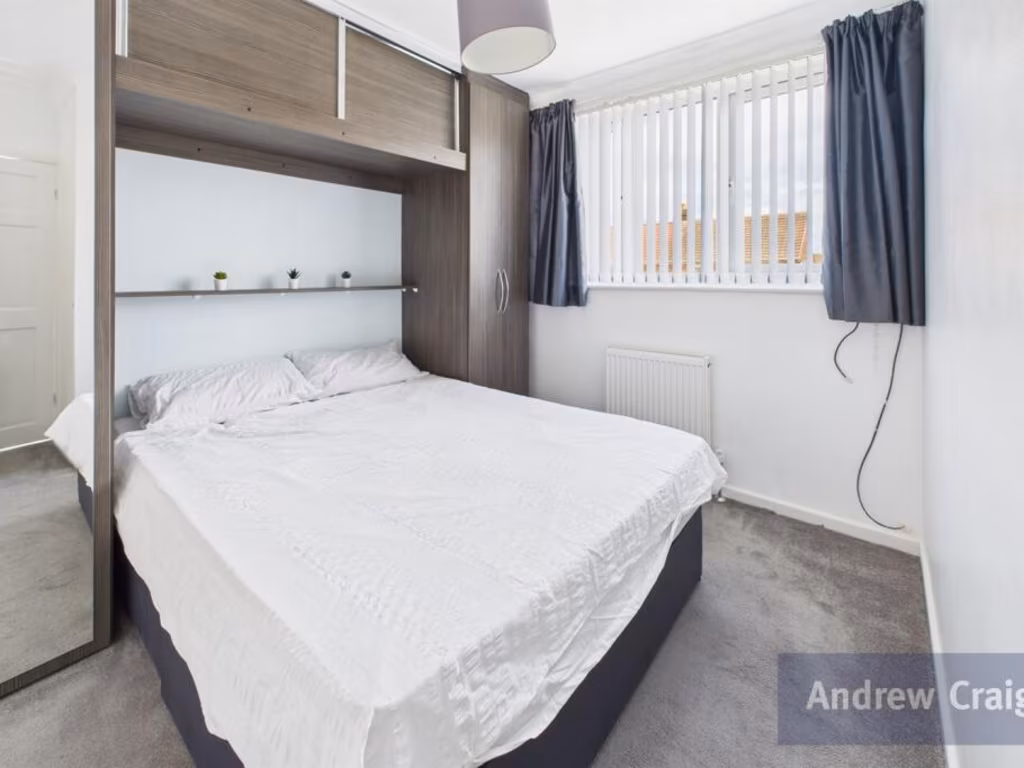
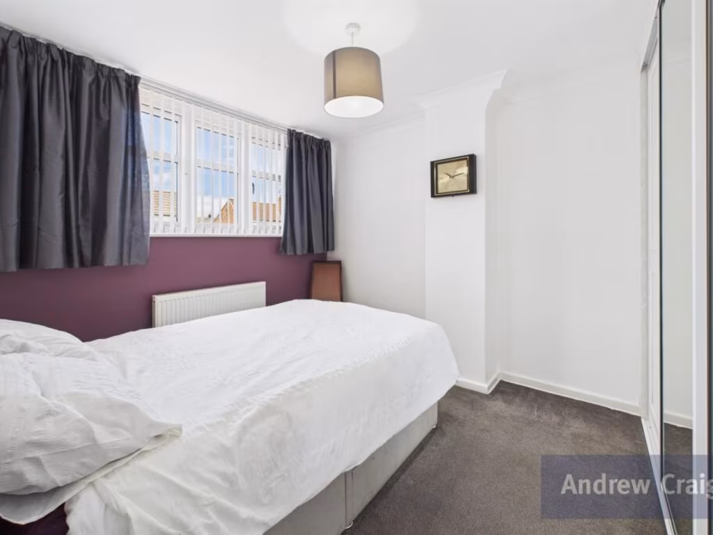
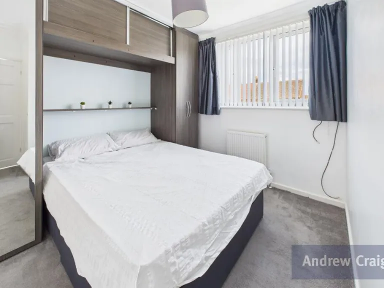
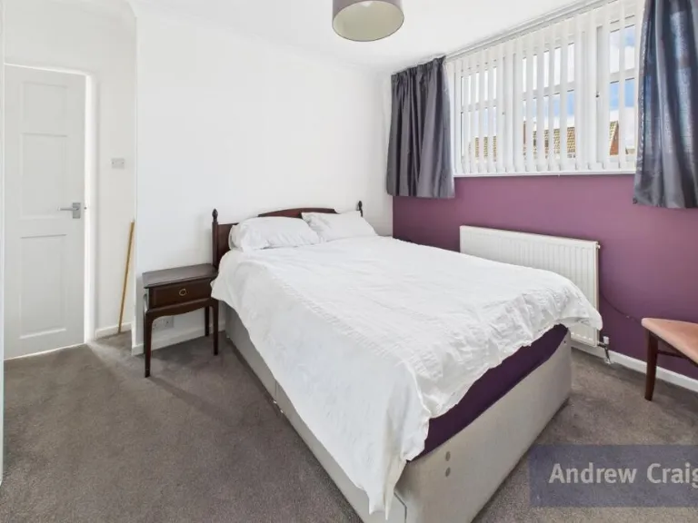
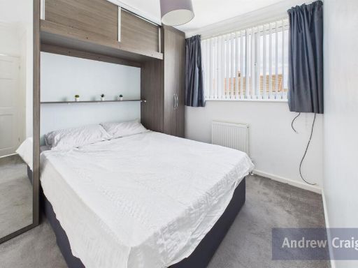
- Rear Bedroom: average
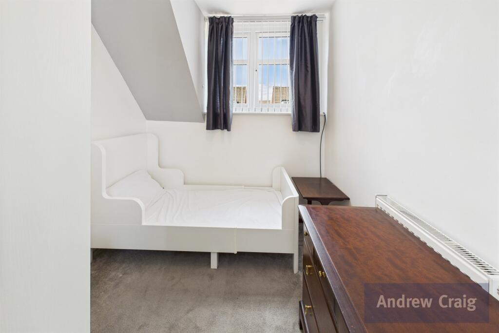
- Front Bedroom: average
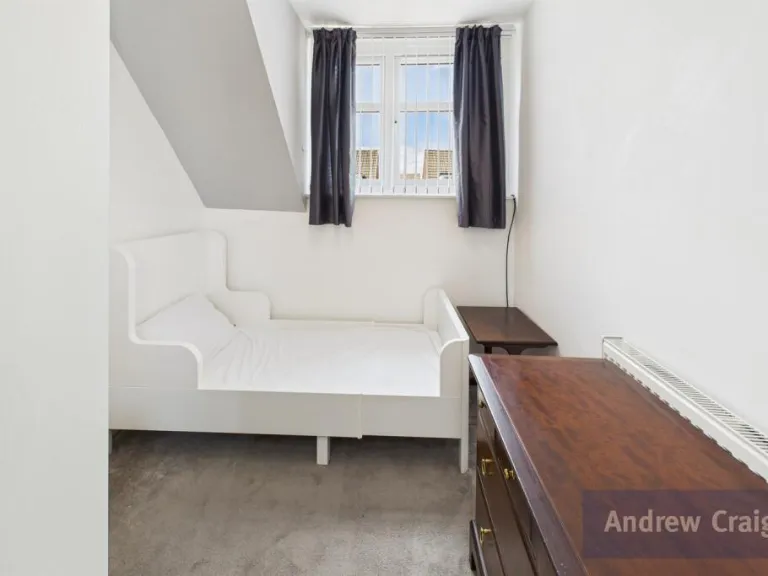
- Front Bedroom: small
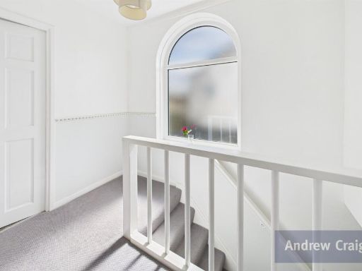
- Landing: average
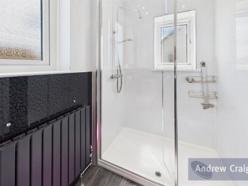
- Shower Room (First Floor): average
Textual Property Features
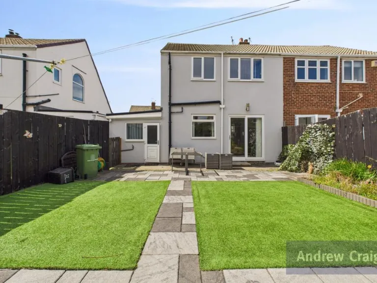
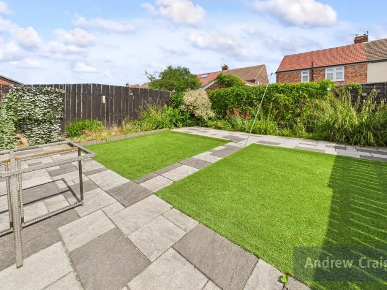
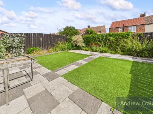
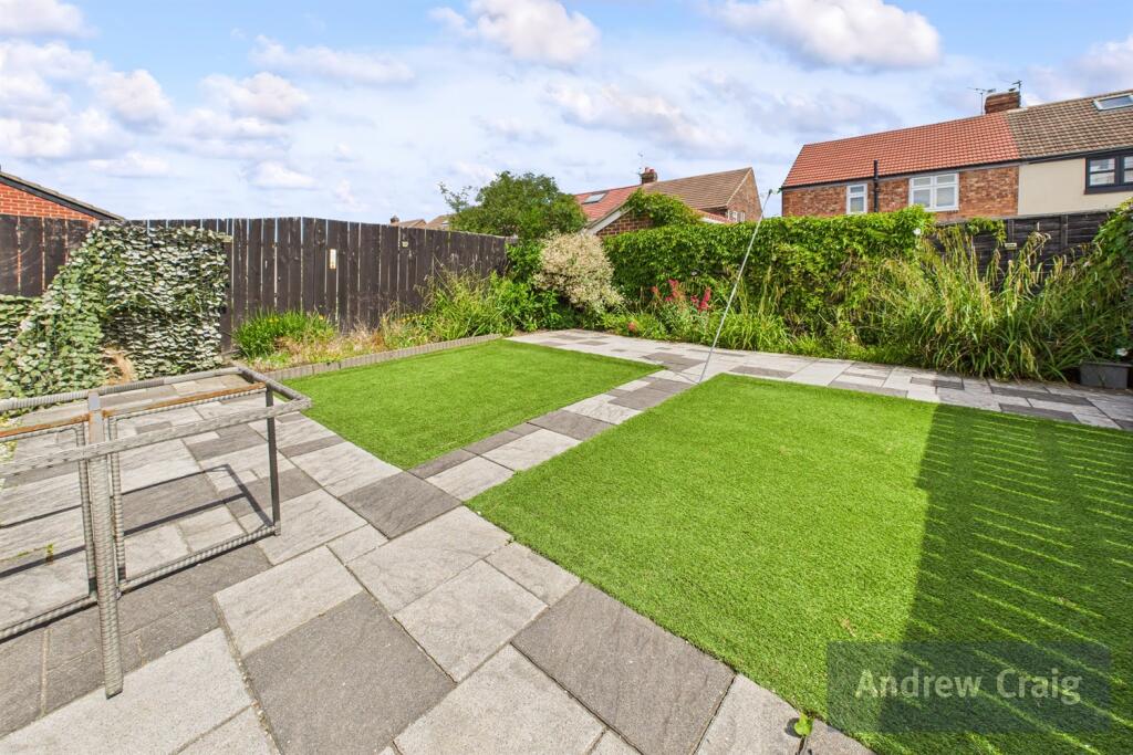
- Has Garden
- Is Retirement
- Success
Detected Visual Features
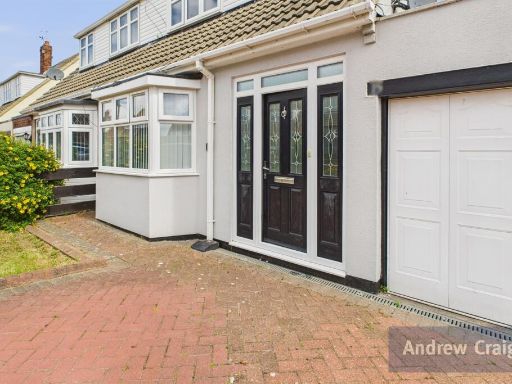
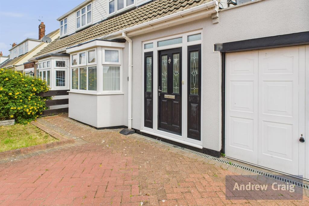
- semi-detached
- traditional style
- dormer windows
- garage
- driveway
- pitched roof
- chimney
- suburban
- residential area
- living room
- modern style
- bay window
- fireplace
- laminate flooring
- bright
- neutral colors
EPC Details
- Fully double glazed
- Cavity wall, filled cavity
- Boiler and radiators, mains gas
- Low energy lighting in 80% of fixed outlets
- Suspended, no insulation (assumed)
Nearby Schools
- Cleadon Church of England Academy
- Holy Trinity Church of England Academy (South Shields)
- Mortimer Primary School
- Mortimer Community College
- Laygate Community School
- Westoe Crown Primary School
- Hadrian Primary School
- St Oswald's Catholic Primary School, South Shields
- Ridgeway Primary Academy
- SS Peter and Paul Catholic Primary School, South Shields
- St Wilfrid's RC College
- Harton Primary School
- Ashley Academy
- East Boldon Junior School
- Marsden Primary School
- Harton Academy
- St Gregory's Catholic Primary School, South Shields
- Sea View Primary School
- Kings Priory School
- Forest View Primary
- Biddick Hall Junior School
- Stanhope Primary School
- St Bede's Catholic Primary School, South Shields
Nearest General Shops
- Id: 4320760296
- Tags:
- Addr:
- City: South Shields
- Street: Highfield Road
- Name: Carpets 101
- Shop: carpet
- TagsNormalized:
- Lat: 54.984538
- Lon: -1.4055597
- FullGeoHash: gcz0b18s0hf9
- PartitionGeoHash: gcz0
- Images:
- FoodStandards: null
- Distance: 362.7
,- Id: 4320760297
- Tags:
- Addr:
- City: South Shields
- Street: Highfield Road
- Name: Monroe's Hair & Beauty Salon
- Shop: hairdresser
- TagsNormalized:
- Lat: 54.9845007
- Lon: -1.4054398
- FullGeoHash: gcz0b18efvu4
- PartitionGeoHash: gcz0
- Images:
- FoodStandards: null
- Distance: 359.4
,- Id: 433226966
- Tags:
- Addr:
- City: South Shields
- Street: Highfield Road
- Building: yes
- Name: Highfield Service Centre
- Shop: car_repair
- TagsNormalized:
- service
- car repair
- repair
- shop
- Lat: 54.9847117
- Lon: -1.4054309
- FullGeoHash: gcz0b18t5j4v
- PartitionGeoHash: gcz0
- Images:
- FoodStandards: null
- Distance: 344.3
}
Nearest Religious buildings
- Id: 430540189
- Tags:
- Addr:
- City: South Shields
- Housenumber: 1
- Postcode: NE34 6SA
- Street: Falstone Avenue
- Amenity: place_of_worship
- Building: yes
- Denomination: jehovahs_witness
- Name: Kingdom Hall of Jehovah's Witnesses
- Religion: christian
- TagsNormalized:
- place of worship
- jehovah
- jehovahs witness
- christian
- church
- Lat: 54.9773292
- Lon: -1.4049105
- FullGeoHash: gcz0b02fphyy
- PartitionGeoHash: gcz0
- Images:
- FoodStandards: null
- Distance: 1057.3
,- Id: 899001003
- Tags:
- Amenity: place_of_worship
- Denomination: roman_catholic
- Name: Holy Rosary
- Religion: christian
- TagsNormalized:
- place of worship
- catholic
- roman catholic
- christian
- church
- Lat: 54.9800306
- Lon: -1.3984571
- FullGeoHash: gcz0b0v9vsdc
- PartitionGeoHash: gcz0
- Images:
- FoodStandards: null
- Distance: 749
,- Id: 899001001
- Tags:
- Amenity: place_of_worship
- Denomination: methodist
- Name: The Marsden Road Baptist Tabernacl
- Religion: christian
- Source: OS OpenData StreetView
- TagsNormalized:
- place of worship
- methodist
- baptist
- christian
- church
- Lat: 54.9811758
- Lon: -1.4017401
- FullGeoHash: gcz0b152944b
- PartitionGeoHash: gcz0
- Images:
- FoodStandards: null
- Distance: 603.1
}
Nearest Medical buildings
- Id: 6826337184
- Tags:
- Addr:
- City: South Shields
- Housenumber: 265
- Postcode: NE34 6DL
- Street: Sunderland Road
- Amenity: dentist
- Healthcare: dentist
- Name: My Dentist
- Opening_hours: Mo-Th 08:00-18:00, Fr 08:00-17:30, Sa 08:00-13:00
- Website: https://www.mydentist.co.uk/dentists/practices/england/tyne-and-wear/tyne-and-wear/265-sunderland-road
- TagsNormalized:
- dentist
- health
- healthcare
- my dentist
- Lat: 54.973969
- Lon: -1.4110056
- FullGeoHash: gcybxzsw94tf
- PartitionGeoHash: gcyb
- Images:
- FoodStandards: null
- Distance: 1538
,- Id: 4342851121
- Tags:
- Addr:
- City: South Shields
- Street: Westoe Road
- Amenity: pharmacy
- Healthcare: pharmacy
- Name: Hogg Chemist
- TagsNormalized:
- pharmacy
- health
- healthcare
- chemist
- Lat: 54.9875447
- Lon: -1.423231
- FullGeoHash: gcybzd5tsm60
- PartitionGeoHash: gcyb
- Images:
- FoodStandards: null
- Distance: 1413.5
,- Id: 4298485821
- Tags:
- Addr:
- Amenity: pharmacy
- Name: Horsley Hill Pharmacy
- TagsNormalized:
- Lat: 54.9805325
- Lon: -1.3992628
- FullGeoHash: gcz0b0vhff45
- PartitionGeoHash: gcz0
- Images:
- FoodStandards: null
- Distance: 684
,- Id: 430540198
- Tags:
- Addr:
- City: South Shields
- Postcode: NE34 6RE
- Street: Marsden Road
- Amenity: doctors
- Building: yes
- Healthcare: doctor
- Name: Marsden Road Health And Wellbeing Centre
- Phone: +44 191 283 2861
- TagsNormalized:
- doctor
- doctors
- health
- healthcare
- Lat: 54.9805143
- Lon: -1.399859
- FullGeoHash: gcz0b0ussytq
- PartitionGeoHash: gcz0
- Images:
- FoodStandards: null
- Distance: 680.3
}
Nearest Airports
- Id: 51496177
- Tags:
- Addr:
- City: Newcastle upon Tyne
- Housename: Newcastle International Airport
- Postcode: NE13 8BZ
- Street: Woolsington
- Aerodrome: international
- Aerodrome:type: public
- Aeroway: aerodrome
- Contact:
- Website: http://www.newcastleairport.com
- Ele: 81
- Iata: NCL
- Icao: EGNT
- Ifr: yes
- Name: Newcastle International Airport
- Old_name: Woolsington Aerodrome
- Operator: Newcastle International Airport Ltd
- Operator:type: private
- Phone: +44 871 882 1121
- Ref: NCL
- Size: 4500000
- Source: Bing
- Vfr: yes
- Website: https://www.newcastleairport.com/
- Wheelchair: yes
- Wikidata: Q8975
- Wikipedia: en:Newcastle International Airport
- TagsNormalized:
- airport
- international airport
- Lat: 55.0385826
- Lon: -1.6925163
- FullGeoHash: gcyc17rwcx2m
- PartitionGeoHash: gcyc
- Images:
- FoodStandards: null
- Distance: 19456.7
,- Id: 224091164
- Tags:
- Addr:
- City: Newcastle upon Tyne
- Postcode: NE13 8BZ
- Street: Woolsington
- Building: hotel
- Contact:
- Facebook: https://www.facebook.com/doubletree.newcastle
- Google_plus: https://plus.google.com/115643701064921491168/about
- Twitter: https://twitter.com/dtnewcastle_int
- Email: info@doubletree-newcastle.co.uk
- Fhrs:
- Name: DoubleTree by Hilton Hotel Newcastle International Airport
- Operator: Hilton Worldwide
- Phone: +44 1661 824266
- Rooms: 179
- Smoking: no
- Stars: 4
- Tourism: hotel
- Website: https://doubletree3.hilton.com/en/hotels/united-kingdom/doubletree-by-hilton-hotel-newcastle-international-airport-NCLNADI/index.html?WT.mc_id=zELWAKN0EMEA1DT2DMH3LocalSearch4DGGenericx6NCLNADI
- Wheelchair: yes
- TagsNormalized:
- hotel
- airport
- international airport
- tourism
- major airport
- Lat: 55.0364476
- Lon: -1.7124358
- FullGeoHash: gcyc1514937m
- PartitionGeoHash: gcyc
- Images:
- FoodStandards:
- Id: 236731
- FHRSID: 236731
- LocalAuthorityBusinessID: 11/00246/MIXED
- BusinessName: Doubletree By Hilton Hotel
- BusinessType: Hotel/bed & breakfast/guest house
- BusinessTypeID: 7842
- AddressLine1: Doubletree By Hilton Newcastle Airport
- AddressLine2: Woolsington
- AddressLine3: Newcastle Upon Tyne
- AddressLine4: null
- PostCode: NE13 8BZ
- RatingValue: 5
- RatingKey: fhrs_5_en-GB
- RatingDate: 2019-08-13
- LocalAuthorityCode: 416
- LocalAuthorityName: Newcastle Upon Tyne
- LocalAuthorityWebSite: http://www.newcastle.gov.uk/
- LocalAuthorityEmailAddress: psr@newcastle.gov.uk
- Scores:
- Hygiene: 0
- Structural: 5
- ConfidenceInManagement: 0
- NewRatingPending: false
- Geocode:
- Longitude: -1.71254240000000
- Latitude: 55.03664040000000
- Distance: 20608.2
}
Nearest Leisure Facilities
- Id: 436407683
- Tags:
- Leisure: pitch
- Sport: bowls
- Surface: grass
- TagsNormalized:
- Lat: 54.9895736
- Lon: -1.4140773
- FullGeoHash: gcybzfd33x7x
- PartitionGeoHash: gcyb
- Images:
- FoodStandards: null
- Distance: 889.7
,- Id: 702868983
- Tags:
- TagsNormalized:
- outdoor
- outdoor seating
- leisure
- Lat: 54.9884282
- Lon: -1.4133764
- FullGeoHash: gcybzf6fccyp
- PartitionGeoHash: gcyb
- Images:
- FoodStandards: null
- Distance: 807.1
,- Id: 436408312
- Tags:
- Leisure: outdoor_seating
- Operator: The Waters Edge
- TagsNormalized:
- outdoor
- outdoor seating
- leisure
- Lat: 54.9930727
- Lon: -1.4049808
- FullGeoHash: gcz0b50vvef2
- PartitionGeoHash: gcz0
- Images:
- FoodStandards: null
- Distance: 761.5
,- Id: 726858774
- Tags:
- Leisure: pitch
- Sport: soccer
- TagsNormalized:
- Lat: 54.9803095
- Lon: -1.3998063
- FullGeoHash: gcz0b0uew0sc
- PartitionGeoHash: gcz0
- Images:
- FoodStandards: null
- Distance: 703.4
,- Id: 400296933
- Tags:
- Leisure: pitch
- Surface: grass
- TagsNormalized:
- Lat: 54.9813709
- Lon: -1.404683
- FullGeoHash: gcz0b111sw2k
- PartitionGeoHash: gcz0
- Images:
- FoodStandards: null
- Distance: 622.7
}
Nearest Tourist attractions
- Id: 4344376496
- Tags:
- Addr:
- City: South Shields
- Housenumber: 106
- Postcode: NE33 2NE
- Street: Beach Road
- Name: Annie's Guest House
- Phone: +44 191 456 6088
- Tourism: guest_house
- Website: https://www.anniesguesthouse.co.uk/
- TagsNormalized:
- Lat: 54.9974003
- Lon: -1.423136
- FullGeoHash: gcybzegxnd2z
- PartitionGeoHash: gcyb
- Images:
- FoodStandards: null
- Distance: 1847.8
,- Id: 65134358
- Tags:
- Addr:
- City: South Shields
- Postcode: NE33 2NL
- Street: Bents Park Road
- Name: Sandhaven Caravan Site
- Phone: +44 1670 860256
- Tents: no
- Tourism: caravan_site
- Website: http://www.northumbrianleisure.co.uk/sandhaven-holiday-park/
- TagsNormalized:
- Lat: 54.9981469
- Lon: -1.4154769
- FullGeoHash: gcybzu172vxv
- PartitionGeoHash: gcyb
- Images:
- FoodStandards: null
- Distance: 1577.5
,- Id: 724036643
- Tags:
- Building: yes
- Historic: monument
- Name: Disappearing Gun Turret
- Tourism: yes
- Wikidata: Q26525874
- TagsNormalized:
- Lat: 54.9930939
- Lon: -1.4019208
- FullGeoHash: gcz0b55juzsp
- PartitionGeoHash: gcz0
- Images:
- FoodStandards: null
- Distance: 725.1
}
Nearest Train stations
- Id: 7340953432
- Tags:
- Internet_access: no
- Light_rail: yes
- Name: Tynemouth
- Naptan:
- Network: Tyne and Wear Metro
- Operator: Nexus
- Public_transport: station
- Railway: station
- Source: Bing
- Station: light_rail
- Wikidata: Q7860525
- Wikipedia: en:Tynemouth Metro station
- TagsNormalized:
- Lat: 55.0170464
- Lon: -1.4288662
- FullGeoHash: gcybzrx990b1
- PartitionGeoHash: gcyb
- Images:
- FoodStandards: null
- Distance: 3820.6
,- Id: 7350858172
- Tags:
- Internet_access: no
- Name: Tyne Dock
- Naptan:
- Network: Tyne and Wear Metro
- Operator: Nexus
- Public_transport: station
- Railway: station
- Station: light_rail
- Wikidata: Q7860483
- Wikipedia: en:Tyne Dock Metro station
- TagsNormalized:
- Lat: 54.9761432
- Lon: -1.4416187
- FullGeoHash: gcybz0n5pzgh
- PartitionGeoHash: gcyb
- Images:
- FoodStandards: null
- Distance: 2832.1
,- Id: 7350826844
- Tags:
- Light_rail: yes
- Name: South Shields
- Naptan:
- Network: Tyne and Wear Metro
- Operator: Nexus
- Public_transport: station
- Railway: station
- Station: light_rail
- Wheelchair: yes
- Wikipedia: en:South Shields Interchange
- TagsNormalized:
- Lat: 54.9973681
- Lon: -1.4329872
- FullGeoHash: gcybz7uwburr
- PartitionGeoHash: gcyb
- Images:
- FoodStandards: null
- Distance: 2358.9
,- Id: 7340963887
- Tags:
- Internet_access: no
- Name: Chichester
- Naptan:
- Network: Tyne and Wear Metro
- Operator: Nexus
- Public_transport: station
- Railway: station
- Station: light_rail
- Train: yes
- Wikidata: Q5096006
- Wikipedia: en:Chichester Metro station
- TagsNormalized:
- Lat: 54.986499
- Lon: -1.4320588
- FullGeoHash: gcybz3vpwd7d
- PartitionGeoHash: gcyb
- Images:
- FoodStandards: null
- Distance: 1972.7
,- Id: 59970430
- Tags:
- Public_transport: station
- Railway: station
- Usage: tourism
- TagsNormalized:
- Lat: 55.0009858
- Lon: -1.4186178
- FullGeoHash: gcybzswgzycu
- PartitionGeoHash: gcyb
- Images:
- FoodStandards: null
- Distance: 1950.9
}
Nearest Hotels
- Id: 226982932
- Tags:
- Addr:
- City: South Shields
- Postcode: NE33 2LD
- Street: Sea Road
- Building: yes
- Fixme: add FHRS id
- Name: The Sea Hotel
- Phone: +44 844 387 6191
- Tourism: hotel
- Website: https://www.bestwestern.co.uk/hotels/best-western-the-sea-hotel-83751
- TagsNormalized:
- Lat: 55.0015241
- Lon: -1.4190866
- FullGeoHash: gcybzswxhghr
- PartitionGeoHash: gcyb
- Images:
- FoodStandards: null
- Distance: 2017.1
,- Id: 436393552
- Tags:
- Addr:
- City: South Shields
- Housenumber: 48
- Postcode: NE33 4AF
- Street: Chichester Road
- Amenity: pub
- Building: yes
- Fhrs:
- Name: The Cyprus Hotel
- TagsNormalized:
- Lat: 54.9879931
- Lon: -1.4308343
- FullGeoHash: gcybz6q070ue
- PartitionGeoHash: gcyb
- Images:
- FoodStandards: null
- Distance: 1901
,- Id: 701691326
- Tags:
- Addr:
- City: South Shields
- County: Tyne & Wear
- Housenumber: 5
- Postcode: NE33 3DZ
- Street: Westoe Village
- Building: yes
- Fhrs:
- Name: The Sir William Fox Hotel
- Source:
- Tourism: hotel
- TagsNormalized:
- Lat: 54.9869794
- Lon: -1.422919
- FullGeoHash: gcybzd5f7efs
- PartitionGeoHash: gcyb
- Images:
- FoodStandards: null
- Distance: 1390.2
}
Tags
- semi-detached
- traditional style
- dormer windows
- garage
- driveway
- pitched roof
- chimney
- suburban
- residential area
- living room
- modern style
- bay window
- fireplace
- laminate flooring
- bright
- neutral colors
Local Market Stats
- Average Price/sqft: £162
- Avg Income: £32800
- Rental Yield: 4.7%
- Social Housing: 30%
- Planning Success Rate: 96%
AirBnB Data
- 1km average: £74/night
- Listings in 1km: 1
Similar Properties
 3 bedroom semi-detached house for sale in Midhurst Avenue, South Shields, NE34 — £150,750 • 3 bed • 1 bath • 1023 ft²
 3 bedroom bungalow for sale in Northfield Road, South Shields, NE33 — £140,750 • 3 bed • 1 bath • 1249 ft²
 3 bedroom semi-detached house for sale in Greenside, South Shields, NE34 — £100,500 • 3 bed • 1 bath • 891 ft²
 2 bedroom semi-detached house for sale in Hemsley Road, South Shields, NE34 — £191,500 • 2 bed • 1 bath • 995 ft²
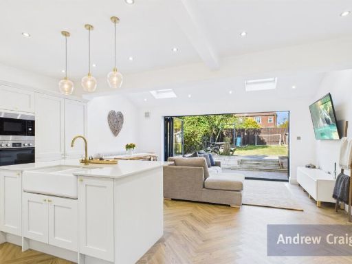 3 bedroom semi-detached house for sale in Tynedale Road, South Shields, NE34 — £291,500 • 3 bed • 1 bath • 1363 ft²
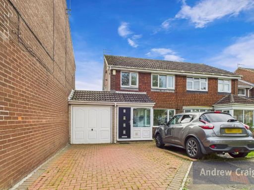 3 bedroom semi-detached house for sale in Caraway Walk, South Shields, NE34 — £160,750 • 3 bed • 1 bath • 968 ft²
Meta
- {
"@context": "https://schema.org",
"@type": "Residence",
"name": "3 bedroom semidetached house for sale in Allendale Drive, S…",
"description": "",
"url": "https://propertypiper.co.uk/property/57dad363-7413-41ae-ac86-1d416e1f3b35",
"image": "https://image-a.propertypiper.co.uk/5beb3b04-ea1b-443a-a59c-042ae5336004-1024.jpeg",
"address": {
"@type": "PostalAddress",
"streetAddress": "15 ALLENDALE DRIVE SOUTH SHIELDS",
"postalCode": "NE34 7SX",
"addressLocality": "South Tyneside",
"addressRegion": "South Shields",
"addressCountry": "England"
},
"geo": {
"@type": "GeoCoordinates",
"latitude": 54.98658856197188,
"longitude": -1.4011389069522453
},
"numberOfRooms": 3,
"numberOfBathroomsTotal": 1,
"floorSize": {
"@type": "QuantitativeValue",
"value": 968,
"unitCode": "FTK"
},
"offers": {
"@type": "Offer",
"price": 160750,
"priceCurrency": "GBP",
"availability": "https://schema.org/InStock"
},
"additionalProperty": [
{
"@type": "PropertyValue",
"name": "Feature",
"value": "semi-detached"
},
{
"@type": "PropertyValue",
"name": "Feature",
"value": "traditional style"
},
{
"@type": "PropertyValue",
"name": "Feature",
"value": "dormer windows"
},
{
"@type": "PropertyValue",
"name": "Feature",
"value": "garage"
},
{
"@type": "PropertyValue",
"name": "Feature",
"value": "driveway"
},
{
"@type": "PropertyValue",
"name": "Feature",
"value": "pitched roof"
},
{
"@type": "PropertyValue",
"name": "Feature",
"value": "chimney"
},
{
"@type": "PropertyValue",
"name": "Feature",
"value": "suburban"
},
{
"@type": "PropertyValue",
"name": "Feature",
"value": "residential area"
},
{
"@type": "PropertyValue",
"name": "Feature",
"value": "living room"
},
{
"@type": "PropertyValue",
"name": "Feature",
"value": "modern style"
},
{
"@type": "PropertyValue",
"name": "Feature",
"value": "bay window"
},
{
"@type": "PropertyValue",
"name": "Feature",
"value": "fireplace"
},
{
"@type": "PropertyValue",
"name": "Feature",
"value": "laminate flooring"
},
{
"@type": "PropertyValue",
"name": "Feature",
"value": "bright"
},
{
"@type": "PropertyValue",
"name": "Feature",
"value": "neutral colors"
}
]
}
High Res Floorplan Images
Compatible Floorplan Images
FloorplanImages Thumbnail