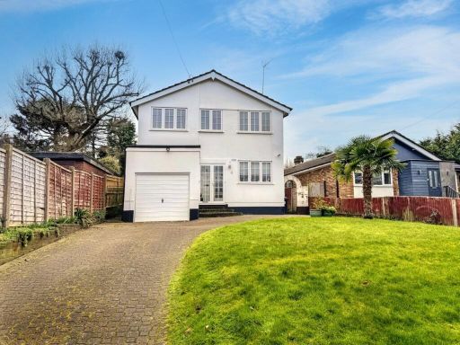
BR6 7RD - 4 bedroom detached house for sale in Long Acre, Orpington,…
View on Property Piper
4 bedroom detached house for sale in Long Acre, Orpington, BR6
Property Details
- Price: £650000
- Bedrooms: 4
- Bathrooms: 1
- Property Type: undefined
- Property SubType: undefined
Image Descriptions
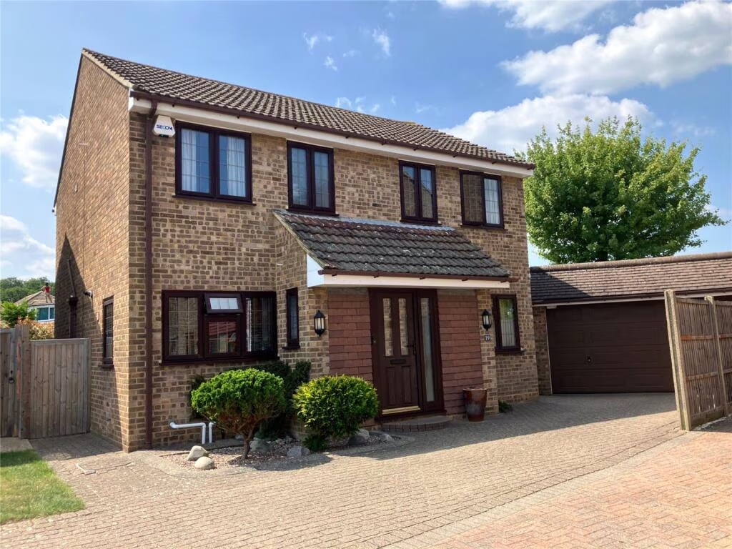
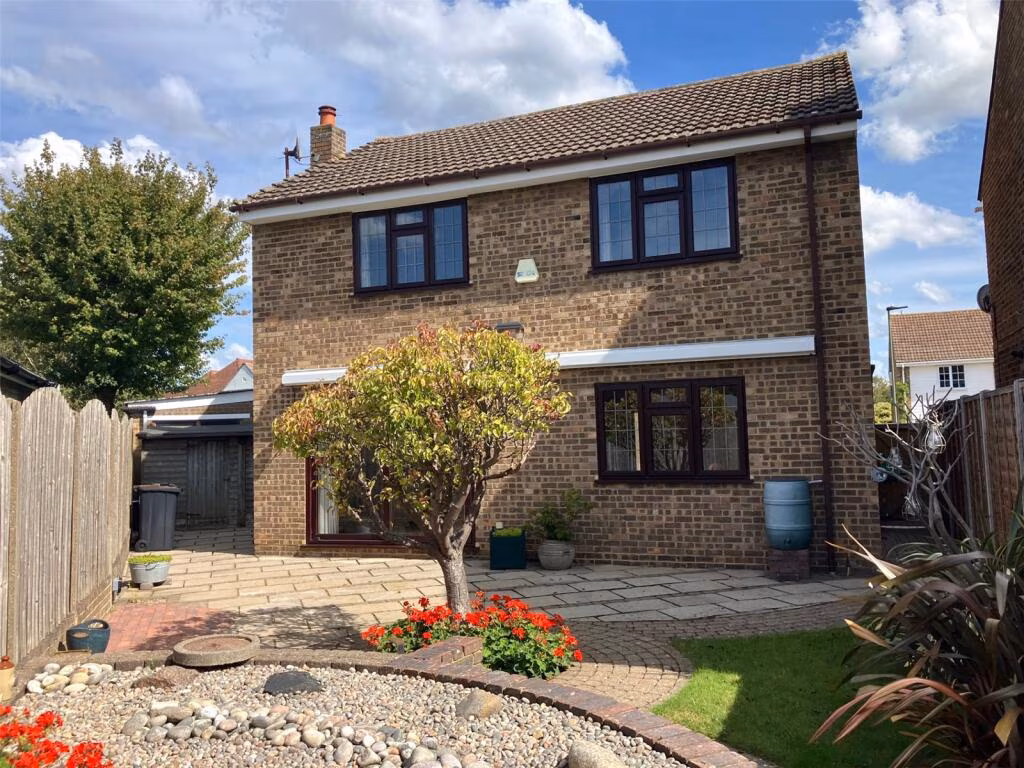
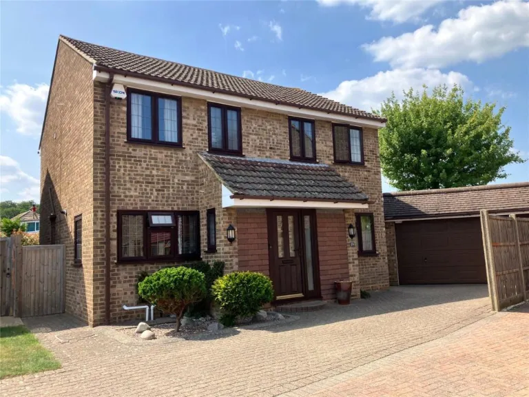
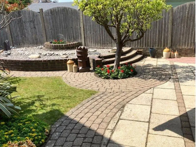
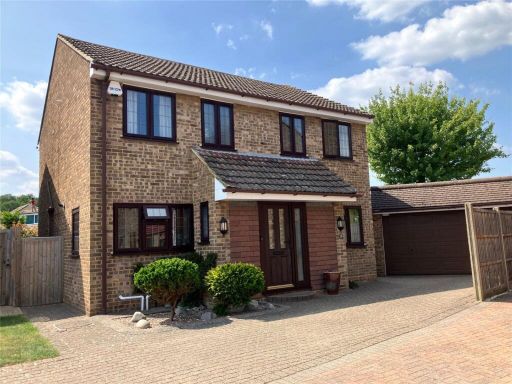
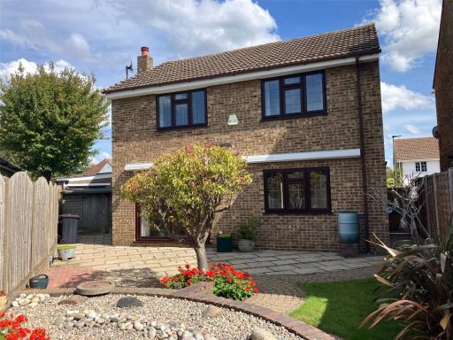
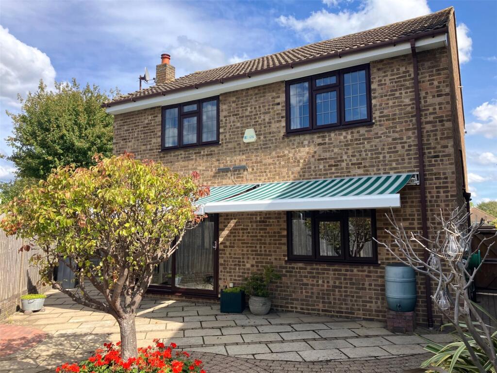
- detached house with garage 1980s suburban
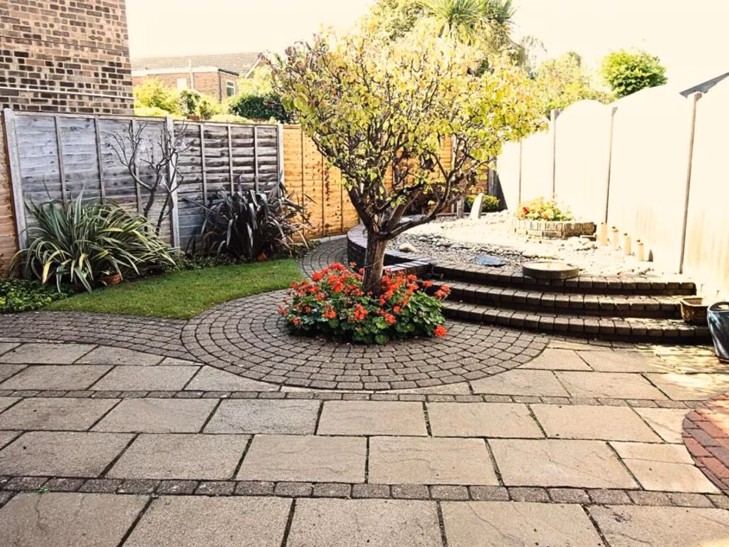
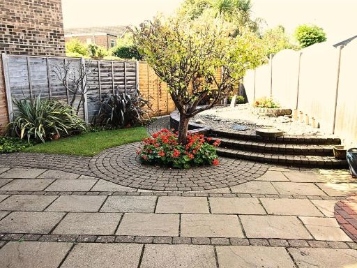
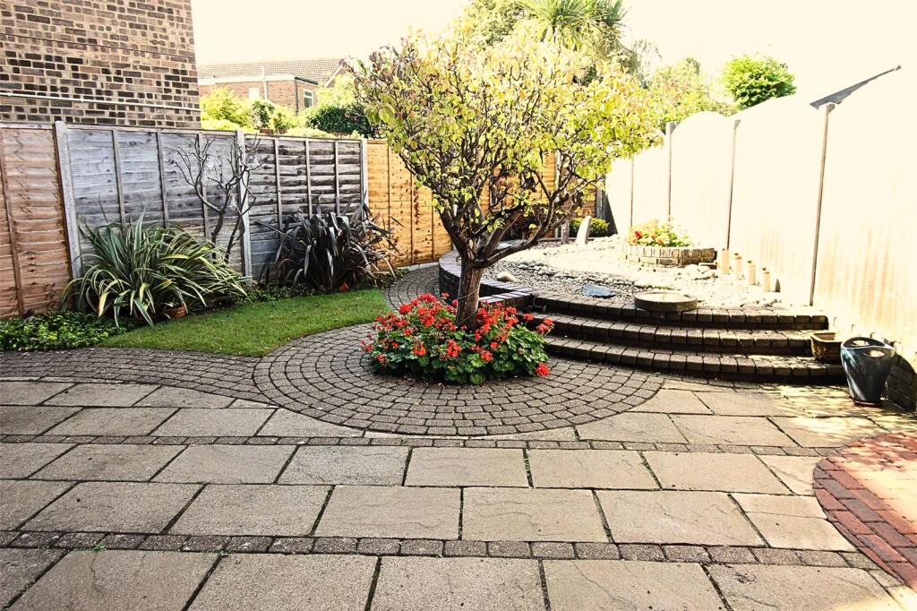
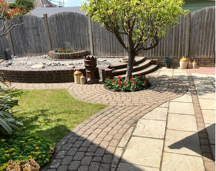
- backyard modern garden
Floorplan Description
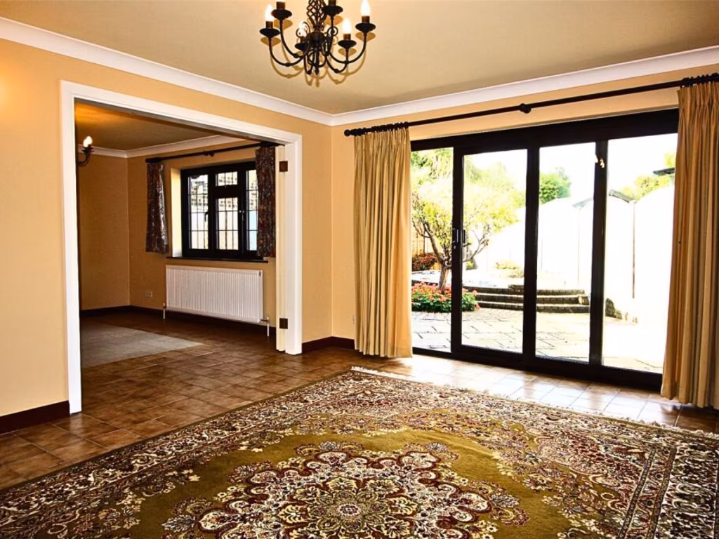
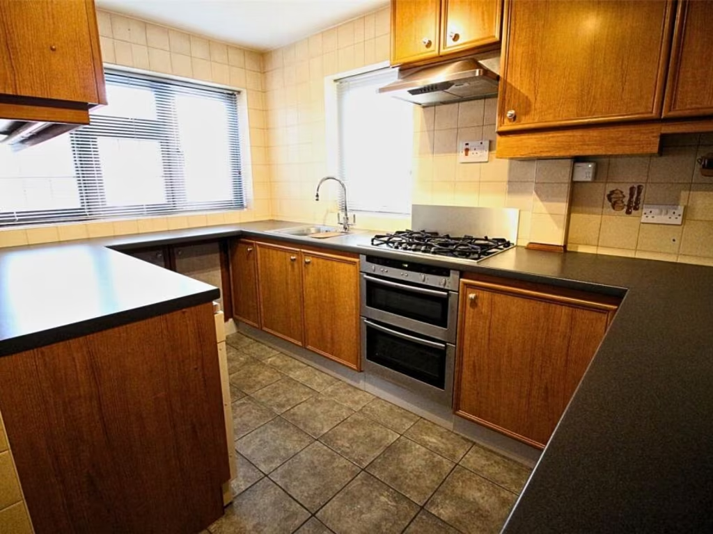
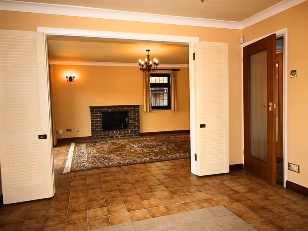
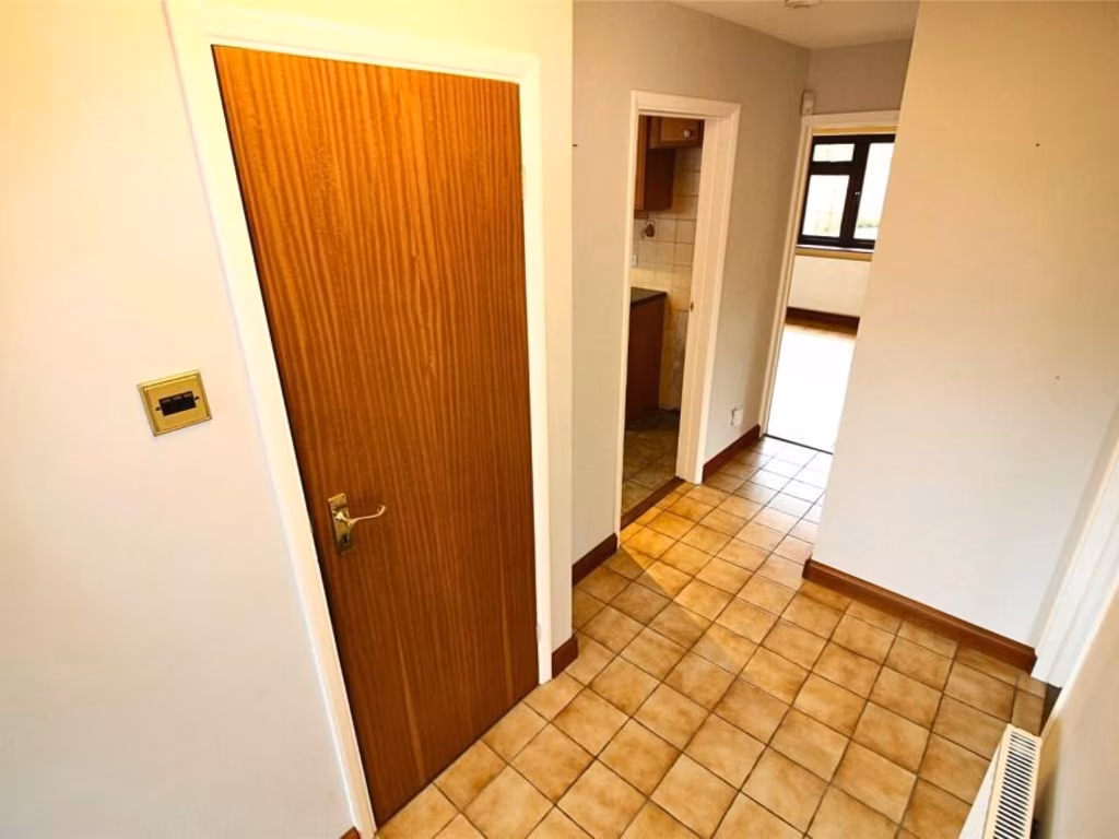
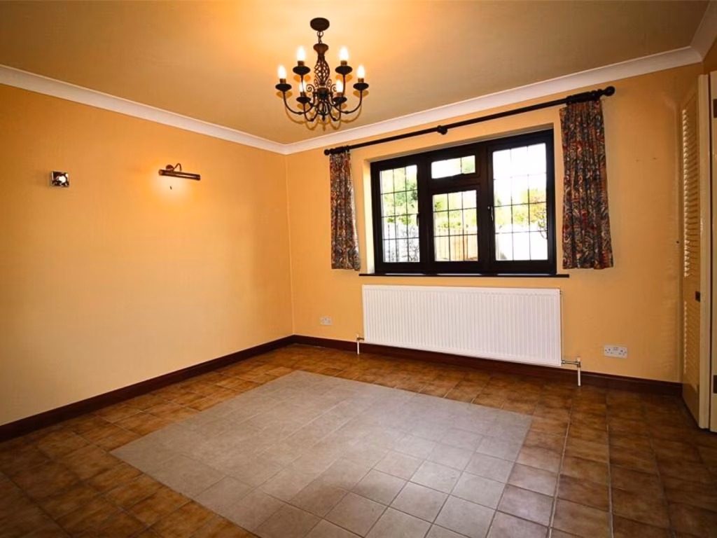
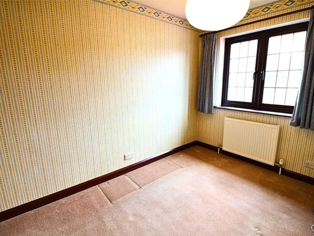
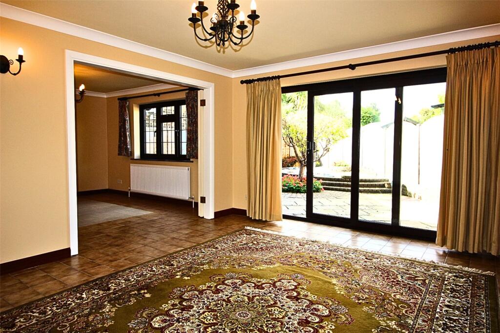
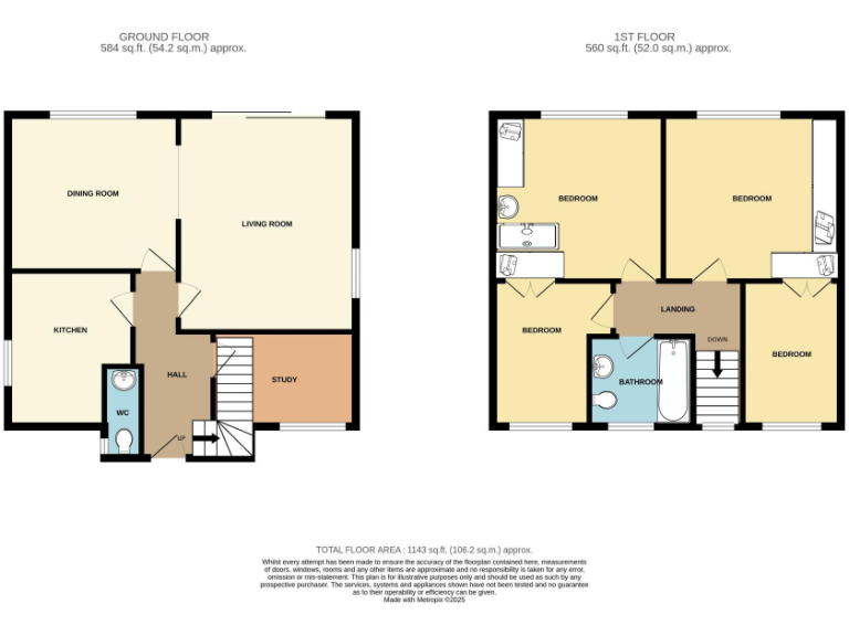
- Two-storey house with living/dining, kitchen, study and four bedrooms
Rooms
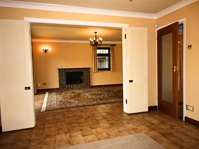
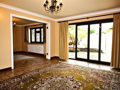
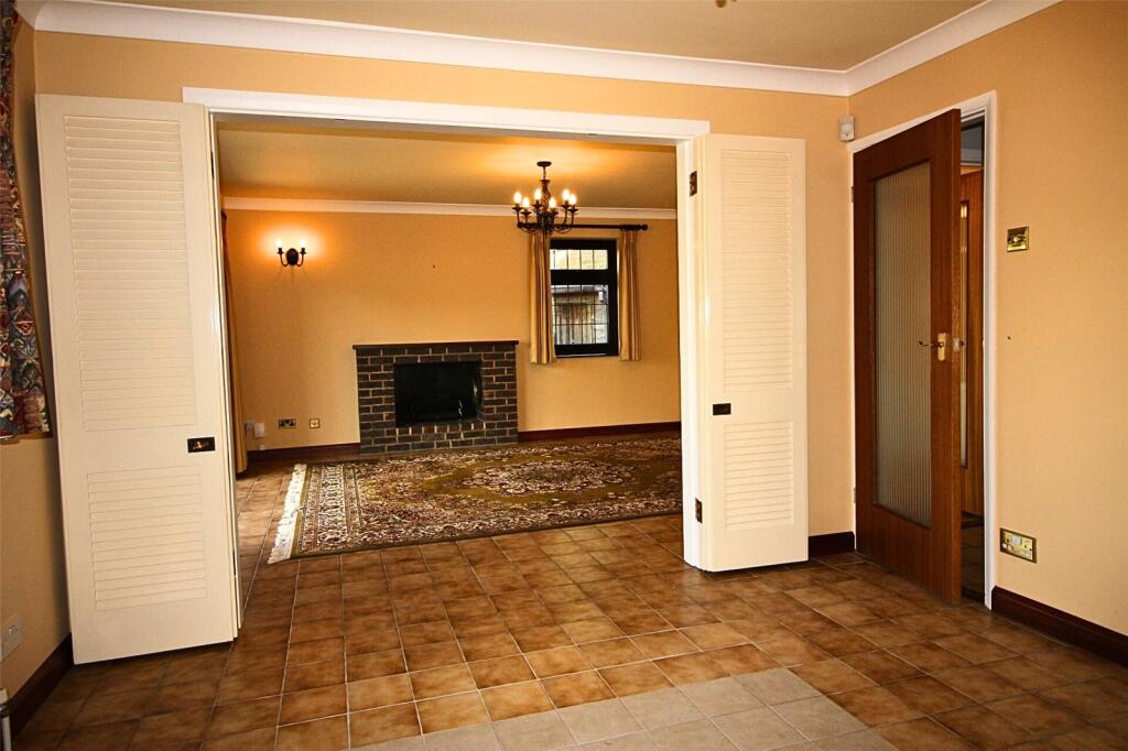
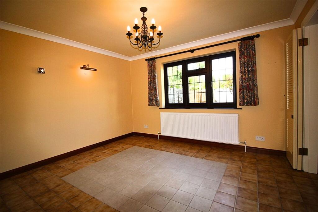
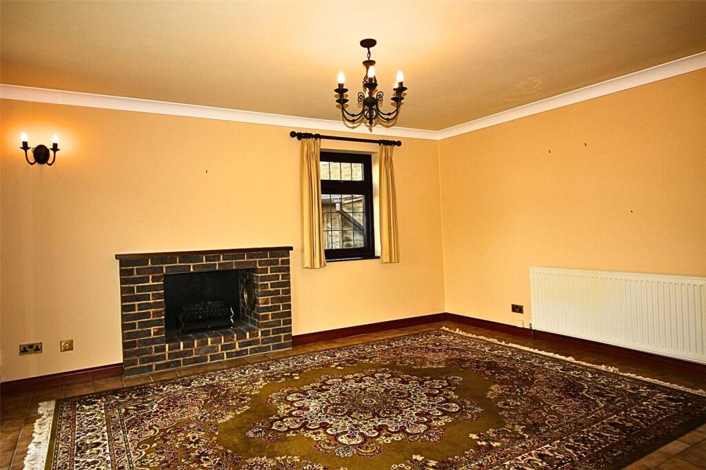
- DINING ROOM:
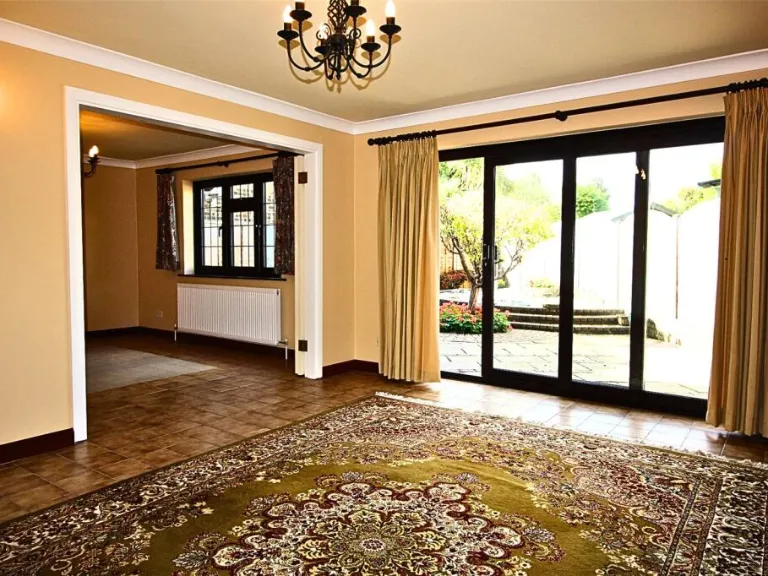
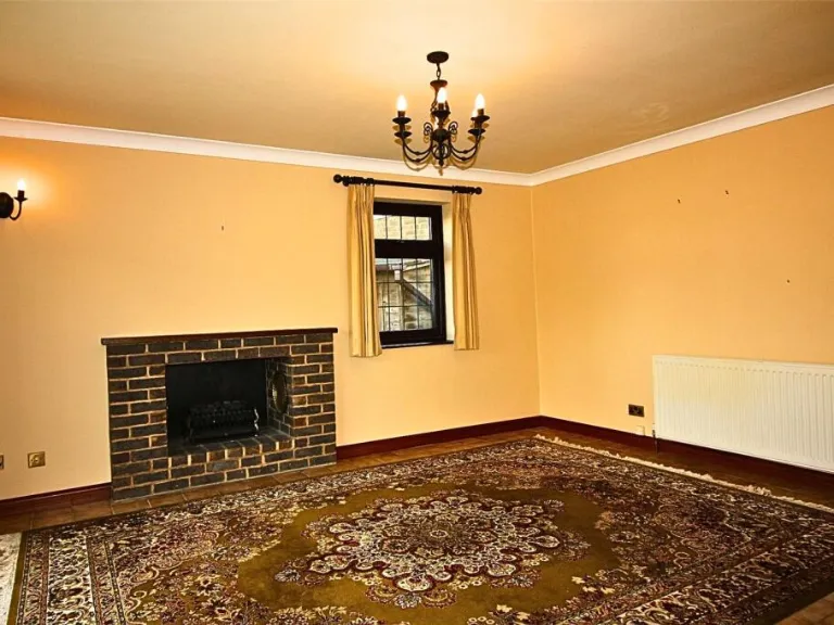
- LIVING ROOM:
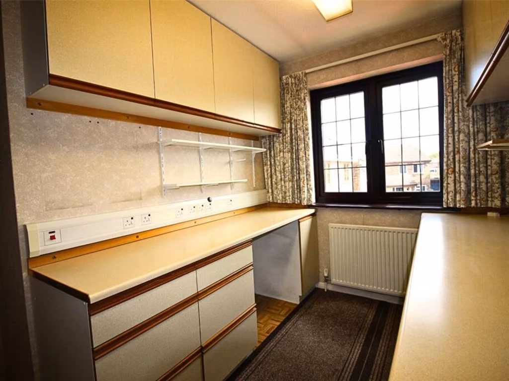
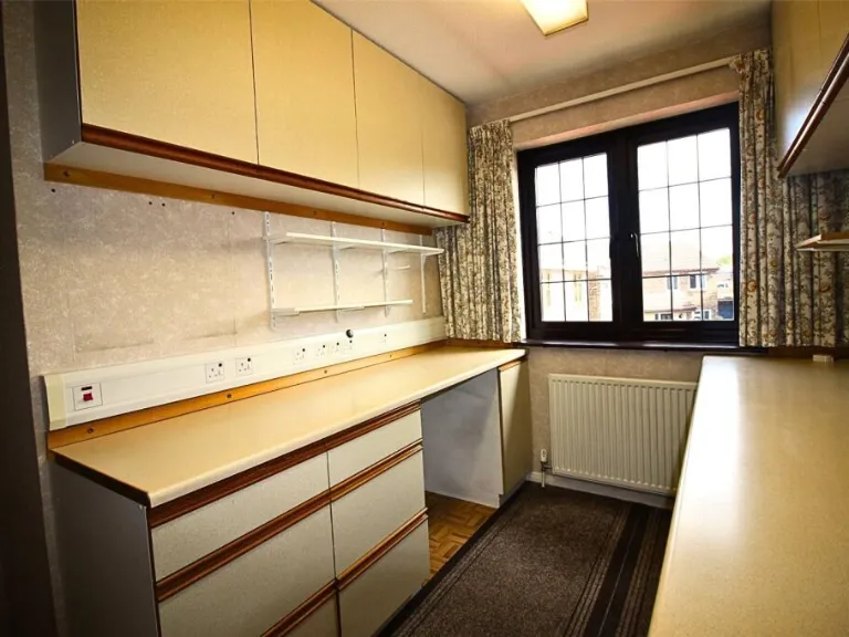
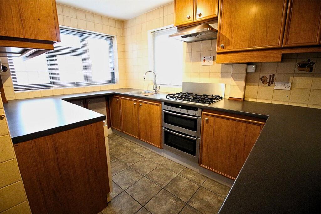
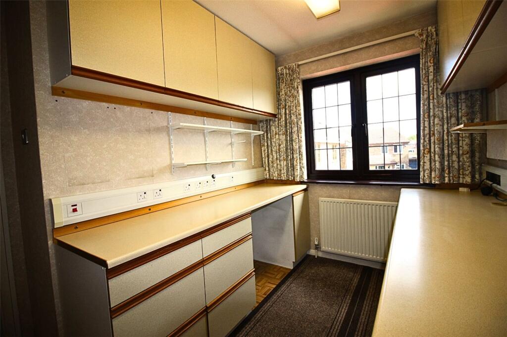
- KITCHEN:
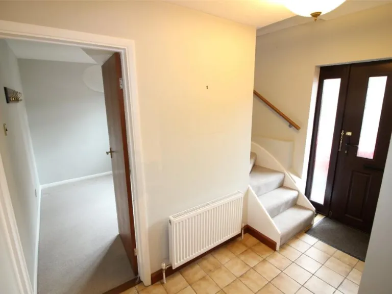
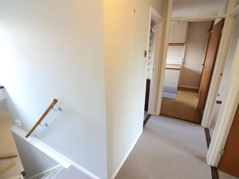
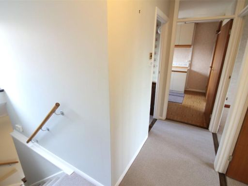
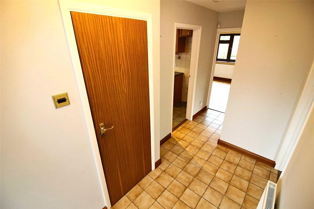
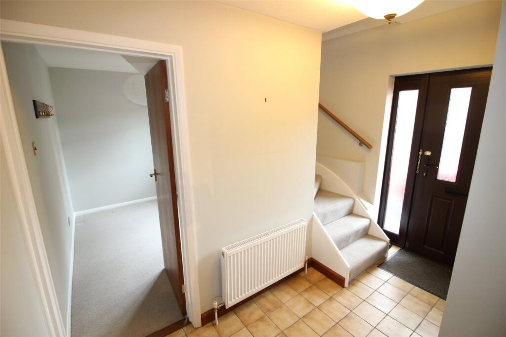
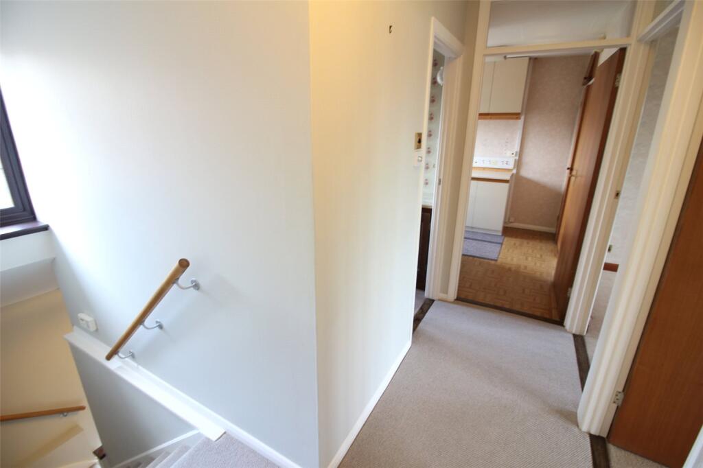
- HALL:
- STUDY:
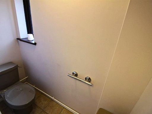
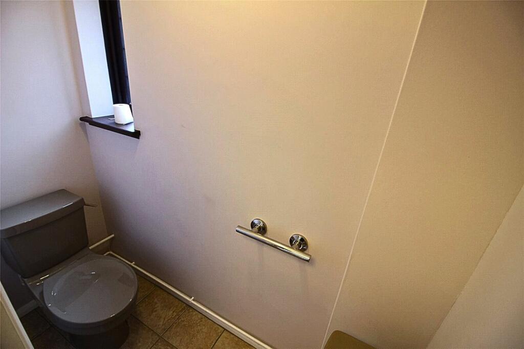
- WC:
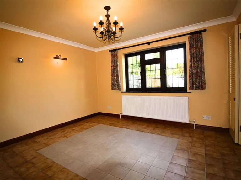
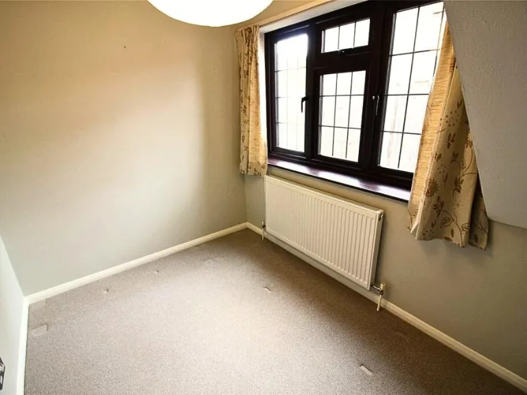
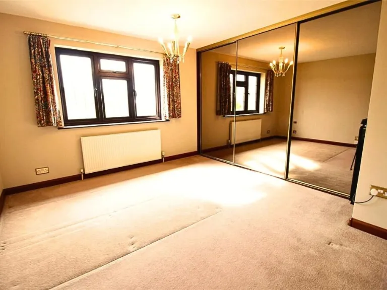
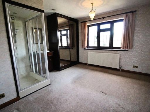
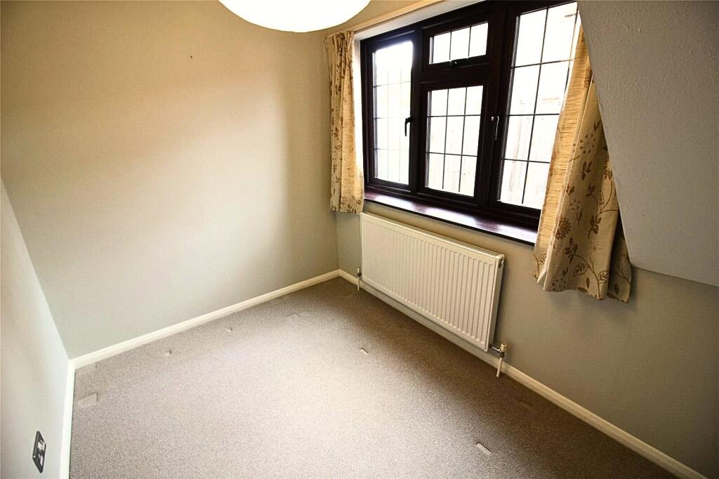
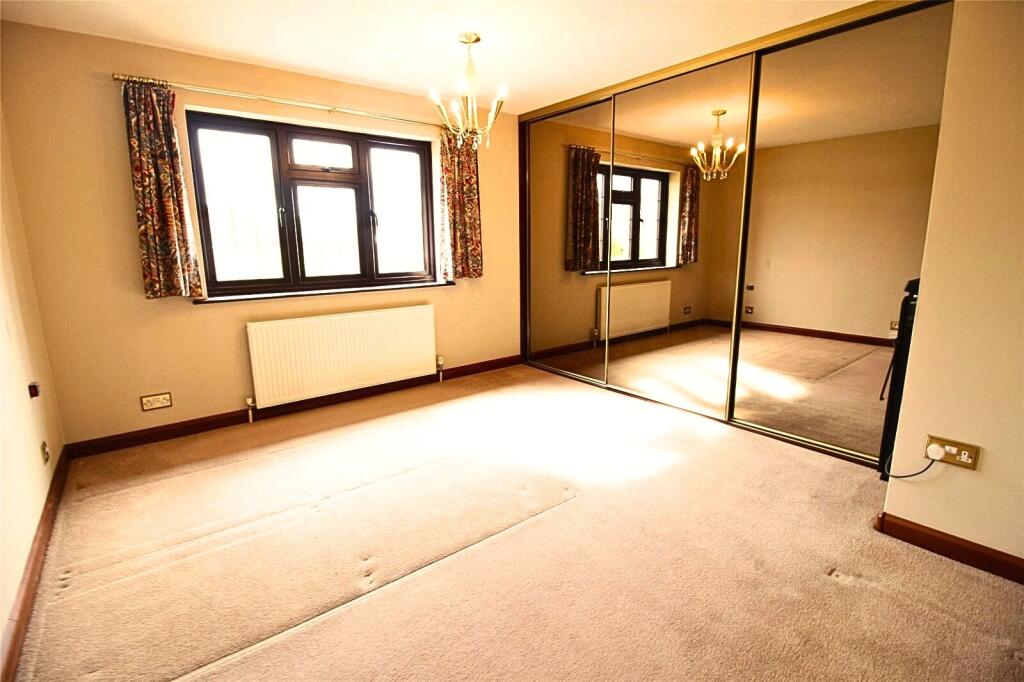
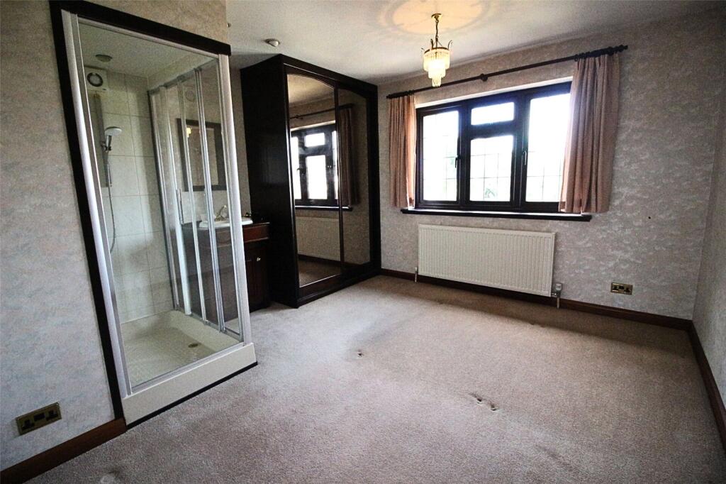
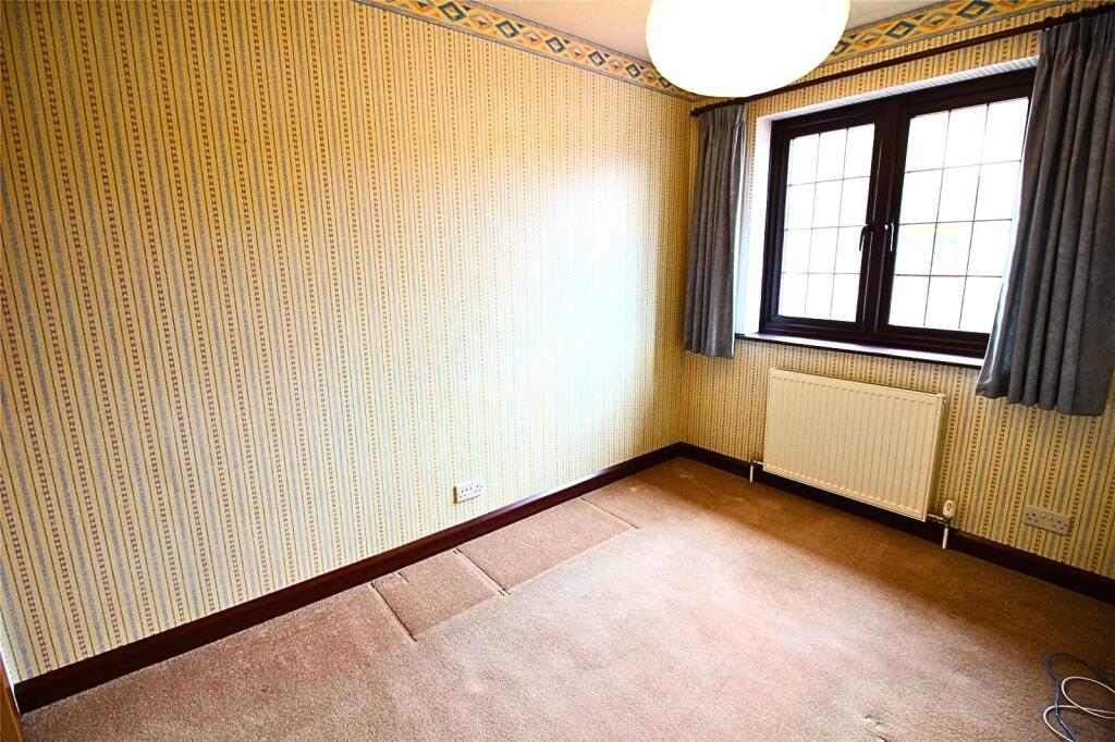
- BEDROOM:
- BEDROOM:
- BEDROOM:
- BEDROOM:
- LANDING:
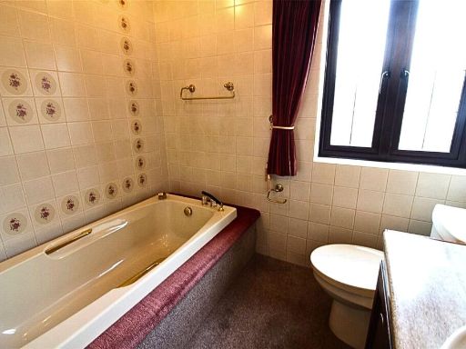
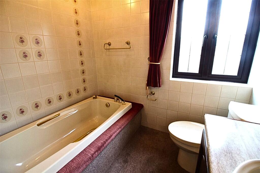
- BATHROOM:
Textual Property Features
- Has Garden
- Chain Free
- Success
Detected Visual Features
- detached house
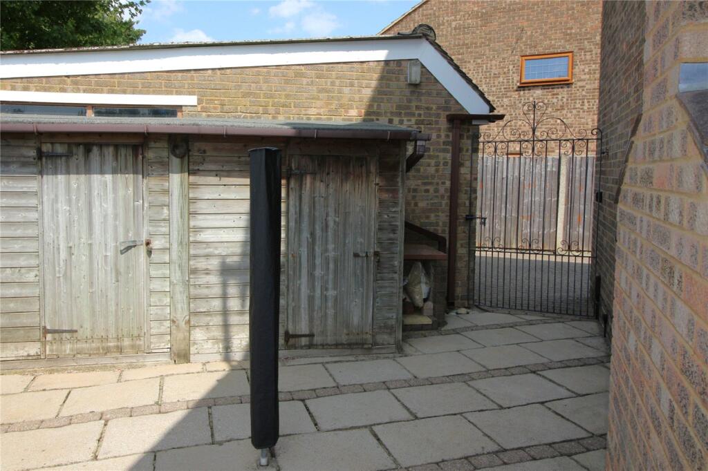
- garage
- 1980s
- suburban
- family home
- brick exterior
- two-story
- driveway
- modern roof
- garden
- backyard
- landscaped
- modern
- patio
- paved
- fenced
- private
- outdoor space
EPC Details
- Fully double glazed
- Cavity wall, as built, no insulation (assumed)
- Boiler and radiators, mains gas
- No low energy lighting
- Solid, no insulation (assumed)
Nearby Schools
- Halstead Community Primary School
- Tubbenden Primary School
- Blenheim Primary School
- Crofton Infant School
- The Highway Primary School
- St Olave's and St Saviour's Grammar School
- Harris Academy Orpington
- St Philomena's Primary School
- St. Mary Cray Primary Academy
- Manor Oak Primary School
- Gray's Farm Primary Academy
- Pratts Bottom Primary School
- Chelsfield Primary School
- Warren Road Primary School
- Holy Innocents Catholic Primary School
- Harris Primary Academy Orpington
- Perry Hall Primary School
- Crockenhill Primary School
- Poverest Primary School
- Kemnal Technology College
- Green Street Green Primary School
- Newstead Wood School
- St Paul's Cray Church of England Primary School
- Leesons Primary School
- Midfield Primary School
Nearest General Shops
- Id: 6433136754
- Tags:
- Addr:
- City: Orpington
- Housenumber: 49
- Street: Eldred Drive
- Male: yes
- Name: Elite Male Hair Grooming
- Shop: hairdresser
- Website: elitemalehair.co.uk
- TagsNormalized:
- Lat: 51.3740244
- Lon: 0.1171354
- FullGeoHash: u10h68m73kq2
- PartitionGeoHash: u10h
- Images:
- FoodStandards: null
- Distance: 453.9
,- Id: 6433136753
- Tags:
- Addr:
- City: Orpington
- Street: Eldred Drive
- Name: Cleanpeople Dry Cleaners
- Shop: dry_cleaning
- TagsNormalized:
- Lat: 51.3739981
- Lon: 0.1172063
- FullGeoHash: u10h68m75p77
- PartitionGeoHash: u10h
- Images:
- FoodStandards: null
- Distance: 448.5
,- Id: 6433136752
- Tags:
- Addr:
- City: Orpington
- Housenumber: 61
- Street: Eldred Drive
- Name: This, That & Party
- Phone: +44 1689 822 232
- Shop: variety_store
- TagsNormalized:
- Lat: 51.3739717
- Lon: 0.1172771
- FullGeoHash: u10h68m7hf2n
- PartitionGeoHash: u10h
- Images:
- FoodStandards: null
- Distance: 443.1
}
Nearest Grocery shops
- Id: 863419477
- Tags:
- Brand: M&S Simply Food
- Brand:wikidata: Q714491
- Brand:wikipedia: en:Marks & Spencer
- Building: retail
- Name: M&S Simply Food
- Shop: convenience
- TagsNormalized:
- m&s simply food
- food
- retail
- convenience
- shop
- Lat: 51.3640912
- Lon: 0.1106836
- FullGeoHash: u10h4w89e0ed
- PartitionGeoHash: u10h
- Images:
- FoodStandards: null
- Distance: 1054
,- Id: 6433136757
- Tags:
- Addr:
- City: Orpington
- Housenumber: 33-35
- Postcode: BR5 4PE
- Street: Eldred Drive
- Brand: Martin's
- Brand:wikidata: Q116779207
- Fhrs:
- Name: Martin's
- Shop: convenience
- Source:
- TagsNormalized:
- Lat: 51.3740772
- Lon: 0.1169937
- FullGeoHash: u10h68m5wnhg
- PartitionGeoHash: u10h
- Images:
- FoodStandards: null
- Distance: 464.7
,- Id: 6433136755
- Tags:
- Addr:
- City: Orpington
- Housenumber: 45-47
- Postcode: BR5 4PE
- Street: Eldred Drive
- Alt_name: Premier
- Brand: Premier
- Brand:wikidata: Q7240340
- Fhrs:
- Name: Eldred Drive Store
- Shop: convenience
- Source:
- TagsNormalized:
- Lat: 51.3740508
- Lon: 0.1170646
- FullGeoHash: u10h68m5xc1w
- PartitionGeoHash: u10h
- Images:
- FoodStandards:
- Id: 357743
- FHRSID: 357743
- LocalAuthorityBusinessID: 00000/0001/0/932
- BusinessName: Premier Eldred Drive Store
- BusinessType: Retailers - other
- BusinessTypeID: 4613
- AddressLine1: 45 - 47 Eldred Drive
- AddressLine2: Orpington
- AddressLine3: null
- AddressLine4: null
- PostCode: BR5 4PE
- RatingValue: 5
- RatingKey: fhrs_5_en-GB
- RatingDate: 2022-11-09
- LocalAuthorityCode: 505
- LocalAuthorityName: Bromley
- LocalAuthorityWebSite: http://www.bromley.gov.uk
- LocalAuthorityEmailAddress: food@bromley.gov.uk
- Scores:
- Hygiene: 0
- Structural: 5
- ConfidenceInManagement: 5
- NewRatingPending: false
- Geocode:
- Longitude: 0.11780700000000
- Latitude: 51.37375100000000
- Distance: 459.3
}
Nearest Religious buildings
- Id: 199533
- Tags:
- Name: Christ Church
- Naptan:
- StopAreaCode: 490G00005025
- StopAreaType: GPBS
- Verified: no
- Network: London Buses
- Operator: Transport for London
- Public_transport: stop_area
- Public_transport:version: 2
- Type: public_transport
- TagsNormalized:
- Lat: 51.3639471
- Lon: 0.1071154
- FullGeoHash: u10h4qtbxvxp
- PartitionGeoHash: u10h
- Images:
- FoodStandards: null
- Distance: 1249.6
,- Id: 809728273
- Tags:
- Addr:
- City: Orpington
- Postcode: BR6 9EP
- Street: Charterhouse Road
- Amenity: place_of_worship
- Building: church
- Denomination: anglican
- Fhrs:
- Name: Christ Church
- Religion: christian
- Wikidata: Q105087656
- TagsNormalized:
- place of worship
- church
- anglican
- christian
- Lat: 51.3642727
- Lon: 0.1071962
- FullGeoHash: u10h4qw49f7m
- PartitionGeoHash: u10h
- Images:
- FoodStandards:
- Id: 358256
- FHRSID: 358256
- LocalAuthorityBusinessID: 03/00111/MIXED
- BusinessName: Christ Church
- BusinessType: Other catering premises
- BusinessTypeID: 7841
- AddressLine1: Charterhouse Road
- AddressLine2: Orpington
- AddressLine3: null
- AddressLine4: null
- PostCode: null
- RatingValue: 5
- RatingKey: fhrs_5_en-GB
- RatingDate: 2019-08-13
- LocalAuthorityCode: 505
- LocalAuthorityName: Bromley
- LocalAuthorityWebSite: http://www.bromley.gov.uk
- LocalAuthorityEmailAddress: food@bromley.gov.uk
- Scores:
- Hygiene: 0
- Structural: 0
- ConfidenceInManagement: 5
- NewRatingPending: true
- Geocode:
- Longitude: 0.10558800000000
- Latitude: 51.36390800000000
- Distance: 1223.2
,- Id: 812589503
- Tags:
- Amenity: place_of_worship
- Building: church
- Denomination: anglican
- Name: Unity Church
- Religion: christian
- Wikidata: Q105107211
- TagsNormalized:
- place of worship
- church
- anglican
- christian
- Lat: 51.3746655
- Lon: 0.118038
- FullGeoHash: u10h68mzn7z8
- PartitionGeoHash: u10h
- Images:
- FoodStandards: null
- Distance: 478.3
}
Nearest Airports
- Id: 260720166
- Tags:
- Aerodrome: international
- Aeroway: aerodrome
- Alt_name: Gatwick Airport
- Ele: 62
- Iata: LGW
- Icao: EGKK
- Internet_access: wlan
- Internet_access:fee: no
- Internet_access:ssid: Gatwick FREE Wi-Fi
- Name: London Gatwick Airport
- Operator: Gatwick Airport Limited
- Ref: LGW
- Website: https://www.gatwickairport.com/
- Wikidata: Q8703
- Wikipedia: en:Gatwick Airport
- TagsNormalized:
- airport
- international airport
- Lat: 51.1540917
- Lon: -0.1883773
- FullGeoHash: gcpg58qf4mzd
- PartitionGeoHash: gcpg
- Images:
- FoodStandards: null
- Distance: 32331.4
,- Id: 103894219
- Tags:
- Aerodrome: international
- Aeroway: aerodrome
- Iata: SEN
- Icao: EGMC
- Name: London Southend Airport
- Old_name: Southend Municipal Airport
- Ref: SEN
- Wikidata: Q1415441
- TagsNormalized:
- airport
- international airport
- Lat: 51.5701749
- Lon: 0.6924624
- FullGeoHash: u10mru04p937
- PartitionGeoHash: u10m
- Images:
- FoodStandards: null
- Distance: 45346.3
,- Id: 121158889
- Tags:
- Aerodrome: continental
- Aeroway: aerodrome
- Fhrs:
- Authority: City of London Corporation
- Iata: LCY
- Icao: EGLC
- Name: London City Airport
- Operator: London City Airport Limited
- Ref: LCY
- Website: https://www.londoncityairport.com/
- Wikidata: Q8982
- Wikipedia: en:London City Airport
- TagsNormalized:
- airport
- continental airport
- Lat: 51.5042658
- Lon: 0.0539987
- FullGeoHash: u10j10p64702
- PartitionGeoHash: u10j
- Images:
- FoodStandards: null
- Distance: 15548.7
}
Nearest Leisure Facilities
- Id: 28469304
- Tags:
- Leisure: park
- Name: Goddington Park
- Operator: London Borough of Bromley
- Operator:type: government
- Operator:wikidata: Q208201
- TagsNormalized:
- Lat: 51.3670981
- Lon: 0.1177038
- FullGeoHash: u10h4xjen9n7
- PartitionGeoHash: u10h
- Images:
- FoodStandards: null
- Distance: 488.1
,- Id: 864850777
- Tags:
- Access: yes
- Leisure: playground
- TagsNormalized:
- Lat: 51.3693889
- Lon: 0.1149119
- FullGeoHash: u10h4xe8mshs
- PartitionGeoHash: u10h
- Images:
- FoodStandards: null
- Distance: 472.6
,- Id: 964356398
- Tags:
- TagsNormalized:
- Lat: 51.3747918
- Lon: 0.1227512
- FullGeoHash: u10h6b3ru73f
- PartitionGeoHash: u10h
- Images:
- FoodStandards: null
- Distance: 447.4
,- Id: 1120877239
- Tags:
- Leisure: pitch
- Lit: no
- Sport: soccer
- Surface: grass
- TagsNormalized:
- Lat: 51.3683471
- Lon: 0.1169999
- FullGeoHash: u10h4xm4q3cq
- PartitionGeoHash: u10h
- Images:
- FoodStandards: null
- Distance: 409.4
,- Id: 189090114
- Tags:
- Leisure: playground
- Name: Eldred Drive Playground
- TagsNormalized:
- Lat: 51.3735798
- Lon: 0.120965
- FullGeoHash: u10h6b20f9qh
- PartitionGeoHash: u10h
- Images:
- FoodStandards: null
- Distance: 301.8
}
Nearest Tourist attractions
- Id: 2709945660
- Tags:
- Name: Bromley Millennium Rock
- Tourism: attraction
- TagsNormalized:
- Lat: 51.3518108
- Lon: 0.0748298
- FullGeoHash: u10h1sq3zxm5
- PartitionGeoHash: u10h
- Images:
- FoodStandards: null
- Distance: 3859.9
,- Id: 2986114674
- Tags:
- Tourism: observation_hive
- TagsNormalized:
- Lat: 51.3518472
- Lon: 0.076322
- FullGeoHash: u10h1srd4qju
- PartitionGeoHash: u10h
- Images:
- FoodStandards: null
- Distance: 3771.5
,- Id: 672695326
- Tags:
- Addr:
- City: Orpington
- Country: GB
- Postcode: BR5 4ET
- Street: Sheepcote Lane
- Caravans: yes
- Dryer: yes
- Motorhome: yes
- Name: The Naturist Foundation
- Nudism: yes
- Old_name: North Kent Sun Club
- Operator: The Naturist Foundation
- Power_supply: yes
- Sauna: yes
- Tents: yes
- Tourism: camp_site
- Washing_machine: yes
- Website: https://www.naturistfoundation.org
- TagsNormalized:
- Lat: 51.395334
- Lon: 0.139023
- FullGeoHash: u10h7hjpx2xj
- PartitionGeoHash: u10h
- Images:
- FoodStandards: null
- Distance: 2985.3
}
Nearest Hotels
- Id: 133754779
- Tags:
- Addr:
- City: Swanley
- Postcode: BR8 7QD
- Street: London Road
- Brand: Premier Inn
- Brand:wikidata: Q2108626
- Building: yes
- Fax: +44 871 527 9289
- Fhrs:
- Internet_access: wlan
- Internet_access:fee: yes
- Name: Premier Inn
- Operator: Premier Inn
- Phone: +44 871 527 9288
- Tourism: hotel
- Website: https://www.premierinn.com/gb/en/hotels/england/kent/swanley/swanley.html
- TagsNormalized:
- Lat: 51.4059895
- Lon: 0.1585471
- FullGeoHash: u10h7w5mw6vr
- PartitionGeoHash: u10h
- Images:
- FoodStandards: null
- Distance: 4683
,- Id: 9413250
- Tags:
- Addr:
- City: Orpington
- Housenumber: 36-50
- Postcode: BR5 3NJ
- Street: High Street
- Alt_name: TLK Apartments & Hotel
- Building: yes
- Fhrs:
- Name: The Pavilion
- Tourism: hotel
- Type: multipolygon
- TagsNormalized:
- Lat: 51.3941755
- Lon: 0.1145291
- FullGeoHash: u10h6s52u8xn
- PartitionGeoHash: u10h
- Images:
- FoodStandards: null
- Distance: 2633.2
,- Id: 8892480605
- Tags:
- Addr:
- City: Orpington
- Postcode: BR6 0TW
- Brand: Premier Inn
- Brand:wikidata: Q2108626
- Brand:wikipedia: en:Premier Inn
- Fhrs:
- Internet_access: wlan
- Internet_access:fee: customers
- Internet_access:operator: Virgin Media
- Internet_access:ssid: Premier Inn Free Wi-Fi
- Name: Premier Inn
- Tourism: hotel
- TagsNormalized:
- Lat: 51.376515
- Lon: 0.1007575
- FullGeoHash: u10h62c3gud1
- PartitionGeoHash: u10h
- Images:
- FoodStandards: null
- Distance: 1557.2
}
Tags
- detached house
- garage
- 1980s
- suburban
- family home
- brick exterior
- two-story
- driveway
- modern roof
- garden
- backyard
- landscaped
- modern
- patio
- paved
- fenced
- private
- outdoor space
Local Market Stats
- Average Price/sqft: £526
- Avg Income: £61000
- Rental Yield: 4%
- Social Housing: 5%
- Planning Success Rate: 79%
Similar Properties
 4 bedroom detached house for sale in Warren Road, Orpington, BR6 — £735,000 • 4 bed • 2 bath • 1536 ft²
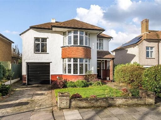 4 bedroom detached house for sale in Pound Court Drive, Orpington, BR6 — £875,000 • 4 bed • 1 bath • 1557 ft²
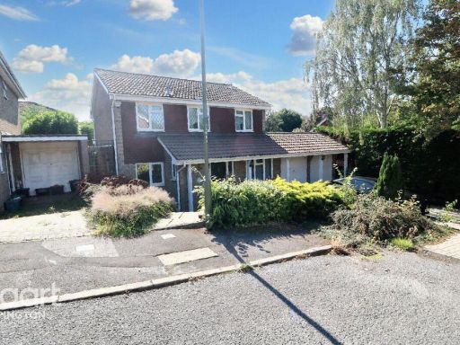 4 bedroom detached house for sale in Briarswood Way, Orpington, BR6 — £725,000 • 4 bed • 2 bath • 1399 ft²
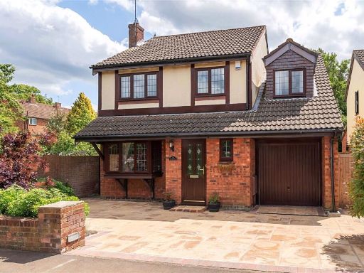 5 bedroom detached house for sale in Berrylands, Orpington, Kent, BR6 — £700,000 • 5 bed • 2 bath • 1232 ft²
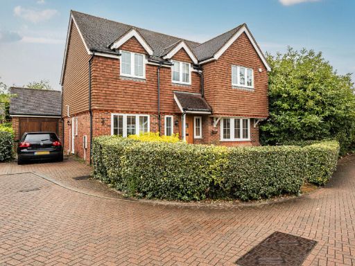 4 bedroom detached house for sale in Wyvern Close, Orpington, BR6 — £925,000 • 4 bed • 2 bath • 1921 ft²
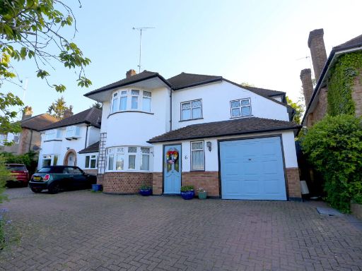 4 bedroom detached house for sale in St. Aubyns Gardens, Orpington, BR6 — £950,000 • 4 bed • 1 bath • 2046 ft²
Meta
- {
"@context": "https://schema.org",
"@type": "Residence",
"name": "4 bedroom detached house for sale in Long Acre, Orpington,…",
"description": "",
"url": "https://propertypiper.co.uk/property/545a4b76-15bb-4036-a438-43236f81da4f",
"image": "https://image-a.propertypiper.co.uk/0c020a30-e793-48bd-bc5a-a70c89c365e3-1024.jpeg",
"address": {
"@type": "PostalAddress",
"streetAddress": "Long Acre, Orpington, BR6",
"postalCode": "BR6 7RD",
"addressLocality": "Bromley",
"addressRegion": "Orpington",
"addressCountry": "England"
},
"geo": {
"@type": "GeoCoordinates",
"latitude": 51.3708732,
"longitude": 0.1212911
},
"numberOfRooms": 4,
"numberOfBathroomsTotal": 1,
"floorSize": {
"@type": "QuantitativeValue",
"value": 1143,
"unitCode": "FTK"
},
"offers": {
"@type": "Offer",
"price": 650000,
"priceCurrency": "GBP",
"availability": "https://schema.org/InStock"
},
"additionalProperty": [
{
"@type": "PropertyValue",
"name": "Feature",
"value": "detached house"
},
{
"@type": "PropertyValue",
"name": "Feature",
"value": "garage"
},
{
"@type": "PropertyValue",
"name": "Feature",
"value": "1980s"
},
{
"@type": "PropertyValue",
"name": "Feature",
"value": "suburban"
},
{
"@type": "PropertyValue",
"name": "Feature",
"value": "family home"
},
{
"@type": "PropertyValue",
"name": "Feature",
"value": "brick exterior"
},
{
"@type": "PropertyValue",
"name": "Feature",
"value": "two-story"
},
{
"@type": "PropertyValue",
"name": "Feature",
"value": "driveway"
},
{
"@type": "PropertyValue",
"name": "Feature",
"value": "modern roof"
},
{
"@type": "PropertyValue",
"name": "Feature",
"value": "garden"
},
{
"@type": "PropertyValue",
"name": "Feature",
"value": "backyard"
},
{
"@type": "PropertyValue",
"name": "Feature",
"value": "landscaped"
},
{
"@type": "PropertyValue",
"name": "Feature",
"value": "modern"
},
{
"@type": "PropertyValue",
"name": "Feature",
"value": "patio"
},
{
"@type": "PropertyValue",
"name": "Feature",
"value": "paved"
},
{
"@type": "PropertyValue",
"name": "Feature",
"value": "fenced"
},
{
"@type": "PropertyValue",
"name": "Feature",
"value": "private"
},
{
"@type": "PropertyValue",
"name": "Feature",
"value": "outdoor space"
}
]
}
High Res Floorplan Images
Compatible Floorplan Images
FloorplanImages Thumbnail