NG10 5LZ - 2 bedroom bungalow for sale in Springfield Avenue, Sandiacr…
View on Property Piper
2 bedroom bungalow for sale in Springfield Avenue, Sandiacre, Nottingham, Derbyshire, NG10
Property Details
- Price: £350000
- Bedrooms: 2
- Bathrooms: 1
- Property Type: undefined
- Property SubType: undefined
Image Descriptions
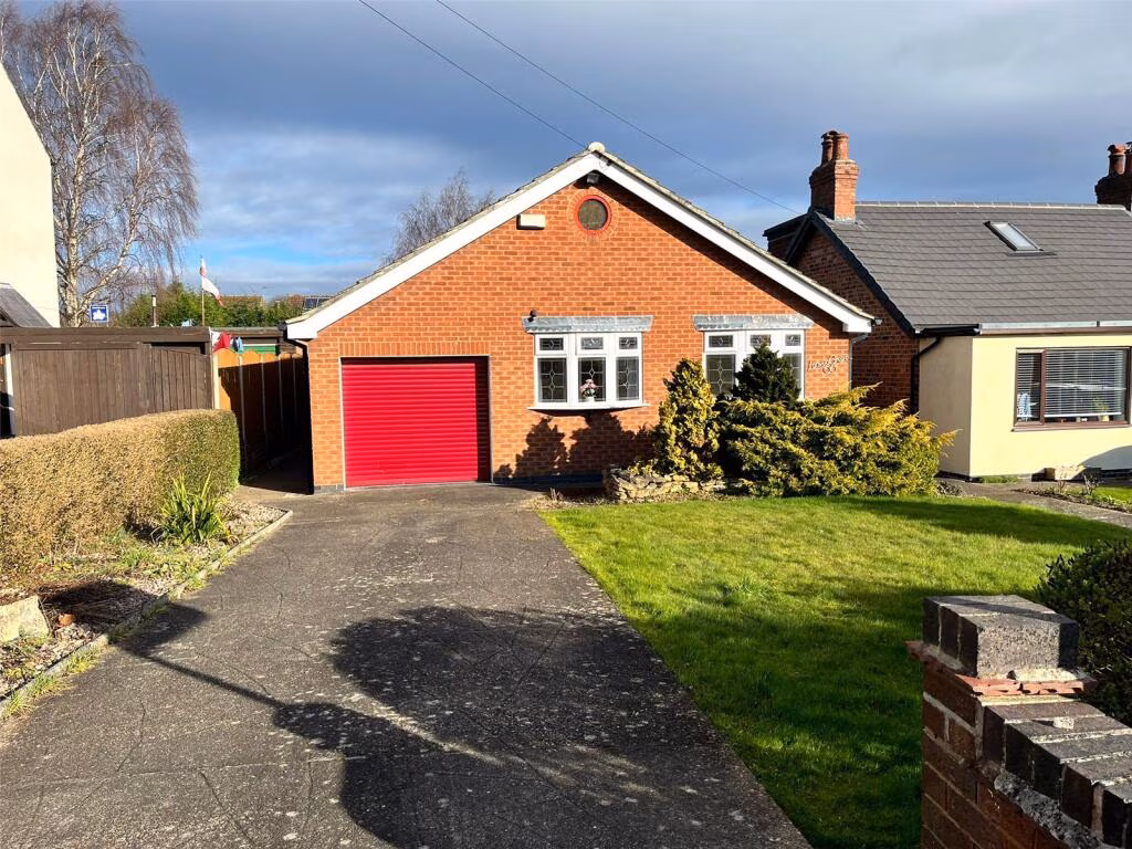
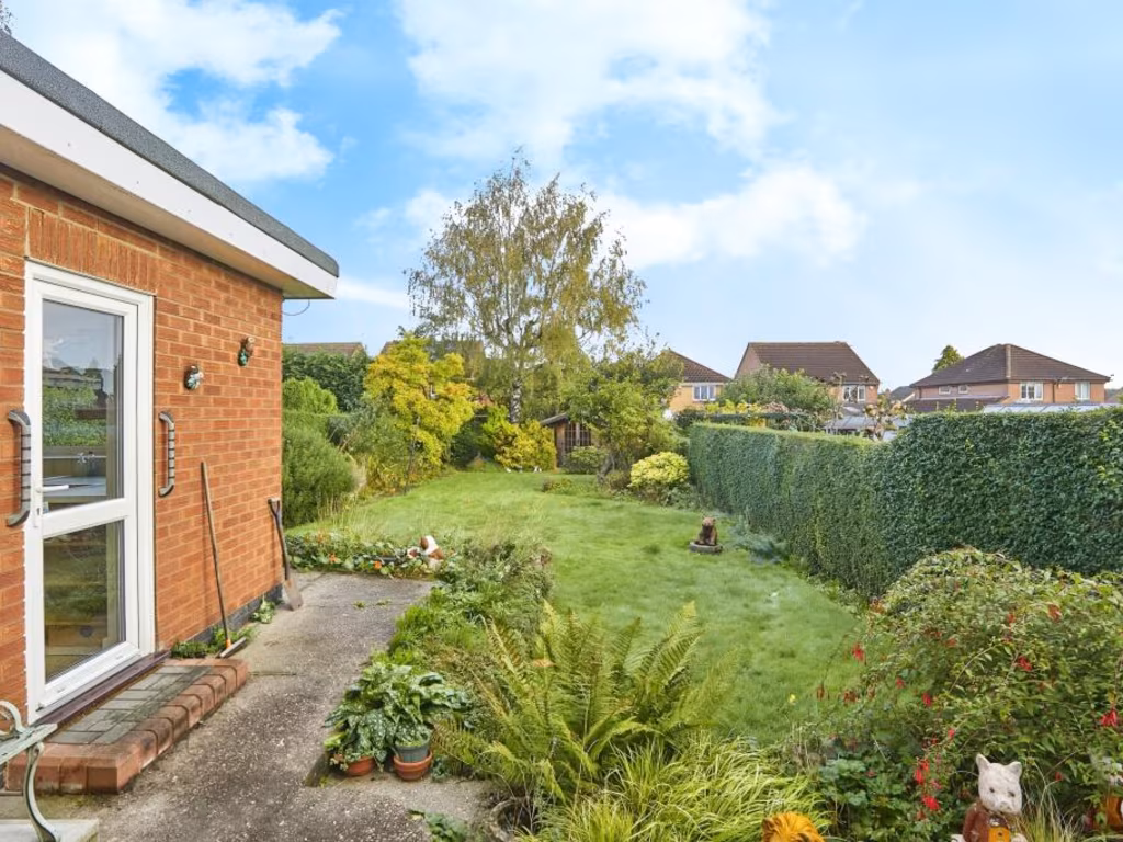
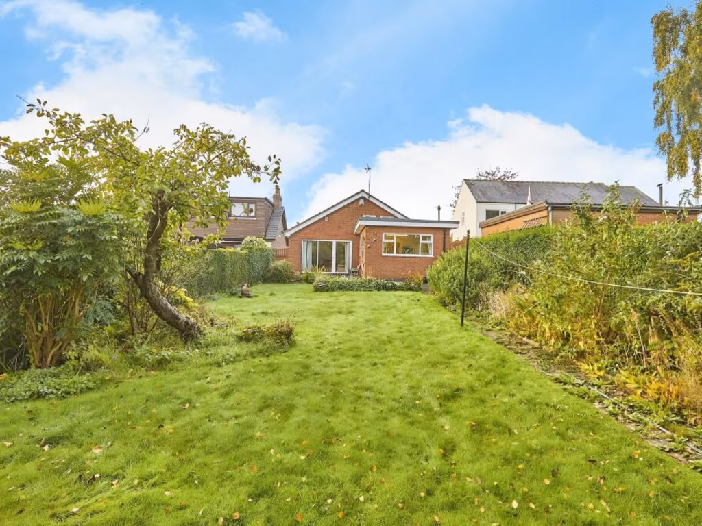
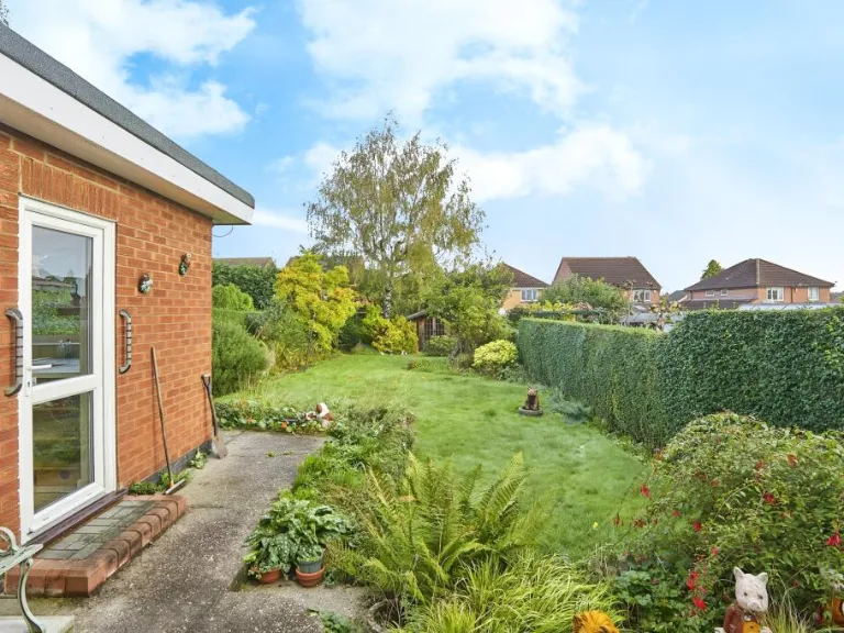
- property exterior mid-20th century bungalow
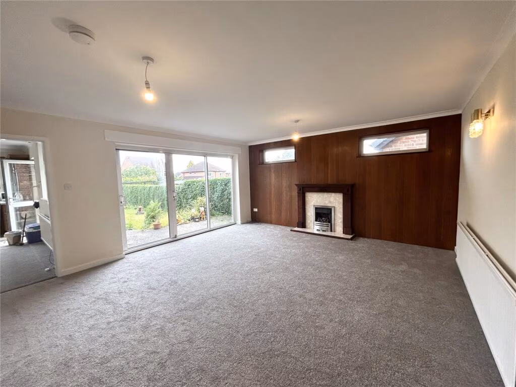
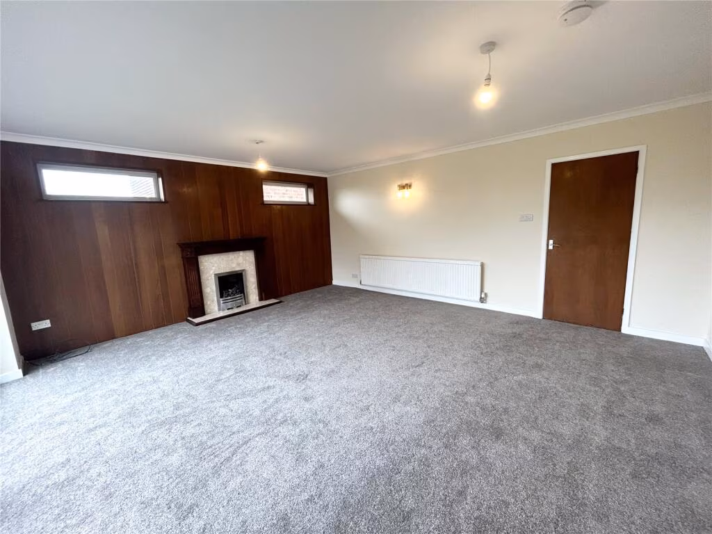
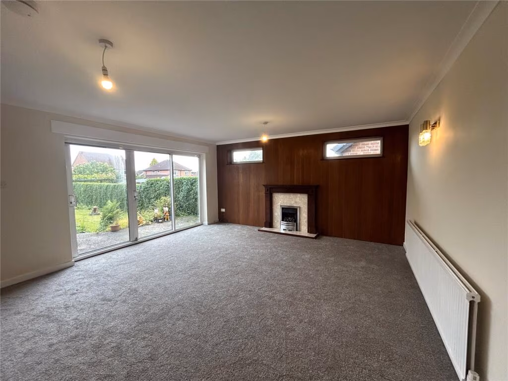
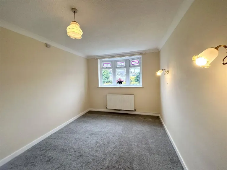
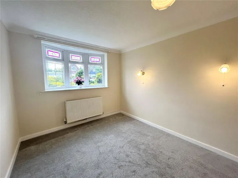
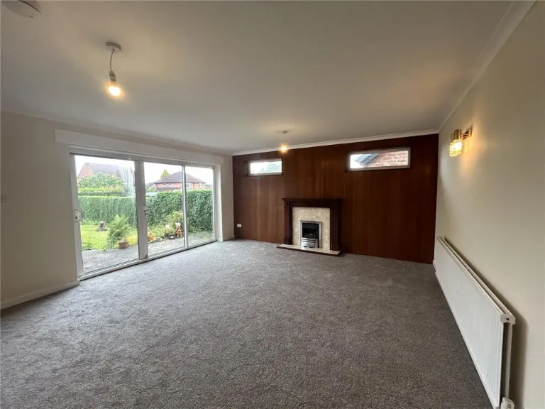
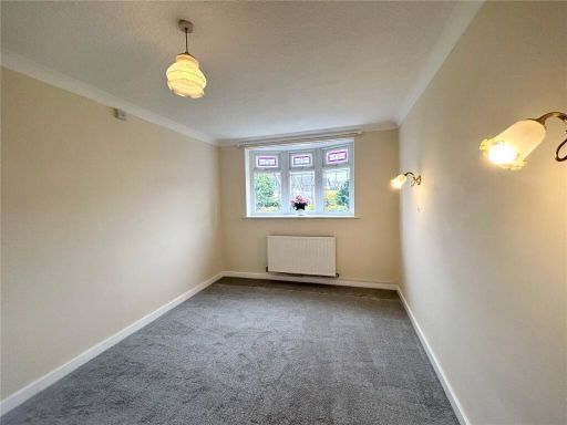
- living room mid-century modern
Floorplan Description
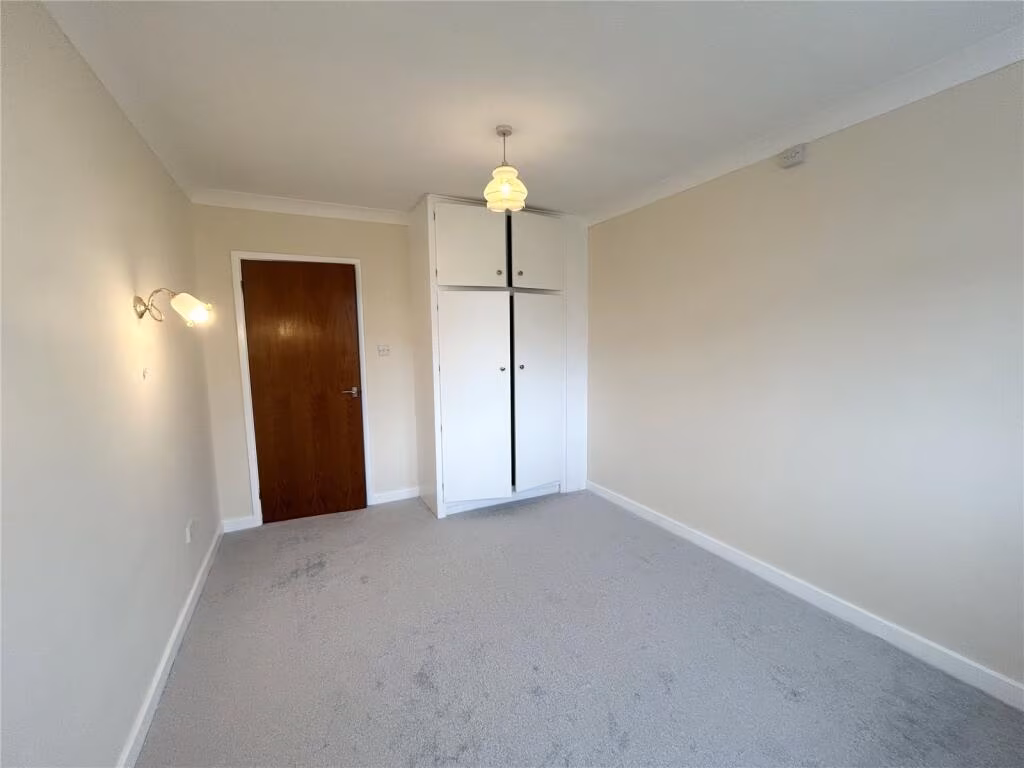
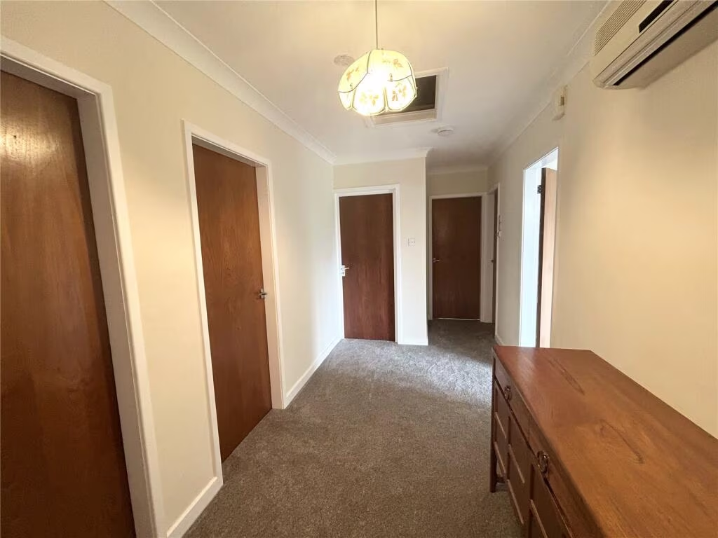
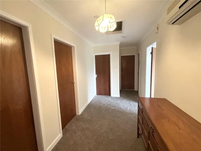
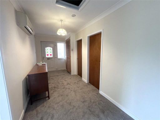
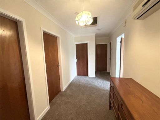
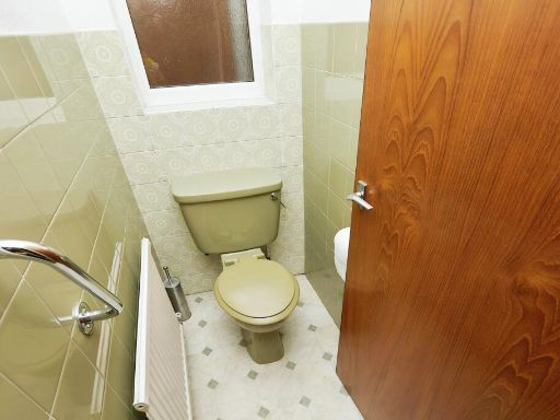
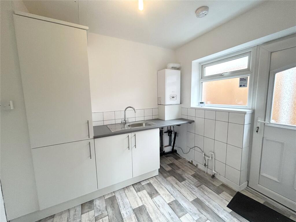
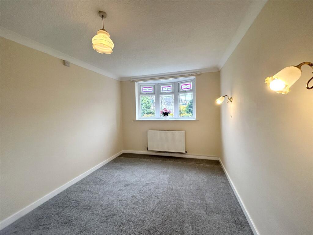
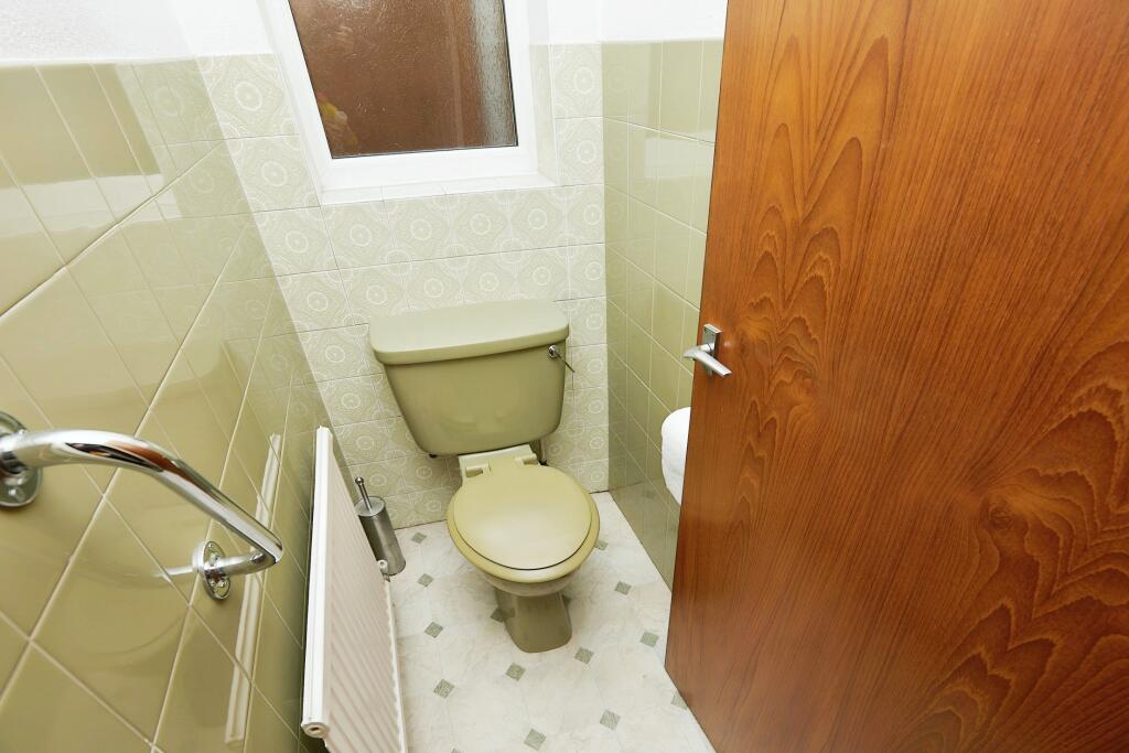
- Single-floor property with lounge, kitchen, two bedrooms, reception room, bathroom, toilet, hallway and garage (garage excluded from totals).
Rooms
- Garage: Small
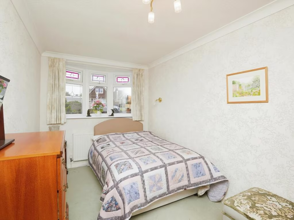
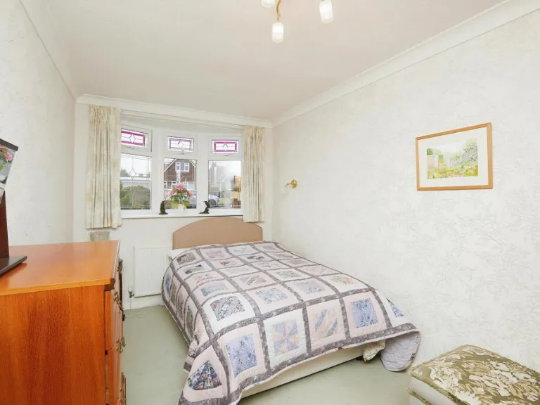
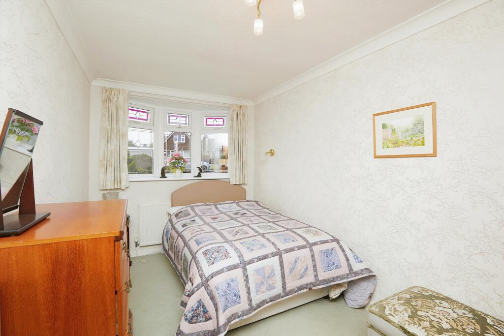
- Bedroom: Average
- Bedroom: Average
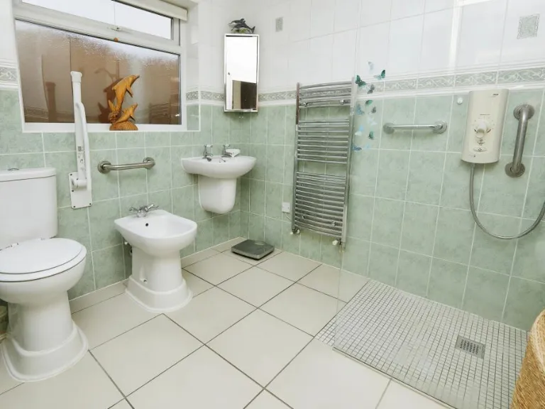
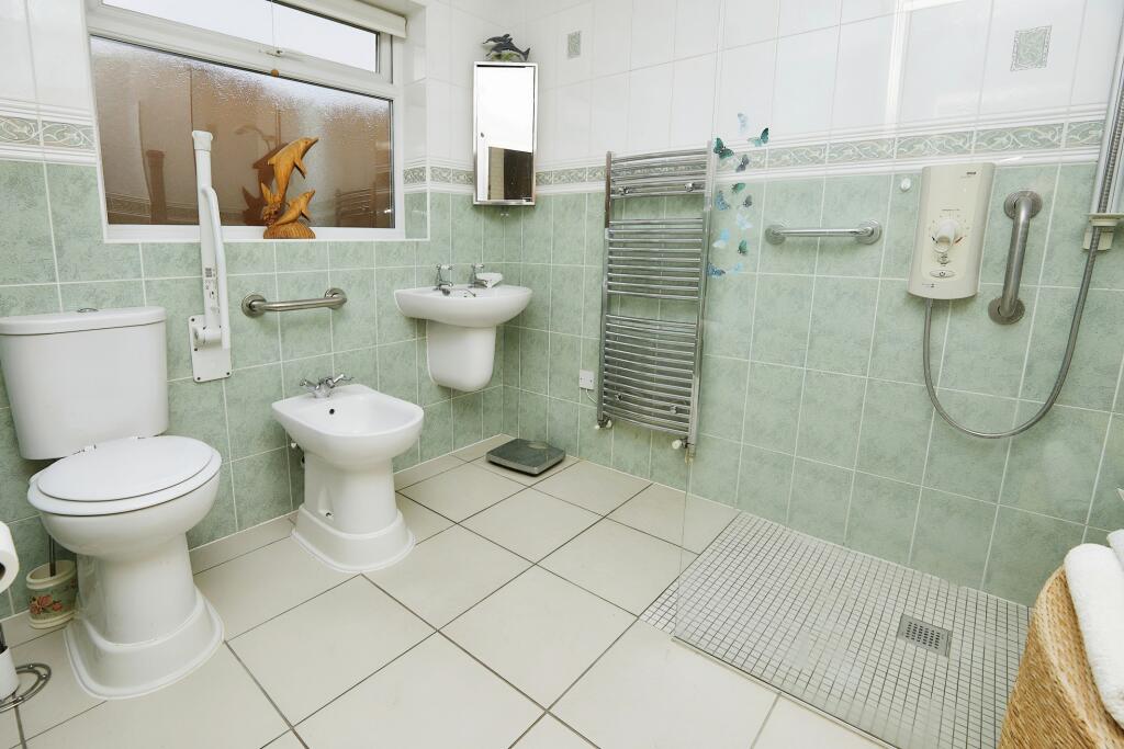
- Bathroom: Small
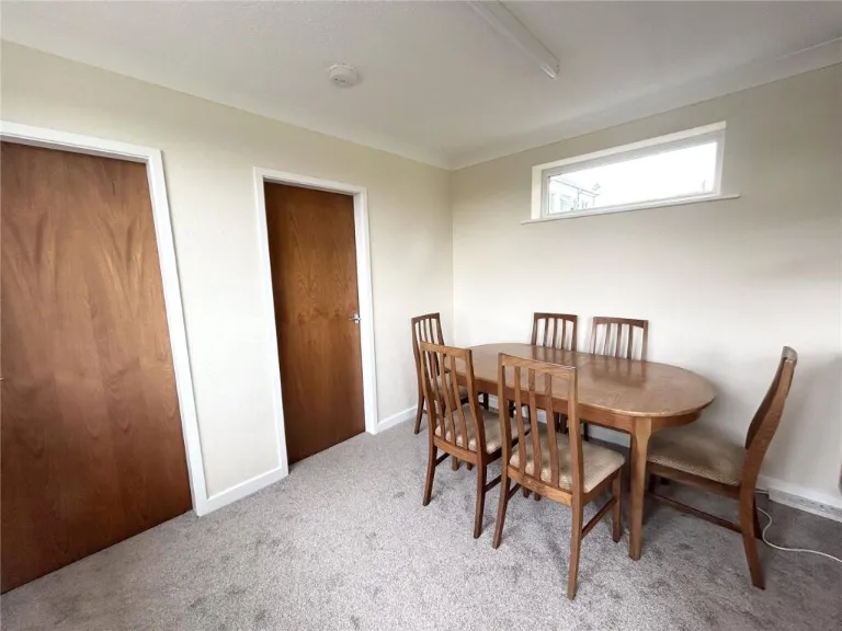
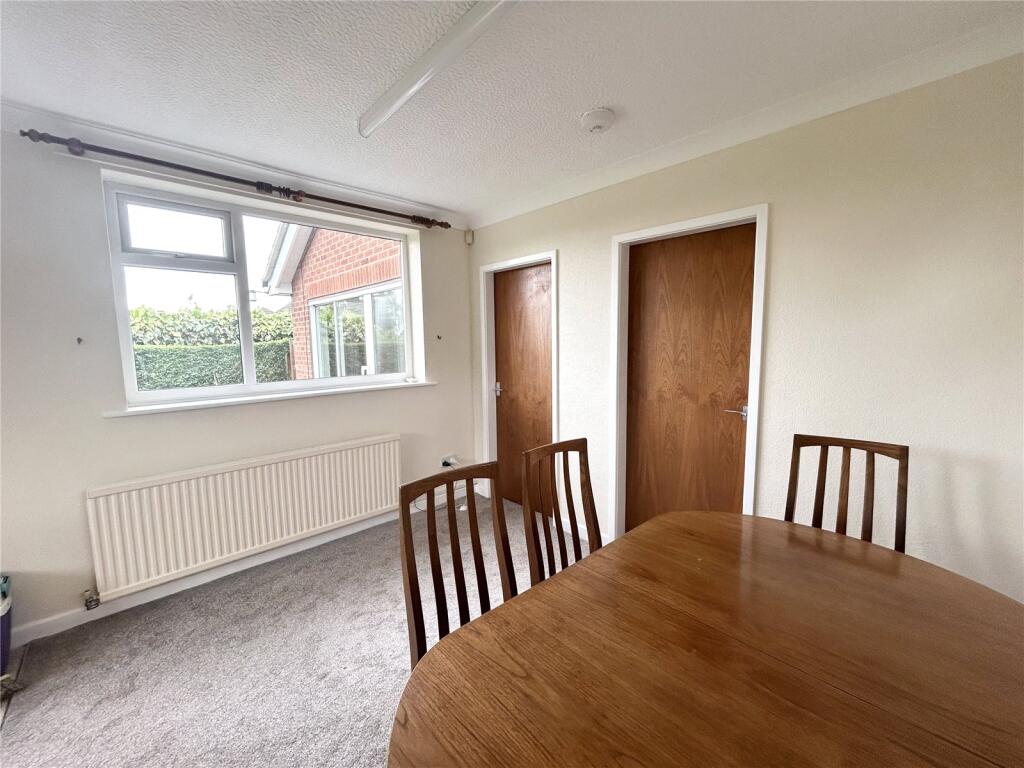
- Reception Room: Small
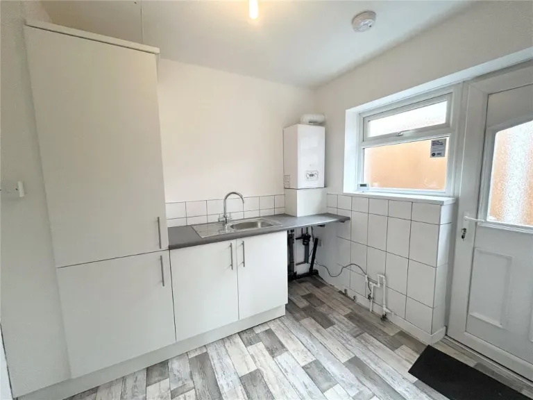
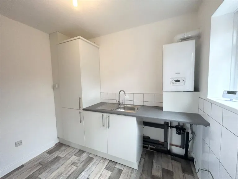
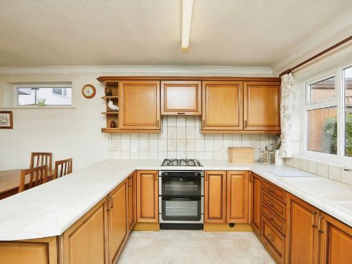
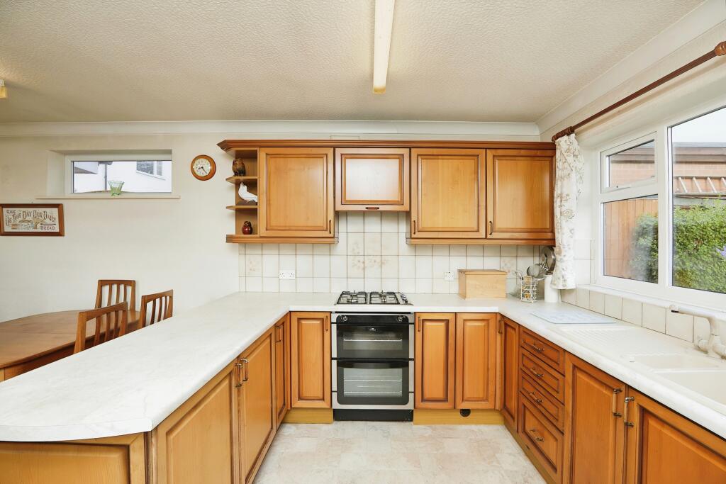
- Kitchen: Large
- Lounge: Large
Textual Property Features
Detected Visual Features
- bungalow
- mid-20th century
- brick
- single-storey
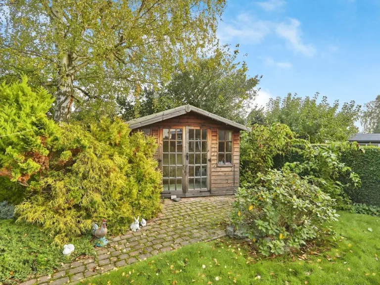
- front garden
- garage
- driveway
- bay window
- pitched roof
- mid-century modern
- large living room
- wood paneling
- fireplace
- picture windows
- sliding doors
- garden access
EPC Details
- Fully double glazed
- Cavity wall, as built, partial insulation (assumed)
- Boiler and radiators, mains gas
- Low energy lighting in 58% of fixed outlets
- Solid, no insulation (assumed)
Nearby Schools
- St Laurence CofE Primary School
- The Long Eaton School
- Trent College
- Parklands Infant and Nursery School
- Wilsthorpe School
- OneSchool Global Uk Nottingham Campus
- Toton Banks Road Infant and Nursery School
- Toton Bispham Drive Junior School
- Risley Lower Grammar CE (VC) Primary School
- William Lilley Infant and Nursery School
- Fairfield Spencer Academy
- Sawley Infant and Nursery School
- Harrington Junior School
- George Spencer Academy
- Brooklands Primary School
- Firfield Primary School
- Friesland School
- Ladycross Infant School
- Albany Junior School
- Albany Infant and Nursery School
- Sawley Junior School
- Dovedale Primary School
- English Martyrs' Catholic Voluntary Academy
- Longmoor Primary School
- Cloudside Academy
- St John's CofE Primary School
Nearest General Shops
- Id: 79504297
- Tags:
- Addr:
- City: Nottingham
- Housenumber: 37
- Postcode: NG10 5LL
- Street: Hayworth Road
- Suburb: Sandiacre
- Building: retail
- Shop: vacant
- Source: os_streetview
- Source:postcode: ONS
- TagsNormalized:
- Lat: 52.920254
- Lon: -1.2936132
- FullGeoHash: gcrj49f4bdk5
- PartitionGeoHash: gcrj
- Images:
- FoodStandards: null
- Distance: 806.8
,- Id: 84227156
- Tags:
- Addr:
- City: Nottingham
- Housenumber: 82
- Postcode: NG10 5JP
- Street: Longmoor Lane
- Suburb: Sandiacre
- Building: retail
- Name: Memory Lane
- Shop: antiques
- Source: survey
- Source:addr:postcode: OS Opendata Codepoint
- Source:area: OS_OpenData_StreetView
- TagsNormalized:
- Lat: 52.918403
- Lon: -1.2887774
- FullGeoHash: gcrj49t8133c
- PartitionGeoHash: gcrj
- Images:
- FoodStandards: null
- Distance: 713.4
,- Id: 316153204
- Tags:
- Addr:
- City: Nottingham
- Housenumber: 47
- Postcode: NG10 4FN
- Street: Longmoor Road
- Suburb: Long Eaton
- Building: yes
- Name: Elite Autocare
- Shop: car_repair
- Source: survey
- TagsNormalized:
- Lat: 52.9105557
- Lon: -1.2923779
- FullGeoHash: gcrj484fm6mn
- PartitionGeoHash: gcrj
- Images:
- FoodStandards: null
- Distance: 311.1
}
Nearest Airports
- Id: 11359528
- Tags:
- Aerodrome: international
- Aerodrome:type: public
- Aeroway: aerodrome
- Iata: EMA
- Icao: EGNX
- Is_in: Castle Donington,England,UK
- Name: East Midlands Airport
- Old_name: RAF Castle Donington
- Operator: Manchester Airports Holdings Limited
- Operator:type: private
- Ref: EMA
- Type: multipolygon
- Website: https://www.eastmidlandsairport.com/
- Wikidata: Q8977
- Wikipedia: en:East Midlands Airport
- TagsNormalized:
- airport
- international airport
- Lat: 52.8281122
- Lon: -1.3322143
- FullGeoHash: gcrh99jfj1vh
- PartitionGeoHash: gcrh
- Images:
- FoodStandards: null
- Distance: 9773.7
}
Nearest Leisure Facilities
- Id: 84344926
- Tags:
- TagsNormalized:
- Lat: 52.9152113
- Lon: -1.2968781
- FullGeoHash: gcrj42ztkw3d
- PartitionGeoHash: gcrj
- Images:
- FoodStandards: null
- Distance: 288.5
,- Id: 84489850
- Tags:
- Leisure: park
- Source: Yahoo; survey
- TagsNormalized:
- Lat: 52.9106107
- Lon: -1.2950005
- FullGeoHash: gcrj48148k9w
- PartitionGeoHash: gcrj
- Images:
- FoodStandards: null
- Distance: 269.6
,- Id: 49011845
- Tags:
- TagsNormalized:
- Lat: 52.9136941
- Lon: -1.2909024
- FullGeoHash: gcrj48euxg92
- PartitionGeoHash: gcrj
- Images:
- FoodStandards: null
- Distance: 257.1
,- Id: 49011846
- Tags:
- TagsNormalized:
- Lat: 52.9135176
- Lon: -1.2909493
- FullGeoHash: gcrj48egwdw7
- PartitionGeoHash: gcrj
- Images:
- FoodStandards: null
- Distance: 249
,- Id: 84489825
- Tags:
- Leisure: park
- Source: Yahoo; survey
- TagsNormalized:
- Lat: 52.9130153
- Lon: -1.2908852
- FullGeoHash: gcrj48s08hyn
- PartitionGeoHash: gcrj
- Images:
- FoodStandards: null
- Distance: 247.1
}
Nearest Tourist attractions
- Id: 102072338
- Tags:
- Addr:
- City: Derby
- Housenumber: 113
- Postcode: DE72 3SS
- Street: Derby Road
- Suburb: Risley
- Fhrs:
- Name: Risley Guest House
- Tourism: guest_house
- Website: https://www.braesideguesthouse.co.uk/
- TagsNormalized:
- Lat: 52.9165898
- Lon: -1.3220241
- FullGeoHash: gcrj1cjm6x73
- PartitionGeoHash: gcrj
- Images:
- FoodStandards:
- Id: 252088
- FHRSID: 252088
- LocalAuthorityBusinessID: 47579
- BusinessName: Risley Guest House
- BusinessType: Hotel/bed & breakfast/guest house
- BusinessTypeID: 7842
- AddressLine1: null
- AddressLine2: 113 Derby Road
- AddressLine3: null
- AddressLine4: Risley
- PostCode: DE72 3SS
- RatingValue: 5
- RatingKey: fhrs_5_en-GB
- RatingDate: 2018-02-06
- LocalAuthorityCode: 066
- LocalAuthorityName: Erewash
- LocalAuthorityWebSite: http://www.erewash.gov.uk/
- LocalAuthorityEmailAddress: environmentalhealth@erewash.gov.uk
- Scores:
- Hygiene: 0
- Structural: 0
- ConfidenceInManagement: 0
- NewRatingPending: false
- Geocode:
- Longitude: -1.32205600000000
- Latitude: 52.91746900000000
- Distance: 1883.1
,- Id: 5694779421
- Tags:
- TagsNormalized:
- Lat: 52.8971525
- Lon: -1.2858109
- FullGeoHash: gcrhftxsnrvv
- PartitionGeoHash: gcrh
- Images:
- FoodStandards: null
- Distance: 1859.8
,- Id: 618792582
- Tags:
- Amenity: public_bookcase
- Booth: K6
- Disused:
- Information: board
- Man_made: telephone_box
- Note: Also leaflets
- Operator: Risley with Hopwell Parish Council
- Public_bookcase:
- Source: survey
- Tourism: information
- TagsNormalized:
- public bookcase
- information
- tourism
- Lat: 52.9159633
- Lon: -1.3202524
- FullGeoHash: gcrj1cn9gfs2
- PartitionGeoHash: gcrj
- Images:
- FoodStandards: null
- Distance: 1752.8
}
Nearest Train stations
- Id: 7170589239
- Tags:
- Name: Ilkeston
- Naptan:
- Network: National Rail
- Public_transport: station
- Railway: station
- Ref:
- Wikidata: Q15228309
- Wikipedia: en:Ilkeston railway station
- TagsNormalized:
- Lat: 52.9790983
- Lon: -1.2950397
- FullGeoHash: gcrj6s8cx7sr
- PartitionGeoHash: gcrj
- Images:
- FoodStandards: null
- Distance: 7347.5
,- Id: 2136826434
- Tags:
- Addr:
- Name: East Midlands Parkway
- Naptan:
- Network: National Rail
- Operator: East Midlands Railway
- Public_transport: station
- Railway: station
- Ref:
- Train: yes
- Wikidata: Q5328988
- Wikipedia: en:East Midlands Parkway railway station
- TagsNormalized:
- Lat: 52.862275
- Lon: -1.262883
- FullGeoHash: gcrher23hdq1
- PartitionGeoHash: gcrh
- Images:
- FoodStandards: null
- Distance: 6030
,- Id: 4292892169
- Tags:
- Is_in:
- Layer: 2
- Name: Beeston
- Naptan:
- Network: National Rail
- Public_transport: station
- Railway: station
- Ref:
- Wheelchair: yes
- Wikidata: Q3299120
- Wikipedia: en:Beeston railway station
- TagsNormalized:
- Lat: 52.9207938
- Lon: -1.2075065
- FullGeoHash: gcrjh9btzncz
- PartitionGeoHash: gcrj
- Images:
- FoodStandards: null
- Distance: 5901.1
,- Id: 6415345182
- Tags:
- Name: Attenborough
- Naptan:
- Network: National Rail
- Public_transport: station
- Railway: station
- Ref:
- Wikidata: Q2098552
- Wikipedia: en:Attenborough railway station
- TagsNormalized:
- Lat: 52.9064132
- Lon: -1.2311523
- FullGeoHash: gcrhgzrd0n4r
- PartitionGeoHash: gcrh
- Images:
- FoodStandards: null
- Distance: 4315.8
,- Id: 1587569090
- Tags:
- Name: Long Eaton
- Naptan:
- Network: National Rail
- Public_transport: station
- Railway: station
- Ref:
- Train: yes
- Wheelchair: limited
- Wheelchair:description: Both platforms have a lift available. Sloped access is steep.
- Wikidata: Q2357399
- Wikipedia: en:Long Eaton railway station
- TagsNormalized:
- Lat: 52.8849595
- Lon: -1.2872899
- FullGeoHash: gcrhfeqt5yzp
- PartitionGeoHash: gcrh
- Images:
- FoodStandards: null
- Distance: 3158.3
}
Nearest Hotels
- Id: 909462
- Tags:
- Addr:
- City: Nottingham
- Postcode: NG10 5NJ
- Street: Bostocks Lane
- Suburb: Sandiacre
- Brand: Holiday Inn
- Brand:wikidata: Q2717882
- Brand:wikipedia: en:Holiday Inn
- Building: hotel
- Fhrs:
- Internet_access: wlan
- Name: Holiday Inn
- Rooms: 92
- Source: Bing;survey
- Source:postcode: Food hygiene open data
- Tourism: hotel
- Type: multipolygon
- TagsNormalized:
- Lat: 52.9186048
- Lon: -1.3018706
- FullGeoHash: gcrj43s10nyv
- PartitionGeoHash: gcrj
- Images:
- FoodStandards: null
- Distance: 790.6
,- Id: 73305226
- Tags:
- Addr:
- City: Nottingham
- Postcode: NG10 4EP
- Street: Bostocks Lane
- Suburb: Long Eaton
- Brand: Best Western
- Brand:wikidata: Q830334
- Brand:wikipedia: en:Best Western
- Building: hotel
- Name: Best Western Nottingham Derby
- Old_name: Ramada Nottingham
- Source:
- Tourism: hotel
- TagsNormalized:
- Lat: 52.9092847
- Lon: -1.2993182
- FullGeoHash: gcrhfrvfgtw1
- PartitionGeoHash: gcrh
- Images:
- FoodStandards: null
- Distance: 523.5
,- Id: 73305225
- Tags:
- Addr:
- City: Nottingham
- Postcode: NG10 4EP
- Street: Bostocks Lane
- Suburb: Long Eaton
- Brand: Novotel
- Brand:wikidata: Q420545
- Brand:wikipedia: en:Novotel
- Building: hotel
- Fhrs:
- Name: Novotel
- Source:
- Tourism: hotel
- TagsNormalized:
- Lat: 52.910471
- Lon: -1.298113
- FullGeoHash: gcrj42n9zf8v
- PartitionGeoHash: gcrj
- Images:
- FoodStandards: null
- Distance: 369.9
}
Tags
- bungalow
- mid-20th century
- brick
- single-storey
- front garden
- garage
- driveway
- bay window
- pitched roof
- mid-century modern
- large living room
- wood paneling
- fireplace
- picture windows
- sliding doors
- garden access
Local Market Stats
- Average Price/sqft: £233
- Avg Income: £39600
- Rental Yield: 4.4%
- Social Housing: 9%
- Planning Success Rate: 95%
AirBnB Data
- 1km average: £99/night
- Listings in 1km: 1
Similar Properties
 3 bedroom bungalow for sale in Bostocks Lane, Sandiacre, Nottingham, Derbyshire, NG10 — £325,000 • 3 bed • 1 bath • 981 ft²
 3 bedroom bungalow for sale in Moorfield Crescent, Sandiacre, Nottingham, Derbyshire, NG10 — £295,000 • 3 bed • 1 bath • 908 ft²
 3 bedroom detached house for sale in Sandringham Road, Sandiacre, Nottingham, Derbyshire, NG10 — £250,000 • 3 bed • 1 bath • 1033 ft²
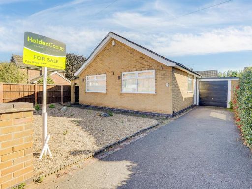 3 bedroom detached bungalow for sale in Charles Avenue, Sandiacre, Nottinghamshire, NG10 5BX, NG10 — £270,000 • 3 bed • 1 bath • 1171 ft²
 2 bedroom detached bungalow for sale in Orchard Way, Sandiacre, NG10 — £250,000 • 2 bed • 1 bath • 764 ft²
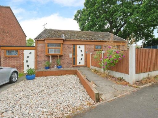 3 bedroom detached bungalow for sale in Sandringham Road, Sandiacre, Nottingham, NG10 — £230,000 • 3 bed • 1 bath • 846 ft²
Meta
- {
"@context": "https://schema.org",
"@type": "Residence",
"name": "2 bedroom bungalow for sale in Springfield Avenue, Sandiacr…",
"description": "",
"url": "https://propertypiper.co.uk/property/53a3288f-cf9a-4759-a135-5ca39a642add",
"image": "https://image-a.propertypiper.co.uk/38ee0d69-930a-41cc-a362-ee8a5e30f233-1024.jpeg",
"address": {
"@type": "PostalAddress",
"streetAddress": "66 Springfield Avenue, Sandiacre",
"postalCode": "NG10 5LZ",
"addressLocality": "Erewash",
"addressRegion": "Erewash",
"addressCountry": "England"
},
"geo": {
"@type": "GeoCoordinates",
"latitude": 52.91302146078726,
"longitude": -1.294570484533577
},
"numberOfRooms": 2,
"numberOfBathroomsTotal": 1,
"floorSize": {
"@type": "QuantitativeValue",
"value": 830,
"unitCode": "FTK"
},
"offers": {
"@type": "Offer",
"price": 350000,
"priceCurrency": "GBP",
"availability": "https://schema.org/InStock"
},
"additionalProperty": [
{
"@type": "PropertyValue",
"name": "Feature",
"value": "bungalow"
},
{
"@type": "PropertyValue",
"name": "Feature",
"value": "mid-20th century"
},
{
"@type": "PropertyValue",
"name": "Feature",
"value": "brick"
},
{
"@type": "PropertyValue",
"name": "Feature",
"value": "single-storey"
},
{
"@type": "PropertyValue",
"name": "Feature",
"value": "front garden"
},
{
"@type": "PropertyValue",
"name": "Feature",
"value": "garage"
},
{
"@type": "PropertyValue",
"name": "Feature",
"value": "driveway"
},
{
"@type": "PropertyValue",
"name": "Feature",
"value": "bay window"
},
{
"@type": "PropertyValue",
"name": "Feature",
"value": "pitched roof"
},
{
"@type": "PropertyValue",
"name": "Feature",
"value": "mid-century modern"
},
{
"@type": "PropertyValue",
"name": "Feature",
"value": "large living room"
},
{
"@type": "PropertyValue",
"name": "Feature",
"value": "wood paneling"
},
{
"@type": "PropertyValue",
"name": "Feature",
"value": "fireplace"
},
{
"@type": "PropertyValue",
"name": "Feature",
"value": "picture windows"
},
{
"@type": "PropertyValue",
"name": "Feature",
"value": "sliding doors"
},
{
"@type": "PropertyValue",
"name": "Feature",
"value": "garden access"
}
]
}
High Res Floorplan Images
Compatible Floorplan Images
FloorplanImages Thumbnail