SO30 0PP - 2 bedroom terraced house for sale in Ferndale, Hedge End, S…
View on Property Piper
2 bedroom terraced house for sale in Ferndale, Hedge End, SO30
Property Details
- Price: £275000
- Bedrooms: 2
- Bathrooms: 1
- Property Type: undefined
- Property SubType: undefined
Brochure Descriptions
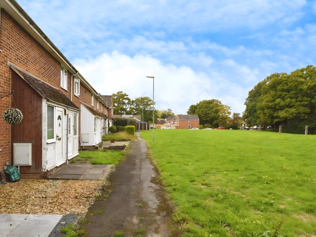
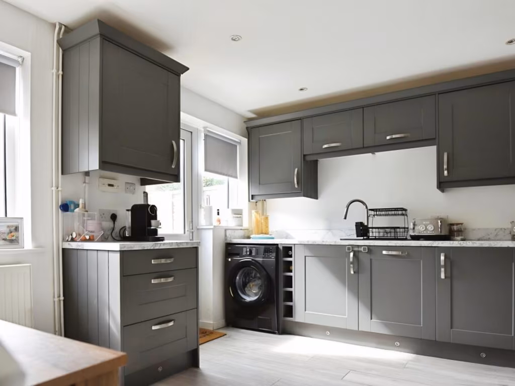
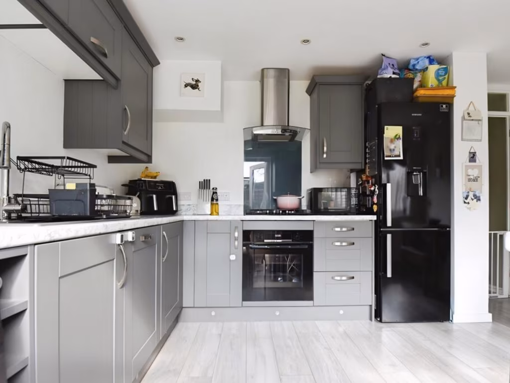
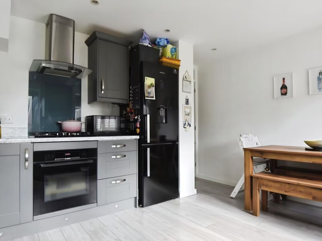
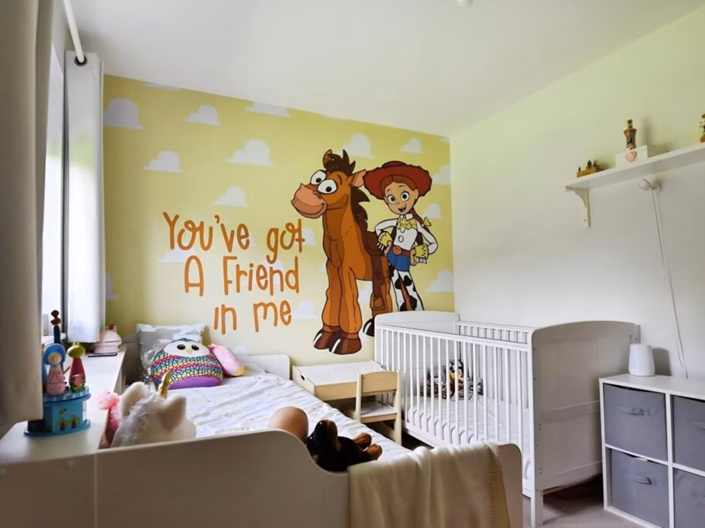
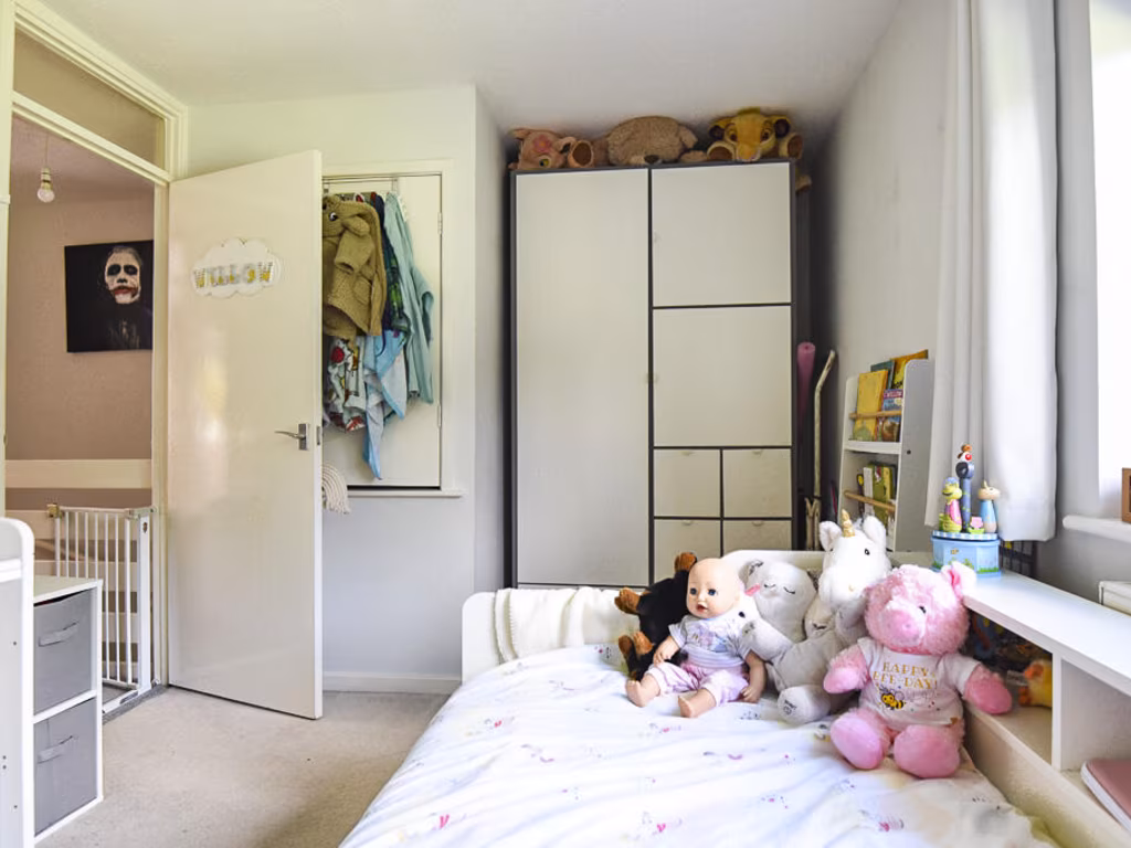
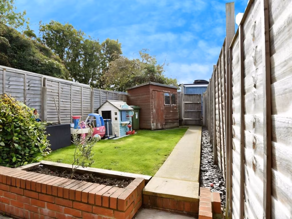
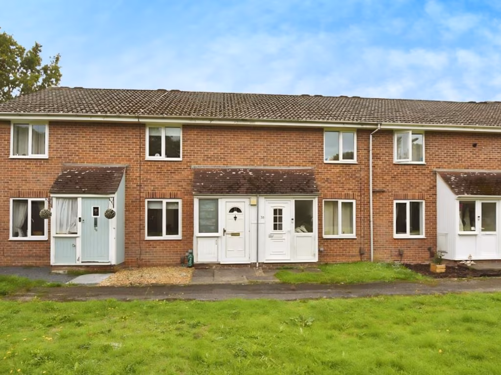
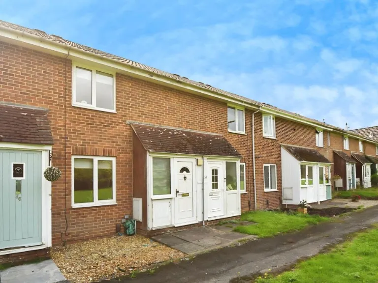
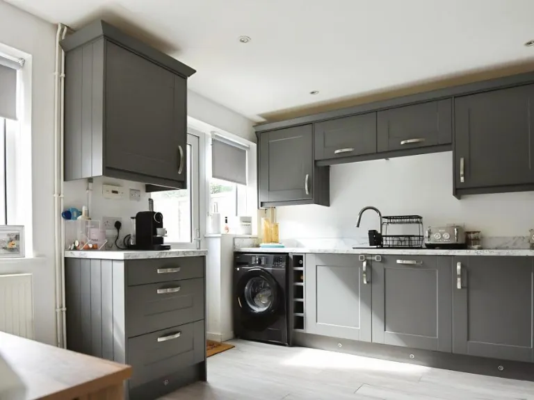
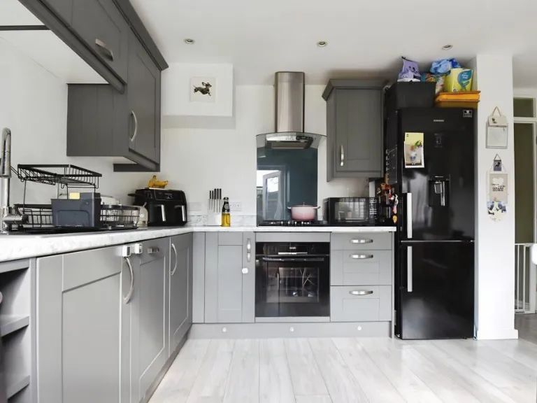
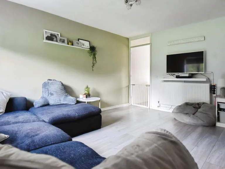
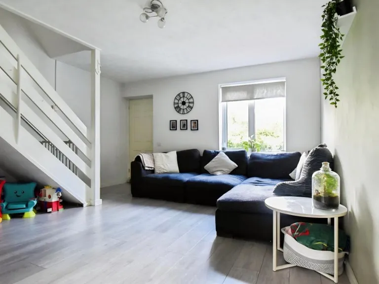
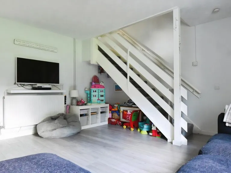
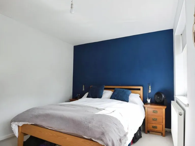
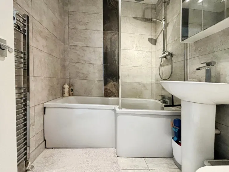
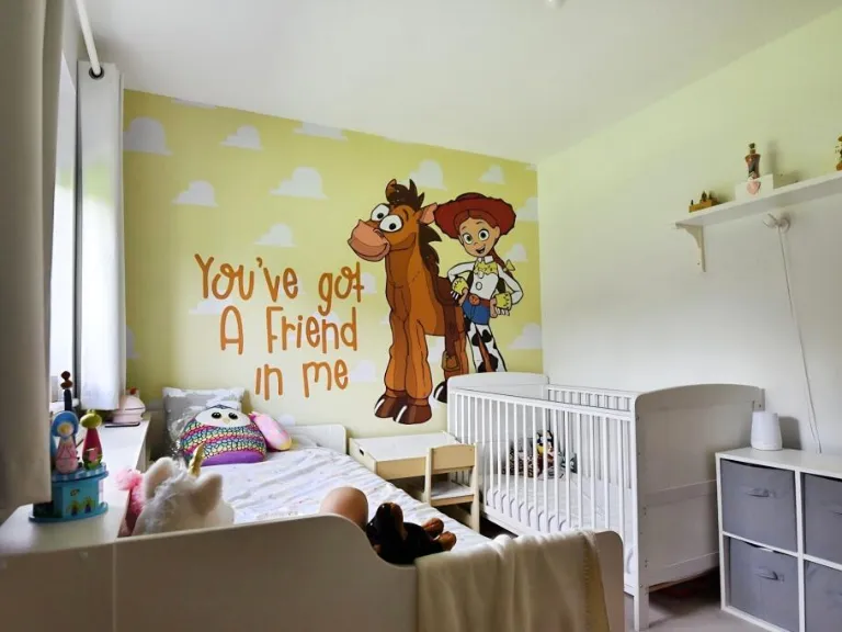
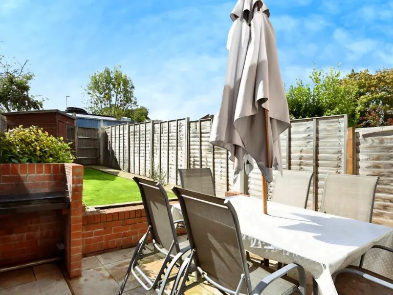
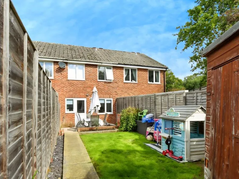
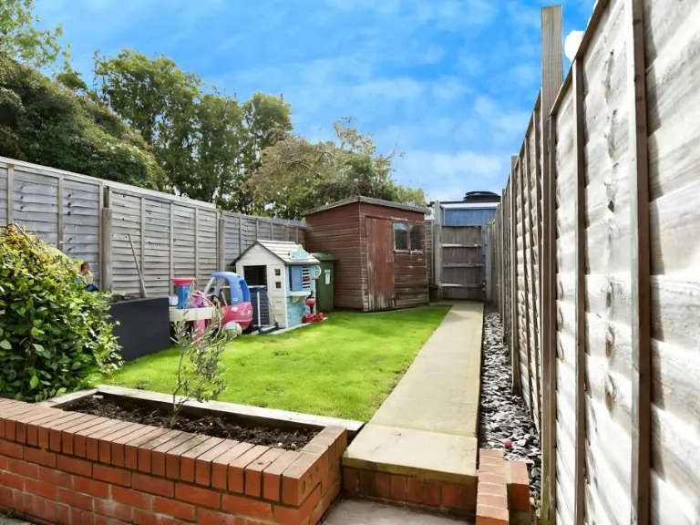
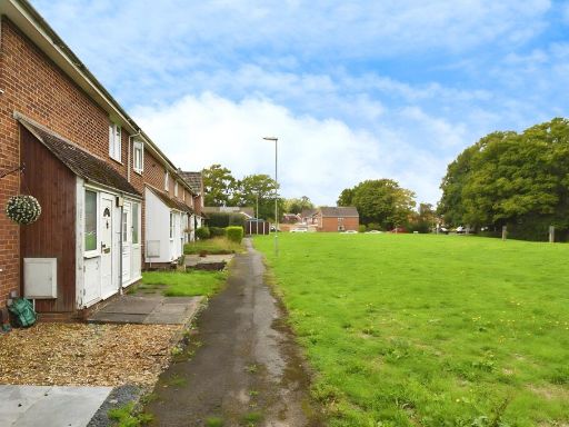
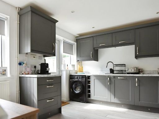
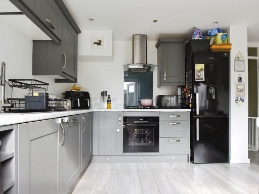
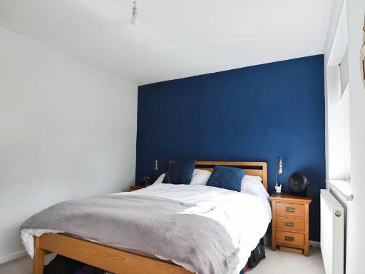
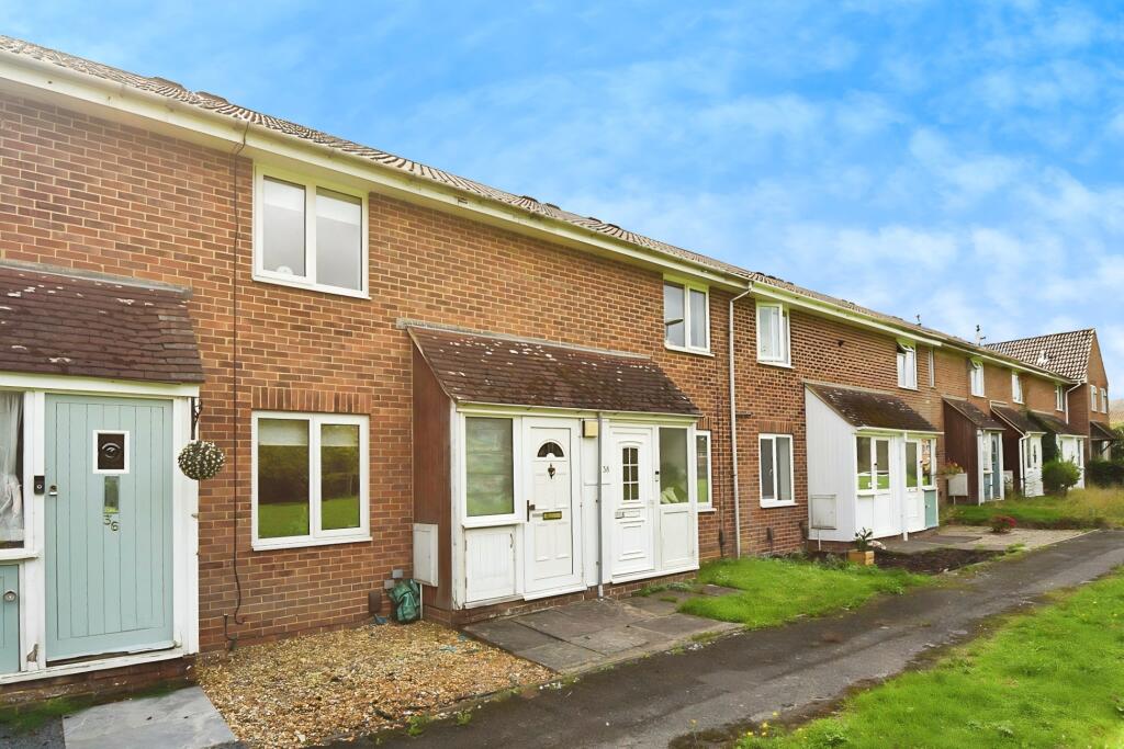
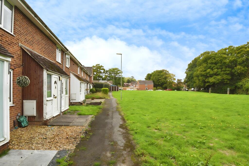
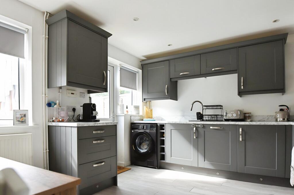
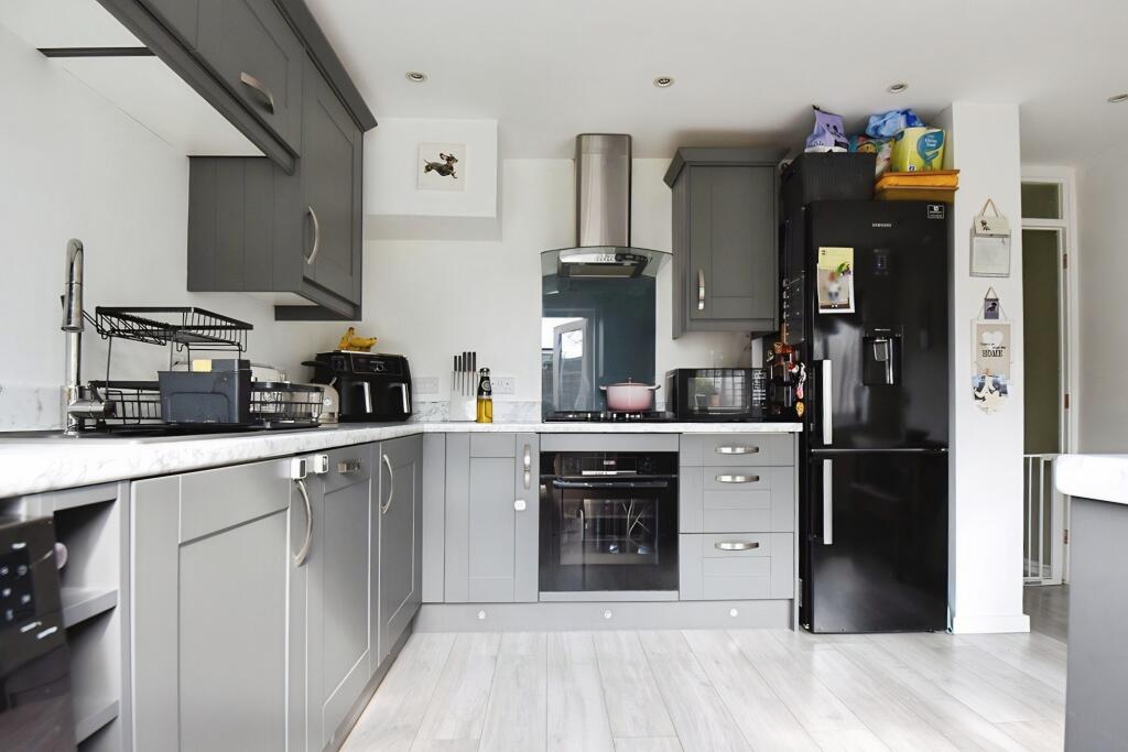
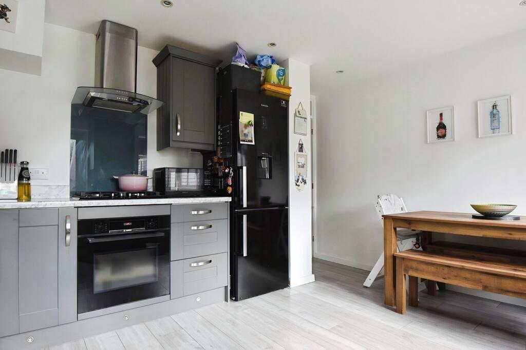
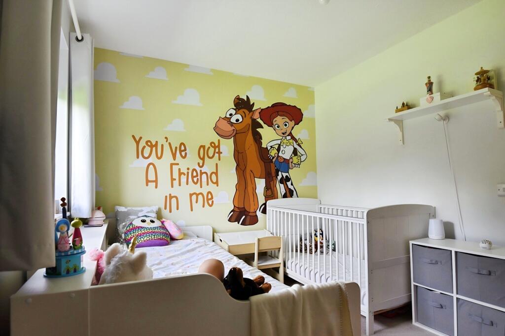
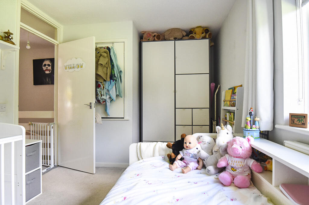
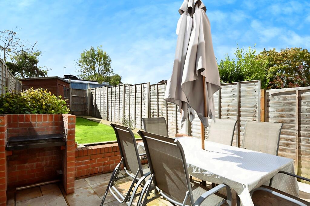
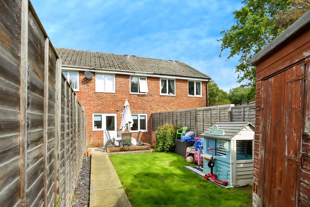
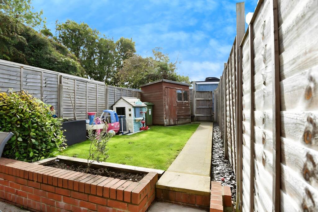
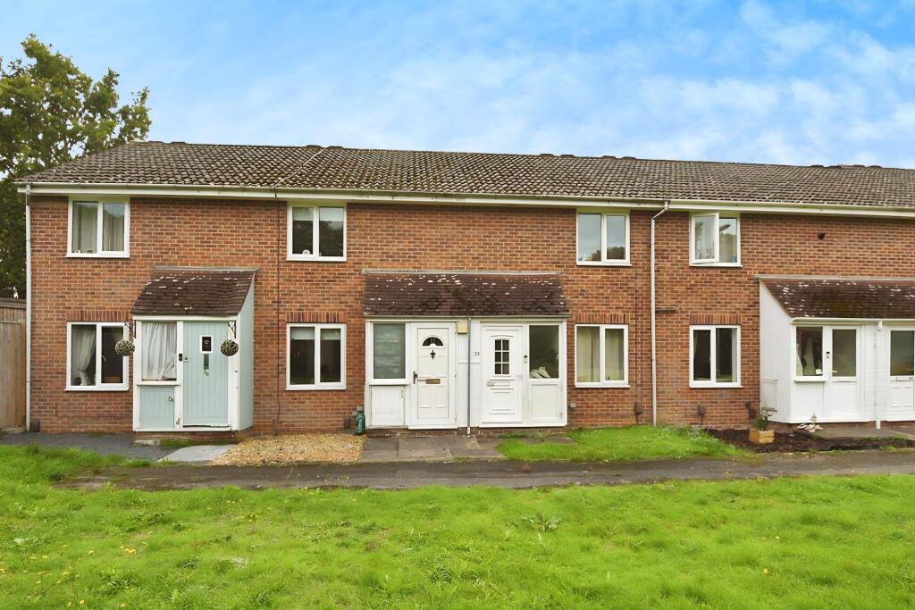
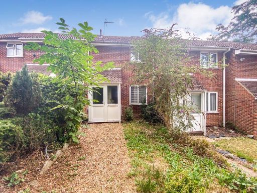
- Mid-terrace two-bedroom house in a residential row on Ferndale, Hedge End (SO30). Traditional brick-built two-storey terrace with small enclosed porch/entrance and front lawn area. Property appears to offer: 2 bedrooms (first floor), an open-plan kitchen/dining area, allocated parking and a low-maintenance rear garden. The plot and garden are small-to-average in size consistent with modest terrace housing; overall property footprint is compact, suitable for first-time buyers or investors. Exterior condition appears sound with standard roofline and double-glazed windows; likely average local-standard finish internally.
Image Descriptions
- residential building front Modern Terraced
- row of houses mid-20th century terraced
Floorplan Description
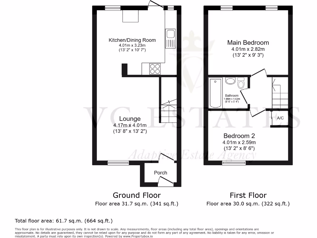
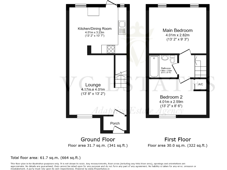
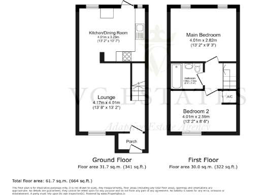
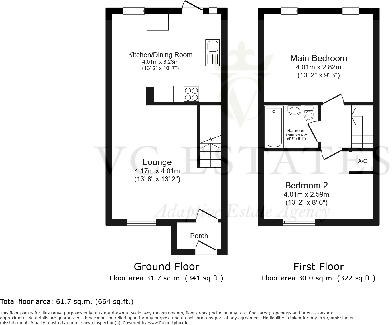
- Floorplan with Ground and First Floor and labelled room dimensions.
Rooms
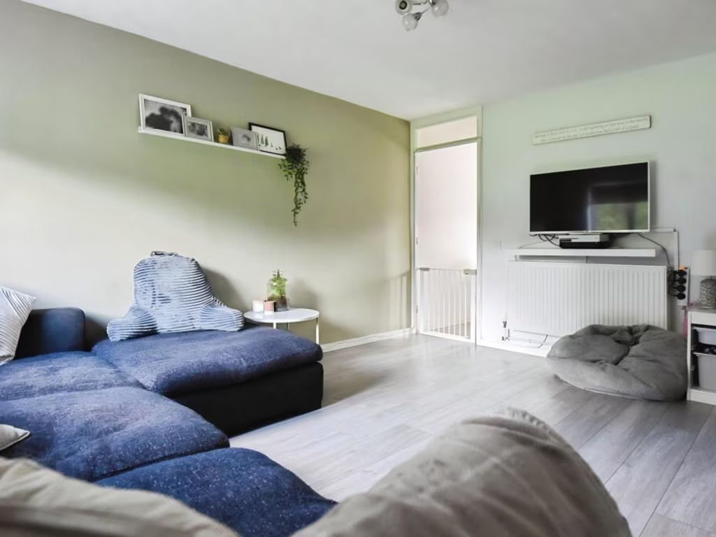
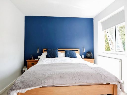
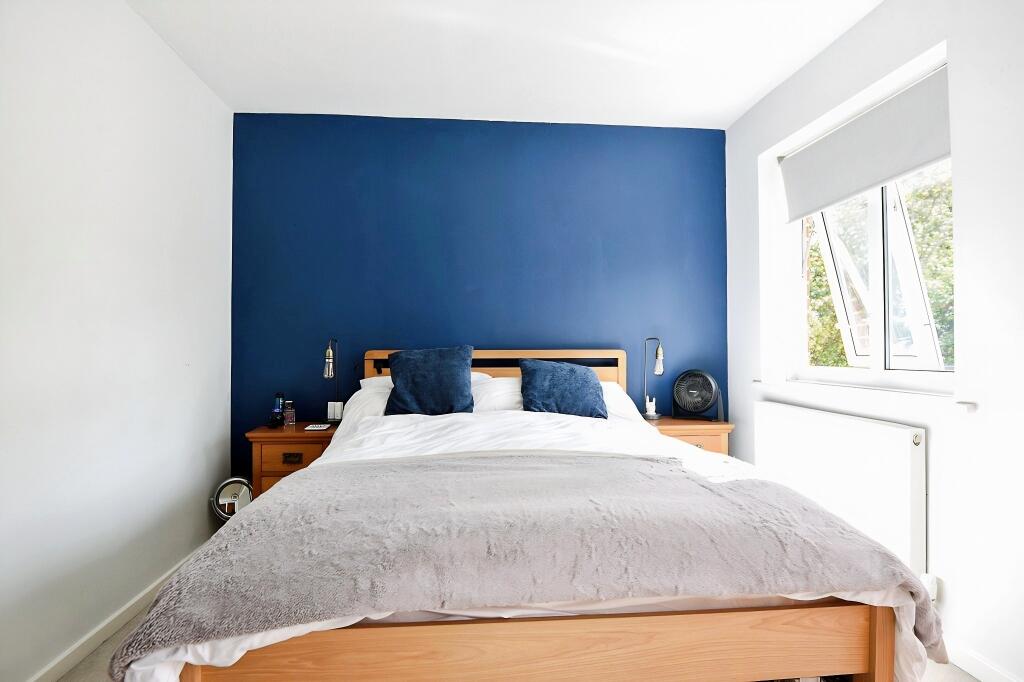
- Kitchen/Dining Room:
- Lounge:
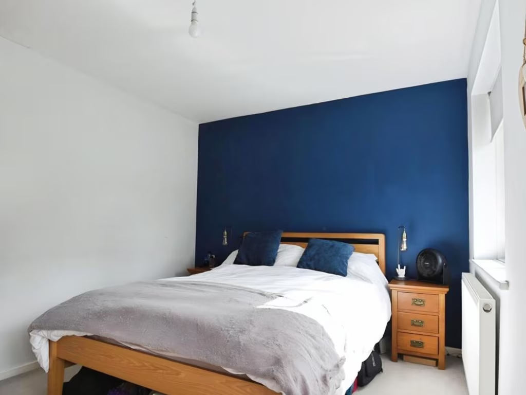
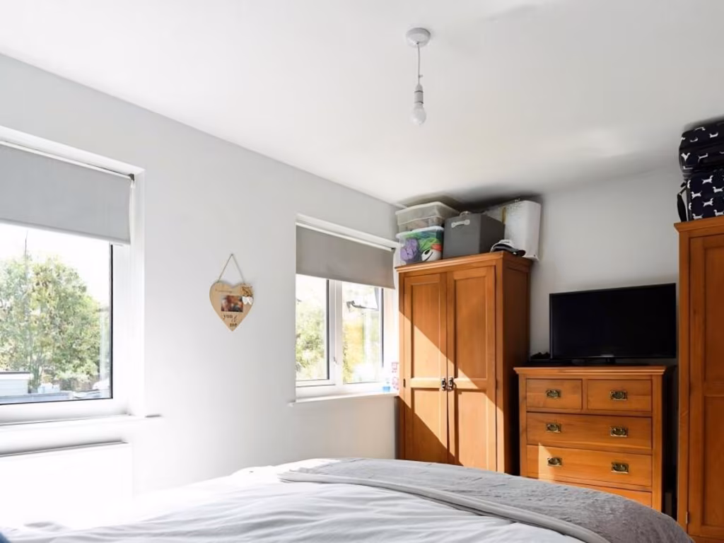
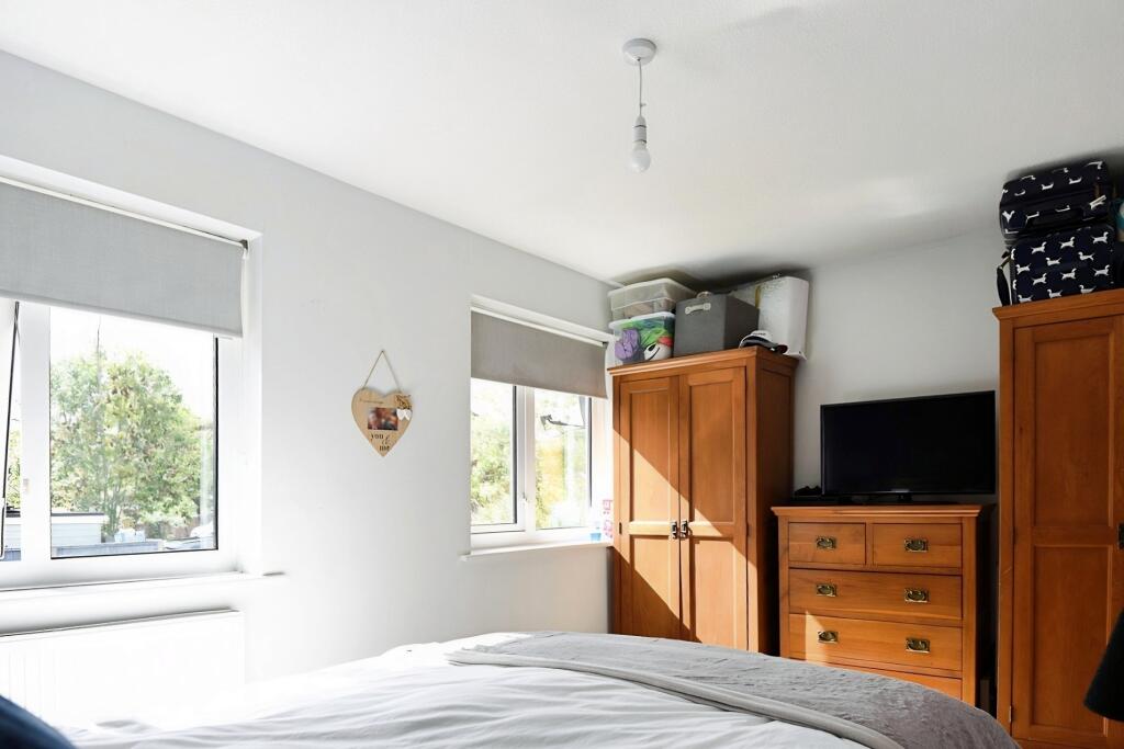
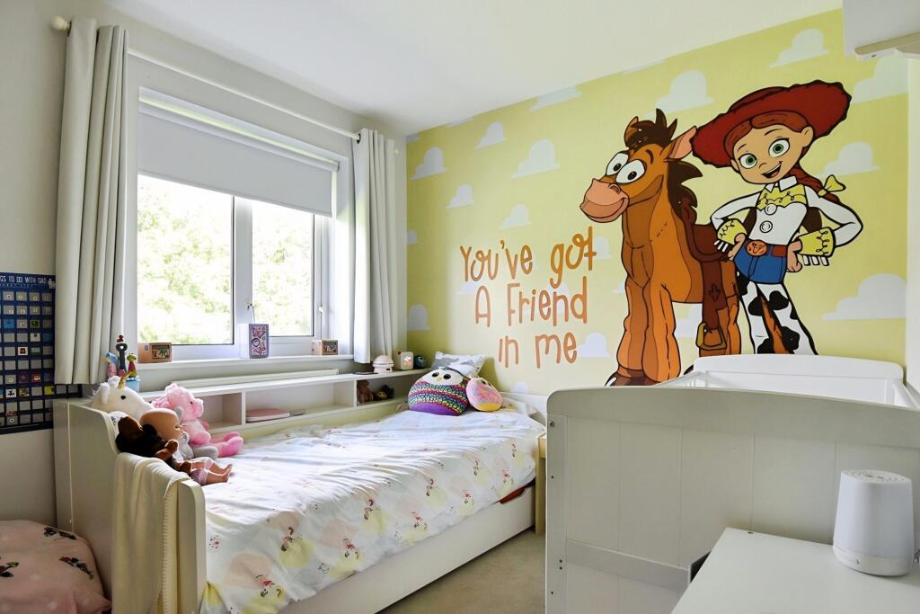
- Main Bedroom:
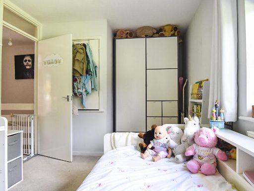
- Bedroom 2:
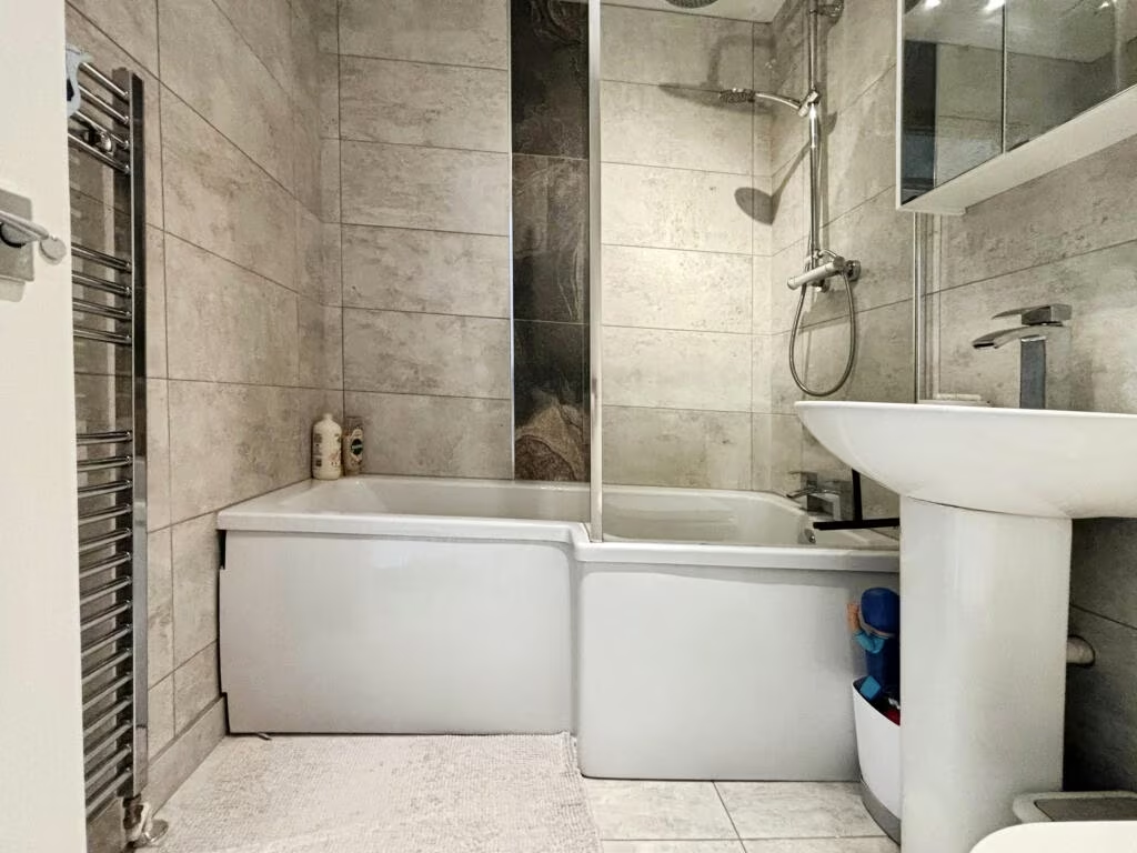
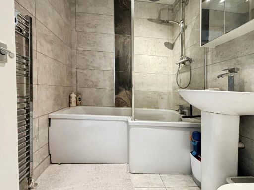
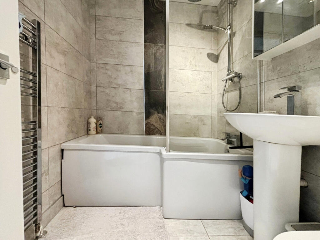
- Bathroom:
Textual Property Features
Detected Visual Features
- modern
- terraced
- two-storey
- brickwork
- white door
- porch
- gabled porch
- front garden
- residential area
- mid-20th century
- brick
- outdated
- needs modernization
- garden
Nearby Schools
- Brookfield Community School
- Freegrounds Infant School
- Freegrounds Junior School
- Deer Park School
- Saint James' Church of England Primary School
- Sarisbury Infant School
- Park Gate Primary School
- Sarisbury Church of England Junior School
- Valentine Primary School
- Hightown Primary School
- Kanes Hill Primary School
- Berrywood Primary School
- Boorley Park
- Wellstead Primary School
- Durley Church of England Controlled Primary School
- The Hamble School
- Bursledon Church of England Infant School
- Bursledon Junior School(CA)
- Kings Copse Primary School
- Botley Church of England Controlled Primary School
- Woodlands Community College
- Whiteley Primary School
- Thornhill Primary School
- Wildern School
- Shamblehurst Primary School
- Curdridge Primary School
Nearest Bars And Restaurants
- Id: 234553650
- Tags:
- Amenity: restaurant
- Building: yes
- Cuisine: chinese
- Name: China Town
- TagsNormalized:
- Lat: 50.9140965
- Lon: -1.3027336
- FullGeoHash: gcp1dkekh57r
- PartitionGeoHash: gcp1
- Images:
- FoodStandards: null
- Distance: 1052.9
,- Id: 297179743
- Tags:
- Amenity: fast_food
- Cuisine: pizza
- Name: Mr Pizza
- TagsNormalized:
- Lat: 50.9129791
- Lon: -1.3039567
- FullGeoHash: gcp1dk6mxe5q
- PartitionGeoHash: gcp1
- Images:
- FoodStandards: null
- Distance: 1019.9
,- Id: 234554487
- Tags:
- Amenity: pub
- Building: yes
- Name: The Barleycorn
- Source: Local Knowledge
- Source:location: Bing Imagery
- TagsNormalized:
- Lat: 50.9137276
- Lon: -1.3022759
- FullGeoHash: gcp1dke9yy8x
- PartitionGeoHash: gcp1
- Images:
- FoodStandards: null
- Distance: 1000.8
,- Id: 234554486
- Tags:
- Amenity: fast_food
- Building: yes
- Cuisine: chinese
- Name: Hong Kong Garden
- Opening_hours: Mo-Su 17:00-23:30; Fr 17:00-24:00
- Phone: +44 1489 786184
- Source: Survey
- Source:location: Bing Imagery
- Takeaway: yes
- TagsNormalized:
- fast food
- food
- chinese
- takeaway
- Lat: 50.9137993
- Lon: -1.3021073
- FullGeoHash: gcp1dkef6sn6
- PartitionGeoHash: gcp1
- Images:
- FoodStandards: null
- Distance: 999.7
,- Id: 842195339
- Tags:
- Amenity: cafe
- Building: retail
- Name: Kettle & Cake
- TagsNormalized:
- Lat: 50.9123819
- Lon: -1.3036672
- FullGeoHash: gcp1dk6dn7g7
- PartitionGeoHash: gcp1
- Images:
- FoodStandards: null
- Distance: 960.3
}
Nearest General Shops
- Id: 4074238929
- Tags:
- Addr:
- City: Hedge End, Southampton
- Street: Bursledon Road
- Name: Mike's Barber Shop
- Shop: hairdresser
- TagsNormalized:
- Lat: 50.9108682
- Lon: -1.3046661
- FullGeoHash: gcp1dk1cr1dq
- PartitionGeoHash: gcp1
- Images:
- FoodStandards: null
- Distance: 919
,- Id: 5457089115
- Tags:
- Name: Mike's
- Shop: hairdresser
- TagsNormalized:
- Lat: 50.9108511
- Lon: -1.3046318
- FullGeoHash: gcp1dk1cpys0
- PartitionGeoHash: gcp1
- Images:
- FoodStandards: null
- Distance: 915.9
,- Id: 5457089114
- Tags:
- Name: Vanilla Rooms
- Shop: beauty
- TagsNormalized:
- Lat: 50.9109086
- Lon: -1.3045755
- FullGeoHash: gcp1dk4191np
- PartitionGeoHash: gcp1
- Images:
- FoodStandards: null
- Distance: 915.8
}
Nearest Grocery shops
- Id: 234553649
- Tags:
- Area: yes
- Shop: greengrocer
- Source: Local Knowledge
- TagsNormalized:
- Lat: 50.913904
- Lon: -1.3034204
- FullGeoHash: gcp1dkdfupe7
- PartitionGeoHash: gcp1
- Images:
- FoodStandards: null
- Distance: 1067.5
,- Id: 185578424
- Tags:
- Brand: Co-op Food
- Brand:wikidata: Q3277439
- Brand:wikipedia: en:Co-op Food
- Building: retail
- Name: Co-op Food
- Opening_hours: Mo-Sa 06:00-23:00; Su 10:00-16:00
- Operator: Co-operative Group Limited
- Phone: +441489783808
- Shop: convenience
- Store_ref: 9726
- TagsNormalized:
- co-op
- co-op food
- food
- retail
- convenience
- shop
- Lat: 50.9135168
- Lon: -1.3025643
- FullGeoHash: gcp1dke88p3t
- PartitionGeoHash: gcp1
- Images:
- FoodStandards: null
- Distance: 995.6
,- Id: 668750101
- Tags:
- Addr:
- City: Southampton
- Country: GB
- Postcode: SO30 2SZ
- Street: Tanhouse Lane
- Suburb: Hedge End
- Brand: Tesco Express
- Brand:wikidata: Q98456772
- Building: retail
- Contact:
- Website: https://www.tesco.com/store-locator/southampton/tanhouse-ln
- Name: Tesco Express
- Shop: convenience
- TagsNormalized:
- tesco
- tesco express
- retail
- convenience
- shop
- Lat: 50.9078121
- Lon: -1.2955713
- FullGeoHash: gcp1de2x7pbp
- PartitionGeoHash: gcp1
- Images:
- FoodStandards: null
- Distance: 198.8
}
Nearest Supermarkets
- Id: 1009715605
- Tags:
- Addr:
- City: Southampton
- Housenumber: Unit 1A
- Postcode: SO30 2UH
- Street: Hedge End Retail Park, Tollbar Way
- Brand: Lidl
- Brand:wikidata: Q151954
- Brand:wikipedia: en:Lidl
- Building: retail
- Internet_access: wlan
- Name: Lidl
- Opening_hours: Mo-Sa 07:00-22:00; Su 10:00-16:00
- Shop: supermarket
- TagsNormalized:
- lidl
- retail
- supermarket
- shop
- Lat: 50.92468
- Lon: -1.3146369
- FullGeoHash: gcp1dnd9y8rs
- PartitionGeoHash: gcp1
- Images:
- FoodStandards: null
- Distance: 2494.4
,- Id: 28888778
- Tags:
- Addr:
- Postcode: SO31 8GN
- Street: Hamble Lane
- Alt_name: Tesco Southampton Bursledon Towers Extra
- Branch: Southampton Bursledon Towers
- Brand: Tesco Extra
- Brand:wikidata: Q25172225
- Brand:wikipedia: en:Tesco Extra
- Building: yes
- Contact:
- Website: https://www.tesco.com/store-locator/southampton/hamble-lane
- Name: Tesco Extra
- Operator: Tesco
- Pharmacy: yes
- Pharmacy:opening_hours: Mo-Fr 09:00-21:00; Sa 08:00-21:00; Su 10:00-16:00
- Phone: +443456779087
- Ref:
- Shop: supermarket
- TagsNormalized:
- tesco
- tesco extra
- supermarket
- shop
- Lat: 50.8947201
- Lon: -1.3204183
- FullGeoHash: gcp19cne0p2z
- PartitionGeoHash: gcp1
- Images:
- FoodStandards: null
- Distance: 2320.1
,- Id: 98452765
- Tags:
- Brand: Sainsbury's
- Brand:wikidata: Q152096
- Building: yes
- Name: Sainsbury's
- Opening_hours: Mo-We 07:00-23:00; Th,Fr 07:00-24:00; Sa 07:00-22:00; Su 10:00-16:00
- Operator: Sainsbury's
- Pharmacy: yes
- Pharmacy:opening_hours: Mo-Fr 08:00-22:00; Sa 08:00-20:00; Su 10:00-16:00
- Phone: +44 1489 790452
- Shop: supermarket
- Wheelchair: yes
- TagsNormalized:
- sainsburys
- supermarket
- shop
- Lat: 50.9193414
- Lon: -1.3127703
- FullGeoHash: gcp1djs4djpw
- PartitionGeoHash: gcp1
- Images:
- FoodStandards: null
- Distance: 1956.7
}
Nearest Religious buildings
- Id: 606506939
- Tags:
- Addr:
- City: Southampton
- Housenumber: 76
- Postcode: SO30 4AF
- Street: Saint John's Road
- Amenity: place_of_worship
- Building: yes
- Denomination: anglican
- Email: office@stjohns-hedgeend.org.uk
- Name: St John's Church
- Phone: +44 1489 790048
- Religion: christian
- Website: https://www.stjohns-hedgeend.org.uk/
- Wikidata: Q26499784
- TagsNormalized:
- place of worship
- anglican
- church
- christian
- Lat: 50.9088428
- Lon: -1.3094199
- FullGeoHash: gcp1d5wt821u
- PartitionGeoHash: gcp1
- Images:
- FoodStandards: null
- Distance: 1152.1
,- Id: 238459948
- Tags:
- Amenity: place_of_worship
- Building: yes
- Denomination: united_reformed
- Name: Hedge End United Reformed Church
- Phone: +44 1489 787408
- Religion: christian
- Source: survey
- Source:outline: bing
- TagsNormalized:
- place of worship
- united reformed
- church
- christian
- Lat: 50.9124433
- Lon: -1.3044255
- FullGeoHash: gcp1dk64kxmf
- PartitionGeoHash: gcp1
- Images:
- FoodStandards: null
- Distance: 1005.3
,- Id: 297179747
- Tags:
- Amenity: place_of_worship
- Building: church
- Denomination: catholic
- Name: Catholic Church of Our Lady of the Assumption
- Religion: christian
- TagsNormalized:
- place of worship
- church
- catholic
- christian
- Lat: 50.9123514
- Lon: -1.3031095
- FullGeoHash: gcp1dk71gq5j
- PartitionGeoHash: gcp1
- Images:
- FoodStandards: null
- Distance: 928.9
}
Nearest Medical buildings
- Id: 297179740
- Tags:
- Addr:
- City: Southampton
- Country: GB
- County: Hampshire
- Housenumber: 51
- Place: Hadge End
- Postcode: SO30 4QU
- Street: St Johns Centre
- Amenity: pharmacy
- Dispensing: yes
- Dispensing_hours: Mo-Fr 09:00-12:30,13:30-18:00; Sa 09:00-12:30,13:30-17:00
- Email: hedgeend@everettspharmacy.co.uk
- Name: Everetts Pharmacy
- Opening_hours: Mo-Fr 09:00-18:00; Sa 09:00-17:00
- Operator: H J Everett (Chemist) Ltd
- Phone: +441489787141
- Website: https://everettspharmacy.co.uk/branches/hedge-end
- TagsNormalized:
- Lat: 50.9132342
- Lon: -1.3045153
- FullGeoHash: gcp1dk6p4ddz
- PartitionGeoHash: gcp1
- Images:
- FoodStandards: null
- Distance: 1067.9
,- Id: 5457089056
- Tags:
- Amenity: dentist
- Name: Acorn Dental Health
- TagsNormalized:
- Lat: 50.9140381
- Lon: -1.300925
- FullGeoHash: gcp1dksey285
- PartitionGeoHash: gcp1
- Images:
- FoodStandards: null
- Distance: 973.1
,- Id: 304090108
- Tags:
- Addr:
- City: Southampton
- Country: GB
- Housenumber: 24
- Postcode: SO30 4FQ
- Street: Lower Northam Road
- Suburb: Hedge End
- Amenity: clinic
- Building: yes
- Name: Hedge End Medical Centre
- Source: survey
- TagsNormalized:
- Lat: 50.9140847
- Lon: -1.3005972
- FullGeoHash: gcp1dksujck3
- PartitionGeoHash: gcp1
- Images:
- FoodStandards: null
- Distance: 965.1
,- Id: 234554593
- Tags:
- Amenity: dentist
- Building: yes
- Healthcare: dentist
- Name: Hedge End Dentists
- Phone: +441489790661
- Source:
- TagsNormalized:
- Lat: 50.9130703
- Lon: -1.3021641
- FullGeoHash: gcp1dk7y1khn
- PartitionGeoHash: gcp1
- Images:
- FoodStandards: null
- Distance: 939.7
}
Nearest Airports
- Id: 100647893
- Tags:
- Aerodrome: international
- Aerodrome:type: public
- Aeroway: aerodrome
- Contact:
- Vhf:
- Approach: 120.225 MHz
- Tower: 118.2 MHz
- Ele: 44ft
- Iata: SOU
- Icao: EGHI
- Is_in: Hampshire, England,UK
- Name: Southampton Airport
- Operator: Southampton International Airport Limited
- Source: Bing;Gagravarr_Airports
- Wikidata: Q8988
- Wikipedia: en:Southampton Airport
- TagsNormalized:
- airport
- international airport
- Lat: 50.9513872
- Lon: -1.3516684
- FullGeoHash: gcp1c5rtrffz
- PartitionGeoHash: gcp1
- Images:
- FoodStandards: null
- Distance: 6433.6
}
Nearest Leisure Facilities
- Id: 239039242
- Tags:
- Barrier: fence
- Leisure: park
- Name: Dog exercise field
- TagsNormalized:
- Lat: 50.9002031
- Lon: -1.2929126
- FullGeoHash: gcp1dd4e0vw6
- PartitionGeoHash: gcp1
- Images:
- FoodStandards: null
- Distance: 724.1
,- Id: 446671588
- Tags:
- Barrier: fence
- Leisure: park
- TagsNormalized:
- Lat: 50.9006925
- Lon: -1.2920638
- FullGeoHash: gcp1dd5nh8z3
- PartitionGeoHash: gcp1
- Images:
- FoodStandards: null
- Distance: 675
,- Id: 7419159340
- Tags:
- Leisure: park
- Name: Sport and Recreational Field
- TagsNormalized:
- Lat: 50.9042208
- Lon: -1.2961579
- FullGeoHash: gcp1ddb4t6d8
- PartitionGeoHash: gcp1
- Images:
- FoodStandards: null
- Distance: 340
,- Id: 9907999025
- Tags:
- Leisure: playground
- Name: Little Hats Playground
- TagsNormalized:
- Lat: 50.9071605
- Lon: -1.2887818
- FullGeoHash: gcp1deme9nw8
- PartitionGeoHash: gcp1
- Images:
- FoodStandards: null
- Distance: 323.5
,- Id: 270623394
- Tags:
- Leisure: park
- Surface: grass
- TagsNormalized:
- Lat: 50.9085937
- Lon: -1.2931595
- FullGeoHash: gcp1dedk51wq
- PartitionGeoHash: gcp1
- Images:
- FoodStandards: null
- Distance: 209.9
}
Nearest Tourist attractions
- Id: 2415877241
- Tags:
- TagsNormalized:
- Lat: 50.9042529
- Lon: -1.2769744
- FullGeoHash: gcp1dfy4u2db
- PartitionGeoHash: gcp1
- Images:
- FoodStandards: null
- Distance: 1179.6
,- Id: 2415876758
- Tags:
- TagsNormalized:
- Lat: 50.8961704
- Lon: -1.2932901
- FullGeoHash: gcp1d9678jv4
- PartitionGeoHash: gcp1
- Images:
- FoodStandards: null
- Distance: 1171.9
,- Id: 21421150
- Tags:
- Created_by: JOSM
- Name: Paulines Lodge Scout activity centre
- Tourism: camp_site
- TagsNormalized:
- Lat: 50.8988106
- Lon: -1.2988444
- FullGeoHash: gcp1d3y5n9zr
- PartitionGeoHash: gcp1
- Images:
- FoodStandards: null
- Distance: 959.4
}
Nearest Train stations
- Id: 9838822
- Tags:
- Name: Hamble
- Naptan:
- Network: National Rail
- Public_transport: station
- Railway: station
- Ref:
- Wikidata: Q927502
- Wikipedia: en:Hamble railway station
- TagsNormalized:
- Lat: 50.8712423
- Lon: -1.3289942
- FullGeoHash: gcp13ub62nyh
- PartitionGeoHash: gcp1
- Images:
- FoodStandards: null
- Distance: 4669.9
,- Id: 21310084
- Tags:
- Addr:
- City: Southampton
- Country: GB
- Postcode: SO31 1BA
- Name: Swanwick
- Naptan:
- Network: National Rail
- Public_transport: station
- Railway: station
- Ref:
- Wikidata: Q2765966
- Wikipedia: en:Swanwick railway station
- TagsNormalized:
- Lat: 50.8757192
- Lon: -1.2659524
- FullGeoHash: gcp17jwht1mq
- PartitionGeoHash: gcp1
- Images:
- FoodStandards: null
- Distance: 3945.2
,- Id: 2430249
- Tags:
- Name: Hedge End
- Naptan:
- Network: National Rail
- Public_transport: station
- Railway: station
- Ref:
- Wikidata: Q2686491
- Wikipedia: en:Hedge End railway station
- TagsNormalized:
- Lat: 50.9323988
- Lon: -1.2944932
- FullGeoHash: gcp1dxcqsp7c
- PartitionGeoHash: gcp1
- Images:
- FoodStandards: null
- Distance: 2857.7
,- Id: 596457
- Tags:
- Name: Bursledon
- Naptan:
- Network: National Rail
- Platforms: 1
- Public_transport: station
- Railway: station
- Ref:
- Wikidata: Q2219439
- Wikipedia: en:Bursledon railway station
- TagsNormalized:
- Lat: 50.8835729
- Lon: -1.305111
- FullGeoHash: gcp16r1dk9qx
- PartitionGeoHash: gcp1
- Images:
- FoodStandards: null
- Distance: 2701.8
,- Id: 9509195
- Tags:
- Addr:
- City: Eastleigh
- Housename: Botley Railway Station
- Postcode: SO30 2DY
- Street: Station Hill
- Name: Botley
- Naptan:
- Network: National Rail
- Public_transport: station
- Railway: station
- Ref:
- Wikidata: Q2041220
- Wikipedia: en:Botley railway station
- TagsNormalized:
- Lat: 50.9163612
- Lon: -1.2590525
- FullGeoHash: gcp1em51mcwm
- PartitionGeoHash: gcp1
- Images:
- FoodStandards: null
- Distance: 2632.6
}
Nearest Hotels
- Id: 156996801
- Tags:
- Addr:
- City: Southampton
- Postcode: SO32 2UA
- Street: Winchester Road
- Internet_access: wlan
- Name: Macdonald Botley Park Hotel & Spa
- Operator: Macdonald Hotels & Resorts
- Rooms: 130
- Source: Bing;local knowledge
- Stars: 4
- Tourism: hotel
- TagsNormalized:
- Lat: 50.9309519
- Lon: -1.2810974
- FullGeoHash: gcp1dzenk38d
- PartitionGeoHash: gcp1
- Images:
- FoodStandards: null
- Distance: 2829
,- Id: 208141751
- Tags:
- Addr:
- City: Southampton
- Postcode: SO30 3XH
- Street: Botley Road
- Brand: Hilton
- Brand:wikidata: Q598884
- Building: yes
- Contact:
- Facebook: https://www.facebook.com/HiltonatTheAgeasBowl
- Instagram: https://instagram.com/hiltonageasbowl/
- Twitter: https://twitter.com/hiltonageasbowl
- Email: reservations@hiltonageasbowl.com
- Fax: +44-23-82020901
- Internet_access: wlan
- Internet_access:fee: no
- Layer: 1
- Name: Hilton at the Ageas Bowl, Southampton
- Operator: Hilton Worldwide
- Phone: +44 23 82020900
- Rooms: 171
- Stars: 4
- Tourism: hotel
- Website: https://www.hilton.com/en/hotels/souaghi-hilton-at-the-ageas-bowl-southampton/
- TagsNormalized:
- Lat: 50.9247184
- Lon: -1.3208901
- FullGeoHash: gcp19yw1vp8c
- PartitionGeoHash: gcp1
- Images:
- FoodStandards: null
- Distance: 2782.2
,- Id: 120391033
- Tags:
- Building: yes
- Name: The Legacy Botleigh Grange Hotel
- Source: Bing
- Tourism: hotel
- TagsNormalized:
- Lat: 50.9202278
- Lon: -1.293411
- FullGeoHash: gcp1dtdpv66y
- PartitionGeoHash: gcp1
- Images:
- FoodStandards: null
- Distance: 1503.2
}
Tags
- modern
- terraced
- two-storey
- brickwork
- white door
- porch
- gabled porch
- front garden
- residential area
- terraced
- mid-20th century
- brick
- outdated
- needs modernization
- garden
Local Market Stats
- Average Price/sqft: £361
- Avg Income: £52600
- Rental Yield: 3.7%
- Social Housing: 12%
- Planning Success Rate: 87%
Similar Properties
 2 bedroom terraced house for sale in Havendale, Hedge End, SO30 — £250,000 • 2 bed • 1 bath • 662 ft²
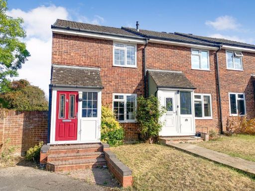 2 bedroom end of terrace house for sale in Ferndale, Hedge End, SO30 — £279,950 • 2 bed • 1 bath • 776 ft²
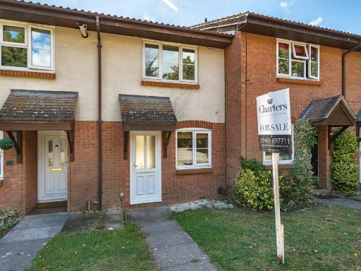 2 bedroom terraced house for sale in Walker Gardens, Hedge End, Southampton, Hampshire, SO30 — £250,000 • 2 bed • 1 bath • 616 ft²
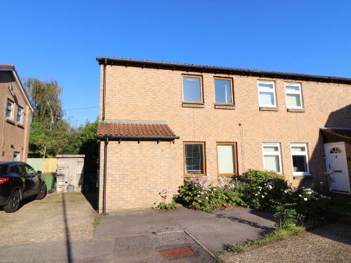 2 bedroom semi-detached house for sale in Hawthorn Close, Hedge End, SO30 — £265,000 • 2 bed • 1 bath • 626 ft²
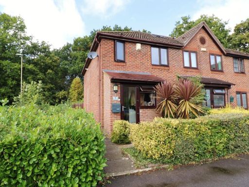 3 bedroom end of terrace house for sale in Charterhouse Way, Hedge End, SO30 — £315,000 • 3 bed • 2 bath • 741 ft²
 2 bedroom terraced house for sale in Goodlands Vale, Hedge End, Southampton, SO30 — £269,000 • 2 bed • 1 bath • 592 ft²
Meta
- {
"@context": "https://schema.org",
"@type": "Residence",
"name": "2 bedroom terraced house for sale in Ferndale, Hedge End, S…",
"description": "",
"url": "https://propertypiper.co.uk/property/531119e3-3f03-4f26-8bf1-12d091f407ef",
"image": "https://image-a.propertypiper.co.uk/d17b3333-d691-4dac-8cfa-a949784a3254-1024.jpeg",
"address": {
"@type": "PostalAddress",
"streetAddress": "37 FERNDALE HEDGE END SOUTHAMPTON",
"postalCode": "SO30 0PP",
"addressLocality": "Eastleigh",
"addressRegion": "Eastleigh",
"addressCountry": "England"
},
"geo": {
"@type": "GeoCoordinates",
"latitude": 50.90670913758617,
"longitude": -1.293340104411264
},
"numberOfRooms": 2,
"numberOfBathroomsTotal": 1,
"floorSize": {
"@type": "QuantitativeValue",
"value": 664,
"unitCode": "FTK"
},
"offers": {
"@type": "Offer",
"price": 275000,
"priceCurrency": "GBP",
"availability": "https://schema.org/InStock"
},
"additionalProperty": [
{
"@type": "PropertyValue",
"name": "Feature",
"value": "modern"
},
{
"@type": "PropertyValue",
"name": "Feature",
"value": "terraced"
},
{
"@type": "PropertyValue",
"name": "Feature",
"value": "two-storey"
},
{
"@type": "PropertyValue",
"name": "Feature",
"value": "brickwork"
},
{
"@type": "PropertyValue",
"name": "Feature",
"value": "white door"
},
{
"@type": "PropertyValue",
"name": "Feature",
"value": "porch"
},
{
"@type": "PropertyValue",
"name": "Feature",
"value": "gabled porch"
},
{
"@type": "PropertyValue",
"name": "Feature",
"value": "front garden"
},
{
"@type": "PropertyValue",
"name": "Feature",
"value": "residential area"
},
{
"@type": "PropertyValue",
"name": "Feature",
"value": "terraced"
},
{
"@type": "PropertyValue",
"name": "Feature",
"value": "mid-20th century"
},
{
"@type": "PropertyValue",
"name": "Feature",
"value": "brick"
},
{
"@type": "PropertyValue",
"name": "Feature",
"value": "outdated"
},
{
"@type": "PropertyValue",
"name": "Feature",
"value": "needs modernization"
},
{
"@type": "PropertyValue",
"name": "Feature",
"value": "garden"
}
]
}
High Res Floorplan Images
Compatible Floorplan Images
FloorplanImages Thumbnail