OL11 3NT - 3 bedroom detached house for sale in THE WOODS, Castleton,…
View on Property Piper
3 bedroom detached house for sale in THE WOODS, Castleton, Rochdale OL11 3NT, OL11
Property Details
- Price: £325000
- Bedrooms: 3
- Bathrooms: 2
- Property Type: undefined
- Property SubType: undefined
Image Descriptions
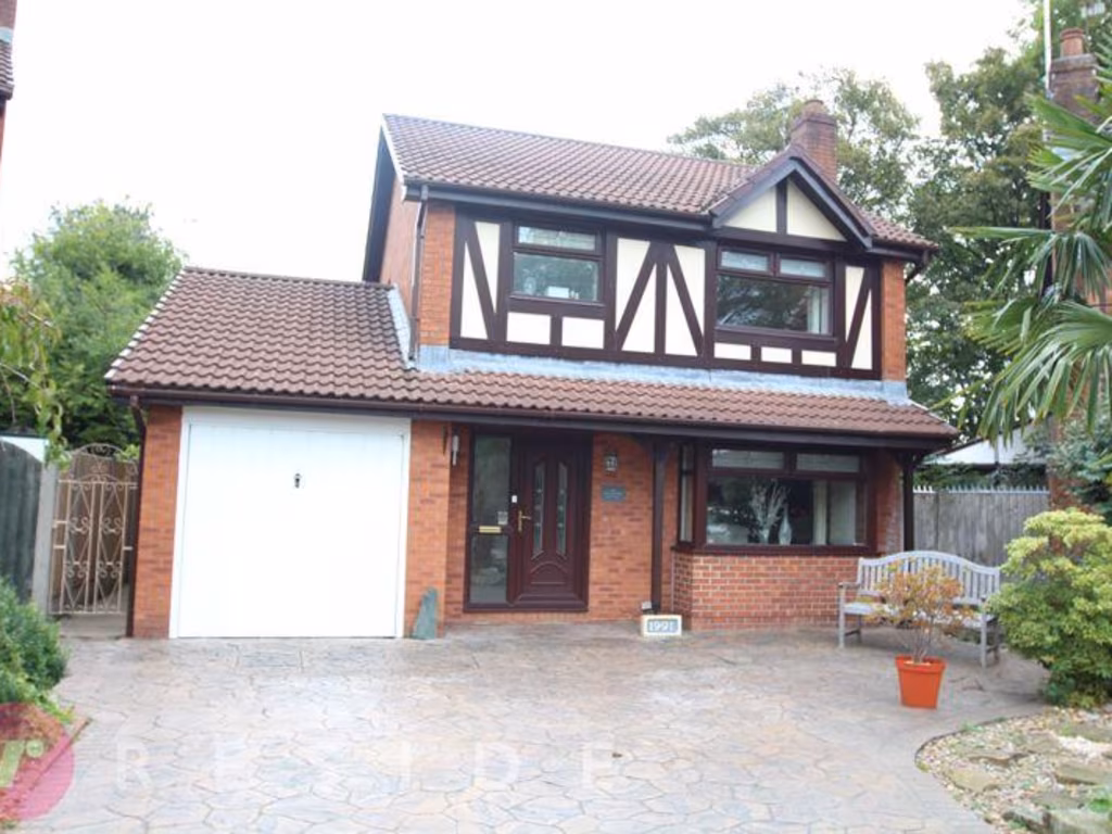
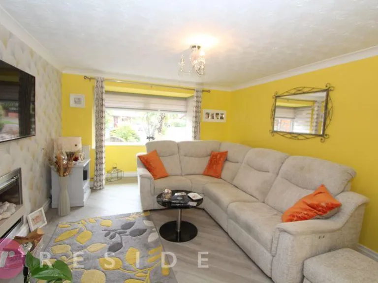
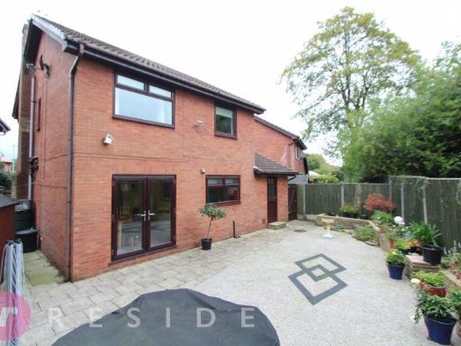
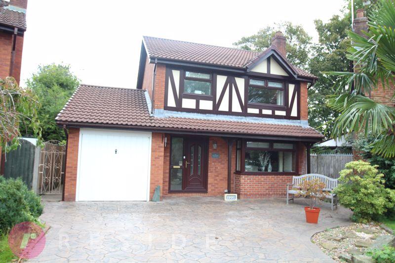
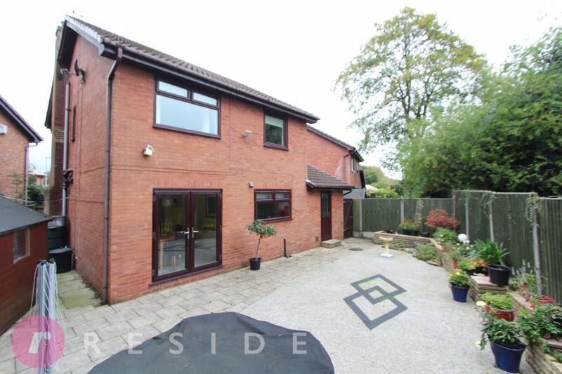
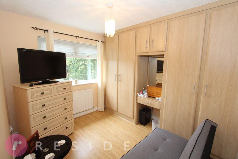
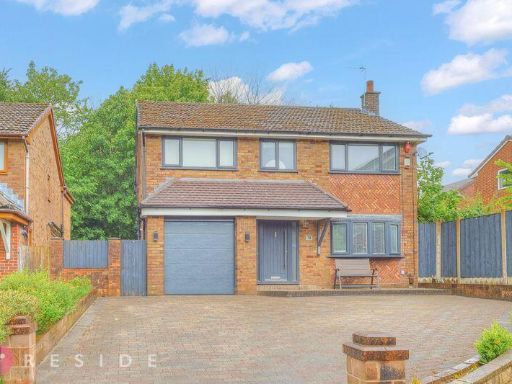
- detached house mock Tudor
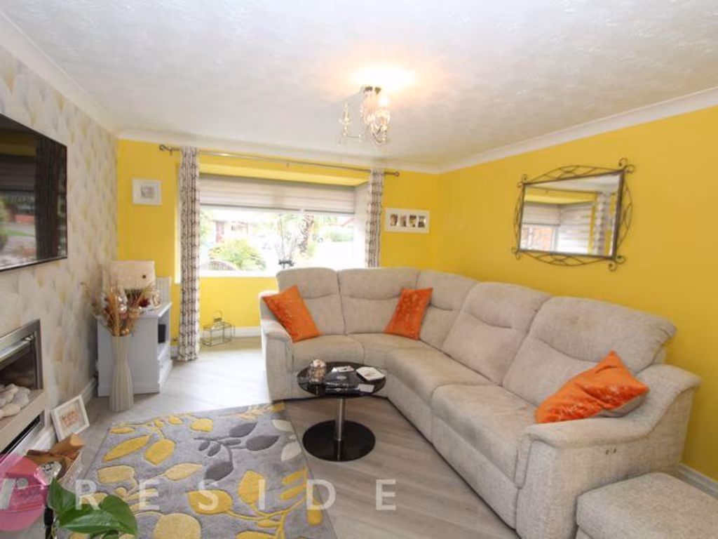
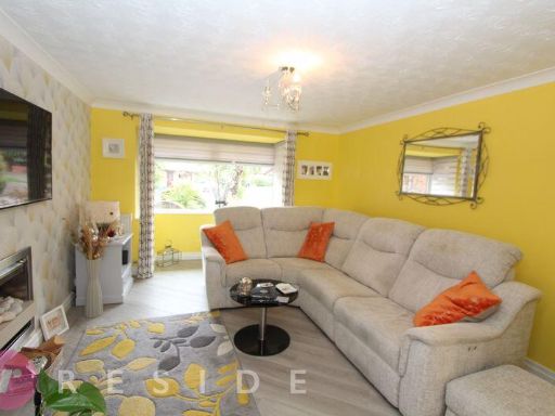
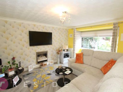
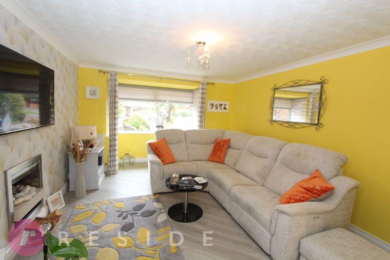
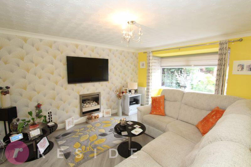
- living room modern
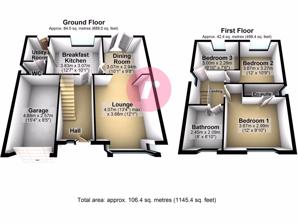
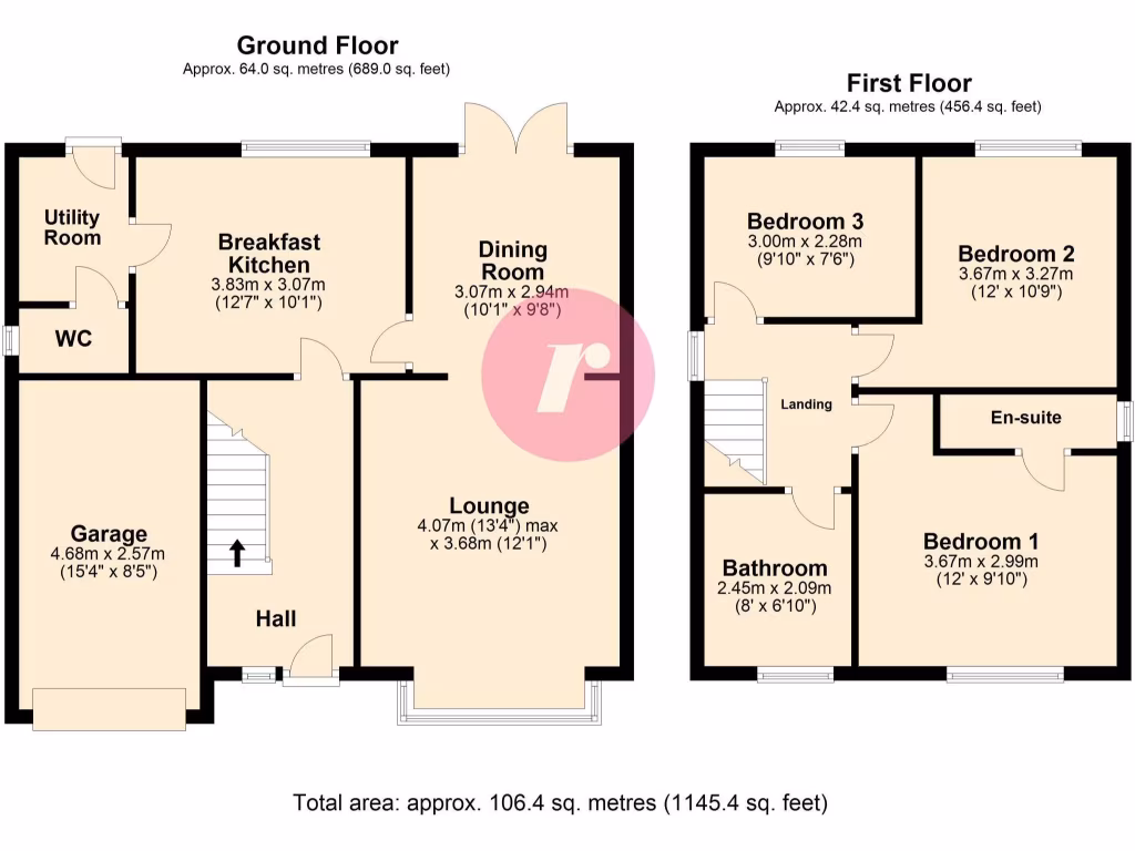
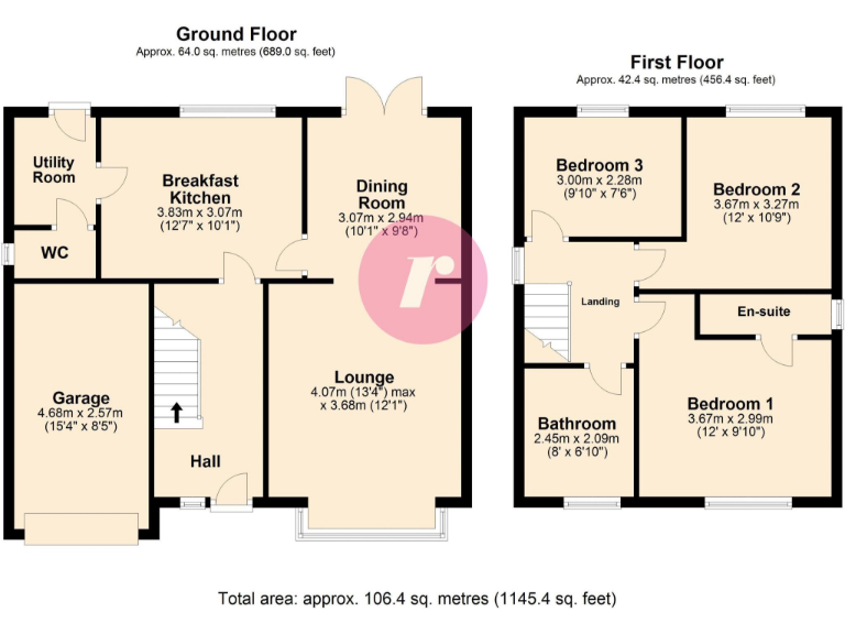
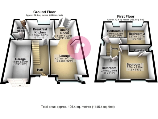
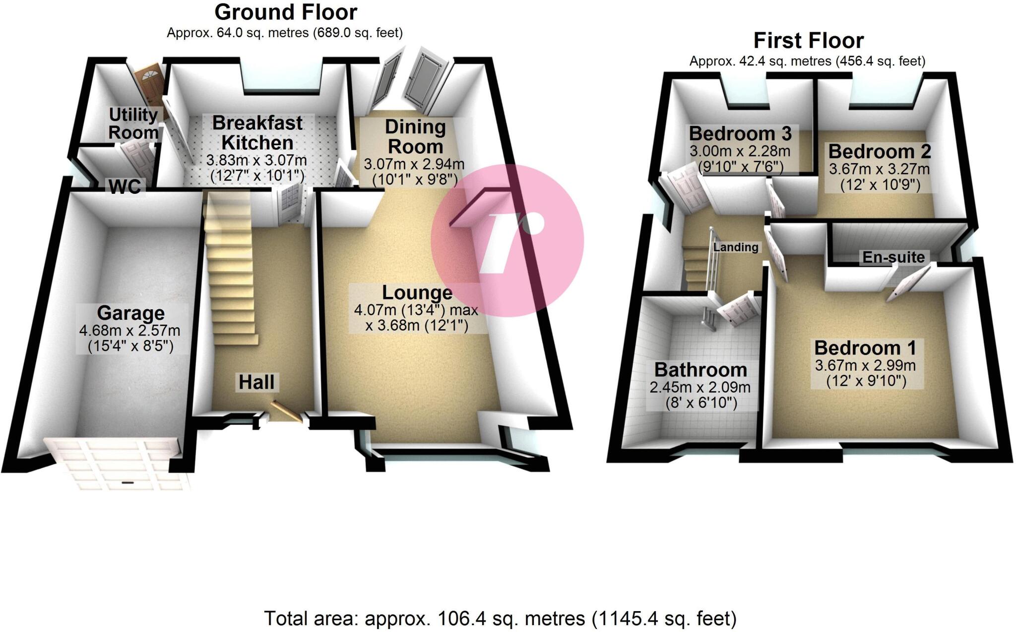
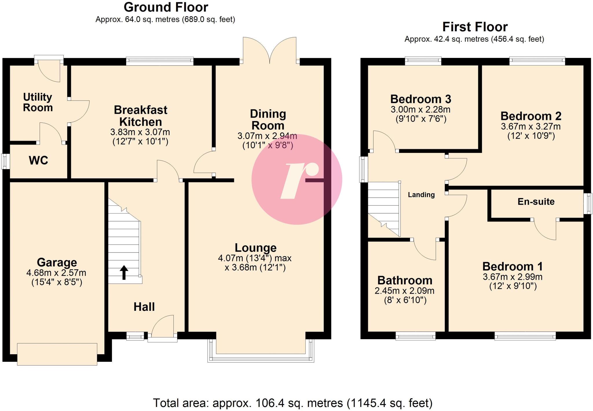
Floorplan Description
- Three-bedroom property with garage
- Two-floor residential property floorplan.
Rooms
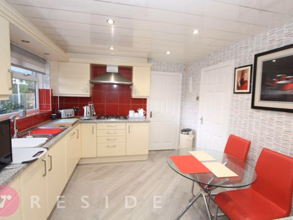
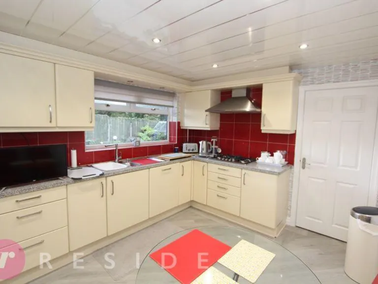
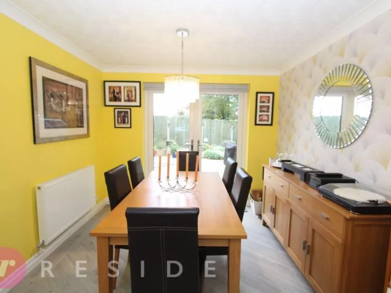
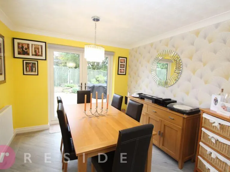
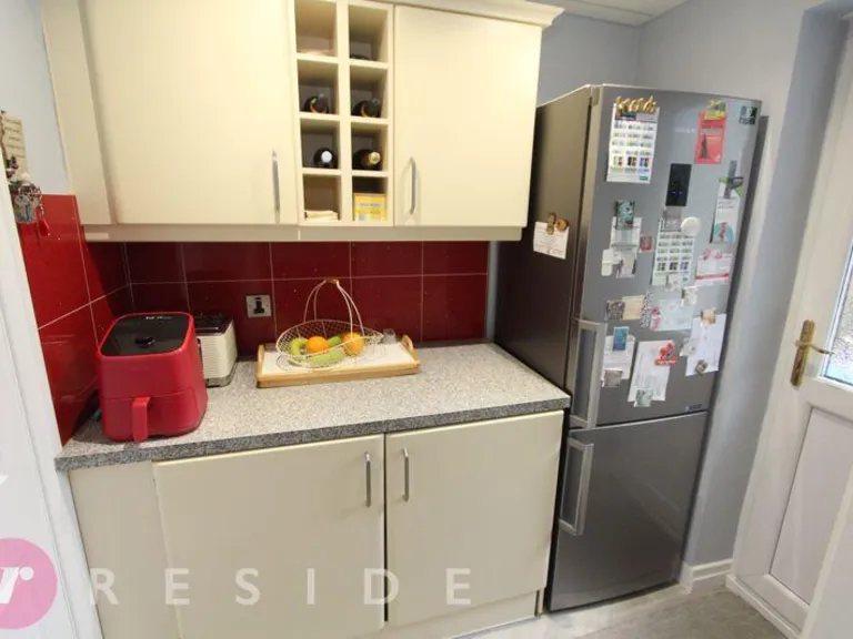
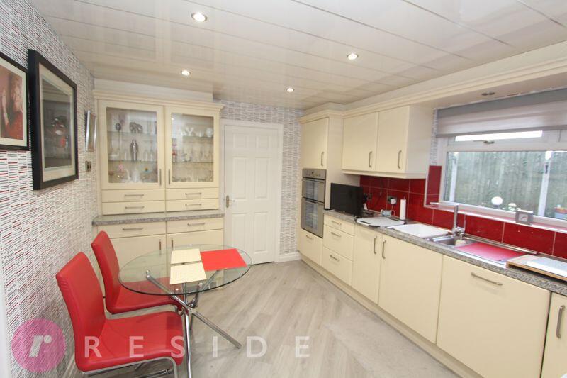
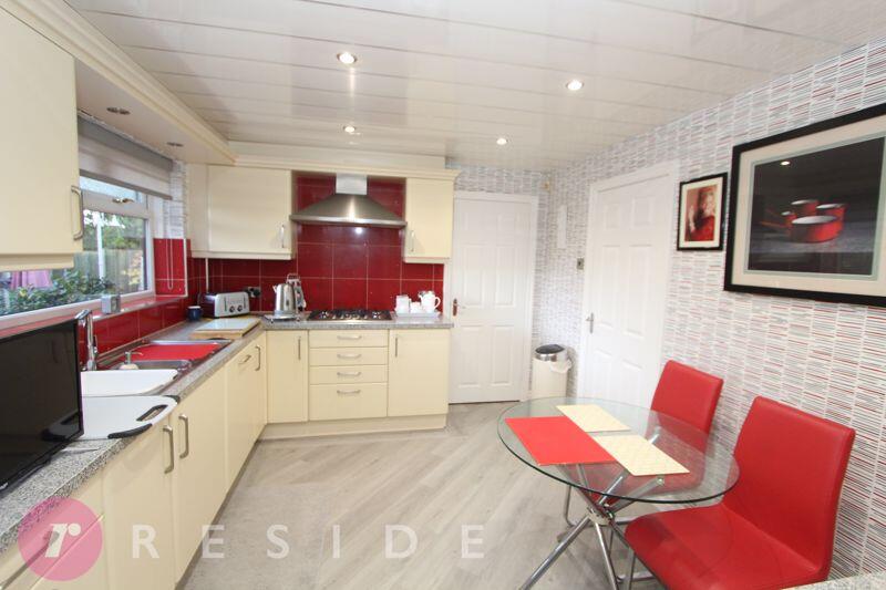
- Breakfast Kitchen:
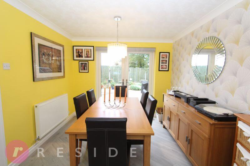
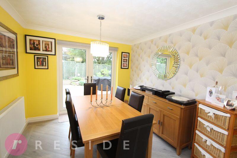
- Dining Room:
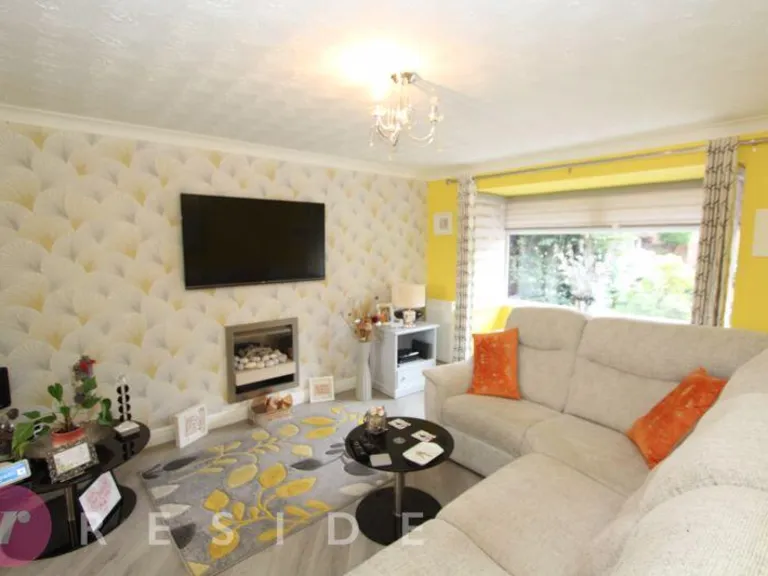
- Lounge:
- Garage:
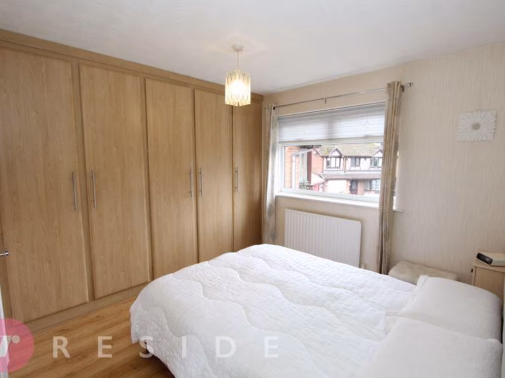
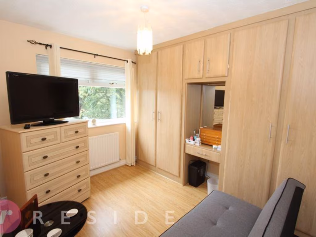
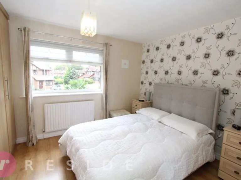
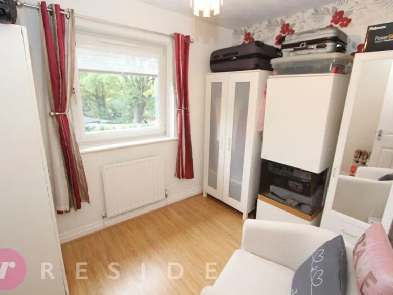
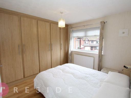
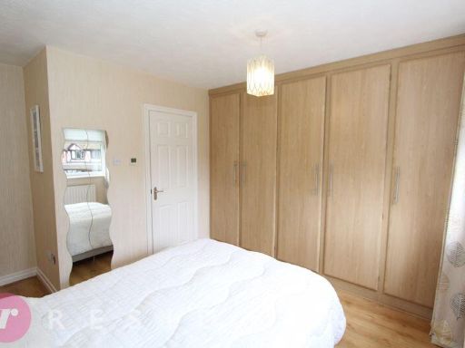
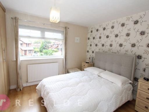
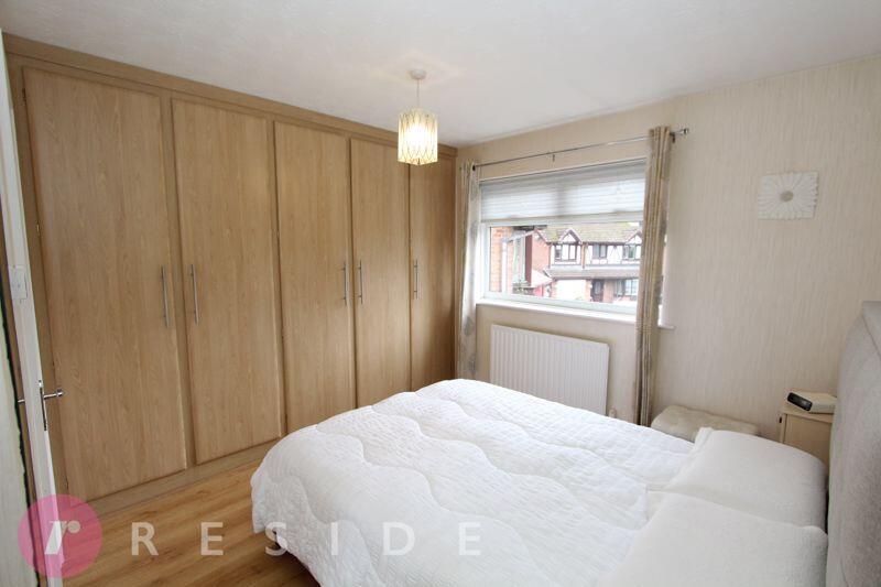
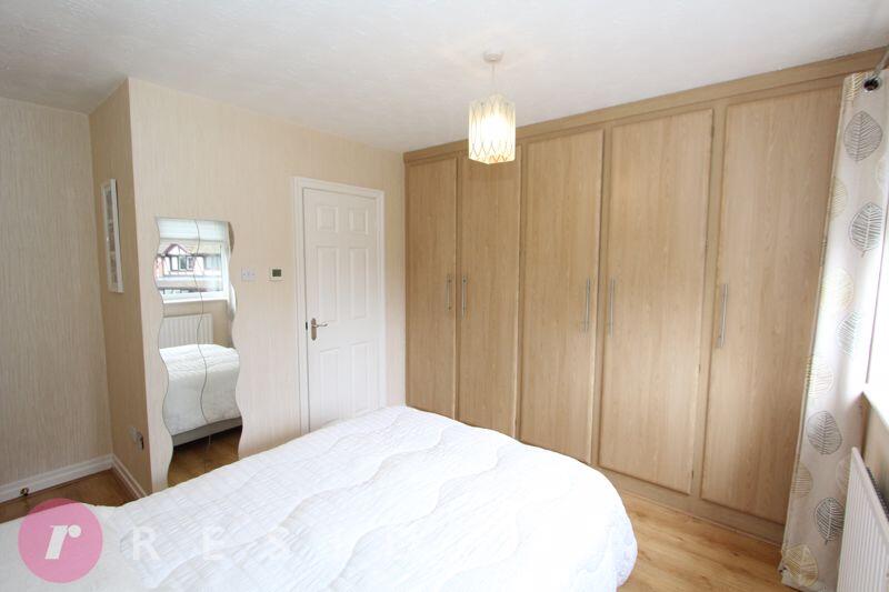
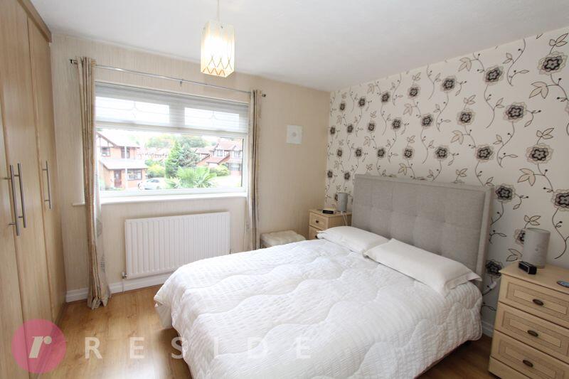
- Bedroom 3:
- Bedroom 2:
- Bedroom 1:
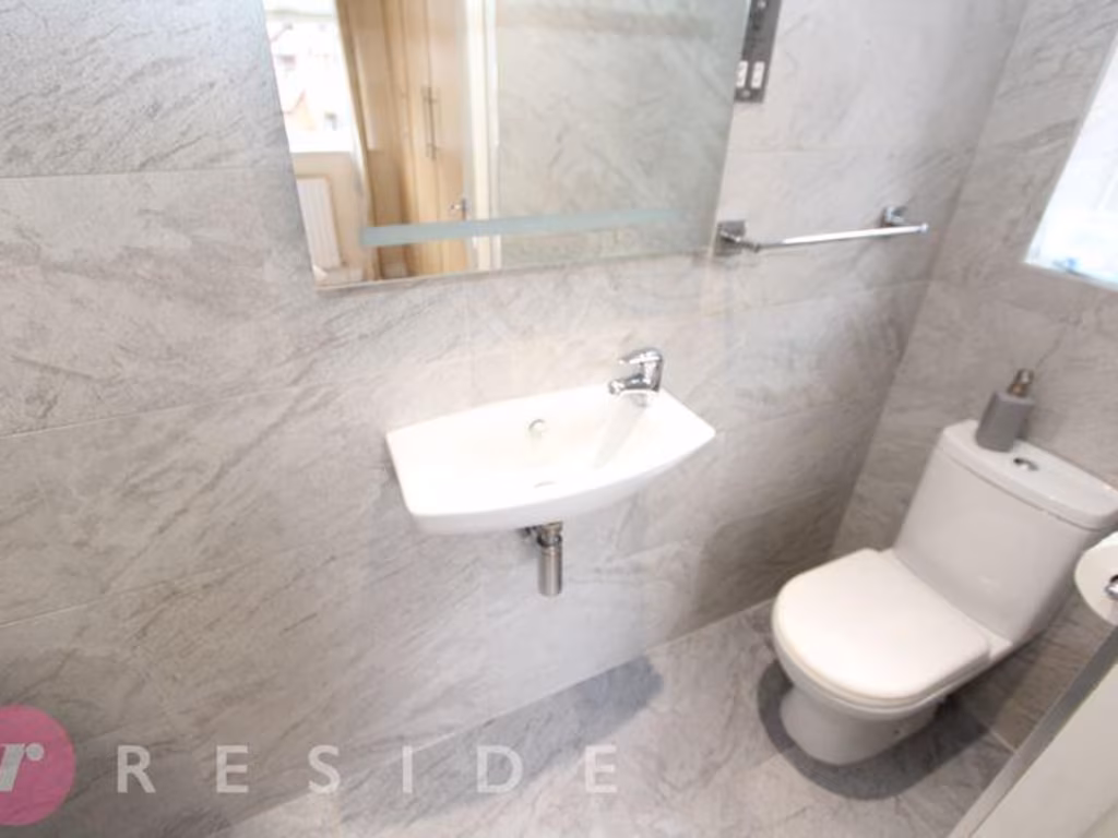
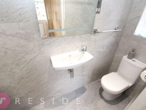
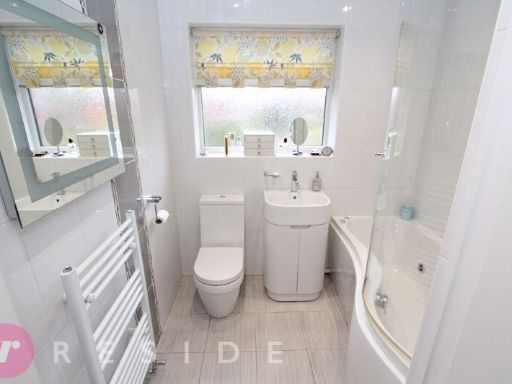
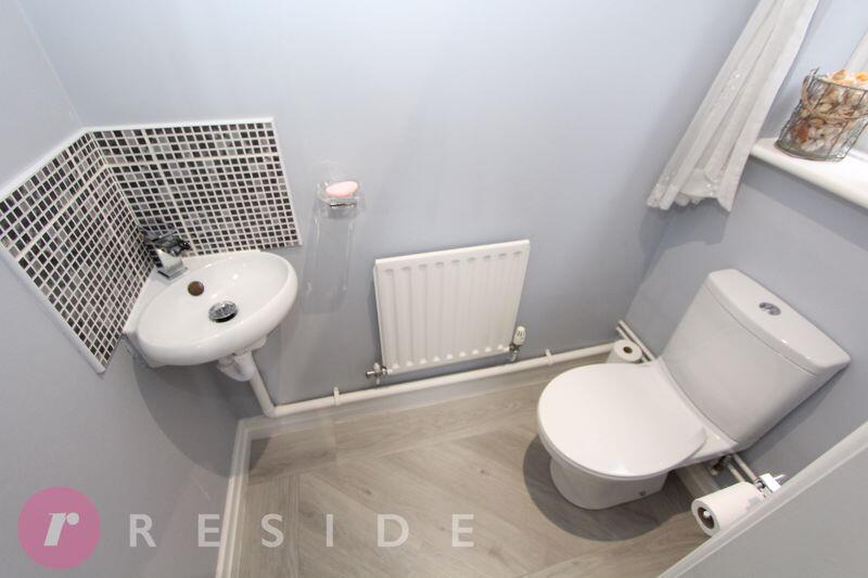
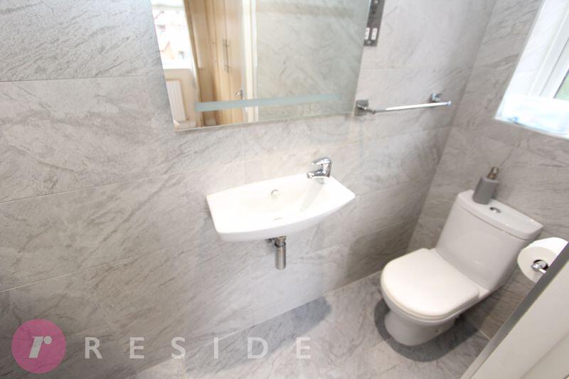
- Bathroom:
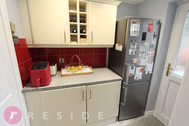
- Utility Room:
- Breakfast Kitchen: average
- Dining Room: average
- Lounge: large
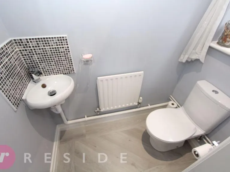
- WC:
- Garage: small
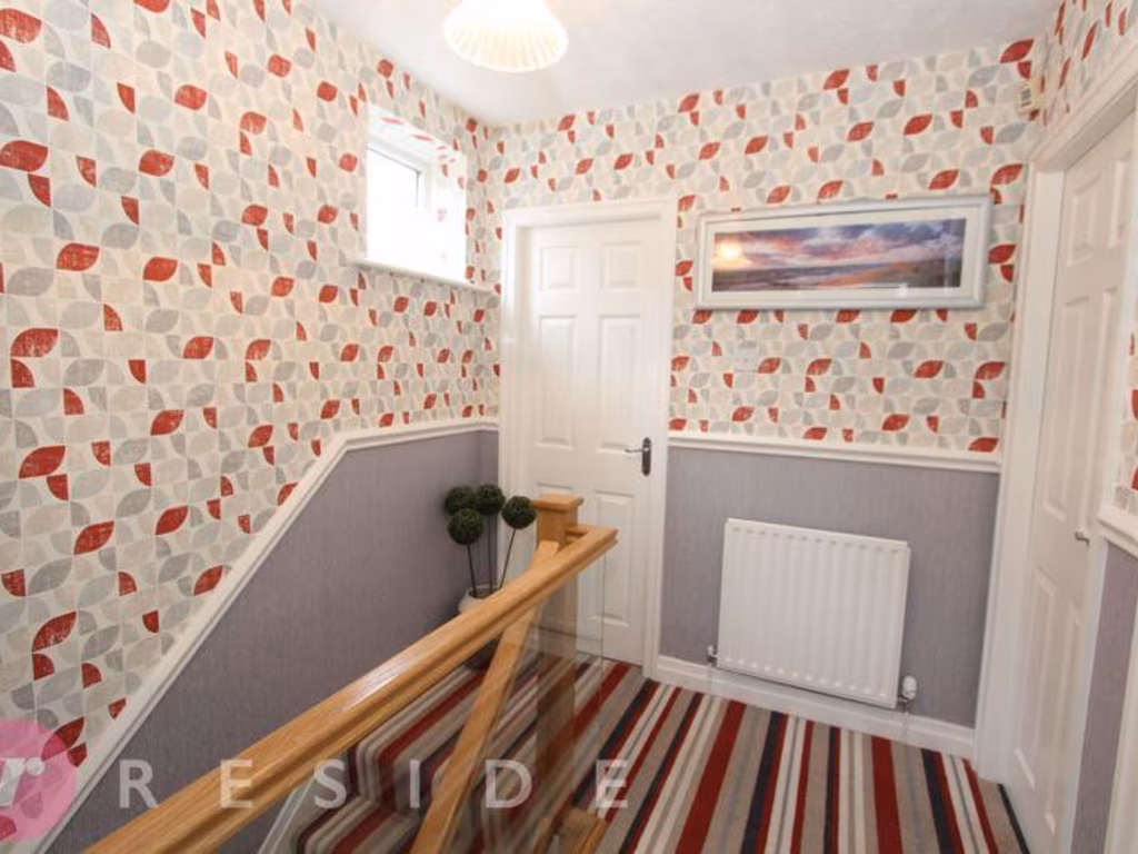
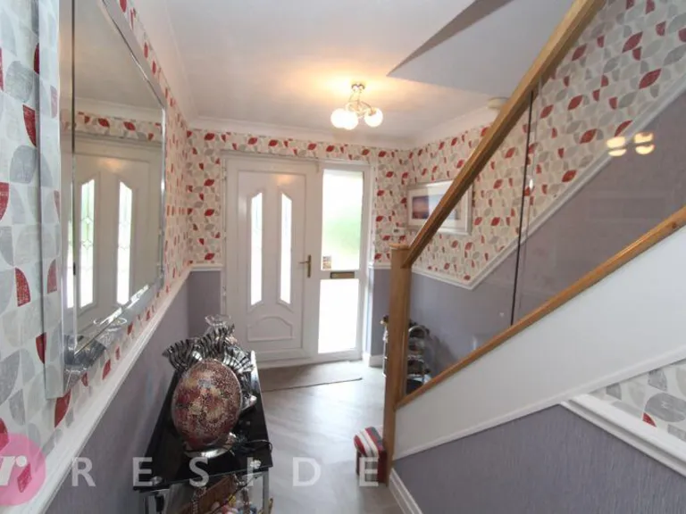
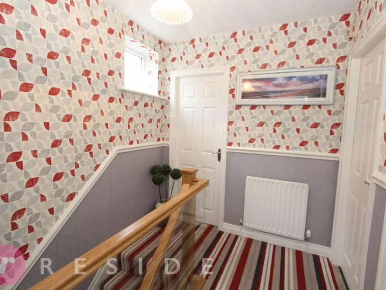
- Hall:
- Bedroom 3: small
- Bedroom 2: average
- Bedroom 1: average
- Bathroom: small
- En-suite:
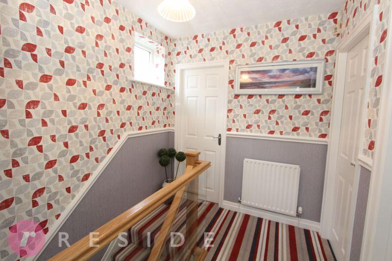
- Landing:
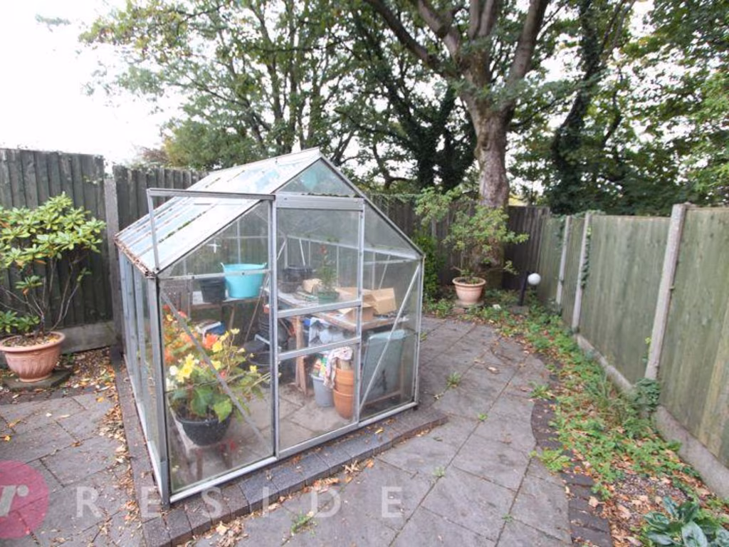
Textual Property Features
Detected Visual Features
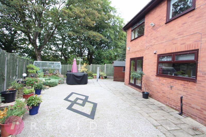
- detached
- mock Tudor
- garage
- two-story
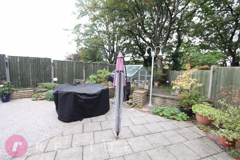
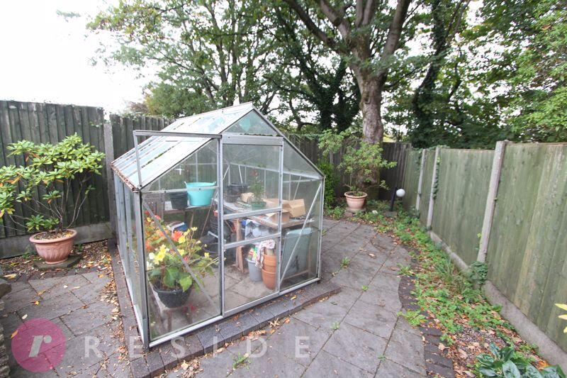
- tree-lined street
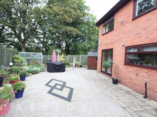
- front garden
- red brick
- bay window
- modern
- living room
- medium size
- standard ceiling
- corner sofa
- neutral color scheme
Nearby Schools
- All Souls Church of England Primary School
- Sandbrook Community Primary School
- Lowerplace Primary School
- Broadfield Community Primary School
- Oulder Hill Leadership Academy
- Spotland Primary School
- Meanwood Community Nursery and Primary School
- Rochdale Islamic Academy
- St Gabriel's Roman Catholic Primary School, Rochdale
- St Edward's Church of England Primary School
- Holy Family Roman Catholic Primary School, Rochdale
- Marland Hill Community Primary School
- Deeplish Primary Academy
- Bamford Academy
- St Mary's Church of England Primary School, Balderstone
- Beech House School
- St John's Roman Catholic Primary School, Rochdale
- Greenbank Primary School
- Castleton Primary School
- Matthew Moss High School
- Ashfield Valley Primary School
- Brimrod Community Primary School
- St Vincent's Roman Catholic Primary School, Rochdale
- Caldershaw Primary School
Nearest Bars And Restaurants
- Id: 696019508
- Tags:
- Amenity: fast_food
- Brand: Subway
- Brand:wikidata: Q244457
- Brand:wikipedia: en:Subway (restaurant)
- Building: yes
- Contact:
- Website: https://restaurants.subway.com/united-kingdom/en/rochdale/unit-9-sandbrook-retail-park
- Cuisine: sandwich
- Name: Subway
- Takeaway: yes
- TagsNormalized:
- fast food
- food
- sandwich
- takeaway
- Lat: 53.6023782
- Lon: -2.1646362
- FullGeoHash: gcw2ywpb2rd2
- PartitionGeoHash: gcw2
- Images:
- FoodStandards: null
- Distance: 748.4
,- Id: 154475182
- Tags:
- Amenity: fast_food
- Brand: McDonald's
- Brand:wikidata: Q38076
- Brand:wikipedia: en:McDonald's
- Building: yes
- Contact:
- Website: https://www.mcdonalds.com/gb/en-gb/location/rochdale/rochdale-sandbrook-park/sandbrook-park-retail-park/8260861.html
- Cuisine: burger
- Drive_through: yes
- Name: McDonald's
- Source: Bing
- Takeaway: yes
- Wheelchair: yes
- TagsNormalized:
- fast food
- food
- mcdonalds
- burgers
- drive through
- takeaway
- Lat: 53.6020123
- Lon: -2.1646473
- FullGeoHash: gcw2ytzy253f
- PartitionGeoHash: gcw2
- Images:
- FoodStandards: null
- Distance: 734.6
,- Id: 4172306316
- Tags:
- TagsNormalized:
- Lat: 53.5942858
- Lon: -2.1727399
- FullGeoHash: gcw2ys9c76zx
- PartitionGeoHash: gcw2
- Images:
- FoodStandards: null
- Distance: 662.1
,- Id: 446218226
- Tags:
- Amenity: cafe
- Brand: Starbucks
- Brand:wikidata: Q37158
- Brand:wikipedia: en:Starbucks
- Building: retail
- Cuisine: coffee_shop
- Name: Starbucks
- Official_name: Starbucks Coffee
- Takeaway: yes
- TagsNormalized:
- cafe
- starbucks
- retail
- coffee
- takeaway
- Lat: 53.604128
- Lon: -2.1701272
- FullGeoHash: gcw2yw7f8mey
- PartitionGeoHash: gcw2
- Images:
- FoodStandards: null
- Distance: 566.9
,- Id: 2210473286
- Tags:
- Amenity: pub
- Name: Waggon and Horses
- TagsNormalized:
- Lat: 53.6040623
- Lon: -2.1737056
- FullGeoHash: gcw2yw34kcrw
- PartitionGeoHash: gcw2
- Images:
- FoodStandards: null
- Distance: 458.4
}
Nearest General Shops
- Id: 4186083237
- Tags:
- TagsNormalized:
- Lat: 53.5960619
- Lon: -2.1813593
- FullGeoHash: gcw2ykgedwhd
- PartitionGeoHash: gcw2
- Images:
- FoodStandards: null
- Distance: 597.9
,- Id: 1641508755
- Tags:
- Brand: Peugeot
- Brand:wikidata: Q6742
- Name: Peugeot
- Shop: car
- TagsNormalized:
- Lat: 53.6028469
- Lon: -2.1697042
- FullGeoHash: gcw2ywh54nzk
- PartitionGeoHash: gcw2
- Images:
- FoodStandards: null
- Distance: 481.8
,- Id: 1641508750
- Tags:
- Brand: Toyota
- Name: RRG Rochdale
- Shop: car;car_repair
- TagsNormalized:
- toyota
- car repair
- repair
- shop
- Lat: 53.6028087
- Lon: -2.1711633
- FullGeoHash: gcw2yw54bpz2
- PartitionGeoHash: gcw2
- Images:
- FoodStandards: null
- Distance: 409.9
}
Nearest Grocery shops
- Id: 359735286
- Tags:
- Building: yes
- Name: The Co-operative Food
- Operator: The Co-operative Group
- Shop: supermarket
- TagsNormalized:
- the co-operative food
- food
- shop
- Lat: 53.5901233
- Lon: -2.1765021
- FullGeoHash: gcw2y7z15g43
- PartitionGeoHash: gcw2
- Images:
- FoodStandards: null
- Distance: 1106.4
,- Id: 4172305902
- Tags:
- TagsNormalized:
- Lat: 53.5913582
- Lon: -2.1720157
- FullGeoHash: gcw2ys42k35x
- PartitionGeoHash: gcw2
- Images:
- FoodStandards: null
- Distance: 989.8
,- Id: 446218229
- Tags:
- Brand: Spar
- Brand:wikidata: Q610492
- Brand:wikipedia: en:Spar (retailer)
- Building: retail
- Name: Spar
- Shop: convenience
- TagsNormalized:
- spar
- retail
- convenience
- shop
- Lat: 53.6041555
- Lon: -2.1707102
- FullGeoHash: gcw2yw76ffc4
- PartitionGeoHash: gcw2
- Images:
- FoodStandards: null
- Distance: 547.3
}
Nearest Religious buildings
- Id: 883175190
- Tags:
- Amenity: place_of_worship
- Anglican: Church of England
- Building: church
- Denomination: anglican
- Name: St. Thomas's
- Religion: christian
- Wikidata: Q105100650
- TagsNormalized:
- place of worship
- church
- anglican
- christian
- Lat: 53.5955656
- Lon: -2.1605261
- FullGeoHash: gcw2yufbb1df
- PartitionGeoHash: gcw2
- Images:
- FoodStandards: null
- Distance: 1093.5
,- Id: 250535415
- Tags:
- Addr:
- Postcode: OL11 3AR
- Street: Hanover Street
- Amenity: school
- Fhrs:
- Name: Saint Edwards Church of England Primary School
- Ref:
- Source: Bing
- Source:addr: FHRS Open Data
- Source:name: FHRS Open Data
- Wikidata: Q66135524
- TagsNormalized:
- Lat: 53.5923556
- Lon: -2.1818099
- FullGeoHash: gcw2yk5q05ht
- PartitionGeoHash: gcw2
- Images:
- FoodStandards:
- Id: 103596
- FHRSID: 103596
- LocalAuthorityBusinessID: 3489
- BusinessName: Heritage Kitchen Range Of Preserves
- BusinessType: Retailers - other
- BusinessTypeID: 4613
- AddressLine1: 26 Burnley Road
- AddressLine2: Bacup
- AddressLine3: Lancashire
- AddressLine4: null
- PostCode: OL13 8AB
- RatingValue: 5
- RatingKey: fhrs_5_en-GB
- RatingDate: 2020-01-13
- LocalAuthorityCode: 204
- LocalAuthorityName: Rossendale
- LocalAuthorityWebSite: http://www.rossendale.gov.uk
- LocalAuthorityEmailAddress: envhealth@rossendalebc.gov.uk
- Scores:
- Hygiene: 5
- Structural: 5
- ConfidenceInManagement: 5
- NewRatingPending: false
- Geocode:
- Longitude: -2.20232500000000
- Latitude: 53.70418600000000
- Distance: 957.7
,- Id: 837060893
- Tags:
- Amenity: place_of_worship
- Building: church
- Denomination: anglican
- Name: St Aidan
- Religion: christian
- Wikidata: Q17534422
- TagsNormalized:
- place of worship
- church
- anglican
- christian
- Lat: 53.6012108
- Lon: -2.1780774
- FullGeoHash: gcw2ymvcxjgu
- PartitionGeoHash: gcw2
- Images:
- FoodStandards: null
- Distance: 225.6
}
Nearest Medical buildings
- Id: 878928336
- Tags:
- Amenity: hospital
- Healthcare: hospital
- Name: Nye Bevan House
- TagsNormalized:
- Lat: 53.6106915
- Lon: -2.1553744
- FullGeoHash: gcw2yzw8bjhr
- PartitionGeoHash: gcw2
- Images:
- FoodStandards: null
- Distance: 1767.8
,- Id: 4172314770
- Tags:
- TagsNormalized:
- Lat: 53.5904794
- Lon: -2.1773262
- FullGeoHash: gcw2y7ye0t7v
- PartitionGeoHash: gcw2
- Images:
- FoodStandards: null
- Distance: 1072.4
,- Id: 944859475
- Tags:
- Addr:
- City: Rochdale
- Postcode: OL11 4LZ
- Street: Manchester Road
- Amenity: hospital
- Name: The Highfield Hospital
- Operator: BMI
- TagsNormalized:
- Lat: 53.6067716
- Lon: -2.1673272
- FullGeoHash: gcw2ywvf1de8
- PartitionGeoHash: gcw2
- Images:
- FoodStandards: null
- Distance: 913.4
,- Id: 1135460930
- Tags:
- Building: yes
- Leisure: fitness_centre
- Name: Castleton Health and Leisure Centre
- TagsNormalized:
- fitness
- fitness centre
- leisure
- health
- Lat: 53.595175
- Lon: -2.1820762
- FullGeoHash: gcw2yken9by0
- PartitionGeoHash: gcw2
- Images:
- FoodStandards: null
- Distance: 703.4
}
Nearest Airports
- Id: 1224469
- Tags:
- Addr:
- City: Manchester
- Country: GB
- Postcode: M90 1QX
- Aerodrome: international
- Aeroway: aerodrome
- Arp: yes
- Atis: 128.175
- Iata: MAN
- Icao: EGCC
- Name: Manchester Airport
- Note: rough sketched outline referring to Yahoo imagery - true boundary is where?
- Old_name: Ringway
- Operator: Manchester Airport PLC
- Size: 18720000
- Source:
- Tower_frequency: 118.625,119.400
- Type: multipolygon
- Website: https://www.manchesterairport.co.uk/
- Wikidata: Q8694
- Wikipedia: en:Manchester Airport
- TagsNormalized:
- airport
- international airport
- Lat: 53.3503197
- Lon: -2.2798822
- FullGeoHash: gcqrs05u4ukt
- PartitionGeoHash: gcqr
- Images:
- FoodStandards: null
- Distance: 28618.3
}
Nearest Leisure Facilities
- Id: 1658835683
- Tags:
- Brand: PureGym
- Brand:wikidata: Q18345898
- Brand:wikipedia: en:PureGym
- Contact:
- Website: https://www.puregym.com/gyms/rochdale/
- Leisure: fitness_centre
- Name: PureGym
- TagsNormalized:
- puregym
- fitness
- fitness centre
- leisure
- Lat: 53.6026517
- Lon: -2.1655301
- FullGeoHash: gcw2ywp456x8
- PartitionGeoHash: gcw2
- Images:
- FoodStandards: null
- Distance: 705.3
,- Id: 944859485
- Tags:
- Leisure: pitch
- Sport: soccer
- Surface: grass
- TagsNormalized:
- Lat: 53.6056206
- Lon: -2.1702701
- FullGeoHash: gcw2yweem5cq
- PartitionGeoHash: gcw2
- Images:
- FoodStandards: null
- Distance: 702.3
,- Id: 5007976
- Tags:
- Leisure: park
- Surface: grass
- TagsNormalized:
- Lat: 53.5988265
- Lon: -2.1839515
- FullGeoHash: gcw2ym3ey1rw
- PartitionGeoHash: gcw2
- Images:
- FoodStandards: null
- Distance: 588.3
,- Id: 5007981
- Tags:
- Leisure: park
- Surface: grass
- TagsNormalized:
- Lat: 53.6004008
- Lon: -2.1819302
- FullGeoHash: gcw2ymehvqfv
- PartitionGeoHash: gcw2
- Images:
- FoodStandards: null
- Distance: 440.8
,- Id: 405370270
- Tags:
- TagsNormalized:
- Lat: 53.6018684
- Lon: -2.1800621
- FullGeoHash: gcw2ymut8b7z
- PartitionGeoHash: gcw2
- Images:
- FoodStandards: null
- Distance: 375.2
}
Nearest Tourist attractions
- Id: 247043990
- Tags:
- Building: yes
- Name: Touchstones
- Tourism: museum
- Wheelchair: yes
- Wikidata: Q7828737
- TagsNormalized:
- Lat: 53.6151097
- Lon: -2.1620867
- FullGeoHash: gcw3nb3desz7
- PartitionGeoHash: gcw3
- Images:
- FoodStandards: null
- Distance: 1887.5
,- Id: 416486996
- Tags:
- TagsNormalized:
- Lat: 53.5844297
- Lon: -2.1765016
- FullGeoHash: gcw2y6xpgvdv
- PartitionGeoHash: gcw2
- Images:
- FoodStandards: null
- Distance: 1738.4
,- Id: 4874412221
- Tags:
- Addr:
- Housenumber: 11
- Street: Perry Close
- Name: Our House
- Tourism: guest_house
- TagsNormalized:
- Lat: 53.6058254
- Lon: -2.1689698
- FullGeoHash: gcw2ywsse64u
- PartitionGeoHash: gcw2
- Images:
- FoodStandards: null
- Distance: 765.5
}
Nearest Hotels
- Id: 256646449
- Tags:
- Addr:
- Housenumber: 470
- Postcode: OL11 5EU
- Street: Bury Road
- Amenity: pub
- Building: yes
- Fhrs:
- Name: Cemetery Hotel
- Source:
- Wikidata: Q26673106
- TagsNormalized:
- Lat: 53.6133413
- Lon: -2.181717
- FullGeoHash: gcw3n252671y
- PartitionGeoHash: gcw3
- Images:
- FoodStandards: null
- Distance: 1538.1
,- Id: 1065906623
- Tags:
- Addr:
- City: Rochdale
- Postcode: OL11 1RY
- Street: Sandbrook Way
- Brand: Travelodge
- Brand:wikidata: Q9361374
- Building: yes
- Fhrs:
- Authority: Rochdale
- Id: 1288738
- Local_authority_id: 143485
- Internet_access: wlan
- Internet_access:fee: customers
- Internet_access:ssid: Travelodge WiFi
- Name: Travelodge Rochdale
- Tourism: hotel
- TagsNormalized:
- Lat: 53.6009899
- Lon: -2.1645844
- FullGeoHash: gcw2ytzb3s8z
- PartitionGeoHash: gcw2
- Images:
- FoodStandards: null
- Distance: 713.3
,- Id: 4186083252
- Tags:
- TagsNormalized:
- Lat: 53.5983413
- Lon: -2.1802811
- FullGeoHash: gcw2ymk2gybx
- PartitionGeoHash: gcw2
- Images:
- FoodStandards: null
- Distance: 380.8
}
Tags
- detached
- mock Tudor
- garage
- two-story
- tree-lined street
- front garden
- red brick
- bay window
- modern
- living room
- medium size
- standard ceiling
- bay window
- corner sofa
- neutral color scheme
Local Market Stats
- Average Price/sqft: £198
- Avg Income: £38900
- Rental Yield: 5.2%
- Social Housing: 17%
- Planning Success Rate: 48%
Similar Properties
 4 bedroom detached house for sale in LAWNSWOOD, Castleton, Rochdale, OL11 3HB, OL11 — £425,000 • 4 bed • 2 bath • 1538 ft²
 4 bedroom detached house for sale in The Green, Castleton, Rochdale, Greater Manchester, OL11 — £370,000 • 4 bed • 2 bath • 1164 ft²
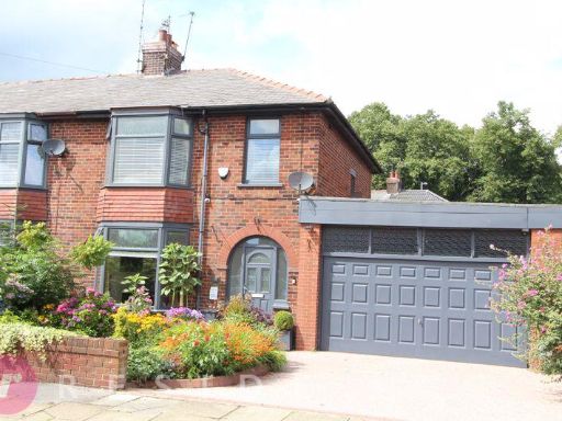 3 bedroom semi-detached house for sale in BATTERSBY STREET, Bamford, Rochdale OL11 4DE, OL11 — £325,000 • 3 bed • 1 bath • 1811 ft²
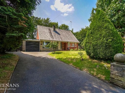 3 bedroom detached bungalow for sale in Gipsy Lane, Castleton, Rochdale, OL11 — £375,000 • 3 bed • 1 bath • 1238 ft²
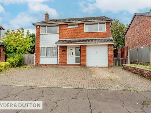 4 bedroom detached house for sale in Lawnswood, Castleton, Rochdale, Greater Manchester, OL11 — £395,000 • 4 bed • 3 bath • 1451 ft²
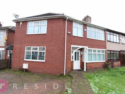 4 bedroom semi-detached house for sale in BOLTON ROAD, Marland, Rochdale OL11 3NG, OL11 — £300,000 • 4 bed • 1 bath • 1387 ft²
Meta
- {
"@context": "https://schema.org",
"@type": "Residence",
"name": "3 bedroom detached house for sale in THE WOODS, Castleton,…",
"description": "",
"url": "https://propertypiper.co.uk/property/52cf282a-b904-4ce8-ab7b-c55089ae297c",
"image": "https://image-a.propertypiper.co.uk/8fa75f81-2fef-494c-a66d-b360b36a67f9-1024.jpeg",
"address": {
"@type": "PostalAddress",
"streetAddress": "997 THE WOODS, Castleton, Rochdale OL11 3NT",
"postalCode": "OL11 3NT",
"addressLocality": "Rochdale",
"addressRegion": "Heywood and Middleton",
"addressCountry": "England"
},
"geo": {
"@type": "GeoCoordinates",
"latitude": 53.60004667286153,
"longitude": -2.1752765612492704
},
"numberOfRooms": 3,
"numberOfBathroomsTotal": 2,
"floorSize": {
"@type": "QuantitativeValue",
"value": 1906,
"unitCode": "FTK"
},
"offers": {
"@type": "Offer",
"price": 325000,
"priceCurrency": "GBP",
"availability": "https://schema.org/InStock"
},
"additionalProperty": [
{
"@type": "PropertyValue",
"name": "Feature",
"value": "detached"
},
{
"@type": "PropertyValue",
"name": "Feature",
"value": "mock Tudor"
},
{
"@type": "PropertyValue",
"name": "Feature",
"value": "garage"
},
{
"@type": "PropertyValue",
"name": "Feature",
"value": "two-story"
},
{
"@type": "PropertyValue",
"name": "Feature",
"value": "tree-lined street"
},
{
"@type": "PropertyValue",
"name": "Feature",
"value": "front garden"
},
{
"@type": "PropertyValue",
"name": "Feature",
"value": "red brick"
},
{
"@type": "PropertyValue",
"name": "Feature",
"value": "bay window"
},
{
"@type": "PropertyValue",
"name": "Feature",
"value": "modern"
},
{
"@type": "PropertyValue",
"name": "Feature",
"value": "living room"
},
{
"@type": "PropertyValue",
"name": "Feature",
"value": "medium size"
},
{
"@type": "PropertyValue",
"name": "Feature",
"value": "standard ceiling"
},
{
"@type": "PropertyValue",
"name": "Feature",
"value": "bay window"
},
{
"@type": "PropertyValue",
"name": "Feature",
"value": "corner sofa"
},
{
"@type": "PropertyValue",
"name": "Feature",
"value": "neutral color scheme"
}
]
}
High Res Floorplan Images
Compatible Floorplan Images
FloorplanImages Thumbnail