WF10 3QN - 4 bedroom detached house for sale in Hillcrest Drive, Townv…
View on Property Piper
4 bedroom detached house for sale in Hillcrest Drive, Townville, Castleford, West Yorkshire, Wakefield, WF10
Property Details
- Price: £474995
- Bedrooms: 4
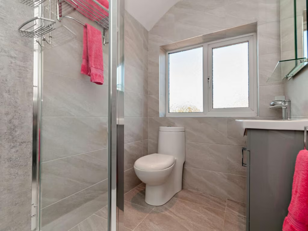
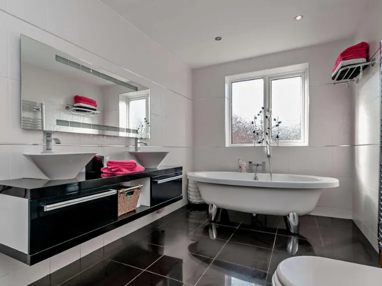
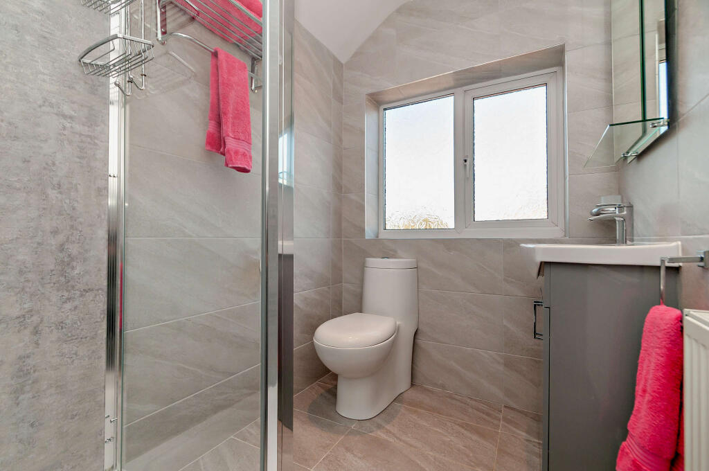
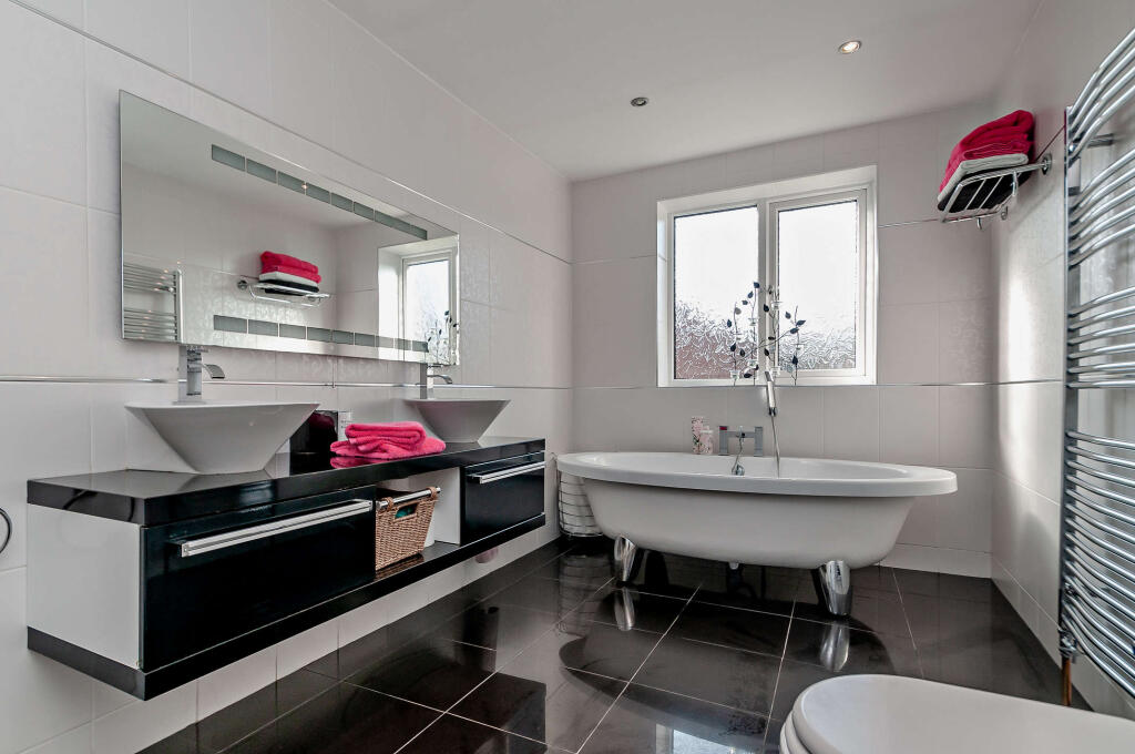
- Bathrooms: 2
- Property Type: undefined
- Property SubType: undefined
Image Descriptions
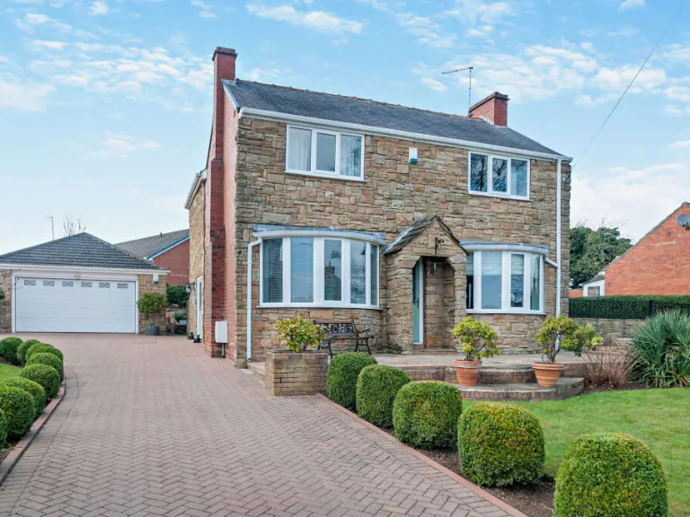
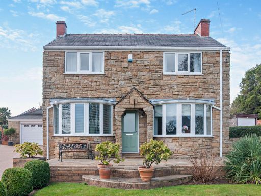
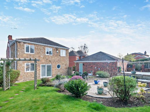
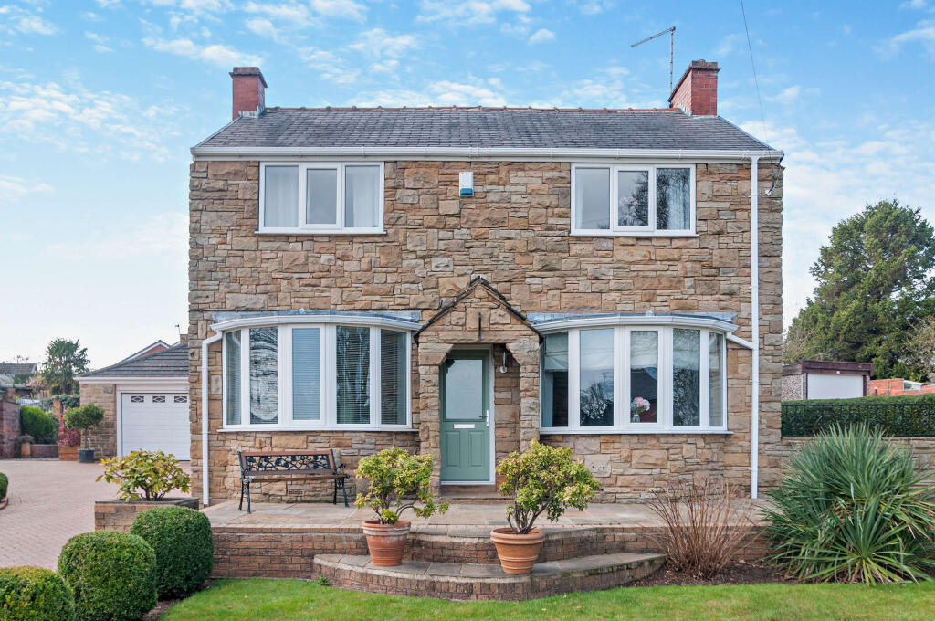
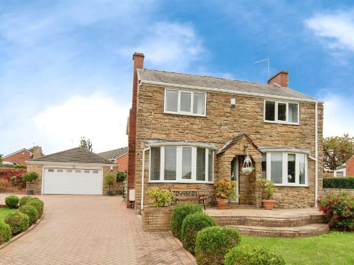
- two-story detached house suburban traditional
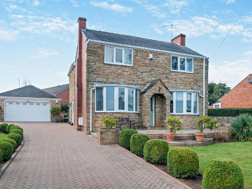
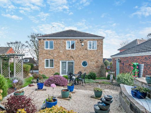
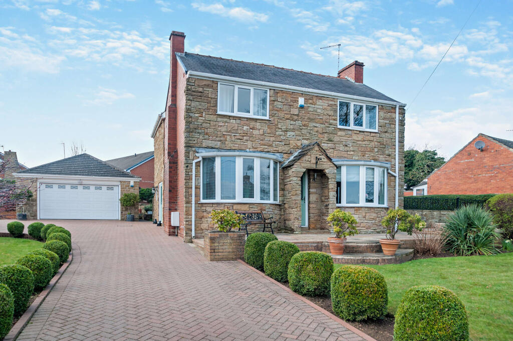
- detached house mid-20th century
Floorplan Description
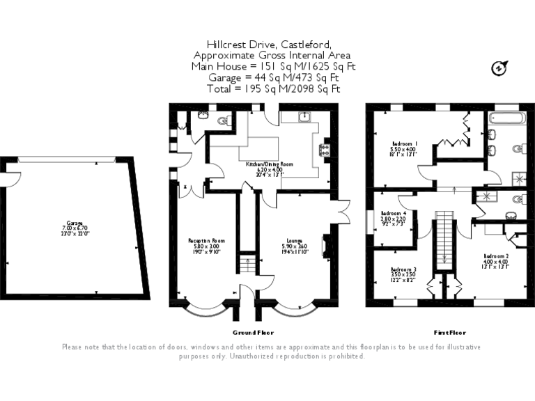
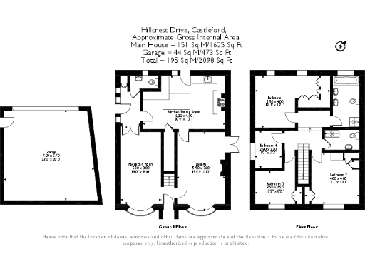
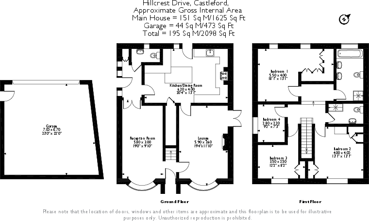
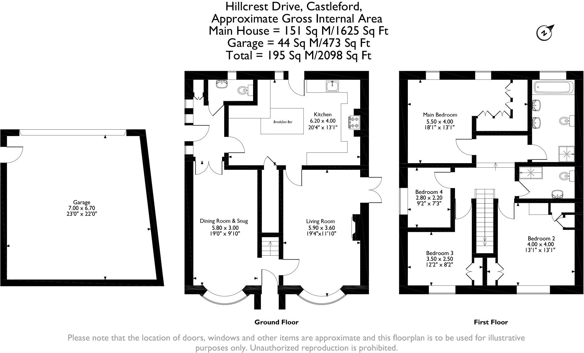
- A functional single-story home with three bedrooms and ample living space.
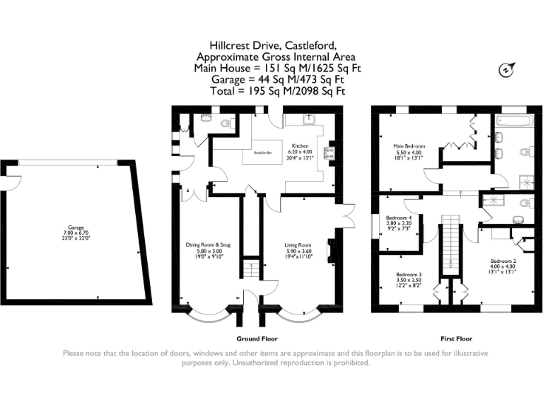
- Detached house on Hillcrest Drive, Castleford (main house internal area shown separately).
Rooms
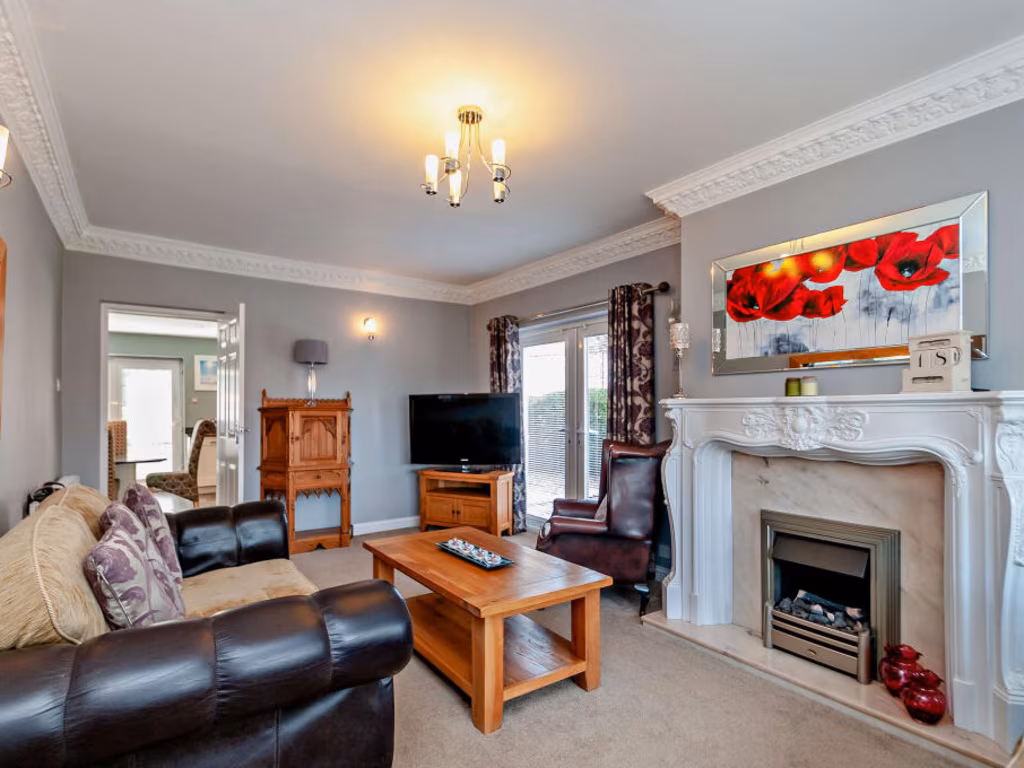
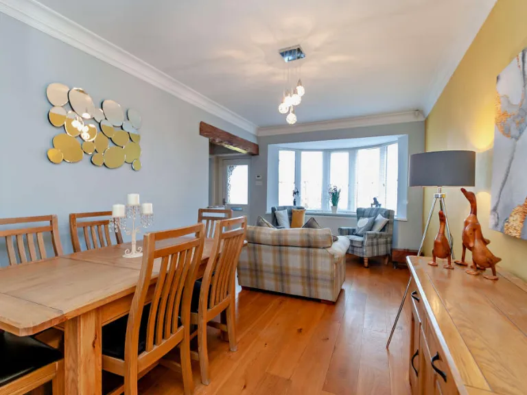
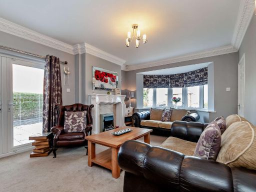
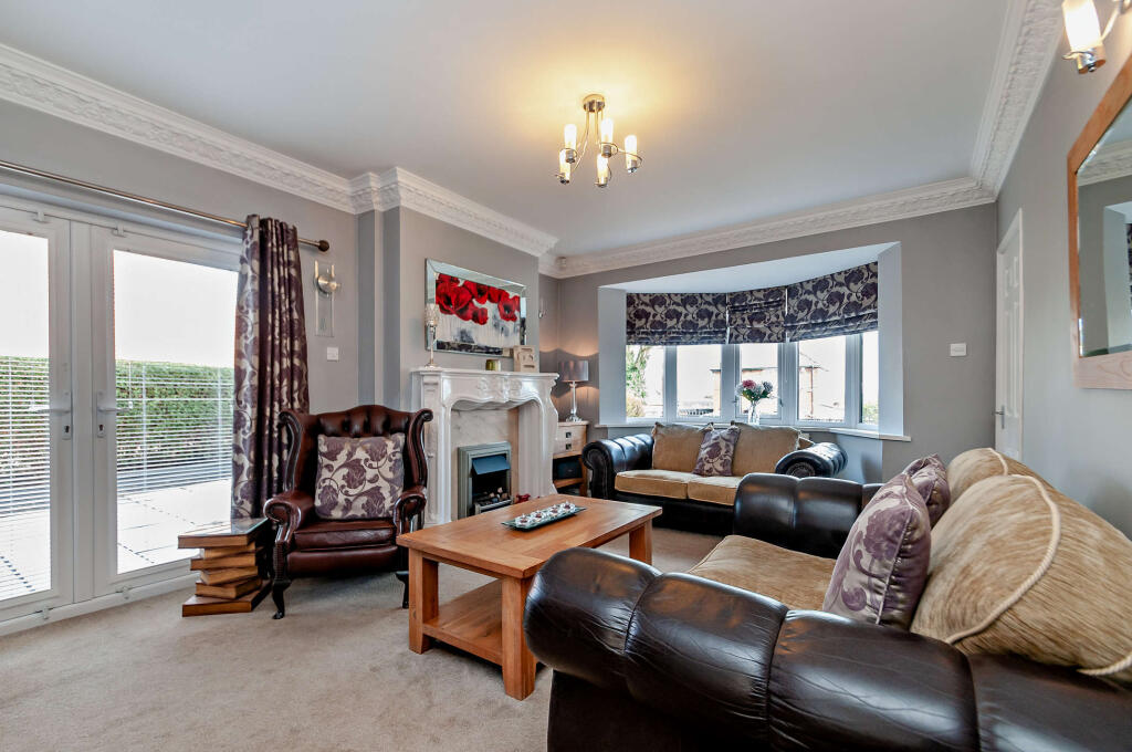
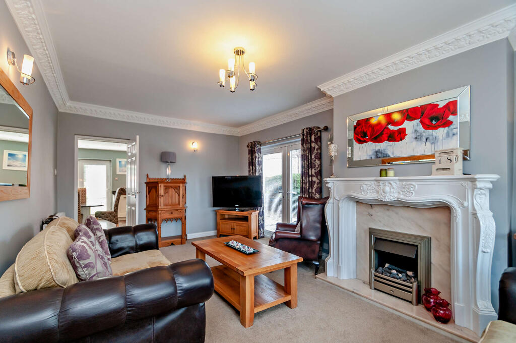
- Living Room: Large
- Dining Room: Average
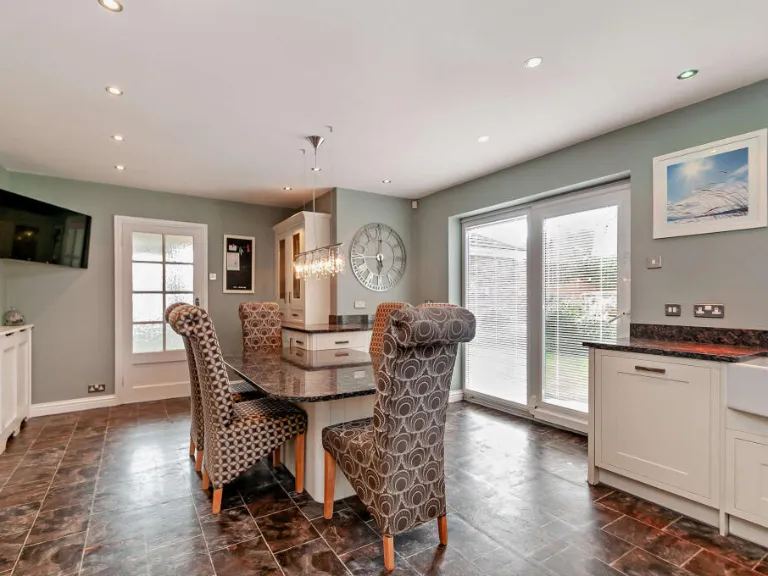
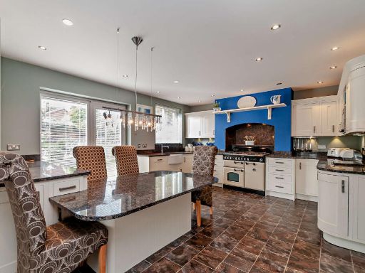
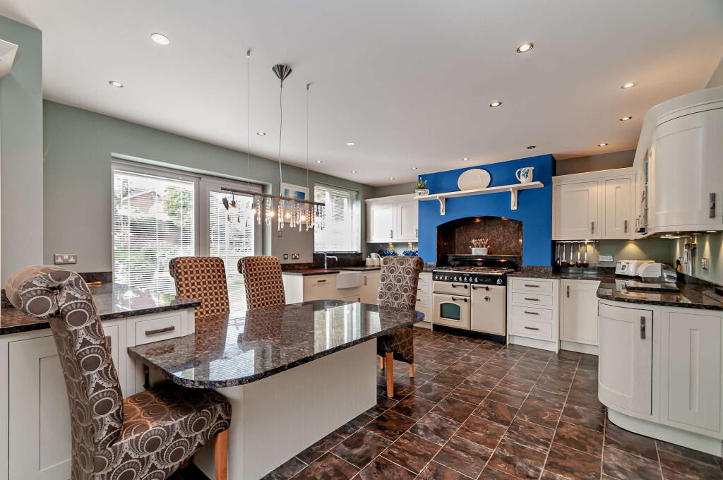
- Kitchen: Average
- Breakfast: Average
- Bedroom 3: Average
- Bedroom 2: Average
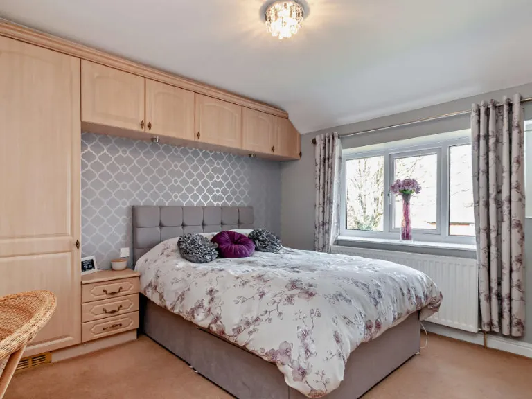
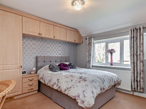
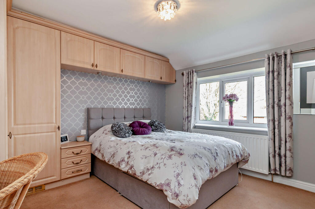
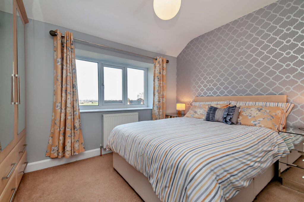
- Master Bedroom: Large
- Laundry Room: Small
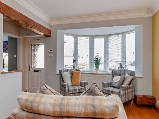
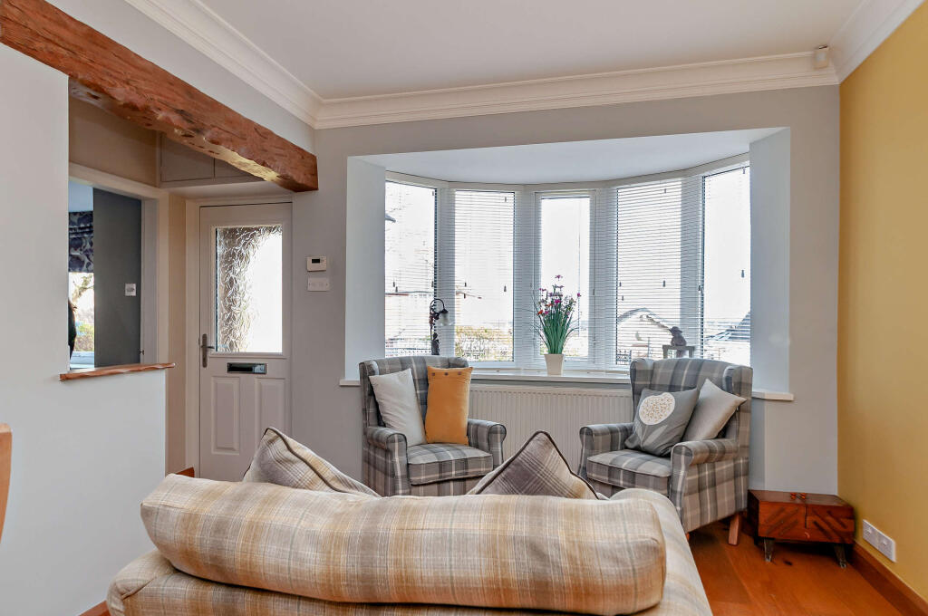
- Dining Room & Snug:
- Living Room:
- Kitchen:
- Main Bedroom:
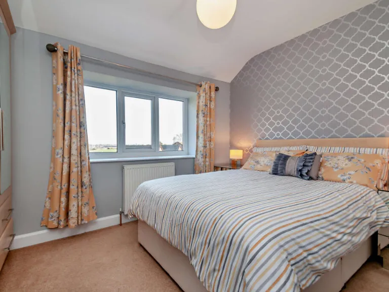
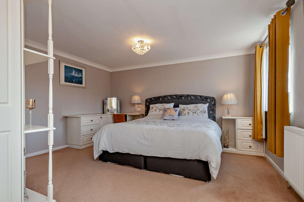
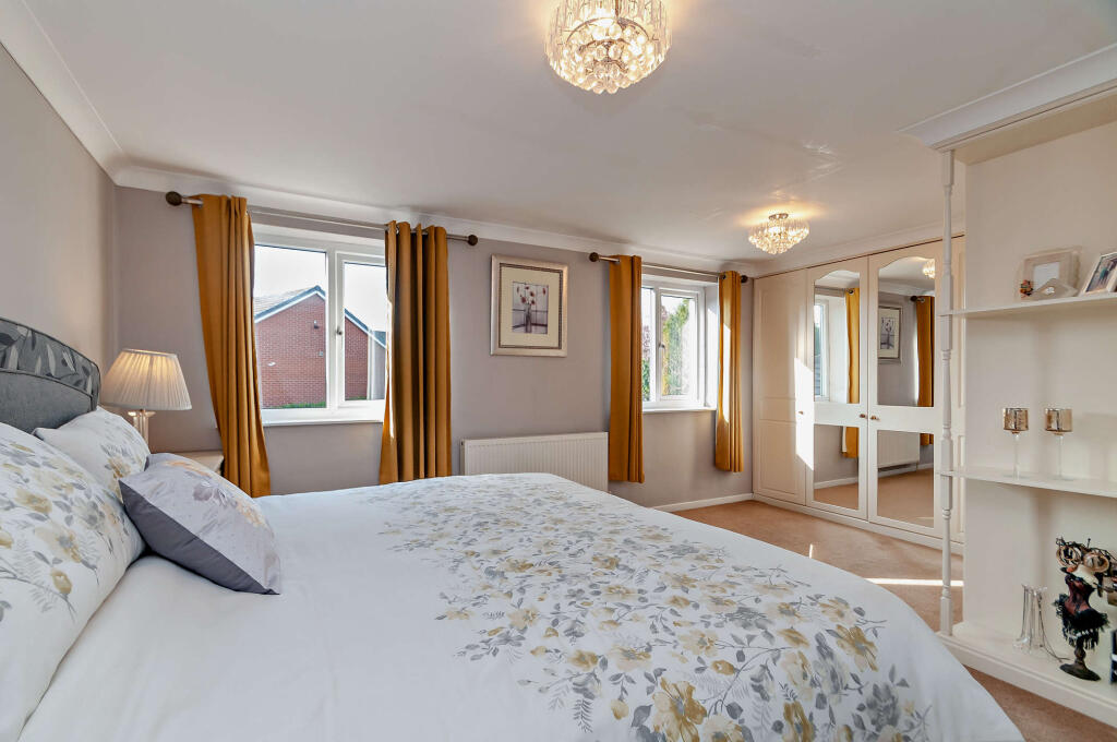
- Bedroom 2:
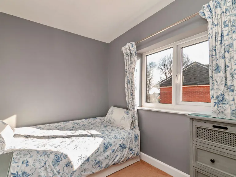
- Bedroom 3:
- Bedroom 4:
Textual Property Features
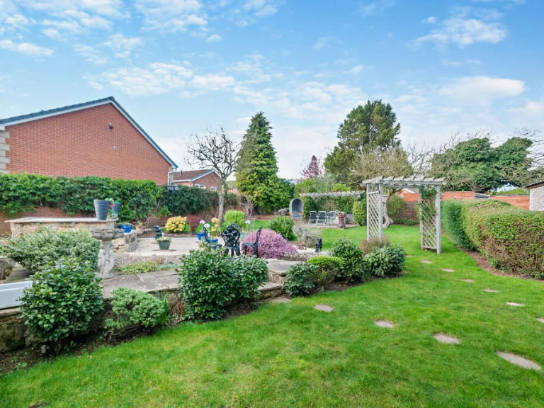
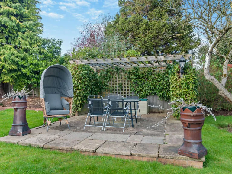
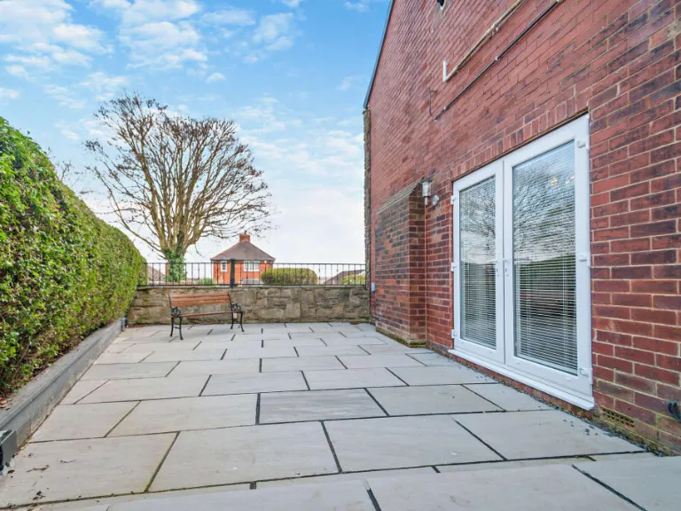
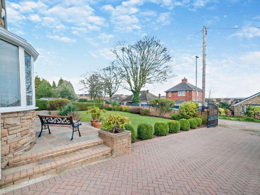
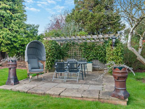
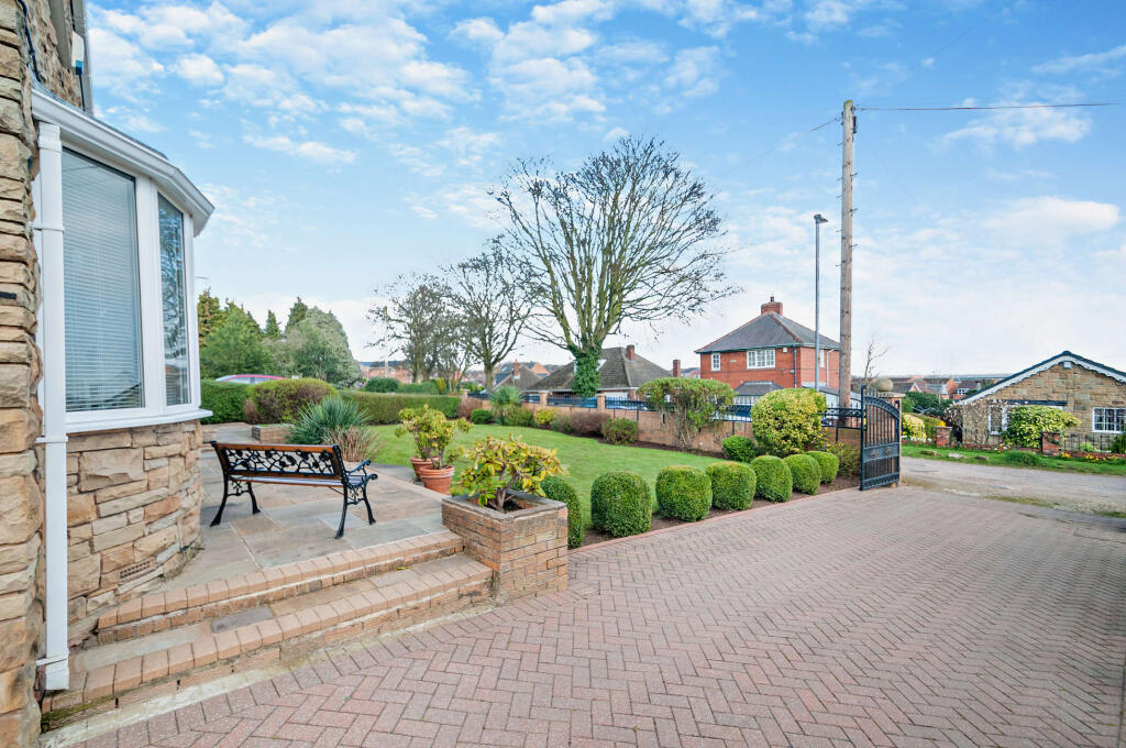
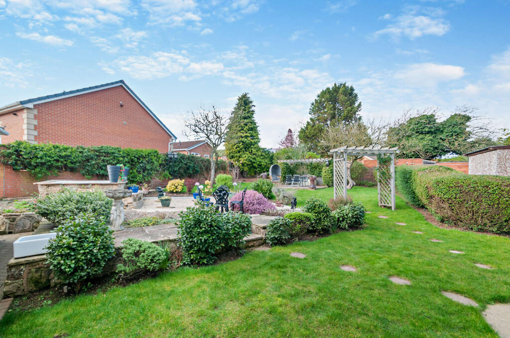
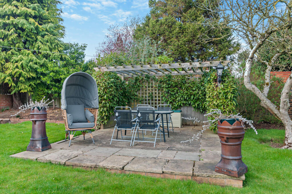
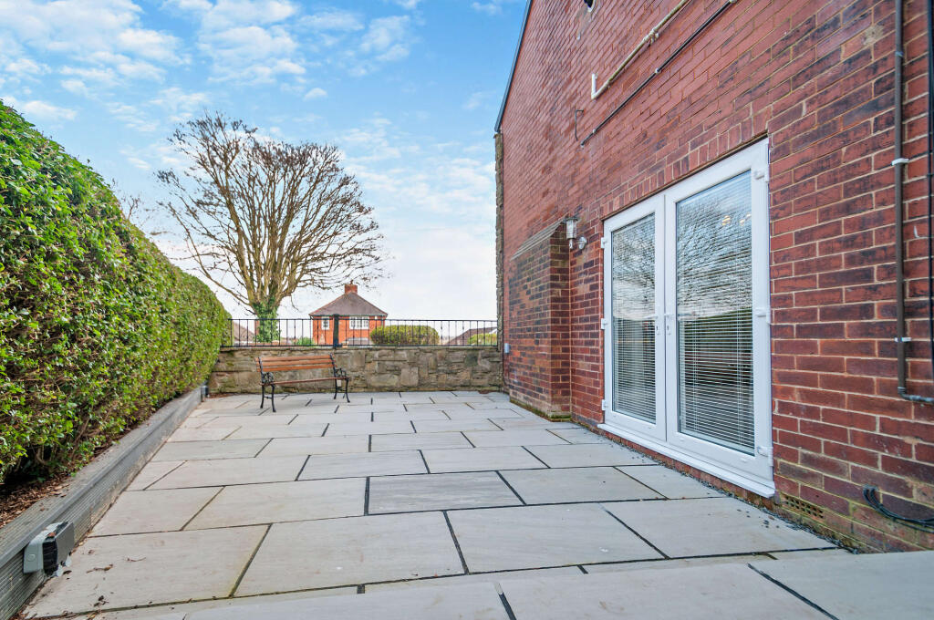
- Has Garden
- Chain Free
- Success
Detected Visual Features
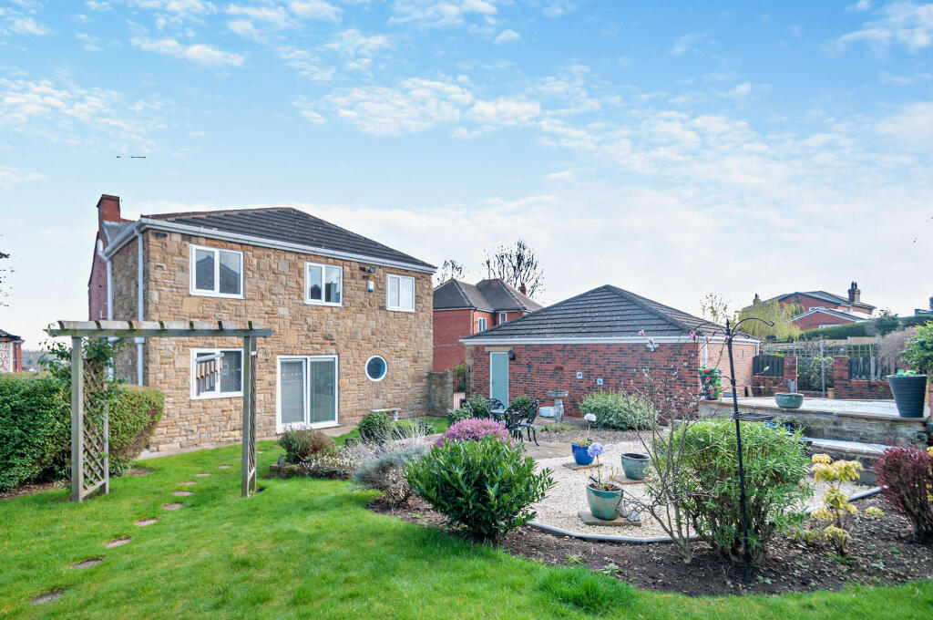
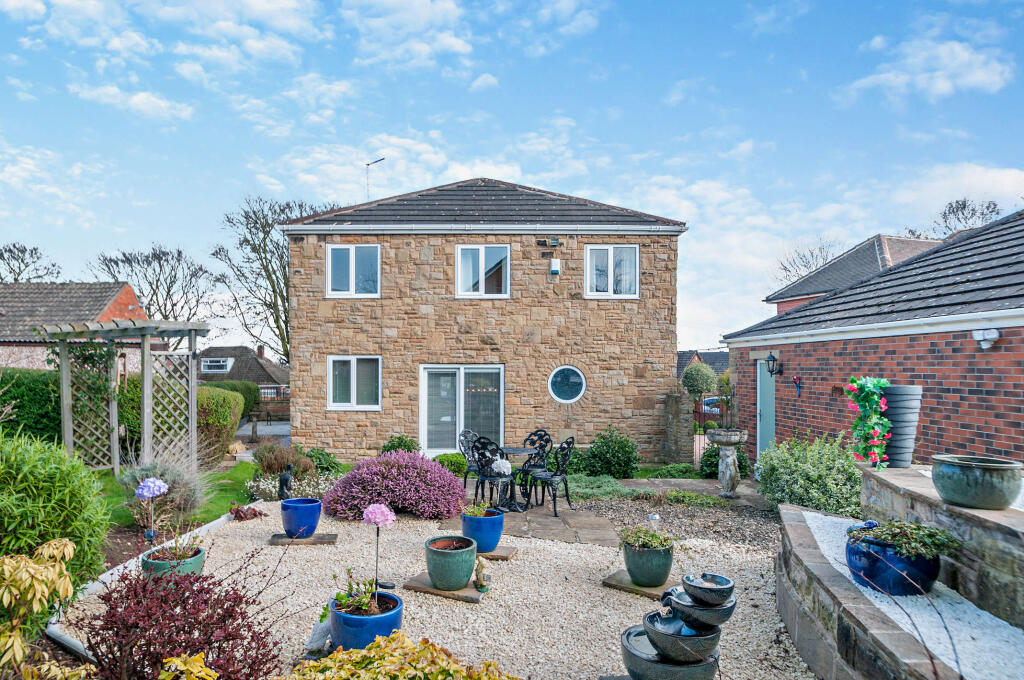
- detached house
- traditional style
- stone facade
- suburban
- two-story
- bay windows
- front porch
- sloped roof
- mid-20th century
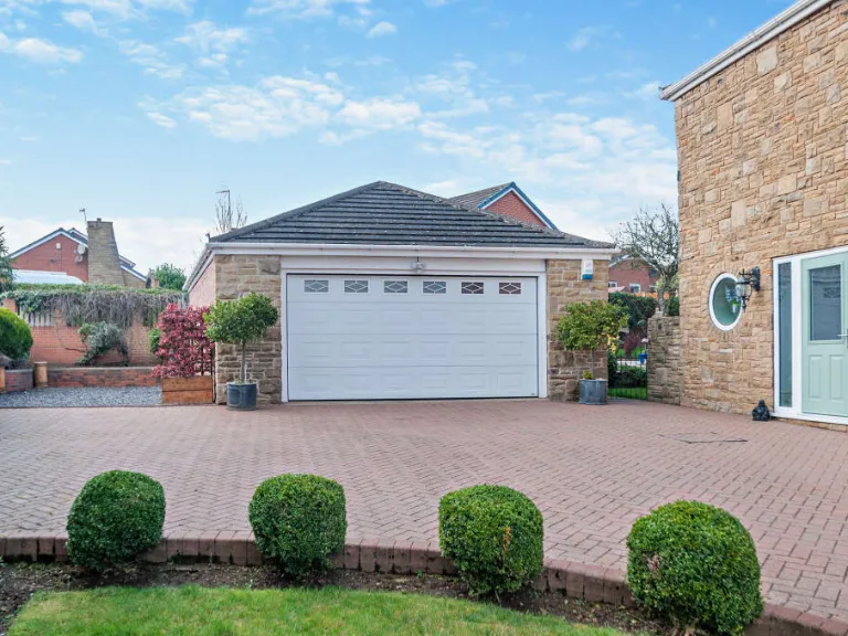
- double bay windows
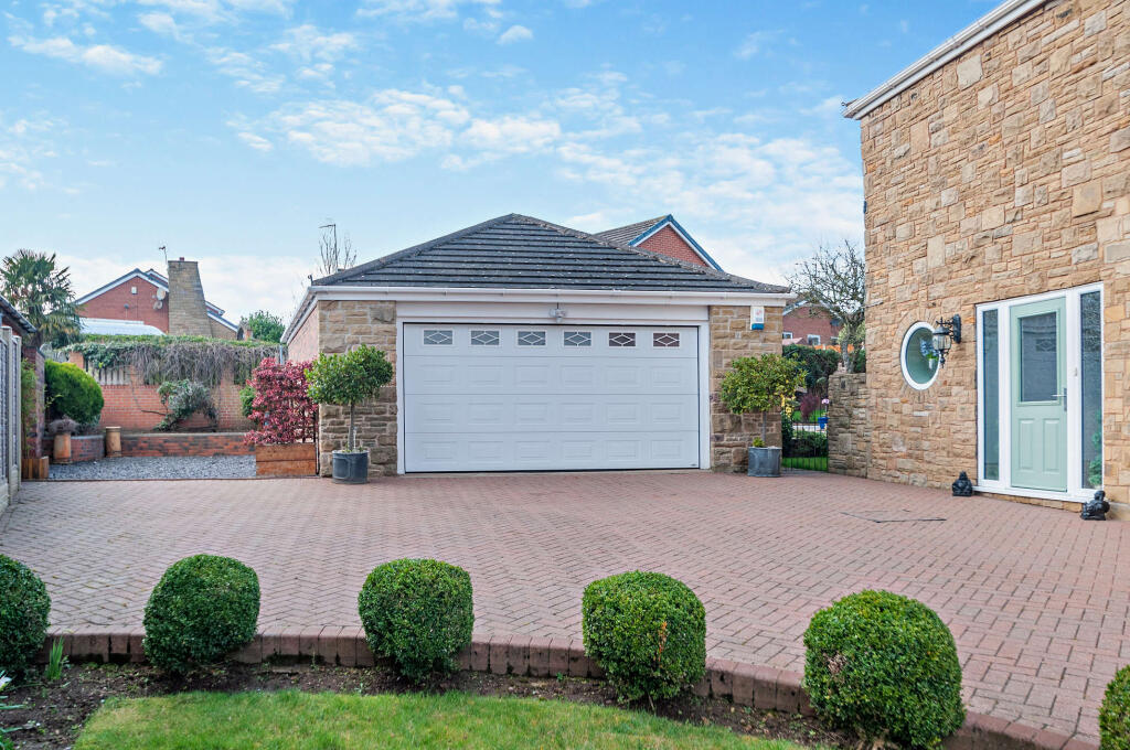
- garage
- driveway
- front garden
EPC Details
- Fully double glazed
- Cavity wall, filled cavity
- Boiler and radiators, mains gas
- Low energy lighting in 83% of fixed outlets
- Suspended, no insulation (assumed)
Nearby Schools
- Carleton High School
- The King's School
- Halfpenny Lane Junior Infant and Nursery School
- Cherry Tree Academy
- St Giles C of E Academy
- Orchard Head Junior and Infant and Nursery School
- The Vale Primary Academy
- Airedale Junior School
- Brotherton and Byram Community Primary Academy
- Fairburn View Primary School, Castleford
- De Lacy Primary School
- St Joseph's Catholic Primary School
- Airedale Academy
- Glasshoughton Infant Academy
- Castleford Park Junior Academy
- Castleford Academy
- Oyster Park Primary Academy
- Carleton Park Junior and Infant School
- Larks Hill Junior and Infant School
- Holy Family and St Michael's Catholic Primary School, A Voluntary Academy
- Willow Green Academy
- Smawthorne Henry Moore Primary School, Castleford
- The Rookeries Carleton Junior and Infant School
- Airedale Infant School
- St Joseph's Catholic Primary School Castleford
- Castleford Wheldon Infant School and Nursery
- Fairburn Community Primary School
Nearest General Shops
- Id: 8008605575
- Tags:
- Name: Vaparama
- Shop: e-cigarette
- TagsNormalized:
- Lat: 53.723612
- Lon: -1.3146402
- FullGeoHash: gcx1dh4dwxjh
- PartitionGeoHash: gcx1
- Images:
- FoodStandards: null
- Distance: 823
,- Id: 8008605576
- Tags:
- Name: Tan & Hair
- Shop: hairdresser
- TagsNormalized:
- Lat: 53.7236835
- Lon: -1.3144674
- FullGeoHash: gcx1dh4g4sqp
- PartitionGeoHash: gcx1
- Images:
- FoodStandards: null
- Distance: 821.5
,- Id: 320506424
- Tags:
- Name: Holmfields Plant Centre
- Shop: garden_centre
- TagsNormalized:
- Lat: 53.7184859
- Lon: -1.2953691
- FullGeoHash: gcx1de0szewf
- PartitionGeoHash: gcx1
- Images:
- FoodStandards: null
- Distance: 722.6
}
Nearest Religious buildings
- Id: 701909792
- Tags:
- Amenity: place_of_worship
- Building: yes
- Name: Gospel Hall
- Religion: christian
- TagsNormalized:
- place of worship
- christian
- church
- Lat: 53.7259543
- Lon: -1.3159618
- FullGeoHash: gcx1dh98rggb
- PartitionGeoHash: gcx1
- Images:
- FoodStandards: null
- Distance: 1080.9
,- Id: 701377515
- Tags:
- Amenity: place_of_worship
- Building: church
- Denomination: anglican
- Name: The Holy Cross
- Religion: christian
- Website: http://www.airedaleholycross.co.uk/
- Wikidata: Q105104231
- TagsNormalized:
- place of worship
- church
- anglican
- christian
- Lat: 53.7235723
- Lon: -1.3164335
- FullGeoHash: gcx1dh16kzsp
- PartitionGeoHash: gcx1
- Images:
- FoodStandards: null
- Distance: 902.7
,- Id: 700170606
- Tags:
- Addr:
- Postcode: WF10 3SD
- Street: Elizabeth Drive
- Amenity: place_of_worship
- Building: yes
- Denomination: methodist
- Fhrs:
- Name: Airedale Methodist Church
- Religion: christian
- TagsNormalized:
- place of worship
- methodist
- church
- christian
- Lat: 53.7245842
- Lon: -1.3132273
- FullGeoHash: gcx1dh78rs6g
- PartitionGeoHash: gcx1
- Images:
- FoodStandards:
- Id: 313235
- FHRSID: 313235
- LocalAuthorityBusinessID: PI/000019661
- BusinessName: Airedale Methodist Church
- BusinessType: Restaurant/Cafe/Canteen
- BusinessTypeID: 1
- AddressLine1: Elizabeth Drive
- AddressLine2: Castleford
- AddressLine3: null
- AddressLine4: null
- PostCode: WF10 3SD
- RatingValue: 5
- RatingKey: fhrs_5_en-GB
- RatingDate: 2021-09-15
- LocalAuthorityCode: 432
- LocalAuthorityName: Wakefield
- LocalAuthorityWebSite: http://www.wakefield.gov.uk
- LocalAuthorityEmailAddress: food@wakefield.gov.uk
- Scores:
- Hygiene: 0
- Structural: 0
- ConfidenceInManagement: 5
- NewRatingPending: false
- Geocode:
- Longitude: -1.31154200000000
- Latitude: 53.72465400000000
- Distance: 853.8
}
Nearest Medical buildings
- Id: 2689724091
- Tags:
- Amenity: pharmacy
- Brand: Lloyds Pharmacy
- Brand:wikidata: Q6662870
- Brand:wikipedia: en:LloydsPharmacy
- Healthcare: pharmacy
- Name: Lloyds Pharmacy
- TagsNormalized:
- pharmacy
- lloyds pharmacy
- health
- healthcare
- Lat: 53.7232676
- Lon: -1.3152988
- FullGeoHash: gcx1dh40xqfn
- PartitionGeoHash: gcx1
- Images:
- FoodStandards: null
- Distance: 825.2
,- Id: 7958443281
- Tags:
- Amenity: dentist
- Healthcare: dentist
- Name: Airedale Dental Practice
- TagsNormalized:
- dentist
- health
- healthcare
- dental
- Lat: 53.7230202
- Lon: -1.3156151
- FullGeoHash: gcx1d5czrby6
- PartitionGeoHash: gcx1
- Images:
- FoodStandards: null
- Distance: 821.6
,- Id: 701377547
- Tags:
- Addr:
- City: Airedale
- Street: Crewe Road
- Amenity: doctors
- Building: yes
- Healthcare: doctor
- Name: Airedale Health Center
- TagsNormalized:
- doctor
- doctors
- health
- healthcare
- Lat: 53.7230088
- Lon: -1.3155287
- FullGeoHash: gcx1d5fp1yww
- PartitionGeoHash: gcx1
- Images:
- FoodStandards: null
- Distance: 816.5
,- Id: 700170609
- Tags:
- Addr:
- Postcode: WF10 3TG
- Street: Elizabeth Drive
- Town: Castleford
- Amenity: pharmacy
- Building: yes
- Healthcare: pharmacy
- Name: Airedale Pharmacy
- TagsNormalized:
- Lat: 53.724248
- Lon: -1.3123802
- FullGeoHash: gcx1dhhq7mdq
- PartitionGeoHash: gcx1
- Images:
- FoodStandards: null
- Distance: 793
}
Nearest Airports
- Id: 100889514
- Tags:
- Addr:
- Aerodrome: international
- Aerodrome:type: public
- Area: yes
- Cities_served: Doncaster, Sheffield
- Closest_town: Doncaster
- Disused:
- Ele: 17
- Iata: DSA
- Icao: EGCN
- Ifr: yes
- Is_in: Finningley
- Name: Doncaster Sheffield Airport
- Old_iata: FNY
- Old_icao: EGXI
- Old_name: RAF Finningley
- Old_operator: Royal Air Force
- Old_type: military
- Operator: Doncaster Sheffield Airport Limited/Peel Airports
- Source: wikipedia
- Tower_frequency: 128.775
- Vfr: yes
- Website: https://www.robinhoodairport.com/
- Wikidata: Q8996
- Wikipedia: en:Robin Hood Airport Doncaster Sheffield
- TagsNormalized:
- airport
- international airport
- Lat: 53.4761577
- Lon: -1.0054086
- FullGeoHash: gcx21p5chq34
- PartitionGeoHash: gcx2
- Images:
- FoodStandards: null
- Distance: 33436
,- Id: 11519546
- Tags:
- Addr:
- City: Leeds
- Postcode: LS19 7TU
- Aerodrome: international
- Aerodrome:type: public
- Aeroway: aerodrome
- Iata: LBA
- Icao: EGNM
- Name: Leeds Bradford Airport
- Operator: Leeds Bradford Airport Limited
- Operator:type: private
- Ref: LBA
- Type: multipolygon
- Website: https://www.leedsbradfordairport.co.uk/
- Wikidata: Q8699
- Wikipedia: en:Leeds Bradford Airport
- TagsNormalized:
- airport
- international airport
- Lat: 53.8667047
- Lon: -1.660138
- FullGeoHash: gcwf6nph7cx3
- PartitionGeoHash: gcwf
- Images:
- Q8699-1
- Q8699-2
- Q8699-3
- Q8699-4
- FoodStandards: null
- Distance: 28516.6
}
Nearest Leisure Facilities
- Id: 892576606
- Tags:
- TagsNormalized:
- Lat: 53.721364
- Lon: -1.3088268
- FullGeoHash: gcx1d5wvwhh4
- PartitionGeoHash: gcx1
- Images:
- FoodStandards: null
- Distance: 400.4
,- Id: 892576613
- Tags:
- TagsNormalized:
- Lat: 53.721436
- Lon: -1.3074709
- FullGeoHash: gcx1d5xyj9x0
- PartitionGeoHash: gcx1
- Images:
- FoodStandards: null
- Distance: 380.6
,- Id: 405870144
- Tags:
- Leisure: pitch
- Sport: soccer
- TagsNormalized:
- Lat: 53.7205206
- Lon: -1.3101263
- FullGeoHash: gcx1d5tbxyg5
- PartitionGeoHash: gcx1
- Images:
- FoodStandards: null
- Distance: 368.8
,- Id: 405870152
- Tags:
- Leisure: pitch
- Sport: soccer
- TagsNormalized:
- Lat: 53.7205825
- Lon: -1.3086906
- FullGeoHash: gcx1d5x1163s
- PartitionGeoHash: gcx1
- Images:
- FoodStandards: null
- Distance: 318.7
,- Id: 892576614
- Tags:
- Leisure: pitch
- Sport: soccer
- TagsNormalized:
- Lat: 53.7206647
- Lon: -1.3069544
- FullGeoHash: gcx1d7839c8p
- PartitionGeoHash: gcx1
- Images:
- FoodStandards: null
- Distance: 290.3
}
Nearest Tourist attractions
- Id: 863472534
- Tags:
- Addr:
- City: Pontefract
- Postcode: WF8 1AP
- Street: Salter Row
- Building: yes
- Email: museums@wakefield.gov.uk
- Fee: no
- Museum: history
- Name: Pontefract Museum
- Operator: Wakefield Museums & Castles
- Phone: +44 1977 722740
- Toilets: yes
- Toilets:wheelchair: yes
- Tourism: museum
- Website: https://www.wakefield.gov.uk/museums-and-castles/pontefract-museum
- Wheelchair: yes
- Wikidata: Q7228173
- Wikipedia: en:Pontefract Museum
- TagsNormalized:
- Lat: 53.6920291
- Lon: -1.3120442
- FullGeoHash: gcx16nkdepsv
- PartitionGeoHash: gcx1
- Images:
- FoodStandards: null
- Distance: 2921.1
,- Id: 1005151239
- Tags:
- Addr:
- City: Pontefract
- Housenumber: 21
- Postcode: WF8 2JP
- Street: Bondgate
- Building: house
- Email: info@towerhouseguesthouse.com
- Fax: +44 1977 707111
- Fhrs:
- Guest_house: guest_house
- House: detached
- Internet_access: yes
- Internet_access:fee: no
- Name: Tower House Guest House
- Phone: +44 1977 699988
- Ref:
- Rooms: 6
- Stars: 5
- Tourism: guest_house
- Website: https://www.towerhouseguesthouse.com/
- TagsNormalized:
- Lat: 53.6981205
- Lon: -1.2975162
- FullGeoHash: gcx16rrnjxjv
- PartitionGeoHash: gcx1
- Images:
- FoodStandards:
- Id: 283442
- FHRSID: 283442
- LocalAuthorityBusinessID: PI/000011071
- BusinessName: Tower House Guest House
- BusinessType: Hotel/bed & breakfast/guest house
- BusinessTypeID: 7842
- AddressLine1: 21 Bondgate
- AddressLine2: Pontefract
- AddressLine3: null
- AddressLine4: null
- PostCode: WF8 2JP
- RatingValue: 5
- RatingKey: fhrs_5_en-GB
- RatingDate: 2015-01-26
- LocalAuthorityCode: 432
- LocalAuthorityName: Wakefield
- LocalAuthorityWebSite: http://www.wakefield.gov.uk
- LocalAuthorityEmailAddress: food@wakefield.gov.uk
- Scores:
- Hygiene: 5
- Structural: 5
- ConfidenceInManagement: 5
- NewRatingPending: false
- Geocode:
- Longitude: -1.29773900000000
- Latitude: 53.69803100000000
- Distance: 2294
,- Id: 320506423
- Tags:
- Name: Oakland Hill Estate
- Tourism: caravan_site
- TagsNormalized:
- Lat: 53.7197199
- Lon: -1.2930311
- FullGeoHash: gcx1de6kn1w5
- PartitionGeoHash: gcx1
- Images:
- FoodStandards: null
- Distance: 893.8
}
Nearest Hotels
- Id: 1122498998
- Tags:
- Addr:
- City: Knottingley
- Postcode: WF11 0BU
- Street: Pontefract Road
- Substreet: A1 Business Park
- Brand: Premier Inn
- Brand:wikidata: Q2108626
- Brand:wikipedia: en:Premier Inn
- Building: hotel
- Building:levels: 2
- Internet_access: wlan
- Internet_access:fee: customers
- Internet_access:operator: Virgin Media
- Internet_access:ssid: Premier Inn Free Wi-Fi
- Name: Premier Inn
- Nohousenumber: yes
- Tourism: hotel
- Wheelchair: yes
- TagsNormalized:
- Lat: 53.7029895
- Lon: -1.2730697
- FullGeoHash: gcx1e02fx6f6
- PartitionGeoHash: gcx1
- Images:
- FoodStandards: null
- Distance: 2758.1
,- Id: 5499421884
- Tags:
- Addr:
- Postcode: WF10 2SD
- Street: Wheldon Road
- Town: Castleford
- Amenity: pub
- Fhrs:
- Name: The Wheldale Hotel
- TagsNormalized:
- Lat: 53.7305089
- Lon: -1.3411341
- FullGeoHash: gcx19mr6vkcf
- PartitionGeoHash: gcx1
- Images:
- FoodStandards: null
- Distance: 2674.5
,- Id: 891201837
- Tags:
- Addr:
- City: Castleford
- Postcode: WF10 4TA
- Street: Colorado Way
- Area: yes
- Brand: Premier Inn
- Brand:wikidata: Q2108626
- Brand:wikipedia: en:Premier Inn
- Building: yes
- Fhrs:
- Internet_access: yes
- Internet_access:fee: customers
- Internet_access:operator: Virgin Media
- Internet_access:ssid: Premier Inn Free Wi-Fi
- Name: Premier Inn
- Tourism: hotel
- TagsNormalized:
- Lat: 53.708605
- Lon: -1.339417
- FullGeoHash: gcx1992em3dk
- PartitionGeoHash: gcx1
- Images:
- FoodStandards: null
- Distance: 2418.9
}
Tags
- detached house
- traditional style
- stone facade
- suburban
- two-story
- bay windows
- front porch
- sloped roof
- detached house
- stone facade
- mid-20th century
- double bay windows
- garage
- driveway
- front garden
Local Market Stats
- Average Price/sqft: £183
- Avg Income: £36800
- Rental Yield: 5.1%
- Social Housing: 15%
- Planning Success Rate: 92%
AirBnB Data
- 1km average: £56/night
- Listings in 1km: 1
Similar Properties
 4 bedroom detached house for sale in Hillcrest Drive, Castleford, WF10 — £475,000 • 4 bed • 1 bath • 1637 ft²
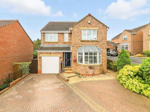 4 bedroom detached house for sale in Fair View, Castleford WF10 — £325,000 • 4 bed • 2 bath • 1429 ft²
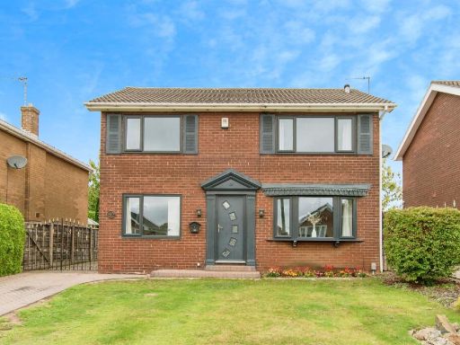 4 bedroom detached house for sale in Hillcrest Close, CASTLEFORD, WF10 — £320,000 • 4 bed • 1 bath • 1131 ft²
 4 bedroom detached house for sale in Healdfield Court, Castleford, WF10 — £325,000 • 4 bed • 2 bath • 1147 ft²
 4 bedroom detached house for sale in Netherwood Avenue, Castleford, West Yorkshire, WF10 — £340,000 • 4 bed • 3 bath • 1455 ft²
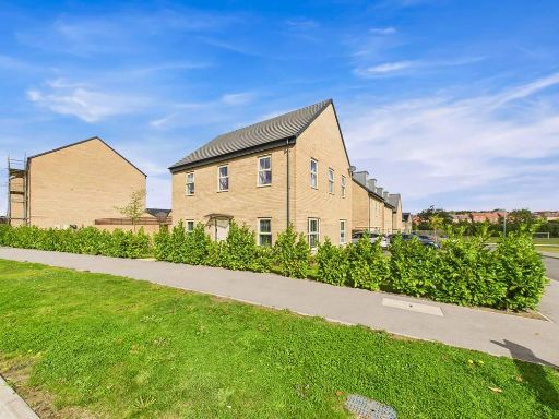 4 bedroom detached house for sale in Haydock Avenue, Castleford, WF10 — £430,000 • 4 bed • 2 bath • 1421 ft²
Meta
- {
"@context": "https://schema.org",
"@type": "Residence",
"name": "4 bedroom detached house for sale in Hillcrest Drive, Townv…",
"description": "",
"url": "https://propertypiper.co.uk/property/518a190e-cdc1-4845-9102-50466f3da164",
"image": "https://image-a.propertypiper.co.uk/8978690f-530e-44dd-9d10-e8b69826e9fc-1024.jpeg",
"address": {
"@type": "PostalAddress",
"streetAddress": "7 Hillcrest Drive",
"postalCode": "WF10 3QN",
"addressLocality": "Wakefield",
"addressRegion": "Normanton, Pontefract and Castleford",
"addressCountry": "England"
},
"geo": {
"@type": "GeoCoordinates",
"latitude": 53.7180802087725,
"longitude": -1.3063295899648584
},
"numberOfRooms": 4,
"numberOfBathroomsTotal": 2,
"floorSize": {
"@type": "QuantitativeValue",
"value": 1636,
"unitCode": "FTK"
},
"offers": {
"@type": "Offer",
"price": 474995,
"priceCurrency": "GBP",
"availability": "https://schema.org/InStock"
},
"additionalProperty": [
{
"@type": "PropertyValue",
"name": "Feature",
"value": "detached house"
},
{
"@type": "PropertyValue",
"name": "Feature",
"value": "traditional style"
},
{
"@type": "PropertyValue",
"name": "Feature",
"value": "stone facade"
},
{
"@type": "PropertyValue",
"name": "Feature",
"value": "suburban"
},
{
"@type": "PropertyValue",
"name": "Feature",
"value": "two-story"
},
{
"@type": "PropertyValue",
"name": "Feature",
"value": "bay windows"
},
{
"@type": "PropertyValue",
"name": "Feature",
"value": "front porch"
},
{
"@type": "PropertyValue",
"name": "Feature",
"value": "sloped roof"
},
{
"@type": "PropertyValue",
"name": "Feature",
"value": "detached house"
},
{
"@type": "PropertyValue",
"name": "Feature",
"value": "stone facade"
},
{
"@type": "PropertyValue",
"name": "Feature",
"value": "mid-20th century"
},
{
"@type": "PropertyValue",
"name": "Feature",
"value": "double bay windows"
},
{
"@type": "PropertyValue",
"name": "Feature",
"value": "garage"
},
{
"@type": "PropertyValue",
"name": "Feature",
"value": "driveway"
},
{
"@type": "PropertyValue",
"name": "Feature",
"value": "front garden"
}
]
}
High Res Floorplan Images
Compatible Floorplan Images
FloorplanImages Thumbnail