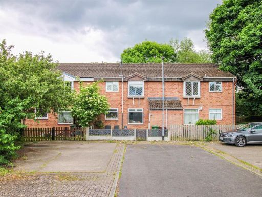
WF12 8LP - 2 bedroom apartment for sale in 36 Elsham Meadows, Dewsbury…
View on Property Piper
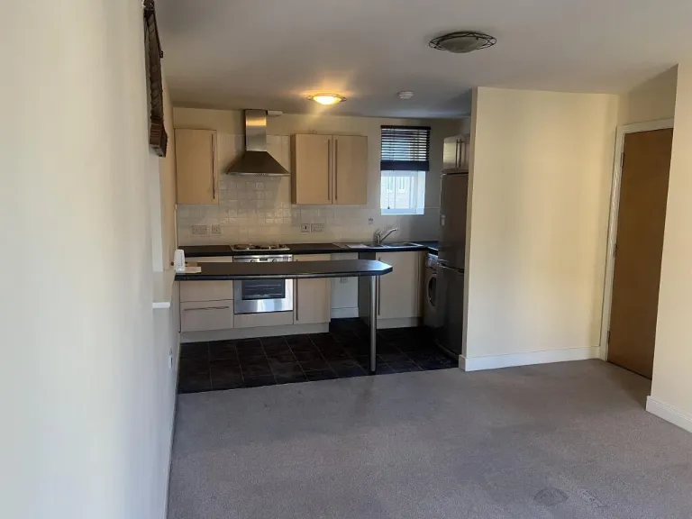
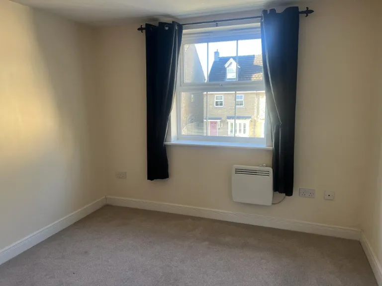
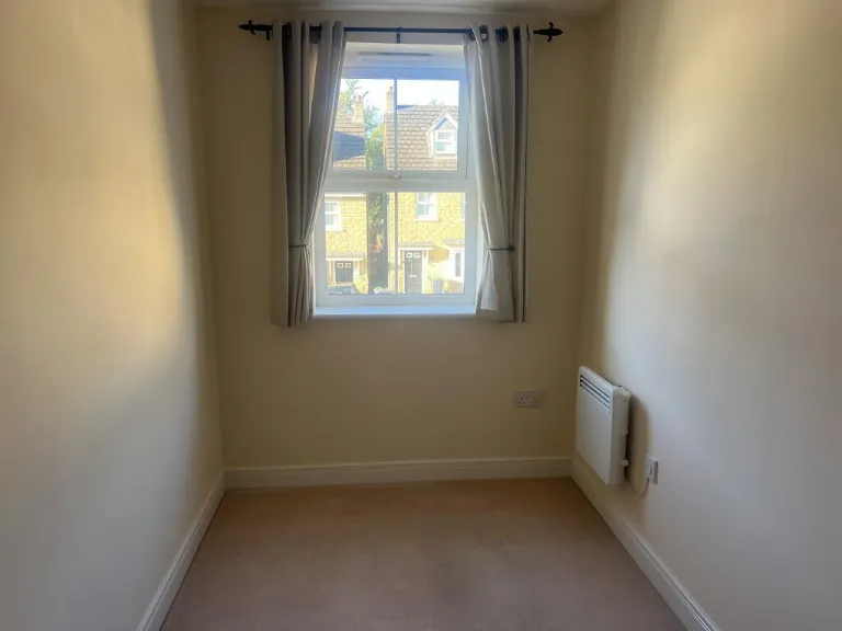
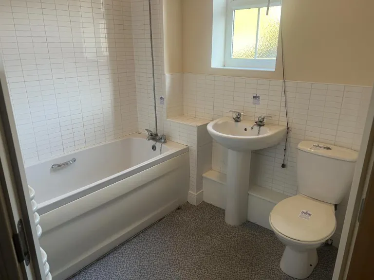
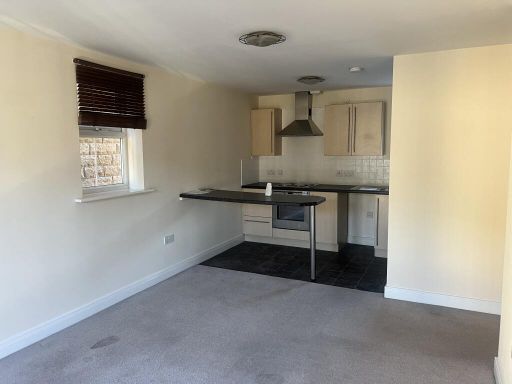
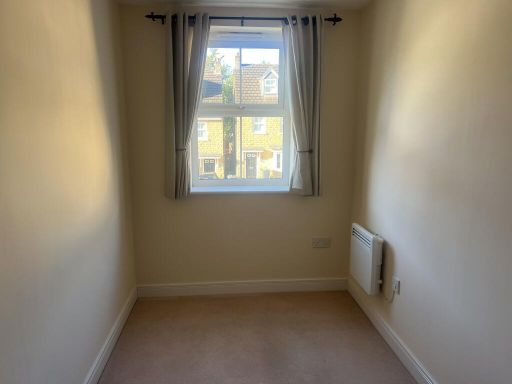
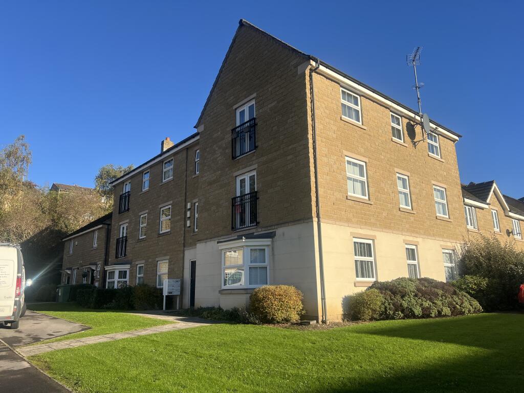
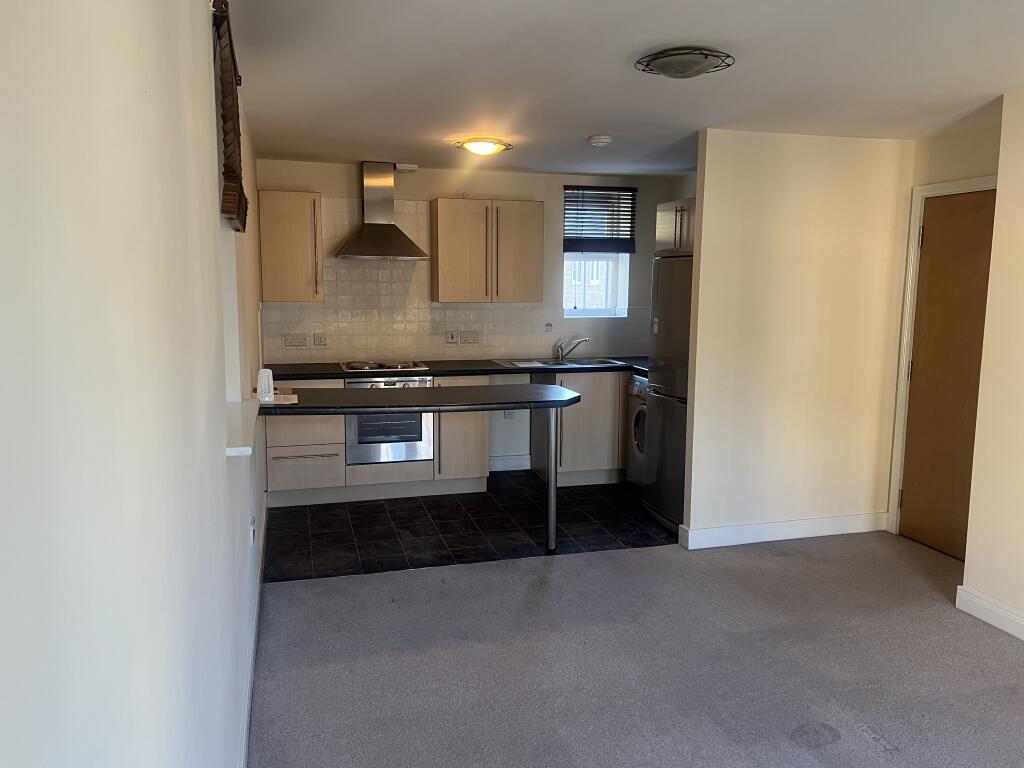
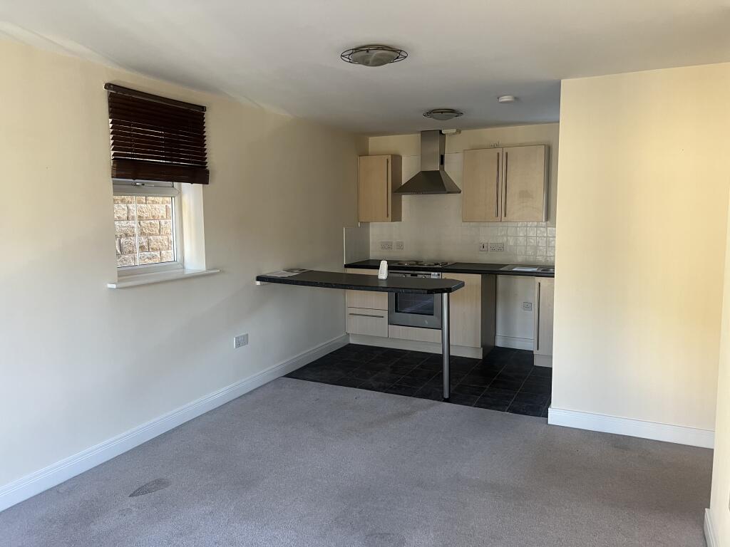
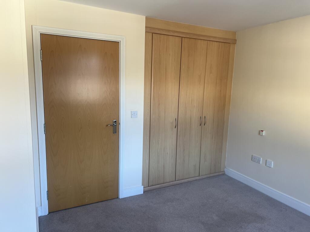
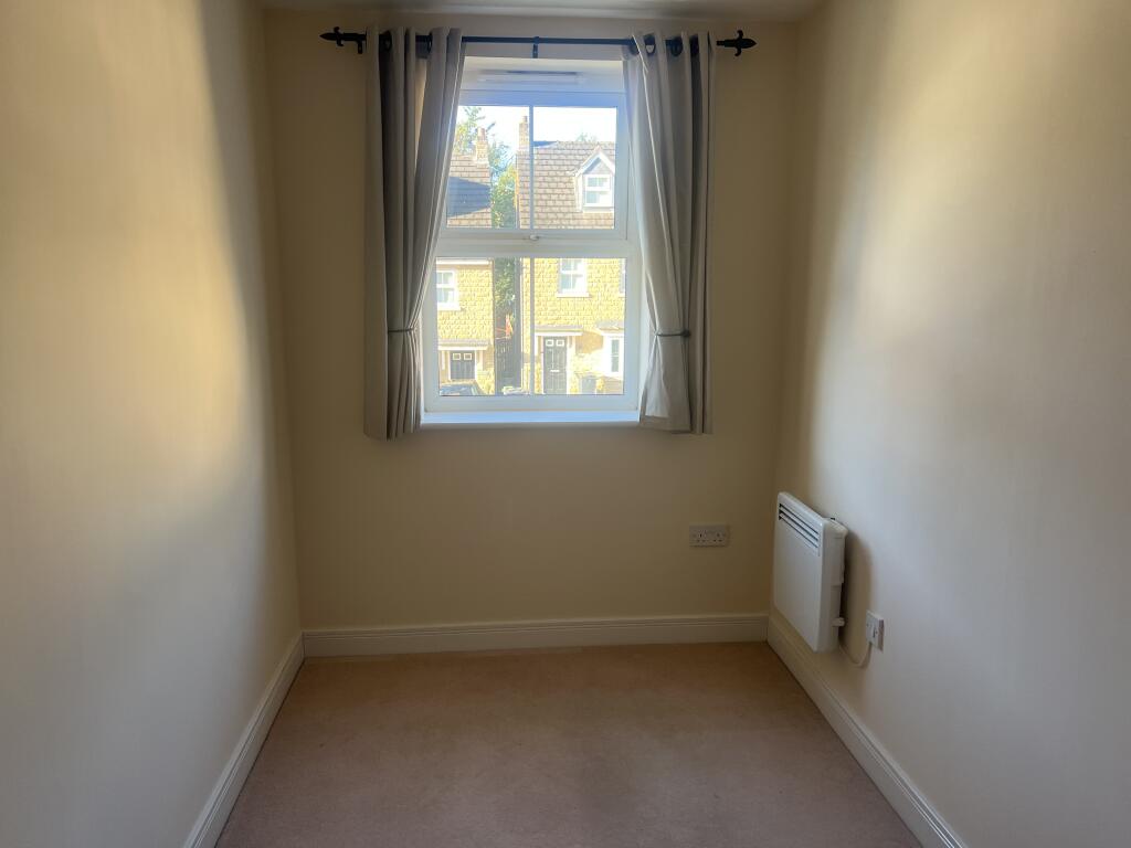
2 bedroom apartment for sale in 36 Elsham Meadows, Dewsbury WF12 8LP, WF12
Property Details
- Price: £70000
- Bedrooms: 2
- Bathrooms: 1
- Property Type: undefined
- Property SubType: undefined
Image Descriptions
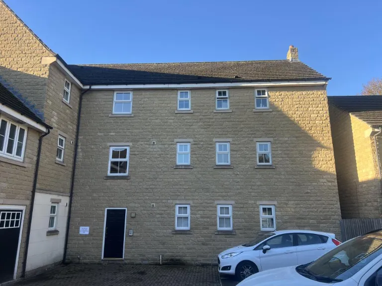
- apartment building exterior modern
- three-story townhouse modern
Textual Property Features
- Is Auction
- Has Garden
- Success
Detected Visual Features
- apartment building
- modern
- exterior
- low-rise
- brick
- garden
- lawn
- well-kept
- landscaped
- modern townhouse
- three stories
- stone facade
- residential area
- parking
- contemporary design
- recent construction
- family home
EPC Details
- Fully double glazed
- Cavity wall, as built, insulated (assumed)
- Electric storage heaters
- No low energy lighting
- (another dwelling below)
Nearby Schools
- Thornhill Junior and Infant School
- Dimple Well Infant School and Nursery
- Hanging Heaton Church of England Voluntary Controlled Junior and Infant School
- Mill Lane Primary School
- Lydgate Junior and Infant School
- Thornhill Community Academy, A Share Academy
- Pentland Infant and Nursery School
- Savile Town Church of England Voluntary Controlled Infant and Nursery School
- Manor Croft Academy
- Al-Furqaan Preparatory School
- Overthorpe CofE Academy
- Thornhill Lees Church of England Voluntary Controlled Infant and Nursery School
- Rida Boys High School
- Headfield Church of England Voluntary Controlled Junior School
- Paradise Primary School
- Ossett Holy Trinity CofE VA Primary School
- Orchard Primary Academy
- Gawthorpe Community Academy
- The Branch Christian School
- Bywell Church of England Voluntary Controlled Junior School
- Hyrstmount Junior School
- Madni Academy
- Rida Girls High School
- Carlton Junior and Infant School
- Warwick Road Primary School
- Shaw Cross Infant and Nursery School
- Field Lane Junior Infant and Nursery School
Nearest Bars And Restaurants
- Id: 290777887
- Tags:
- Amenity: fast_food
- Created_by: JOSM
- Name: The Parade Fish Bar
- TagsNormalized:
- Lat: 53.6865717
- Lon: -1.6027147
- FullGeoHash: gcwc7t2fyn36
- PartitionGeoHash: gcwc
- Images:
- FoodStandards: null
- Distance: 508.6
,- Id: 1643124309
- Tags:
- Amenity: pub
- Name: The Park
- TagsNormalized:
- Lat: 53.6868004
- Lon: -1.6146628
- FullGeoHash: gcwc7m2hr8un
- PartitionGeoHash: gcwc
- Images:
- FoodStandards: null
- Distance: 370
,- Id: 28093563
- Tags:
- Amenity: pub
- Name: The Spangled Bull
- TagsNormalized:
- Lat: 53.6857885
- Lon: -1.6142305
- FullGeoHash: gcwc7m0w3sq6
- PartitionGeoHash: gcwc
- Images:
- FoodStandards: null
- Distance: 295.3
,- Id: 183083336
- Tags:
- Amenity: fast_food
- Building: yes
- Cuisine: sandwich
- TagsNormalized:
- Lat: 53.6865317
- Lon: -1.6131429
- FullGeoHash: gcwc7m36enc7
- PartitionGeoHash: gcwc
- Images:
- FoodStandards: null
- Distance: 271.4
,- Id: 1643126591
- Tags:
- Amenity: pub
- Name: The Commercial
- TagsNormalized:
- Lat: 53.6870799
- Lon: -1.6113101
- FullGeoHash: gcwc7m6tvv04
- PartitionGeoHash: gcwc
- Images:
- FoodStandards: null
- Distance: 249.6
}
Nearest General Shops
- Id: 148253702
- Tags:
- Brand: Pets at Home
- Brand:wikidata: Q7179258
- Brand:wikipedia: en:Pets at Home
- Building: yes
- Name: Pets at Home
- Shop: pet
- TagsNormalized:
- Lat: 53.6897318
- Lon: -1.6236761
- FullGeoHash: gcwc7jctme7m
- PartitionGeoHash: gcwc
- Images:
- FoodStandards: null
- Distance: 1046.4
,- Id: 273324307
- Tags:
- Building: yes
- Name: Valley Batteries
- Shop: car_parts
- TagsNormalized:
- Lat: 53.6918102
- Lon: -1.6104387
- FullGeoHash: gcwc7q736ncg
- PartitionGeoHash: gcwc
- Images:
- FoodStandards: null
- Distance: 759.8
,- Id: 128918699
- Tags:
- Building: yes
- Shop: newsagent
- Source: Bing; survey
- TagsNormalized:
- Lat: 53.6914273
- Lon: -1.6108946
- FullGeoHash: gcwc7q4zprmz
- PartitionGeoHash: gcwc
- Images:
- FoodStandards: null
- Distance: 719.2
}
Nearest Grocery shops
- Id: 290433497
- Tags:
- Addr:
- City: Dewsbury
- Country: GB
- Housenumber: 65-67
- Postcode: WF12 8HE
- Street: Princess Lane
- Suburb: Chickenley
- Fhrs:
- Name: Duncan Stores
- Shop: convenience
- Source:
- TagsNormalized:
- Lat: 53.6901097
- Lon: -1.60324
- FullGeoHash: gcwc7tbx9cce
- PartitionGeoHash: gcwc
- Images:
- FoodStandards:
- Id: 228066
- FHRSID: 228066
- LocalAuthorityBusinessID: PI/000053379
- BusinessName: 65-67 Princess Lane
- BusinessType: Retailers - other
- BusinessTypeID: 4613
- AddressLine1: Chickenley
- AddressLine2: Dewsbury
- AddressLine3: null
- AddressLine4: null
- PostCode: WF12 8HE
- RatingValue: 4
- RatingKey: fhrs_4_en-GB
- RatingDate: 2016-02-25
- LocalAuthorityCode: 411
- LocalAuthorityName: Kirklees
- LocalAuthorityWebSite: http://www.kirklees.gov.uk/
- LocalAuthorityEmailAddress: food.safety@kirklees.gov.uk
- Scores:
- Hygiene: 10
- Structural: 5
- ConfidenceInManagement: 5
- NewRatingPending: false
- Geocode:
- Longitude: -1.60375201702118
- Latitude: 53.68958282470700
- Distance: 721.5
,- Id: 180157971
- Tags:
- Brand: Nisa local
- Building: yes
- Name: Patbro
- Shop: convenience
- TagsNormalized:
- nisa
- nisa local
- convenience
- shop
- Lat: 53.6868046
- Lon: -1.6121882
- FullGeoHash: gcwc7m6h339r
- PartitionGeoHash: gcwc
- Images:
- FoodStandards: null
- Distance: 250.2
,- Id: 180157970
- Tags:
- Alcohol: yes
- Building: yes
- Name: Sunny's Food & Booze
- Shop: convenience
- TagsNormalized:
- Lat: 53.6868759
- Lon: -1.6118933
- FullGeoHash: gcwc7m6k8pj1
- PartitionGeoHash: gcwc
- Images:
- FoodStandards: null
- Distance: 246.1
}
Nearest Religious buildings
- Id: 215451913
- Tags:
- Amenity: place_of_worship
- Building: mosque
- Name: Markazi Mosque
- Religion: muslim
- Wikipedia: en:Markazi mosque
- TagsNormalized:
- place of worship
- mosque
- muslim
- Lat: 53.6810094
- Lon: -1.6281319
- FullGeoHash: gcwc6uq6tc2y
- PartitionGeoHash: gcwc
- Images:
- FoodStandards: null
- Distance: 1275.9
,- Id: 6049512
- Tags:
- Addr:
- City: Wakefield
- Postcode: WF12 9LY
- Amenity: school
- Capacity: 232
- Denomination: anglican
- Diocese: Diocese of Leeds
- Isced:
- Max_age: 7
- Min_age: 2
- Name: Savile Town Church of England Voluntary Controlled Infant and Nursery School
- Phone: +44 1924 469455
- Ref:
- Religion: christian
- School:
- Boarding: no
- Gender: mixed
- Selective: no
- Trust: no
- Type: voluntary_controlled
- Type: multipolygon
- Website: https://saviletown.co.uk/
- TagsNormalized:
- school
- anglican
- church
- nursery
- christian
- Lat: 53.683842
- Lon: -1.6292098
- FullGeoHash: gcwc6uveh9mp
- PartitionGeoHash: gcwc
- Images:
- FoodStandards: null
- Distance: 1274.2
,- Id: 290433502
- Tags:
- Amenity: place_of_worship
- Denomination: catholic
- Name: St Thomas More Catholic Church
- Religion: christian
- TagsNormalized:
- place of worship
- catholic
- church
- christian
- Lat: 53.6874502
- Lon: -1.5997995
- FullGeoHash: gcwc7te01fp5
- PartitionGeoHash: gcwc
- Images:
- FoodStandards: null
- Distance: 723
}
Nearest Medical buildings
- Id: 99803636
- Tags:
- Addr:
- Amenity: doctors
- Name: Dewsbury Health Centre
- TagsNormalized:
- doctor
- doctors
- health
- health centre
- Lat: 53.6898806
- Lon: -1.6345806
- FullGeoHash: gcwc6vcwpx0k
- PartitionGeoHash: gcwc
- Images:
- FoodStandards: null
- Distance: 1710.4
,- Id: 7524292683
- Tags:
- Amenity: pharmacy
- Brand: Asda
- Brand:wikidata: Q297410
- Brand:wikipedia: en:Asda
- Contact:
- Phone: +44 1924 431500
- Website: https://storelocator.asda.com/yorkshire-&-humber/dewsbury/mill-street-west/pharmacy
- Fixme: Location not accurate
- Operator: Asda Stores Ltd
- TagsNormalized:
- Lat: 53.6881303
- Lon: -1.633527
- FullGeoHash: gcwc6vds00cg
- PartitionGeoHash: gcwc
- Images:
- FoodStandards: null
- Distance: 1591
,- Id: 290777884
- Tags:
- Amenity: pharmacy
- Created_by: JOSM
- Dispensing: yes
- TagsNormalized:
- Lat: 53.6867328
- Lon: -1.6029157
- FullGeoHash: gcwc7t2gck77
- PartitionGeoHash: gcwc
- Images:
- FoodStandards: null
- Distance: 502.8
,- Id: 290777889
- Tags:
- Amenity: doctors
- Name: Chickenley Medical Centre
- TagsNormalized:
- Lat: 53.6865367
- Lon: -1.6030251
- FullGeoHash: gcwc7t2dwzcc
- PartitionGeoHash: gcwc
- Images:
- FoodStandards: null
- Distance: 488.1
}
Nearest Airports
- Id: 11519546
- Tags:
- Addr:
- City: Leeds
- Postcode: LS19 7TU
- Aerodrome: international
- Aerodrome:type: public
- Aeroway: aerodrome
- Iata: LBA
- Icao: EGNM
- Name: Leeds Bradford Airport
- Operator: Leeds Bradford Airport Limited
- Operator:type: private
- Ref: LBA
- Type: multipolygon
- Website: https://www.leedsbradfordairport.co.uk/
- Wikidata: Q8699
- Wikipedia: en:Leeds Bradford Airport
- TagsNormalized:
- airport
- international airport
- Lat: 53.8667047
- Lon: -1.660138
- FullGeoHash: gcwf6nph7cx3
- PartitionGeoHash: gcwf
- Images:
- Q8699-1
- Q8699-2
- Q8699-3
- Q8699-4
- FoodStandards: null
- Distance: 20473.8
}
Nearest Leisure Facilities
- Id: 26529742
- Tags:
- TagsNormalized:
- Lat: 53.6853231
- Lon: -1.6031357
- FullGeoHash: gcwc7t0esjx6
- PartitionGeoHash: gcwc
- Images:
- FoodStandards: null
- Distance: 450.8
,- Id: 26529774
- Tags:
- Created_by: JOSM
- Leisure: park
- TagsNormalized:
- Lat: 53.6844773
- Lon: -1.6035324
- FullGeoHash: gcwc7sbqdzzs
- PartitionGeoHash: gcwc
- Images:
- FoodStandards: null
- Distance: 426.8
,- Id: 901188465
- Tags:
- TagsNormalized:
- Lat: 53.6858855
- Lon: -1.6065131
- FullGeoHash: gcwc7mnnvw3j
- PartitionGeoHash: gcwc
- Images:
- FoodStandards: null
- Distance: 248
,- Id: 901188743
- Tags:
- TagsNormalized:
- Lat: 53.685531
- Lon: -1.6075251
- FullGeoHash: gcwc7mjkvuq6
- PartitionGeoHash: gcwc
- Images:
- FoodStandards: null
- Distance: 171.3
,- Id: 901188994
- Tags:
- TagsNormalized:
- Lat: 53.6849821
- Lon: -1.6091738
- FullGeoHash: gcwc7mh1xw10
- PartitionGeoHash: gcwc
- Images:
- FoodStandards: null
- Distance: 51.6
}
Nearest Tourist attractions
- Id: 4985497151
- Tags:
- TagsNormalized:
- Lat: 53.6979457
- Lon: -1.5662908
- FullGeoHash: gcwckr7mny8g
- PartitionGeoHash: gcwc
- Images:
- FoodStandards: null
- Distance: 3216.2
,- Id: 292321082
- Tags:
- Created_by: JOSM
- Name: Gawthorpe Maypole
- Tourism: attraction
- TagsNormalized:
- Lat: 53.6953641
- Lon: -1.5877046
- FullGeoHash: gcwc7ygy5v3e
- PartitionGeoHash: gcwc
- Images:
- FoodStandards: null
- Distance: 1865.3
,- Id: 628076491
- Tags:
- Addr:
- City: Wakefield
- Housename: Heath House
- Postcode: WF5 9RZ
- Street: Chancery Road
- Town: Ossett
- Building: yes
- Fhrs:
- Name: Heath House Bed & Breakfast
- Tourism: guest_house
- TagsNormalized:
- bed
- heath
- guest house
- tourism
- Lat: 53.6929909
- Lon: -1.5939817
- FullGeoHash: gcwc7wx23dcn
- PartitionGeoHash: gcwc
- Images:
- FoodStandards: null
- Distance: 1378.2
}
Nearest Train stations
- Id: 7156725056
- Tags:
- Name: Wakefield Westgate
- Naptan:
- Network: National Rail
- Operator: LNER
- Public_transport: station
- Railway: station
- Ref:
- Train: yes
- Wikidata: Q3907323
- Wikipedia: en:Wakefield Westgate railway station
- TagsNormalized:
- Lat: 53.6822118
- Lon: -1.5055805
- FullGeoHash: gcwcmsx9t3tf
- PartitionGeoHash: gcwc
- Images:
- FoodStandards: null
- Distance: 6880.6
,- Id: 258134259
- Tags:
- Public_transport: station
- Railway: station
- Usage: tourism
- TagsNormalized:
- Lat: 53.6763613
- Lon: -1.5121653
- FullGeoHash: gcwcme6z7yzz
- PartitionGeoHash: gcwc
- Images:
- FoodStandards: null
- Distance: 6511.4
,- Id: 252822812
- Tags:
- Name: Mirfield
- Naptan:
- Network: National Rail
- Note: checkme, the 1852-base mapping doesn't fit too well
- Operator: Northern
- Platforms: 3
- Public_transport: station
- Railway: station
- Ref:
- Source: NPE
- Wikipedia: en:Mirfield railway station
- TagsNormalized:
- Lat: 53.6714301
- Lon: -1.6928647
- FullGeoHash: gcwc36x69rsx
- PartitionGeoHash: gcwc
- Images:
- FoodStandards: null
- Distance: 5664.7
,- Id: 6012937555
- Tags:
- Name: Batley
- Naptan:
- Network: National Rail
- Public_transport: station
- Railway: station
- Ref:
- Source: gpx
- Wikipedia: en:Batley railway station
- TagsNormalized:
- Lat: 53.7102081
- Lon: -1.6230114
- FullGeoHash: gcwce1dhth6z
- PartitionGeoHash: gcwc
- Images:
- FoodStandards: null
- Distance: 2933.6
,- Id: 6012937554
- Tags:
- Name: Dewsbury
- Naptan:
- Network: National Rail
- Public_transport: station
- Railway: station
- Ref:
- Wikipedia: en:Dewsbury railway station
- TagsNormalized:
- Lat: 53.692016
- Lon: -1.6332735
- FullGeoHash: gcwc6y6dtvpp
- PartitionGeoHash: gcwc
- Images:
- FoodStandards: null
- Distance: 1723
}
Nearest Hotels
- Id: 149947486
- Tags:
- Amenity: pub
- Building: yes
- Name: The Bath Hotel
- TagsNormalized:
- Lat: 53.6955886
- Lon: -1.6349103
- FullGeoHash: gcwc6ycrrz4w
- PartitionGeoHash: gcwc
- Images:
- FoodStandards: null
- Distance: 2022.4
,- Id: 149659869
- Tags:
- Addr:
- City: Dewsbury
- Country: GB
- Housenumber: 112
- Postcode: WF13 1RW
- Street: Crackenedge Lane
- Amenity: pub
- Building: yes
- Fhrs:
- Name: Crackenedge Hotel
- Real_ale: yes
- Source:
- TagsNormalized:
- Lat: 53.6972029
- Lon: -1.6292933
- FullGeoHash: gcwc6zm8fsnu
- PartitionGeoHash: gcwc
- Images:
- FoodStandards: null
- Distance: 1862.1
,- Id: 210830820
- Tags:
- Building: yes
- Name: Heath Cottage Hotel
- Phone: +44 1924 465399
- Stars: 3
- Tourism: hotel
- TagsNormalized:
- Lat: 53.6924064
- Lon: -1.6069959
- FullGeoHash: gcwc7qmufmcp
- PartitionGeoHash: gcwc
- Images:
- FoodStandards: null
- Distance: 848.2
}
Tags
- apartment building
- modern
- exterior
- low-rise
- brick
- garden
- lawn
- well-kept
- landscaped
- modern townhouse
- three stories
- stone facade
- residential area
- parking
- contemporary design
- recent construction
- family home
Local Market Stats
- Average Price/sqft: £190
- Avg Income: £34100
- Rental Yield: 4.3%
- Social Housing: 17%
- Planning Success Rate: 81%
Similar Properties
 2 bedroom flat for sale in Blackthorn Way, Wakefield, WF2 0HN, WF2 — £45,000 • 2 bed • 1 bath • 603 ft²
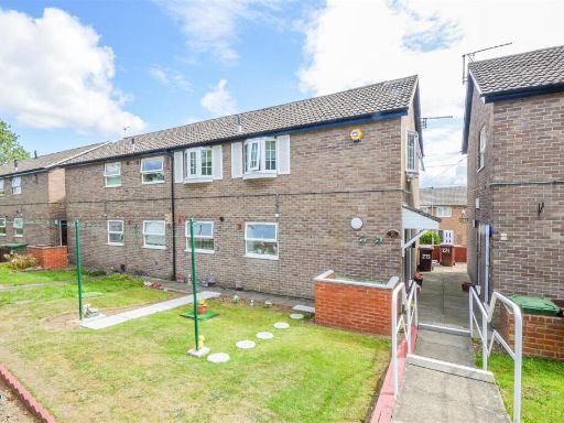 1 bedroom apartment for sale in Standbridge Lane, Wakefield, WF2 — £67,500 • 1 bed • 1 bath • 474 ft²
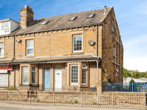 2 bedroom end of terrace house for sale in Leeds Road, Dewsbury, WF12 — £80,000 • 2 bed • 1 bath • 1027 ft²
 2 bedroom apartment for sale in 30 Belfry Court, Wakefield, West Yorkshire, WF1 3TY, WF1 — £100,000 • 2 bed • 1 bath • 726 ft²
 2 bedroom apartment for sale in Artist Street, Leeds, LS12 — £70,000 • 2 bed • 1 bath • 498 ft²
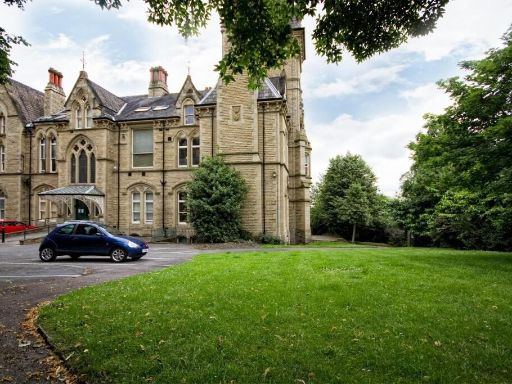 1 bedroom apartment for sale in Apartment 7, Boothroyds, Dewsbury, West Yorkshire, WF13 — £35,000 • 1 bed • 1 bath • 517 ft²
Meta
- {
"@context": "https://schema.org",
"@type": "Residence",
"name": "2 bedroom apartment for sale in 36 Elsham Meadows, Dewsbury…",
"description": "",
"url": "https://propertypiper.co.uk/property/50fd0e3d-b4b1-4a7c-aea9-3d72b5c42412",
"image": "https://image-a.propertypiper.co.uk/bf8bf5c7-d6de-473d-98ae-f0b8bdf87910-1024.jpeg",
"address": {
"@type": "PostalAddress",
"streetAddress": "36 ELSHAM MEADOWS DEWSBURY ",
"postalCode": "WF12 8LP",
"addressLocality": "Kirklees",
"addressRegion": "Dewsbury",
"addressCountry": "England"
},
"geo": {
"@type": "GeoCoordinates",
"latitude": 53.684982964769496,
"longitude": -1.6099570138533086
},
"numberOfRooms": 2,
"numberOfBathroomsTotal": 1,
"floorSize": {
"@type": "QuantitativeValue",
"value": 528,
"unitCode": "FTK"
},
"offers": {
"@type": "Offer",
"price": 70000,
"priceCurrency": "GBP",
"availability": "https://schema.org/InStock"
},
"additionalProperty": [
{
"@type": "PropertyValue",
"name": "Feature",
"value": "apartment building"
},
{
"@type": "PropertyValue",
"name": "Feature",
"value": "modern"
},
{
"@type": "PropertyValue",
"name": "Feature",
"value": "exterior"
},
{
"@type": "PropertyValue",
"name": "Feature",
"value": "low-rise"
},
{
"@type": "PropertyValue",
"name": "Feature",
"value": "brick"
},
{
"@type": "PropertyValue",
"name": "Feature",
"value": "garden"
},
{
"@type": "PropertyValue",
"name": "Feature",
"value": "lawn"
},
{
"@type": "PropertyValue",
"name": "Feature",
"value": "well-kept"
},
{
"@type": "PropertyValue",
"name": "Feature",
"value": "landscaped"
},
{
"@type": "PropertyValue",
"name": "Feature",
"value": "modern townhouse"
},
{
"@type": "PropertyValue",
"name": "Feature",
"value": "three stories"
},
{
"@type": "PropertyValue",
"name": "Feature",
"value": "stone facade"
},
{
"@type": "PropertyValue",
"name": "Feature",
"value": "residential area"
},
{
"@type": "PropertyValue",
"name": "Feature",
"value": "parking"
},
{
"@type": "PropertyValue",
"name": "Feature",
"value": "contemporary design"
},
{
"@type": "PropertyValue",
"name": "Feature",
"value": "recent construction"
},
{
"@type": "PropertyValue",
"name": "Feature",
"value": "family home"
}
]
}