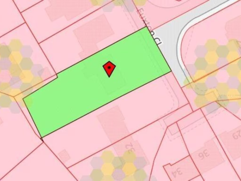
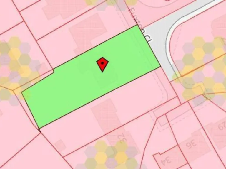
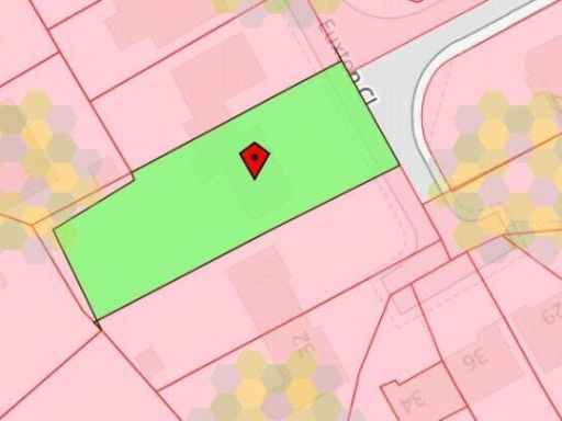
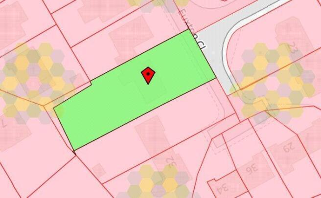
BL8 2HY - 2 bedroom detached bungalow for sale in Euxton Close, Seddo…
View on Property Piper
2 bedroom detached bungalow for sale in Euxton Close, Seddons Farm, Bury, BL8
Property Details
- Price: £375000
- Bedrooms: 2
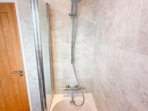
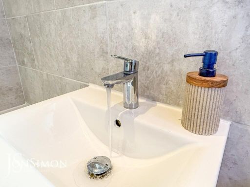
- Bathrooms: 1
- Property Type: undefined
- Property SubType: undefined
Brochure Descriptions
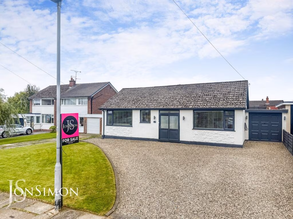
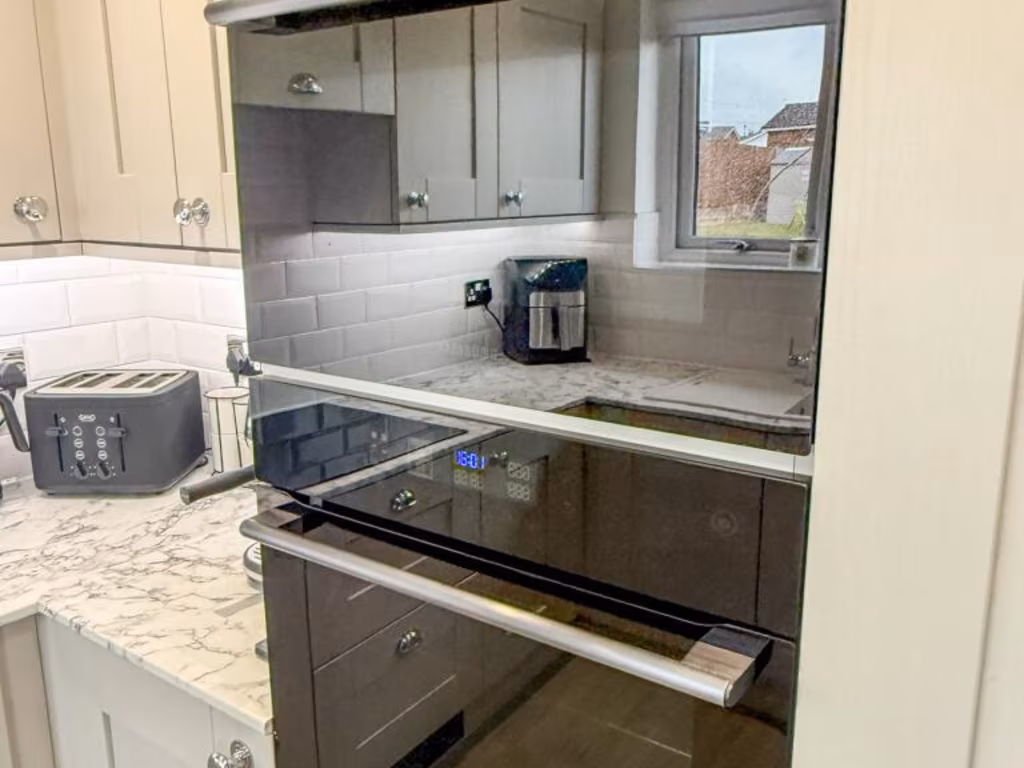
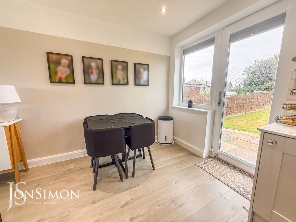
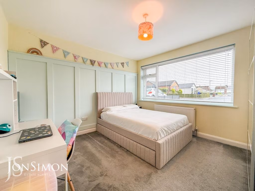
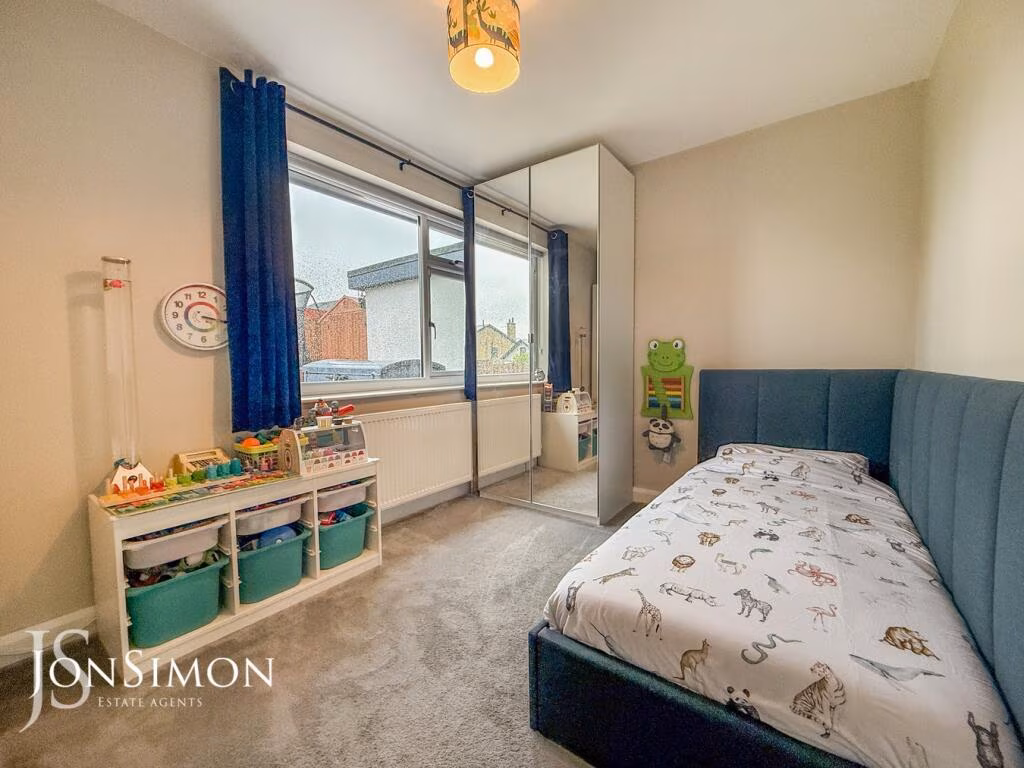
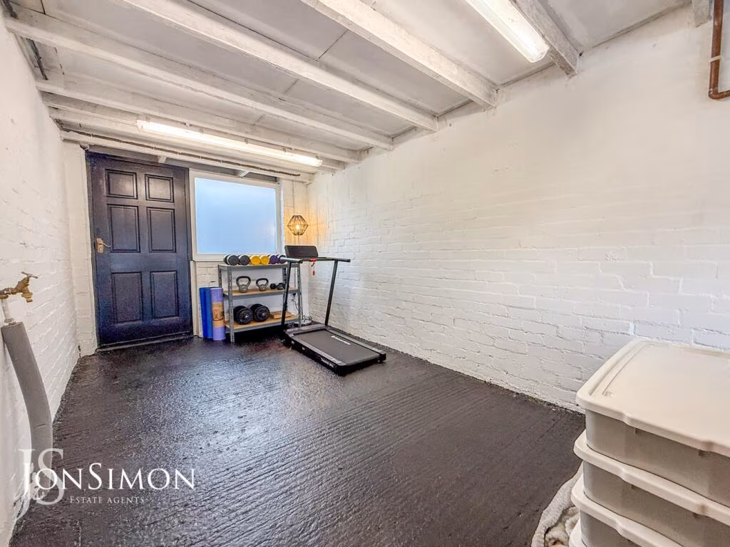
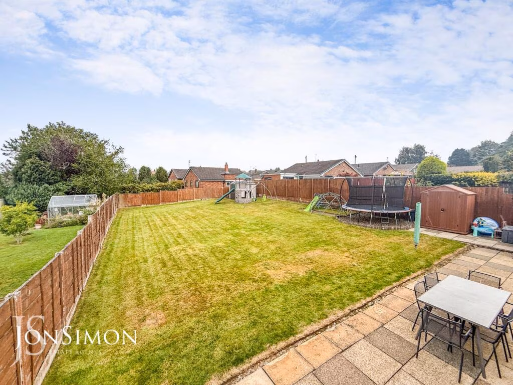
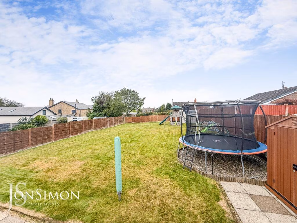
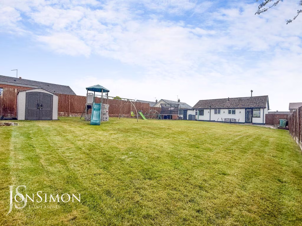
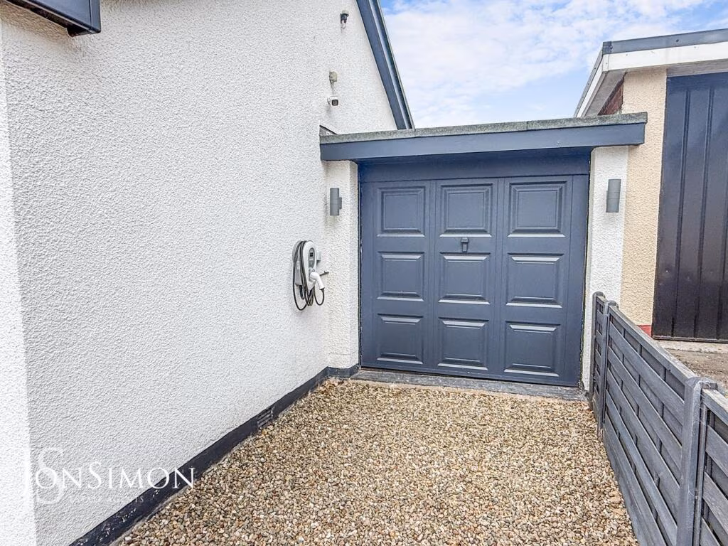
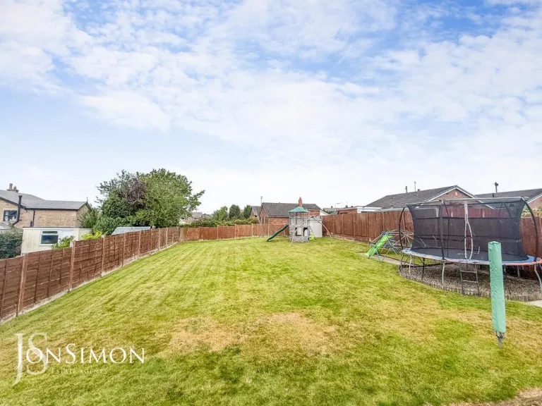
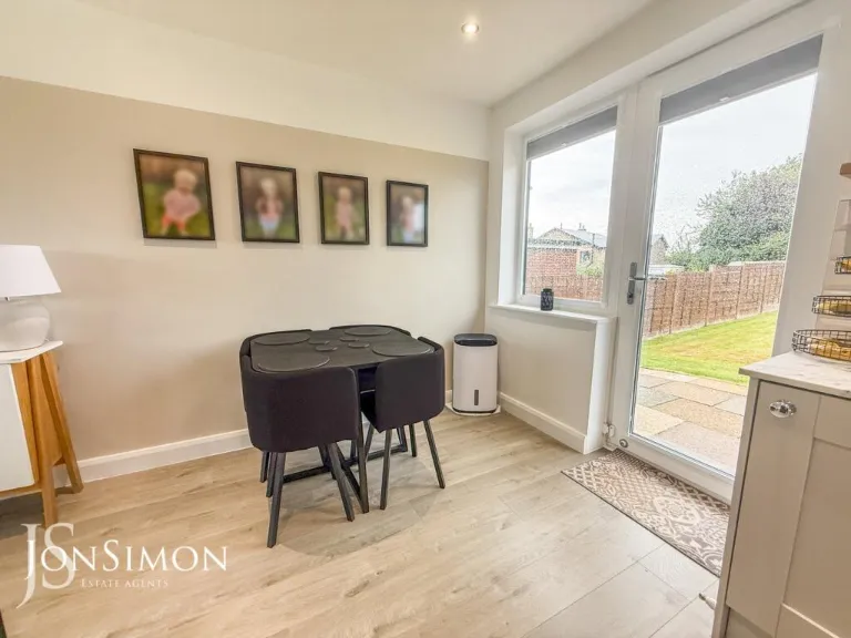
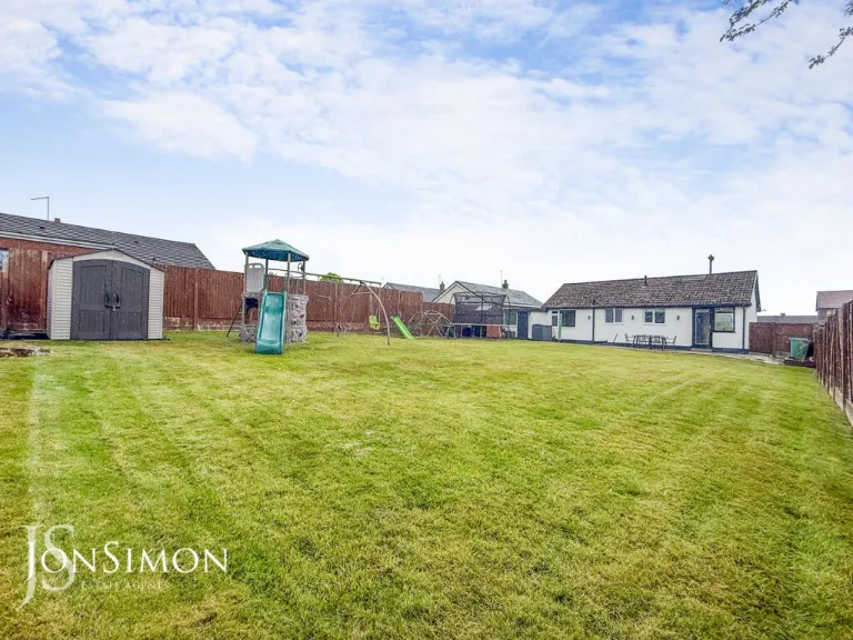
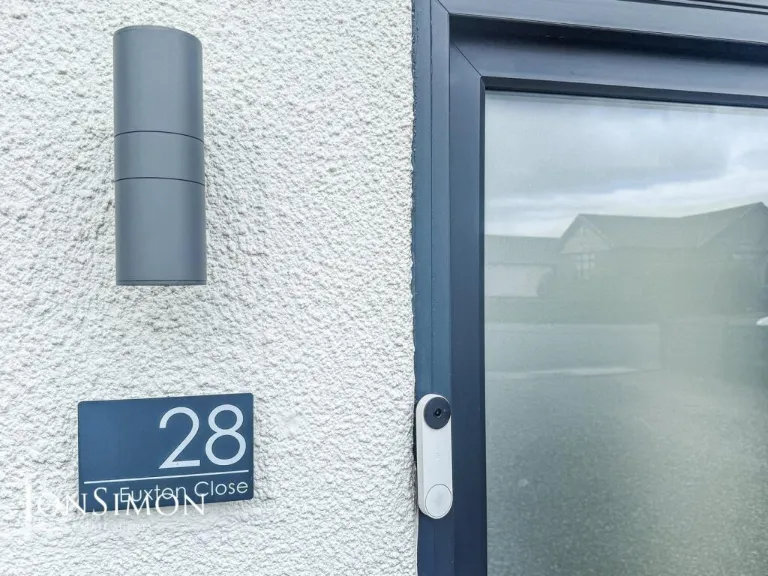
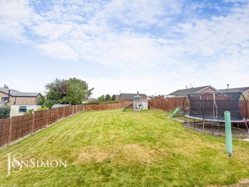
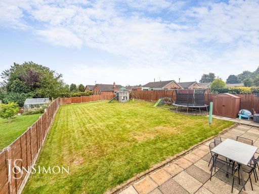
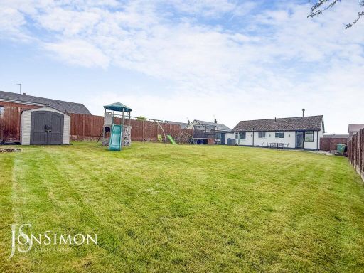
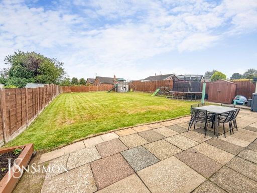
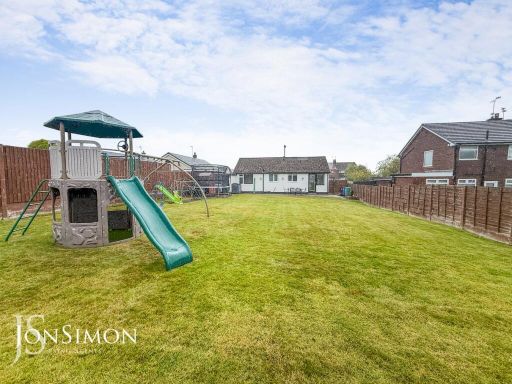
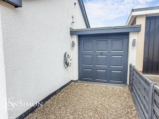
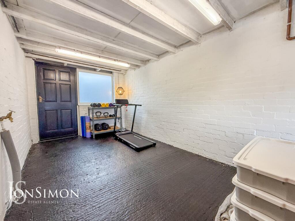
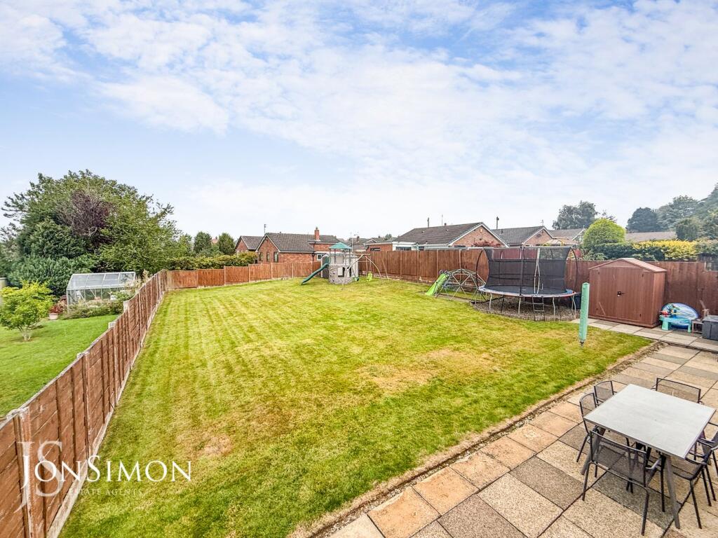
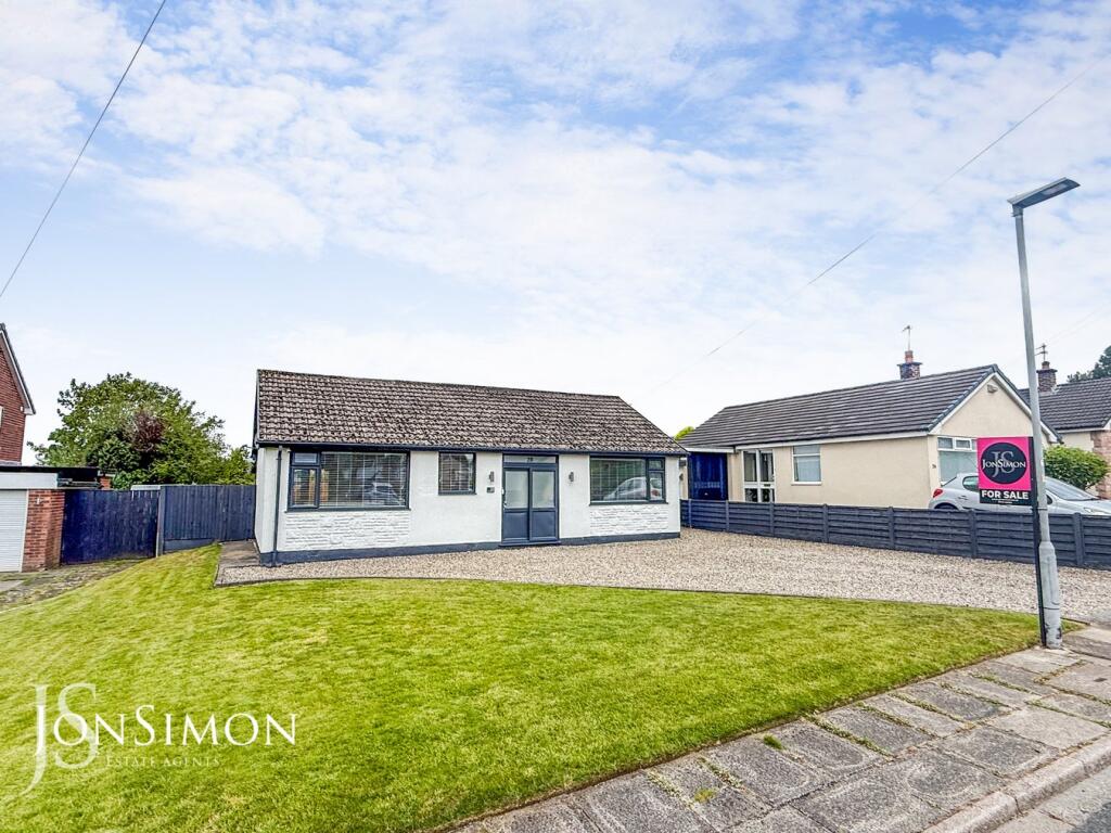
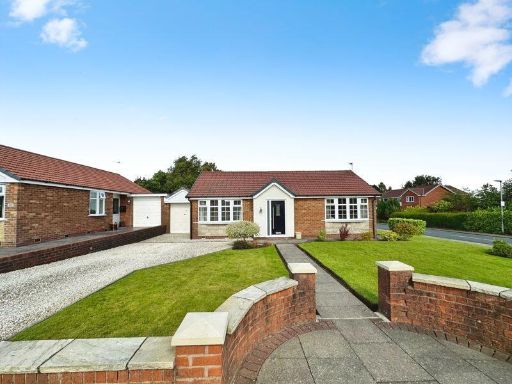
- The property is a detached single-story bungalow with a large gravel driveway that could accommodate multiple vehicles. It features a single-car attached garage and has modern windows and doors. The front garden is of medium size with a well-maintained lawn and some landscaping. The street appears to be residential, lined with similar detached and semi-detached homes, and the area looks peaceful, likely in a suburban setting. No exceptional views are present, only adjacent homes and yards. The property itself looks to be of average to large size for its type.
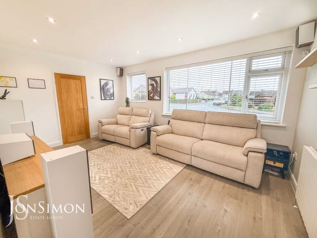
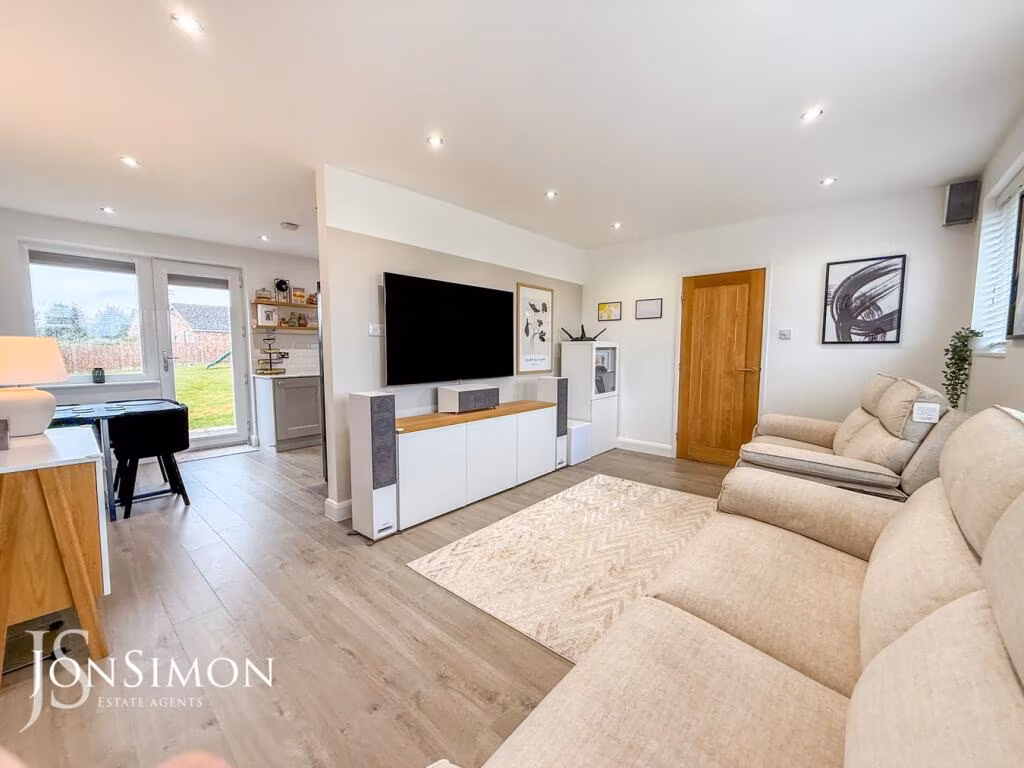
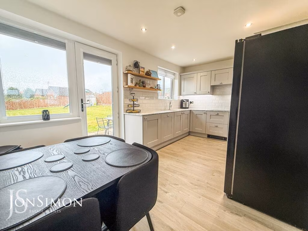
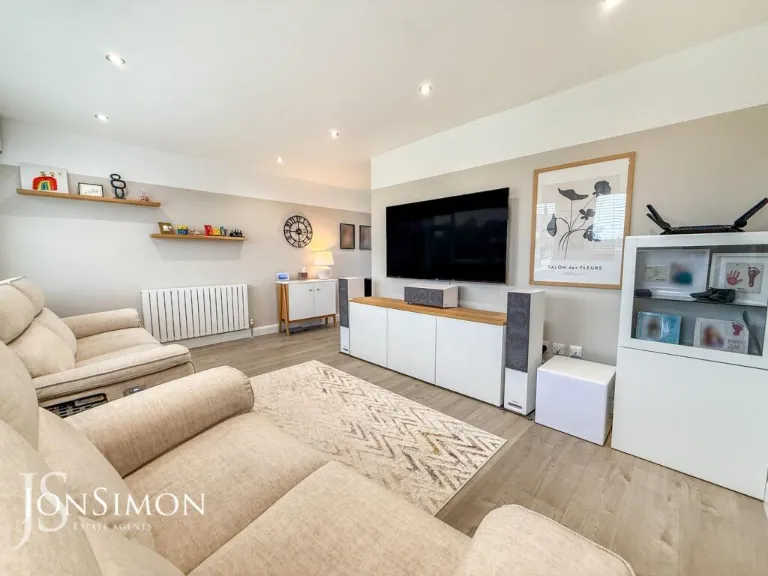
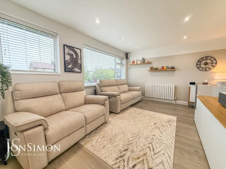
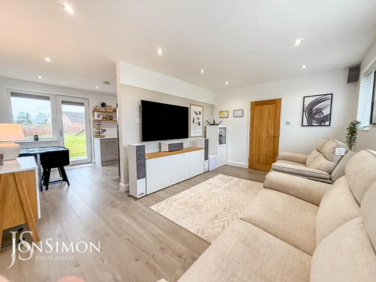
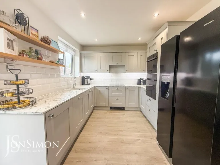
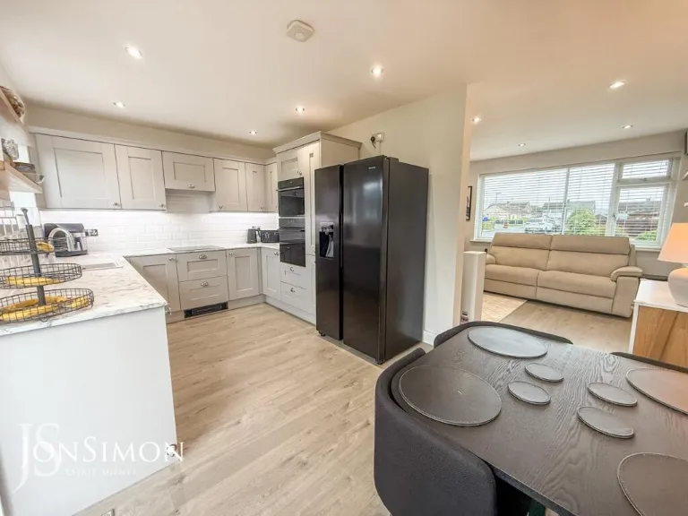
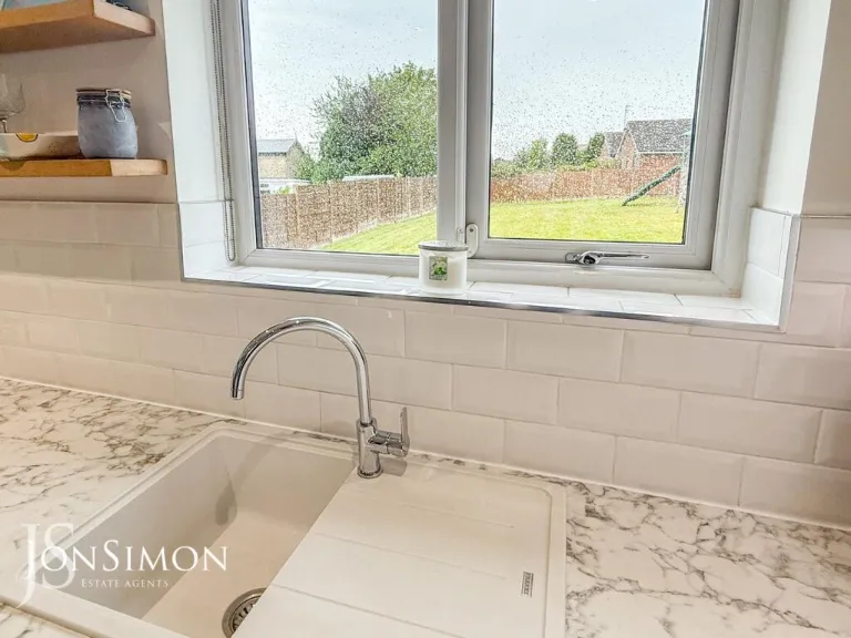
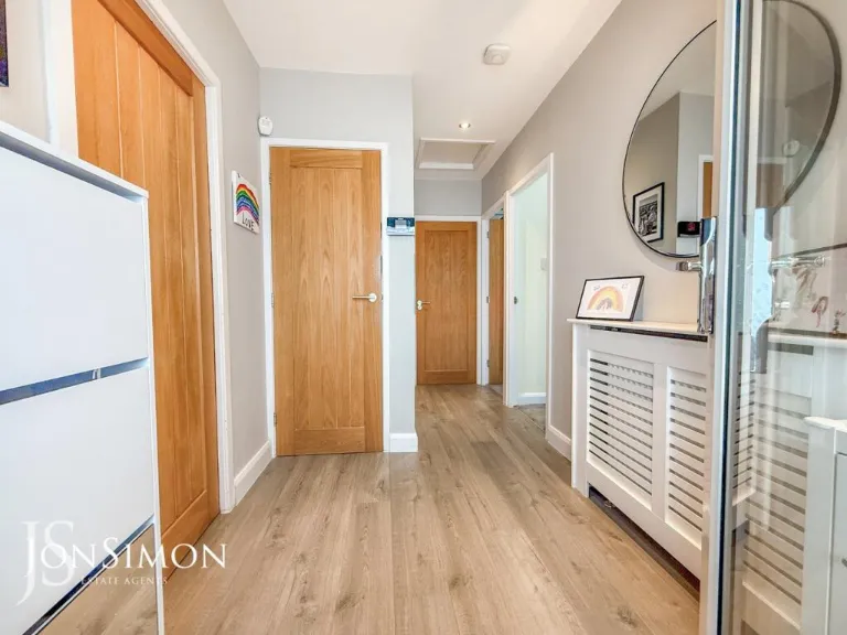
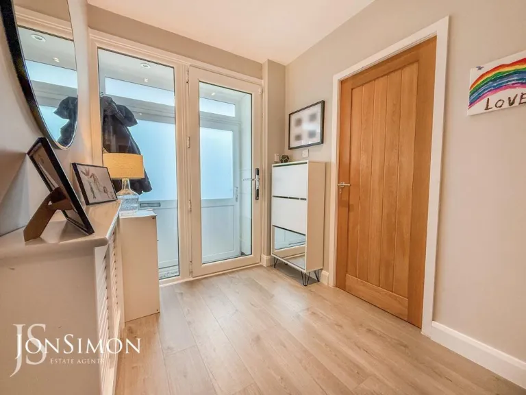
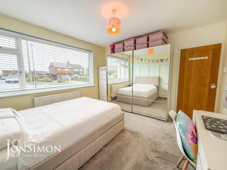
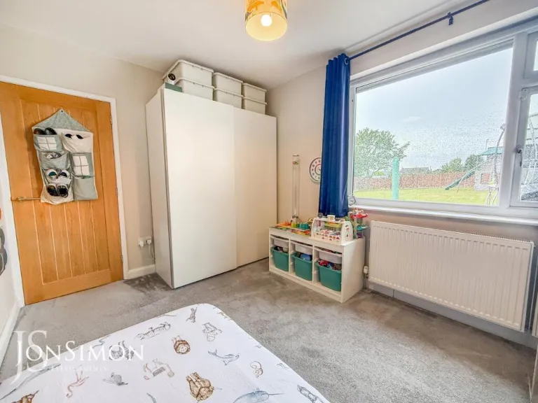
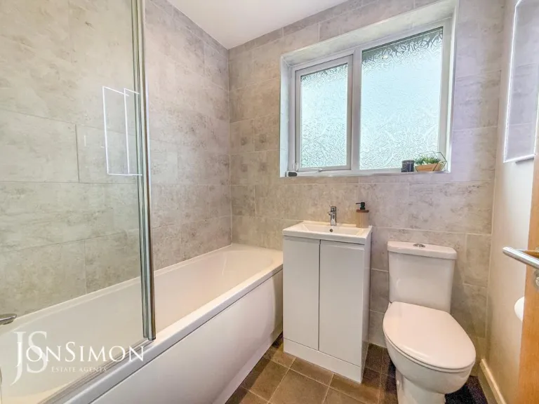
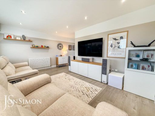
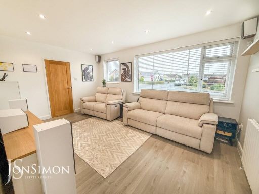
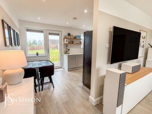
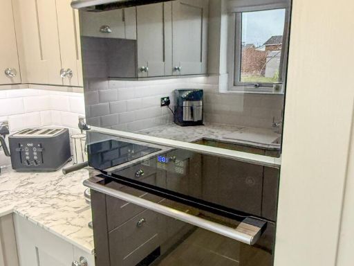
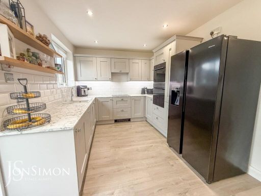
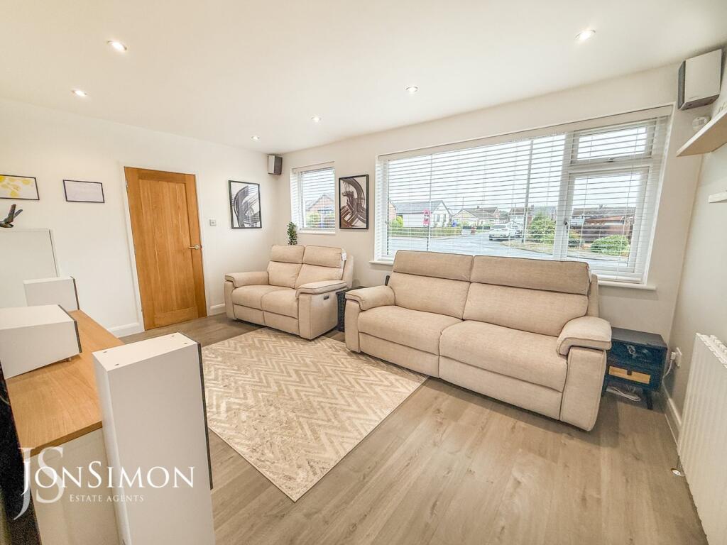
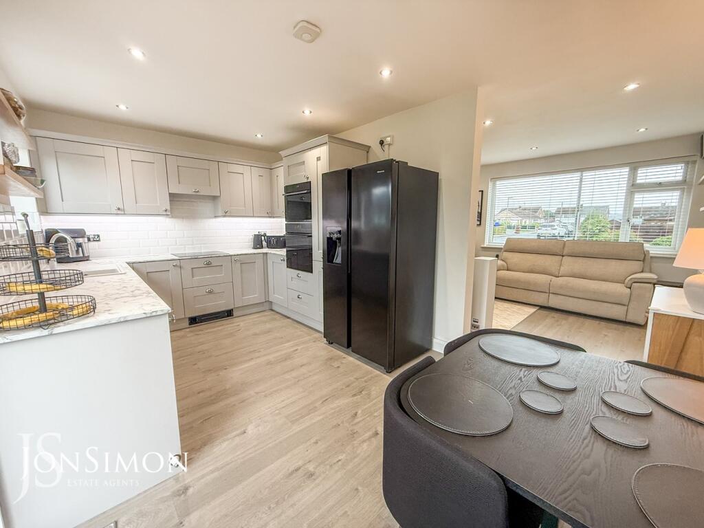
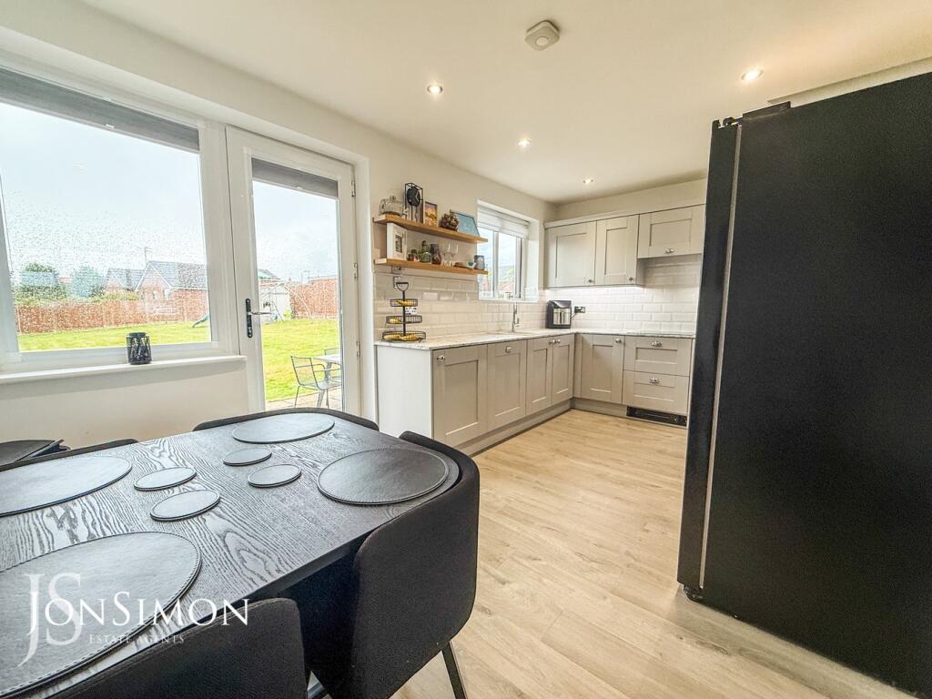
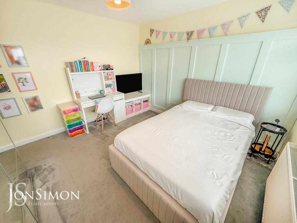
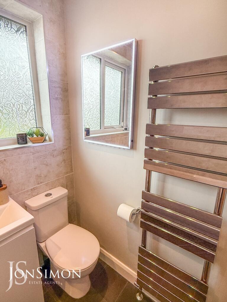
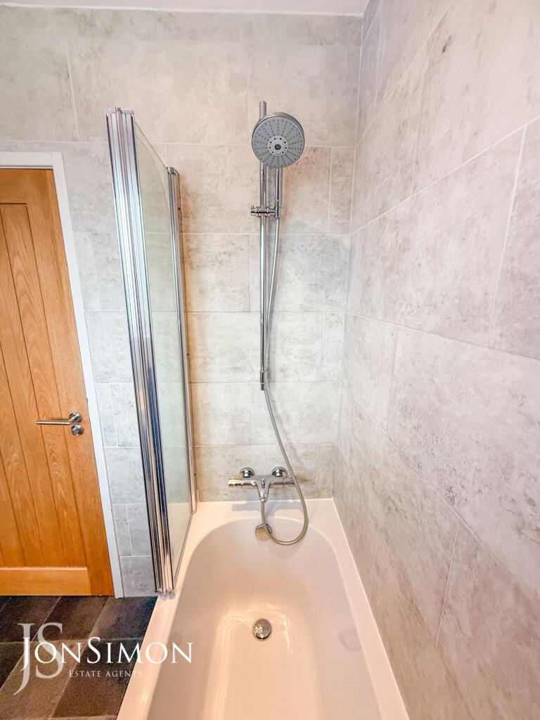
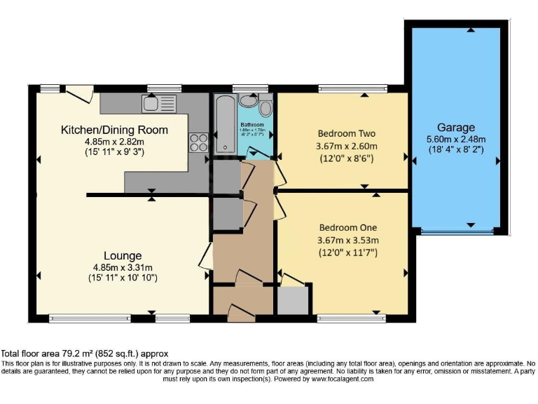
- The property is a detached or semi-detached bungalow with a total floor area of approximately 79.2 m² (852 sq.ft.). It comprises a generous-sized lounge and kitchen/dining room, two bedrooms (one slightly larger than the other), a single bathroom, and an attached garage. The layout suggests a compact and functional design, suitable for a small family or a couple. The rooms, especially the lounge and kitchen/dining, are of average size for properties of this type. There is no visible indication of any notable external views (such as forest, sea, or city) from the floorplan alone. The garage is of average size for a single car plus some storage.
Image Descriptions
- bungalow mid-20th century
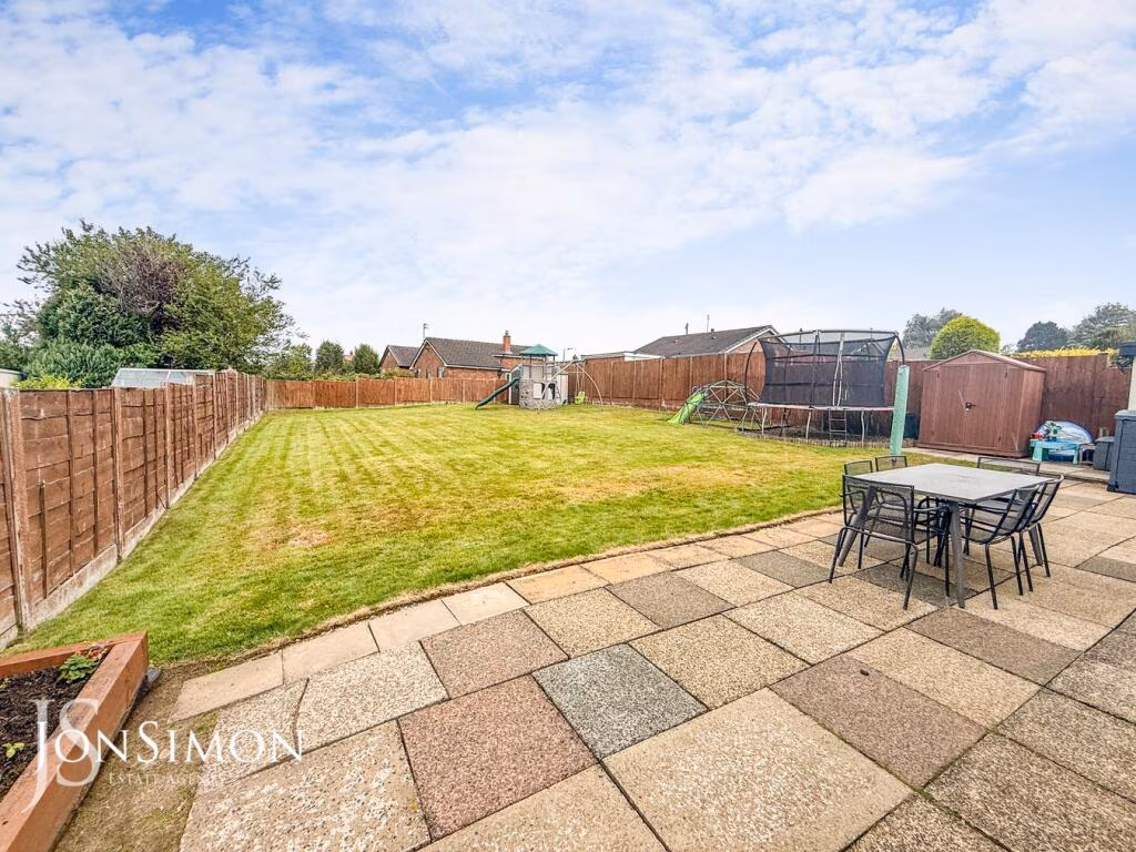
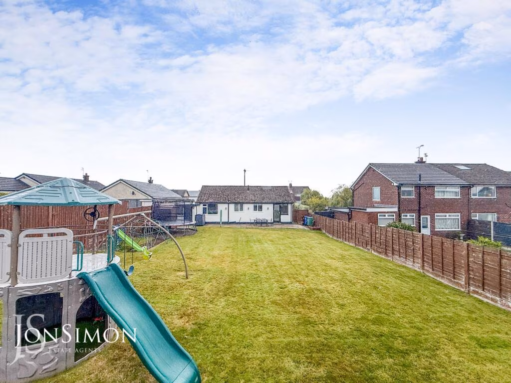
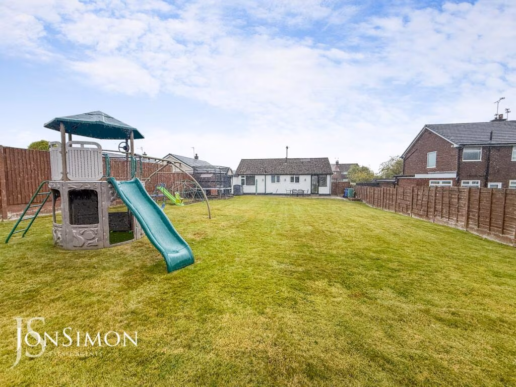
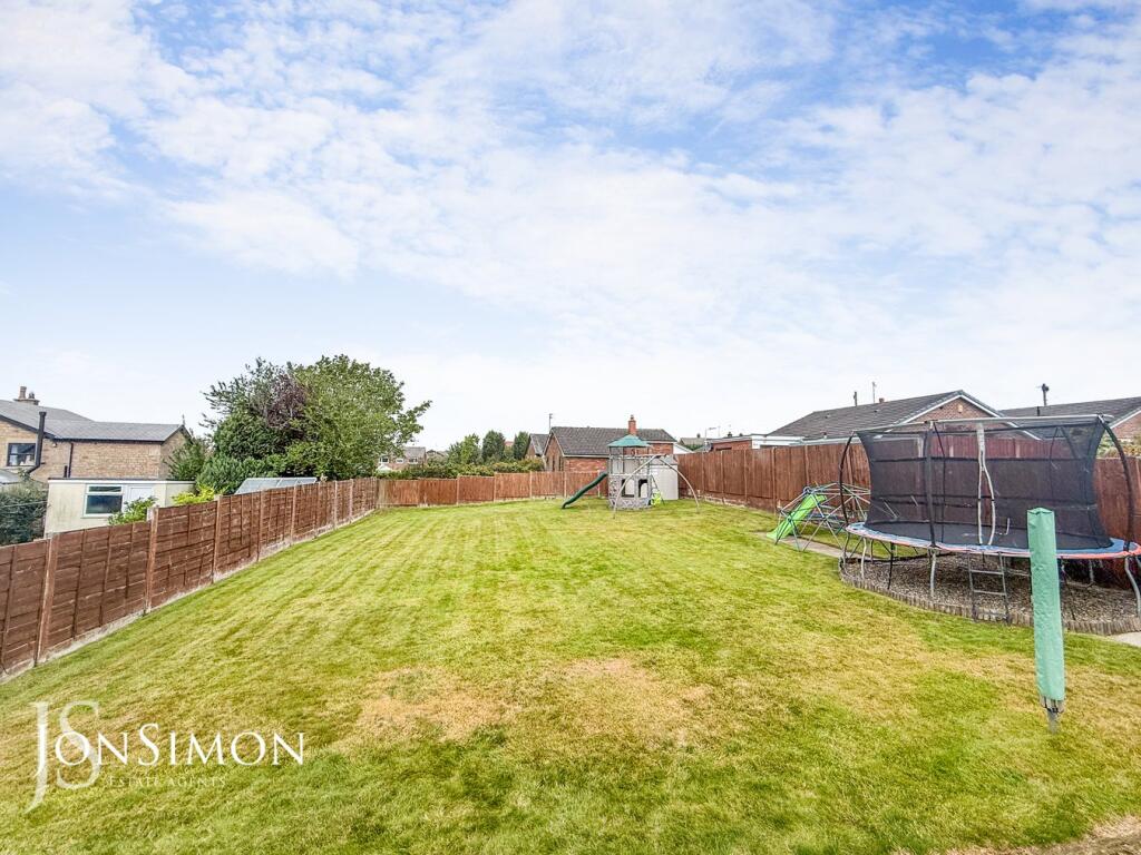
- back yard
Floorplan Description
- A single-story home with a kitchen/dining room, lounge, two bedrooms, and a bathroom.
Rooms
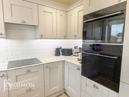
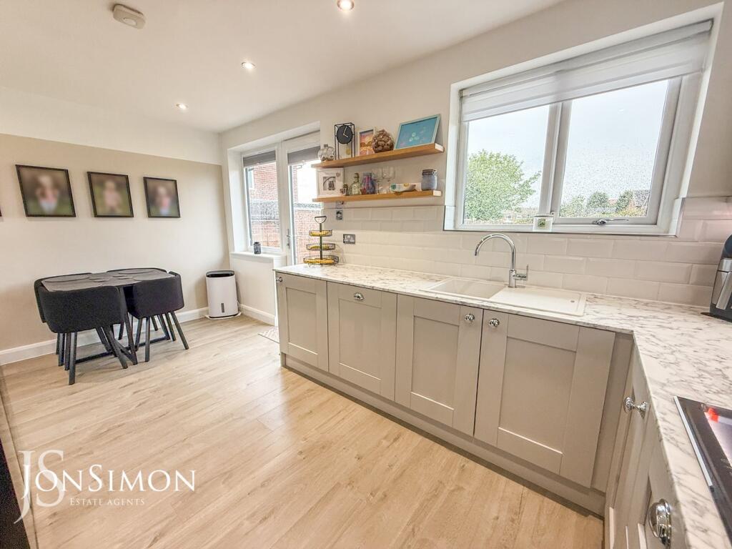
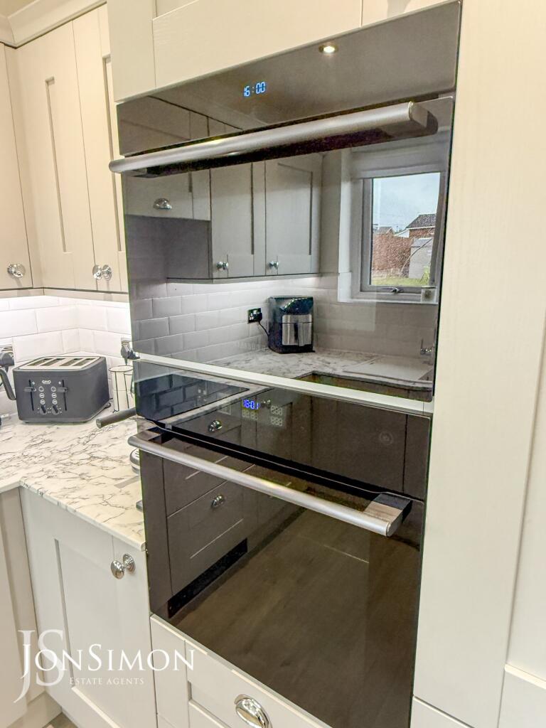
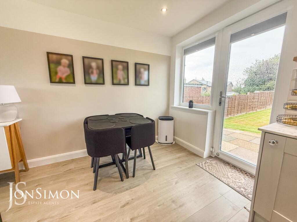
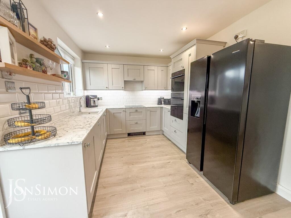
- Kitchen/Dining Room: average
- Lounge: average
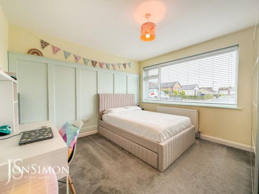
- Bedroom Two: small
- Bedroom One: average
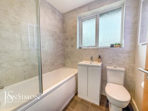
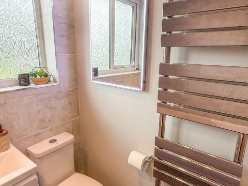
- Bathroom: small
Textual Property Features
- Has Garden
- Chain Free
- Success
Detected Visual Features
- bungalow
- mid-20th century
- single-story
- detached
- gravel driveway
- garage
- modern windows
- front lawn
- residential neighborhood
- large garden
- fenced backyard
- playset
- family-friendly
- outdoor space
- residential
EPC Details
- Fully double glazed
- Cavity wall, as built, no insulation (assumed)
- Boiler and radiators, mains gas
- Low energy lighting in 60% of fixed outlets
- Solid, no insulation (assumed)
Nearby Schools
- Radcliffe Primary School
- St Gabriel's RC High School, a Voluntary Academy
- Bury Grammar Schools
- Guardian Angels Roman Catholic Primary School, Bury
- Bury Church of England High School
- Elton Community Primary School
- Christ Church CofE Primary School
- Tottington High School
- St Andrew's Church of England Primary School, Radcliffe
- The Derby High School
- St Stephen's Church of England Primary School
- Greenhill Primary School
- Gorsefield Primary School
- Radcliffe Hall Church of England Methodist Primary School
- Wesley Methodist Primary School
- St Peter's Church of England Primary School
- Christ Church Ainsworth Church of England Primary School
- Lowercroft Primary School
- Chantlers Primary School
- The Elton High School
- Tottington Primary School
- Our Lady of Lourdes Roman Catholic Primary School, Bury
- Old Hall Primary School
Nearest General Shops
- Id: 1472157480
- Tags:
- Brand: Londis
- Brand:wikidata: Q21008564
- Name: Londis
- Shop: alcohol
- TagsNormalized:
- Lat: 53.5868585
- Lon: -2.3250607
- FullGeoHash: gcw2g54yn4mn
- PartitionGeoHash: gcw2
- Images:
- FoodStandards: null
- Distance: 413.8
,- Id: 1420318947
- Tags:
- Addr:
- Name: The Laundry Basket
- Shop: laundry
- TagsNormalized:
- Lat: 53.5881935
- Lon: -2.335386
- FullGeoHash: gcw2fg7mve3c
- PartitionGeoHash: gcw2
- Images:
- FoodStandards: null
- Distance: 337.4
,- Id: 1420318945
- Tags:
- Addr:
- Name: TLC
- Shop: hairdresser
- TagsNormalized:
- Lat: 53.5882158
- Lon: -2.3353028
- FullGeoHash: gcw2fg7mzx2n
- PartitionGeoHash: gcw2
- Images:
- FoodStandards: null
- Distance: 334.5
}
Nearest Grocery shops
- Id: 3643949256
- Tags:
- Addr:
- City: Bury
- Housenumber: 131
- Postcode: BL8 2RT
- Street: Ainsworth Road
- Brand: McColl's
- Brand:wikidata: Q16997477
- Brand:wikipedia: en:McColl's
- Contact:
- Website: https://www.mccolls.co.uk/storelocator/bury-131-ainsworth-rd/
- Name: McColl's
- Opening_hours: Mo-Su 07:00-22:00
- Phone: +44 161 272 0484
- Shop: convenience
- TagsNormalized:
- Lat: 53.5924407
- Lon: -2.3177786
- FullGeoHash: gcw2gk0nxg51
- PartitionGeoHash: gcw2
- Images:
- FoodStandards: null
- Distance: 1116.8
,- Id: 558220571
- Tags:
- Addr:
- Postcode: BL8 2NZ
- Street: Bolton Road
- Brand: Tesco Express
- Brand:wikidata: Q98456772
- Building: yes
- Contact:
- Website: https://www.tesco.com/store-locator/bury/bolton-rd
- Fhrs:
- Name: Tesco Express
- Shop: convenience
- Source:
- TagsNormalized:
- tesco
- tesco express
- convenience
- shop
- Lat: 53.5890493
- Lon: -2.3183156
- FullGeoHash: gcw2g5xfg6fd
- PartitionGeoHash: gcw2
- Images:
- FoodStandards: null
- Distance: 905.4
,- Id: 1850103922
- Tags:
- TagsNormalized:
- Lat: 53.5881426
- Lon: -2.3355149
- FullGeoHash: gcw2fg7md9cf
- PartitionGeoHash: gcw2
- Images:
- FoodStandards: null
- Distance: 341
}
Nearest Religious buildings
- Id: 837330292
- Tags:
- Amenity: place_of_worship
- Building: church
- Denomination: anglican
- Name: St Stephen
- Religion: christian
- Wikidata: Q105100792
- TagsNormalized:
- place of worship
- church
- anglican
- christian
- Lat: 53.5909821
- Lon: -2.3151787
- FullGeoHash: gcw2g7fnh7js
- PartitionGeoHash: gcw2
- Images:
- FoodStandards: null
- Distance: 1179.1
,- Id: 962442855
- Tags:
- Amenity: place_of_worship
- Building: church
- Denomination: methodist
- Historic: church
- Name: Bolton Road Methodist Church
- Religion: christian
- TagsNormalized:
- place of worship
- church
- methodist
- christian
- Lat: 53.5868033
- Lon: -2.3228982
- FullGeoHash: gcw2g5htb81s
- PartitionGeoHash: gcw2
- Images:
- FoodStandards: null
- Distance: 555.1
,- Id: 440838518
- Tags:
- Addr:
- City: Bury
- Country: GB
- Postcode: BL8 2DX
- Street: Colville Drive
- Amenity: school
- Fhrs:
- Name: St Stephen's Church of England Primary School
- Phone: +44 161 764 1132
- Ref:
- Source:
- Addr: edubase
- Geometry: OS_Open_Map_Local_FunctionalSite
- Name: edubase
- Website: https://www.ststephensceprimary.co.uk/
- Wikidata: Q67149267
- TagsNormalized:
- Lat: 53.58789
- Lon: -2.3249019
- FullGeoHash: gcw2g57h1fer
- PartitionGeoHash: gcw2
- Images:
- FoodStandards:
- Id: 624753
- FHRSID: 624753
- LocalAuthorityBusinessID: 1506
- BusinessName: St Stephens C.E Junior School
- BusinessType: School/college/university
- BusinessTypeID: 7845
- AddressLine1: St Stephens C Of E Primary Sch
- AddressLine2: Colville Drive
- AddressLine3: Bury
- AddressLine4: Greater Manchester
- PostCode: BL8 2DX
- RatingValue: 5
- RatingKey: fhrs_5_en-GB
- RatingDate: 2018-06-25
- LocalAuthorityCode: 405
- LocalAuthorityName: Bury
- LocalAuthorityWebSite: http://www.bury.gov.uk
- LocalAuthorityEmailAddress: Commercial@bury.gov.uk
- Scores:
- Hygiene: 5
- Structural: 5
- ConfidenceInManagement: 0
- NewRatingPending: false
- Geocode:
- Longitude: -2.32537800000000
- Latitude: 53.58704000000000
- Distance: 452.9
}
Nearest Medical buildings
- Id: 655853802
- Tags:
- Amenity: dentist
- Building: yes
- Healthcare: dentist
- Name: Ainsworth Village Dental Practice
- TagsNormalized:
- dentist
- health
- healthcare
- dental
- Lat: 53.5880911
- Lon: -2.358414
- FullGeoHash: gcw2f76tkbpn
- PartitionGeoHash: gcw2
- Images:
- FoodStandards: null
- Distance: 1801.1
,- Id: 274501630
- Tags:
- Addr:
- City: Bury
- Postcode: BL8 2BS
- Street: Buller Street
- Amenity: hospital
- Email: grantstevens@cygnethealth.co.uk
- Emergency: no
- Fax: +44 161 762 4747
- Healthcare: hospital
- Name: Cygnet Hospital
- Old_name: Alpha Hospital
- Operator: Cygnet Health Care
- Phone: +44 161 762 7200
- Website: https://www.cygnethealth.co.uk/locations/cygnet-hospital-bury/
- TagsNormalized:
- Lat: 53.5862379
- Lon: -2.3171295
- FullGeoHash: gcw2g70dqyz0
- PartitionGeoHash: gcw2
- Images:
- FoodStandards: null
- Distance: 934.1
,- Id: 174322881
- Tags:
- Amenity: clinic
- Building: yes
- Emergency: no
- Healthcare: clinic
- Name: Mile Lane Medical Practice
- TagsNormalized:
- Lat: 53.5879097
- Lon: -2.3363137
- FullGeoHash: gcw2fg6spyqh
- PartitionGeoHash: gcw2
- Images:
- FoodStandards: null
- Distance: 373
,- Id: 1420318936
- Tags:
- Addr:
- Amenity: pharmacy
- Dispensing: yes
- Healthcare: pharmacy
- Name: Vantage Pharmacy
- TagsNormalized:
- Lat: 53.5882429
- Lon: -2.3352278
- FullGeoHash: gcw2fg7w1hxb
- PartitionGeoHash: gcw2
- Images:
- FoodStandards: null
- Distance: 332.5
}
Nearest Airports
- Id: 1224469
- Tags:
- Addr:
- City: Manchester
- Country: GB
- Postcode: M90 1QX
- Aerodrome: international
- Aeroway: aerodrome
- Arp: yes
- Atis: 128.175
- Iata: MAN
- Icao: EGCC
- Name: Manchester Airport
- Note: rough sketched outline referring to Yahoo imagery - true boundary is where?
- Old_name: Ringway
- Operator: Manchester Airport PLC
- Size: 18720000
- Source:
- Tower_frequency: 118.625,119.400
- Type: multipolygon
- Website: https://www.manchesterairport.co.uk/
- Wikidata: Q8694
- Wikipedia: en:Manchester Airport
- TagsNormalized:
- airport
- international airport
- Lat: 53.3503197
- Lon: -2.2798822
- FullGeoHash: gcqrs05u4ukt
- PartitionGeoHash: gcqr
- Images:
- FoodStandards: null
- Distance: 26469
}
Nearest Leisure Facilities
- Id: 172477715
- Tags:
- TagsNormalized:
- Lat: 53.5823389
- Lon: -2.3348378
- FullGeoHash: gcw2ff7gdrfv
- PartitionGeoHash: gcw2
- Images:
- FoodStandards: null
- Distance: 507.7
,- Id: 174418505
- Tags:
- TagsNormalized:
- Lat: 53.5890919
- Lon: -2.3254145
- FullGeoHash: gcw2g5dejfv2
- PartitionGeoHash: gcw2
- Images:
- FoodStandards: null
- Distance: 490.2
,- Id: 1020574061
- Tags:
- Building: yes
- Leisure: playground
- TagsNormalized:
- Lat: 53.5887289
- Lon: -2.3341702
- FullGeoHash: gcw2fgs2czhe
- PartitionGeoHash: gcw2
- Images:
- FoodStandards: null
- Distance: 322.9
,- Id: 1020574057
- Tags:
- Building: yes
- Leisure: pitch
- Sport: running
- Surface: grass
- TagsNormalized:
- pitch
- leisure
- running
- sports
- Lat: 53.5884127
- Lon: -2.334524
- FullGeoHash: gcw2fgkp1sht
- PartitionGeoHash: gcw2
- Images:
- FoodStandards: null
- Distance: 310.9
,- Id: 1020574060
- Tags:
- TagsNormalized:
- Lat: 53.5882541
- Lon: -2.3336717
- FullGeoHash: gcw2fgkwjw87
- PartitionGeoHash: gcw2
- Images:
- FoodStandards: null
- Distance: 260.9
}
Nearest Tourist attractions
- Id: 405208907
- Tags:
- Tourism: museum
- Wheelchair: no
- TagsNormalized:
- Lat: 53.5944888
- Lon: -2.3003755
- FullGeoHash: gcw2gssft2gd
- PartitionGeoHash: gcw2
- Images:
- FoodStandards: null
- Distance: 2229.7
,- Id: 103989468
- Tags:
- Building: yes
- Name: Bury Transport Museum
- Tourism: museum
- Wikidata: Q26670146
- Wikipedia: en:Bury Transport Museum
- TagsNormalized:
- Lat: 53.5945646
- Lon: -2.3006588
- FullGeoHash: gcw2gssdyybq
- PartitionGeoHash: gcw2
- Images:
- FoodStandards: null
- Distance: 2216.1
,- Id: 510707138
- Tags:
- Addr:
- City: Bury
- Housenumber: 7
- Postcode: BL8 2AL
- Street: Wellington Street
- Building: yes
- Name: Castle Guest House
- Phone: +44 161 797 3396
- Tourism: guest_house
- TagsNormalized:
- Lat: 53.592117
- Lon: -2.3107506
- FullGeoHash: gcw2gkjkeweq
- PartitionGeoHash: gcw2
- Images:
- FoodStandards: null
- Distance: 1497.3
}
Nearest Train stations
- Id: 6284257125
- Tags:
- Name: Farnworth
- Naptan:
- Network: National Rail
- Public_transport: station
- Railway: station
- Ref:
- Source: NPE
- Train: yes
- Wikidata: Q2043682
- Wikipedia: en:Farnworth railway station
- TagsNormalized:
- Lat: 53.5504599
- Lon: -2.3885326
- FullGeoHash: gcw29ssdp1m0
- PartitionGeoHash: gcw2
- Images:
- FoodStandards: null
- Distance: 5500.2
,- Id: 9776991777
- Tags:
- Name: Kearsley
- Naptan:
- Network: National Rail
- Public_transport: station
- Railway: station
- Ref:
- Source: npe
- Train: yes
- Wikidata: Q3464698
- Wikipedia: en:Kearsley railway station
- TagsNormalized:
- Lat: 53.5443635
- Lon: -2.3751628
- FullGeoHash: gcw29gqqw8y3
- PartitionGeoHash: gcw2
- Images:
- FoodStandards: null
- Distance: 5498.5
,- Id: 27016810
- Tags:
- Name: Summerseat
- Public_transport: station
- Railway: station
- Usage: tourism
- Wikidata: Q7637658
- TagsNormalized:
- Lat: 53.6279534
- Lon: -2.3134126
- FullGeoHash: gcw356emmx4d
- PartitionGeoHash: gcw3
- Images:
- FoodStandards: null
- Distance: 4770
,- Id: 27016832
- Tags:
- Name: Burrs Country Park Halt
- Network: East Lancashire Railway
- Note: Opened to the public on Jan 1st 2017
- Operator: East Lancashire Railway
- Public_transport: station
- Railway: station
- Train: yes
- Usage: tourism
- Wheelchair: yes
- Wikidata: Q28197680
- TagsNormalized:
- Lat: 53.6113055
- Lon: -2.3032556
- FullGeoHash: gcw2gxdu6r8n
- PartitionGeoHash: gcw2
- Images:
- FoodStandards: null
- Distance: 3331.2
,- Id: 27016927
- Tags:
- Name: Bury, Bolton Street
- Naptan:
- Public_transport: station
- Railway: station
- Train: yes
- Usage: tourism
- Wheelchair: yes
- Wikidata: Q5001073
- TagsNormalized:
- Lat: 53.5929094
- Lon: -2.3003018
- FullGeoHash: gcw2gskcr46t
- PartitionGeoHash: gcw2
- Images:
- FoodStandards: null
- Distance: 2169.4
}
Nearest Hotels
- Id: 617646212
- Tags:
- Addr:
- Housenumber: 288
- Postcode: BL8 1SJ
- Street: Tottington Road
- Amenity: pub
- Building: yes
- Fhrs:
- Name: Swan Hotel
- Source:
- TagsNormalized:
- Lat: 53.6023996
- Lon: -2.3203634
- FullGeoHash: gcw2gnn2eee8
- PartitionGeoHash: gcw2
- Images:
- FoodStandards: null
- Distance: 1920.8
,- Id: 1139455462
- Tags:
- Addr:
- Housenumber: 12-14
- Postcode: BL8 3BD
- Street: Hall Street
- Amenity: pub
- Fhrs:
- Name: Victoria Hotel
- Source:
- Wheelchair: limited
- TagsNormalized:
- Lat: 53.6022687
- Lon: -2.3397662
- FullGeoHash: gcw2fvbpz7pg
- PartitionGeoHash: gcw2
- Images:
- FoodStandards: null
- Distance: 1852.7
,- Id: 1834280711
- Tags:
- Addr:
- Postcode: BL8 1PU
- Street: Walshaw Road
- Fhrs:
- Name: Bolholt Hotel
- Source:
- Tourism: hotel
- TagsNormalized:
- Lat: 53.602862
- Lon: -2.3284695
- FullGeoHash: gcw2gn07q9xq
- PartitionGeoHash: gcw2
- Images:
- FoodStandards: null
- Distance: 1841.3
}
Tags
- bungalow
- mid-20th century
- single-story
- detached
- gravel driveway
- garage
- modern windows
- front lawn
- residential neighborhood
- large garden
- fenced backyard
- playset
- family-friendly
- outdoor space
- residential
Local Market Stats
- Average Price/sqft: £246
- Avg Income: £45900
- Rental Yield: 4.2%
- Social Housing: 4%
- Planning Success Rate: 94%
Similar Properties
 2 bedroom detached bungalow for sale in Mile Lane, Bury, BL8 — £425,000 • 2 bed • 2 bath • 985 ft²
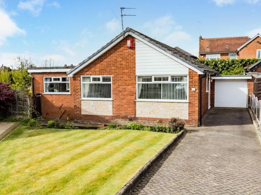 3 bedroom bungalow for sale in Turton Close, Bury, Greater Manchester, BL8 2EE, BL8 — £350,000 • 3 bed • 1 bath • 951 ft²
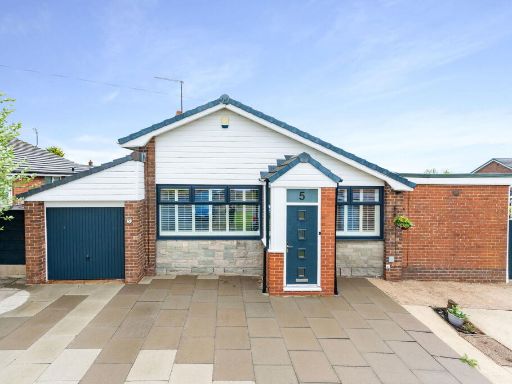 3 bedroom detached house for sale in Wheelton Close, Bury, BL8 2HZ, BL8 — £399,995 • 3 bed • 2 bath • 1054 ft²
 3 bedroom detached bungalow for sale in 56, Mile Lane, Seddons Farm, Bury, BL8 — £460,000 • 3 bed • 1 bath • 1309 ft²
 3 bedroom bungalow for sale in Turton Close, Seddons Farm, Bury, Greater Manchester, BL8 — £350,000 • 3 bed • 2 bath • 1339 ft²
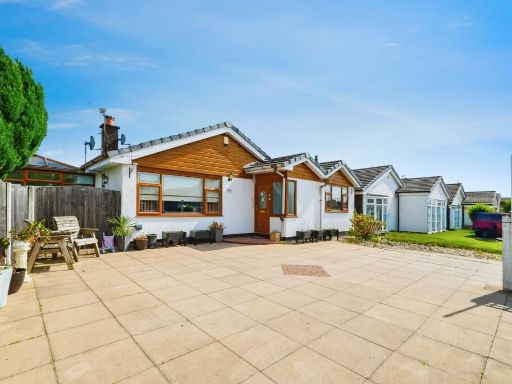 3 bedroom detached house for sale in Adlington Close, Bury, Greater Manchester, BL8 — £450,000 • 3 bed • 1 bath • 1403 ft²
Meta
- {
"@context": "https://schema.org",
"@type": "Residence",
"name": "2 bedroom detached bungalow for sale in Euxton Close, Seddo…",
"description": "",
"url": "https://propertypiper.co.uk/property/4ffd1885-838c-44eb-a633-704b9e78e99f",
"image": "https://image-a.propertypiper.co.uk/bc41ab9b-9069-4184-b4e4-43d9cb8d599b-1024.jpeg",
"address": {
"@type": "PostalAddress",
"streetAddress": "28 EUXTON CLOSE BURY",
"postalCode": "BL8 2HY",
"addressLocality": "Bury",
"addressRegion": "Bury North",
"addressCountry": "England"
},
"geo": {
"@type": "GeoCoordinates",
"latitude": 53.58638649864344,
"longitude": -2.331278859681094
},
"numberOfRooms": 2,
"numberOfBathroomsTotal": 1,
"floorSize": {
"@type": "QuantitativeValue",
"value": 852,
"unitCode": "FTK"
},
"offers": {
"@type": "Offer",
"price": 375000,
"priceCurrency": "GBP",
"availability": "https://schema.org/InStock"
},
"additionalProperty": [
{
"@type": "PropertyValue",
"name": "Feature",
"value": "bungalow"
},
{
"@type": "PropertyValue",
"name": "Feature",
"value": "mid-20th century"
},
{
"@type": "PropertyValue",
"name": "Feature",
"value": "single-story"
},
{
"@type": "PropertyValue",
"name": "Feature",
"value": "detached"
},
{
"@type": "PropertyValue",
"name": "Feature",
"value": "gravel driveway"
},
{
"@type": "PropertyValue",
"name": "Feature",
"value": "garage"
},
{
"@type": "PropertyValue",
"name": "Feature",
"value": "modern windows"
},
{
"@type": "PropertyValue",
"name": "Feature",
"value": "front lawn"
},
{
"@type": "PropertyValue",
"name": "Feature",
"value": "residential neighborhood"
},
{
"@type": "PropertyValue",
"name": "Feature",
"value": "large garden"
},
{
"@type": "PropertyValue",
"name": "Feature",
"value": "fenced backyard"
},
{
"@type": "PropertyValue",
"name": "Feature",
"value": "playset"
},
{
"@type": "PropertyValue",
"name": "Feature",
"value": "family-friendly"
},
{
"@type": "PropertyValue",
"name": "Feature",
"value": "outdoor space"
},
{
"@type": "PropertyValue",
"name": "Feature",
"value": "residential"
}
]
}
High Res Floorplan Images
Compatible Floorplan Images
FloorplanImages Thumbnail